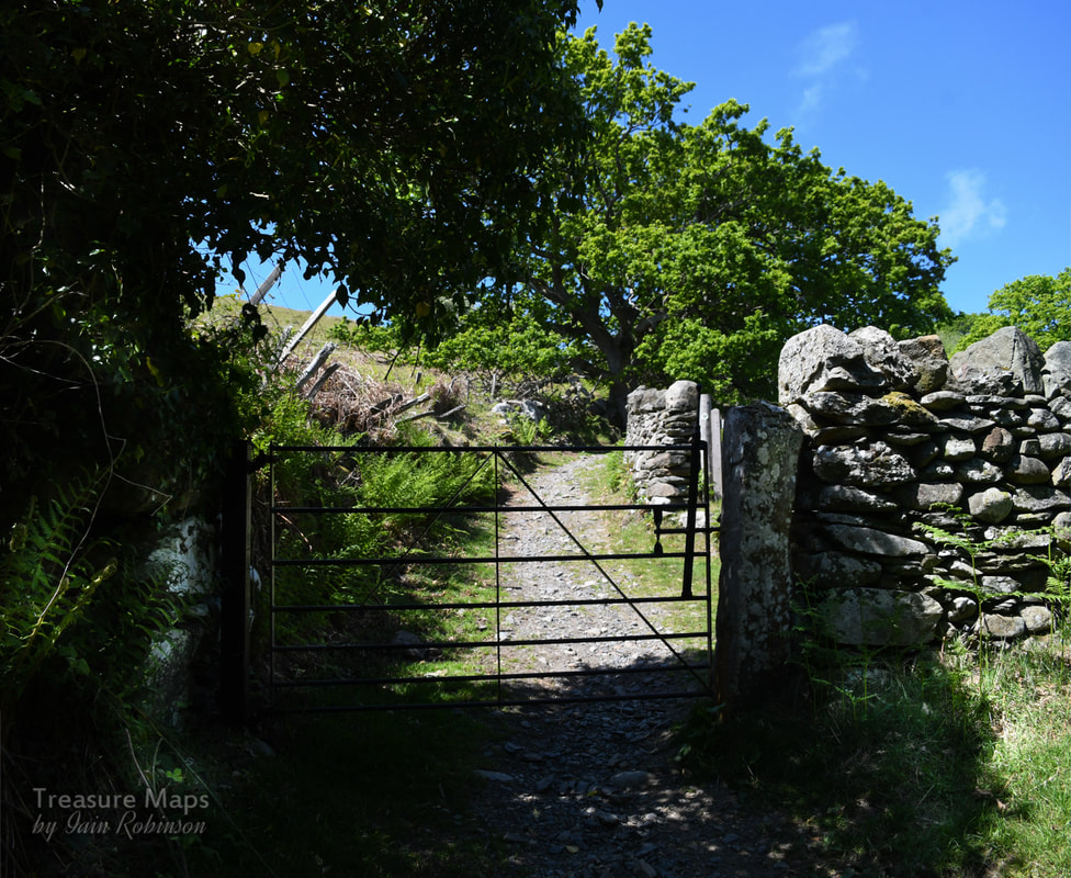
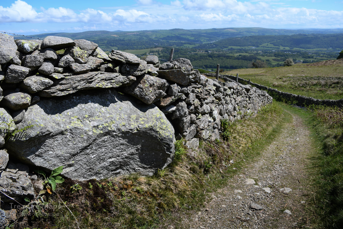
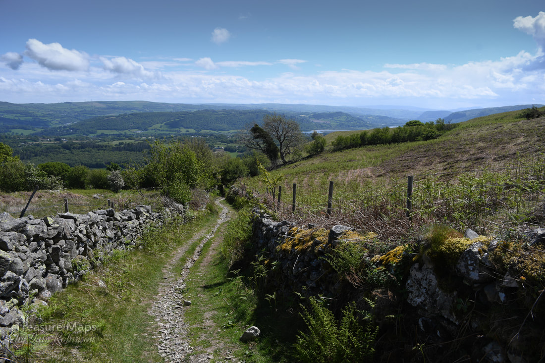
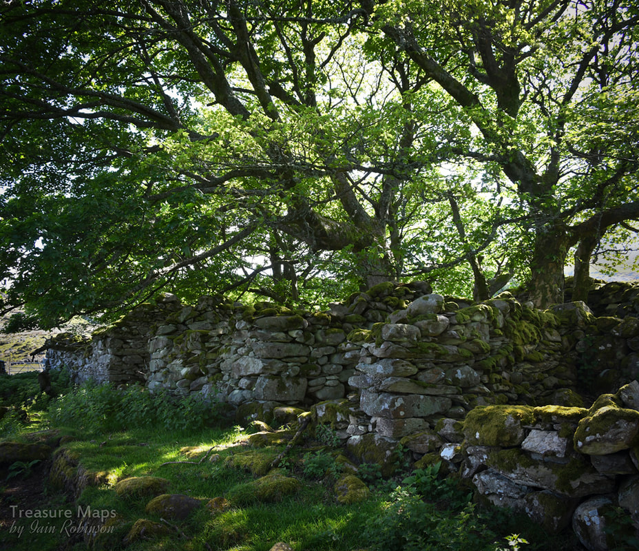
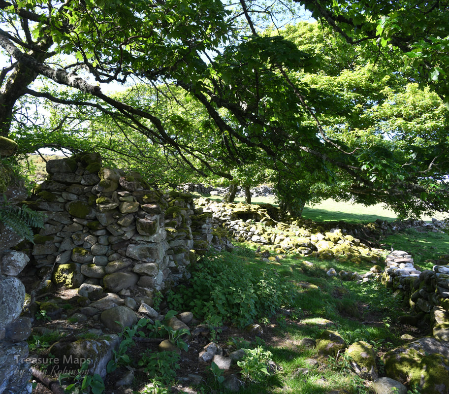
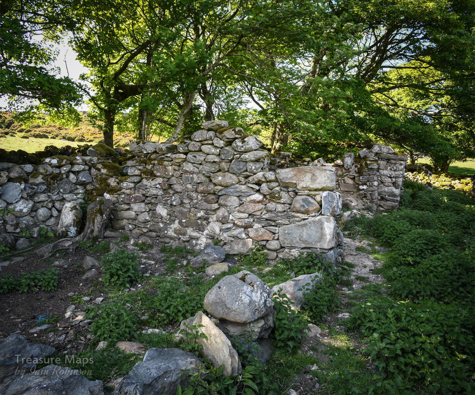
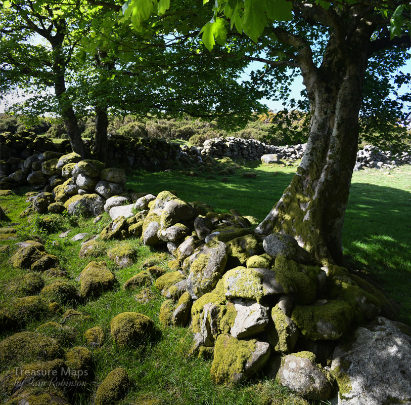
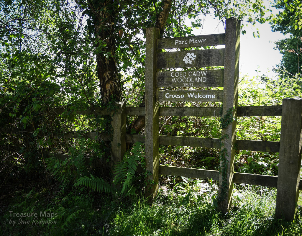
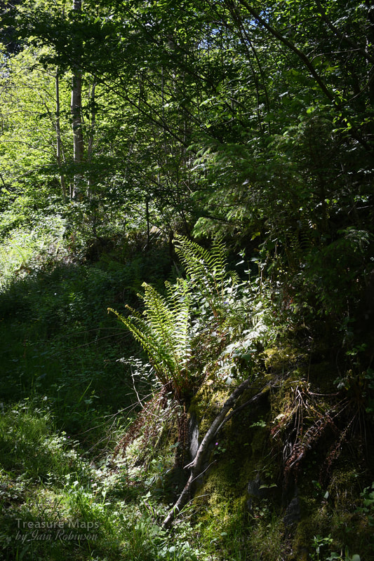
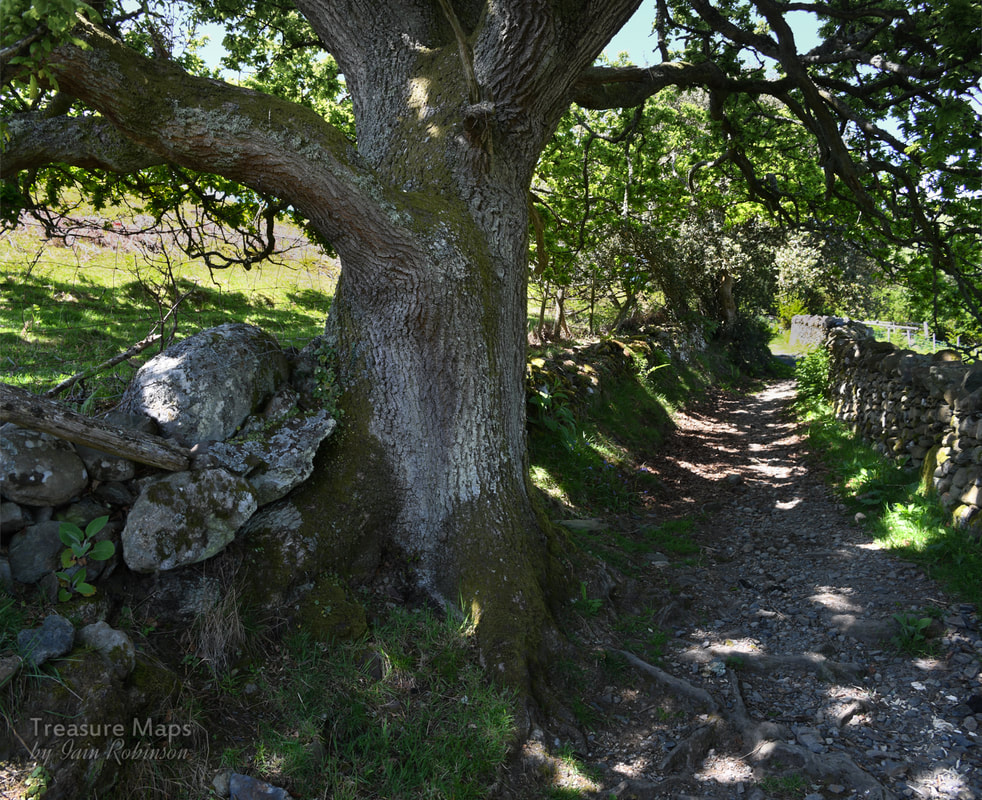
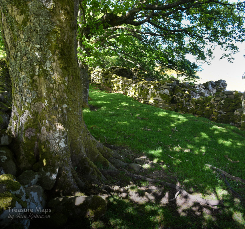
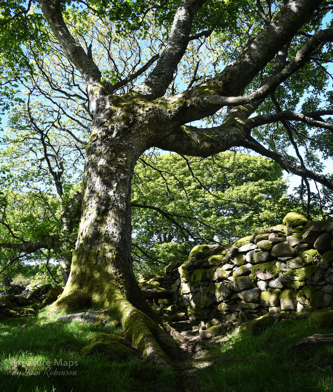
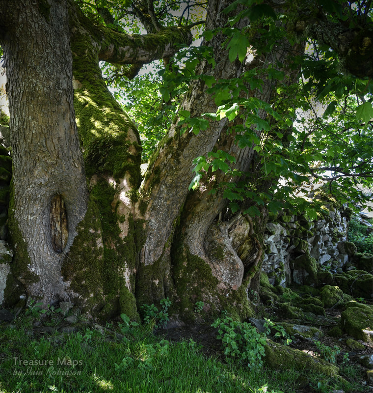
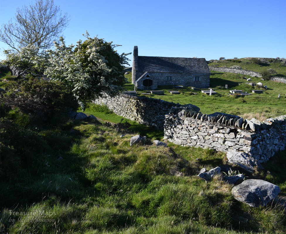
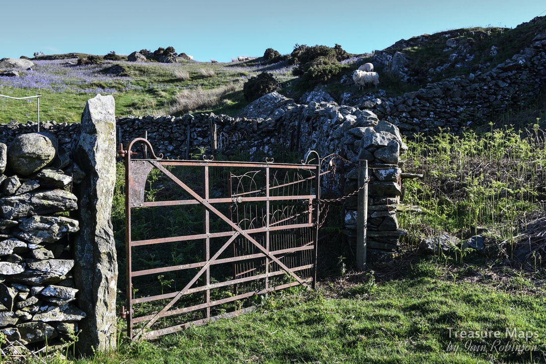
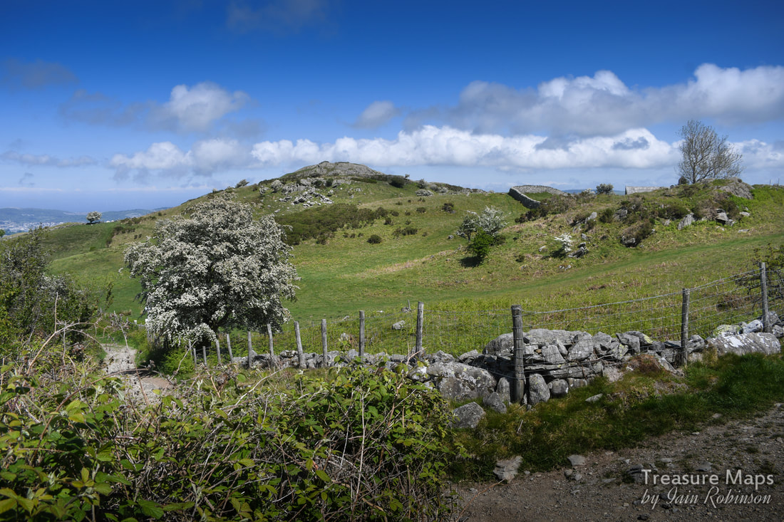
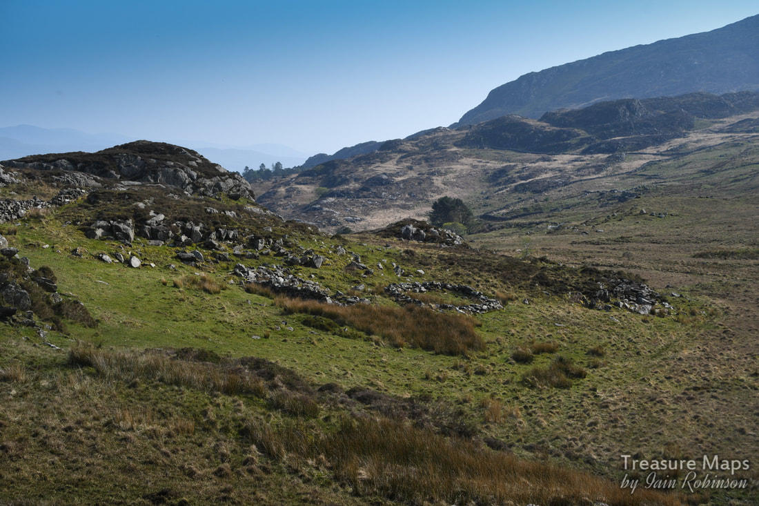
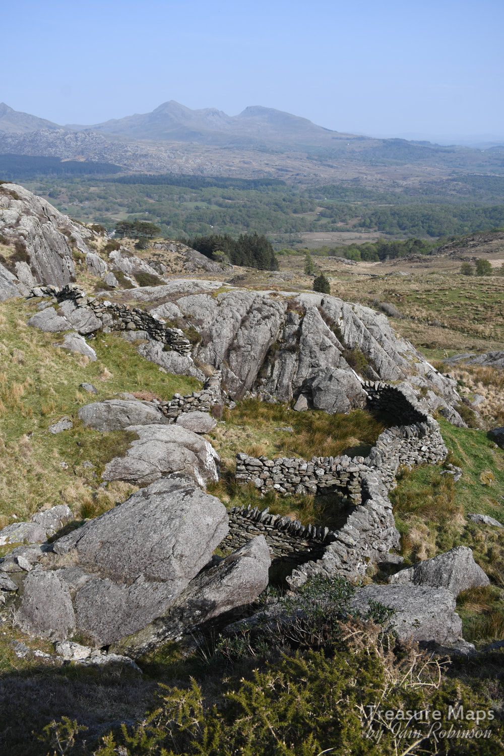
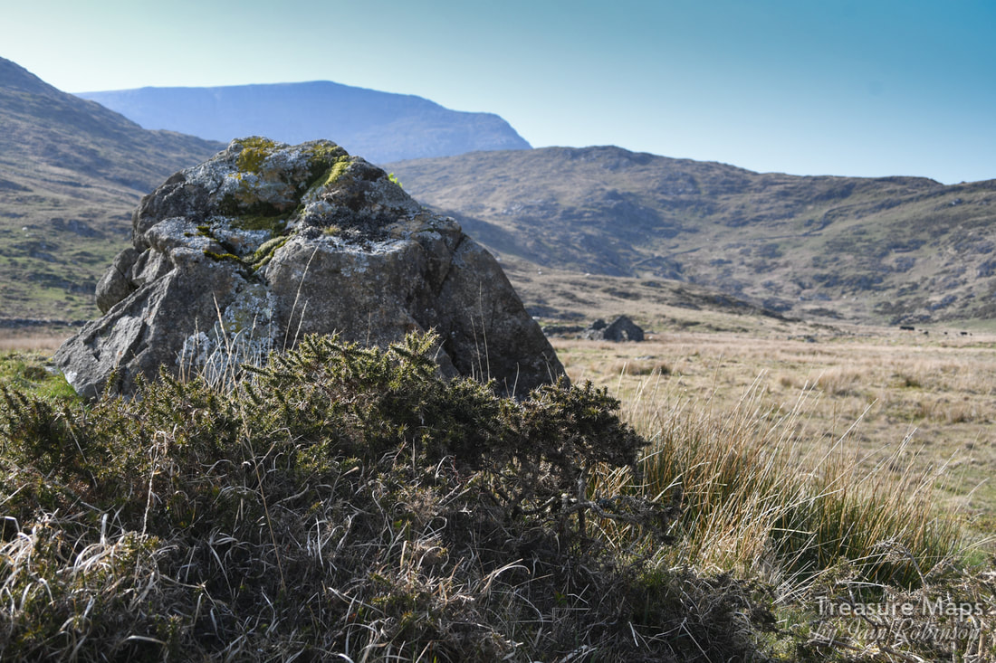
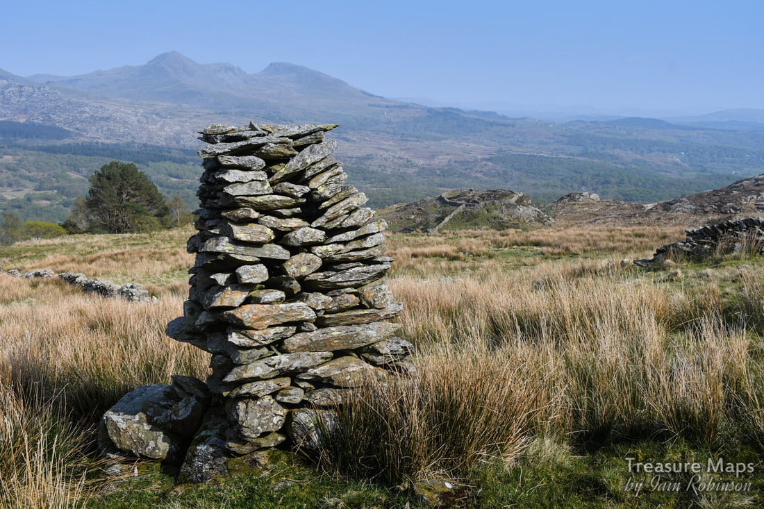
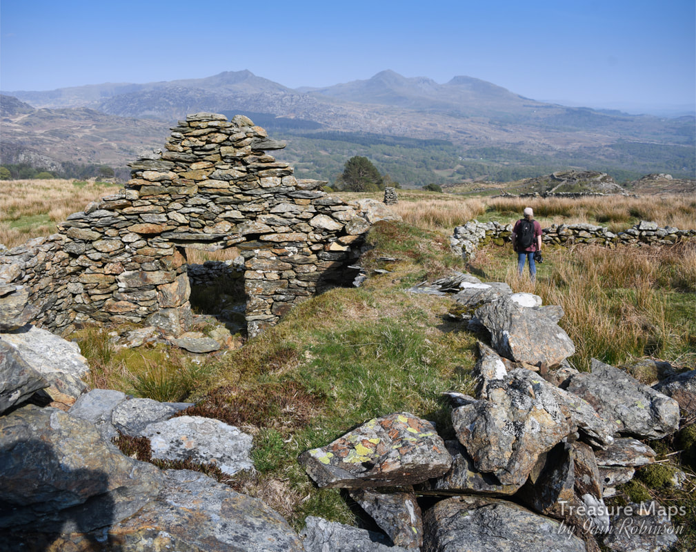
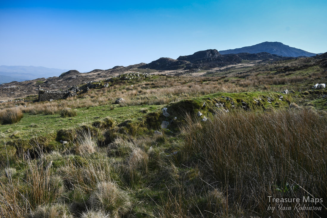
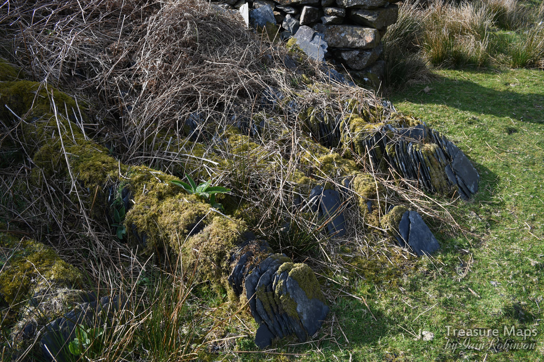
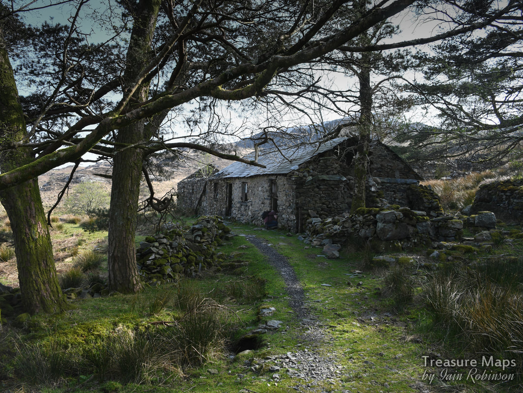
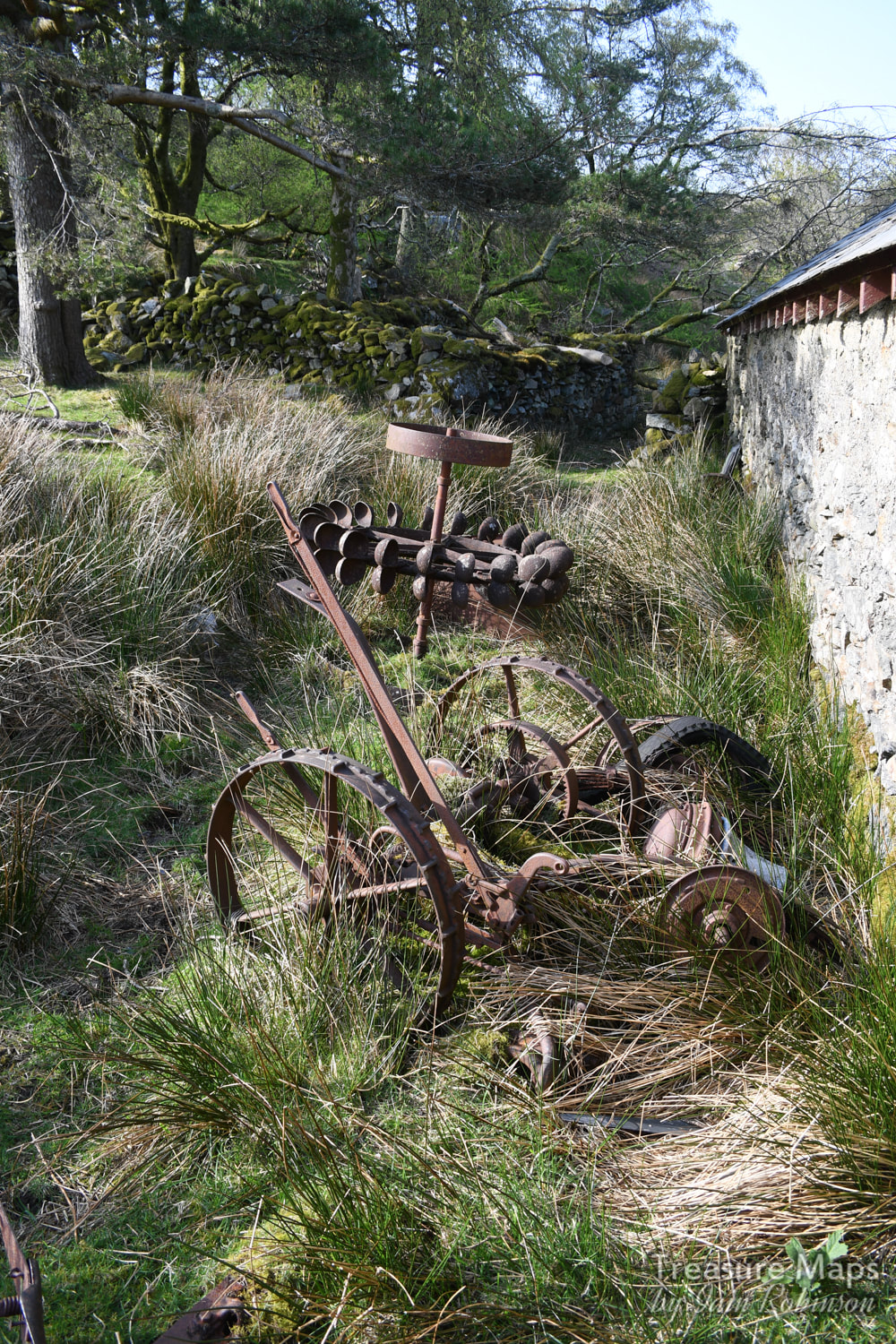
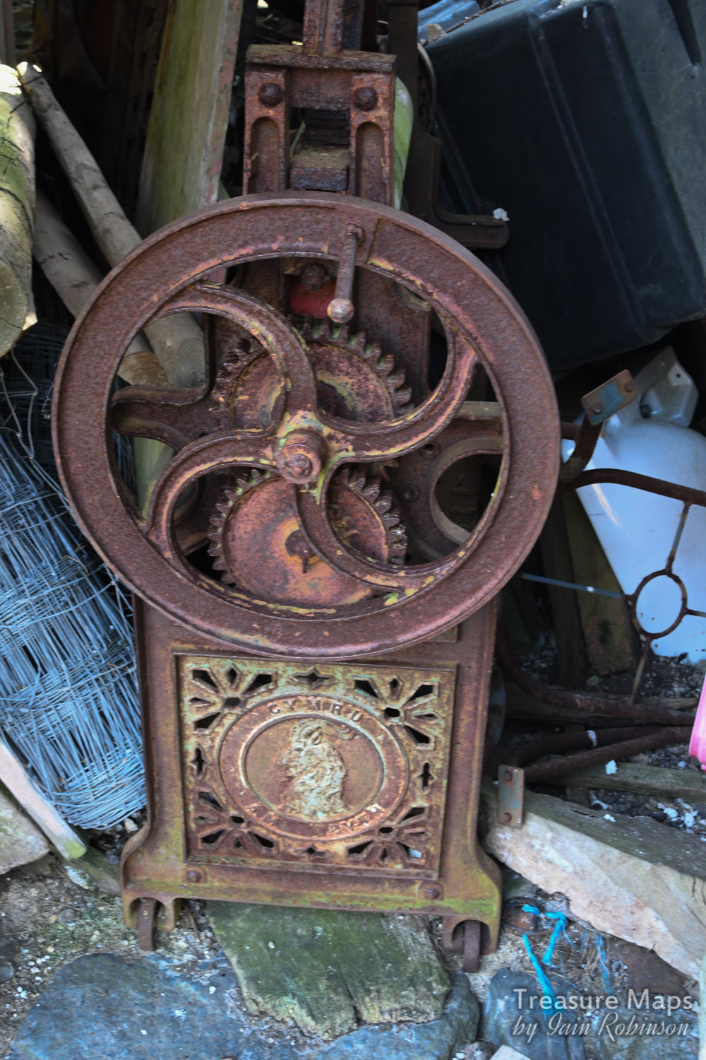
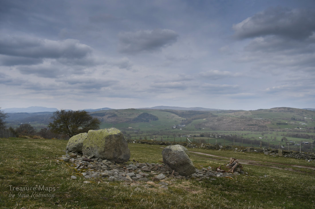
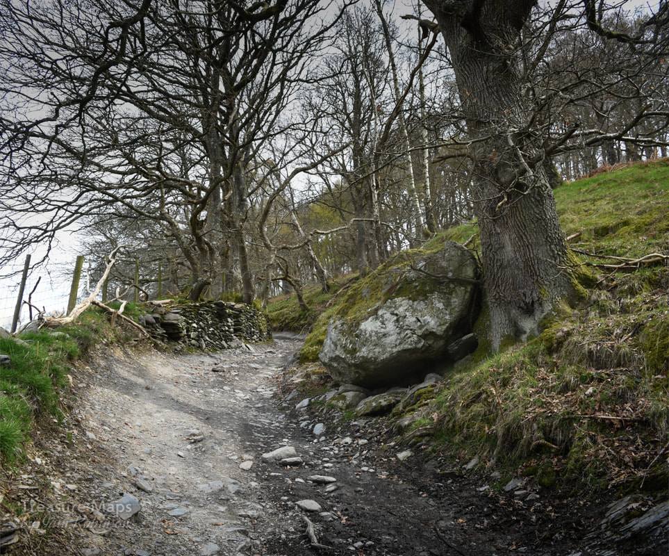
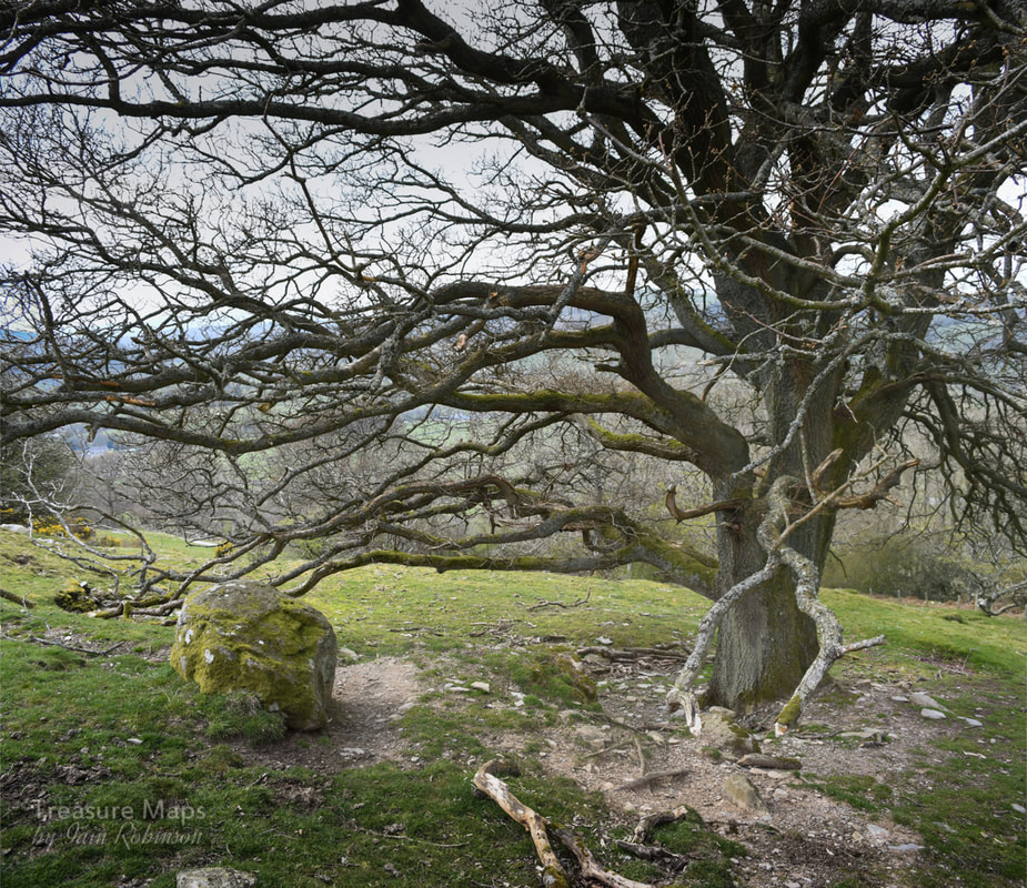
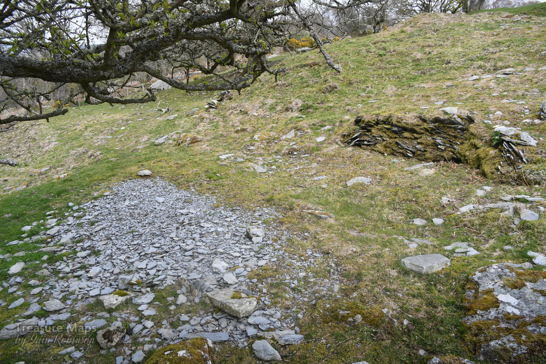
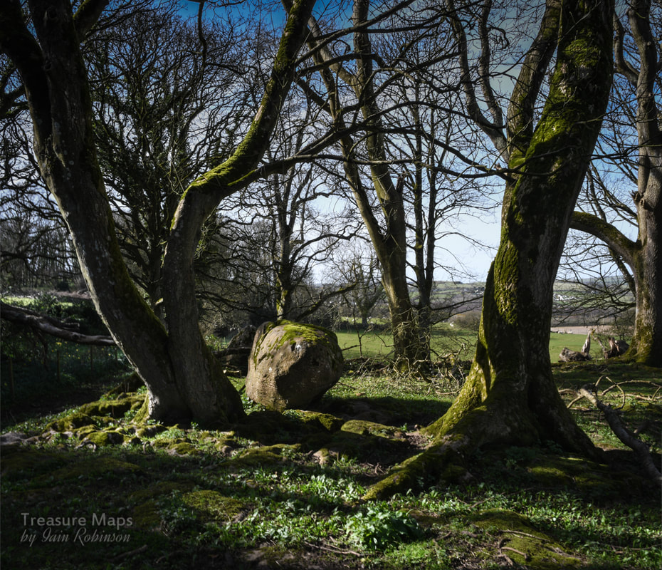
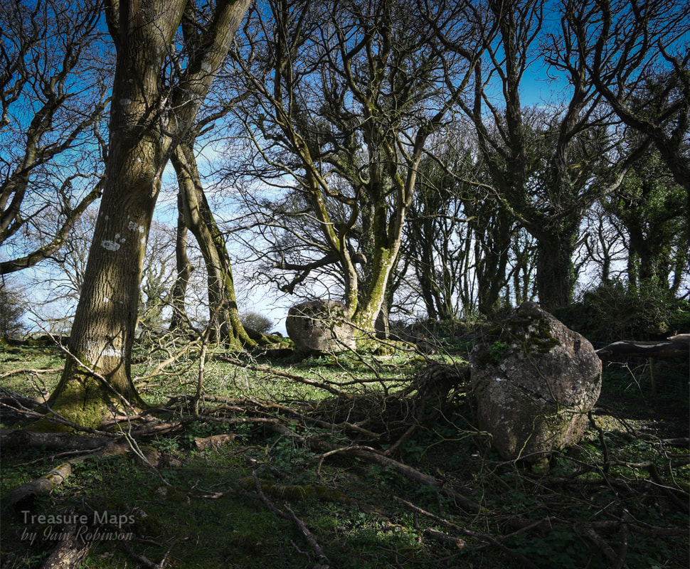
 Some ancient woodland, the old, remote church of Llangelynnin and Maen Penddu standing stone, all connected by a rather old path. Parc Mawr An area of woods to the west of Henryd, at SH757737, Parc Mawr is owned and managed by the Woodland Trust who welcome considerate visitors. There's a small car park/layby near the entrance, which is handy as there are few places to park hereabouts unless you start from Henryd. This is a mixed deciduous woods, on a very steep east facing site above the Conwy valley. But the first thing we encountered was an adit...  A low trial adit of the mine seen immediately as you enter the woods. Photograph by Petra Brown. 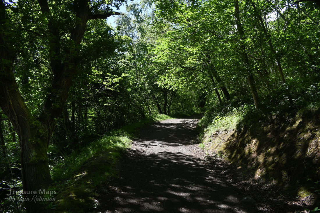 Into the woods! After having a nosey around the ungated trial adit, (more about this here) we set off up the main path which takes a route along the middle of the woods. The path climbs steeply for almost a mile, (a vertical climb of 110 metres in height), to a viewpoint with a handy bench. There are many fine trees to admire; beeches, sweet chestnuts, Douglas firs, and some fine old oaks. Conifers have been felled and left on the ground. We sat for a few minutes and gazed at the view across to Conwy, starting in on the snacks already, despite it being early in the day. Feeling slightly full, we walked on a little way until we encountered a trackway crossing from below. This is an old route which has been re-branded as the "Pilgrim's Path". We turned right and walked steeply up. It's surfaced with round stones and would probably be very slippery in the wet- even on the glorious day we had, it resembled a stream bed in places. It's interesting that on the way up the path, the walls vary in age and repair condition. Near the top, there is some ancient walling on display, parts of it originating from the middle ages. We went through another gate, with the Iron Age fort of Cerrig y Dinas looming on our right. The old church came into view now. 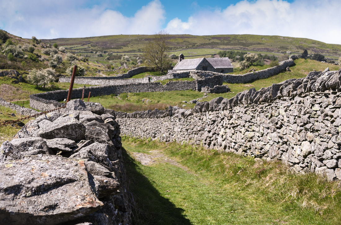 Looking at the walls as they strode up the hill, I realised that they were enclosure walls- perticularly noticeable in the higher land above the Conwy valley. I don't like the thinking behind them, the idea that a few people could divvy up land that folk had been living and farming on for thousands of years. Share it out between themselves and chuck everybody else off. But I had to admire the craftsmanship that went into building the walls. I have tried to build dry stone walls a good few times and I know how much thought goes into it- and how much frustration! St Celynnin's church I shan't say much about the church, since churches and religion are not my thing. But if it's your thing, then it is well worth a look. The site was dedicated to St Celynnin in the sixth century, although this ultra-modern imposter dates from the twelfth century. You can pick up a very good, free informative leaflet inside the church. Petra went in and took some photos- I will put them on here when her workload allows her to process them. 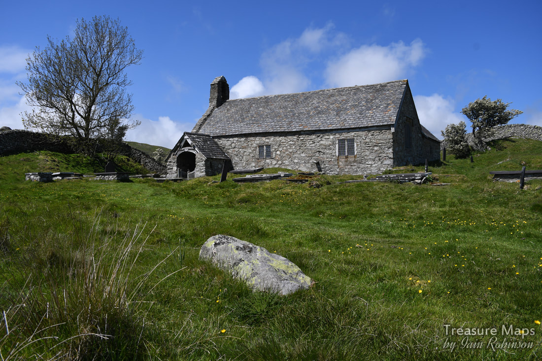 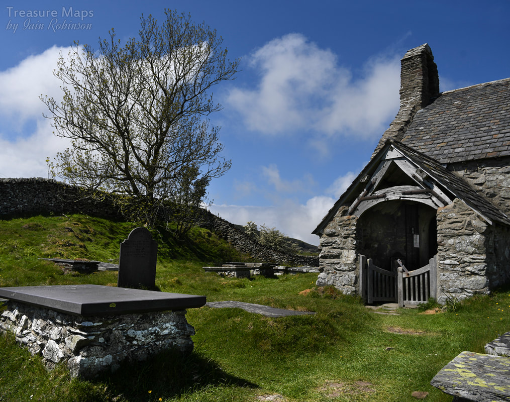 Once past the church, the moor opens out and horizons become wider. We walked past a very fine sheepfold. I'm glad to see there is renewed interest in these wonderful old structures that always fascinate me when I find them in the hills. Sadly, they don't photograph very well without a drone, or a tame pilot to do them justice! 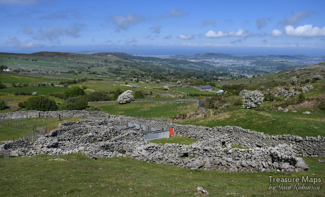 We headed upwards as the landscape became more remote, despite being only a few miles from Conwy. That is one of the attractive features of this area, as locals can come up and get some fresh air while it is relatively unknown to the majority of tourists, who tend to congregate on the Bwlch y Ddeufaen to the south. I don't think my readership is big enough to endanger the secret. The ruined medieval farm of Friddlys We were now on the lower slopes of Tal y Fan, and could see the eponymous slate quarry ahead. See post here. We were intrigued by some stands of trees below in the otherwise bare hillside. I wondered if the trees masked a ruined farm, so we went down to have a look. We found something rather magical in the shade of some old sycamore trees. According to Coflein, this was a medieval farmstead, which they call Ffriddlys, although it is marked on the 1st edition OS maps as Llwyn Penduu. Modern maps ignore it. The first thing that I saw was a pig sty, almost completely ruined, but still recogniseable. Then a cart shed. To the right, or south, there was a range of buildings- at the end was the dwelling house with a range still in position (just). I wished it wasn't so sunny (never satisfied) as the light was so harsh, but perhaps that added to the magic as well. 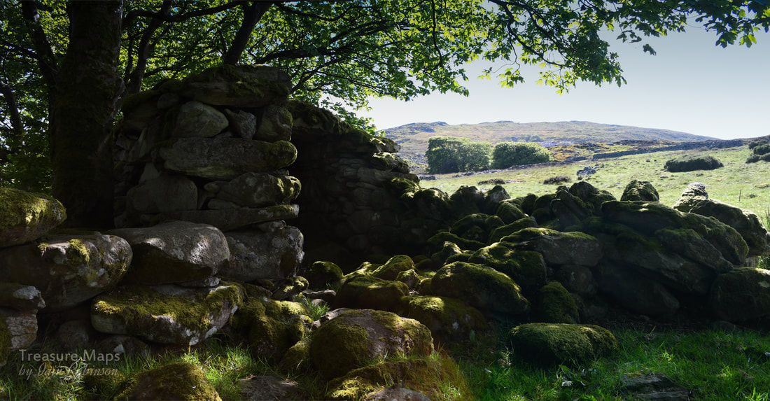 The remains of a cart shed. 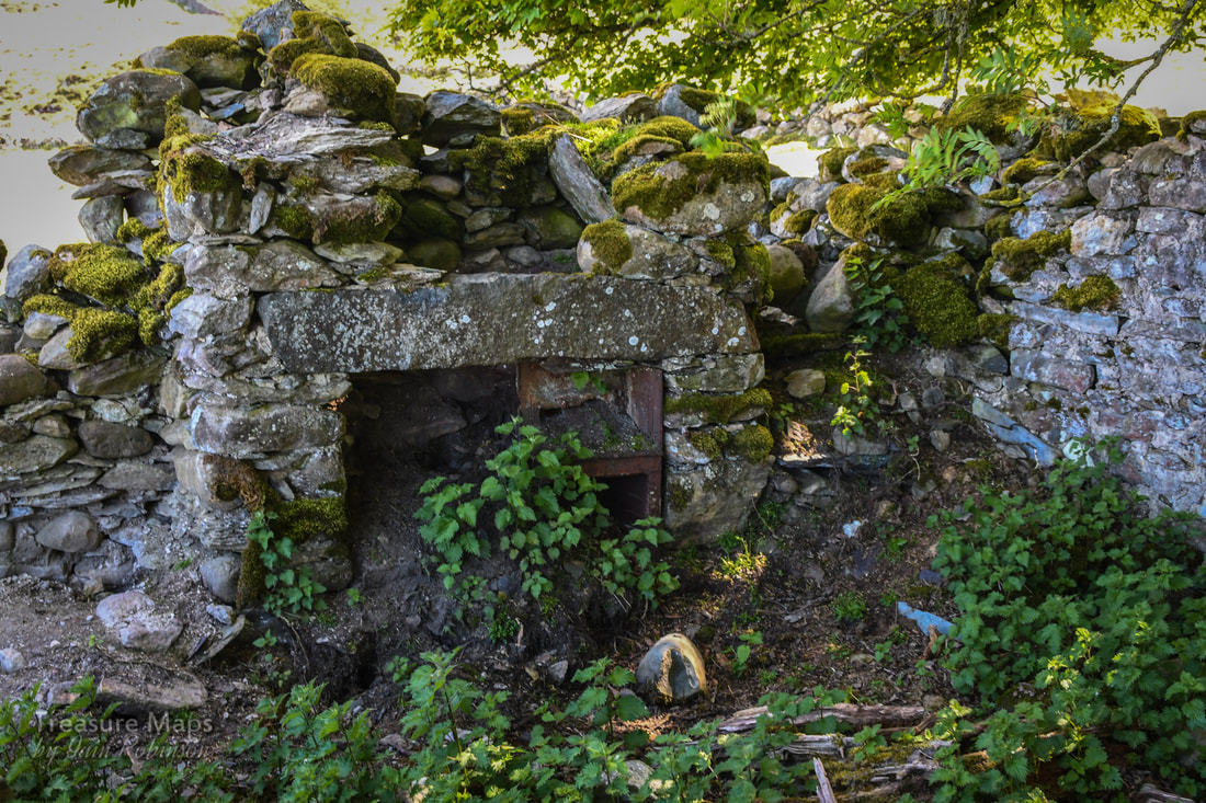 The remains of the kitchen fireplace. 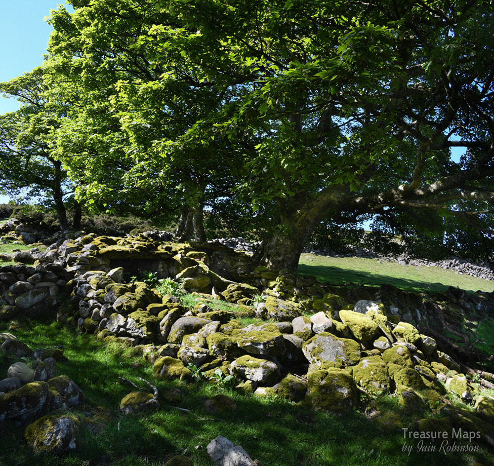 Remains of a double pig-sty. A little bit further up the hill, there was another, smaller set of more ruinous structures- I think they were a part of Ffridllys farm. I failed to photograph anything here, sadly, the differences between the light and the shade defeated me. There was a mysterious metal wheel leaning in a gate opening, perhaps from a machine like a hay rake. Maen Penddu We made our way uphill to an area which contained a number of old beudy structures, and the peat hut shown in a previous blog post here. These were all close to a very impressive standing stone, Maen Penddu. 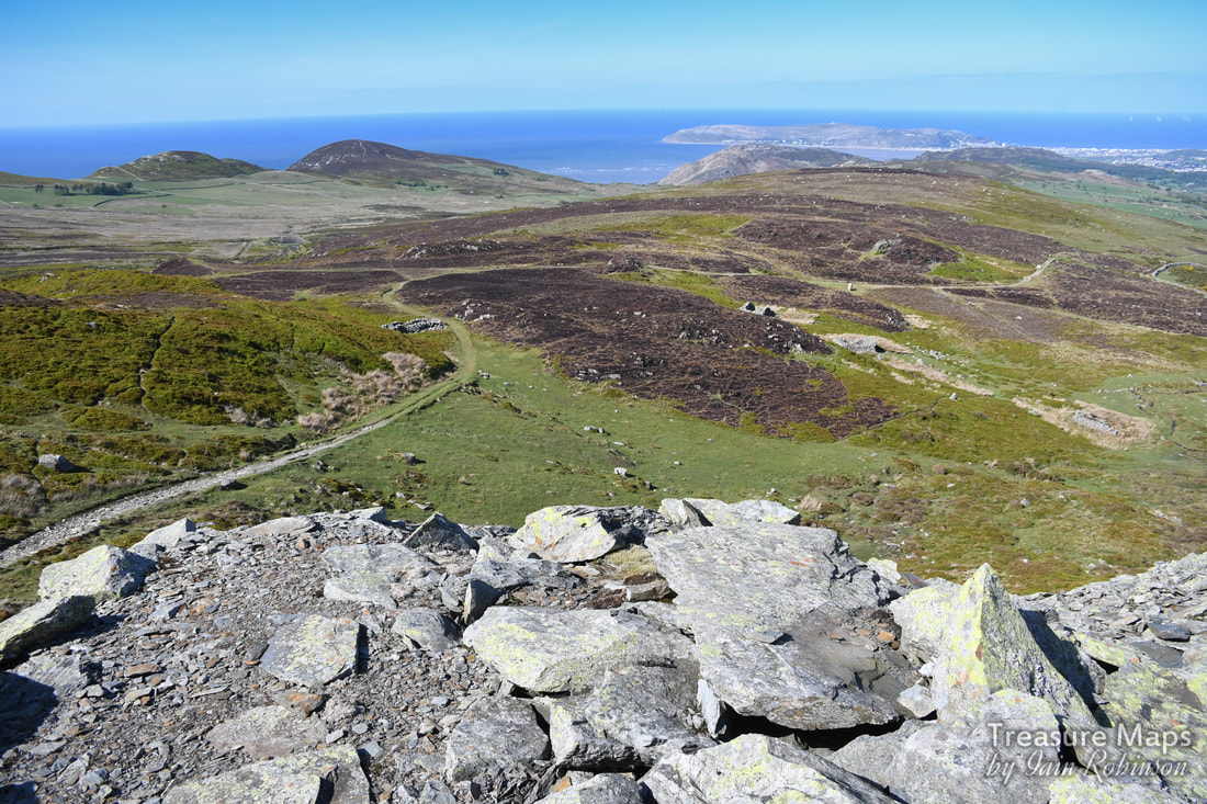 In a shot from the tips of Tal y Fan slate quarry- the beudy structures and the peat hut on the right of them. Maen Penddu is in a clearing to the right of centre. On the left is a sheepfold. In the distance is Penmaen bach and in the distance, the Great Orme. 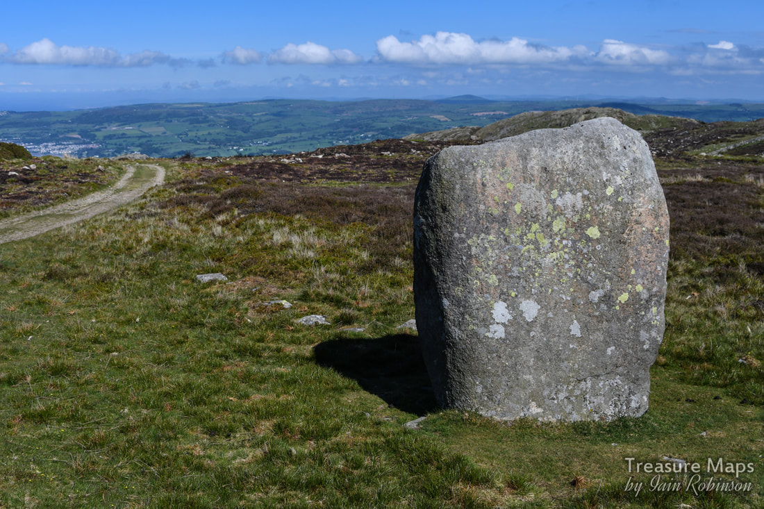 I quote Coflein NPRN 303070 which says: "The stone stands 6ft high and measures 3ft 6 ins x 2ft 6 ins at base. It has been incorporated in the line of an old enclosure bank on the S of a well-used track." Maen Penddu means "black headed stone". The side that faces the track coming uphill has sadly been defaced with some deeply carved names. The south elevation has a cross carved into it. Honestly, I can't find the words. At this point, we headed off up the hill to spend a couple of hours at the slate quarry. Our next adventure will be to take the lower track from here all the way down to the Bwlch y Ddeufaen-and it's many neolithic treasures. Coming soon :-) 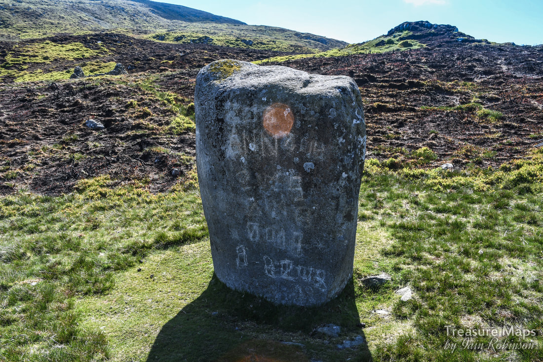 A few more images from the walk: Part two of our adventures above the Aberglaslyn Pass. 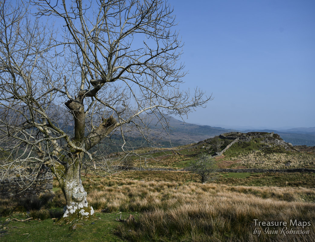 The "defended enclosure" of Pen y Gaer seen from Oerddwyr Uchaf farmhouse. So, last time, we were on the hilltop at Bryn Du, having taken a wrong turn and wondering what we could do with the rest of our day. We started to wander back along the path towards the Coed Aberglaslyn. Then I had an idea that we could skirt the upper boundary of the woods and perhaps access the country that forms a plateau below Moel Ddu- the ground was dry and firm, after all- and it was open access land. And that was what we did- a bit of trackless stravaiging. It was tough, through heather and Johnny Breakleg grass, but when we got to the top of a big rocky ridge we realised that it was going to be good...we could see the fort that had been our original objective in the distance! 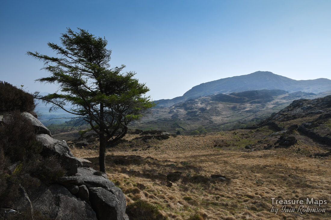 Our first sight of the objective, from the rocks above. Pen y Gaer is in the very middle of the shot, right of the tree in the distance. Moel Ddu is in the background. It wasn't even a particularly difficult scramble across to where Petra had seen a trackway. After a while, we stopped on a rocky knoll and had a snack. A raven was sunning him or herself while a Wheatear landed quite unafraid of us a couple of feet away. With the wonderful sunshine, it felt idyllic. I turned to the west and immediately spotted two adits in the hillside- yes, mines! We looked at the country and our time left and decided to leave those for another day. There was already a plethora of prehistoric and mediaeval stuff to investigate in this valley without yet another five mile detour. That will be my next post :-) We began to descend, looking out for the settlements and ancient cairns that are littered here, according to Coflein. What we didn't expect were the remains of old beudiau (is that the plural of "beudy", meaning field-barn in Sais?), of more clearance cairns, gorlans, burnt mounds and standing stones. We had a heck of a lot of fun identifying, photographing and debating over them. We found old boundaries that could have been pre-mediaeval, trackways, marker stones and so on. I am pleased that there was an upland study initiative in North Wales that catalogued all this stuff, allowing us ignorant folk to potter around having fun. Here are some photos of what we found. As we descended lower, towards the fort, something else emerged from behind a screen of trees- the most wonderful deserted farmhouse. It was so charming and looked like it had been used recently as an informal bothy- there was an (empty) whisky bottle in one of the windows. Outside were the remains of a pelton wheel and an old mechanical mower. I was quietly hoping to stumble over an old Fordson, (as happened to us at Bwlch y Plwym), but no such luck. The farmhouse was Oerddwr-Uchaf, ("Upper Cold Water") and the plaque on the wall told us that this was once the home of a noted Welsh poet, William Francis Hughes - Wil Oerddwr (1879-1966). He was a shepherd/poet who had spent some time working in the USA. I searched online for quite a while but couldn't find much out about Wil Oerddwr, except the rather ominous note in the Gwynedd archives to the effect that: "Beudy Brynybont ...was a cattle and hay shed and was last roofed by the bard Wil Oerddwr [William Frances Hughes] of Oerddwr [Uchaf]. Mrs. Jones mentions the storage of furniture here in her tapes (when the men were away and the villagers were herded out of their houses)." I wonder what that was about? 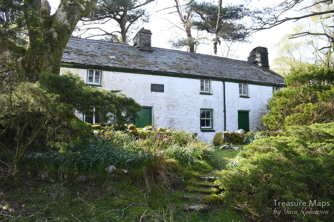 Oerddwr-Uchaf, looking very picturesque. I will update this when I have more to tell. The house had a good feeling to it, felt like somewhere I would have liked to stay for a good few years myself- but perhaps that was the weather lending everything a rose tinted ambience). Nevertheless, I felt that you would have to be made of stone not to be inspired to poetry by this exquisite landscape. Here are a couple more photos I took of the place: We made our way down to the hillfort, which Coflein describes as a "defensive enclosure". Someone, a long time ago, has robbed the walls of the fort to make a sheepfold (gorlan) but in some ways, it makes the place more impressive, if a tad less authentic. Coflein says: "Of roughly oval plan, it measures 46m east by west by 37m. It is defined by a denuded wall up to 3m thick and natural outcrops, on top of which is a post-medieval drystone wall up to 1.5m high. The interior is uneven and rocky, and no remains of huts were visible suggesting that the site was not permanently occupied. The entrance is on the east side. Integral with the post-medieval wall are two sheepfolds." One very interesting feature was the stones around the entrance which are some kind of brecciated plutonic rock. Fabulous. 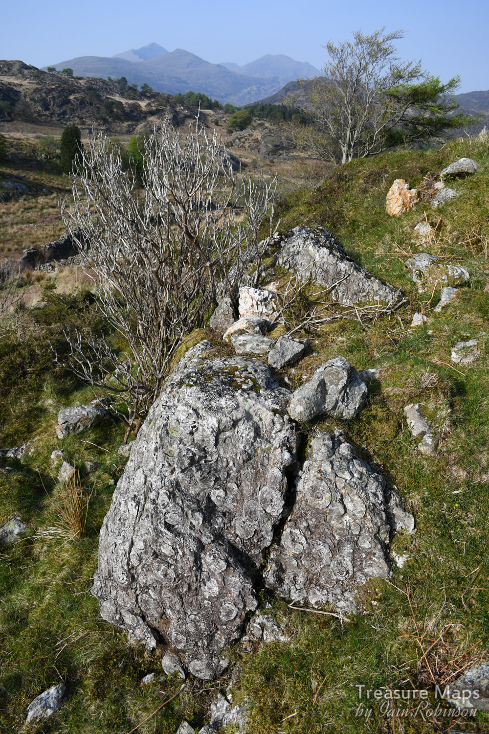 A remarkable chunk of brecciated rock at the entrance to the fort. The trouble with things like hill forts is that while they look great from a distance, they look like nothing from the inside- they are very difficult to photograph. We did study what looked very like some mediaeval house platforms in the small settlement fields beside the fort, and the ramparts were the ideal spot to scope out the surroundings. 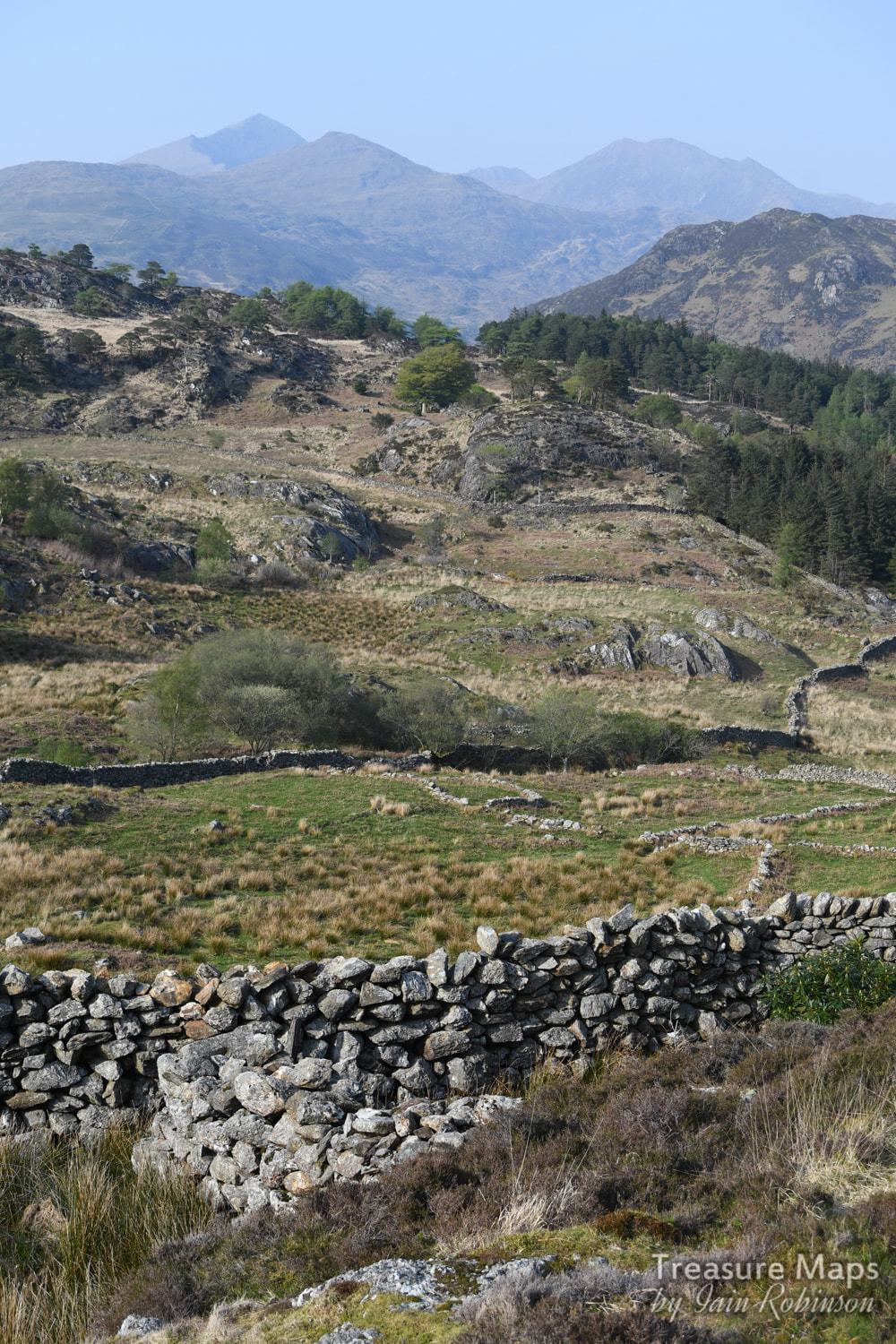 A house platform in the middle foreground centre- also what looks like it might be a chunk of the original fort walling. Snowdon makes the perfect backdrop. 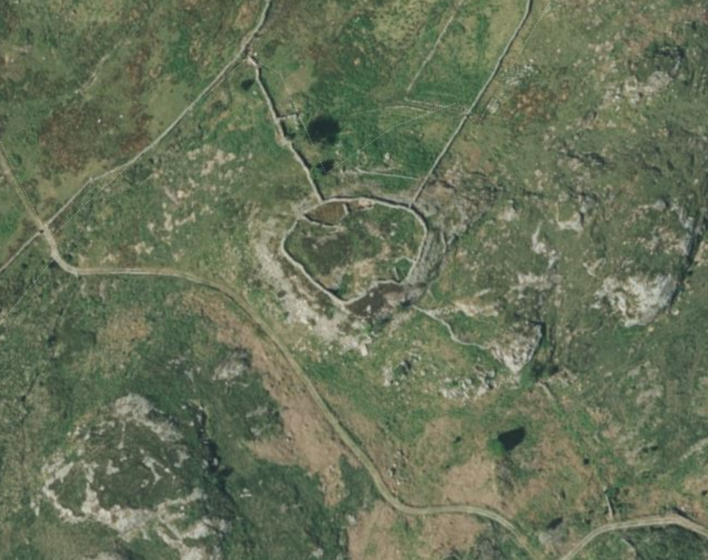 A Google Earth capture showing the fort- this gives a good idea of the layout. We reluctantly made our way down from the fort along a rough road- the road that Petra had seen on the map, leading to the farm. It was time for me to apologise for my high-handed dismissal of the route earlier, she had been right all along. We couldn't help noticing a great number of piled twigs every now and then beside the way- I suspected that they were the remains of rhododendrons, which still infest great parts of Snowdonia- those darned Victorians and their ideas. We passed another beudy, this one was the eponymous "Beudy Brynbont", now in ruins and being harassed by ruthless hordes of brambles. I imagined it full of Mrs Jones' furniture. The road became steeper, then joined a road from a very plush residence, Oerddwr Isaf, a very old house which has been restored and looks very loved. Farrow and Ball paint shades were noted.  Finally, we were back on the main road which we would have to negotiate on foot, as our parking place, if you remember, had been near the bridge at Pont Aberglaslyn. The first thing of note were the remains of a slate quarry near the road- Dinas Ddu- somewhere I have often wondered about. Sadly, the mill and wheelpit have had their stone used for other things, although there is some leat work and a fine stone cutting leading to the adit. It looked too "occupied" to explore, so we didn't bother. The road walk was a trial...a dice with death. Cars came along so quickly and often an oncoming car would brake and move out to give us a foot or so, only for the car behind to nearly run into the back of them because they were following too closely and didn't react in time. Occasionally, we had to dive into the ditch as cars started to overtake at great speed, leaving us no room. I was very glad to get back to our car! Despite the near death experience of the road walk, it had been a great day. I can recommend the country below Moel Ddu for those who like a bit of reflection and study of ancient history in their landscapes. We'd been out for eight hours and had climbed and walked about three and a half miles, none of it seemed strenuous or difficult. And we'd hardly seen a soul, quite an achievement on an Easter weekend!  Evening light on trees below Oerddwr Isaf. What is a Burnt Mound?
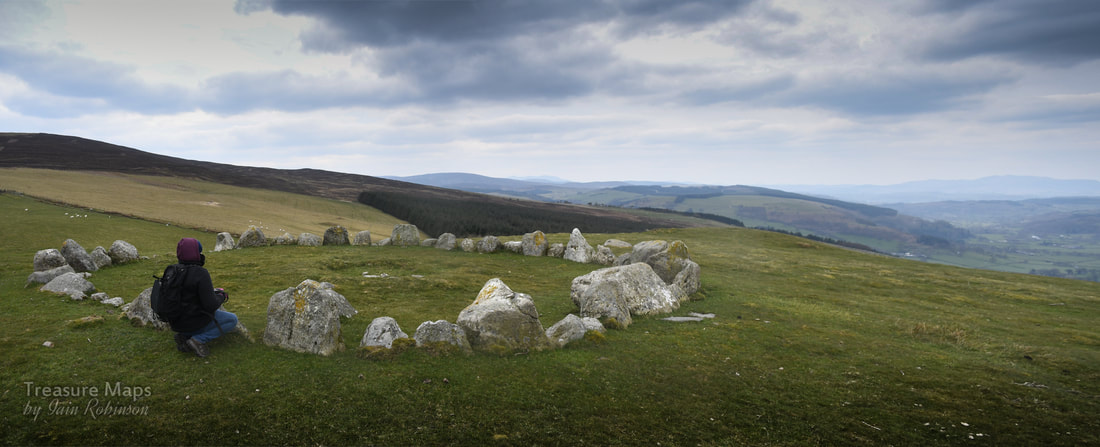
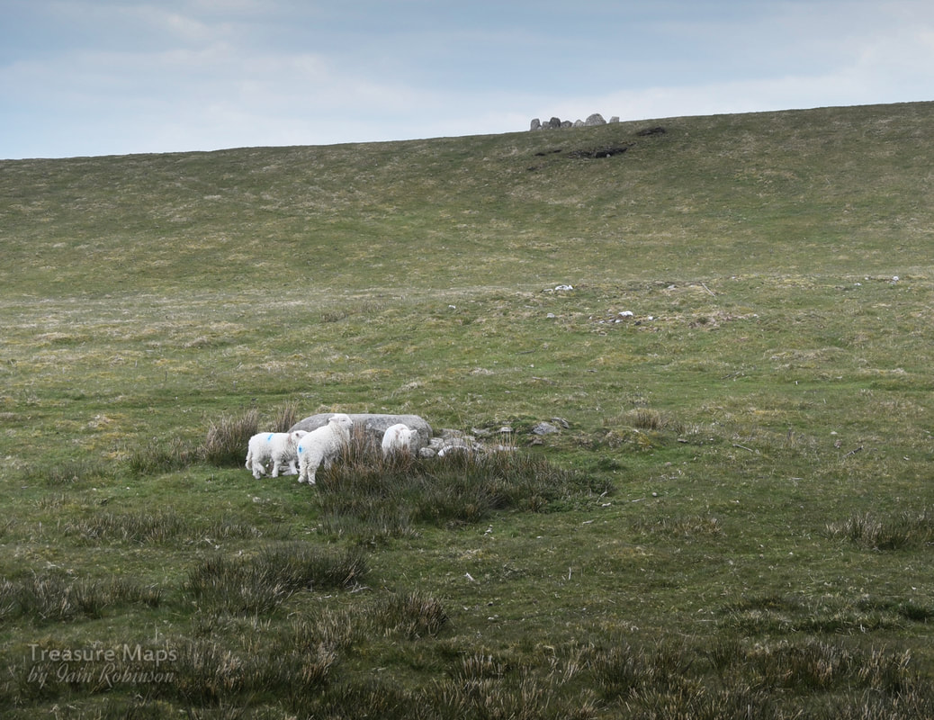
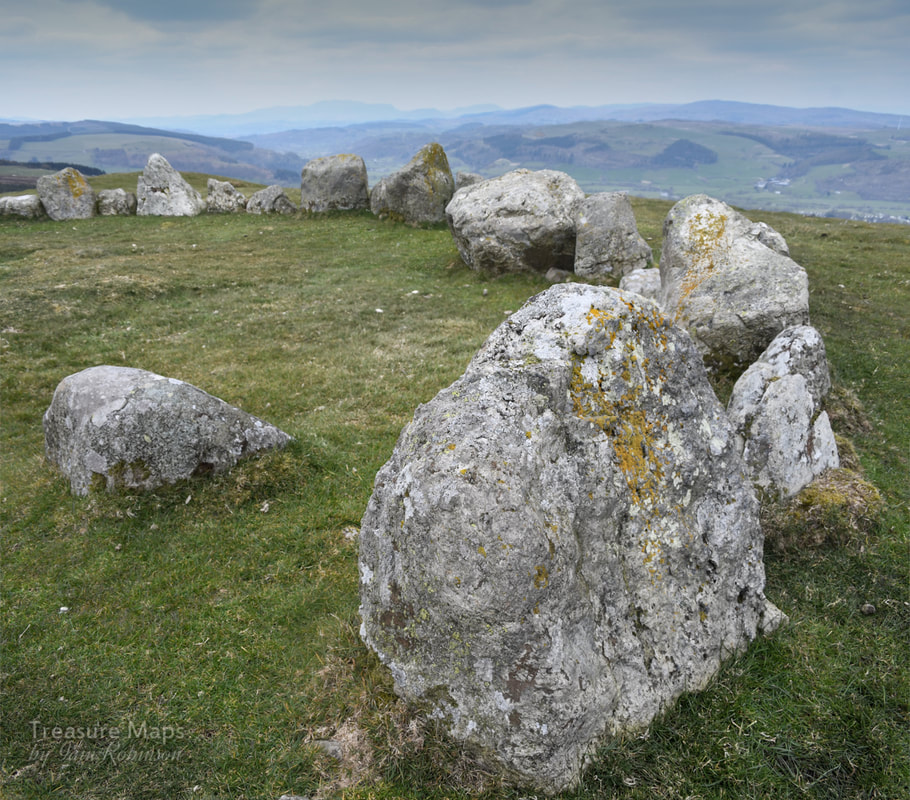
These are features of roughly crescent shape, a spread of burnt stone and charcoal, surrounding and partially overlapping an oval trough. Water would have been heated in the trough using stones heated on a fire. The stones were added to the water and, after cooling, were then thrown aside, resulting in a mound of discarded, reddened, cracked stone. Whether food was cooked in the trough or, as some have imaginatively suggested, the trough was used for bathing has not yet been firmly established. Incidentally, if you are wondering why this place is also called Pen y Gaer, the name means "the Head of the Fort", so I guess it was a catch-all name for hillforts. Description and photographs of Pen y Gaer on the Modern Antiquarian A link to Petra's description of the farm on her blog, "Hinterlands" 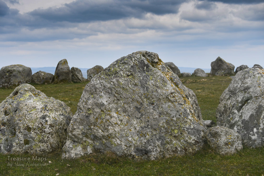 It was a bitterly cold Saturday in early April- the weather hadn't been told that buds were on the trees and spring was supposed to be coming. We'd travelled to Llandrillo, a pretty little village between Bala and Corwen- and were walking up the steep road that wound up the slopes of Moel ty Uchaf. The plan was to see what most authorities call a ring cairn, a remarkable survivor on the summit of this dinky little hill. It's a ring of 41 stones, (although there may have once been more) and it's around 12 metres across. The setting is stunning, even on the indifferently gloomy day that we had to work with, and it is well worth the climb. There are a couple of cists and cairns as well, and a standing stone further to the south. Petra found a small and ancient slate quarry on the way up...we were expecting something like that, as the ground had been disturbed in a way that suggested old workings. There were also some massive clearance cairns, evidently made by heavy machinery, so obviously quite modern compared to the ring cairn! 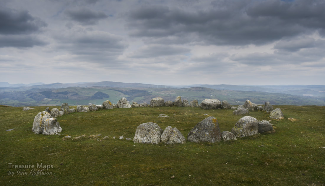 I had also read that there were many stories about the site. Some say that they have felt malevolent vibes, others that the place has a benign feeling. Not surprising, the site is dated from the bronze age and was apparently a place of ritual and sacred significance. Stories will abound in a special place like this. But perhaps there are none so strange as the claim made by locals that UFOs have been seen over the circle. Stranger things in the Berwyns Back in 1974 locals reported strange lights across the sky, then a colossal explosion which sent tremors through the village. It all seemed to be centred on the stone circle. One witness wrote: " something came down in the Berwyn mountains on that night, I am certain … we were visited by an object that evening..." Ministry files show that it was taken seriously by the RAF and the police- a search and rescue sea king was scrambled and deployed. The search continued until 2pm the next day. Locals and ufologists claim that roads were sealed off and men in black were seen taking remains away, prompting claims that this might be the "Welsh Roswell". Who knows? It all seems very far-fetched. The files show that officially, nothing was found...or was it? 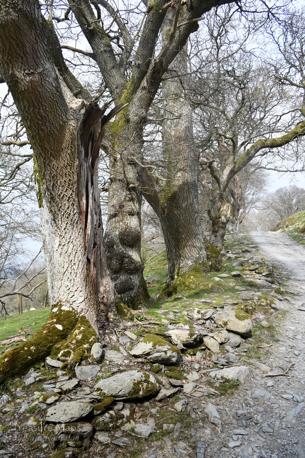 We, at least, got a great deal from the walk. The trackway up is lined by some beautiful trees; old oaks and later hawthorns of some age. Giant stones appear at the side of the track, placed no doubt by a glacier, although one group looked a little suspicious- I put them down as a possible bronze age feature. One of the gates below the moor whistled eerily due to the wind blowing across it's tubular steel framework. It was a surprisingly lovely sound, rather like those folk who used to run their fingers around the rims of banks of wine glasses on TV. That dates me, doesn't it? Hey, that was what ordinary folk thought was cool in the 'sixties. Somewhat enchanted by the sound, we sheltered behind the wall and had some lunch before tackling the last half mile to the circle. The wall itself was interesting, made from small chunks of slatey rock, interspersed with tall stones set on end. Perhaps it was a local style; I am not yet familiar enough with the area around Llandrillo to say. Petra wondered where the slatey stones had come from, as the fields were remarkably bare of any stones, apart from the occasional massive erratic. 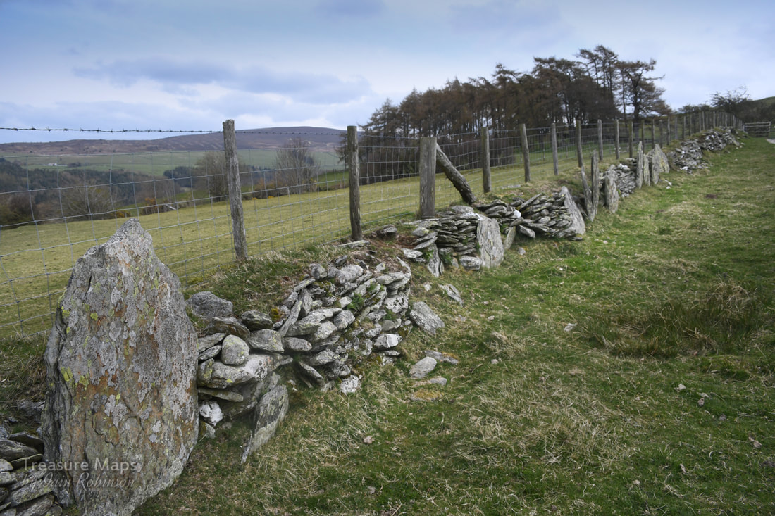 Further down from the circle on the hill, there were two cists, greatly eroded by the activities of the farmer- and a pattern of field markings which were quite pronounced on the ground. Coflein considers them to be cultivation marks, so I am glad my intuitive feeling was correct there. Someone on the Megalithic portal site thinks there may be a second circle on a site about 60 metres SE- I didn't see it when I was there, partly because it was so cold that we didn't hang about. But here's a photo on Megalithic Portal which shows that there is a circle, quite clearly. 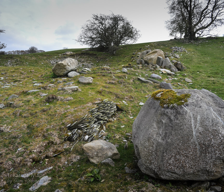 The ancient quarry site, with one of two stocks of moss slates beside a boulder which has only recently been moved, judging by the scars on its flanks. Above is a shallow opencut with a tip. Parking- It's best to park the car in the (free) car park in the centre of the village. Take a left turn out of the car park and then walk up the road marked as a bridle path to the right, after the war memorial. A grumpy moment I thought twice about mentioning this, as I don't want to be intolerant of others enjoying the hills- but again on this visit, there was the malodorous presence of two- stroke motor bikers on the hill. We were forced to the side by a group hurtling downhill without any consideration for anything. Later we had a nosey around the rather lovely village of Llandrillo and were standing at the crossroads when the bikers appeared again and stopped at the junction. The noise was incredible as the eight of them revved their engines and bellowed to each other. We picked our way out of their petrol fumed world of noise without taking them on and they roared off back up the hill to do more mischief. I wonder if making the maximum noise is part of the fun of this activity. Apart from that smallish irritation, it was a wonderful day; perhaps it might have been more peaceful on a weekday, although apart from the bikers we only saw two other people. Location of the stone circle: Map Ref: SJ05613717 Landranger Map Number: 125 Guide with map for locating the stone circle. 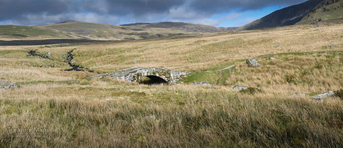 The ancient bridge of Pont Scethin sat in the middle of the moor, leading the eye to the mountains, whose deceptively smooth flanks coruscated with sunlight and shadow. It was early spring, and we were sitting on a giant boulder near the bridge, resting after the trek over from Tal-y-Bont. The Afon Ysgethin was flowing normally again after weeks of rain, chuckling and rattling over the moor. The skylarks and meadow pipits were singing, the sunshine was warm. All seemed right with the world. I didn't know at the time, but we had been walking on the route of a bronze age trackway through the mountains- I had some suspicions after coming up by the old burial chamber of Cors y Gedol and seeing in the grass what I thought were the frail bones of ancient settlements, almost submerged by the passage of time. 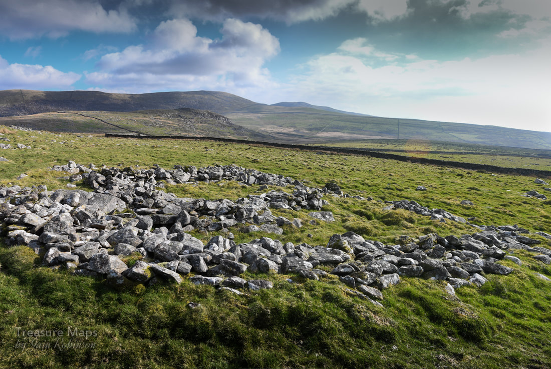 Ruins of an ancient hut/settlement. 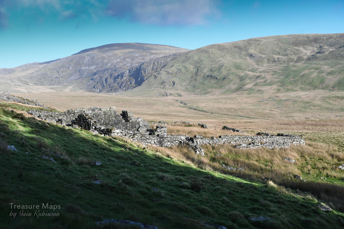 The ruined Coaching Inn. The hill in the distance is the mighty Diffwys (750m), while under that small area of crags is Llyn Bodlyn. Then, we'd passed the ruins of what we thought might have been a rambling sort of farm, just before the trackway made a dive for the river. Later, I found out that the farm was actually the remains of a coaching inn on the London to Harlech road. That would explain the unusual layout, but not the situation, a way off the "road". Surely, even "Jamaica Inn" was beside the road? And this place was called "Tynewydd" (the new house). I also discovered that the route over the bridge had been a drove road, which had wound it's way on over the Bwlch y Rhigwyr (which translates as the Pass of the Drovers). While the cattle droving had been carried on for centuries, the stage coach was a relatively new development in the C18th.  To be honest, I can't imagine how a coach and horses could be driven over this terrain, or over the surface of the trackway that remains, which comprised of gigantic boulders placed with no regard for smoothness of passage, rather like the ones on the Roman Steps in Cwm Bychan. The bridge itself seems hardly wide enough to permit the passage of a coach, or a cart. Perhaps, as Rob Collister postulates in his excellent "Days To Remember" , this part of the route was undertaken on ponies. It seems logical to think that the Coaching inn was there for passengers and mails to re-alight onto a coach, plying roads more suitable for iron shod wheels down to Harlech.  Apparently, there were considerable dangers in this area from highway men and gangs of brigands. Shirley Toulson, in her fascinating "The Drover's Roads of Wales" tells of one occasion when a fashionable party of Londoners, going to a posh wedding in Harlech were fleeced of their valuables. Perhaps that is why many folk preferred to travel rather more slowly with the cattle drovers, who were, as a rule, extremely handy fellows and who travelled in numbers enough to see off the occasional robber. The drovers were sometimes armed, as well, to protect the large sums of money they carried. (They received an exemption from the Disarming Acts of 1716 and 1748). Other travellers had cause to get out of the way of the cattle drovers. The sound of the drive could be heard for miles and farmers would gather in their own cattle lest they be carried along by the driven herd, while coaches mule drivers and carters would lie well off the road until the melee had passed.  A view from the south side of the river. The hill in the background is Moelfre (589m) I thought I had managed to lose all the bike tracks, but I see the farmer's quad bike tracks intrude. As we were sitting there beside the bridge, munching Petra's famous home-made flapjacks and supping coffee, I pondered (as you do) on the way that the landscape is a fragile palimpsest of man's activity throughout the ages. The land that we see is the result of habitation and use, even if it looks to us like "wild" country. So it was ironic to think of one instance, in 1989 -when this place was ransacked, the bridge almost destroyed and the river banks used as a ford for massive tracked vehicles. The river became a dumping ground for used drums of diesel and the ancient trackway was transformed into a 50 metre wide scar. The perpetrators of this sacriledge were the contractors for Welsh Water Authority in the run-up (read crazed stampede) to privatisation. Luckily, outdoor writer Jim Perrin encountered the scene and sent photographer Fay Godwin some snaps of the damage. Between them, they made enough published noise to embarrass the Authority into retribution and restoration.   You can see the wide swathe of motor cycle tracks going up the other side of the valley. Sorry folks, but there's no excuse for this. ,Fay Godwin, in her book "Our Forbidden Land" says that although the Bronze age tracks around the bridge are lost forever, "at least the scars are now healing." I'm not so sure about that. Due to the increasing popularity of motorised trails biking, the trackways are being damaged all over again by a bunch of oblivious fools who think it's fine to pollute these quiet places with their noise and their fuel stink as they churn up the ground, making it difficult for anyone else to make progress. This time, the damage wasn't just around the bridge, either. It was visible for a mile or so up the opposite hillside. I noted, too, the tracks of farmer's quad bikes and Land Rovers, as if sheep farming in these moors was profitable or even justifiable in the 21st century. The farmer seemed to be using a different crossing beside the bridge perpetrating a new scar. And yes, I know that by law, they have the right of access as this is technically a "bridleway"...but really? It seems as if we can't really be trusted to take care of anything in the landscape. What survives, survives because of disinterest. The moment something attracts the gaze of financial or recreational interest, all restraints are off. Certainly, SSSIs or "listings" are worth nothing, since there are not the funds to implement any policing of them. Quietly thinking our own thoughts, and luckily not meeting any motorised trails bikers, we went carefully on our way. 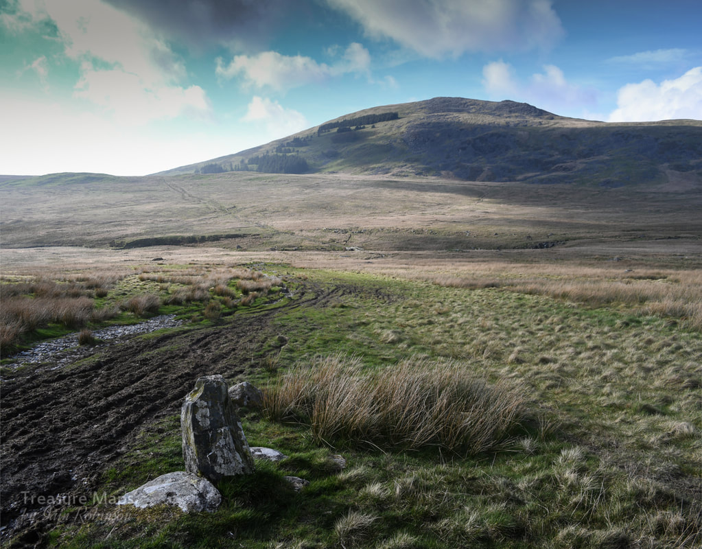 Recommended Reading
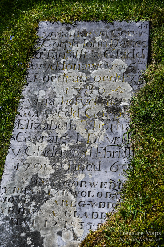
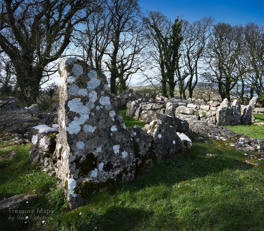
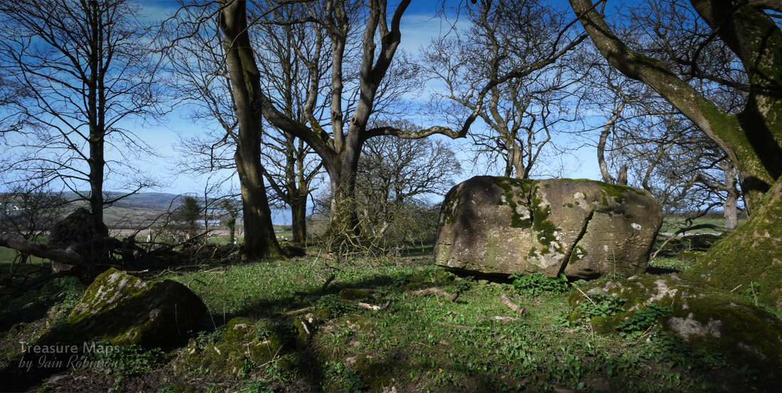
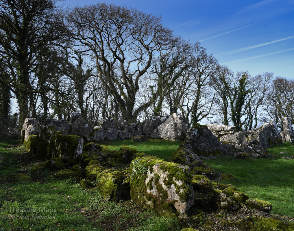
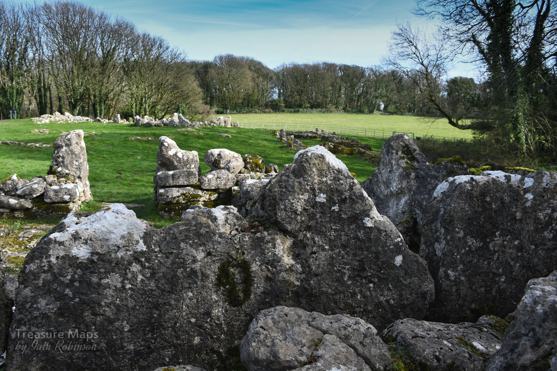
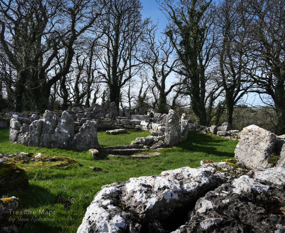
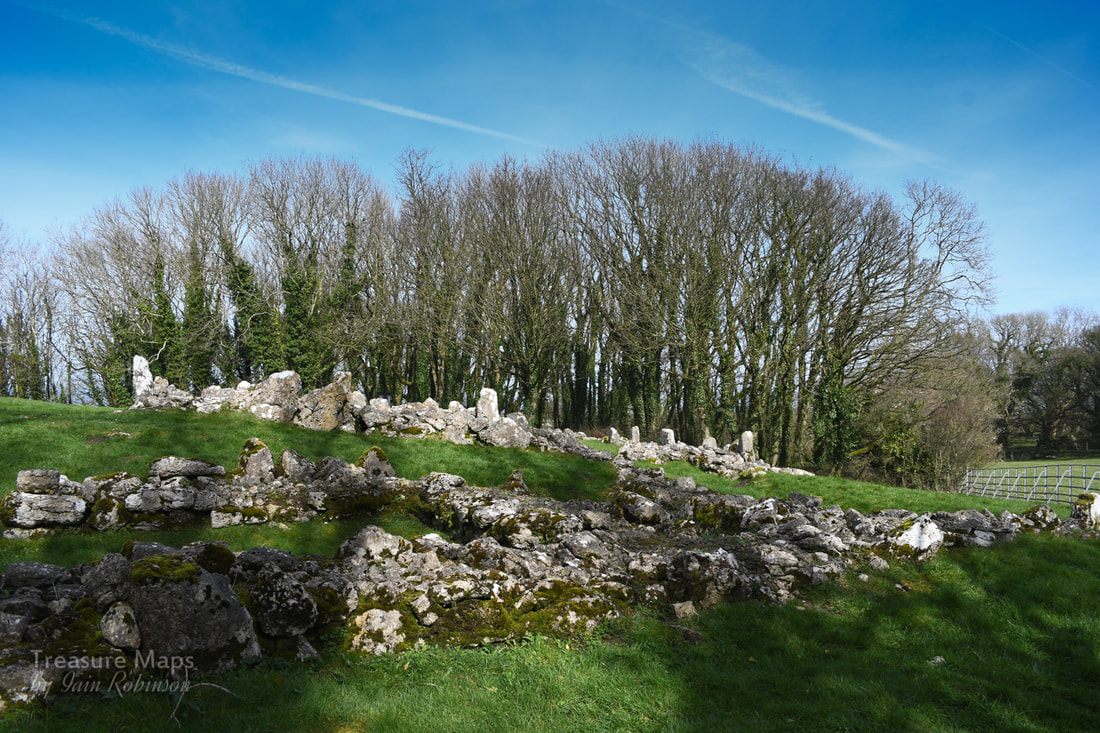
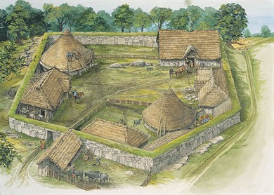
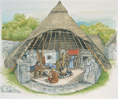
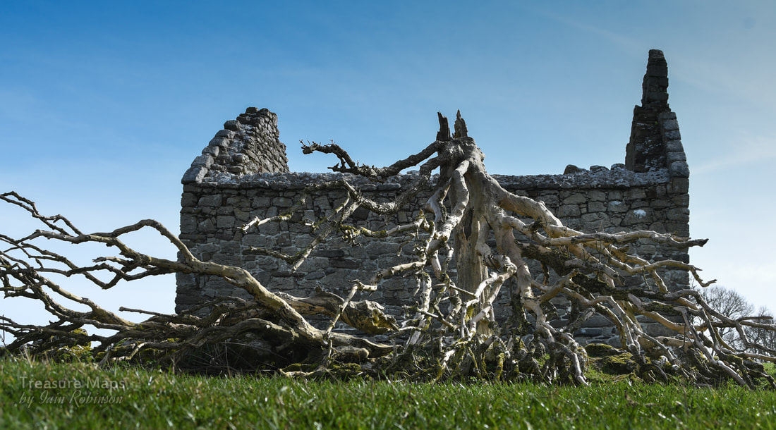
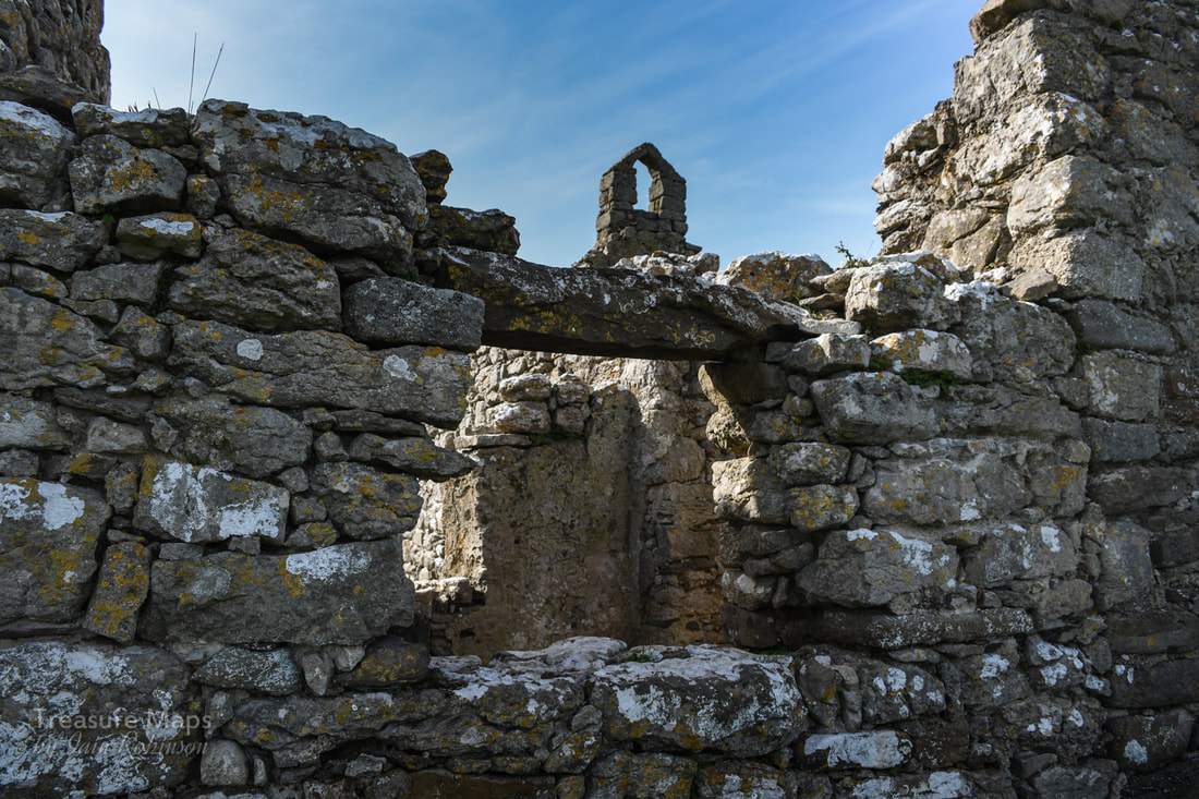
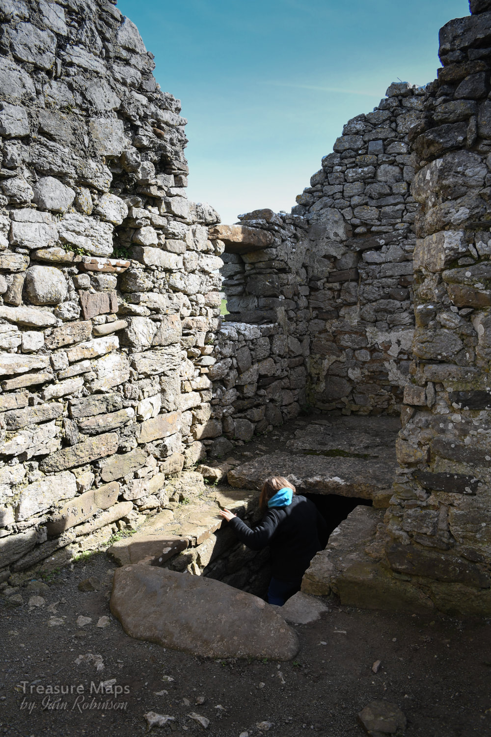
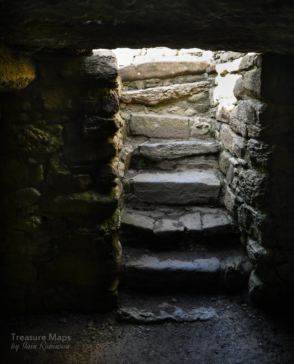
"The Drover's Roads of Wales" Godwin and Toulson, Wildwood House, 1977 "Our Forbidden Land" Fay Godwin, Jonathan Cape, 1990 "Days to Remember" Rob Collister, Vertebrate Publishing 2016 Web sites Walkingworld, drover's roads The Drovers of Snowdonia Jean Napier's page about the Bridge 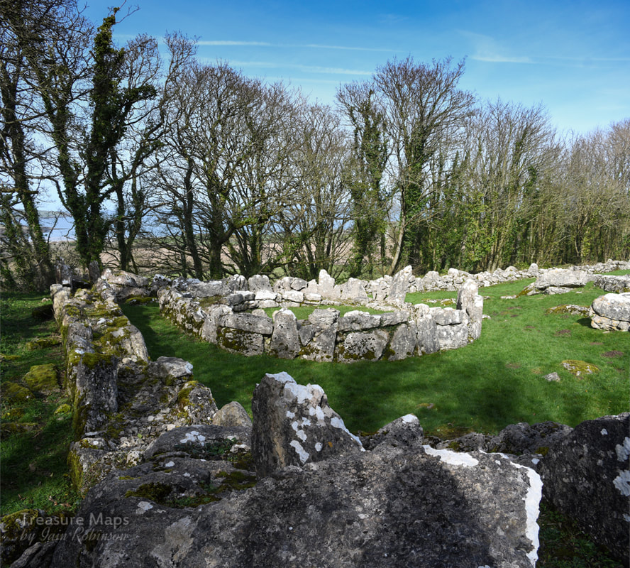 The fascinating ages of Din Lligwy- Megalithic, Roman and Mediaeval. Anglesey, as most people know, is a place rich in the remains of prehistory. But even on an island famed for its evocative ancient sites, Din Lligwy is something special. It's a walled settlement, standing on an eminence a little way outside the popular tourist village of Moelfre, on the north east coast of the island. It sits within a mature grove of Sycamore, Ash and Hawthorn trees, which allow the light to gently dapple the bright white limestone blocks making up the remains. Din Lligwy was excavated in 1905-7 by Edward Neil Baynes- in those days, excavation techniques were slightly clumsier than they are today, with subsequent technological and cultural advances in the science. But nevertheless, significant quanties of Roman material were recovered, mostly of the late third-fourth century AD. The remains here have been consolidated for public display- at the time we visited, (March 2019) some of the found artefacts were on display at the excellent Oriel Ynys Mon at Llangefni. 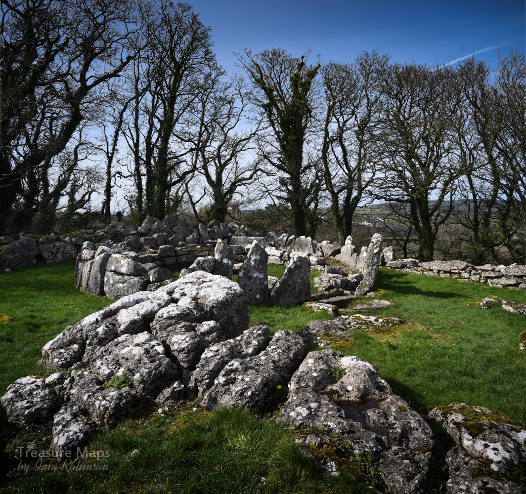 However, Neolithic flints have been found here, although we don't know at what horizon within the excavations they were located. But the presence of another feature nearby, the Din Lligwy burial chamber, makes it more than likely that this site was in some kind of use then. The interpretation board at the site suggests that the village may have been in use during the later roman period, explaining the outer wall- the Roman influence was waning and chaos was beginning to descend on the land. We can't be certain. What we do know was that there were settlements here before Roman times that may have been consolidated...more remains lie outside the perimeter including a hut and stones which may be the remains of enclosures. This would suggest that the site was a locus for agricultural activity and fits in with the idea that this place was associated with a person of power and wealth, not a Roman. While the round huts would have gone out of fashion by 4AD, it may be that they were a return to the old pre-Roman ways. One hut base is larger, this is at the top of the enclosure and would have been the high-status dwelling. Excavations in this hut found Roman coins, pottery and a glass jug, as well as a silver ingot. Other (square) huts were used as workshops- here large amounts of metallic slag, as well as remains of several hearths with charcoal formed from oak were found. It was evidently a workshop for the smelting and working of iron. The original entrance to the fortified compound was through a gap next to the external building. The unanswered question here for me is: where did the ore that they were smelting come from? The nearest iron deposit was at Llandyfrydog Quarry, Llanerchymedd on Anglesey at SH451861, and there are other iron mines on Anglesey as well. Of course, this site is relatively close to the sea- perhaps ore was brought by boat, along with other high value items- in which case the ore could have come from Europe. We don't know for sure, but it is a fascinating thought. 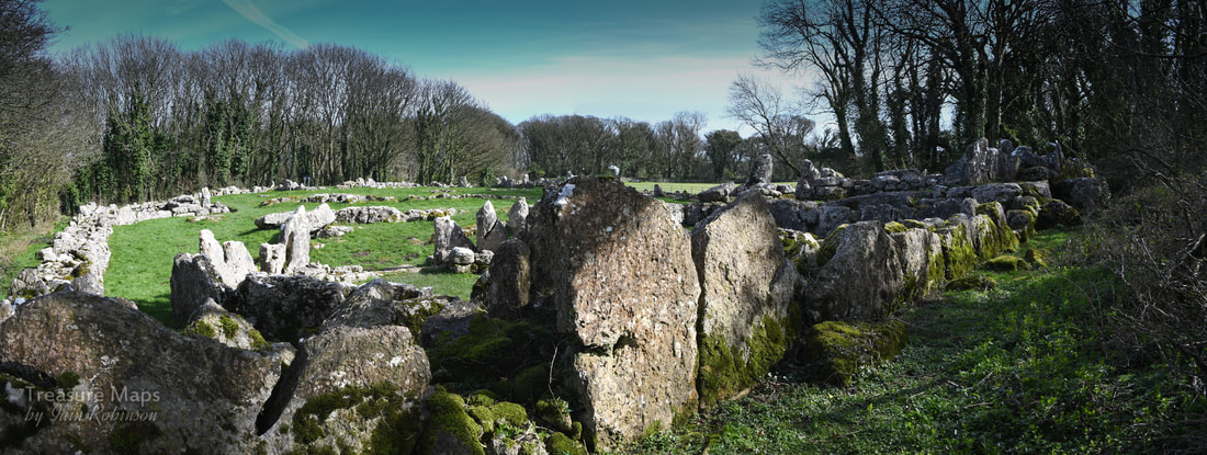 Looking over the site from the top, above the high-status dwelling. 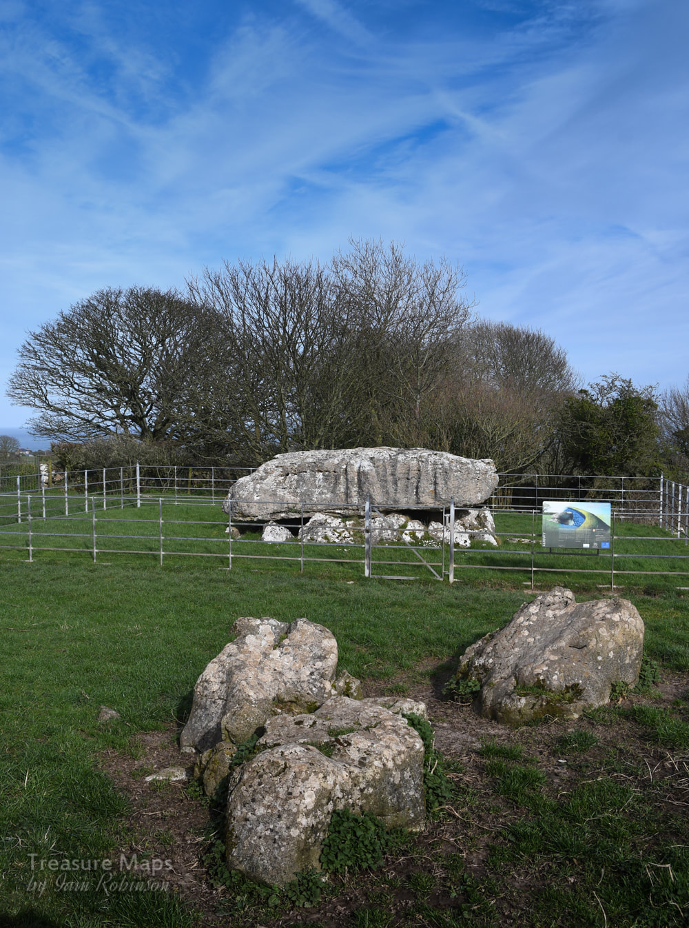 The Burial Chamber Not far from the settlement is the Neolithic burial chamber of Din Lligwy, dating back to the 3rd millennium BC. This is an impressive reminder of the determination and capability of the Neolithic peoples, since the capstone is thought to weigh 25 tons! This site was also excavated in 1908, when the remains of 15-30 people were found. Along with them were pieces of beaker and grooved ware pottery that provide evidence for the age of this tomb. It is from the end of the Neolithic period and so was among the last of these types of tombs in use. The interpretation board reminds us that this tomb was covered over with stones and earth- I wonder where all that went to? Taken by farmers for rubble, perhaps. The sides of the gigantic capstone are marked with lines where the stone was hewn. It's not clear, of course, where the stone could have come from, but it was quarried and shaped. A little awe-inspiring to think that these tooling marks were made by men from such a long time ago- that really brought home to me the significance of this place. The chambered tomb is nowadays surrounded by railings, the gate is locked but doesn't seem to preclude visits from sheep. The railings do spoil the atmosphere for photographers a little. 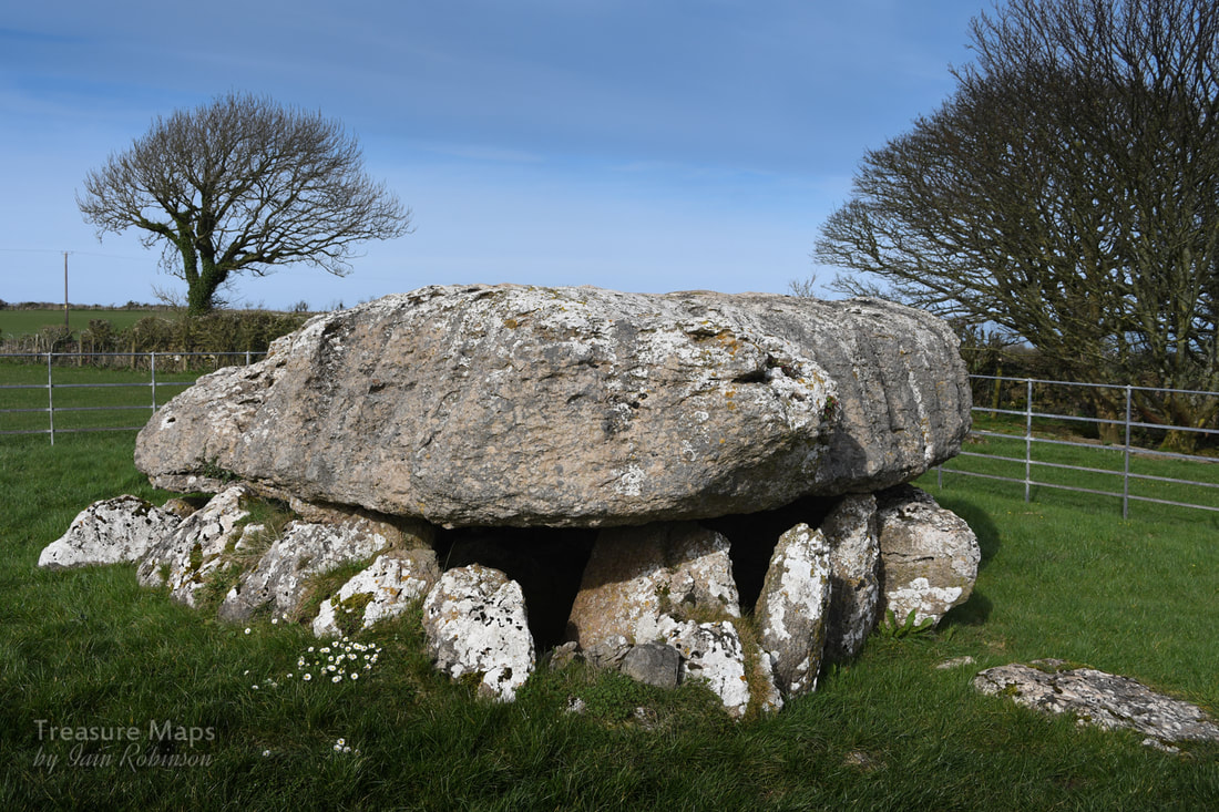 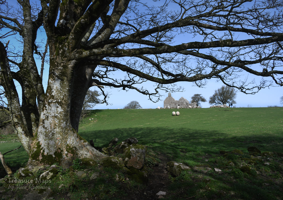 Hen Capel Lligwy Nearby, to the north east of the settlement is a ruined chapel. This, perhaps, offers some clues as to the prosperity and population of the area in prehistory. Originally, this would have been a wooden church, but it is thought that in the middle of the C12 AD, (with the raids on Anglesey by Vikings becoming rare), many places of worship were rebuilt in stone. We know that this chapel was first built in stone in the 12th century, but the upper parts of the walls were reconstructed in the 14th century. A small chapel, with a crypt underneath, was added in the 16th century. There is a small "borrow pit" nearby where stone was quarried to build the church. It's also possible to make out from the walls where repairs have taken place, as different types of limestone have been used. The interesting point here is that the settlements that surrounded the church were probably made from wood- the area was likely to have been much busier than today, but most traces of the hut dwellers have gone. Populations moved away, and the wood from their dwellings was burnt as fuel by those who remained. 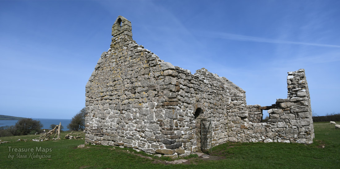 Locating the sites- and parking. Din Lligwy Settlement is at Map Ref: SH4970286134 Burial Chamber- Map Ref: SH50138604 Both are Landranger Map Number: 114 The site is signed from the roundabout on the A5108 at Llanalgo. Coming from Moelfre, it is a right turn. Turning along this road, the Burial Chamber is seen first on the left- a small lay by offers parking for one car here. A quarter of a mile further on and there is parking for three/four cars at a layby - the chapel can be seen clearly, and the settlement is in the woods to the south east. I am indebted to my friend Dave Linton for pointing out to me that iron ore could have come from Anglesey- and for his diligence generally! Sources Lynch, F. 1995. Gwynedd: A Guide to Ancient and Historic Wales, Cardiff: Cadw Yates, M. J. and Longley, D. 2001. Anglesey: A Guide to Ancient Monuments on the Isle of Anglesey, Cardiff: Cadw. P30. |
TracksReceive the occasional Treasure Maps Newsletter- and alerts when a new post is available!
If you enjoy my content, please buy me a coffee!
Check out my other online activity...
Index
All
|


 RSS Feed