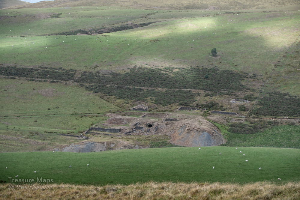
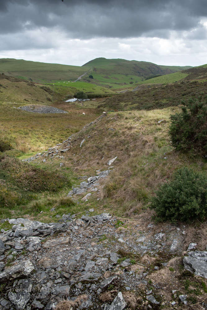
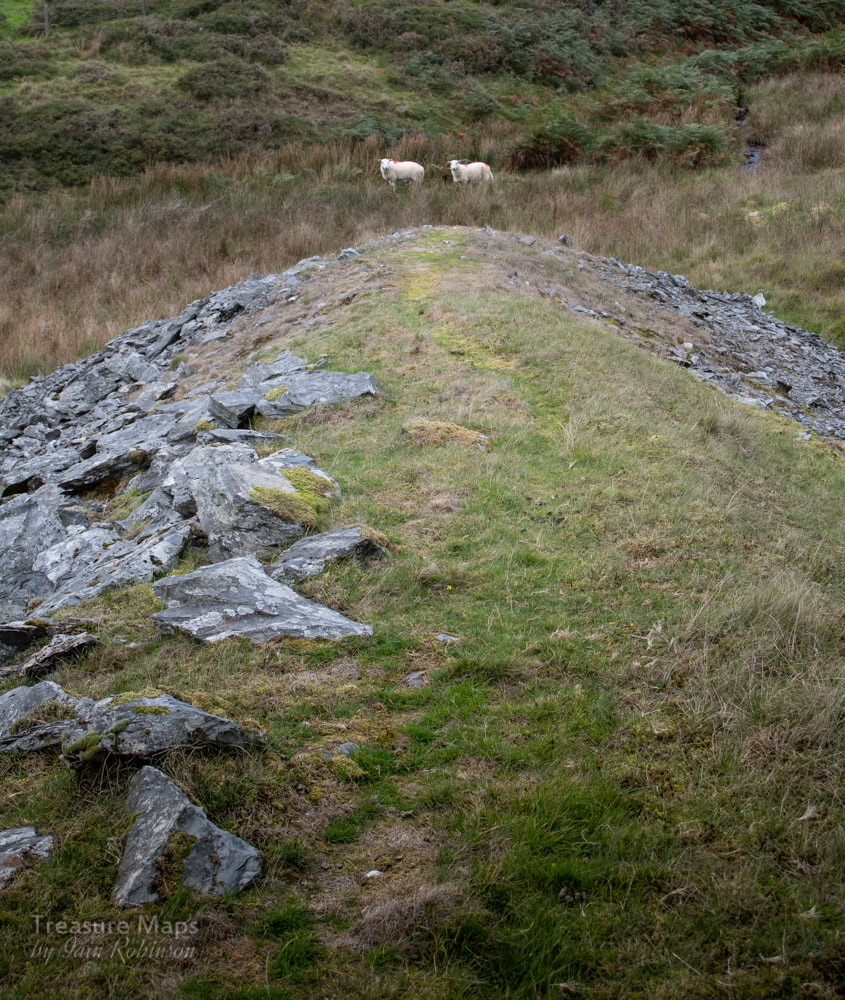
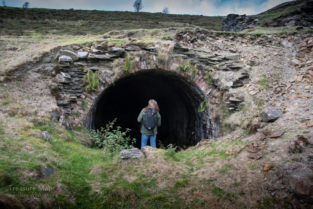
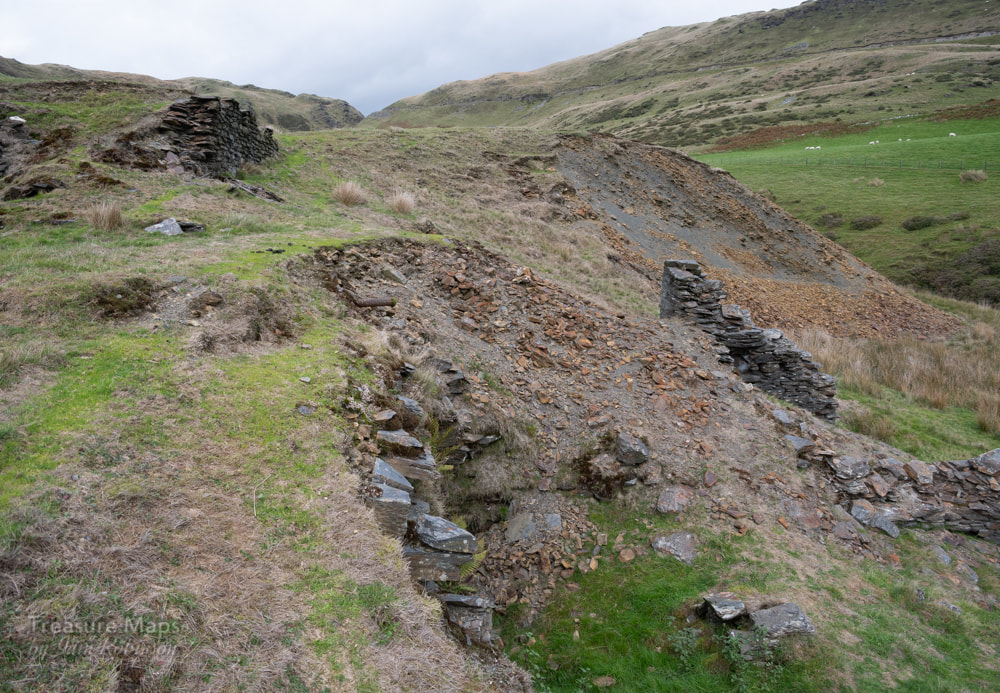
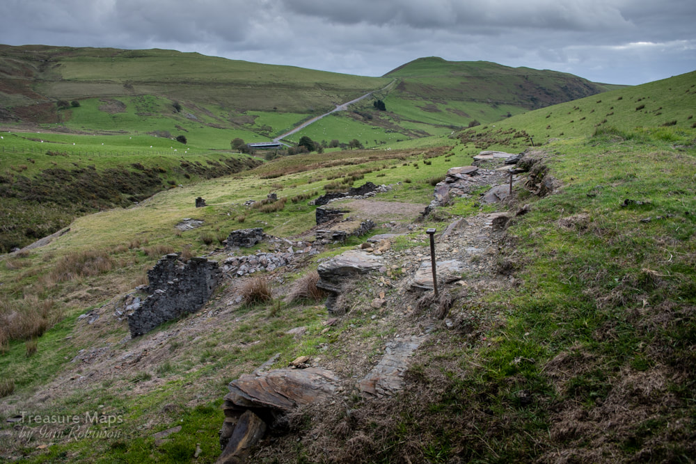
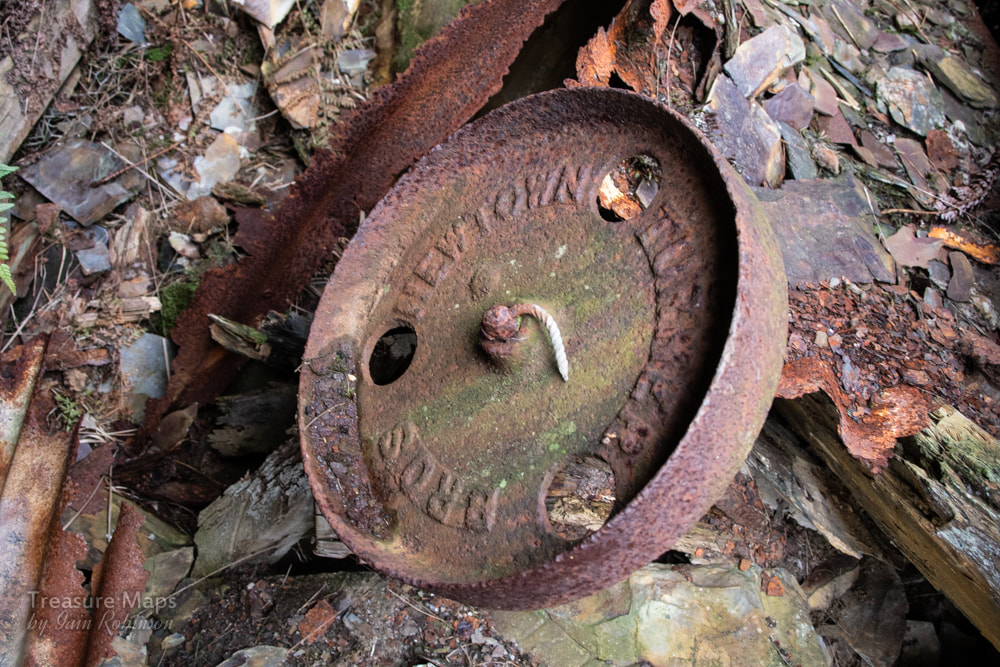
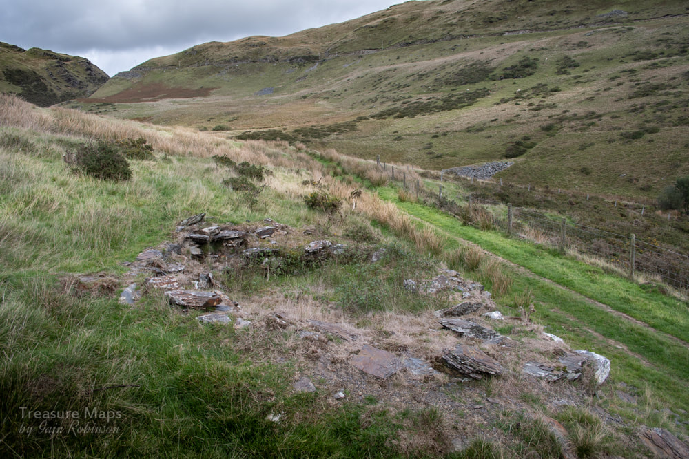
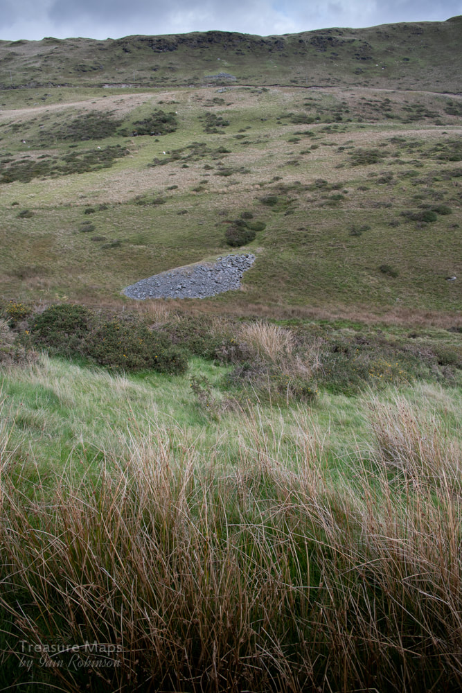
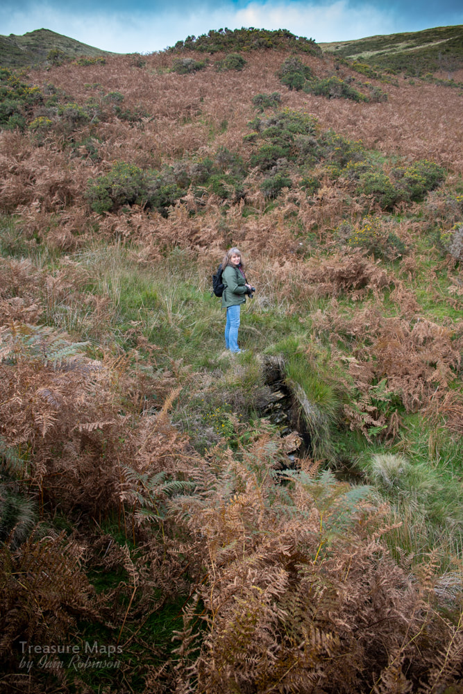
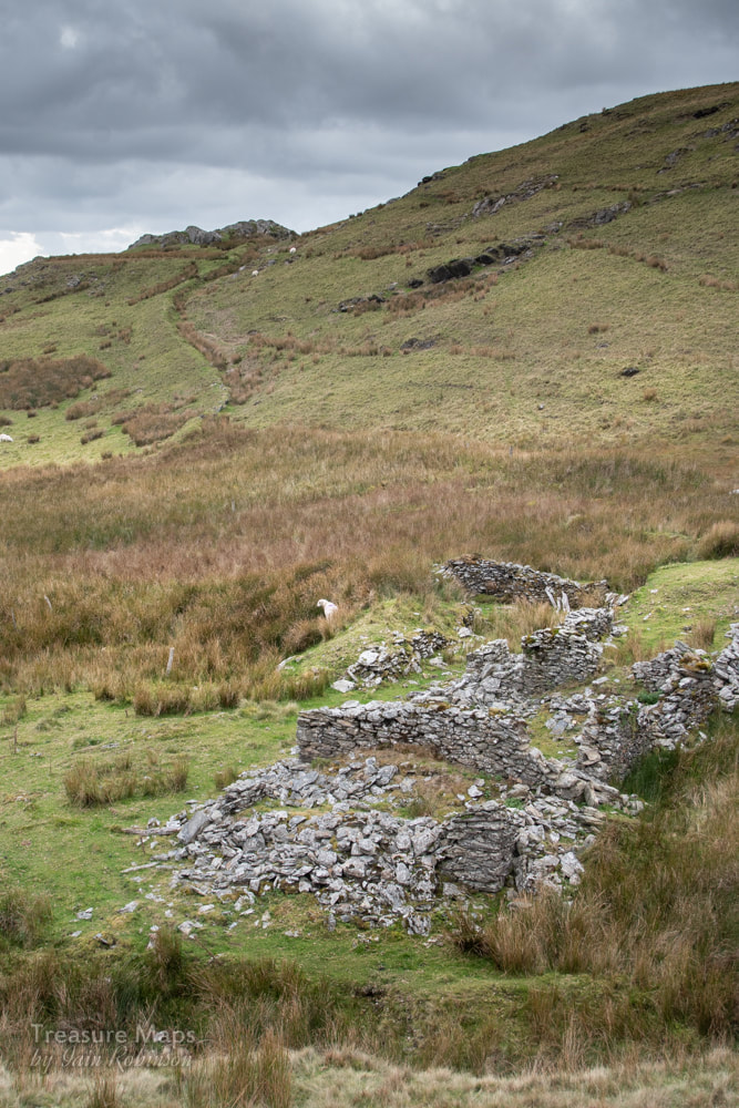
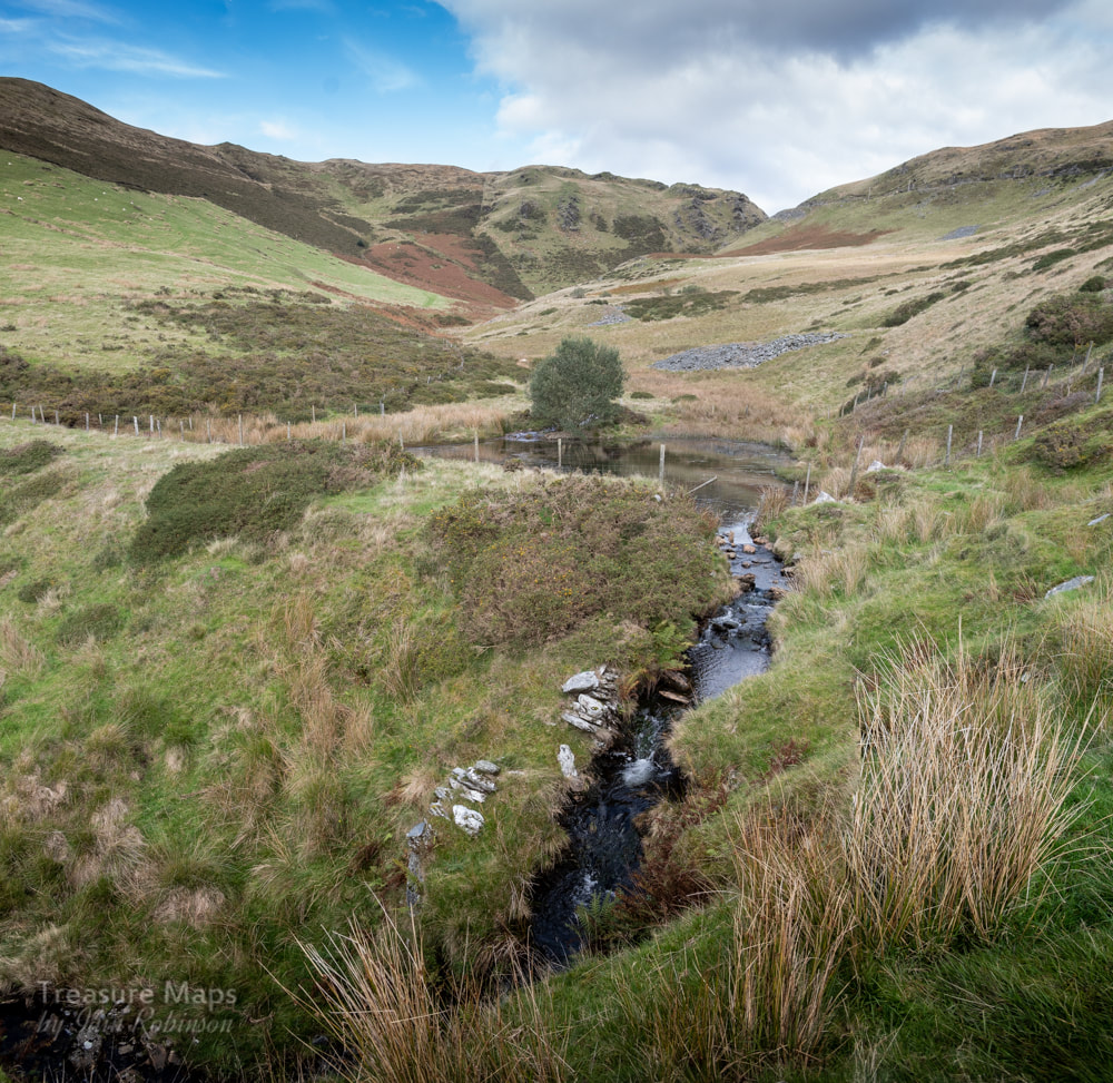
 First view of the mine from the road. The lone tree marks a shaft, presumably the destination for a wire rope line from the engine house. The copse of trees in the ravine top left also hides the remains of an adit. At bottom left, the flotation pits and buddle area can just be discerned. For our next Mid-Wales adventure, we decided to take a look at the Blaen Ceulan mine, the one tantalisingly seen from the narrow road that winds scenically to the top of Cwm Ceulan. The mine is on a public footpath, which starts from SN72139085 and goes off the vertical rather dramatically down a 1:3 slope. Almost immediately, we spotted some trial adits- these are generally referred to as the Bwlch-y-Garreg trials. The first one was open, (a little way, anyway) with a modest tip. Most of the adits here have arched portals, an attractive feature. Unfortunately this one didn't go very far before ending in a headwall. Nearby was that inevitable accessory, a car wheel trim that must have whizzed off from the road.  One of the Bwlch - Garreg trials. We made our way past a few more trials until we came towards the reservoir for the mine. Here there was an extensive trial, although the tips had the feeling of a slate mine about them; there were a lot of chunks of rock and very little in the way of minerals. This trial was an attempt to find the Esgair Hir lode in 1873. The trench is 50 yards long and 7-8 yards deep. Sadly, nothing was found, and the excavation was abandoned. 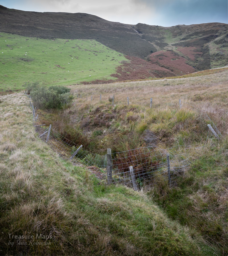 The prospecting trench, looking north. It was strange that although we could see the Blaen Ceulan mine from the road, down here by the old trials it seemed to be hiding. It wasn't until we were nearly upon it that it was revealed, hidden up until now by the moraine spurs that skirt the stream. 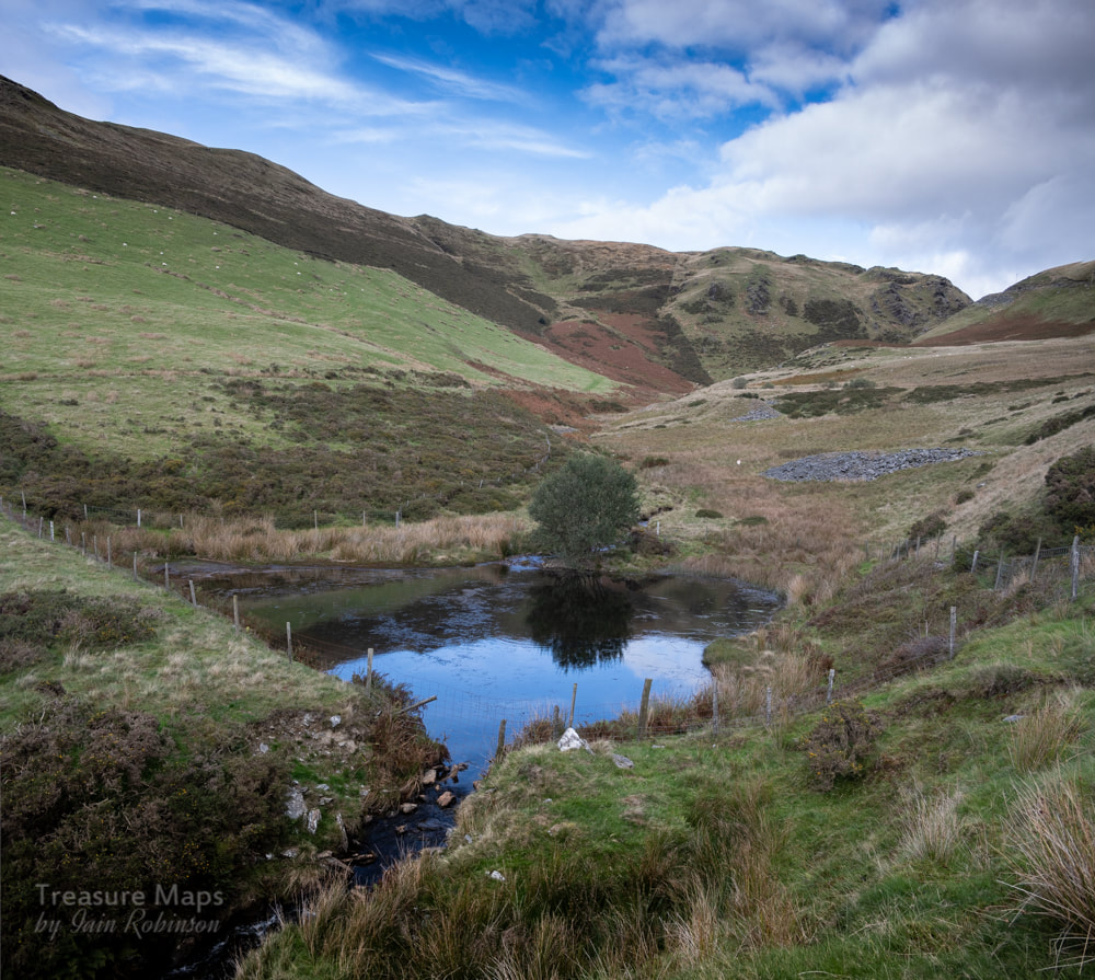 The reservoir, with evidence of trials in the background. This was obviously a big operation for a while, judging by the spoil. Our first glimpse revealed the fossil impressions of floatation tanks and buddle pits highlighted in the fitful sunshine. The main adit, a brick arched tunnel was obvious, although rather underwhelming, as it only went in about fifteen feet before ending in a stone wall. I got the feeling that there might be a lot of water behind that wall. 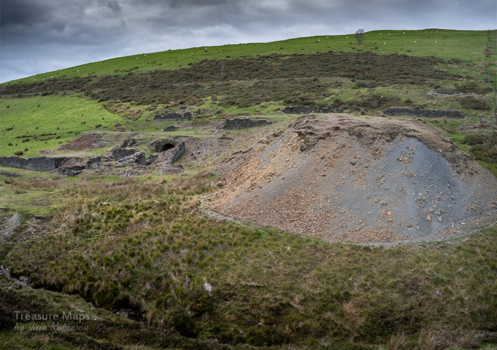 The tip from the deep adit, paradoxically above and to the right of the main adit. 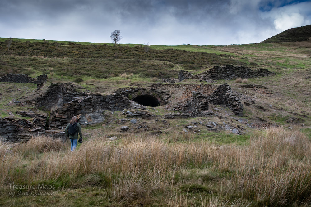 Petra makes her way to the mine. There was a confusing array of ruined structures, and one we could identify- a wheel pit. I wondered if the big tunnel was simply for transport or access, and that another tunnel struck the lode and connected with it. Another theory is that the tunnel was simply an alcove for a steam engine. It is known that the Perran Foundry supplied a 16in horizontal "Puffer" and a 20 foot boiler. This would explain the lack of spoil or roadway here, near to the crushing floor. A 40 foot waterwheel and a 36 inch crusher were ordered from Perran and must have been in this vicinity. The stone for the buildings, incidentally, came from the opencut at the deep adit. There were the remains of a shaft further up and behind the mine- this could be the engine shaft. We know from Bick that the company purchased a steam engine from the Castle Hotel, Aberystwyth to drain the mine. It was a an 8nhp engine by Bennet of Deptford- lowered down the shaft to a purpose-cut chamber, the engine started pumping on 15th June 1870. Unfortunately, returns did not match the investment, and the engine was retired and presumably still languishes in it's chamber, rusting slowly into oblivion. From 1873, the pumps were worked by a wire rope from the 40foot wheel- something that the 1880 O.S. maps show clearly. 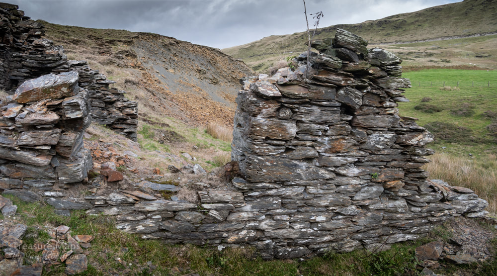 The ruins of what could be an engine house near the main adit. The remains of bearings in the opening are interesting. 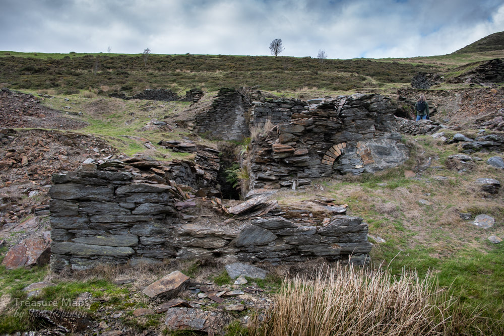 The waterwheel pit and processing area. We roamed around happily for a while, examining the minerals in the spoil and speculating about the structures. Further up the hill, there was a long ruined structure beside an adit that was choked with gorse and vegetation. This was the deep adit, rather wet and inhospitable- and impossible to photograph.. 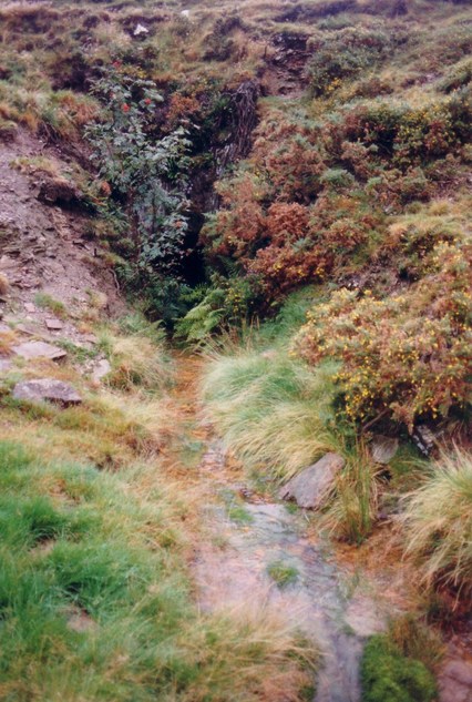 A photograph taken in 1990 of the deep adit, from Graham Levin's photo archive, by kind permission of the Welsh Mines Preservation Trust. 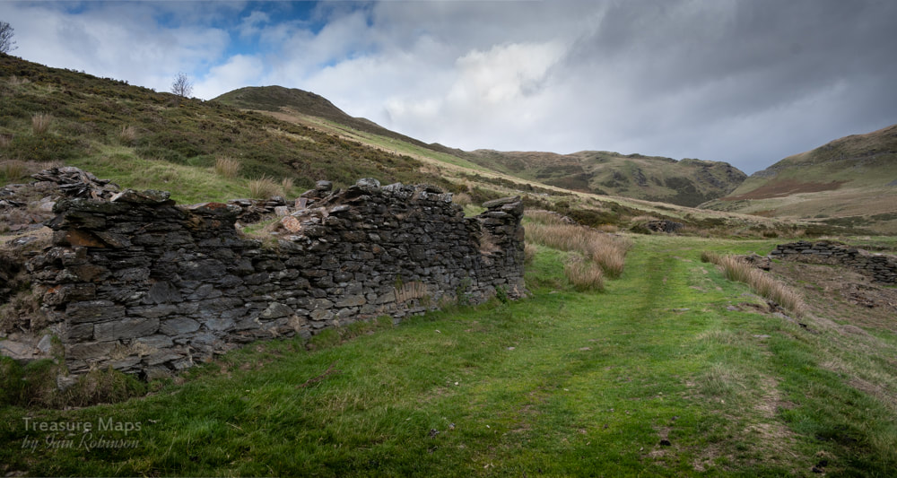 The deep adit lurks behind the buildings. We made our way east on a farm track which gave us good views of the trials along the south side of the Bryn Mawr valley. I had been wondering where the powder house could have been, when I nearly stumbled over it, just the right distance from the workings. 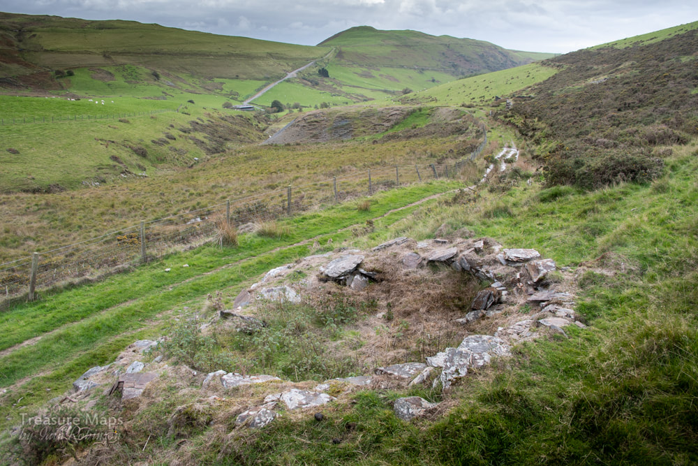 The remains of the powder house, or magazine. It is rectangular in shape, although my photo makes it look round! Obviously, the coffee we'd had earlier in Newtown hadn't worn off, as Petra decided that we'd try and find the old road marked on the 1880 OS maps from Bwlch y Garreg farm. We ended up making for the end of the cwm through an area of gorse and bracken that wasn't pleasant. The gorse is a direct result of sheep farming, as the poor beasts won't eat it, so it spreads unchecked. Some breeds of cattle have a taste for it, but they weren't in evidence here. 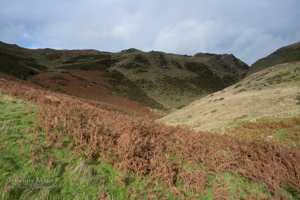 Towards the bwlch! The gorse awaits... We found ourselves on a very steep slope towards some crags. Petra went up big-style, but I had the wrong boots on (that's my story). I wasn't wearing my trusty Vibram soled climbing boots, but a pair of lightweight Merrells- I'd envisaged this as an easy potter about, not an attack on K5. Of course, the inevitable happened and I slipped, descending twenty feet or so very quickly on the grass before doing an ice-axe belay with my walking pole. The rest of the slope was taken very slowly while you-know-who looked on patiently. 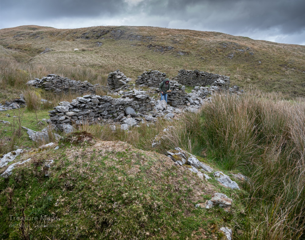 Petra examines a Newtown-made brick in the farmhouse. It had started to rain by now- luckily our car was parked at the bwlch. We eventually found the road, which took us down to the old Bwlch-y-Garreg farm, sheltered in the lee of another moraine. It was still an exposed spot and I didn't like to imagine what conditions must have been like for the occupants, especially before the road was built by the mine company. There was a hollowed out area in front. perhaps another wind-break that might have been planted with bushes. Beside the farm was a pig-sty. We walked back to the car, feeling thankful for the 21st century and all it's mod-cons. 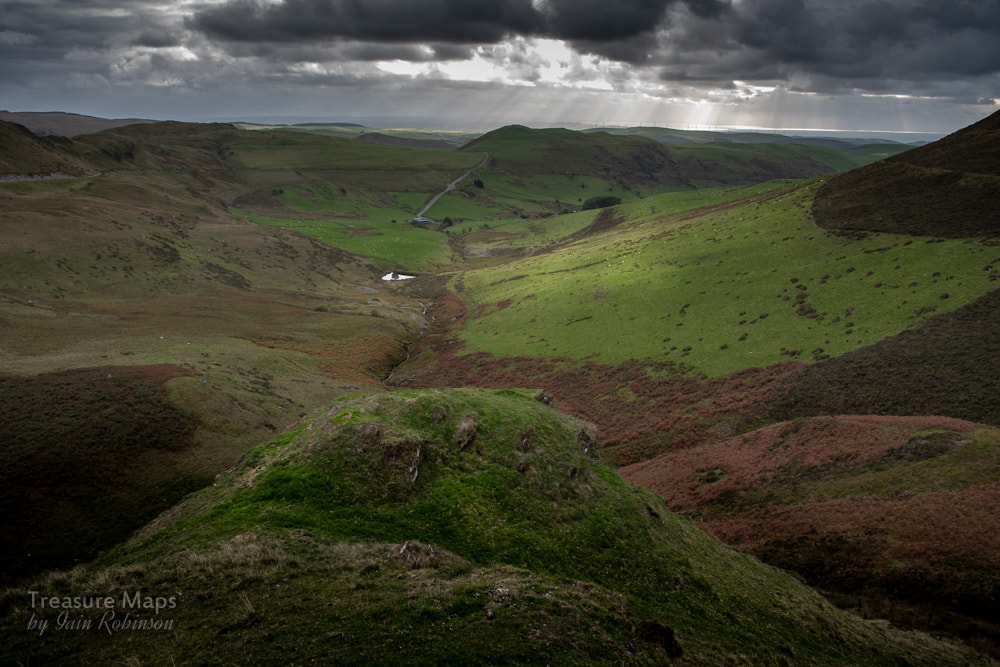 The view from the rocks at the top of the bwlch, looking towards Tal-y-Bont. The Factoids... The mine works a continuation of the Esgair-Hir vein, exploited by the mines to the north east at the bwlch- Esgair-Hir and Esgair Fraith. My post about Esgair-Hir is...here. The earliest workings are impossible to date, but Foster-Smith considers a date of 1723, when some shallow shafts were sunk on the vein. In 1732-3, take-notes were issued from the Gogerddan estate to miners, probably unemployed, to raise a little ore and work the tips at Blaen Ceulan. In 1852 a deep adit level was driven- it found the vein and was then connected to the engine shaft. While the ore was stated to be rich, it was inconsistent and tapered off. The mine was working from 1852-54, then closed until 1868-76. During this period the recorded output was 438 tons of lead ore, 7 tons of zinc and 18 tons of copper ore. An account of a visit to the mine by the Welsh Mines Society (Autumn 2008) notes that "One discovery of the day was ironwork on the river bank that might have been associated with an aerial ropeway from the mine to the road." That might explain some of the mysterious holding down bolts. The cart wheel we found in the waterwheel pit was made by Turner Brothers, Cambrian Iron Works, Newtown, Mid-Wales. They were agricultural engineers who also specialised in making equipment for slate mines- the works was founded in 1795. Sources: "The Mines of Cardiganshire", J Foster-Smith, Northern Mine Research Society 1979. "Lead Mining in Wales" W. J. Lewis, UWP 1967. "The Old Metal Mines of Mid Wales, part 3" David Bick Pound House 1974. "Metal Mining in Mid-Wales" by G. W. Hall, WMS 2014 Graham Levin's photographic record of the mine- these are proper film photos, back when you needed skill to take a photo :-)
4 Comments
|
TracksReceive the occasional Treasure Maps Newsletter- and alerts when a new post is available!
If you enjoy my content, please buy me a coffee!
Check out my other online activity...
Index
All
|

 RSS Feed