|
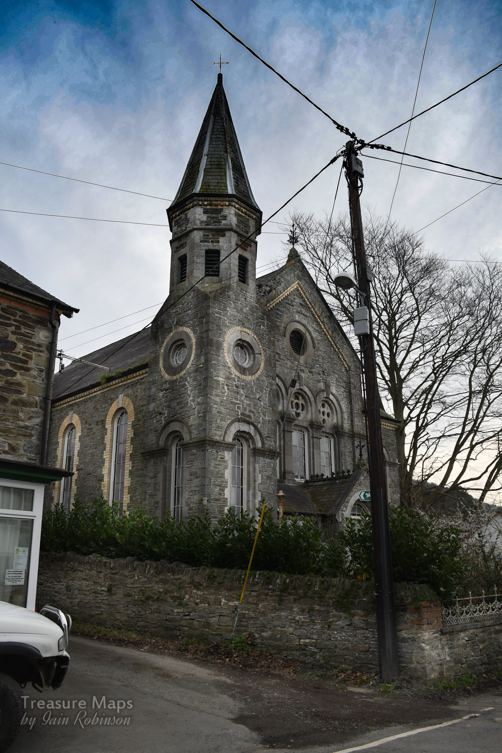
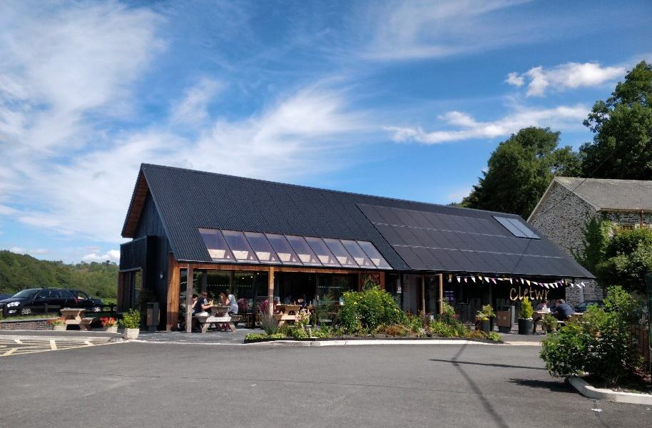
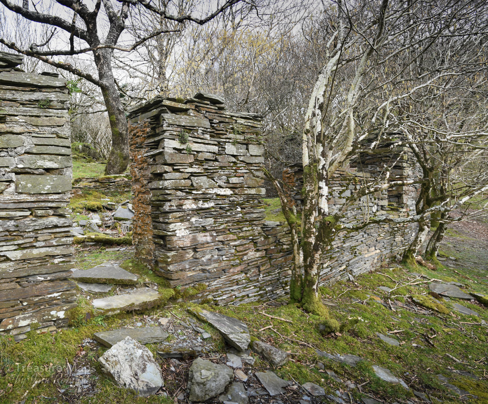
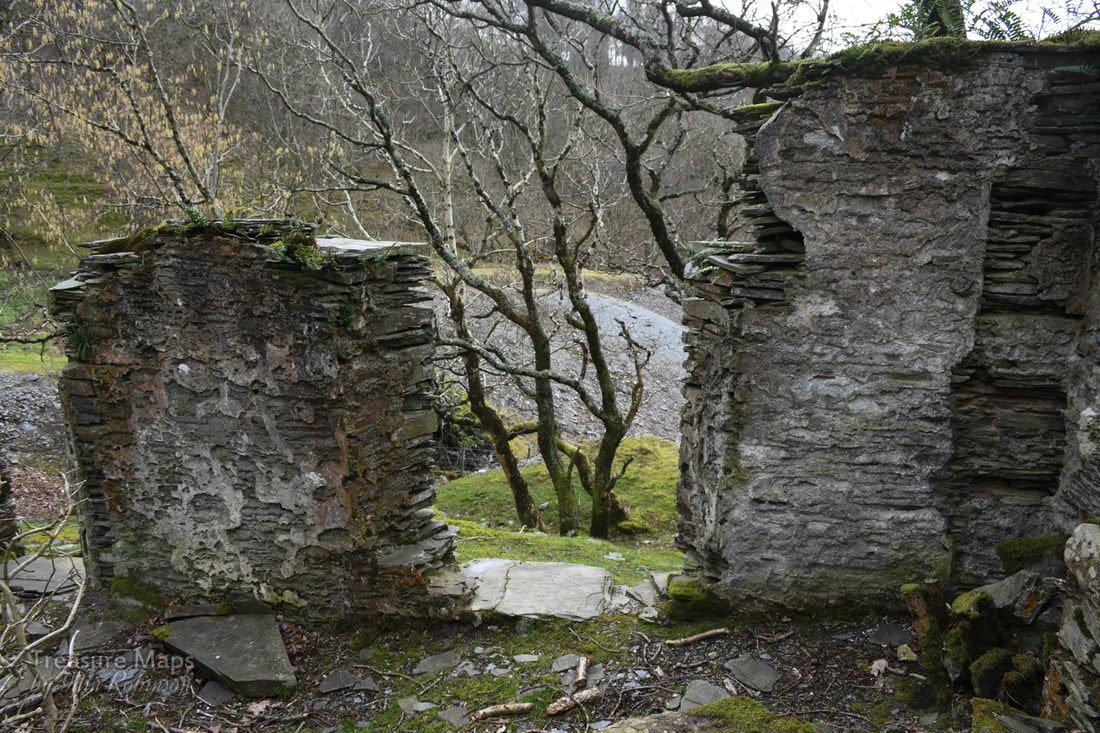
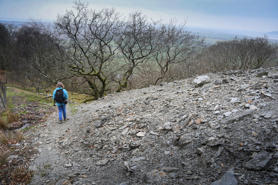
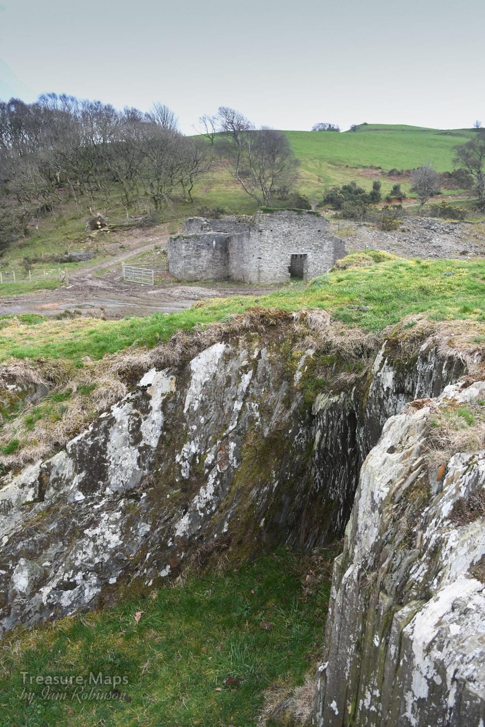
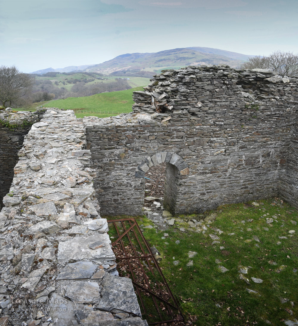
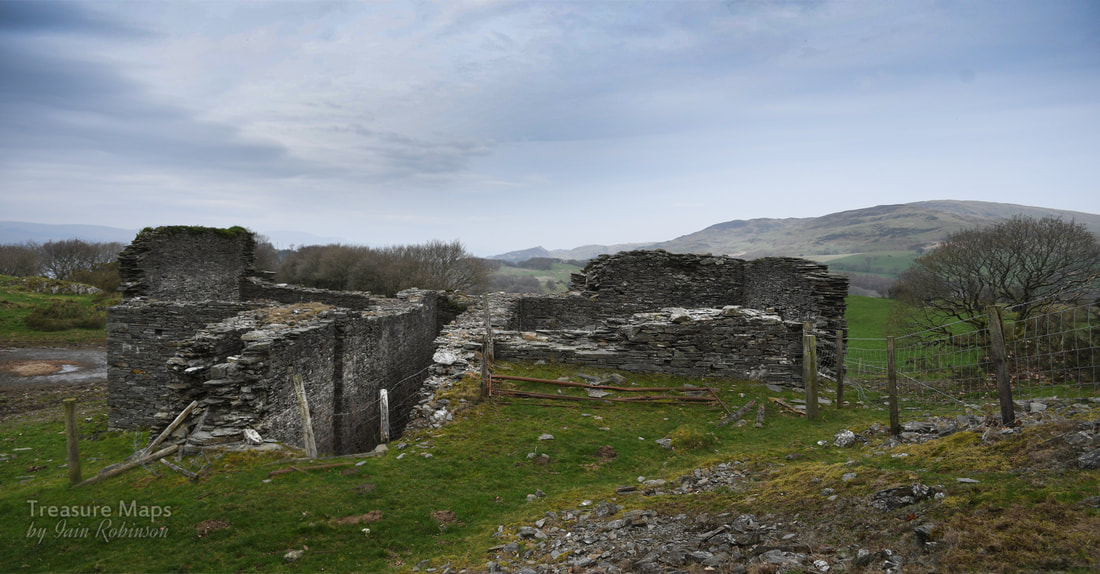
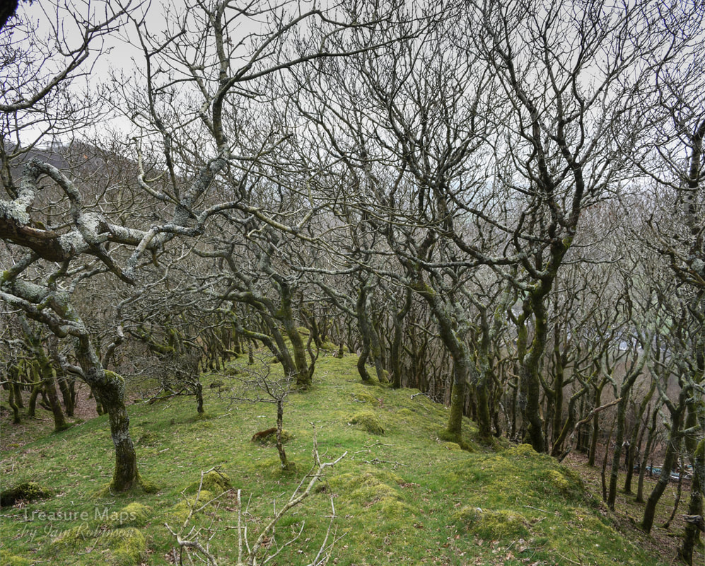
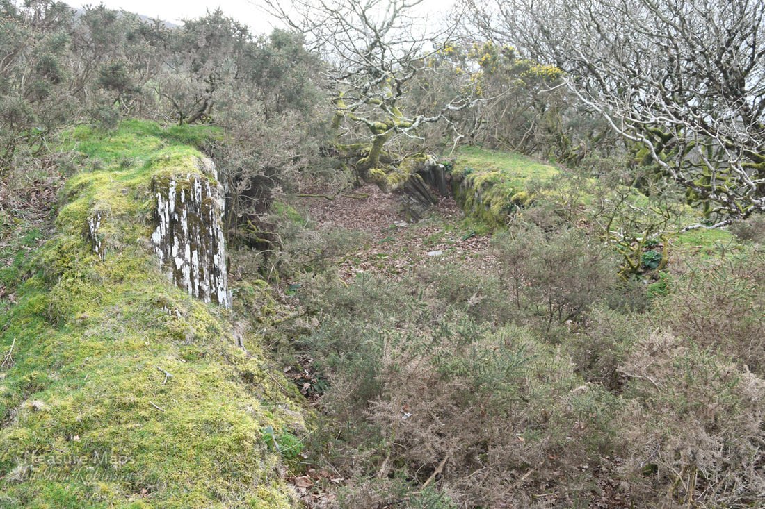
The Gnarly story of the Brynarian mine, or Cardigan Bay Consols. 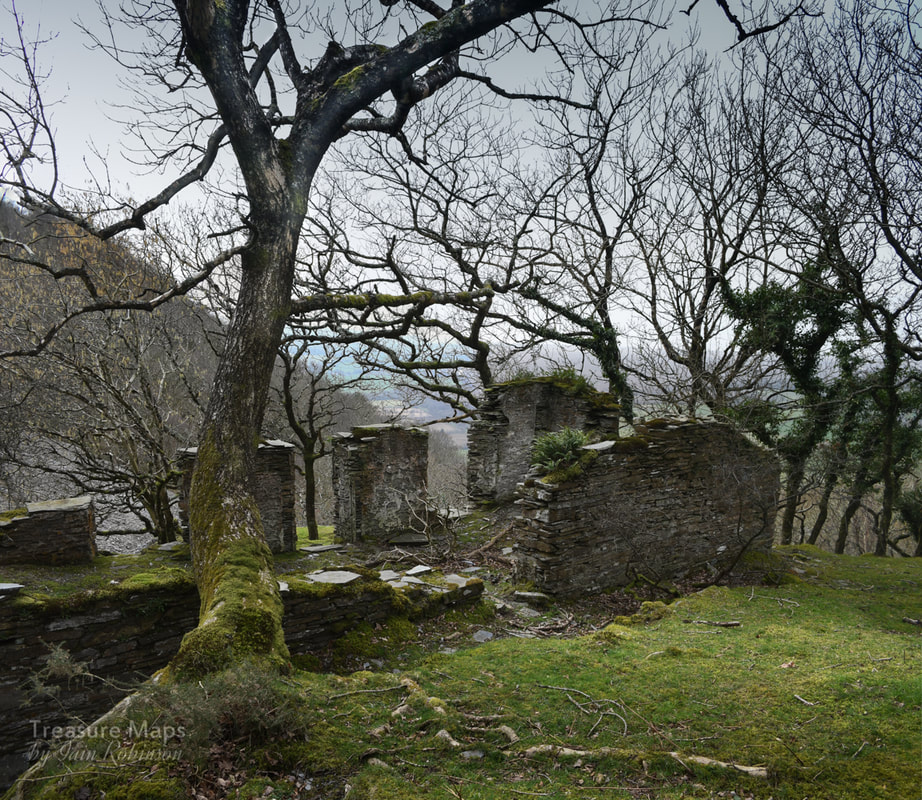 The mine office at the top of the workings above Hallet's level. The hills rose steeply above Tre'r-ddol as we pulled in to the little mining hamlet, parked and prepared to climb up the track to the Bryn Arian mine. But first, there was something to tick off the list. Breakfast. Tre'r-ddol has a wonderful community cafe...we'd noticed it many times as we drove past, on the way to Aberystwyth- making a mental note to try it when we had time. Now we had, and we were not disappointed! 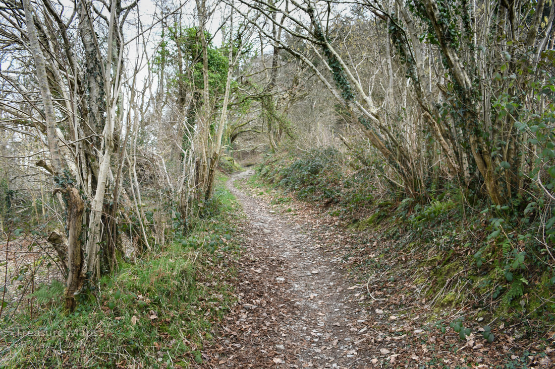 The trackway going up to Cwm Cletwr. Suitably fuelled, we took the path to the side of the imposing Soar Chapel and began to climb upwards into the valley of the Afon Cletwr. The path goes over the bedrock in places and I suspect it might be an old miner's track - there are several mines here, within the cwm and on the hillside. After half a mile, we came to a junction at SN 66267 92019. The path continues straight on and down into the Cwm Cletwr nature reserve, but we turned right, bearing south west, onto a path which parallels a forestry access road. The conifers have been thinned out, revealing the occasional fine beech tree that was probably here before the spruce woods. In the fields below, Vanner horses grazed- they seemed to be quite contented, despite sharing the field with some bullocks. There are several tracks that head off steeply up into the woods on the left, but the third one links with a track coming up from Tre Taliesin, another mining settlement on the A487. You could approach from this village- but then you would miss the fine breakfast. 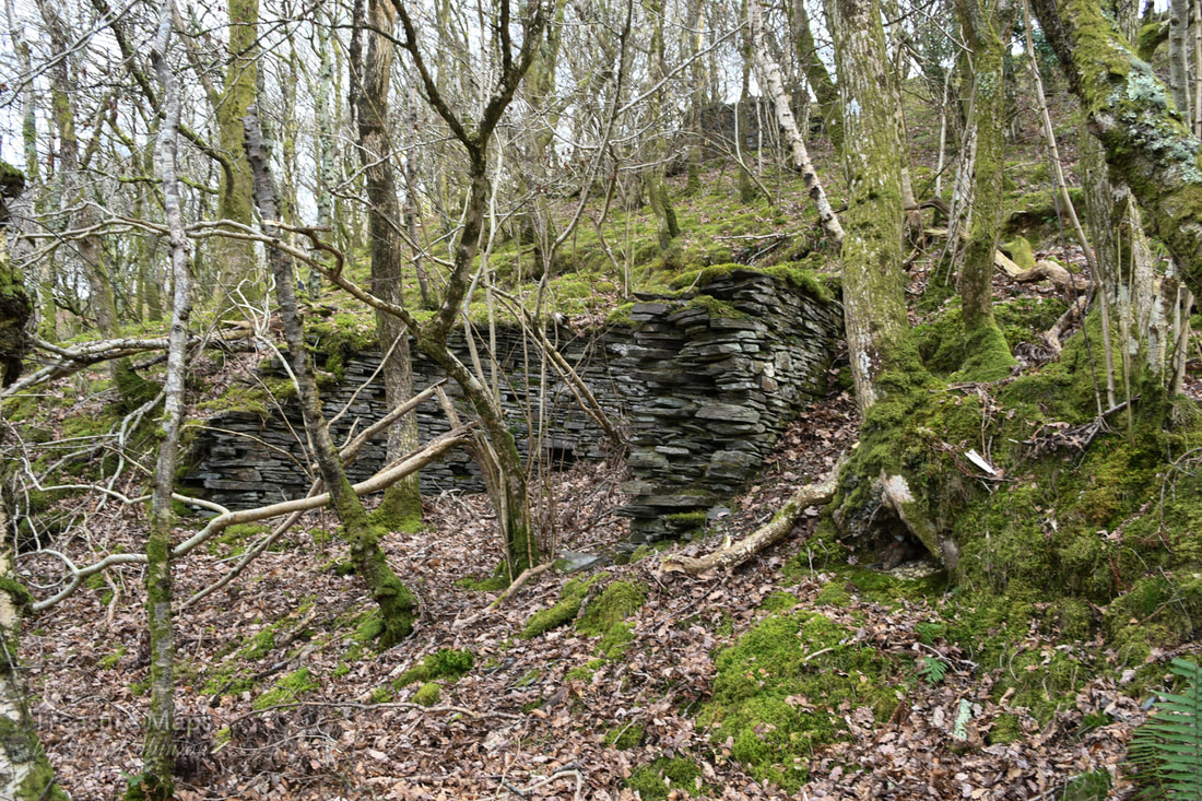 Ore bins below the Hallet's level tramway. As soon as we started to climb, the mine senses kicked in. I was imagining spoil everywhere. The track then did a steep jink uphill to the left and we spotted a real spoil heap. Not much, probably a small trial, but then above that were a couple of bastions made from drystone which might have been for winching. Hard to tell, but this might be the whim that wound the new Boundary adit below- it seemed to be connected by the remains of a tramway level. The path went away to the left, but we crossed the fence and went off-piste up to some huge tips that spread across the hill and into the woods here. There appeared to be a number of shafts and two ore bins. The ground was disturbed and bore the marks of many excavations over the years, with run-in adits and trials. Oak trees had re-colonised here, reminding me of Bryndyfi a few miles to the north. 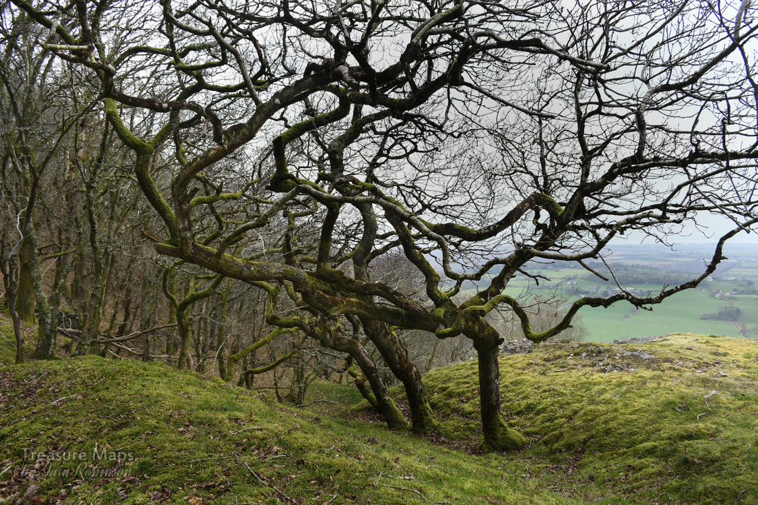 Young oak trees inbetween the old tips. Then Petra spotted a big opencut and shouted to me that she'd found what looked like Hallet's adit. It was open, but not at all amusing, being belly deep in mud. According to a survey by David James, this adit once reached into the workings and connected with the engine shaft further up the hill. There was a labyrynthine network of stoping and crosscuts underground which I would dearly like to see- but I also value my life. 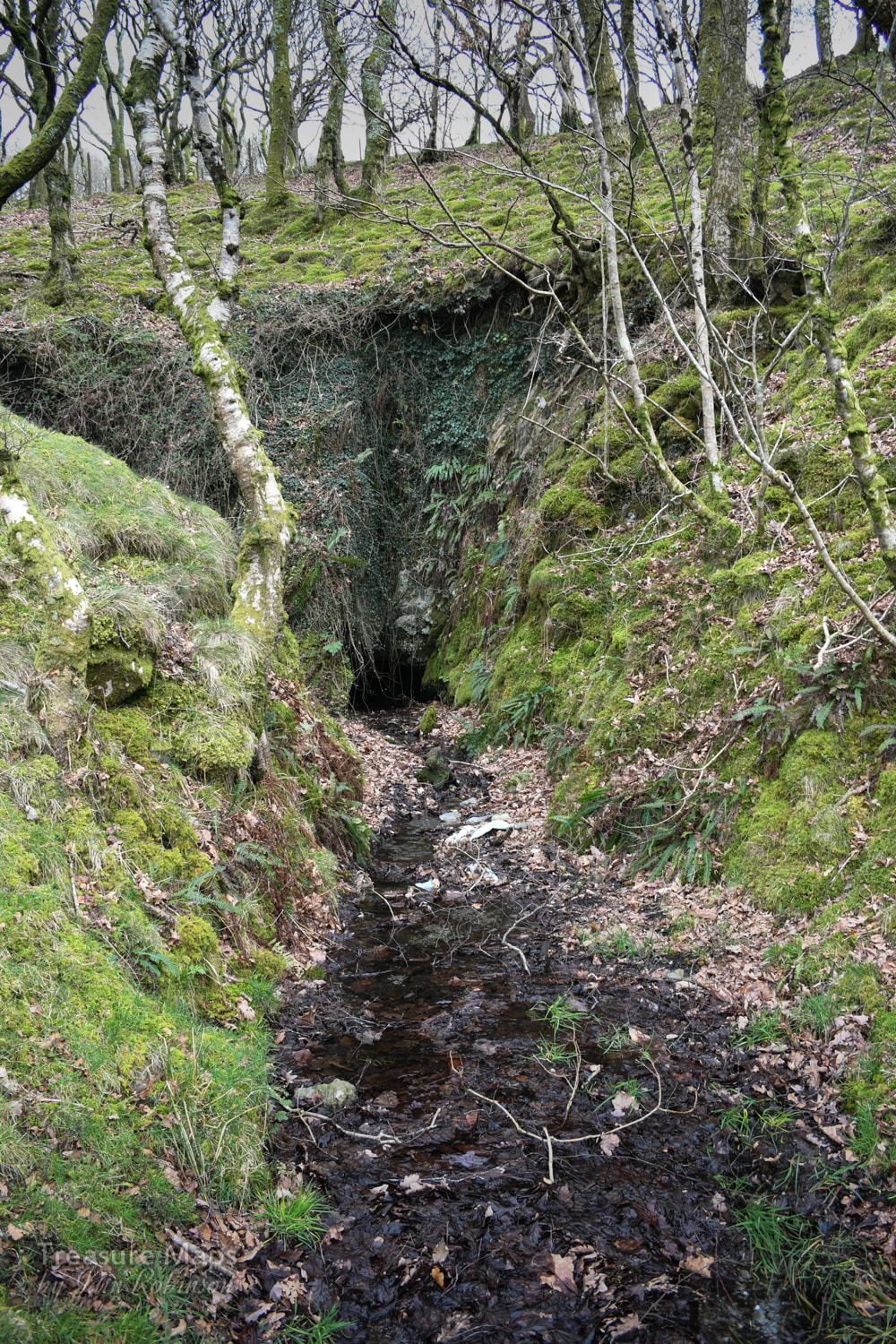 Hallet's adit, in all its muddy glory. We moved on over the tips to a ruin which appeared to be a mine office, situated on an eminence above this area of working. One of the rooms seemed much lower and more strongly constructed, I wondered if there had been machinery in there. The tips around here were not at all rich in other minerals and the overwhelming feeling was of shaley rock- normally in lead mine tips you would expect to find some quartz at least, possibly some pyrites and the occasional blob of galena. There was nothing. 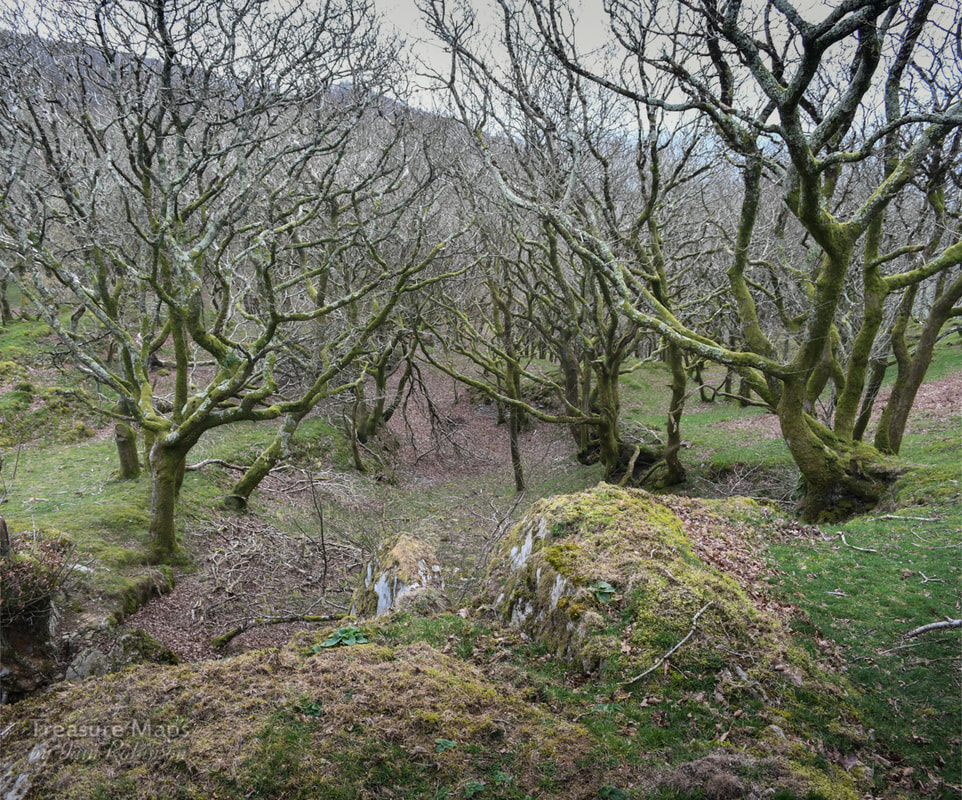 One of the old man's excavations, probably dating from the mid C18. We moved on upward, rejoining the public footpath again, towards the ruined waterwheel house and crusher that we knew waited on clear ground above us. The oak woods here were enchanting, low growing trees contorting their limbs in ever more crazy shapes, masking numerous opencuts made by the "old man*". 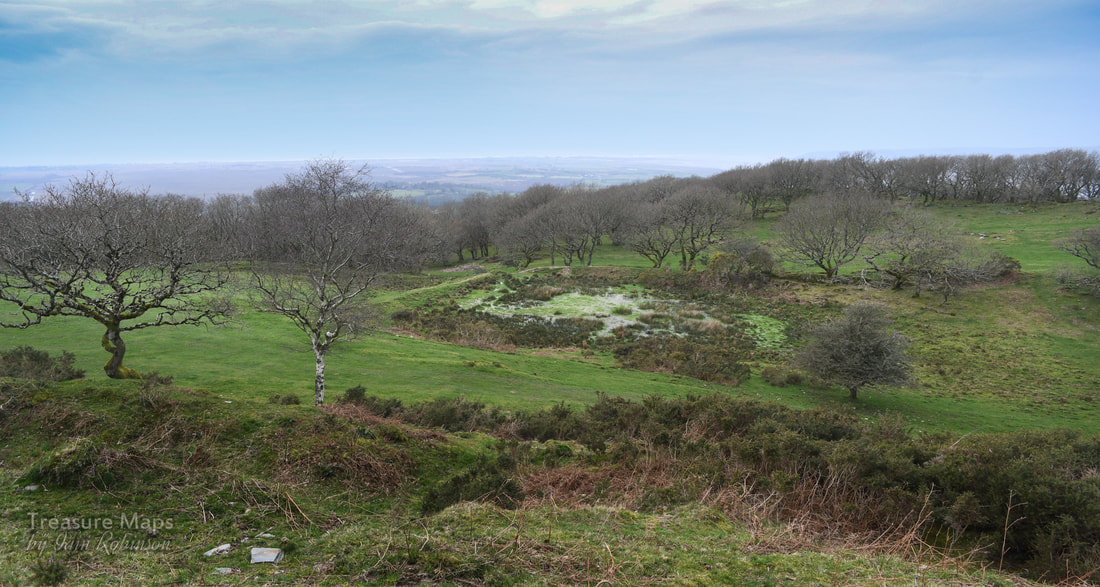 The reservoir, still holding water. Taken from another opencut above. Here and there were suggestions in the ground of leats*, supplying the workings below. Grass-grown tips pointed accusingly from stands of trees, crown holes were disguised by the growth of more oaks. I marvelled at how nature quickly takes back and absorbs the works of humans. Then, we came to an old reservoir with a leat going off to the south. The leat was badly degraded by cattle- the whole area had been poached by them, obscuring the remains. But it was obvious where the old man had been digging the low hanging fruit, areas where gossans* of ore had broken out at surface and been quarried. These workings pre-dated the Victorian miners and could date back to the C17th. 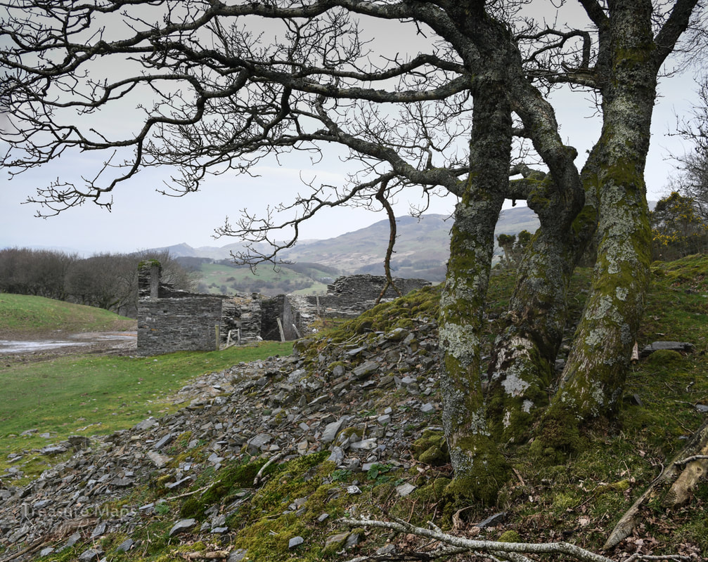 The waterwheel pit and crushing house seen from an old shaft collar. Then we climbed up to the wheel house and crusher building. It was an impressive structure and very well-built, although repurposed to some extent by the farmer. Rusty old gates and farm junk lay around while the structure itself was marooned in a sea of cow poo. The farmer here was obviously doing his bit towards climate change. Nearby were the various shafts sunk to Hallet's level. The spoil here was the real deal, rich in quartz and other minerals. As if to confirm, small craters had formed where mineral hunters had been "mining "for the rare specimens that have been found here. Further to the south, along a public footpath, we found another major shaft and some stoping breaking out to bank. The shaft was interesting in that it had a masonry support to the side that might have housed a sheave to haul material up, perhaps worked by a horse-whim*. This was all very intriguing - the visit had exceeded our expectations. We had an idea to walk along the footpath to the east towards the nearby Pensarn mine and on perhaps to the megalithic site of Bedd Taliesin, but the footpath through the farm was like the Ypres salient rendered in cow poo, so we headed back down the woods the way we had come. 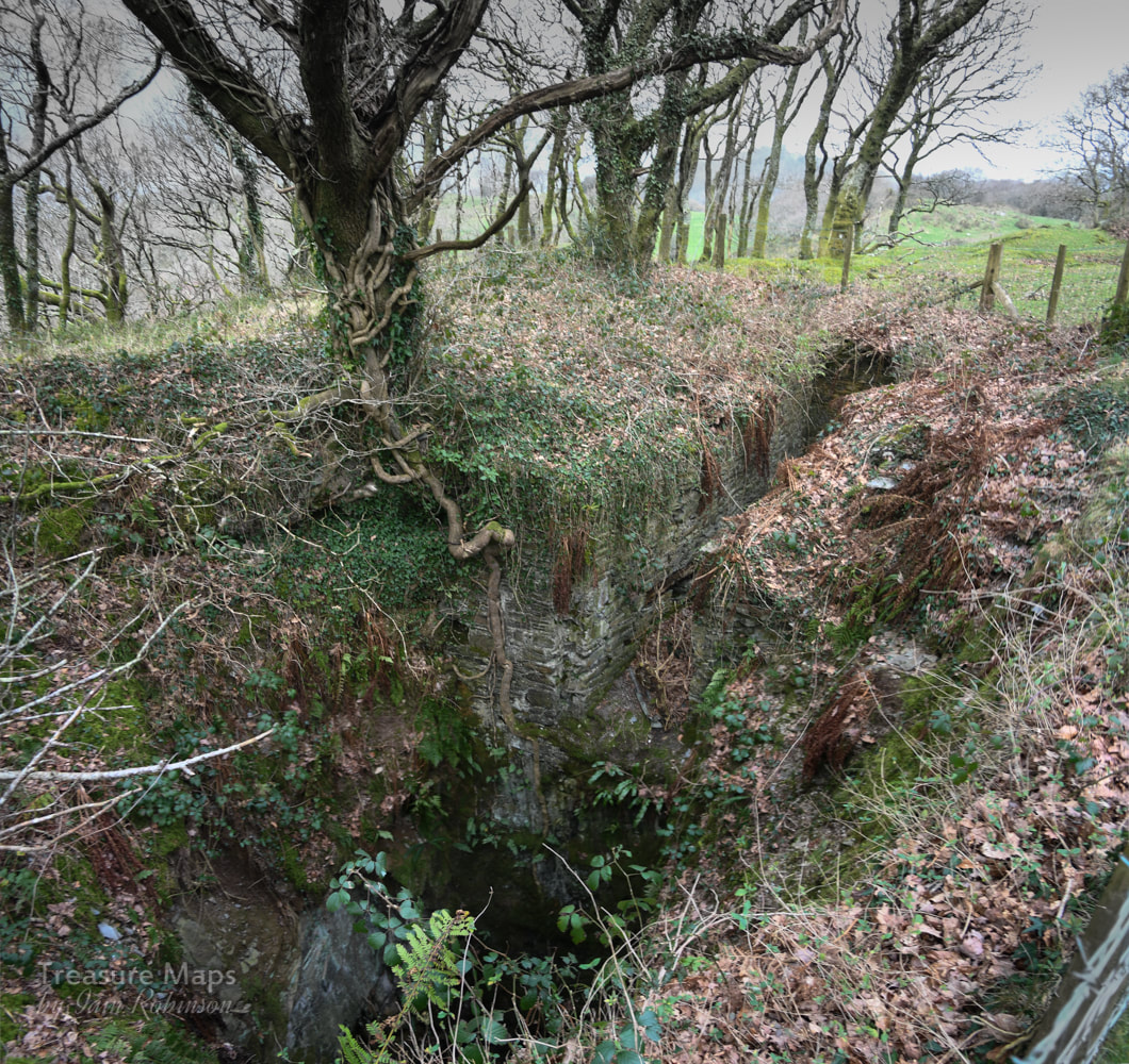 The shaft with masonry support/re-inforcement, top right. Later, we took the car up to Pensarn, only to find that the site of the mine was being used by a contractor to quarry gravel. The horse whim circle and structures described by David Bick were gone. The waterwheel pit beside the road appeared to still be intact, but by this time I felt too upset to continue. As for Bedd Taliesin, again, the farmer hasn't really been taking care of it. A vast pile of almost prehistoric silage sits nearby, filling the air with the smell of rotting vegetation, while it is quite a challenge to imagine anything historic, let alone Neolithic about the site. The precious signs and signifiers of our landscape, left in the hands of a bunch of philistines. We had taken the minor road up to Bedd Taliesin from Tre'r-ddol- a route I would not recommend. Although it is beautiful and interesting, passing the site of more vestigial mines, it is a very narrow road. I will let the photograph below, from John Lucas give the idea. 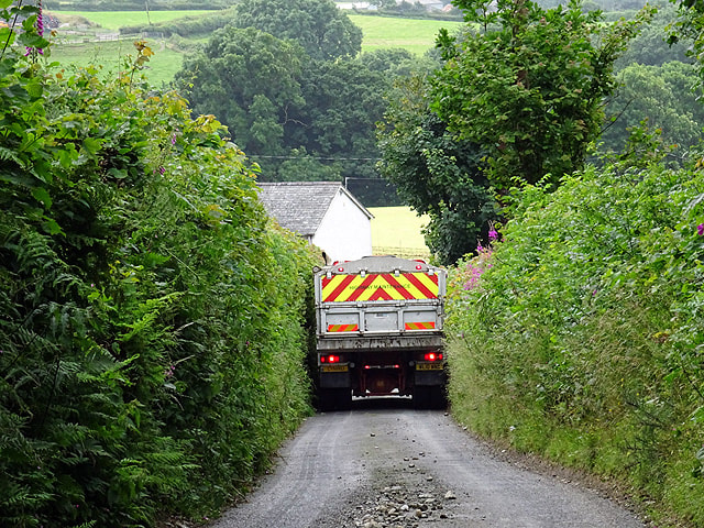 "Not a lot of room"... between Pensarn and Talybont. © Copyright John Lucas and licensed for reuse from Geograph under this Creative Commons Licence. Cardigan Bay Consols/Bryn Arian Mine Factoids Bryn Arian means "hill of silver" - a tad optimistic perhaps. While most latter day mining went on here between 1845 and 1876, the site had seen a great deal of attention from the "old man", at least a hundred years previously and possibly earlier than that. Mining records from that period are scarce, but it is clear that a great deal of ore had been won. When driving the adits underground, miners would encounter where they thought the lode would be only to find that it had already been mined out from shafts or adits long since run-in. Earlier I mentioned a horse whim that possibly wound the New Boundary adit- this was an embarrassing moment for the mine's proprietors, when they discovered that the original Boundary adit ,below the track at the foot of the woods, lay on the Llanhir sett- and the owners refused them access from the adit! Thus a new adit was dug on the revised boundary. I wonder who was rapped over the knuckles for that misinterpretation of the sett plans! Like many concerns, the mine seemed to exist solely to bankrupt the companies who beat a path to it's portals. One of the early proprietors, a London company, lost £10,000 in the late 1840s, followed hot on their heels by Waddingtons of Leeds who lost £6,000 and Silk and Co. of London who lost another £5,000- and these, of course, were big sums for those times. The final coup de grace was administered by the mine to our old friend the Cwm Dwyfor Company, to quote David Bick: "Owners of a remote and worthless copper mine near Portmadoc (sic)" They flogged away until 1886, having found no ore whatsoever! While we were traversing this fascinating site I did wonder if I could hear the old man laughing still. The mine also had a laugh at my expense, since when we got home, I realised that I had missed a couple of features on the ground, notably the boundary adit near the lower track and a waterwheel pit in the woods. It's not too far to go back, though- and have another breakfast :-) *Glossary of some terms used that may be unfamiliar: Adit- a tunnel driven for access and drainage. Gossan- The weathered upper part of a lode. Lode- Mineralised ground containing ore, often along with valueless material such as quartz. Lodes are usually vertical, 20 or 30 feet wide and can extend for miles. Opencuts- quarry-like excavations on the lode often dating from ancient times. Whim- a large windlass worked by horses, steam or water power. The old man- a term for the original miners, perhaps from bronze-age times, or from earlier than C17. Nowadays explorers refer to anything pre- 1940 as the old man. Leat- also lete or leet, or millstream) is the name, common in the south and west of England and in Wales (Lade in Scotland), for an artificial watercourse or aqueduct dug into the ground, especially one supplying water to a waterwheel or reservoir. Sources and further information: "The Old Metal Mines of Mid Wales" Part 3, North of Goginan- David Bick, Pound House Press 1976 British Mining No.93, "Mines, Trials and Lodes of the Glandyfi Tract" by David M. D. James. Page 83 onwards. "A Guide to the Industrial Archaeology of Mid-Wales", Association for Industrial Archaeology: 1984. Link here
2 Comments
|
TracksReceive the occasional Treasure Maps Newsletter- and alerts when a new post is available!
If you enjoy my content, please buy me a coffee!
Check out my other online activity...
Index
All
|


 RSS Feed