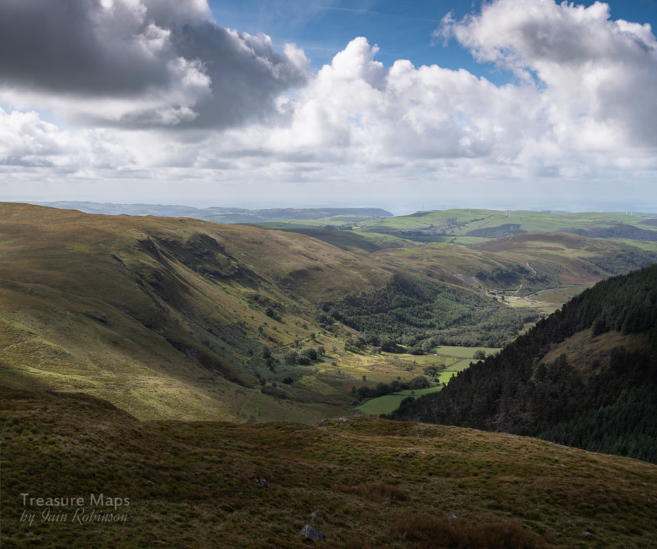
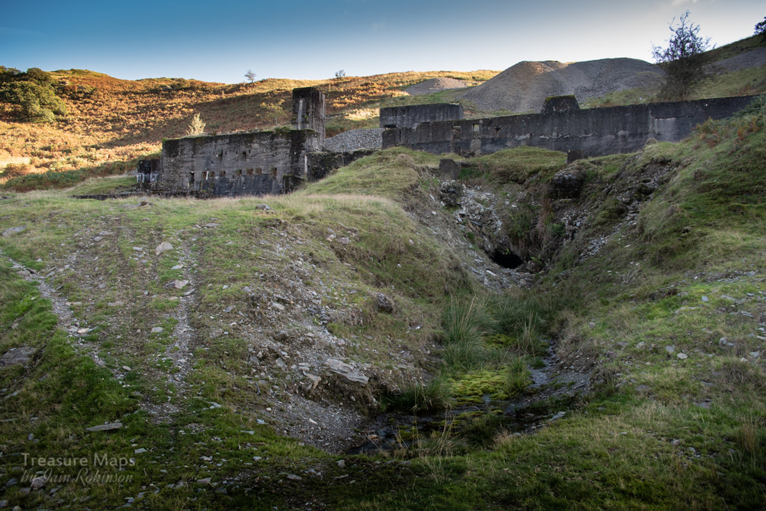
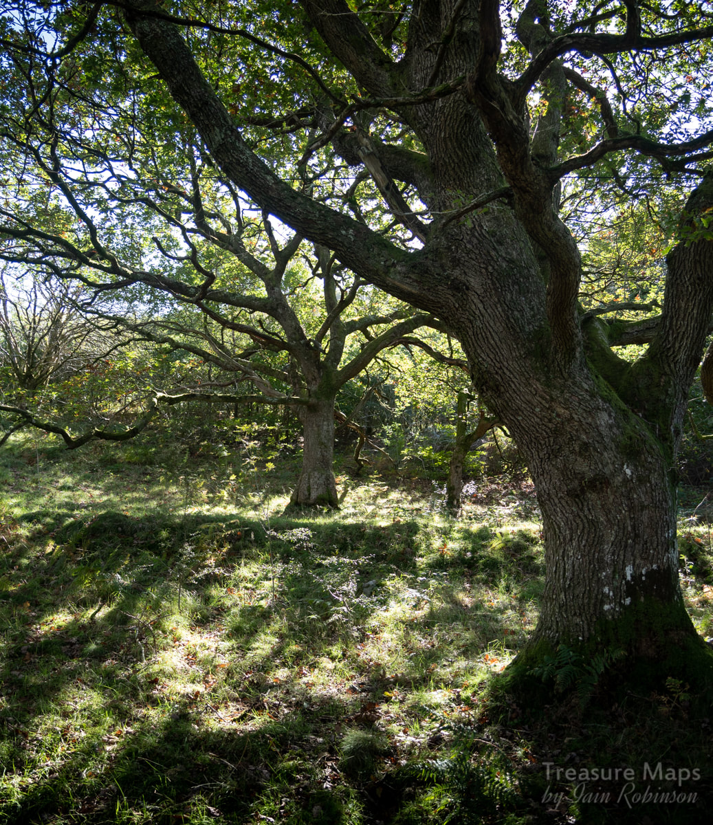
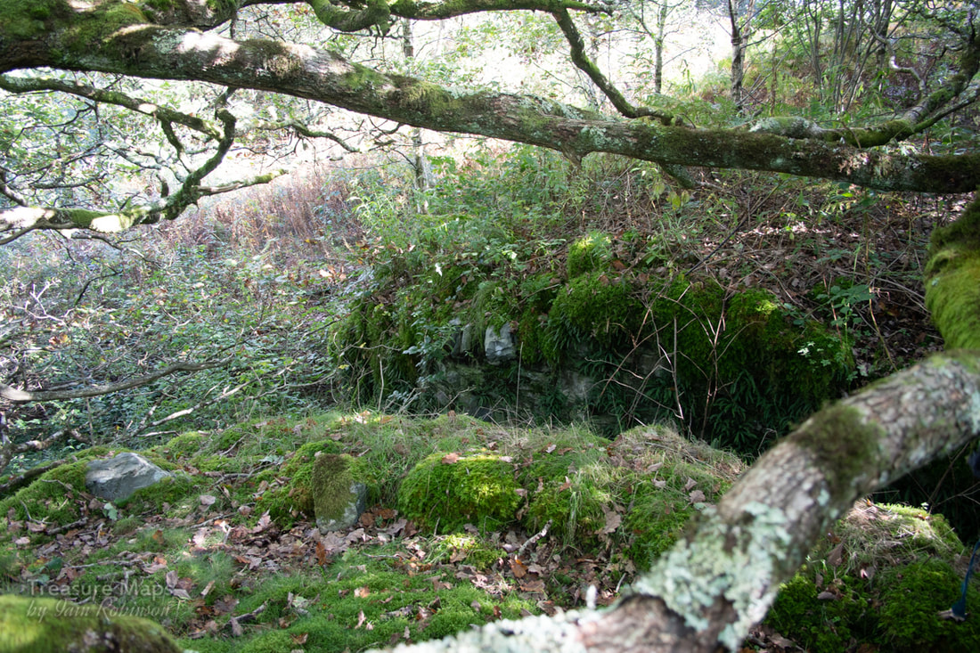
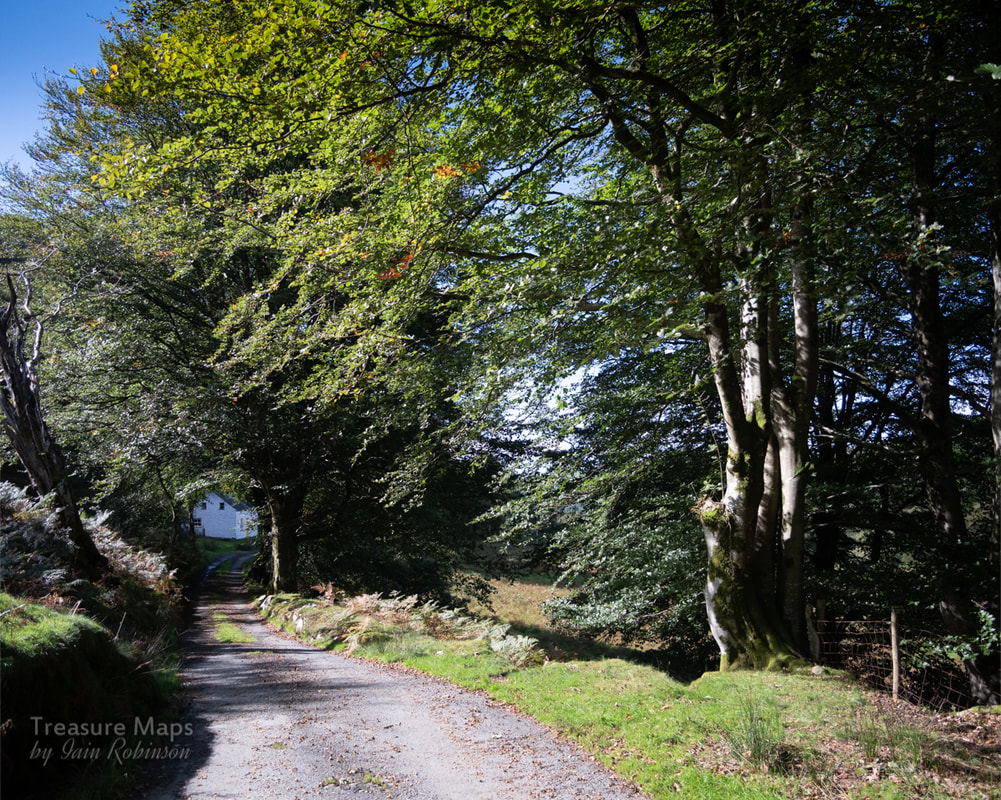
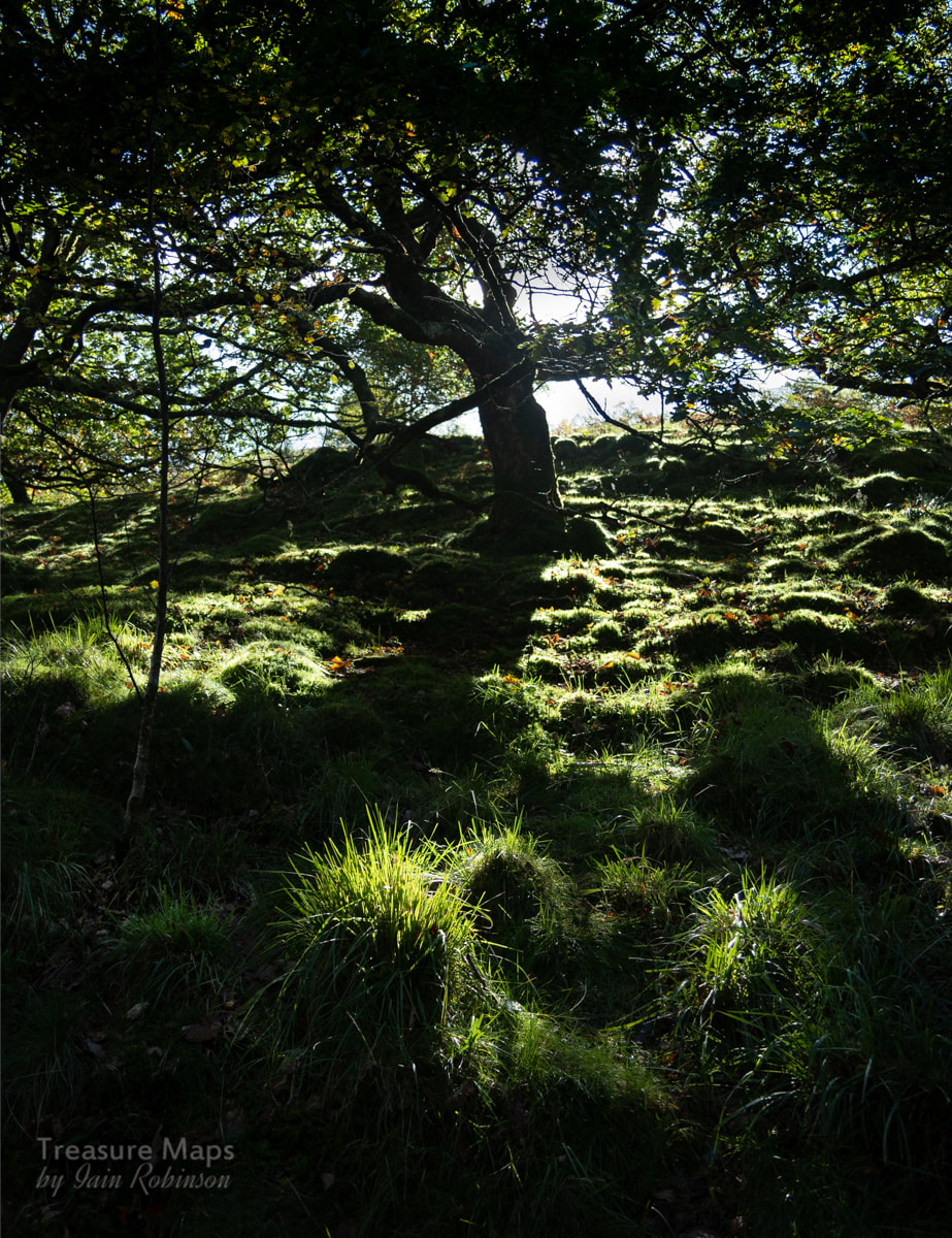
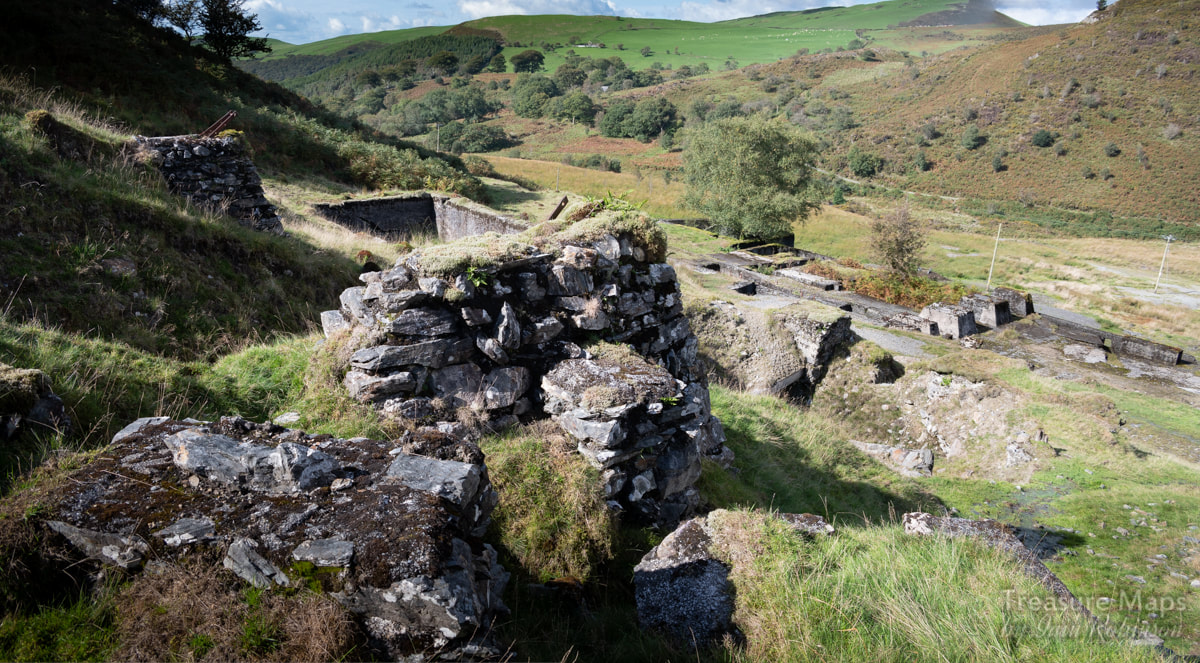
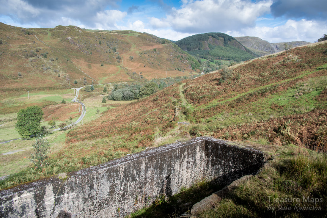
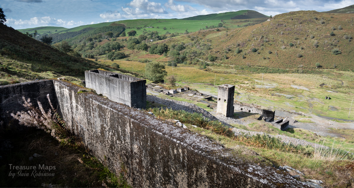
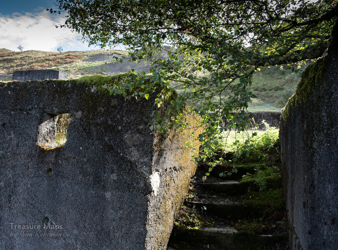
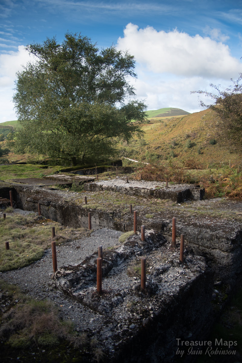
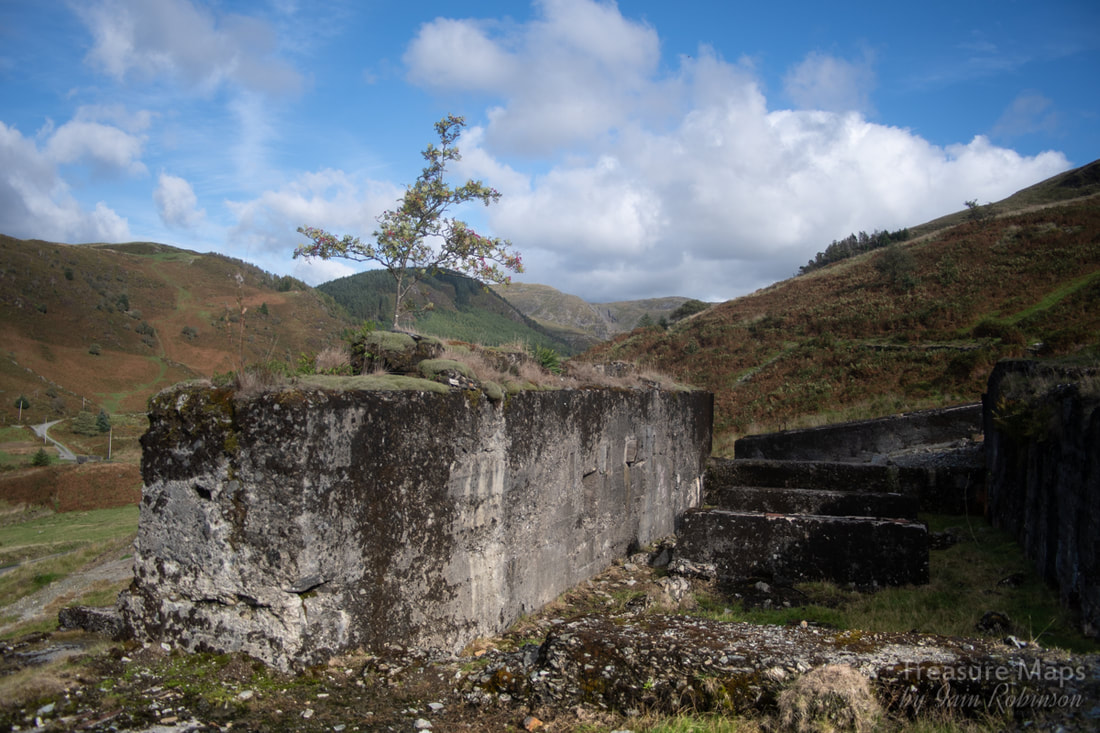
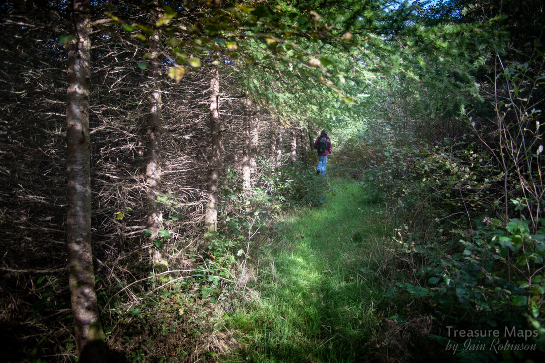
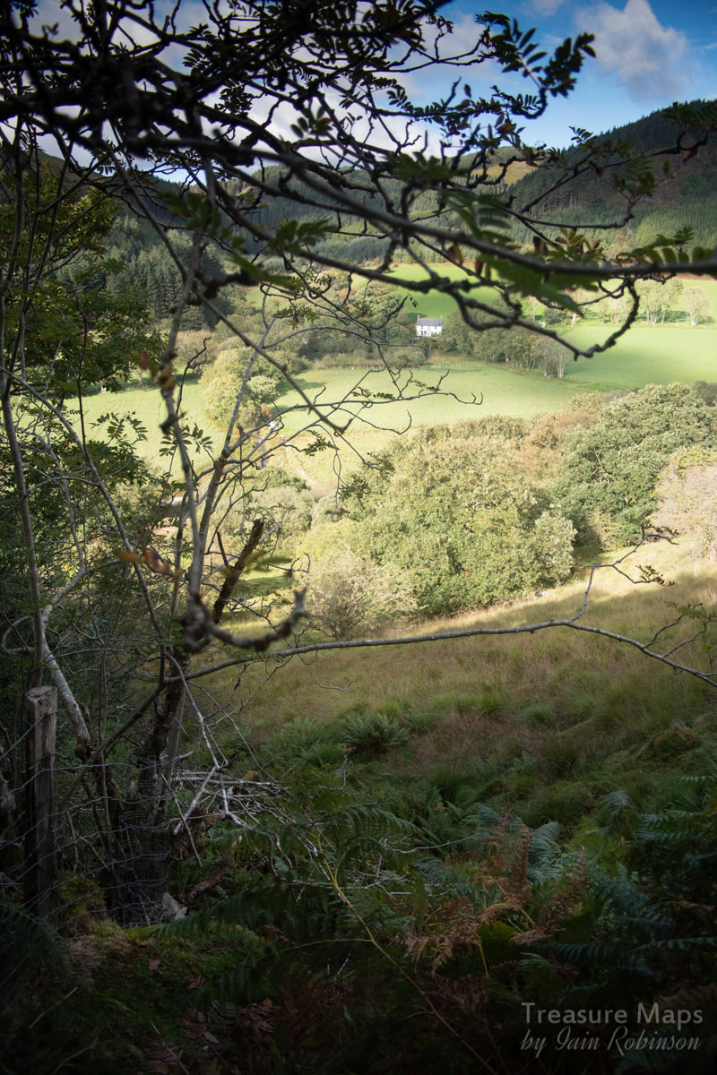
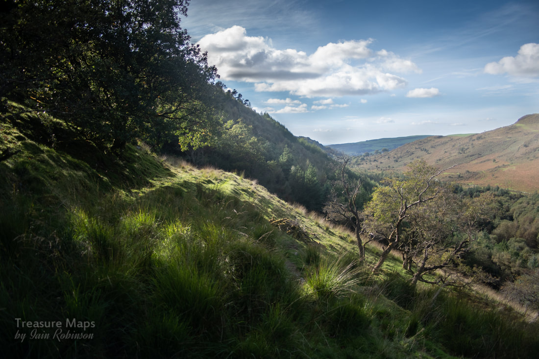
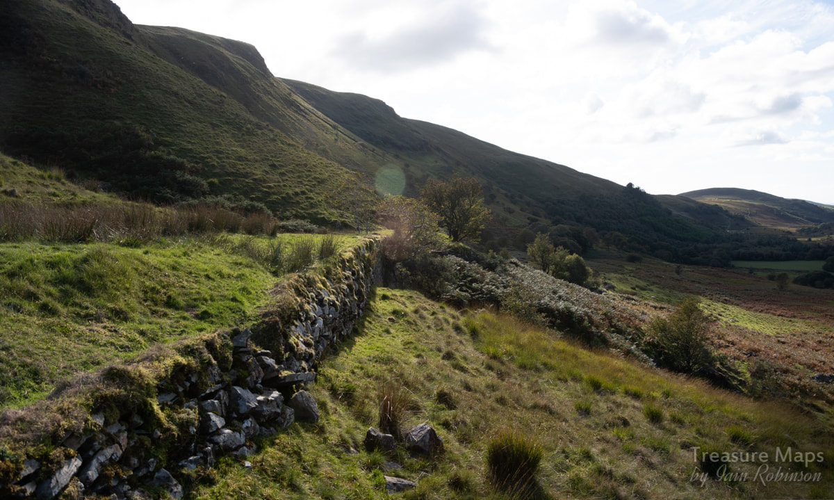
 The view of Bwlch Glas from Cerrig yr Hafan. The mine is in the right distance, and you can make out the tramway snaking through the forest and out past the mine. When we were standing at the top of the Hafan incline a few weeks before, what looked like a large mine with extensive tips was visible in the distance, a couple of miles or so down Cwm Ty-nant towards Tal-y-Bont. We knew that we would have to see it, but we were exhausted after scrambling around the mines of Nant-y-Moch that day. We didn't fancy trying to descend the Hafan incline again- an easier route would have to be found, if there was one. We approached from Tal-y-bont, but instead of taking the road signed to Nant-y-Moch, we carried on up increasingly smaller and narrower lanes, following the course of the Afon Leri. On the right side of the valley, (the south side if you're looking at a map) we could see the course of the Plumlumon and Hafan tramway on it's way to Hafan, as it followed the 150metre contour. Amazing that it is still visible after 119 years of abandonment. There is supposed to be a viaduct built for the tramway, but lost in the woods just south west of Tal-y-Bont...it's on private land I'm told, but I hope to find it. There are a few old mines along the Leri valley, most notable being the Cefn Gwyn mine below Bontgoch. The old maps show many old shafts and levels, but sadly, the passage of the years has erased them from the landscape. Cefn Gwyn still has a few adits, but the surface remains have gone. Fancying a flattish walk and suspecting that there would be one or two things best viewed as a pedestrian, we parked the car where the road starts to become a farm track, at SN68988848. There was a wide lay-by, so we wouldn't be bothering anyone. We walked off into a beautiful autumn day, showing off the trees on either side of the road just as their leaves started to turn brown. I couldn't resist a couple of contre jour shots. 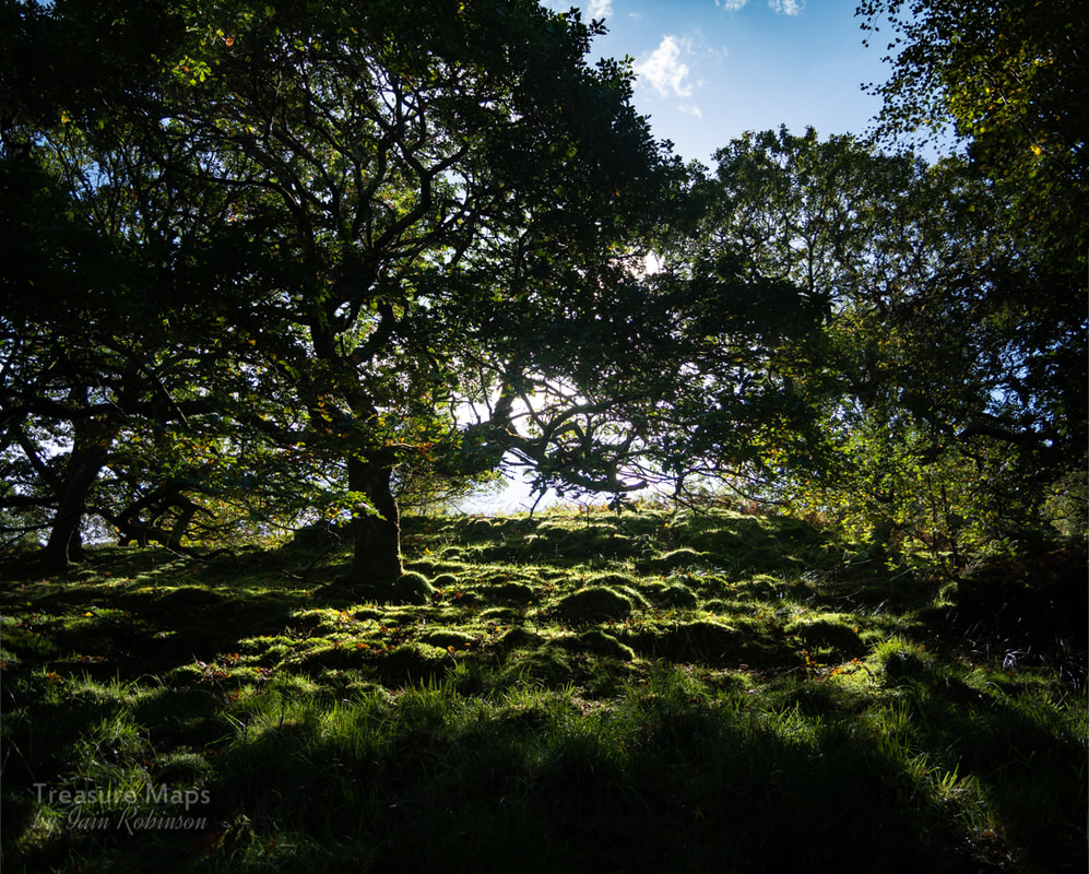 After half a mile or so, we encountered what looked like a stone-built dam to the south of the road. Petra thought it might have been a wheel pit but after some debate, we decided it was probably a valve or sluice, as the ends were curved outwards. The woods were too thick on the north side to see where the water would have gone, but I am guessing it went to a mill. I don't think it was mine-related, but you never know. 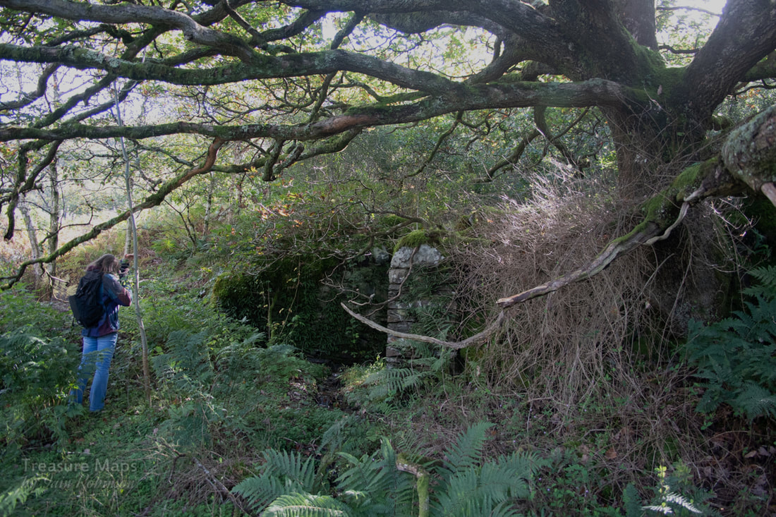 After a while, the Afon Cyneinog can be heard to the left, below the road. We spotted the formation of the tramway above us, running behind a lovely little cottage, Dolgarnwen. From the old maps, it would seem that this had been much larger at one time- it's a super spot, and appears to pre-date the tramway. After a hundred yards, the tramway joined the road, at which point we could see the tips of Bwlch Glas. It's ironic that the mine was opened after the tramway closed, otherwise it would have been a good source of traffic. 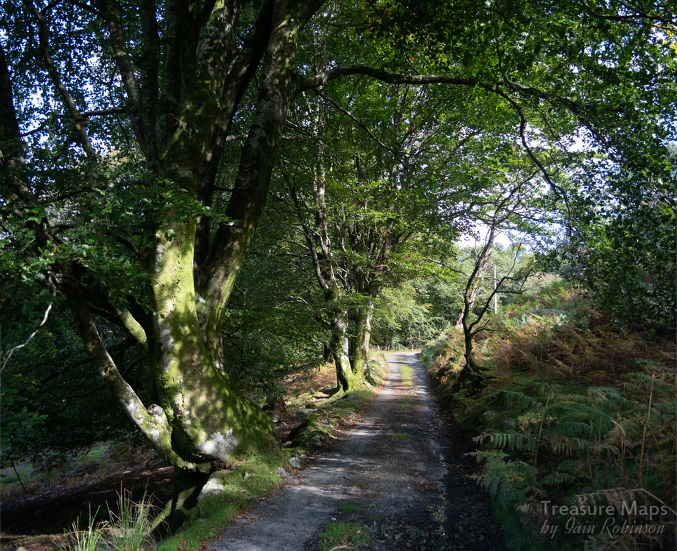 The road ramps up to take over the tramway formation. 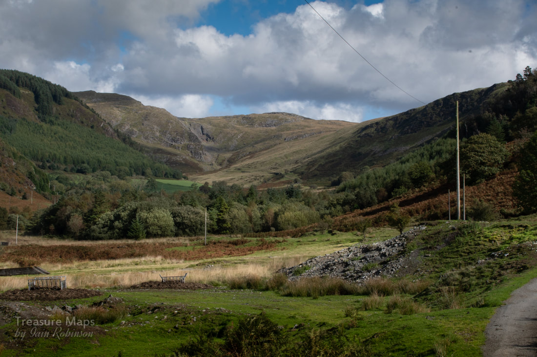 Our first sight of the mine tips. In the distance are the excavations of the Hafan mine and incline. The mine is impressive. There must have been a great deal of work, as the tips were extensive. A small inspection revealed quite a few different minerals and types of rock, from the Hafan Greywacke through to quartzy Breccias and iron rich sediments. But the remains of the buildings were vying for our attention. Apparently it is the only mine in Ceredigion whose surface works are made almost entirely of concrete. Supports and plinths for machines were arrayed in a monosyllabic manner, brutal in their lack of ornament- no fancy stone arches here, or any mason's work. Yet I was impressed by the skill of the shutter-builders and by the sheer amount of material that must have been needed. 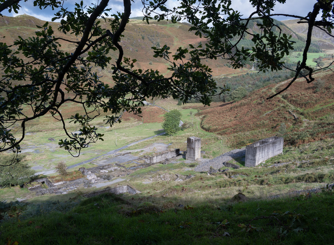 An overview from some tips at the shallow adit level. The tramway is very obvious as it winds off towards Hafan. 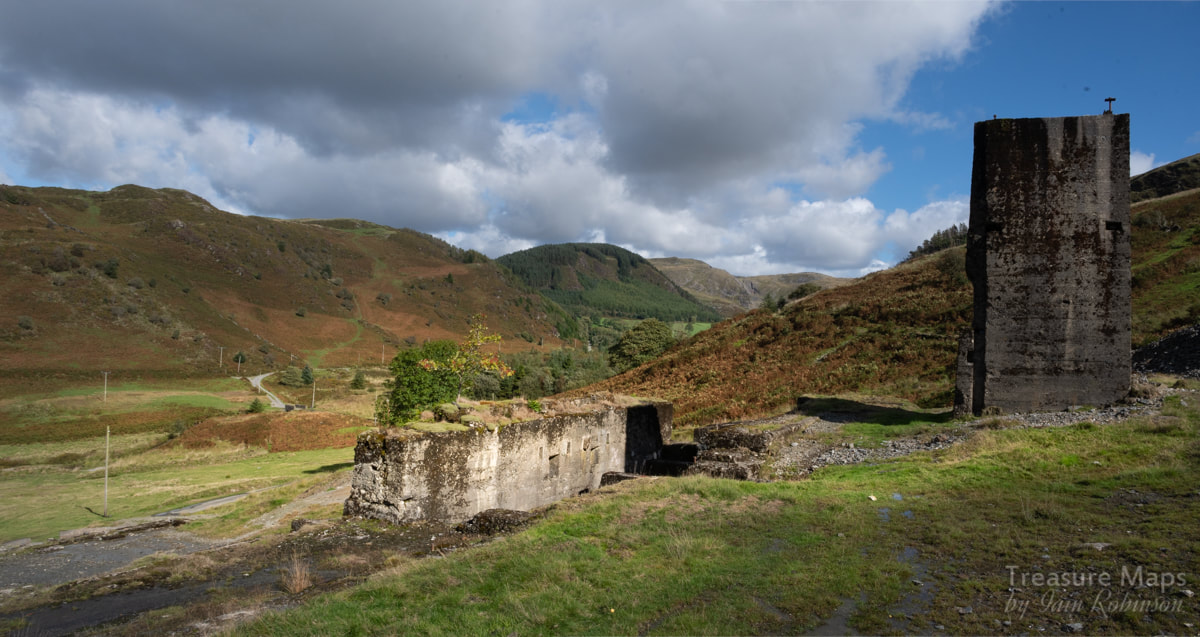 From the first level above the road. 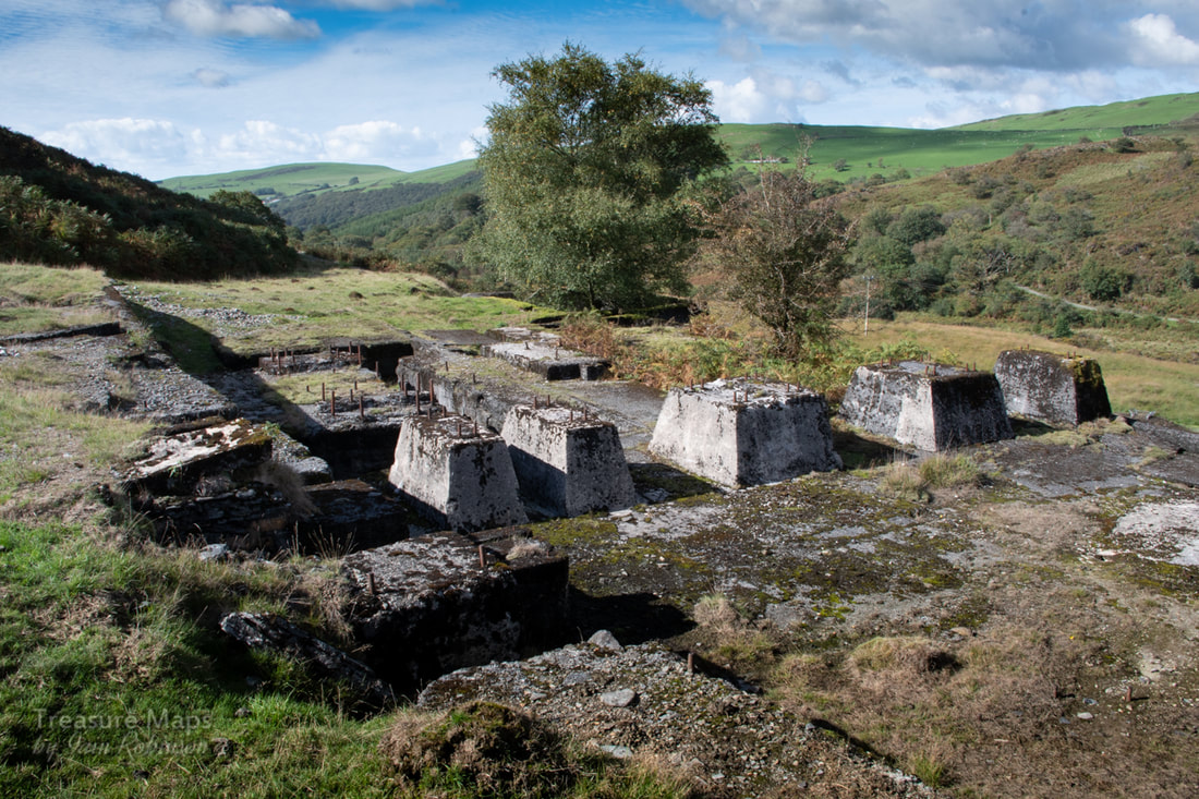 Holding down bolts emerge from concrete bases... I imagined that when the mine was in operation, everything would have been covered over in corrugated iron so that the place would have presented the appearance of a large factory. Holding-down bolts strained from their imprisonment in the concrete blocks like rusty Ladies of the Lake holding threaded swords aloft. These blocks would have supported jigger tables, stamp batteries and grinders. The length of the bolts attested to the size of the machines. It must have been a noisy place to work. There were some more excavations further up the hill, a shaft and a couple of run-in adits. The shaft had the unmistakable outline of a headframe, grass-grown but still visible. 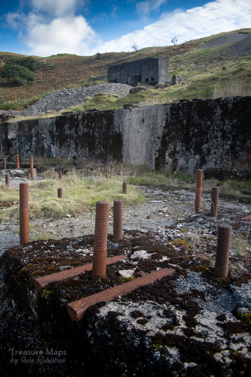 More holding down bolts We didn't venture far underground on this occasion- the adits were very wet indeed, although that doesn't normally stop us. But I can tell you that the lower, deep adit ends in a fall after a few yards. The upper adit leads to a series of deadly ladders to lower levels, where there is a proper old rusty mine cage to transport the work force down to work and product to the surface. Ropes and a mastery of SRT techniques are neccessary to explore those delights, but there are several good shots available on the internet if you are curious. It seems that some machinery was water powered, although by the time of the mine, internal combustion engines were becoming more prevalent, and I can't imagine the mine cages being powered by anything but steam or i/c. Since writing this, a friend has pointed out that the mine cage is equipped with the remains of an electric light, so there must have been a generating set on site, undoubtedly i/c powered. (thanks Dave!) Further research has since revealed that a gas plant was installed on site in 1907 when lead prices rose to £20 a ton. The mine at this point was being worked in conjunction with the Loveden mine. Later, in 1919, Hydro Electric power was used, presumably from one of the schemes in Nant-y-Moch as there didn't seem to be any evidence of this near the mine. (source: British Mining 1909, vol 86 p112.) 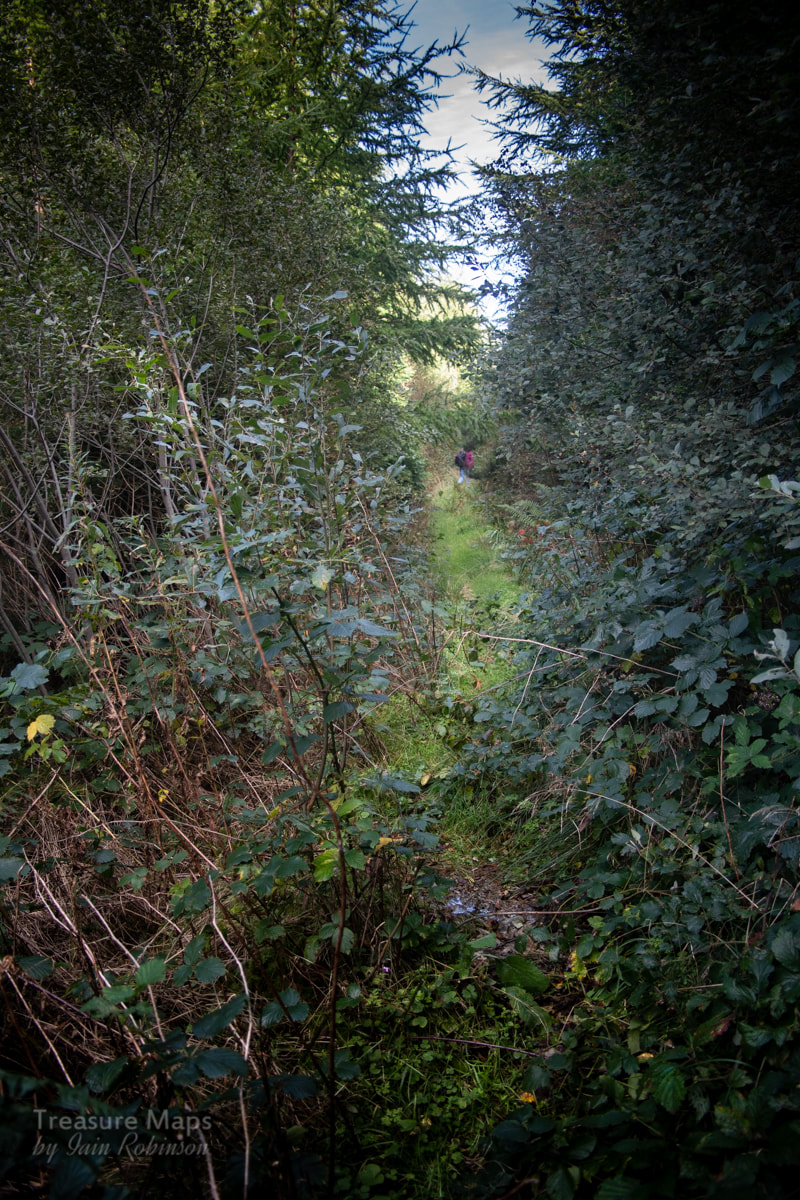 The tramway runs through a forestry plantation While inspecting the mine, we were aware of the tramway heading off east towards Hafan. I didn't take much persuading to go and try to follow the formation to the base of the Hafan incline. It was a very pleasant walk, even when the line is swallowed up by a forestry plantation. Apparently the way was cleared through here a while ago by the "Railway Ramblers"- if you want to see their take on the tramway and lots of other interesting stuff, their site is here. 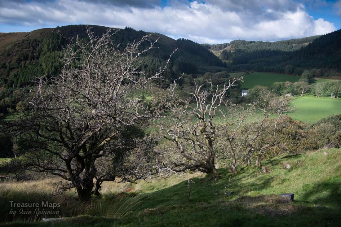 Cyneinog farm in the distance from the tramway. I appreciated the help from the ramblers, even if things have grown back a bit since they cleared a path. But soon we were out of the trees and back onto the sides of the hill, with great views down towards Cyneinog farm. 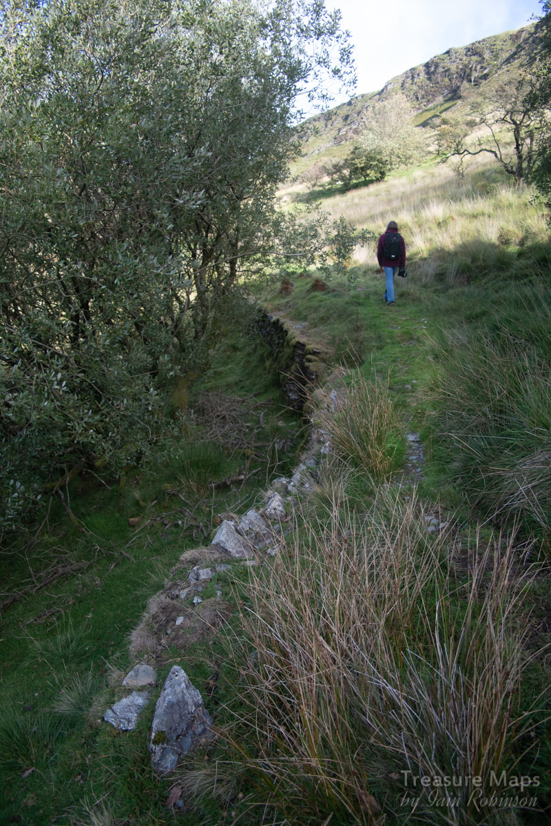 There were sections that were revetted and embanked on the hillside, and elsewhere a small bridge had been made to cross a stream. 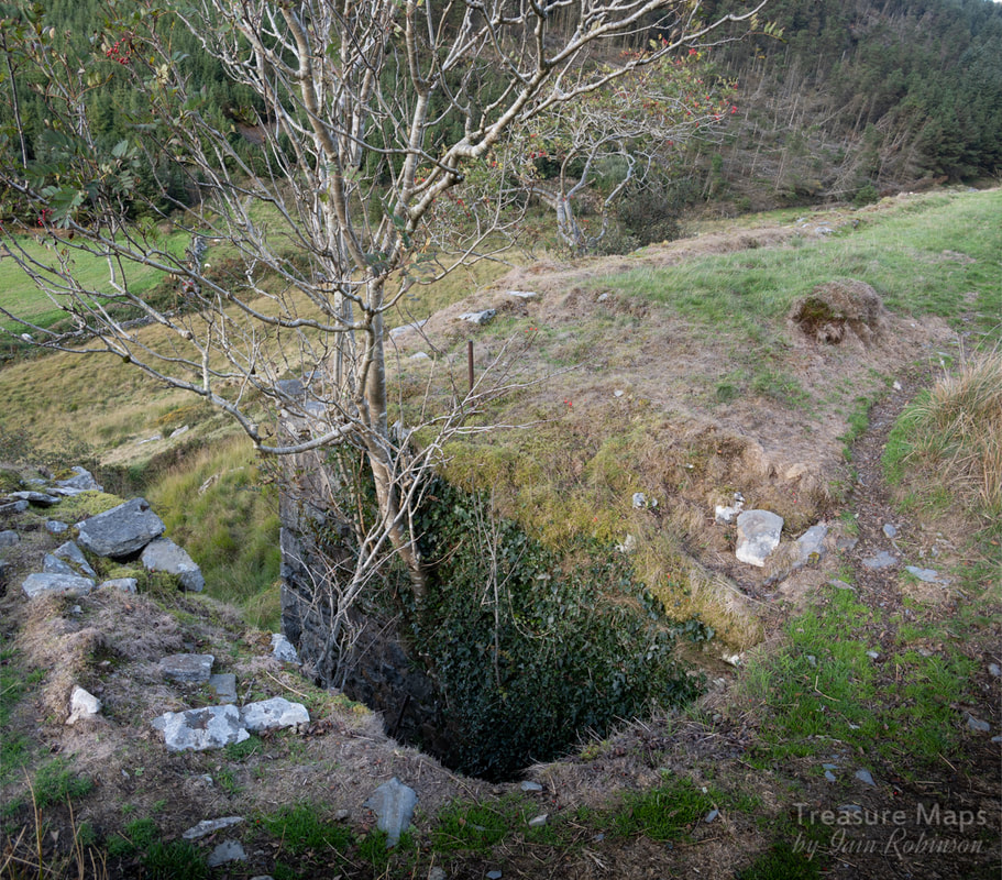 The remains of a bridge across a small stream. Before long, we came to the base of the Hafan incline. I certainly didn't feel like climbing it again- (or perhaps it was the descent that worried me with my ancient knees). One thing was for sure, it had been a fascinating walk and another bit of the Hafan and Plumlumon tramway explored. 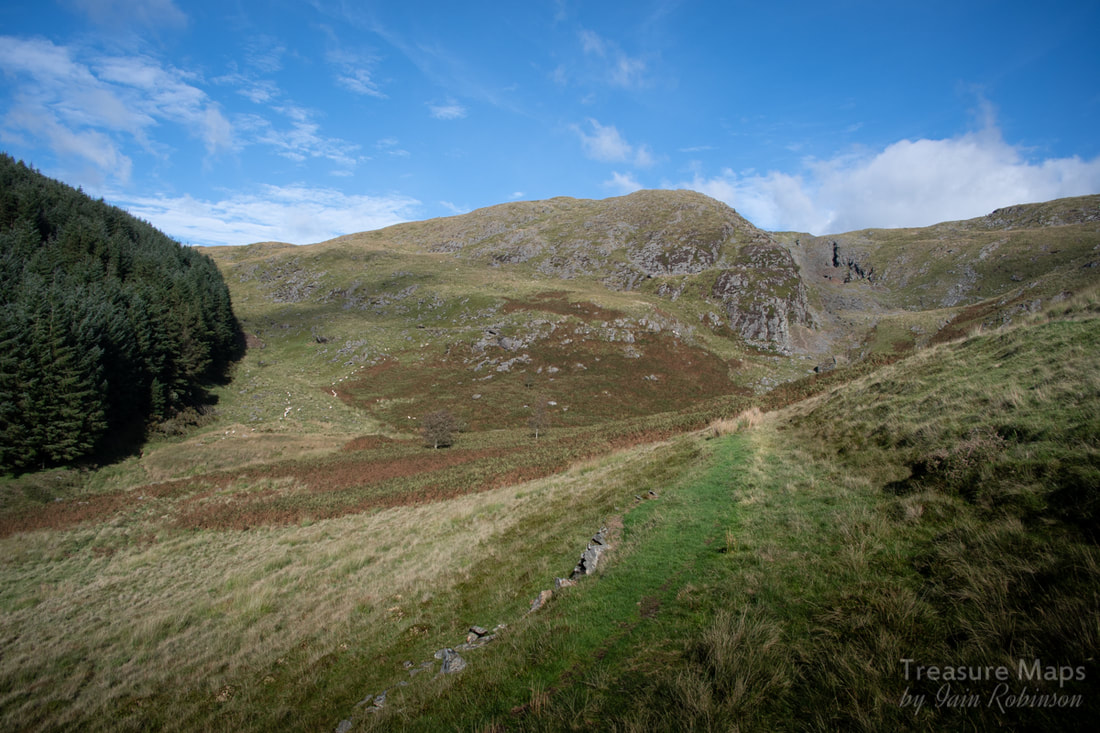 Nearing the incline up to Hafan. What a wonderful view- and the diminutive Cyneinog mine can just be seen beside the forestry, halfway up the hill. The Factoids: Initial investigations at Bwlch Glas started during the 1880's when a level was excavated to intercept two parallel veins of ore, which outcropped further up the hill. Serious production at the mine didn't start until 1909, when an impressive processing mill was constructed and other levels opened. The Scottish Cardigan Lead Mining Company Ltd. finally closed the mine in 1923, having worked there on a fairly intermittent basis for a number of years. The mine produced 1240 tons of lead ore and 99 tons of zinc ore. Further Reference: The Metal Mines of Mid-Wales: Part 3 Cardiganshire - North of Goginan', David Bick, 1988, pp.34-35. 'British Mining No.12: The Mines of Cardiganshire', J.R. Foster-Smith, 1979, pp.44-45. 'The Plynlimon & Hafan Tramway', E.A. Wade, 1997 (2nd Edition), p.141. 'Special Reports on the Mineral Resources of Great Britain. Vol. XX.-Lead and Zinc. The mining District of North Cardiganshire and West Montgomeryshire', O.T. Jones, 1922, pp.57-59. Lead Mining in Wales: W.J. Lewis, 1967 p193, 340. 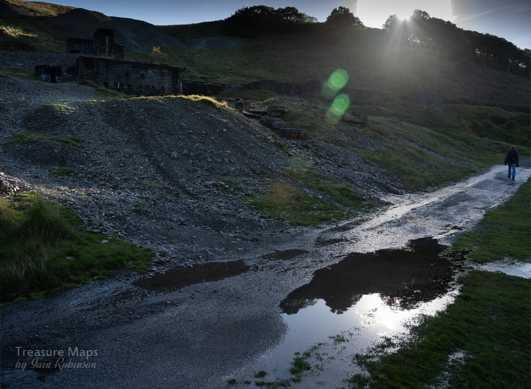 Cheerio for now!
6 Comments
|
TracksReceive the occasional Treasure Maps Newsletter- and alerts when a new post is available!
If you enjoy my content, please buy me a coffee!
Check out my other online activity...
Index
All
|
 RSS Feed