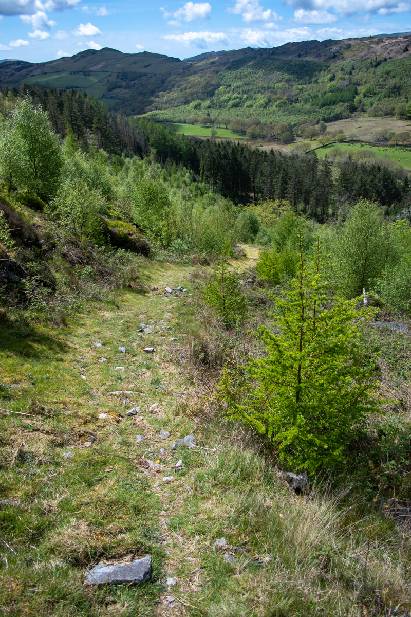
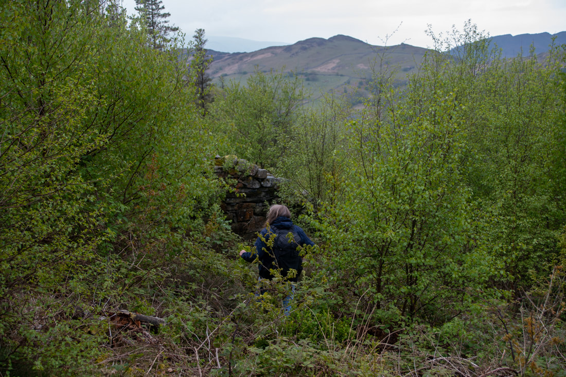
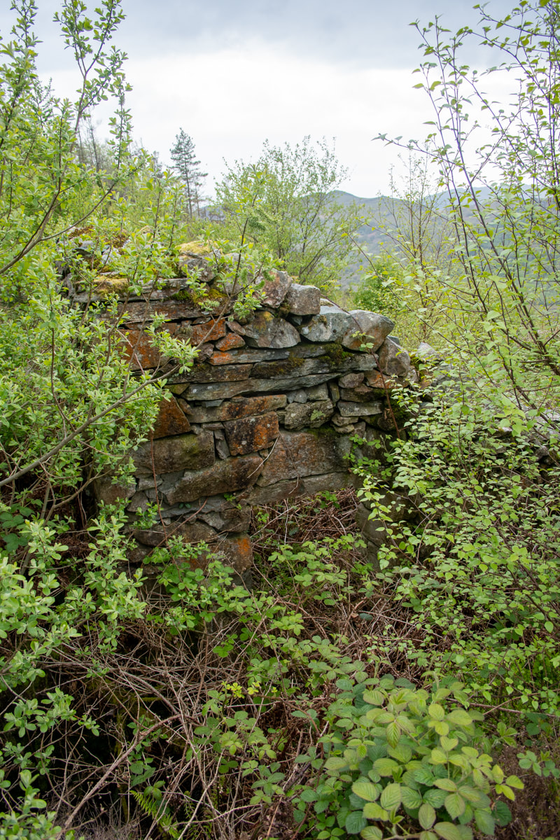
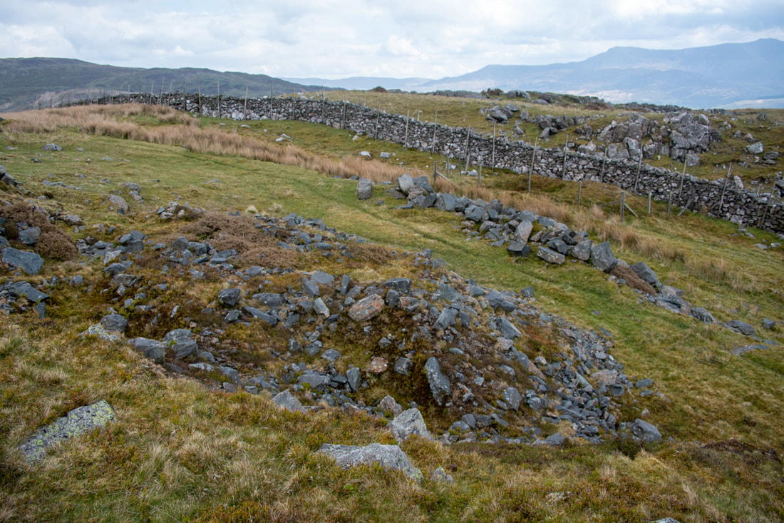
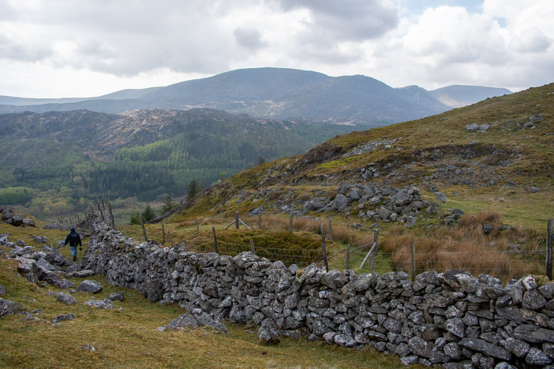
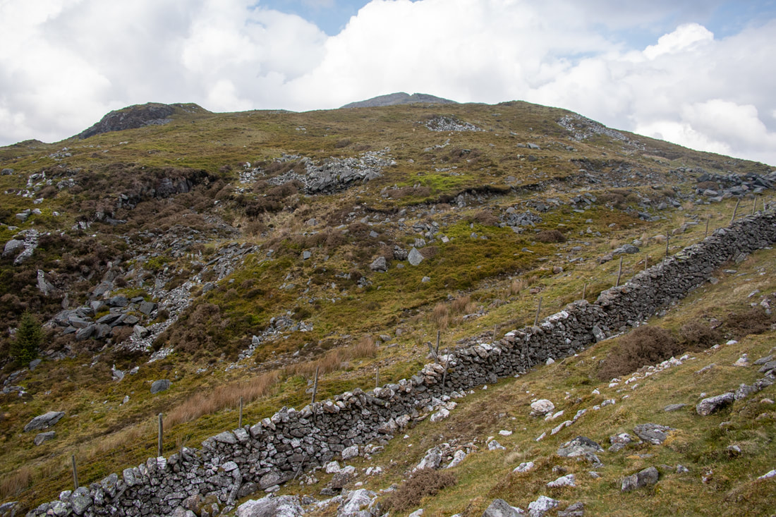
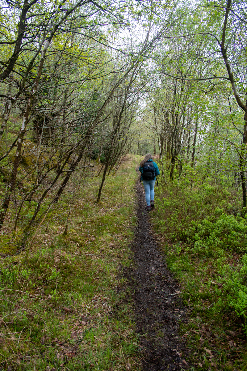
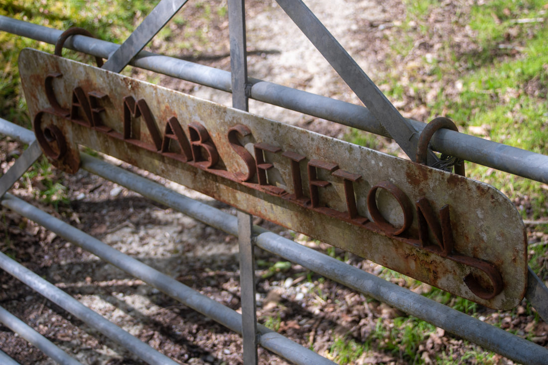
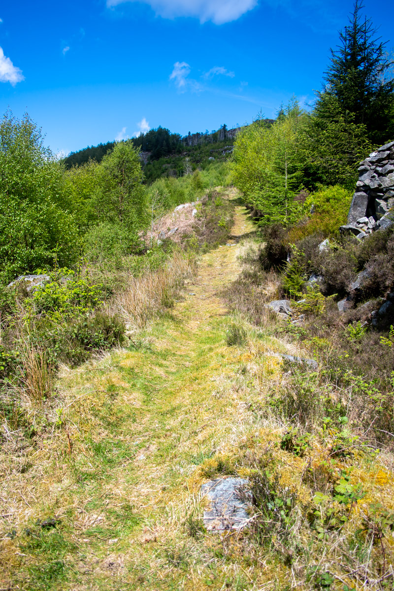
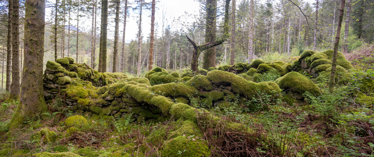
 Mines? On the manicured "miner's path". Since lockdown ended, we've been determined to try and find the Manganese mines in Cwm Mynach and have made three resolute forays- but those forestry people have beaten us. There's very little mine content this time. We did, however, find a mystery mine that we didn't expect- so perhaps every cloud has a silver (or gold?) lining. 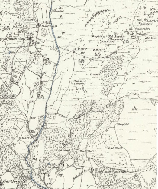 Map courtesy of the National Library of Scotland, OS 1887 survey. The mines we were looking for are at the top right. The bonus mine is marked as a "level" near the sheepfold. Cae Mab Seifion is the start of our adventure. A couple of years ago, we found an impressive portal in the woods which could only be a gold mine. There was a Masonry lined opencut, even a fine wall above the arched portal. Of course, I didn't have my camera... The place was the very devil to access, due to brambles and fallen conifers- it will be even worse now, as the area has been infiltrated with birch trees. If you are of a masochistic persuasion, the GR is SH6858820775. It looks on the map as if it's not too far in to the woods- don't be fooled, the venture is like the Blair Witch Project, once in those woods, the bramble gets you and won't let go. I like birch trees. Heck, I like all trees, except perhaps the Sitka Spruce en masse.. I love the way that the birch is an early and optimistic coloniser of disturbed and marginal ground, such as slate tips. It paves the way for oaks and beeches. Cwm Mynarch is owned by the Woodland Trust, and I really can't quarrel with them. 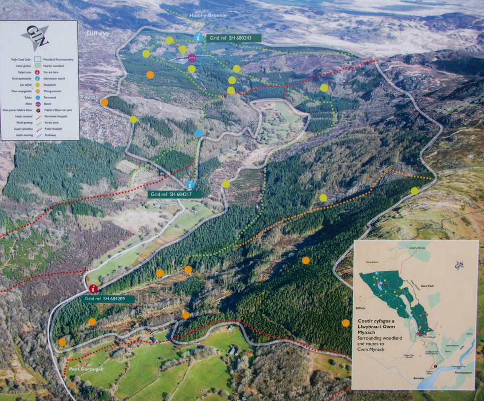 The Woodland Trust's signboard at the entrance to the reserve. The "mines" track is marked as orange. We decided to approach the mine listed in Dave Linton's Merioneth Manganese site as the Cae Mab Seifion mine, by walking up a forestry access road. It looked simple enough. Except that when we were actually in the forest, the ground either side looked impassable. I really need to invest in a drone for situations like these. We tried a couple of tracks, none of which did what they were supposed to do on the the Ordnance map. They were rather lovely, all the same. 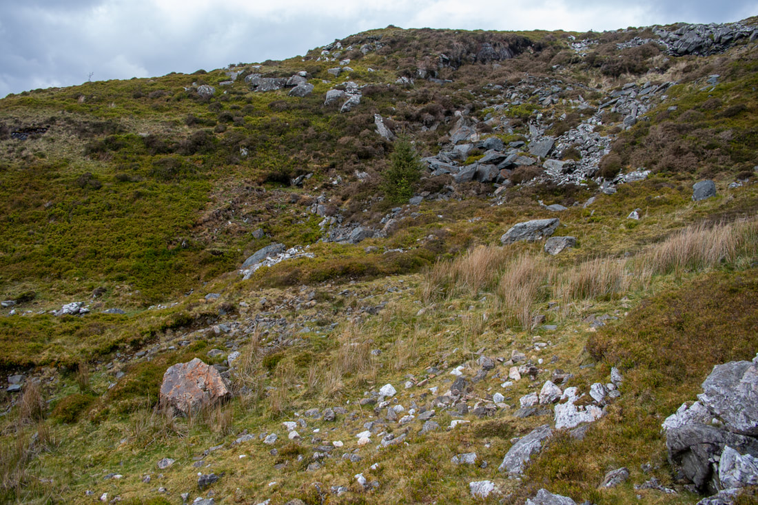 There is an adit in there...honest! Petra figured that the mines would run on a lode from the overgrown and heavily fenced in adit we'd discovered by the road at SH68682140, up towards SH688214... in theory this was correct, but in practice, the ground soon became impassable. Harvested trees and brashings had been left lying- birch regrowth and the inevitable supporting act, brambles, made progress very difficult. 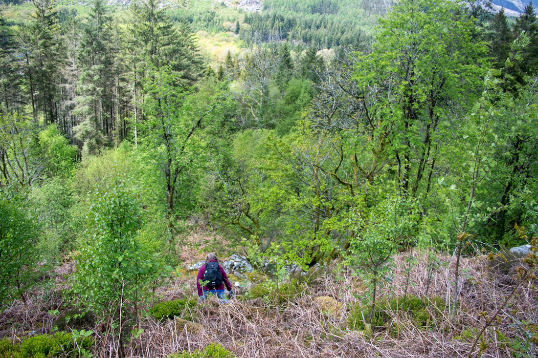 Petra looking for signs of bluestone in the jungle. We regrouped after trying, in desperation, the climber's path to Rhino buttress (not a bright idea, it took us well off piste.) We made a detailed study of the Woodland Trust's own map of the site at the entrance to the reserve, which is marked with a "Mining remains" route. Yes! The game was afoot! But after slogging up the track for half a mile, I began to wonder. Don't get me wrong, the track is wonderful, revealing stupendous views of the Rhinogiau and of Cadair. Weirdly, it had also been strimmed, which was a little jarring. Almost at the top, we noticed a little opencut to the right, then some bluestone spoils above us. Both these had been "neutralised" by the forestry folk, and there was no sign of an adit or workings. 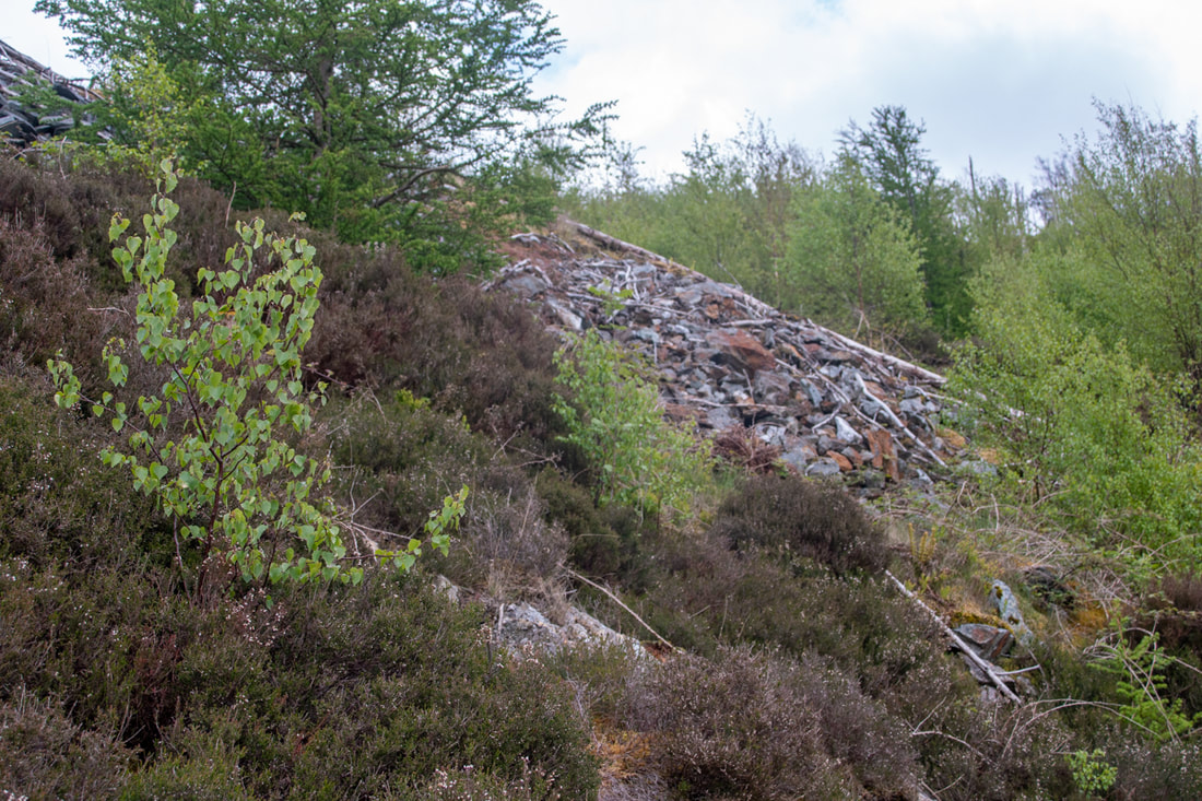 The first sign of bluestone tips...the adit above was backfilled. Petra determined to make a recce below the path where she thought the adit might be that we'd seen in Merioneth Manganese. It was, she reckoned, under the sycamore tree we could see sticking out of a waving ocean of birches. 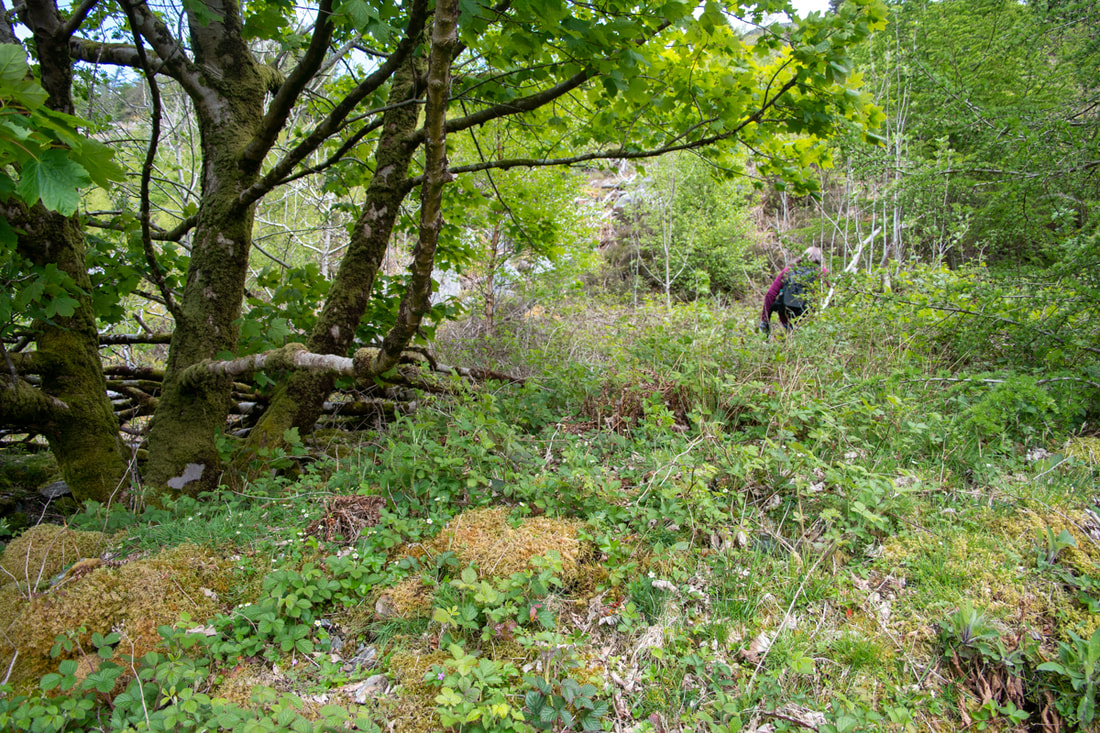 In the opencut...it's impossible to show because of the sycamore tree, but there are several fingers of built up bluestone go out from here. Pleading aching knees, I stayed on the road, but after some serious bramble bashing, Petra shouted up. There were no excuses now. I stumbled steeply downhill- she'd left a good track to follow. We found ourselves in a level with a lovely funnel of bluestone spoil, leading to what looked like it might be an adit behind a bramble explosion. The aforesaid sycamore was right in the middle of proceedings, making photography meaningless.  At the adit, about to remove some brambles... 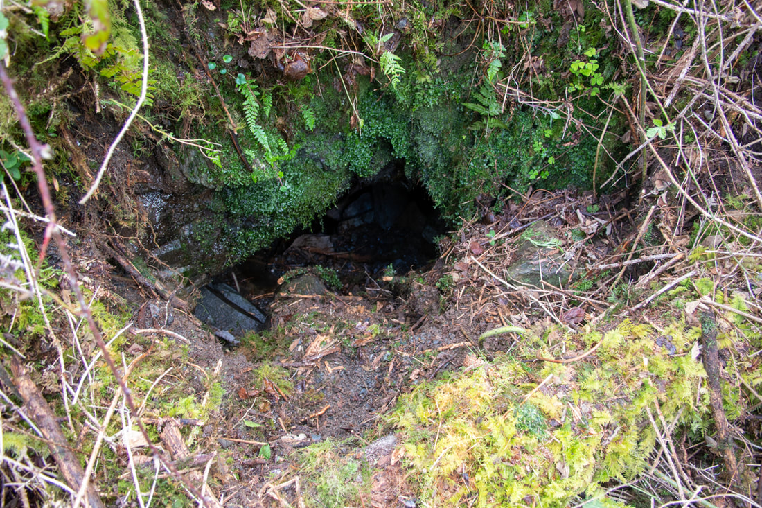 The entrance to the workings, after a little gardening.The backfill sloped very steeply down and was too unstable to attempt an explore. We cleared the brambleage with our sticks (luckily Petra had insisted we wore gardening gloves, suspecting something like this.) But it was no use. When we exposed the portal, it had been backfilled- there was a measly six inches of air space from which we could hear the delicious sound of dripping water. Comparing it with the photo on Dave's site, we felt rather deflated. Much shaking of fists at imaginary forestry crews ensued. After refuelling with crunchy bars and water, we carried on further up to the top adit, SH6889521675 where the story was much the same. There was a structure there, a stone hut with a low window at the end of an opencut, itself choked and filled. I don't really blame the forestry folk. They have trees to harvest, trees to plant and they are not paid to conserve mining remains for strange folk who like to go looking for them. I'm just very grateful that there's a record of these sites on Merioneth Manganese. From the photos on there, it looks like it was tough going- and that was nearly twenty years ago! I should also stress that no trees were harmed by our recent incursions into the forest zone, only brambles felt the steel of our walking poles- and they had it coming. But there's a twist to this story. Being a completist, Petra suggested going to the top of the track to see where it went. We came to a sheepfold, where our path continued over a fragment of railings, "farmerised" into a deadly burlesque of a stile. Out of the woods, all manner of mining activity could be seen. A tip run, several run-in opencuts and a crown hole, filled with the inevitable farmer's detritus. Over the wall in another field was an adit, albeit only a very short one. Further up, a terrace could be seen, where the bluestone had been cut away. Entropy had reduced everything to within an inch of its life, but we were happy. At last, a sign from the mining gods!  A crown hole and the workings above 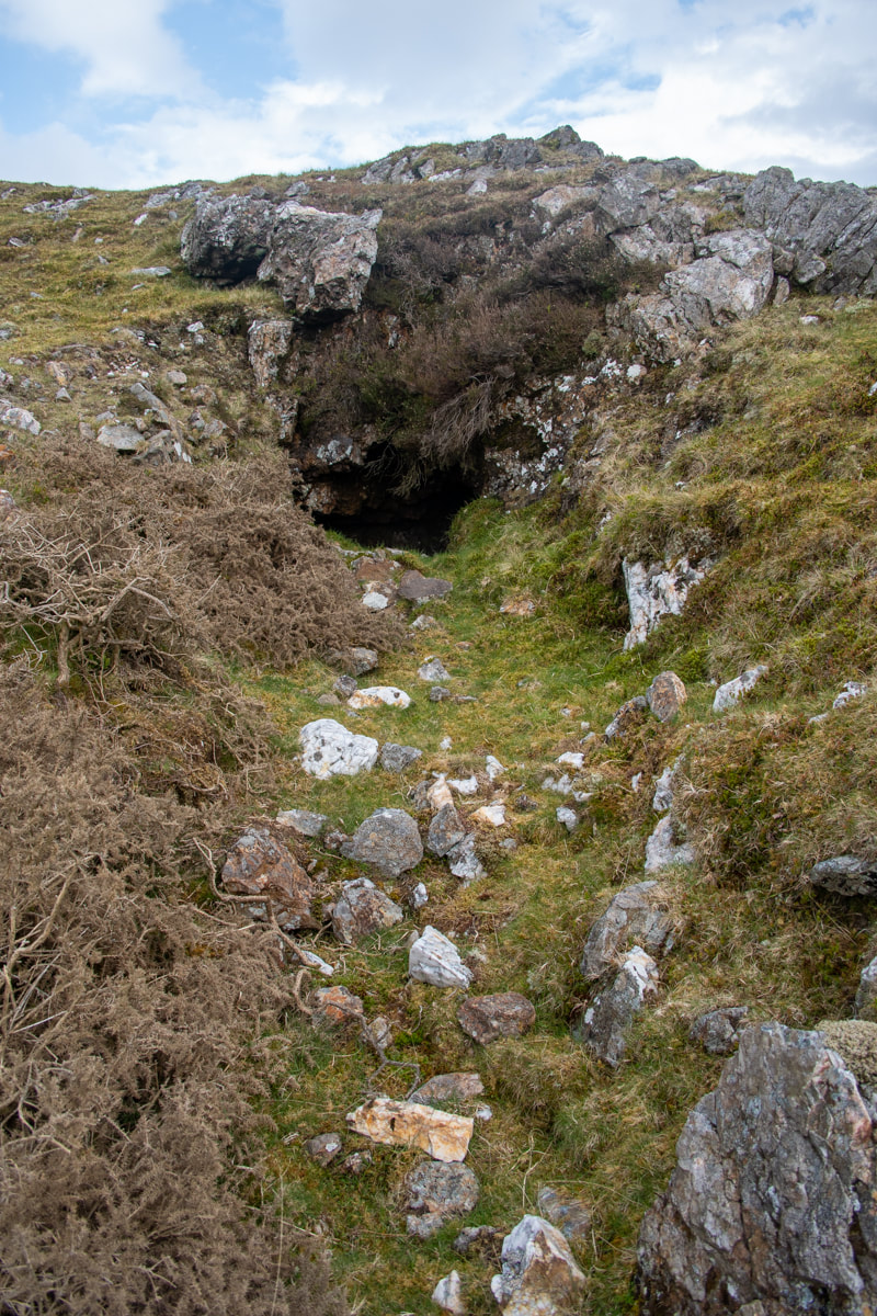 The adit...there was an awful lot of quartz about in the tip- I wonder if this was a gold trial? I do wonder about the Woodland Trust naming that path the "Mining remains" path, though. I shouldn't wonder that every year, there will be folk who are not happy. Wandering up and down expecting to find headframes and winding gear, dark adits leading to chambers that soar "beyond the light of caplamps"... they're going to be disappointed, aren't they? Check out how things looked 20 years ago on Merioneth Manganese. There's also an excellent history of the site. |
TracksReceive the occasional Treasure Maps Newsletter- and alerts when a new post is available!
If you enjoy my content, please buy me a coffee!
Check out my other online activity...
Index
All
|

 RSS Feed