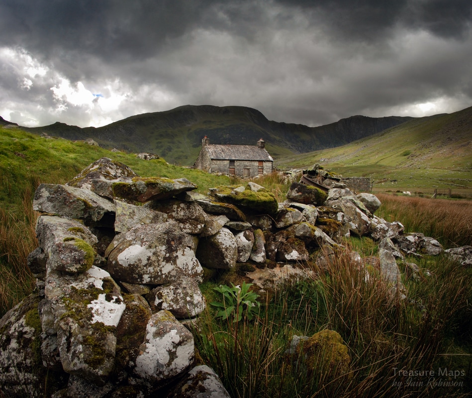
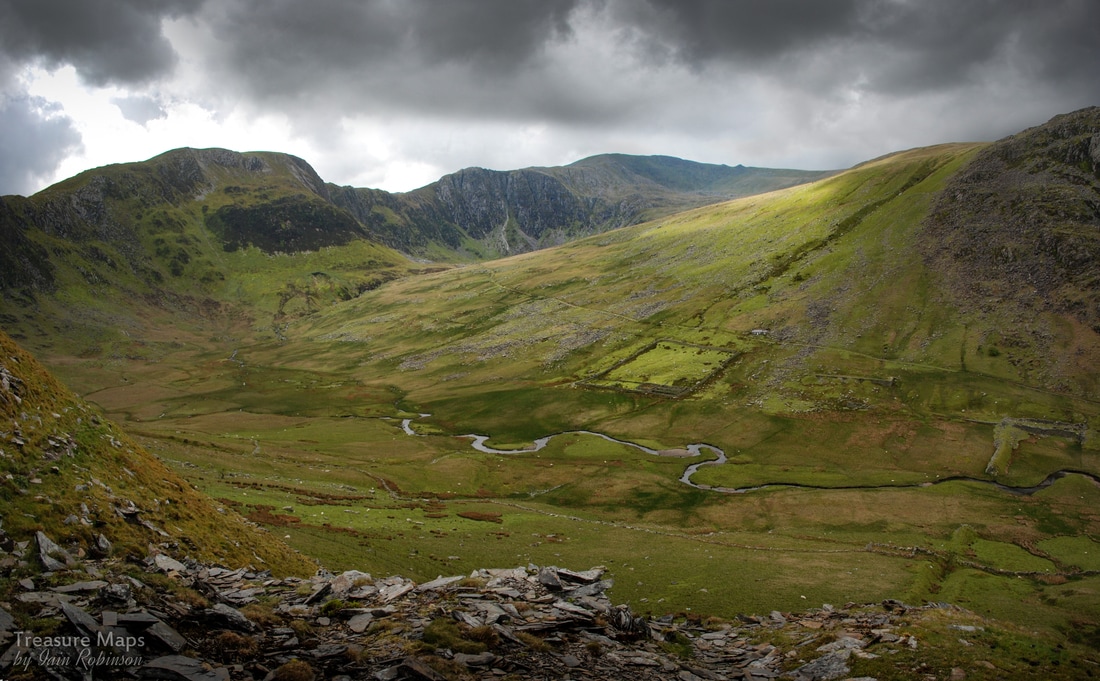
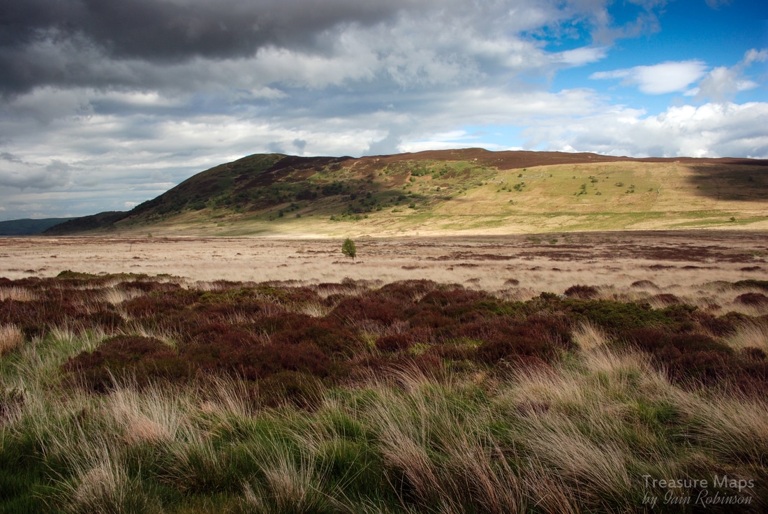
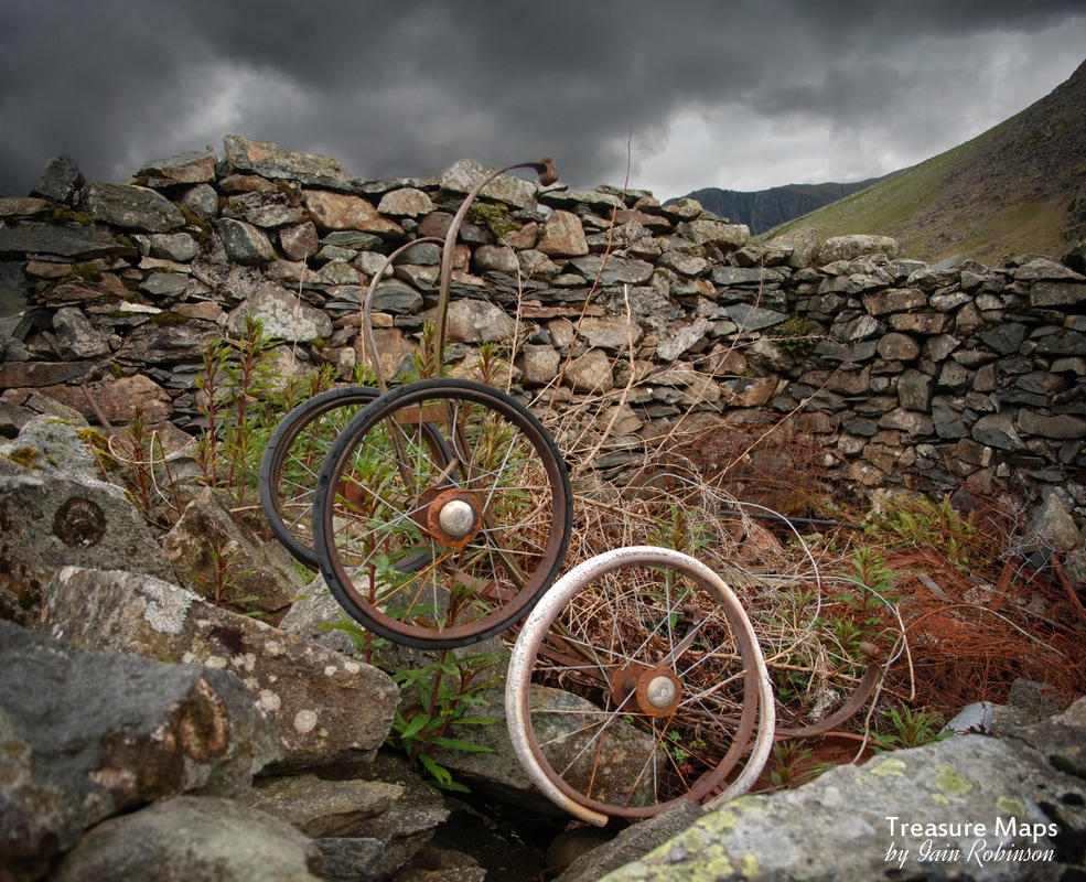
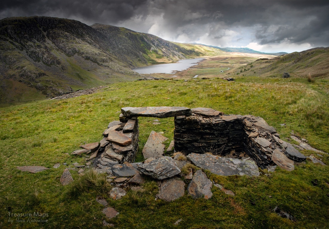
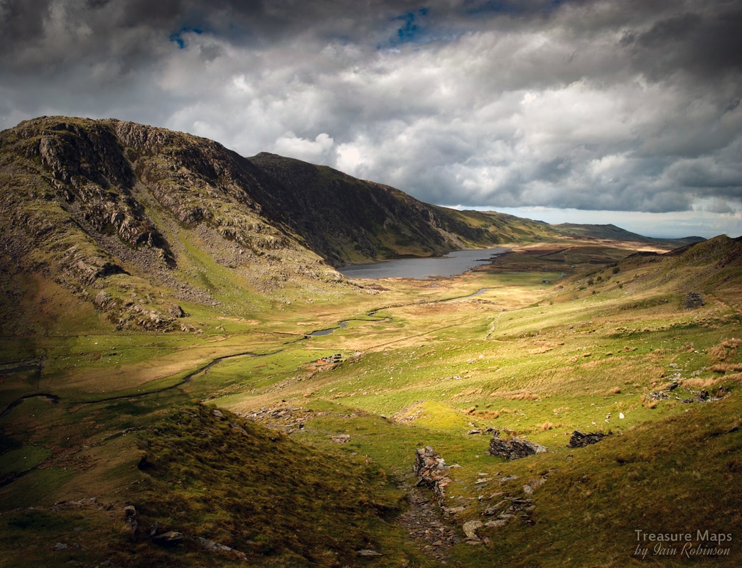
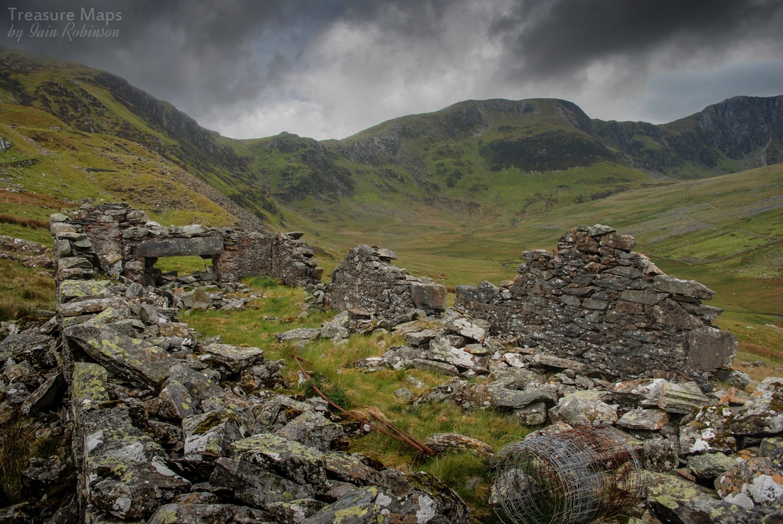
 The deserted farmhouse of Cedryn. The single track road from the B5106 at Talybont reared and bucked like a wild Carneddau pony. We hung on for the ride and after a couple of switchback miles, arrived at the trailhead. You can park in the free space at GR SH7317266305, there's room for 15 cars, but this is a favourite starting point for exploring the Carneddau peaks, and was almost full when we arrived, a little after 1.00pm on a Saturday in May. We weren't planning on peak bagging so headed off up the well-made track towards the dam. The weather didn't look encouraging, but what the heck, some of my best shots are done in dreich conditions...in fact, I've developed a real aversion to fine, bright weather. Just as well - living in Wales, I won't ever be disappointed! Straight off, this seems like a wild and isolated spot. There's a feeling of dread here, or perhaps it's just the way the cloud covered hills looked a little like Mordor. For now, we headed up the track towards the Cedryn dam.. 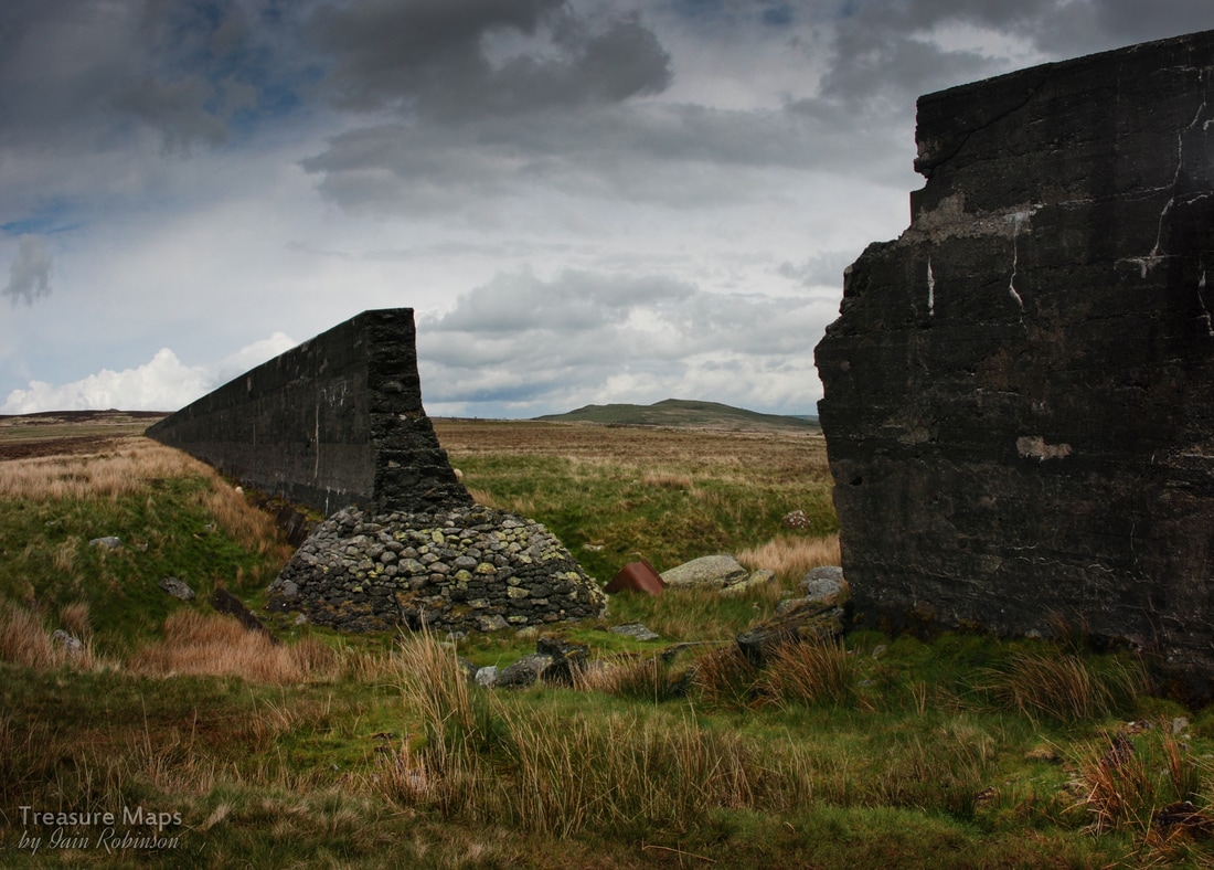 The breach in the dam, with the remains of a Hudson tipper body lying in the channel cut by the escaping waters. The dam is an imposing and surreal sight in the landscape here, when everything else seems so wild. It was built in 1917 to supply water to power the Aluminium smelter in Dolgarrog- and must have been the biggest thing that had happened in the cwm since the last ice age. We took a detour to look at the breach - which happened in 1925, allegedly caused by cost-cutting by the contractors. The concrete isn't exactly construction grade, it's remarkable that it has survived the elements. Tragically, 16 folk lost their lives when the waters swept down to another dam below which eventually collapsed under the strain. We carried on towards the top end of the dam, where the wall has been dismantled. I lost my sense of direction here, so I'll mention that you carry on left at this point and then keep on the track, don't go up to the beautifully situated Hafod y Rhiw, which looks as if it is inhabited, or a holiday cottage. For now, we were walking on a cart track which had been built after the dam, taking a slightly higher route along the cwm. The old quarry tramway, constructed c.1859, can be made out below. Its course was flooded until the dam was dismantled. It runs along the floor of the cwm until Cedryn quarry is reached, where it takes off again towards a mill, and then the more remotely sited Eigiau Quarry. It's possible to follow the line of the tramway over small bridges and through modest cuttings, but I must warn that it is a soggy business, as if the land has still not recovered from being inundated by the dam. In 1863 the North Wales Chronicle printed a verse by local poet Robert Jones in praise of “Ffordd Haiarn Cedryn” (the Cedryn iron road), whose MacGonigalesque verses predicted the awe that would greet the railway's opening. Another verse praised the railway’s civil engineer James Spooner, best known for his work on the Ffestiniog railway. Spooner must have spread himself thinly about, because his name seems to crop up again and again at this time. The "iron road" is little more than a Spooner pencil scribble on the map, yet like all these old routes, it has a considerable charm. 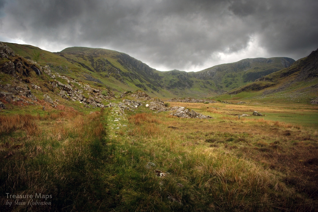 The quarry in the distance and the tramway, passing through a small cutting. Being set now on reaching the quarry, we diverted from the track at SH7212664130 and forged uphill towards the barracks. These are quite substantial and constructed from country rock, probably found on the hillside or quarried from one of the dolerite outcrops in the cwm. Records show that quarrying for slate at Cedryn dates back to 1827, at which point pack horses or mules would have used the track to the barracks and beyond. All supplies must have been brought this way, and finished slate taken to the quays on the river Conwy at Dolgarrog. 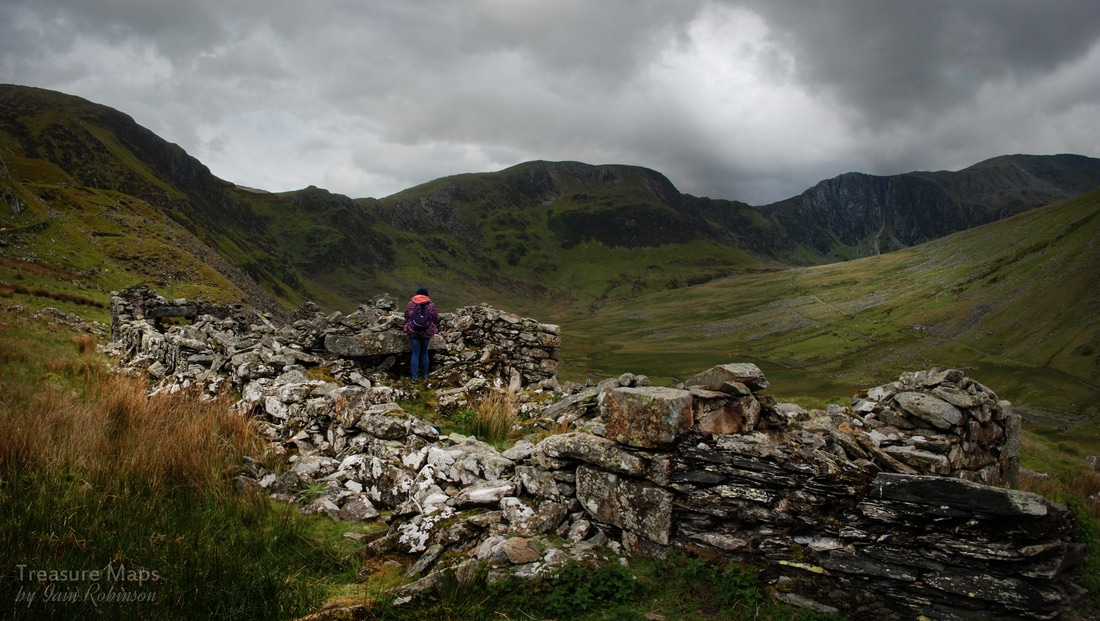 The ruinous barracks At the quarry pit, (SH7197763538) it soon became apparent that the slate was not of the best quality, fit only for lower-grade roofing slates. Building remains were vestigial, although it was obvious where entrances to the pit were made, now run-in. Little remains of the incline drum-house or any shelters, and I failed to find sign of a powder house. It is, however, an intriguing location with fine views, and we enjoyed half an hour there trying to work out the remains on the ground. The incline is well deliniated in the landscape- it falls down to the valley bottom and once crossed the river on a wooden bridge, now lost. Across the river was a mill, which I will deal with in a future post, as the light was almost non-existant when we looked there! An advertisement in the "Law Times and Journal of Property, 1844 to 1845", lists the quarry as: "The Cedryn Slate Quarry, of great extent, situate in Caernarvonshire, North Wales; the slate is of excellent quality, and can be had in abundance under a very thin cover; the work is already about 40 yeards wide and is capable of being extended to 180 yards in width, and at least half a mile in length, without any obstruction, and as deep as any parties may feel inclined to go- 4000 guineas." An idea of the precarious nature of the quarry comes from a letter in the Gwynedd archives from J.M. Hopkins, Liverpool Crescent, St. George to Lord Newborough, re the Cedryn Slate Quarry. They have already obtained advances of between £1200 and £1500, but need more money. They say that the quarry has already cost them between £6000 and £7000 and now they want permission to obtain more shareholders. Incredibly, Newborough agrees to the sale of more shares. Obviously it didn't go well for any of the parties involved! 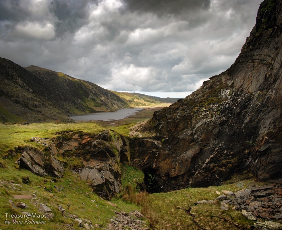 Cedryn quarry pit, looking towards Llyn Eigiau After exploring the quarry pit, we descended back down the cart track and then cut across to the deserted farmhouse of Cedryn. It's a beautiful, if isolated spot, although back in the middle of the 19th century I suspect it was quite a busy place, producing food and supplies for the quarries. The house is in good condition externally, wind and weathertight. It seems to be in use as a store for the farmer and is surrounded by sheep pens and tidy bits and bobs of the agricultural persuasion. On the dry stone wall outside, a mine cart wheel was resting on the cap stones. Another cottage lies higher up, above the mill. This is a mountain bothy maintained by the Mountain Bothies Association. By now, the wind was getting up and rain had started lashing us, so we turned back for the car park. With a final glimpse of the cloud beseiged tops we retreated to the trail head car park, to explore Cwm Eigiau quarry and mill another, hopefully slightly drier time. Some interesting facts- The mountains at the end of the cwm are called Pen yr Helgi Du (Hill of the Black Hound) and Pen Llithrig y Wrach (Hill of the Slippery Witch) - wonderfully evocative Welsh names! Cwm Eigiau and Cedryn quarries eventually amalgamated and the mill served both concerns. According to Alun John Richards, author of the indispensable "Gazetteer of Slate Quarrying", the mill had a total of 5 Hunter saws, the largest known assemblage of these fearsome machines, all probably installed around 1864. The Cedryn and Cwm Eigiau quarries were sold in 1881 after three years in rent arrears. The chief assets were tramway inclines and rails worth £140 and six railway wagons valued at £36. The quarry tramway was horse operated throughout it's life. Sadly, there are several air crash sites in this area...Pen Llithig yr Wrach has wreckage of an Anson from 1944 and a Vampire from 1956. Most if not all of the wreckage has been removed. Craig yr Isfa has engine wreckage from a Bristol Blenheim, from 1944. Link to Graham Stephen's blog post about the site here. 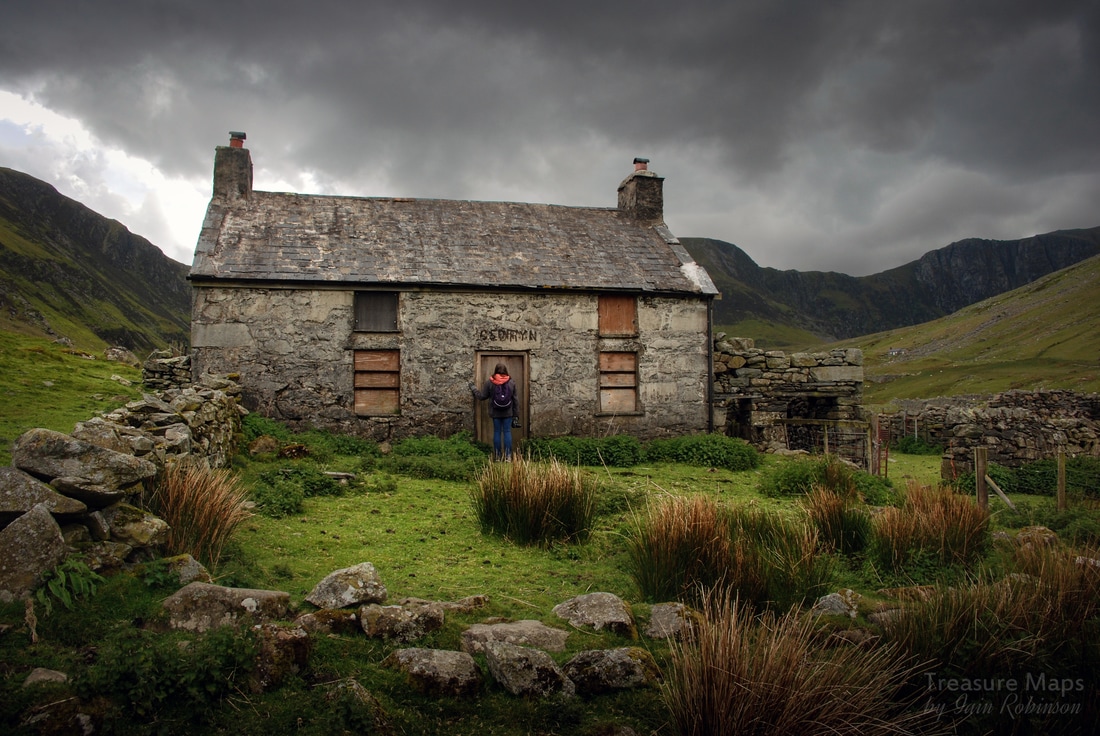
6 Comments
|
TracksReceive the occasional Treasure Maps Newsletter- and alerts when a new post is available!
If you enjoy my content, please buy me a coffee!
Check out my other online activity...
Index
All
|
 RSS Feed