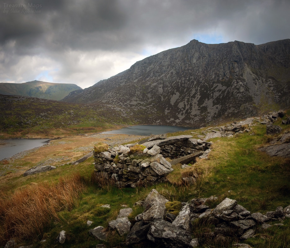
 The Powder House, with Craig Cwm Silyn in the background. It's funny how sometimes you go out and just follow your nose, with no intention of discovering old mines, or mysteries in the landscape. Yet, despite your best efforts just to go on an uneventful walk, interesting things keep cropping up. I guess it's something to do with living in a part of Wales that has more mines and ruins per square mile than almost anywhere else, but it still surprises me. With a couple of hours off work in early May this year, we decided to have a wander towards Craig Cwm Silyn. The weather wasn't great, but what the heck, it would be a good walk. We passed by the route to go up to the top of that majestic hill, and instead, made for the cliffs below it, the haunt of climbers and fishermen. I hoped to get some moody photographs. 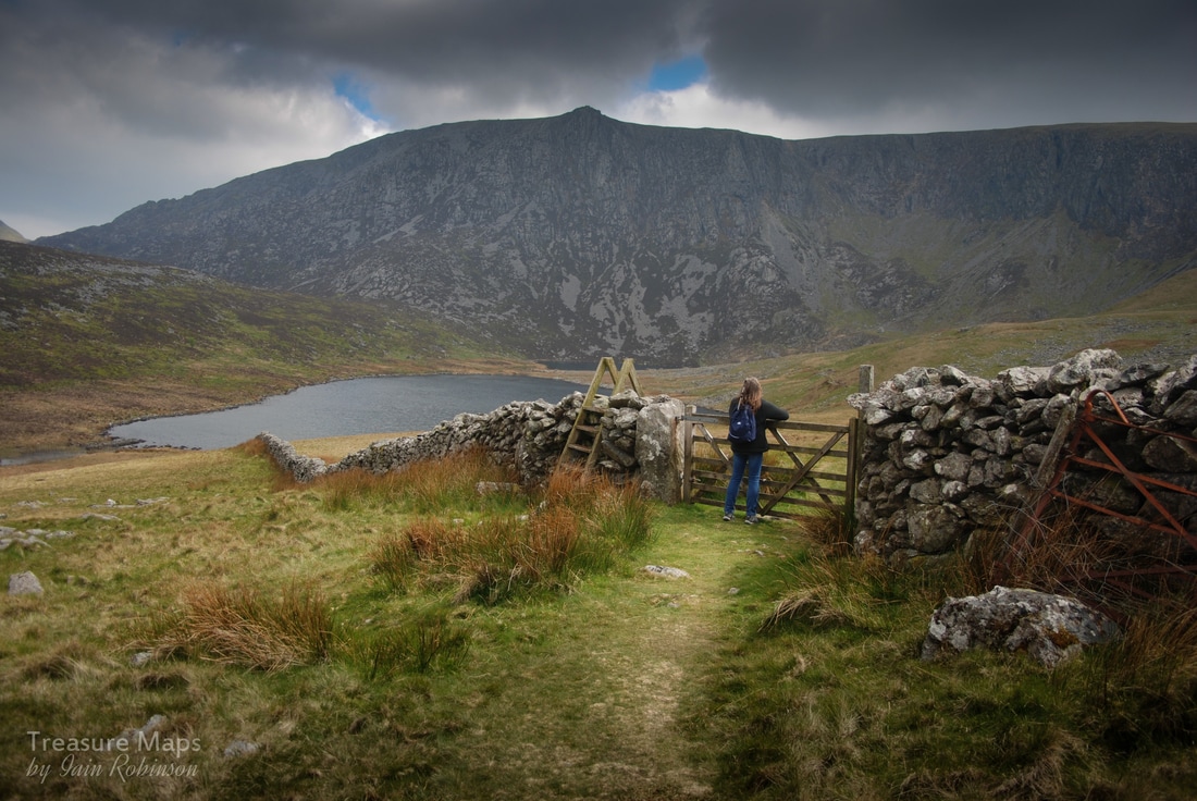 Petra looks over towards the mine. We seemed to be following a well made track, revetted with stones. I glanced at Petra, who was looking very thoughtful. She turned to me and muttered something about the track looking like a mule road. I agreed. A short while later some ruined structures hove into view...above them was, unmistakably, a mine area. This bit of Wales is a wild place weather-wise; it's rare to get a day without wind, rain, snow or all three, summoned by the Nantlle ridge.. The elements were brewing up something when we arrived. Any structures abandoned here go back to nature pretty soon. Which makes it all the more surprising that the iron age huts and dwellings that abound in this area are so well delineated compared to these mine ruins, only abandoned in the last hundred years or so. 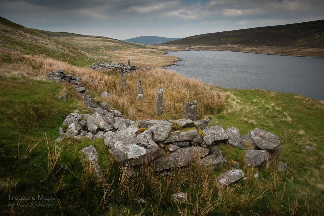 Remains of structures, possibly cart sheds, at the lower part of the site. We stumbled around, looking in surprise at the remains. Further up the hill were some opencuts, three trenches with spoil and more ruined structures. I thought I'd identified a powder house below, but then another, a round one, appeared further up the hill. The area at the bottom, at the end of the track, was constructed with slate slabs and the walls were infilled with cobbed waste which looked very like Manganese. It was heavy, too- always a give-away. The workings looked like the classic way of mining for manganese; shallow, lengthy, in lines chasing the lode. There wasn't enough spoil for any major excavation, but this looked like it might have kept a few miners going for a year, maybe. 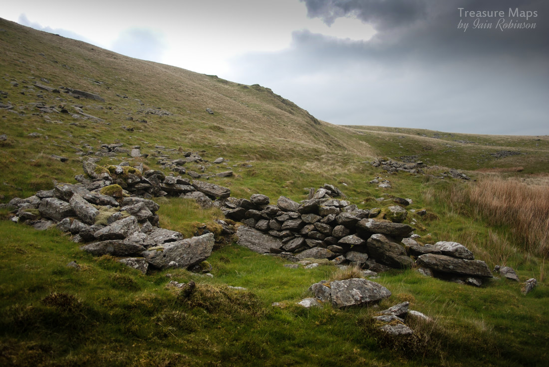 Remains of the smithy, with some opencuts in the background. Later, I checked Wilkinson's database and there was indeed a manganese mine here. According to his record, it was the Cwm Silyn mine, with a date of 1851 in the mining journal. Coflein's new, swanky map also confirmed that there were at least two mines (trials, they call them) but they won't be drawn about the date. In some ways, I almost prefer sites like this to the big, brash places like Dinorwig; they are a refreshing change, at any rate. There are no remains to speak of, just lots of subtle signs on the ground and, the more you look at them, the more they come into focus. Folk worked here, dug and built, sharpened tools and drove mules away with the ore, such as it was. Countless years before that, others farmed by the lake. Now only fishermen, climbers and mine-hunters pass by. What a wild spot to prospect for ore. 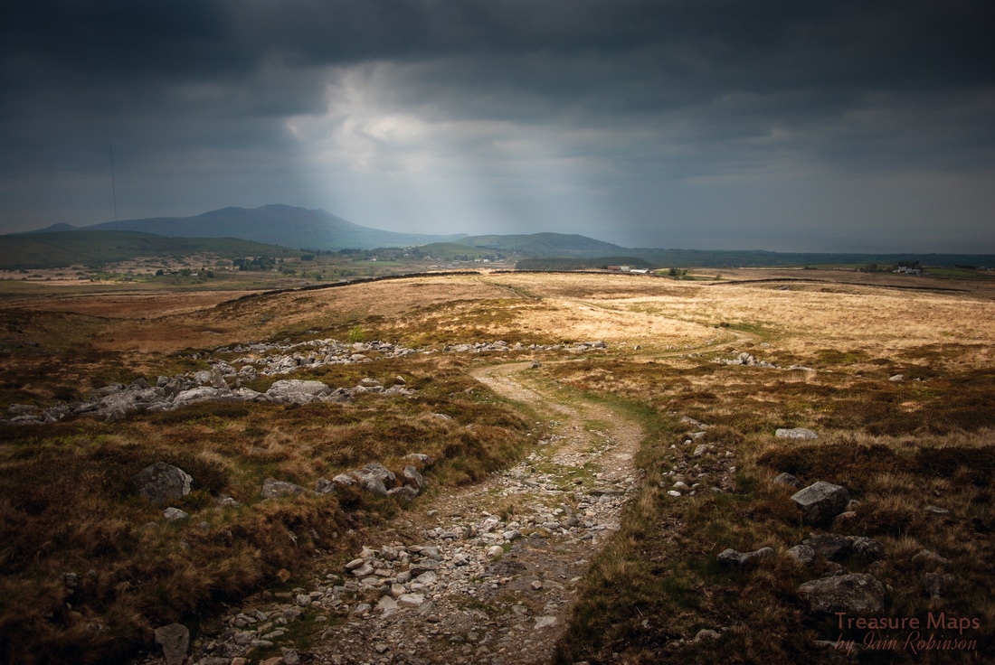 The way back down to Llanllyfni. |
TracksReceive the occasional Treasure Maps Newsletter- and alerts when a new post is available!
If you enjoy my content, please buy me a coffee!
Check out my other online activity...
Index
All
|
 RSS Feed