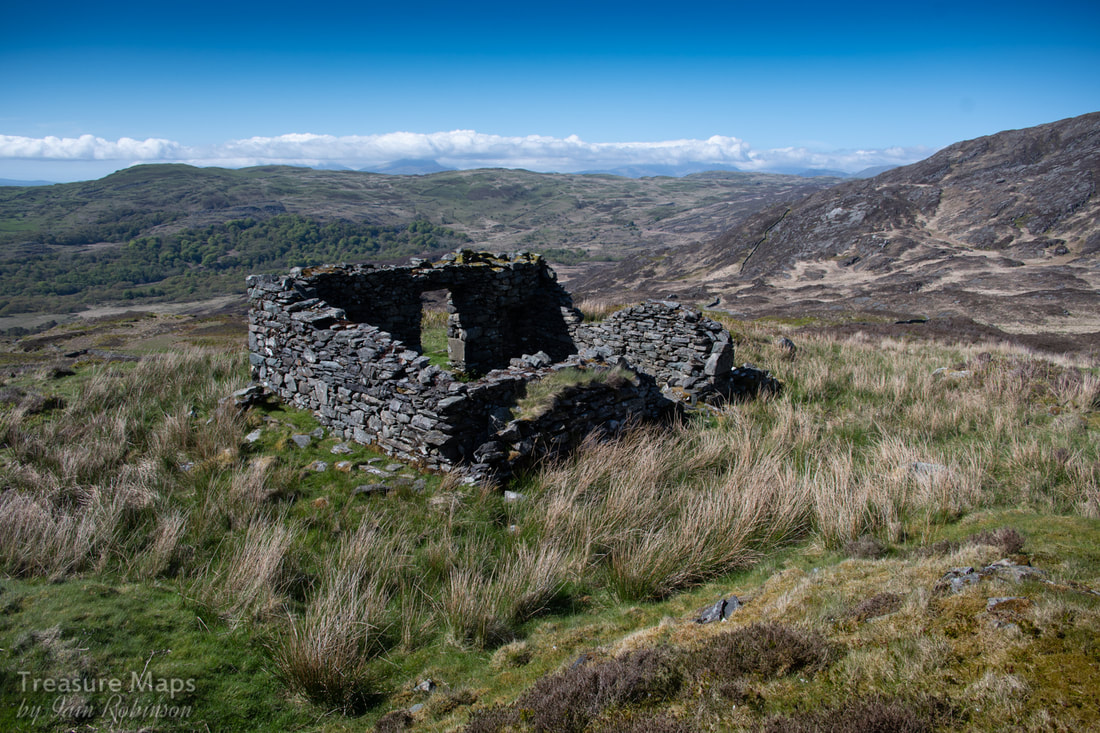
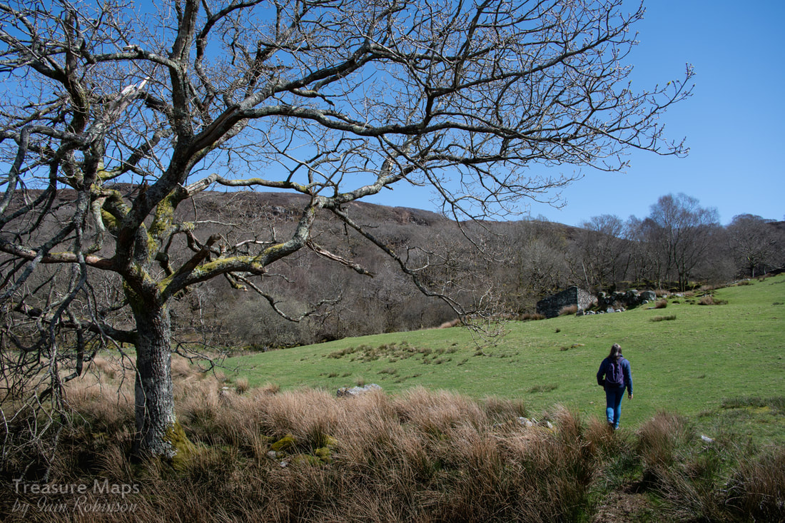
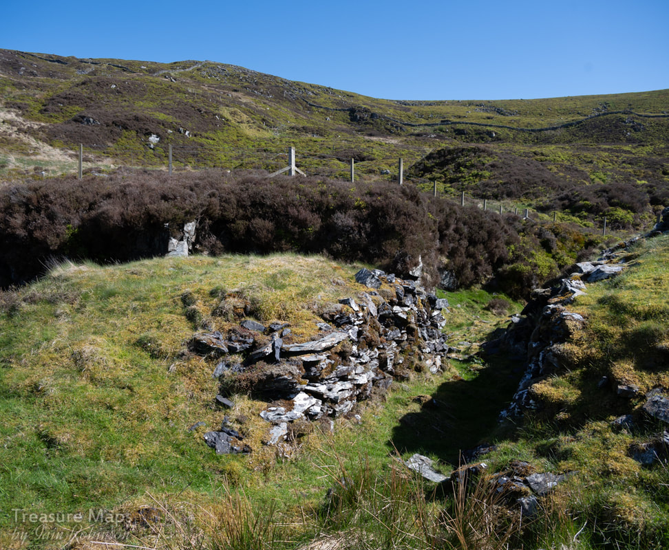
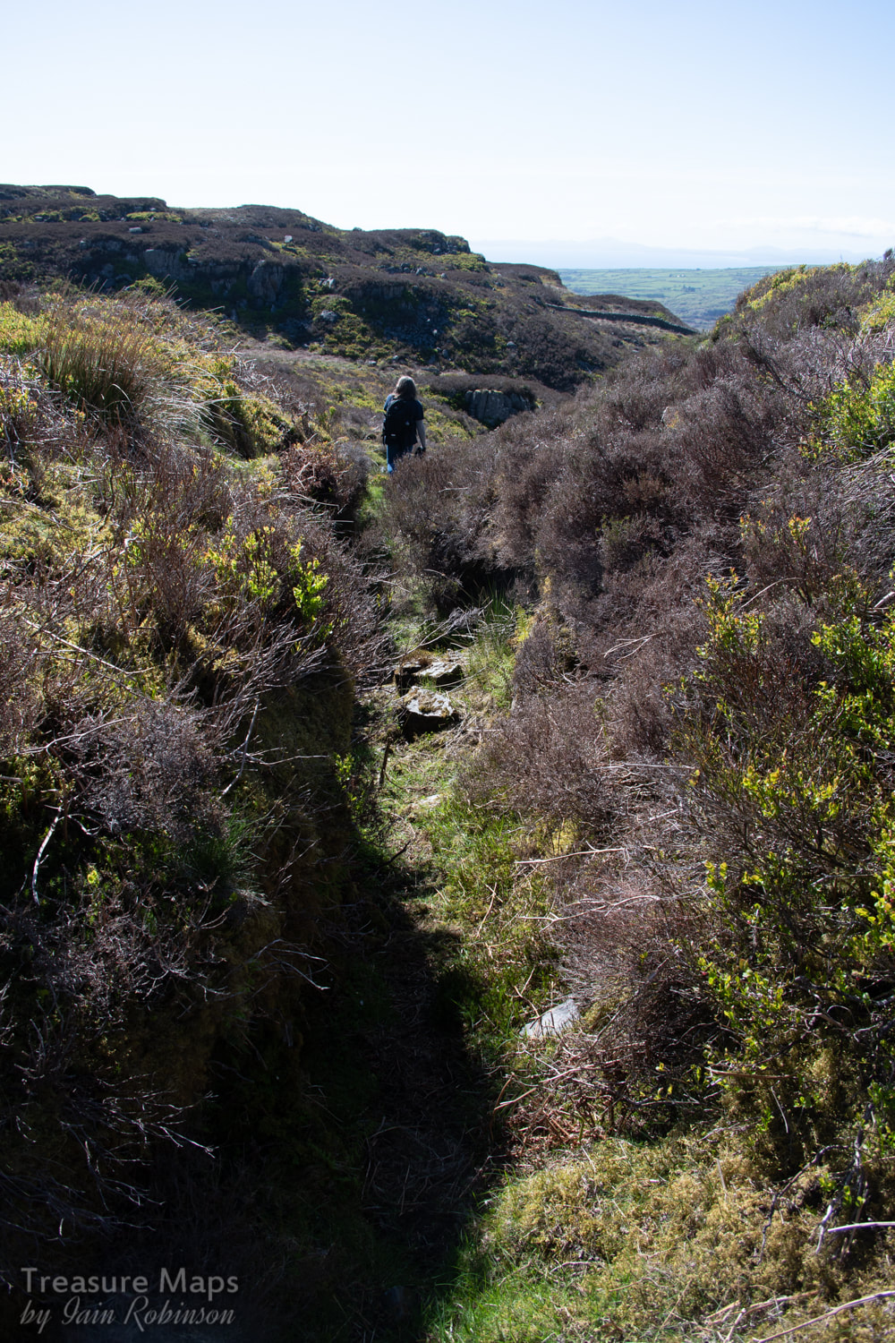
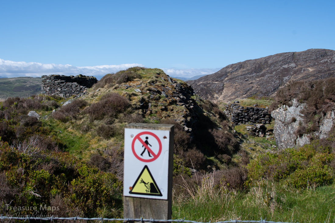
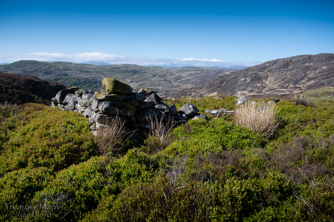
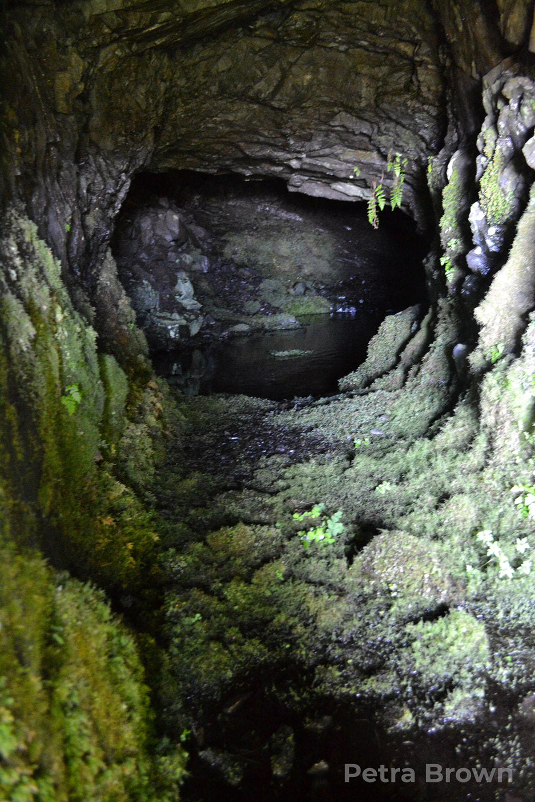
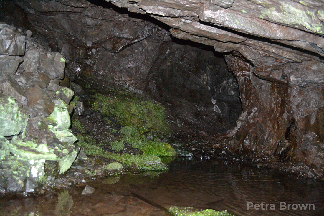
 Possibly a Smithy, looking towards Mynydd Drws y Coed, then Moel Hebog in the centre and Snowdon (Yr Wyddfa) under some cloud to the right. The Rinogiau are rightly known for their difficult walking terrain, unyielding rock and almost total heather cover. But they are also remarkably beautiful- and studded with the intriguing remains of some mines. We spent a couple of days exploring one of these, the Cwm-yr -Afon mine. It's a long slog from the road that goes through Cwm Bychan to the mine, an uphill trek that includes a lot of bog and treacherous tussock grass. On the days we explored, the weather was perfect- not good for photography, but ideal for enjoying the landscape- which, despite the sunshine was still very boggy indeed. 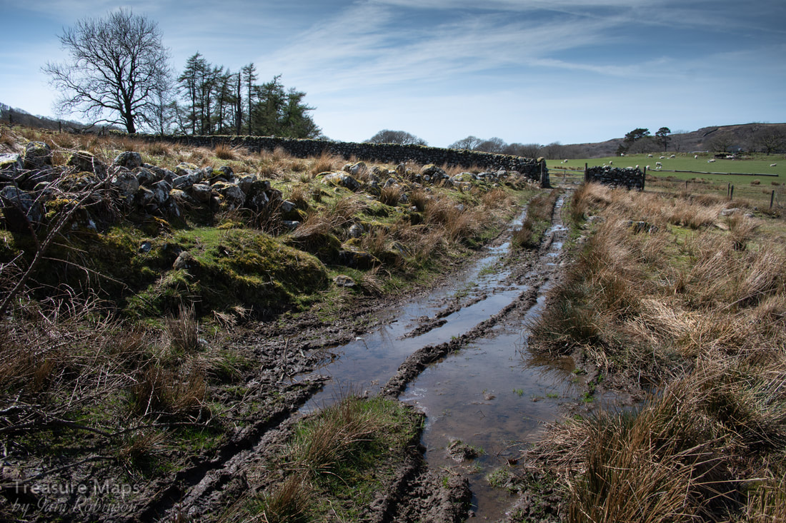 The soggy right of way through Cwm yr Afon farm. There are several ways to reach the mine, but the least exhausting is probably the mine track up from Cwm-yr-Afon farm. Coming this way also lets you view a very fine trial beside the Afon Artro, almost directly below the farm. I have found no information about this, but since the small tip includes some bluestone rocks (a low-grade rock found around the ore), I am fairly certain this is a manganese trial.  The trial adit below the farm, beside the Afon Artro The route takes you up a cart road which was the only way to transport ore from the mine- quite a thought. It's steep and narrow, and I pitied the poor horses having to hold back a load of ore coming down the track. On one of our visits, we took a slight wrong turn and ended up at the ruins of an old mill, Pandy, where in the remains of an old barn, there was a horse-drawn cart (with Ford Model "T" wheels) and on the floor, some old wooden cart wheels. It was nice to speculate for a moment if this was the remains of one of the mine carts, but I don't think so! 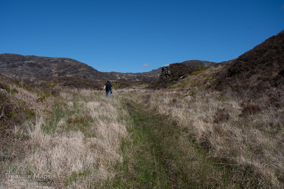 The cart road, almost lost in the moor. The road twists and turns uphill through boggy ground. Increasingly it can be seen that the sides of the road were revetted with big stones and the road itself was surfaced with cobbled rocks. The landscape goes up in a series of steps, gaining height until a plateau is reached. Here and there, are evident investigations at the side of the road, diggings that may have been explorative trials that came to nothing. 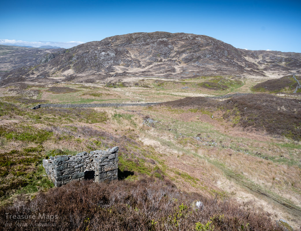 Looking down on the (possible?) Powder Store. In the background is Carreg y Saith. The mine sits on rising ground between Carreg-y-Saith and Carreg Fawr. We came to a point above Cwm Bychan where the footpath went one way, left towards, Carreg-y-Saith, while the road went through some particularly boggy ground ahead. A cuckoo was calling almost constantly, occasionally flying between the solitary Hawthorn trees to be found up here. Petra was for going on up the footpath, but I persuaded her to go along the road, knowing that as soon as she saw the mine I would not be able to stop her. So it transpired, she caught sight of a ruined building and I was rewarded by a smile and the sight of her racing ahead. We noted a structure that I first thought was a powder store; square(ish), no windows, a respectable distance away from the mine. But apparently, black powder was rarely used in manganese mines, the rock being crowbarred out. I still think the structure looks like a powder hut...what else could it be, sitting in the middle of a moor? 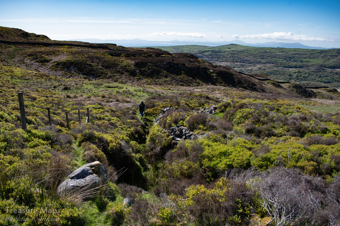 A typical opencut, with more beyond. We followed the track onwards and upwards- it was obvious that the mine was extensive and opencuts lay all the way up the slopes towards Gloyw Llyn, out of sight beyond a false summit. The workings were easily spotted because of the fencing around them, although since none were more than ten feet deep it seems a little bit "H&S". 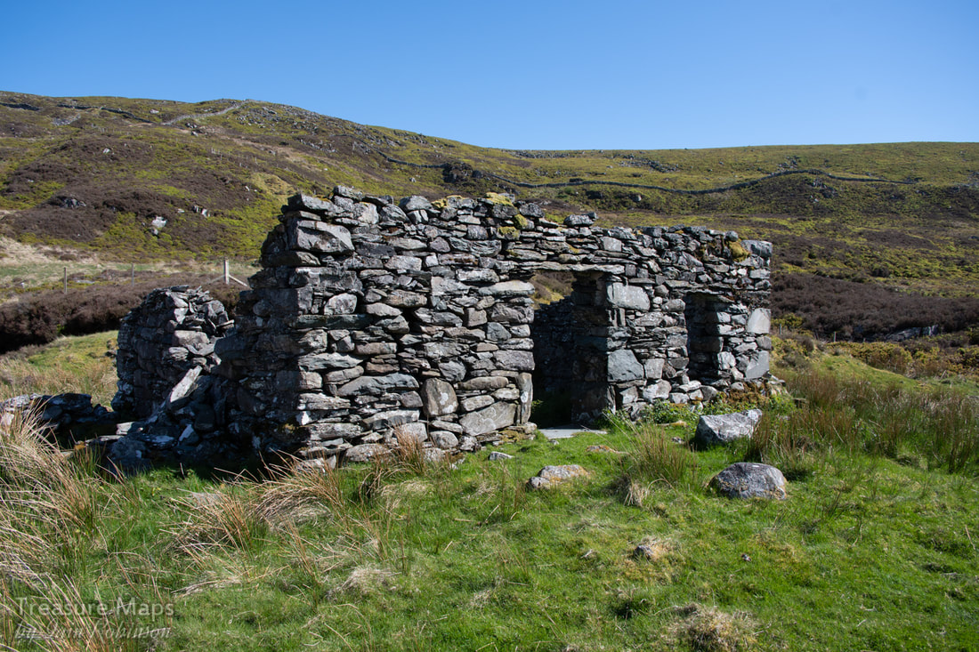 The smithy, with more workings stretching up the slopes beyond. We eventually made our way up the steep cart road to another ruined structure, called a smithy in C. G. Down's NMRS book. This was a great spot, commanding a superb view across the cwm and on to the sun-kissed waters of Cardigan Bay. We sat and had lunch, listening to the solitary bees as they fussed over the little spring plants on the ground. The landscape was magnificent and we had it totally to ourselves, apart from the cuckoo. 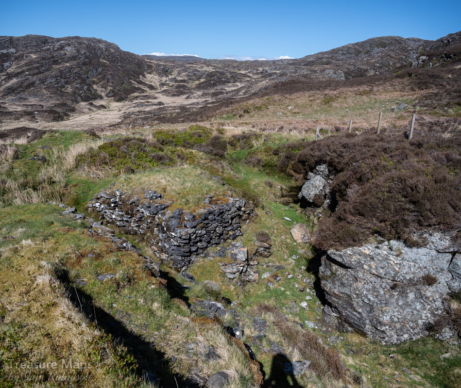 The opencut behind the "smithy" showing a stone built platform where manganese ore would be stored, then loaded onto a cart. Behind the smithy was a classic scene, an opencut with neat stacks of "deads" piled up, the excavation assiduously chasing the vein cross country, bending back on itself. We stravaiged all over the site, quite exhausting because of the deep banks of heather and the rocky terrain. In an upper area there were a couple of adits and a sizeable tip. In typical fashion, the adits were stacked with deads inside; once an area of the workings was exhausted, the workers used spoil to support the roofs. More workings appeared uphill, which we reached by following the twists and turns of the old cart road. There was a substantial tip and a couple of adits at one level, with a loading bank built out from the tip- it looked as if some crude processing had gone on here. The adit seemed to have been extensive, but as usual, was infilled with deads. 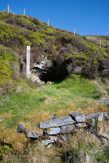 We also found an opencut and adit on the other side of the boundary wall, but the wall was high and topped with barbed wire. We tried to find a way through, but by the time we had searched up and down the wall, there was a substantial climb back up. Tiredness overcame us, and, thinking of the long walk back, we decided to leave that one for another time! On our way back, a troupe of goats were spotted, about 400 yards away- the only wildlife seen all day. Some facts: The Mine The Cwm-yr-Afon mine, also called Drosgol or Foel Ddu, was active from 1889-1923 in sporadic periods. The recorded output of the mine was 472 tons in total, although these figures are the returns from the official records; often actual production figures were higher. Typically, only a couple of men worked at the mine, although the figure went up to six in 1891 and ten in 1918. A surprising amount of work was accomplished when that is taken into consideration! As we've already seen, ore was carted down to Cwm Bychan and on to the railway at Llanbedr. One mystery is that while the mine appears as a series of structures on the 1:2500 Ordnance map, current edition, it doesn't appear on any of the older editions, robbing us of the opportunity to study what it looked like in the late 1800s. The excellent maps in C. G. Down's book (see references) make up for that. The mineral The manganese mined in the Harlech Dome area is found at the bottom of a thick layer of shale. The actual ore occurs in a bed some 10-18 inches thick, beneath a deposit of "bluestone" which was the miner's term for the heavy, dark rock that surrounded the actual deposits. The bluestone is extremely hard, but only weakly manganiferous. The ore bodies form as the result first of precipitation; a gel of rhodochrosite with clay and silica alongside iron hydroxides. These gels are then the subject of metamorphism, heat changing the sediments, resulting in crystallisation, the bluestone on top, then the manganese and underneath Iron oxide, which presents as iron pyrites where it is exposed by mining. It's uses Manganese was used in the production of bleach, and was much in demand from the cotton industry of the north west, to bleach cotton fabrics. It was also used for bleaching in glass production. The greatest use of manganese was (and is still) for strengthening and increasing the wear characteristics of steel - almost 90% of all manganese is used in steel manufacture. Less pure ores (the welsh ones) were used as an addition to the blast furnace, acting as a deoxidiser. Manganese is also used as a disinfectant in the form of Potassium Permanganate. Sources of information as always, the excellent Merioneth Manganese site by Dave Linton. British Mining No.14 "The Manganese Mines of North Wales" by C. G. Down- available from the Northern Mine Research Society. Thanks to Tom Cotterell for the use of his Conference Paper, "Manganese Mineralisation in North Wales." which was super-helpful in identifying samples in situ.
0 Comments
|
TracksReceive the occasional Treasure Maps Newsletter- and alerts when a new post is available!
If you enjoy my content, please buy me a coffee!
Check out my other online activity...
Index
All
|
 RSS Feed