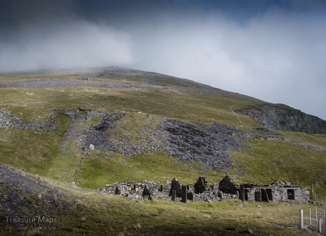
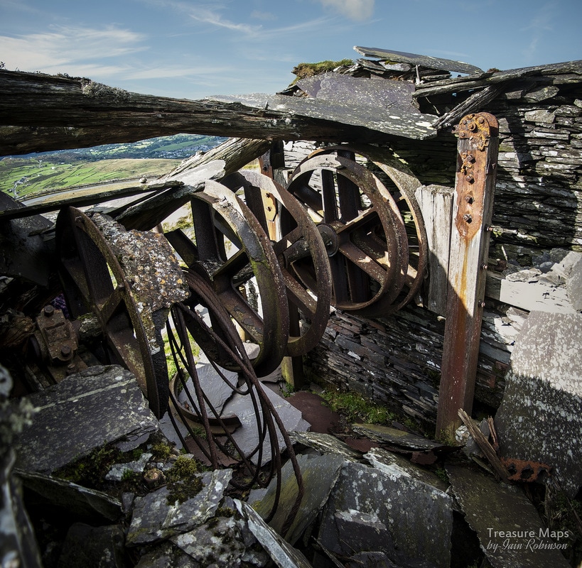
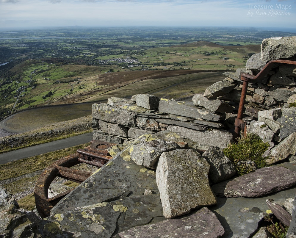
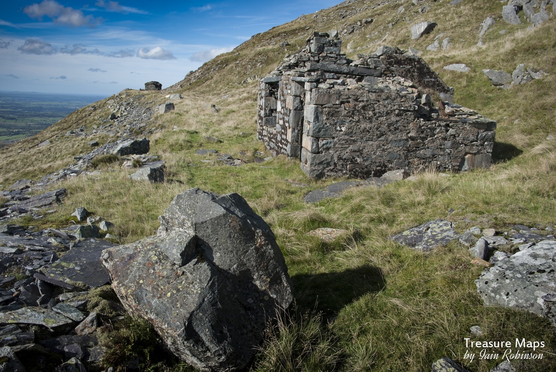
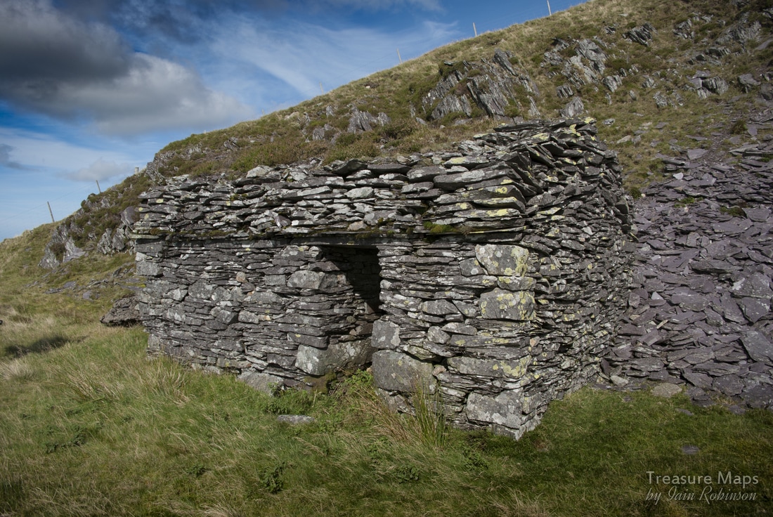
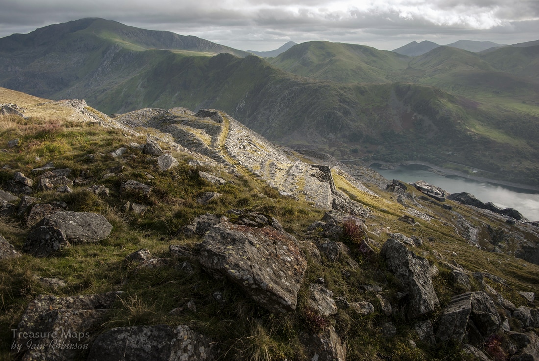
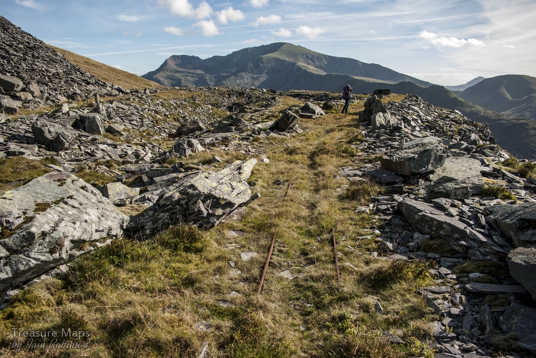
 "Barics Aberdaron" with the top levels going up into the sky. This time, we're taking a look at a less visited part of the mighty Dinorwig quarry. Less frequented, perhaps...but in it's own way, very interesting. On a fine day, it has a special character all of its own, despite the top level being cut by the Hydro surge pond road. The best way to take a look at the top levels is to approach by the road, parking at SH 59660 63099. There's space here aplenty- (it is also a good starting point for an assault on the mountains around here). I won't wrap it up, it's a long slog on tarmac to Barics Aberdaron, but a rewarding one. The first sight on the way is the abandoned workings of the Marchlyn quarry, an attempt by the management of the main quarry to find some easier pickings without bad rock and tipping restrictions. But there's no such thing as a free lunch and the new quarry never prospered. It was first opened in the thirties, then a really concerted effort was made in the fifties when things were beginning to look bad for the main Dinorwig quarry. The slate was never good enough and much effort and money was wasted on this desperate scheme. 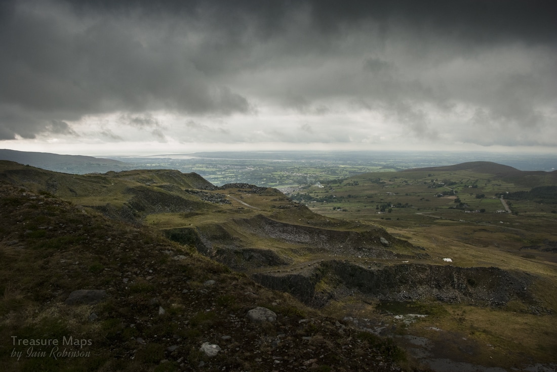 Marchlyn... a chaotic site now, after being used by the hydro company to tip thousands of tons of waste rock from the underground tunnels. There was a proposal to re-open work here and extract rock for raising the height of the Marchlyn dam, but so far, that has not transpired. Walking further up the road the views become more intriguing. Assuming you are lucky to have a fine day, it is possible to see as far as Anglesey, but perhaps of more immediate interest are the two imposing places of worship down in the shallow valley below. 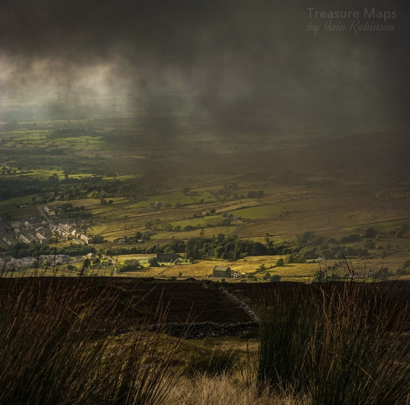 Look closely and you will see a Chapel, then a church with a spire behind it, both lit up with a chance sun beam. Llandinorwig Church and Cefnywaen Chapel, seen from the surge pool road, near Marchlyn. The competition between rival denominations, particularly Anglicans and Non-conformists, was fierce in the slate districts. The Anglican church was the church of the employer and his lackeys, the chapels the realm of the workers and the trade unionists. In an attempt to attract members, the Anglicans built the ornate Llandinorwig church on the outskirts of the village. This, of course, was paid for by Assheton-Smith, the owner of Dinorwig Quarry. The Calvinistic Methodists replied by building Cefnywaen (meaning: ridge of the moor) chapel adjacent to the church, adopting an architectural style which was rather grandiose for a Welsh non-conformist chapel and included a huge rose window above the main doors. (Thanks, as always, to the infinitely knowledgeable Eric Jones for this information.) 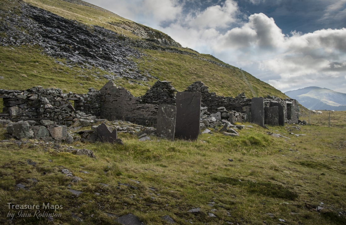 The wind-harried ruins of Barics Aberdaron. The vertical slate slabs are primitive porches to try and keep the draughts out. Finally, the ruined barracks of Aberdaron is reached. There are spectacular views over the Garret district of Dinorwig from here, which is why I recommend leaving the exploration of the top levels until you have quartered the more spectacular remains below. Having satisfied your appetite for the spectacular, you can the more enjoy the subtle delights of these levels. Given the ravages of the weather here at 2,100 feet , there isn't too much of the barracks left. One can only imagine what this place was like in the winter. The place was inhabited from Monday to Friday nights by men from Anglesey. It seems, the more I find out about the quarry, the more it appears that there was a certain antipathy towards the men of Anglesey. In any case, they had to buy their coal for heating from the company, at 2/2d a hundredweight in the 1920's, according to the quarry's accounts book. Not only that, but they had to carry it up from Gilfach Ddu! It's no surprise, then, that it became hard to find men to work here, so in the twenties, the company decided to allow free coal and to provide a free armchair for each man. There was never any water supply, however- I wonder what the company thought the men were going to use- luckily a natural spring was found nearby. The men's basic human rights were ignored, as the company knew that there was precious little local work to be had- and they could pick and choose their workers. Reading some accounts of the quarry, the authors wax lyrical about the Ashetton-Smiths and how fascinating and wonderful they were. Yet they were happy to let these men work for pennies every week without even basic human comforts. Starting from Aberdaron level, there are five levels (or "Poncs" in Welsh) further up the mountain. Above are Langristolius, which at one time, like Aberdaron, went from the Garret side of the quarry to the Braich side. These have been truncated by falls caused by rock deterioration or by the work of the Hydro company. Then there is Asheton-Smith and Enid on the Braich side, topped out by Alice on Garret. The best way up is to climb the shattered remains of the A9 incline (1 in 25) to Llangristolius. This strangely named level was named after the Anglesey parish of that name, and the birthplace of Owen Rowlands, the man charged with developing this gallery. The eastern, or Braich, end of Ponc Llangristiolus is known as Ponc Jubilee. 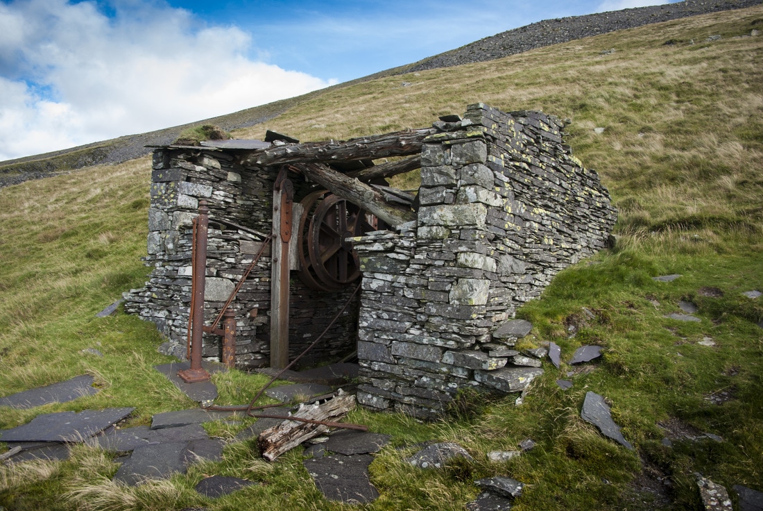 The A9 incline house on Llangristolius is a small and economically built example, with unplaned timbers for the roof supports. It consists of two drums on a common axle. The breaking mechanism is likewise unusual, each drum controlled by curved wooden blocks attached to the ends of timber uprights. One of these is visible in the photograph. Further towards the quarry, the ground becomes dangerous, undermined by rockfalls until finally, the way becomes impassable.. 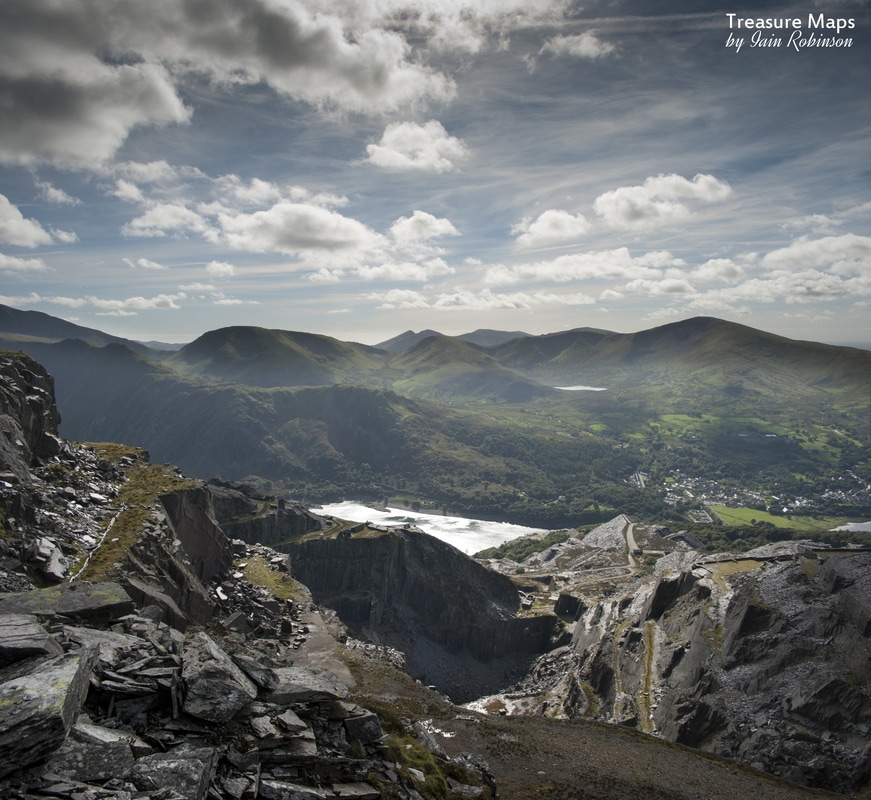 There are some wonderful views of the quarry from here, given a clear day. We explored the level as much as we could and then headed up the hill towards Ponc Alice, the highest gallery at Dinorwig (2,200ft). There was no incline here, just a winch house which is of the horizontal sheave type, very unusual for Dinorwig, but very economical. Slate from Alice and Enid was lowered to Aberdaron in cradles along a ropeway. These higher levels were never very productive and were the last resort before the management decided to open up the Marchlyn workings just over the hill. If only there hadn't been so much indiscriminate tipping in the pits and over good slate measures; but now it was too late, moving the slate waste would be unprofitable. A classic example of the management's mantra - make money now, the future can take care of itself. No doubt there had been much talk in the cabans about the orders given to tip waste over slate reserves! 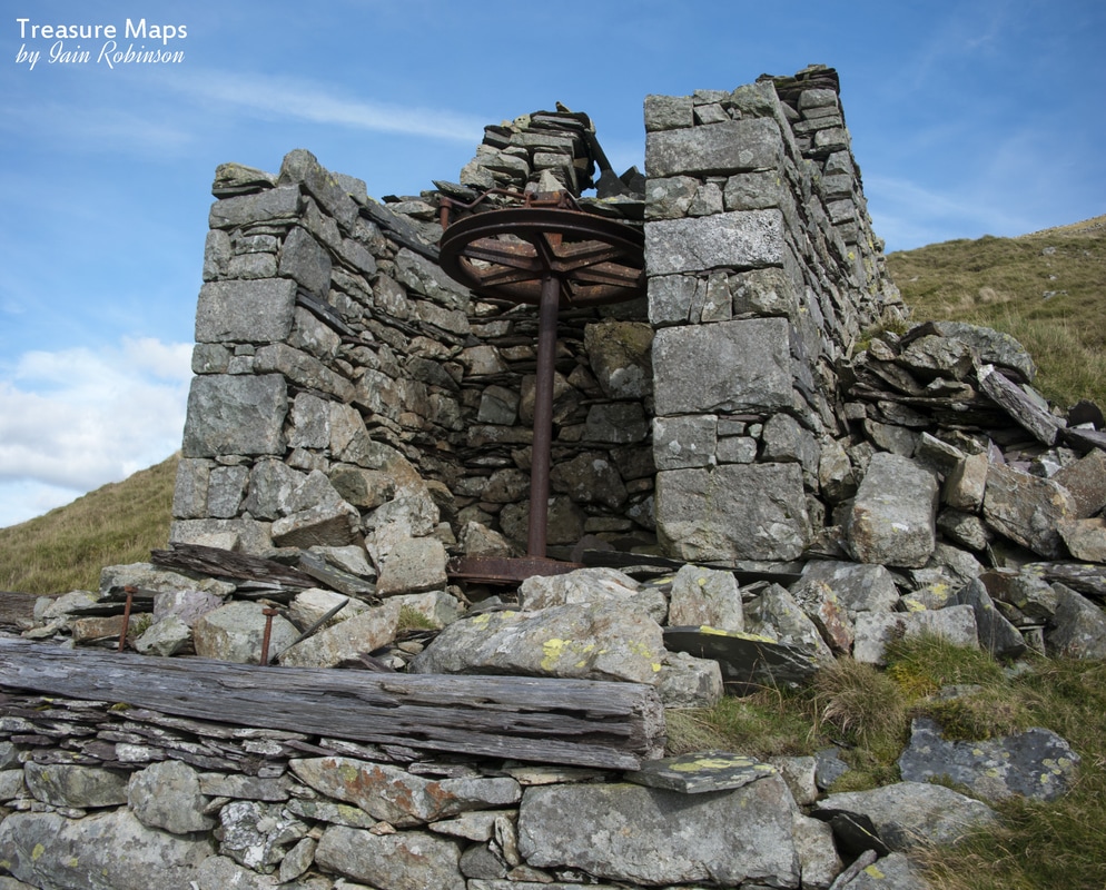 Once we had examined the winch house and gazed out to sea towards Ireland, we sauntered along the level, which had been taken over by the Hydro road. Some of the working face survives; enough to conclude that this wasn't the best Dinorwig product. The surge pool now becomes only too evident at the end of the level. This was built by the Hydro people to compensate for the massive rise in pressure when water from the Marchlyn dam is sent down the pipe to the turbines below. Water levels here can change dramatically and very dangerously, so the pool is fenced off in a rather ugly way. There isn't much to see here anyway, apart from the subtle marks of quarrying in the ground; but at least the Hydro people have provided some steps to access the next level down, which is Assheton-Smith. It won't have escaped the reader that a theme is occurring here with these names...Enid was born in 1888, the daughter of George William Duff and Laura Alice Jones (later to assume "Assheton-Smith" on inheriting the estate) while Assheton-Smith seems a strange vainglory, given the desperate nature of the search for saleable slate reserves. We had now, by walking across the top of the quarry, arrived above the Braich district. It is possible to descend down towards the Australia level from here, should the fancy take you, although it would be a stiff walk back! On this side of the quarry there are some poignant remains, small weigh houses, cabans and blast shelters, lying seemingly forgotten. In one hut, itself almost destroyed by massive blocks of rubble from the making of the surge pool, we found some original core samples. These were presumably from when the level was being prospected. We put them back under some slate for someone else to find. 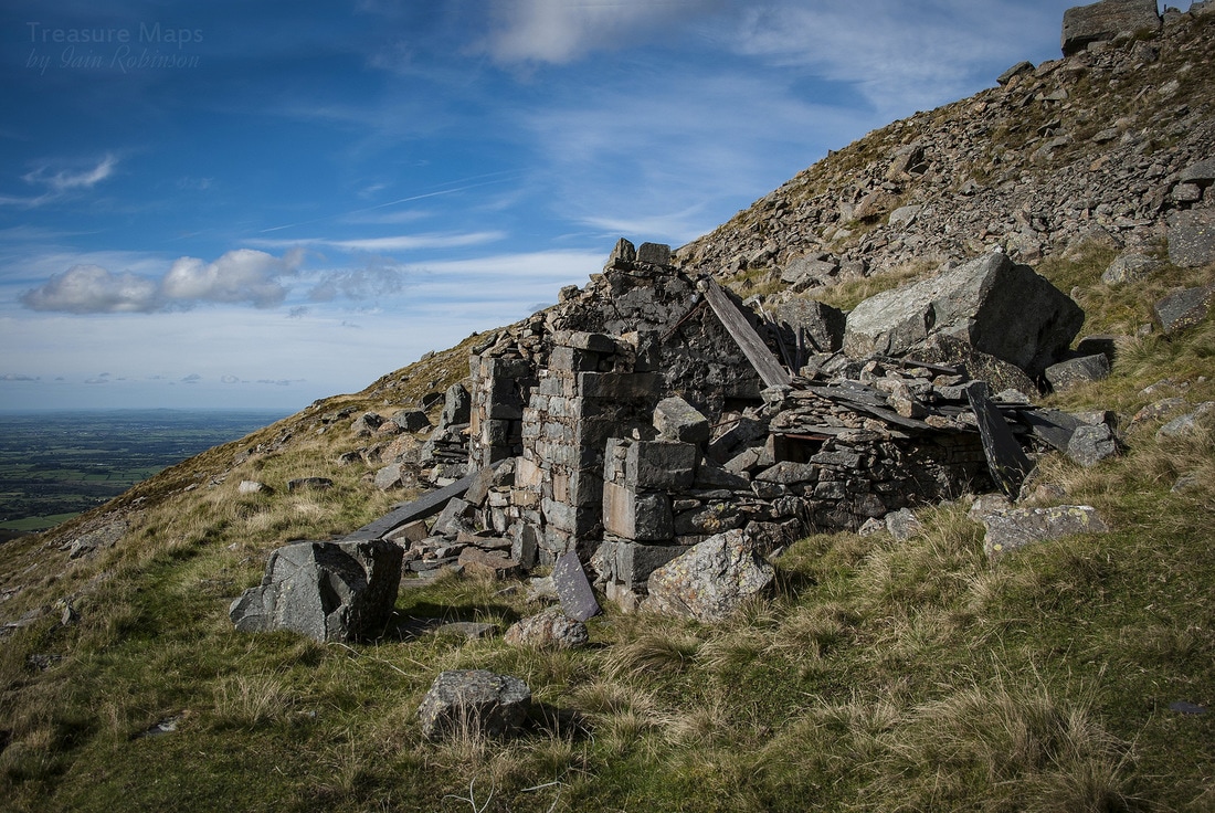 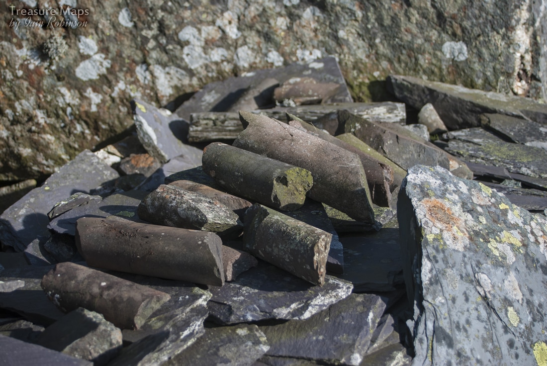 The core samples I find it slightly ironic that history repeats itself here, as the enormous blocks of dolerite from the making of the surge pool were simply rolled over the lip to land indescriminately below, destroying archaeology, sheep and anything else that was unfortunate enough to be in their way. Now it is mooted that stone will have to be quarried for proposals to increase the height of the Marchlyn dam...if these blocks had been stored somewhere more sensible... Finally, we made our way to the massive C10 incline, a dry stone tour de force if ever there was one. This creation is Dinorwig's answer to the pyramids in its sublime lines and construction. It's at a 1 in 3 incline and has a connection to Ponc Aberdaron. Sadly, this incline was never finished and, troubling to relate, there has been a collapse on the top end, so it is no longer advisable to walk on the incline. I still find it hard to credit that each of the stones in the construction of this leviathan have been handled a few times by one, perhaps two men...people now long forgotten. 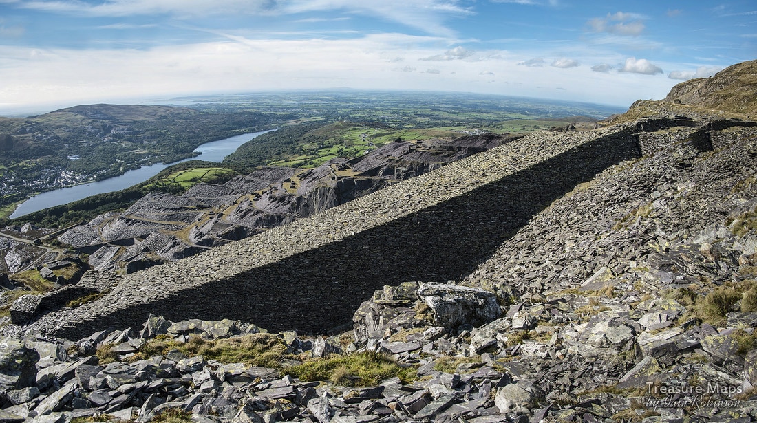 A photo-stitched view of C10, showing the length and size of the incline. 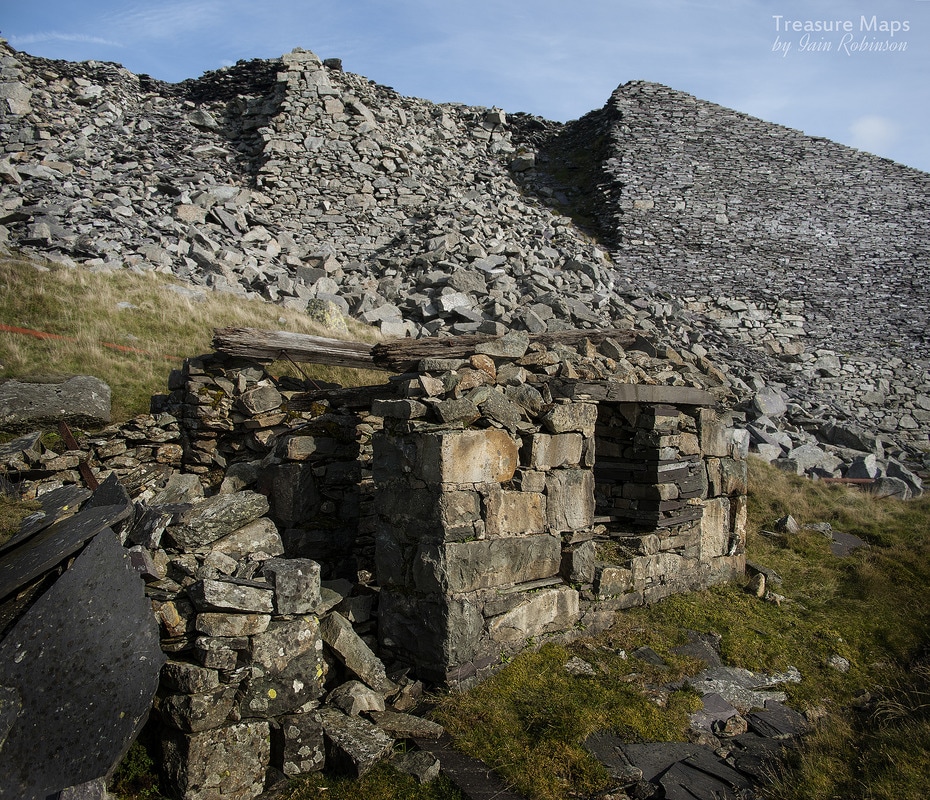 A view of the collapse from Aberdaron. An interesting reflection on the photograph above is that the weigh house was built of country rock, in this case igneous blocks- so it was built before slate was found on the level, whereas the incline was a general construction/transport project and was built from specially shaped slate waste . Both were admirable ways of dealing with waste! This is where the post ends, this time. We trudged back up and over to Aberdaron, then down the road...the fates rewarded us with a wonderful, moody sunset, which made the weary legs feel worthwhile... Grateful thanks to Eric Jones for his always insightful observations and information about Dinorwig. Main printed source for the information here is the book "Delving in Dinorwig" by Douglas Carrington, sadly out of print, but available on Amazon and Ebay. 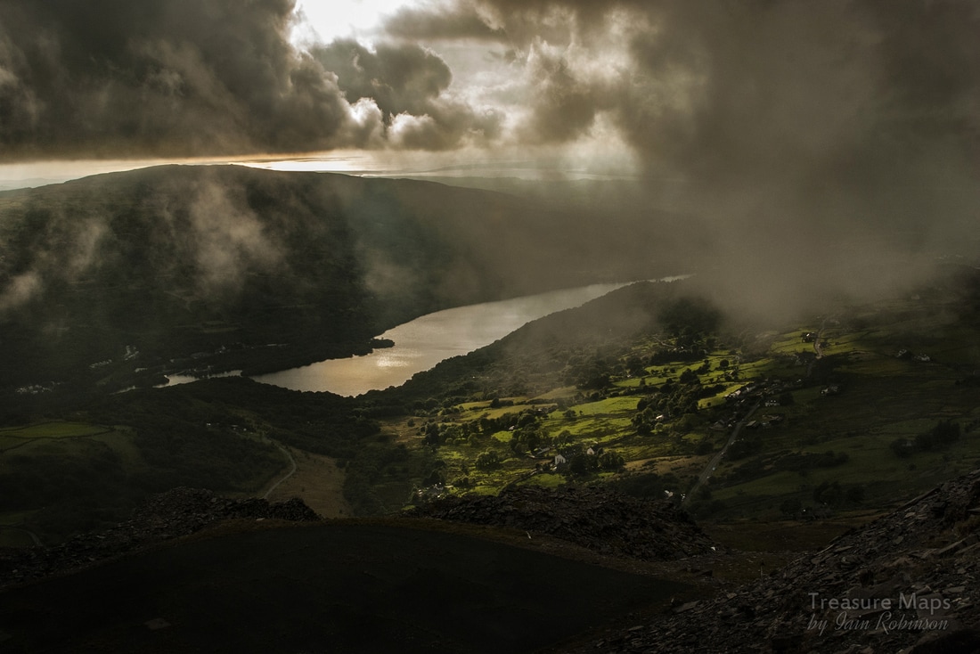 |
TracksReceive the occasional Treasure Maps Newsletter- and alerts when a new post is available!
If you enjoy my content, please buy me a coffee!
Check out my other online activity...
Index
All
|
 RSS Feed