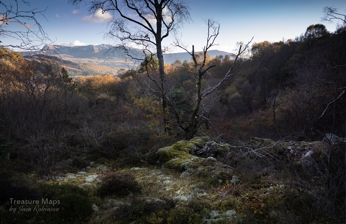
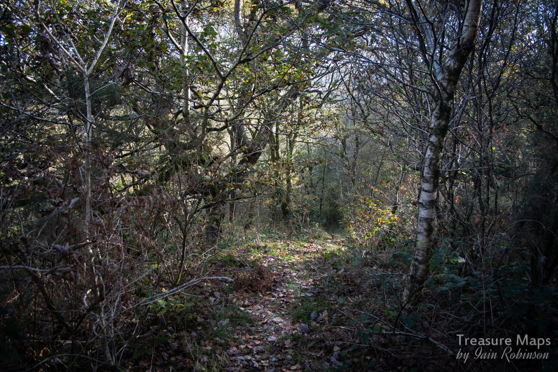
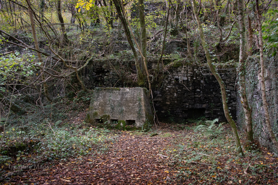
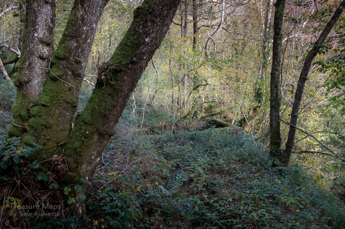
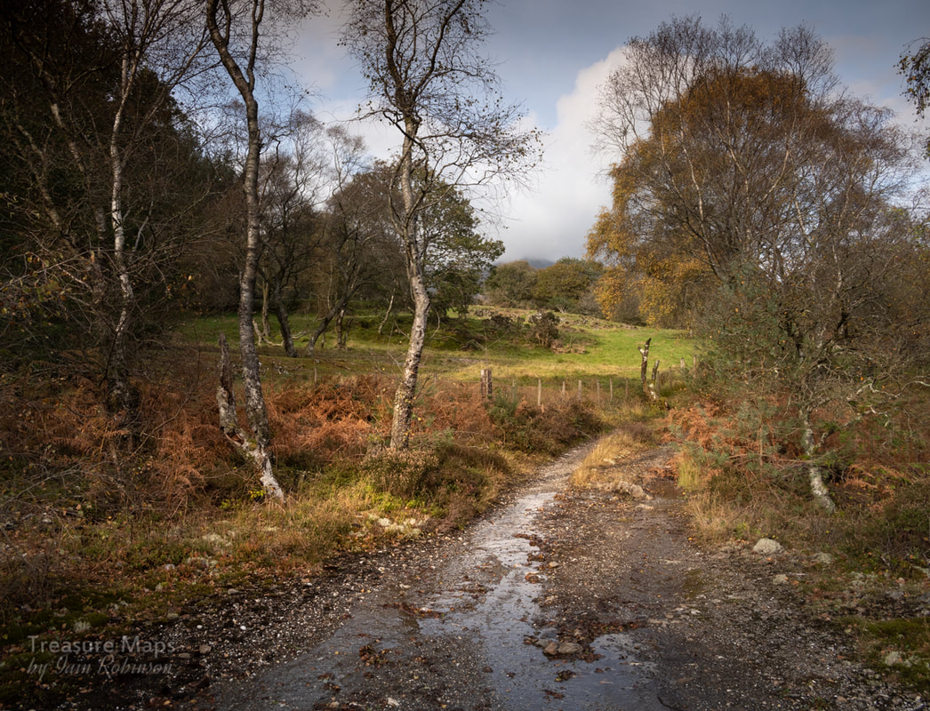
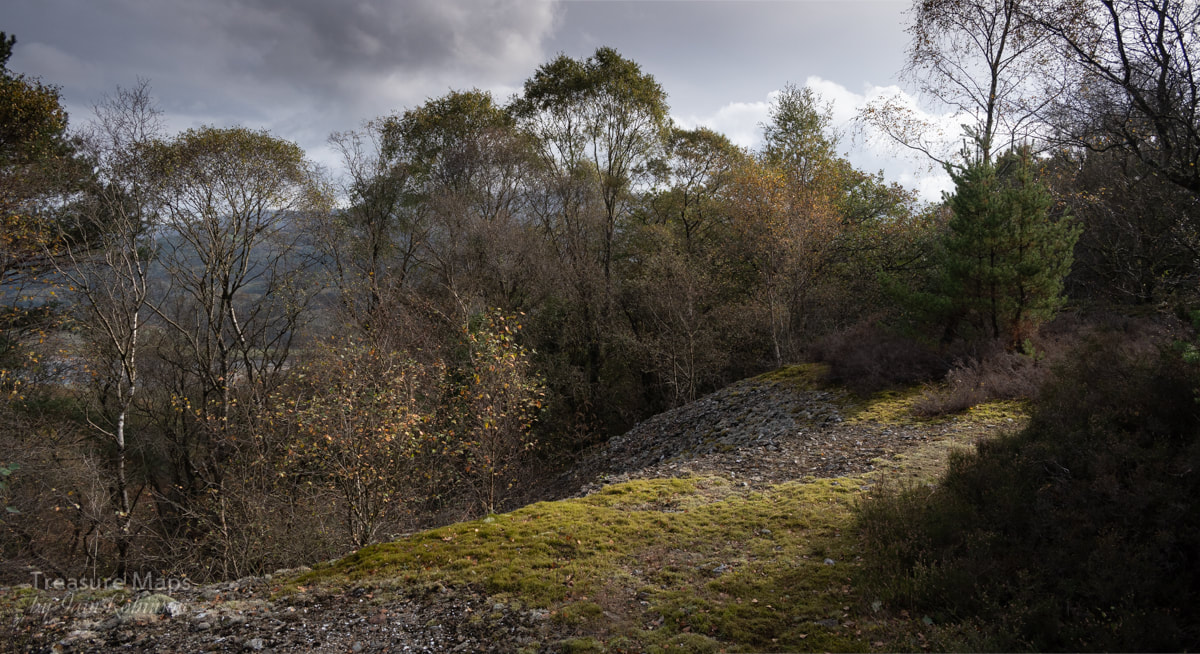
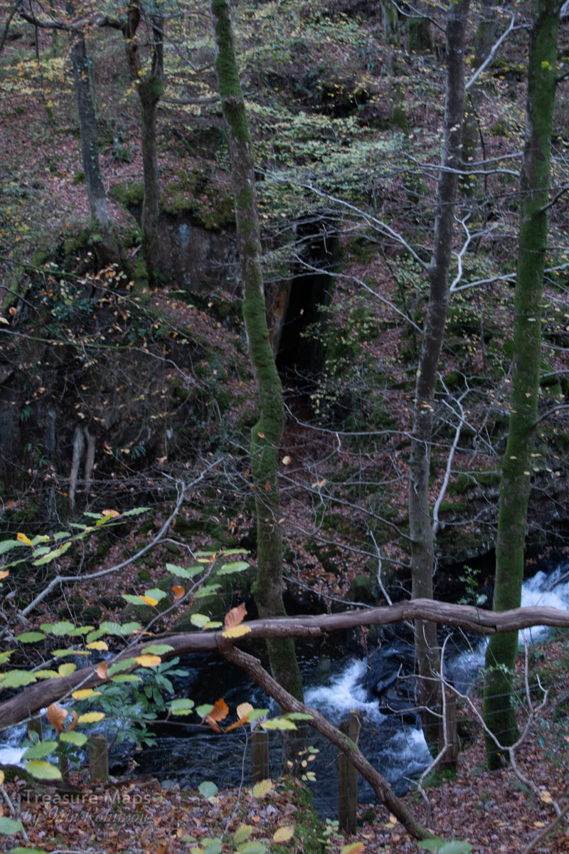
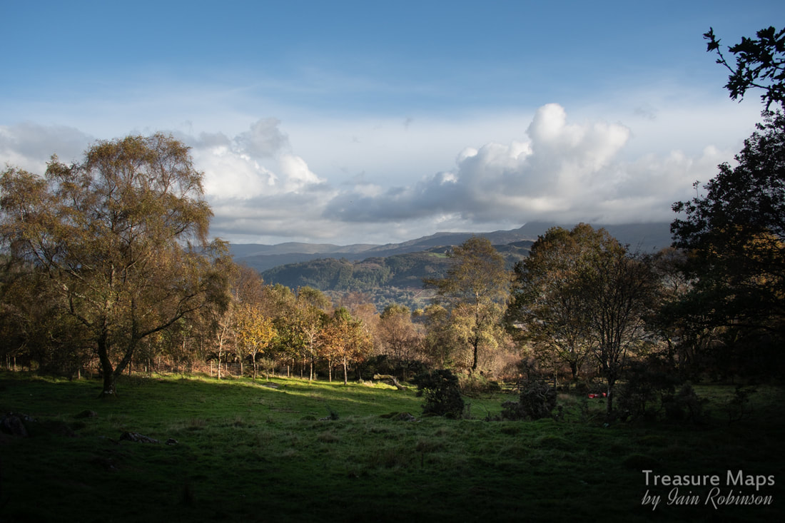
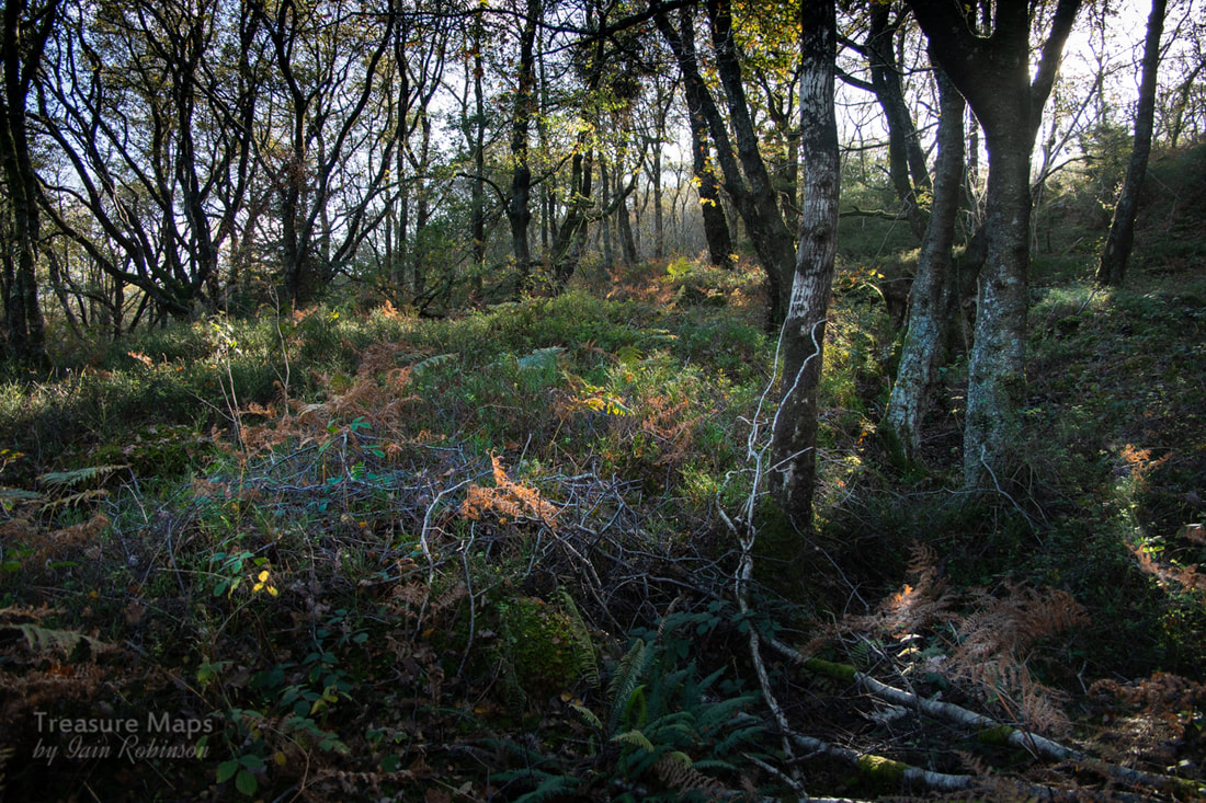
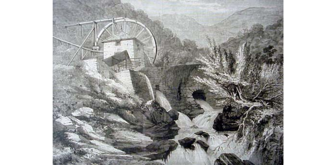
 The remains of the magazine at Figra, with a wonderful view of Cadair Idris in the distance. An old mine, a beautiful river gorge, some woodlands and footpaths- does that sound like a fine day out? We're greedy, we had two days out- we came back a week later to check things that we'd missed first time round. We visited during a fine spell in autumn, probably the best time to see this enchanting place- early spring might be a good time too. I've made a little map at the end for anyone wanting to visit, as there are a number of routes you could take. 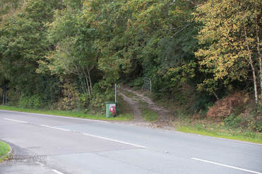 On our first visit, we went straight up from a parking place on the A496 just after Bontddu. The layby is on the left and the footpath directly across. There are paths that are not marked on the map, but most are signed as footpaths, so you should be fine. Of course, we went wrong almost immediately, having to retrace our steps and take the path to the left that goes uphill. If you see this arrow, it's time to turn back. After a stiff climb, we arrived at the working area of the Figra Mine (also known as the St David's Mine). There's a lot of spoil; obviously a great deal of mineral was extracted here. Unfortunately, the buildings are all ruined, so it's very difficult to interpret what went on and where. There are a couple of adits on this level, one fenced in and completely overgrown near to the processing buildings, the other a little way back into the hill. This one is collapsed, but a good run of water was still coming out of it. 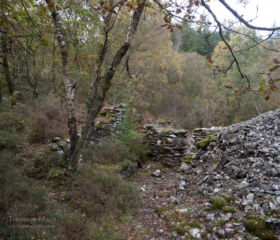 Our first glimpse of the mine coming up the path. There's an adit to the left in the woods, and one straight ahead, disguised by thick tree growth. The trees are all of a certain age, probably around sixty to seventy years old. 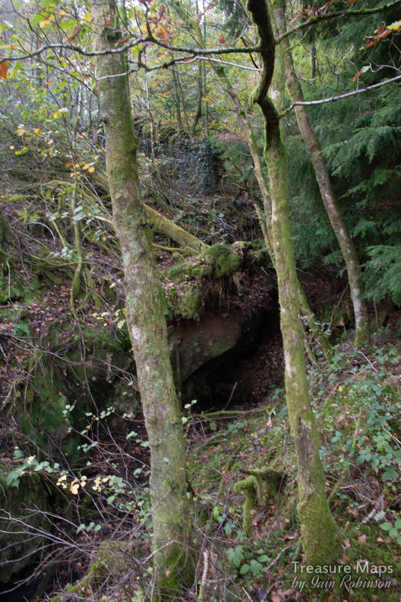 The collapsed lower adit. There looks to be an office or perhaps a smithy within the processing complex- it was so overgrown that it was hard to tell. One side is buttressed in the way that mine buildings tend to be when they start to subside. There were some minerals, notably a chunk of quartz with a little Erythrite showing. We left it as someone had thoughtfully placed it on a wall for others to see. Mineral collectors have, however, been working the site over, betrayed by their round depressions in the tips. Erythrite has no worth, but was used by the old man as an indicator of cobalt and silver in the ground. There were no signs of machine bases or the usual copper mine Buddle pits; it looked like all the work here had been done by hand. 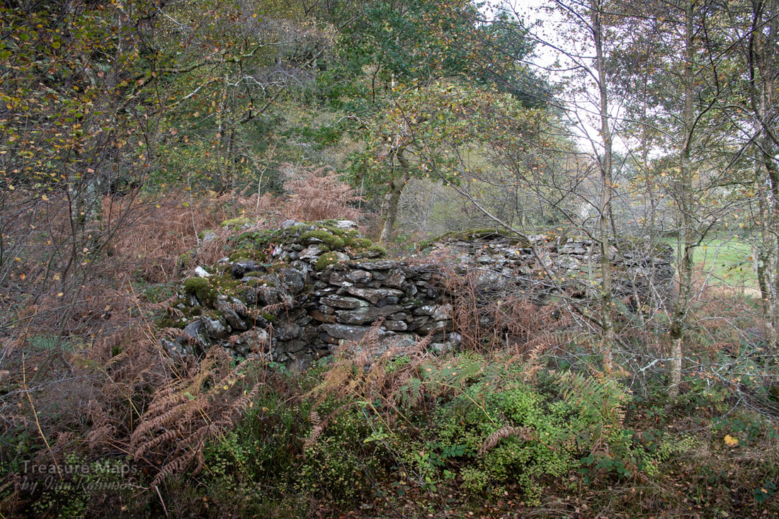 The mystery building, buttressed to the left here. 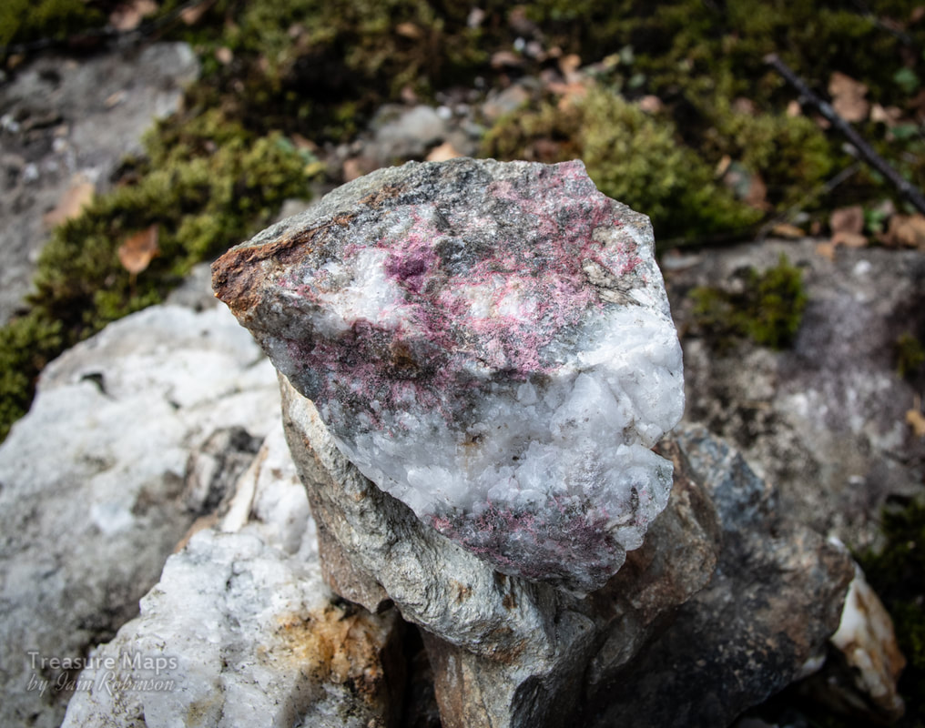 The small specimen of Erythrite found in the spoil here. 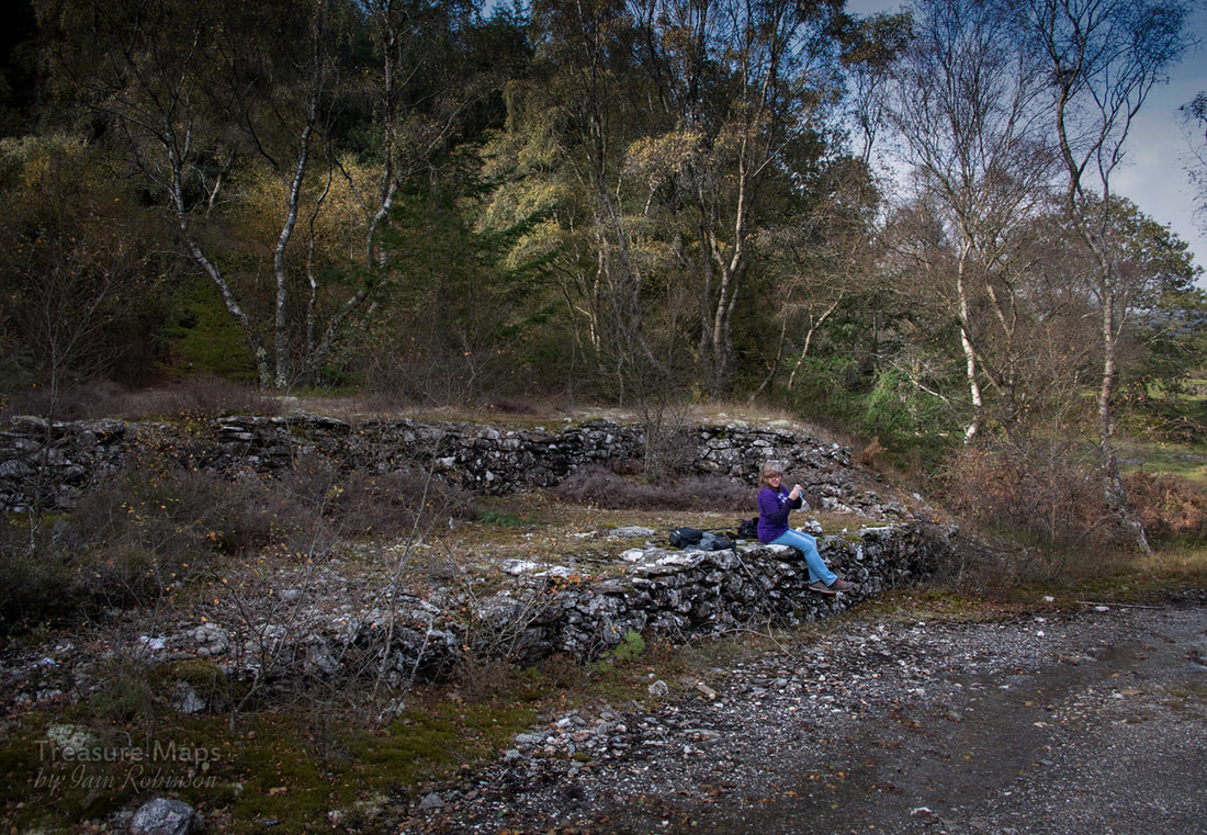 Lunch time in the processing area. We struggled through a mature forestry plantation above the mine to find two tandem adits behind a paling fence. One goes to a winze, which presumably communicates with one of the lower adits- by the looks of it, all the useable ore was taken out this way. The left hand adit, curiously, communicates with the right one and goes in a way. Unfortunately, the roof is extremely dangerous, holding many tons of rock above, supported by rotten stulls. Looks deadly- not a place to hang around! 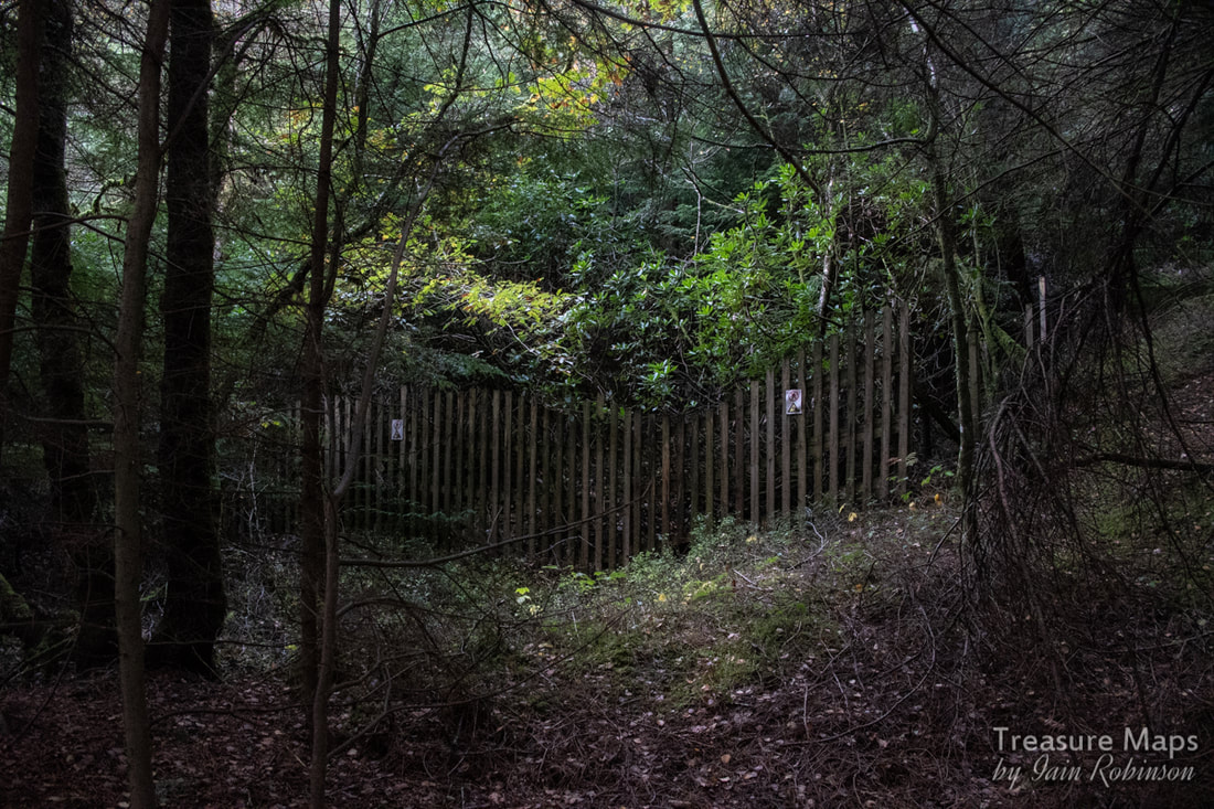 The inviting sight of the tandem adits at the top of the site. 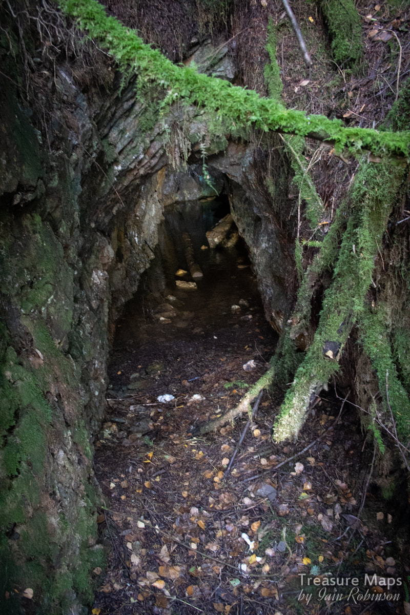 Looking in to the left hand adit. Back outside, we looked about and found the remains of a dam a little bit further north from the mine. The maps suggest that it pre-dated the mine, it is marked as a relic even in 1880. I couldn't work out how the rock had been processed, there was no sign of a waterwheel or leats. Mystified, we went home, determined to research more and return. 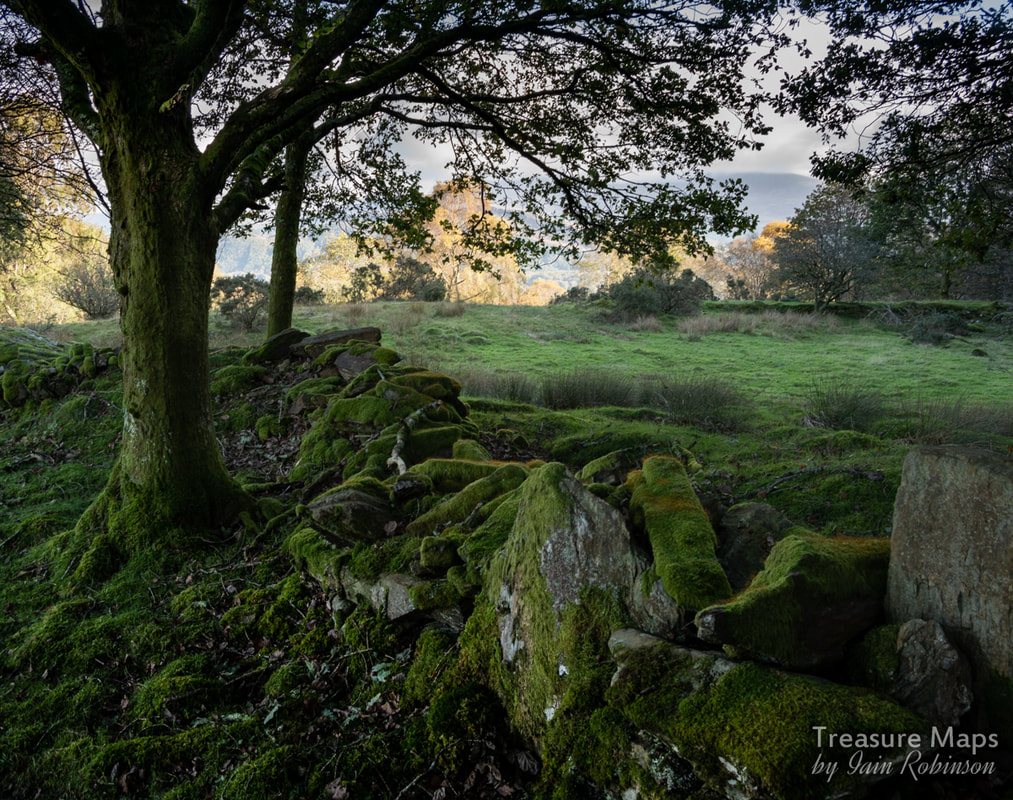 Looking south towards the mine, the dam wall can be made out going left to right in the middle distance. We returned on a very fine Sunday afternoon. While everyone else was playing football and having barbecues in Barmouth along the Mawddach, we were enjoying the beautiful colours and peace of the Bontddu Glen and the Afon Cwm Llechen. I'd found out that there had once been a big processing plant near the river, shared with the Clogiau gold mine on the other side of the valley. We headed upriver, along a road that had originally been a mine track, towards Figra Bridge. The road passed several shafts in the side of the gorge, while mature Beech trees provided a beautiful yellow canopy, their fallen leaves deep underfoot. 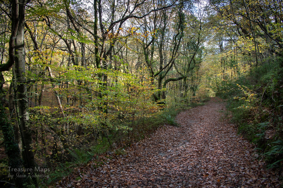 Looking back down to the road, along the mine track to Figra Bridge. 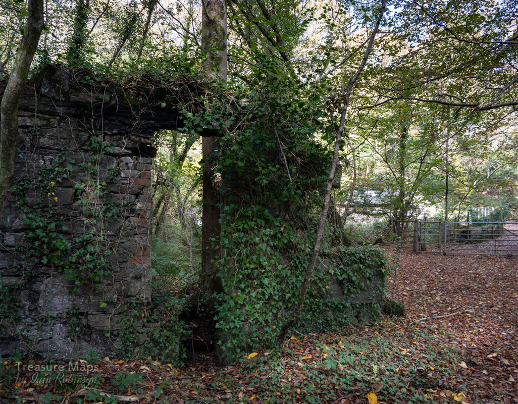 The remains of the mill at Figra Bridge. At Figra Bridge, there was little remaining of what had once been an impressive structure. A couple of stone walls and some concrete machine bases hinted at the hustle and bustle of a busy mine mill. Nearby, a water turbine generator hummed in a small building, a nice echo of the activity a century earlier. We didn't cross the river at the bridge, but took a path upwards to the left, passing some stone and concrete holding tanks for the waterwheel at the mill. 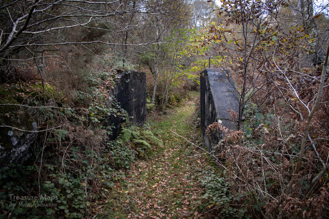 I didn't realise at the time, but the path here, going up from the mill, was the bed of an incline. The penny dropped when we found the drum house straddling the path and noticed that, yes, the path was rather well revetted! Petra spotted some tips in the woods here, to the left of the path and went off to investigate. This seemed to be the area marked on the O.S. 1887 survey as a "Level" and as we had thoughts of unknown archaeological finds, we bashed through the boskage in keen style. It was tough going, with gorse and bramble vying with young birches to impede us. Like something from a lost Mayan kingdom, an incline rose up from the undergrowth, almost swallowed up by trees and vegetation. Above, the unusual semi-circular tip ended in a run-in adit, as I knew it probably would. It was an amazing spot, though- well worth the scratches and bruises. According to Wilkinson's database, this would have been the St David's North No.2 Mine. 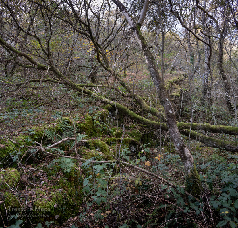 Lost in Boskage- the incline to St David's North No.2. 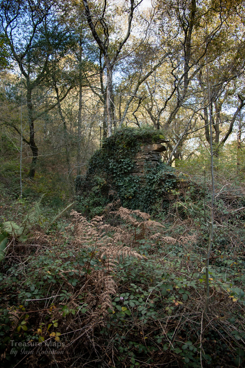 The rather heroic remains of the drum house at the top of the incline. Petra reckoned that this was an excavation on the lode, and that if we made our way upwards through the woods, we might come to more diggings. So we struggled on through unchecked vegetation and birch, oak and holly trees, eventually finding a stream bed that was easier to climb than the steep boskage. But Petra was right. A substantial opencut lay in a flat(ish) area, telling us that we were on the right track. It's a shame that there is no record of the men that dug these mines, or of the captain who decided where to dig and for how long. The opencut was deep and looked as if it had been crowbarred out. It couldn't have been easy work. 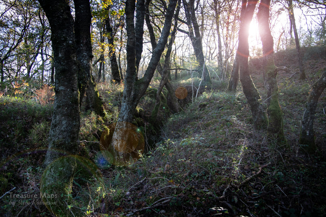 The opencut. Towards the top it was over ten feet deep. Finally, we made it to the top and found the powder store a little way down from the main area of the mine. There was an old incline drum house here, too, presumably from a very early iteration of the mine, as all trace of the incline itself had been lost. I can only assume it must have connected at one time with the lower one, down in the jungle 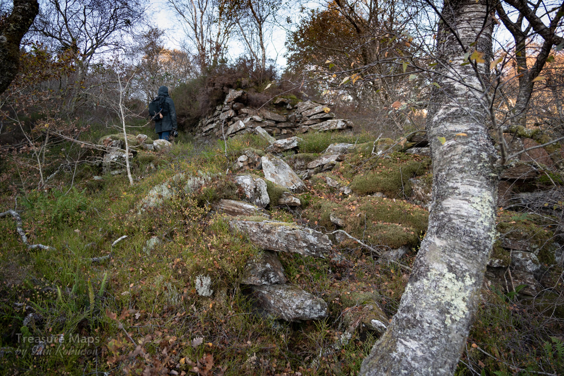 The ruined drumhouse near the magazine. The main processing area is to the left here. After taking much-needed refreshments, we headed off north to try and find the zig-zag track that I had read connected the mine with the mill in later days. Rather embarrassingly it was easy to find and provided an equally easy route back to Figra bridge, passing a couple of old shafts on the way. Why hadn't we done this the first time? Never mind, we'd had a lot of fun stravaiging about, taking photos and finding things in the woods. 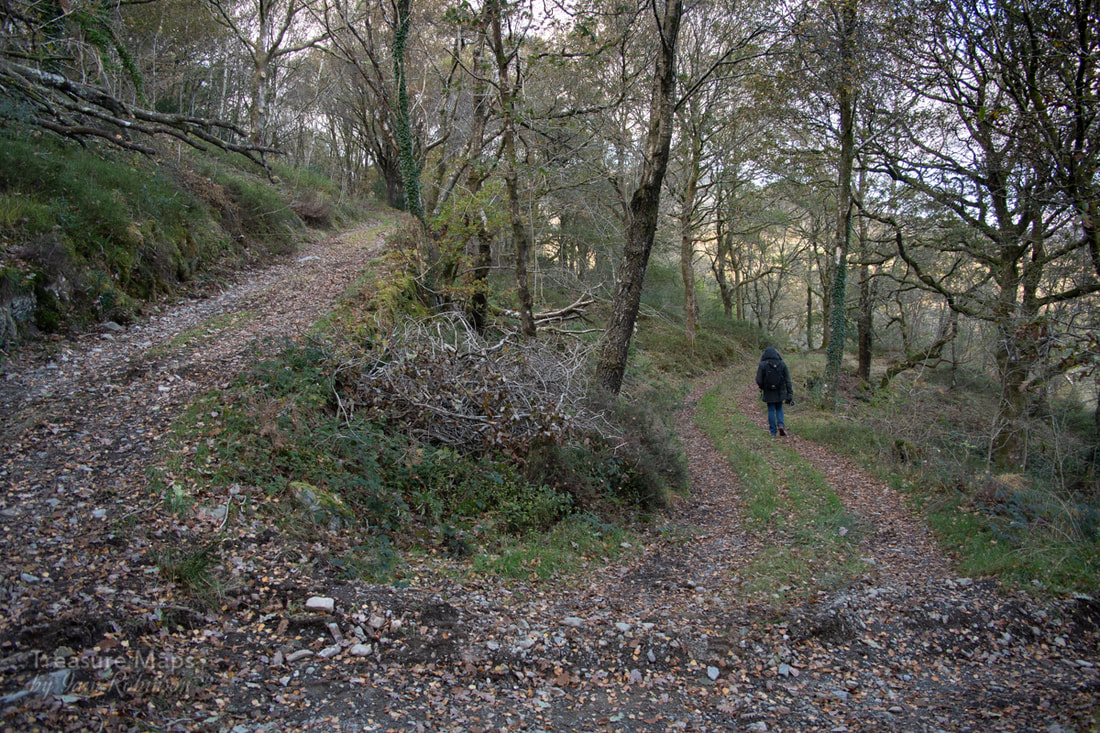 The zig-zag road. The sides were revetted higher up and well engineered- this was no old farm track. It's not strictly a right of way, but ... Back at the mill, we crossed the bridge and took the path on the north east side of the river. From this side it was apparent just how deep the gorge was. We passed another couple of shafts and then the gorge narrowed - the drop on our side to the waterfalls was easily eighty to a hundred feet, and no handrails- not a walk for a young family! The path ended ignominiously very close to a house, coming out into the front garden of a converted chapel...we felt a little uncomfortable until we saw the footpath sign pointing up the way we had come. Parking in the height of the season here might be a little tricky, but we left the car outside the "Halfway House" pub which, sadly, looks rather derelict. 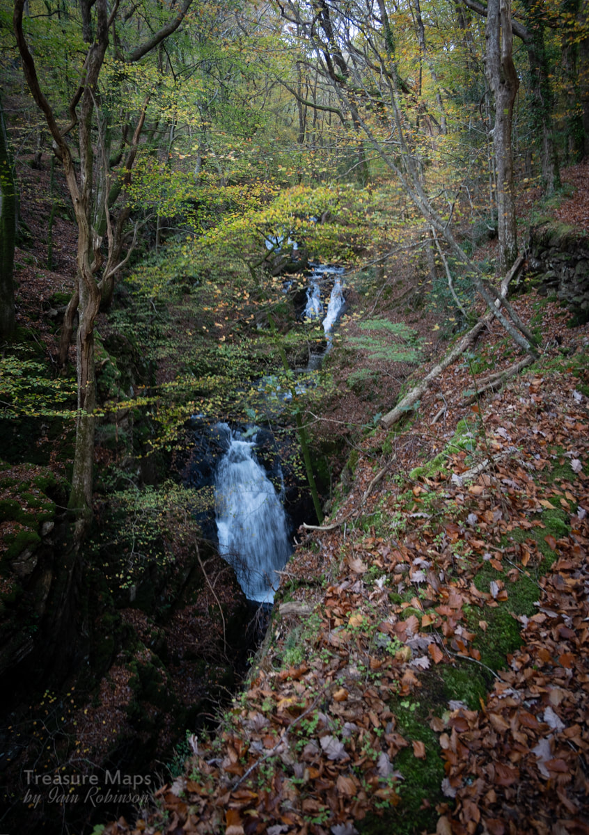 The trackway on the east side of the river- see what I mean about the drop? The Factoids The Figra mine (pronounced "Vigra") was opened in 1833 and was worked originally for copper, then gold. It works a continuation of the St David's lode of Clogiau Mountain. After bankruptcy in 1857, the mine became owned by the Clogiau between 1861-67. Work finished in 1897, although there were re-openings after the first world war - the mine finally closed in 1938. Full details are on the mine's page in Wilkinson's Gazetteer, reached from this link. Further Images of the mine and woods...
2 Comments
|
TracksReceive the occasional Treasure Maps Newsletter- and alerts when a new post is available!
If you enjoy my content, please buy me a coffee!
Check out my other online activity...
Index
All
|
 RSS Feed