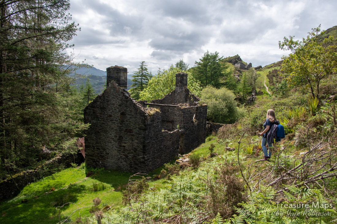
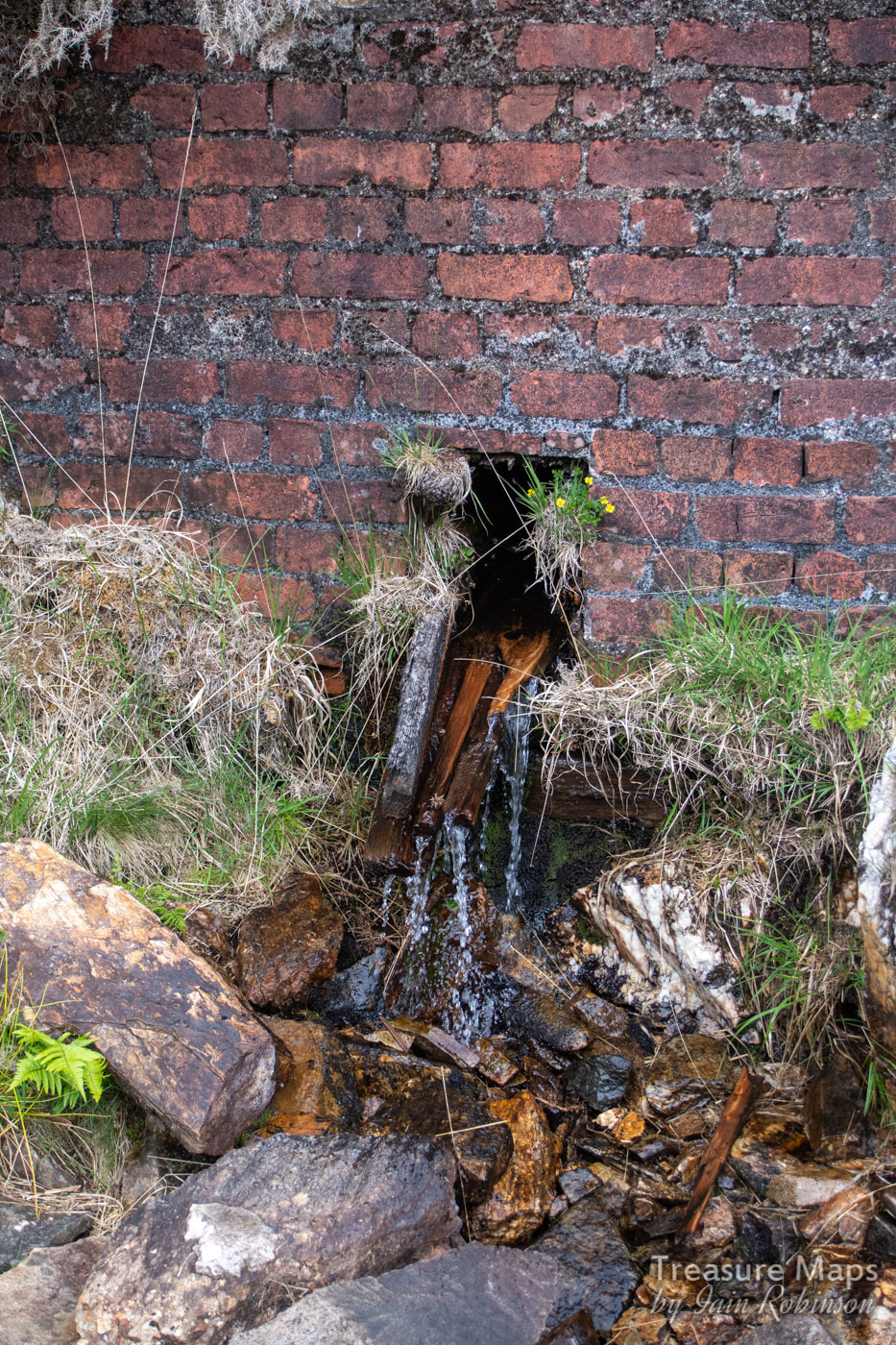
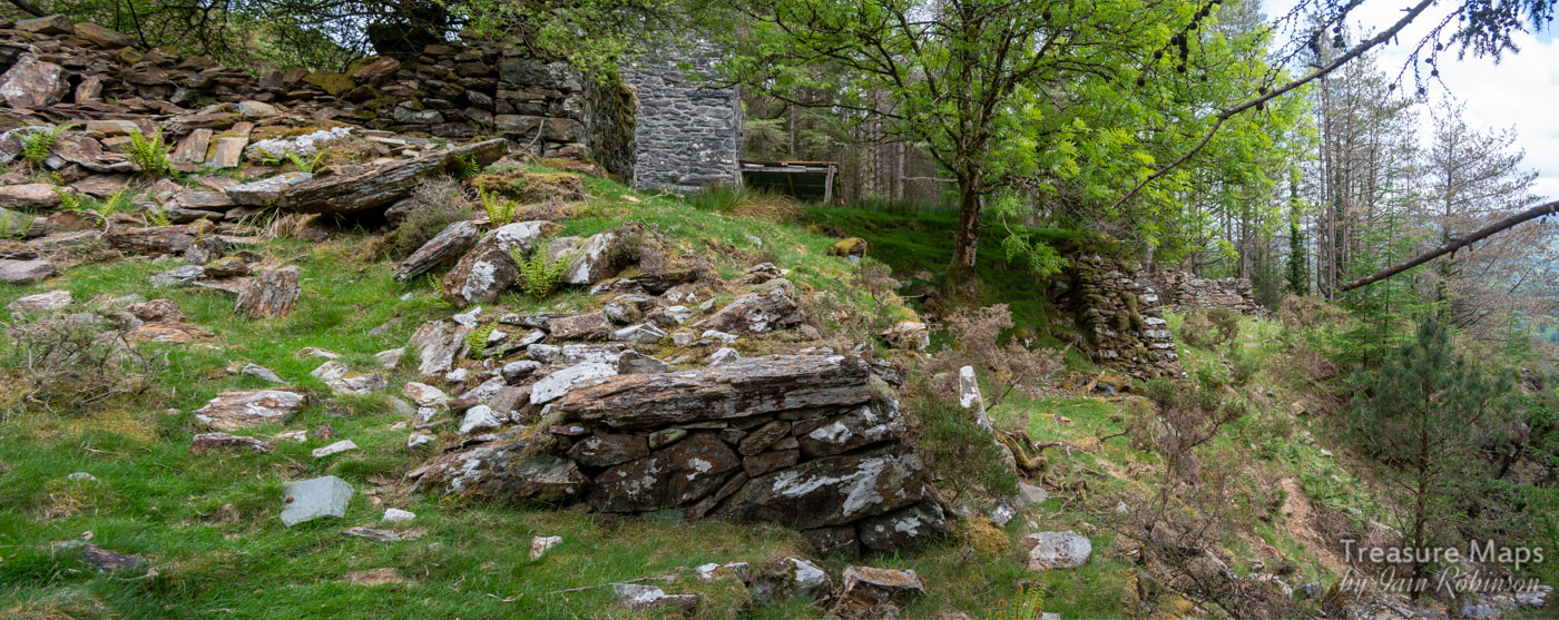
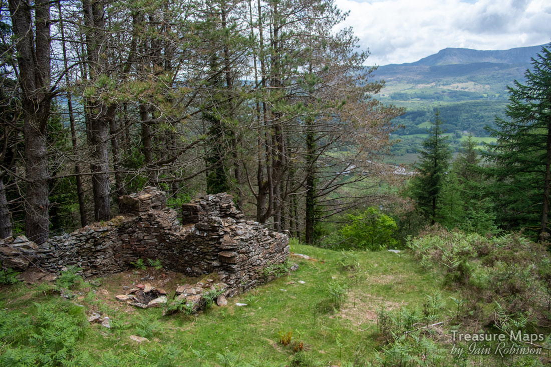
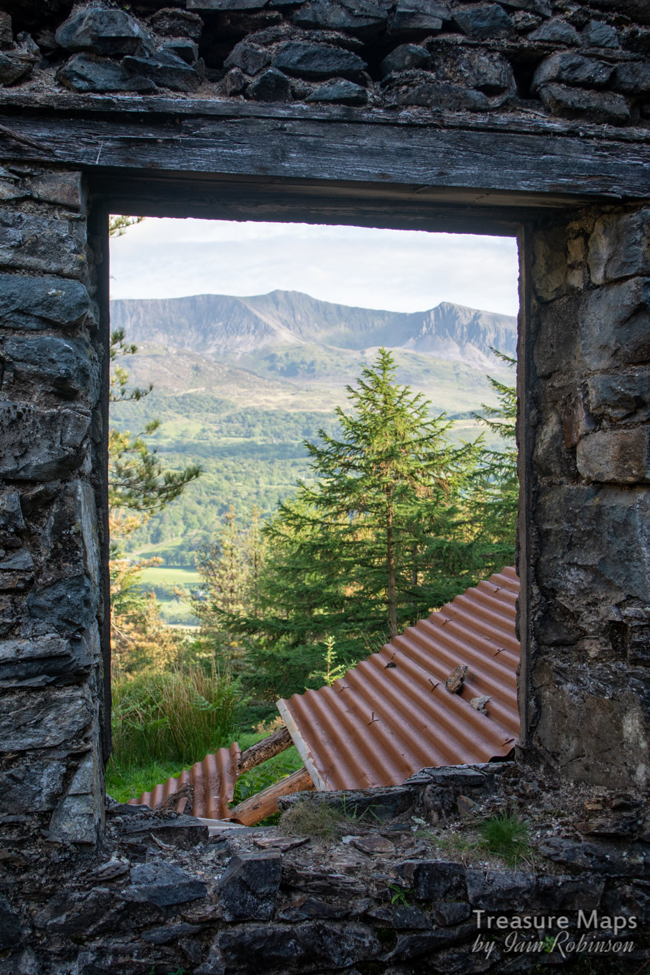
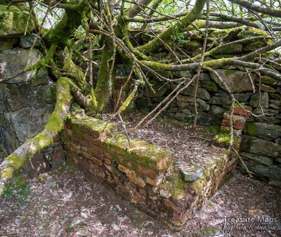
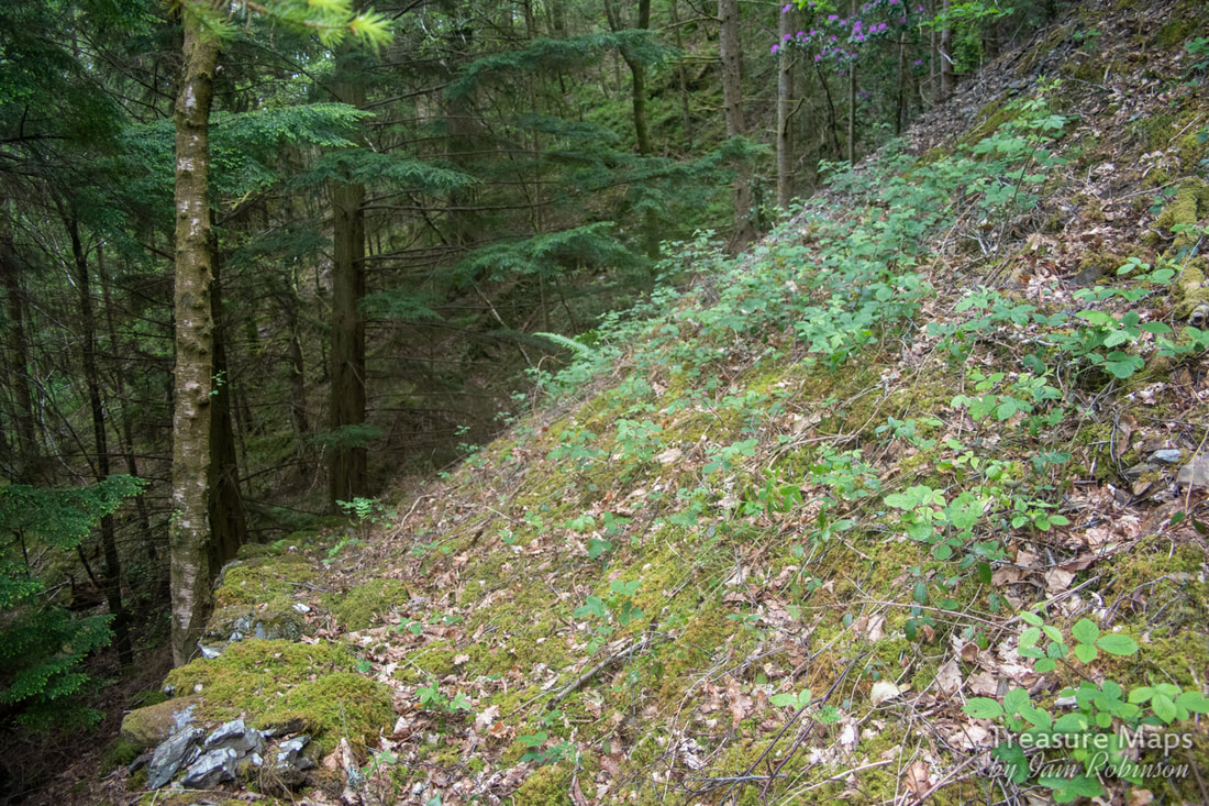
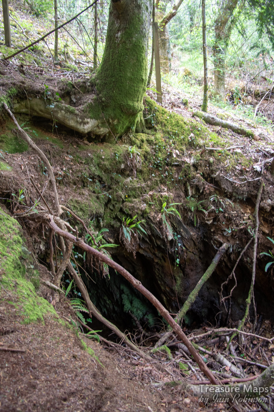
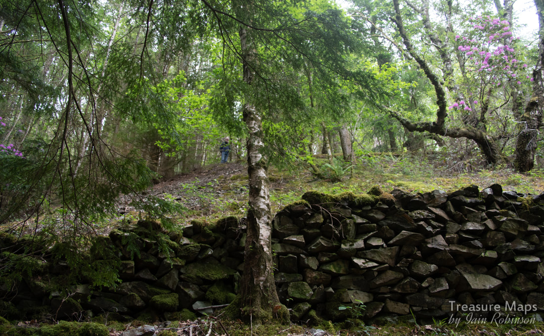
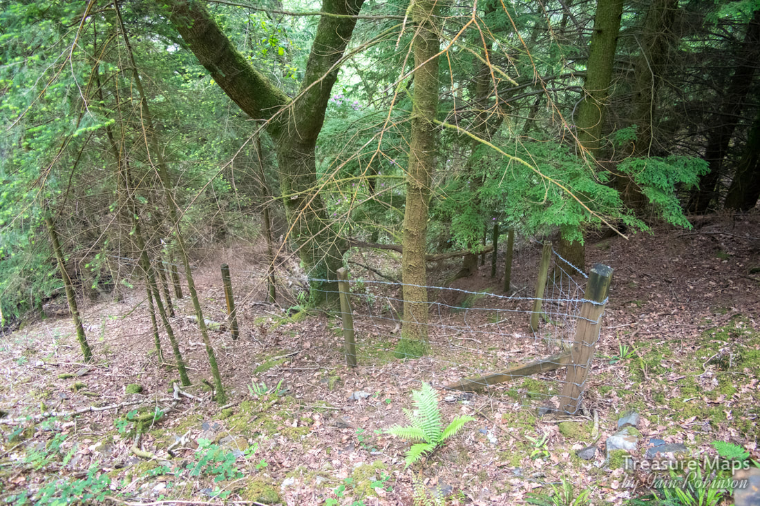
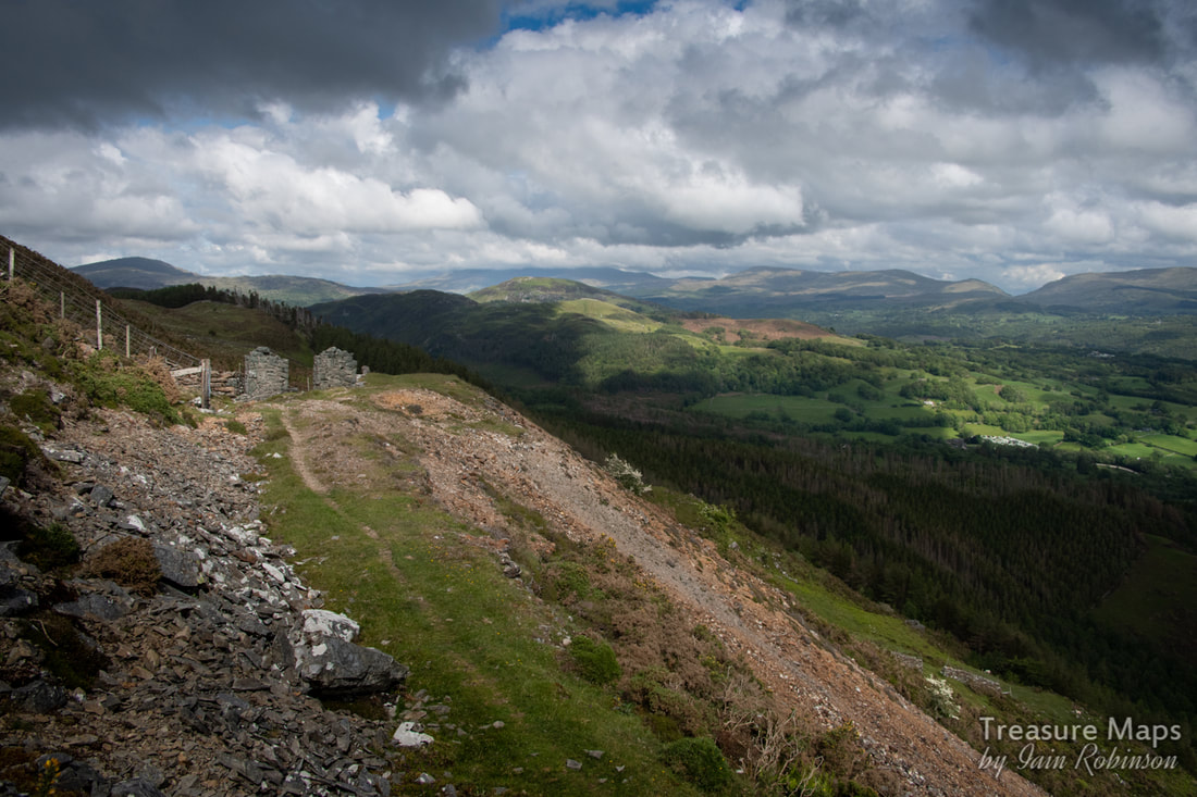
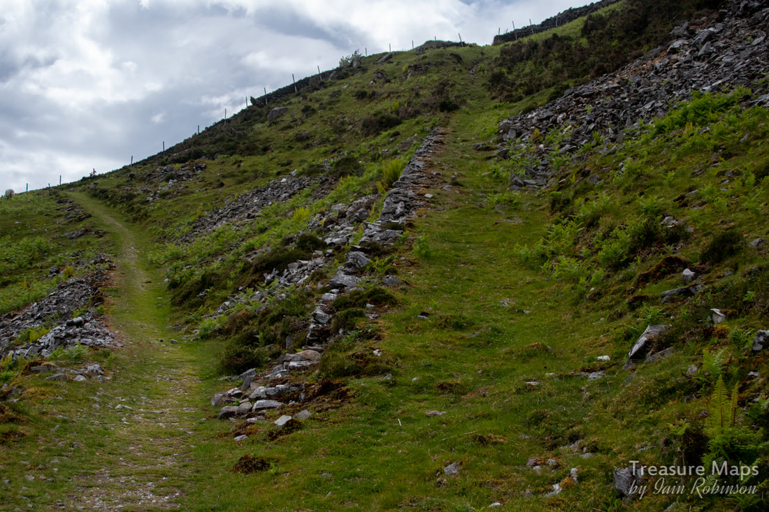
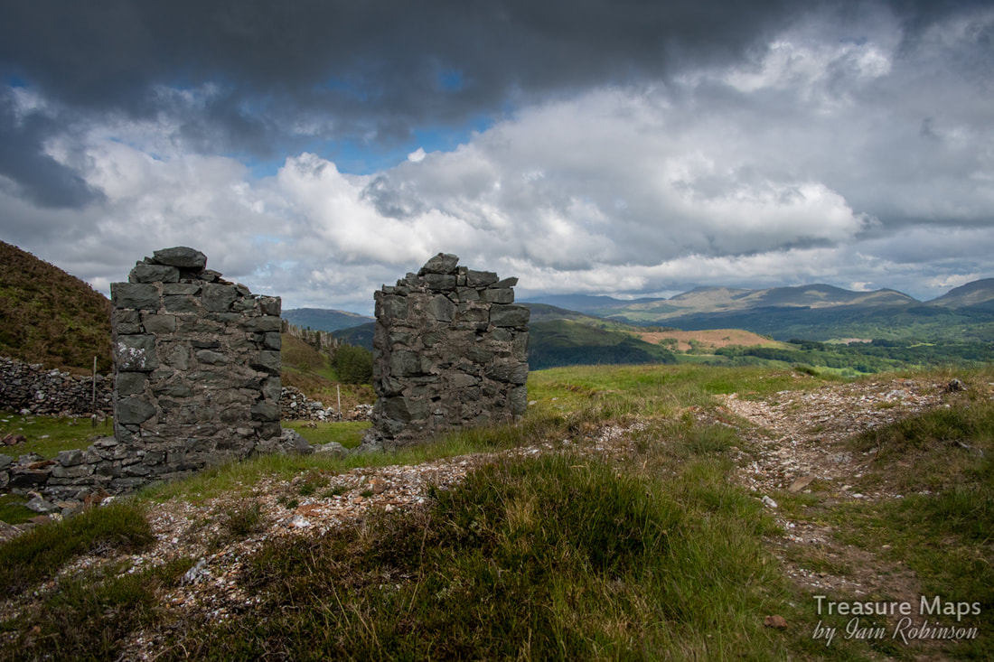
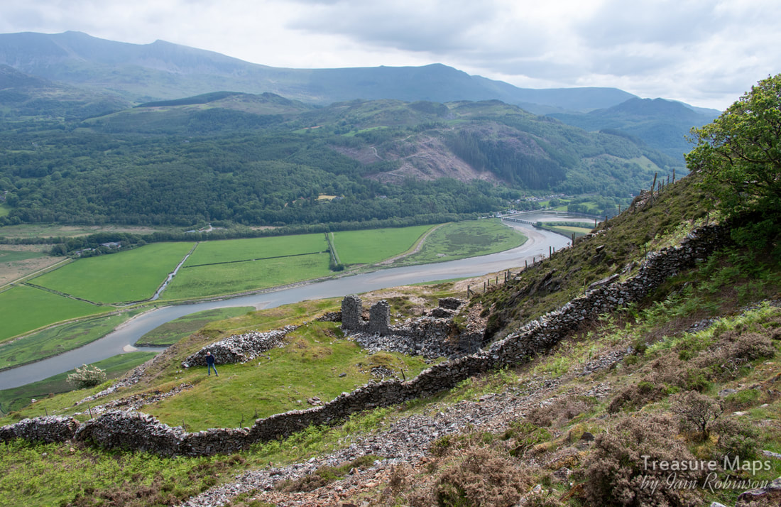
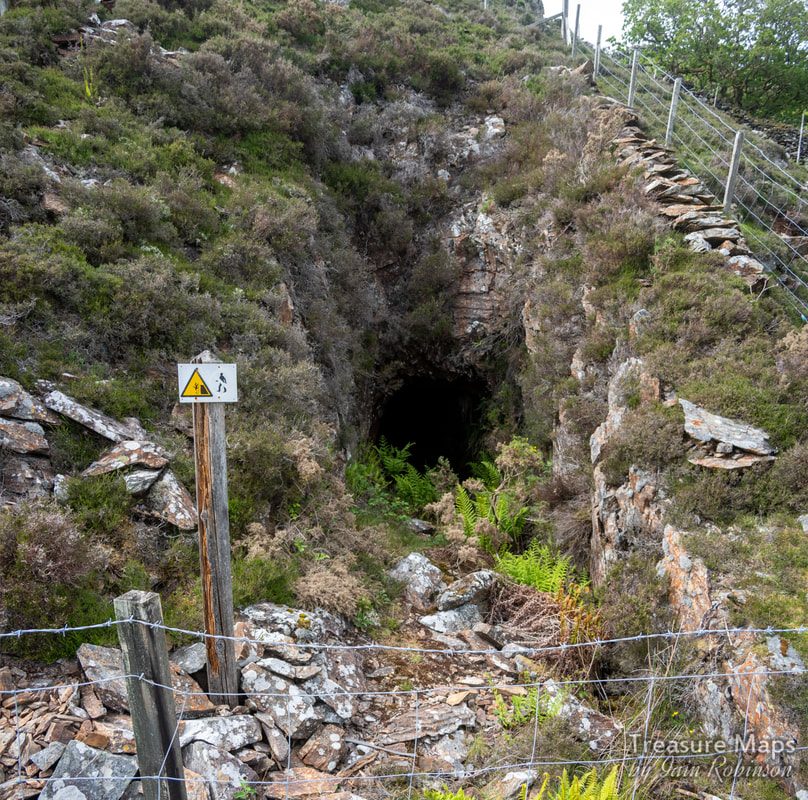
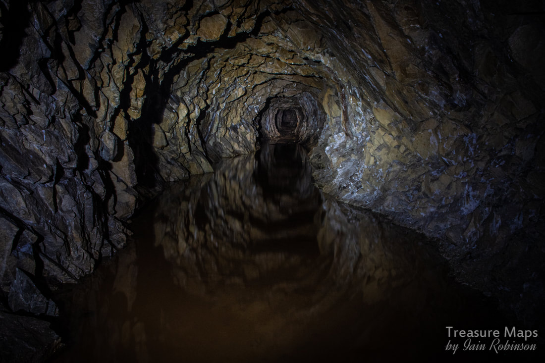
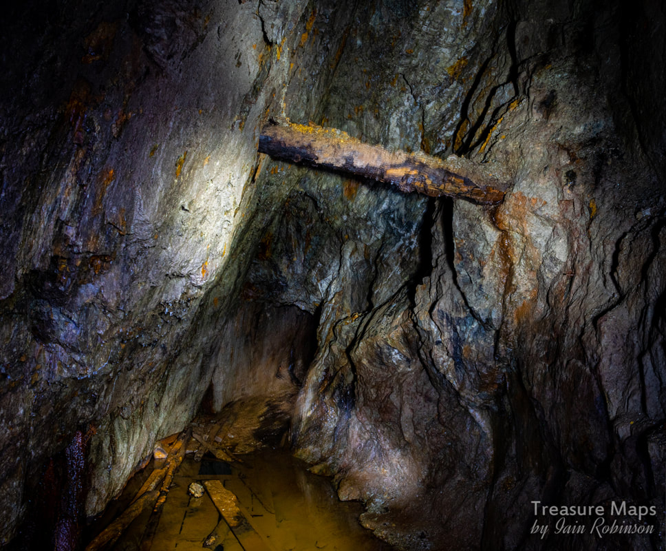
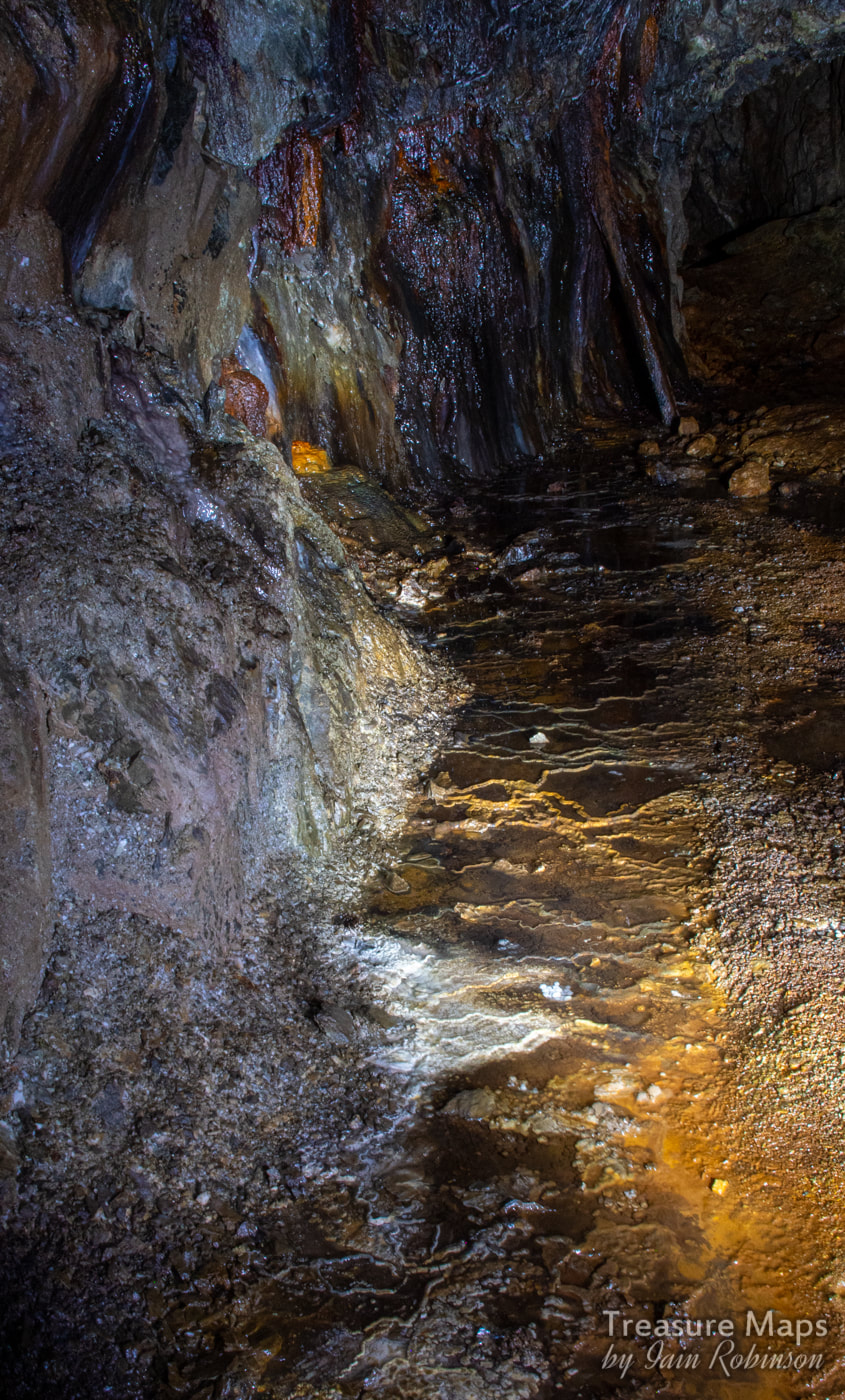
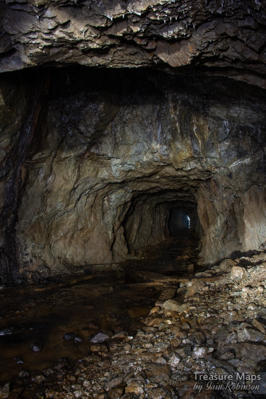
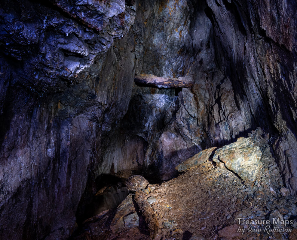
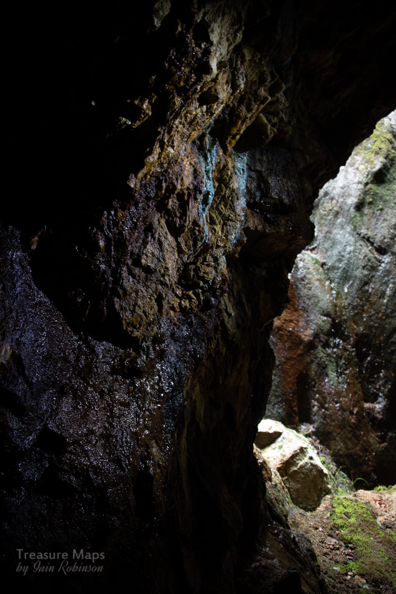
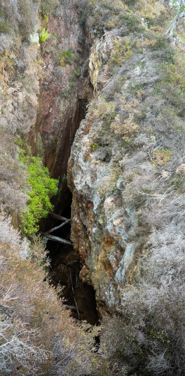
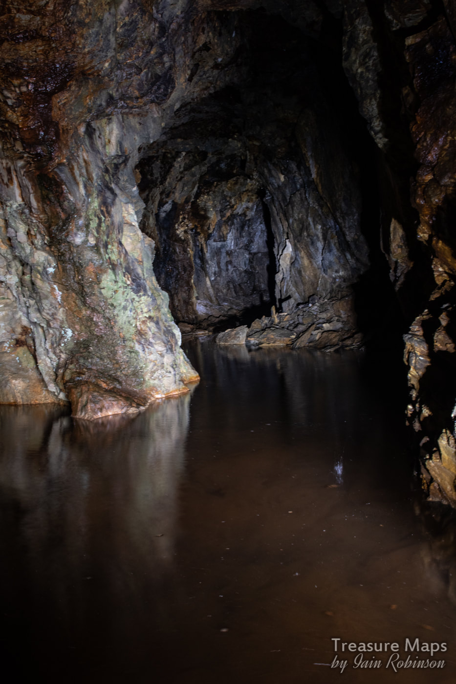
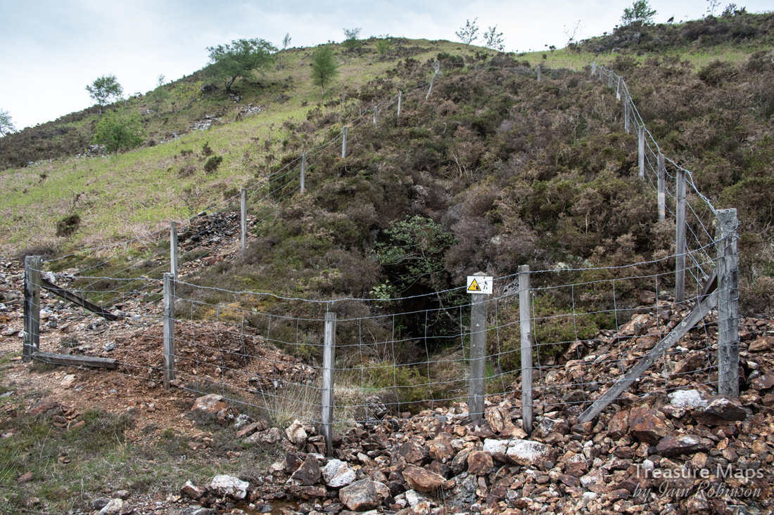
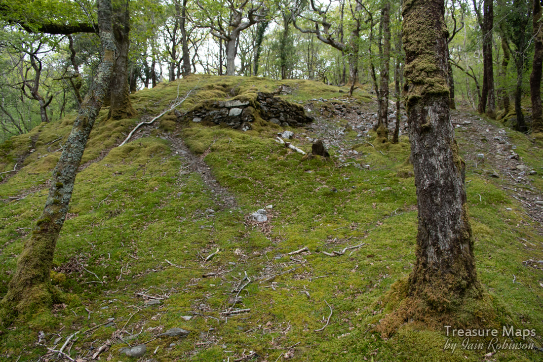
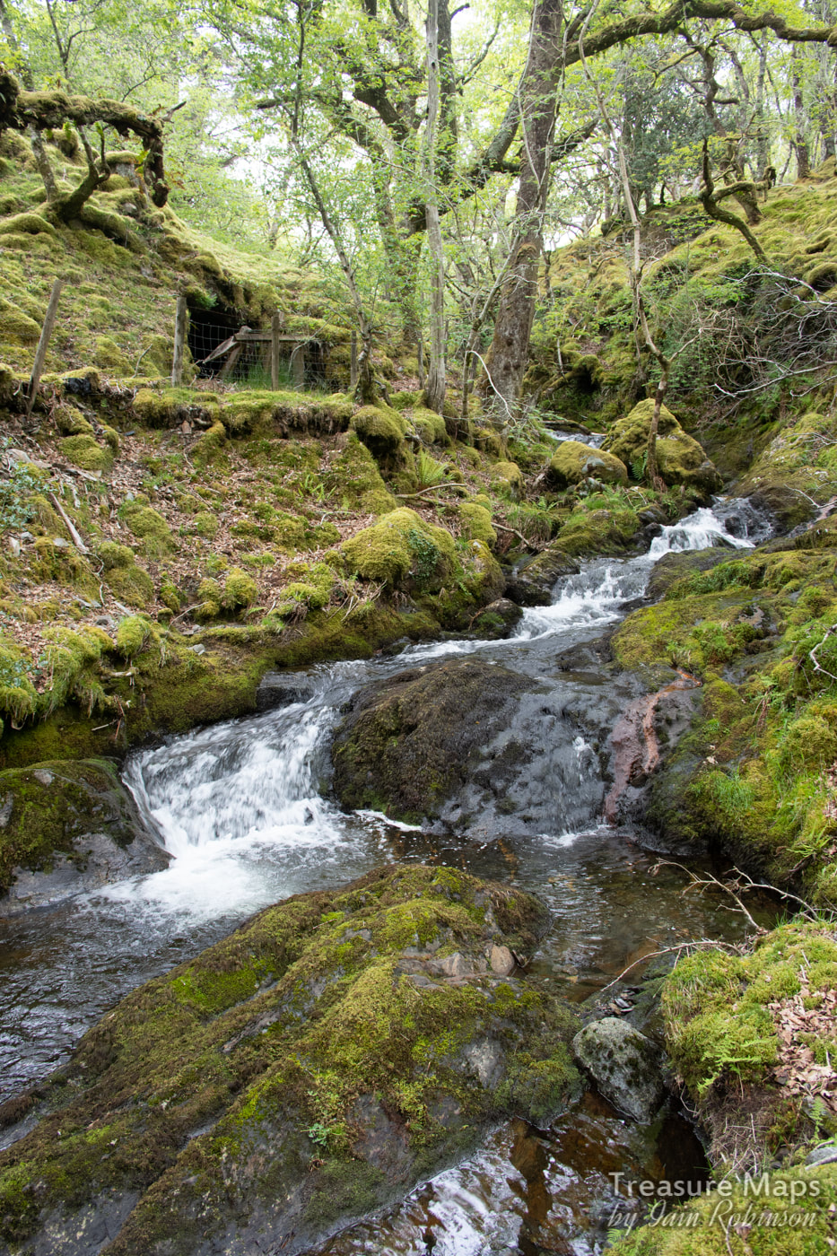
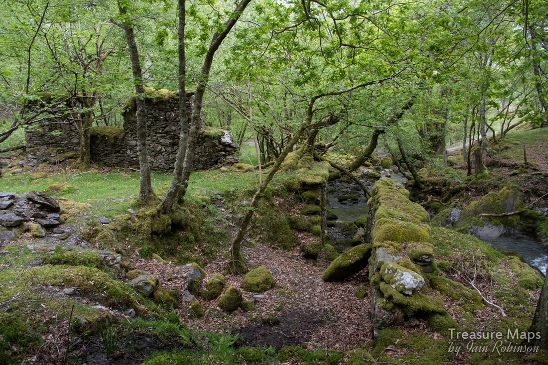
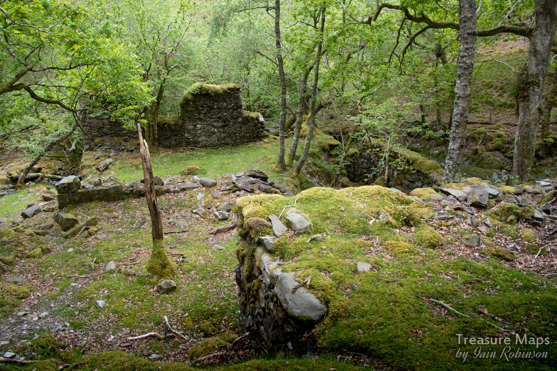
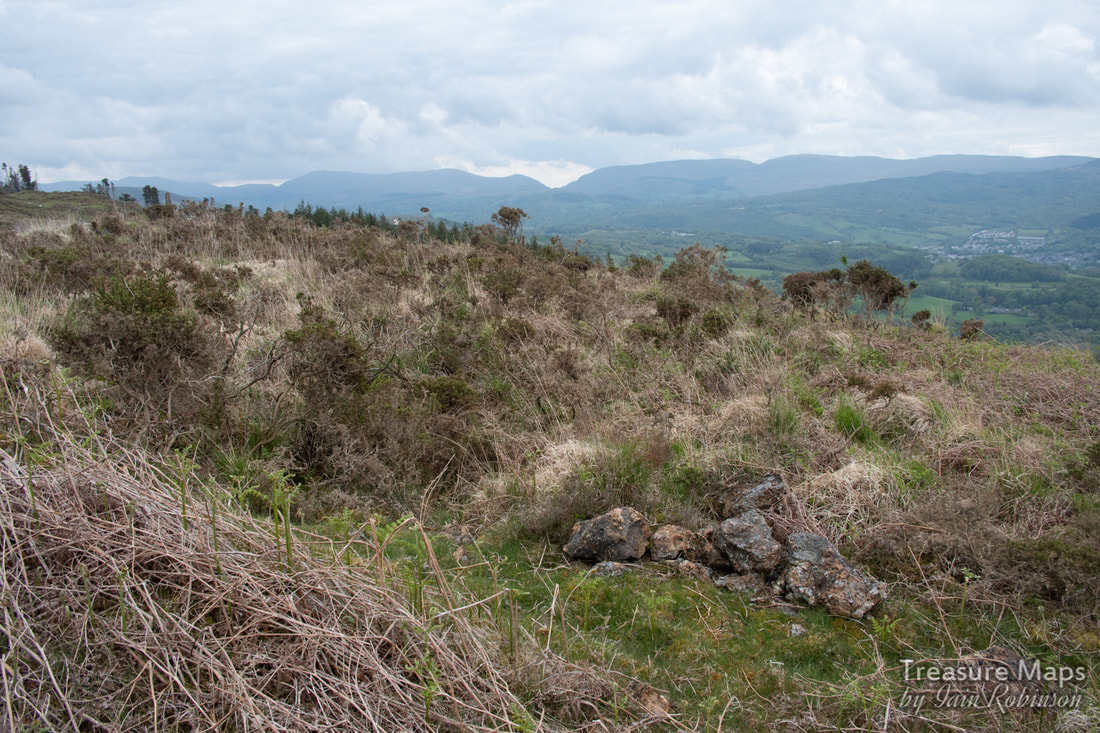
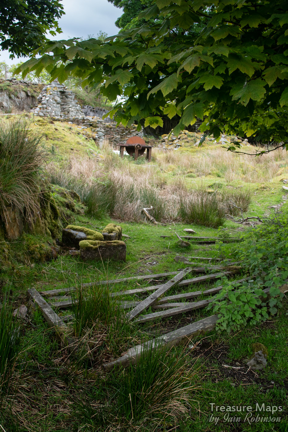
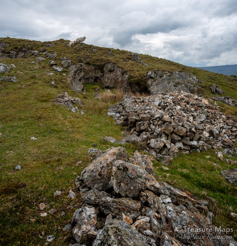
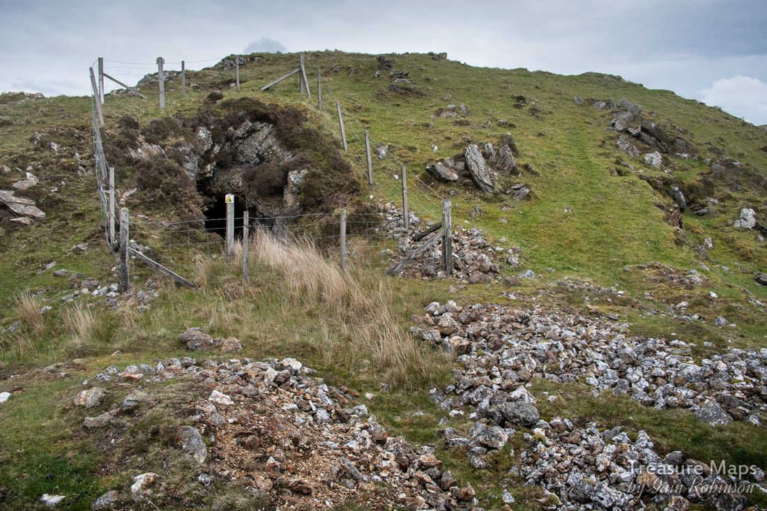
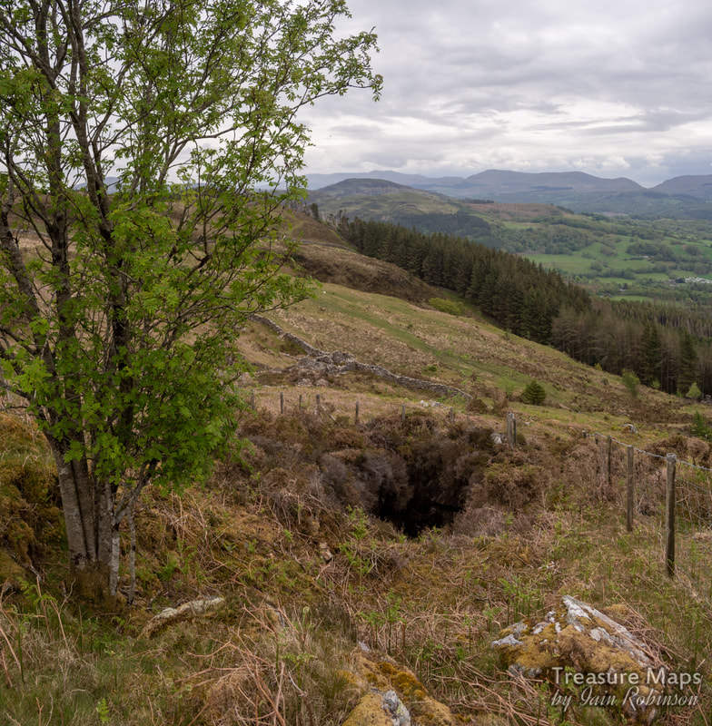
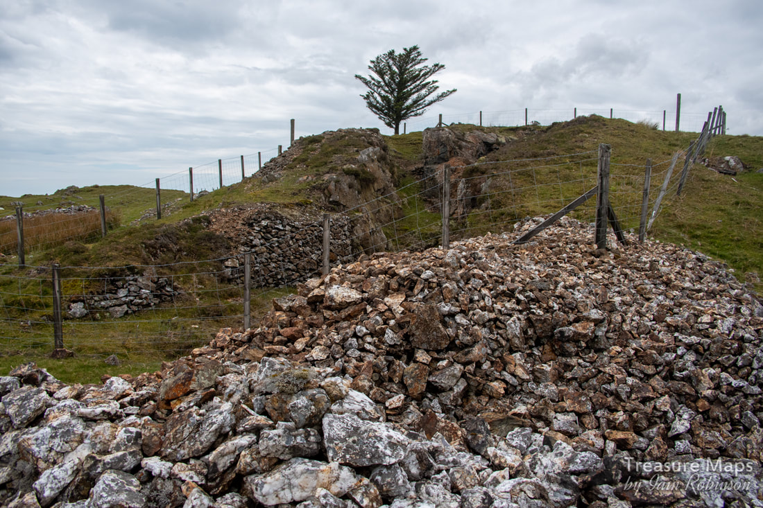
 The old farmhouse/barracks along the New Precipice Walk. We've been back to Foel Ispri and it's fascinating mining remains a few times now. As always, the more we find, the more the mysteries gather, but a clearer view is emerging of the workings- we've also discovered some adits hidden deep in the forest and an aerial ropeway jetty. Approaching from the steep path up from Llanelltyd, a stile crosses over the wall out of the forest. The path continues left past the old farmhouse, towards the precipice walk. Petra had spotted some marks along the hillside facing the stile, that looked like the formation of an old tramway... we investigated and found that they came from a large opencut and workings along the stream that runs under the new(ish) bridge for the path. At the opencut there were piles of worked fines and cobbed rock. Following the sketchy tramway east, it crossed a stream- the ruins of a stone bridge were plain to see.  The working area on the tramway, above the walker's bridge. The opencut is behind the camera. As we carried on, it curved round following the hill contours and disappeared into the forest. Except that, when we looked closer, we spotted what was unmistakably a jetty for an aerial ropeway. The boundary wall had a clear section in it that had once been a gate, to let the tramway through. 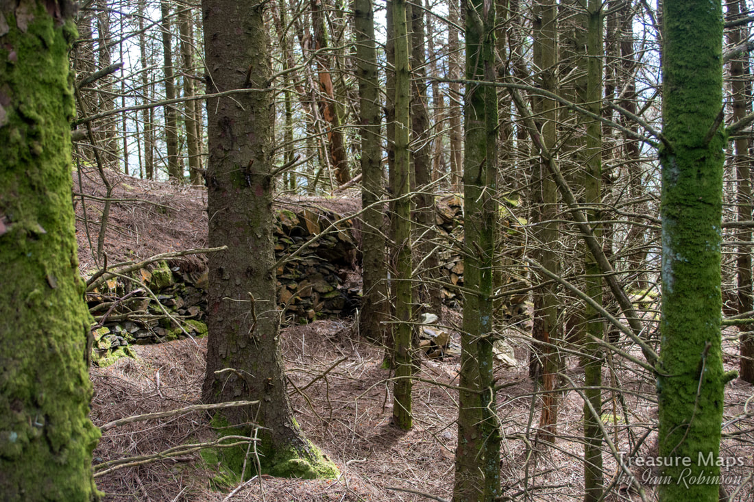 The ropeway jetty. Not easy to photograph in dense forestry! The question is, where did this go? Was it to the mill belonging to the Prince of Wales Co. down by today's A496 road- or was this ropeway intended to bring material up from several adits we eventually found in the woods? After our most recent visit. I felt that the woods below the old farmhouse needed more investigation. The structures around the place are strange, not quite agricultural yet not particularly industrial. There's what might be the remains of a waterwheel, for instance... 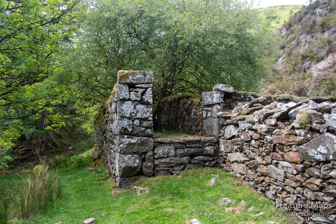 Supports for a waterwheel? The wall between the sides looks to be an addition. There's no sign of any mountings for journals on the top- but perhaps it was originally higher? I can't make my mind up about the farmhouse area. To the man with a hammer, everything looks like a nail- and I might be viewing things from a desire to find significance where there is none. And yet... a shaft is marked slap bang next to the house on the 1900 Ordnance map. We decided to take a look round... 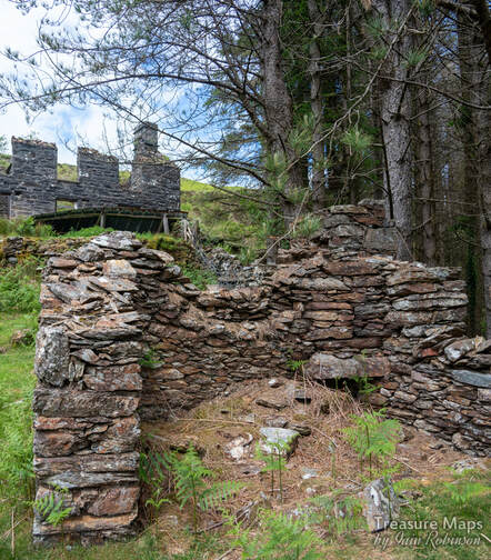 The two-celled structure below the house. It is made of different rock to the house, although the latter has been rendered at some time with a dark grey covering. 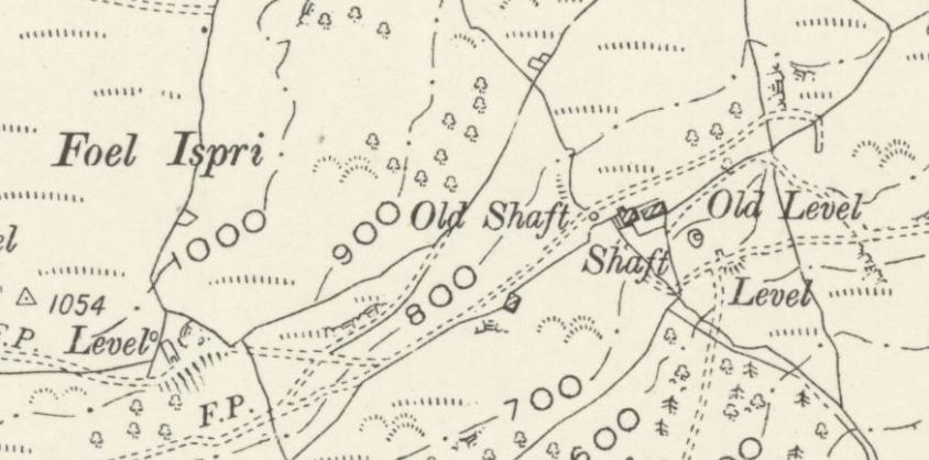 The shaft below the house and a level on the 1900 Ordnance survey. The ropeway jetty is at the hooked end of the trackway marked just above the word "level". Map by courtesy of National Library of Scotland. 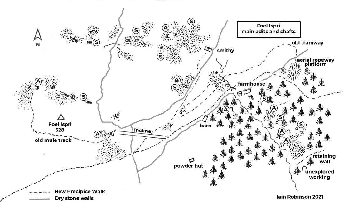 "A" denotes adit, "S" denotes shaft. There are also a multitude of crown holes over the site. We crossed over a fence next to the structure below the house. It was steep here and difficult going because of the trees/bracken/gorse/holly cocktail that the forestry encourages. I shouldn't grumble, because it does promote biodiversity- and it stops non-mine obsessives from discovering the place and staging their barbecues etc. Strange, I know, that some people aren't interested in mines... It wasn't long before we found the shaft. A steep openwork with exposed rock that goes down into the depths...difficult to photograph meaningfully, but here's my attempt anyway... 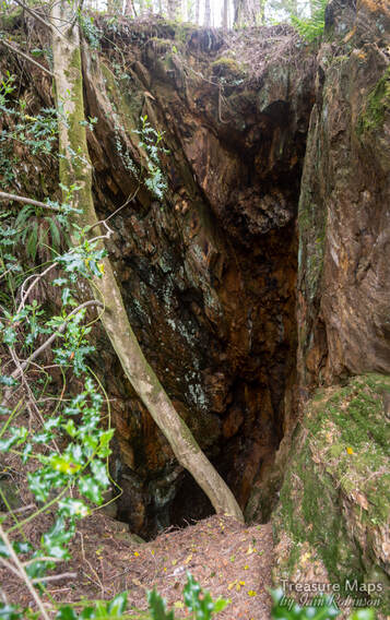 This was well fenced off- and in a tight situation on the steep hillside. Looking downhill from the shaft, we could see fencing that protected another excavation below us. We investigated and found an adit... 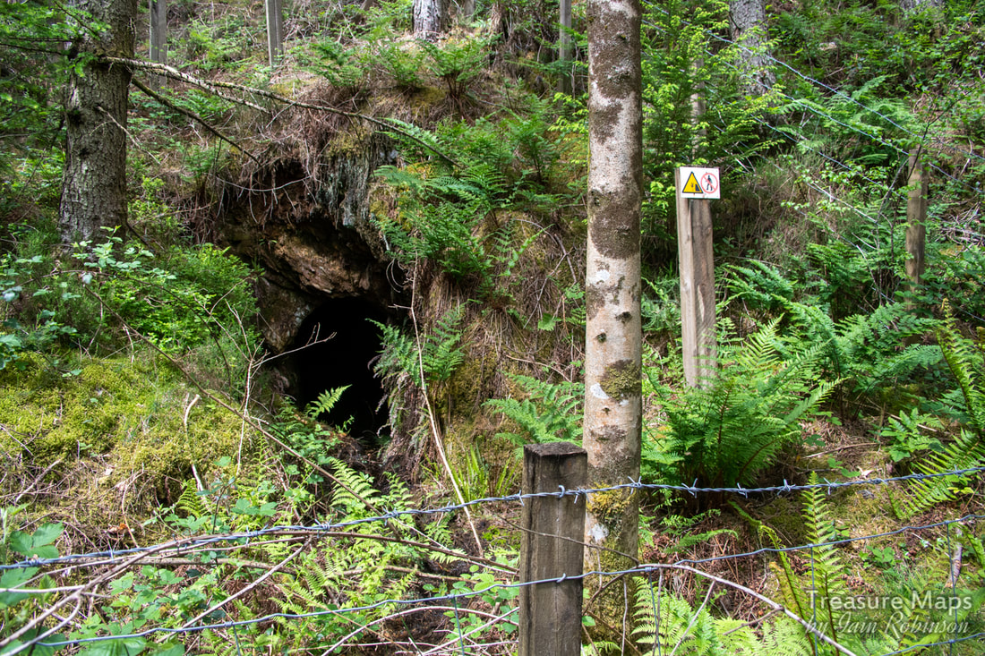 The adit below the shaft. This adit looked promising, although I noted that there was only a minimal quantity of water emanating from the portal. In our experience that means it's choked near the portal and will be very wet. We will explore it soon; but for now, we wanted to carry on and see what else there was. Thirty metres down hill, another fenced excavation was encountered- this time a shaft... 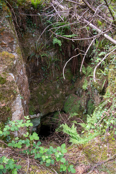 Things were hotting up now. A big excavation loomed below. We struggled through and down, until we reached what had been a fairly extensive digging. A shaft first, followed by a large adit portal to the left. We realised that the bosky platform we were standing on was actually a tip, reclaimed by nature. There were some really old birch trees growing on it that had amazingly fissured bark. A check of the leaves and yes, they were birches. But, to the adit! 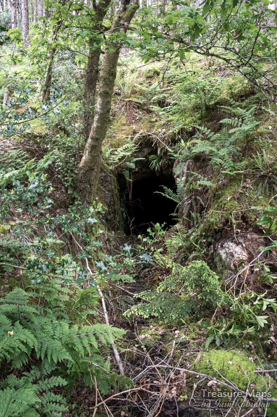 This was the most promising adit. Again, little water issuing, but a huge tip. We couldn't pass this one up. We could see more fenced off areas below, but this portal looked so tempting...so we put on the safety gear, grabbed the lamps and in we went... 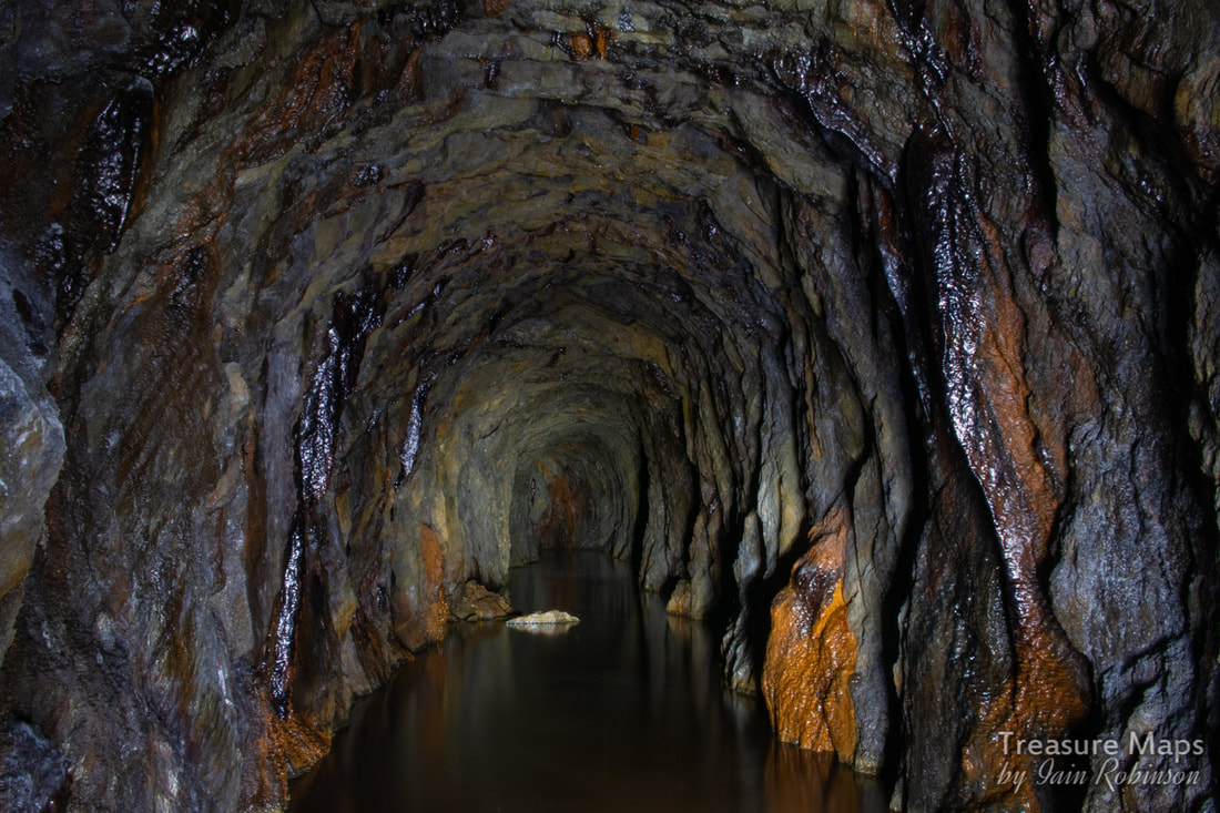 Looking inbye...nice iron formations. As soon as we entered the adit, (water thigh deep and freezing cold) a passage was noted going to the right a little way, then abandoned. We carried on for a long way, noticing the marks of sleepers on the floor and a couple of alcoves where a crosscut attempt was made then abandoned. 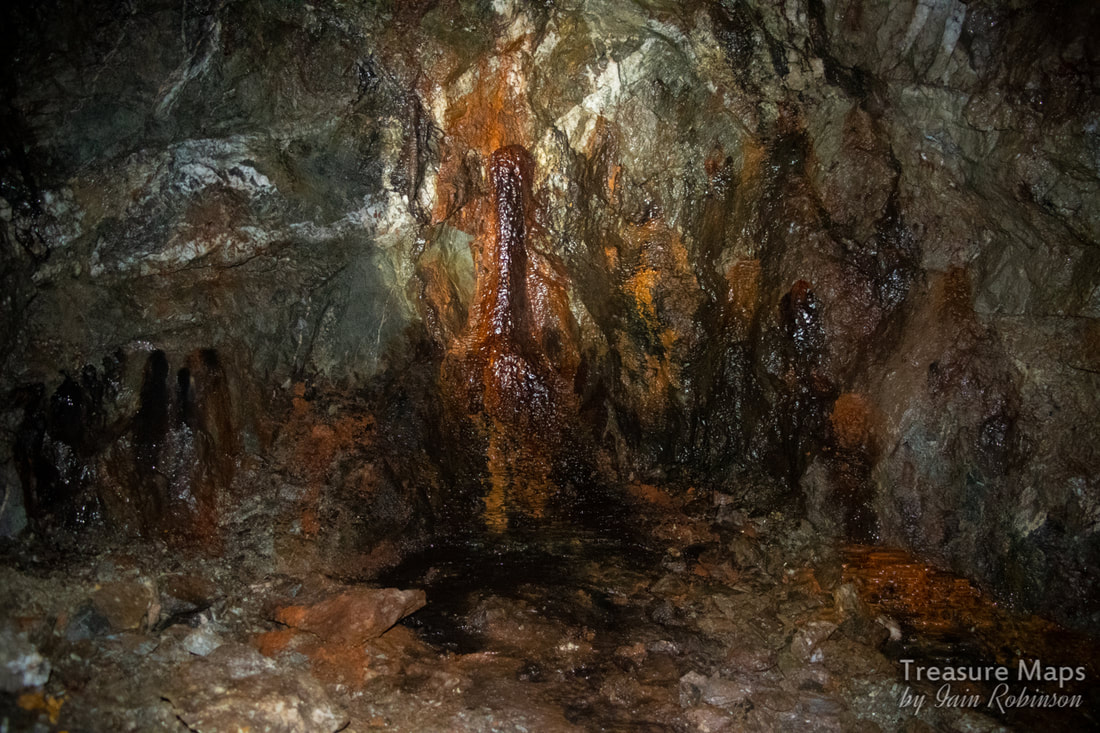 There were some great little formations in the mine, mostly iron, with some calcite straws from the roof. The adit ended after 350 metres. Somehow, with all the shafts, I was expecting false floors, but the tunnel was sound all the way. It even dried out towards the end. It felt like a long way in that cold water, but worth it. Outside, I explored the tip while Petra went down to the next level. A little way below the tips was an adit that opened out onto the stream. It was impossible to reach from my side due to erosion of the stream banks- perhaps that's why there wasn't much spoil. I took a shot, hoping that it would look like something. 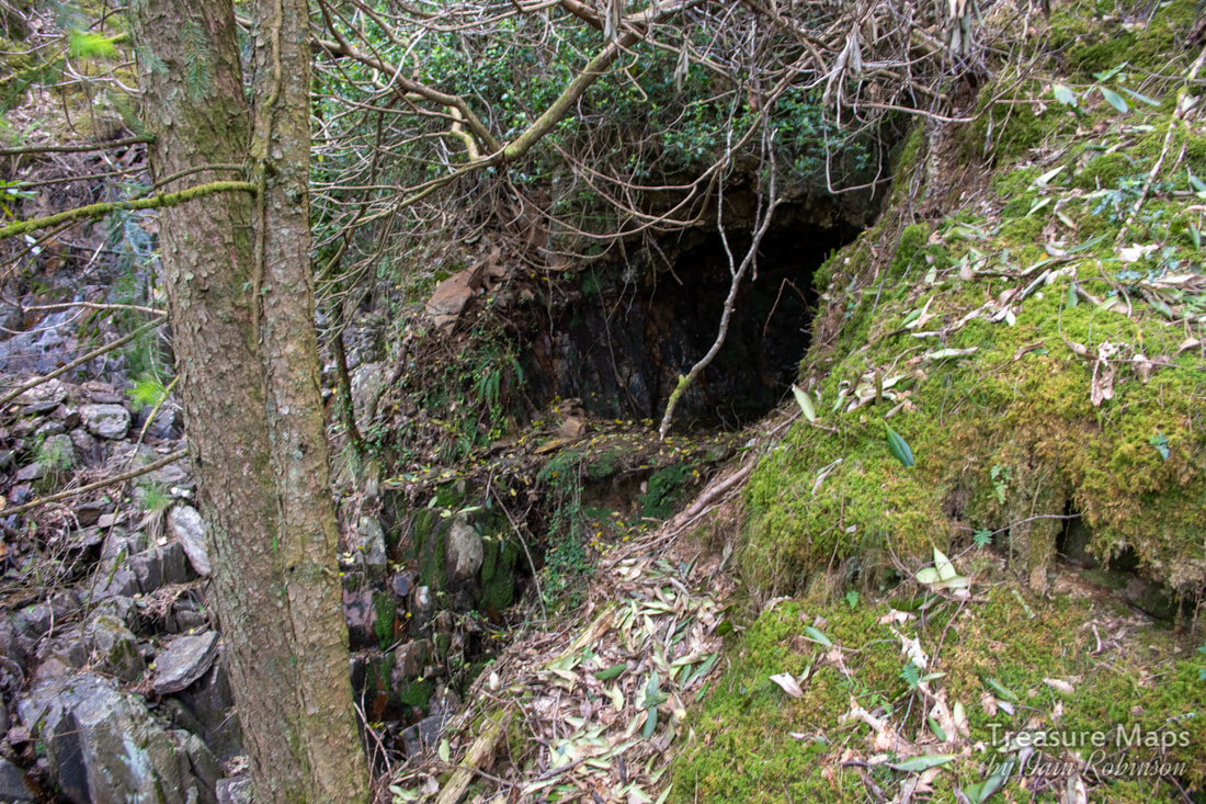 Doesn't really look like much, does it? The ground fell away vertically to the stream bed to my left. 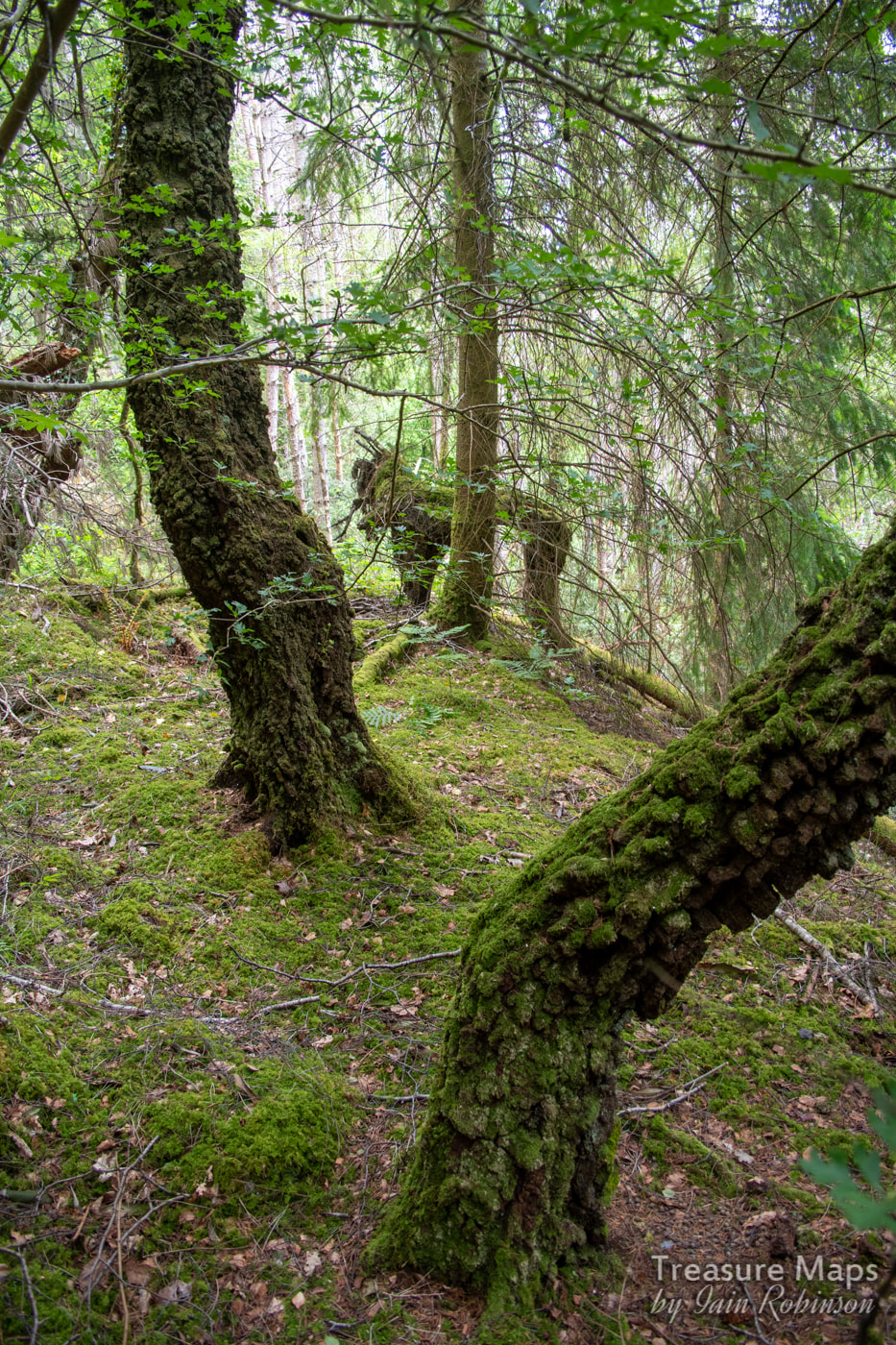 The ancient birches on the tip. The dead tree in the middle startled me when I first saw it- I thought it was a gorilla :-) Petra bravely battled her way to the lower workings, to find a large opening of some sort... it was very difficult to access due to the slope and at the moment, we can't tell whether it is an adit or a shaft. There was yet another working below, but we were both running out of energy by this time, battling away through all the vegetation on a 1 in 5 slope. We decided to come back another day. We climbed wearily back up to the old farmhouse and sat for a while, munching oatcakes spread with marmite peanut butter. Surprisingly refreshed, we wandered back to the barn, amused to see that the lintel was held up by some bridge rail. Arriving at the bit of the path where it joins the incline, we looked at each other. There was an adit up there that we hadn't explored. It must have been the peanut butter, because we dashed up the incline... There was what looked like a processing area at the top comprising several weatherbeaten remains of buildings including some sorry-looking brick pillars. The main structure was what looked like two walls standing on their own, no sign of a lintel between them. There must have been a sheave here, or some winding apparatus, but there was little trace of it. After enjoying the view, we entered the adit. The adit continued into the mountain for a good 4-500 metres, after which it branched. One way led into an area where stulls had fallen over a false floor. I wasn't prepared to go on as it looked too sketchy; but we'd seen a fine set of formations and some interesting little side excavations, so honour was satisfied. We had also spotted the powder magazine earlier, although neither of us fancied struggling down to it- a photo will have to suffice. It was well out of the way, should an explosion occur. 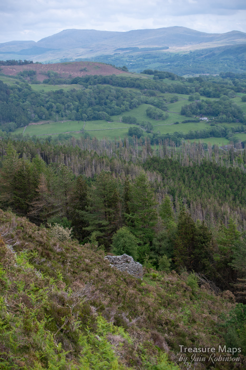 The powder magazine. While at the adit, we noticed a track going away in the opposite direction to the incline. Curiosity got the better of us and we followed it. It turned out to be a mule track to the other adit that we had explored a few days before, described in my last post- the one with the flooded stope at the entrance. So material would have been brought on the track, circumnavigating around the rocky knoll above , to send down the incline- that made sense. Looking at the old maps, on the 1880 survey, the adit at the end of the mule track is the only one on the hill, leading me to wonder if it is the earliest digging. There is a level marked on the 1880 map below the farmhouse, but the smithy hadn't appeared yet. The car was parked at the end of the walk , so we used the mule track and then dropped down to the car park. Like the miners, we hadn't found any gold, but we'd some fabulous memories of the day. 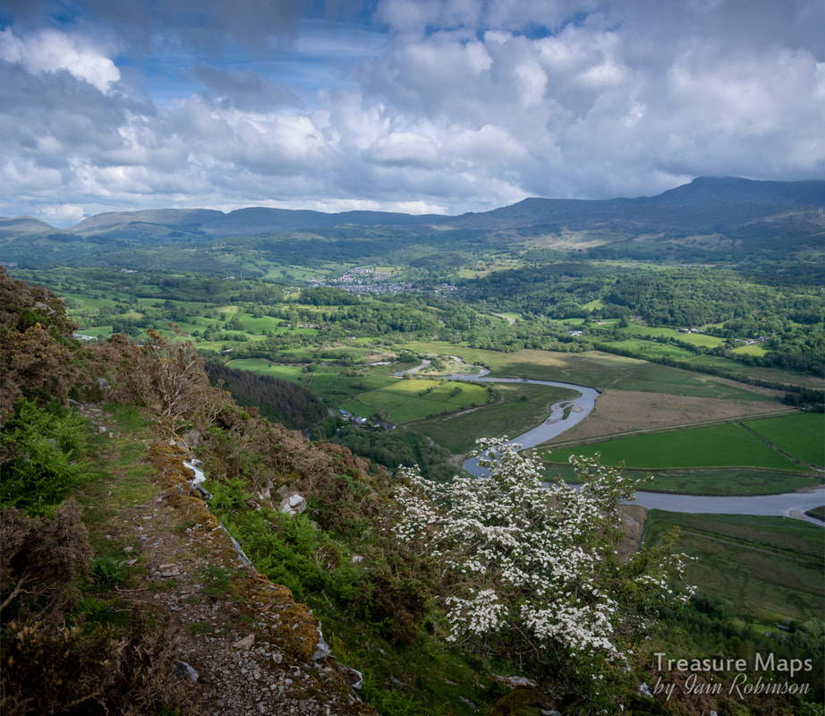 From the mule track. The New Precipice walk is a good bit below this. 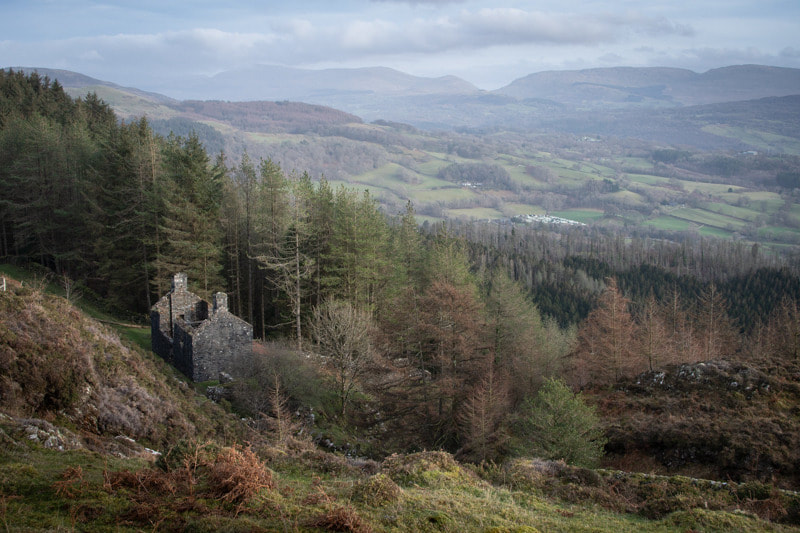 The (possible) barracks above the woods, looking towards Aran Fawddwy and Cae Afon. Driving from Dolgellau towards Llanelltyd on the A470, Foel Ispri makes an interesting sight above the trees, it's flanks coloured by the ochreous spoil from the mines. The name had always fascinated me, especially when I found out that it came from the welsh "ysbryd" and means "The Hill of the Spirits". I wondered about those spirits (and the mines) every time we drove that way.  A gratuitous view of the lake... On our first visit, we walked up a steep path from Llanelltyd through the conifer woods. This is probably the route most folk take to the New Precipice Walk- It passes a lake, originally built as a reservoir for the village. Eventually, we emerged from the woods to see a ruined building- at first glance it could have been a farmhouse, although seems a bit grand for the place with the remains of a veranda along one side. I wondered if it might have been repurposed as a barracks for the nearby mines in the 1860s. 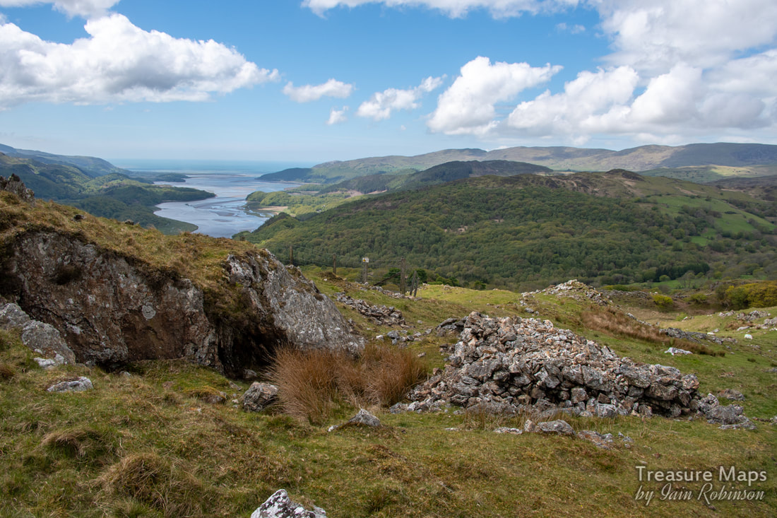 The workings at the top of the hill. The hillside above is pock-marked with adits rather like a dutch cheese- to a mine explorer, it presents an irresistible sight. We've made a few visits now, and have still to find all the adits and features. On one of our visits, we discovered the easiest way to access the area- to come up to the hill from the west. There's an unclassified road that runs through Taicynhaeaf up to the small farm of Foel Ispri Uchaf. Not a farm any more, I'm not sure anyone lives there now. I don't think tourists would want to stay there either, despite the views- as it's the last stop on a viciously steep single track road with few passing places. We were lucky to only meet one vehicle on the occasions we went up, but you do need nerves of steel. 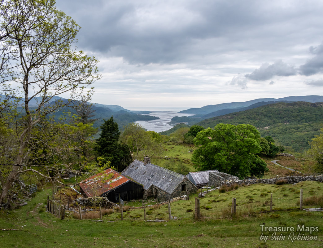 The farm, with obligatory view of the Mawddach estuary behind. The New Precipice At the farm, Foel Ispri Uchaf, there's some limited parking, enough for three or four cars. It's really meant for wheelchair users, so that they can access the walk. The walk itself is a flat footpath edged with rails- too heavy for tramway rails, but a nice touch all the same.* The footpath is, or was, the tramway from the Foel Ispri mine. It joined an aerial ropeway here to be taken to a processing area, (according to Hall), near Cae Mab Seifion farm. There are a couple of very likely places down there, surrounded by spoil. Apparently the mill was a timber and tin one, so would have been dismantled once the money had run out for mining. The tramway makes a pleasant walk with stunning views of the Mawddach estuary, even on an overcast day. The route hugs the hillside contours until some ruined buildings are encountered, where an incline from the workings cuts the path. The smaller of the structures is probably just a barn, the larger is the one I mentioned previously and might perhaps have been a barracks. It's beside a stream, but there's no sign of material being processed. 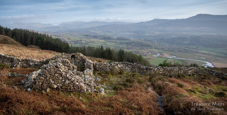 The Smithy The Smithy After a mooch around the buildings, we took off for the higher ground, passing over the incline. An old Smithy appears near to the main working area. Apparently, this was converted to house Britten Pans* to process the ore, although there is no record of any gold recovered at this time (1836). There are several crown holes in this part of the mountain, perhaps one is the shaft known as "Joe's Shaft" which had been sunk twenty fathoms to intersect the Champion and Fanny lodes. Around this area are several adits, one series stoping out to surface. Many adits are unpromising or run in, but the adit to the main stope was open. Exploration showed that it ran for about twenty yards before encountering the stoping. Stulls were in place, greatly eroded by weather. The adit continued on, frustratingly inaccessible. 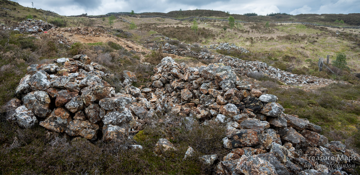 Piles of uncobbed ore. Probably worked by women and children in all weathers. The spoil outside is interesting- mostly quartz, but with occasional appearances of galena and sphalerite. There was also some pyrites in the quartz. We noticed several cobbing areas, wide scatterings of small quartz stones beside larger piles of rocks. The large accumilations were interesting because they all seemed to be spilt into two piles...was this to shelter the workers from the weather, or was it just the attentions of latter day gold seekers? 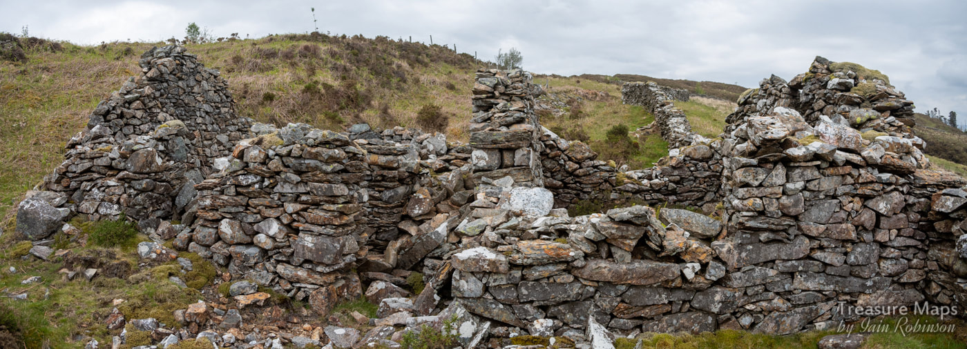 A composite view of the smithy, showing the extension on the left and an area in the middle that might have been a wheel pit. Adits We explored a couple of adits. I should stress that this isn't advised unless you are experienced in this sort of foolishness- and have the appropriate safety equipment. The adits were mostly uninviting- but the range of excavations above the smithy were fascinating. After a low portal and a flooded passage, the middle one opened out into stoping, with stulls in place. There's quite a drop here and it would be unwise to go too close to the edge. 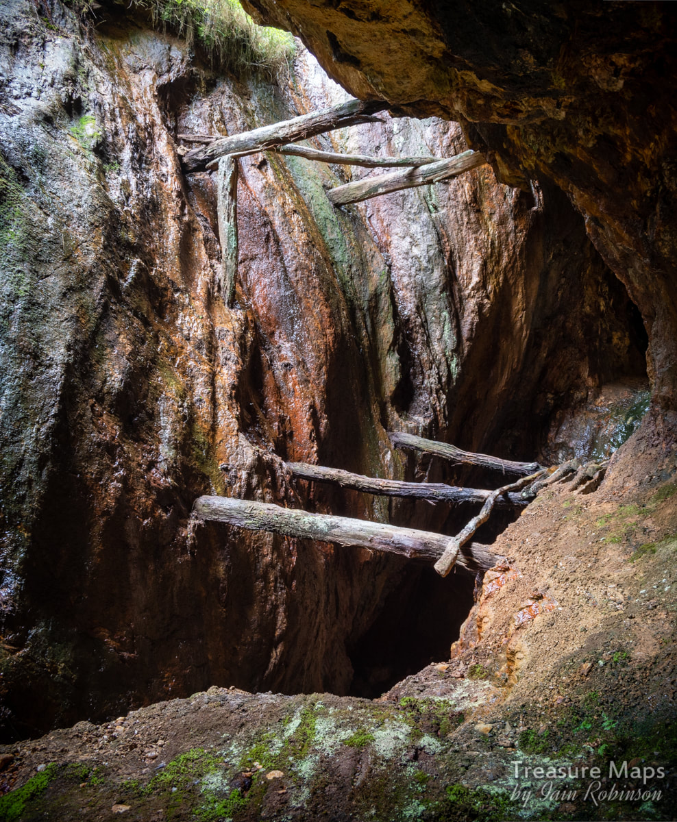 The stoping, with stulls in place. A passage carries on into the hill on the right. We carried on up the hill, where the diggings seemed to become older and more vestigial. The ones at the crest of the hill look more like lead workings in the way that they have been mined, following a rock outcrop along a fault. 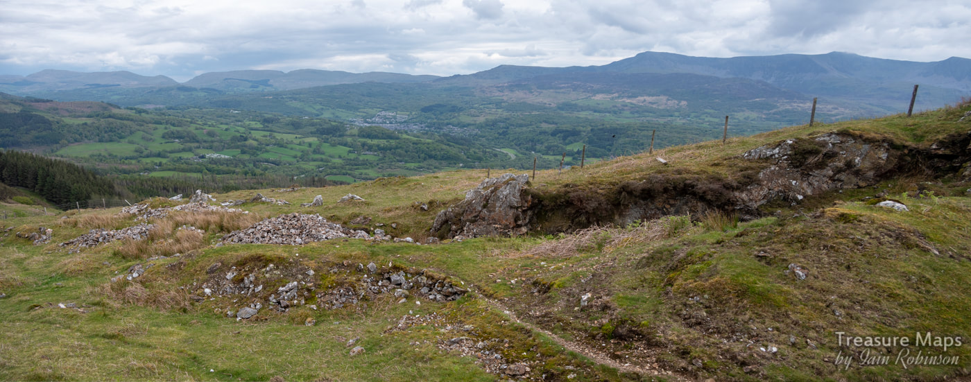 At the top of the workings. Over the top of the hill are another couple of adits. The most encouraging one had a large portal and looked inviting- I wasn't fooled, of course, knowing that such promise is always disappointing. The first few yards were mired with deep, sticky mud- we had to take care not to lose the wellies . Petra reminisced how I had been stuck for ten minutes in a similar situation at the Cae Fali mine- before she had pulled me out in a most undignified fashion. Then the water became deeper, over critical welly depth, but clear. Wet feet now, but who was caring about that when the mine beckoned? There was a branching of tunnels which looked most promising- until we noticed that our passage was blocked by a dark looming shape in the water ahead. This was probably a flooded stope. We'd been looking out for something like this, so weren't surprised, but it would be fatal for the unsuspecting. Stumbling into that, wellies and gear weighing you down... it wouldn't end well. Disappointed, we waded back outbye. We did manage to explore one passage safely, off to the left, which had some interesting minerals. Honour was satisfied.  Looking outbye from the right hand passage. Interesting mineralisation on the walls. As always, I felt the disappointment of not seeing past the flooded stope, feeling that it might have led to some undiscovered Moria, a golden mine of yore, with ore chutes and kibbles arranged for my delectation...in reality, both passages probably went monotonously on to blind foreheads, but nobody will ever know now. Further down towards the farm, another adit looked inviting, but we noticed a water pipe emerging from it; not wishing to pollute the supply, we stayed away. Afterwards, studying old maps and some frankly mystifying notes on the UCET site, we concluded that we'd missed a lot of stuff and should have gone up the incline where the principal adit lay waiting. Hopefully there will be a part two at some point soon! 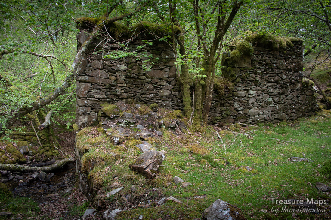 A Bonus Mill As we drove up to Foel Ispri Uchaf, we crossed a small tributary of the Afon Cwm Mynach. It was early spring and the trees weren't yet in leaf, so we were able to make out some ruins. The game was afoot! We managed to park on the verge and explored what was obviously some kind of mill with a water wheel pit beside it, some ancillary structures, plus what looked like the base for an aerial ropeway pylon. We were thinking "mines" even before Petra spotted an adit on the opposite side of the stream. In fact, what we'd stumbled on was the Borth Valley Company's gold reduction mill, in operation during the early 1900s. This served a few mines up on the Cesailgwm hills, connected by a ropeway as we'd suspected. The main source of the gold bearing quartz was a mine near Cesialgwm Mawr farm, of which there is little trace now. There are however, two mines to the east of them which I'll come back to in another post. The factoids The workings on the hillside cover a large time span, from very early scratchings for lead to C19th gold workings. Mining here was sporadic but reached it's peak of activity between 1862 to 1902 when the area was worked by a variety of concerns- the Foel Ispri Mine, The Voel Mine, the East Cambrian Mine, Prince of Wales, Gesailgwm and Wnion mines. A couple of the concerns operated until the 1930s, but none of the mines were ever profitable. The mine at the top of Foel Ispri was started in 1853. Over the years it was mined for lead and zinc, as well as gold. In 1890, 60 tons of zinc, 21/4 tons of lead and 88 ounces of gold were produced. Geologically, the chief vein filling is massive quartz in which much pyrite occurs. Galena, sphalerite and chalcopyrite also occur and the ore is auriferous in places Britten Pans Britten Pans were huge rotating cauldrons containing big iron balls rolling around inside . The pans were powered by waterwheels . Gold bearing ore was tipped in to the pans and reduced by the action of the balls to fine powder. Mercury was then mixed in, forming a coagulation called an "amalgam". This could then be poured out of the Britten Pan, leaving the unwanted material behind. The amalgam was placed in a crucible and the mercury evaporated off leaving (hopefully) a little gold. *Rails About those rails. We explored the remains of Foel Ispri Isaf farm, finding a stash of bridge rail and lighter gauge flat bottom rail. These would very probably have come from the tramway. 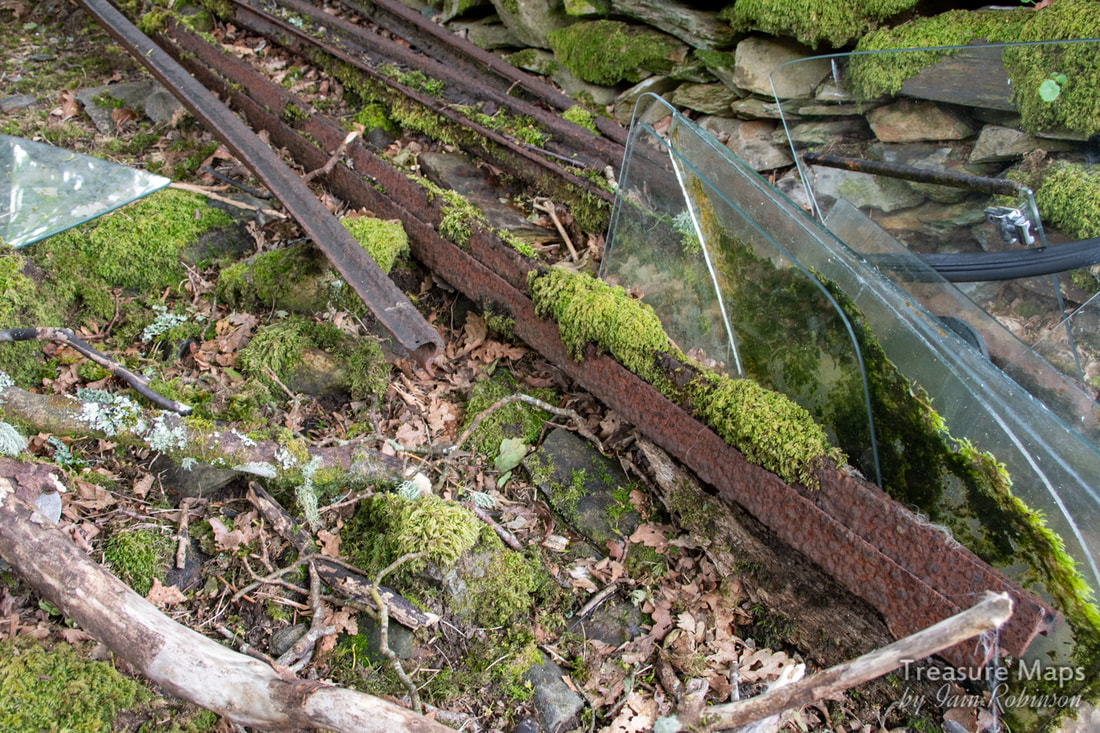 Bridge rail on the left. References "The Gold Mines of Meirioneth" by George Hall, Griffin Publications, 1971. "The Mines of Merioneth" by J. R. Foster-Smith, Northern Mine Research Society, 1977. I can't stress enough that exploration of old mines is unwise and could lead to injury or death. Please explore only with the proper equipment, lights, safety gear and preferably at least one highly experienced guide. |
TracksReceive the occasional Treasure Maps Newsletter- and alerts when a new post is available!
If you enjoy my content, please buy me a coffee!
Check out my other online activity...
Index
All
|


 RSS Feed