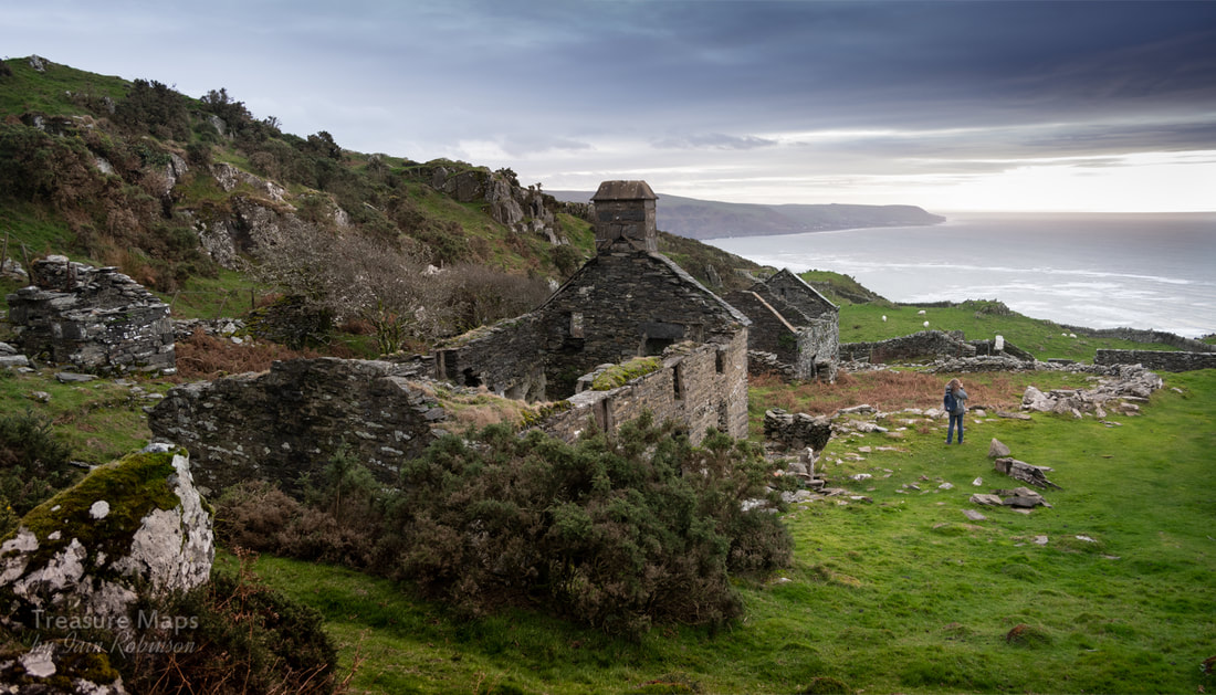
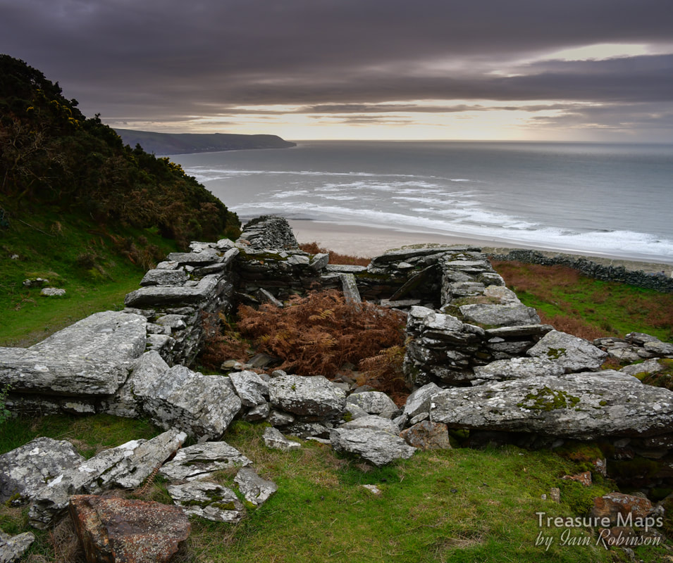
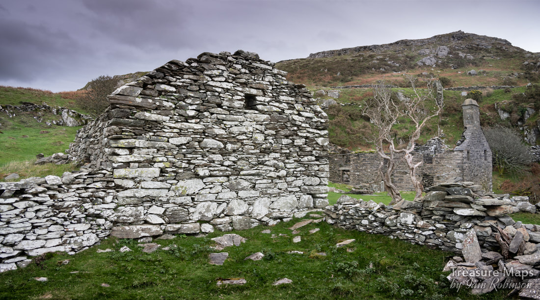
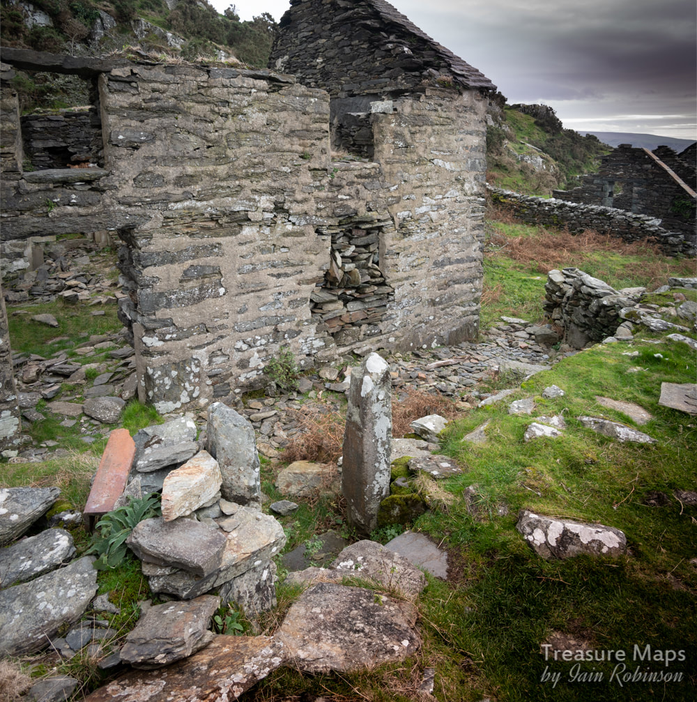
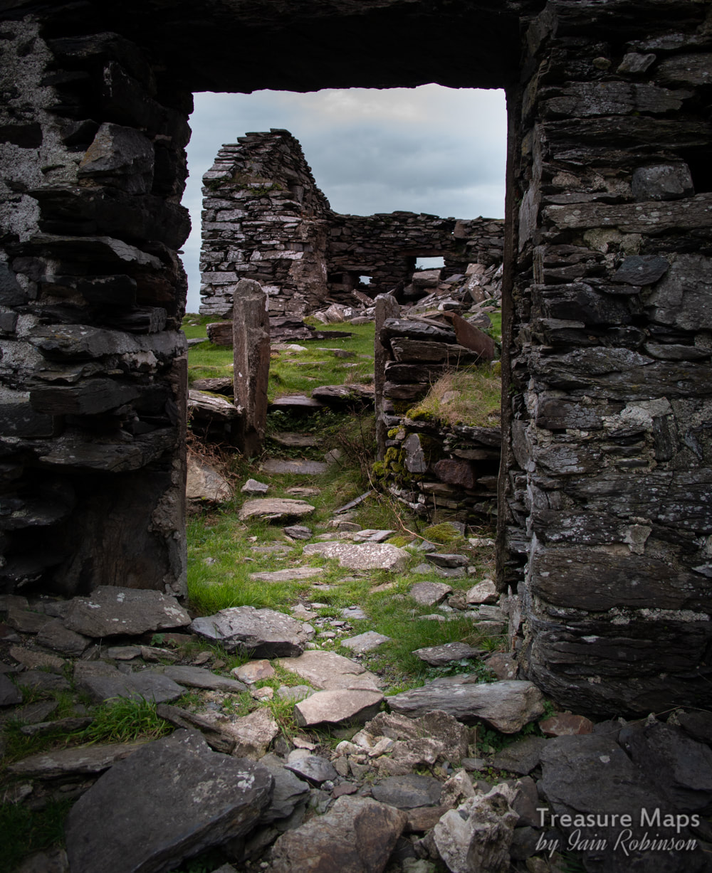
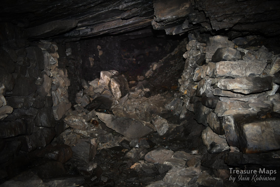
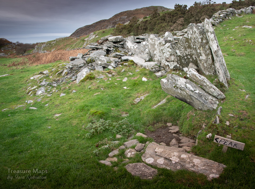
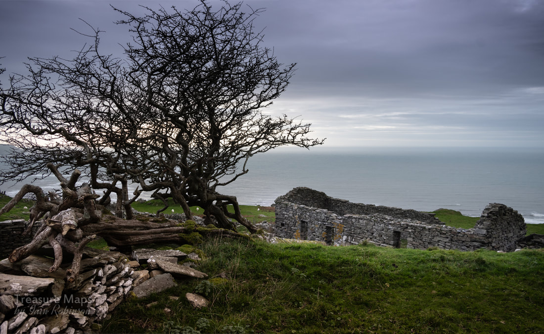
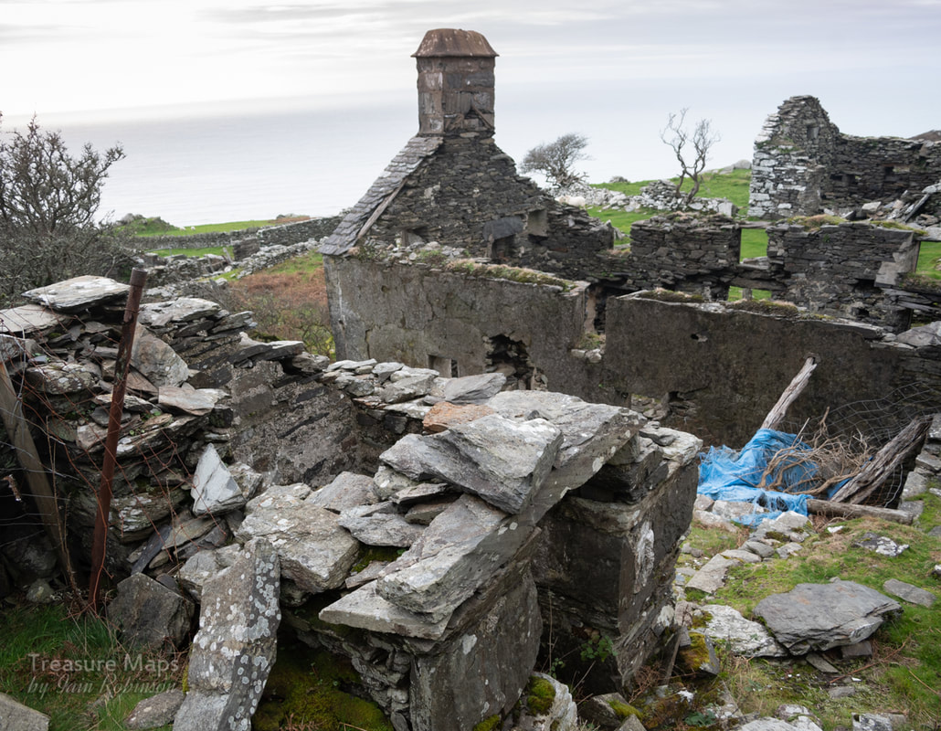
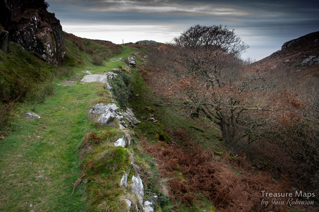
 Google Earth is a good substitute for an adventure when it's raining- as it has tended to do rather a lot this winter. But in fact, most of our explores result from wandering happily about over the satellite view until we spot something interesting. Following the big manganese lode south from Cwm Nantcol, Gellfechan looked intriguing- there were the signs of mining activity and some interesting ruins. It was October before we could visit, but by then, the tourist hordes had relinquished Barmouth. It was a charming little coastal town again. I'd done some homework, combing "Merioneth Manganese" for info about mines, while Petra had found a lovely little book by a lady called Carol Skelton, which provided some interesting history of the farm and it's inhabitants. Carol has given me permission to reproduce some of the pictures and story. 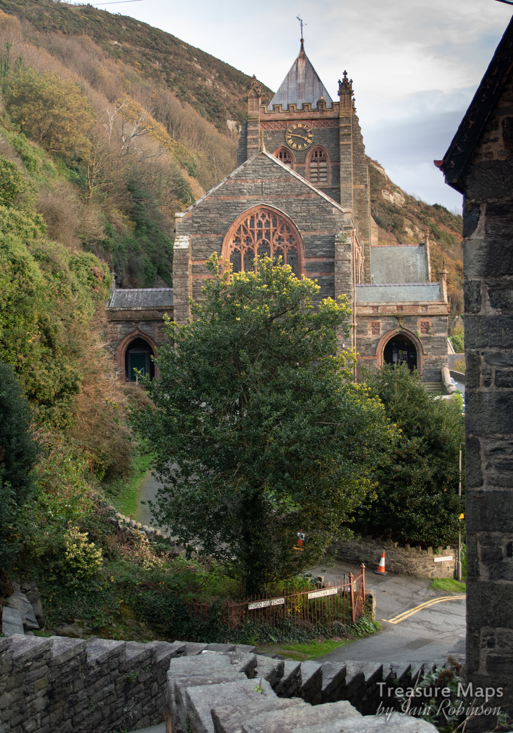 The starting point- St John's church, on Gellfechan road. I'm running ahead. Not that you would be doing much of that, going up to Gellfechan. The walk starts from St John's church, going steeply uphill along Gellfechan Road. After 100 yards, a signed footpath goes up off the road to the right at SH 61215 16047 and climbs past many old adits, reminders of the mineral wealth in this area. I'll come to those later. After a while, you take a sharp left at a hairpin junction in the path- there are a multitude of waymarkers here. Carry on going almost due north, then the track curves to the south west and comes to a hairpin again. The path that goes straight on leads to Dinas Oleu, a popular viewpoint and a National Trust property. We went left, up the steep track to the farm. The sounds of the town gradually faded, only the snarls of motor bikes and lorries wafted up now, almost lost amid the cries of birds and the wind's conversation with the hawthorns. 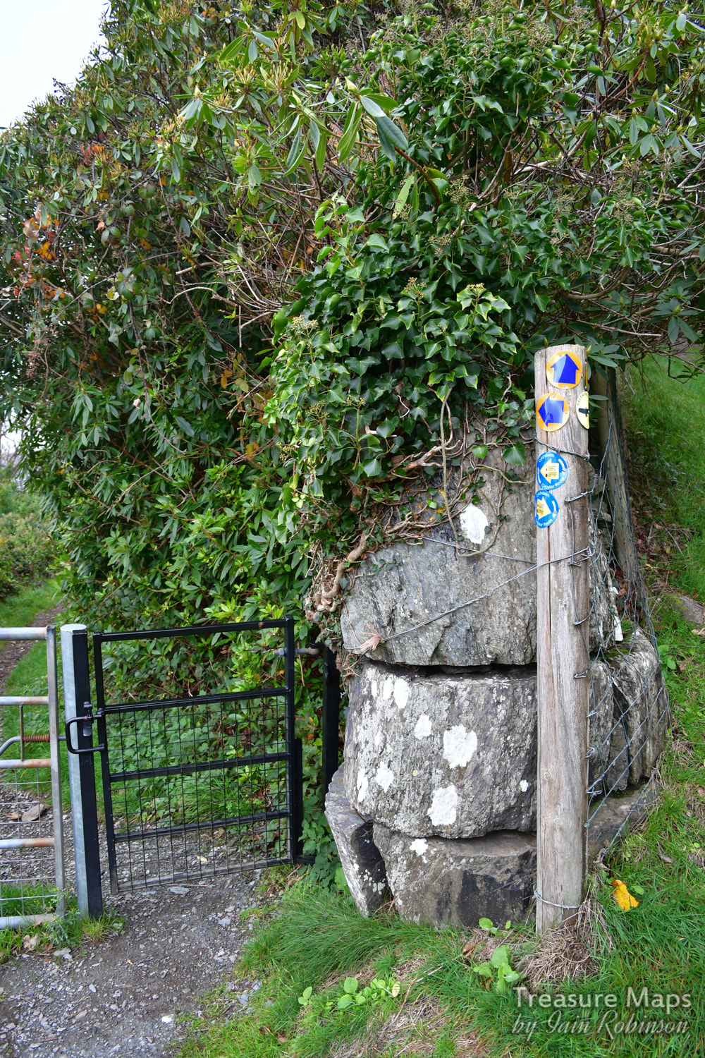 Waymarker overload! Carol's book tells of her late father, and her aunt and uncle in their turn, delivering milk to the town from Gellfechan, high on the top of the hill. Her aunt would do the delivery round before school, then slap the pony's backside to send it back up the hill. She would then go off to her lessons. I like to think that the pony enjoyed it's saunter back up to Gellfechan, browsing on succulent grass all the way up. Carol wrote to me about how her father, as a schoolboy, was in the habit of running up to the farmhouse at lunch hours with his siblings- in ten minutes! The return to school, full from their mother's excellent meal, was a little more leisurely. On another occasion, her father had to deliver a churn of milk to the town, which he somehow carried all the way down to Barmouth- then went to the pictures! To be sure, those were different times, tougher folk than today. 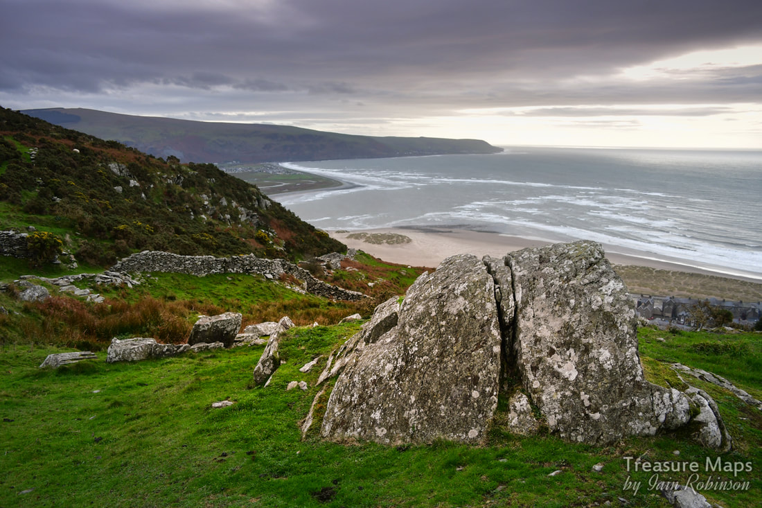 A rock outcrop beside the trackway up to the farm. Meanwhile, up on the hill, we were finding little excavations and piles of rock everywhere as we climbed up. My mine senses were working overtime. The views now were spectacular, although the weather wasn't too clear on the day we visited. Even so, it was possible to see out towards Tywyn and further. After climbing up the track for a while, we came through a gate beside a wall to the right. The farm could be seen above, nestling below a rocky crag. Apart from the wind's playful zephyrs, it was almost completely quiet now. 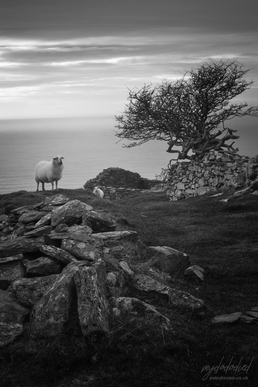 A sheep gives us "the stare" beside the gnarled old Hawthorn. Photo by Petra. The farm is approached by a well-made road which passes a long barn, then turns uphill again towards an older structure guarded by a wind-harried tree, looking like an old witch in the process of casting a spell. This old ruin, now very much the worse for wear, was the original "Gellfechan". The inglenook fireplace with it's oak beam is still there, under the rubble. Even in these reduced circumstances, the place reminded me of a scene from an Enid Blyton "Famous Five" story, where the farmer's wife would emerge and supply bread and fresh provisions in exchange for a few coins, while adventure beckoned in the hills all around. I suppose that dates me... 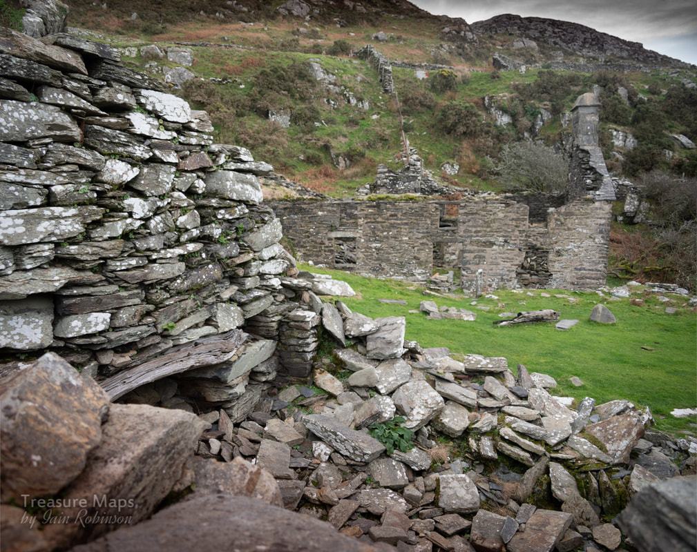 The original dwelling with inglenook. The newer house is in the background. 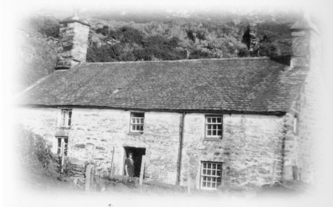 Gellfechan, possibly in the fifties. Look at the beautiful roof- and the tall chimney to the kitchen, which sadly fell in 1999. It looks a strong and cosy place, despite having no running water or mains electricity. (photograph by kind permission of Carol Skelton) The "new" house appears on the 1887 Ordnance survey map, and was probably built in the middle of the C19th. Now, it is roofless and in a bad way. It was abandoned in 1959, so quite a tribute to the original builders that it has lasted this long. It was sad seeing the remains of the front door and gate, the place of many greetings and farewells. Carol's book hints at the lively life of the farm, with cousins and aunts visiting and many adventures. At one time, teas and cakes were sold from the farm to walkers passing by as they journeyed to the various view points such as Dinas Oleu, or Craig y Gigfran nearby. For a time, full bed and board was offered- the house was a large one but even so, some of the family had to sleep over the stables when paying visitors arrived. 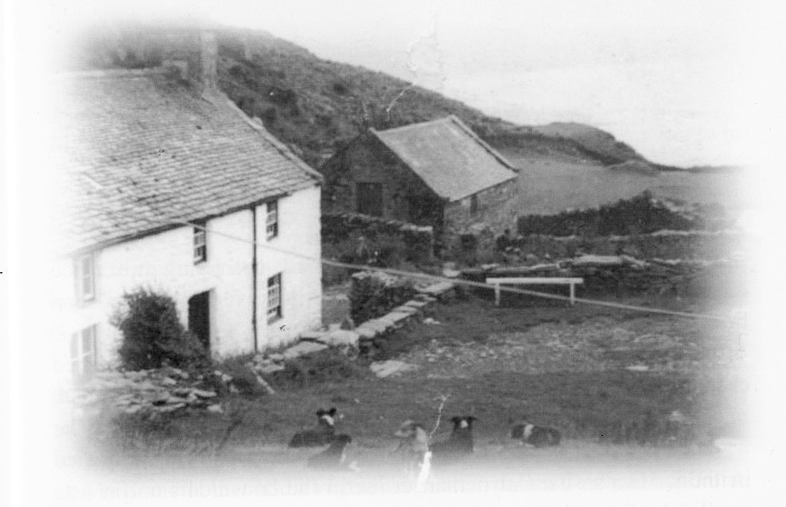 I wonder what the dog's names were? (photograph by kind permission of Carol Skelton) We spent quite a while, enjoying the special vibe of the place. Imagining people going about their daily chores, children playing. I could have wished for better light, taking photographs was a challenge, but I hope some of the atmosphere comes through. It was really nice that for once, I had an idea about some of the farm's life and times- so often, these places are frustrating ciphers, full of locked memories. Here, at least, I know that there was laughter and happiness as well as the hardship of living on an upland farm. 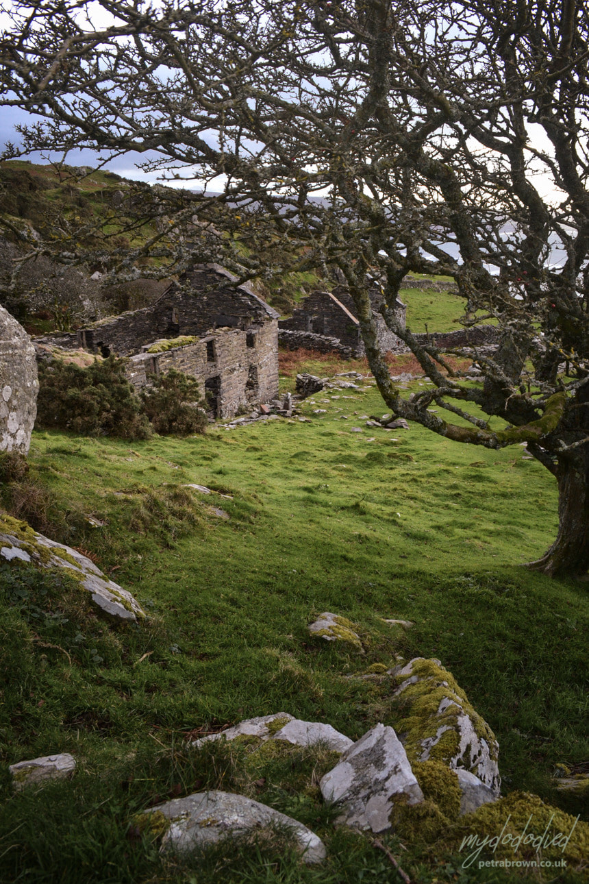 Photograph by Petra The mines They are not all Manganese mines, despite being on the south end of a long rake of excavations almost all the way to Cwm Nantcol. The manganese adits are mostly beside the track going up, and can be found with close reference to "Merioneth Manganese", referenced as "MM" where I have sourced information. Early on along the track, we found a couple of diggings, where the rock had been quarried back and an opening made. This looked like a manganese mine alright. There was a fine portal cut from the rock and although the floor level had been built up over the years, with a little stooping it was possible to gain access. The typical style of manganese workings, small chambers stacked with "deads" was apparent inside. 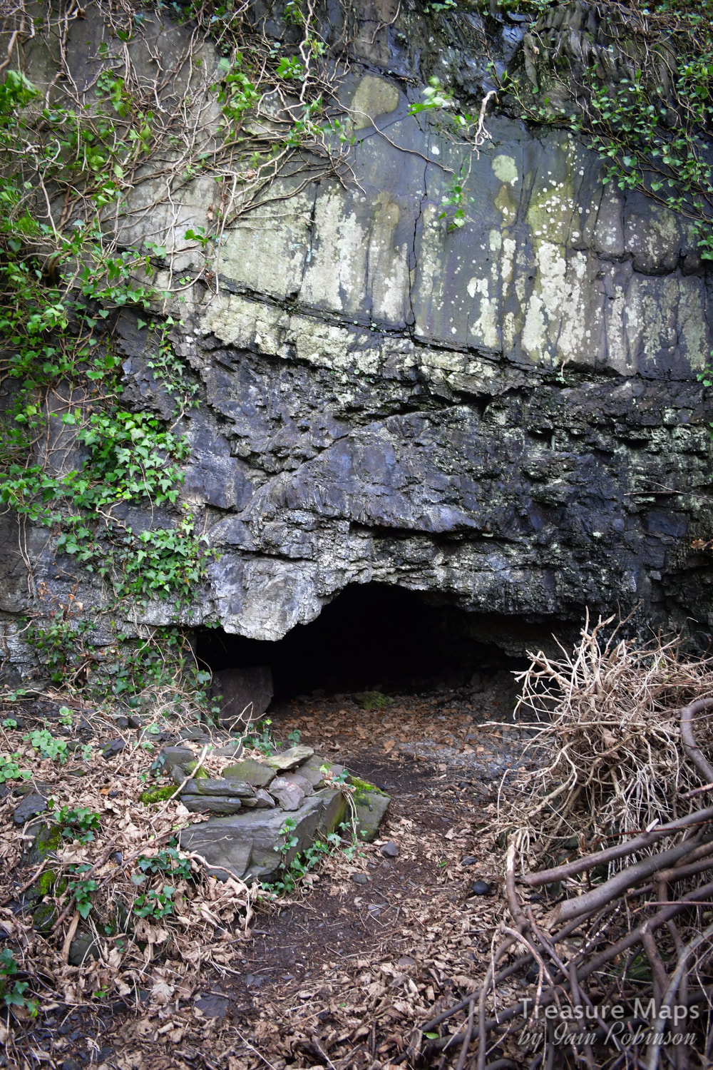 The first indication of manganese workings. After the "dog's leg" in the track is a mine that seems to be associated with the "Belle Vue" gold mine, which Jeremy Wilkinson puts at SH613161. It must take it's name from some villas named "Belle Vue residences" and what seems to be an area marked as such on the 1887 maps. Also marked on the 1887 map is a "Dripping well" which is further down the track towards the church. It must have been an early copper trial on a thick vein of quartz, as there is another adit concealed beside the church below. There's a little wall in front of the adit, which does indeed drip- but then most adits do! 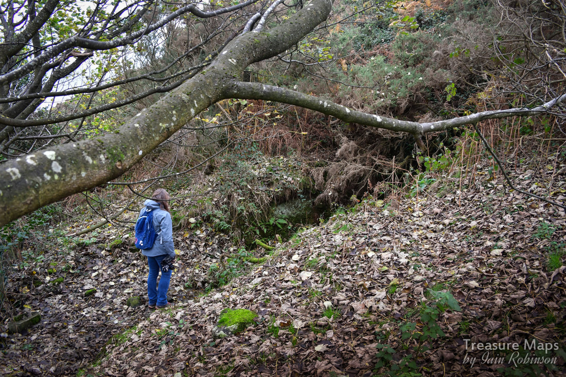 Petra considers the "Belle Vue" mine. We did bring our usual safety gear, helmets, torches, boots etc...at this point P is "evaluating" the situation. Higher up the hill, we encountered an adit next to the track. It didn't seem like a manganese mine, the tip was slightly chalcopyritic. (A brass-yellow mineral with a chemical composition of CuFeS2. It occurs in most sulfide mineral deposits throughout the world and has been the most important ore of copper for thousands of years. It loses it's brightness on exposure to atmosphere) There was a ruined structure nearby which I think was probably a sheepfold. However, it wasn't until we returned home that I saw on Google Earth that we had missed another adit below. 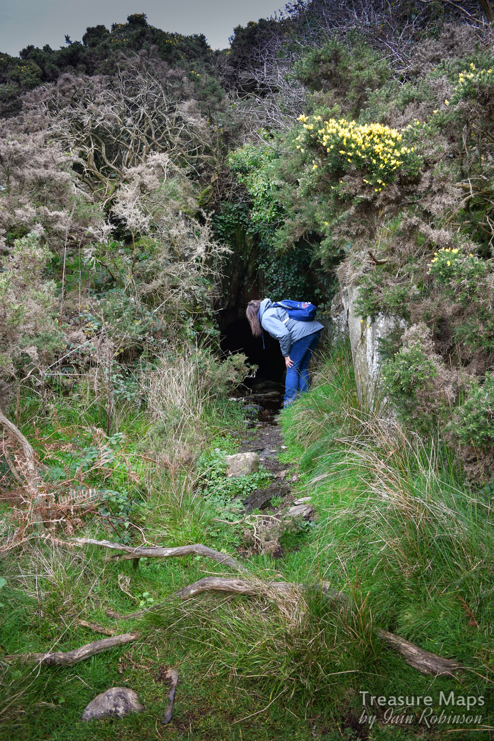 Further "evaluation"... 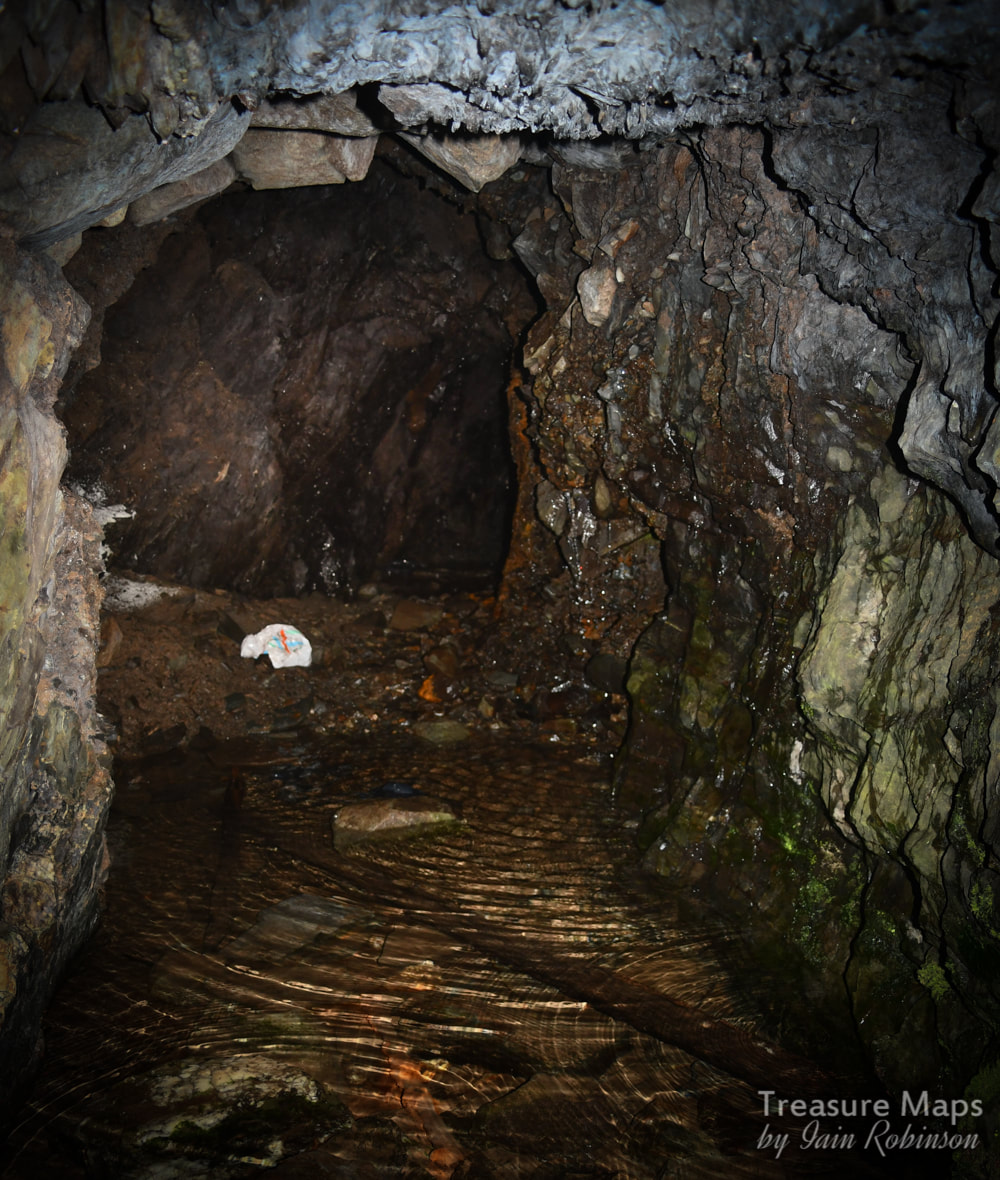 Inside the adit. Don't think they had carrier bags in the 1890s... The workings described on the maps as the Gellfechan manganese mine are to the east of the farm- the miner's "eye of faith" can easily spot the tell-tale depressions and piles of spoil. These continue in a north easterly direction until a ravine is encountered. There are two small adits with a little chambering at SH615167. There seems to be a mule track, well-revetted along the side of the ravine which goes east and then doubles back to the Cell Fawr mine on the north side of the ravine. We didn't explore further as light was failing, but intend to return. 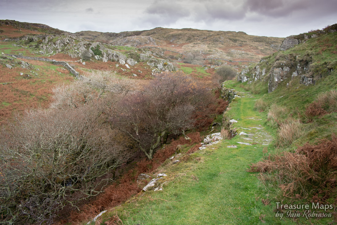 The mule track. Despite how it looks, the photo was taken at 1000ASA- it was becoming very gloomy. The wonders of modern cameras! An interesting clue lies in the 1899 sale advertisement for the estate, then owned by John Abraham Esq. It reads that "A valuable vein of manganese (occurs) on the estate, which has been proved... " "...and gold veins have also been opened" (MM) References in local papers indicate that a mine of some sort was working manganese here in 1917 (MM) Many thanks indeed to Carol Skelton for permission to use photographs of the farm in it's heyday, and for writing the lovely book. Copies are available at the "Y Tepot Arian" (the Silver Teapot) community cafe in Dyffryn Ardudwy- proceeds to the Wales Air Ambulance. There is also a web-site here where the book can be downloaded as a PDF for £1.00- very good value I reckon. Ty Dolwar Information on manganese mining and all the sites mentioned can be found at the excellent Merioneth Manganese site. The late Jeremy Wilkinson's Gazetteer of mines and quarries in North Wales is here.
2 Comments
|
TracksReceive the occasional Treasure Maps Newsletter- and alerts when a new post is available!
If you enjoy my content, please buy me a coffee!
Check out my other online activity...
Index
All
|
 RSS Feed