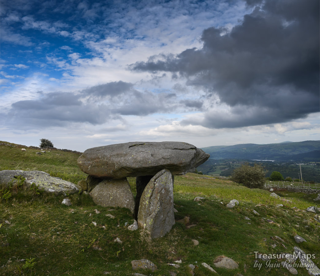
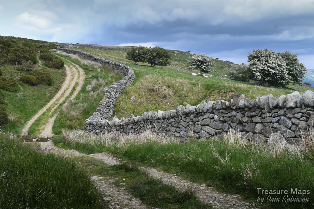
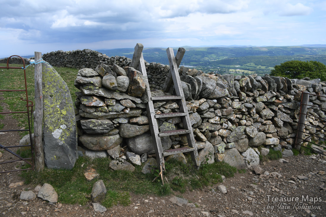
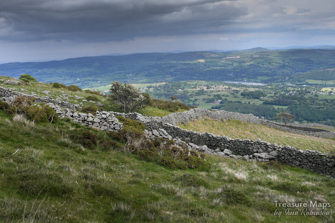
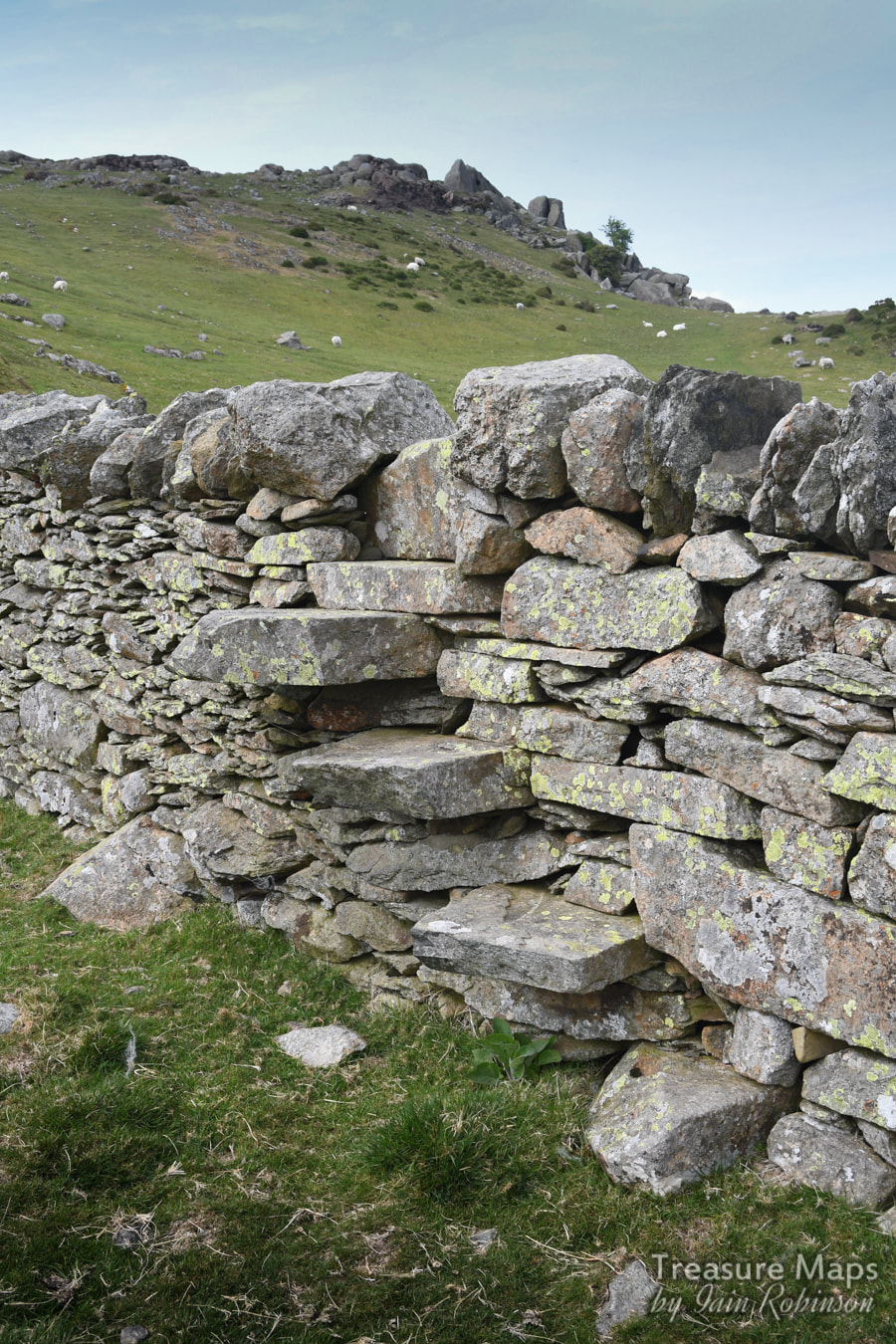
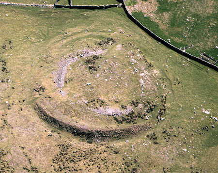
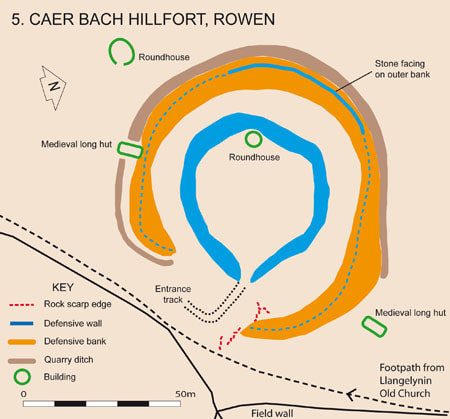
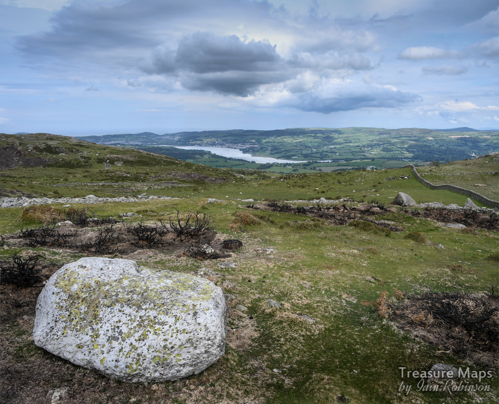
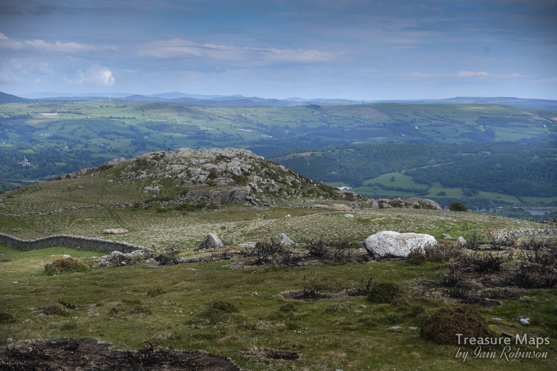
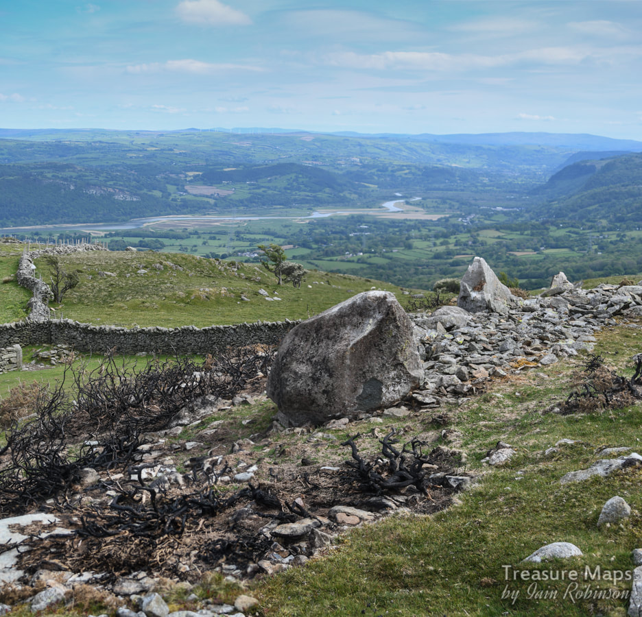
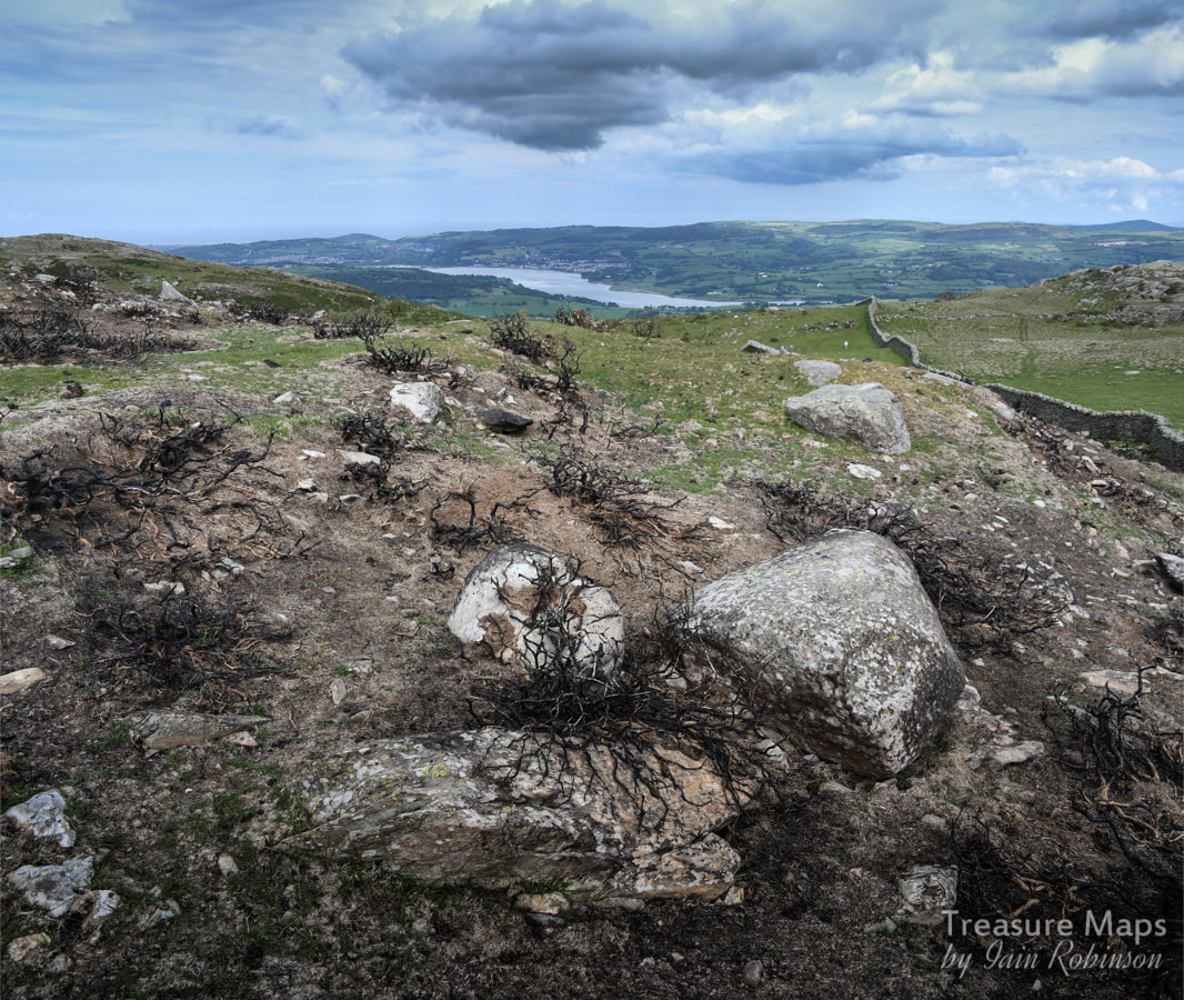
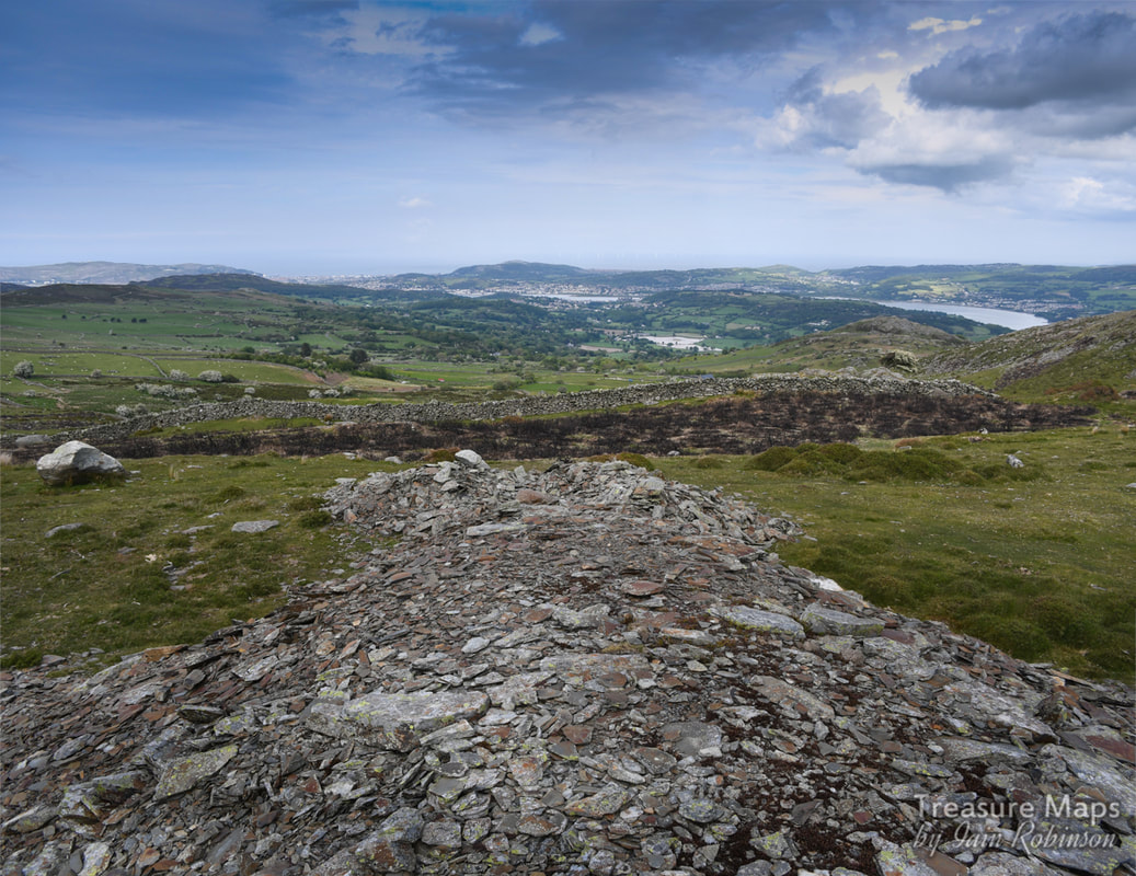
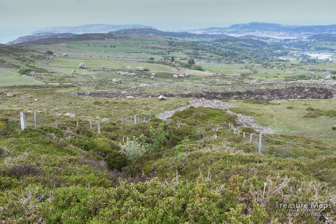
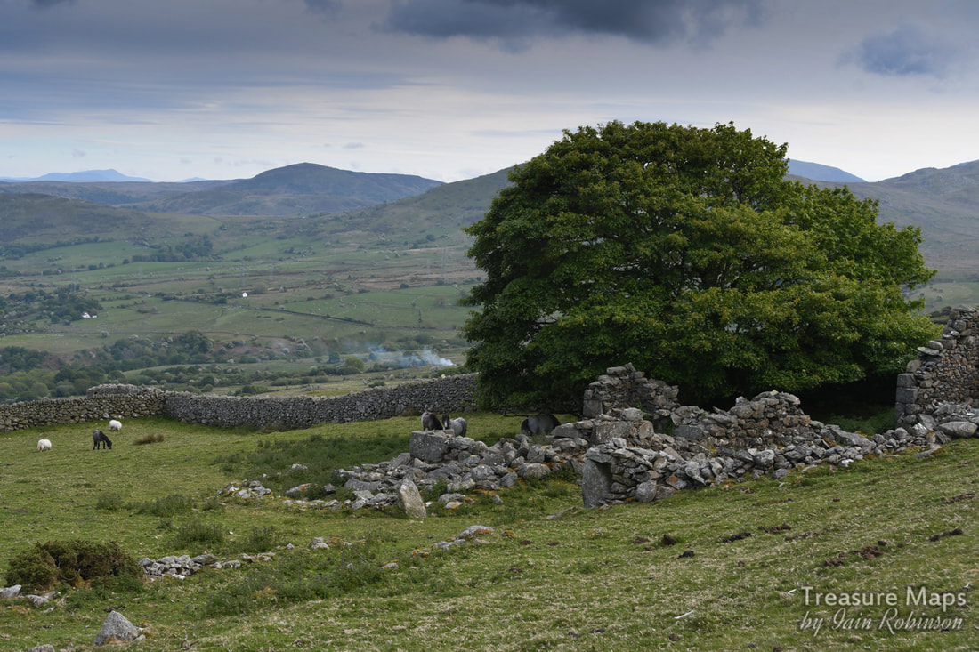
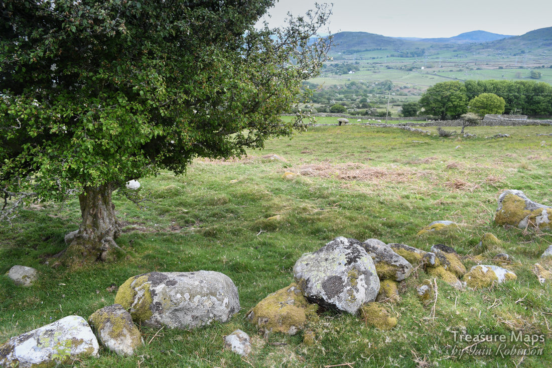
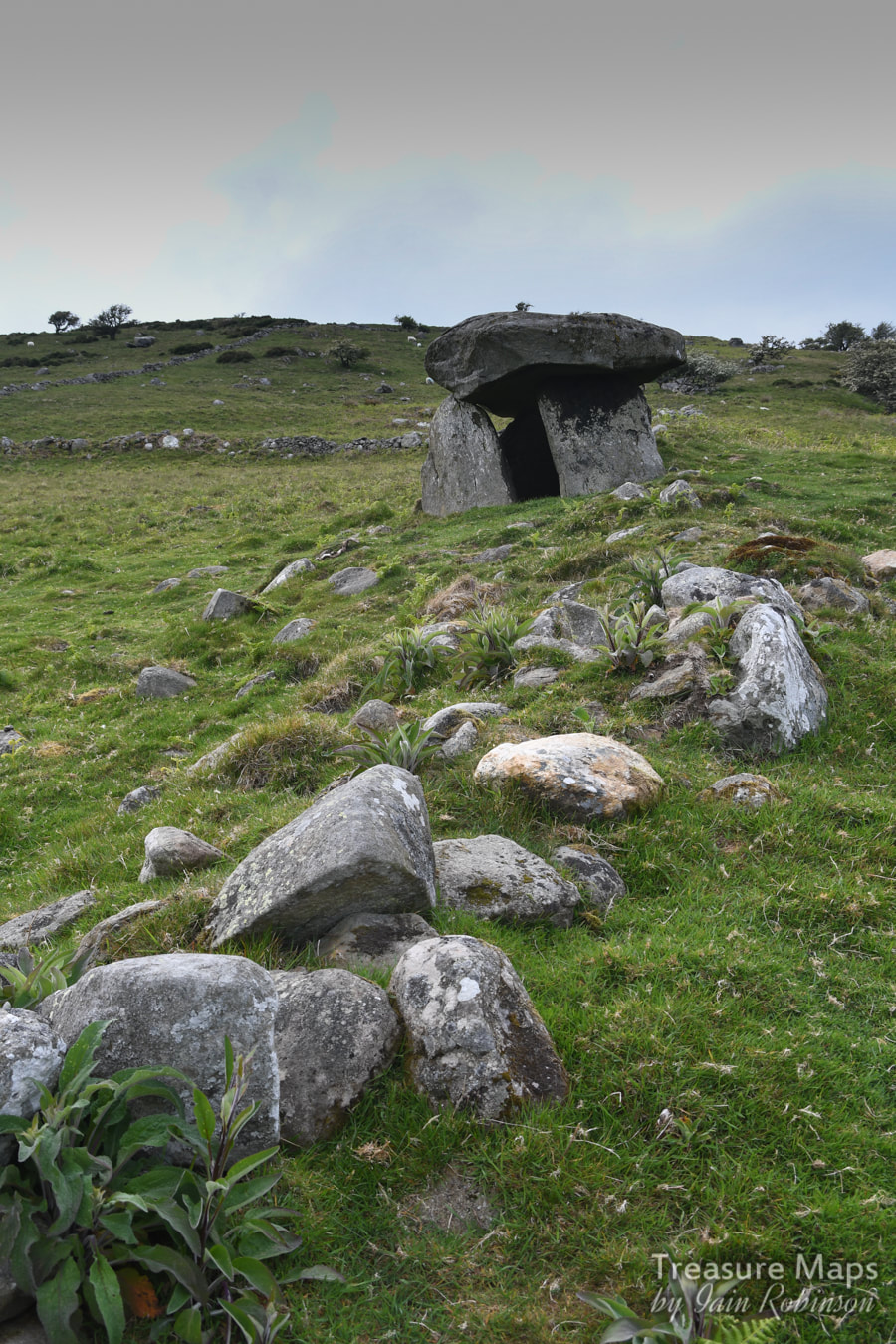
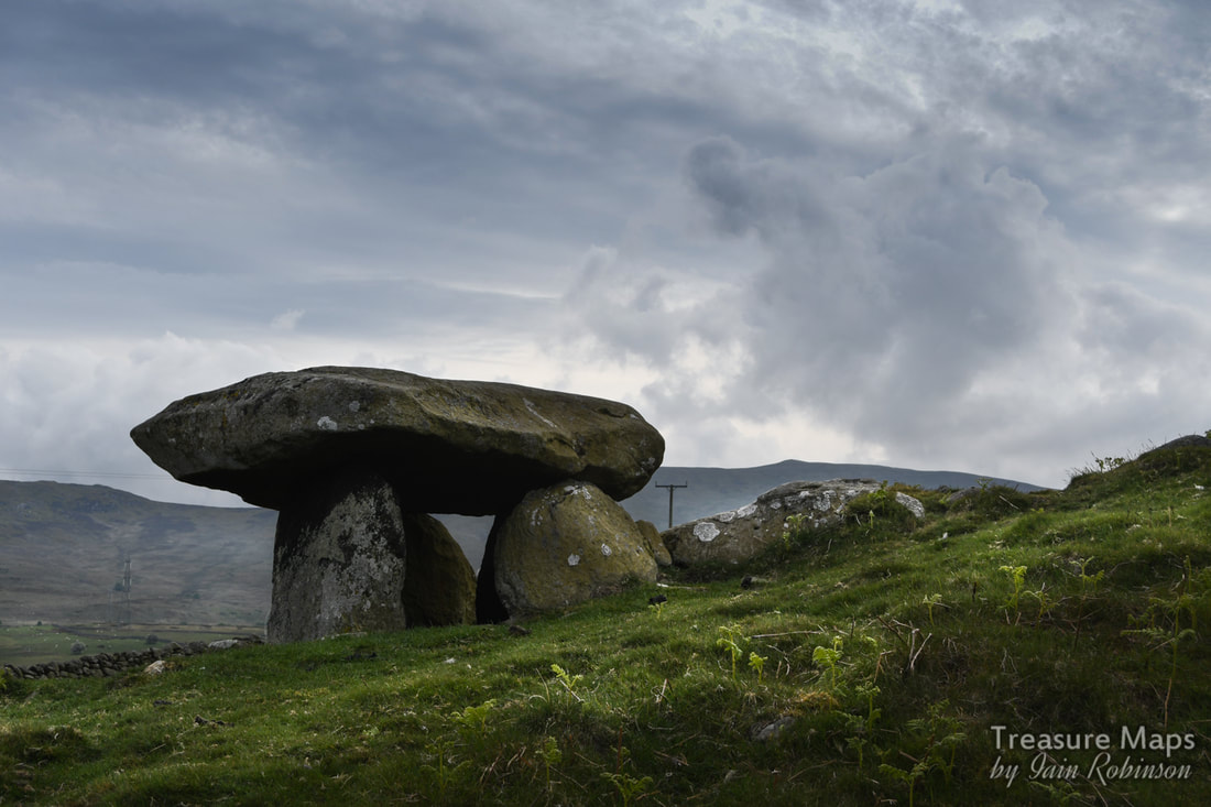
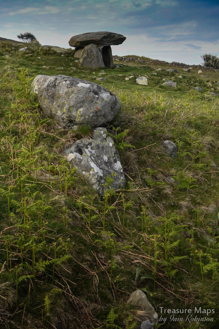
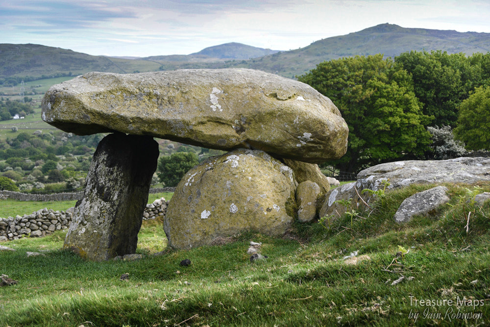
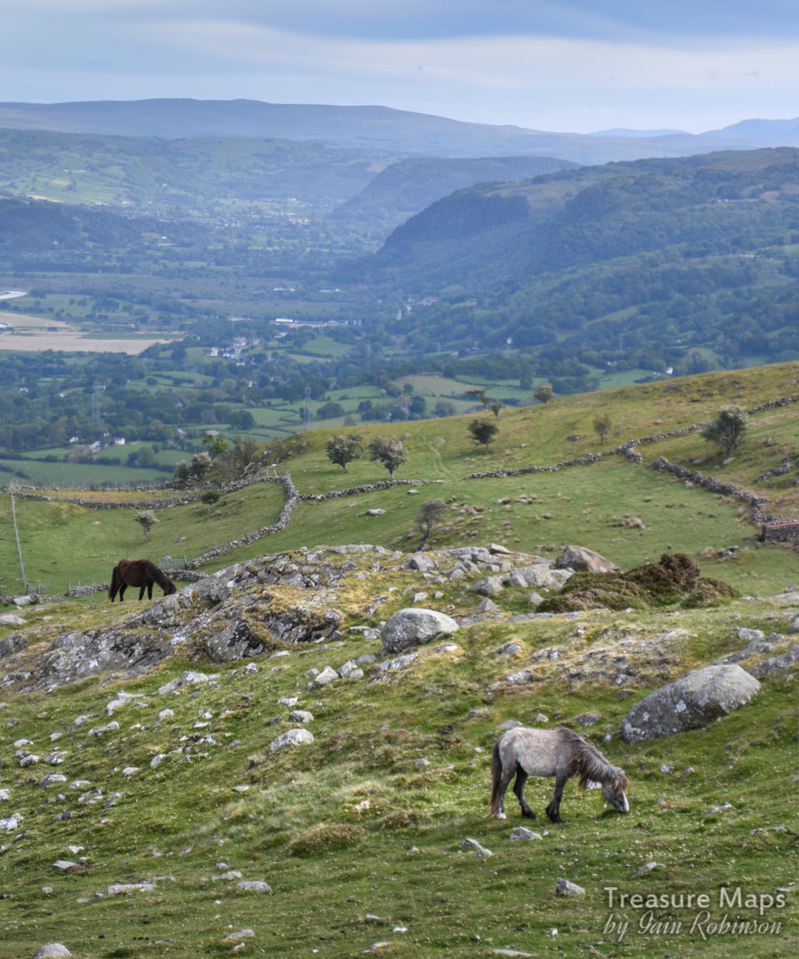
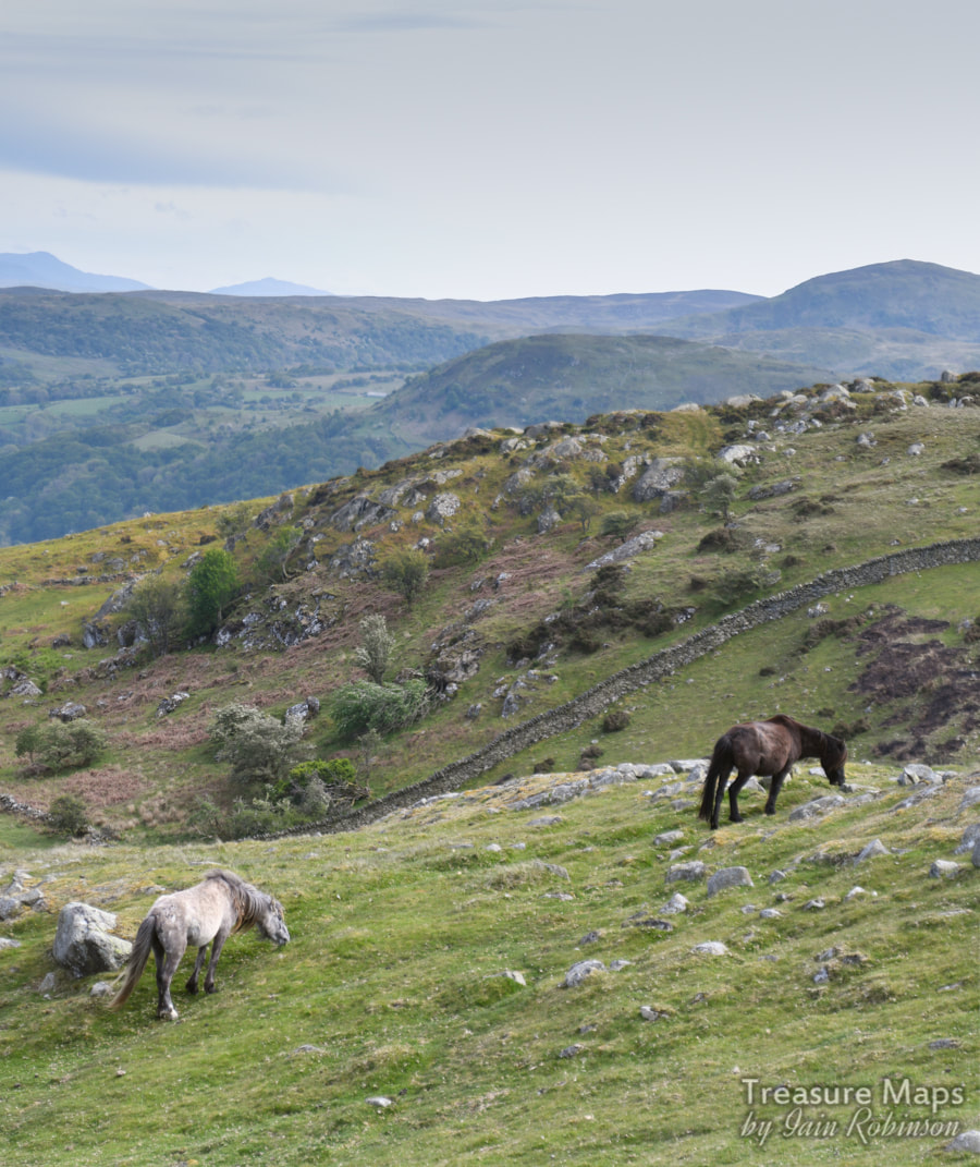
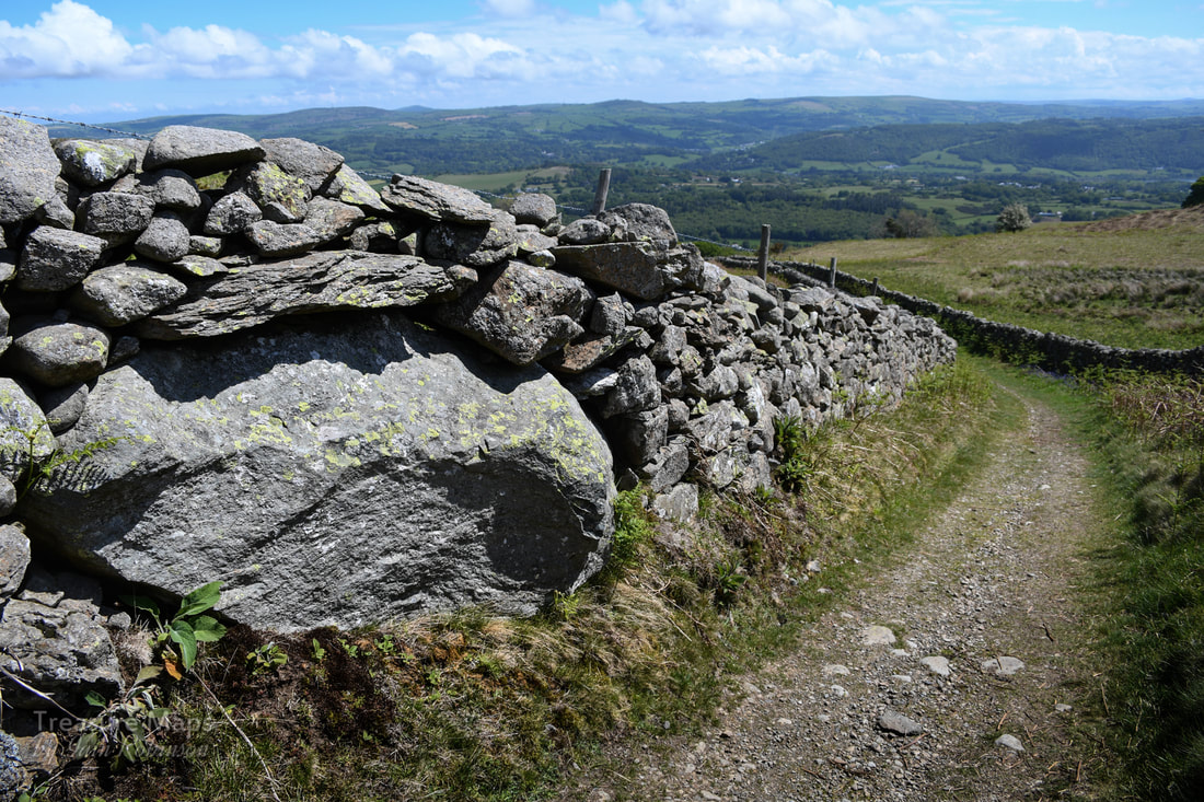
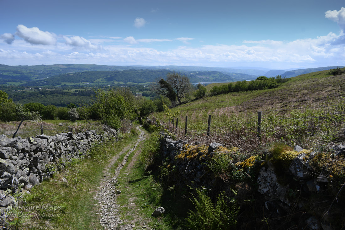
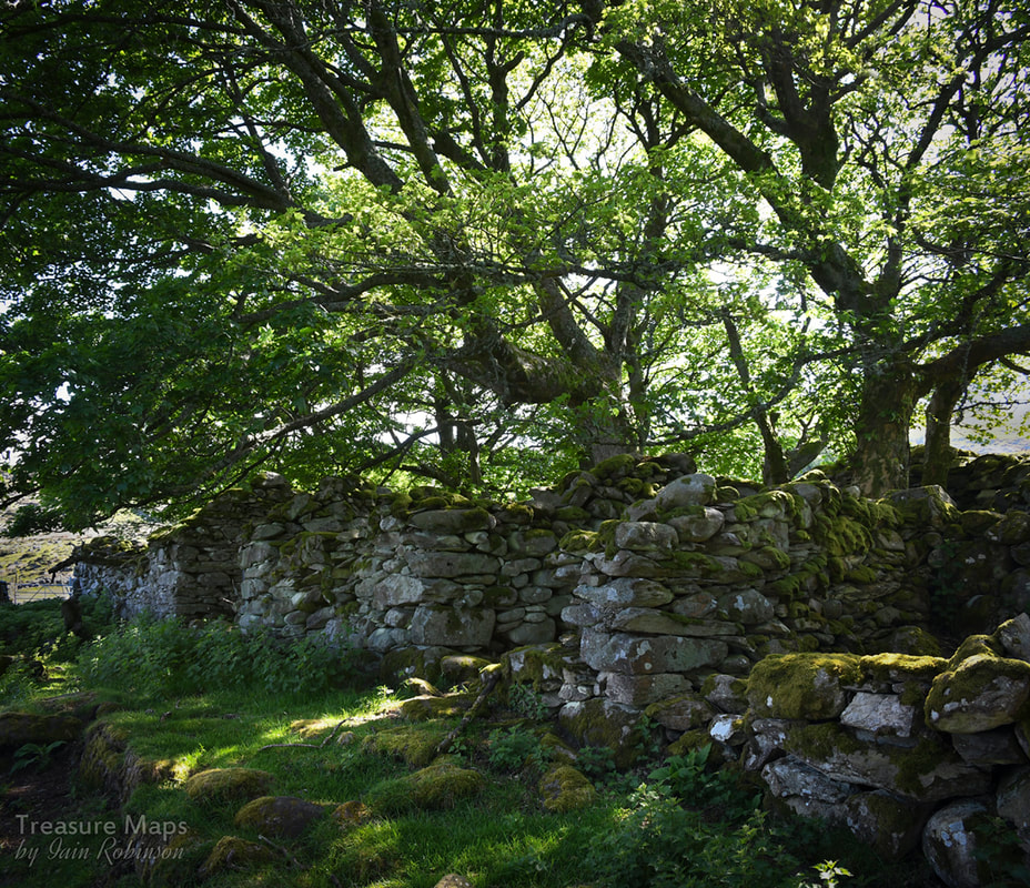
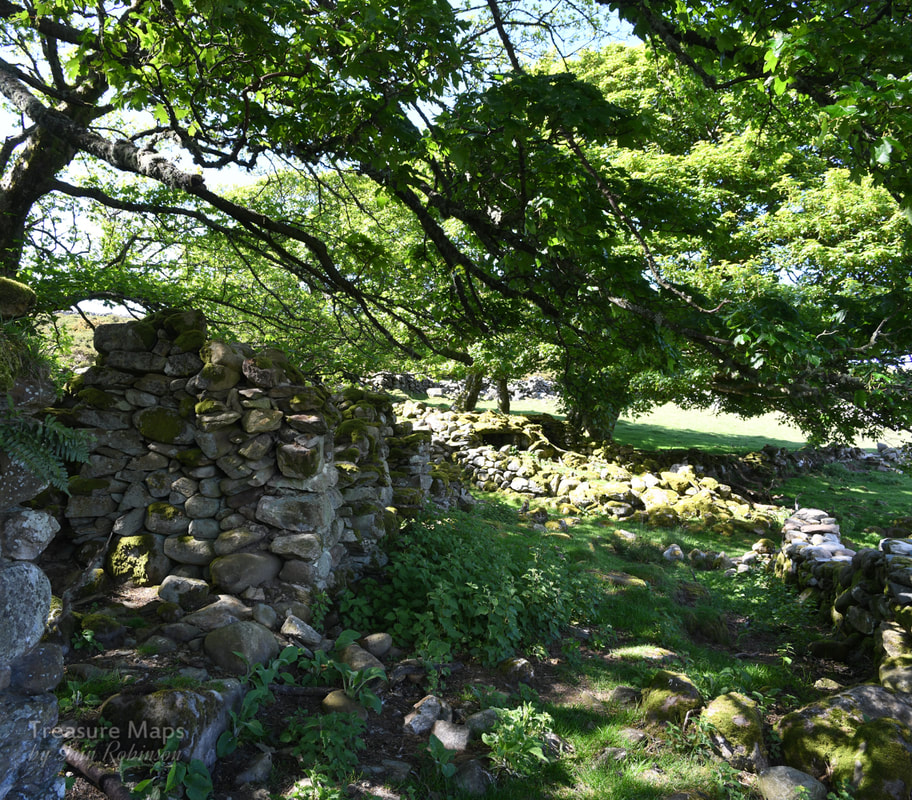
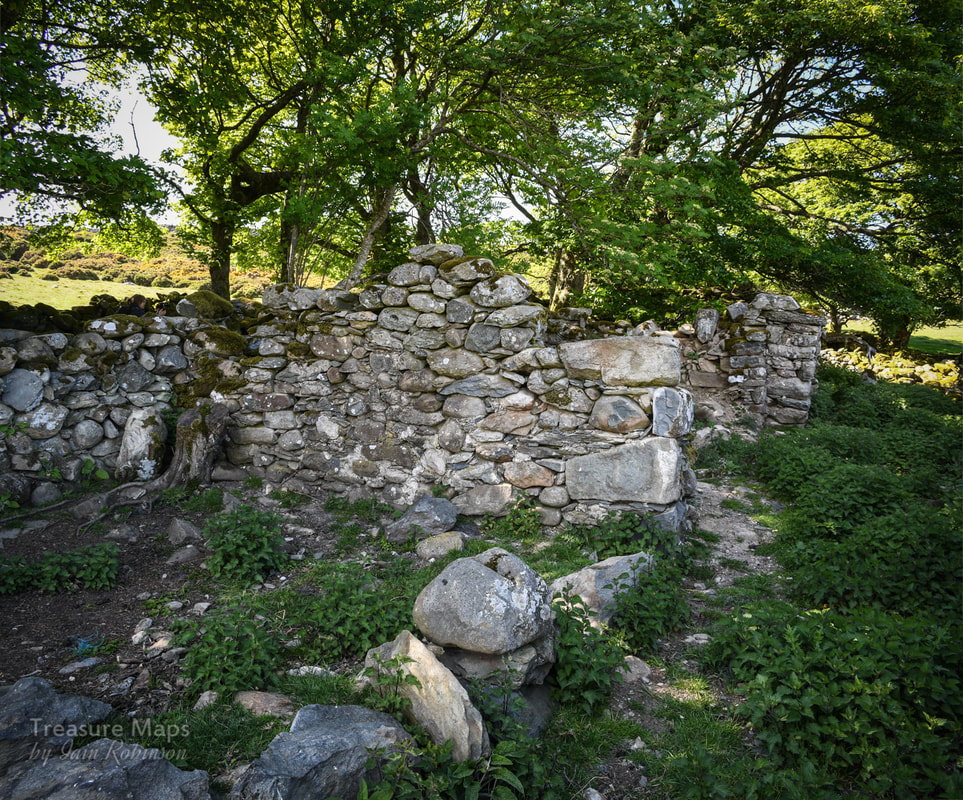
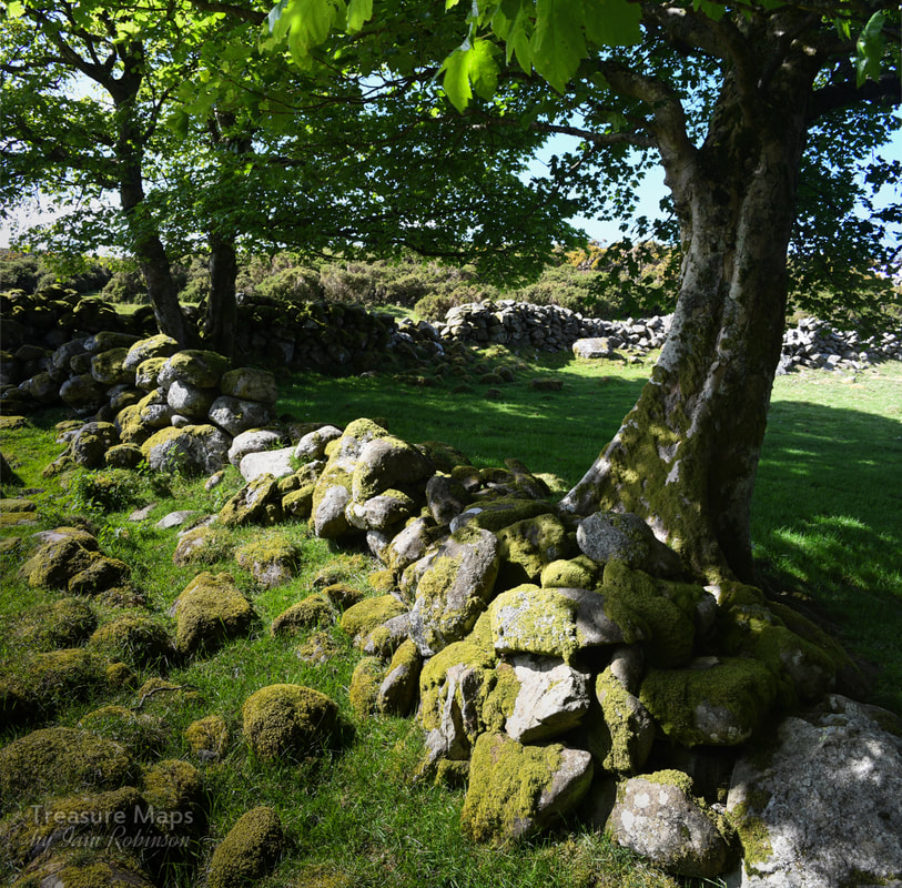
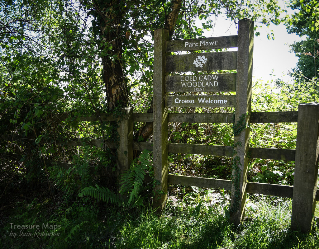
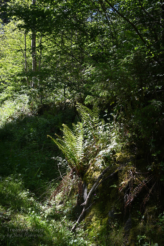
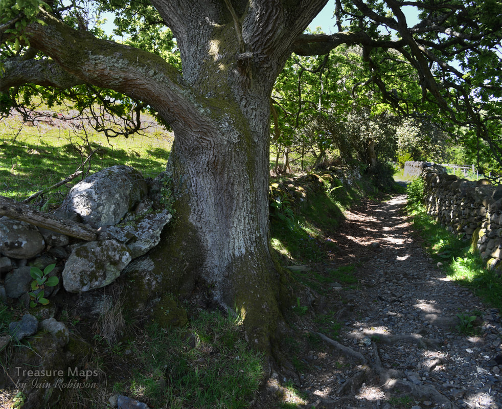
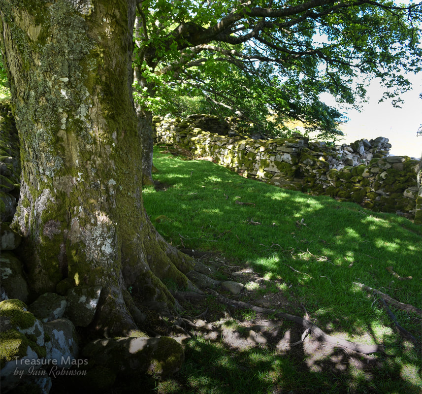
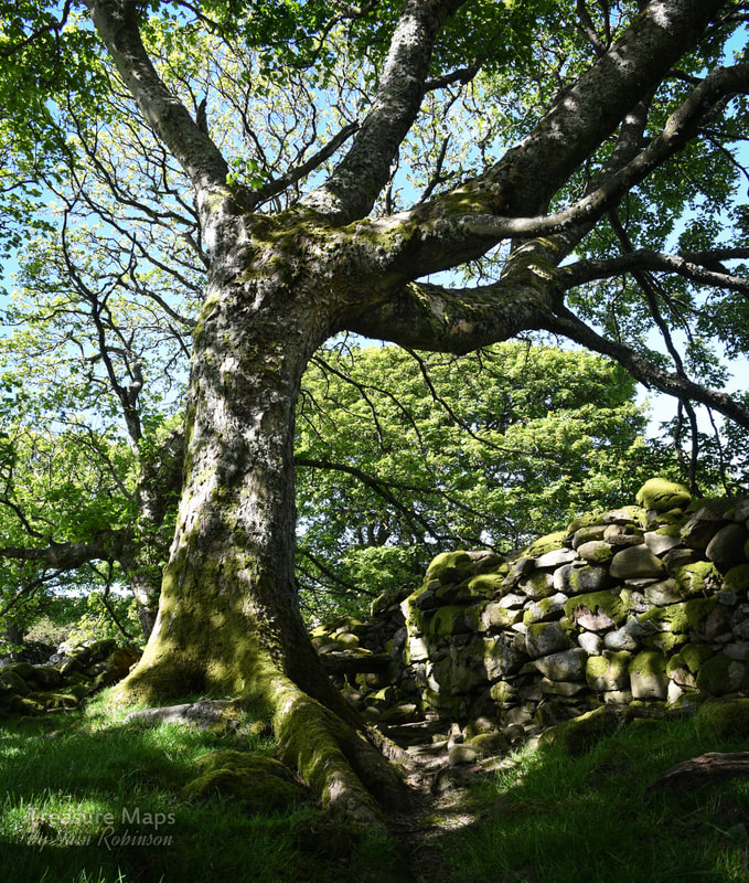
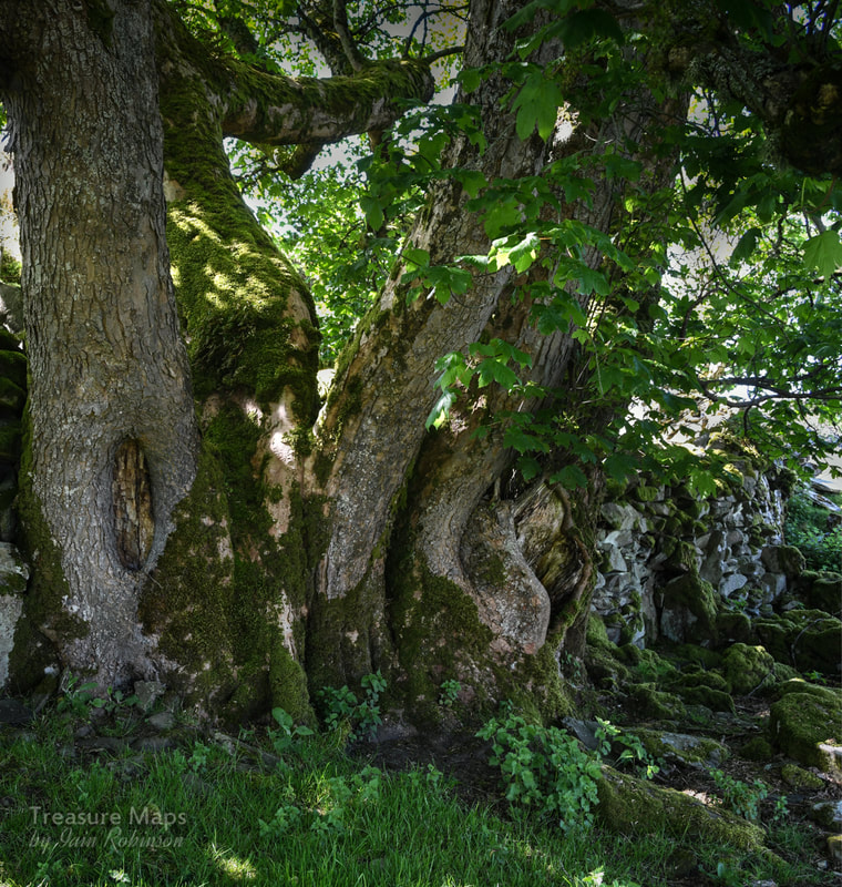
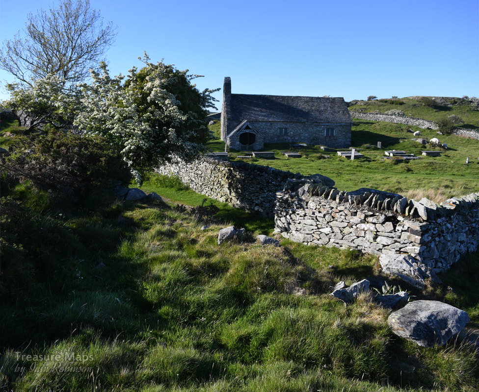
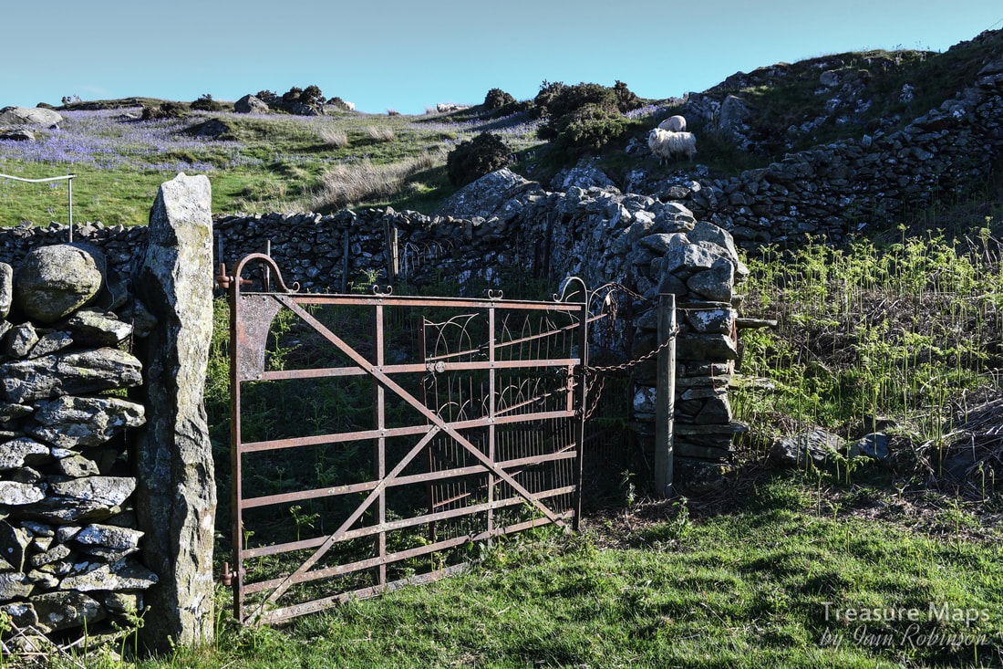
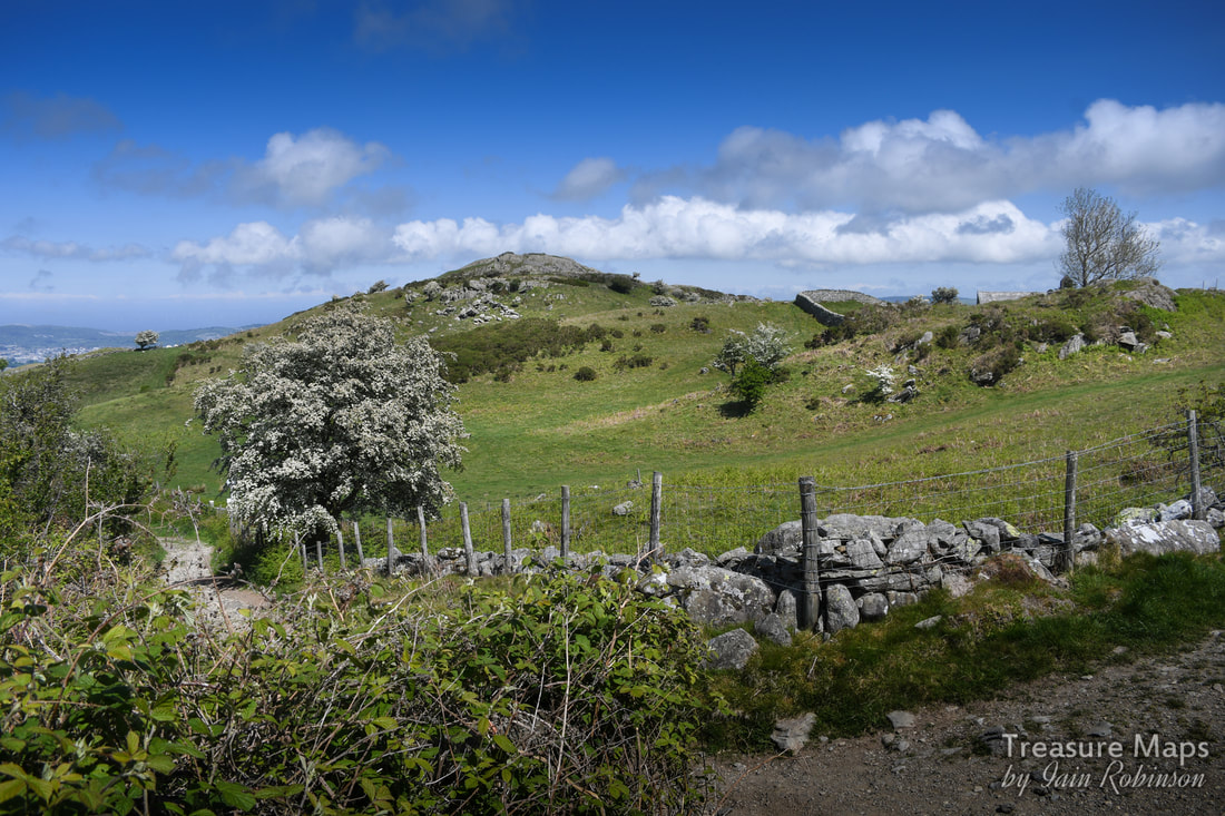
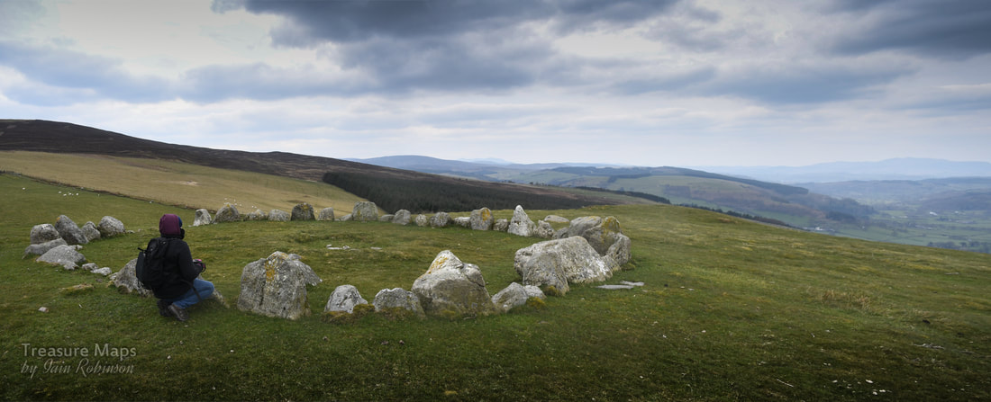
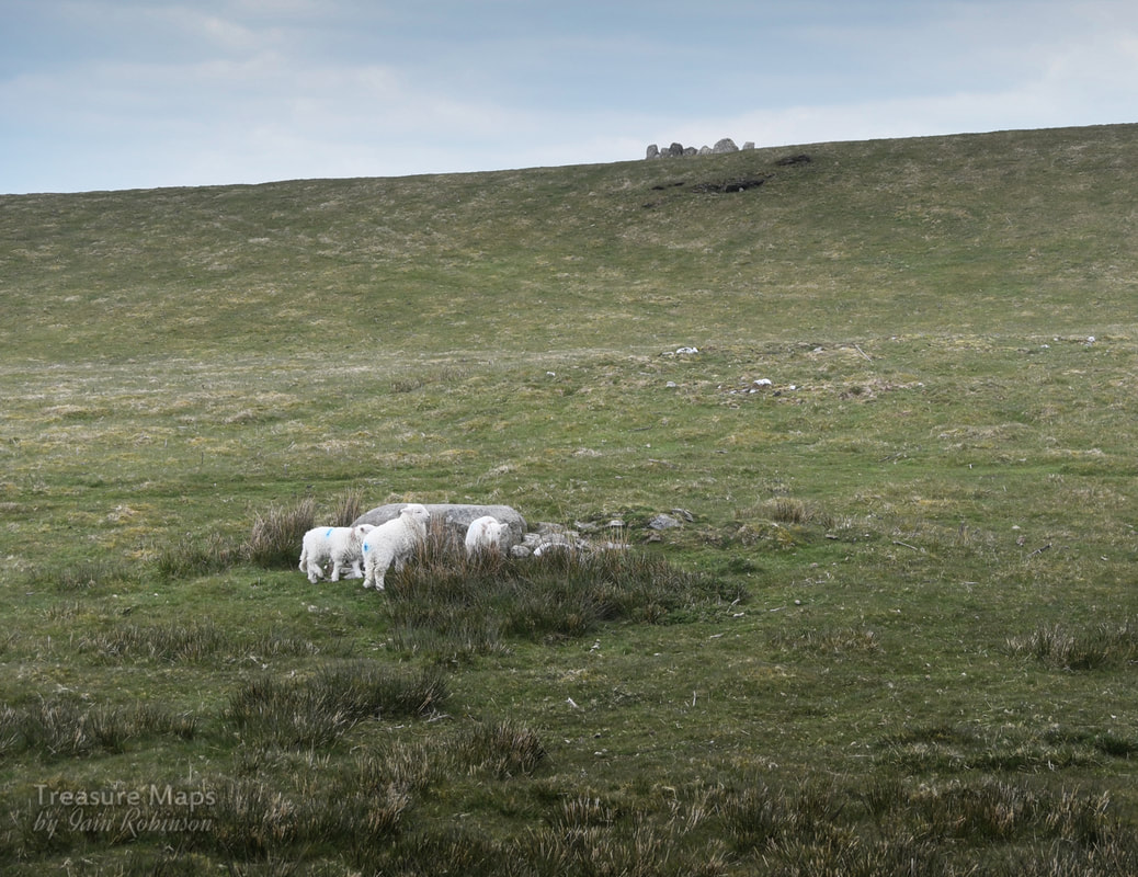
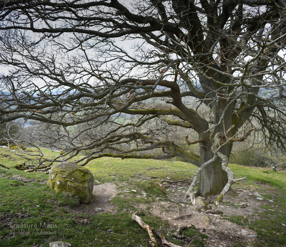
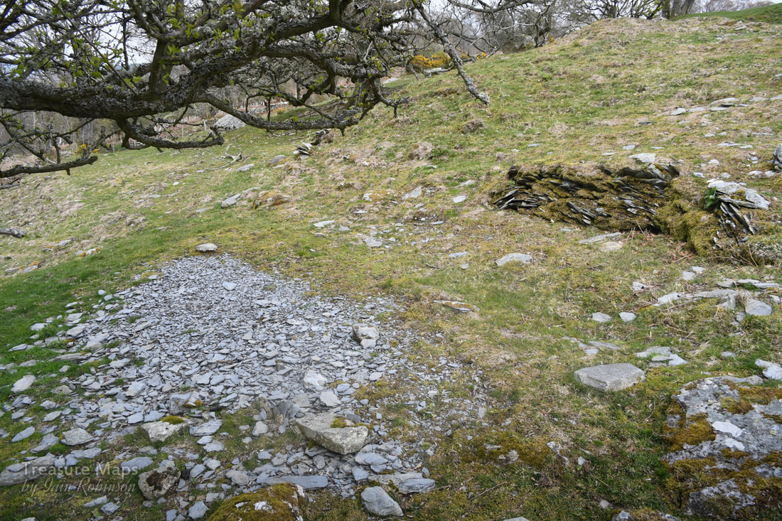
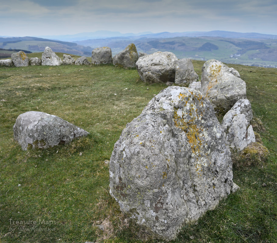
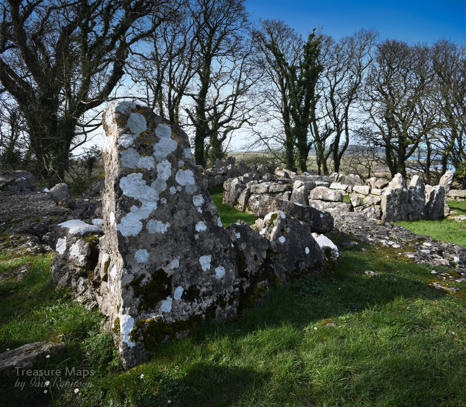
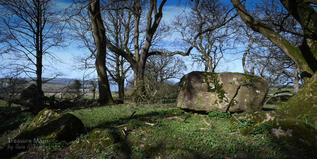
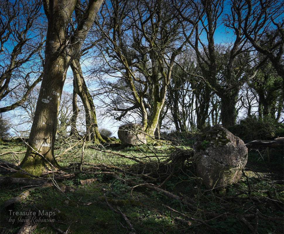
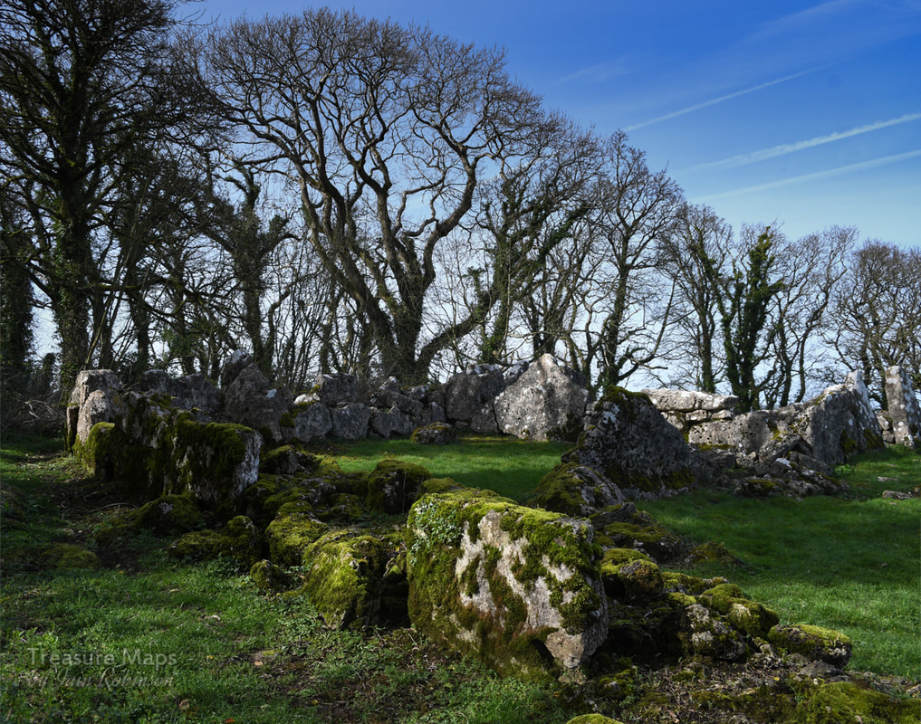
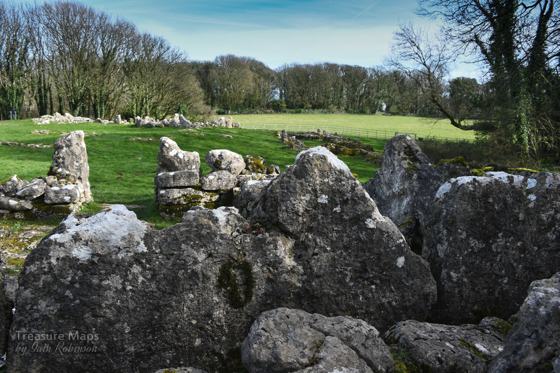
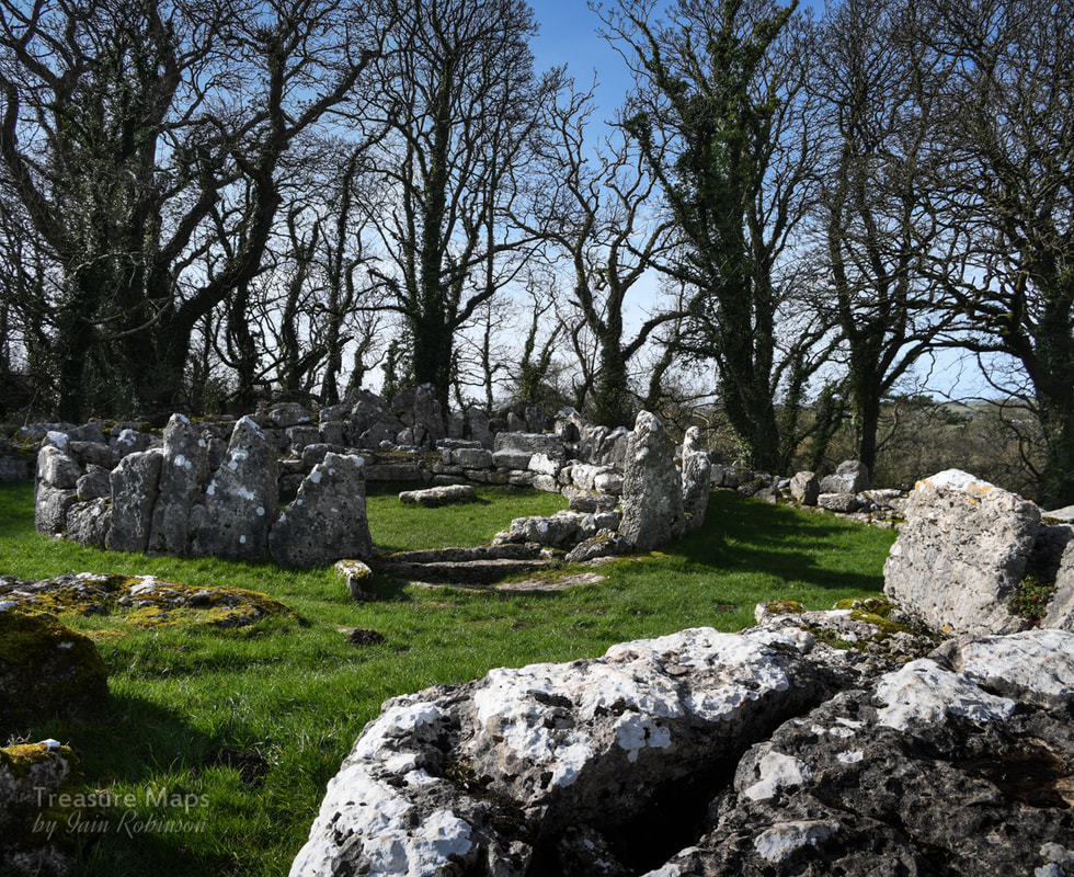
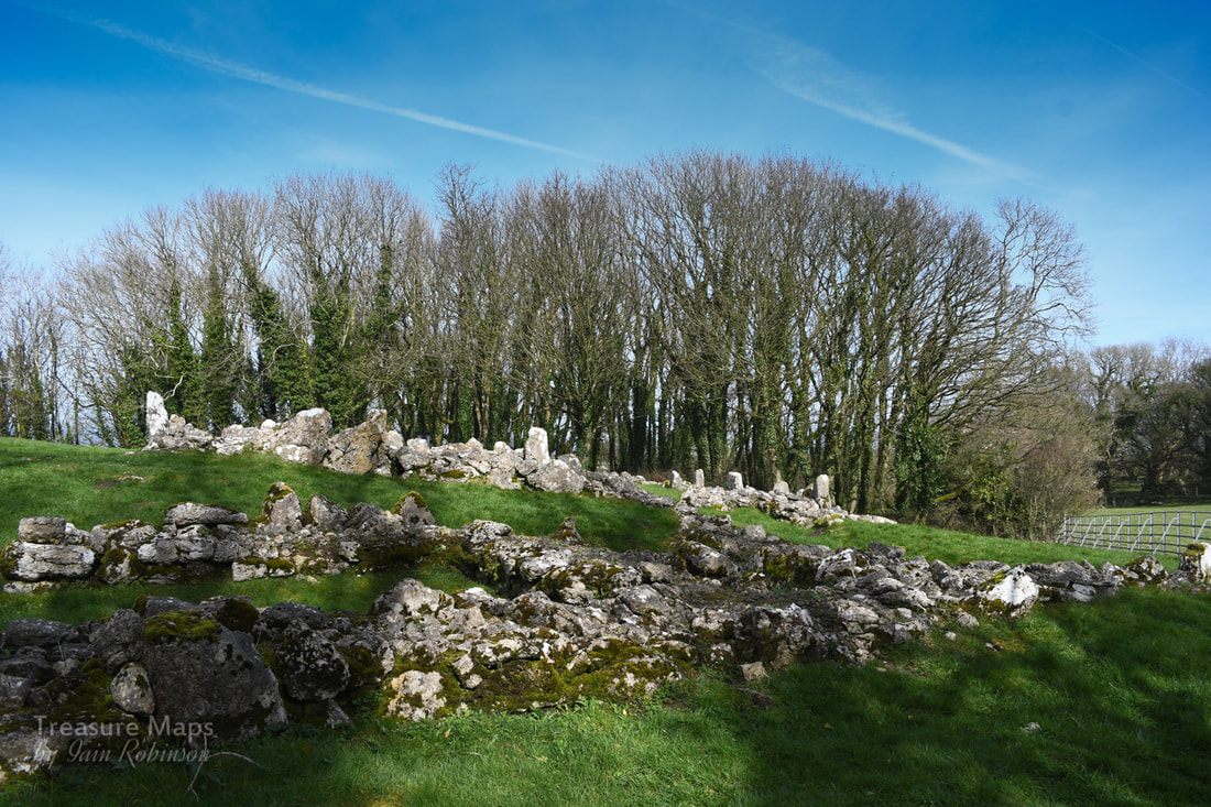
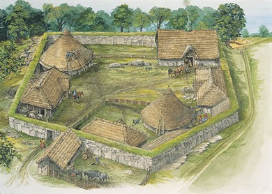
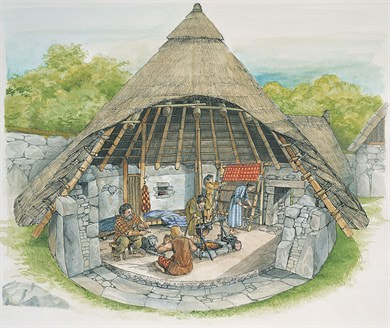
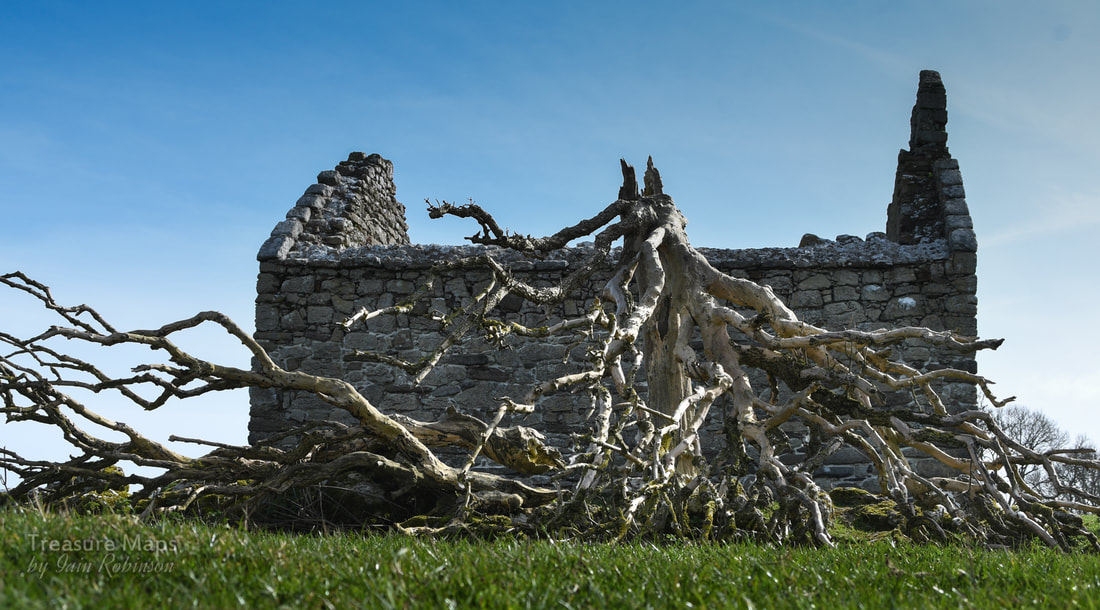
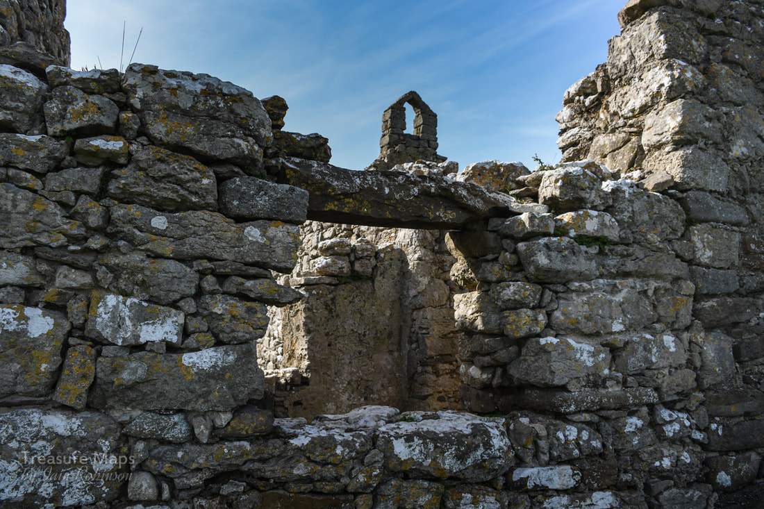
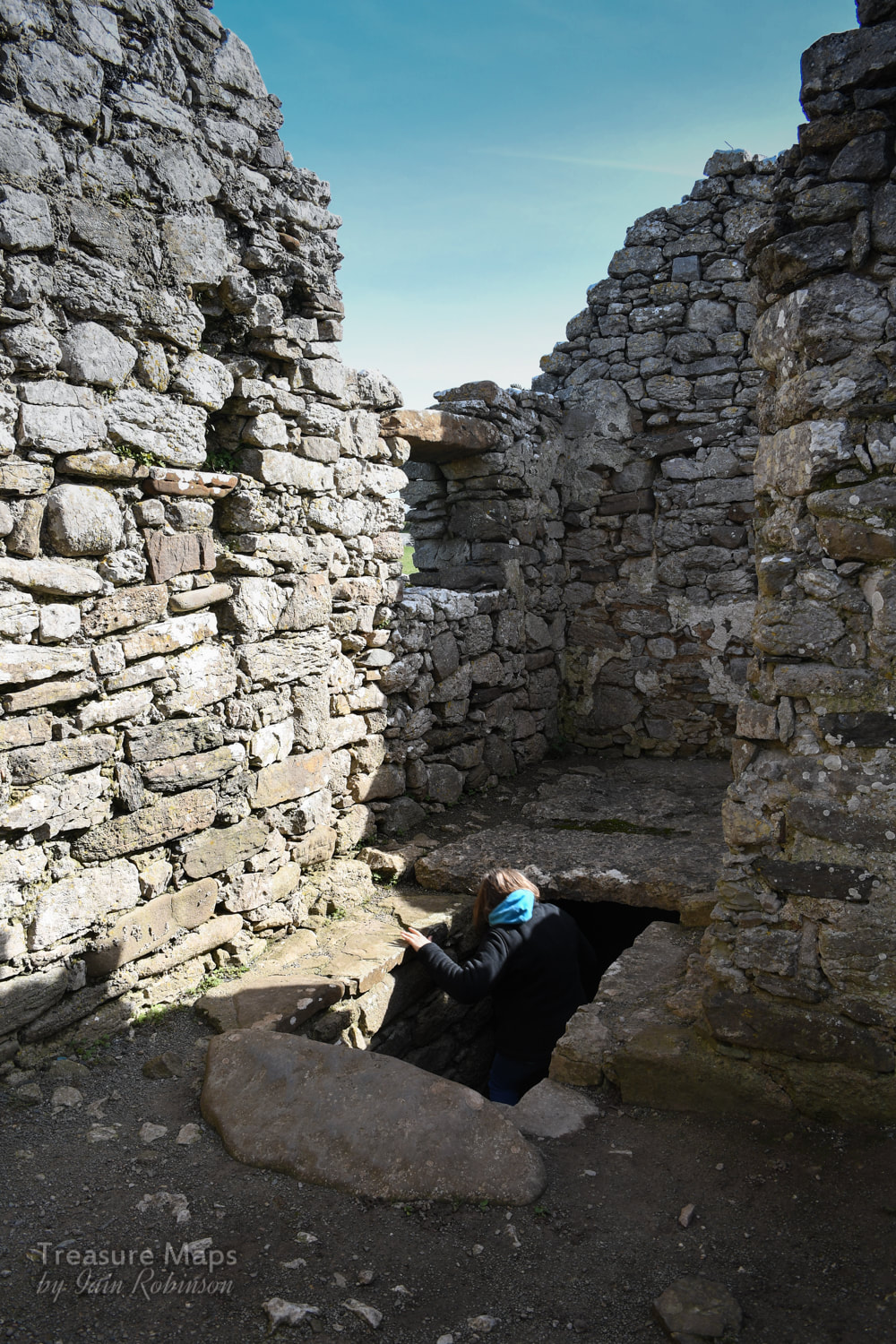
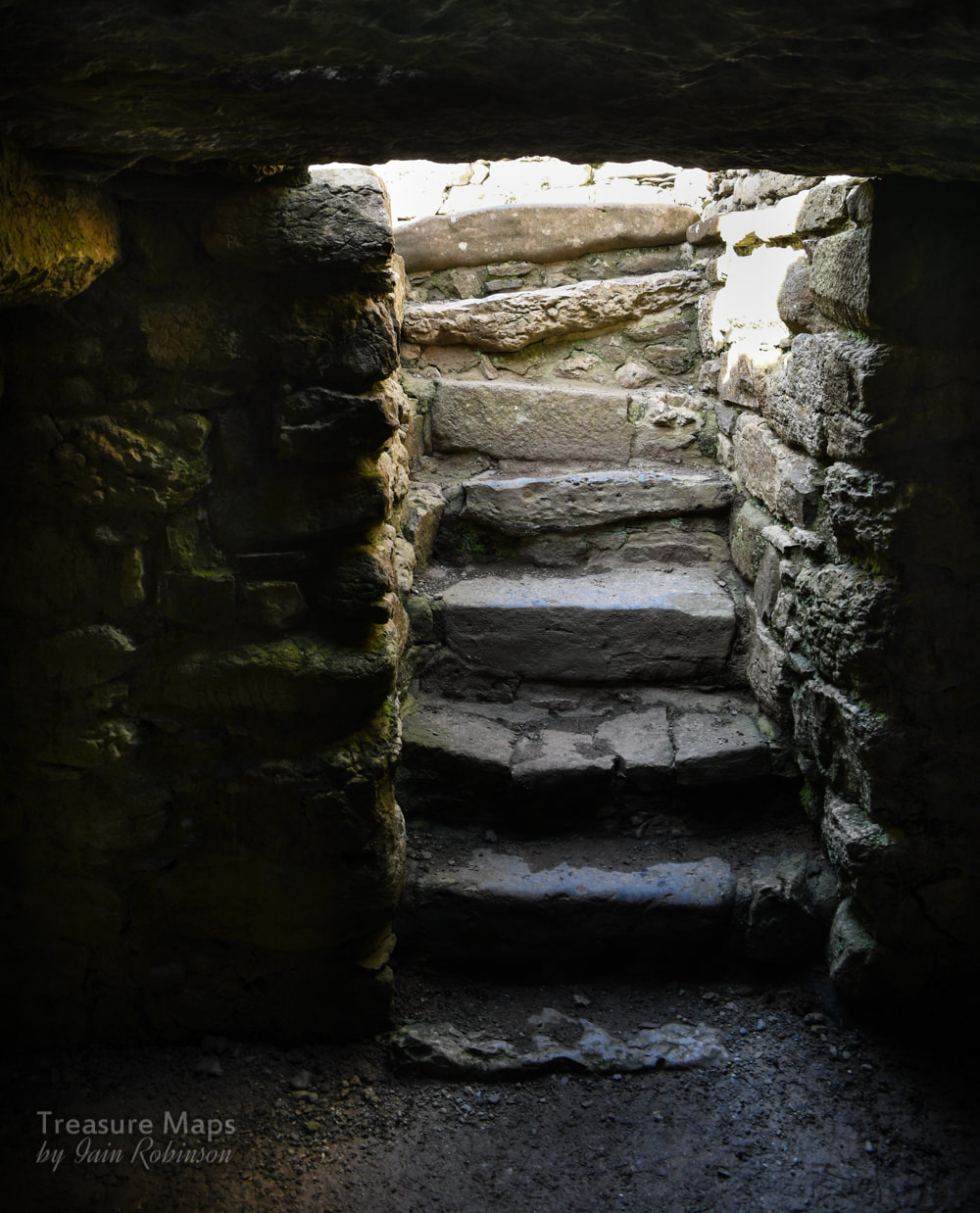
 We take a look at a couple of megaliths and the vestiges of a fort, plus a bonus mine near Tal-y-Fan mountain. And ponies... You might remember a couple of posts ago that I mentioned we were going to have a look at the area south of Tal-y-Fan which is rich in prehistoric remains. We finally got round to it, and it was better than we could have hoped. Remains of prehistory are thick on the ground here, from obvious standing stones to more subtle manifestations of our distant ancestors. 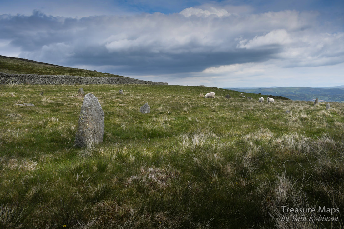 Cerrig Pryfaid stone circle Cerrig Pryfaid stone circle Cerrig Pryfaid stone circle SH72457132 We started from the Bwlch y Ddeufaen car park. Unlike our last few visits (here), we headed east along the road as it heads back towards Rowen-just for a short way. Within a few minutes, we had arrived at the site of Cerrig Pryfaid stone circle. It's unassuming, shall we say. You have to sit for a while and soak up the place (and it's stunning location). The stones fight for attention with the tussocky grass, but after a while you begin to see ten or twelve stones in a ring about 22 metres across. There appears to be a stone missing towards the north west end of the circle and there are a couple of outliers. Looking at Coflein's map, it seems that there were many other prehistoric features immediately nearby- a burnt mound, some hut circles and a longhouse. These things all take time to discover and to recognise, so it looks like we'll have to go back. One thing is for sure, this area was of considerable significance in neolithic times. 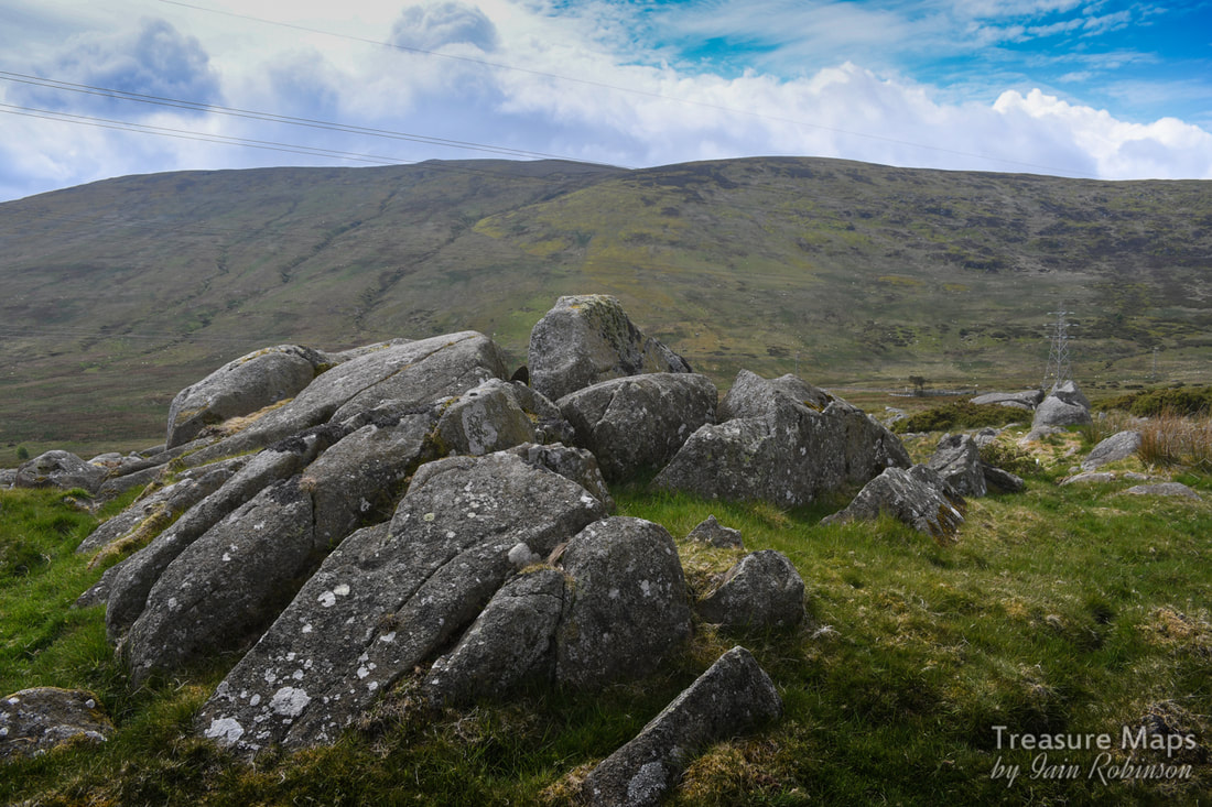 An impressive rock outcrop near to Cerrig Pryfaid. After trying very hard (and failing) to take any meaningful photos of Cerrig Pryfaid, we walked on until a fork in the road at SH73187147, where we went left and then through a gate.  Cae Coch The road becomes a trackway here then winds uphill through a wonderful landscape of low hedges, boulders and walls, always with a panorama of hills as a backdrop. We stopped by a big pile of rocks which must be an ancient clearance cairn and had our lunch. In the distance could be seen the hillfrot of Pen y Gaer (link to previous post). Areas of burnt gorse made me realise that when we'd been at Pen y Gaer last, the smoke had come from over here. 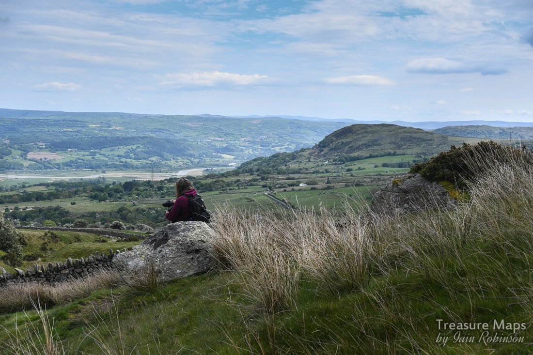 Petra looks over to the hills east of the dyffryn Conwy- Pen y Gaer hillfort is that darker eminence on the right...its commanding position is very obvious from here. After a pleasant ten minutes or so, we came to a sheepfold- not a very old one. A carving on the very fine gatepost gave the game away...1884. 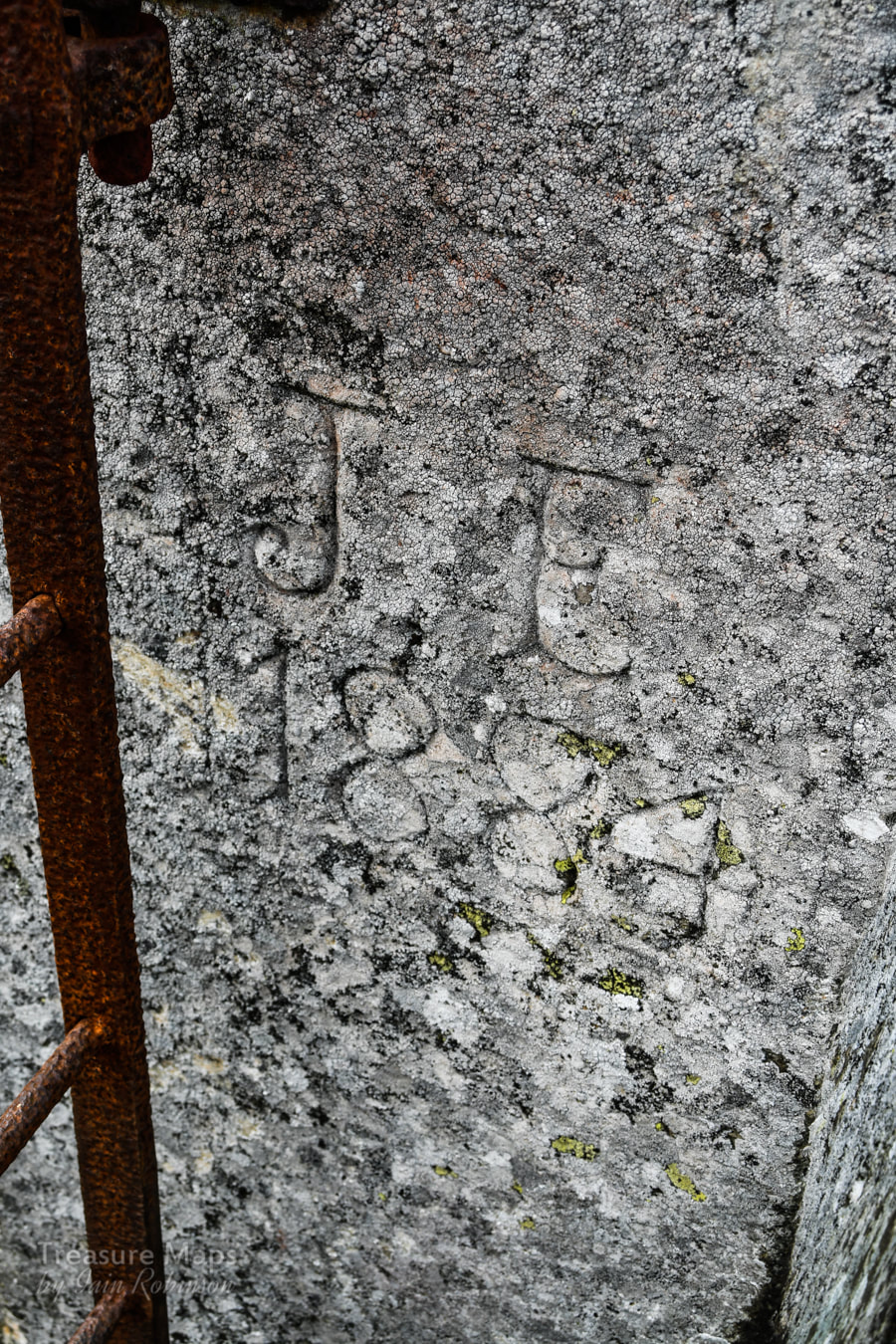 The fields here are littered with stones left by the glacier as it retreated. It must have been quite a job to clear the fields of these monsters, each weighing a good few hundredweights. 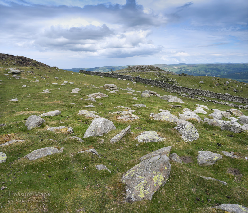 The glacial erratic boulders. That twmp in the background is Craig Celynin, and behind it is St. Celynin's church, visited in a previous post. We had been walking beside a wall, which gradually petered out until it was simply a line of boulders. It wasn't particularly straight, either. This type of wall, probably medieval, is known as a "Wandering Wall" which seems a nice image and fits these things very well. The rewarding thing about walking round an area is that gradually you begin to join the dots and see things from different perspectives. So here we were coming up to Craig y Celynin towards the east- a hill that we had walked around from the South, the Parc Mawr direction a few weeks earlier. Wales is compact and bijou- but that's it's charm, after all. 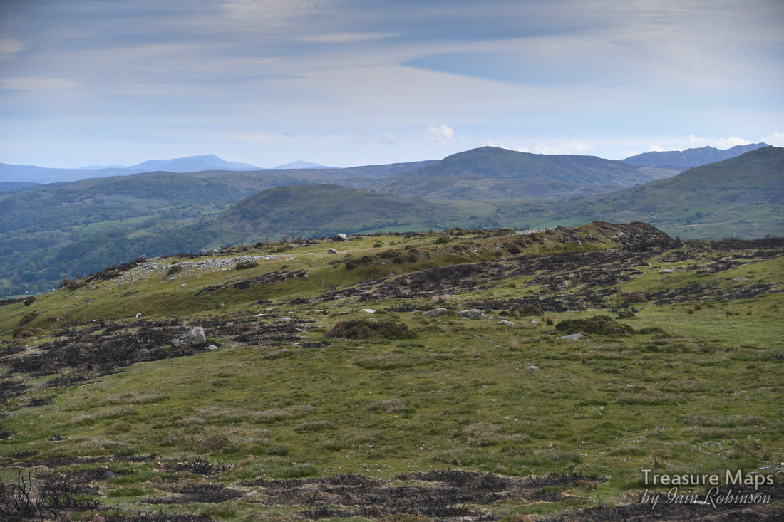 Caer Bach Hillfort from the north. Caer Bach Hillfort SH74427296 It was time to walk up to Caer Bach hillfort. From the south east it looks like nothing at all, but once on the site it's origins are obvious. The atmosphere wasn't helped by the gorse having been burnt over the hillfort, but at least it cleared the ground and made the remains more visible. It is a small fort of only 38m internal diameter. Strangely enough, it is built on a spur of land above the trackway, not a naturally strong position for defence as it is overlooked from above. However, it has a massive internal wall 5-6m in width and an outer defence of a large bank and ditch. This outer bank is unusual in that had a stone outer facing, some of which can still be seen on the west side. Little remains of the inner wall and the lack of tumbled stone has been suggested to show that it was unfinished or had been robbed to create the outer rampart in a second phase of use. Who knows...but the remaining stones left in the platform are useful for photography! We made a little detour here to visit a mine; what I expect was a trial adit for the Tal y Fan slate mine a few hundred feet above. This was at SH74347332 and shows up well on Google Earth satellite view. The opencut was too choked with gorse to even attempt a look without some serious bush cutters. There is quite a quantity of spoil, but no discernable trackway to the mine. 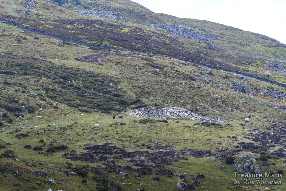 The trial mine viewed from Craig y Cellynin. Above are the tips of the Tal y Fan slate mine. Just for the heck of it, we decided to scramble up to the top of Craig y Celynin...there were some impressive rocks on the top and I thought there might be a view towards the church below, but that was masked by some small drumlins. What we did see were some wild horses, so there are some gratuitous Carneddau pony shots at the end of the post. Maen y Bardd SH74067178 It was time to walk back and go cross-country to find Maen y Bardd. We retraced our steps, then picked up a path going downhill through the ruined farmstead of Pen y Ffridd. 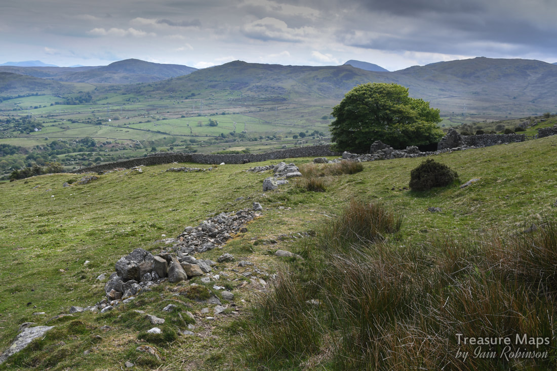 The remains of a wall going across to Pen y Ffridd in the trees. There are all sorts of remains here, from victorian farm remains through to medieval field systems and long houses. Everything you see seems to have some past significance. Gradually we descended towards Maen y Bardd. 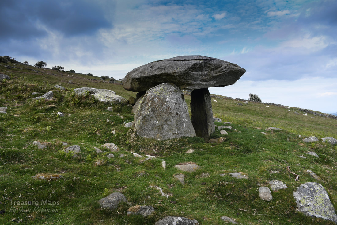 So here we were at last. Maen y Bardd, 'Bard's Stone' is thought to be all that remains of a burial chamber built around 3500 BC. Tradition suggests that the dolmen was originally covered by a large cairn, but only scattered traces of stones remain. The burial chamber consists of a large, flat, capstone supported on four standing stones forming a rectangular inner chamber. The chamber is about 1.2 metres high (roughly 4 feet) and the capstone projects beyond the upright stones to form an entrance, or portal. For that reason this type of burial chamber is often called a portal dolmen. The chamber is sometimes called Cwrt-y-Filiast (Kennel of the Greyhound); a reference to an ancient legend that says that a giant's (in some versions, Arthur's) sheepdog took shelter under the dolmen and his master threw a spear across the valley at the hound, who sheltered in the chamber. It's a fine spot, all the more so for being surrounded by other remains in a rich landscape of prehistoric settlements and fields, the majority probably belonging to the later Iron Age and Romano-British periods. It also lies adjacent to a sunken trackway which bisects the earlier fields, thought to be the line of a Roman road. Ffon-y-cawr standing stone SH73927170 The trackway that leads past the stone connects it to a couple of other interesting megalithic remains. The next one was the standing stone of Ffon yr Cawr (the Giant's Stick) or Piccel Arthur (the Spear of Arthur). 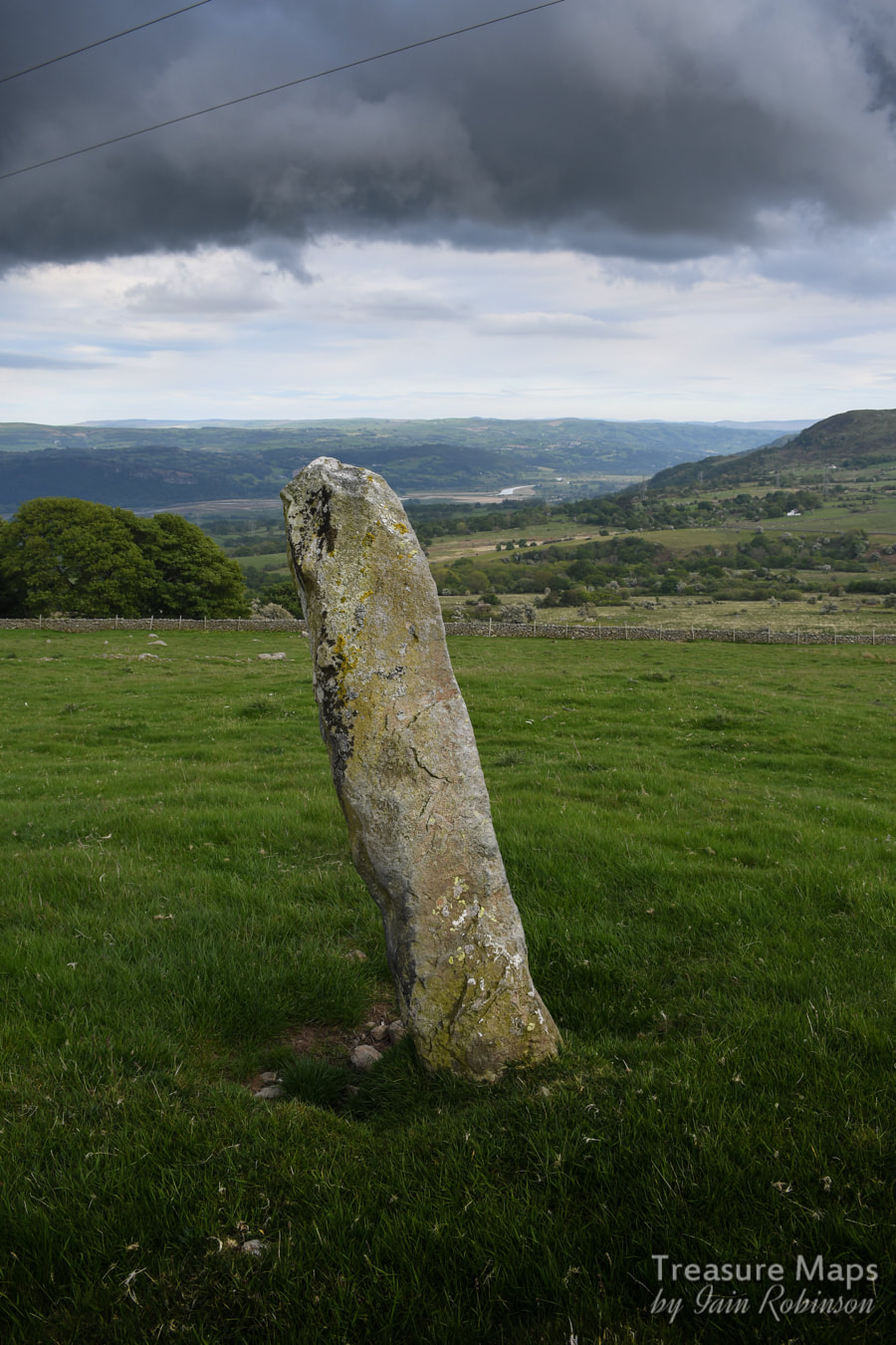 Legend has it that this stone, over 7 feet high was originally a spear belonging to that all-purpose mythical figure, Arthur. Apparently, Arthur was gathering his sheep on Pen y Gaer but the dog ran off and sheltered in the dolmen. Arthur threw his staff in exasperation, and it landed nearby. Not a bad shot. By now, it was becoming rather gloomy and my shot of the Cae Coch standing stone further along the sunken trackway (SH73557164) was pretty useless. Luckily, Terry Hughes had taken an excellent shot for which I give grateful thanks. We managed to miss quite a few things on this part of the walk, meaning that a re-visit will have to be done, but that's the fun of it, isn't it? 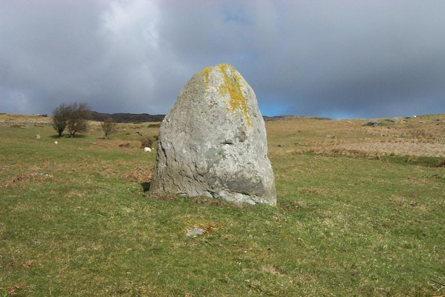 Cae Coch standing stone cc-by-sa/2.0 - © Terry Hughes - geograph.org.uk/p/196627 And to finish off the post, some Carneddau Pony shots, as promised... 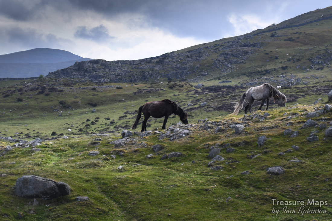 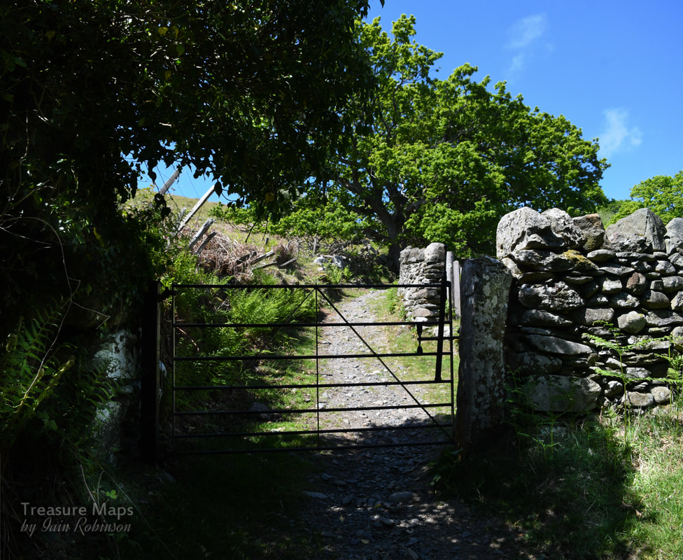 Some ancient woodland, the old, remote church of Llangelynnin and Maen Penddu standing stone, all connected by a rather old path. Parc Mawr An area of woods to the west of Henryd, at SH757737, Parc Mawr is owned and managed by the Woodland Trust who welcome considerate visitors. There's a small car park/layby near the entrance, which is handy as there are few places to park hereabouts unless you start from Henryd. This is a mixed deciduous woods, on a very steep east facing site above the Conwy valley. But the first thing we encountered was an adit...  A low trial adit of the mine seen immediately as you enter the woods. Photograph by Petra Brown. 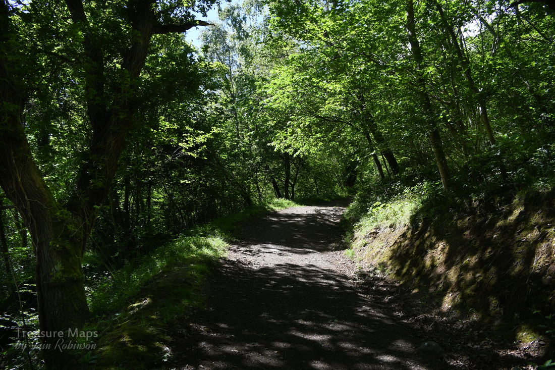 Into the woods! After having a nosey around the ungated trial adit, (more about this here) we set off up the main path which takes a route along the middle of the woods. The path climbs steeply for almost a mile, (a vertical climb of 110 metres in height), to a viewpoint with a handy bench. There are many fine trees to admire; beeches, sweet chestnuts, Douglas firs, and some fine old oaks. Conifers have been felled and left on the ground. We sat for a few minutes and gazed at the view across to Conwy, starting in on the snacks already, despite it being early in the day. Feeling slightly full, we walked on a little way until we encountered a trackway crossing from below. This is an old route which has been re-branded as the "Pilgrim's Path". We turned right and walked steeply up. It's surfaced with round stones and would probably be very slippery in the wet- even on the glorious day we had, it resembled a stream bed in places. It's interesting that on the way up the path, the walls vary in age and repair condition. Near the top, there is some ancient walling on display, parts of it originating from the middle ages. We went through another gate, with the Iron Age fort of Cerrig y Dinas looming on our right. The old church came into view now. 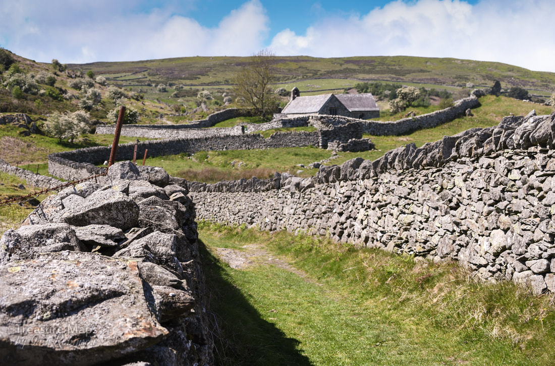 Looking at the walls as they strode up the hill, I realised that they were enclosure walls- perticularly noticeable in the higher land above the Conwy valley. I don't like the thinking behind them, the idea that a few people could divvy up land that folk had been living and farming on for thousands of years. Share it out between themselves and chuck everybody else off. But I had to admire the craftsmanship that went into building the walls. I have tried to build dry stone walls a good few times and I know how much thought goes into it- and how much frustration! St Celynnin's church I shan't say much about the church, since churches and religion are not my thing. But if it's your thing, then it is well worth a look. The site was dedicated to St Celynnin in the sixth century, although this ultra-modern imposter dates from the twelfth century. You can pick up a very good, free informative leaflet inside the church. Petra went in and took some photos- I will put them on here when her workload allows her to process them. 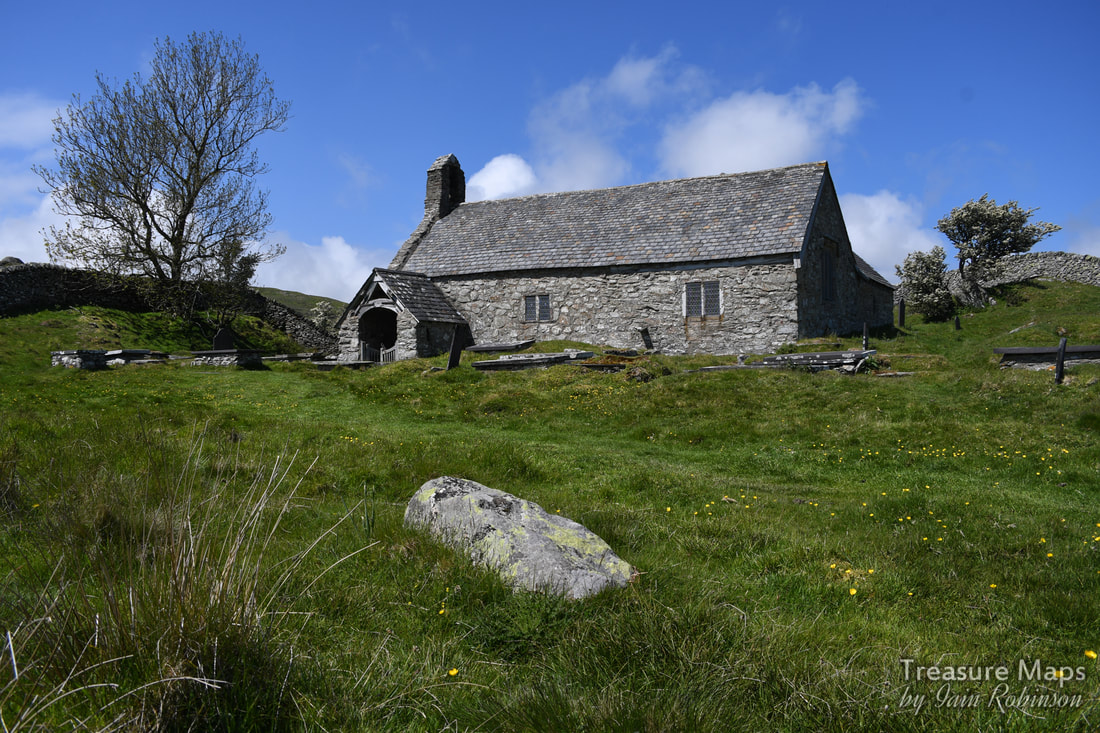 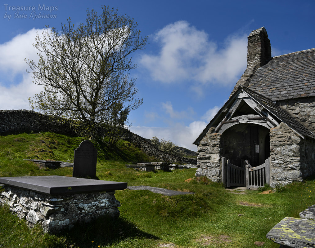 Once past the church, the moor opens out and horizons become wider. We walked past a very fine sheepfold. I'm glad to see there is renewed interest in these wonderful old structures that always fascinate me when I find them in the hills. Sadly, they don't photograph very well without a drone, or a tame pilot to do them justice! 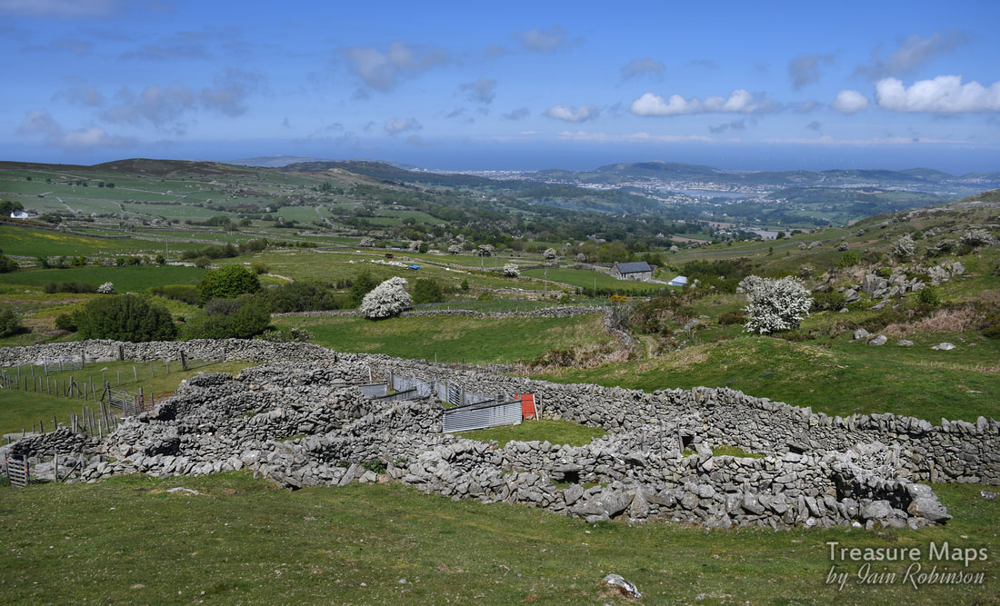 We headed upwards as the landscape became more remote, despite being only a few miles from Conwy. That is one of the attractive features of this area, as locals can come up and get some fresh air while it is relatively unknown to the majority of tourists, who tend to congregate on the Bwlch y Ddeufaen to the south. I don't think my readership is big enough to endanger the secret. The ruined medieval farm of Friddlys We were now on the lower slopes of Tal y Fan, and could see the eponymous slate quarry ahead. See post here. We were intrigued by some stands of trees below in the otherwise bare hillside. I wondered if the trees masked a ruined farm, so we went down to have a look. We found something rather magical in the shade of some old sycamore trees. According to Coflein, this was a medieval farmstead, which they call Ffriddlys, although it is marked on the 1st edition OS maps as Llwyn Penduu. Modern maps ignore it. The first thing that I saw was a pig sty, almost completely ruined, but still recogniseable. Then a cart shed. To the right, or south, there was a range of buildings- at the end was the dwelling house with a range still in position (just). I wished it wasn't so sunny (never satisfied) as the light was so harsh, but perhaps that added to the magic as well. 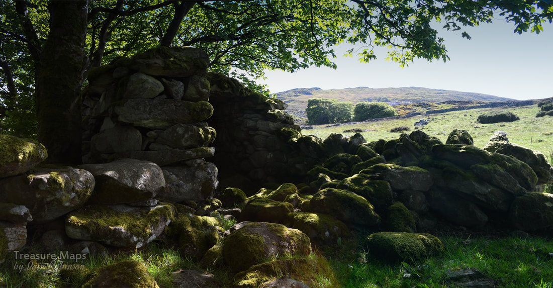 The remains of a cart shed. 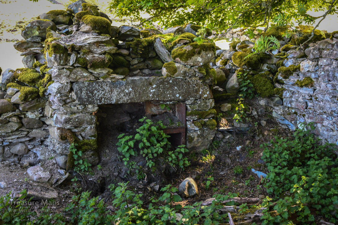 The remains of the kitchen fireplace. 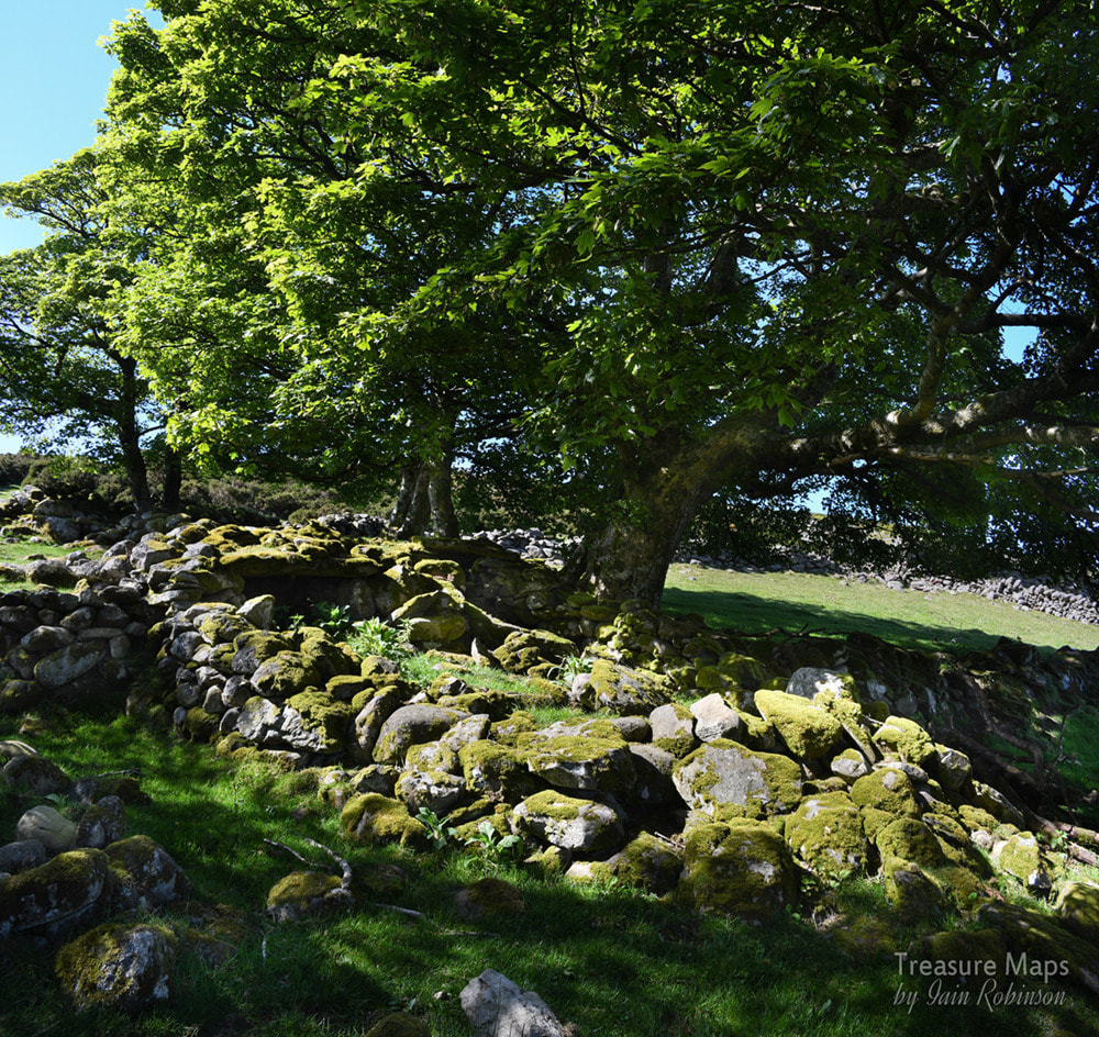 Remains of a double pig-sty. A little bit further up the hill, there was another, smaller set of more ruinous structures- I think they were a part of Ffridllys farm. I failed to photograph anything here, sadly, the differences between the light and the shade defeated me. There was a mysterious metal wheel leaning in a gate opening, perhaps from a machine like a hay rake. Maen Penddu We made our way uphill to an area which contained a number of old beudy structures, and the peat hut shown in a previous blog post here. These were all close to a very impressive standing stone, Maen Penddu. 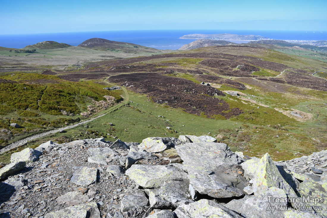 In a shot from the tips of Tal y Fan slate quarry- the beudy structures and the peat hut on the right of them. Maen Penddu is in a clearing to the right of centre. On the left is a sheepfold. In the distance is Penmaen bach and in the distance, the Great Orme. 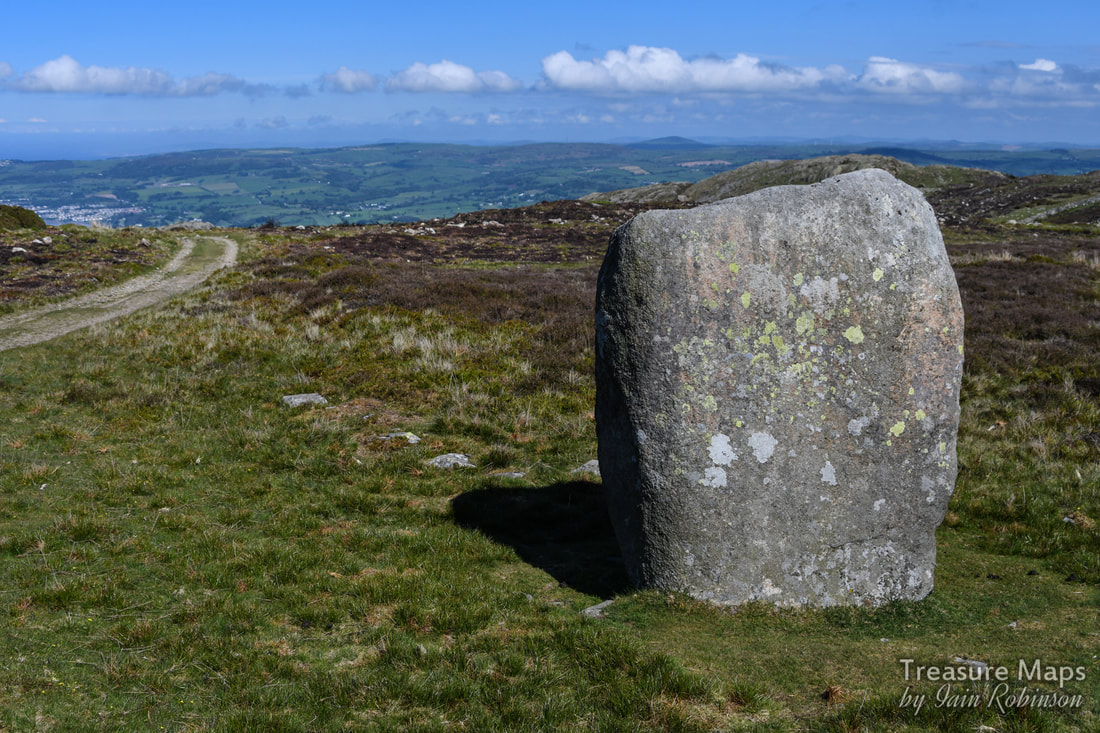 I quote Coflein NPRN 303070 which says: "The stone stands 6ft high and measures 3ft 6 ins x 2ft 6 ins at base. It has been incorporated in the line of an old enclosure bank on the S of a well-used track." Maen Penddu means "black headed stone". The side that faces the track coming uphill has sadly been defaced with some deeply carved names. The south elevation has a cross carved into it. Honestly, I can't find the words. At this point, we headed off up the hill to spend a couple of hours at the slate quarry. Our next adventure will be to take the lower track from here all the way down to the Bwlch y Ddeufaen-and it's many neolithic treasures. Coming soon :-) 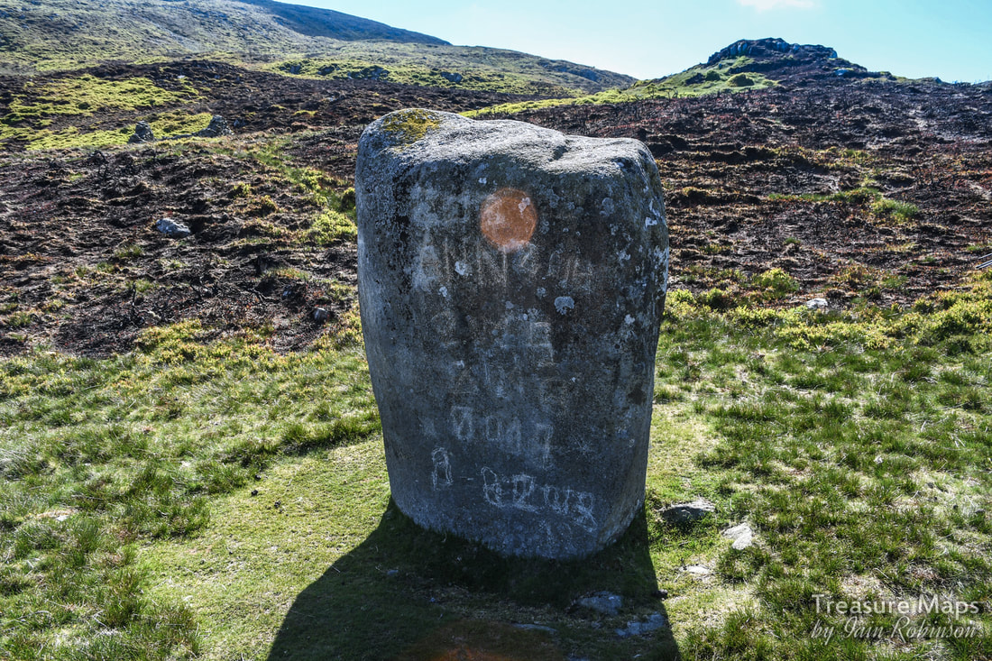 A few more images from the walk: 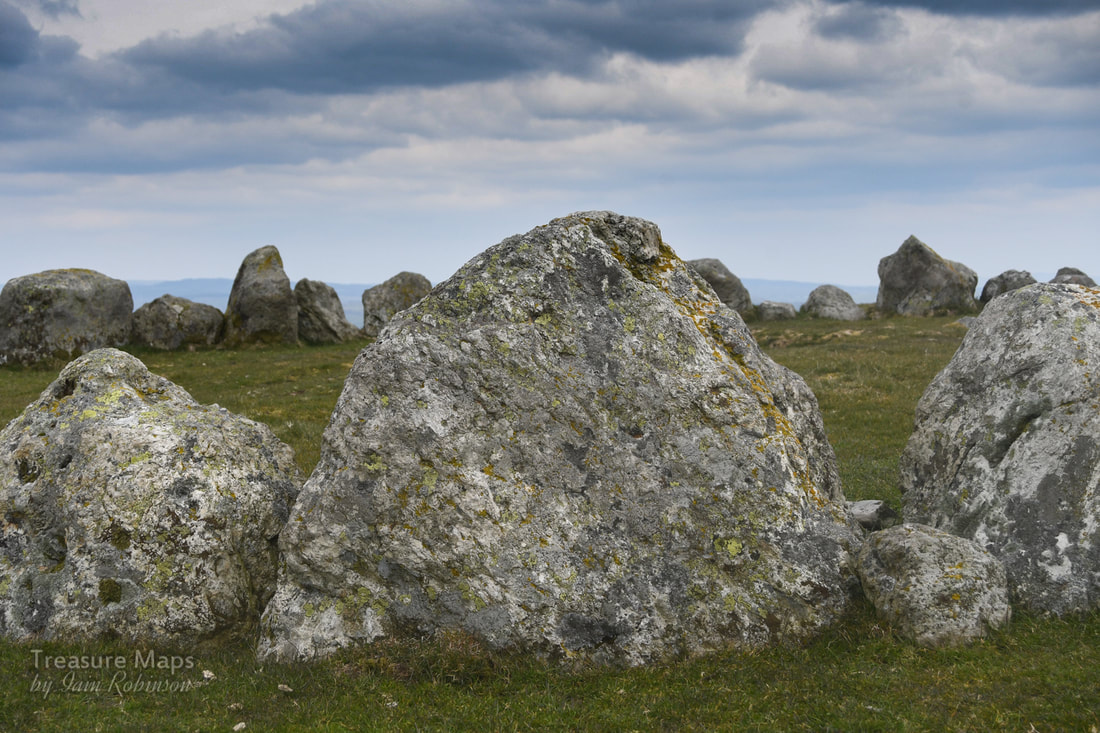 It was a bitterly cold Saturday in early April- the weather hadn't been told that buds were on the trees and spring was supposed to be coming. We'd travelled to Llandrillo, a pretty little village between Bala and Corwen- and were walking up the steep road that wound up the slopes of Moel ty Uchaf. The plan was to see what most authorities call a ring cairn, a remarkable survivor on the summit of this dinky little hill. It's a ring of 41 stones, (although there may have once been more) and it's around 12 metres across. The setting is stunning, even on the indifferently gloomy day that we had to work with, and it is well worth the climb. There are a couple of cists and cairns as well, and a standing stone further to the south. Petra found a small and ancient slate quarry on the way up...we were expecting something like that, as the ground had been disturbed in a way that suggested old workings. There were also some massive clearance cairns, evidently made by heavy machinery, so obviously quite modern compared to the ring cairn! 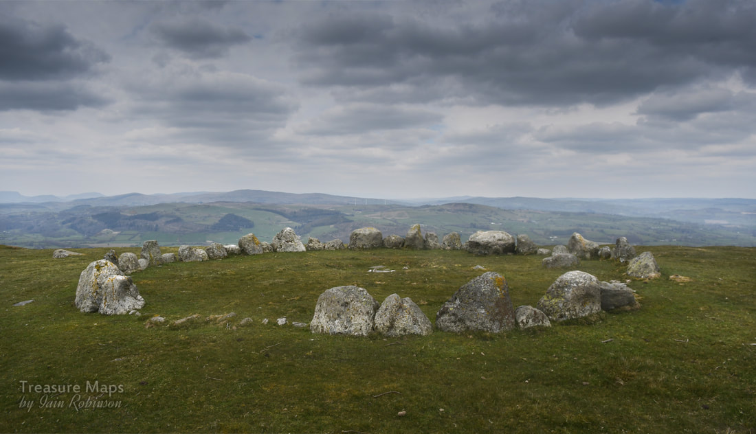 I had also read that there were many stories about the site. Some say that they have felt malevolent vibes, others that the place has a benign feeling. Not surprising, the site is dated from the bronze age and was apparently a place of ritual and sacred significance. Stories will abound in a special place like this. But perhaps there are none so strange as the claim made by locals that UFOs have been seen over the circle. Stranger things in the Berwyns Back in 1974 locals reported strange lights across the sky, then a colossal explosion which sent tremors through the village. It all seemed to be centred on the stone circle. One witness wrote: " something came down in the Berwyn mountains on that night, I am certain … we were visited by an object that evening..." Ministry files show that it was taken seriously by the RAF and the police- a search and rescue sea king was scrambled and deployed. The search continued until 2pm the next day. Locals and ufologists claim that roads were sealed off and men in black were seen taking remains away, prompting claims that this might be the "Welsh Roswell". Who knows? It all seems very far-fetched. The files show that officially, nothing was found...or was it? 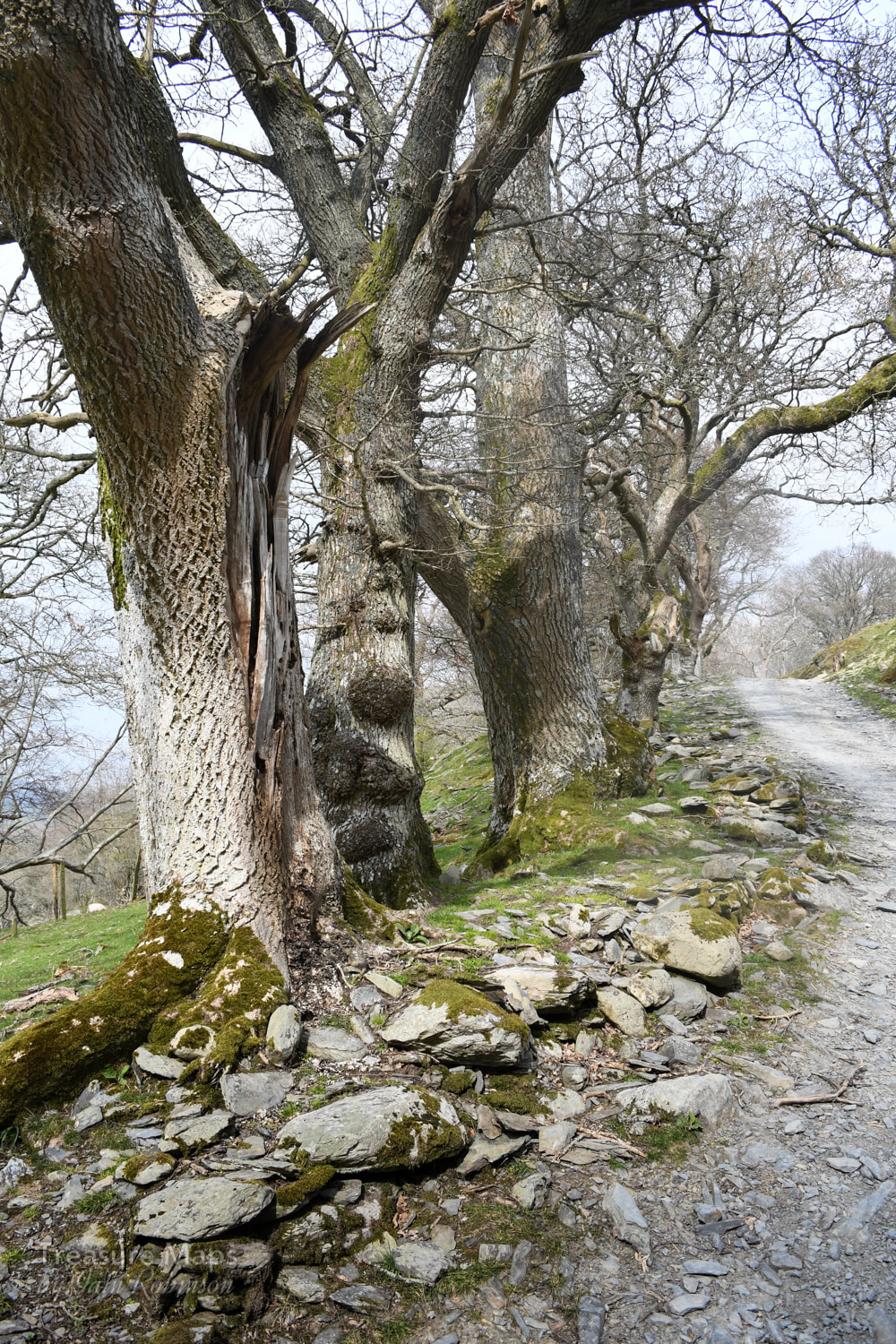 We, at least, got a great deal from the walk. The trackway up is lined by some beautiful trees; old oaks and later hawthorns of some age. Giant stones appear at the side of the track, placed no doubt by a glacier, although one group looked a little suspicious- I put them down as a possible bronze age feature. One of the gates below the moor whistled eerily due to the wind blowing across it's tubular steel framework. It was a surprisingly lovely sound, rather like those folk who used to run their fingers around the rims of banks of wine glasses on TV. That dates me, doesn't it? Hey, that was what ordinary folk thought was cool in the 'sixties. Somewhat enchanted by the sound, we sheltered behind the wall and had some lunch before tackling the last half mile to the circle. The wall itself was interesting, made from small chunks of slatey rock, interspersed with tall stones set on end. Perhaps it was a local style; I am not yet familiar enough with the area around Llandrillo to say. Petra wondered where the slatey stones had come from, as the fields were remarkably bare of any stones, apart from the occasional massive erratic. 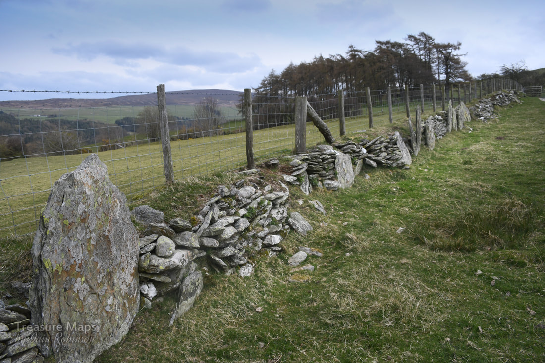 Further down from the circle on the hill, there were two cists, greatly eroded by the activities of the farmer- and a pattern of field markings which were quite pronounced on the ground. Coflein considers them to be cultivation marks, so I am glad my intuitive feeling was correct there. Someone on the Megalithic portal site thinks there may be a second circle on a site about 60 metres SE- I didn't see it when I was there, partly because it was so cold that we didn't hang about. But here's a photo on Megalithic Portal which shows that there is a circle, quite clearly. 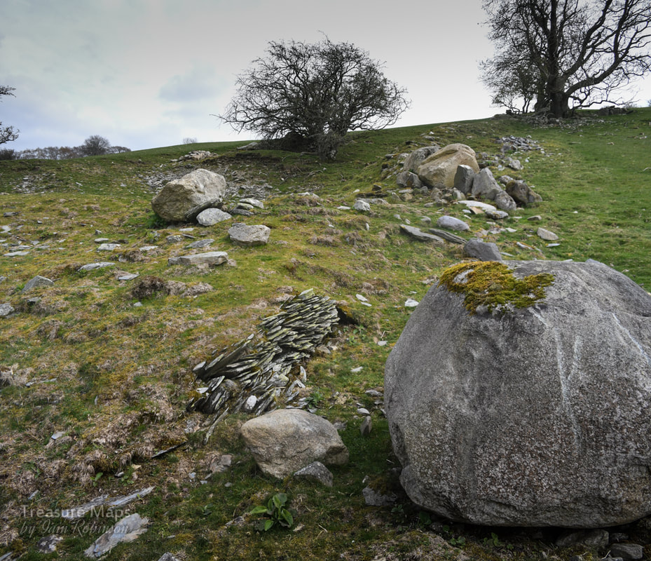 The ancient quarry site, with one of two stocks of moss slates beside a boulder which has only recently been moved, judging by the scars on its flanks. Above is a shallow opencut with a tip. Parking- It's best to park the car in the (free) car park in the centre of the village. Take a left turn out of the car park and then walk up the road marked as a bridle path to the right, after the war memorial. A grumpy moment I thought twice about mentioning this, as I don't want to be intolerant of others enjoying the hills- but again on this visit, there was the malodorous presence of two- stroke motor bikers on the hill. We were forced to the side by a group hurtling downhill without any consideration for anything. Later we had a nosey around the rather lovely village of Llandrillo and were standing at the crossroads when the bikers appeared again and stopped at the junction. The noise was incredible as the eight of them revved their engines and bellowed to each other. We picked our way out of their petrol fumed world of noise without taking them on and they roared off back up the hill to do more mischief. I wonder if making the maximum noise is part of the fun of this activity. Apart from that smallish irritation, it was a wonderful day; perhaps it might have been more peaceful on a weekday, although apart from the bikers we only saw two other people. Location of the stone circle: Map Ref: SJ05613717 Landranger Map Number: 125 Guide with map for locating the stone circle. 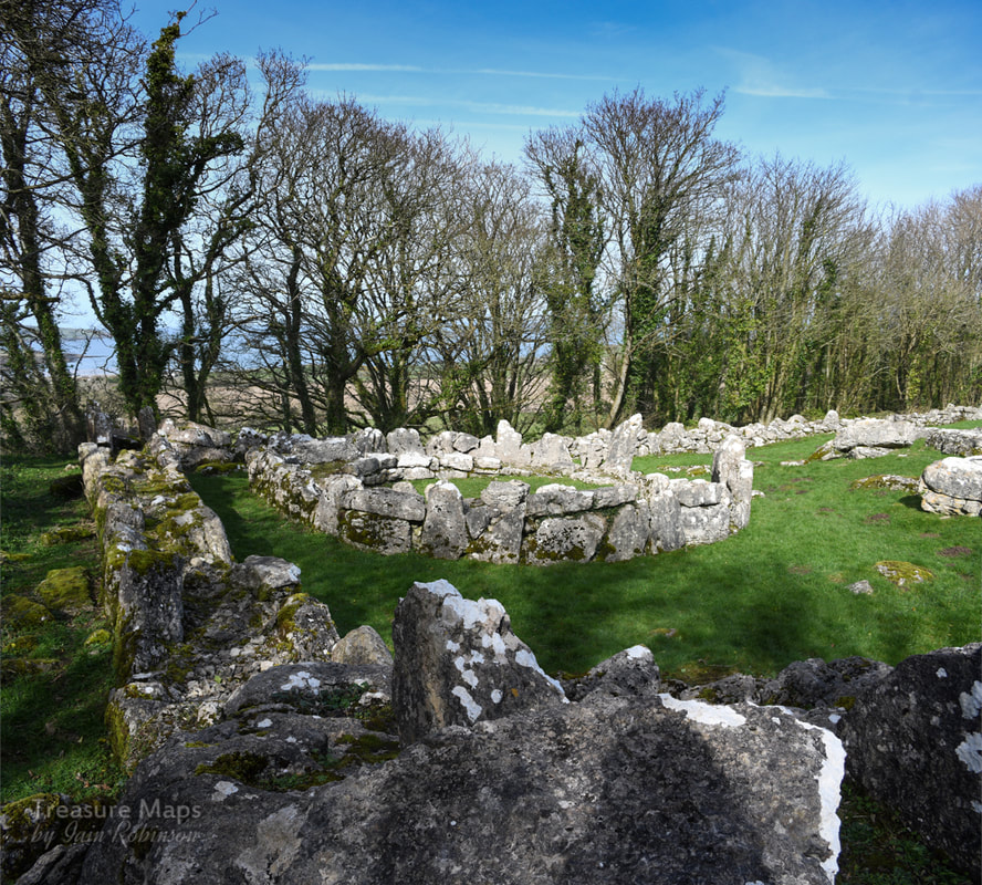 The fascinating ages of Din Lligwy- Megalithic, Roman and Mediaeval. Anglesey, as most people know, is a place rich in the remains of prehistory. But even on an island famed for its evocative ancient sites, Din Lligwy is something special. It's a walled settlement, standing on an eminence a little way outside the popular tourist village of Moelfre, on the north east coast of the island. It sits within a mature grove of Sycamore, Ash and Hawthorn trees, which allow the light to gently dapple the bright white limestone blocks making up the remains. Din Lligwy was excavated in 1905-7 by Edward Neil Baynes- in those days, excavation techniques were slightly clumsier than they are today, with subsequent technological and cultural advances in the science. But nevertheless, significant quanties of Roman material were recovered, mostly of the late third-fourth century AD. The remains here have been consolidated for public display- at the time we visited, (March 2019) some of the found artefacts were on display at the excellent Oriel Ynys Mon at Llangefni. 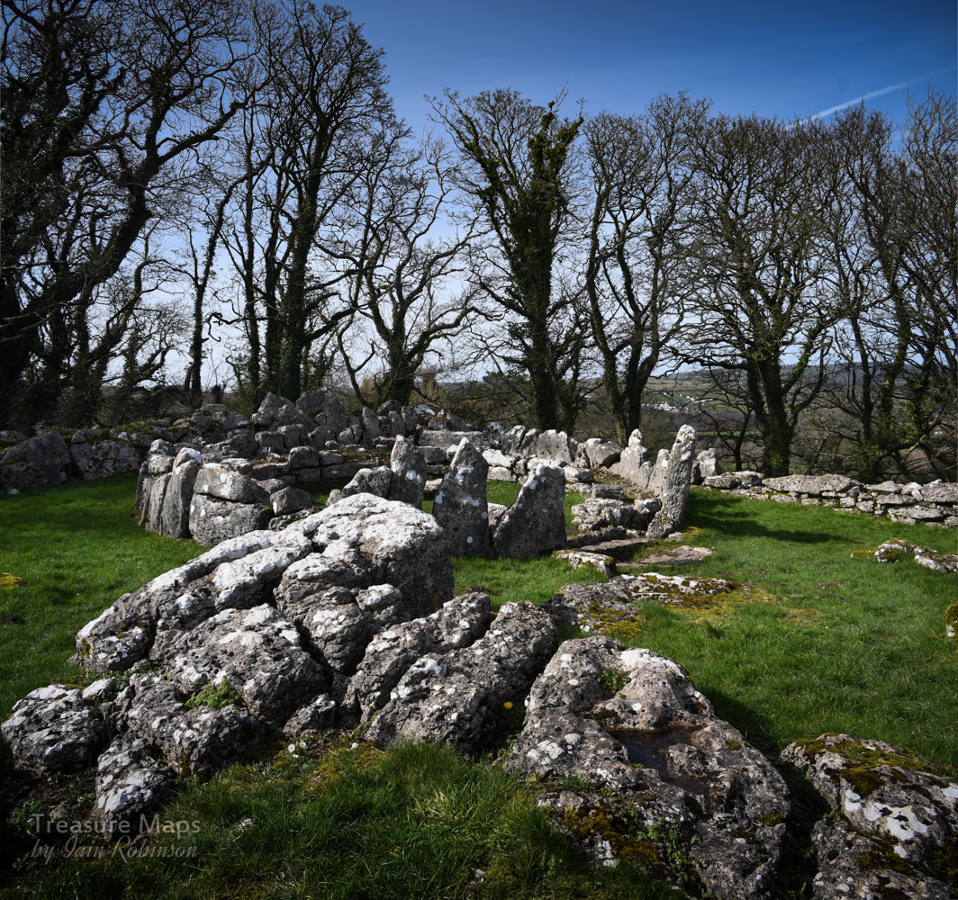 However, Neolithic flints have been found here, although we don't know at what horizon within the excavations they were located. But the presence of another feature nearby, the Din Lligwy burial chamber, makes it more than likely that this site was in some kind of use then. The interpretation board at the site suggests that the village may have been in use during the later roman period, explaining the outer wall- the Roman influence was waning and chaos was beginning to descend on the land. We can't be certain. What we do know was that there were settlements here before Roman times that may have been consolidated...more remains lie outside the perimeter including a hut and stones which may be the remains of enclosures. This would suggest that the site was a locus for agricultural activity and fits in with the idea that this place was associated with a person of power and wealth, not a Roman. While the round huts would have gone out of fashion by 4AD, it may be that they were a return to the old pre-Roman ways. One hut base is larger, this is at the top of the enclosure and would have been the high-status dwelling. Excavations in this hut found Roman coins, pottery and a glass jug, as well as a silver ingot. Other (square) huts were used as workshops- here large amounts of metallic slag, as well as remains of several hearths with charcoal formed from oak were found. It was evidently a workshop for the smelting and working of iron. The original entrance to the fortified compound was through a gap next to the external building. The unanswered question here for me is: where did the ore that they were smelting come from? The nearest iron deposit was at Llandyfrydog Quarry, Llanerchymedd on Anglesey at SH451861, and there are other iron mines on Anglesey as well. Of course, this site is relatively close to the sea- perhaps ore was brought by boat, along with other high value items- in which case the ore could have come from Europe. We don't know for sure, but it is a fascinating thought. 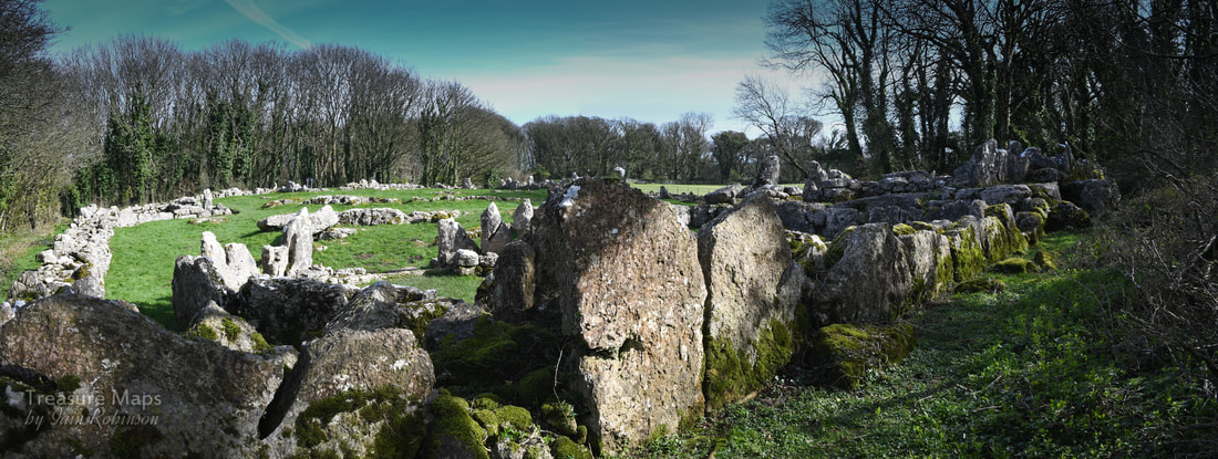 Looking over the site from the top, above the high-status dwelling. 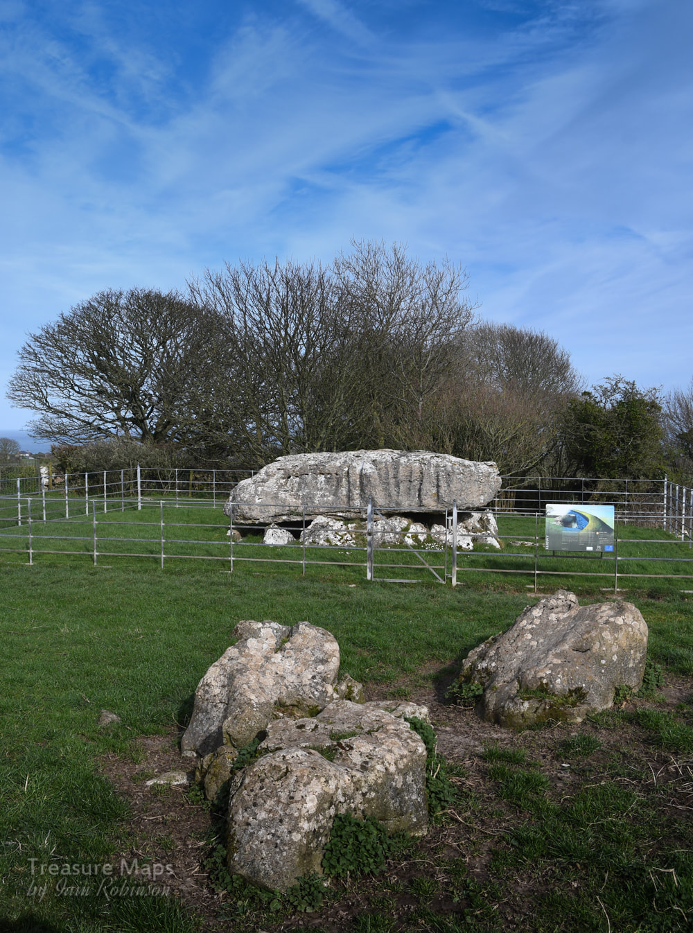 The Burial Chamber Not far from the settlement is the Neolithic burial chamber of Din Lligwy, dating back to the 3rd millennium BC. This is an impressive reminder of the determination and capability of the Neolithic peoples, since the capstone is thought to weigh 25 tons! This site was also excavated in 1908, when the remains of 15-30 people were found. Along with them were pieces of beaker and grooved ware pottery that provide evidence for the age of this tomb. It is from the end of the Neolithic period and so was among the last of these types of tombs in use. The interpretation board reminds us that this tomb was covered over with stones and earth- I wonder where all that went to? Taken by farmers for rubble, perhaps. The sides of the gigantic capstone are marked with lines where the stone was hewn. It's not clear, of course, where the stone could have come from, but it was quarried and shaped. A little awe-inspiring to think that these tooling marks were made by men from such a long time ago- that really brought home to me the significance of this place. The chambered tomb is nowadays surrounded by railings, the gate is locked but doesn't seem to preclude visits from sheep. The railings do spoil the atmosphere for photographers a little. 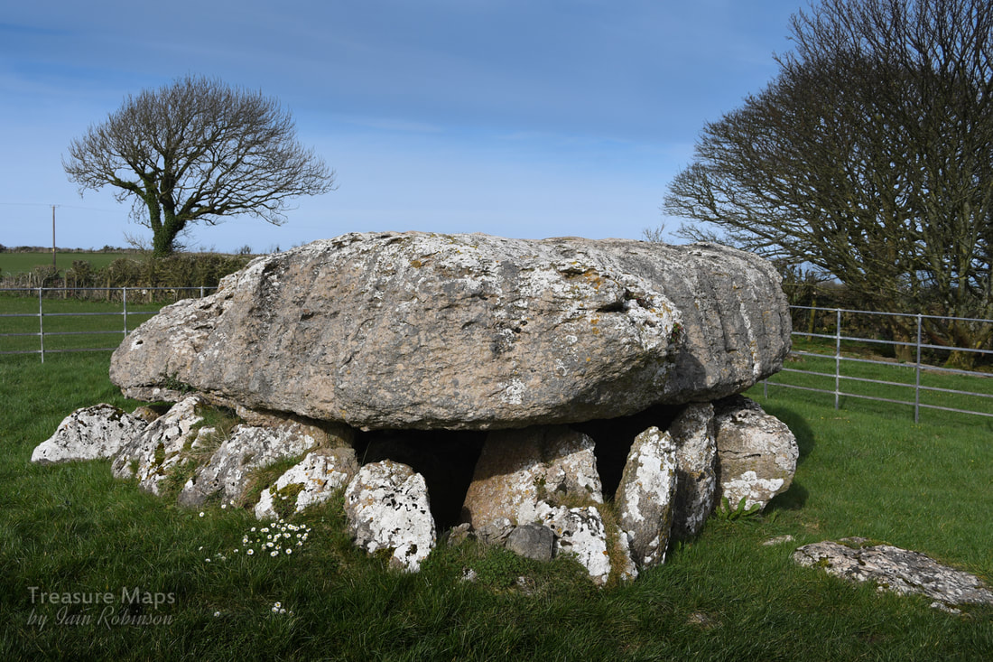 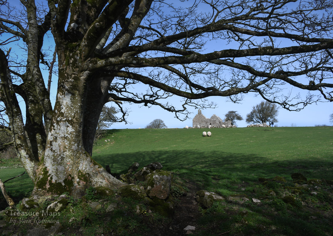 Hen Capel Lligwy Nearby, to the north east of the settlement is a ruined chapel. This, perhaps, offers some clues as to the prosperity and population of the area in prehistory. Originally, this would have been a wooden church, but it is thought that in the middle of the C12 AD, (with the raids on Anglesey by Vikings becoming rare), many places of worship were rebuilt in stone. We know that this chapel was first built in stone in the 12th century, but the upper parts of the walls were reconstructed in the 14th century. A small chapel, with a crypt underneath, was added in the 16th century. There is a small "borrow pit" nearby where stone was quarried to build the church. It's also possible to make out from the walls where repairs have taken place, as different types of limestone have been used. The interesting point here is that the settlements that surrounded the church were probably made from wood- the area was likely to have been much busier than today, but most traces of the hut dwellers have gone. Populations moved away, and the wood from their dwellings was burnt as fuel by those who remained. 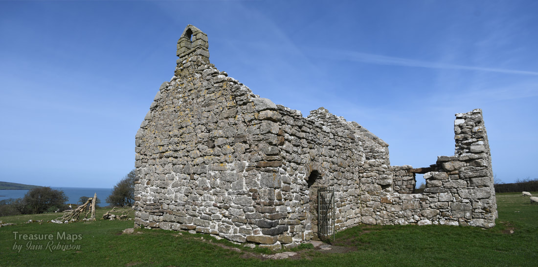 Locating the sites- and parking. Din Lligwy Settlement is at Map Ref: SH4970286134 Burial Chamber- Map Ref: SH50138604 Both are Landranger Map Number: 114 The site is signed from the roundabout on the A5108 at Llanalgo. Coming from Moelfre, it is a right turn. Turning along this road, the Burial Chamber is seen first on the left- a small lay by offers parking for one car here. A quarter of a mile further on and there is parking for three/four cars at a layby - the chapel can be seen clearly, and the settlement is in the woods to the south east. I am indebted to my friend Dave Linton for pointing out to me that iron ore could have come from Anglesey- and for his diligence generally! Sources Lynch, F. 1995. Gwynedd: A Guide to Ancient and Historic Wales, Cardiff: Cadw Yates, M. J. and Longley, D. 2001. Anglesey: A Guide to Ancient Monuments on the Isle of Anglesey, Cardiff: Cadw. P30. |
TracksReceive the occasional Treasure Maps Newsletter- and alerts when a new post is available!
If you enjoy my content, please buy me a coffee!
Check out my other online activity...
Index
All
|


 RSS Feed