|
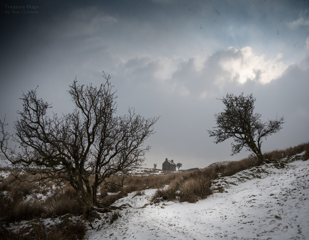
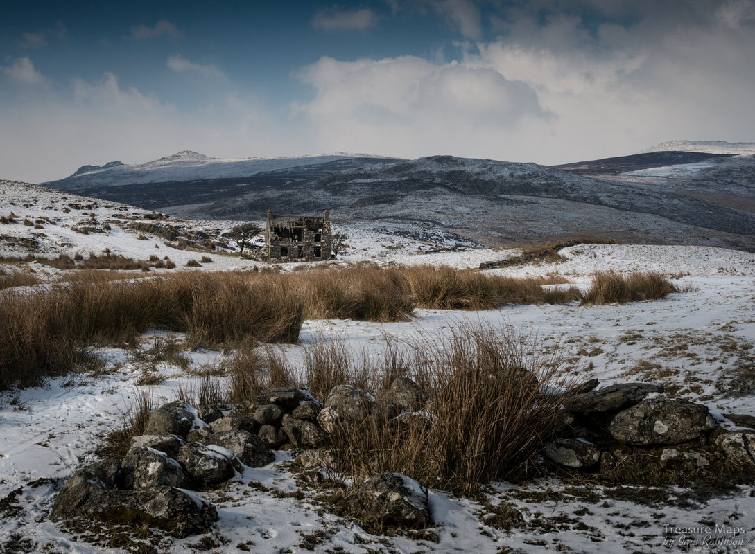
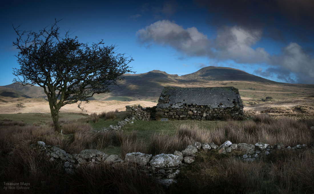
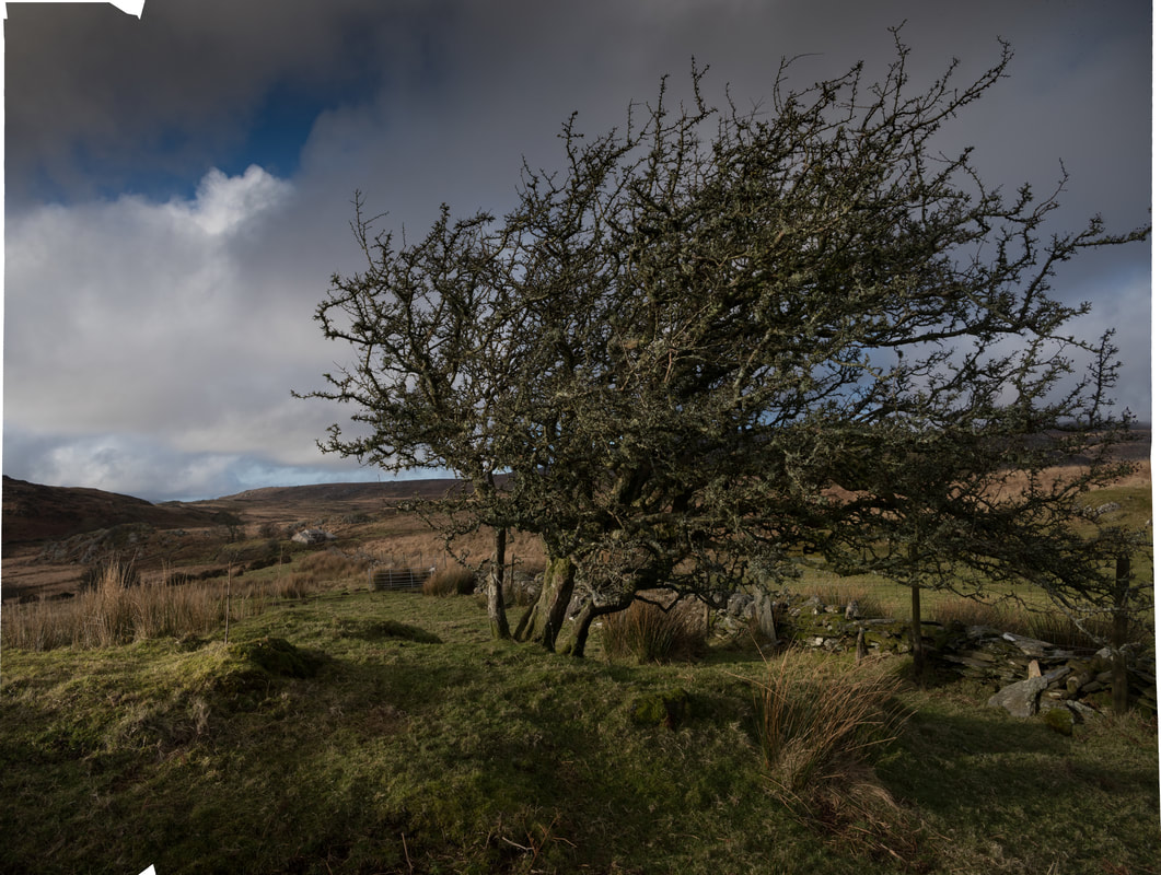
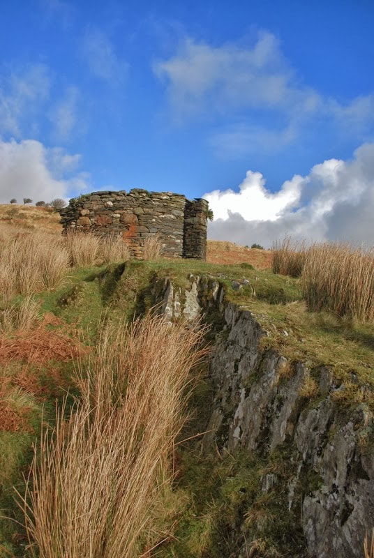
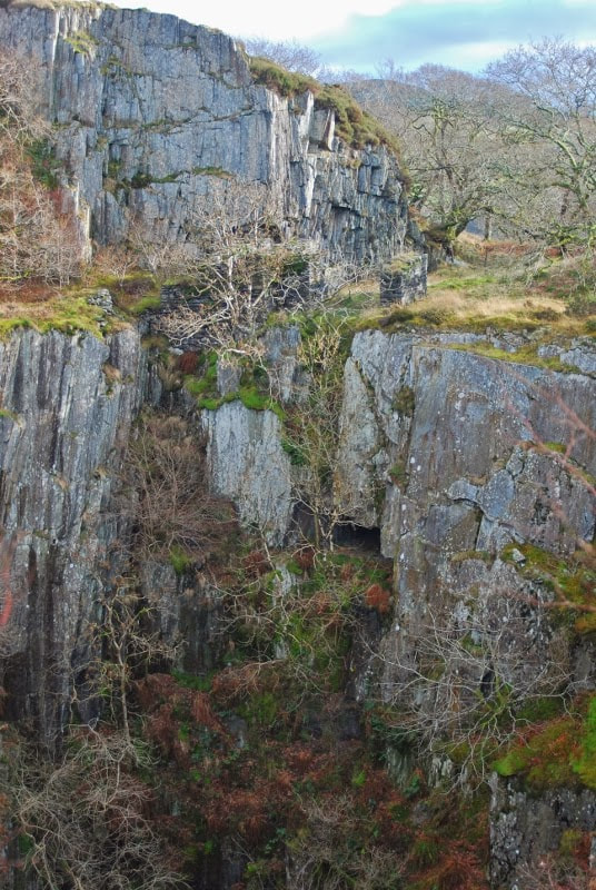
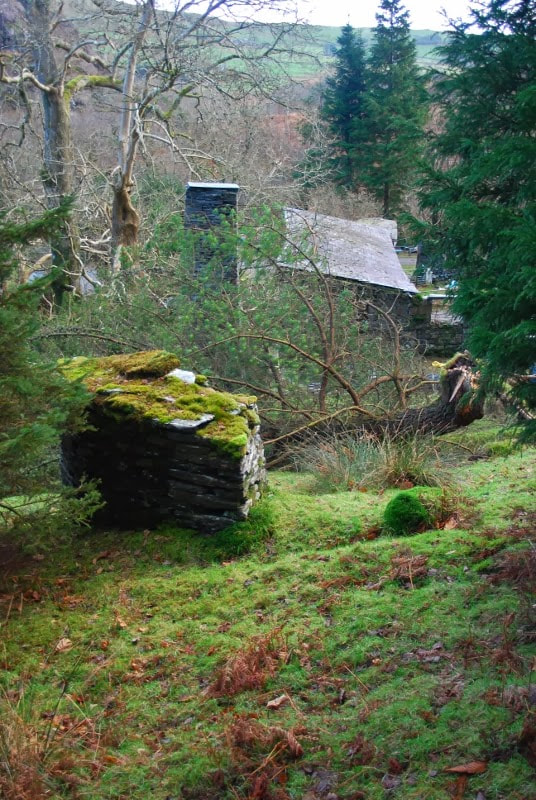
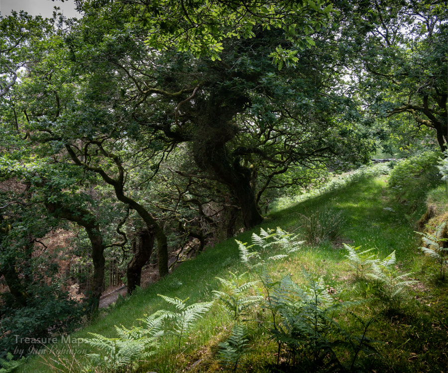
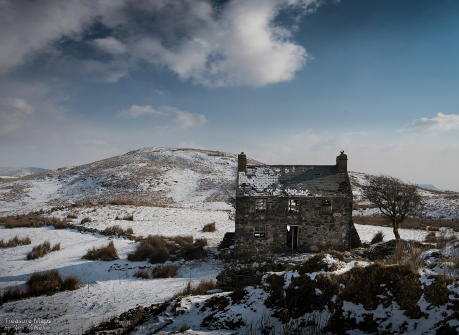
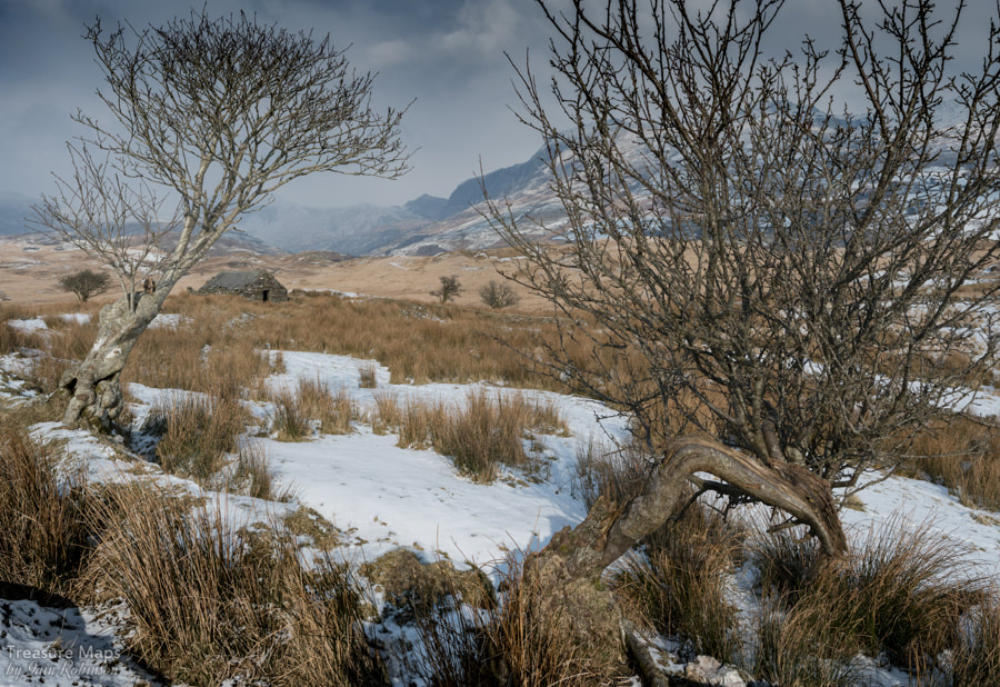
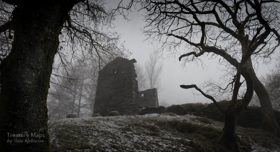
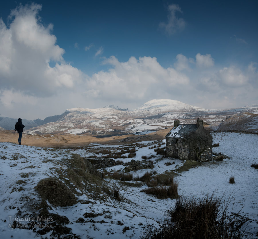
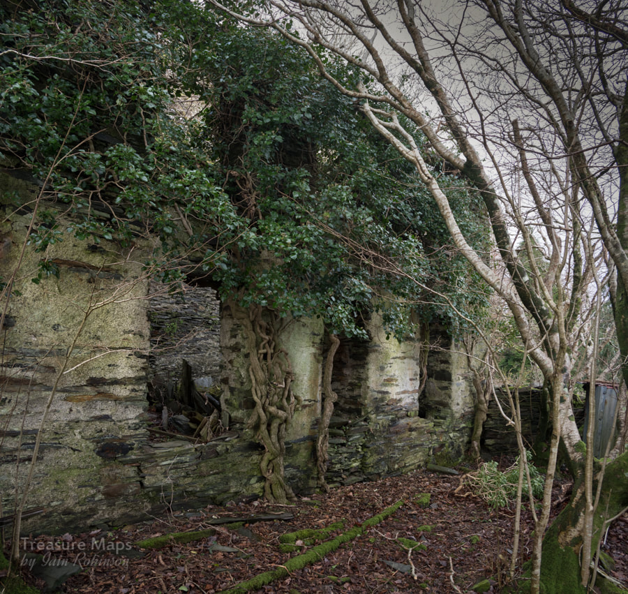
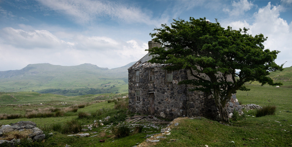
A look at Moelfre Slate Quarry and a discovery on the moors above Pennant 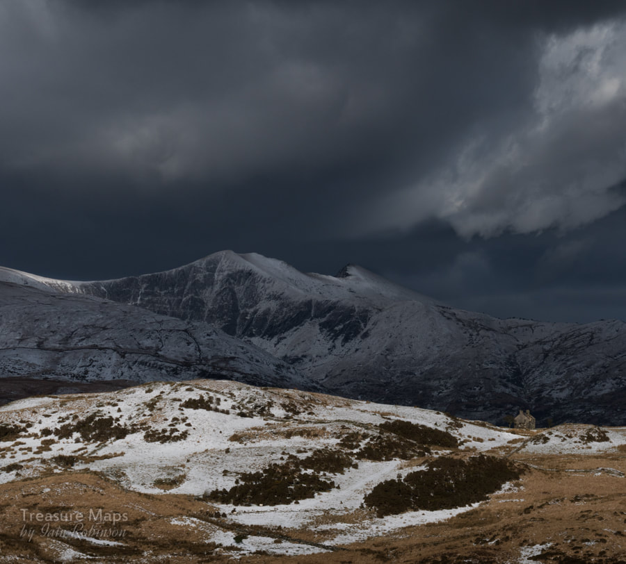 Llwyn y Betws, seen from Hendre Ddu. Moelfre slate quarry is an intriguing place. The quarry track runs up to the moor surrounded by wonderful mature oakwoods, beautiful in any season. The views across the Pennant towards Moel Isallt are fascinating and rewarding as you climb up a path that was once part of an incline for the slate quarry. And yet, I've never felt quite comfortable walking up here, despite it being a public footpath. I've felt a forbidding air of menace about the place, as if my presence here is begrudged. Probably my imagination, or some arrangement of the landscape playing on my sub conscious. At any rate, for those wanting to try, the path comes off the Pennant road at Gyfyng, just after the bridge over the Afon Dwyfor, when the road begins to ramp up. There's a little road to the left, which passes over another bridge. 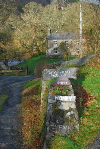 The footpath gets diverted through the remains of the slate mill, to the left of the house. The mill is fascinating, dating from the 1870's and was water wheel powered, later by a turbine. There are some towers in the woods to the right of the mill that are the remains of leats, bringing water to the turbine. These days, rather than try to pick my way through what feels like someone's back garden, I carry on up the road past the house, until the track turns left and starts to climb upwards to the quarry. 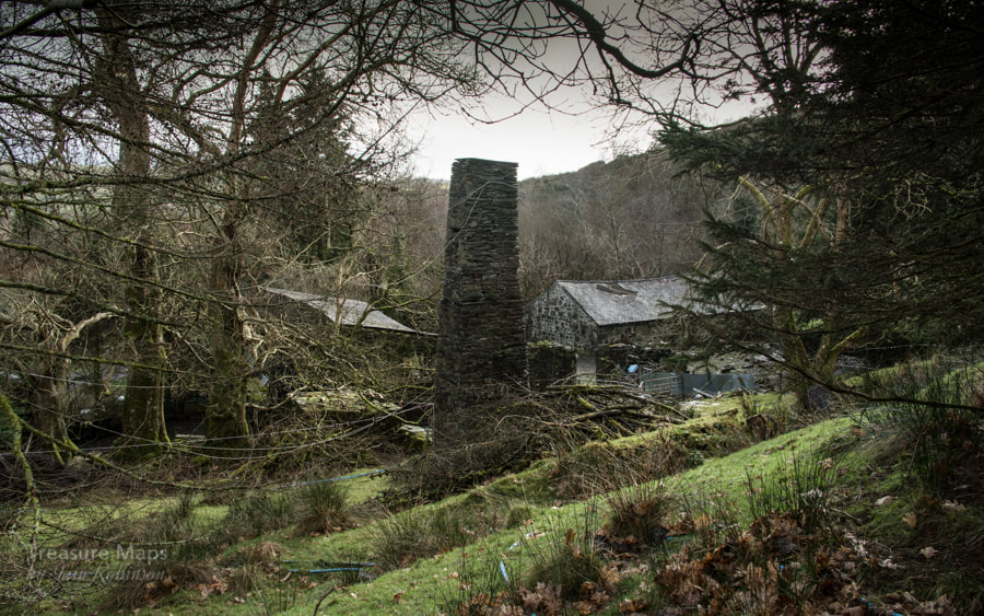 The mill and a launder pillar. The woods here are exquisite. Marred recently by the landowner fixing galvanised steel fences, which are rather unsympathetic, if functional and long-lasting. There are some adits as you climb up- waterlogged, impassable -and probably the water supply for the houses, so best not to explore. After the impressive drumhouse is reached, there is a strange, low slate structure which might have been walliau at one time, but is now a kind of backwoods retreat, although it doesn't seem very weathertight. It's attractive though and would be fun for a night or two if it wasn't too cold. There is evidence of an old working area here and some run-in tunnels above. 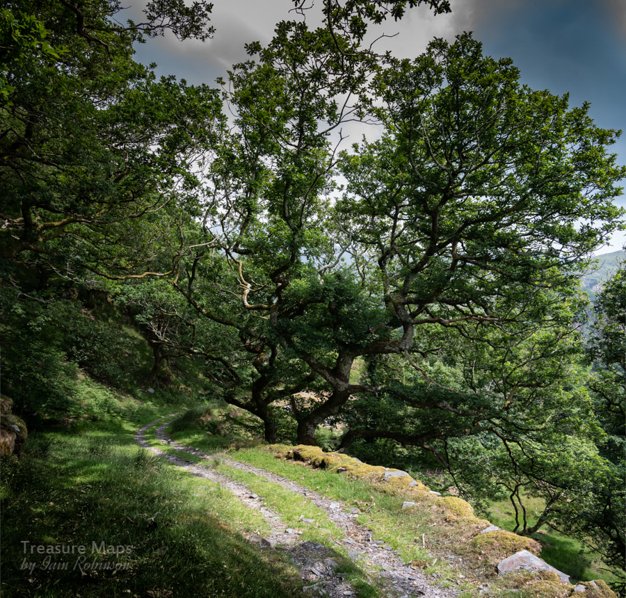 Exquisite woods... Walking upwards, there is a line of new fences to the right, going into the woods. These lead to the ruins of the manager's house, an intriguing place, if impossible to photograph. There's a nice old shed, which again seems to have been used as a kind of overnight bothy at some time in the past. 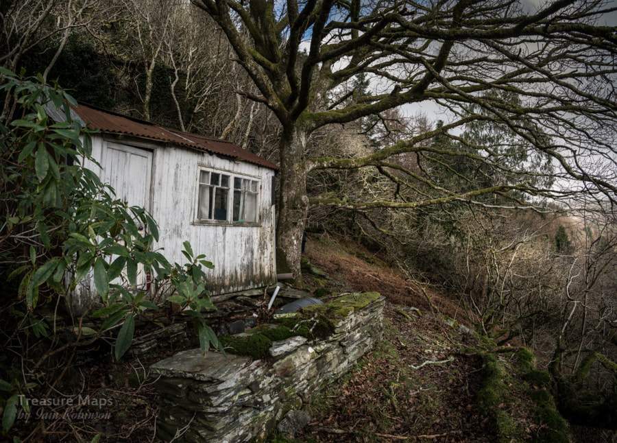 The old shed, manager's house ruins in the background. Then, the trees give way and the views across the valley become clearer, Moel Isallt and it's attendant slate quarry showing as a grey scar on the flanks of the hill. There is a small pit to the left, then a larger pair to the right. These are the remains of the main quarry- ruined weigh-houses and structures can be seen on the tip runs below. The quarry was a development of an earlier metal mining operation, and from some angles it is possible to see the old tunnels, and the remains of a waterwheel powered chain incline out of the pit. The pits are infested with gnarly vegetation and young birch and oak trees, making it very dangerous to do anything but gaze at the place from a distance. I did get to the south western side of the pit during a nightmare stravaige across country from Hendre Ddu once, but it's not something I ever want to do again! 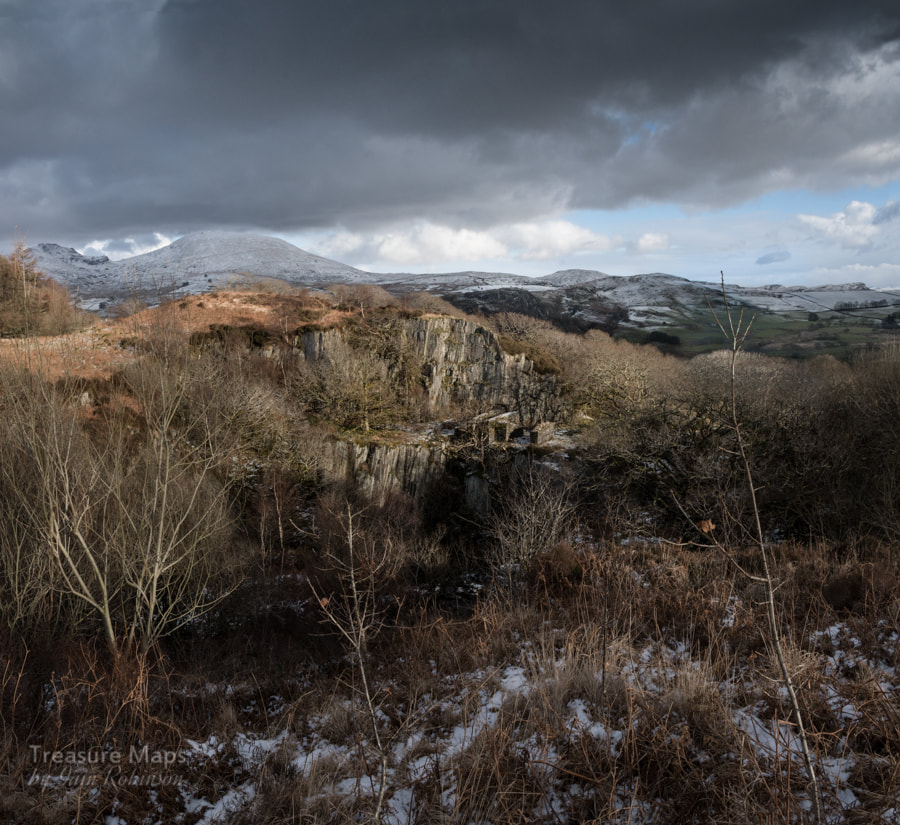 The pit, with the waterwheel winder remains. There's a gate here with a stile, marking the boundary with open farmland. We usually stop and have sandwiches here, as the climb is a sharp one- yes, any excuse, really. 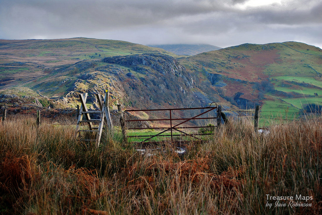 The stile. Moel Ddu looms under cloud behind the craggy slopes of Moel Isallt From here, an old cart road makes it's way across the moor. It's hard to follow, but at one time it was a substantial trackway with stone supports and revetting. We usually head towards the powder house, which is a fine round pattern similar to the rather dilapidated one at Hendre Ddu. True to type, the farmer has filled this powder store with old barbed wire and rubbish, but it is still a good sight. There's the remains of an old beudy, or field barn nearby, then the trackway ramps up toward the plateau. 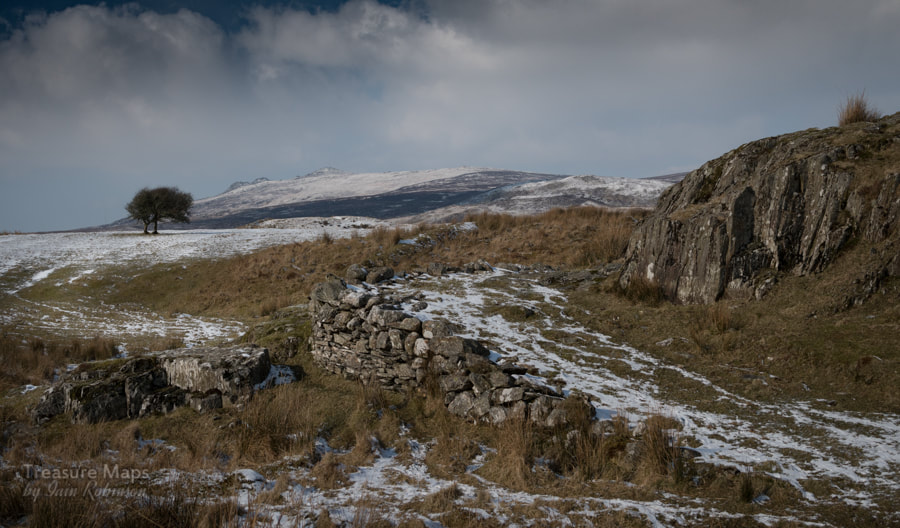 The trackway, with some revetment in evidence as it climbs the last few yards to more level ground. 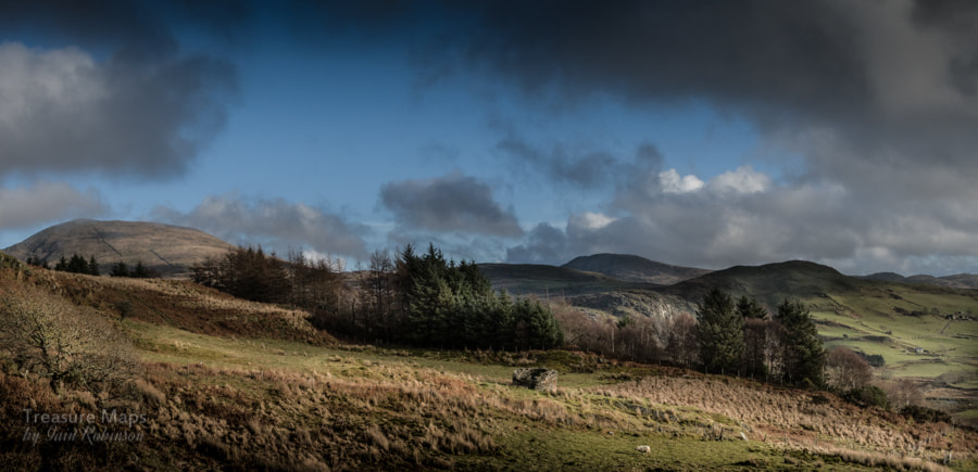 The powder house, with Moel Hebog showing to the left distance. At last, slightly more level ground is reached. The first time we came this way, we encountered yet another makeshift shelter, this one a little more watertight, locked up and seeming to have been used by hunters. We walked around it and then I noticed something about half a mile away and gave a start. A most incongrouous structure, a house of a victorian suburban design, sitting slap in the middle of the moor with nothing around it. Oh, and half it's roof off as well. 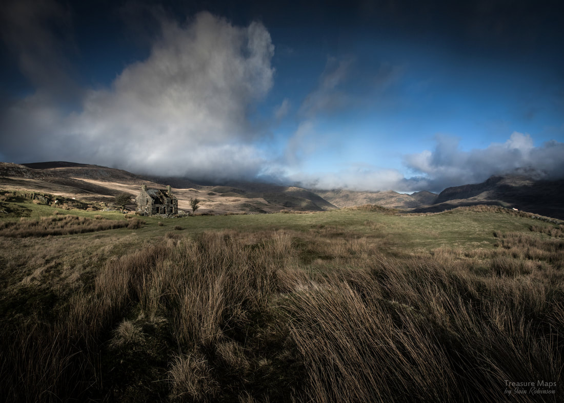 The house looks as if it has landed from space... We've made half a dozen visits since, in all weathers- and the place still has this effect on me, it's strangeness stands out from the surrounding grass and rock, without any visible overtures to the landscape around it. sadly, it is now impossible to get inside the house due to the sketchiness of the roof and the delicate state of the walls. The windows are open to the moor, a sad tatter of curtain flapping in one of the upstairs windows. Looking in from the kitchen window, it seems as if this place had also been cannibalised as a kind of bothy in the last twenty years. Gas cannisters and tins of food lay alongside a saucepan. But the house itself dates back to at least the late 1870s. All I can find out is that it was last occupied in the 1960s. Was it a hunting lodge? It looks so uncompromising that I wonder if it was a wealthy person's statement in the landscape, a hunting retreat for city dwellers. 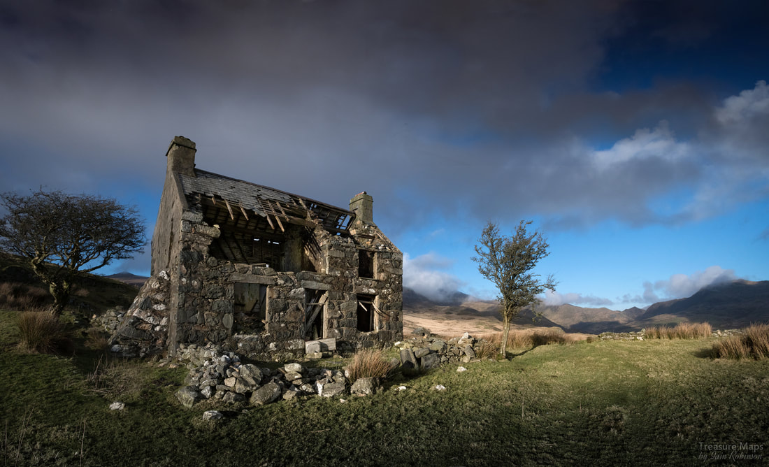 The funny thing is, that once we had seen the place, every time we travelled further in Cwm Pennant we saw it again in the distance, even from the slopes of Moel Hebog, or from Moel Lefn. It became a sort of talisman on our explorations. It must have been an exposed spot, and a lonely one as well. There are some outbuildings, a couple of pig sties and a beudy a little further along. We visited this one day in a blizzard, and went in to shelter. It was filled, feet deep, with sheep poo, but it was still preferable to the storm raging outside. Petra found what she thought at first to be an adit nearby, but later we decided it must have been a cold store, dug into the rock. 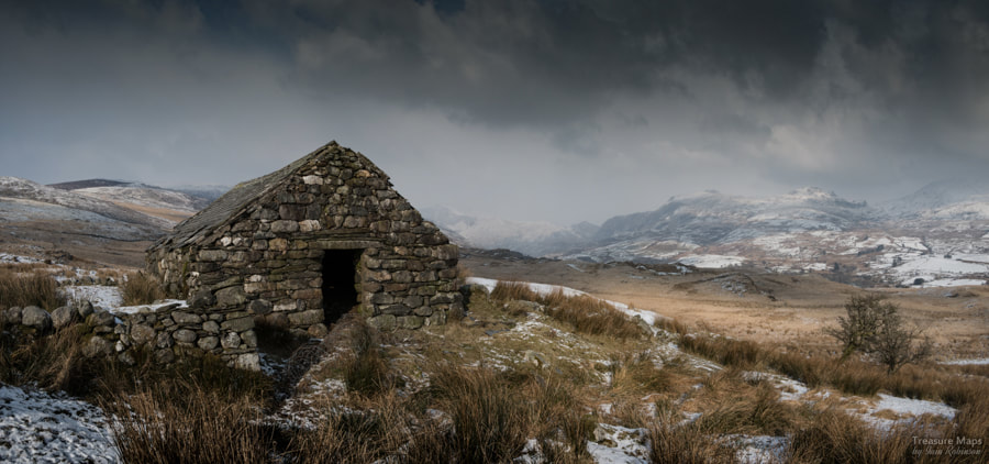 The blizzard approaches... I tried to approach the place from Chwarel y Plas once, a little to the north. It seemed like an easier way from the map- but I was wrong. There are some impassable fences and ditches and a large expanse of "Johnny Breakaleg" grass. You know the sort, unstable hummocks with deep ankle breaking pits between them, filled with water. If you want to see this mysterious house, best to approach from Moelfre. A couple of years on and I am still none the wiser as to the story of this place- if anyone reading this knows, please put me out of my misery. The factoids about Moelfre
The slate quarry was developed in the 1860 after workings to exploit copper were abandoned. These workings could have been extensive, as the adits still show in the pit. At first, material was taken out of the pit via a tunnel, later a chain incline pulled it out to a mill on an upper level. Later in the early 1870s, a lower tunnel was driven to the incline and slate was taken down to the lower mill. In it's heyday, 30 men were employed, producing 600tons per annum. The operation closed in the 1880s, although the place was worked sporadically after that until the 1930s. There are reputedly two disused turbines and generators still on site from the early days, while a third one, supplied by an unsightly plastic pipe is still in use. source: "Gazeteer of Slate Quarrying in Wales."- Alun John Richards, Llygad Gwalch.
7 Comments
|
TracksReceive the occasional Treasure Maps Newsletter- and alerts when a new post is available!
If you enjoy my content, please buy me a coffee!
Check out my other online activity...
Index
All
|
 RSS Feed