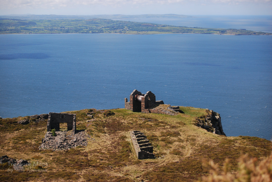
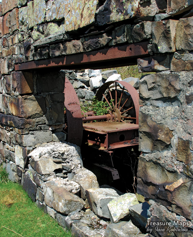
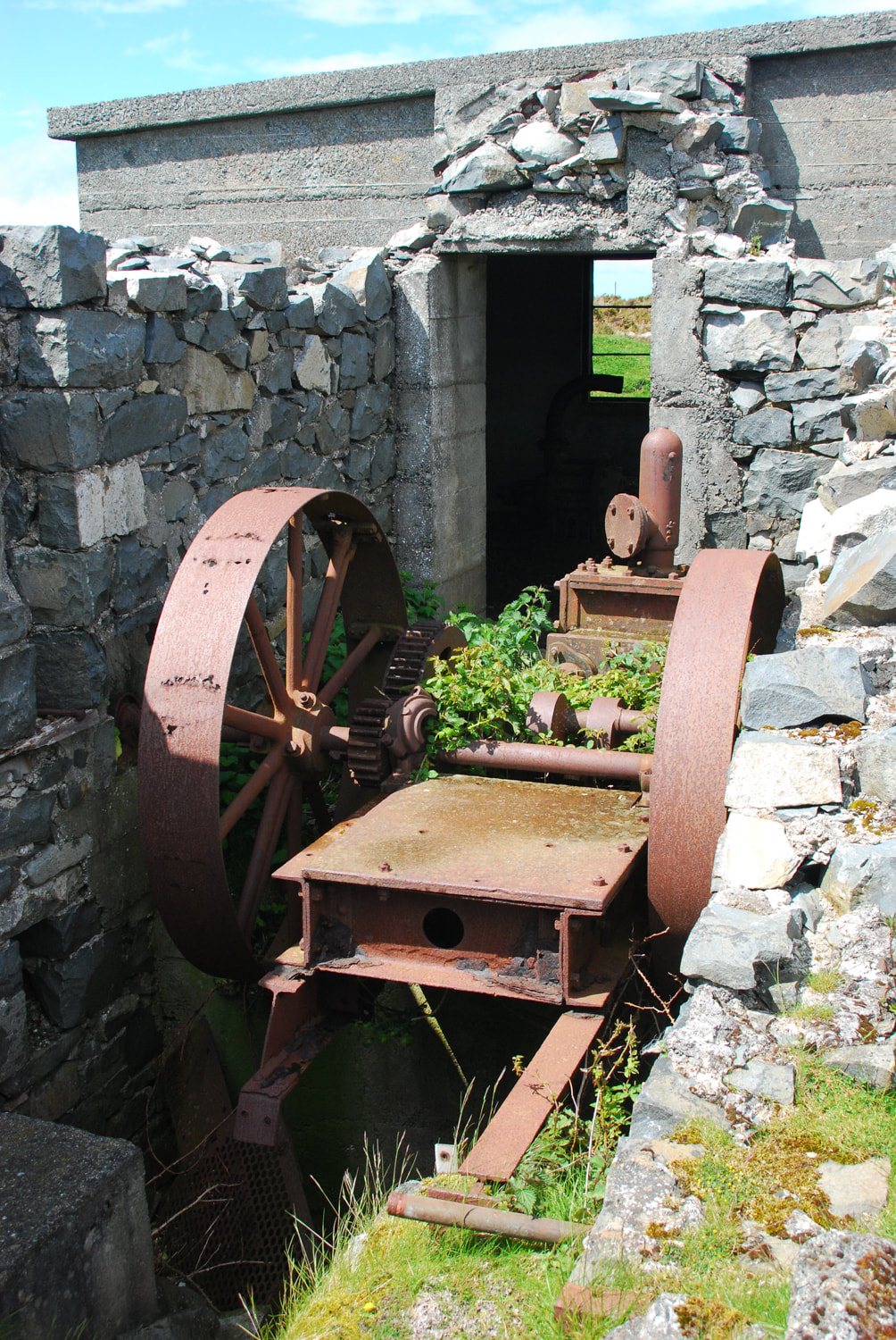
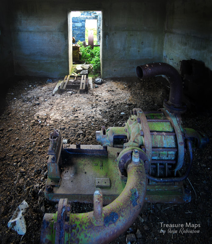
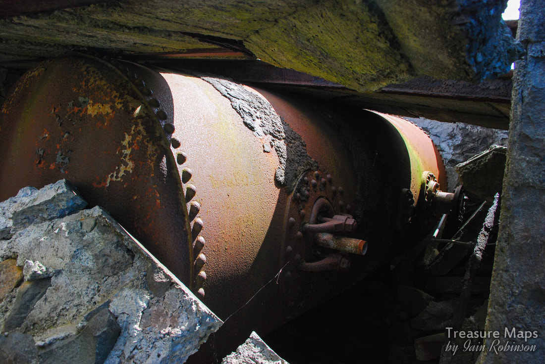
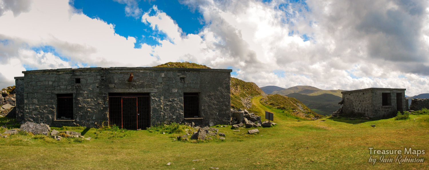
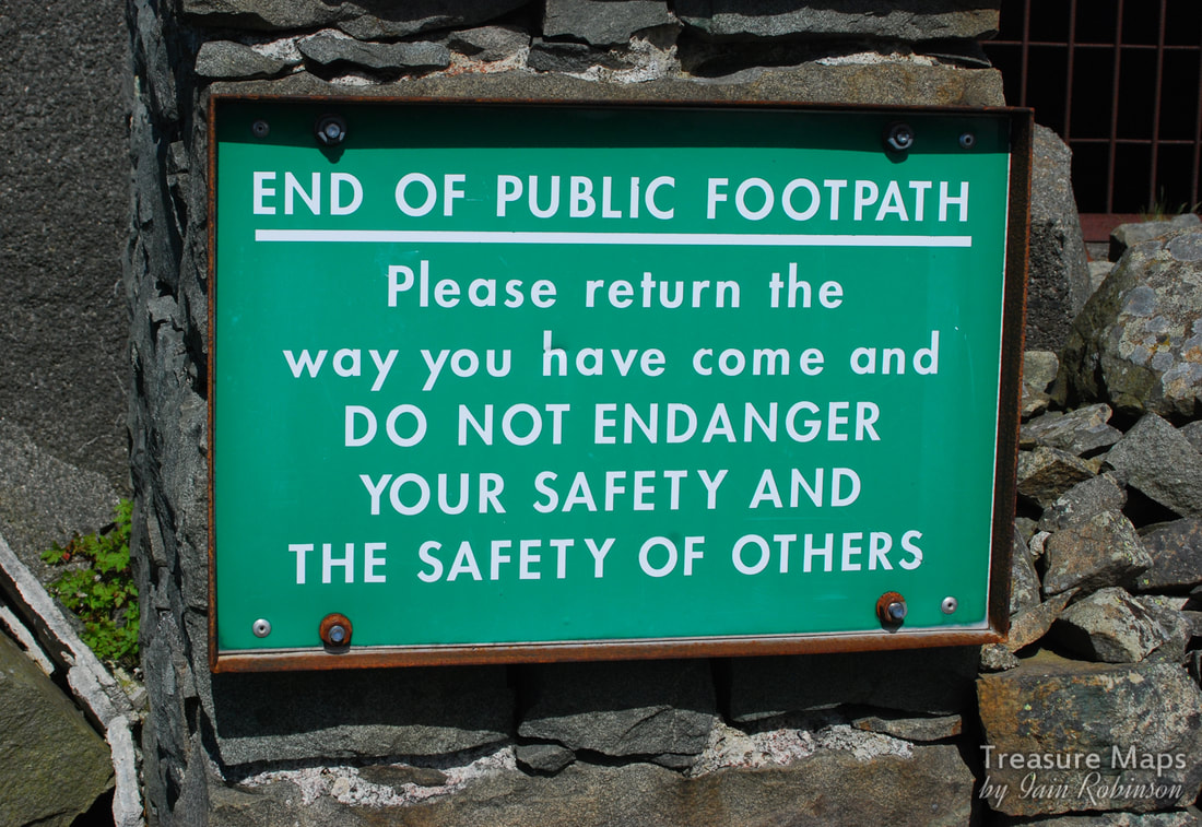
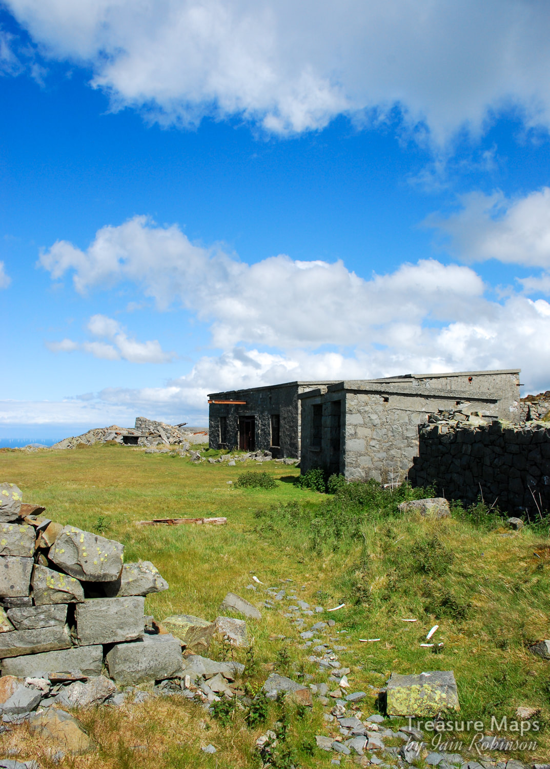
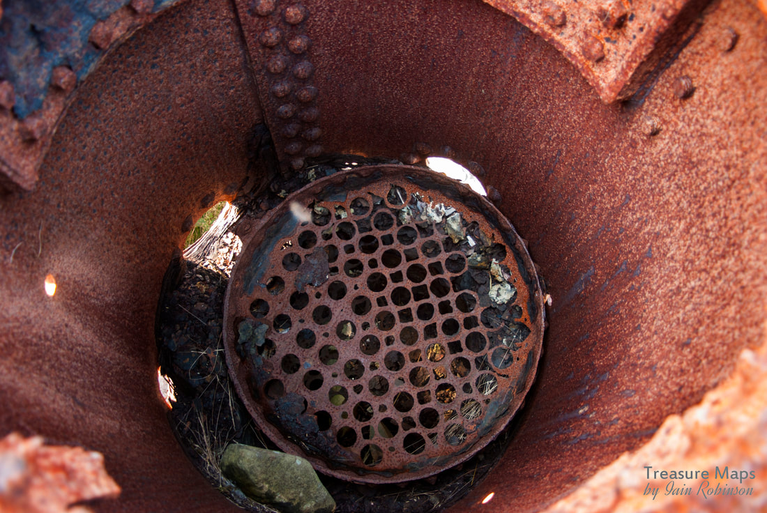
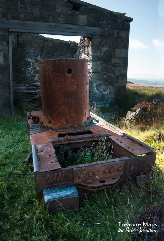
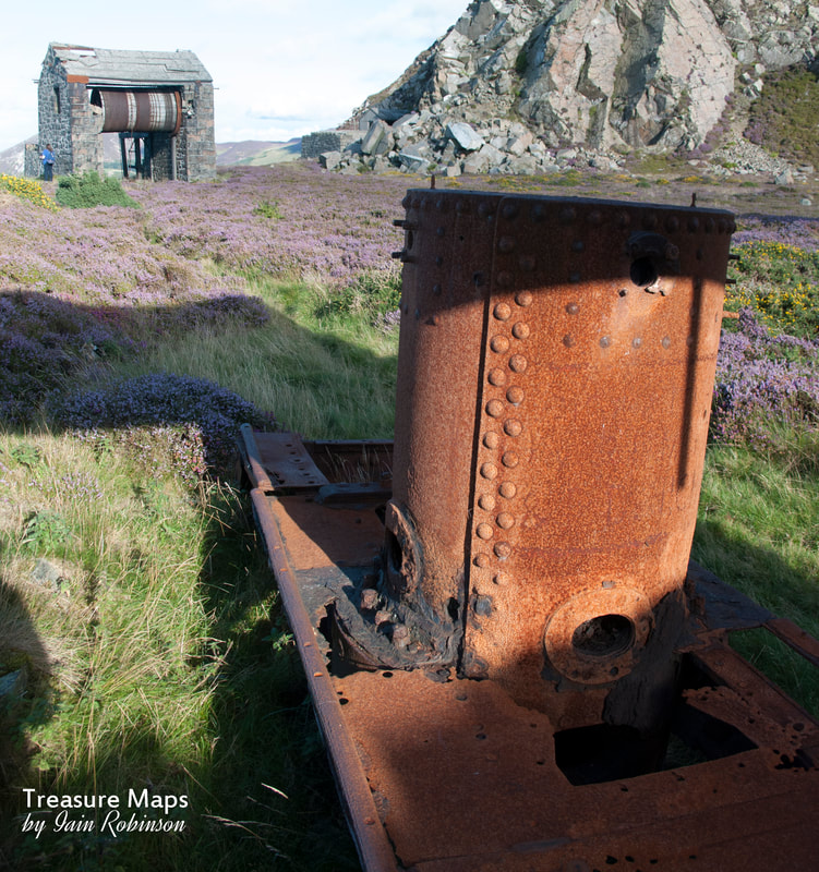
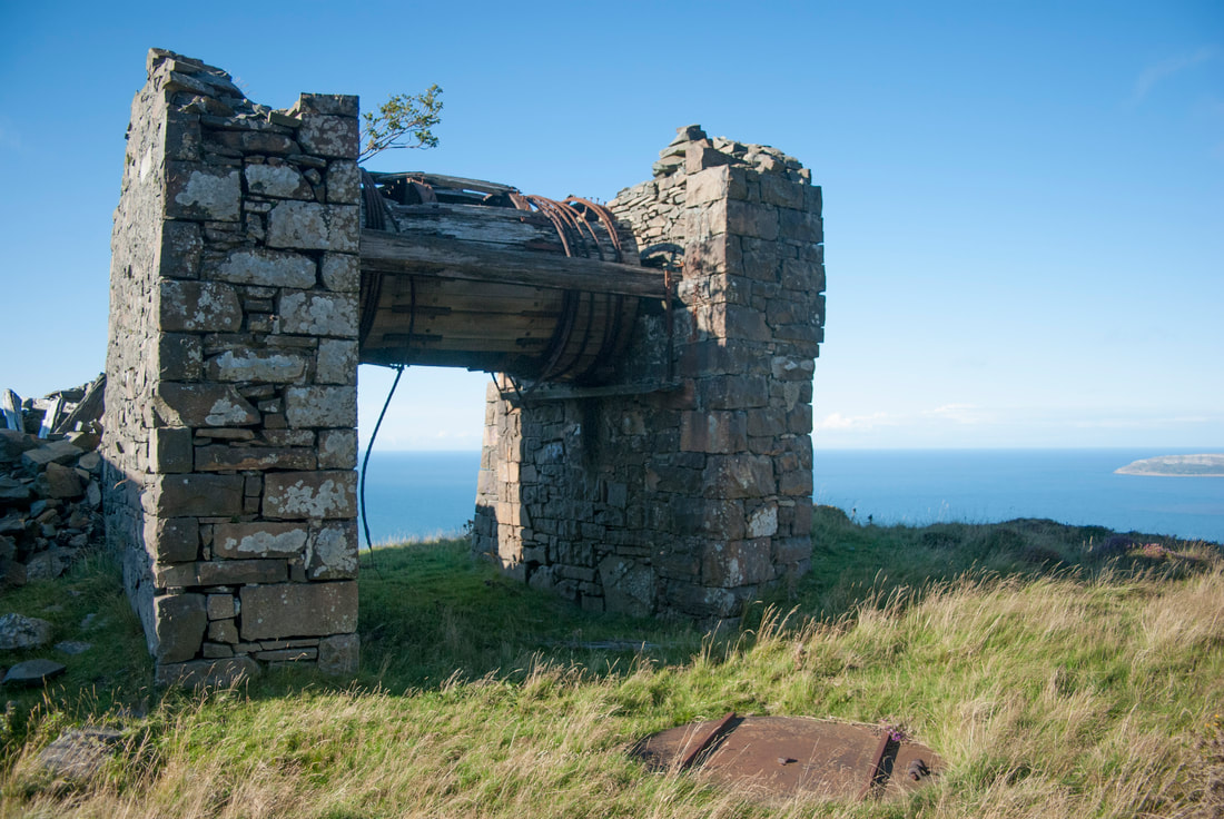
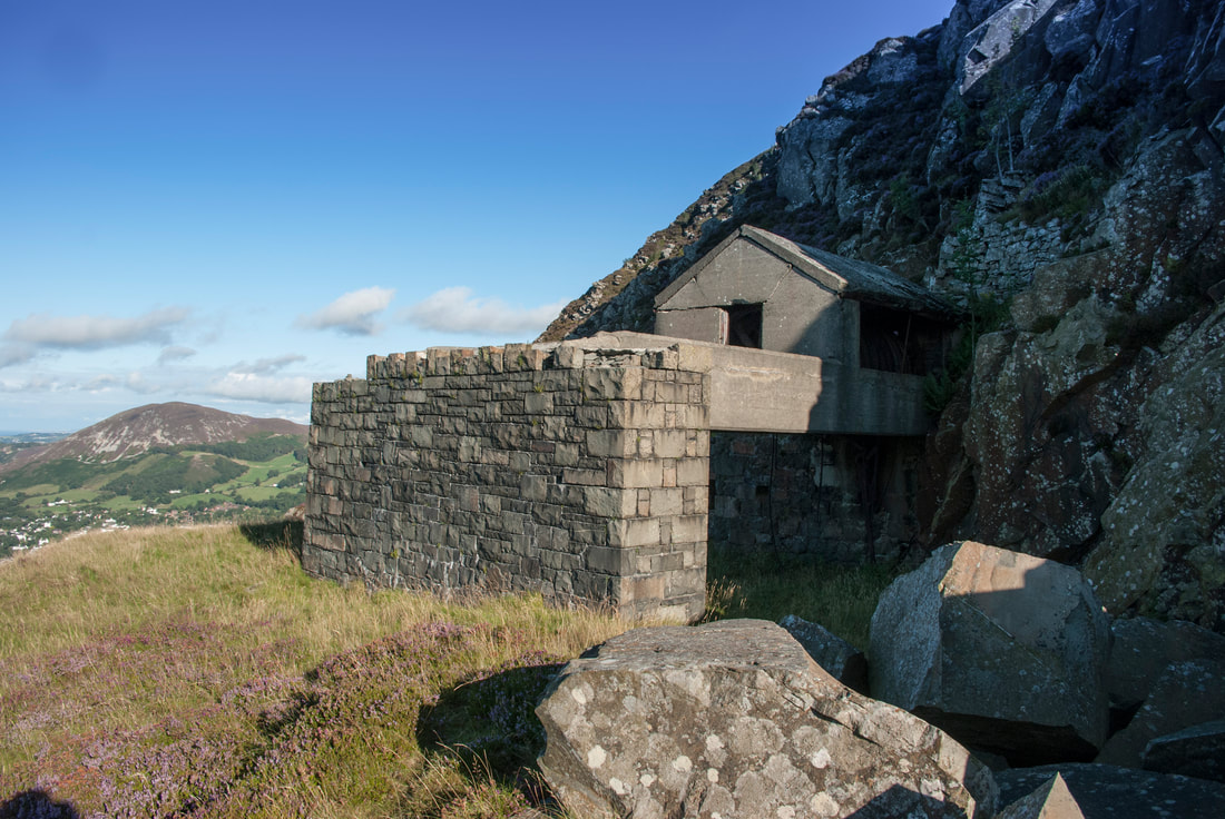
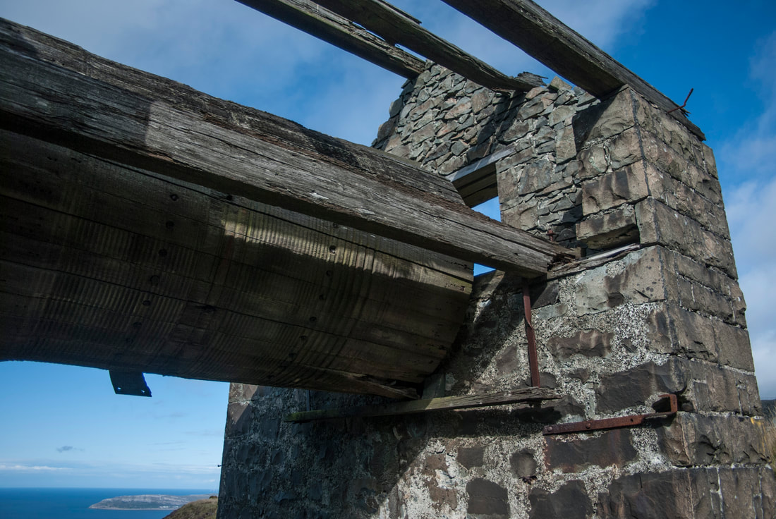
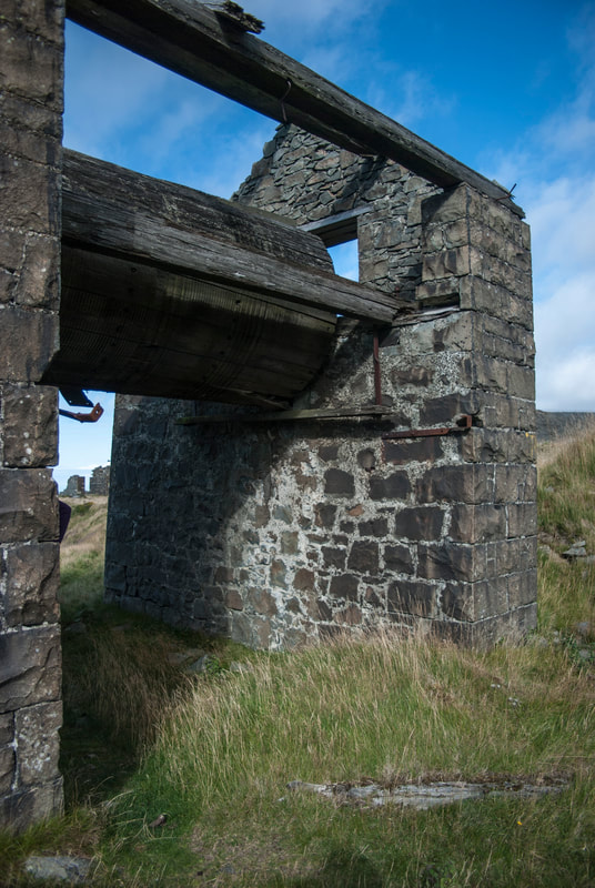
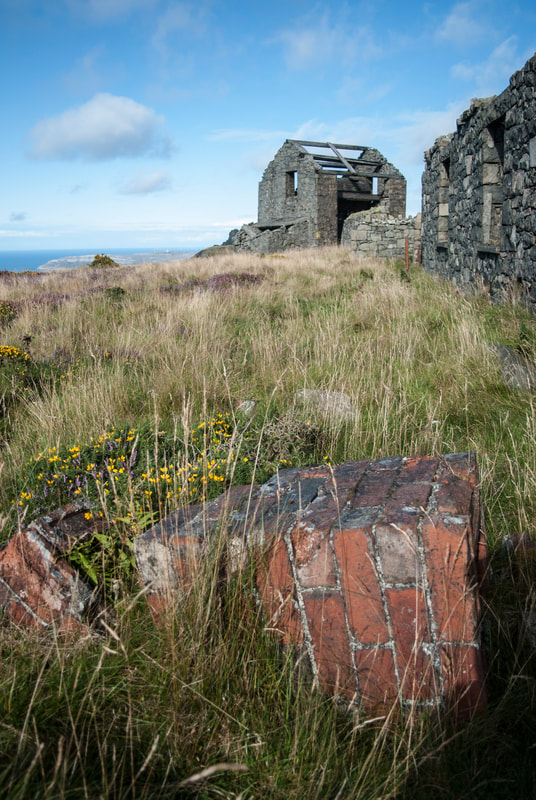
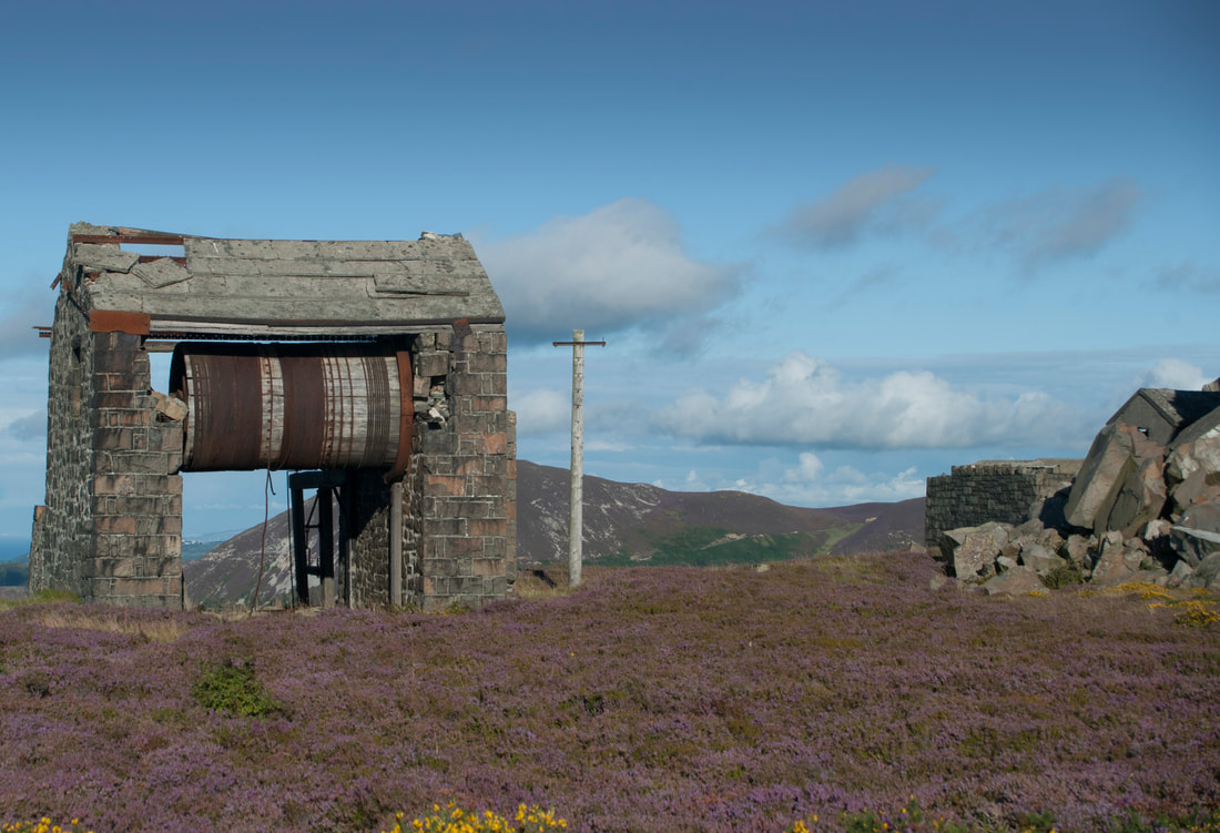
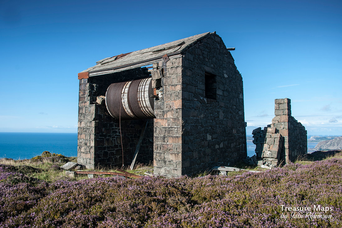
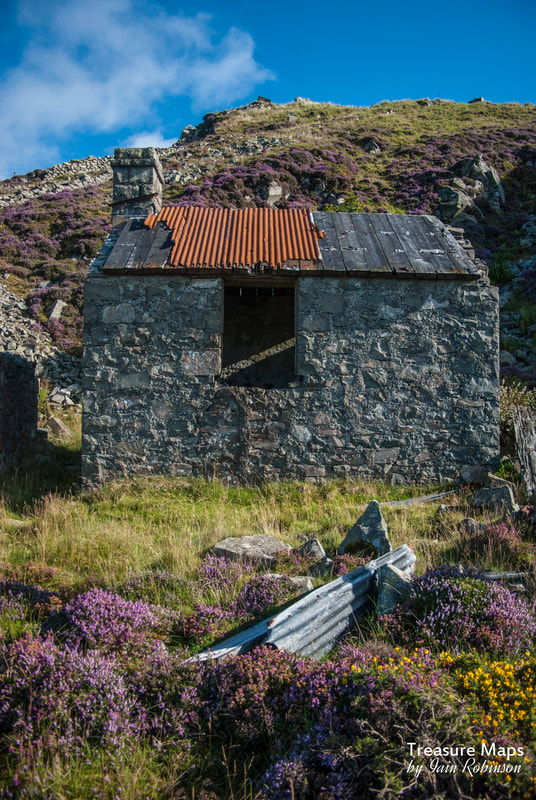
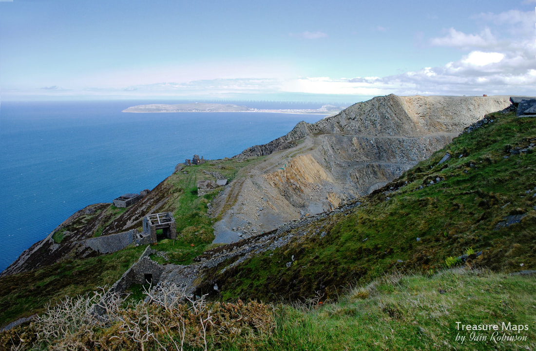
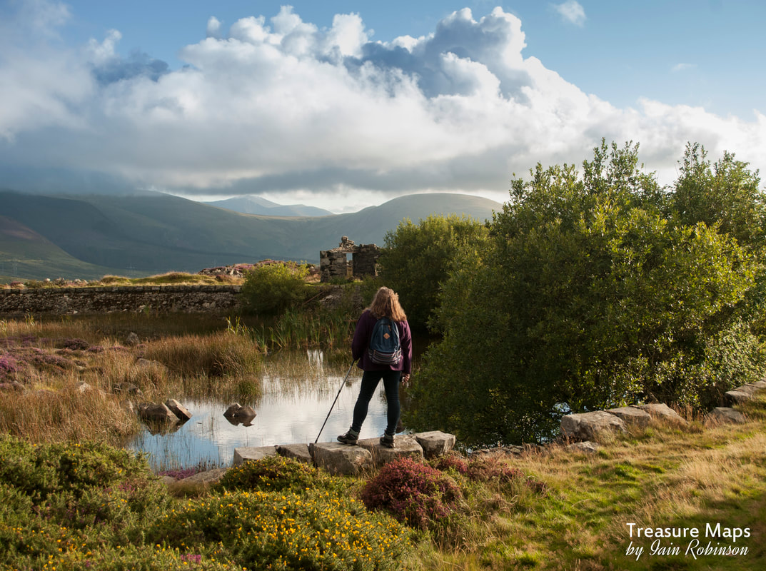
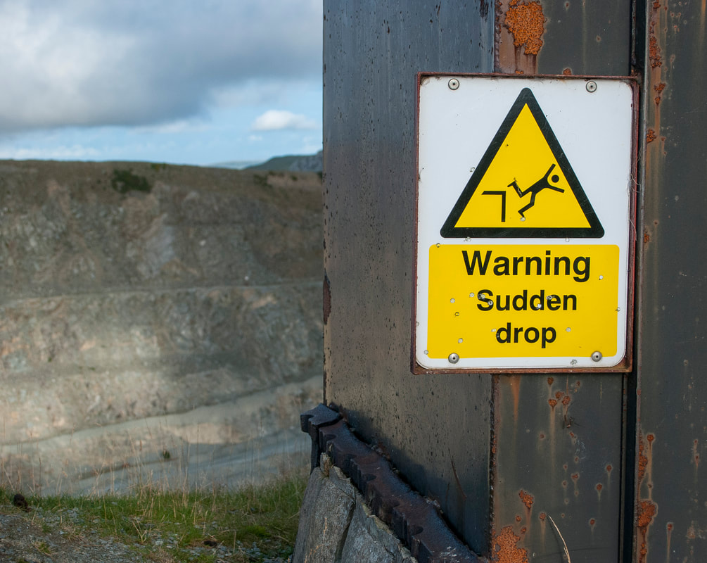
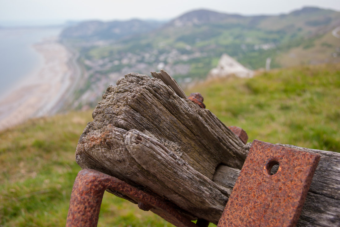
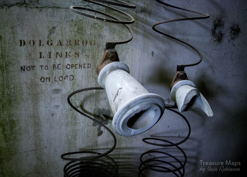
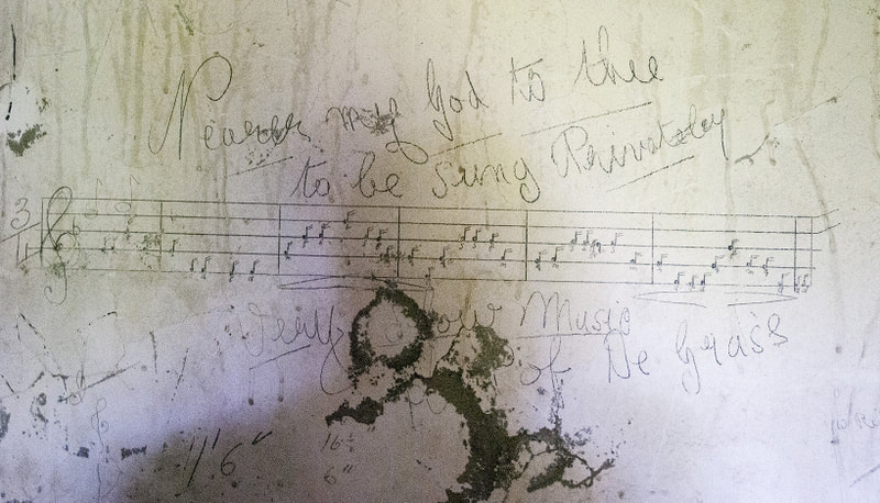
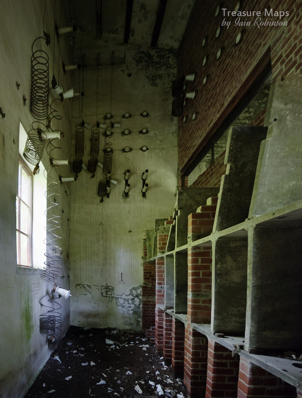
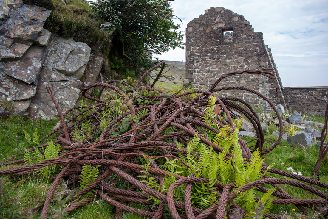
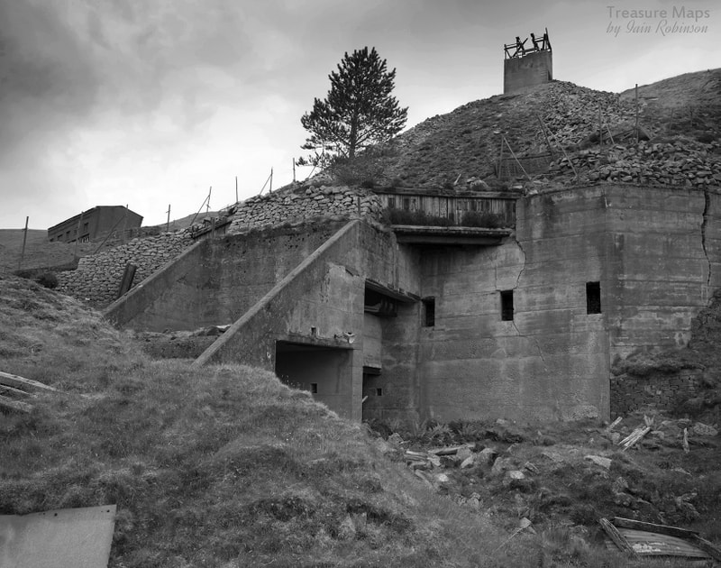
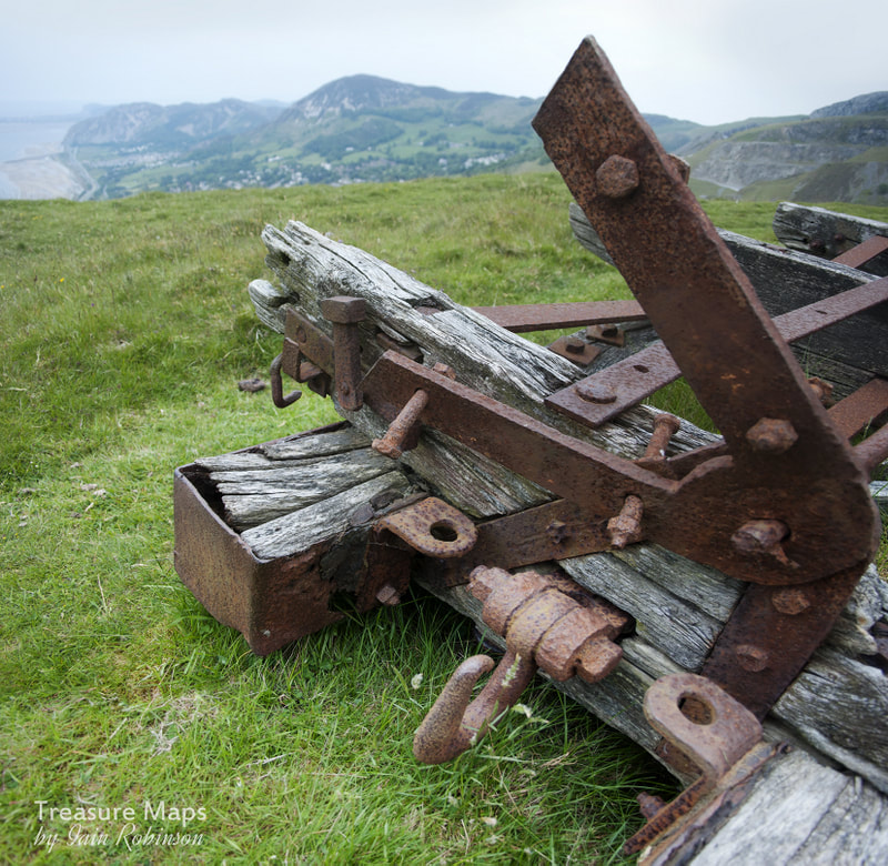
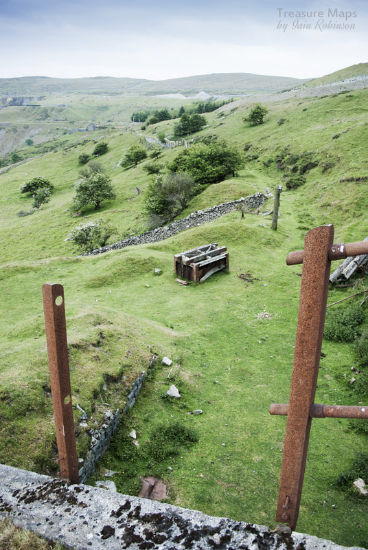
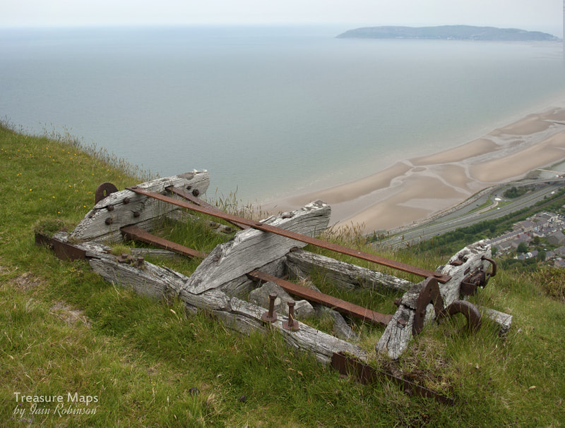
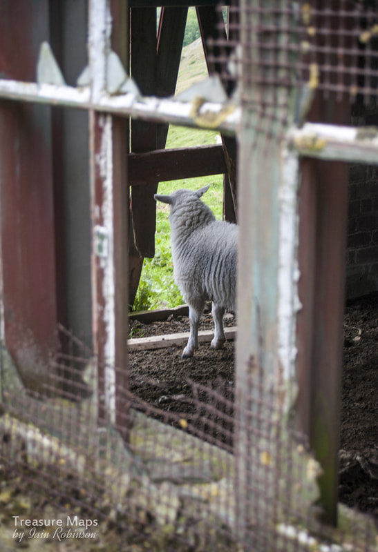
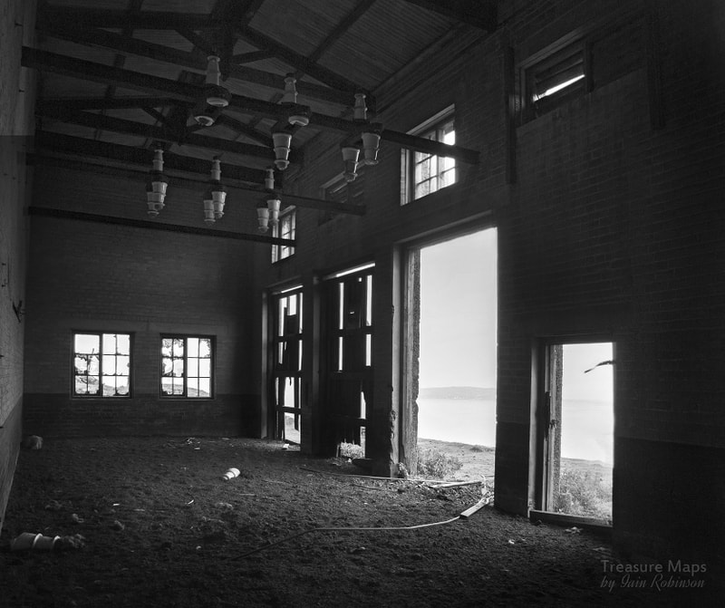
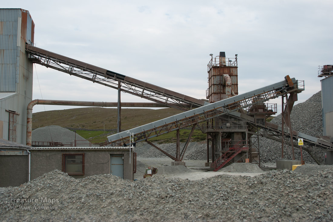
 Looking down on Penmaen West Quarry. Over on Anglesey, Penmon quarry can be made out. I always look forward to driving along the A55 from Bangor to Conwy; while it is highly dangerous at times, depending on how late the HGV's are off the ferry at Holyhead, it also rewards with some breathtaking vistas. To seaward, there are views of the Ormes and of Penmon Point on Anglesey, but it is to landward that my attention always wanders. The magnificent remains of the Penmaenmawr inclines and drumhouses cover the headland like weathered veins of mineral on a pebble..for years I'd wondered about taking a closer look at them. There's that funny giant clock, as well... Eventually, we made it and I wrote a blog post...which was subsequently lost on my old Blogger platform, along with a shedload of other stuff.. So this is my attempt at remembering what we did and how we got there- please bear with me if it seems a little sporadic here and there... 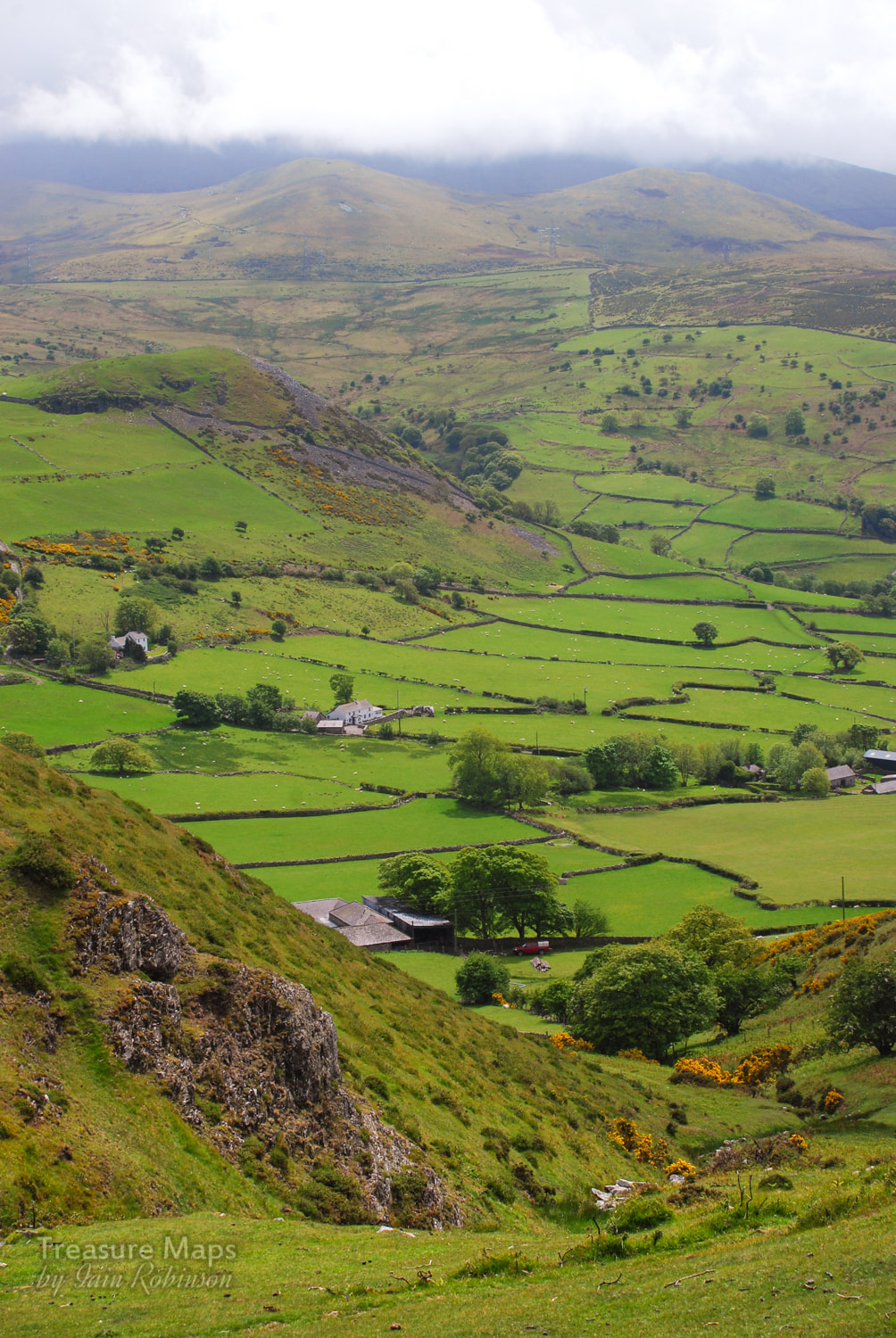 Dinas, from the slopes of Penmaenmawr...the hill is, like Penmaenmawr, an ancient settlement and guards the western end of the Bwlch-y-Ddeufaen. From any angle, Dinas looks like a South Wales coal bing! The slopes of the mountain are criss crossed with footpaths, some made by the quarrymen themselves in days of yore. The best one to reach the upper levels is the North Wales Coastal Path. If you're feeling bold, you can drive all the way up to the Hanson Aggregates old gateway to the quarry at SH 69907 74735. You have to start in Lalnfairfechan at the crossroads, taking the Valley Road up to Plas Heulog. It's very steep and very narrow! There's parking at the gate for two or three cars. The gate is locked, but there's a way round for pedestrians. If using the quarry road, peel off when it starts to turn towards the east and into the pit. You definitely don't want that way! Instead head across the moor as it climbs steeply towards Penmaen West, a lovely airy walk through heather and wild flowers. 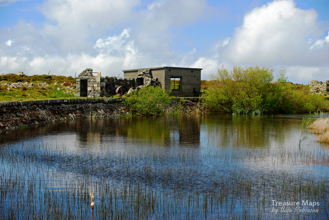 The Hushing pump On our visit, we arrived at a plateau, where a ruinous concrete building revealed a rusty old machine- a fly-wheel could just be made out behind a fallen wall. In front was a small holding pond and evidence of some leats running towards the structure. Inside there was a modern-ish turbine or impeller while in the other, older compartment of the structure was a victorian three-cylinder pump. I looked at this for a while and came to the tentative conclusion that this must have been for "hushing" the rock faces of spoil, the pump providing a strong pressure jet of water. At this altitude the quarry hardly would have needed to be pumped out. On a later visit with my daughter, several wild Carneddau ponies were relaxing in the heat here, their hooves in the water. After mooching around and looking over the lip of the quarry face, where the wind was strong enough to send you flying backwards, we headed up the hill to a ramshackle range of structures looking as if they had strayed from a Sergio Leone movie. Here, various dire warnings greeted us on signs installed by the quarry company. I guess if I owned the land and was responsible and concerned about litigation, I would put signs up too. I think mine would be worded something like "You're big enough and ugly enough to think for yourselves, so don't come crying to me etc..." I was, however, disappointed that there were no signs featuring the falling man with flared trousers, an omission, I think. These structures here were compressor houses and some smaller buildings that might have been cabans or the like. The larger ones were made of concrete, a material readily to hand on site, while the others, which must have been older, were expertly constructed from Whin Stone, a hard, brittle form of rock which chips sharply and is difficult to build with. It must have overlaid the granite as overburden and used as it was easily to hand. A very steep incline ran down from this level, leading to many more interesting structures. including the level where the famous De Winton "coffee pot" locomotive, "Penmaen" still slumbers. The views are fantastic from up here though. I know that the mountain has been despoiled by the quarry- and that the quarry masters are like some mischievious agent of destruction, obliterating not only the pretty views but also anything of worth archaeologically which gets in the way of making money. I admit to being one of those people who love scenes like this, although I regularly get my fingers burnt when artifacts from an earlier and more colourful quarrying era are destroyed by the very process that fascinates me. C'est la vie. 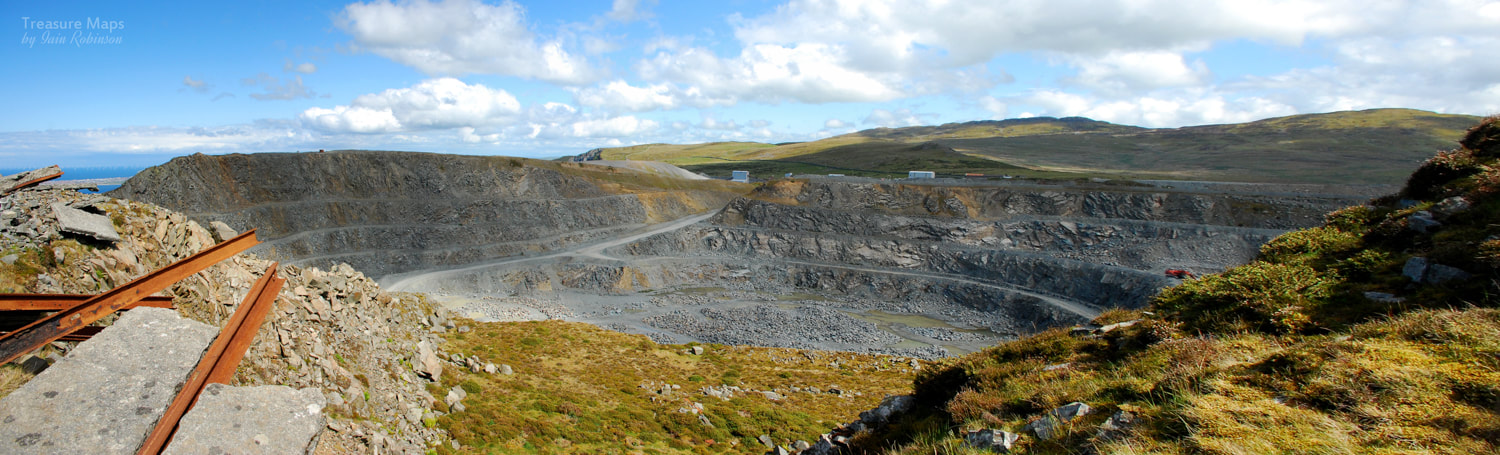 For the view from the north side of the pit, see my earlier blog about Penmaenmawr and Fox Bank. Over a few months, we made various sorties up and down the various levels, but didn't make it over to Penmaen West due to the old quarryman's path being eroded away almost entirely. Looking at the 1890 maps the path seems to have been the main route for workmen coming from Llanfairfechan, but that it is also joined by a steeper path coming up, I can only assume that these old quarrymen were made of stern stuff. The track has collapsed in several places and sometimes progress can only be made by inching along a very narrow ledge- it's very dangerous, but as I said before, you are big enough etc...just don't say I told you to do it. 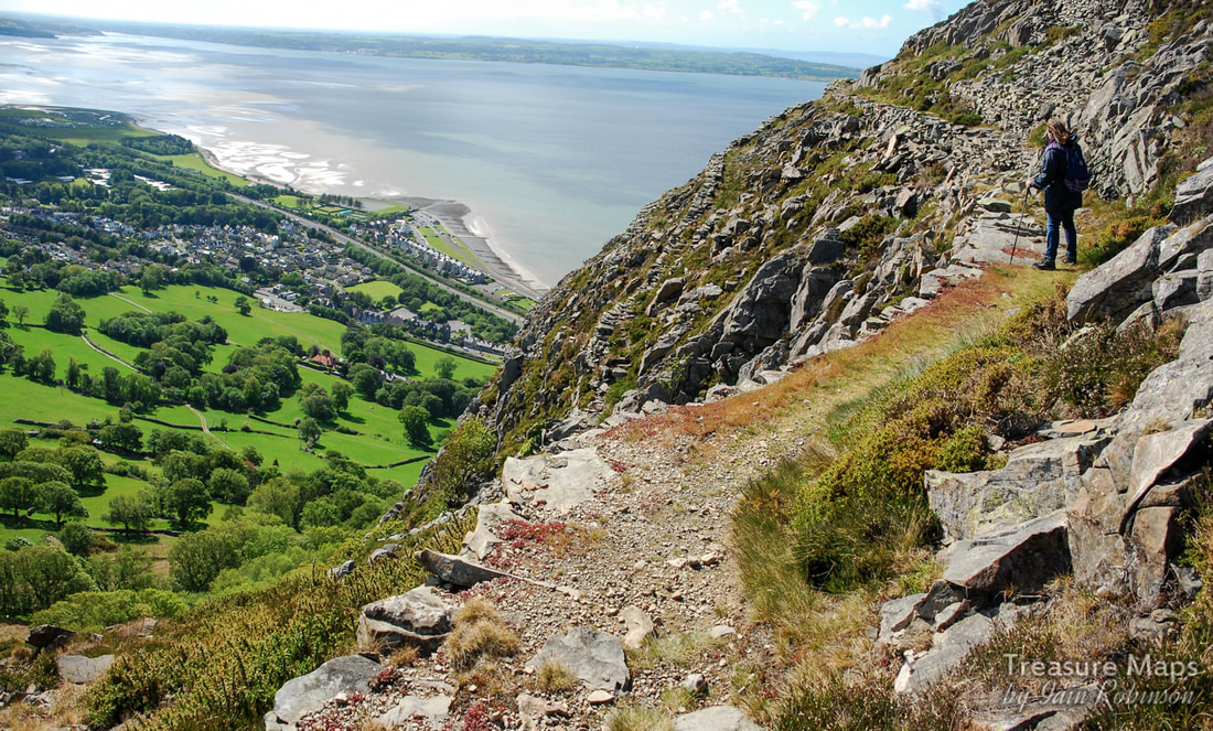 Petra considers the view from the old quarryman's path. While wandering around the slopes, we encountered a very fine powder store, one that I've not seen mentioned anywhere else. It's below the top level at SH 69712 75755 and is quite easy to access. 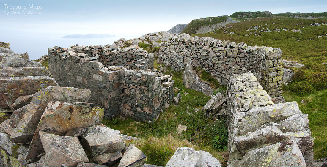 The ruined powder store, with curtain walls still intact. The temptation of the "Coffee Pot Level" was becoming hard to resist, so we made our way down the steep incline from the outer lip of the pit. There was nearly a foot of heather on the slope, but the rails were still in place underneath. Similarly on all the levels, there is still a wealth of ironwork and relicry hidden beneath heather and undergrowth, and long may it relish. A glance at Google earth will see how this joins other inclines and leads to a cornucopia of structures and other delights, of which I can only hope to give a flavour of here. And what of "Penmaen"? Eventually, we were standing outside the shed, looking at the old De Winton's remains. What a lovely thing it is, being left to rot away in dignity. The unseemly paint daubs of a few years ago have faded away- after all, these days anyone who wants to know about the loco just needs a browser and Google. The loco reminded me a little of "Alice", left slumbering away in her shed on Australia level at Dinorwig- except that Penmaen will actually be left to rust in peace. This side of the quarry has such a proliferation of structures; there's almost a feeling of "drumhouse fatigue" after a while- but guard against that, these lovely things won't be here forever. I am conscious that they could be swept aside by some new development, however remote the possibility seems. Here are some shots of the buildings, in no particular order, to give a flavour of this side of Penmaen head. The light is quite critical here, better to be earlier in the day; when it's later the shadows are in the wrong place (as you can see from my "Penmaen" shots above); not helpful. There are still many areas of Penmaenmawr to explore; I want to have a look at the brick built loaders at Bonc Jolly, but have been chased off a couple of times so far. There's the Pendalar Inclines, whih we almost got to before being stuck in acres of brambles -and then there's that clock, which still eludes us. Soon... Here are a few more random images of the place... 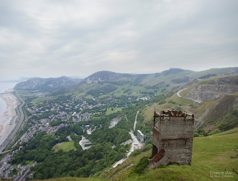 The Fox Bank conveyor support above Penmaenmawr, with the Graiglwyd quarries to the right. I should have known better. I'd found a footpath on the OS 1/25000 map that climbed up the mountain to the top workings of Penmaenmawr Granite Quarry and, checking the road access on Google street view, all seemed perfectly civilised. So when we arrived, why was I surprised to find the metalled road to be at an almost 1 in 5 gradient? Even our all-terrain truck was grumbling a little, although not as much as the Waitrose home delivery van that was following, a centimetre behind. 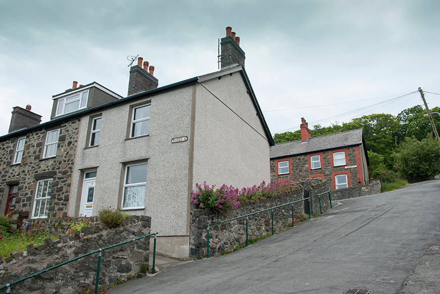 The road took a tack across the contours, in between a row of quarryman's houses, before striking upwards again. I wondered at how the Waitrose van was managing to fit in the narrow space between the houses and still be glued to our towbar. I spotted a parking space and Petra slotted the truck in, at a disconcerting 45 degree angle from horizontal. The Waitrose van braked, swerved and headed off down another street. I hope whoever ordered that delivery eventually got their vegetables.We had parked at the end of a set of three beautiful terraces, obviously built for the quarrymen and their families. I wondered at how folk got about in snow and frost with these gradients, but perhaps winters here are mild. However, a sure sign of winter fun were the handrails on all the pavements... 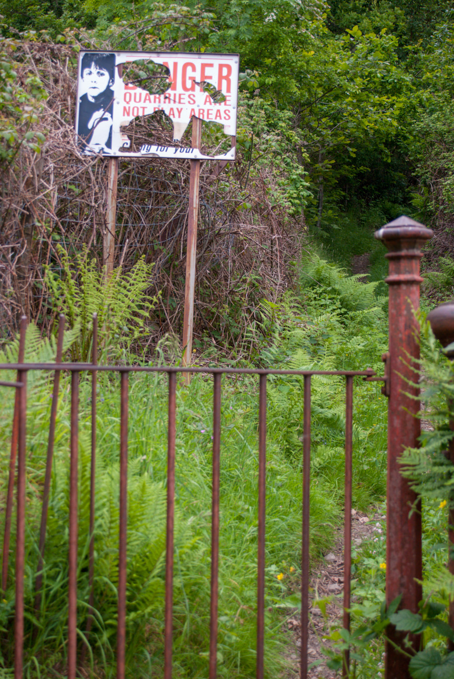 An old warning sign at the start of the footpath Finally, we set off up the steep path to the quarry. I'd seen the path mentioned on the web as a popular walk with ramblers, and had feared that it might be a manicured and tame affair. As it turned out, I needn't have worried! The path threaded steeply up the bosky hillside, eventually following an old incline- not one I could find on any of the old maps available at the NLS database. Then, like something from an Alfred Bestall illustration, a strange building appeared, surrounded by trees. It was a long-deserted power-house, for supplying juice to the many inclines and crushers in the vicinity. Unlike some slate quarries, these granite quarries relied on power bought in- and by the look of this structure, they used a fair bit of it. Inside were the tell-tale signs of insulators and switchgear, including a bank of meters, the like of which I wouldn't fancy finding under our stairs! Of all the many charming things about this wonderful building, the stencilled signage and the graffiti caught my imagination most. I wondered when the music had been put there, especially as there were some imperial measurements pencilled on the wall near it. 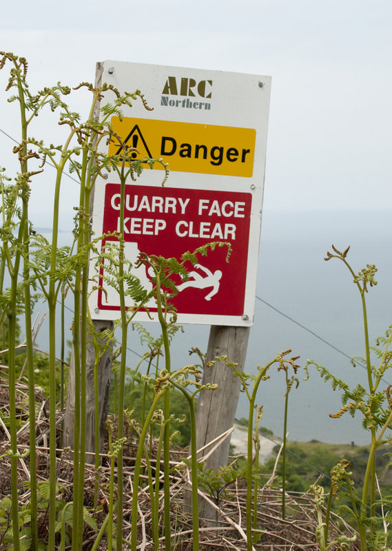 Climbing again from the generator house, the footpath struck a very uncompromising angle upwards. It was here that we met someone coming down the path who had been a little unnerved by the exposure- he'd decided to turn back rather than face the uncertainties ahead. While sympathising with the poor fellow I did experience an inward feeling of warmth- this wasn't going to be a Saga Magazine featured ramble after all! Of course, if this was underground, I would be the one returning uneasily because of the dark, so I mustn't crow. The path zig-zagged up the mountain and soon left the tree line where it did indeed become a little airy. A jolly message from the usual chap with flared trousers, about falling off the cliff appeared, which cheered us up. This path is marked on the old maps, so must have been a quarryman's route to work. 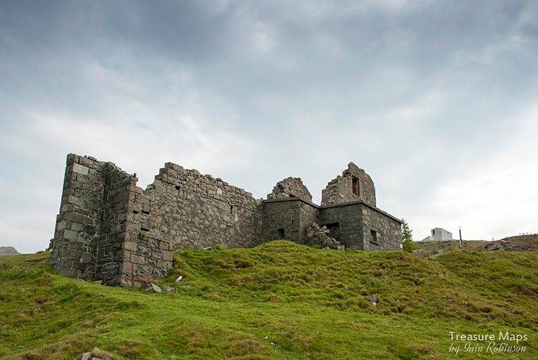 The drumhouse, with a shielding wall against the wind After much huffing and puffing, we arrived at a very substantial drum house. I've looked at the 1941 revisions of the Ordnance survey and can't find this feature- not helped by the fact that it's on a join in the sheets, (that's my excuse anyway.) The only reference I can find is on M Lloyd's map in Boyd's book*. Uphill of the drum house was a substantial steel tank and a girder bridge carrying the route of the tramway from Fox Bank. The incline here must have been in use in the early forties- Boyd has the tramway at 1943, which explains why it doesn't appear on the 1940 map... perhaps. Now, we could see conveyors stalking up the mountain as well as a new quarry road. As if to remind us of the harsh nature of granite quarrying, across the valley a gigantic truck came slowly down one of the roads, it's rheostatic and engine brakes working overtime. The driver was taking no risks with the enormous chunks of rock in the tipper- they must have weighed over fifty tons. 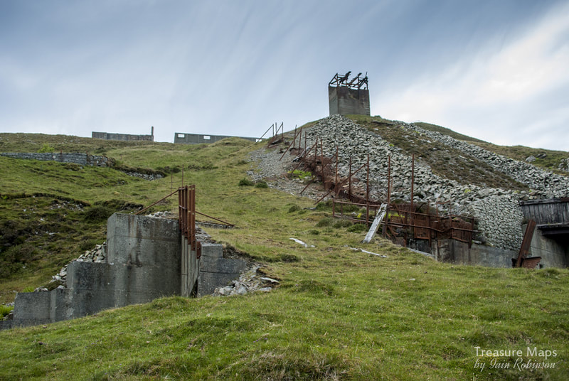 The conveyor head and ancillary structures at Fox Bank. We could have gone uphill to the modern processing area, but there were folk wandering about in Hi-Viz vests and hats up there, plus the usual sounds of crunching- so we headed over to the right, (or the west) to Fox bank where there had been a mill and loading station from 1895- to be honest, the structures looked no older than the nineteen forties. However, this was a charming location if you like old tramways and breathtaking views. It was hard to photograph anything without including the gratuitous view of the Great Orme, which soon began to feel like a cliche. I decided to just enjoy taking the photos and examining the many abandoned wagons lying about. Above: More views of the brutalist structures at Fox Bank... 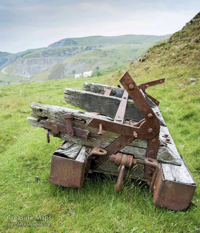 Remains of a side tipper waggon 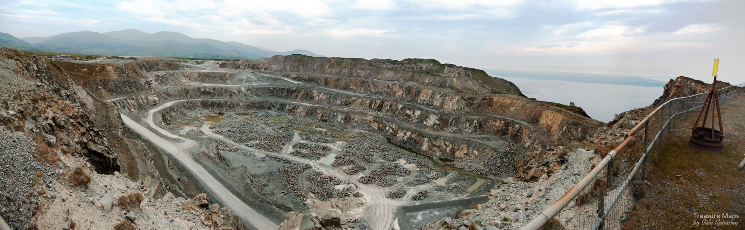 The Pit... We followed another zig-zag track uphill to the remains of the Attic Bank working, where the lip of the vast pit suddenly opens out below. Standing here, I realised that the conveyor tower and this flat area, all that remained of the Attic Bank level, were what I'd been looking at as I drove past for all these years. It felt great to be standing here, the views and the ruins making it one of the best explores as far as I'm concerned. While Petra is equally keen on quarry and mine remains, she has a side-interest in wild flowers and I had noticed that she'd been busy the whole time photographing little colourful plants. Alpines, apparently. Although I am allergic both mentally and physically to flowers, I do appreciate those with delicate, tiny little blooms- and here the hillside looked like it had been tricked out by Laura Ashley. It gave the brutal concrete structures a genteel air, somehow. There was another transformer house above Fox Bank, probably to power the crushers and machinery here. It had a strange atmosphere, a dissonance with the other structures, but I couldn't put my finger on what the reason was. Outside, I was mobbed by a couple of Choughs and realised that they were nesting inside- so I moved away, not wanting to disturb them further. While having lunch on the headshunt, high above the town, a hawk rose quickly from the crags below. I couldn't identify it for certain, but it looked like a Kestrel. 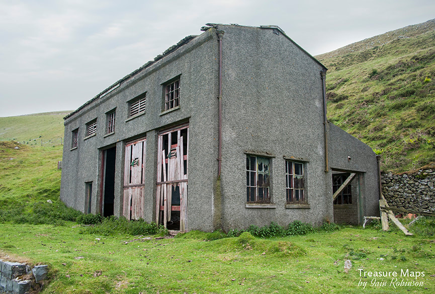 The transformer house between Fox Bank and Attic Bank. One of the more bizarre features of the quarry was that, while it had a network of three-foot tramways, the main quarry at the top of the mountain, an amalgamation of several workings, had a standard gauge railway. (!) Shades of Clee Hill, or the Cromford and High Peak, except this line was in glorious isolation. It ran along the two topmost levels, Attic and Kimberley (now quarried completely away) from 1931. Some inclines were converted to hoist operation using electric motors (hence the transformer houses perhaps?) and thus the locomotives and wagons were brought to work, along with a crusher and a face shovel. Motive power was mostly internal combustion, although an ex-L&Y (no. 43) "Pug" 0-4-0 was kept as stand by. With the sun becoming lower in the sky we set off towards the quarry road this time. It was after 5pm and we hoped to have a look at the modern structures at the top level. I guess the elevation at it's highest on our explore was around the thousand foot mark- not much compared to Sgurr Alasdair or the Inaccessible Pinnacle, but the presence of houses close to the cliff below, looking for all the world like a Google earth view, certainly lends a charm of it's own. And...we'd only explored a fraction of this fascinating place. References: "Penmaenmawr, Rails of Granite" Mike Hitches, Irwell Press 1990 * "Narrow Gauge Railways in North Caernarvonshire", volume 3, James I. C. Boyd ISBN 0 85361 328 1 On the web Penmaenmawr and Welsh Granite Industrial Heritage Railway Penmaenmawr Historical Society Graham Stephen's photos of Penmaenmawr The fascinating article on Jaggers Heritage about the quarry...how things have deteriorated since then :-( 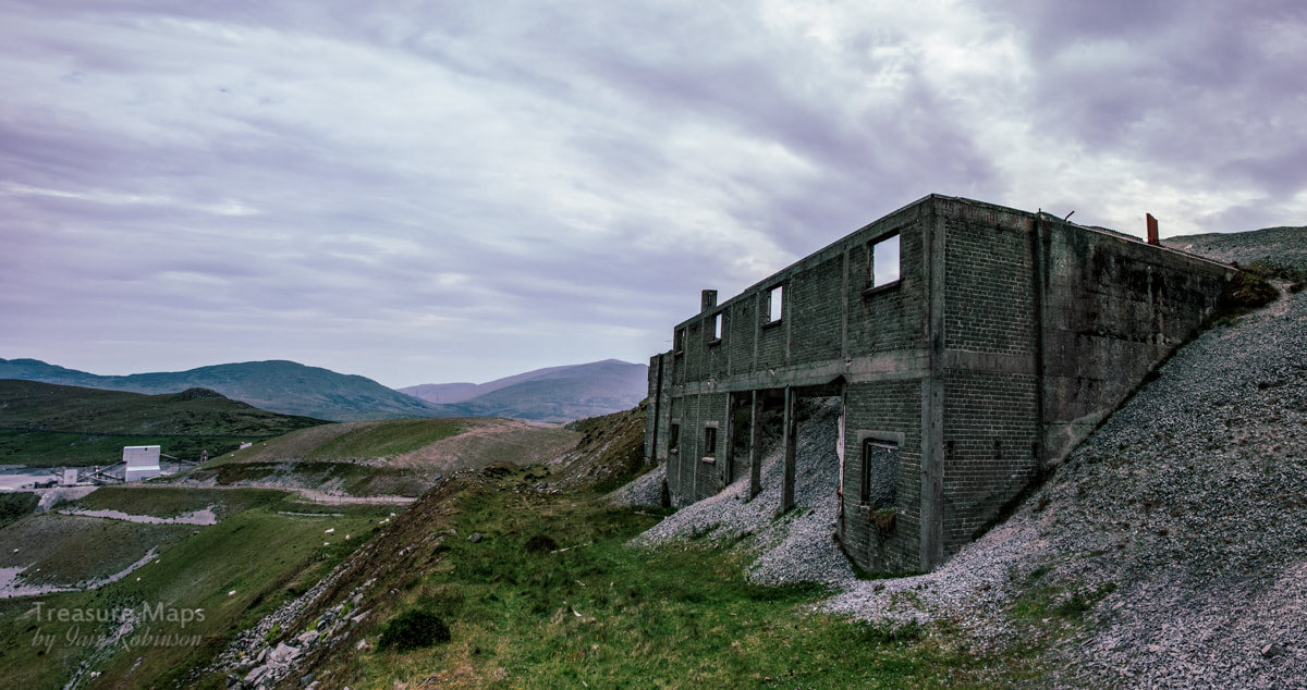 A rather gloomy shot of the bulk storage at Attic Bank, with the modern structures in the distance, looking over to the Carneddau. 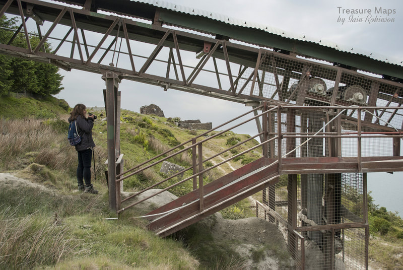 |
TracksReceive the occasional Treasure Maps Newsletter- and alerts when a new post is available!
If you enjoy my content, please buy me a coffee!
Check out my other online activity...
Index
All
|


 RSS Feed