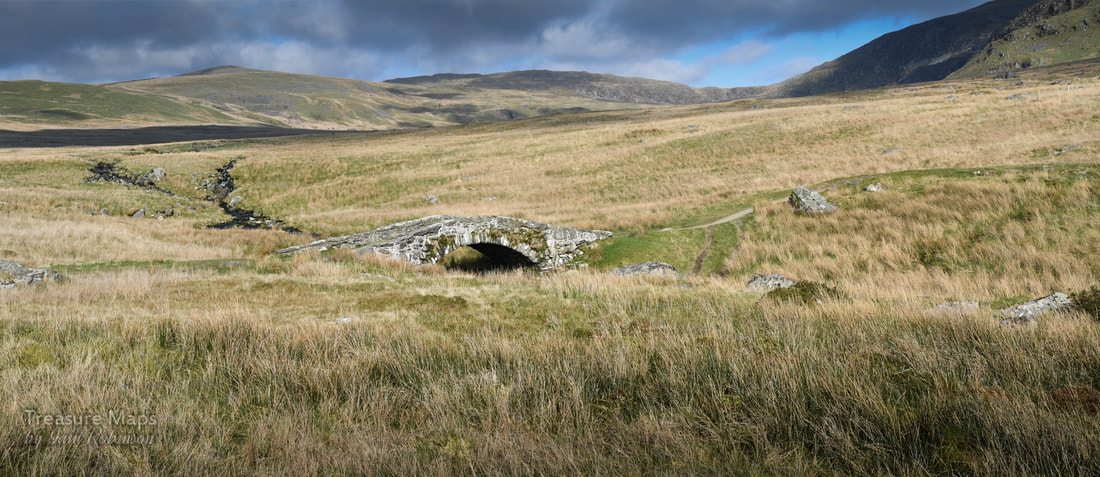
 The ancient bridge of Pont Scethin sat in the middle of the moor, leading the eye to the mountains, whose deceptively smooth flanks coruscated with sunlight and shadow. It was early spring, and we were sitting on a giant boulder near the bridge, resting after the trek over from Tal-y-Bont. The Afon Ysgethin was flowing normally again after weeks of rain, chuckling and rattling over the moor. The skylarks and meadow pipits were singing, the sunshine was warm. All seemed right with the world. I didn't know at the time, but we had been walking on the route of a bronze age trackway through the mountains- I had some suspicions after coming up by the old burial chamber of Cors y Gedol and seeing in the grass what I thought were the frail bones of ancient settlements, almost submerged by the passage of time. 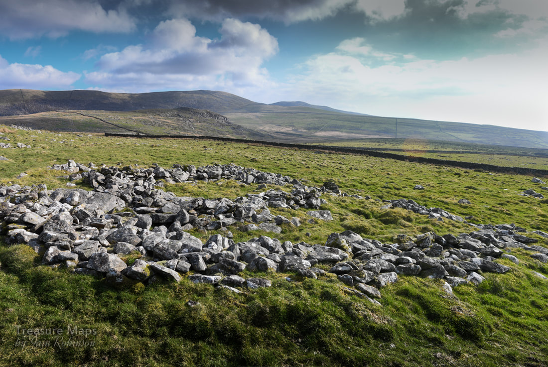 Ruins of an ancient hut/settlement. 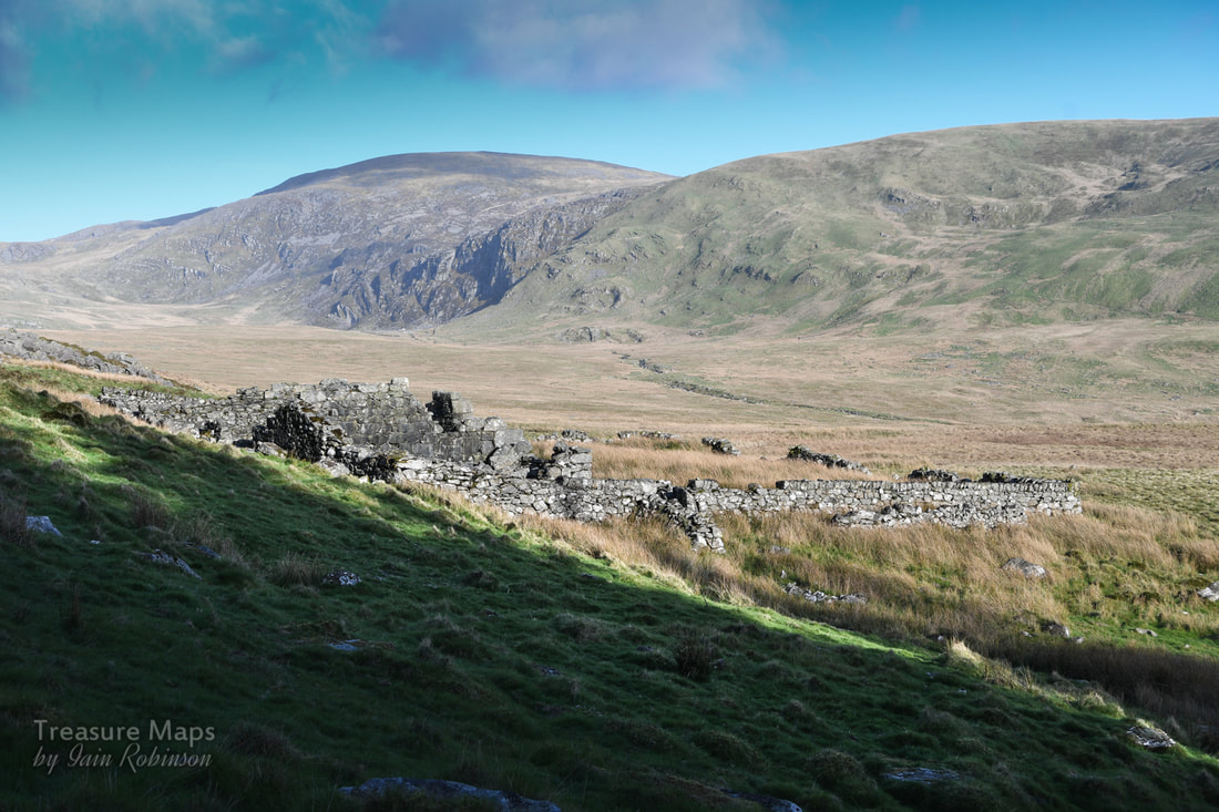 The ruined Coaching Inn. The hill in the distance is the mighty Diffwys (750m), while under that small area of crags is Llyn Bodlyn. Then, we'd passed the ruins of what we thought might have been a rambling sort of farm, just before the trackway made a dive for the river. Later, I found out that the farm was actually the remains of a coaching inn on the London to Harlech road. That would explain the unusual layout, but not the situation, a way off the "road". Surely, even "Jamaica Inn" was beside the road? And this place was called "Tynewydd" (the new house). I also discovered that the route over the bridge had been a drove road, which had wound it's way on over the Bwlch y Rhigwyr (which translates as the Pass of the Drovers). While the cattle droving had been carried on for centuries, the stage coach was a relatively new development in the C18th. 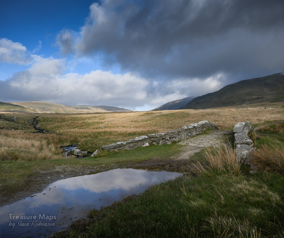 To be honest, I can't imagine how a coach and horses could be driven over this terrain, or over the surface of the trackway that remains, which comprised of gigantic boulders placed with no regard for smoothness of passage, rather like the ones on the Roman Steps in Cwm Bychan. The bridge itself seems hardly wide enough to permit the passage of a coach, or a cart. Perhaps, as Rob Collister postulates in his excellent "Days To Remember" , this part of the route was undertaken on ponies. It seems logical to think that the Coaching inn was there for passengers and mails to re-alight onto a coach, plying roads more suitable for iron shod wheels down to Harlech. 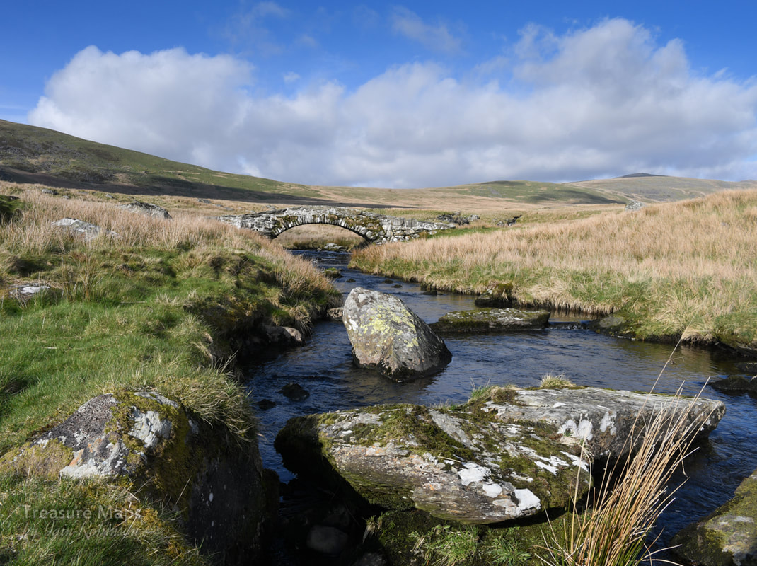 Apparently, there were considerable dangers in this area from highway men and gangs of brigands. Shirley Toulson, in her fascinating "The Drover's Roads of Wales" tells of one occasion when a fashionable party of Londoners, going to a posh wedding in Harlech were fleeced of their valuables. Perhaps that is why many folk preferred to travel rather more slowly with the cattle drovers, who were, as a rule, extremely handy fellows and who travelled in numbers enough to see off the occasional robber. The drovers were sometimes armed, as well, to protect the large sums of money they carried. (They received an exemption from the Disarming Acts of 1716 and 1748). Other travellers had cause to get out of the way of the cattle drovers. The sound of the drive could be heard for miles and farmers would gather in their own cattle lest they be carried along by the driven herd, while coaches mule drivers and carters would lie well off the road until the melee had passed.  A view from the south side of the river. The hill in the background is Moelfre (589m) I thought I had managed to lose all the bike tracks, but I see the farmer's quad bike tracks intrude. As we were sitting there beside the bridge, munching Petra's famous home-made flapjacks and supping coffee, I pondered (as you do) on the way that the landscape is a fragile palimpsest of man's activity throughout the ages. The land that we see is the result of habitation and use, even if it looks to us like "wild" country. So it was ironic to think of one instance, in 1989 -when this place was ransacked, the bridge almost destroyed and the river banks used as a ford for massive tracked vehicles. The river became a dumping ground for used drums of diesel and the ancient trackway was transformed into a 50 metre wide scar. The perpetrators of this sacriledge were the contractors for Welsh Water Authority in the run-up (read crazed stampede) to privatisation. Luckily, outdoor writer Jim Perrin encountered the scene and sent photographer Fay Godwin some snaps of the damage. Between them, they made enough published noise to embarrass the Authority into retribution and restoration. 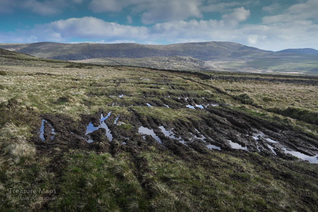 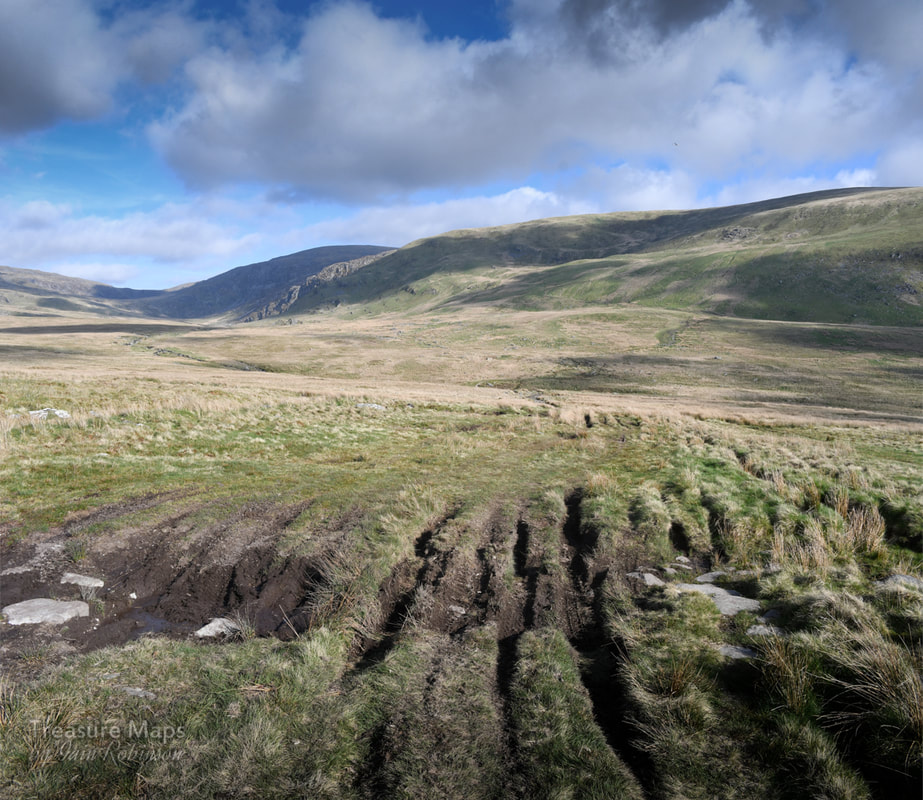 You can see the wide swathe of motor cycle tracks going up the other side of the valley. Sorry folks, but there's no excuse for this. ,Fay Godwin, in her book "Our Forbidden Land" says that although the Bronze age tracks around the bridge are lost forever, "at least the scars are now healing." I'm not so sure about that. Due to the increasing popularity of motorised trails biking, the trackways are being damaged all over again by a bunch of oblivious fools who think it's fine to pollute these quiet places with their noise and their fuel stink as they churn up the ground, making it difficult for anyone else to make progress. This time, the damage wasn't just around the bridge, either. It was visible for a mile or so up the opposite hillside. I noted, too, the tracks of farmer's quad bikes and Land Rovers, as if sheep farming in these moors was profitable or even justifiable in the 21st century. The farmer seemed to be using a different crossing beside the bridge perpetrating a new scar. And yes, I know that by law, they have the right of access as this is technically a "bridleway"...but really? It seems as if we can't really be trusted to take care of anything in the landscape. What survives, survives because of disinterest. The moment something attracts the gaze of financial or recreational interest, all restraints are off. Certainly, SSSIs or "listings" are worth nothing, since there are not the funds to implement any policing of them. Quietly thinking our own thoughts, and luckily not meeting any motorised trails bikers, we went carefully on our way. 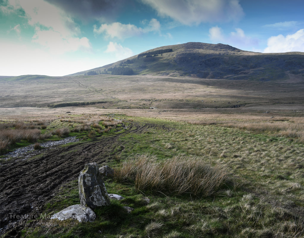 Recommended Reading
"The Drover's Roads of Wales" Godwin and Toulson, Wildwood House, 1977 "Our Forbidden Land" Fay Godwin, Jonathan Cape, 1990 "Days to Remember" Rob Collister, Vertebrate Publishing 2016 Web sites Walkingworld, drover's roads The Drovers of Snowdonia Jean Napier's page about the Bridge
0 Comments
|
TracksReceive the occasional Treasure Maps Newsletter- and alerts when a new post is available!
If you enjoy my content, please buy me a coffee!
Check out my other online activity...
Index
All
|
 RSS Feed