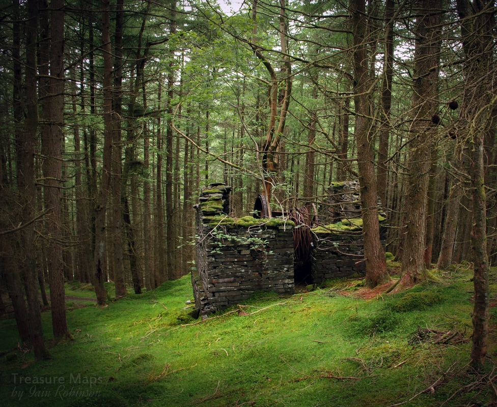
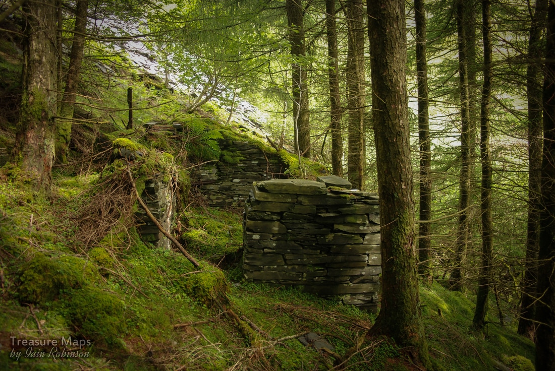
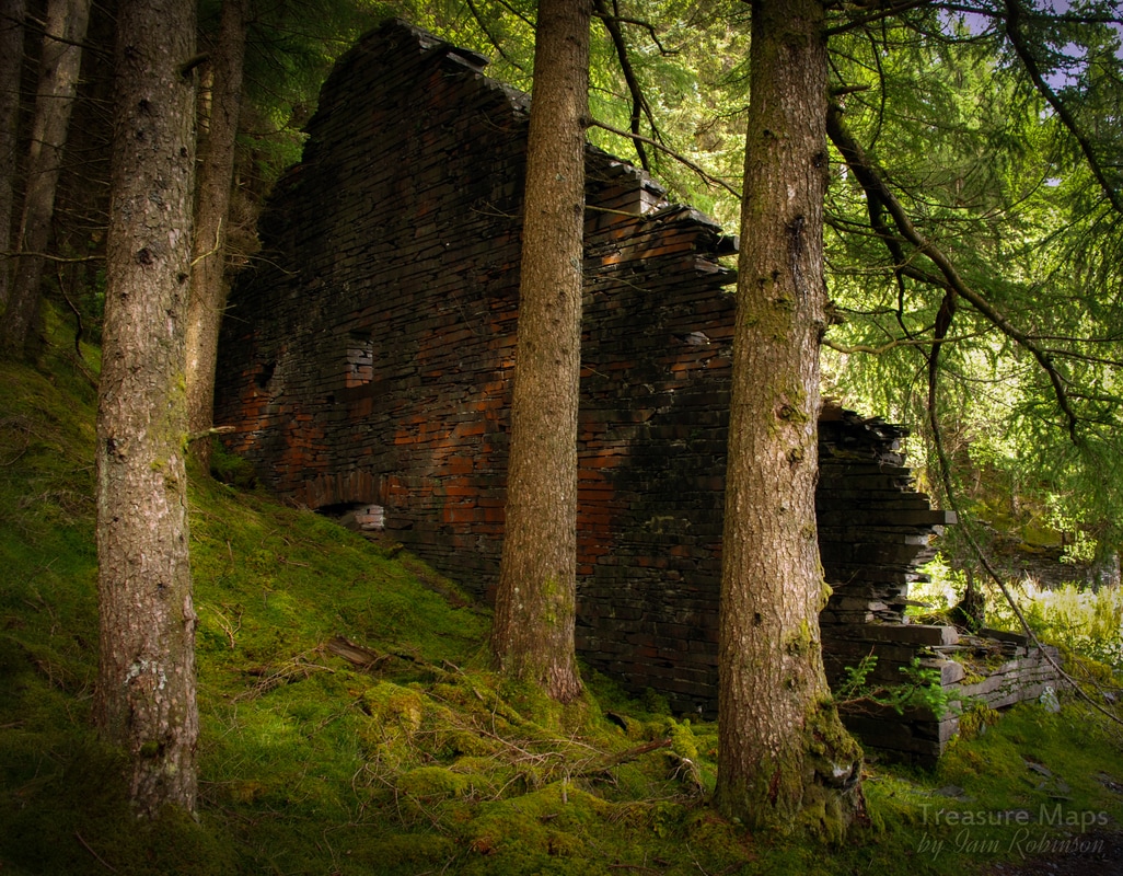
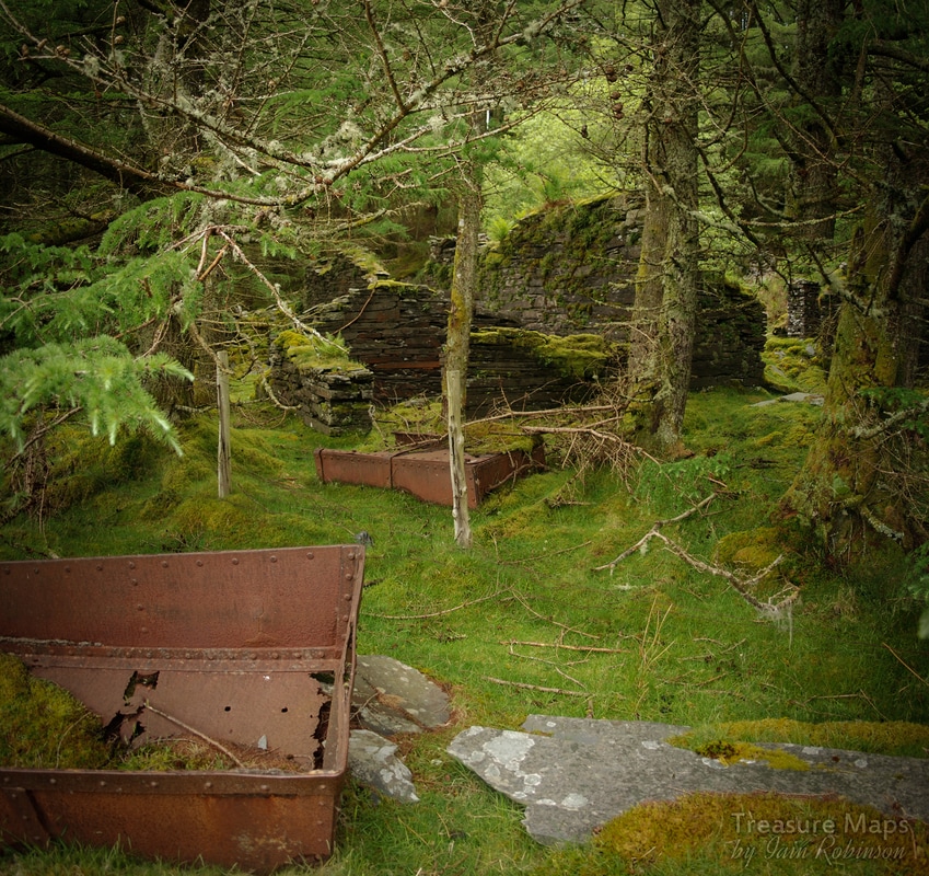
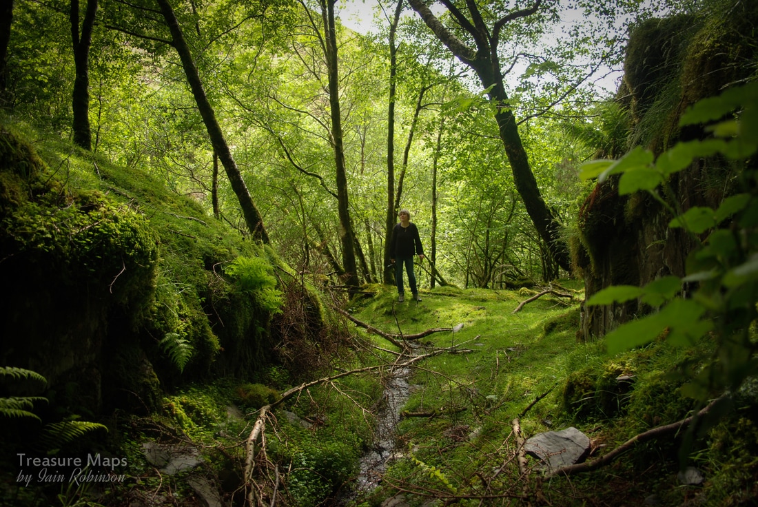
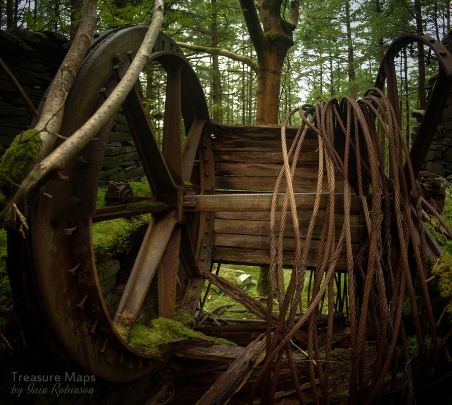
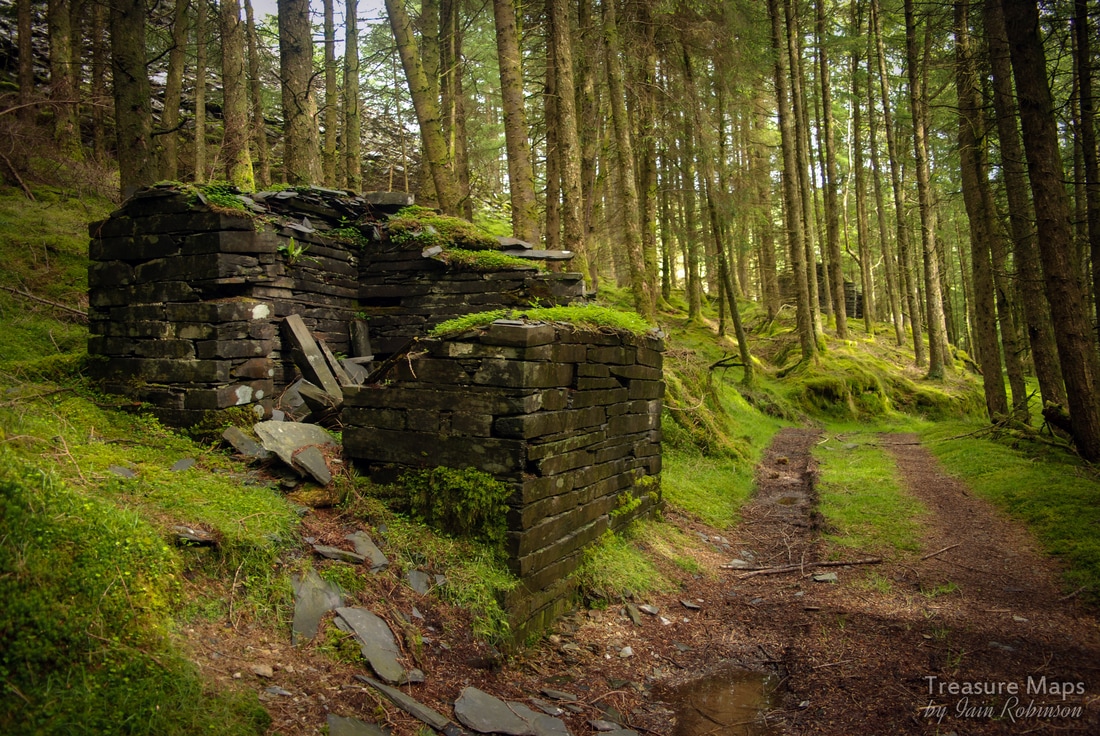
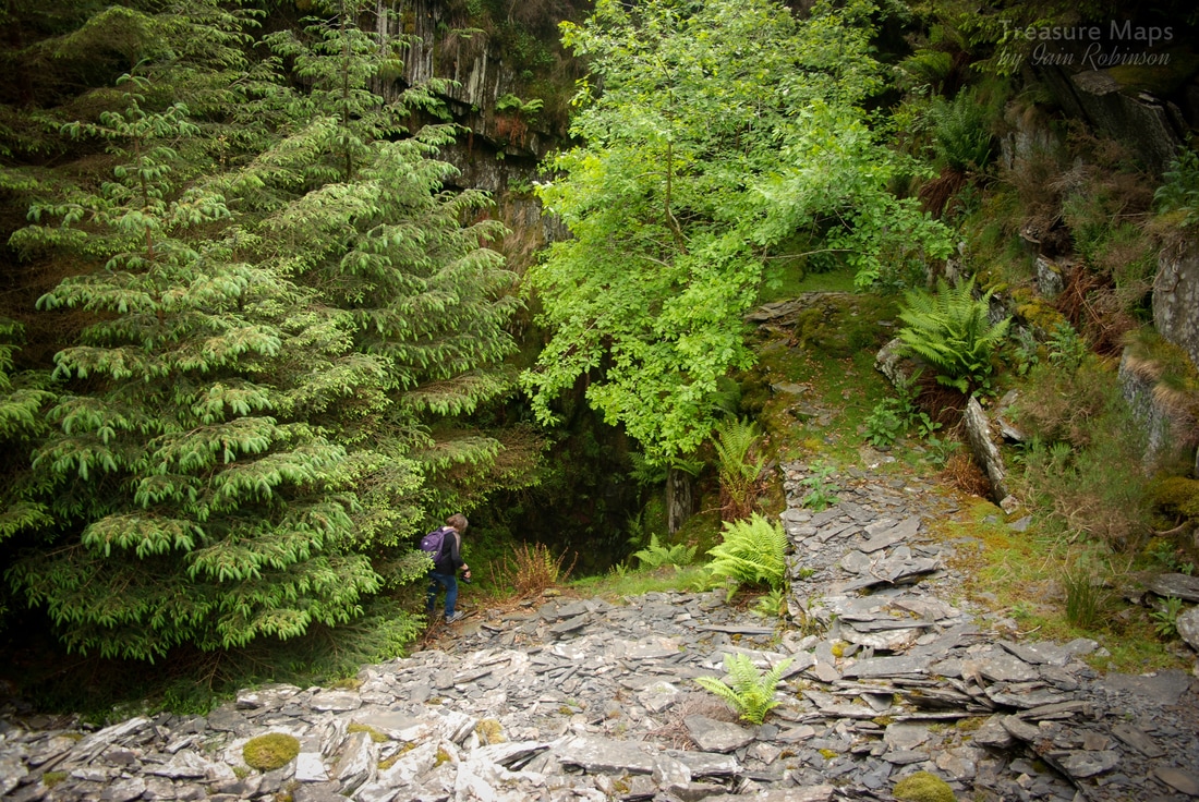
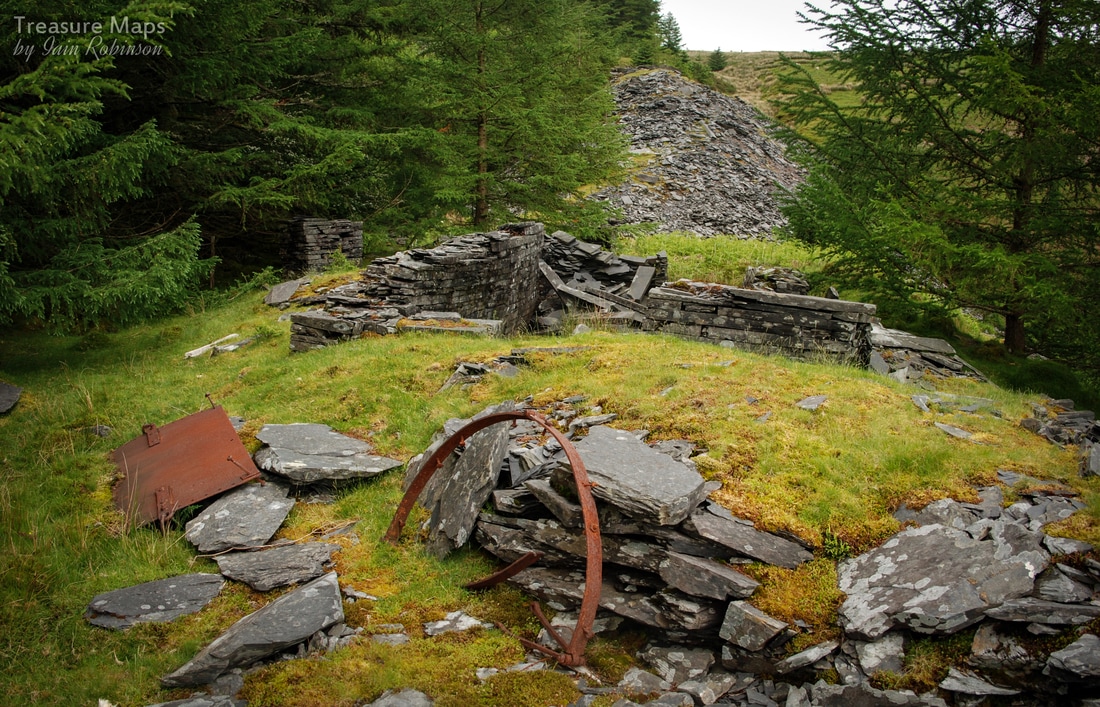
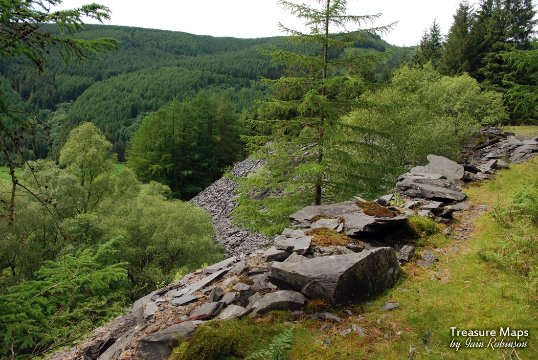
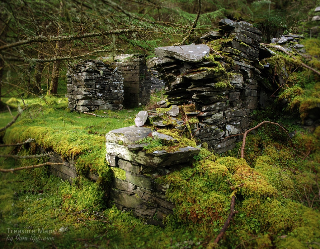
 Last time we visited, it was early spring and we ran out of light. Determined to return, we made it back to this fascinating site at the beginning of June this year. It was intriguing to see the remains on the valley floor level with the leaves on the trees. I couldn't resist another try at photographing the stables, for instance: 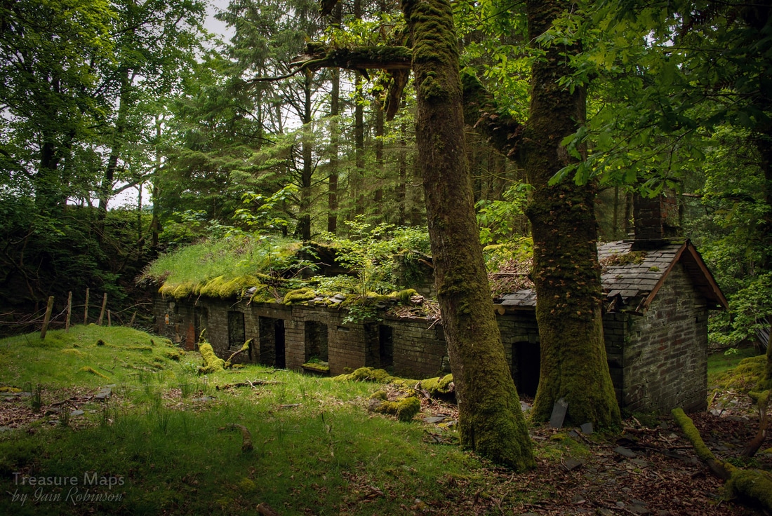 But the upper levels were exerting a powerful fascination. There are six inclines, almost lost in the woods. Rather than walk up using one or more of these, we followed a forestry road that climbed up (with scant regard for archaeology) until we made it to the first recognisable drum house. I should refer the reader who wants to form an overview of the place to the excellent "Remains of the Welsh Slate Industry" site where there is a good sketch map plus some very interesting photographs (from 1987) and informative descriptions. 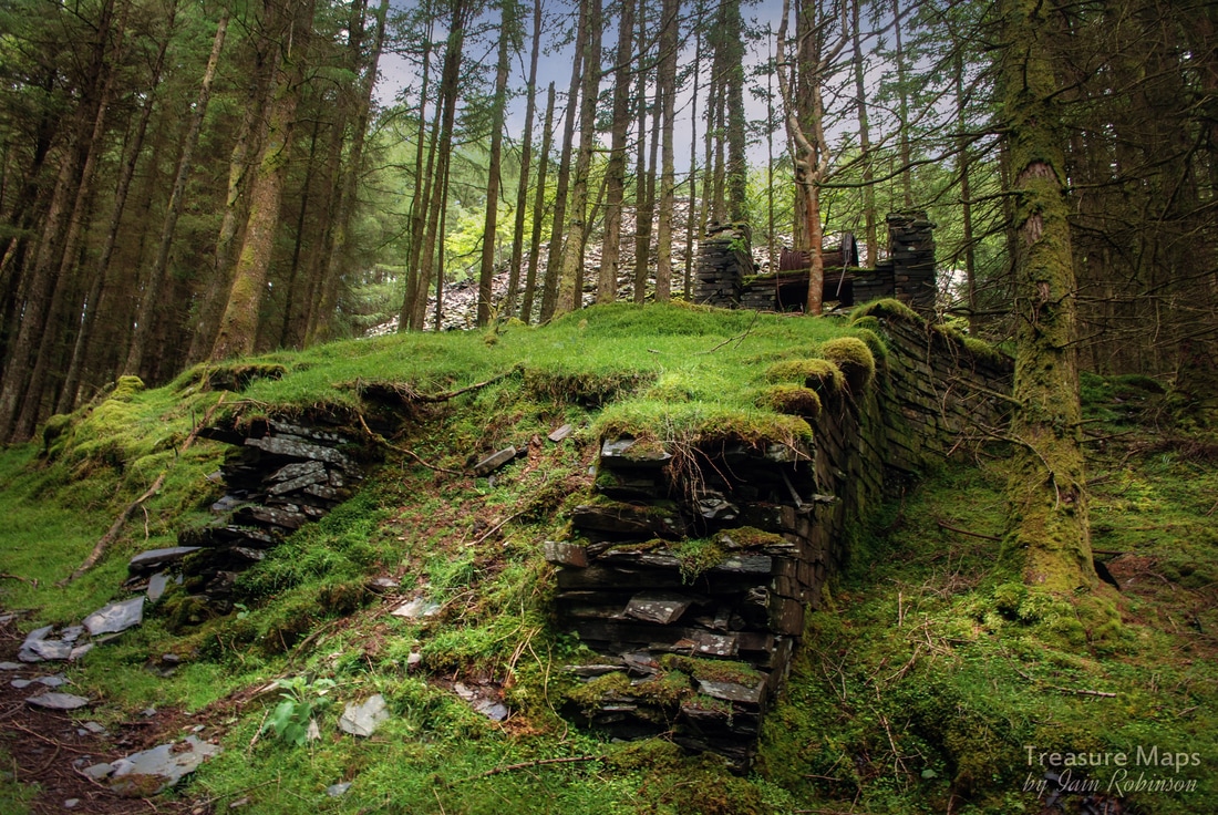 This is at the head of the 7-8 incline- what a fascinating structure. Originally much larger, it had started to buckle and bulge under the strain of holding loads down the long incline. So the quarry craftsmen had adapted it by building a smaller structure within the larger. It has an impressive position and a fine revetted causeway, cut into by the forestry vandals. I can't condemn the forestry people enough for what they have done here, bulldozing remains, demolishing structures and generally doing their best to obliterate the site in the name of growing a few trees as tax breaks for the one percent. Don't get me wrong, I'm all for sensitively planted trees, goodness knows we need them- but not like this. I guess all this happened in the seventies, and we've all become a little wiser since then. 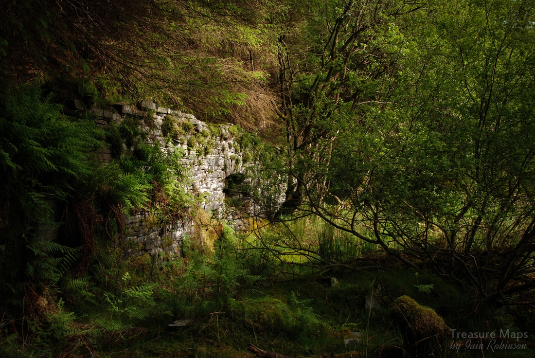 We carried on up through the trees to the remains of the Middle Mill, which now is barely more than one wall and a teetering gable end; obviously it wasn't cost-effective to demolish the entire mill, thank goodness. We sat on what looked like a very modern pile of slate waste, probably the remains of the mill- and ate lunch while trying to make sense of the site. It may be confusing, but despite all my complaints about the forestry, it is an enchanting place. While much has been needlessly destroyed and degraded, an air of mystery pervades the place. It feels like a forgotten world, which indeed, it is. It seemed from "JAW's" map that an adit might be found at this level. We walked along a shelf made of slate waste which became ever more enclosed by woodland until Petra discovered the entrance. It was wonderfully scenic. It is not worth venturing inside, as it doesn't have any artefacts or chambers and was solely for transporting blocks from the level 7 workings above. It was also rather wet on the day we visited. However, it is worth a look just for the beautiful situation. A little way above the adit, below the level 7 waste tips, was a small structure which I suspect might have been a caban. 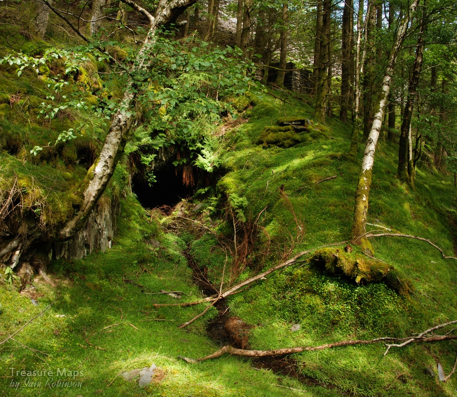 Toiling upwards again, this time along a path between the tips, we came to the upper mill, on level 6. There were remains of an extensive mill and barracks here, but all has been needlessly confused by tree planting. Weigh-houses and other structures, more difficult to interpret lay in disarray all round, punctuated by tall spruce trees. I was perplexed by some machinery remains on the ground which were clearly not associated with a weigh house, perhaps something to do with a haulage sheave which pulled loads up from one of the lower levels. Then again, this could be something to do with the Pelton Wheels which were used on site, using water from a dam on level 6, which burst in 1936, putting the stables below at the valley bottom out of action. 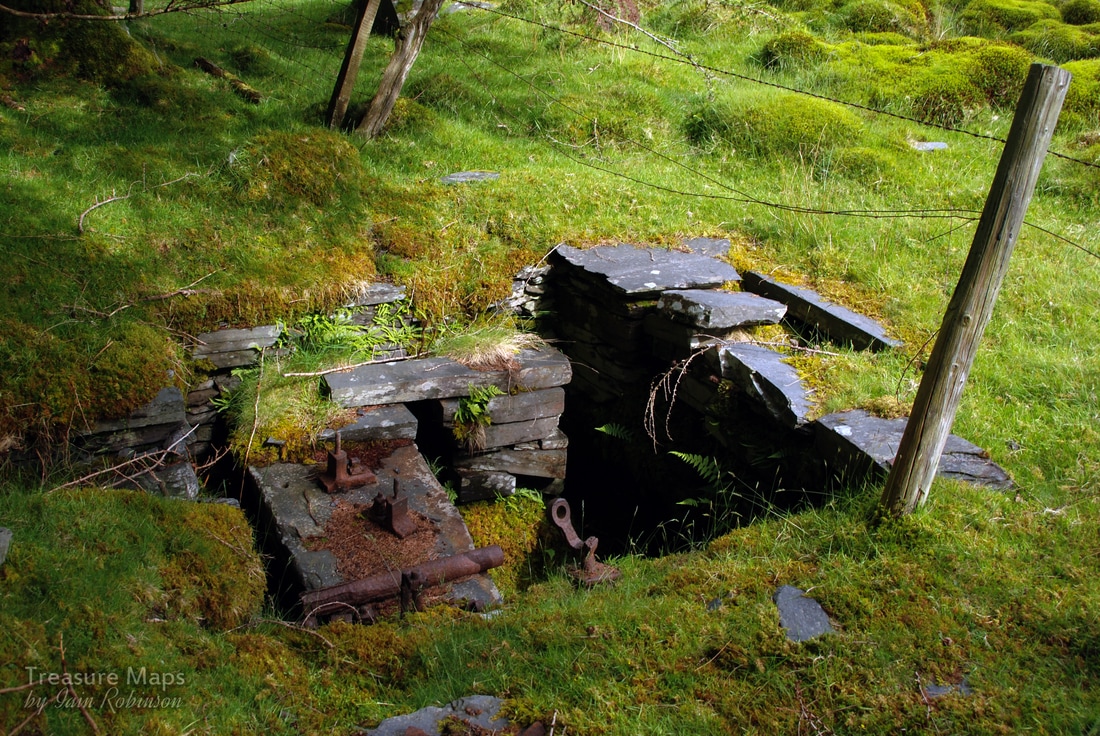 The mysterious holding down bolts... We had a brief detour to look at the level 6 adit, marooned by tips from level 5. It has collapsed, but is still accessible providing you are of slim build. It eventually leads into the collapsed area of the pit and chambers out to daylight there. On the way are several shafts for the unwary. On upwards to level 5 and there was a fine cutting into one of the three pits. These are badly degraded and hard to make sense of, but we could see the chambering from below breaking out. Petra had a close look and wants to return with ropes and gear to descend safely. I traversed to the other side of the pit and looked down into the next one, where a marooned adit beckoned tantalisingly. 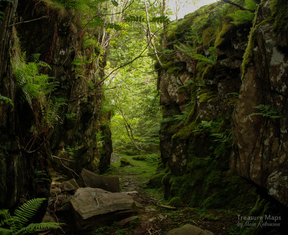 There now followed a period where we tried to trace the higher pit edge by stalking through the closely planted trees, which whipped and scratched at you as you tried to make progress. We couldn't find a safe or interesting view for a photograph. Carrying on upwards took us to another very fragile little adit, probably about 100 yards long, which opened out via a collapse to the top, and a smaller pit. This was the highest point of the workings and, as always, we had run out of time, without finding many of the features mentioned in the JAW report. We may well return again with underground exploring equipment. 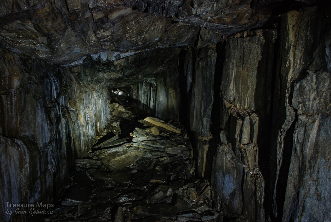 The very unsafe level 2 adit I worry about what will happen when the trees are clearfelled. A look across the valley at the chaos and destruction around the Foel Grochan pit should be enough to dispel any doubts about how little the forestry folk care. The Factoids: Started in the middle of the C19th, Ratgoed stuttered on until 1946, but it's peak production was in the 1880s. The name Ratgoed derives from “Yr Allt Goed”, which means the steep, wooded hillside. Further reading: Welsh Slate: the Archaeology and History of an Industry, by D.Gwyn, (RCAHMW 2015) Ordnance Survey County Series map: sheet Merionethshire XXXVIII.13, editions of 1889 & 1901. A Gazeteer of the Welsh Slate Industry by A.J.Richards Slate Quarrying at Corris (1994) by A.J.Richards 'Ratgoed - A Study in Slate' , Sara Eade (published by Sara Eade) 'Narrow Gauge Railways in Mid Wales' by J.I.C.Boyd , ( Oakwood Press) Remains of the Welsh Slate Industry web site
7 Comments
|
TracksReceive the occasional Treasure Maps Newsletter- and alerts when a new post is available!
If you enjoy my content, please buy me a coffee!
Check out my other online activity...
Index
All
|
 RSS Feed