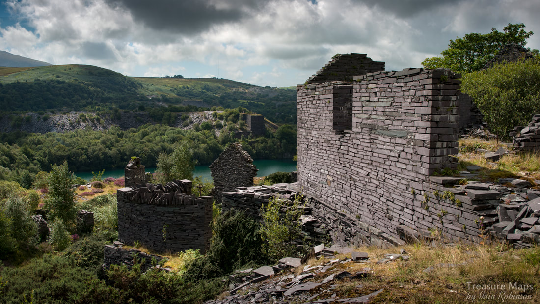
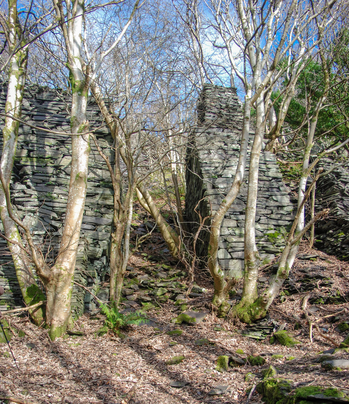
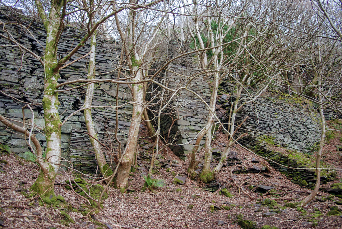
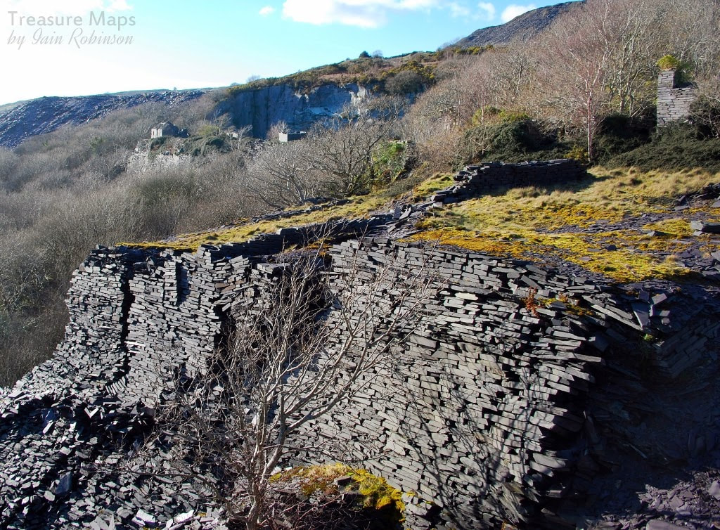
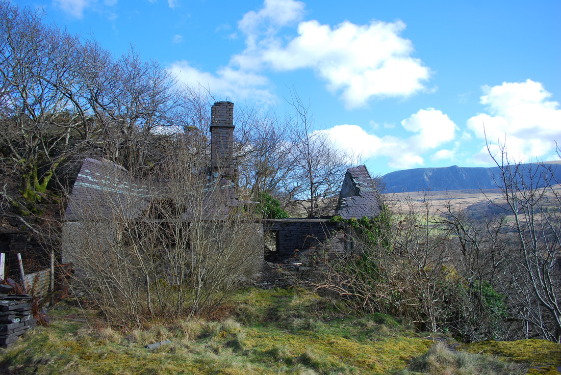
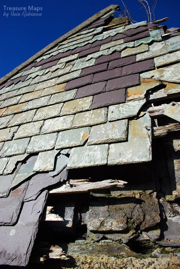
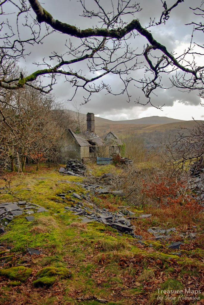
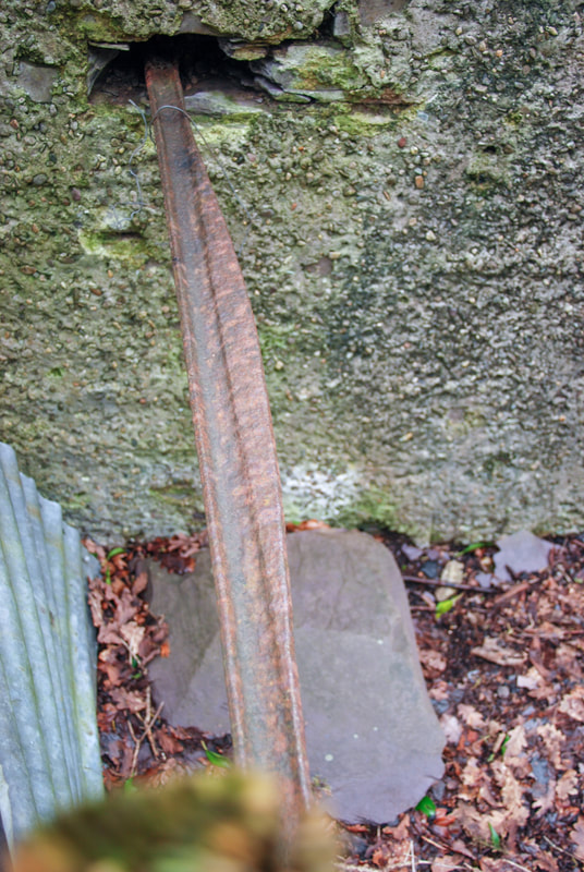
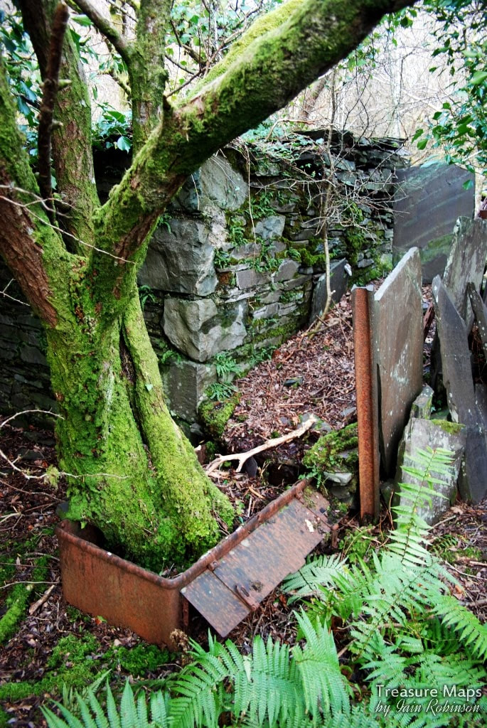
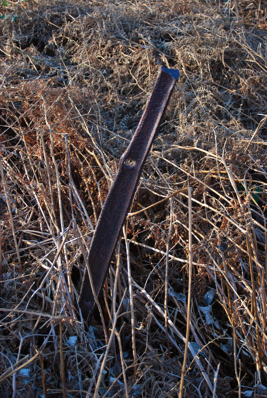
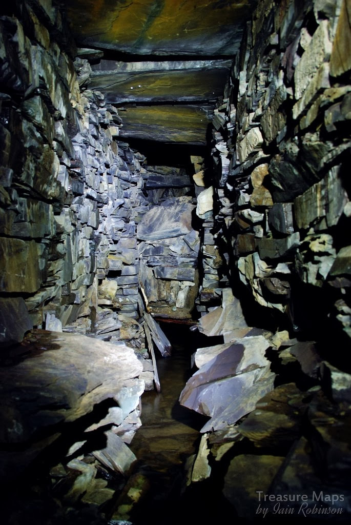
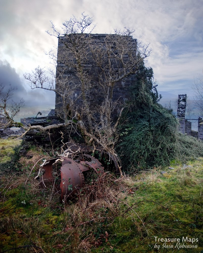
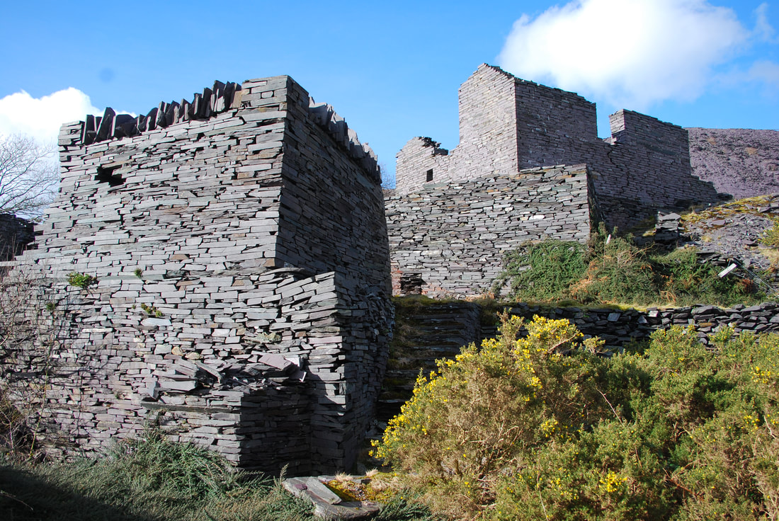
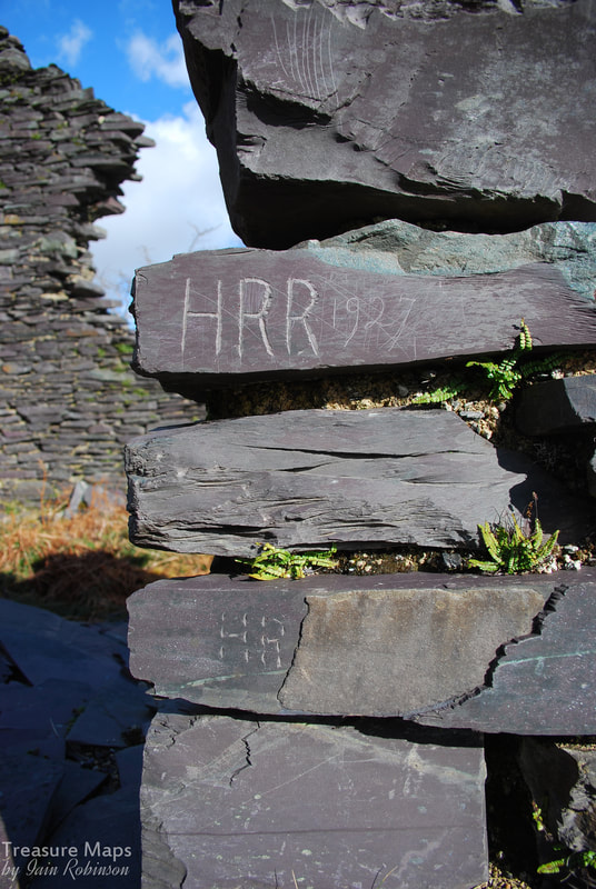
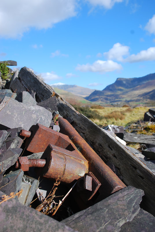
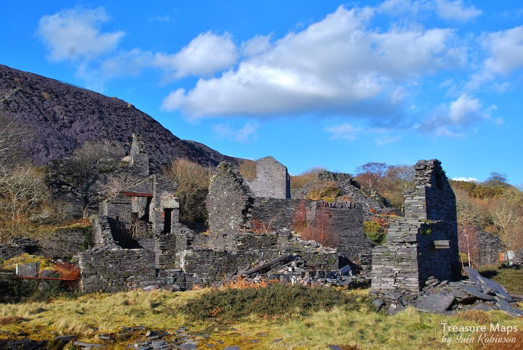
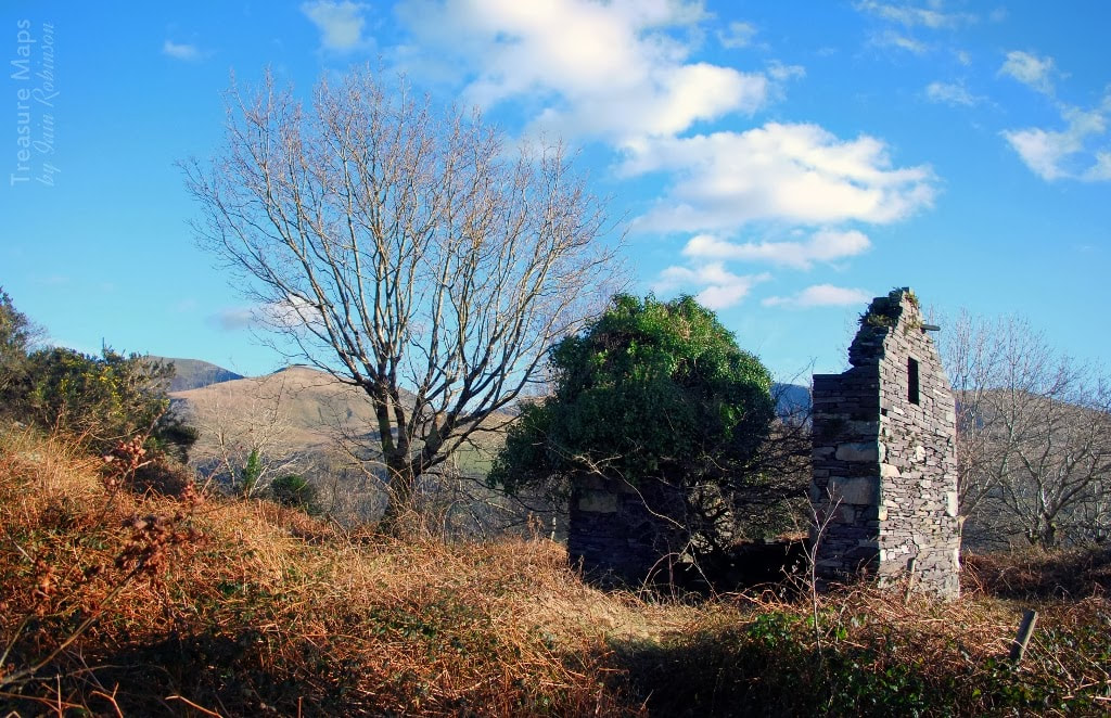
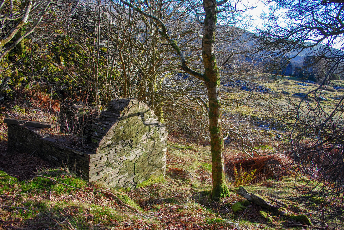
 The mill, looking across to the Western Pyramid. Gallt-y-Fedw means "The Birch Hill". How things change -the predominant vegetation these days seems to be bramble, gorse and bracken. Around the mill area, a variety of Cotoneaster has grown over the structures, cloaking them in dark green. At least the stuff isn't prickly, and it makes a change from being tripped up by mischievious bramble tendrils... The remains of this quarry, known variously as the Alexandria, Victoria and Y Foel, lie to the north of the Dorothea pit, just below the mighty tips of Cilgwyn. It's an interesting place... but what old slate quarry isn't? As you walk past the remains of Talysarn Uchaf, the massive bastion walls of Gallt-y-Fedw are a constant presence, beetling above on the left. A couple of old inclines bisect the bastions as they come down to the tramway level. You have to wonder how much longer the dry stone walls can last. In his slate quarry Gazetteer, Alun John Richards comments that "the vast retaining wall is in a poor state..." and that was in 1991! 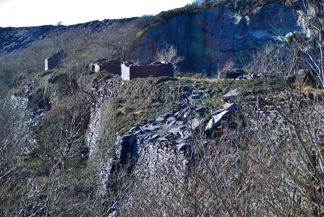 The working area in front of the pit. The bastions are in two stages, these are the upper ones. Hard to imagine that the remains of Talysarn Uchaf are just below! Once at mill level, which is really a man-made plateau of thousands of tons of slate waste (hence the bastions) a clutter of ruined buildings comes into sight. It's a confusing place, constructed at odd angles and juxtaposed in a random manner. I could only think that things were added to and reconstructed over time. Engine and machine mounting bolts bristle atop mighty slate plinths while a boiler house and a machine house sit in a slightly elevated position. All that remains of the mill itself is a large and imposing end gable wall. 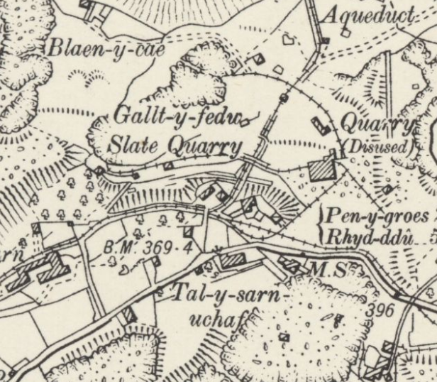 Extract from the 1889 survey by kind courtesy of the National Library of Scotland. 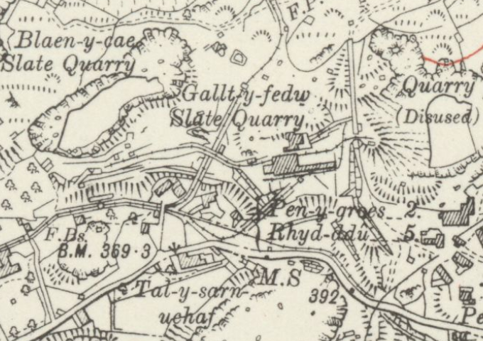 Extract from the 1920 Ordnance survey by kind courtesy of the National Library of Scotland. Here we see the growth of the quarry and its ancillary buildings. The incline down to the tunnel at the bottom left has been abandoned and a new incline built to join the Nantlle railway. An impressive incline formation comes down through the site from Cilgwyn, swooping to join the Nantlle Railway below. There doesn't seem to have been a connection from this to Gallt-y-Fedw on very early maps, the quarry using their own incline before 1881 which ran steeply down to the tunnel behind Plas Talysarn. You can just make out this incline today beside the old tramway tunnel. 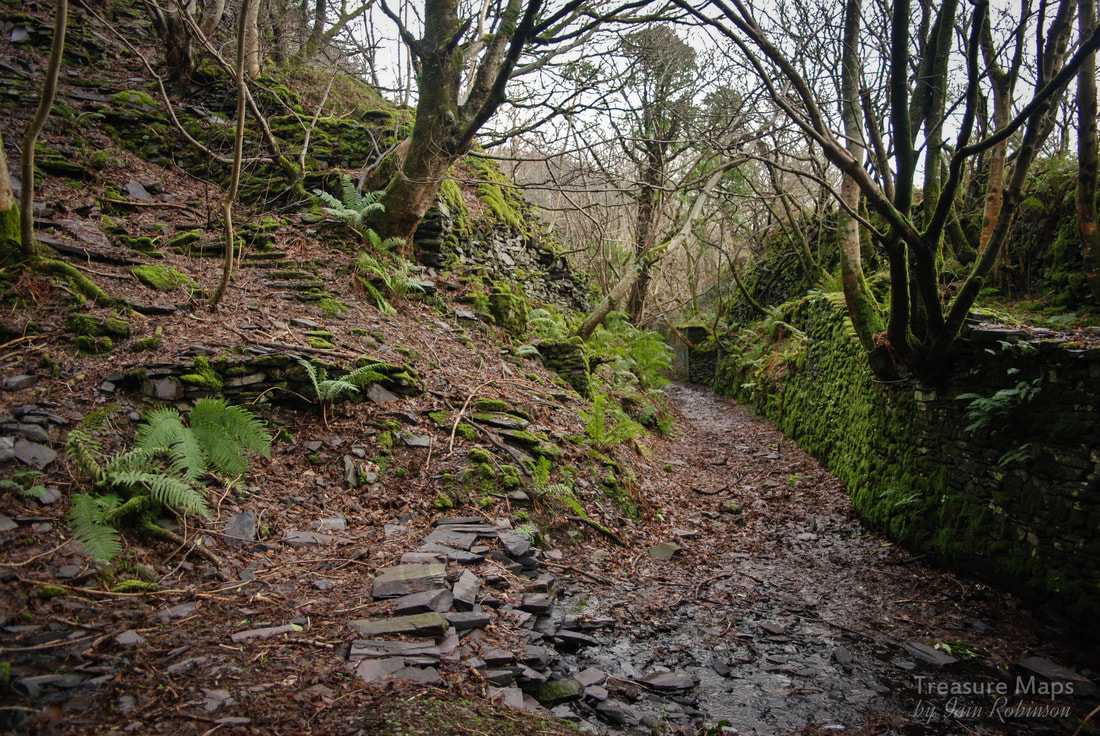 You can just see the remains of the old incline from Gallt y Fedw here on the left- this is in front of the tunnel that took the old formation under the Blaen y Cae tips, looking north east. The tramway formation to Pen yr Orsedd heads away on the middle right. The Cilgwyn incline is crossed, however, by a much later tip tramway heading east where the old Pen-y-Bryn twll was used for rubbish. Records show tramways here from 1857-1901 and in two differing gauges, 2' and the Nantlle gauge of 3'6". Perhaps the more southerly incline used this gauge from the mill at first, then a new incline was constructed beside the mill, which dropped over the Nantlle tramway and then joined it near to the side of the Dorothea pit. This incline must have been built between 1889 and 1910 from the evidence of the Ordnance Survey maps. 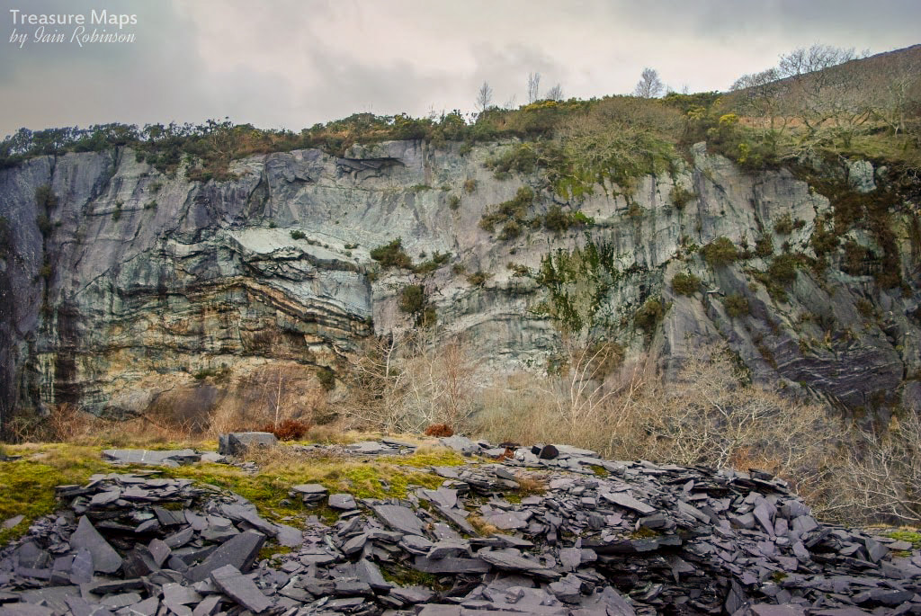 The pit, showing some difficult strata. The main quarry pit is to the west of the mill and describes a shallow arc. It is tipped into and there are the remains of many walliau and also machine houses on the bastions. Richards* states that material was raised by a steam engine, probably powering chain inclines. As many as six saw tables were sited up here, in the open. At least it was healthier for the men's lungs. . I wondered if much of the output was slab, there were some particularly fine big chunks lying about. The pit is not so deep as others here, probably only 150'. It contains a drainage adit with a curious step and launder along it's course- apparently the tunnel was driven from both ends and there was a slight miscalculation when the two bores joined! The official figures show yearly tonnages for the quarry in the hundreds, with between ten or twelve men employed- yet the mill was a large one; the 1912 map shows a big area and the mill can be seen in the background as an imposing structure on many photographs of the area in the 1900's. The quarry was acquired by Dorothea in 1933, but was never worked further. 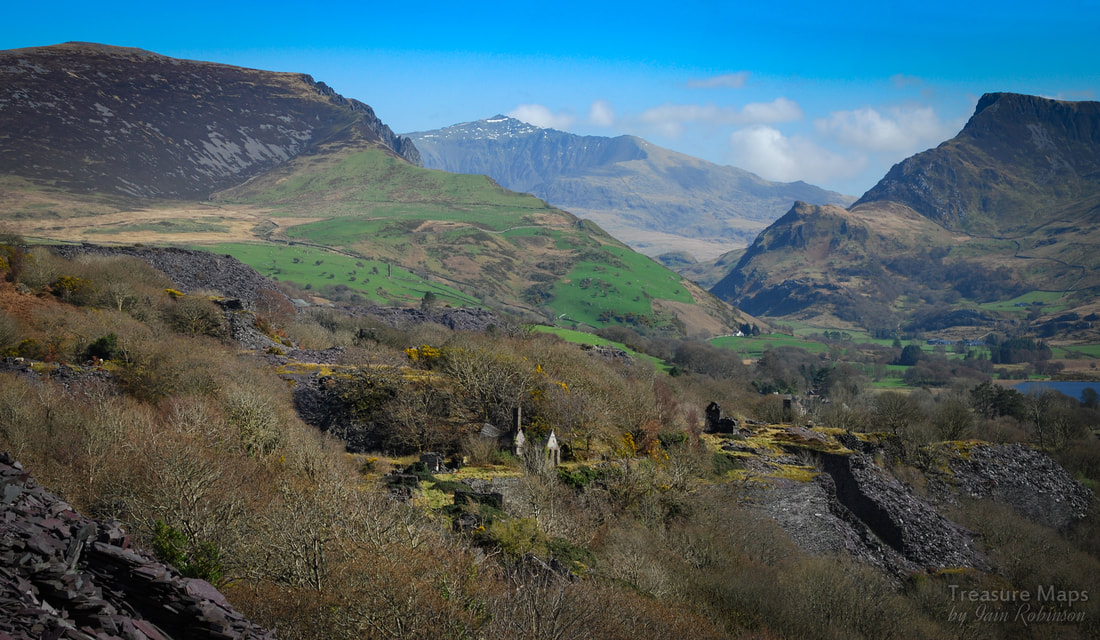 The Gallt y Fedw office sits amid the splendid view towards Yr Wyddfa. Behind and to the right is the drumhouse for the quarry's own incline down to the Nantlle Tramway. While on the pit level I really ought to mention the office, which has a wonderful patterned slate roof, now hanging on for the inevitable collapse. It might be good for a few years yet, given the bravura performance of the mill gable wall... There's also a length of fish-belly rail here, impossible to photograph with any meaning unfortunately, so you will have to take my word for it. *Richards waxes about the "Fine Privy structure" near the office, which I noticed, but privies aren't really my thing so I didn't take a photo. Uphill from here is a small and enterable drainage adit, probably from the older, original workings. There's also a strange round structure in the woods, about 30 metres in diameter. It looks like a holding pond for water, perhaps. Nearby are a couple of very overgrown buildings, possibly a smithy, so perhaps the round structure was connected to that. I could study and wander round the mill forever. It's a confusing site which seems to have grown like topsy over the years. There was a steam engine driving the mill machinery, and a smoke flue which goes to a chimney sited on a slightly higher elevation. Other structures are arranged without regard to each other, with cotoneaster covered steps leading up to higher levels.  Looking over part of the mill area to the eastern pyramid. On one of our visits, we climbed through the gorse and bramble on the old Cilgwyn incline and found the intermediate drumhouse high above the site. Hacking through the undergrowth, we eventually descended back by the old quarry, past a lovely little powder house. This part of the quarry is more-or-less jungle, but the discoveries are delightful. Access to the upper parts of the quarry are easier at the moment because some time before lockdown, there was a mountain bike race held here. You can follow the flattened tracks above the quarry all the way to the upper Pen y Bryn pit. This is fine, but I wish they had cleared up all their plastic tape, there's hundreds of yards of it, blowing everywhere in the wind. I went home with my rucksack full of it. There are other mysterious structures, like the one below, which might be a weighhouse, but it's tips and tramway runs have gone. 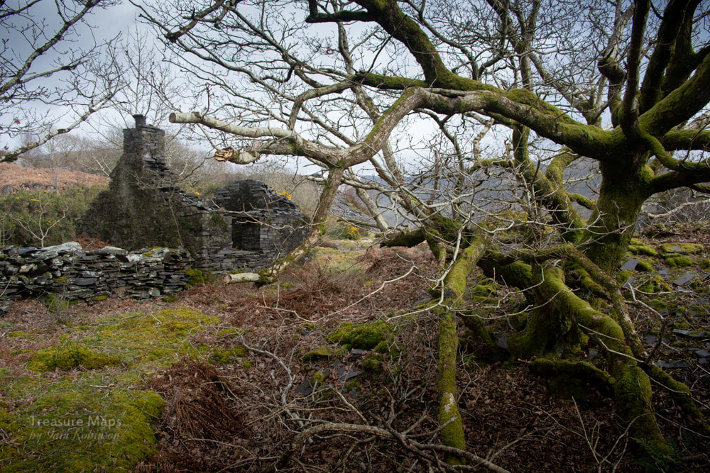 All of Gallt y Fedw is on private land. So I'm not encouraging you to visit, but if you really want to, the best route is to go along the road past the Plas until you reach the left side of the eastern pyramid. There's a road goes up to Pen y Bryn on the left. Take that and then left again round the farmhouse following a 1960's haul road up from when the quarry was briefly re-worked. This brings you up into the mill level. To access the pit area, keep to the higher ground and drop down a tip to the open pit mill area. References: Richards, Alun John (2001). The Slate Railways of Wales. Llanwrst, Wales: Gwasg Carreg Gwalch. ISBN 0-86381-689-4. *Richards, Alun John: Gazetteer of the Welsh Slate Industry Published by Gwasg Carreg Gwalch, Wales, 1991 ISBN 10: 0863811965 Boyd, James I.C. (1990) [1972]. Narrow Gauge Railways in North Caernarvonshire, Volume 1: The West. Headington, Oxford: The Oakwood Press. ISBN 0-85361-273-0. 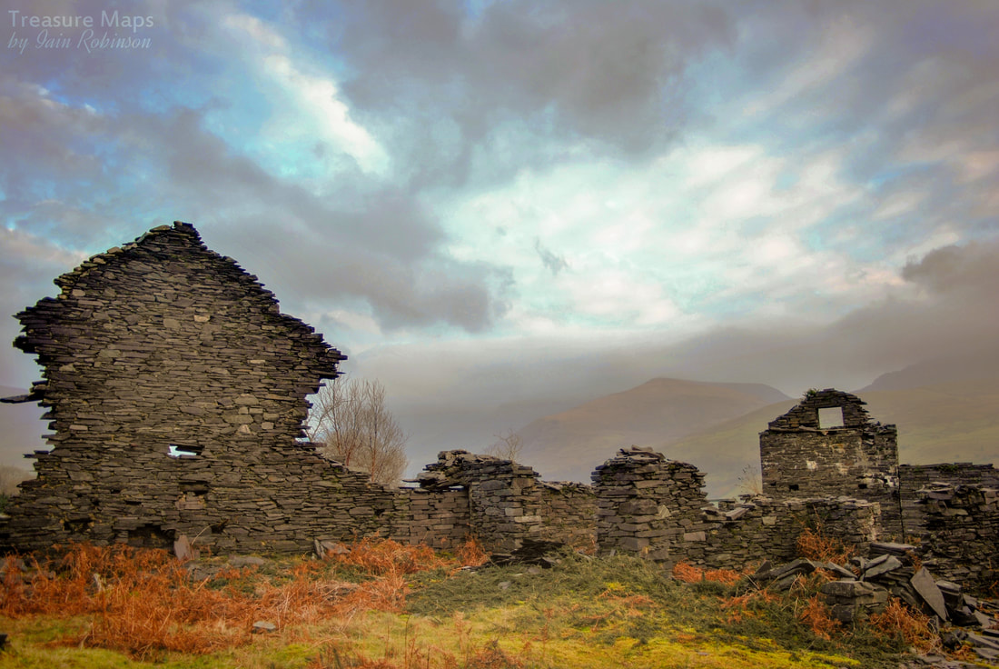 Comments are closed.
|
TracksReceive the occasional Treasure Maps Newsletter- and alerts when a new post is available!
If you enjoy my content, please buy me a coffee!
Check out my other online activity...
Index
All
|


 RSS Feed