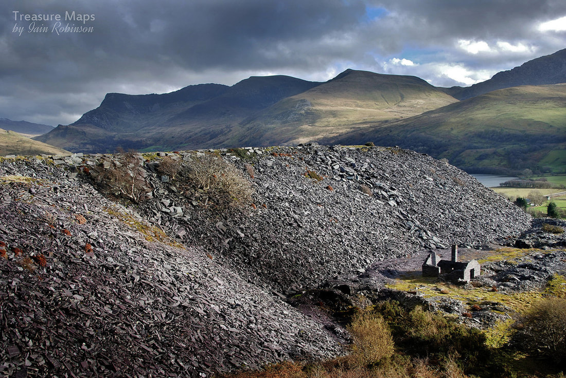
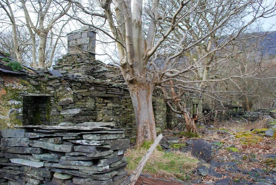
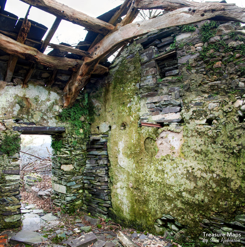
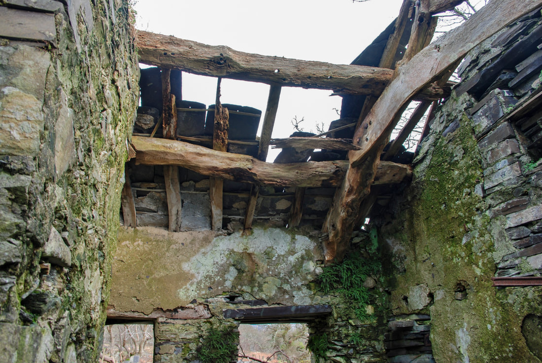
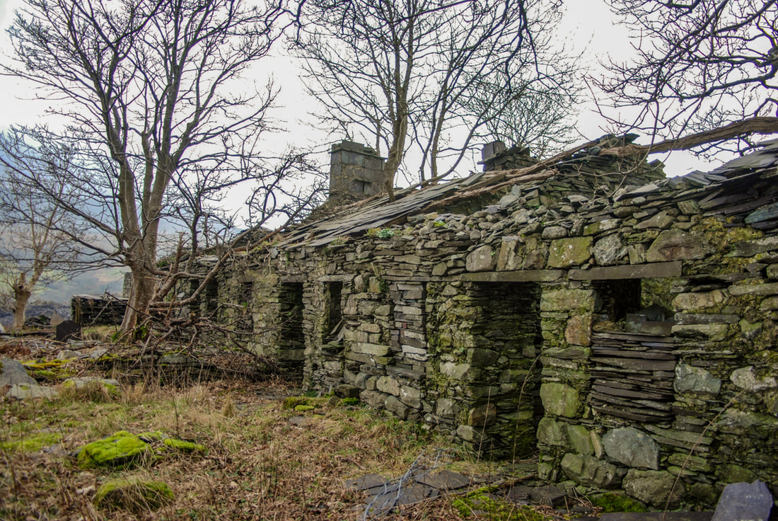
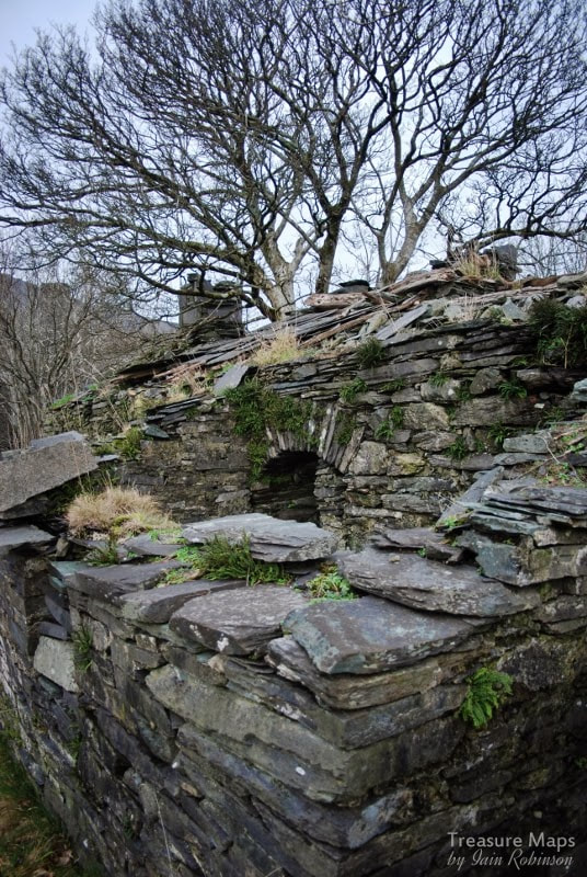
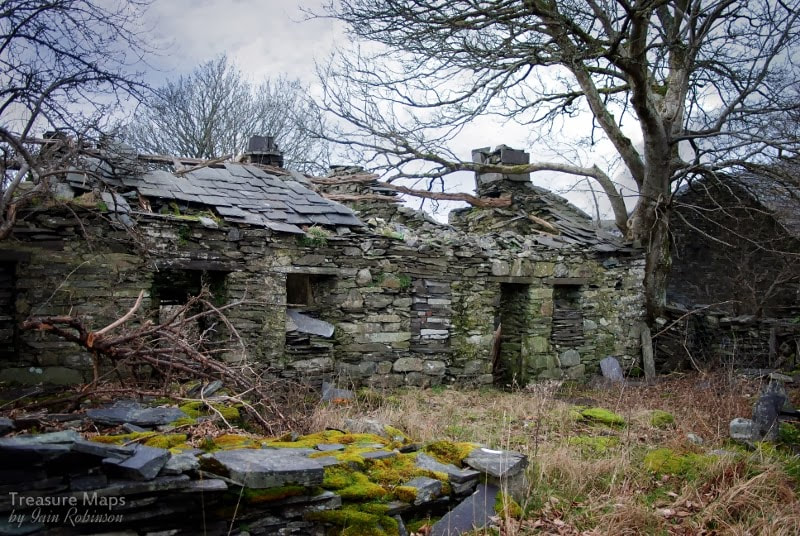
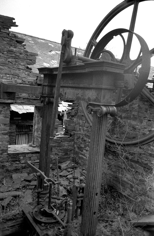
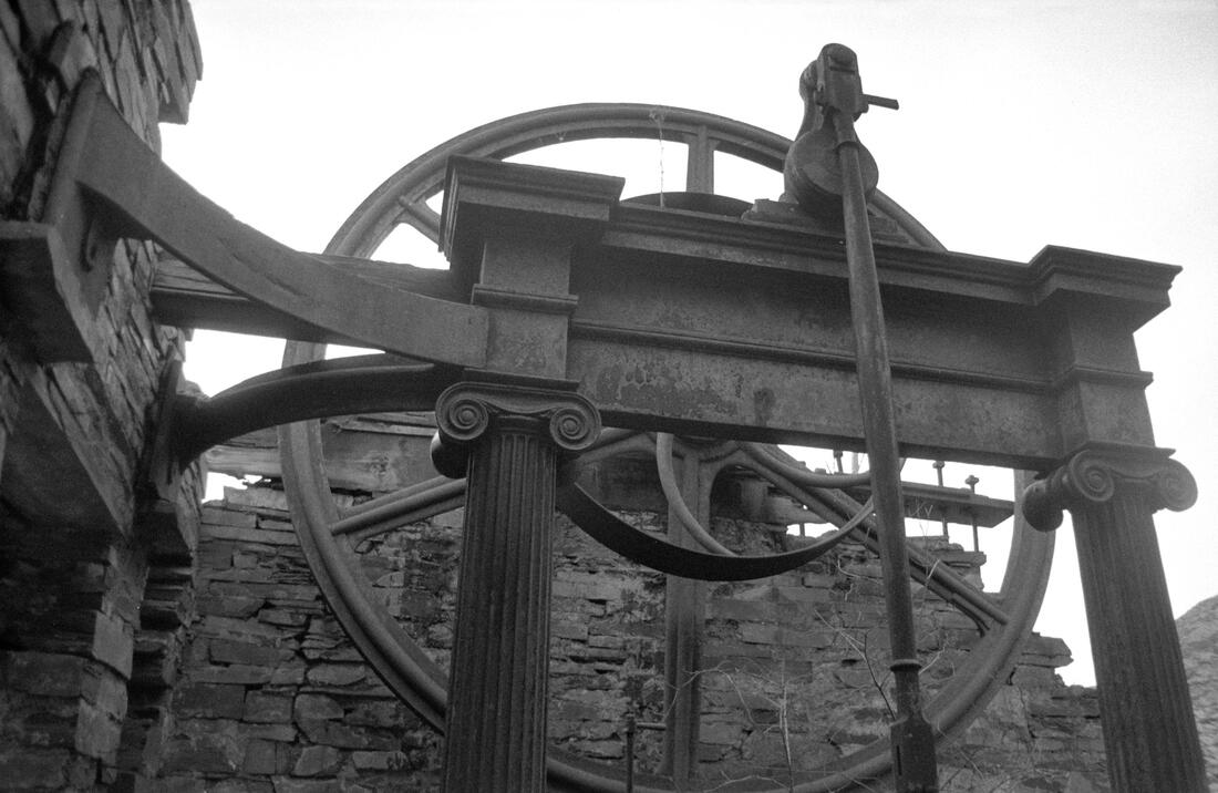
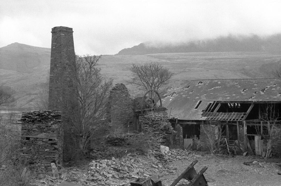
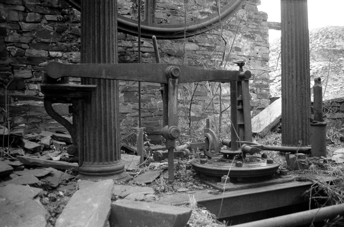
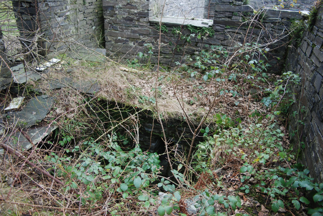
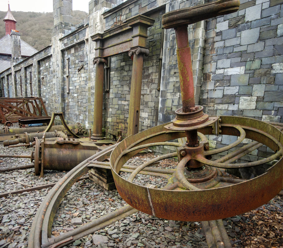
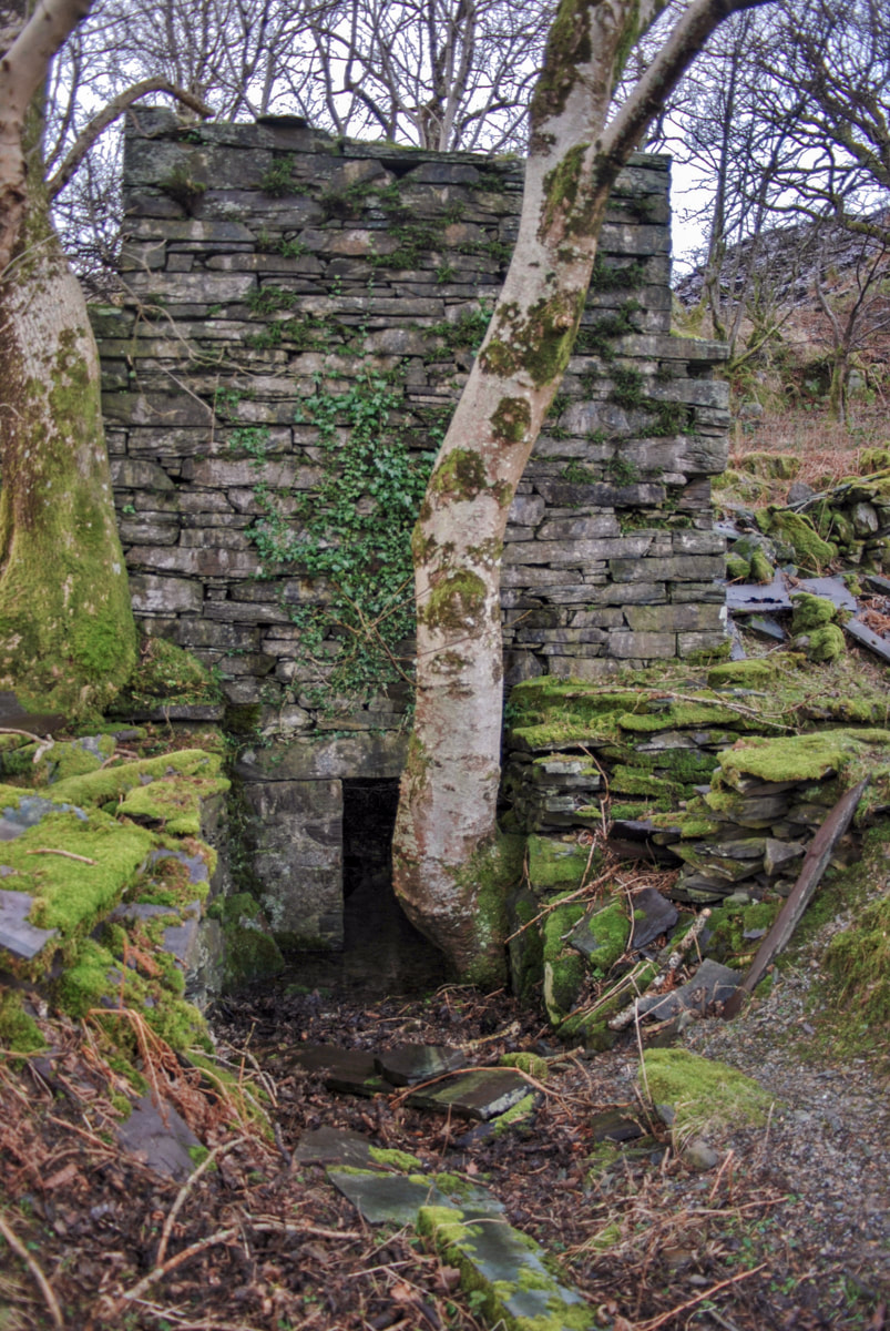
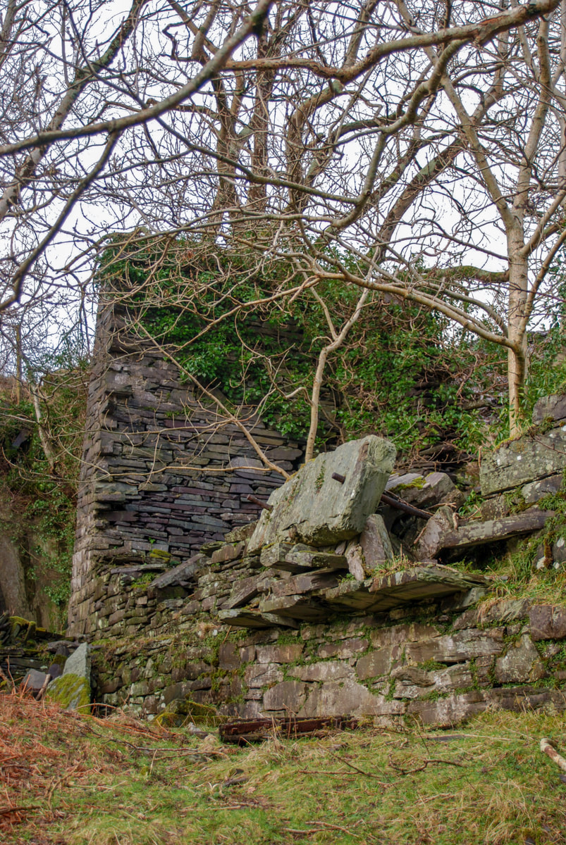
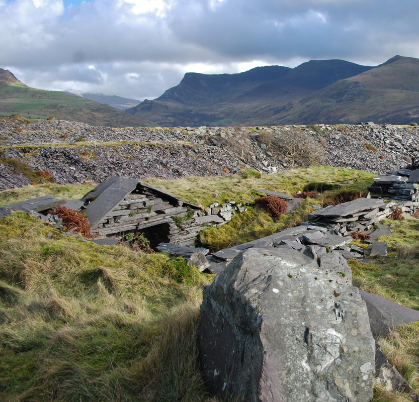
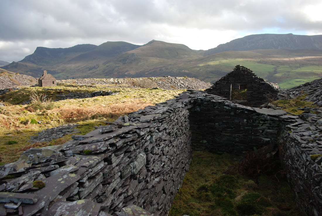
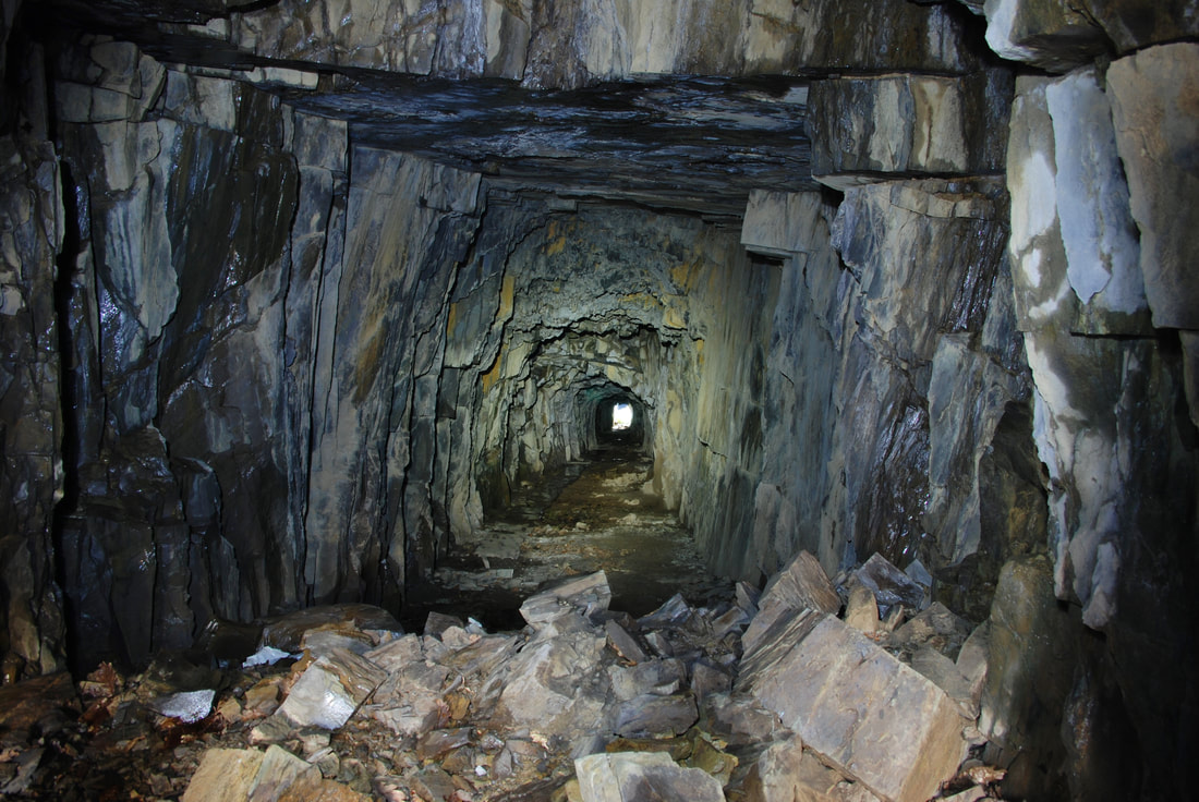
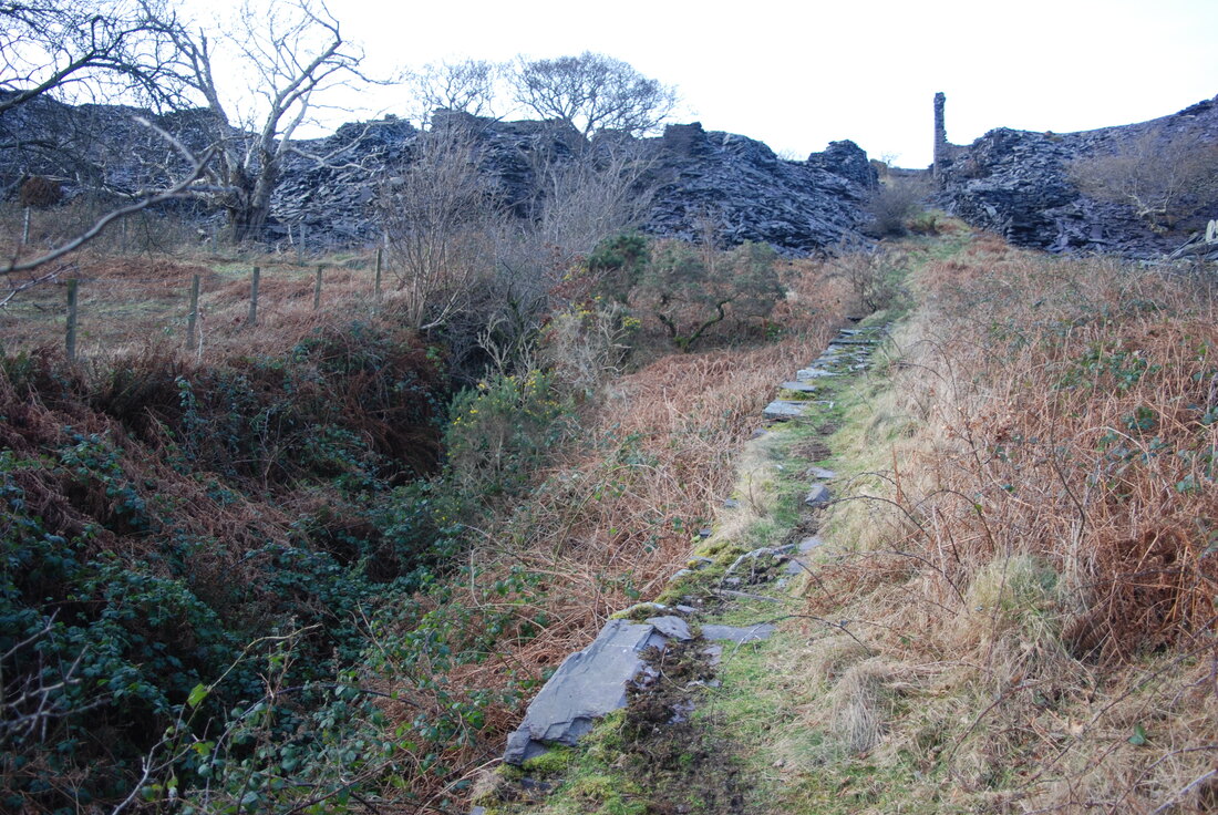
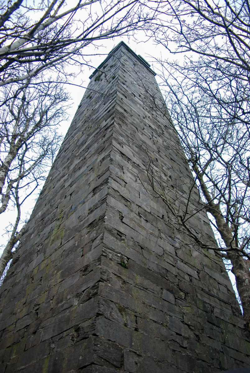
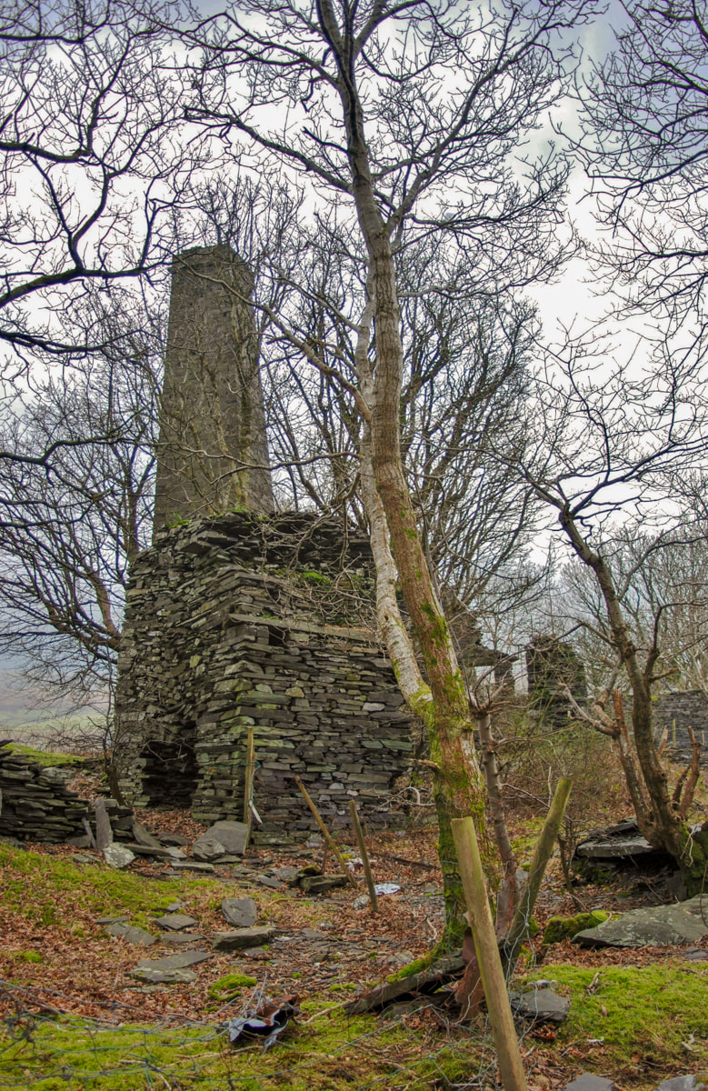
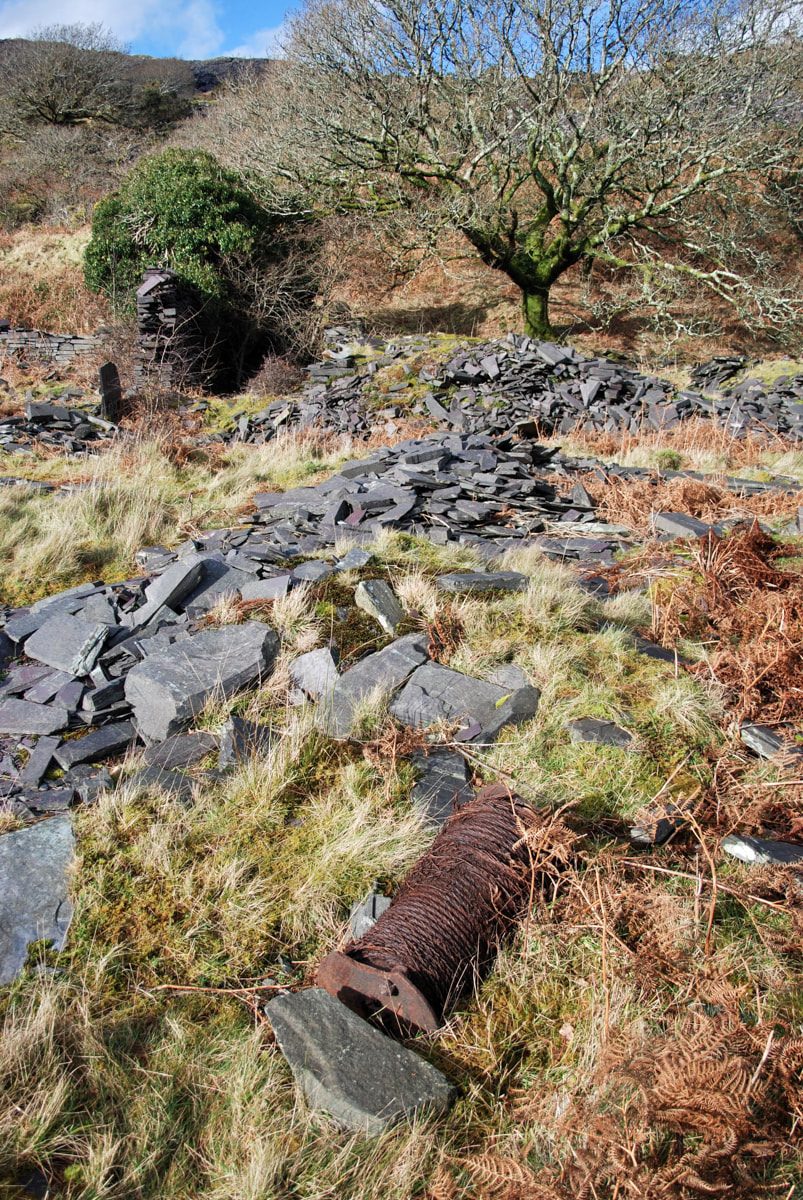
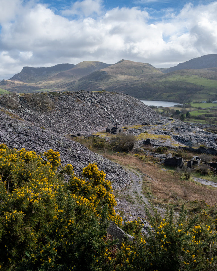
 The smithy at Pen y Bryn upper quarry, overshadowed by the tips from the pit. Pen y Bryn is a lovely old site, north of the main pit at Dorothea. It rambles for a mile and a half up the hillside, squeezing itself between two mighty neighbours, Cilgwyn to the north and Pen yr Orsedd to the east. All old quarries are something of a mystery, but this one is rather special. At the southern, lower end it has a range of buildings that date from the C17th, a fine early 17th farm house and the remains of a C19th mill and steam engine house. There are at least three visible pits on the lower level, all worked out and tipped over, but still frighteningly deep. Over the years of silence at the quarry, nature has enthusiastically re-interpreted the place, doing a fine job. The lens of history is further clouded by the long period of activity here, from 1770 right up until the 1960's, with a good few fallow periods in between. Later developments, such as tipping and a new access road to Gallt-y-Fedw have confused things on the ground. 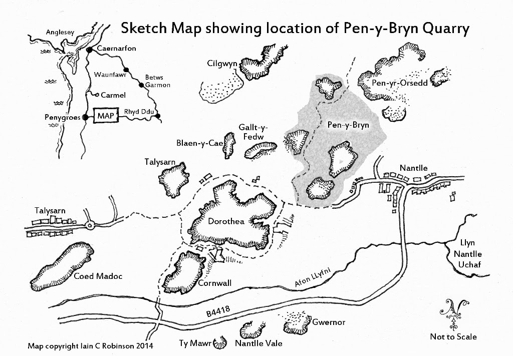 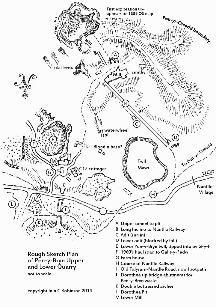 Let's have a look at the workings which give the quarry it's name. The first thing to be seen are the remains of a large old farmhouse, of 17th century origin. It's incredibly ruinous and looks as if it might fall down any minute. However, inside there are clues to it's age and also its remodelling in the 18th century. Large slabs of slate have been used as room dividers- and why not, when the material was to hand? 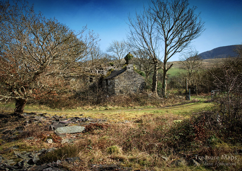 Pen y Bryn farmhouse, from the west. There's a row of very old cottages near the house, (below) which, like the farmhouse, pre-date the quarry. They have ancient beams, planed to shape with rough hand tools and the walls are made from igneous rock. The few slates remaining are of a considerable size, (probably Duchesses*) and I imagine they replaced smaller, "moss" slates quarried from outcrops by the builders back in the 1600's. Richards suggests that the cottages were used by the quarry as barracks accommodation from the 1830's onwards. The thinking these days is that these cottages were once part of a barn that was cut down to size to make accommodation for the workers. They must have used the original beams though, as they look to be ancient. In the photos above, we can see the beams from inside the cottages, which are now sadly falling in to disrepair very rapidly. The walls show evidence of much re-modelling but obviously, the layout was that of a "crog loft" - headroom must have been pretty minimal. Later, internal alterations are built using slate waste blocks. Note the length of light tramway rail poking out from the wall! There's also two fine arched windows, presumably left from the structure's first iteration as a barn. The view out from these structures is magnificent, even if the interior accommodation was sparse. The farmyard is shared with the remains of a substantial slate mill... 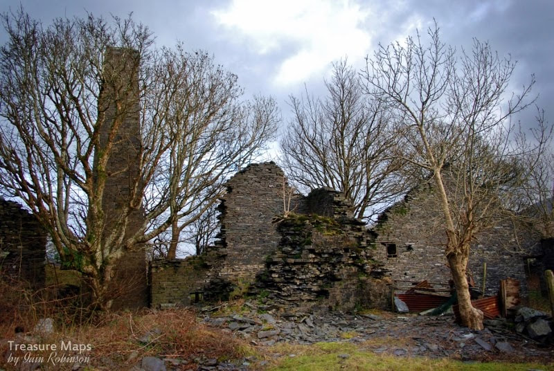 Until the late sixties, the mill contained the remains of a Mather Dixon Vertical Cylinder Condensing Steam Engine. Thankfully, Roberts of Ffestiniog, who were reworking the quarry at the time, realised what they had- and donated the engine to the Slate Museum. Nowadays the mill contains an impressive selection of old rusty bedsteads, the elders of a mighty clan who have scattered themselves all over this site and neighbouring Gallt y Fedw. I imagine they make handy and economical fencing and gates. I'm grateful to Amgueddfa Cymru/National Museum Wales for the mono photographs which give some idea of the engine's location. The mono shots are by Richard L. Hills, (Dr) and were taken in January 1968. 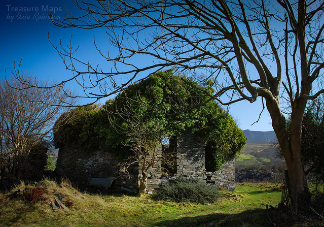 Retracing our steps slightly, there is a filled in pit called "Twll Ballast" which was one of the earliest diggings on the sett. A drumhouse (above) is at the top of a much degraded incline down to it. Material must have been uphauled from here to the mill. 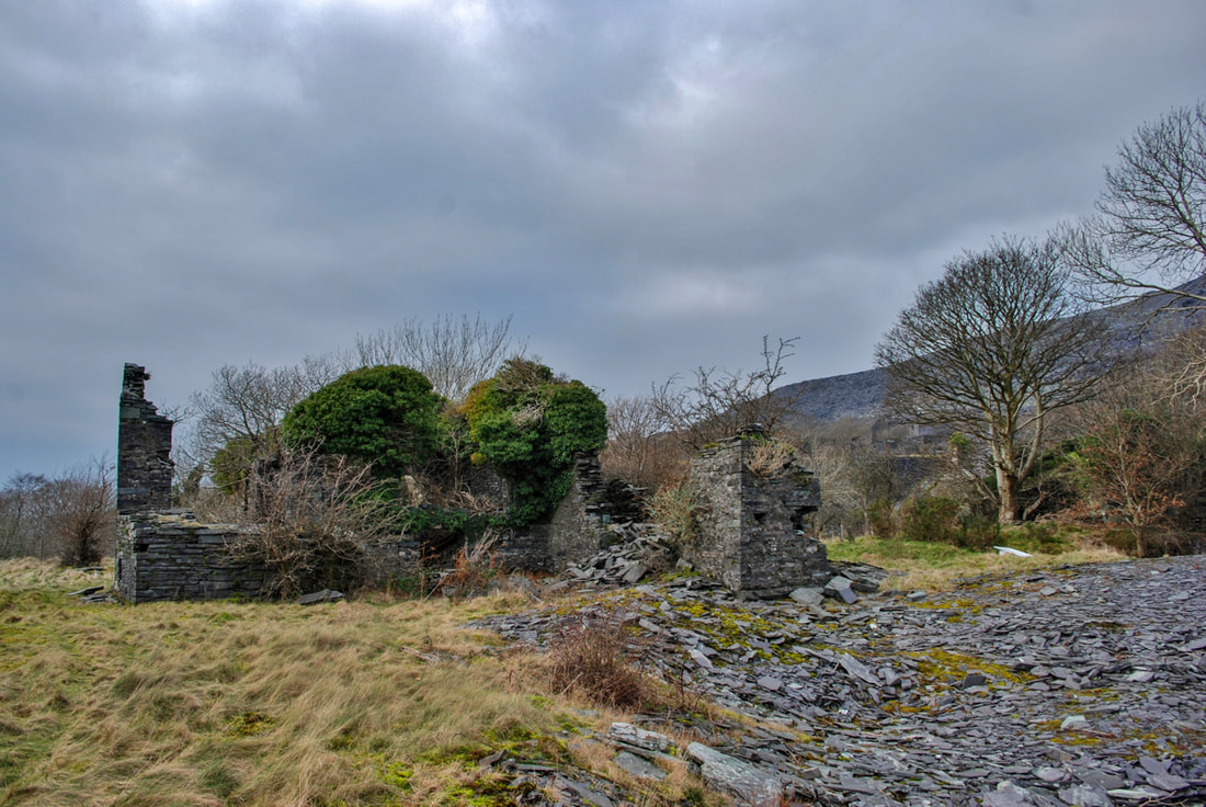 Looking at the winding house from the east, showing the range of buildings. There must have been a steam engine here and a boiler room. 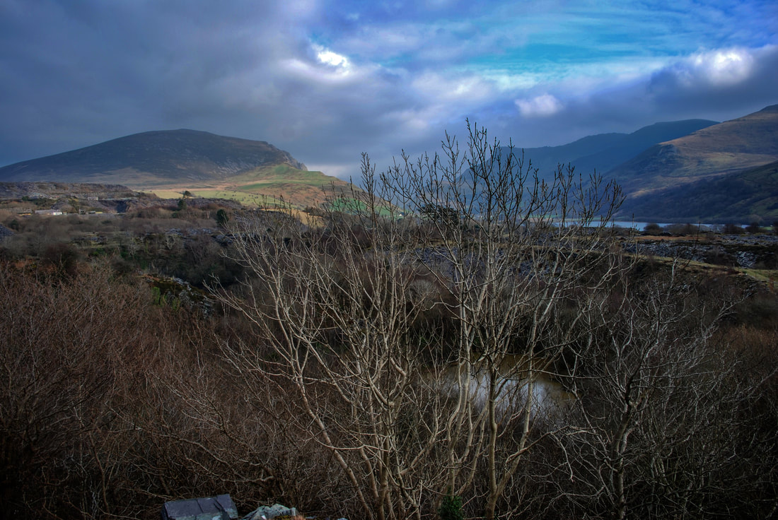 Walking down the incline a little way, this is the best view from here of twll Ballast. It was used in the fifties and sixties to dump all manner of dodgy stuff and it is an environmentally hazardous site today- although the wildlife here is surprising. A mine exploring friend has told me that there is a tunnel from the sinc at the middle pit which connects to Twll Ballast. Apparently in his younger years, he attempted to explore, but the bad air backing up quickly made the endeavour hazardous. 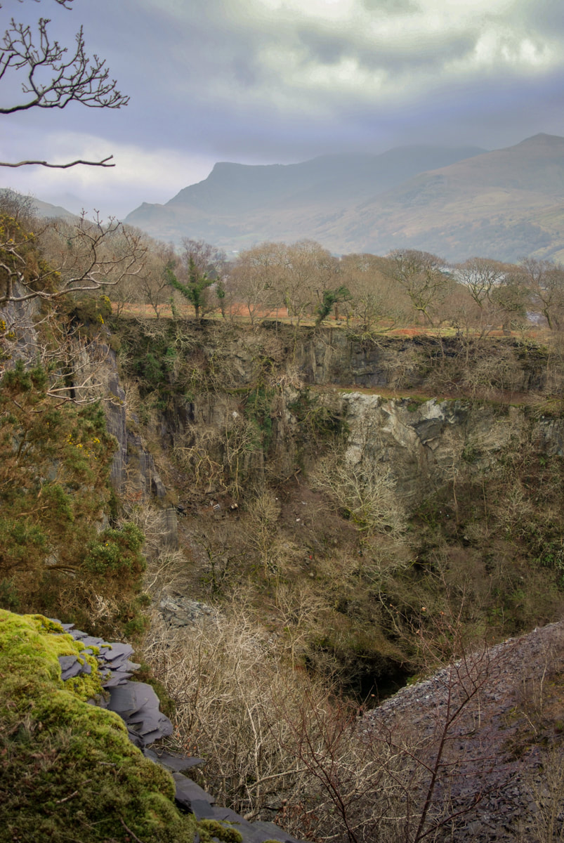 The middle pit. The waste on the right is from Dorothea, who bought the site and used it as a place to tip. The path up to Pen y Bryn uchaf goes up on the far side of this pit. About that buy-out by Dorothea... the problem with all the quarries in this area was that the slate veins were almost vertically inclined. Pits were the only way of winning the slate, with the attendant problem that wherever you tip, it may be on top of untapped slate reserves. So buying Pen y Bryn, a worked out quarry with several pits was a good idea. To that end, Dorothea built the two slate columns that cross over the Nantlle railway towards the mill as supports for a bridge- with a strangely incongrous weigh house on the top of one. That did kind of give the game away, didn't it!  The two columns that supported a bridge over from Dorothea (from the west pyramid) to carry waste slate trimmings. Walking up now along the east side of the pit, various workings and structures appear beside the track. Most are very difficult to explain, even with reference to the 1889, 1900 and 1960's 1:25,000 Ordnance maps of this area. For instance, we puzzled over this, below. Was it a feature for an aqueduct, a blondin base...or what? A depression cutting under the track lies parallel with it and is marked on the 1889 map as disused, perhaps when the pit was abandoned for workings further up the hill. My money is on some kind of chain incline support. 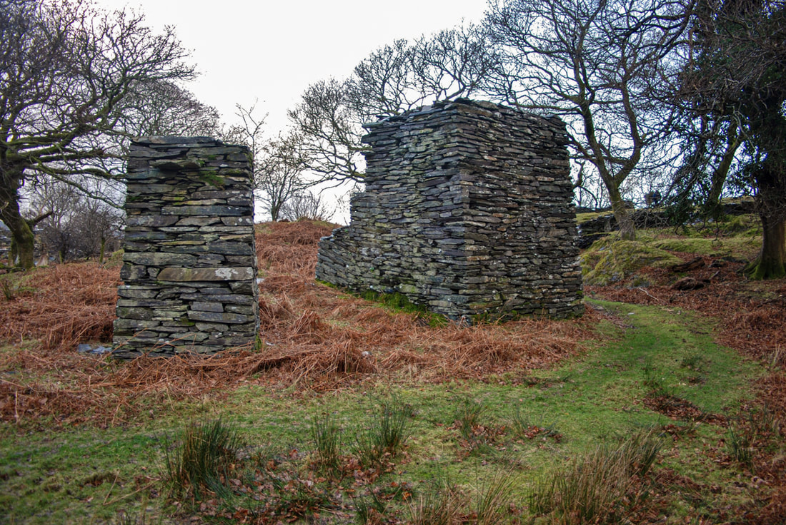 I've marked this on my map as "Blondin Base support"...it certainly supported something! The next thing to be seen is a waterwheel pit. Coflein says: "The 1st and 2nd editions of the historic 25-inch O. S. maps, published in 1889 and 1900 respectively, depict a waterwheel pit at this location, with what appears to be a watercourse supplying water. On the hillside above are the remains of a 260 metre-long pond, its upper reaches already shown as marshy ground on the 1889 map. The water wheel may have been used to pump water from Middle Quarry, which became disused before 1900. The waterwheel pit and its aqueduct are depicted on the 2nd edition map, but the aqueduct is not depicted in the 3rd edition map, published in 1916." By "Middle Quarry" they mean the one next to the mill. Twll Ballast and Twll Mawr were also disused by the late 1800s. Five minutes more walking uphill leads to the top mill, where the mysteries start to gather. Reading the late Dr. Gwynfor Pierce Jones's excellent book, "Chwarelyddiaeth Dyffryn Nantlle" I get the impression that the upper quarry was a later expansion...but it could be my Welsh, which isn't great. However, I think he suggests that there was unsuccessful effort to develop the highest land at Pen y Bryn as a new quarry in 1923. There had been a pit and a mill here certainly since 1889, although a glance at the satellite view will show how much it has grown since then. The enterprise failed due to the cost of removing overburden and of removing rock from the pit- and it closed in 1932, although further attempts to work it were made in 1949-51, and in 1963, but to no avail. 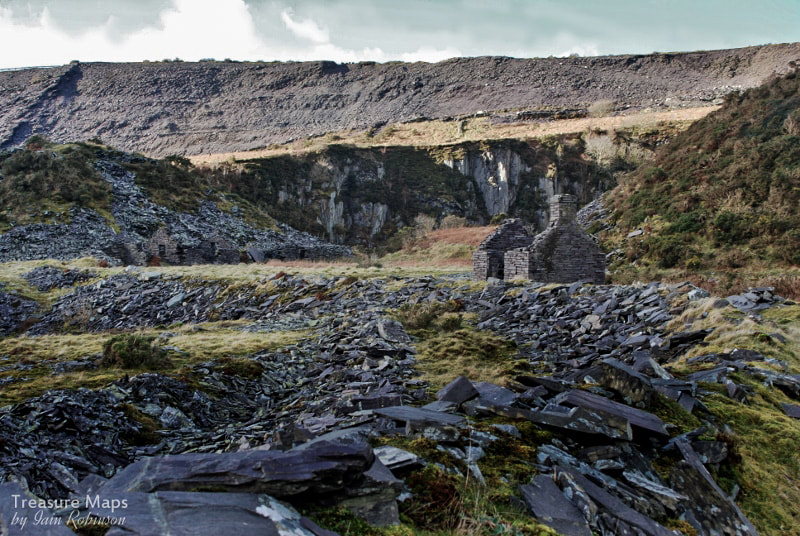 Weigh hut and ruined buildings at the edge of the upper pit. The tips above are from Cilgwyn. What has been left is a very deep pit, a long incline down to the Nantlle railway, the remains of a fine mill and a smithy. Several adits lead into the pit from below. The top one is open, but leads to a ledge over 100 feet above the bottom of the pit. Other adits and drainage tunnels lead off the long incline, but according to the maps, these were out of use by the 1900's. The lowest adit is a very long one and ends in a collapse after half a mile. 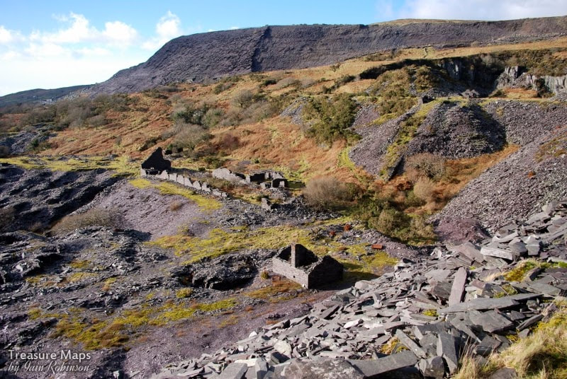 The mill, seen from the tips. The first building in the middle foreground is the smithy. Behind it is the mill, which has a drumhouse attached to the gable end farthest away from us. The incline can be seen as a dark shadow going off to the left. The lowest adit is a mystery. If it led into the pit, where would the rocks be processed? Surely they wouldn't be dragged all the way up the pitches of the long incline to the mill. Pen-y-Bryn was taken over in 1832 by Dorothea, but it seems unlikely that produce would be hauled to the Dorothea mill from here. Because of it's elevation, this tunnel must have been a late enterprise; I can only think in order to access the pit floor...although another mystery is the lack of exploration spoil from the tunnel, unless it was tipped into nearby Twll Mawr. 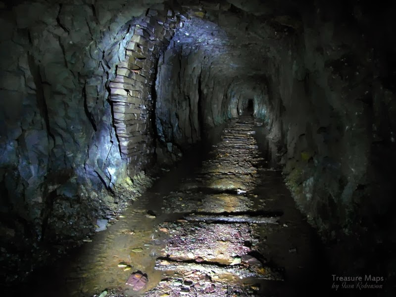 In the lower adit,which is sketchy and dangerous. A fall could be seen in the distance when we explored. 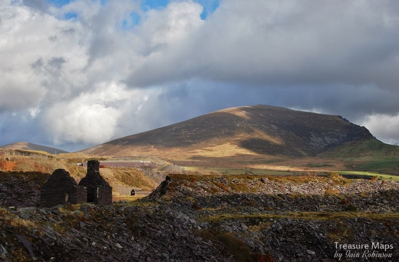 This is the top level, above looking across to Pen-yr-Orsedd through a breach in the tip tramway embankment. 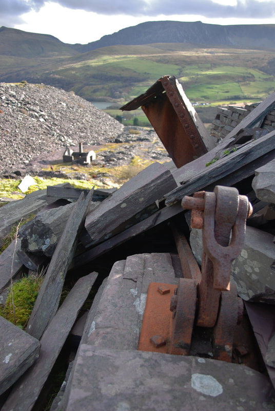 A view from the crimp of the top incline looking down on the tip and smithy. 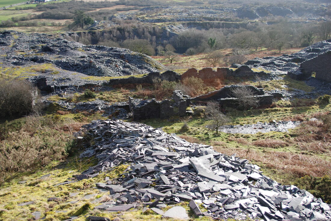 Looking down on the mill. In the background are Twll Mawr (left) and Twll Ballast (right). 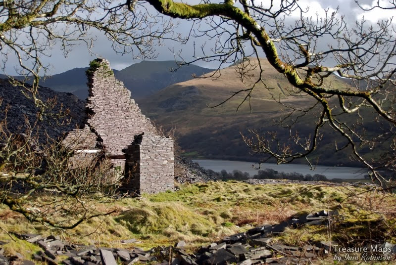 The end wall of the mill with the drumhouse. The mill itself contains few clues as to how it was powered, but the remains of a very large bore pipe suggests perhaps a water turbine- although just where the water came from is yet another mystery. There's no obvious water on the site. Some factoids: * A duchess slate is 24" x 12". Pen y Bryn was opened in around 1770 and in 1882 employed 240 men, producing 5083 tons of slate. As I mentioned earlier, a feature of the Dyffryn Nantlle style of quarrying was that exhausted pits would be tipped over and filled in. There are remains of pits here and there while others simply don't exist any more...this becomes apparent when studying the old OS maps and surveys. Pen-y-Bryn incorporated Cae Cilgwyn, Herbert's Quarry, Twll Penybryn, Cloddfa Lon, Dew's Quarry, Hen Dwll, Twll Balast, Twl Mawr, David's Quarry, Middle Quarry, New Pen y Bryn, Owen's Quarry and Twll Ismaliod. Some were absorbed into ever expanding neighbouring pits, as at Twll Mawr, others just disappeared under thousands of tons of waste. Pen y Bryn was an early adopter (1830) of the Chain Inclines which were so prevalent at Dorothea before the advent of the Henderson Patent ropeways. 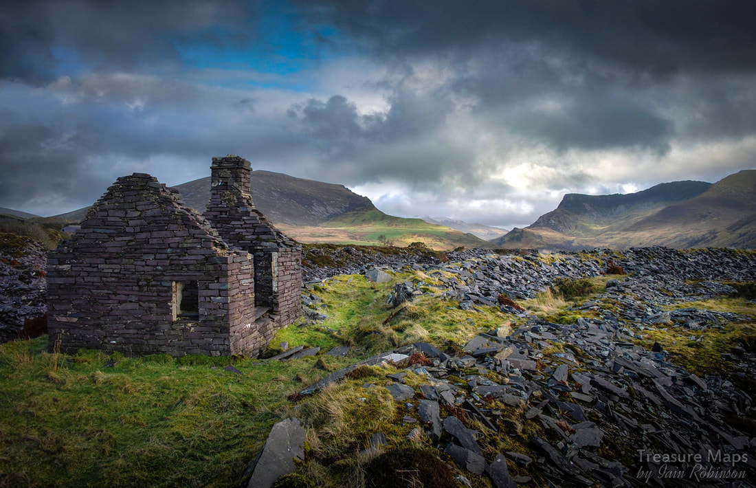 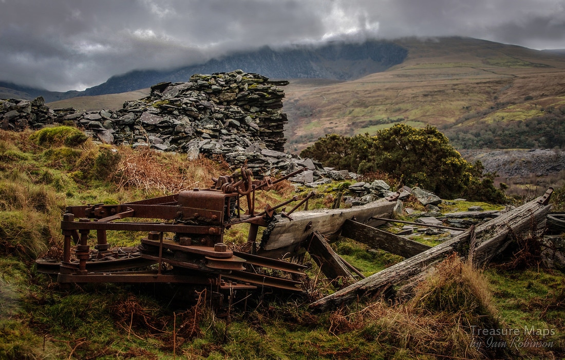 Or, Gentlemen prefer Blondins... Another study of the Nantlle Vale quarries this week, with a look at Blaen-y-Cae quarry. It's reached by climbing a bramble-infested pair of inclines from Talysarn, once the route of the John Robinson Tramway on it's way to join the 3'6" gauge Nantlle Railway. Nowadays though, it's mainly used by sheep, whose tracks we gratefully used to scramble up...or down in the case below- 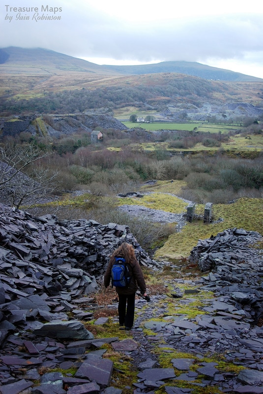 Once above the Talysarn pit, the country becomes a little wilder and views open out towards the Nantlle ridge and Snowdon in the distance. Not much remains on the levels above Talysarn except the drum houses and some ruined structures, barely recognisable among the gorse scrub that infests this part of the valley. A lonely chimney loomed from within a thicket of birch, oak and blackthorn...when I had hacked my way inside I was none the wiser, as there were no clues within the ruin. The 1889 OS map shows a mill at this spot, so perhaps this was the chimney for a steam plant, or possibly a forge. On the next level there seemed to have been a great many walliau, where the slate was roughly split and trimmed by craftsmen. A curious feature that we had not seen elsewhere was a series of sunken passages, rather like WW1 trenches, walled with slate. It felt a little like a Welsh version of Skara Brae. Trimming waste was everywhere. 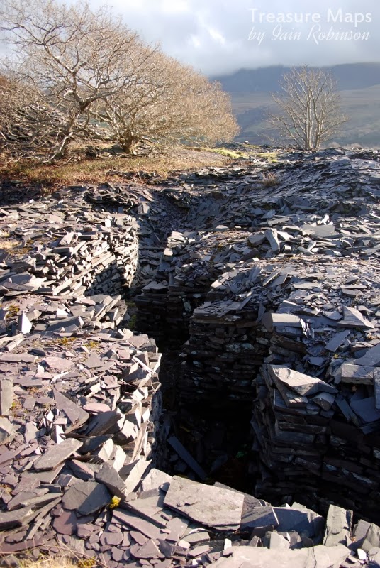 I knew that there was something special on the highest level, below the Cilgwyn tips and as we climbed up, I began to recognise features from the map and from photographs on the web. Despite my mine senses, Petra spotted it first. The remains of a "Henderson's patent Blondin Winder", almost engulfed by thorn bush but nevertheless, instantly recognisable by those who spend too much time poring over old quarry photographs. I guess most folk reading this will know how the Blondin apparatus is synonymous with the Welsh slate industry...or is it? 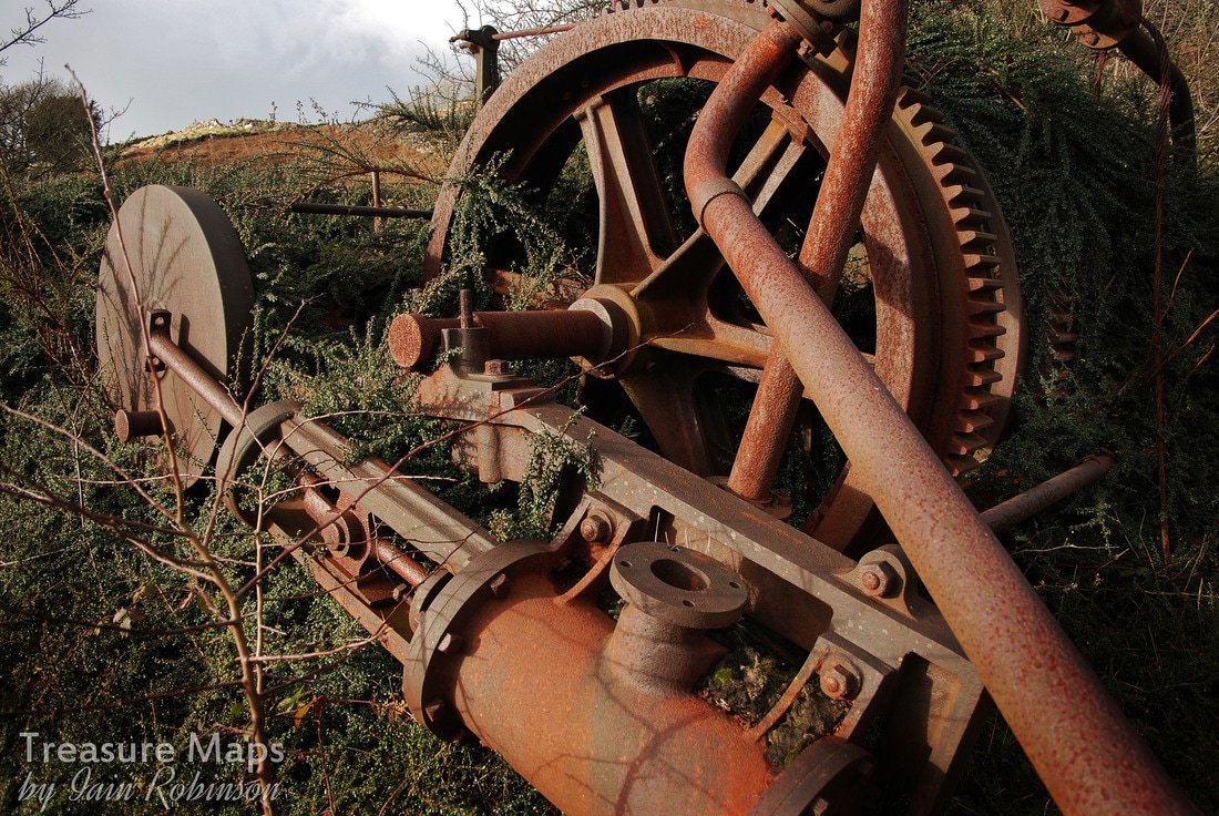 Basically, a Blondin is a series of wires strung from pylons on either side of a pit. Along these wires runs a wheeled carriage, or as it was known in some welsh quarries, a ceffyl (horse). This was pulled between the two pylons, running on static wires. From the carriage descended another block arrangement which allowed a load to be lifted or dropped remotely by the operator, which is where our "Henderson patent Blondin Winder" comes in. An ideal arrangement for situations where there was a deep pit and no access from a hillside. 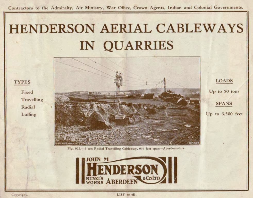 Despite what some folk will claim, the Blondin didn't originate from Wales, it was the idea of one John Fyffe, lessee of Kemnay Granite quarry in Aberdeenshire. He approached a local engineering firm, John M. Henderson & Company, of the King’s Engineering Works, Aberdeen, to manufacture the apparatus from his specifications. Here, historical accounts vary, as Henderson then claimed the invention as his own, built the first one in 1873 and took out a patent, No. 4196 of 1896, a machine for “Lifting and Transmitting Heavy Bodies”. The first Blondins installed at Pen yr Orsedd were of this particular pattern; the quarry was an very early adopter of the design, but not before Kemnay and Rubislaw granite quarries in Aberdeenshire. What of the name? They were named after the famous French tight-rope walker Charles Blondin (real name Jean Francois Gravelet, 1824-97). Blondin was famed for crossing Niagara Falls on a tightrope, pushing a wheelbarrow loaded with a stove. He stopped half way across, cooked an omelette on the stove and lowered it to passengers on the "Maid of the Mist" below. Not quite Welsh slate quarry practice, but certainly interesting. 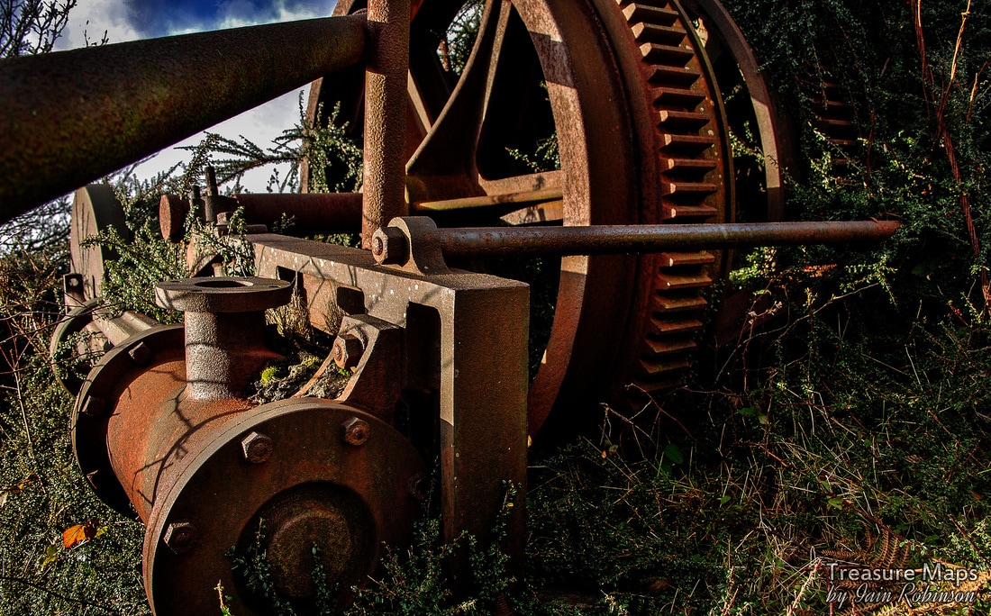 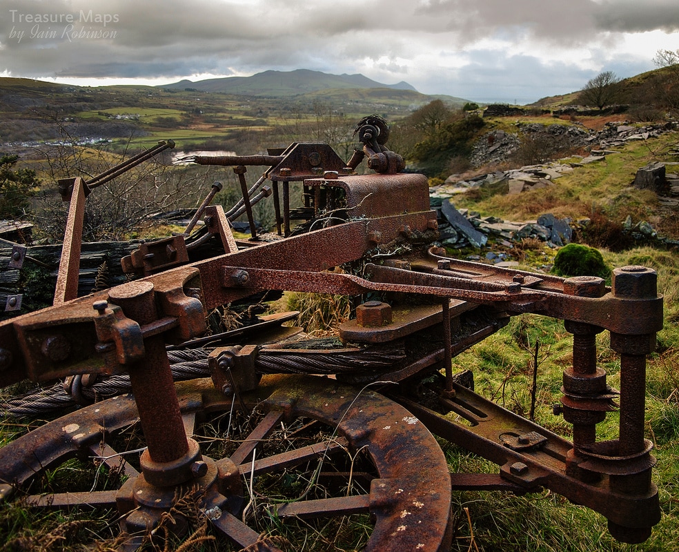 Meanwhile, the light was fading and the weather closing in. A cold wind blew from the east and I thought about those craftsmen working in the waliau in all weathers. No wonder they had dug those trenches. Back home, in the warmth of my studio, I thought about the winders. They were steam powered, yet there was no sign of an engine house on the level we were on, or even a shelter for the operator. I fell to studying more maps, trying to find an answer. I suppose coal came up the inclines, and shelters were corrugated iron or wood...perhaps. More research needed. Blaen y Cae factoids: The quarry was started in the 1830's and was eventually taken over by Tal y Sarn. At it's peak, forty men were employed, producing 800 tons a year. It closed in the 1930's. (source: Gazetteer of Slate Quarrying in Wales, A. J. Richards.) 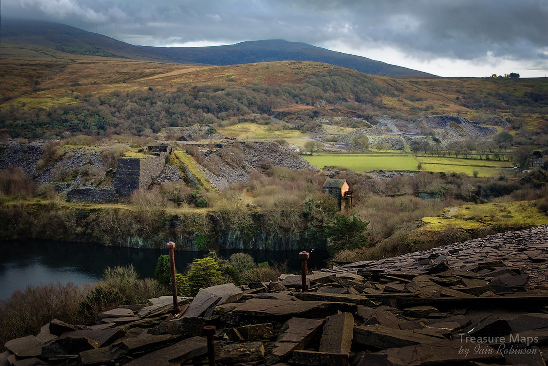 |
TracksReceive the occasional Treasure Maps Newsletter- and alerts when a new post is available!
If you enjoy my content, please buy me a coffee!
Check out my other online activity...
Index
All
|
 RSS Feed