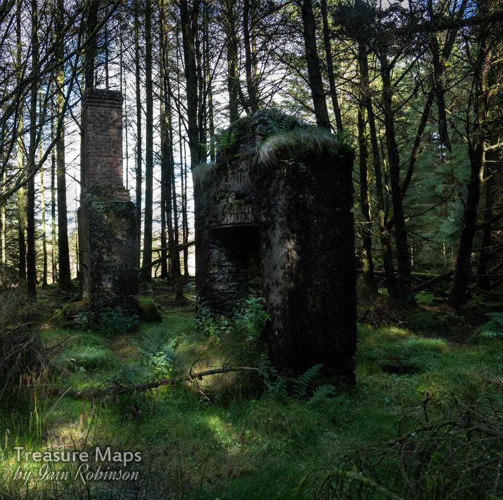
 Another intriguing discovery hidden in the woods beside Nant-y-Moch. I have been unable to find much about the history of this mine, which was nevertheless a productive one in it's early days. It is thought to have been opened before 1750, and worked in conjunction with the Hafan mine, slightly uphill and to the west. Work here continued until 1892. In it's latter years, it was sold to Sir John Molyneux, a Lancashire man with deep pockets. He was the moving force behind the Plumlumon and Hafan tramway, which passed less than half a mile by the mine. There is some speculation that the two mines were joined underground- some leading lights in the contemporary mine exploration field have had dicussions about the possibility and it is true that a survey taken in the adit here seems to show that the heading is correct. Unfortunately, the drive ends in a collapse, so we shall never know. I quote Roy Fellows' article on the mine: "The geological survey seems to suggest that the two mines do connect but without saying so in so many words. It describes the Henfwlch Adit as “draining the principal or Hafan shaft to a depth of 24 fathoms. About 83 fathoms further west the Bog shaft is drained by the same adit”. Plotting the course of the adit on the OS map puts the collapse at my dig to correspond with the shaft on top of the hill adjacent to the quarry (NGR SN735882). This must be the principal shaft referred to by the British Geological Survey. Plotting the rest of the adit on the map takes one to a point only about 80 metres from the head of the Hafan incline, where the Hafan workings start. To add to the controversy, David Bick describes Hafan Deep Adit as being driven for 250 fathoms (500 yards)! This would most certainly take it below the horizon of the Henfwlch workings." (1) One probable development is that the Henfwlch shaft below the Cwm Owen quarry close to Hafan might have been used for removing material. An amusing snippet that has emerged, from the book on the tramway by E. A. Wade, is that communication between Hafan and Henfwlch was by carrier pigeon! Most of the mine's output was before the legal requirements to state volumes of ore raised came into force, so the official figures of 623 tons of lead and 25 tons of copper are probably well short of the mark.  The supports for the uprights remain as moss covered blocks in the ground. The remains The site has been given the forestry treatment, but the general layout can be divined with the aid of the OS six inch map of 1888. The lower adits have been tipped over by later work. The most attractive thing about the site are the ruins of two hearths and chimneys, possibly all that remains of the barracks and office. Where the rest of the huts ran can be imagined by rows of concrete supports on the ground. I imagine these were typical mine structures, made of wood and corrugated iron. Near the road, the remains of a trackway runs above the verge for some way, possibly a remnant from the early days, before the tramway above was built. A quarter of a mile away to the north, at the side of the reservoir there was a chapel (Capel Tabor) and a house called "Spain", but there is no trace of either, sadly. A site well worth a visit to soak in the atmosphere and wonder what things were like here in the late 1600s...no conifers, for sure. I get the feeling that the area was quite busy with several mines open and busy, a chapel and some farms. Oh, for a time machine. 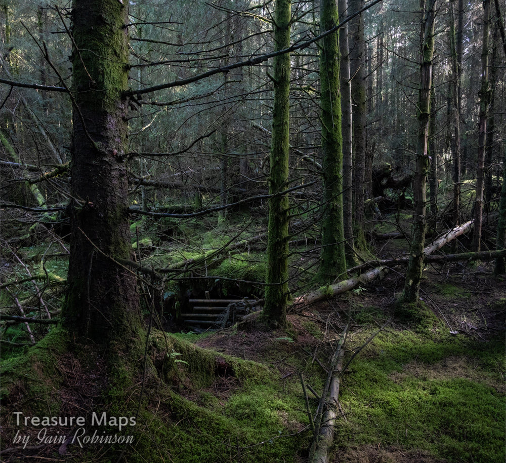 The wet and very uninviting adit, deep in the woods. (1) Roy Fellows is a respected mine explorer and conservator, being responsible for the setting up of a trust to conserve the Cwmystwyth Mines and keep the access open.
4 Comments
|
TracksReceive the occasional Treasure Maps Newsletter- and alerts when a new post is available!
If you enjoy my content, please buy me a coffee!
Check out my other online activity...
Index
All
|
 RSS Feed