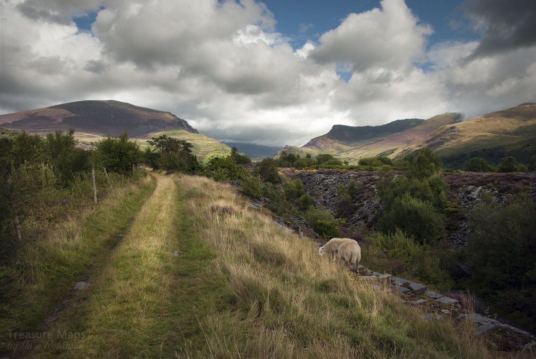
 Sheep graze on the trackbed near to Pen yr Orsedd. Introduction I'm writing this because developments at the quarry mean that stretches of the tramway are likely to be obliterated; there are signs of heavy vehicles having been along the trackbed near Dorothea, so it is fitting that a record is made, before it is too late. Some sections, even of the relatively small formation between Talysarn and Pen yr Orsedd have needed a good degree of guesswork, particularly one bridge over the final stretch- but it has been very enjoyable walking many, many times over the route with various friends and my partner in crime, Petra. As a matter of interest, I use the term "tramway" throughout to denote the quarry railway, and I also prefer the antiquated spelling of "waggon". Well, it's my blog! The early Years In the hazy times before the 1820s, the burgeoning slate industry of the Nantlle valley was thwarted from expansion by transport wrangles and exhorbitant charges from local landowners for the passage of loaded slate carts. The Nantlle Railway Act of 1825 was to sweep these obstacles aside and revolutionise the fortunes of the Nantlle quarries. The Nantlle Railway was constructed by a contractor called William Owen of Gwaunfynydd, Anglesey. Assistance and advice was provided by Robert Stephenson, a canny Newcastle lad- brother of George Stephenson and uncle to his luminous namesake. The railway opened in 1828, but as things turned out, it wasn't just a slate carrier. It carried copper and lead ore from the mines at Drws y Coed, a couple of miles to the west up the valley and it also carried coal. From 1829 it carried passengers, too- but that is a little outside the scope of this article, which concentrates on the stretch between Talysarn and Pen yr Orsedd, remaining in operation until 1963 as a slate tramway. The gauge was 3'6" and originally used wrought iron "fishbelly" rails. Throughout it's life, apart from a couple of years towards the end, it was horse-hauled and used wagons with double-flanged wheels. Stone and wooden sleepers can still be seen underfoot on the tramway today Many will know, thanks to Geoff Charles' photographs, the images of "Prince" and "Corwen", the last horses to work the route. Latterly the line was worked by an International tractor, pulling a rake of waggons from Pen yr Orsedd down to the rail interchange at Talysarn. From Talysarn onwards, the line had been converted to Standard gauge by the LNWR, latterly LMS and then BR before closure in 1963. 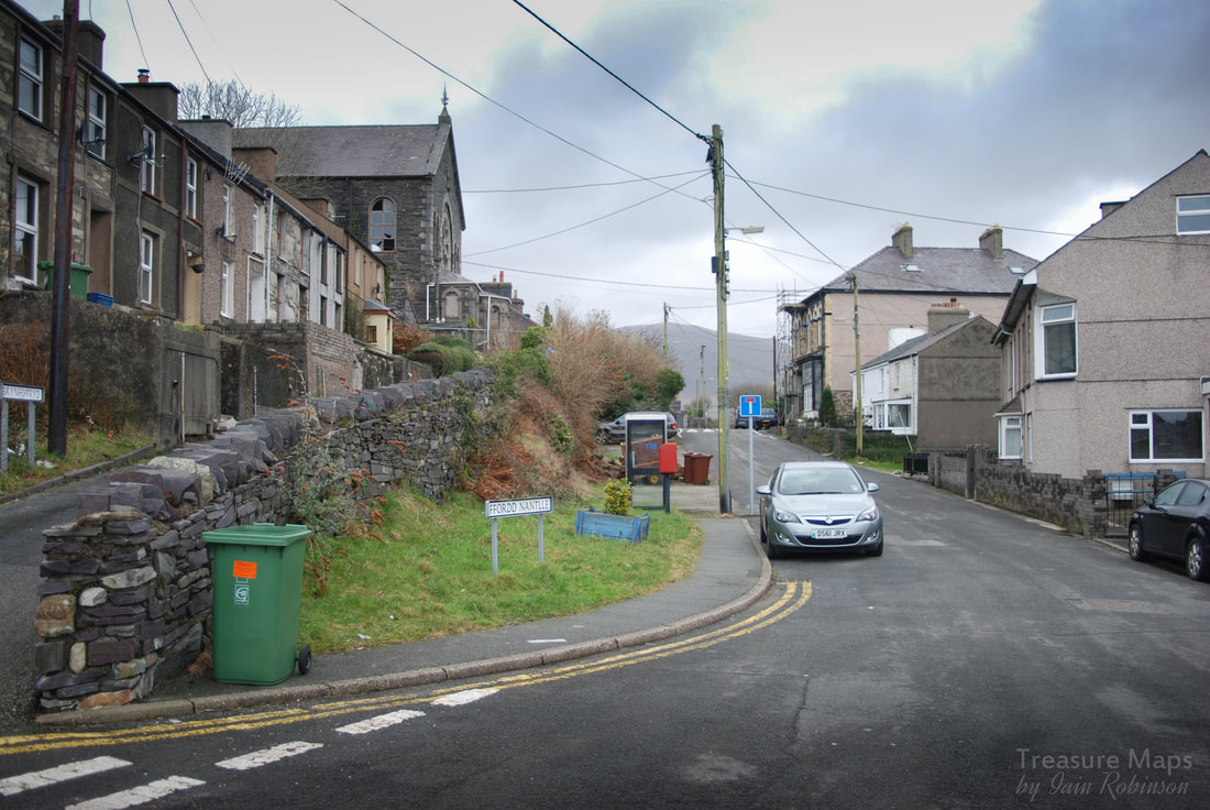 Compare this 2014 image with the one below...  In this 1960s view we can see the tunnel under the front of Capel Mawr, and the bulk of Pont Fawr in the background. (collection of the late Gwynfor Pierce Jones) Talysarn Here the station and old interchange between the standard gauge and the Nantlle Tramway can still be easily made out; the station building survives, albeit in much modified form, and several points of reference from old photographs can be identified. The tramway passed through the village and can easily be traced in the formation of old walls until the formidable bulk of the grade 2 listed Capel Mawr comes into view. This fine chapel was built in 1884, although latterly it is falling into disrepair. The tramway dived into a small tunnel in front of the chapel and emerged at the end of the houses, near to where the new roundabout is today. The tunnel entrance can still be seen behind the parked cars and dense undergrowth. As the chapel was constructed after the tramway, I guess the tunnel was built over to make a better approach for the worshippers. The tramway passes now into open country, or what would probably be called a "post-industrial relict landscape". Whatever the terminology, it is very beautiful. The road that runs along here used to be the main road from Talysarn to Nantlle, until it was severed by a collapse further along, in the Dorothea pit, near where the entrance gate columns to the Plas are today. The collapse happened on the night of 12 Jan 1924, just after a bus went by (GPJ). 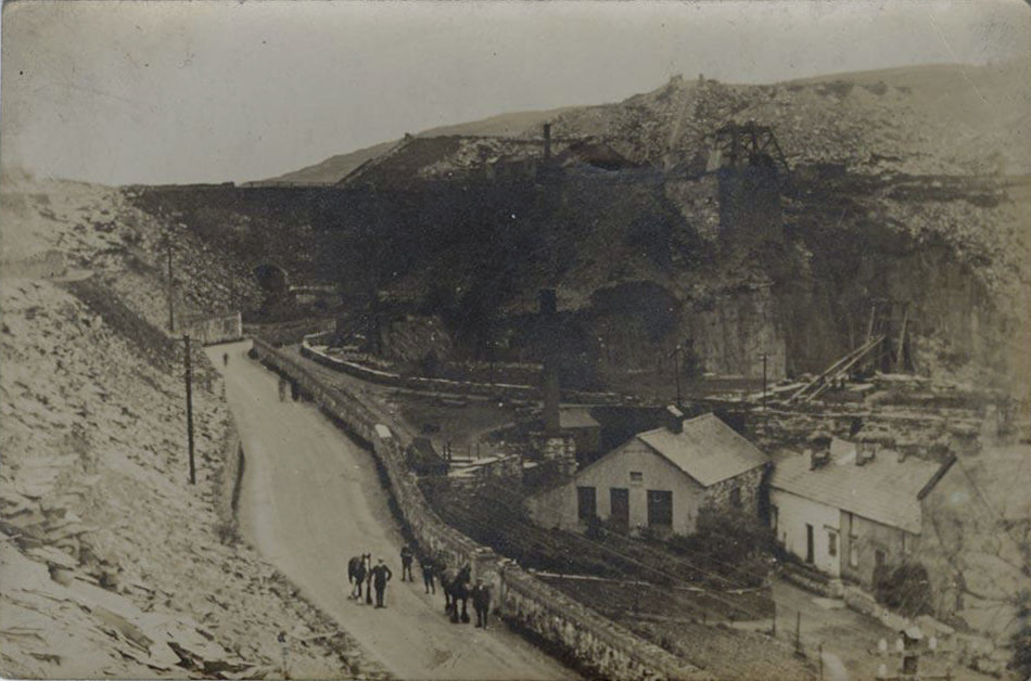 A glimpse of Pont Mawr in the background here looking towards Talysarn. The ruins of the engine house and forges remain in thick woodland, but everything else has been obliterated by landscaping except the pit. The tramway runs to the right of the road here, behind the foundry buildings. The tramway ran beside the road for a while before the Plas- and immediately before the Talysarn quarry, it passed under a massive arched embankment, called Pont Mawr. There's absolutely no sign of this now, the area was "landscaped" in 1977. Dorothea lakes have installed a hideous gate across the road here, for reasons known only to themselves. It doesn't actually close. There was a huge tip here from Cloddfa'r Coed quarry (the digging in the woods) behind what is now Eifion terrace. A tramway ran along the top and Pont Mawr carried this over the road and the Nantlle Tramway, to the Dorothea mills. I guess, looking from the old photos, that it was all built on waste slate. Despite some local opposition, no record was made of the structure -it was demolished and the character of the area thus destroyed, replaced by a sterile landscape. All we can say is that it appeared to be a complex, multi-era structure of four different bridges and that it had, according to local opinion, started to become unstable. The bridge had it's moments, though- in 1879 a locomotive left the tracks while crossing and landed on the tramway below. Gwnfor Pierce Jones noted that he tried very hard to make the council understand that this was a special landscape with many priceless relics "but they looked at me as if I was crazy". (GPJ) Plus ca change. 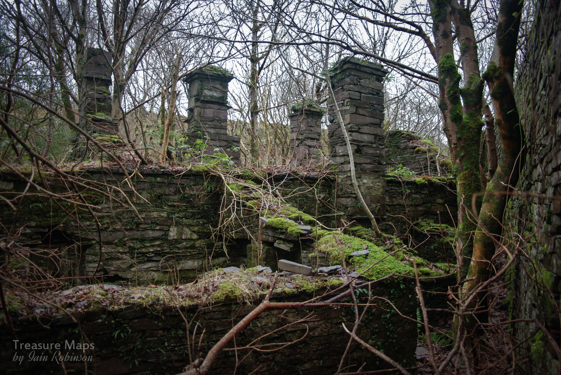 The chimneys of Ty 'r Efail, the Smithy buildings...the causeway for the tramway is on the right. Behind the Plas The tramway veers away from the road after Talysarn pit, heading for the old Mill behind the Plas. It goes to the left of a series of structures on the right known as Ty 'r Efail, the foundry houses. There are still several chimneys standing and inside, the remains of forges and hearths. I guess these would be for servicing the considerable needs of the quarries for metalwork of all kinds...tools, jwmprs, chains, etc etc. A passageway still runs from the foundry cottages, under the tramway, through to a depression which was thought by GPJ to be the site of an old pumping engine for Talysarn pit. This side of the pit had several pumps, nearer the pit was a primitive "FlopJack" pump- only the base survives, while a slightly more substantial base marks where a massive "Bull Engine" stood, a steam engine reputed to have 90" cylinders, similar to the one preserved at Kew Bridge. This stood over the shaft that it pumped, and water drained away through a series of lost, eight foot square tunnels, access to which disappeared in the 1990's. 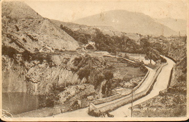 In this fascinating old postcard, taken from the top of Pont Fawr, we can see the tramway veer off to the left past the foundry cottages and on, past a mill building, to the plas in the centre. Also visible are chain inclines and the Talysarn Mill to the left, with the John Robinson Incline going up further to the left. The Talysarn Quarry must have been abandoned by this time, although the water hadn't reached the level that it has today. The ruined walls of a mill are passed, then the tramway runs close to the rear of the stables for the Plas. Until recently, it was possible to explore the stables and offices here, but Dorothea Lakes have now fenced this off. Interested readers are referred to my other posts at the end of this article. The ivy-covered structure is the entrance to offices for the quarry- the stables and chapel were converted to quarry use and are a rabbit warren of rooms open to the sky and dank passages. In summer, this is a bosky route, a haven for wildlife of all kinds, although often wet underfoot- wellies are the best footwear, and perhaps a small set of secateurs to remove brambles... 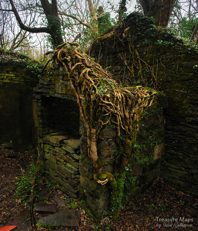 Incidentally, the tramway didn't always come this way. Originally it passed sixty yards or so to the north west until encroaching slate from Blaen y Cae's tips threatened to obliterate it. The tunnel was dug through, a cut and cover affair, through the orchard of the Plas in the 1820s, but this eventually caved in due to the immense pressure of the slate above. It is possible to explore the tunnel partway, but I don't recommend it! The water coming out emerges from a side tunnel underground, a very narrow affair, which connects to a drainage tunnel from Gallt y Fedw quarry above. This has collapsed recently- I remember exploring it a few years ago and getting stuck for a while as it is so narrow! 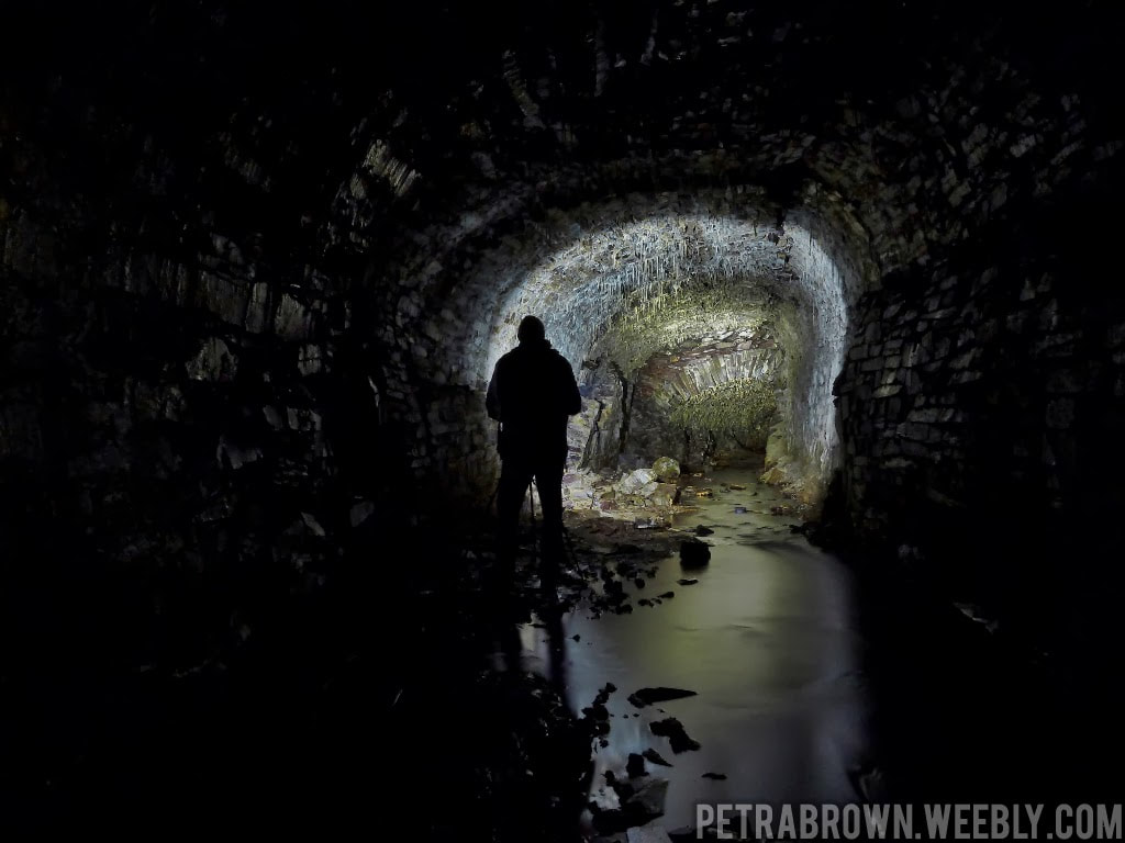 Yours truly, trying to photograph the tunnel (and failing!) 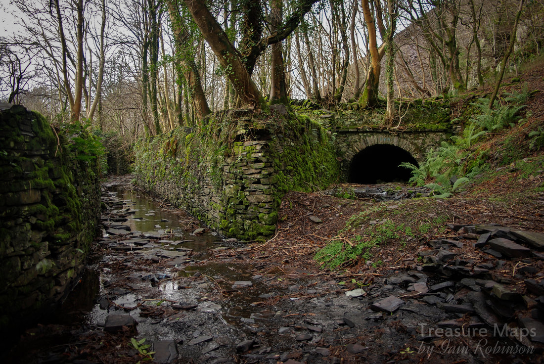 The tunnel entrance, with the new alignment going towards Talysarn on the left. Talysarn Uchaf Immediately after the tunnel entrance, you might be able to make out the remains of a very old incline formation on the left. This came down from the western extremity of Gallt y Fedw quarry above and is marked on the 1888 ordnance map, as is the tunnel. It takes a little imagination, but you can still see the steps at the side of the incline. It is thought that this went out of use in the 1880s, replaced by a more efficient (and massively engineered) central one from the mill floor above. This incline fell all the way from Cilgwyn quarry, high on the skyline above. 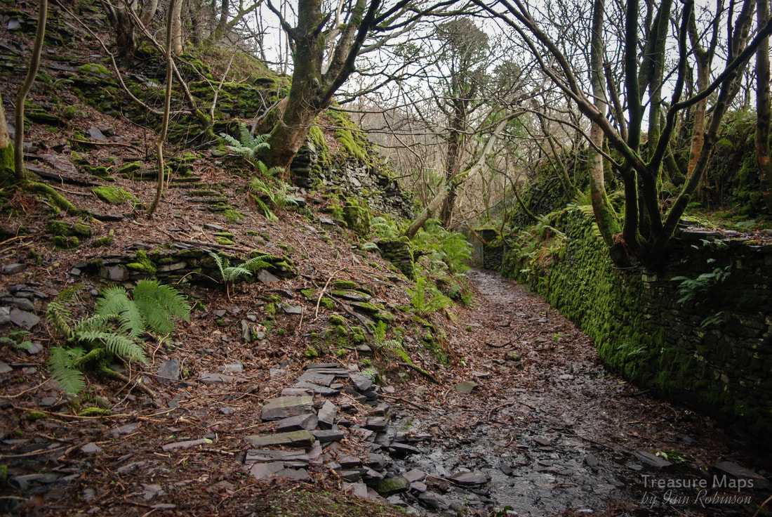 The vestigial remains of the incline to the left; steps can just be made out. The tramway continues on the right, to Dorothea. Soon, the poignant ruins of Talysarn Uchaf village come into view on the left. The remains of the stables and a farmhouse, plus an old cottage, now almost engulfed by vegetation and young trees can be seen. The cottage was owned at one time by a Mr Pritchard, who provided the quarry horses. The stable undoubtedly was for the quarry, while behind in the farm, one side was rented by "Tommy Run" or Thomas Williams, the driver of the Nantlle tramway train at one time. His nickname "y ryn" means a run or train of waggons. In the middle of all this, the massive incline comes down from Gallt y Fedw, whose mill is built on vast piles of slate waste. This is held back by enormous bastions which are slowly deteriorating and being degraded by vegetation- how much longer they will last is an interesting question! Ater the cottages of Talysarn Uchaf, yet another incline comes down from Gallt y Fedw. This is the latest incline, probably out of use by the 1930s and now almost lost in the undergrowth. It is the only one with any drumhouse remains- although these can't be seen from the tramway.  The ruins of Mr Pritchard's House, beside the tramway. 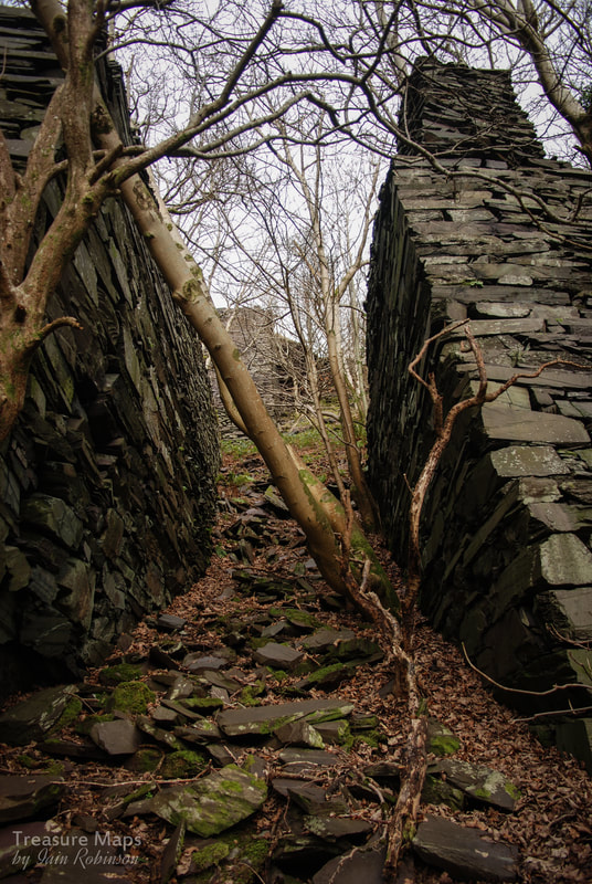 The massive bastions holding back slate waste at either side of the Gallt-y-Fedw to Cilgwyn incline, which rises up from the middle of Talysarn Uchaf. In Sight of the Pyramid The line of the tramway becomes a little vague at this point, passing close to the edge of the quarry pit beside the road. It then starts to burrow down into a cutting as the road level rises. The cutting is choked with vegetation and passes a small pit on the left. Shortly after this, it tunnels under the road near the East Pyramid. The tunnel is a short one, but very well built, almost like a standard gauge formation. 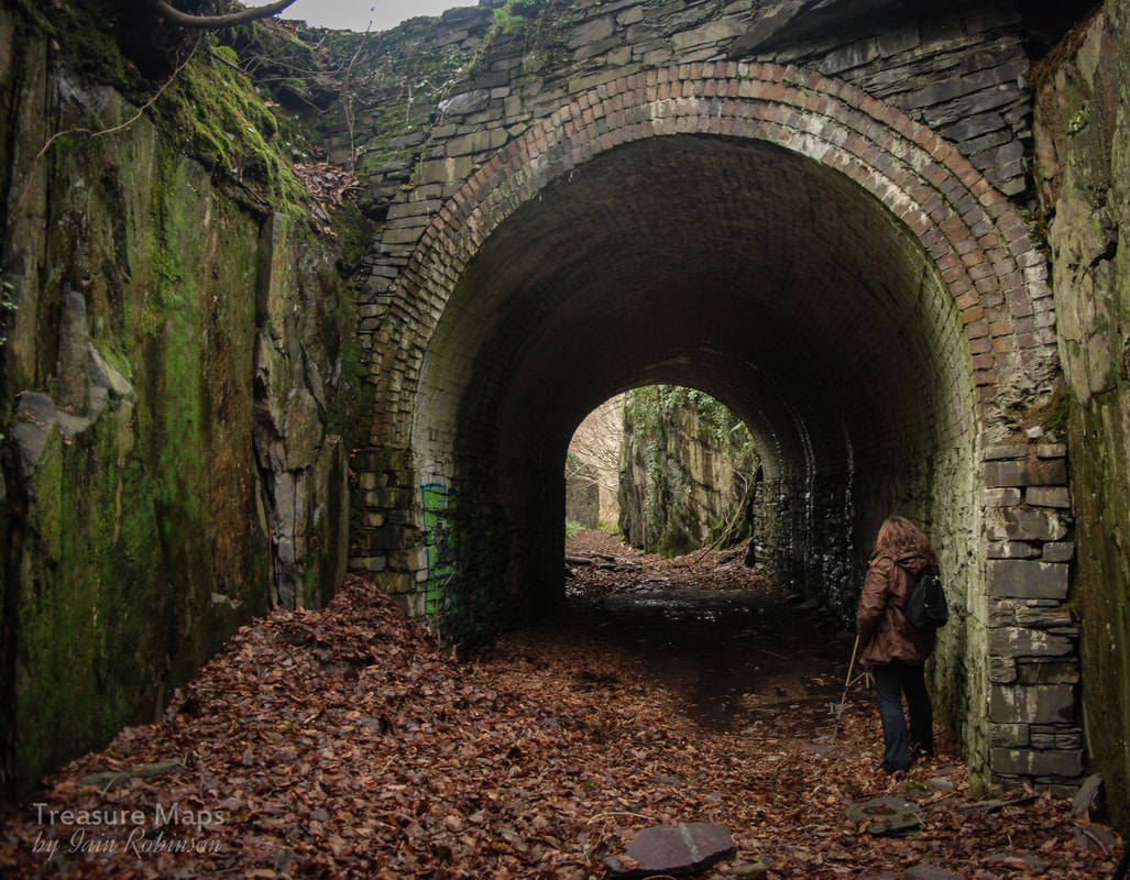 After a short stretch in woodland, the tramway passes between massive slate towers that once supported girder bridges, taking a tramway from Pen y Bryn to the Dorothea tips. I'm informed that these were built when Nantlle lake was being drained. (JpB) Why they had to be so massively built, or were needed at all, is a mystery, but we can marvel at how well they were constructed, all from quarry waste and all dry, without mortar. The quarrymen were real craftsmen, proud of their skills 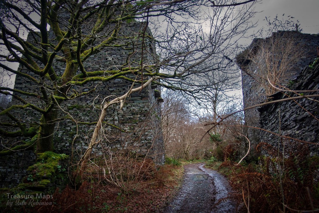 At the top of the left hand one is a winder house for Twll Ballast, so perhaps waste from this was trammed to the Dorothea tips. A junction comes into view from the quarry, and it is worth splodging through the muddy track to see the wonderful flying buttresses that go between the Eastern Pyramid and a viaduct pillar there. There is a school of thought (Wilson and Atyeo) that the alignment coming through the quarry was the original one, and had to be re-aligned because of the increasing size of the pit. The alignment is as the modern one on the 1880's maps, so this must have happened before that date. Why else would a 3'6" gauge line come from the pit, to join in the wrong direction...it seems reasonable to me that they are correct. Retracing our steps, the tramway has been landscaped out of existence for a short while. Best to walk along the roadway that runs beside Twll Ballast- if you look on Google Earth, the course can be seen, mainly by the dense growth of trees that run along it! It describes a curve to right and then left, joining the trackway beside Ballast by a flying bridge. According to a local man, John Pen-y-Bryn, the bridge here was taken down in 1969, much to CADW's annoyance. No doubt the scrap man had something to do with that. It is at this point that wonderful views of the Nantlle Ridge open up ahead, and if you are lucky, Snowdon will be glimpsed between the hills at the end of the valley. It was along this stretch that Geoff Charles took his evocative photograph of Prince and Corwen pulling a train back in the 'fifties. Towards Pen yr Orsedd This stretch of the tramway is a favourite with everyone, combining such a rural feel with stunning views. There is something special about a trackbed, a level way through the countryside. Sleepers, both wooden and stone, can be seen just below the grass here. The abutments of two other bridges are passed on the right, beside a house, Bryn-Deulyn. The highest bridge came from a range of smithies and workshops on the left towards a mill and walliau on the tip area to the right. The lower abutment that can just be seen dates from the 1860s- it was out of use before 1881 and must have been rendered obsolete by the increasing height of the tip to the right. 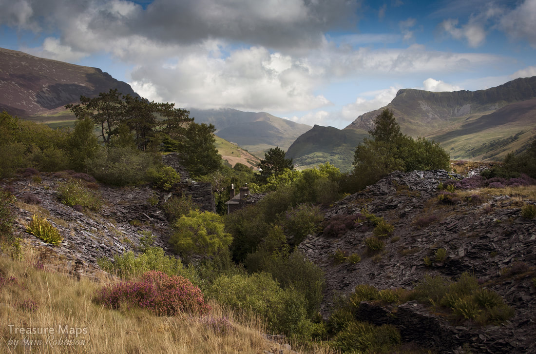 Bryn Deulyn, from the tramway. There were extensive slate mills on the embankment to the right. The brackish waters of the polluted Twll Ballast keep us company to the left for a while. Although the water looks dubious, there is much more undergrowth and plant life here than in any other part of Dorothea! Soon, another pit, Twll Mawr opens up on the left. A variety of birds use it's inaccessible cliffs as roosts and, like the rest of this area, it makes a wonderful refuge for wild life. A branch goes off to the left, guarded by members of a mighty tribe of old fridges that are scattered around Dorothea. I suspect they have their headquarters in the quarry pit. Perhaps they are related to the old bedsteads and railings up at Pen y Bryn. 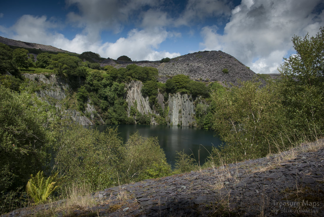 Twll Mawr, with the massive tip of Pen y Bryn behind. This was tipped over several old pits, so represents much more waste material than would first be apparent. Fishbelly rail and Soapwort It's worth a little walk up here to the makeshift barrier, because that is composed of a length of Fishbelly rail, the original rail from the tramway back in 1828- a wonderful survival. I apologise about the photograph, since I found it impossible to depict the rail "artistically"! This branch goes up an incline along the side of the Pen y Bryn tips, but we must rejoin the tramway for now. Below us now are the cottages of Tai Nantlle. From the rear, perhaps, not as attractive as could be wished for. There is also a compound below with rusty old cars and vans that have obviously come here to die, but I don't feel they spoil the vibe overmuch. Petra made an interesting discovery here- beside the track are some clumps of Soap Wort, Saponaria officinalis. It has been used in past times to make soap, produced by soaking the leaves in water. This soap is still used to clean delicate antique tapestries. While wandering about on the road below one day, we discovered an old laundry building complete with wheel pit...mystery solved! 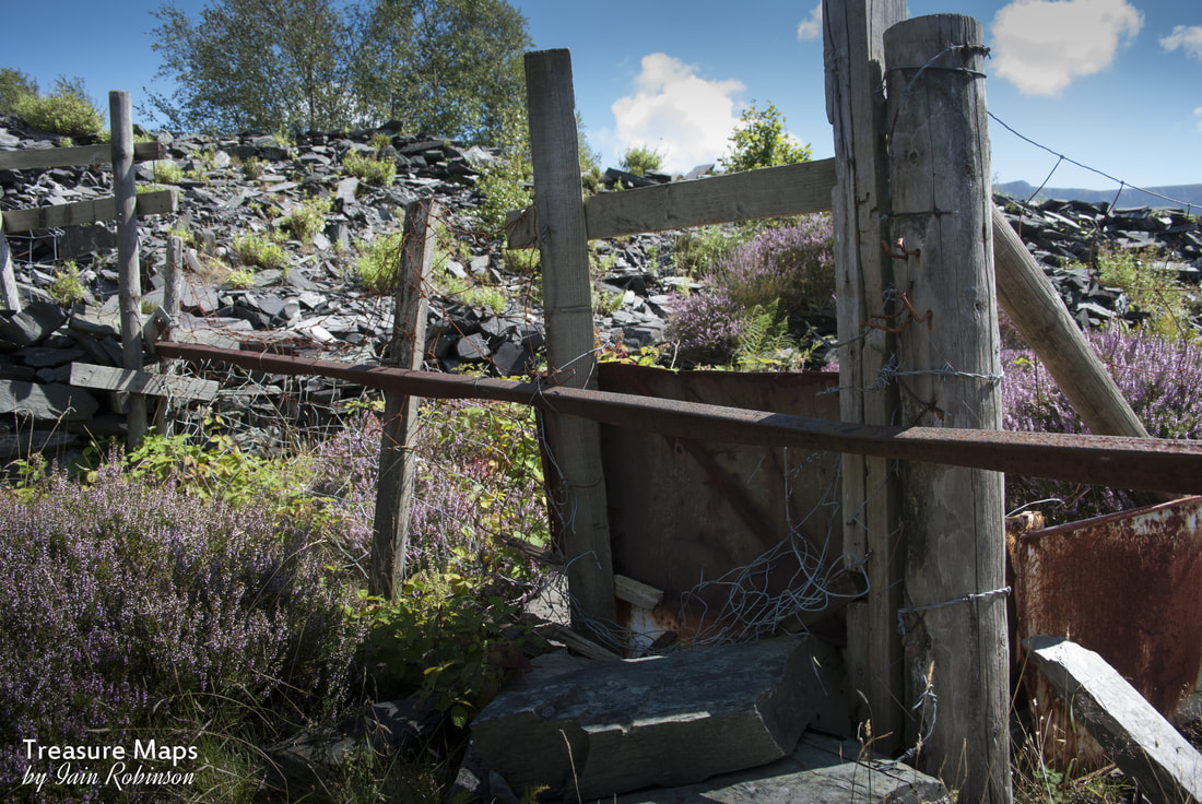 The junction to pen y Bryn, guarded by Fishbelly Rail! Now the tramway becomes secretive. Bushes and trees close in as the way snakes through a young area of woodland that has grown up over a slate tip. Then, a sharpish right into more mature woodland allows entry into a magical place, with ruined buildings surrounding the tramway. It took me a while to realise that this was the foot of the Pen-yr-Orsedd Incline and these structures were the weigh house on the left, and stables on the right. Here's a photograph from the sixties, compared with one taken recently; you can see why I was a little confused! 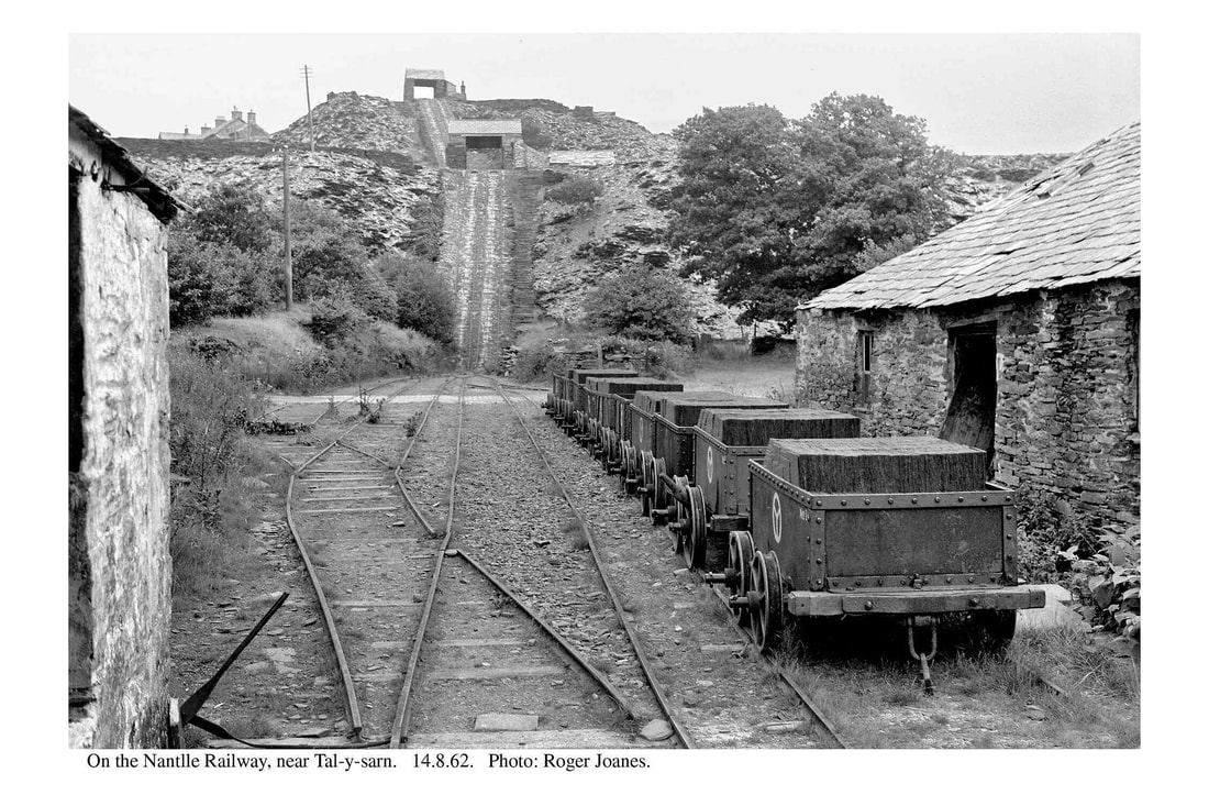 Photo by kind permission of Roger Joanes. Incidentally, Roger's Flickr photostream is full of little known byways and fascinating photographs- it can be found here. 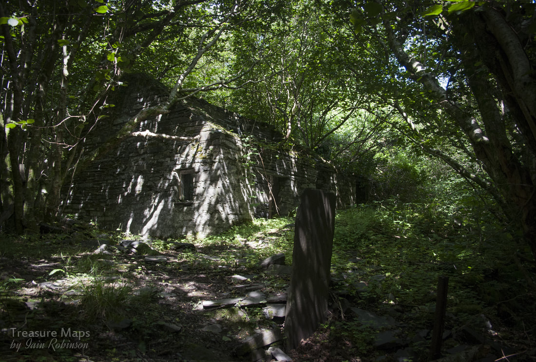 The vegetation has really taken over since 1962! Behind the weigh house is an enclosure where a pig was kept...there are the remains of the pig-sty a little way away to the rear. There is also a waterwheel pit to the rear, perhaps to process food for the animals using a chaff-cutter. The stables themselves are badly degraded and show signs of being adapted to a road/rail interchange shed. There, our journey must end for the moment, as the way up to Pen yr Orsedd is part of a working quarry who blast rock during the day. The two incline houses have been visible on the way up, but sadly the incline is bisected by the new quarry road. But don't despair, the way back is as charming as the way here has been, with different views and surprises, such as a view of Yr Eifl from the tramway past Tai Nantlle. I hope the route of this historic quarry tramway remains traceable for the immediate future but it is threatened, by the developers, Dorothea Lakes, by vandalistic tip contractors, and by a host of other forces who seem unconscious of what they have under their noses. Finally, there is a wonderful video from the 1960s of the tramway, featuring Oswald Jones and the horses, "Prince and Corwen, here. Sources: (GPJ) Email and Facebook conversations with the late Gwynfor Pierce Jones. (JpB) John Williams of Pen y Bryn (Wilson and Atyeo) An article in Railway Bylines No.3, "The Nantlle Railway, it's branch and tramways", Irwell Press. Richards, Alun John (2001). "The Slate Railways of Wales". Llanwrst, Wales: Gwasg Carreg Gwalch. ISBN 0-86381-689-4. Richards, Alun John: "Gazetteer of the Welsh Slate Industry "Published by Gwasg Carreg Gwalch, Wales, 1991 ISBN 10: 0863811965 Boyd, James I.C. (1990) [1972]. "Narrow Gauge Railways in North Caernarvonshire, Volume 1: The West". Headington, Oxford: The Oakwood Press. ISBN 0-85361-273-0. Jean Lindsay: "A History of the North Wales Slate Industry ", David & Charles, Newton Abbot, 1974. "Chwarelyddiaeth Dyffryn Nantlle", Gwynfor Pierce Jones, Cyngor Gwynedd, ISBN 0 901337 94 3 "Dyffryn Nantlle, a Landscape of Neglect", Alan Carr, Village Green Publishing 1996, ISBN 0 9529244 1 2 A note about photographs- some of the old photographs are uncredited, despite great efforts being taken to obtain permission and copyright. If one of these is yours, please get in touch. A big thank you to Petra for her company on the explorations, and to Kerry for her unrivalled knowledge of the lie of the land.
6 Comments
|
TracksReceive the occasional Treasure Maps Newsletter- and alerts when a new post is available!
If you enjoy my content, please buy me a coffee!
Check out my other online activity...
Index
All
|


 RSS Feed