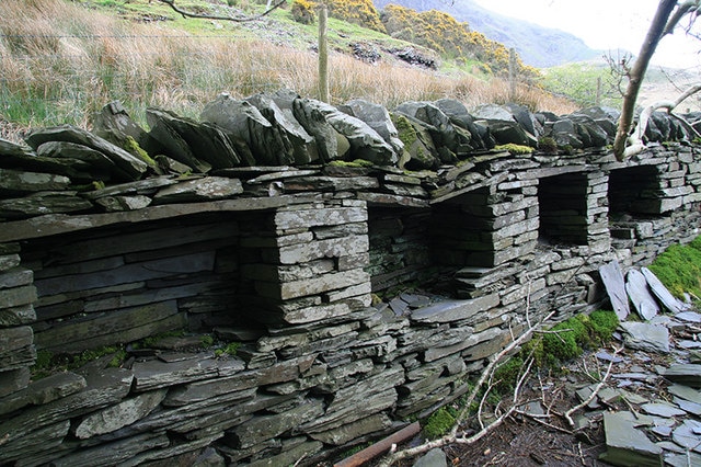
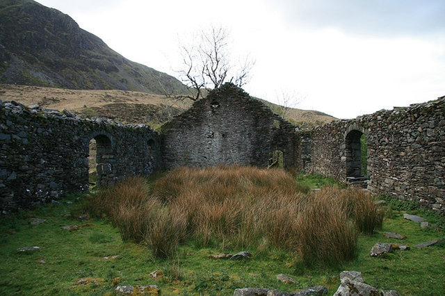
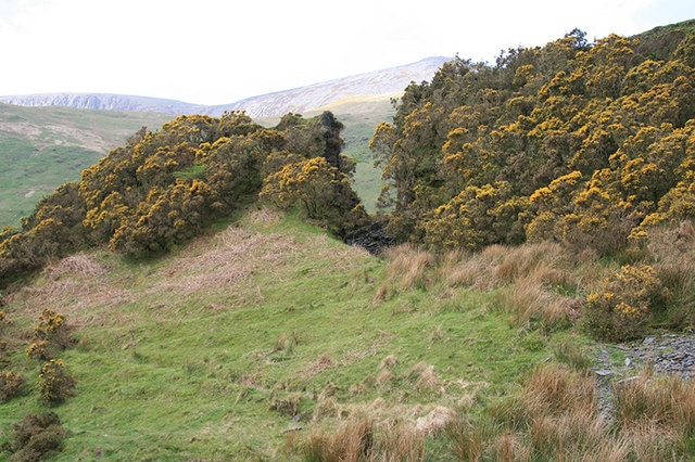
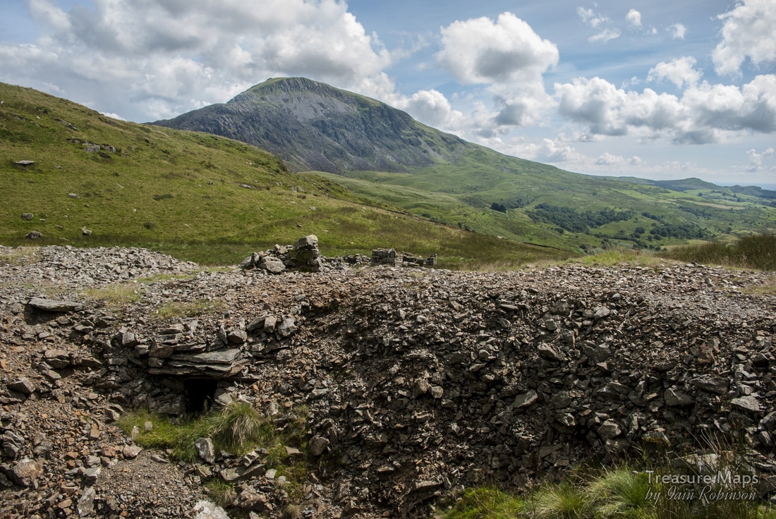
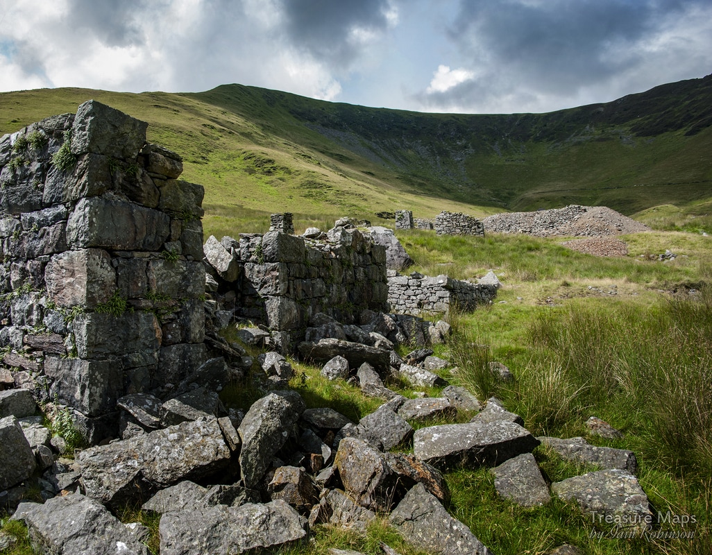
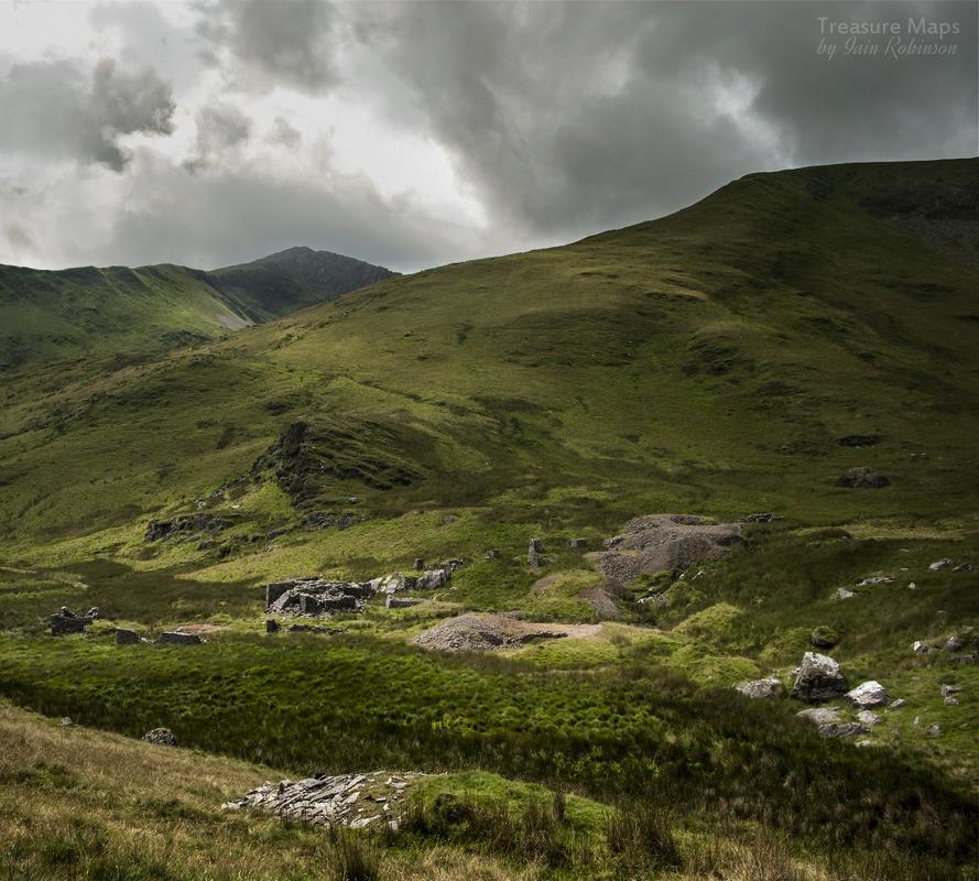
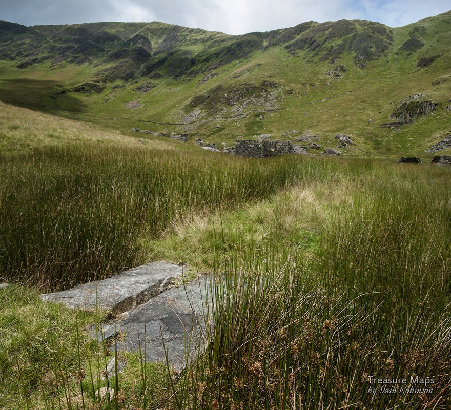
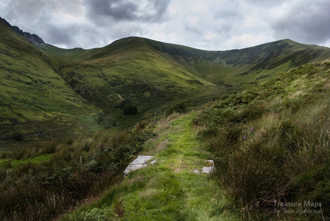
 On the way to Cwm Dwyfor! Mynydd Tal-y-Mignedd looms above. A walk to the ill-starred mine, high up in the hills at the end of Cwm Pennant. Some say it was a copper mine, but it produced more lead than copper. If I tell you that the Huddart's of Brynkir were involved in the operation, the folk who "poured money into holes and called it mining" you will get the picture. But who am I to complain, the profligate toffs gave us a lovely tramway to walk and some fascinating mine buildings to pore over. They also employed some miners and stonemasons for a short while until everyone realised that, in fact, the emperor wasn't wearing any clothes...he'd sold them to keep the mine running. Our walk to the mine had the air of an adventure. It was early summer and we'd managed to get a few hours away from our duties. We parked at the car park, after putting a couple of quid in the honesty box at Beudy Newydd farm. There used to be a very old couple here who would come out and collect the fee from you, but I've noticed in the last few years the box has put in an appearance. From the car park (Beudy’r Ddol) at the furthest end of the valley, we took the stile at the corner and followed the sketchily waymarked right of way up the hill. It can be a bit wet in places and not too distinct. Just head for the ruined Cwm Trwsgl farm...the tramway runs behind it and you can get over from here. 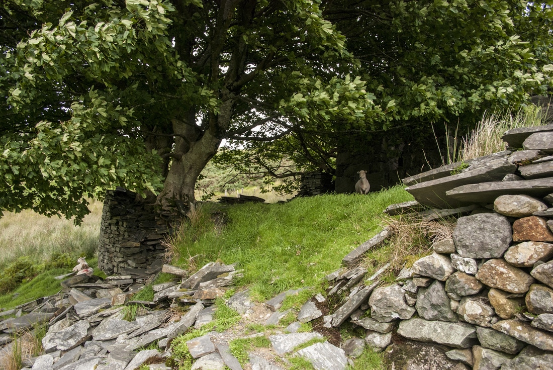 Once we made it to the ruined farm, we discovered that it was occupied by sheep- I felt a little guilty disturbing them; they looked quite shocked at our appearance on their doorstep! We took stock for a while, breathing in the heady odour of sheep poo and antiseptic dip...when I noticed the Dol Ithan Gethin quarry across the cwm from us. It's somewhere I have meant to take a look at for over ten years...I guess it can wait a little while longer. It's also known as Dolgarth and was opened in the 1870's. There was also thought to be a copper mine here, but that would need investigation to confirm. Incidentally, Cwm Trwsgl farm is understood to have been occupied by the manager of the Prince of Wales quarry, just up the hill. Around the back of the farm is a slate wall with recesses thought to have been bee hives- someone must have had a sweet tooth! 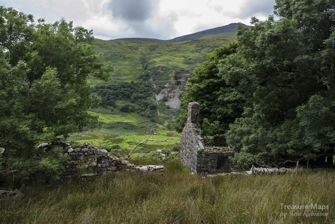 Dolgarth Quarry from the ruined farm (Cwm Trwysgl) - Craig Cwm Silyn in the background. At last, we were on the tramway. The going was a little easier now thanks to the level formation, although it was still rough at times. We passed a set of what looked like reservoirs on the inside of a curve in the tramway, their use was unclear. We could see the Prince of Wales mill in the trees and beyond it, the cutting for the tramway as it carried on up to the cwm head. They say that the sum quantity of the spoil from this cutting exceeded the weight of ore taken out of the mine; how the promoters must have egged the pudding to get those hapless investors to sign on the dotted line! 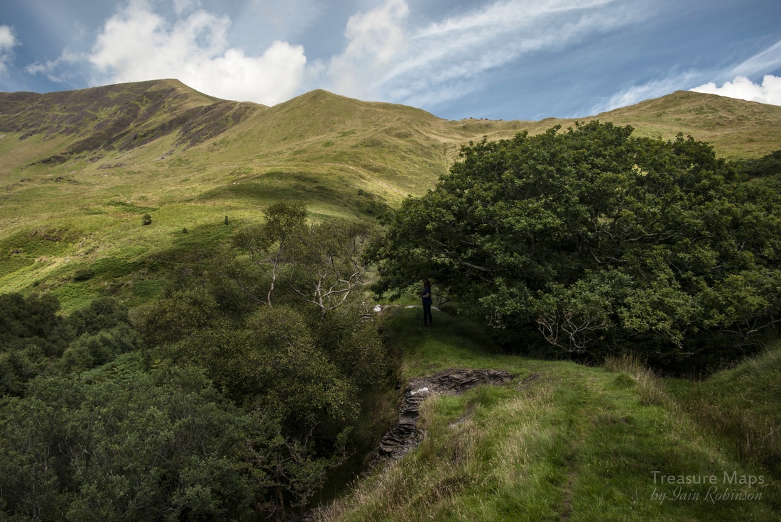 Petra shelters under the trees from the sun and inspects the reservoirs. I have a confession to make now. I failed in my mission as a blogger, as I didn't take any photographs of the Prince of Wales mill, or the cutting, both of which are of interest. I must also admit that I have been along here twice. The first time, well I forgot my memory card and on the second occasion, I couldn't manage to get a decent shot of either. Some photographer, eh? So here are a couple of shots in lieu, thanks to the kind folk at Geograph. Many thanks to John Gibson for the above photos. Once past the cutting, which has now substantially collapsed since John's photo was taken, we headed along until the incline was reached, passing a substantial stone field barn. The ground became increasingly bracken infested here, and I would recommend investing in one of those tick removers if you are thinking of coming this way in summer. 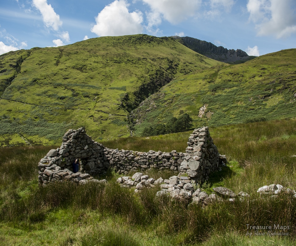 The field barn-views from now on just keep getting better! The incline is quite a long pitch, although not particularly steep. It is broken two thirds of the way up by a stream, so a little portage is needed. According to a prospectus issued in 1874, the incline is "255yards long with two lines of rails" Needless to say, the rails have long since gone. Once at the top, the tramway formation continues towards the mine. What I thought was a mine tip above turned out to be a large glacial feature! 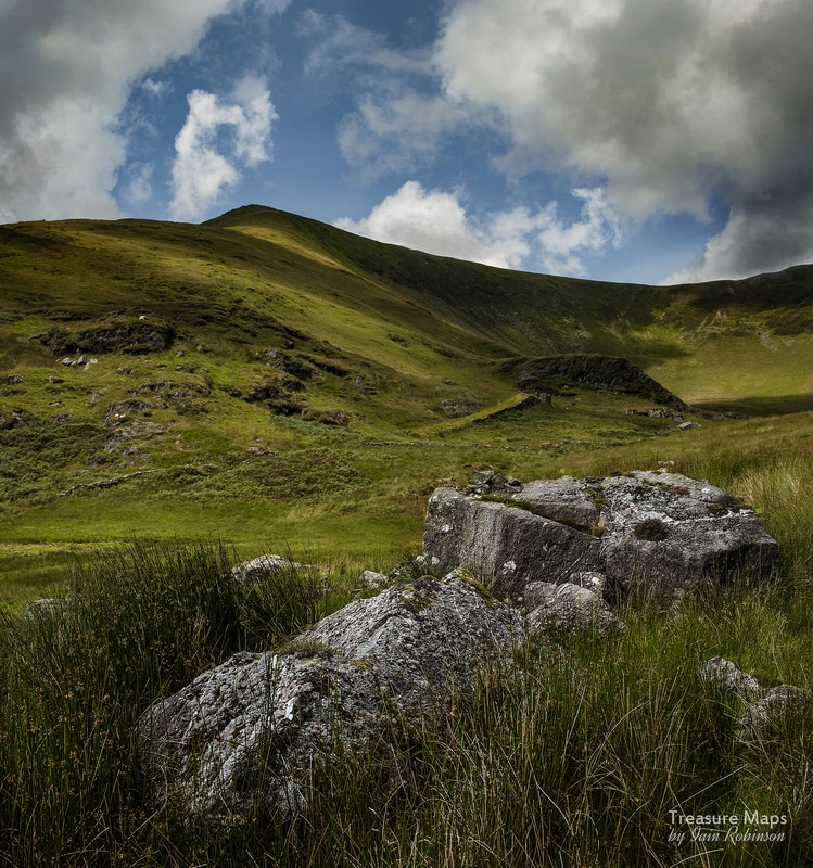 The incline seen from a handy rock foreground. 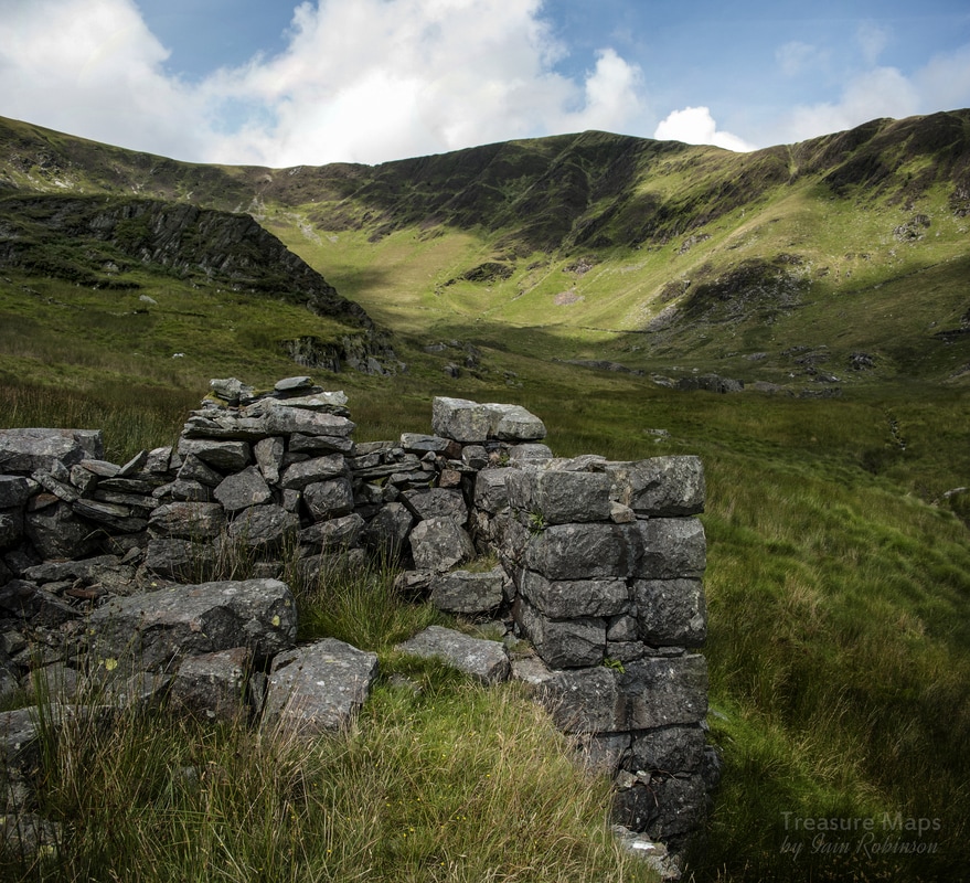 The top of the incline with what I thought was the mine spoil tip behind. The eagle-eyed might spot a mine tip further up the cwm, though... The tramway wanders delightfully via a small slate slab bridge to the mine buildings at this top level. These mostly date from 1876 and are, of course, ruinous but picturesque. A massively constructed masonry wheelpit is the first structure encountered (41ft) with the crusher house remains alongside. Various other structures are mysterious, perhaps a winder house...all structures have been buttressed in one way or another, perhaps due to the boggy ground. 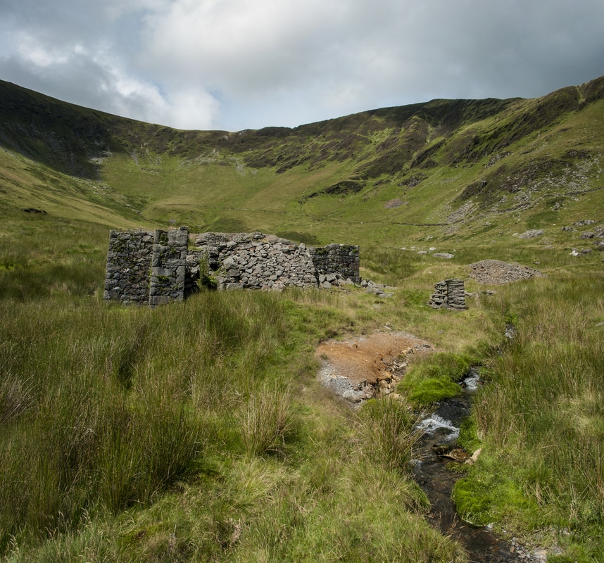 The processing area, with the large buttress to the crusher house and one of the mysterious pillars, perhaps for flat-rods. Underground, there were crosscuts driven from a shaft...later two more, but all proved to be insubstantial with regard to lead or copper ore yielded. The mine was abandoned in 1878. The situation regards funding and prospects was well summed up by a corespondent to the "Mining World" , a journal of the time, who said: "Some companies, like man himself, are born to trouble, as the sparks fly upward. They are launched into a sea of difficulties and the waters never seem to subside until they have engulphed (sic) them. ...I do the Cwm Dwyfor Company no injustice when I say that from its very birth till the present time it has been in all the throes of financial agony. Its career has been unenlivened by a single ray of hope, and it is hard to attribute its present existence to other than the rhetorical flourishes of it's management and the sanguine reports of its officials...." Back on the ground, there is a substantially built barracks which is the best preserved structure on site, perhaps due to its siting in the lee of the hill. There is a grass-grown adit nearby which appears to be a slate trial, and an ad-hoc powder magazine which uses a handy rock outcrop for one wall. 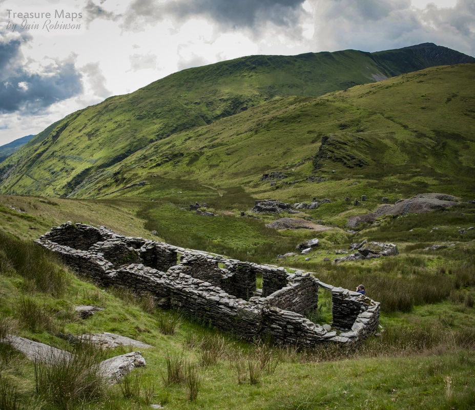 The barracks, with the mine below. In conclusion, a fine walk rewarded by some very interesting mine ruins. There wasn't enough time for us to investigate the trial further up towards the headwall of the cwm, perhaps one for another expedition. It only remains to advise caution at this site, as there are deep shafts that are overgrown.
0 Comments
|