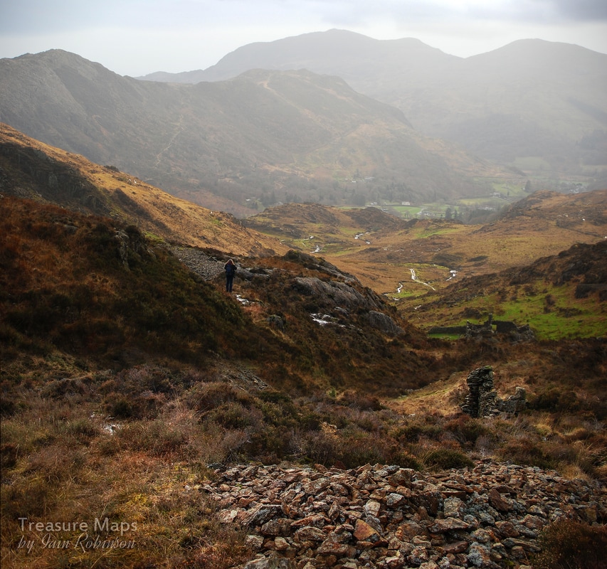
 Petra looks down the cwm from the lower levels of Hafod y Porth mine. This very interesting old mine lies away in a cwm called "Cwm y Bleiddiau" (valley of the Wolves) on a foothill of Yr Aran, north of Beddgelert. The best way to see it is to start from the NT car park at Craflwyn Hall, outside Beddgelert in Nant Gwynant. There's a £2 suggested charge which seems very reasonable. We followed the green waymarked route from the car park, although the signing is slightly confusing. Basically you need to be going up and to the north east generally. The paths are well made, although on the two occasions we have been, they did resemble a quagmire in many places...but it has been a wet winter, they will probably be fine in summer. After a while, the waymarkers go from green to black...black is NT shorthand for "any old footpath". The path you want actually goes past the mine and on to meet the Watkin Path a few miles later. 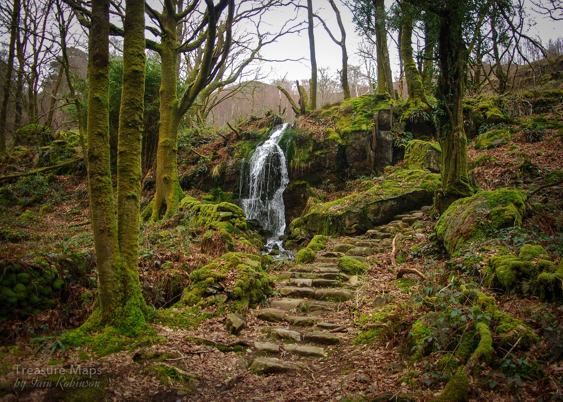 However, the woods, the Coed Craflwyn, are very bonny indeed especially in winter when the shapes of the old trees can be appreciated. They are well-managed and maintained. The path climbs quite steeply for a mile or so until a viewpoint is reached; here you can look over to the volcanic outcrop of Dinas Emrys, where Myrddin Emrys (Merlin) made his first appearance on the mythic stage, and set the mould for Wales' most enduring symbol, the red dragon. The legend is here. 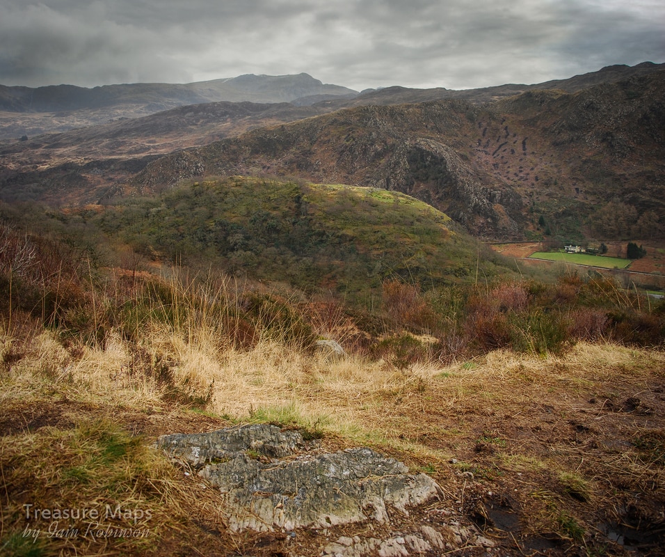 Dinas Emrys. The farm to the right is Cae'r-moch (field of the pigs). Someone has been burning off heather growth on the slopes of Bwlch-y-Re. We struck up from the viewpoint through a glade of the most beautiful oak trees...the path had been laid with igneous blocks, winding through the eight or nine trees; they were stunted and wind-harried, but no less beautiful because of that. The path then dived over a stile and on to the mountain proper. It seemed to be going the wrong way; but we bore with it and in half a mile there was a junction, we took the right hand path. 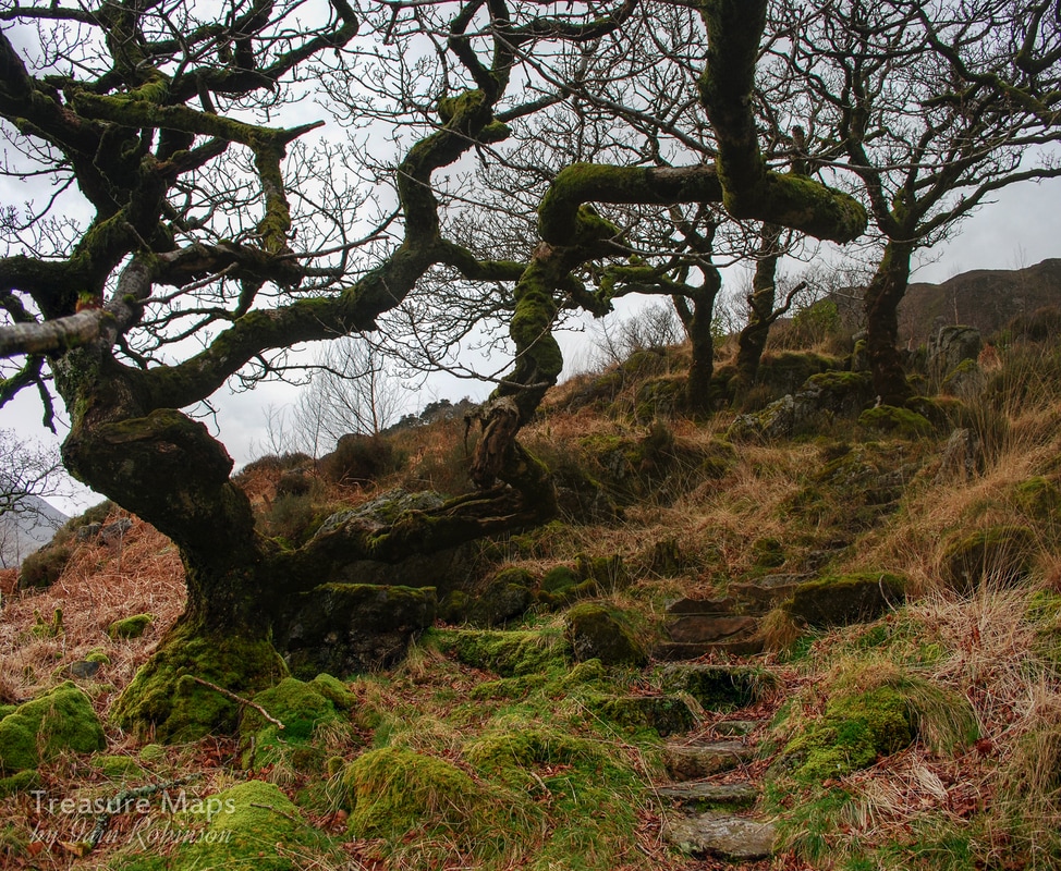 The path now consisted of large and fascinating blocks of Dolerite and Breccia, laid like stepping stones. At one time, this was a hunting estate and the paths would be laid over the hill to make it easy for hunters to go about their fell business. At least, today, we can reap some benefit from their activities: the blocks are still well laid and steady except for a few places where a stream has completely breached the path. The landscape became wilder, any trees were now low, stunted bushes. To our left, we saw the shape of Yr Aran above as we came into the lower part of the cwm and took our lunch in a ruined field barn. The path follows a well-made mule track from a ruined powder store beside the Afon y Cwm, up to the mine, although there's still a lot of climbing yet. We were confused by the powder store; it looks like a relatively modern construction, possibly mid 1800s. Yet, there is already a good, serviceable powder house at the mine. Perhaps this one was built later...there are no other mines around, unless we consider the Bwlch yr Oer copper mine, but that would be a step!  The first magazine encountered...on the edge of a stream, with a mule loading bank next to it. The path became the remnants of a road, cobbled with glacial till for a while. A reminder of the weather in these parts was the wreckage of a gate we'd passed through last time; a few weeks later and it was matchwood, destroyed by the relentless winds that blow up here. It can't be easy keeping this upland area viable. The National Trust are busy installing water power at every opportunity, and we saw some evidence of that up on the Afon here...all very unobtrusive and very clever. But they are doing something else which gives me hope for the landscape. Over at Hafod y Llan farm, they have reduced the head of sheep on the farm by half, and are now attempting to run the sheep using the traditional "Haft" system ("Cynefin" in Welsh). That is, each ewe has it's own territory, passed down from mother to offspring. The result is less impact on the landscape and no need for fences as the sheep gravitate to where they feel they belong. It's how sheep farming was done before economies of scale turned everything on it's head. One thing the system does need is a full-time shepherd...I wonder if we will see the return of the pony, rather than the quad bike? As someone who was brought up on a hill farm and had my own flock of Blackfaces, I will be watching this development with interest. Now the mine came into view above us. It's a very inhospitable landscape, almost like a western movie set. I can imagine a handful of black hats riding over the ridge, six guns drawn. The grass is yellow, the heather brown and rocks break out of the herbage like holes in a threadbare stair carpet. The road became steeper and soggier, but eventually we puffed and panted onto the flat area where the manager's house is built. 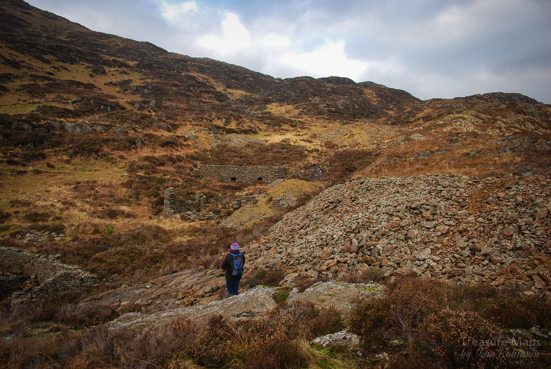 The middle levels of the mine, with remains of dressing floors, flotation ponds, stamps batteries and spoil tips. The spoil was mineral rich, which leads one to suppose that they hadn't such sophisticated ways of processing the ore that was found. 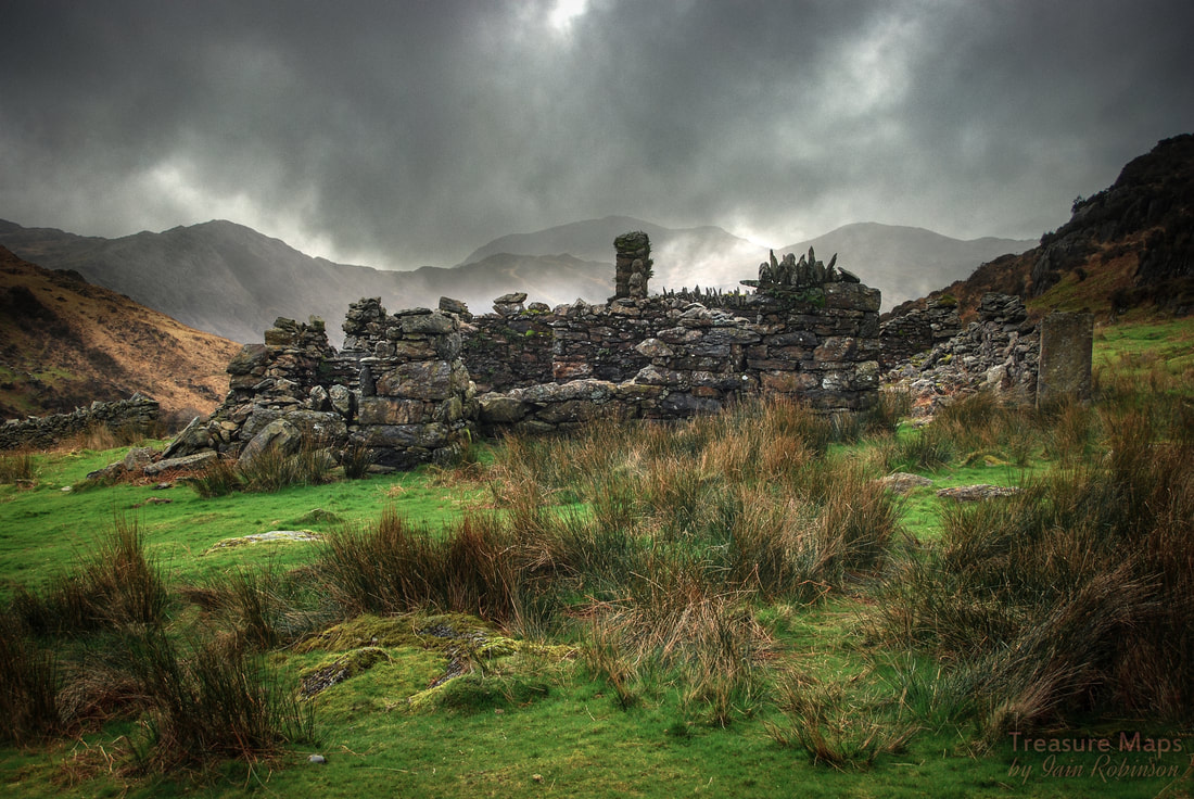 The Manager's house, almost a fortified little manor, with high walls on the west side surrounding a courtyard. There are no records of who the manager was, or how he fared here...I imagine it got pretty windy! There were stores and a blacksmith's forge within this complex. 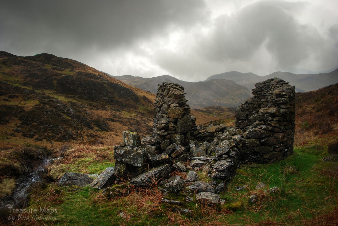 The second powder house was up on a knoll behind the manager's house. It didn't seem like a sensible location, and I wondered if it was an early magazine that was superceded as the mine worked down from the top of the hill. So...what was the story with this mine? It seems to have covered a few acres and there are many structures, some difficult to interpret, including one at the top of the sett that seems like something from a fairy tale. Records are sparse, and I am indebted for some information to J.L.Agnew, who studied the mine as part of his Msc course in 1988. According to his research, the first record about the mine appears in 1755, but it is likely to have been in operation well before this, as with the copper mines of the Migneint. The mine is mentioned in W.J.Lewis "Lead Mining in Wales" (David Davies Papers, 1801-2) as a going concern in the mid 1700s. It seems lead was chased as well as copper. We do know that that there was a 24 foot waterwheel and a 8 head stamp battery, plus many other unexplained structures, but according to official returns, the mine was never profitable. Smaller mines were not required to make official returns before 1867, so perhaps there was some obfuscation with the figures. However, in 1869 the mine only produced 18 tons of dressed ore, with 6.4 % of copper. The record books close on the mine in 1890, when it was abandoned after changing hands for the last time. 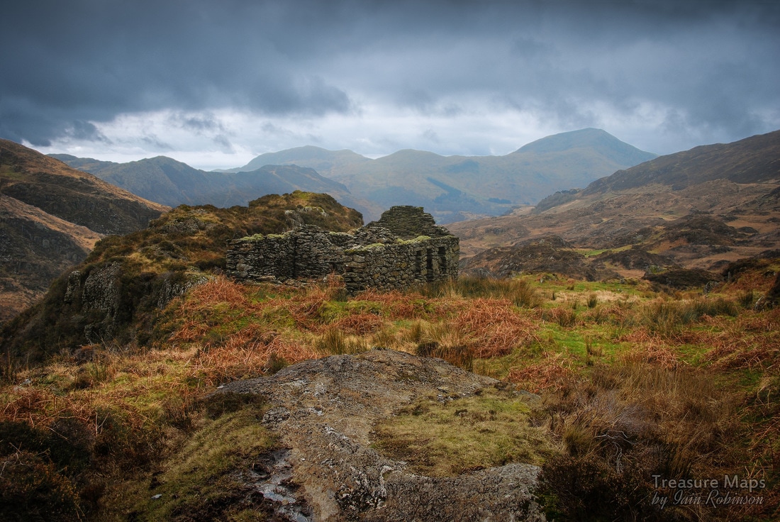 The miner's barracks near the top of the site. A rock outcrop is in the foreground. Looking in some of the adits (there are seven) it becomes apparent that the search for ore was a fairly unsophisticated one with, as Agnew puts it, "no real geological insight". The adits are fairly stable, wet, unpleasant and yet....fascinating. No.3 is the most interesting and illustrates well how the miners literally chased a vein through fault zones, looking for clues in the rock. This is the largest excavation, and switches backward and forwards underground. It is punctuated by shafts from above, which may well be for ventilation. There is a flooded winze towards the end which is at least 2m deep. The rock in the whole area is a fascinating mix, as you would expect from an area of volcanic activity. It seems there was a hydrothermic system which erupted from the side of a caldera, so that the rock here is varied from Breccia, Tuffs, Rhyolite, Dolerite and surrounding measures of sandstone. In the latter years of the mine, much equipment was sold, and the ore had to be dragged over the bwlch to the Hafod y Llan Mill (SH65623521). Not a rosy prospect! In conclusion, yet another fascinating relic, almost quixotic in nature- yet people worked hard here, there was evidence of considerable resolve and determination. Perhaps it supplied some people with wages for a few years; back in the mid 1800s that was perhaps all a miner could ask for. I wish we had some records of the workers, who they were, where they came from. Ironically, a geophysical survey of the site came up with a zone of intense magnetic activity (indicating mineral deposits), around the margins of the complex. There was a plan in the early 1970s to explore this by drilling, but luckily nothing came of it. 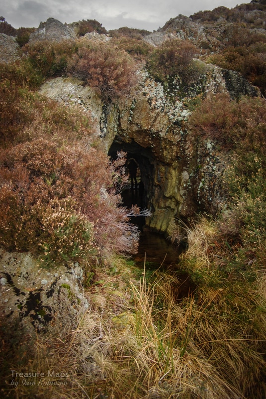 Petra in no.3 adit, highlighted by a ventilation shaft. 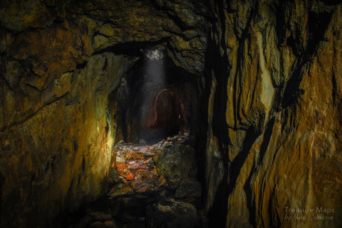 Deep in no.3 adit with light coming from a ventilation shaft. 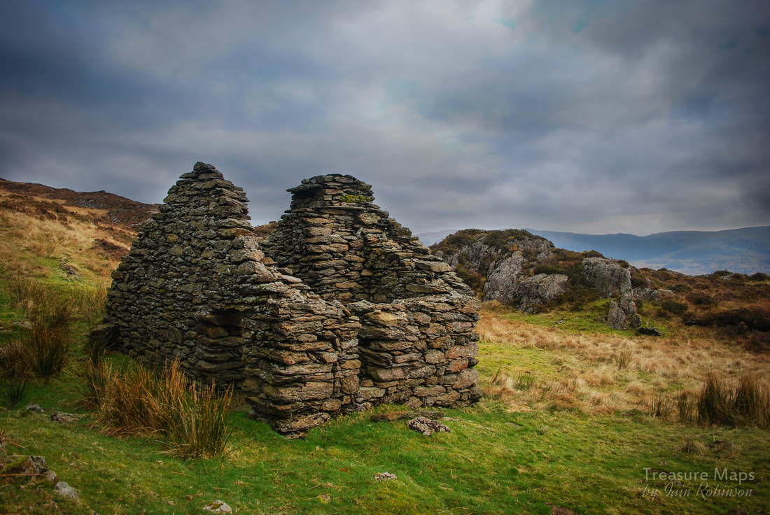 The "Fairy House"...probably a repurposed shepherd's cott, but the fireplace in this structure is huge!
4 Comments
|