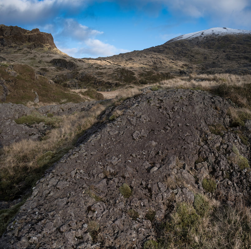
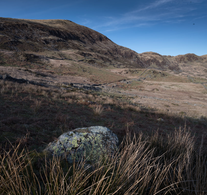
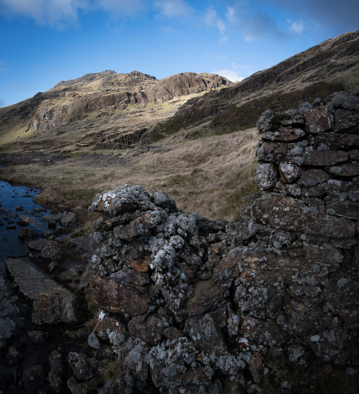
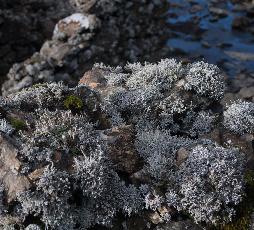
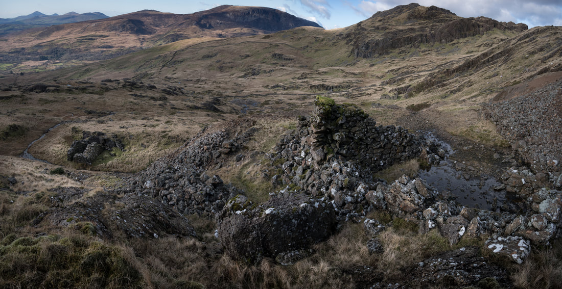
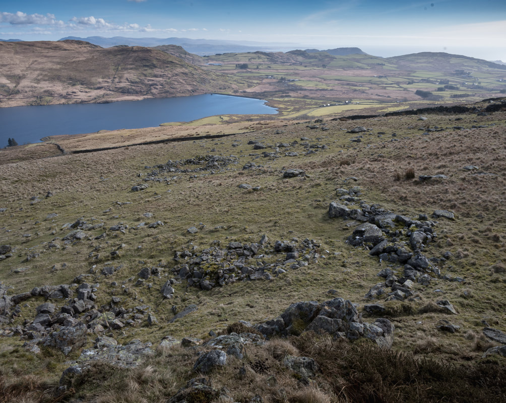
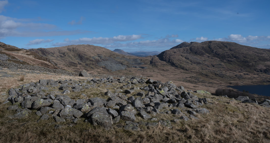
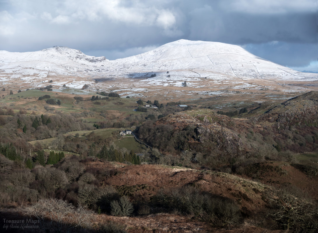
 Moel Hebog in winter, with Moel yr Ogof to the left. Taken from the west side of Cwm Pennant, on Craig y Garn. Moel Hebog has so often been the backdrop to our adventures in Cwm Pennant. It seemed almost to loom reproachfully in the background, chiding us for not being bold enough to come and walk those patchworked slopes. Well, it took a while, but we finally decided to take a closer look at this imposing eminence - and we weren't disappointed. Our first exploration was to the Moel Hebog mine, a place I had long wanted to take a look at. It's best reached from Cwm Pennant. We parked in a quagmire at Cwrt Isaf farm (SH 5399 4640)- the sheep watched with considerable curiosity as we paid in the honesty box. It might have been wet, but parking here cuts out a mile and a half walk up the road from the only other parking spot, outside the Pennant Chapel. 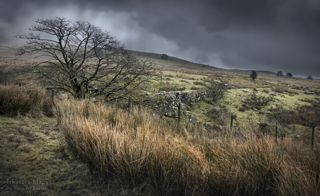 A wet day on Hebog. The Gorseddau tramway crosses the Afon Cwm Llefrith on a substantial embankment. The route up Cwm Llefrith (on a public right of way) starts to the right of the stone barns, through another muddy swamp and on up the fields towards the ruin of Cwrt Uchaf. Little more than a cart shed survives now. Gradually, the views over Cwm Pennant opened out as we gained height, and I was glad to take a rest as we reached the formation of the Gorseddau tramway where it crosses a gorge cut by the river. There was a bridge here, but it has disappeared with the passage of time, rather than trains. To the west, the tramway heads off through a cutting on the 240 metre contour towards Cwms Trwsgl and Dwyfor, a lovely walk and one I want to share with you in another post soon. We went on, to the left of the Afon Cwm-Llefrith, following a well-trodden and often soggy path- it was February, after all. The landscape quickly changed here to straw coloured tussock-grass as the ramparts of Hebog and Ogof rose ever higher on the horizon. In between the increasingly rocky outcrops, feint hints of structures, sheepfolds and settlements could be seen. The landscape seems deserted now, but that was obviously not the case earlier in the history of this area. 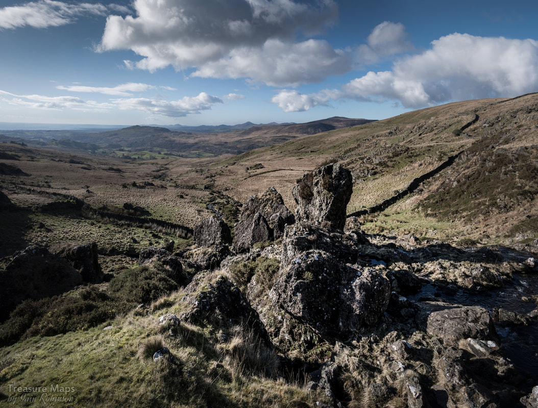 Look at that view! Not half way up the slopes of Hebog. This is looking back above a waterfall that we had just negotiated towards Cwm Pennant and beyond, the magical outlines of Yr Eifl- the Rivals. We'd been walking on a route that had so far avoided the walls that cover the mountain in a dry-stone lattice work, but eventually the path led us to a stile, where the landscape changed again. Now we climbed a small but imposing waterfall to reach a plateau with more walls. The rock was predominantly brecciated Tuff, which is composed of small volcanic bombs, bound together like a currant scone mix with volcanic ash, fused together under heat and pressure. It's nice and grippy to walk on, but sore on the hands. It is said that many of the walls around here date from the Napoleonic era, when prisoners of war were forced to build them- but they are built so skilfully and solidly, and run for so many miles- I know we won and all that, but there can't have been so many prisoners, surely? 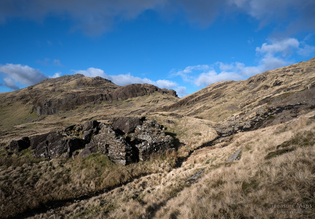 The Hebog Mine smithy, with excavations all around. The mountain in the background is Moel yr Ogof. The mine After more arduous climbing, a dark and ominous gash in the mountain appeared. One of the earlier excavations of the mine, stoped out and worked, seemingly by hand and without any mechanical assistance. There was a strange cavity in the tip here, a small space which Coflein suggests was a powder store...I am not convinced. We trudged on to the north west and found a very fine forge structure, on the line of what could have been a tramway. Curiously, many roof slates were stored in the fireplace, as if for future use. The other thing about this structure was that it was built from granite and dolerite blocks, while all around were tuff boulders. The rock that the smithy is resting against is a huge tuff outcrop. Adits opened out above and below, with attendant tips, but only one of the adits was worth investigation- the middle adit, which has the ruin of a dressing shed beside it. The others are trials and are either flooded or of too little length to be worth exploring. We followed the main adit to a small chamber, where it continued to a fork. One tunnel went on to a blind forehead, while the left fork continued to a collapse. After the collapse, the tunnel continued on into the mountain, but since the water was at least belly height, neither of us fancied going any further! 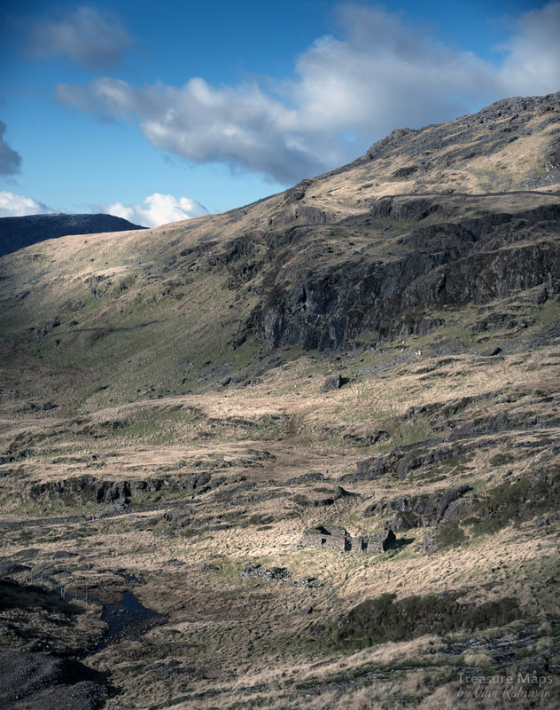 The barracks- this shot indicates just how isolated the mine was. You can also see the remains of an earlier structure immediately in front of the barracks. A little way across the mountain, we found the barracks. On the original plans of the sett, a "miners house" is marked- this ruin is in the approximate place, although there were worked stones in front of it that might date from earlier. We found the broken remains of a cast iron fireplace inside. The men working the mine certainly needed a barracks, and a solid one at that. Work continued here for 8 months of the year...as the mine captain, Henry Marshall put it: "the situation being so exposed that in the winter months, no work can be done". The mine was first opened in 1837 and while copper was found here in some quantity, the difficulties of transport over adjoining land made the situation untenable. Nevertheless, the mine changed hands a few times before being abandoned in 1889. There are some descriptions of a sled-way down the cwm- and there is a strange, solitary wall at the lower part of the mine which might have been something to do with an incline, but I suspect the produce left the mine on the backs of unfortunate Mules. 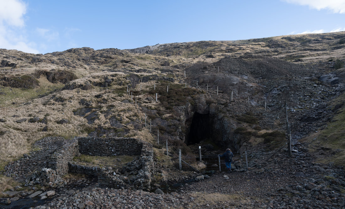 The middle adit and processing area. As often was the case, the promoters of the mine resorted to many wildly exaggerated claims for the mine, that it was a "mountain made of copper" and that it contained untapped reserves of gold. The reality, standing beside the forge on a cold february day, was fascinating from an archaeological point of view, but a dreadful prospect for those unfortunates that had to work the mine. A Place of Mystery For our next foray towards Moel Hebog, we started from Cwmystradllyn, taking the route of the Gorseddau tramway, but then striking north up the ridge of Braich y Cornel, shortly after Tyddyn Mawr . We wanted to look at some of the many prehistoric settlements marked here on the map to see if there was anything left. The first one we came to, at SH 5524 4467 was nothing more than a series of depressions and ridges in the hillside- hard to imagine that this was once somewhere that people had lived out their lives. However, the next couple of sites were much more rewarding. At SH55624527, we encountered a cluster of tiny ruins underneath an outcrop of rock. I discovered later that this is called the Plas Llyn huts and enclosures. Coflein vaccilates between calling it a sheepfold and a settlement, but I would say that it would be fairly useless as the former, the compartments are not big enough, nor are they linked in any way. As a collection of huts, it is fairly small too, but to my untrained eyes, looks more probable. This, according to Coflein, is early mediaeval. 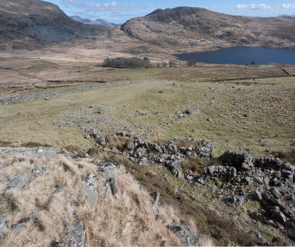 Part of the mediaeval settlement, looking towards Llyn Cwmystradllyn and with the Moelwyns peeking out from behind Moel Ddu. 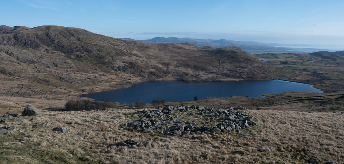 One of several hut circles on the south eastern slopes of Hebog. This one had a door opening facing uphill and was approximately fifteen feet across. We encountered other features, in many ways just as mysterious until I found out later from a local farmer what they were. We'd noticed on many occasions, during our wanderings on the moors, a length of wall in the landscape, sometimes no more than ten feet in length, sometimes in an "L" shape. I had puzzled over these, wondering how they could have ocurred and why, since usually they were isolated and at some height. It turns out that they are for the most part prehistoric in origin and are walls to gather sheep against, or to shelter sheep from the weather, of which there is rather a lot of in this location. 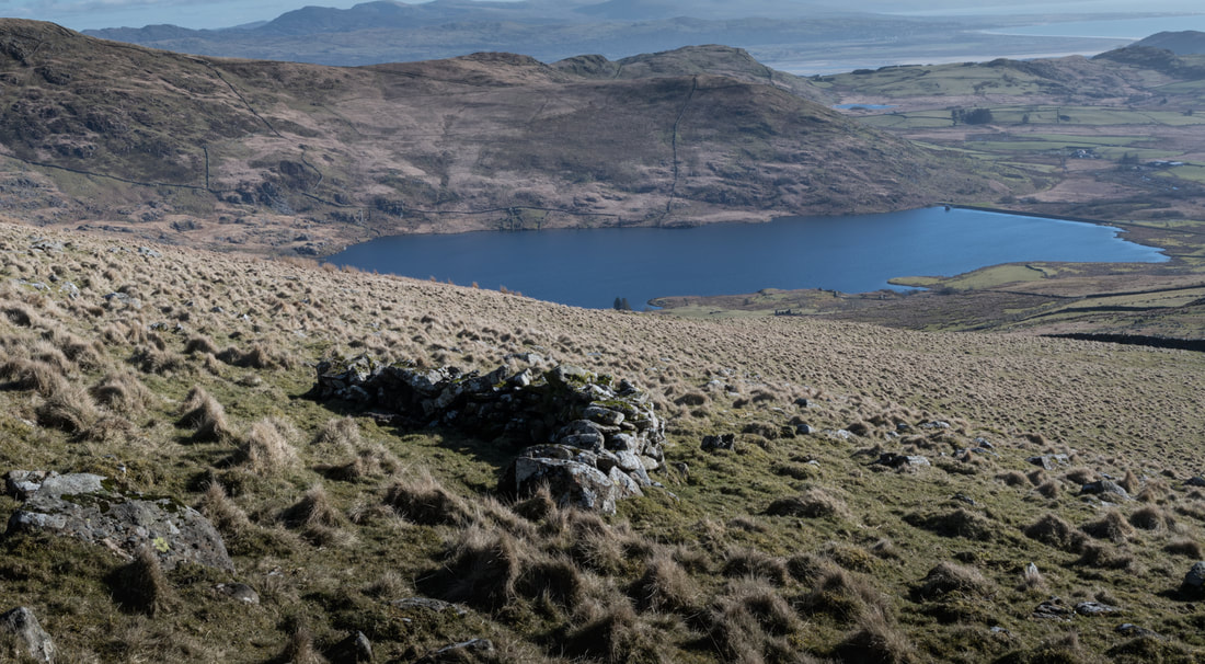 An L shaped sheep shelter on the slopes of Hebog. There are also some 20 foot long examples up here- incredible to think that they date from prehistoric times. After a while, fossicking about on the slopes of the mountain, I realised the sound I had heard feintly without registering it properly was getting louder. A group of four wild horses came into sight, galloping past us...the noise of their hooves was very impressive at close quarters. I love horses, but felt considerable respect for these as they rumbled past- and of course, I was gripped by camera incompetence, as is customary whenever something fleeting and never to be repeated happens. My photos were those of a complete noob. The horses were beautiful, though, take my word for it. They settled for a while, about a hundred yards away from us. It gave me pause to think that they must have jumped over some of the walls to get here, unless they know of a gap that we hadn't seen. 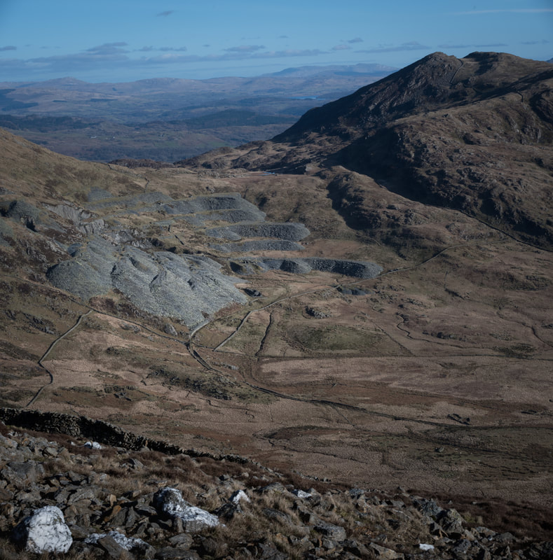 The Gorseddau Quarry from the boulder fields just below the summit of Hebog. That intriguing and rough hill, Moel Ddu is to the right, while Glaslyn and then the Arenigs rise in the far distance. The perfect, textbook layout of the quarry is very evident here...such a shame it was a colossal failure. We'd been concentrating on the ground for so long it was wonderful to take in the views of the landscape, in particular the Gorseddau Quarry from Hebog's slopes. Truly a different perspective on a familiar place. Our time had run out again, but I felt that honour had been satisfied, we had paid tribute to Hebog, the hill of the hawk- climbed his fascinating slopes and found much to puzzle over. We descended in the evening light, still having failed to reach the summit, but rich in the discoveries we had made. For information about Treforus, the abandoned quarry village under Hebog, go to this link. Other information on the Hebog Mine can be gleaned from "The Old Copper Mines of Snowdonia", David Bick - Out of print, but copies turn up on Ebay. 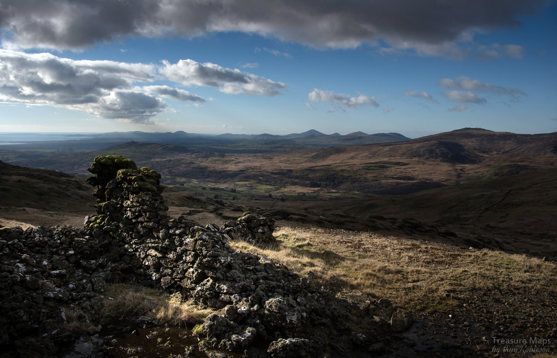
0 Comments
Your comment will be posted after it is approved.
Leave a Reply. |