|
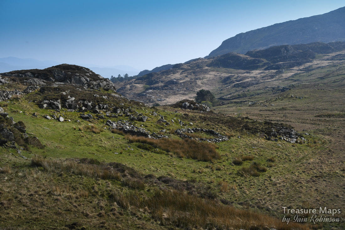
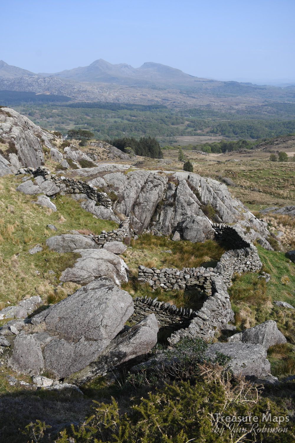
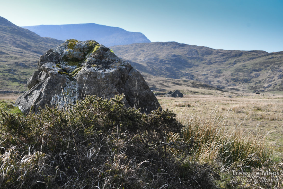
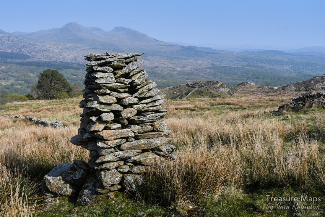
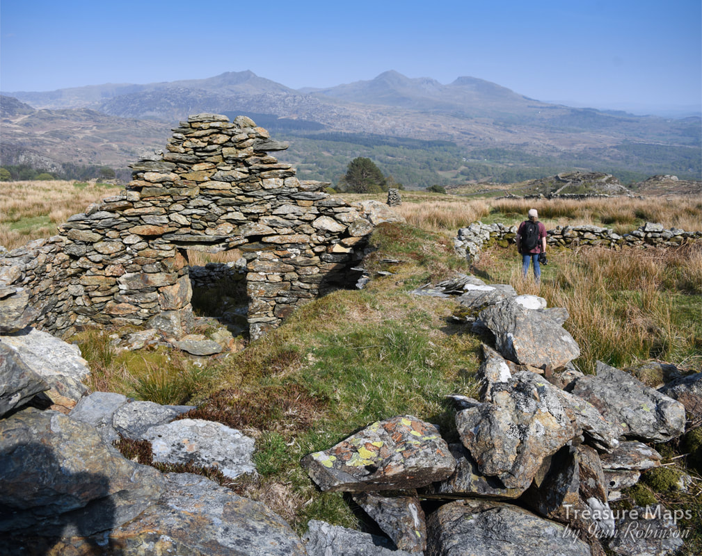
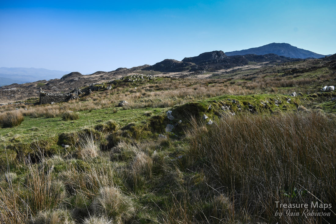
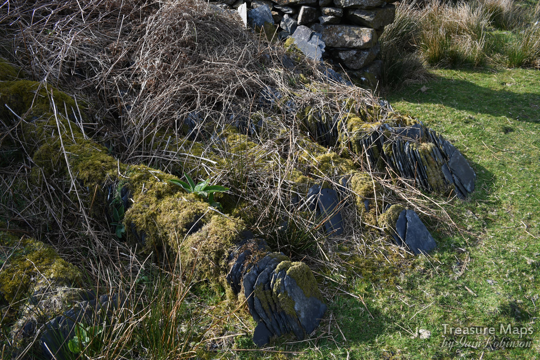
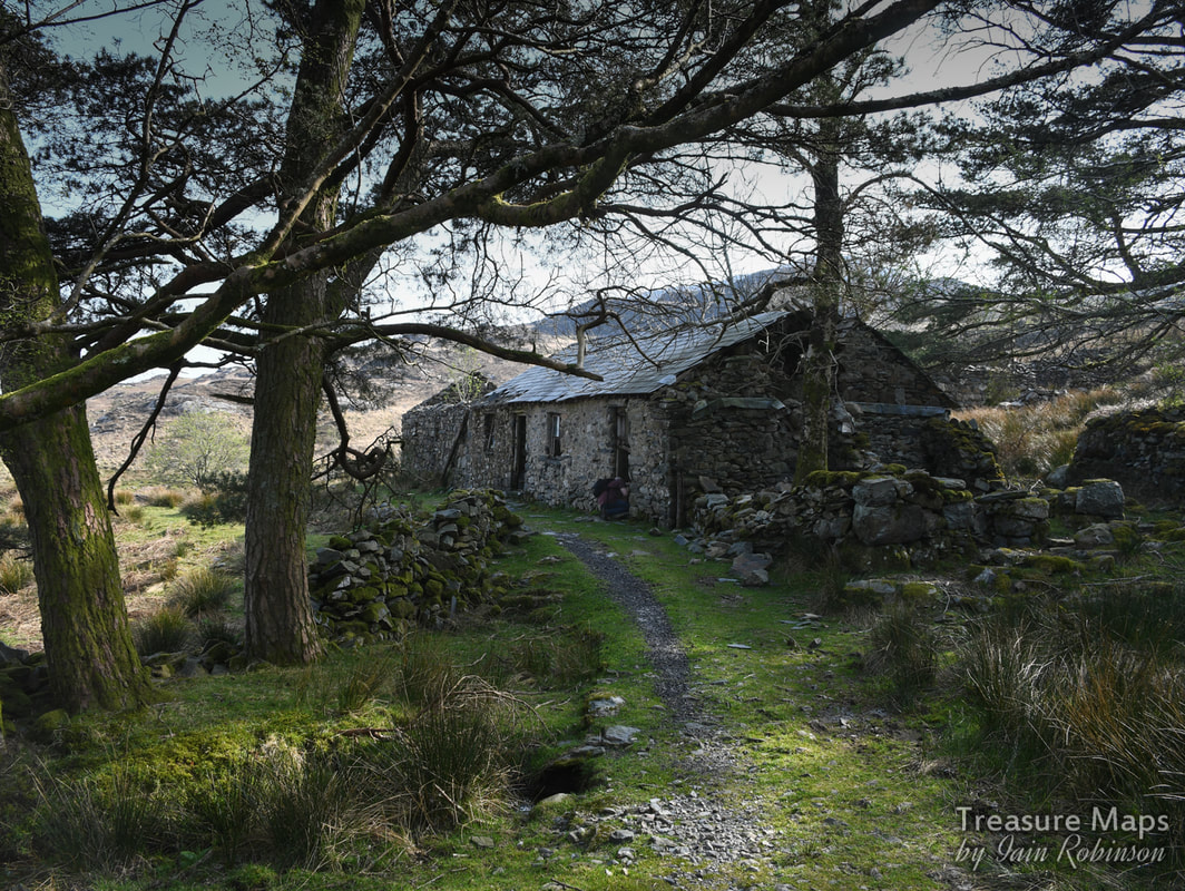
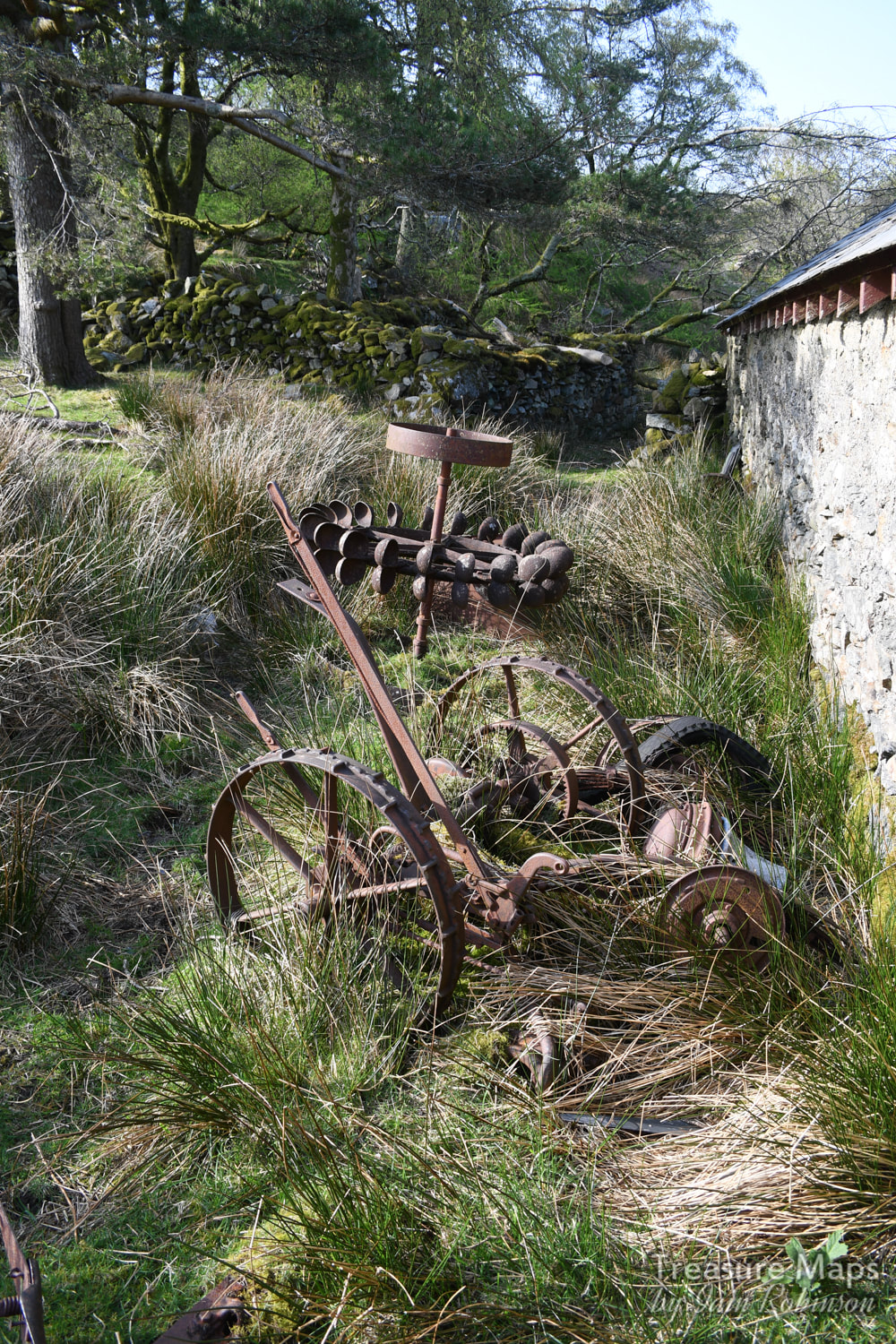
Part two of our adventures above the Aberglaslyn Pass. 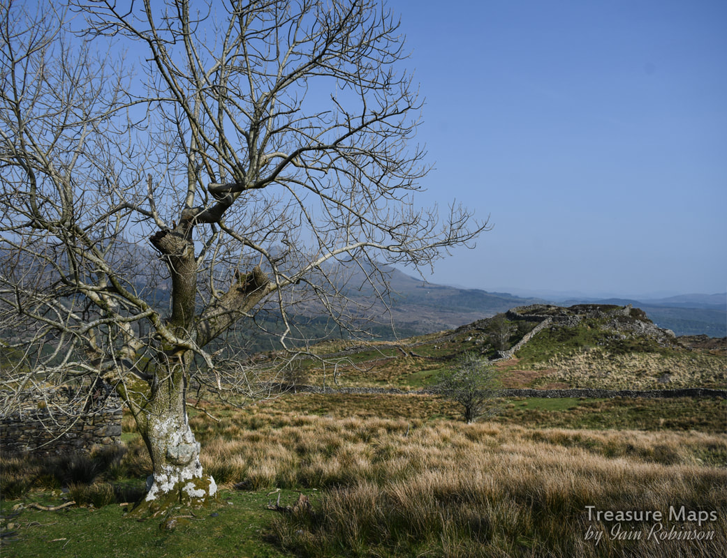 The "defended enclosure" of Pen y Gaer seen from Oerddwyr Uchaf farmhouse. So, last time, we were on the hilltop at Bryn Du, having taken a wrong turn and wondering what we could do with the rest of our day. We started to wander back along the path towards the Coed Aberglaslyn. Then I had an idea that we could skirt the upper boundary of the woods and perhaps access the country that forms a plateau below Moel Ddu- the ground was dry and firm, after all- and it was open access land. And that was what we did- a bit of trackless stravaiging. It was tough, through heather and Johnny Breakleg grass, but when we got to the top of a big rocky ridge we realised that it was going to be good...we could see the fort that had been our original objective in the distance! 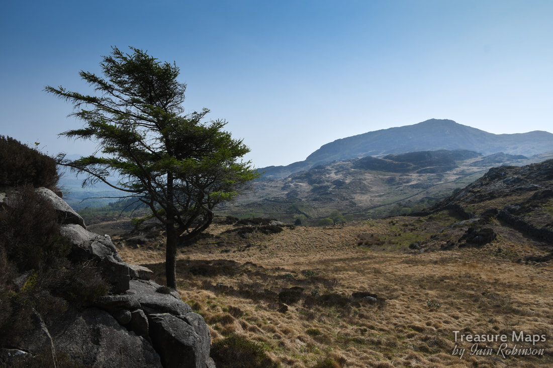 Our first sight of the objective, from the rocks above. Pen y Gaer is in the very middle of the shot, right of the tree in the distance. Moel Ddu is in the background. It wasn't even a particularly difficult scramble across to where Petra had seen a trackway. After a while, we stopped on a rocky knoll and had a snack. A raven was sunning him or herself while a Wheatear landed quite unafraid of us a couple of feet away. With the wonderful sunshine, it felt idyllic. I turned to the west and immediately spotted two adits in the hillside- yes, mines! We looked at the country and our time left and decided to leave those for another day. There was already a plethora of prehistoric and mediaeval stuff to investigate in this valley without yet another five mile detour. That will be my next post :-) We began to descend, looking out for the settlements and ancient cairns that are littered here, according to Coflein. What we didn't expect were the remains of old beudiau (is that the plural of "beudy", meaning field-barn in Sais?), of more clearance cairns, gorlans, burnt mounds and standing stones. We had a heck of a lot of fun identifying, photographing and debating over them. We found old boundaries that could have been pre-mediaeval, trackways, marker stones and so on. I am pleased that there was an upland study initiative in North Wales that catalogued all this stuff, allowing us ignorant folk to potter around having fun. Here are some photos of what we found. As we descended lower, towards the fort, something else emerged from behind a screen of trees- the most wonderful deserted farmhouse. It was so charming and looked like it had been used recently as an informal bothy- there was an (empty) whisky bottle in one of the windows. Outside were the remains of a pelton wheel and an old mechanical mower. I was quietly hoping to stumble over an old Fordson, (as happened to us at Bwlch y Plwym), but no such luck. The farmhouse was Oerddwr-Uchaf, ("Upper Cold Water") and the plaque on the wall told us that this was once the home of a noted Welsh poet, William Francis Hughes - Wil Oerddwr (1879-1966). He was a shepherd/poet who had spent some time working in the USA. I searched online for quite a while but couldn't find much out about Wil Oerddwr, except the rather ominous note in the Gwynedd archives to the effect that: "Beudy Brynybont ...was a cattle and hay shed and was last roofed by the bard Wil Oerddwr [William Frances Hughes] of Oerddwr [Uchaf]. Mrs. Jones mentions the storage of furniture here in her tapes (when the men were away and the villagers were herded out of their houses)." I wonder what that was about? 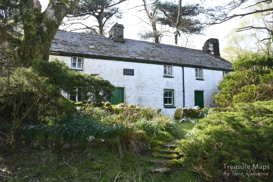 Oerddwr-Uchaf, looking very picturesque. I will update this when I have more to tell. The house had a good feeling to it, felt like somewhere I would have liked to stay for a good few years myself- but perhaps that was the weather lending everything a rose tinted ambience). Nevertheless, I felt that you would have to be made of stone not to be inspired to poetry by this exquisite landscape. Here are a couple more photos I took of the place: We made our way down to the hillfort, which Coflein describes as a "defensive enclosure". Someone, a long time ago, has robbed the walls of the fort to make a sheepfold (gorlan) but in some ways, it makes the place more impressive, if a tad less authentic. Coflein says: "Of roughly oval plan, it measures 46m east by west by 37m. It is defined by a denuded wall up to 3m thick and natural outcrops, on top of which is a post-medieval drystone wall up to 1.5m high. The interior is uneven and rocky, and no remains of huts were visible suggesting that the site was not permanently occupied. The entrance is on the east side. Integral with the post-medieval wall are two sheepfolds." One very interesting feature was the stones around the entrance which are some kind of brecciated plutonic rock. Fabulous. 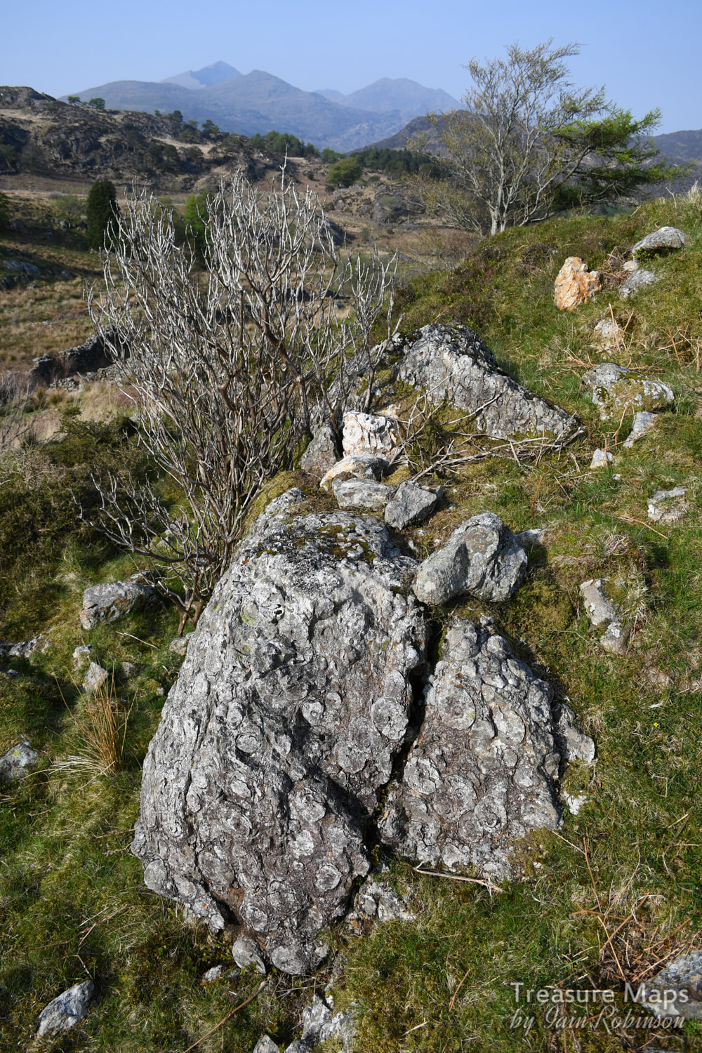 A remarkable chunk of brecciated rock at the entrance to the fort. The trouble with things like hill forts is that while they look great from a distance, they look like nothing from the inside- they are very difficult to photograph. We did study what looked very like some mediaeval house platforms in the small settlement fields beside the fort, and the ramparts were the ideal spot to scope out the surroundings. 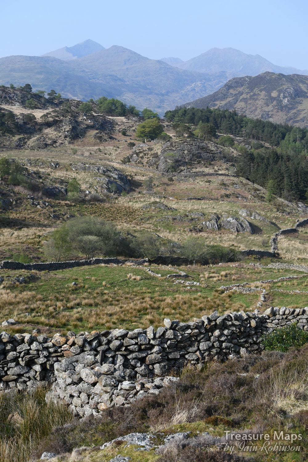 A house platform in the middle foreground centre- also what looks like it might be a chunk of the original fort walling. Snowdon makes the perfect backdrop. 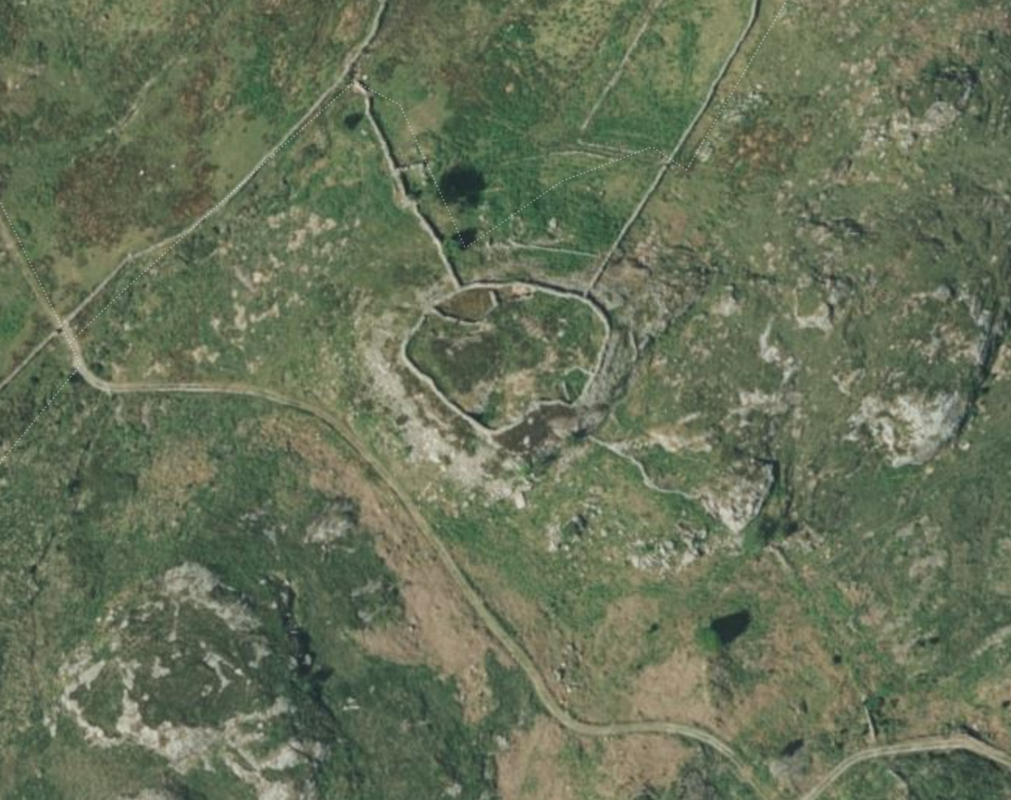 A Google Earth capture showing the fort- this gives a good idea of the layout. We reluctantly made our way down from the fort along a rough road- the road that Petra had seen on the map, leading to the farm. It was time for me to apologise for my high-handed dismissal of the route earlier, she had been right all along. We couldn't help noticing a great number of piled twigs every now and then beside the way- I suspected that they were the remains of rhododendrons, which still infest great parts of Snowdonia- those darned Victorians and their ideas. We passed another beudy, this one was the eponymous "Beudy Brynbont", now in ruins and being harassed by ruthless hordes of brambles. I imagined it full of Mrs Jones' furniture. The road became steeper, then joined a road from a very plush residence, Oerddwr Isaf, a very old house which has been restored and looks very loved. Farrow and Ball paint shades were noted. 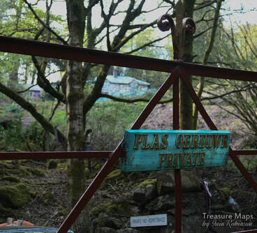 Finally, we were back on the main road which we would have to negotiate on foot, as our parking place, if you remember, had been near the bridge at Pont Aberglaslyn. The first thing of note were the remains of a slate quarry near the road- Dinas Ddu- somewhere I have often wondered about. Sadly, the mill and wheelpit have had their stone used for other things, although there is some leat work and a fine stone cutting leading to the adit. It looked too "occupied" to explore, so we didn't bother. The road walk was a trial...a dice with death. Cars came along so quickly and often an oncoming car would brake and move out to give us a foot or so, only for the car behind to nearly run into the back of them because they were following too closely and didn't react in time. Occasionally, we had to dive into the ditch as cars started to overtake at great speed, leaving us no room. I was very glad to get back to our car! Despite the near death experience of the road walk, it had been a great day. I can recommend the country below Moel Ddu for those who like a bit of reflection and study of ancient history in their landscapes. We'd been out for eight hours and had climbed and walked about three and a half miles, none of it seemed strenuous or difficult. And we'd hardly seen a soul, quite an achievement on an Easter weekend! 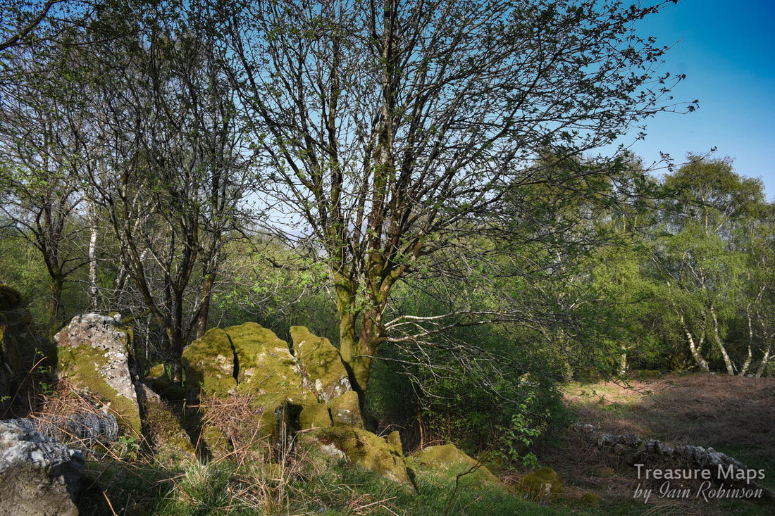 Evening light on trees below Oerddwr Isaf. What is a Burnt Mound?
These are features of roughly crescent shape, a spread of burnt stone and charcoal, surrounding and partially overlapping an oval trough. Water would have been heated in the trough using stones heated on a fire. The stones were added to the water and, after cooling, were then thrown aside, resulting in a mound of discarded, reddened, cracked stone. Whether food was cooked in the trough or, as some have imaginatively suggested, the trough was used for bathing has not yet been firmly established. Incidentally, if you are wondering why this place is also called Pen y Gaer, the name means "the Head of the Fort", so I guess it was a catch-all name for hillforts. Description and photographs of Pen y Gaer on the Modern Antiquarian A link to Petra's description of the farm on her blog, "Hinterlands" |
TracksReceive the occasional Treasure Maps Newsletter- and alerts when a new post is available!
If you enjoy my content, please buy me a coffee!
Check out my other online activity...
Index
All
|
 RSS Feed