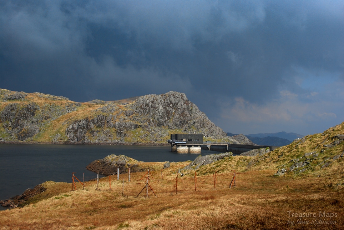
 The tiny reservoir for Wrysgan Quarry, high up above the Vale of Ffestiniog. Like many folk, I stravaige about North Wales looking in hope for the poignant traces of forgotten structures and settlements. Never straightforward, they tell their stories in an obscure, difficult language with many a deception along the way. Despite studying the territory for many years, I am still struggling. Sometimes, it helps that other folk have done the work for me, allowing me to study the margins of a site without feeling completely mystified. Wrysgan is one of those places where clues have been found and enough records left to get an idea of what went on. It's a place near to home, but there is a ferocious climb up a slippery slate track to get there, so I don't go as often as I should. It's a busy spot, too...hard to get a sense of the place with folk hurtling about having the time of their lives.
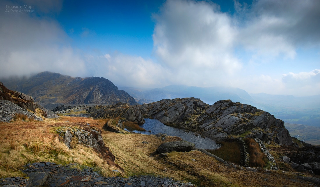
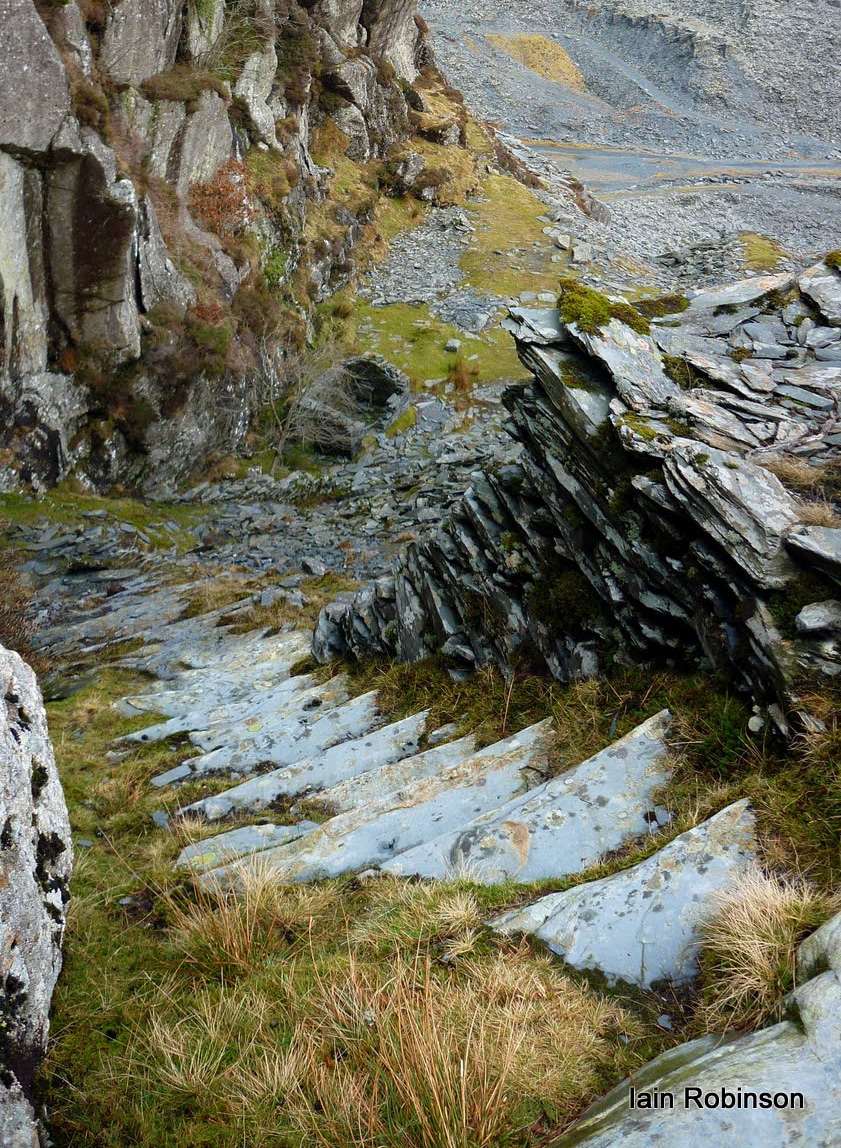
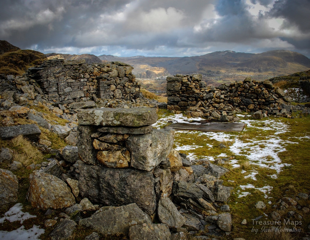
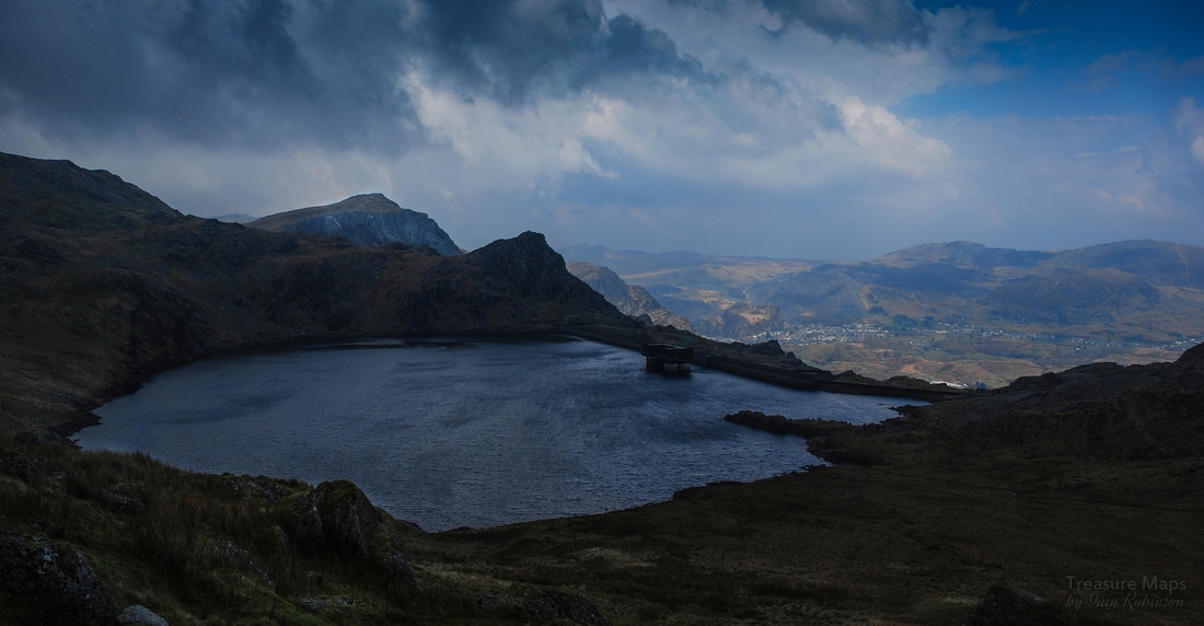
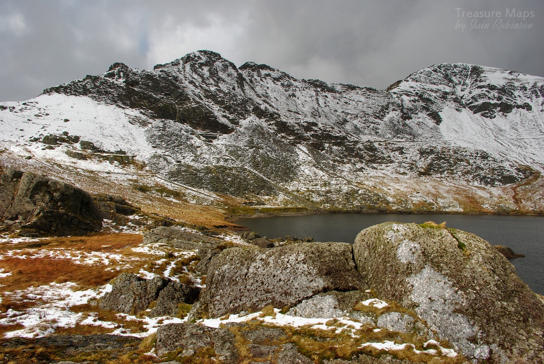
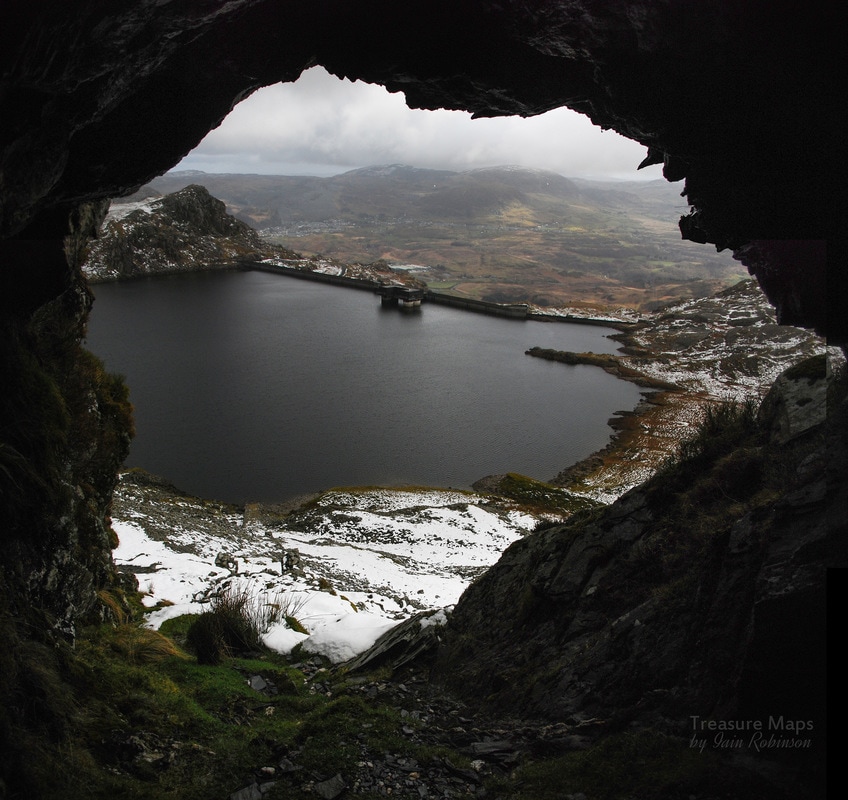
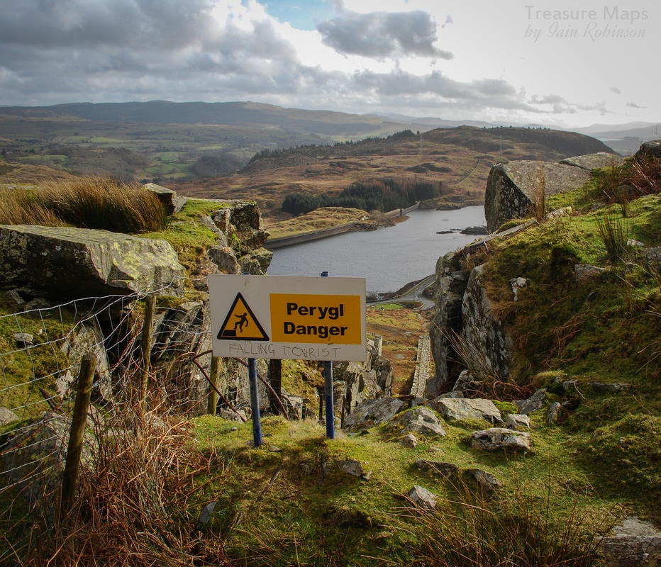
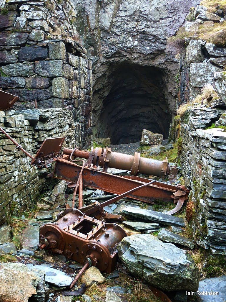
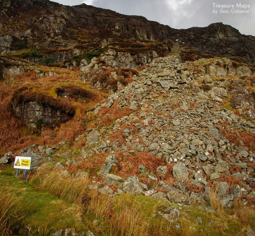
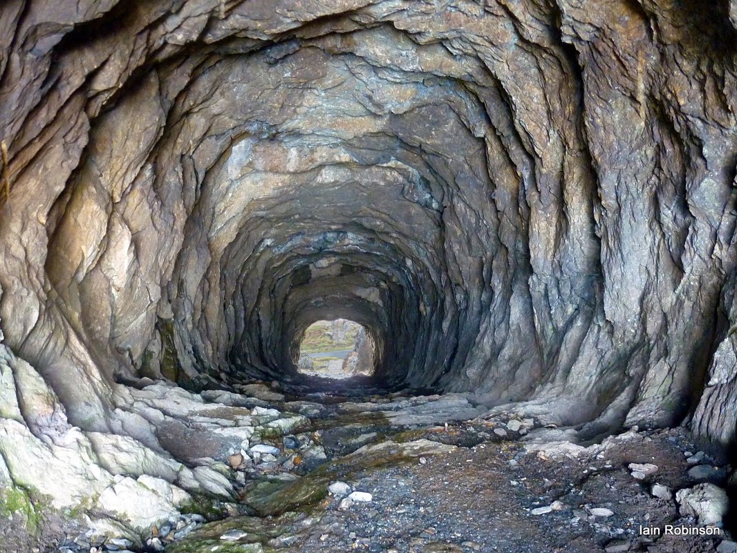
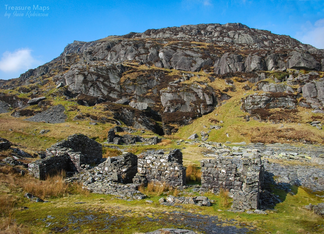
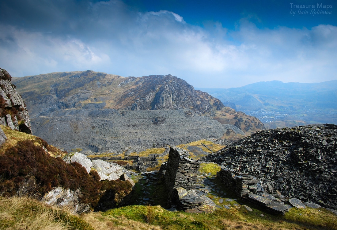
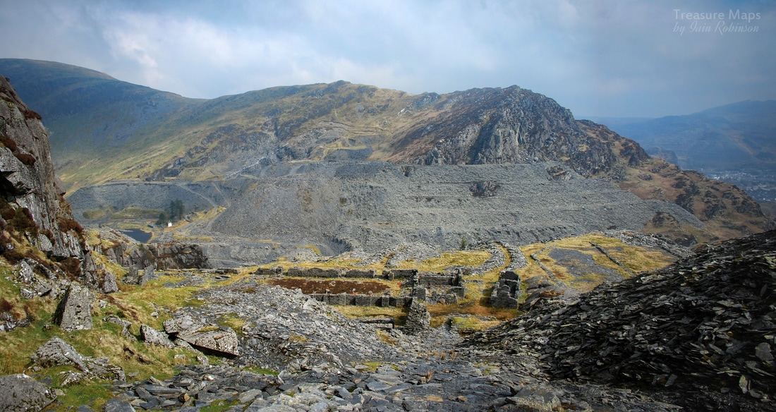
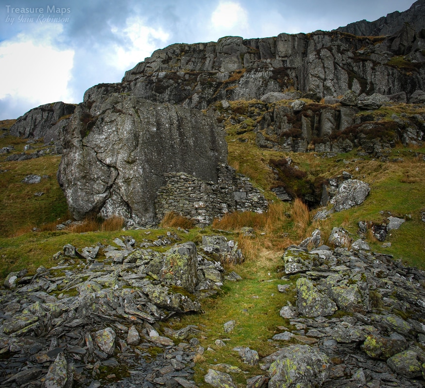
I set off up the dam road and, unusually, had company almost immediately. A very pleasant guy called Wayne, who was going to walk around the Moelwyns. The dam road is a great way to access the range and we talked about the mountains for a while. Then I reached the spot where I reckoned I could make it up to the bwlch. Wayne gave me a doubting, concerned look. "You sure? Doesn't look safe to me!" It would have been very fine to stay on the road with my convivial new friend, but I had to see. I really had studied Google in detail, I was sure it was do-able, although yes, probably not safe. 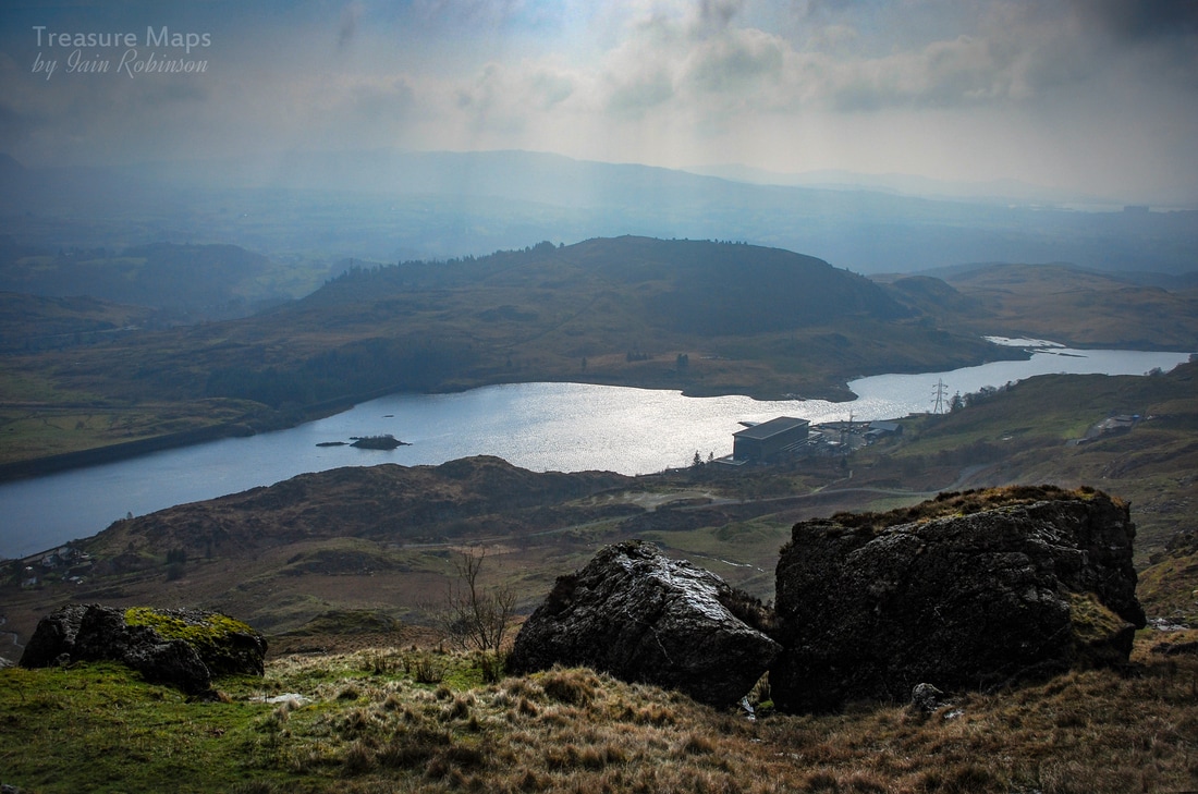 The view from my route once I had negotiated the house sized boulder, which looks nothing like that in this shot. Below is the power station at Tan y Grisiau, and in the right distance, the less than delightful outline of the Trawsfynydd decommissioned nuclear reactor. We parted company and I hopped over the wall, following a stream and on to the flanks of a spur. It was steep and much like climbing a wet sponge. After a few short pitches, I came to a place where a gigantic boulder the size of a house was perched above the stream. The only way seemed to the right, as I didn't fancy trying to go through the low passage under it. After this, the climb was pretty much like a routine steep hill-walk with the odd bit of scrambling. 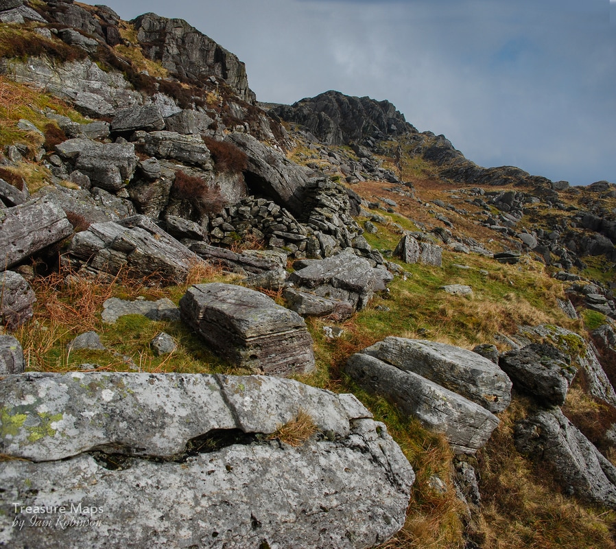 Probably a shepherd's shelter or what the map euphemistically calls a "sheepfold". The image isn't tilted, by the way... I made some interesting discoveries. Almost at the top was a tiny shelter built into the rock...perhaps for a hermit, or a shepherd, although it's not exactly a handy place for anything. Another surprise was a row of the most improbable set of launder pillars, making for the tiny Llyn yr Wrysgan at the bwlch. I couldn't make out where these had come from, and supposed they must have somehow tapped a stream, further to the west. Then after another short scramble, I made it to the top. Not a route I would choose to go down, that's for sure, but a pleasant and airy route up. 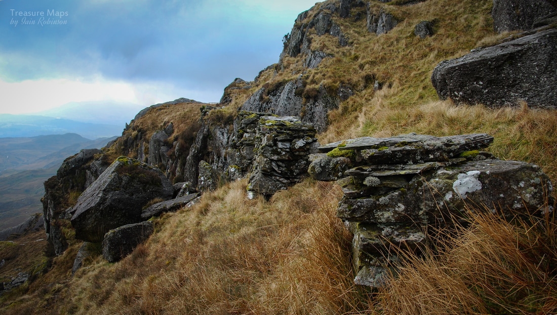 The leat pillars. I had a lightbulb moment when I realised that the old OS maps called these features "Aqueducts" which is logical when you think about it... Above me, Moel yr Hydd's crags looked forbidding. I was on a steadily rising pleateau of ground that sloped down to Wrysgan to the north east, and up to the Rhosydd twlls and Moelwyn Mawr to the south west. In my immediate vicinity was an old mine with curving tip runs. Quite a lot of spoil for a trial, but no sign of a weigh house. I took a look inside. The adit was very wet and curved away to the east. I didn't fancy getting my feet wet, so I came back out. Walking down towards Wrysgan, more adits and workings broke out to bank on the left, but the most attractive feature was the Llyn, built in an opportunistic site beside some rock outcrops and re-inforced by two dam walls. Shortly after this, the land slopes down sharply. There's another adit beside an incline and some nice remains of an early mill, dressing sheds and barracks. I reckoned this was floor 3, counting from the top, which would have been the earliest excavation. A sketchy drumhouse presided over an incline down to the floor six mill. You can easily see the remains of a pit for the waterwheel from here, although I can't imagine it having much water at its disposal. The mine gave up in the 1890 and installed a steam engine in the mill, another one was installed underground to power an incline- you can imagine the fug. A ventilation adit was driven to provide an escape for the smoke. 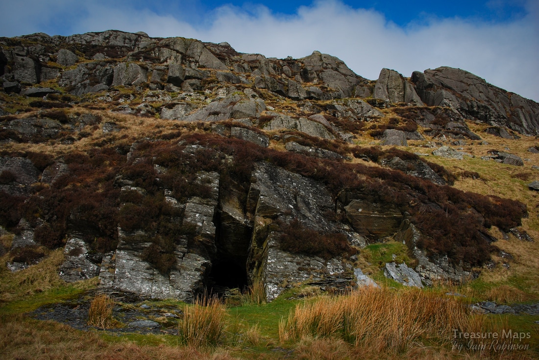 The smoke flue adit. Beware, it ends in a 40 foot drop. While studying the old structures on floor 3, a mighty bellow, followed by screams, came up from down below. I wondered if it was the Balrog, and that Gandalf's services would be required. I decided to put some distance between me and the mine. My usual partner in crime, Petra, wasn't with me due to work pressures- and I found I had no appetite for underground exploration without her. Carrying on uphill, the smoke flue adit was passed, then a deserted, wild looking plateau opened out. Huge boulders had been dislodged by the glacier here on the right, while on the left, the crags of Clogwyn yr Oen and y Bustach leaned where they had been scraped by the glacier, millions of years ago. I stopped and had my lunch here, sheltering out of the wind with my back to a tuff boulder. I closed my eyes, savouring the coffee. A skylark was singing and I just lay there, soaking it all up. It had been so long since any decent sunshine and I could feel the vitamin D seeping into me. I was woken from my reverie by a rustle and there, not two feet away, was a sheep looking at me, an outraged expression on it's face. Once it saw that I was alive, the creature retreated slowly, still not fazed by me. 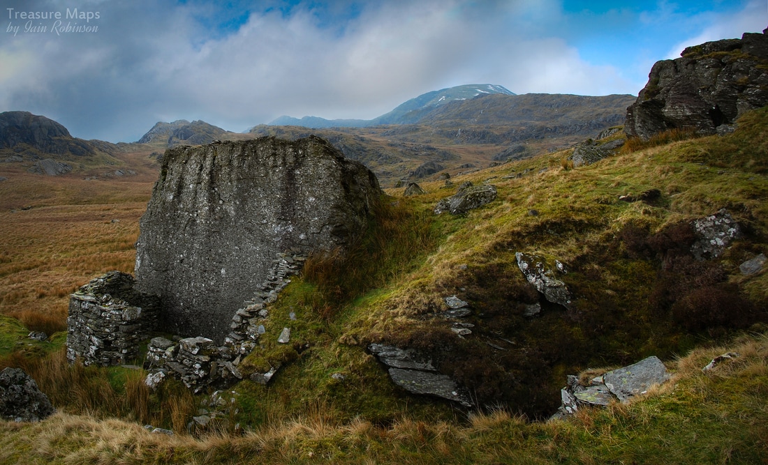 Further along, another adit opened out. This one had the unusual feature of a gigantic boulder almost outside the portal, with an office/shelter built against the rock. There was a fireplace and a fine gable wall left, plus a length of modern plastic Marley guttering, which perplexed me. This adit is marked as disused on the 1840 OS map, so is of some age. I've no idea what the Marley guttering was about. The huge rock was an interesting mixture- on one side, it was a classic Tuff, a rock built up from layers of ash which had then settled and been compressed at great pressure. On the other side was dolerite, probably from a sill of cooling magma a few hundred million years old. The little house that it sheltered was made of slate waste, so that was obviously what the mine was about. The hillsides here are dotted with small diggings and trials, although this was a little special. 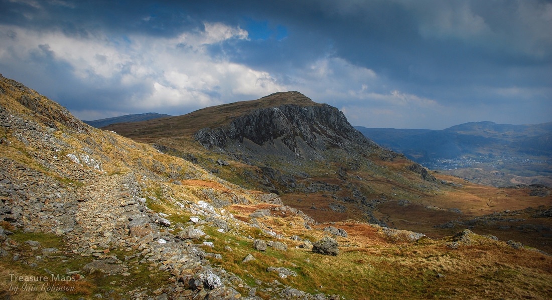 Looking back along the track towards Moel yr Hydd. You can see that the mule track is a slightly different colour and is well revetted. After this, the plateau became more open and I climbed to the bwlch where a gate led onto the bleak top area of the Rhosydd mine. I could see the twlls and across in the distance was the long, low form of Cnicht against the sky- a different vista to the normal view of the mountain. A figure was energetically walking around the openings in the distance- I sensed that he or she was fascinated and felt happy for them. I had planned to go over to Rhosydd and descend into Cwmorthin, but for some reason (probably thinking about that awful road down to Cwmorthin) all enthusiasm for that left me. I wandered about for a while and then settled on a course towards Moelwyn Bach, thinking to get down to Stwlan this way. I followed a feint track, which soon became a revetted path, a mule track. This was looking good. I met a young woman with a fine collie dog, who told me I was on the right track and asked me where I had come from. When I told her, she laughed and said that was the way she was going...so I wasn't crazy after all, although respect to her for descending that way off the mountain. 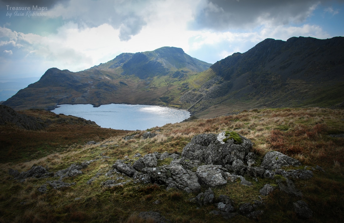 The impressive view towards Llyn Stwlan and Moelwyn Bach, with the quarry incline shining at the centre. Soon, an impressive view of the Stwlan area came into view, with the Moelwyn presiding over the eponymous slate quarry remains. I'd been here a few weeks earlier in the snow, and felt much happier descending while I could see where I was going. Last time, I had to use my "bum-mat" (a cut off from a yoga mat for sitting on at meal-times) as an impromptu sledge. The adits at this mine are all gated, as a poor chap fell to his death here in 1992. There is quite a drop within the top adit and without proper lights it would be easy to miss it. There's the remains of an impressive incline and a lovely barracks, settling slowly back to nature. There were miners families living here in the 1870's with the children going down to school in Tan y Grisiau! That's heroic dedication to learning. 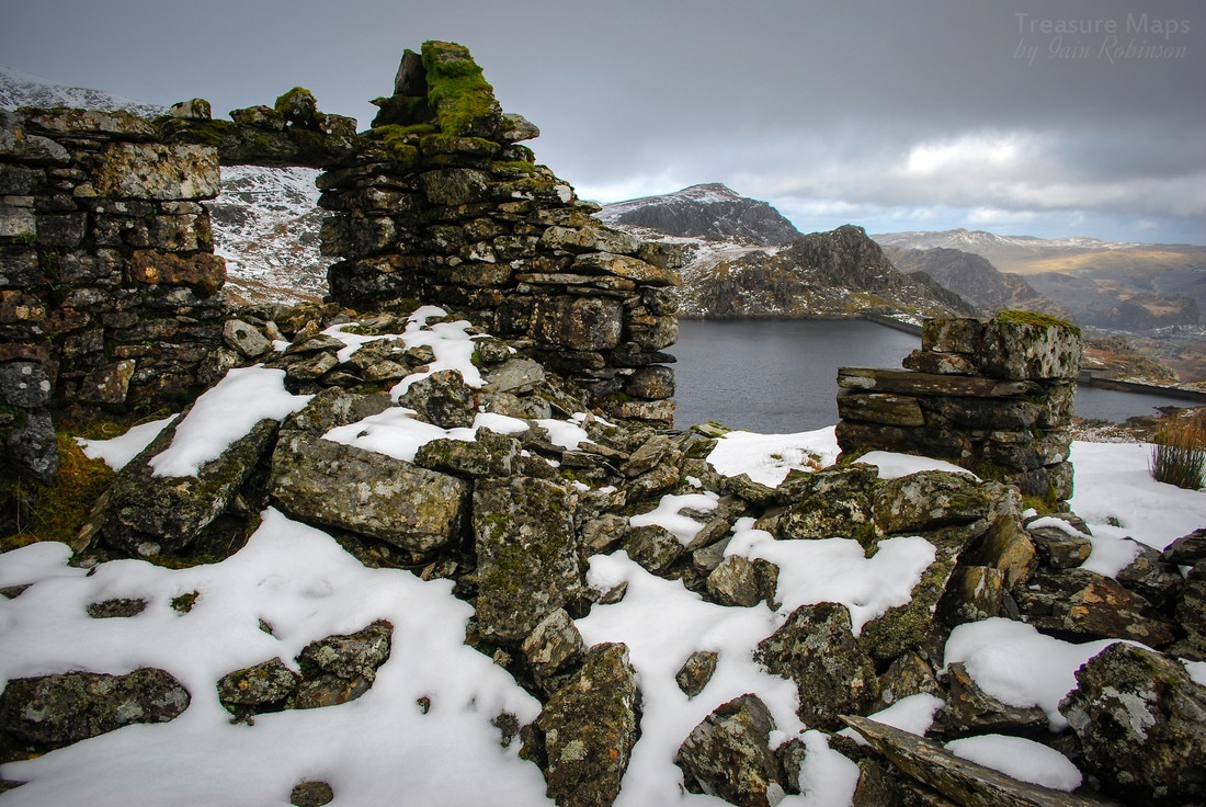 A snowy view of the barracks with Llyn Stwlan in the distance Much still remains at the mine- and the site is worth further study, with an old forge and more barracks down by the lake. Incidentally, this Llyn was originally called Lyn Trwst-y-llon, which by my faltering Welsh means "Lake of the cheerful noise"...? The modern reservoir has cut the line of the incline, which carries on past the dam to another lower mill area and a series of inclines to the Ffestiniog Railway. The Moelwyn mine was active from about 1860 to 1900, although never very productive. The pumped storage scheme here has changed the landscape, but provides a very good access route for walkers. Crosville used to provide a summer service up the dam road for tourists in the 1980's, and by all accounts it was popular. It's an easy walk anyway, even descending with sore knees. On the way back I was amazed, as always, by the Wrysgan incline, it's engineering and audacity. That hole at the top through to the mill is surreal, yet intriguing. There is much to discover on the periphery of the Moelwynion, and it's a rewarding day's tramp discovering small landscapes and the intimate remains of mines, without ever feeling the need to scale the summits. I'll leave that to the Corbett baggers. 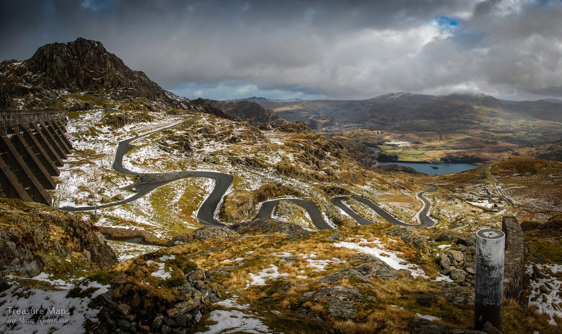 The Stwlan Dam Road as it snakes it's way to the top. The rocky bit above the dam wall is Craig Stwlan.
6 Comments
|
TracksReceive the occasional Treasure Maps Newsletter- and alerts when a new post is available!
If you enjoy my content, please buy me a coffee!
Check out my other online activity...
Index
All
|

 RSS Feed