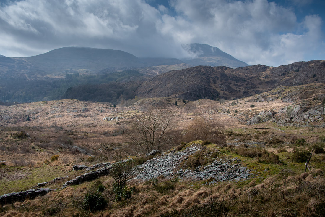
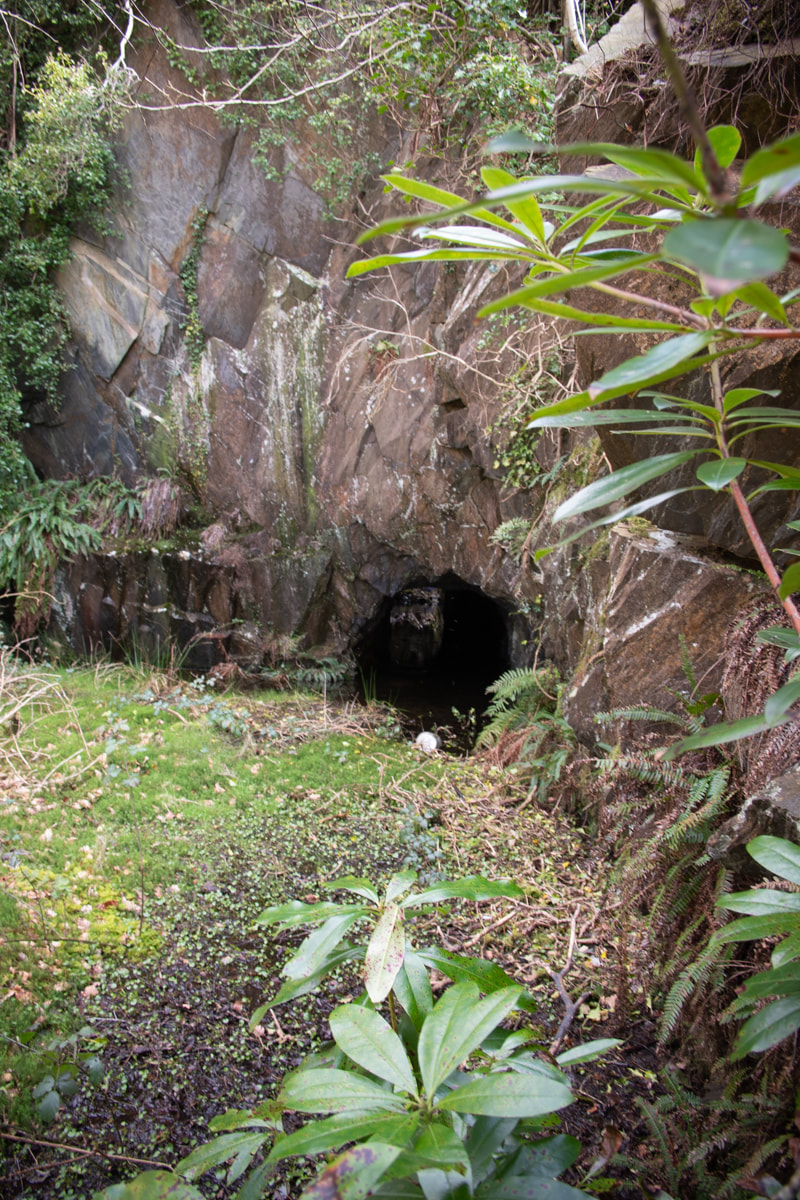
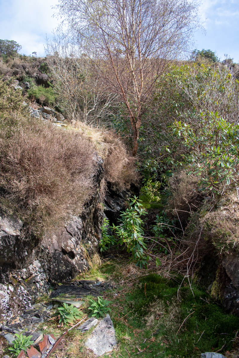
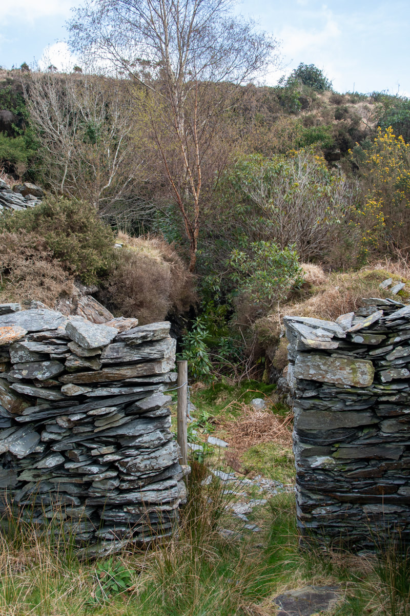
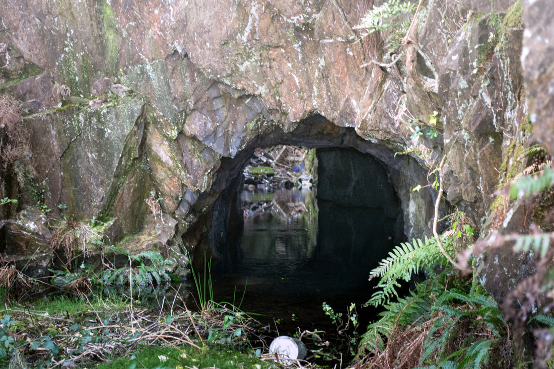
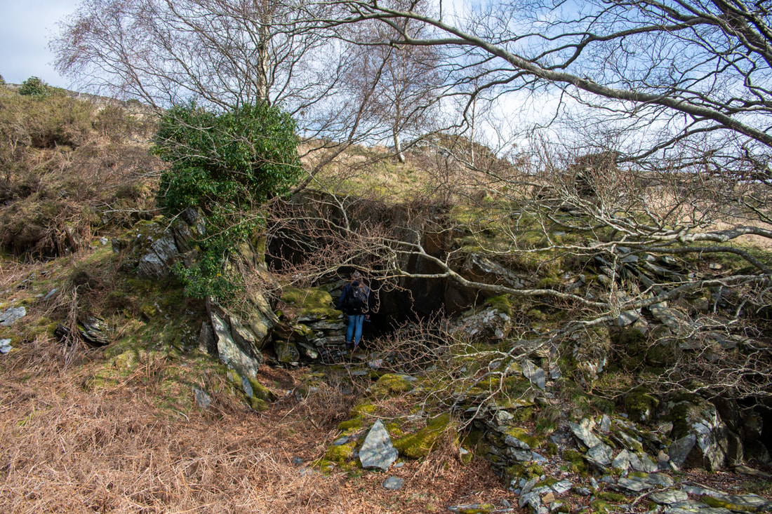
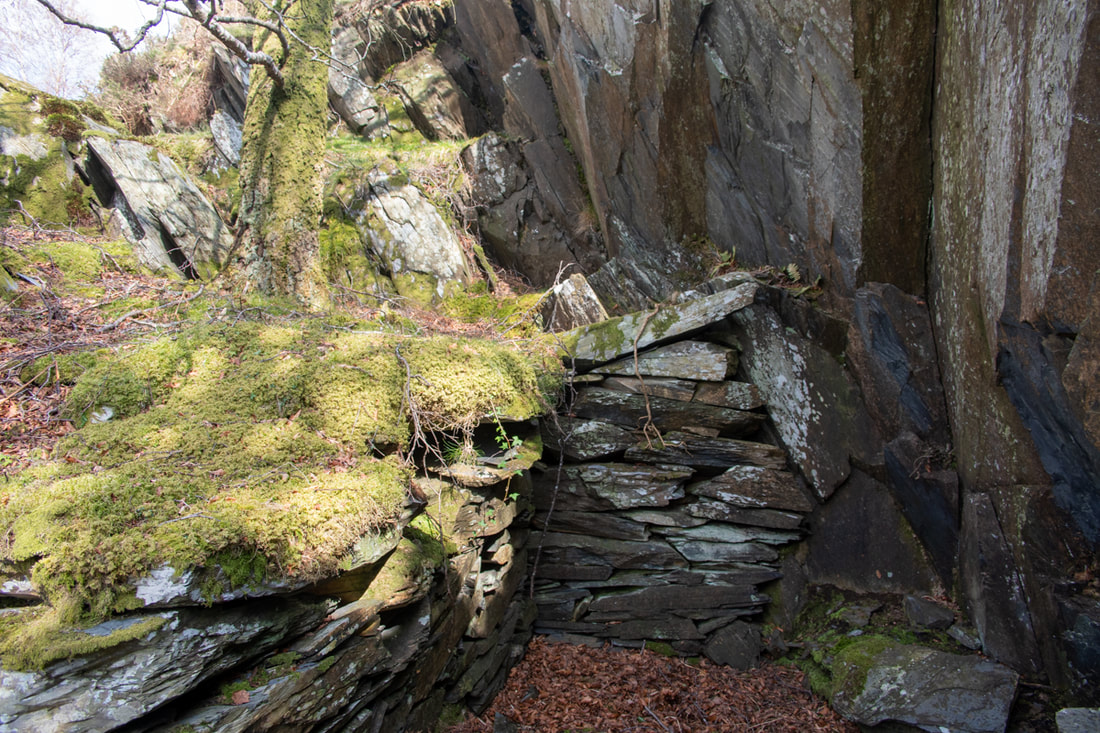
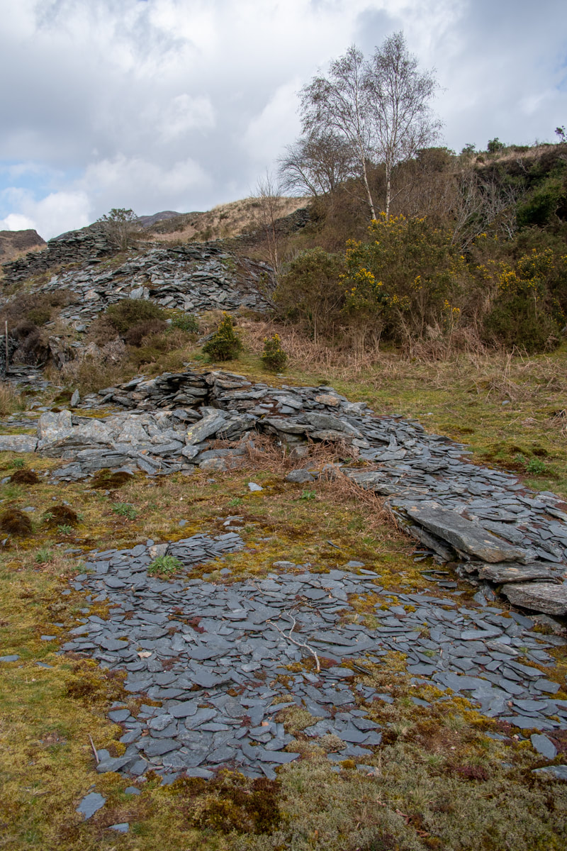
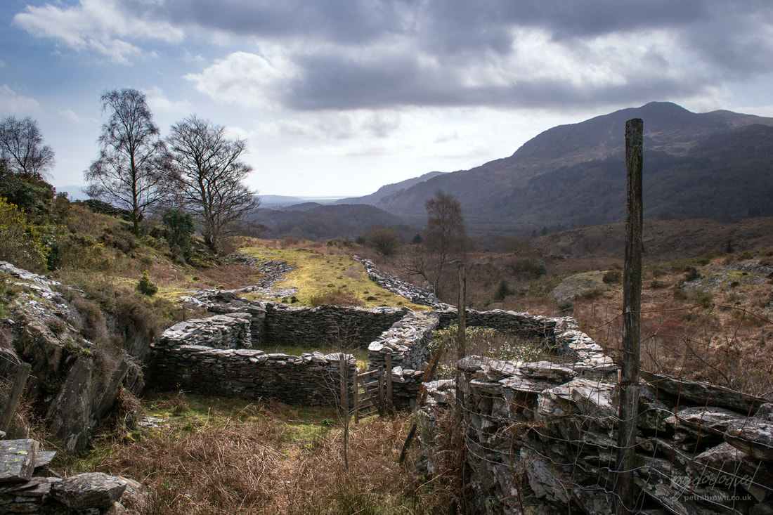
 The view from the tips above the small pit. Mighty Hebog lurks in cloud behind. Many years ago, we were in Cwm Bychan, photographing the aerial ropeway pylons and scoping the mines there. Coming back down the path, I looked over to the east and spotted a distant slate quarry. We paused and considered the ground- it looked difficult, to say the least, but I made a note to try and find a manageable way to get to the mine. Fast forward ten years and we're driving around the very narrow roads to the east of Nantmor, looking for a way to the quarry. In the end, we parked at the start of a footpath that we often use, to photograph the beautiful woodland there. It just so happens that there is a branch of the path that leads (rather tortuously) to Cwm Caeth. If you like doing puzzles and fitting jigsaws together, we parked the car at SH608454 opposite the footpath sign for the Dolfriog woods. 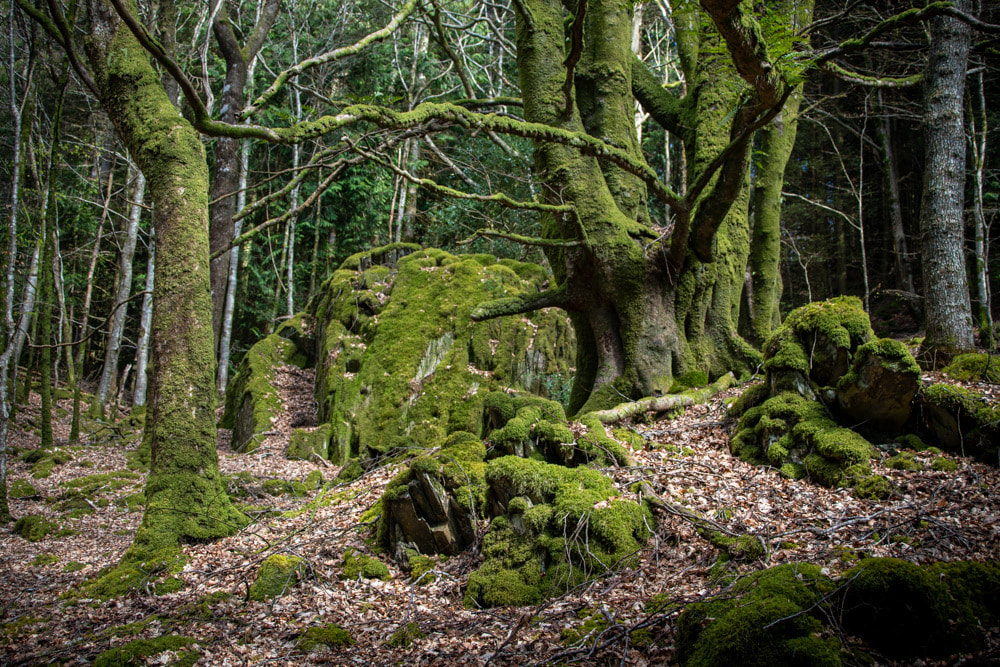 A gratuitous tree photo from the Dolfriog Woods. A more convenient approach to the mine (if you aren't that keen on trees) is by turning left by the chapel on the way out of Nantmor at SH608458. You carry on up that tiny track until the road does a jink and starts to rise up. This very minor unmarked road is a footpath- you could actually start from the Nantmor car park and walk up- it would still be easier than the route we took. I'll cut to where we met the unmarked road, which we crossed. We carried on over the fields following the line of a wall- for some reason we took the right hand side, which we were to regret very soon. These are high dry stone walls and it's not advisable to try and climb them. Luckily we found a gap and crossed to the correct side. Now it was just a matter of walking in approximately the correct heading until the quarry tips come into sight. We sat and had our lunch by some rocks- a lady, probably from the farm, passed by with her very friendly dog. She remarked that walkers were rare on this hill. That was a good sign. 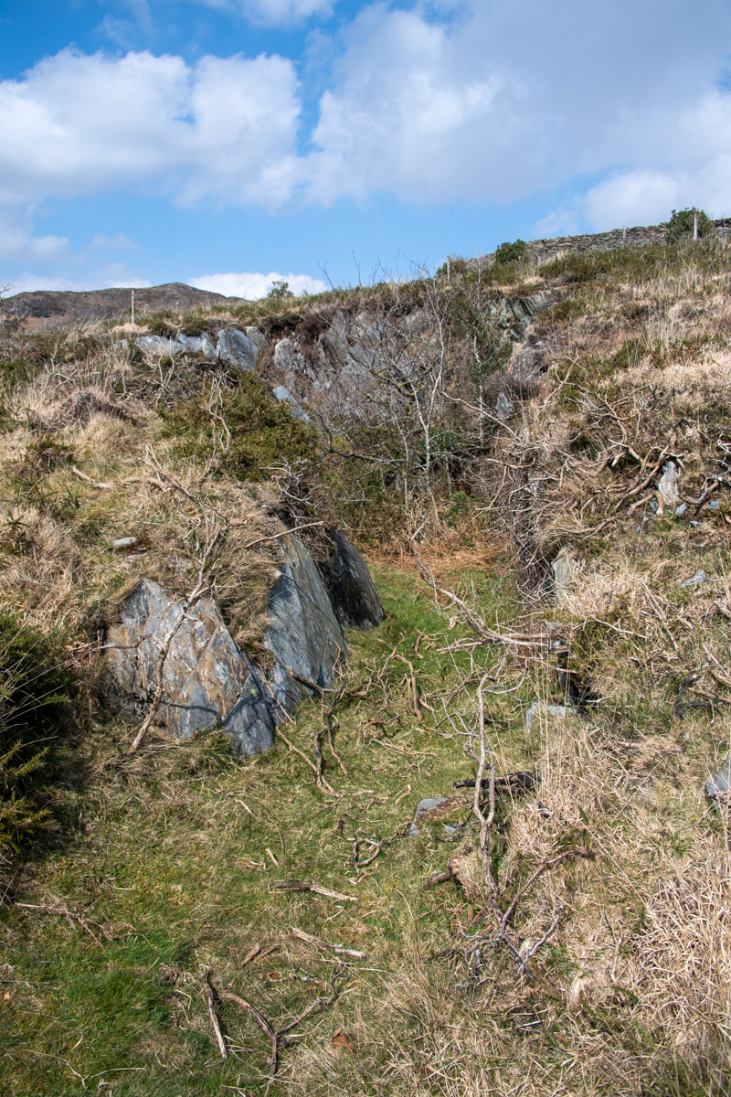 The Upper Pit, from the south. The views here are absolutely sublime, Hebog had his best coat on and was trying a selection of off-the-shoulder clouds, making for some nice photos. To the south, the sea was sparkling and Porthmadog could just be made out beside Moel y Gest. The mine was, to put it kindly, a slight anti-climax. The tips were grassed over as befits a long disused operation (it was marked as disused on the 1842 Ordnance Survey) and the pits were tree grown. Richards says: "An ancient working developed in the 1870s, when a water powered mill was built..." but then contradicts our findings further by saying: "Employed about twelve men 1867-79....It failed to survive the late 1870s depression." We looked around, failing to find any meaningful camera angles. We walked towards the lower pit, but as I expected, the adit was knee deep in gloop and didn't look too exciting. Above: Some views into the lower pit... We looked about at the remains of structures that had obviously been "farmerised", put to fell purposes not connected to quarrying. It was hard to imagine the little mill and the wheelpit. We wandered around looking for the adit Richards describes as "leading to chambering"- this was blocked by stones, presumably to deter mine exploring sheep. There was a large rectangular area to the west of the mine which is described on the Zoom map as a mill, but in Coflein's entry for the site they describe it as a post-medieval livestock enclosure. They don't mention the slate quarry. Perhaps they were disappointed too. Here are a couple of shots of the little mill building which must have had a waterwheel to it's right, and of the working area with what look like vestiges of shelters. The quarry is at SH606465. The 1842 map extract (kindly reproduced from those lovely folk at the National Library of Scotland) helps make sense of the place, as does the extract from Zoom Earth below. 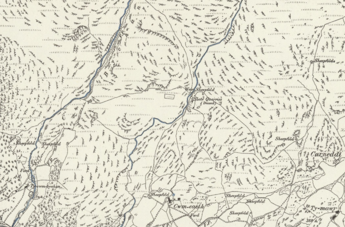 Map by kind permission of the National Library of Scotland. That isn't the slate mill- it was the two-cell building beside the river where a wheelpit can be made out...we missed that... (Satellite image by kind courtesy of Zoom.) We noticed those long stone enclosures to the south of the mine, but we thought they were probably agricultural. There's very little out there to find out about the place, but it does make for a fine stravaige on a good day- the slate quarry is a bonus. I'd still like to see behind that wall into the adit, though... Thanks, as always, to Petra for the use of some of her photos.  The gap in the wall. |
TracksReceive the occasional Treasure Maps Newsletter- and alerts when a new post is available!
If you enjoy my content, please buy me a coffee!
Check out my other online activity...
Index
All
|
 RSS Feed