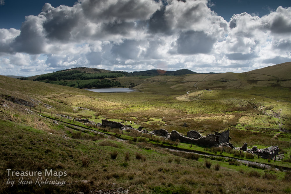
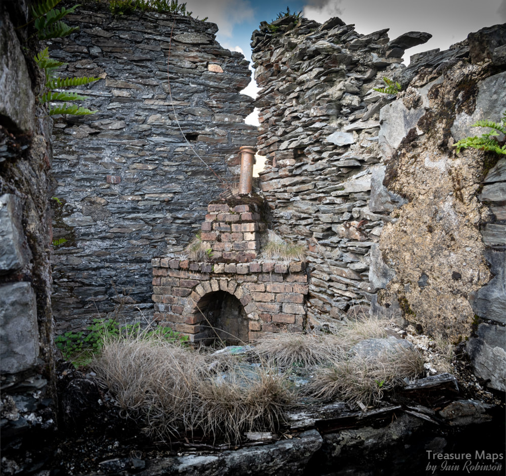
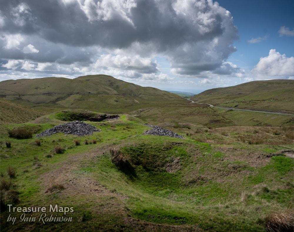
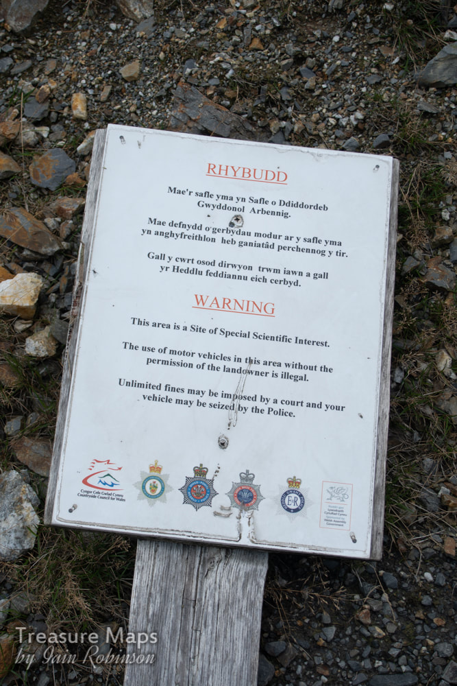
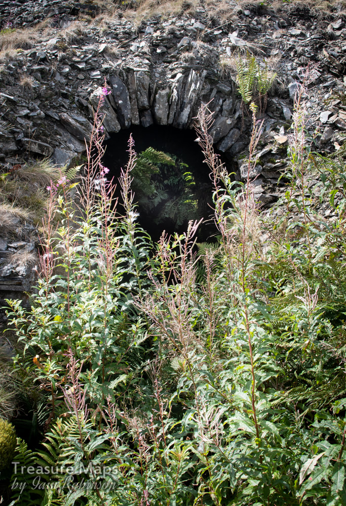
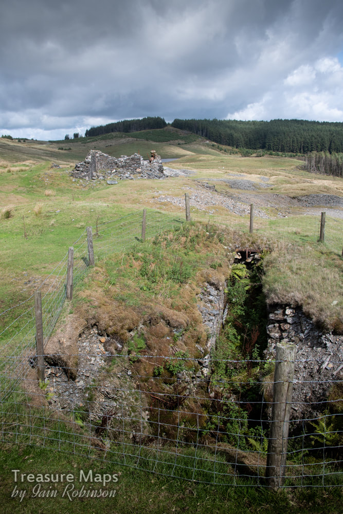
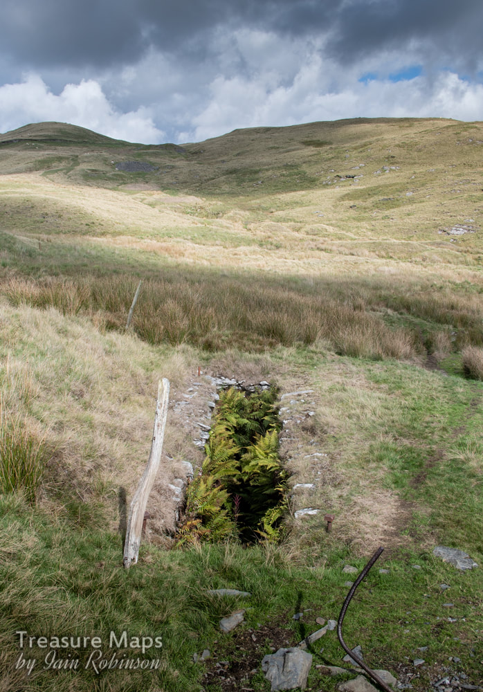
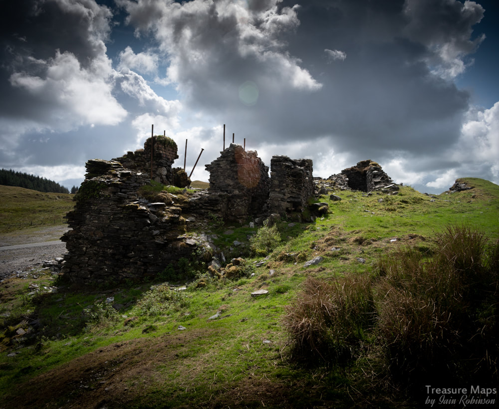
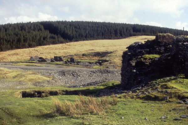
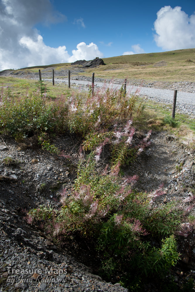
 The barracks, viewed from the hillside and looking south west towards Llyn Nantycagal. Yet another fascinating site that we found while driving over from Cwm Ceulan towards Nant-y-Moch. What intrigued us initially were the remains of barracks for the workers at Esgair Hir and Esgair Fraith mines. Whilst exploring these buildings, a line of crown holes was spotted, climbing up the hillside. We felt sure that there would be something interesting over the ridge- and there was... A little bit of history The story of the mine begins in 1690, when Sir Carberry Pryse found an outcrop of silver ore on his land. He wanted to mine it himself, but fell foul of the Society of the Mines Royal, who had the monopoly of all gold and silver mines worth exploiting. He took the matter to court and won a landmark case- on the 8th February 1693, an Act of Parliament was passed, which removed Crown Ownership of mines containing gold and silver. This allowed local landowners to develop or lease mines on their own land. Sir Carberry soon found that mining was expensive and he began to look for partners in the venture to help with the considerable financial exposure. He produced a fanciful estimate of profits for the mine which suggested that with 600 miners working and each one bringing half a ton of ore per week to the surface, the mine would yield a profit of £70,500 in the first year, after which more miners would be needed! If only mining were that simple. There was silver, lead and copper to be had in the rock below, but the surrounding material was hard and there was also a problem with water ingress, something that would trouble all the companies who tried their luck with the mine. Carberry Pryse died in 1694, after which William Waller, the manager of the old company, issued some extravagant claims for the fortunes to be made here. Connoisseurs of mining history will not be surprised at the claims made- ‘the richest in all Wales'- or that a new company was floated called the "Company of Mines Adventurers of England" who, it is said, raised some 2000 tons of ore between 1703 and 1708. There was the matter, also, of Waller calling the mine the "Welsh Potosi" after the incredibly wealthy Bolivian mine in the C17th and claiming that he was going to construct a town of the same name near the mine. Four other companies attempted with various levels of success and duplicity to exploit the ore underground. Finally after 1886, a ragged group of partnerships stripped the place of any easily won mineral and combed the tips until 1904 when working ceased. For a more thorough overview of the history, I wholeheartedly recommend Marilyn Palmer's monograph on the mine in the Northern Mine Research Society's series of papers. I will provide a link at the end. 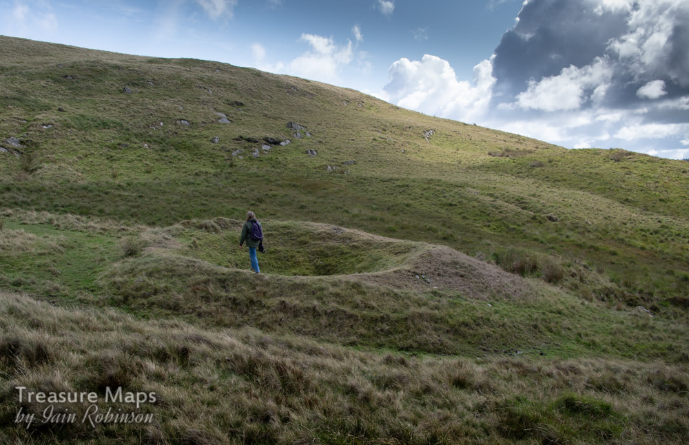 One of the crown pits, with Petra for scale. The Remains We parked up at the start of an unsurfaced road at SN 72322 90958, this comes off the mountain road which was itself engineered by the mining company in 1840. Walking along the road, the line of crown pits is easily seen. They are probably of some antiquity, dating from the earliest days of the mine and since each one represents a blocked shaft, considerable effort must have been expended. Below the line of shafts is an almost run-in adit, the West Level, which was driven under the auspices of William Waller in a hopeless attempt to drain the mine. It is still possible to see into the adit, but exploration is definitely not recommended. 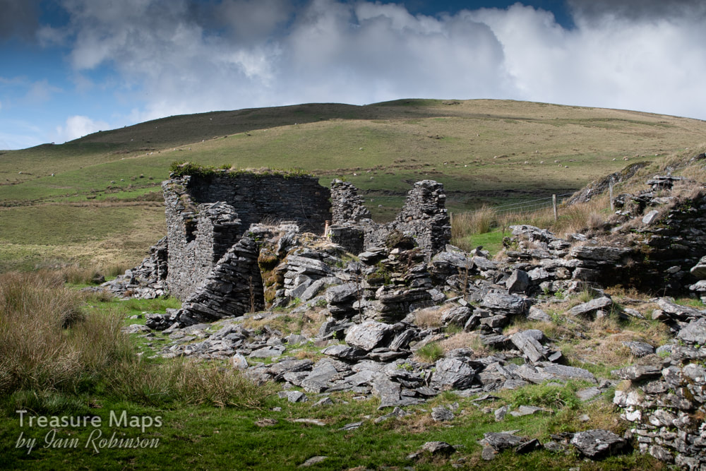 The barracks, showing typical buttressing by miners more used to shoring up adits underground! The barracks are an interesting range of structures, perhaps not big enough to house the six hundred men Pryse had in mind, but substantial none the less. A large single-pitched room seems to have been the kitchen and has the remains of a range. A turf house was situated nearby but there is no sign of that now. Standing next to the ruinous walls, open to the weather's attentions, it's hard to imagine the conversations that must have gone on here between the miners. It's a life that is difficult to imagine for most of us, few creature comforts, isolated on the moors for the week, longer in the winter when the snows blocked the pass. 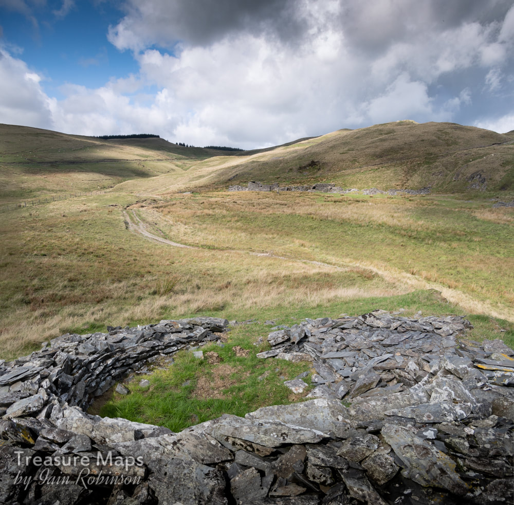 The powder house, with the barracks in the background. The mine is behind the hill above the barracks. I was pleased to find a ruined powder house on a knoll to the west of the barracks, a round pattern that now looks more like the nearby bronze age ring cairn of Carn Owen. Just under the access road are a couple of water wheel pits and run-in adits that may be from other mining enterprises, as the West Level is stated as the outer edge of the sett. Judging from the tips, these excavations were not fruitful. 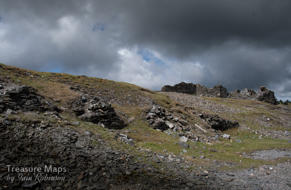 The remains of the ore bins with the crusher house and engine house above. Walking up to the bwlch which is the watershed of the Afon Lluestgota, more shafts are found, then a flat area which was at one time the site of ore bins and a processing floor. This has unfortunately suffered the attentions of the forestry commission and their roadmaking gangs. Mine tips are always easy pickings for road making, even if this one was a SSSI. There are other dark clouds on the horizon in the shape of the Scottish & Southern Energy (SSE) proposals, to build a wind power station of 62 turbines up to 481ft high – much larger than any yet built in the UK – on the foothills of Pumlumon overlooking the Nant y Moch reservoir. Several would be sited above Esgair Hir and I have no doubt that the tips and buildings at the mine would be ransacked for easy hard core. The Cambrian Mountains Society is fighting hard against this- let's hope they are successful. 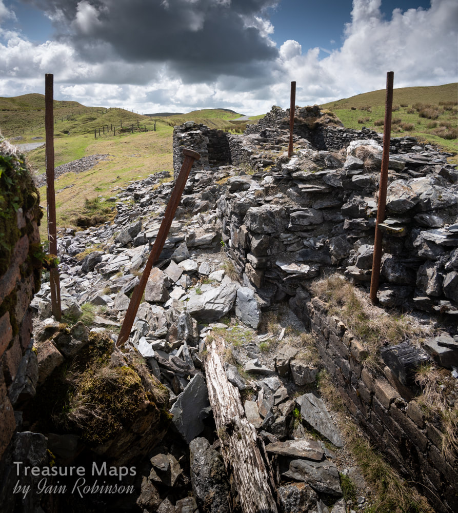 The engine house, looking west towards the Penybwlch shaft, fenced off in the background. The ruins of a complicated looking structure are visible on the left- the engine house and crushing mill of 1872. The foundations to the left are probably for the boiler. On the right, long steel rods supported a winding wheel. As recently as 1979, there was a gable wall and window still standing here, but gales and rain have seen it off since. A little way off to the left is the finely engineered stonework of Shaft Glas, with a pump-rod tunnel designed to de-water the mine and then utilise the motion of the rods to power other machinery, two thirds of a mile away at Esgair Fraith. 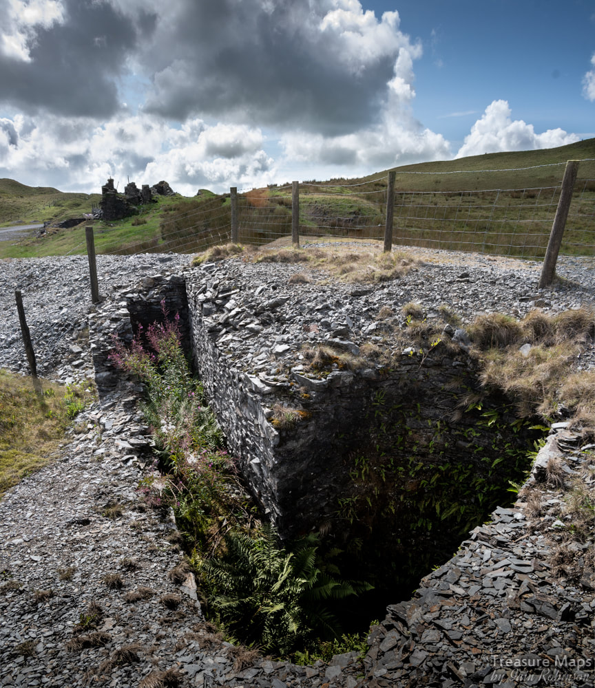 Shaft Glas, with the pumping rod tunnel to the left. Our visit terminated with a look at the mine offices and workshops, a long, low and ruinous structure whose claim to fame was that George Borrow sheltered here one night while on his travels, described in "Wild Wales". I managed somehow to not take a photo, so I am very grateful to Chris Andrews for his excellent shot. Nearby is the opencut of Shaft Moses, filled now with rubble, old washing machines and bits of car. Sadly, we ran out of time on our visit, but will conclude the article with a description of Esgair Fraith as soon as we can. References: Welsh Mines Preservation Trust survey British Mining No.22- "The Richest in all Wales" by Marilyn Palmer, available as a purchaseable download from the Northern Mine Research Society here. 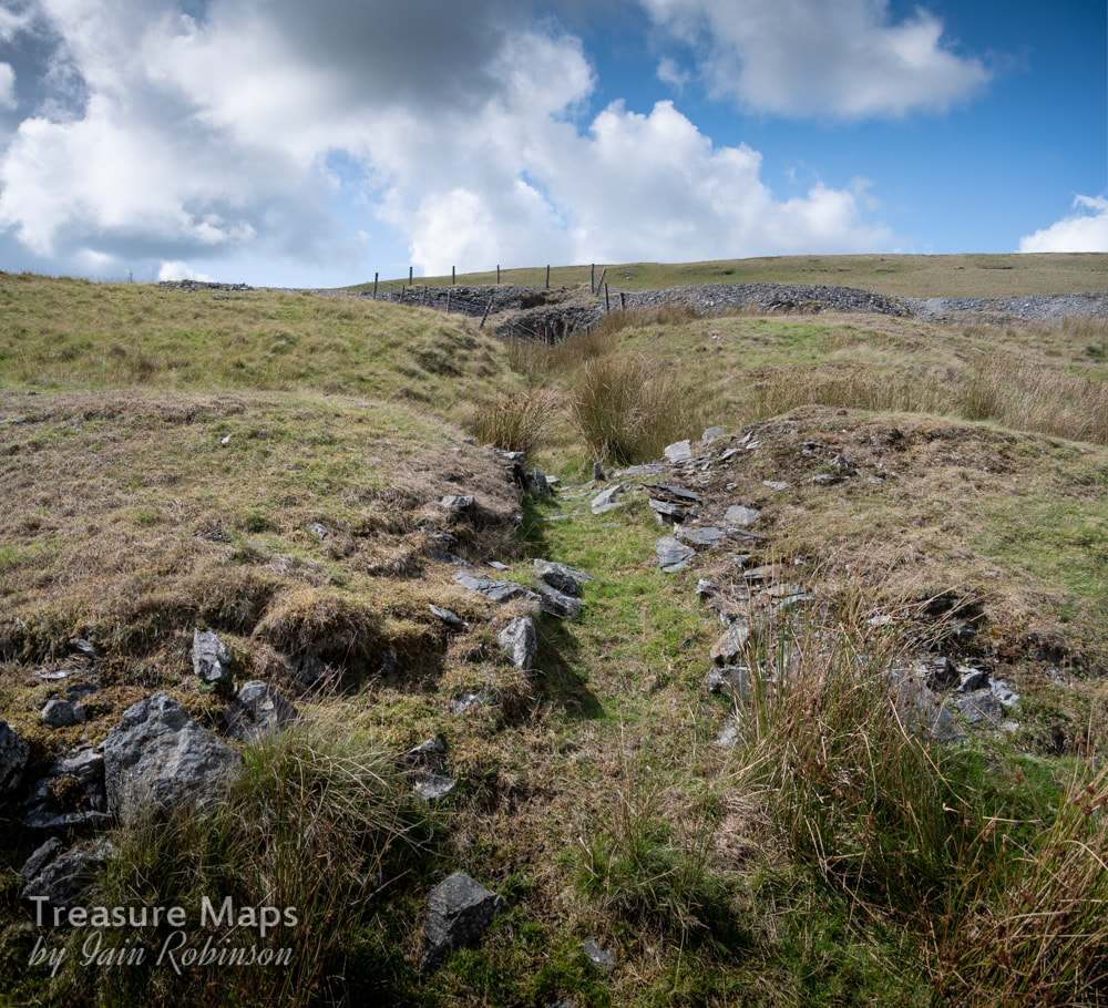 The flat rod line from the engine shaft- later a wire rope was utilised, running over dollys supported by posts driven into the ground.
4 Comments
|
TracksReceive the occasional Treasure Maps Newsletter- and alerts when a new post is available!
If you enjoy my content, please buy me a coffee!
Check out my other online activity...
Index
All
|
 RSS Feed