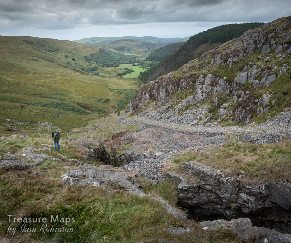
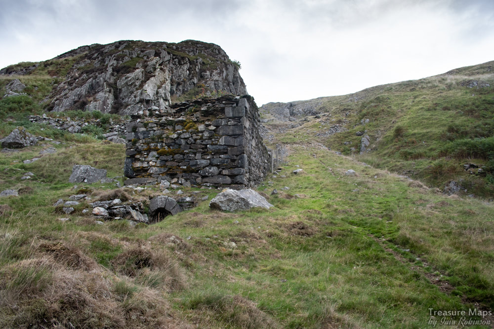
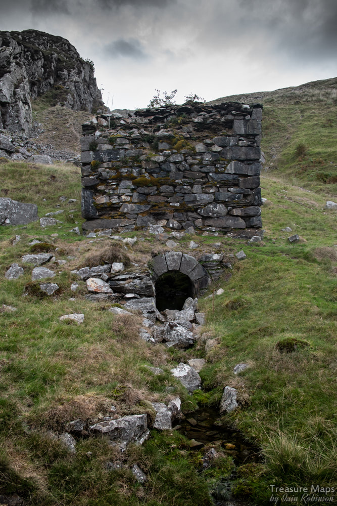
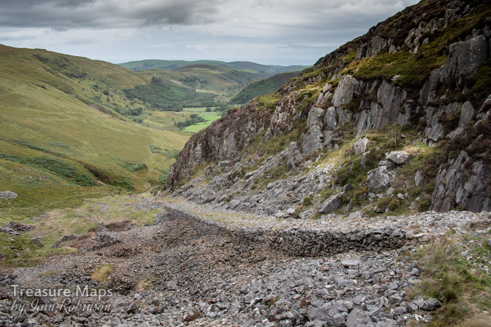
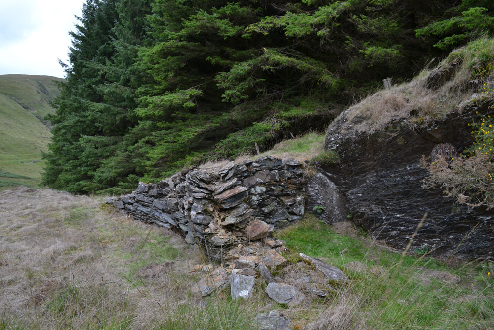
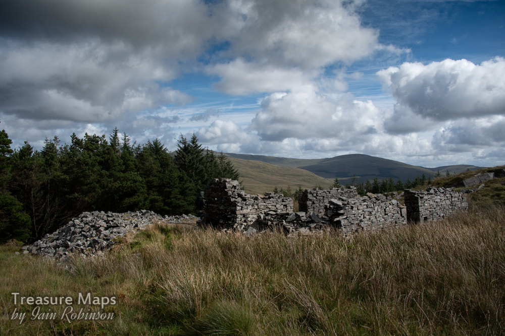
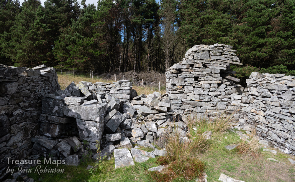
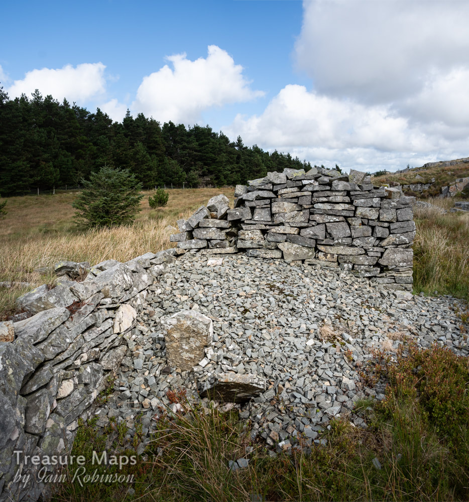
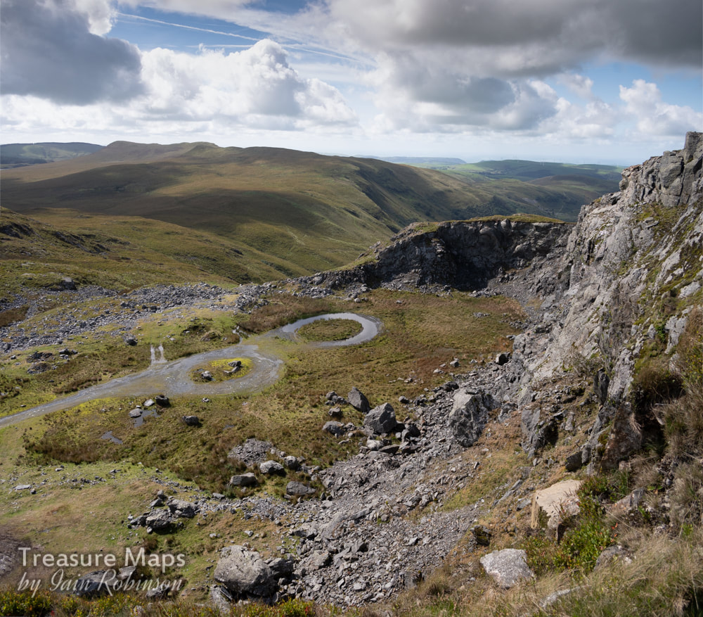
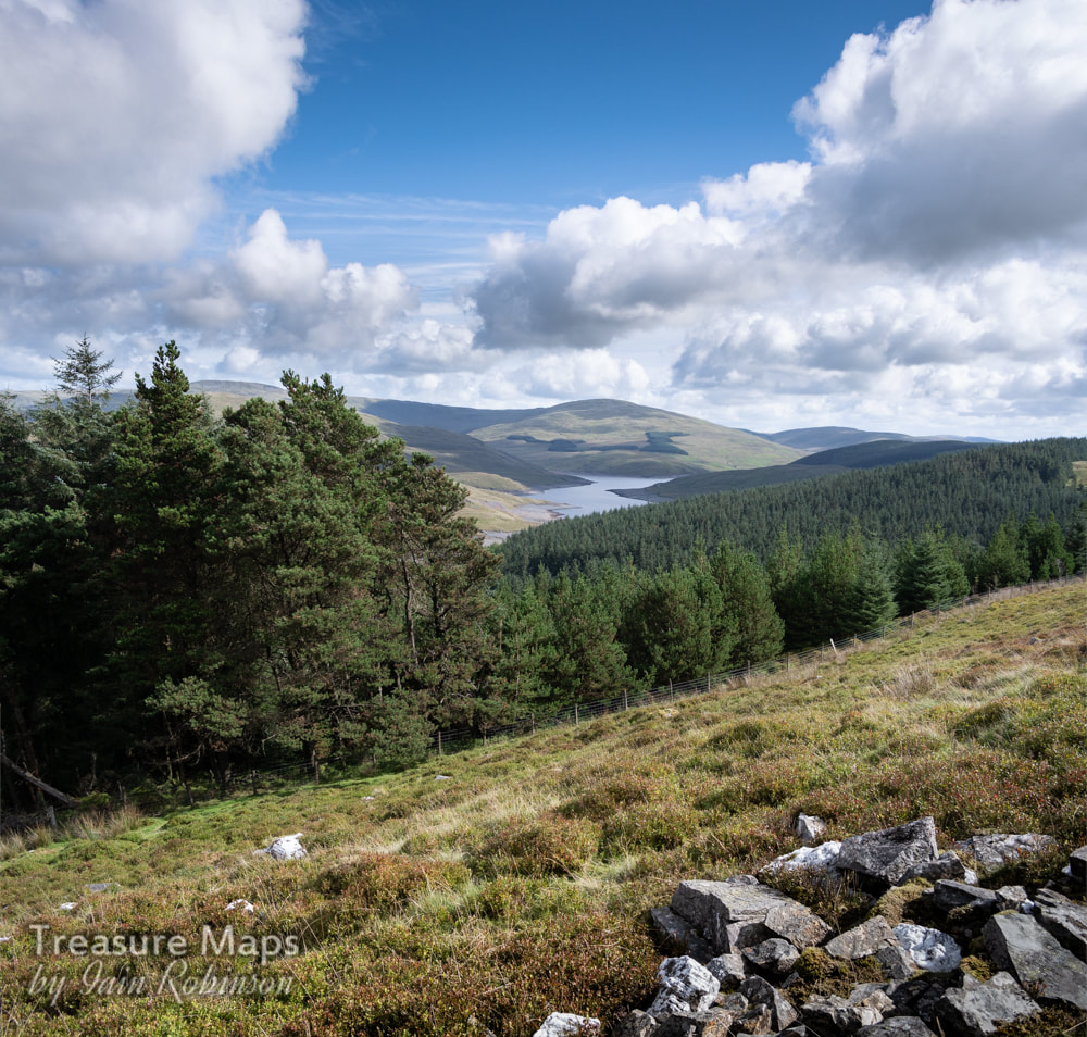
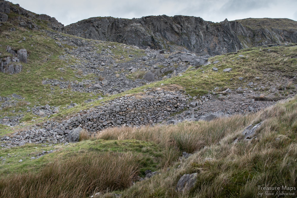
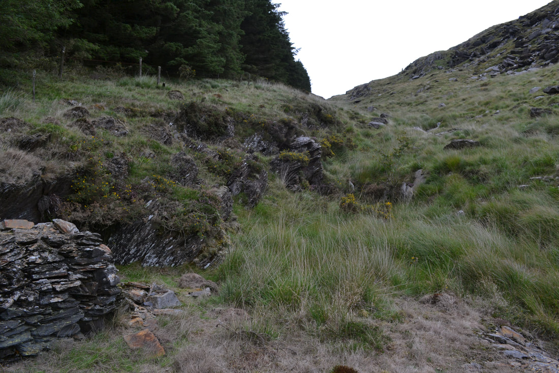
 Petra looking into the stopes at the Hafan Lead Mine. The Incline from the stone quarries is in the background. Drive around the picturesque shores of Nant-y-Moch, nestling in the hills to the west of Pumlumon Fawr, and you could be forgiven for thinking that there was no industrial archaeology, that it was a featureless, if very beautiful landscape. But nothing could be farther from the truth. Despite the massive efforts of the Water Authority and those hired vandals, the forestry commission, there is still a good deal of fascinating evidence that survives. 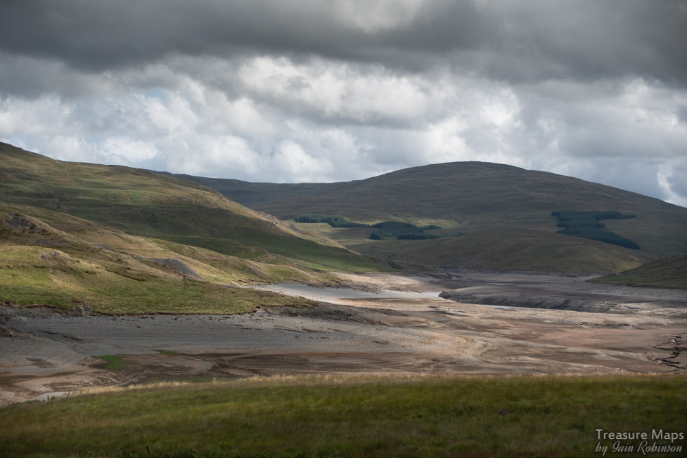 Almost empty! A mine can be seen to the left of the picture on the opposite bank. Our first introduction to the area was in June of 2018, when the air crackled with heat- and the reservoir was almost empty after weeks without rain. We'd taken a turning from Tal-y-Bont on the Aberystwyth road just to see where it went, and were soon on a narrow mountain road with few passing places. Of course, Tal-y-Bont is well-known for it's mining history, but as we skirted the side of Bryn Mawr above Cwm Ceulan and saw the remains of the Blaen Ceulan mine below, my mining senses began to wake up and be fully attuned. The unclassified road carries on past intriguing ruins half-glimpsed on the moor, past grass-grown tips and ruined barracks until the serried Sitkas of the spruce planting maniacs smother the hillsides. This is Nant-y-Moch, which means the stream of the pigs, but is actually a steep valley which at one time harboured several significant mines. It has now been flooded by a reservoir. At this point, looking around, I had a vague memory of reading something by the legendary Roy Fellows about a mine here. To the seasoned gaze there were many signs of mining in the sterilised slopes across the dry reservoir. It had been landscaped, but thankfully, not enough. Petra and I parked the car and took a walk up an old track which showed evidence of some crown pits (where a shaft has been plugged and later collapses, leaving a depression like a volcano). Tips could be seen shining in the light amid spruce plantations. 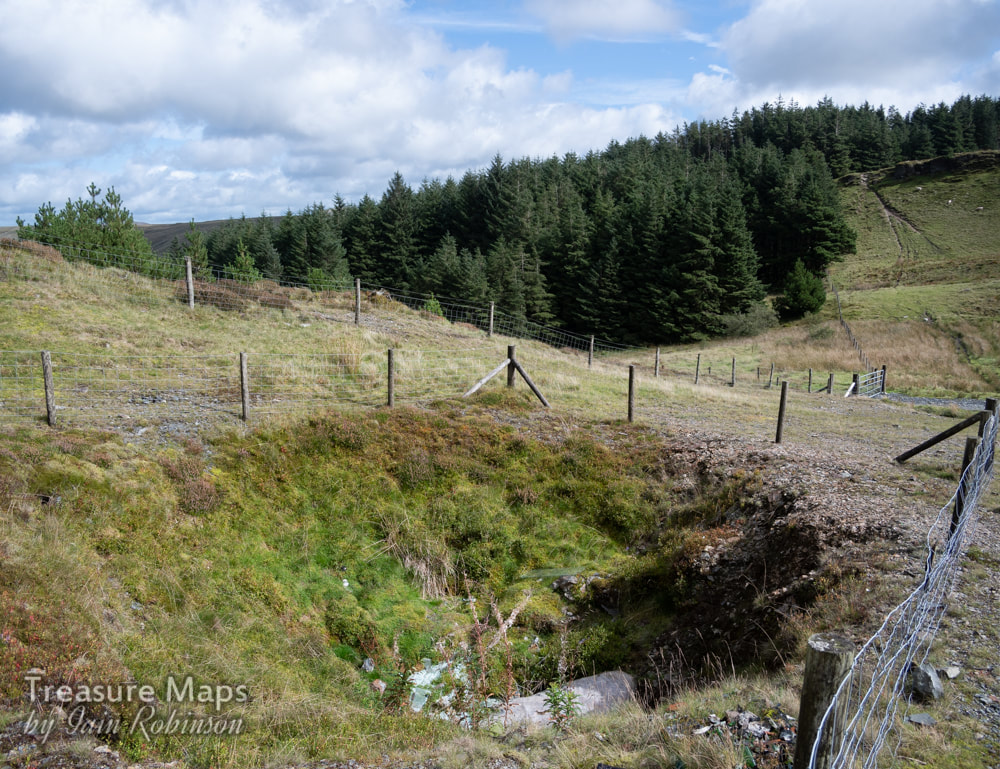 A crown pit, full of rubbish. Probably a shaft from the Henfwlch mine, in thick forestry behind. We drove away determined to explore the area and much time has been spent poring over old maps and books, trying to get a sense of what there is to find. I'll start with a site that gives a nice taste of what is left, the rocky slopes of Cerrig yr Hafan, which reveals some fascinating old quarries, a modern quarry and an intriguing lead mine. And a bronze-age summit cairn, too, if that floats your boat. We parked up at a turning made for the new quarry at SN7362888551. It's a right of way and goes through a SSSI site. Signs encourage you to tread lightly, something that doesn't seem to have been heeded by the 2-strokers who have churned up great ravines with their noisy bikes. Once we reached the top of the slope, we were in an area that had been "landscaped", sterilising the place to a great extent. However, I could still see a sizeable crown hole, full of mattresses and broken glass, beer cans and discarded plastic. This hole masked a shaft from the Henfwlch lead mine, further below in the woods. I will cover this fascinating enterprise in another post. 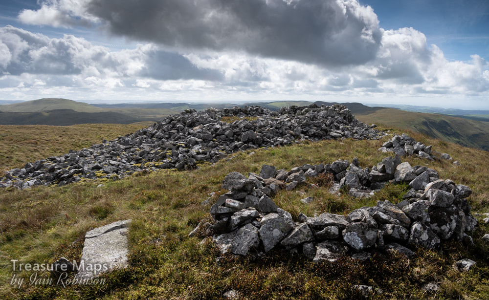 The Bronze age cairn of Carn Owen, made from sandstone blocks. For the moment, we ignored the modern quarry pit, worked from 1956-61 by McAlpines. This is Carn Owen quarry, opened in connection with the Rheidol Hydro-Electric Scheme. It's development obliterated a tramway that ran from higher above on the back of Cerrig-yr-Hafan, serving a couple of old pits, marked on the old maps as "White Stone Quarry". There were some structures up there which still survived, according to Google Maps. We climbed the steep slopes above the quarry and sat by the bronze age cairn. I confess that despite my fascination with pre-history, the tramway was bothering me; there was something familiar about the name. I gazed east towards Plumlumon and suddenly the penny dropped- this was the beginning of the fabled "Plumlumon and Hafan Tramway"! For those who don't know, this was an ill-fated enterprise designed to link the mines in the area with the sea. It was begun in 1896 as a two-foot three inch gauge line which actually carried passengers as well as minerals, but sadly was only open for a year. The track remained in place only until 1914, but the line's fame has proved to be much longer lasting. One of the line's locomotives, a Bagnall 2-4-0T later went to the Vale of Rhiedol Railway and survives to this day, regauged as their no.3, Rheidol. 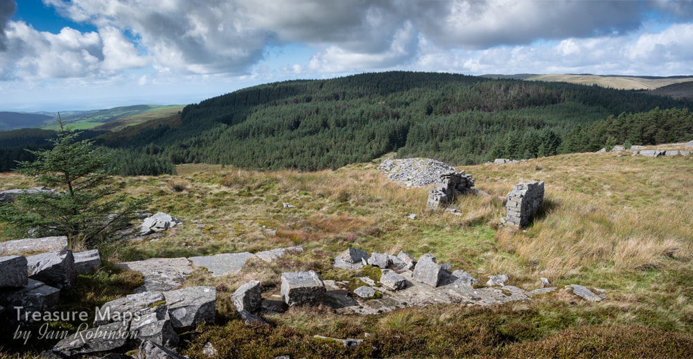 The highest quarry, with sett-makers shelter. The lower quarry is to the right of this photograph. The Cerrig-yr-Hafan quarries Energised by these thoughts, we made our way along the back of the hill until the first of the quarries was reached. The rock, a sedimentary, very hard mudstone occurs on the surface and has been crowbarred out. Deep pits have not been formed, although the tips show extensive working of stone, which must have left the site as blocks and setts. There are piles of fine chippings, made when the blocks and setts were worked by hand. Some exposed blocks show evidence of their marine origin with the appearance of wave-moulded sand patterns. The highest quarry is the one marked as the "White Stone Quarry" on the maps, another, more extensive quarry is below. This has a couple of sett-makers shelters, and further towards the formation of the tramway, a large structure lies in ruins. This seems to have been a workshop and smithy- perhaps part of the building was a stables. For a while, I was confused by the maps of the quarries here, as they didn't seem to correlate with what was on the surface. Then I realised that the northern part of the site is buried under forestry. Now it all made sense. We will have to try and reveal some of that quarry with another visit, although I'm not relishing the prospect with all those tightly packed trees! 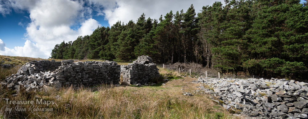 The workshop and smithy. The tramway continues on underneath the trees... 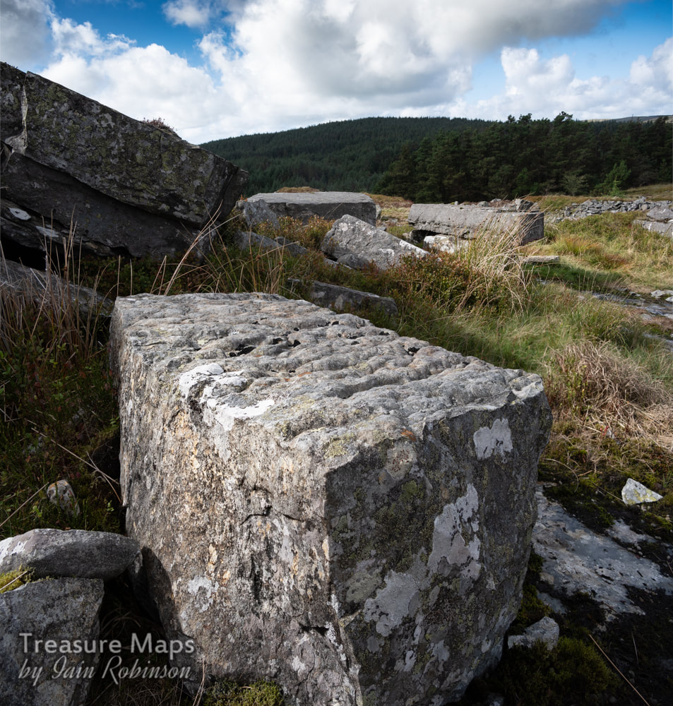 One of the large blocks, showing it's marine origins. Heading south again, we followed the formation of the tramway. It is fairly obvious, being revetted and drained. It passes a couple of trial workings before reaching the McAlpines' workings again. It must have been an airy journey along the steep hillside, and quite exposed during bad weather. No locomotives were used on this section, so I imagine the trains would have been worked by horses. In an article in the "Cambrian News" of December 1898, it is noted that: "The Plynlimon and Hafan Company own one of the finest macadam quarries in Great Britain, the results of experiments exceeding the most sanguine expectations. It is purposed erecting new machinery for crushing the stone and the machinery will be driven by water power." It seems that massaging the facts is not a modern phenomenon. 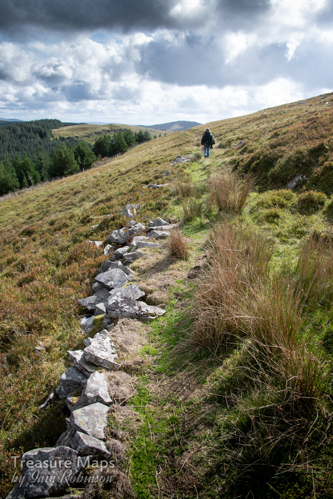 Petra walks back along the remains of the tramway. Carn Owen Quarry. This is an imposing site, the most recent excavation carried out in an uncompromising way with modern machinery. However, it is enlightening because of the way that it reveals the rock strata. I refer to John Mason's account of the quarry: In the main quarry, "the hard Upper Ordovician sandstones of the Drosgol and Brynglas Formations are exposed along the axis of a NNE aligned pericline (dome structure), with the younger, softer, shaley Cwmere Formation rock exposed around the flanks. The contact between the two is strikingly obvious in the change of slope." For more insights and geological information on how this area was once under the sea and ended up as a hill, it is well worth visiting John Mason's excellent site: geologywales On the northern slopes of the quarry there are still remains of inclines or sledgeways, revetted with stone, that must have been used before the advent of the tramway. 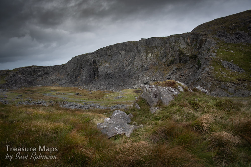 Carn Owen Quarry The Hafan incline and mine, and the Cyneiniog Mine Immediately below the Carn Owen Quarry, the tramway descends into the valley of the Afon Leri and Cwm Ty Nant by a spectacular incline, dry stone built and still in good condition considering how long it has been out of use. As you are going down the incline, to your left are some open stopes from the Hafan Lead Mine. These seem quite extensive and are accompanied by ruined processing areas with much in the way of hand worked spoils. Low dry stone walls remain from the structures that protected the workers cobbing the ore. However hard the work must have been, I hope the ladies hammering the ore took some comfort in the lovely view below them. 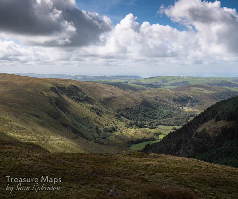 The view down the valley towards Aberystwyth in the distance and the sea. In the right distance is the Bwlch Glas mine, subject of another post soon. 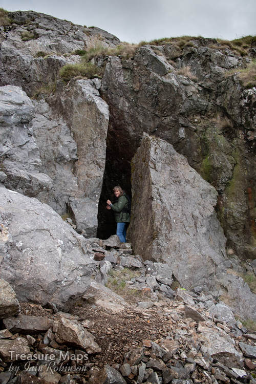 Petra takes a look into one of the stopes beside the incline. At the bottom of the incline is a large waterwheel. According to the Welsh Mines Society, this is called "Barbery's" wheel, after an engineer, or possibly a lessee of the mine. The tail race has a fine arch. There are a couple of fine arched adits at the foot of the incline, corresponding with the tip runs, but I am ashamed to say that we missed them on our visit. They are supposed to be almost lost in the ground, but it would have been nice to see them. 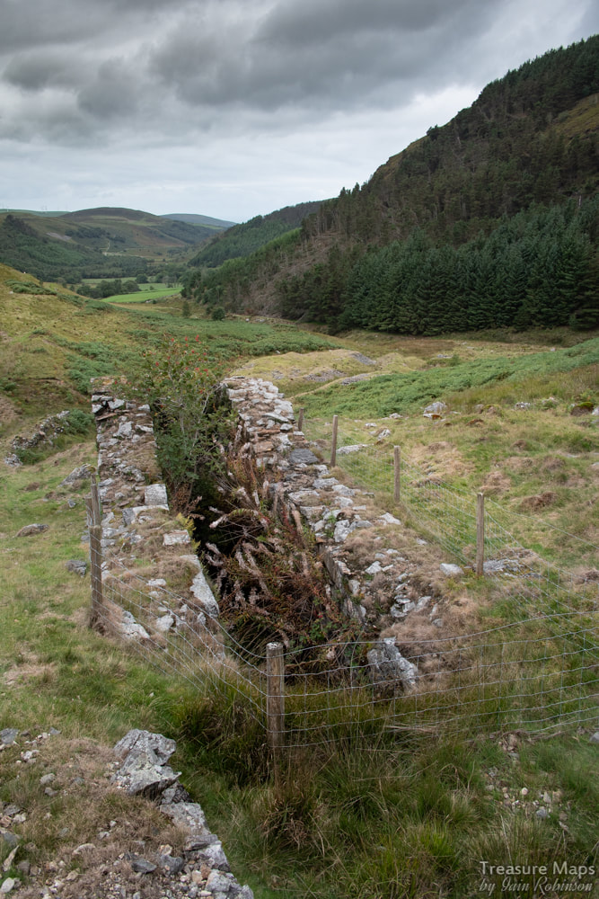 Barberry's wheel pit at the bottom of the incline. Following the tip runs, we came to a ruin which was undoubtedly the powder house, on a small area of ground beneath the modern forest. Above that, Petra spotted another adit on the side of Nant-y-Maes Mawr. It was open, but flooded to waist height. It looked as if there might be a shaft immediately inside, and since neither of us fancied getting wet, we left it alone. This was the Cyneinog Mine, and judging by the Chalcopyrites in the tip, was a copper trial, as the tip wasn't too extensive. 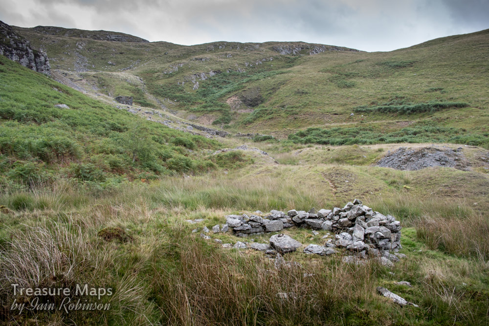 The rather sketchy remains of the powder house. A well-preserved and engineered leat ran from the adit towards the water wheel, utilising the outflow of the mine to good effect. An article in the "Welshman" of 27th March 1857 gives details of a dispute between the Lord of the Manor, Pryse Loveden, wishing to open a mine, and the lessee, a Mr Matthew Davies, an "influential gentleman" of Cyneinog Farm, who objected. Davies had built a wall around the land. The Lord got together a gang of men and demolished the wall, hence the dispute appearing at the Assizes. The plaintiff won on this occasion, but since a mine later appeared, we can assume he eventually lost- or was bought out. More on the Mines of Nant-y-moch next time... 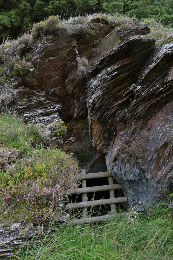 The adit entrance at the Cyneinog Mine
2 Comments
|
TracksReceive the occasional Treasure Maps Newsletter- and alerts when a new post is available!
If you enjoy my content, please buy me a coffee!
Check out my other online activity...
Index
All
|
 RSS Feed