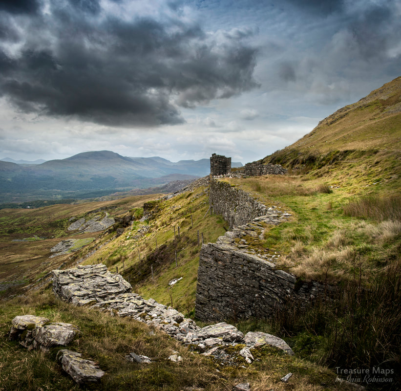
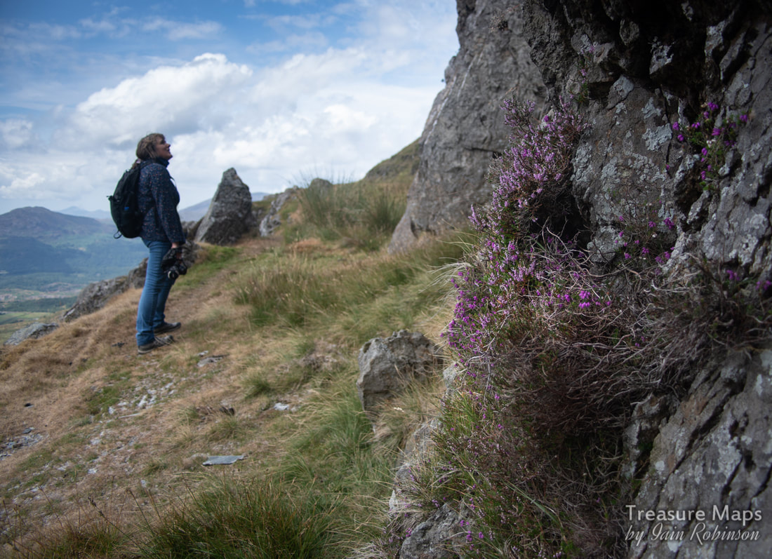
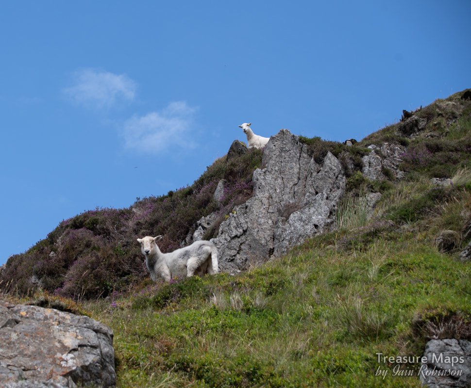
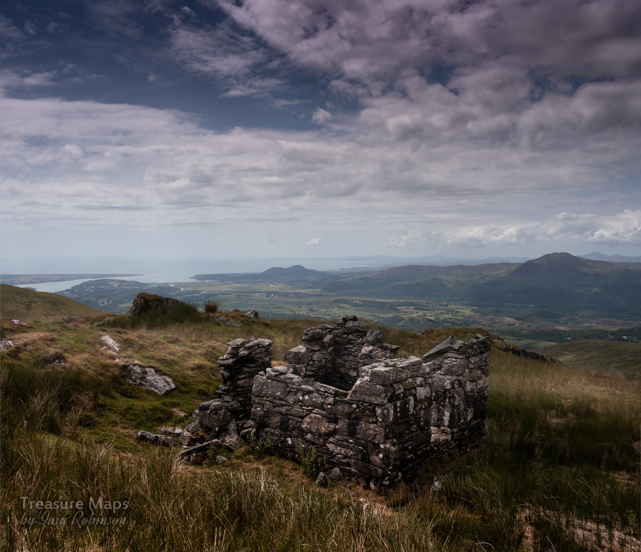
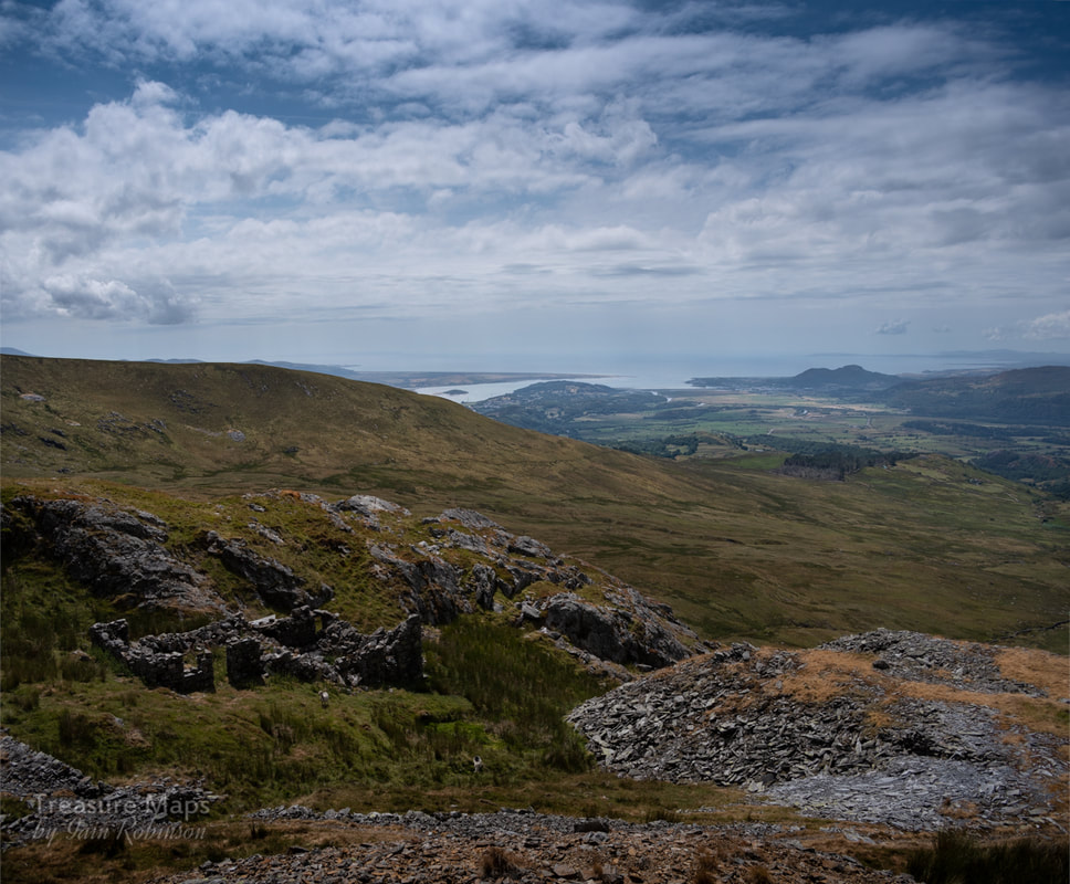
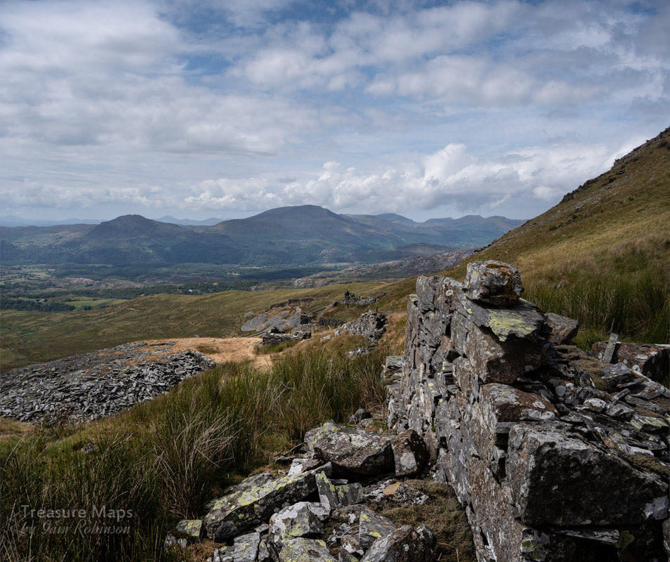
 Towards the mill. The first time I made it to the bwlch between the two Moelwyns, I walked on over, bemused at the striking contrast in the landscape. It had been a long day, stravaiging about the hills above Wrysgan and now, time was running out. It would have been sensible to start back down to the dam road before it became too dark, but I was tempted to explore just a little further. I found an intriguing, level mule track, enticing me to investigate-in the dusk light, the silver tips of a distant, unknown quarry seemed to shine, as if phosphorescent. That was several years ago now- and although we have now roamed most of the Moelwyn range I've never forgotten that first sighting of Pant Mawr and it's lower counterpart, Fron Boeth. Yet, foolishly, we've always felt that there were more exciting places to explore, and after all, Pant Mawr is on our doorstep, isn't it? Then, early last summer, I was driving about wondering where to explore. Petra had to work and I was at a loose end without my best pal. I took a right turn off the B4410 after Tan y Bwlch and drove along the narrow lane which goes towards Croesor. The land to the north is infested with forestry plantations. At last, I emerged from the trees onto the moor above Croesor and remembered a parking spot on the right. I stopped and had a coffee from the flask, perusing the map. The lane is a narrow one and I had been lucky not to encounter another vehicle- there are precious few passing places. Now I could savour the perfect coffee and the exquisite view across to Moel y Gest and the sea. Perusing the map, I noted a farm track which seemed to give access to the ridge going up to the Pant Mawr incline head. This was it! My head buzzed with the excitement of the chase...and the coffee, too, I suspect. 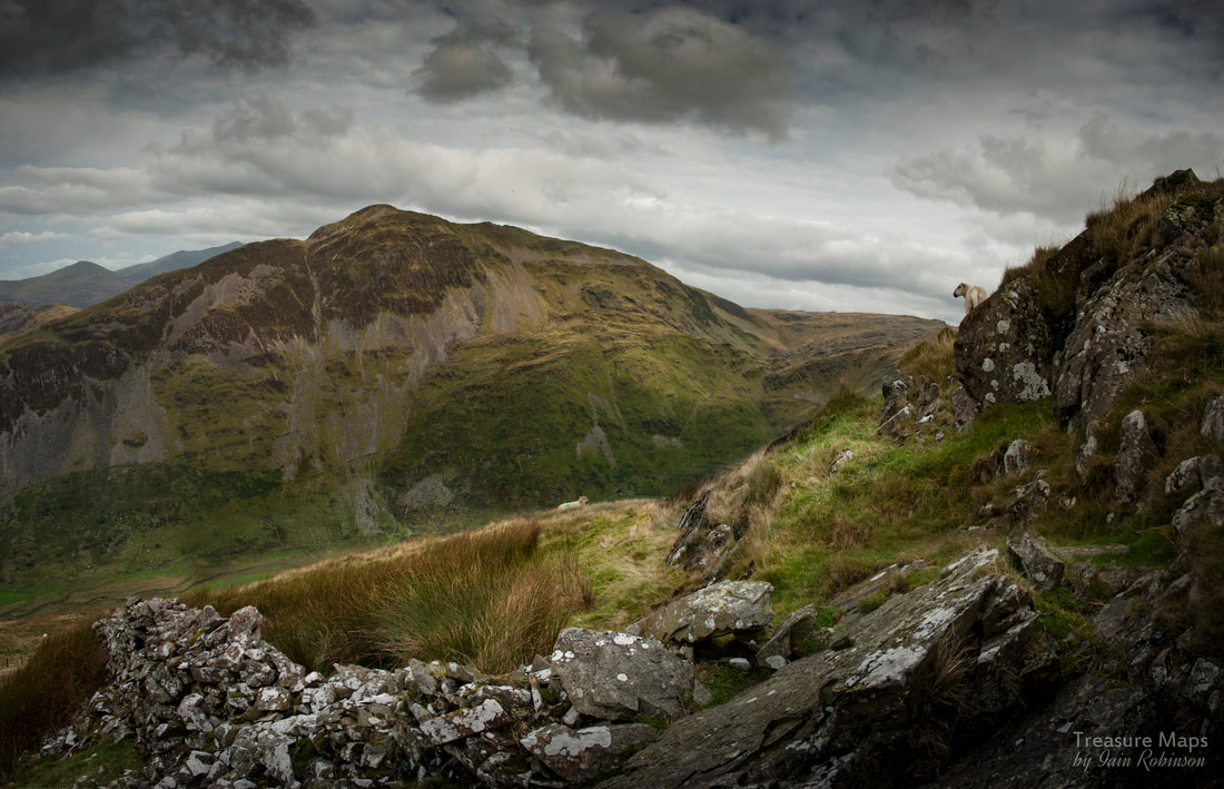 The view of Cnicht as I ascended the ridge towards the Pant Mawr incline head. My parking spot was at SH63464329, a rocky and awkward place, but ideally off the road and out of mischief should a forestry truck or a farmer come along. I walked downhill along the road, through more trees for about three quarters of a mile, passing a couple of farms on the left, until I came to a farm track on the right. (SH6346744001) I had already passed a right-of-way, but reckoned I could pick it up again from the farm track. I had a suspicion that the footpath went through a boggy bit of land and had to cross a stream- why not take the easy way? It was steep going, but gained height quickly- I kept turning round and enjoying the enfolding vista. It was a fine day, a harbinger of the sweltering summer to come. I followed the farmer's road until SH 64082 44511, where it started to decline towards Fron Boeth quarry. For better or worse, I wanted to make that Incline head now, so I struck up along the steep ridge. The footpath wants you to go down the other side, towards the Croseor quarry road, not where I wanted to go, so I kept to the line of the ridge. I noticed the farmer about half a mile below, looking at me with binoculars...I wondered if a "consultation" would ensue, but he buzzed off on his quad bike shortly after eyeballing me. After that, I didn't see another soul all day, although I noticed the summit of Cnicht was busy with folk. Yes, the views of the Croesor valley and Cnicht were becoming rather impressive. It's such a beautiful, if slightly oppressive cwm, one that has been a favourite with me ever since reading J.I.C. Boyd's evocative account of the tramway many years ago when I was exiled in Scotland. From up in my eyrie, I could see the line of the old tramway and the rows of Crawiau Llechi (vertical slate slab fences) either side of it. I reached a rock bastion fifty feet below the incline head and sat on a rock to get my breath back. The flask made another appearance and I surveyed the scene whilst being appraised by a couple of curious sheep. 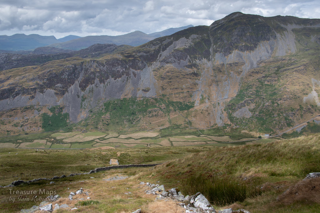 Looking down the incline. Cnicht looks impressive. I realised that I had a perfect view across the valley of the zig-zag miner's paths going up the slopes of Cnicht, towards the crazily sited Deufaen Quarry, and it's close neighbour, the equally preposterous Clogwyn y Darren Quarry. Situated at 800 feet on an almost vertical slope, this was a triumph of optimism over practical considerations, incredibly producing 20 tons a year in the 1860's. Apparently an adit is still open and there are vestiges of a small building and possibly a sledge way. Later work might have involved a rope way according to Richards. Needless to say, I haven't tried the path up! 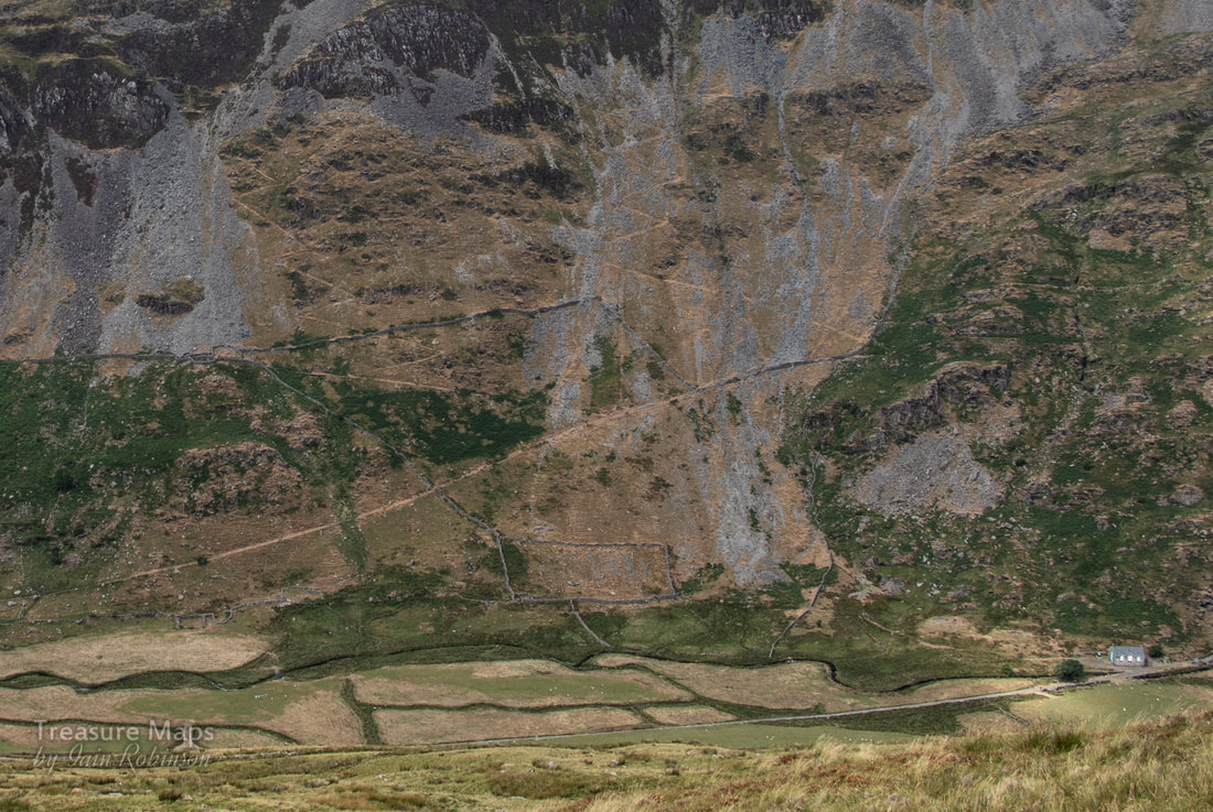 The zig-zag paths. If you open this in lightbox you should be able to see them, the right one comes off the track going from the left to the right uphill. You can also make out the platform with a little imagination. The building on the right lower side is at the base of the Croesor incline- the tramway makes a lovely walk to the foot of the great Rhosydd incline and also the Croesor quarry incline. 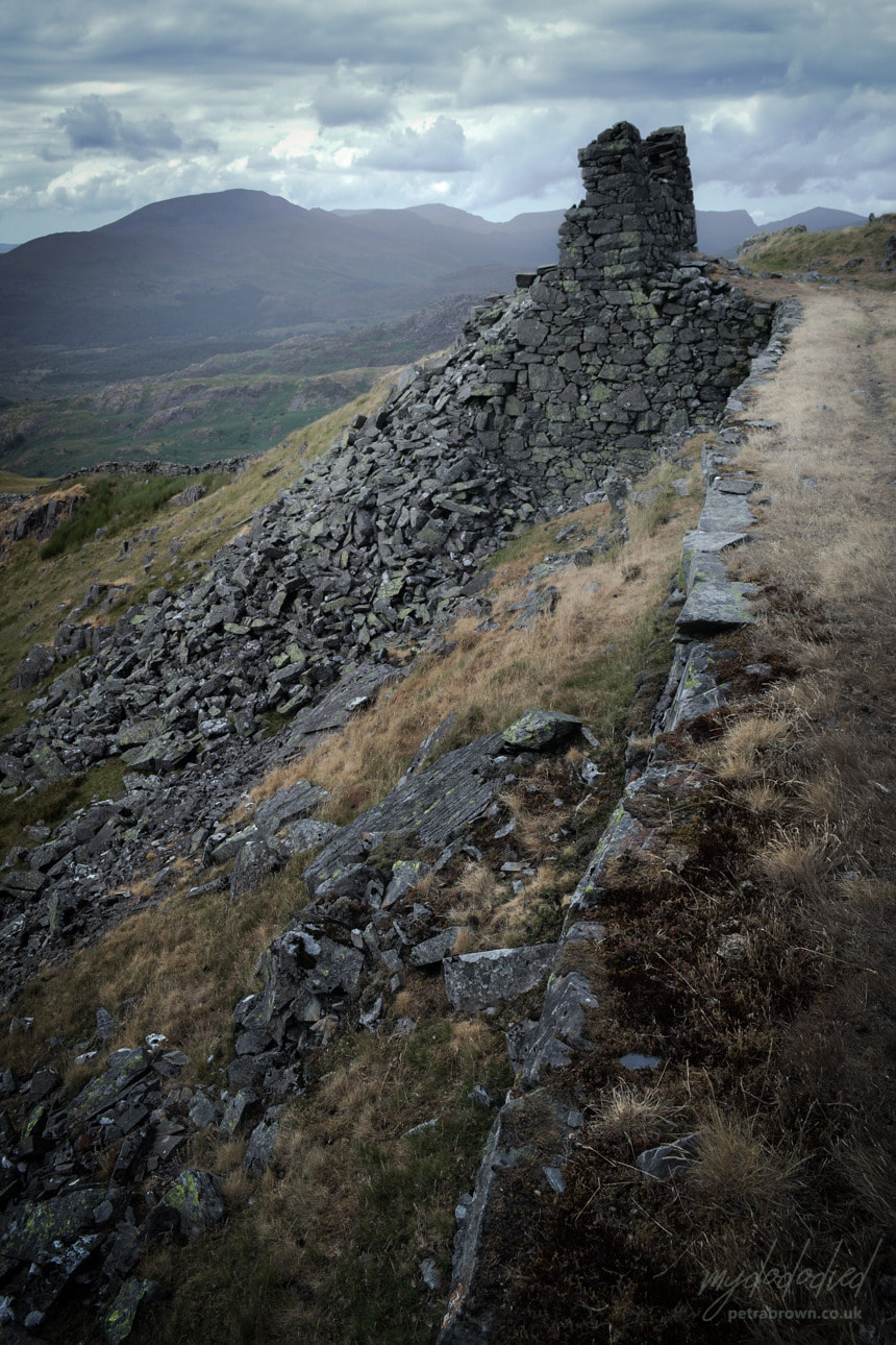 Photo by Petra. The incline head beckoned now and after a slightly hairy scramble up, I stood on the tramway formation. The stone drum house is still a very impressive structure, even if half of it has succumbed to the wind's attentions in this wild spot, over 1000 feet up. Originally, the incline drove down a two-pitch descent, separated by a manoeuvring loop. Later, a tunnel was driven through from Fron Boeth when the lower quarry took over production and used the lower pitch. I've been tempted to explore the incline when walking Cwm Croesor...that is now nearing the top of the "To Do" list! 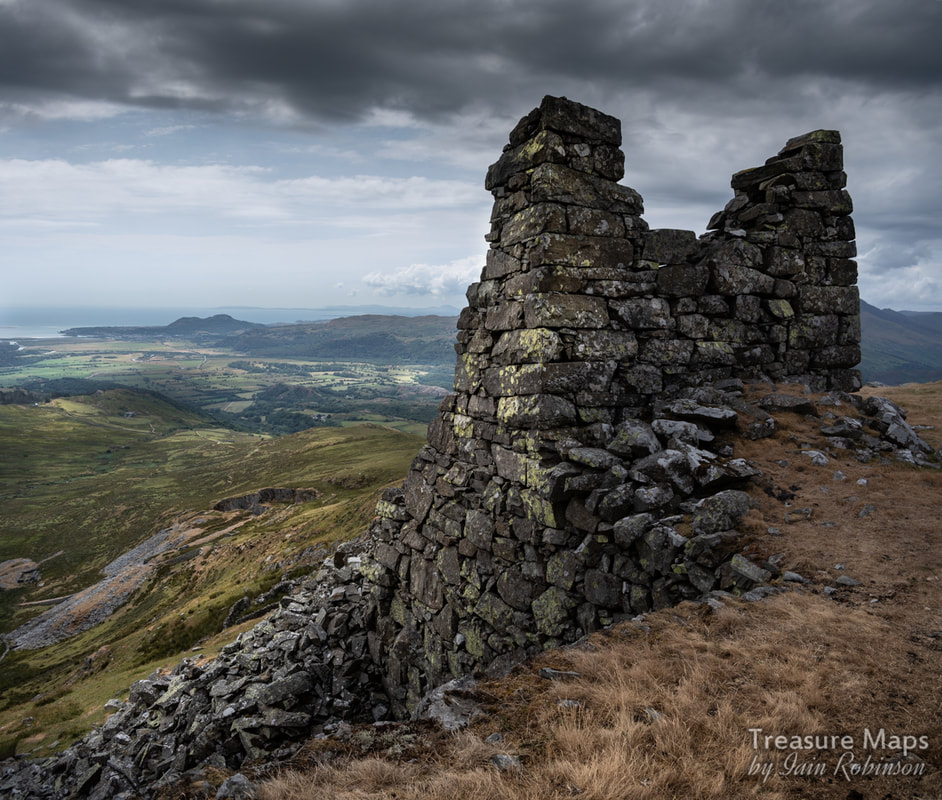 A moody study of the incline head, looking towards Moel y Gest and Porthmadog nestled beneath it. A very attractive feature of this site is the way that the tramway follows the contours of the mountain towards the mill at SH 6523 4473 on a rock-cut shelf. 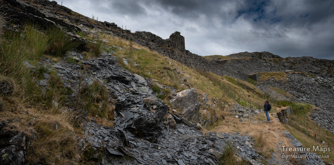 Petra looks up at the mill with fines showing in the foreground. Some of the shots that follow are from when Petra came with me for a return visit- after I told her about it, she was keen to see. The remains of structures are frustrating; the weather really has taken a toll of them and it is difficult to make out what the purpose of some of them was. The mill is unmistakeable, sited atop a very imposing platform made of slate, with fines tipped over the side. The views from here when the mill was working must have been some consolation for having to do such a tough job. 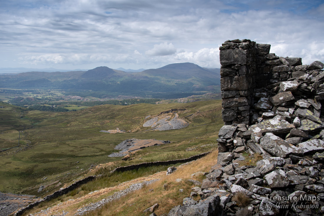 Looking down from the mill ruins to Fron Boeth quarry with Moel Ddu and Moel Hebog in the distance. I haven't mentioned until now, but all the way from the mill towards the bwlch, under the slopes of Craigysgafn (the knife-edge ridge beetling above), are a series of adits. Some are run-in and some are accessible- if you like wading in icy cold water up to your waist! A couple of years ago, some hardy souls from AditNow explored the underground chambers (which are quite extensive) after others from the site had spent two weeks pumping and siphoning the water out. There's also a survey drawing of the tunnels available to registered users of AditNow. The thread on the forum makes for interesting reading. 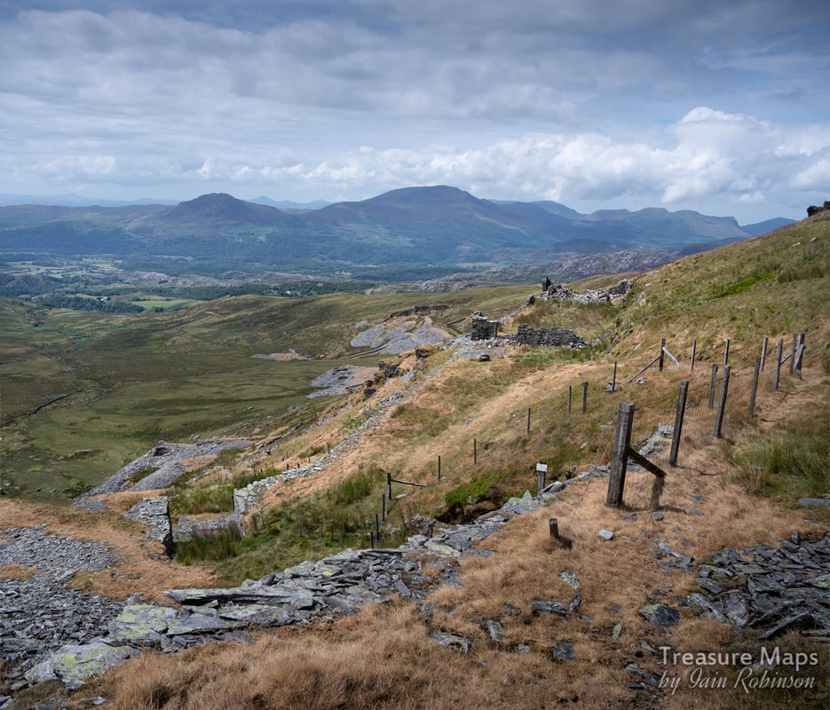 The short incline from the mill level to the exit tramway, with an adit in the foreground, betrayed by the fencing. When I mentioned to a friend that I had been to Pant Mawr, he told me about the old tales of the mine connecting with the Moelwyn mine on the other side of the mountain. I did some research, as at first I thought this was a fanciful notion, but soon found out otherwise. Apparently the Pant Mawr operation worked the lower level of the Moelwyn vein dipping to the west -and connections were made, more to ensure that the Pant Mawr chambers were properly below the Moelwyn ones- it sounds like these were roofing shafts rather than proper tunnels connecting. But in any case, the floors at Pant Mawr were numbered in sequence with the Moelwyn operation as were the floors, lower again, at Fron Boeth. At Pant Mawr and Fron Boeth, there are 19 adits, six of which are impassable/run-in and the others are either too flooded or obstructed to explore without some considerable draining. 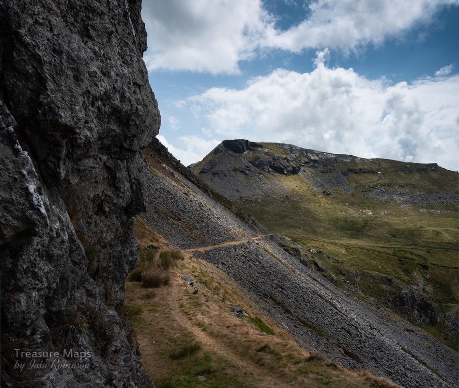 The mule road towards the bwlch. My way down and back to the car went along the track seen going to the right in the middle distance. You can just make out the lead trials in this shot, under the trackway going down to Croesor. Towards the mill, there is a short incline from the tramway up to the mill level. After this, a mule track carries on towards the bwlch. On my visit, I followed this as I had an idea that I could hook up with a footpath that goes to Moelwyn Bach from Croesor. This route passes some high adits, the highest is over 1500 feet on the mountain. Trials appear here and there while there are a few ruined buildings and formations that we can only guess at. One range of structures looked like a barracks, others like weigh-houses. The mule track was constructed by the Moelwyn Quarry in 1820s, when Nathan Meyer Rothschild's Cambrian Company employed John Rogers of Wrexham to engineer the track in an attempt to open up the south side of the crown land. It was known as Ffordd yr luddew mawr ('road of the great Jew') and reached Pant Mawr in the 1850s. By then, the days of cart roads and mule tracks were over, as more concerns invested in tramroads and railed inclines to move their product. Reaching the bwlch there are some more trials, probably from before Rothschild's withdrawal from the quarry in 1828. The path from the Croesor road joins here, (SH6584144158) doglegging downhill, but not before passing more trials, this time for lead. These are more easily recognised for what they are on Google Earth. 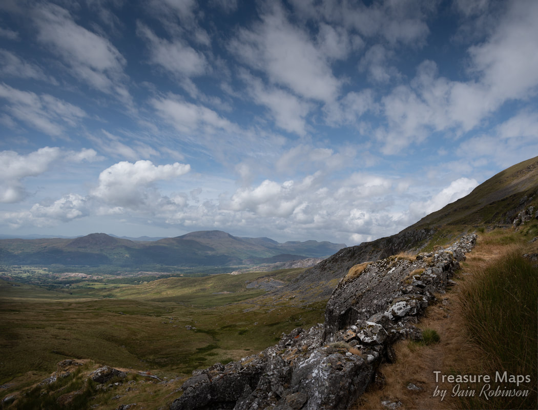 Looking North West along the trackway towards the mill. On my solo visit, I trudged steadily downhill on the footpath, heading for a stand of trees where I had parked the car. Except that, despite my walking on inexorably for what seemed hours, the trees weren't getting any nearer. The ground was also really wet and I sank into gloop well over my boots at times, although the boots stayed dry (miraculously!). Finally, I seemed to be making headway and I got back to the car. I was pretty tired, and glugged down my last cup of coffee from the flask before setting off for Ffestiniog- except that I didn't feel brave enough to drive back the way I had come- that would have been pushing my luck. I took the other way into Croesor and out towards Plas Brondanw and Garreg... It had been a great day out on the hill with so many interesting things to wonder over...and I promise I will write about Fron Boeth as soon as I can, to complete the story :-) Post script- Petra and I walked up from the Stwlan Dam road, which we thought might be more direct- it wasn't. Although you do get more mines for your money. Below you can see the bwlch on the way up and the Moelwyn mine on the side of Moelwyn Mawr. You also pass the lower (run-in) adits of the Moelwyn Bach mine. 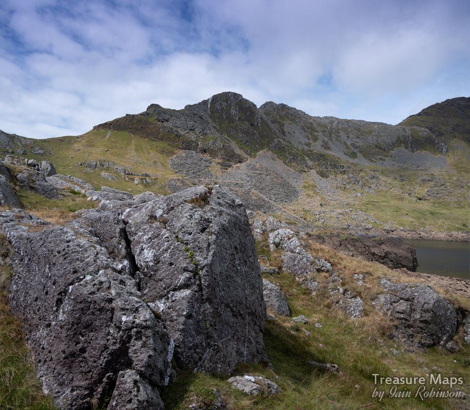 Craigysgafn, with the Moelwyn mine in the centre. Pant mawr is directly on the other side of the mountain, and we walked over the bwlch to the left. Some quick factoids: Pant Mawr was opened in the 1840s, and the incline down to Cwm Croesor was built in 1863. The quarry closed in 1878, but reopened in conjunction with Fron Boeth in 1886. The whole operation fell into disuse around 1912. There was a zig-zag path made down to Fron Boeth from Pant Mawr, this can be traced on Google earth near the mill. References: Gwyn, David (2015). Welsh Slate. Royal Commission on the Ancient and Historical Monuments of Wales. ISBN 978-1-871184-51-8. Lindsay, Jean (1974). A History of the North Wales Slate Industry. David and Charles. ISBN 978-0-7153-6265-5. Richards, Alun John (1999). The Slate Regions of North and Mid Wales. Gwasg Carreg Gwalch. ISBN 978-0-86381-552-2. Richards, Alun John. Gazetteer of Slate Quarrying in Wales: Llygad Gwalch Cyf (1974) ASIN: B01HC1LIUK Boyd, James I.C. Narrow Gauge Railways in North Caernarvonshire, Volume 1, The West. ISBN 0-85361-273-0. 3 vols 1981-6 Quarry page on AditNow (register to see plans) Coflein page about the mill
4 Comments
|
TracksReceive the occasional Treasure Maps Newsletter- and alerts when a new post is available!
If you enjoy my content, please buy me a coffee!
Check out my other online activity...
Index
All
|
 RSS Feed