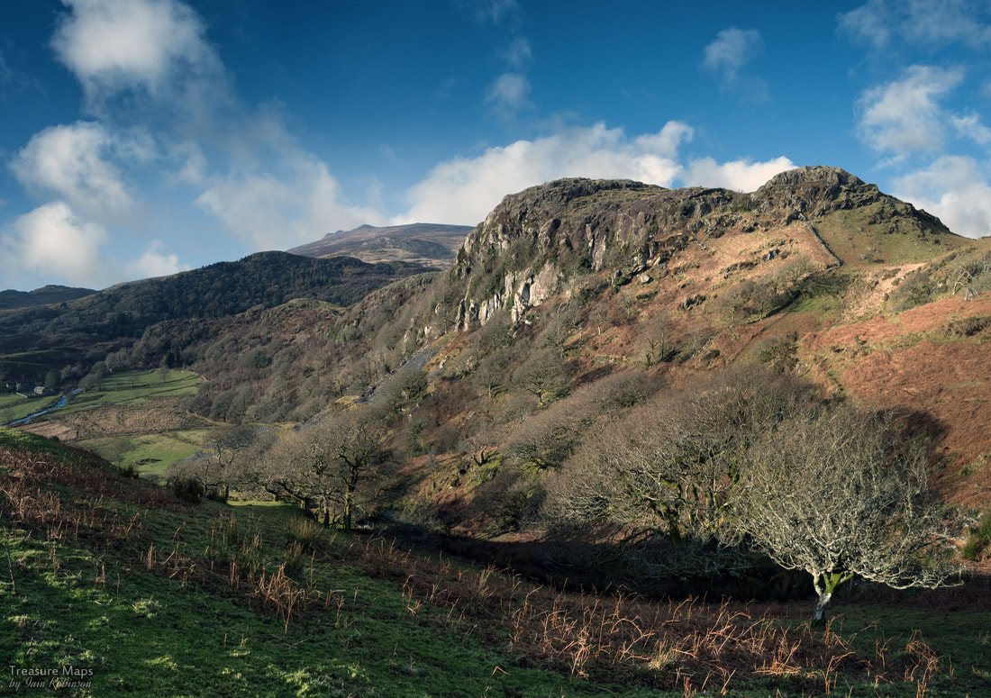
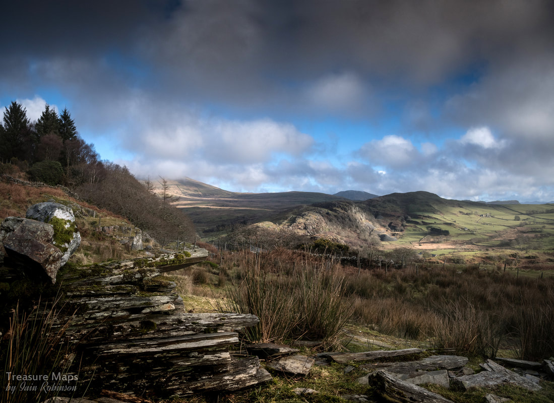
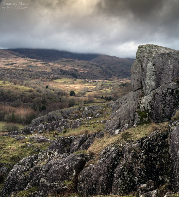
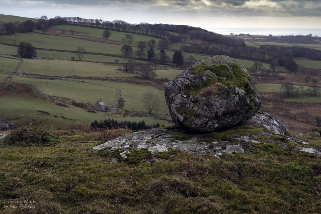
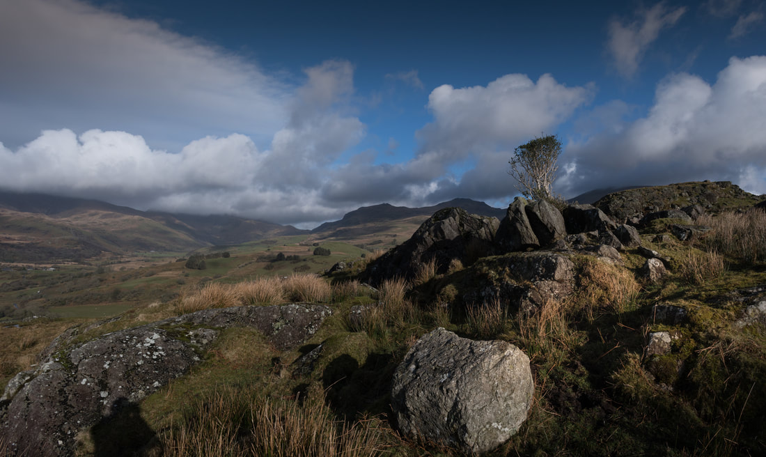
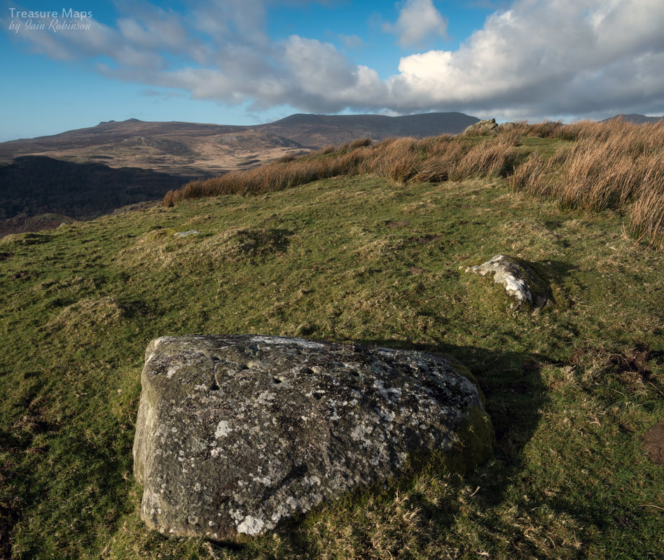
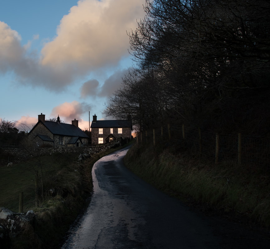
 Craig Isallt from above the top pit of the slate quarry. Moel Isallt is the obstacle every traveller has to negotiate, before the true nature of Cwm Pennant shows itself. It's a hill of differing characters, depending on where you approach it from, but it is always the gatekeeper. Upper Cwm Pennant is a hanging valley, watched on the east by Moel Hebog, Moel lefn and Moel Ogof, while the west side is firmly policed by the mighty Nantlle Ridge. In the Pleistocene era, when glaciers scoured down the cwm, Isallt was already ancient, a tough outcrop of volcanic rock, stubbornly blocking the way. It caused the ice to build up, then climb over on it's journey to the sea. 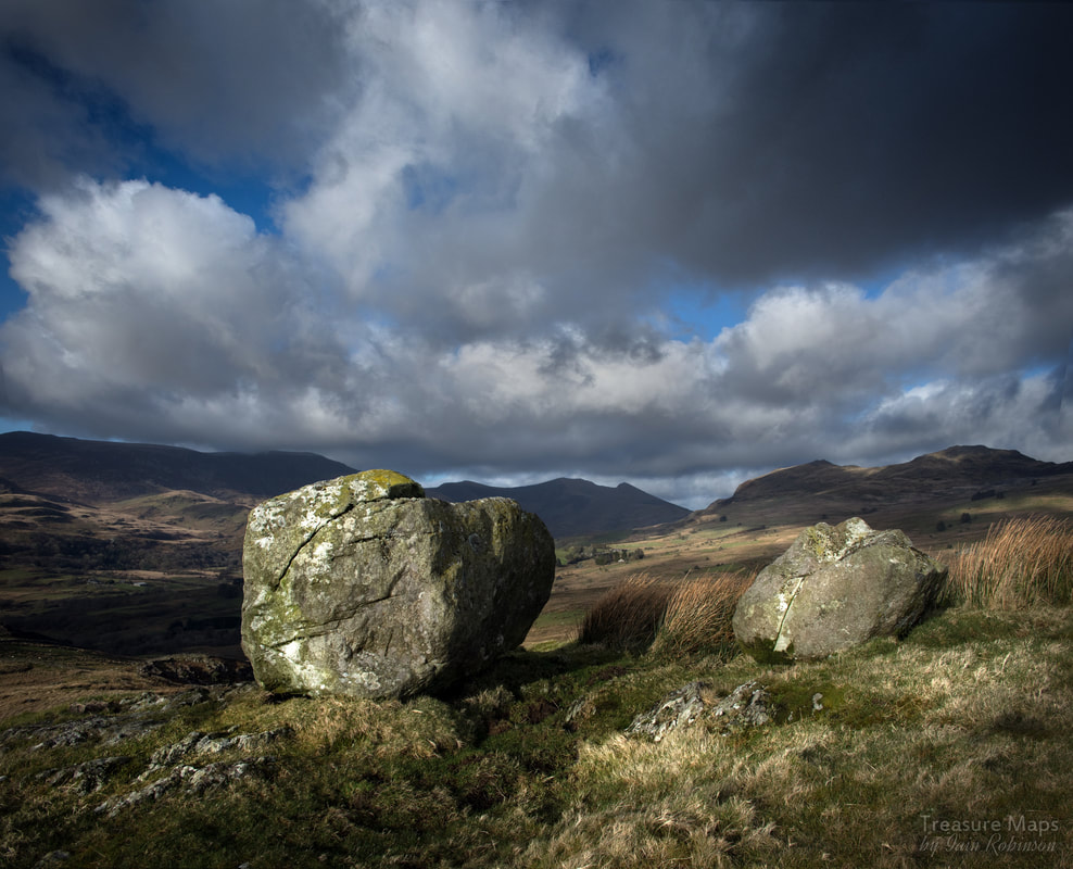 Erratics, huge blocks of rock, left by the ice. It was almost as if they were arranged deliberately, for effect! On the south side, facing the coast, it is sheer, almost vertical in places- a classic Roche moutonnée. On the top, the surface is smoothed and scarred by rocks, carried by the ice, as it careened slowly, inexorably over. To the north, there is a huge slope of glacial till, clay and stones, deposited as the ice ramped up. Then, in an instant of geological time, the climate warmed and the ice melted, leaving some massive rocks stranded on top- "erratics" in "O" level geography speak. Something else happened, too. A lake formed with meltwater, until eventually it spilt over at the lowest point and cut a channel. This channel is now where the road climbs steeply up, over the threshold. It's called Gyfyng, or "narrow place". 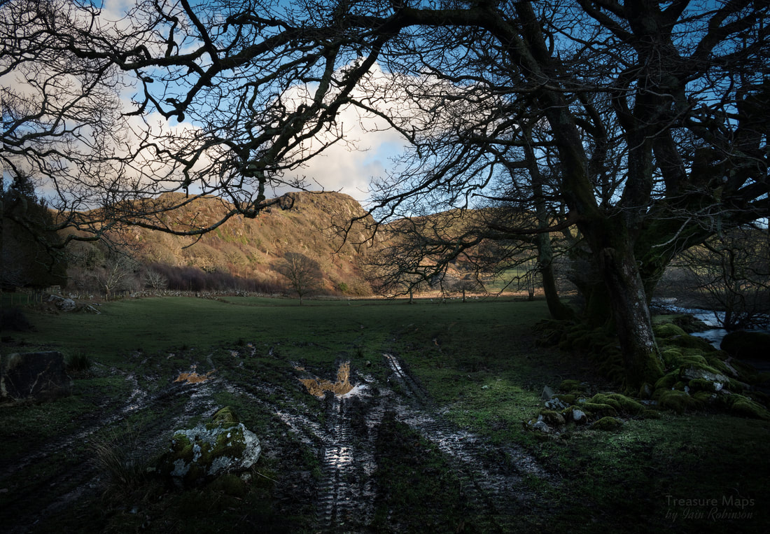 Craig Isallt, from the north side of Pont Gyfyng. So much for the origin of Moel Isallt. But what is there to see now? At the base of the hill is the bridge over the Dwyfor, once a meltwater channel. It's an old bridge, dating from the early 1800s, slate boom days when infrastructure in the valley was overhauled to take carts full of product from the quarries, such as Moelfre and Chwarel Y Plas. To stand by the bridge, before the road starts to rise up, is to feel opressed by the hill as the wooded slopes rise steeply above. This part of the hill, where it resisted the glacier best, is known as Craig Isallt. Incidentally, there is space here for 2 cars to park considerately beside the road after the bridge. Almost at the top is a charming schoolhouse and teacher's accomodation. The school closed in 1939, and after being extensively restored in recent years, is now a holiday let, like so many properties in the cwm. Almost on the level now, the road skirts the flanks of Isallt along a beautiful lane, with the magnificent peaks of Snowdonia providing an exciting backdrop in the distance. Soon Pennant chapel comes into sight, where the explorer must turn right up the steep Rhwngdwyafon road and park. 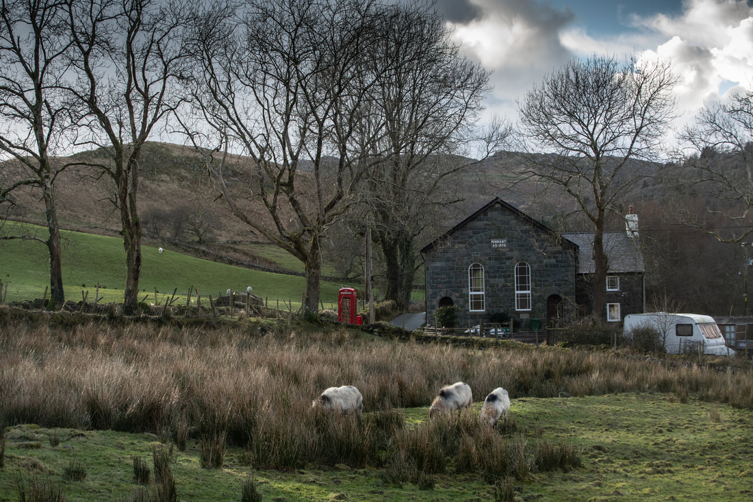 Pennant Chapel, from the meadow at y Ddol. Pennant Chapel is a simple yet dignified structure, built in 1834 as a Calvinistic Methodist place of worship. It was rebuilt in 1870, but by 1998, had fallen on hard times. At the time of writing (2018) it has been under reconstruction and will probably become holiday flats when completed. To the top! It's time to get the boots on and take a hike to the top of Moel Isallt. If possible, park in the small lay-by immediately after the chapel at SH 5314 4538. (If that is full, turn round and try in the space just after the bridge). Then walk steeply uphill until the road turns left. Here, at SH 5341 4534 on the right, is a gate which is a right of way. The gate has been firmly fastened every time we have visited, but nevertheless, it is a right of way. Follow the soggy path uphill gaining height quickly through a waterlogged field until it meets the 200m contour- follow the fence on the right until a gate appears. Go through that and you can reach the top of Craig Isallt. Beware, the southern aspect is almost vertical, and the Craig proceeds in a series of steps- make sure you are wearing very strong boots and are confident about heights. 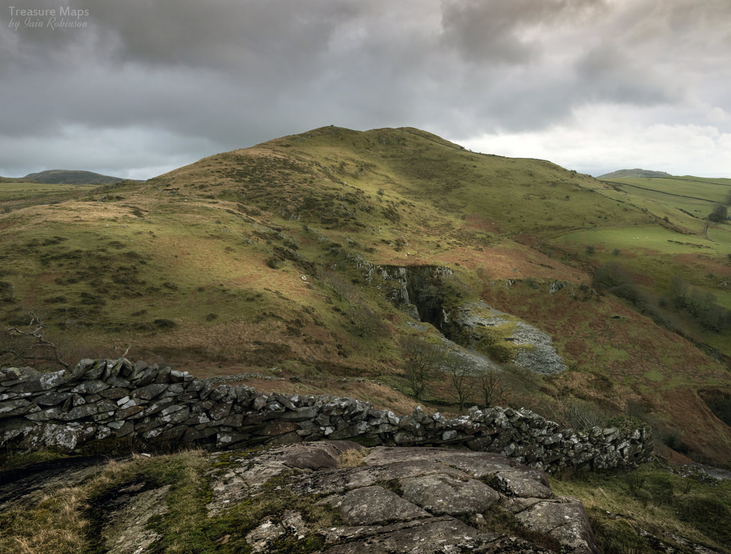 Moel Isallt from the highest point of Craig Isallt. There is a considerable drop behind the wall, which seems to have been built almost in the air. The rewards for this endeavour are some superb views of the mountains to the north, while to the south you can look down on the deserted Llanfihangel-y-Pennant church and the slate quarry. Meanwhile in the distance, Cardigan Bay sparkles on warm days. A significant bonus is a rock-cannon on the top of the Craig, somewhere around SH 5299 4507. 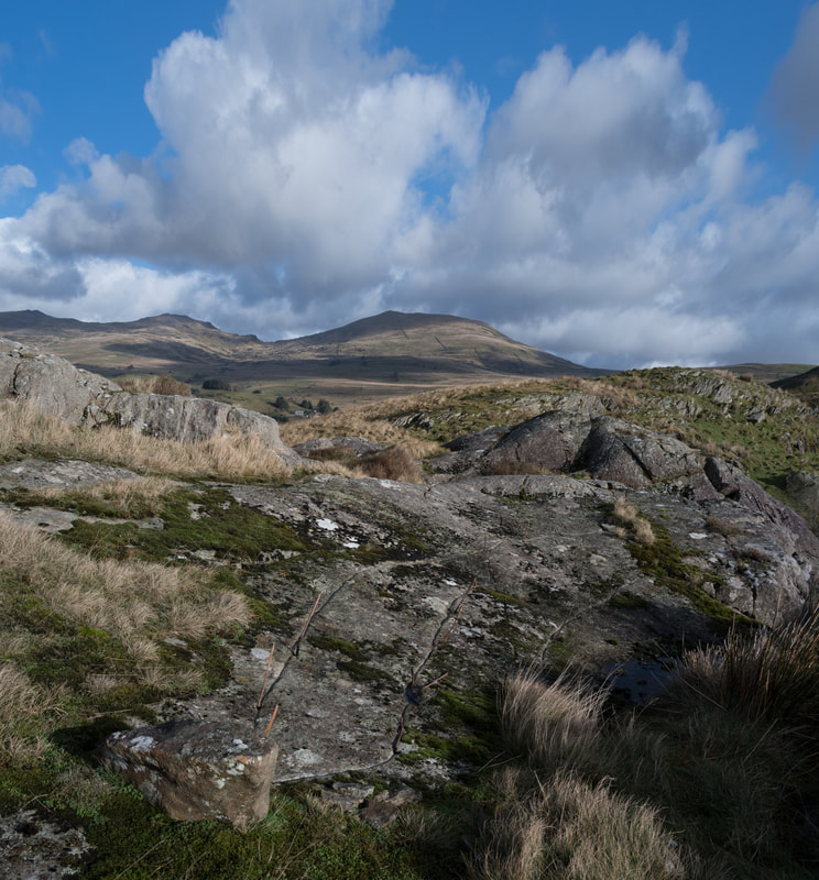 To reach the eastern top of Moel Isallt, I am afraid you will have to retrace your steps back to the footpath, as impassable terrain and unscaleable walls block the way east. There is a surprisingly steep but brief pull up to the top, (286m) but again, the views are great- across to Moel Hebog and over the panorama of the Gorseddau to the east. On the day that Petra and I climbed to this summit, you could see towards Ty Mawr, the Gorseddau quarry slate mill. Again there is the surprise of a rock-cannon, smaller this time and slightly away from the summit. High days and holidays must have been noisy occasions in this area! Below towards the east is the deserted farmhouse of Caerfadog Ichaf, which I shall cover in a future blog post, while to the west the Isallt Slate Quarry opens up below. I covered this on my old Blogger site, here. Moving off the top, it is best to keep to the west and head for the rough road and dry stone wall, as the ground was extremely boggy- and to add some spice, there were some very frisky bullocks around when we visited. 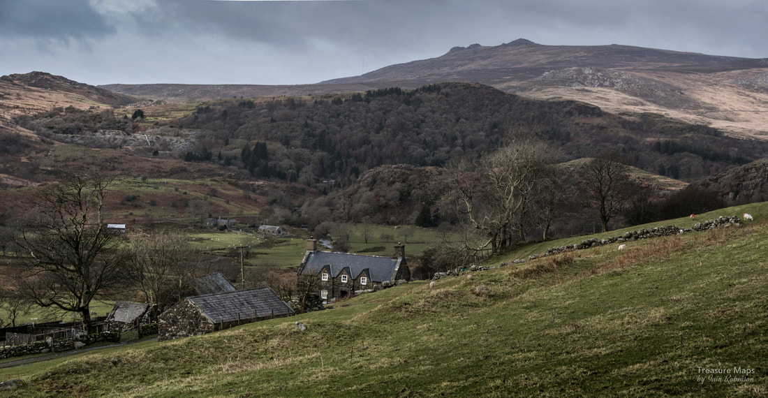 Isallt Fawr farmhouse, with the peak of Mynydd Graig Goch looming in the distance. Moelfre slate quarry can be seen on the hill behind. The House of the Bone-Setters After negotiating the mud and cattle, Isallt Fawr farmhouse is visible, waymarked haphazardly until you reach the farm yard. This is a very fine house, grade 11 listed and dating from the 1570s. It has associations with the Roberts family who were well known bone-setters (surgeons) in the area. One notable member of the family was Griffith Roberts 1735-1808. It is interesting to note that between them, the Roberts and Owen families of Isallt Fawr produced over 100 doctors and surgeons. A snippet of trivia is that J.B.Priestley once stayed at the farm. 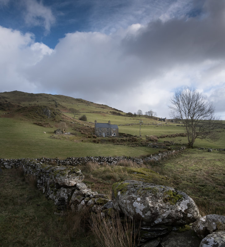 Isallt Bach, with Moel Isallt rising behind. Isallt Fawr is up and to the right . Now you will need to take the road downhill, until Isallt Bach is reached, at which point the right-of-way goes across boggy country again, down towards the river. There is a temptation to follow the tramway formation here from the quarry; it would be easier, yes- but there is a fence to cross and this is private land. I confess, we have done it and I preferred it to wading through gloop on the east bank of the Dwyfor, which is what the footpath wants you to do. We have only been here in wet weather- perhaps the path is passable in dryer times! However you reach the road, there is now a tarmac hike of a mile or so uphill to the parking place- unless you had parked beside the bridge at Gyfyng. The walk I've described takes in some spectacular views and interesting structures. I recommend setting aside two and a half hours to do it justice- and you will need some tough waterproof boots. It's a fine introduction to Cwm Pennant and the sight of some of the distant summits may well, I hope, tempt further exploration. 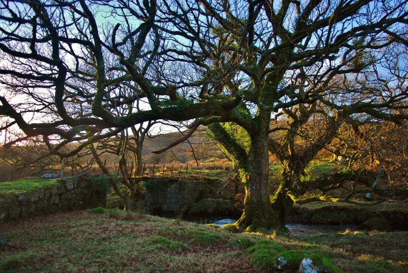 The tramway bridge just before it meets the road. |
TracksReceive the occasional Treasure Maps Newsletter- and alerts when a new post is available!
If you enjoy my content, please buy me a coffee!
Check out my other online activity...
Index
All
|
 RSS Feed