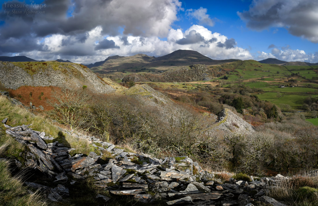
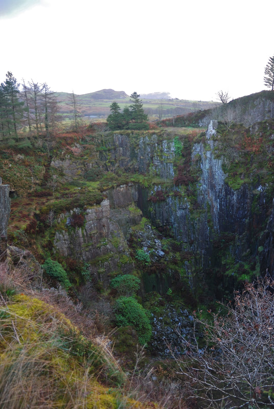
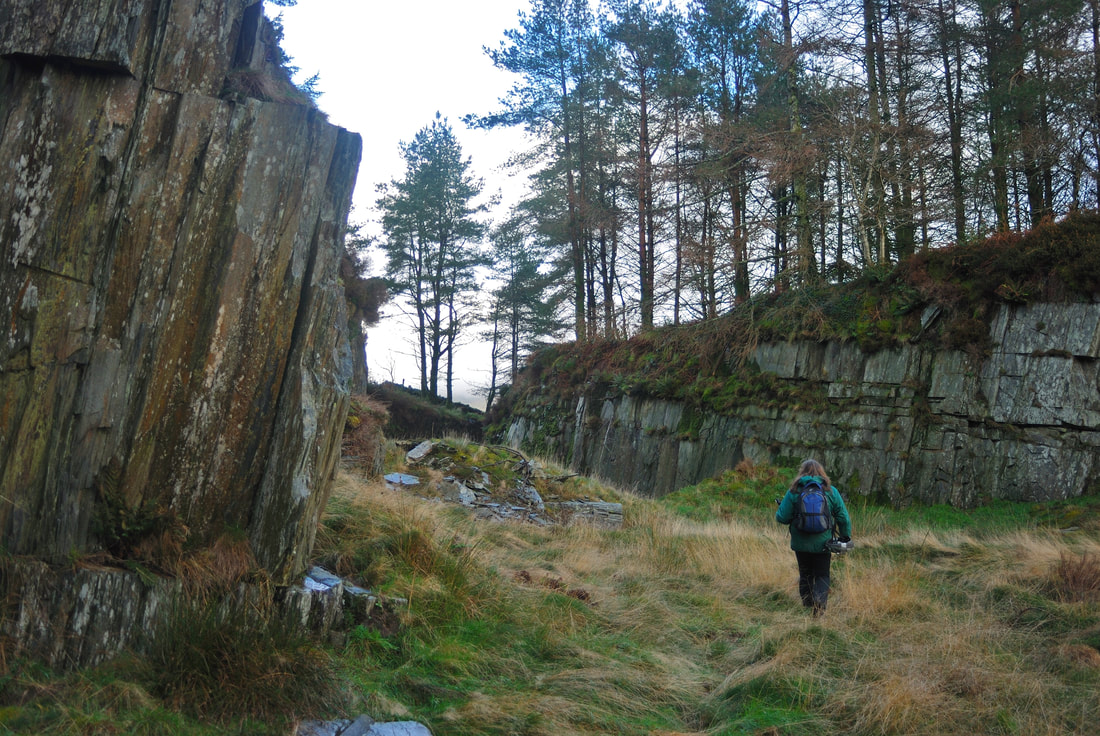
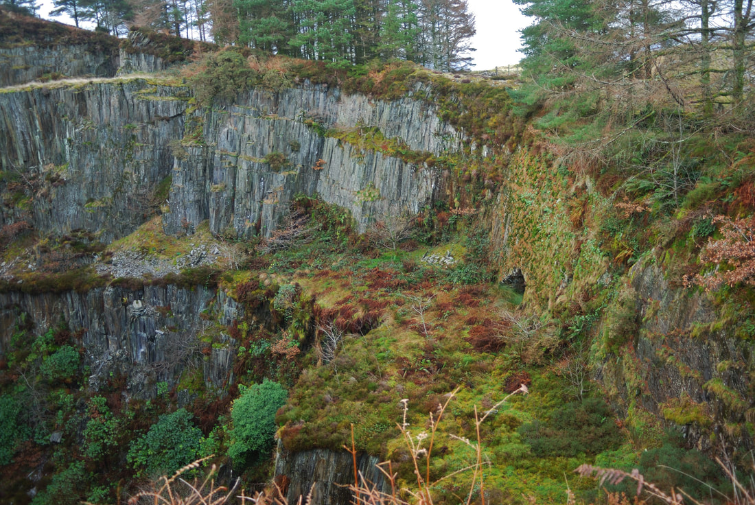
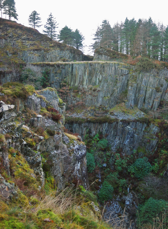
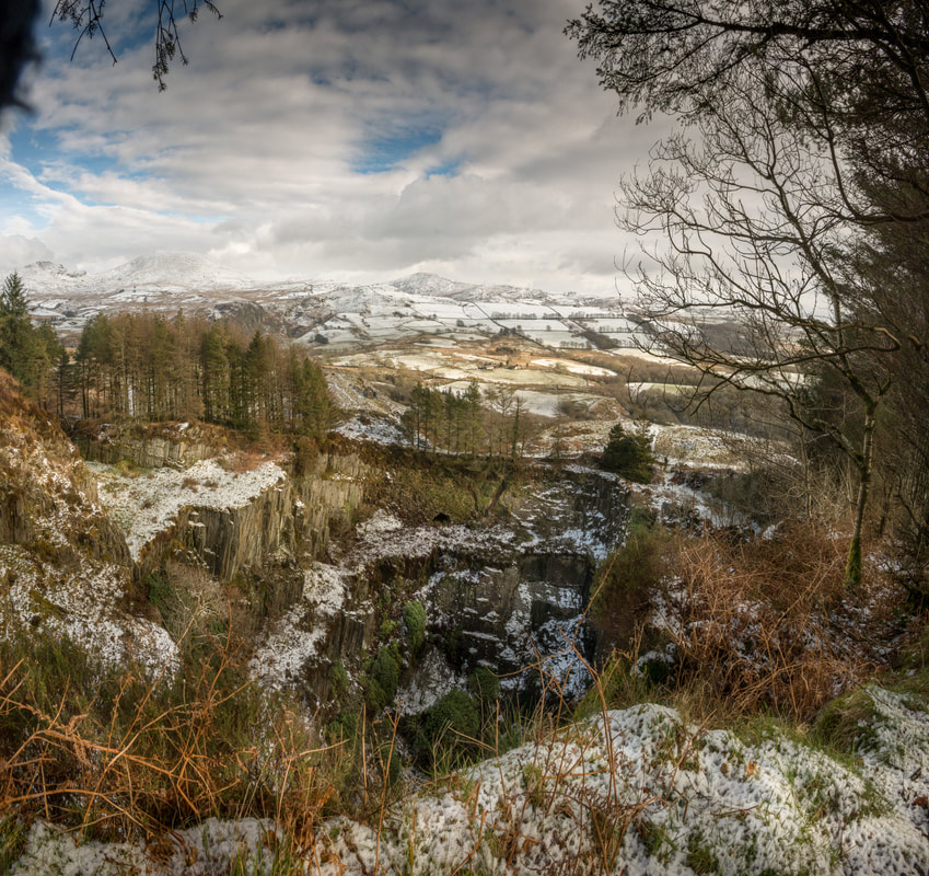
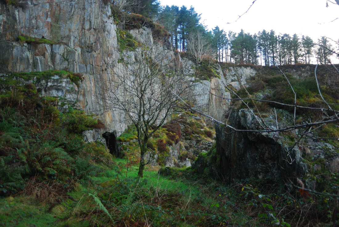
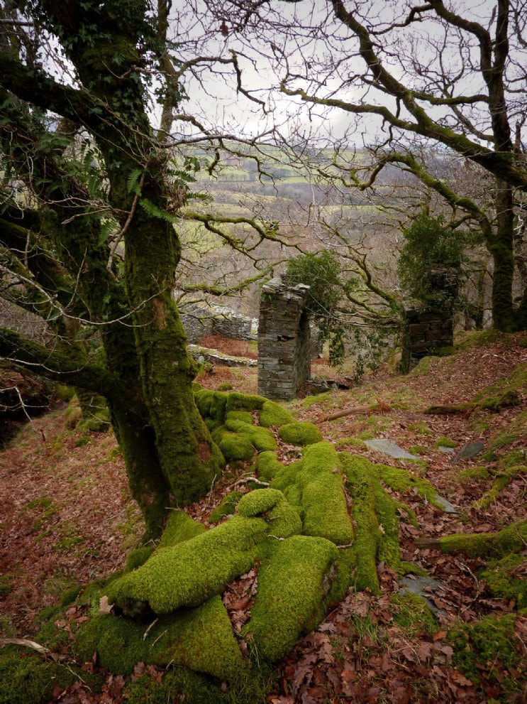
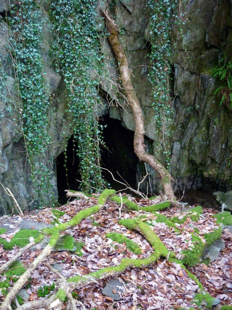
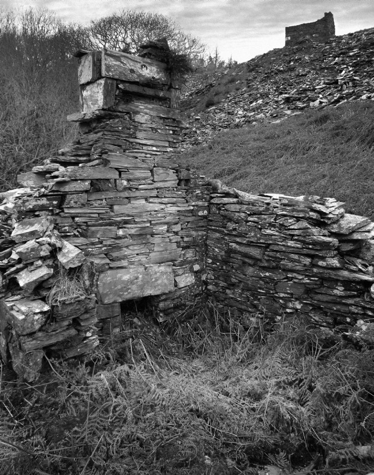
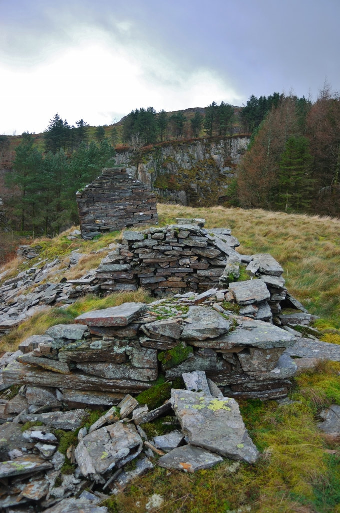
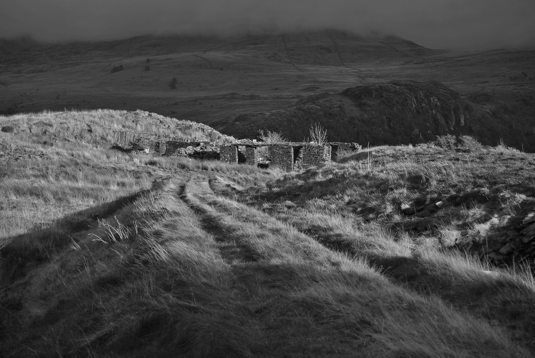
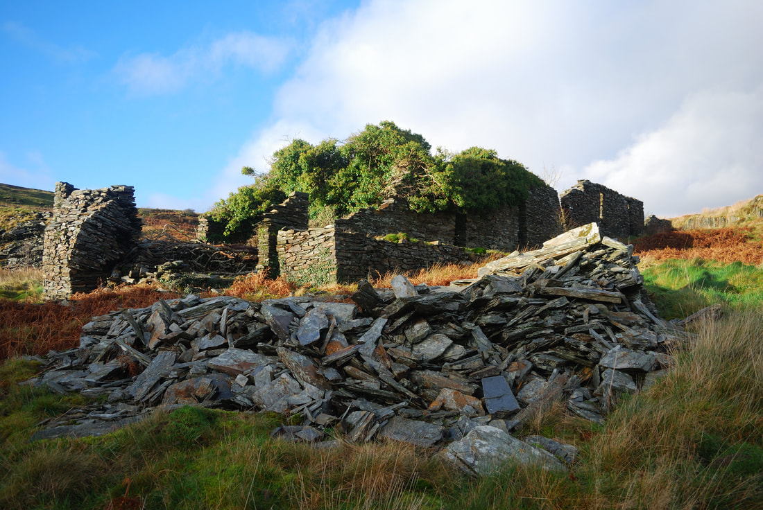
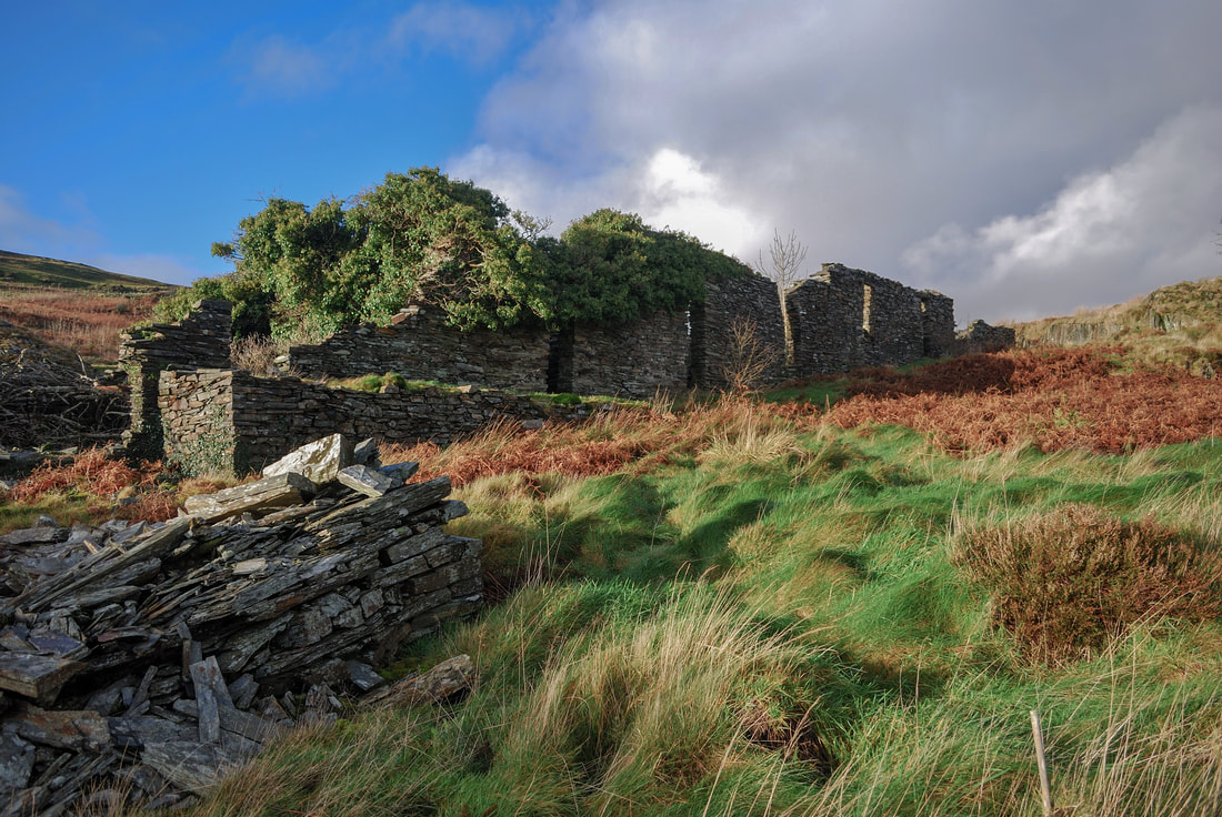
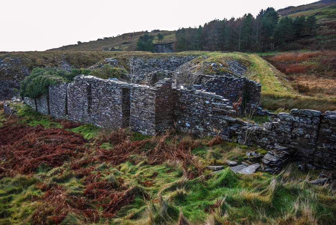
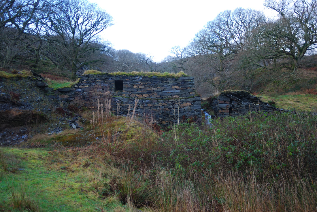
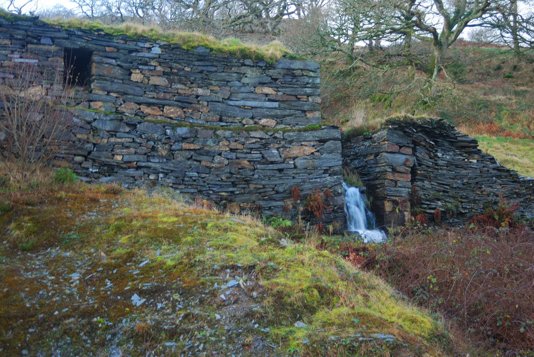
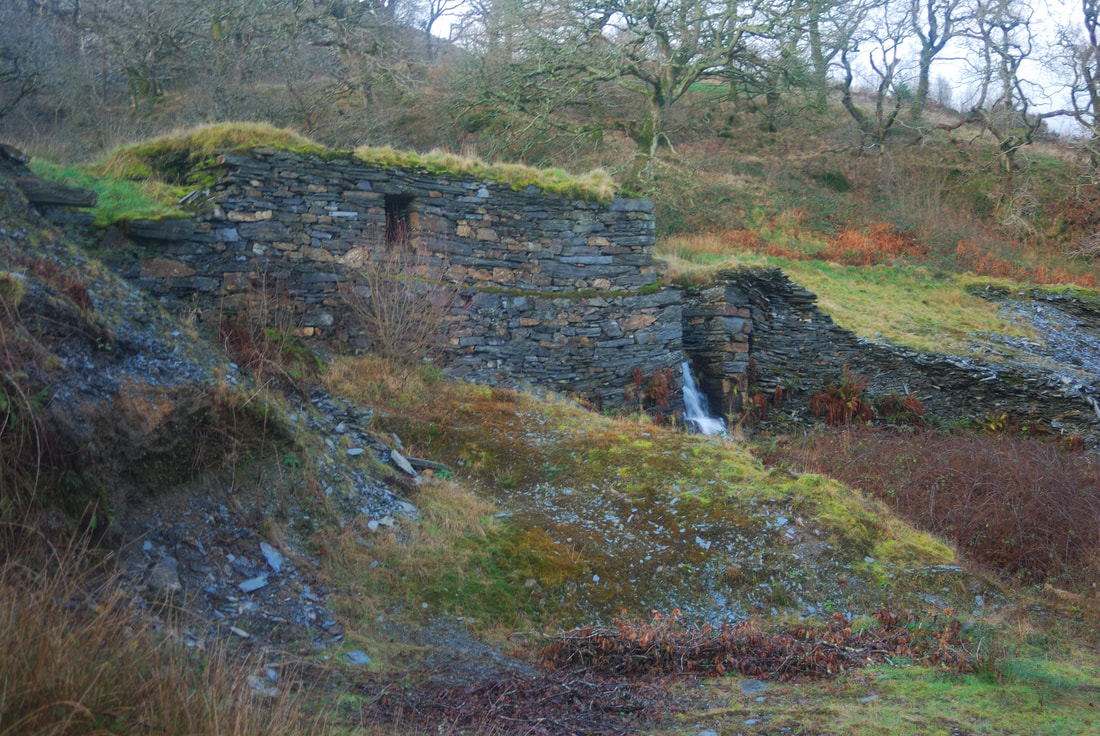
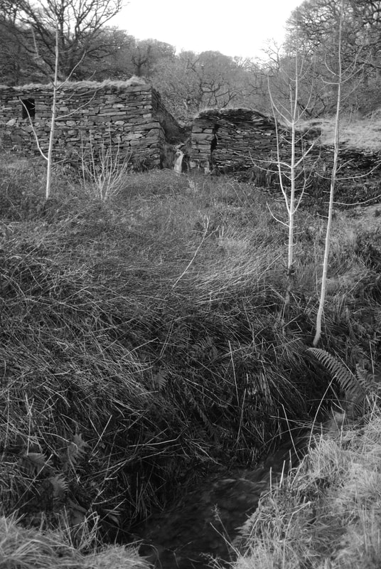
 Hendre Ddu from the middle tips, looking over to Moel Isallt and Hebog. In a cwm full of interest and mystery, Hendre Ddu makes an intriguing study for the mine enthusiast. Apart from it's archaeological allure, the place has a haunting atmosphere that I've noticed with other quarries in Pennant. It has a deep and forbidding pit and a fine range of tips with views over the cwm to Moel Hebog and Moel yr Ogof. 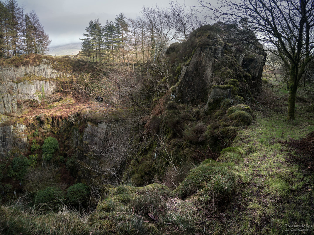 A looming leviathan of gangue rock hangs over the pit. The usual way up to the quarry is via the access track from the unclassified road. There's no parking here; I usually park at the bridge near St Michael's church, north of the quarry- It's not too far. As you walk up the steep access track, it used to be possible to see the round powder house on the left. It is still there, but these days it has been engulfed by brambles and young oak trees and is inaccessible. It's a similar pattern to the one at Moelfre slate quarry, just a little bit further up the cwm. 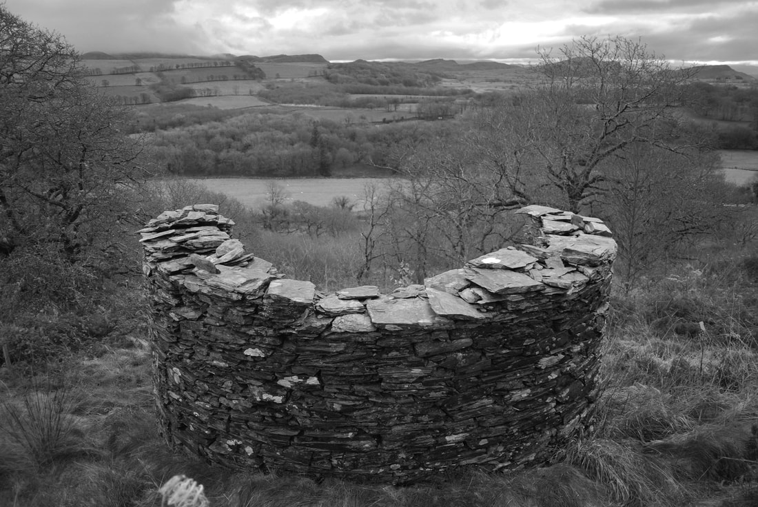 A photo of the powder house that I took in 2009. There are also some opencuts nearer the quarry, beside the road. If these were trial adits, they have run in now. To the right, the tips have been worked over to provide some roads on the site. Oak trees have been extensively planted, a good thing, but the new roads on the site and tip robbing demean the character of the place. A few years ago, I created a bit of a stink about this and a friend took it up with the National Park. Some people from a well-known mine exploration site said: "What's the difference between 21st Century mine activity and 19th century?" meaning, of course, that it was all part of the process, couldn't I see? But this isn't mine activity, and in any case, the miners didn't have gigantic CAT shovels and enormous tippers. They made these tips with their slate gnarled hands, the tips are their only monument, their crabbed copper plate handwriting on the landscape. I know there has to be progress, and I'm behind the planting of oak trees for sure, it just saddens me to see the tips disappearing. 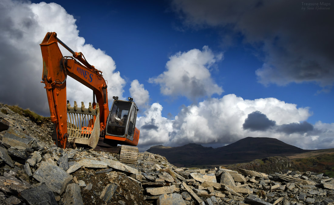 Agent of mischief. The access road comes out level with the lip of the pit, where you can cross a wall and look in. It's possible to see a couple of adits coming in from the lower levels, and also to see an early opencut that emerges into the pit from the north side. The photos above were all taken in 2009. On our first visit, we struggled down the incline at the east side of the quarry and looked at the adits. I got into trouble because the lady who owned the site read my account of the place, on my now defunct Blogger site. She took me to task, very nicely but firmly. I didn't realise, but her water supply comes from the adit...oops. It's not a good idea to explore the adits anyway, as one has a deep winze hidden by the water. The thought of stepping unawares into something like that underground is a chastening thought. On our first visit, the inclines were reasonably accessible and had charming drumhouses, one angled nicely into the hill. Nowadays, the tree growth and brambleage has gone completely rogue and while it's still possible to look at the incline, you'll need a kevlar suit against the prickly plants. 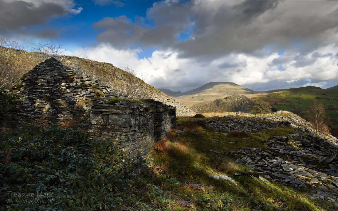 To explore the levels, it's best to go along the tips and clamber down- to find this structure, possibly a workshop or a dressing shed. One of the interesting remains here is the barracks block, although it is degrading quickly- every time I visit, it seems to take on more of a distressed air. It's an interesting building with very tall window openings... Petra wondered if they were doors with windows above them. Part of the barracks, the room at the south end, seems to have been used as a smithy and there is a loading bank that is difficult to explain. The photos above were all taken in 2009 There are some other interesting ruins, a weighhouse and what could be an old dressing shed. The tips are extensive and make a fine statement, especially on a day of sun and showers, when they sparkle. 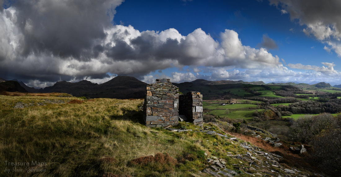 The weigh house on the top level, with a fine panorama of hills, looking towards Moel y Gest on the right It's well worth a walk up above the pit to take in the views from this spectacular location. There are a couple of trial opencuts there which show how determined the desire was to find good slate. A footpath goes off to the south west towards the start of the cwm, it follows an old cart track that was probably used when the quarry was in it's youth. There are a couple of small quarries along the way and an unguarded shaft. It's a charming walk, and the right of way takes you down to the road again via Dolwgan Uchaf and Tyddyn Graig. Back at the quarry, at the top level, a footpath goes through and on to the north. A quarter of a mile that way, there is another trial digging below on the right, fast being engulfed by young oaks. There are another two which we've failed to find on the slopes of Craig y Garn, although these may be mineral trials. Close to the road is a built-up platform with heavy stone retaining walls and a level, paved surface, on which probably stood a slate processing mill of wooden construction. Above are some shots of the lower mill by the road, taken in 2007/9. A look at the 1887 map shows a reservoir above in one of the opencuts. There's no water there today. 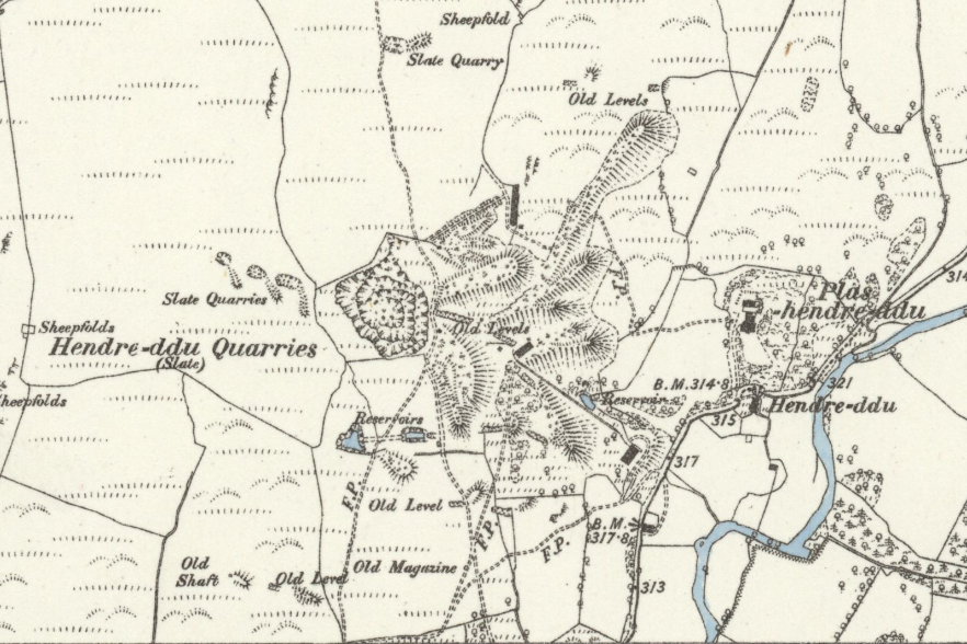 Extract from the Caernarvonshire XXVII.SW, surveyed 1887 by kind courtesy of those lovely folk at the National Library of Scotland. The factoids Hendre Ddu is an early C19 enterprise, gaining pace in the 1860s with the installation of a steam mill, perhaps on one of the upper levels. It employed over 60 men, but production fell short of profitability. A fresh start was made in 1872 with a turbine mill beside the road. with a waterwheel pit which could have accommodated a waterwheel 35ft (10.3 metres) in diameter and 5ft (1.5 metres) wide. A covered channel under the floor probably housed a shaft transmitting power to machines above. At SH5203544324 is a small reservoir excavated in the bed of a narrow rocky ravine. However, in 1875, the reservoir dam wall collapsed...was this the upper one? It's hard to tell today. The quarry fidgeted on for a few years, until 1880, when the project finally expired, leaving the intriguing remains for us today. Location: SH5180044400 Sources Gazetteer of Slate Quarrying in Wales, Alun John Richards, Llygad Gwalch 2007. Coflein W J Crompton, RCAHMW, 23 September 2010. 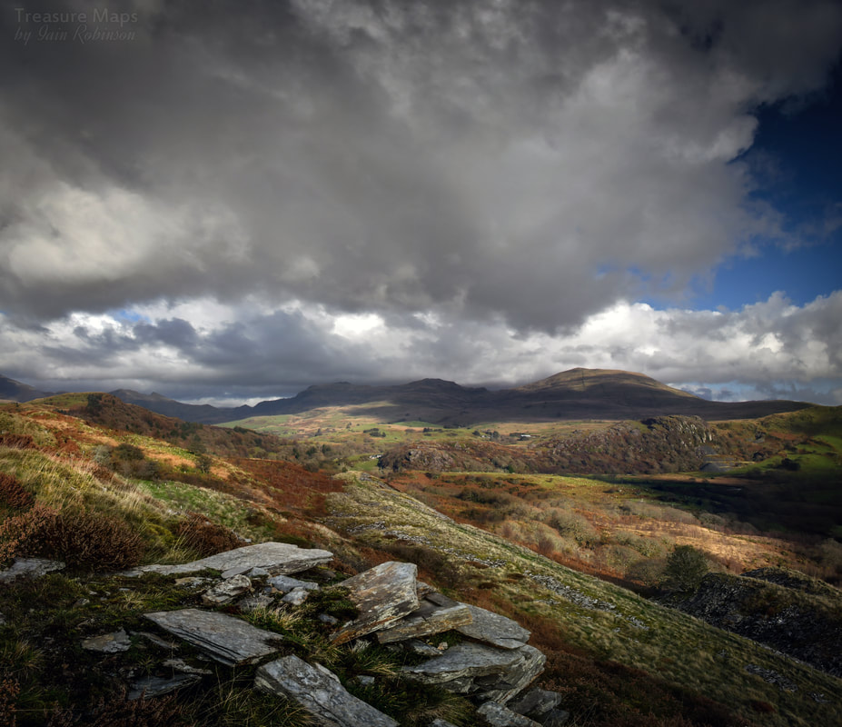 The lower tips from the middle tips. This view has been spoiled now as a road has been driven through from left to right, presumably for timber harvesting. (2019) 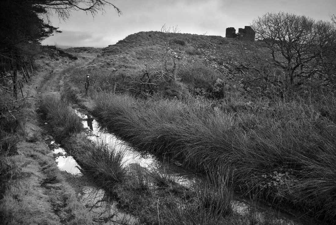 Atmospheric view of the footpath running through the quarry (2007) |
TracksReceive the occasional Treasure Maps Newsletter- and alerts when a new post is available!
If you enjoy my content, please buy me a coffee!
Check out my other online activity...
Index
All
|
 RSS Feed