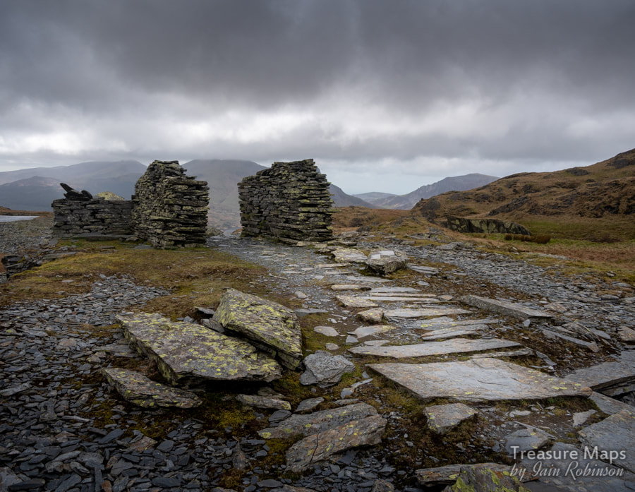
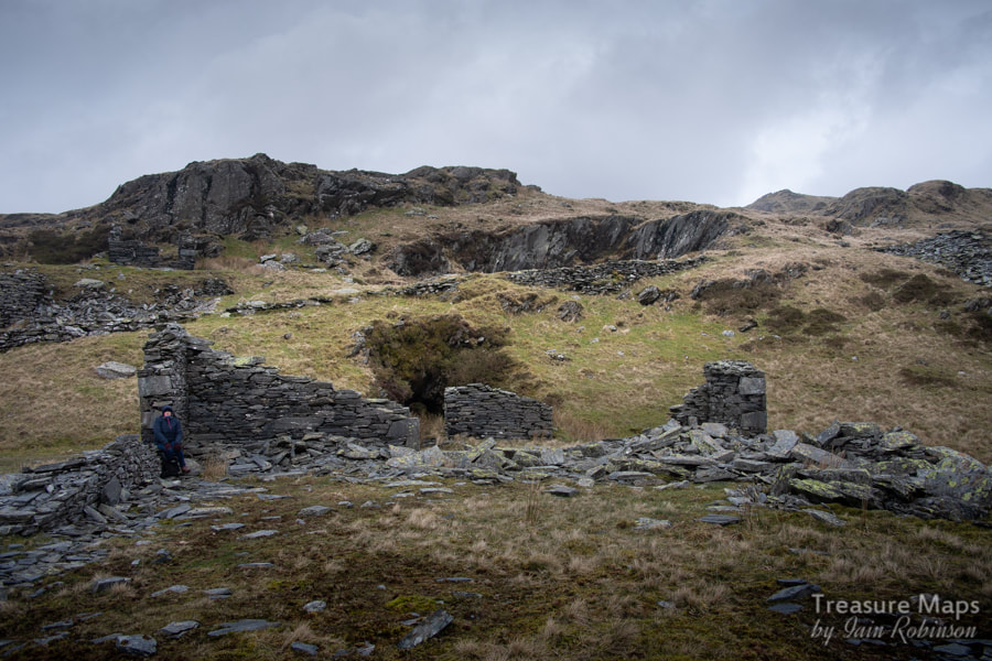
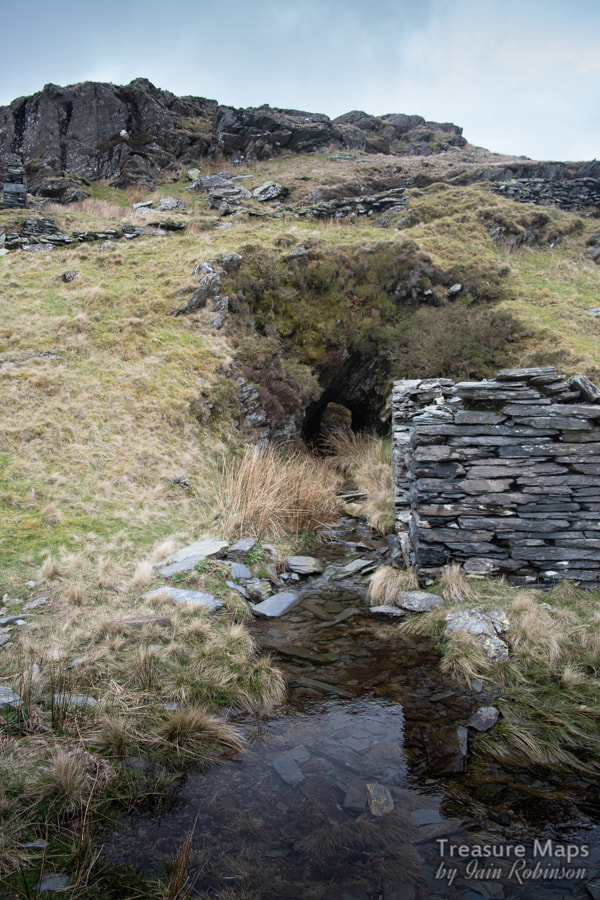
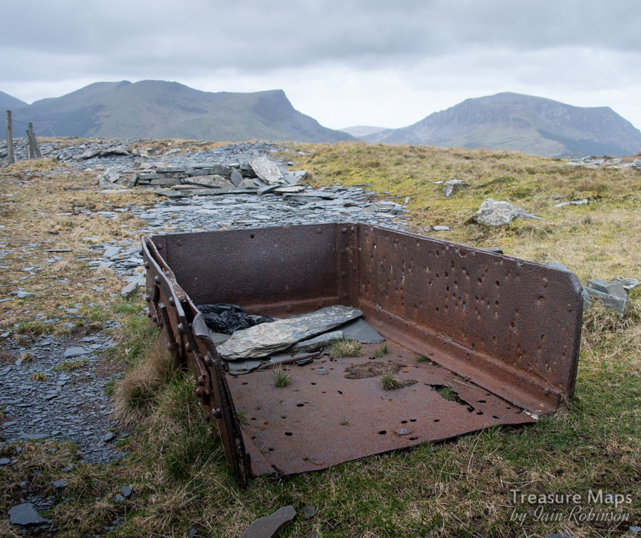
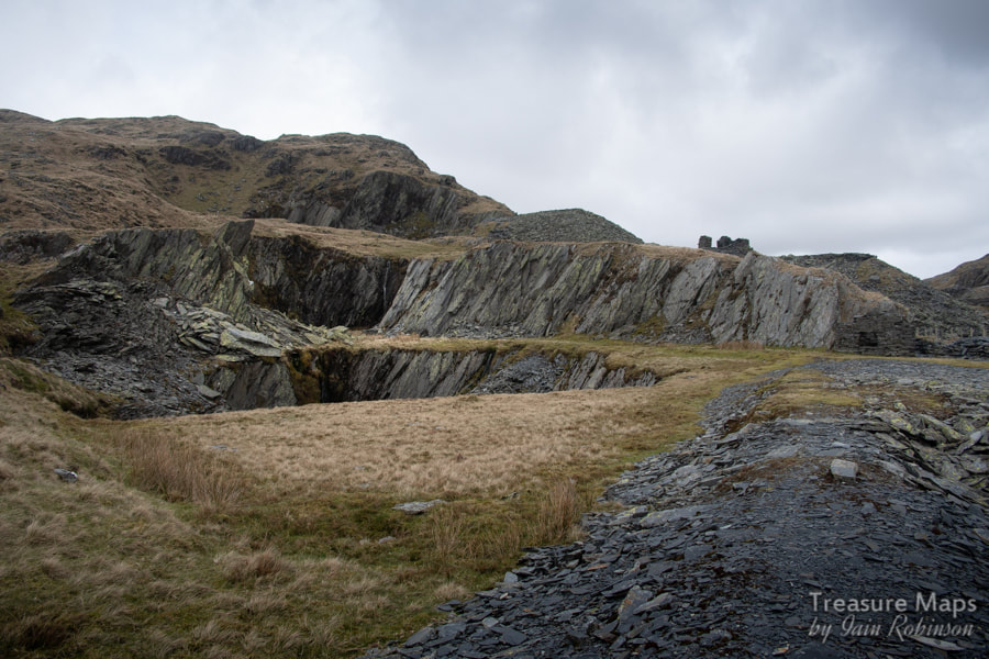
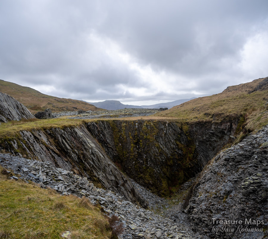
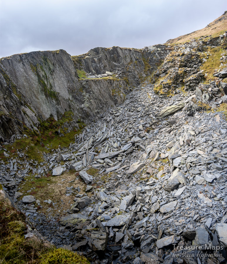
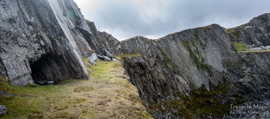
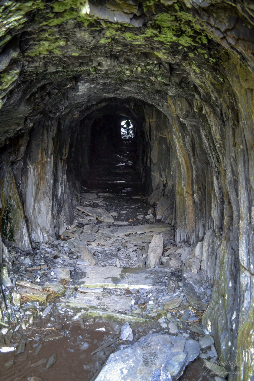
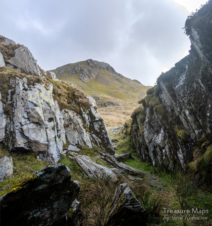
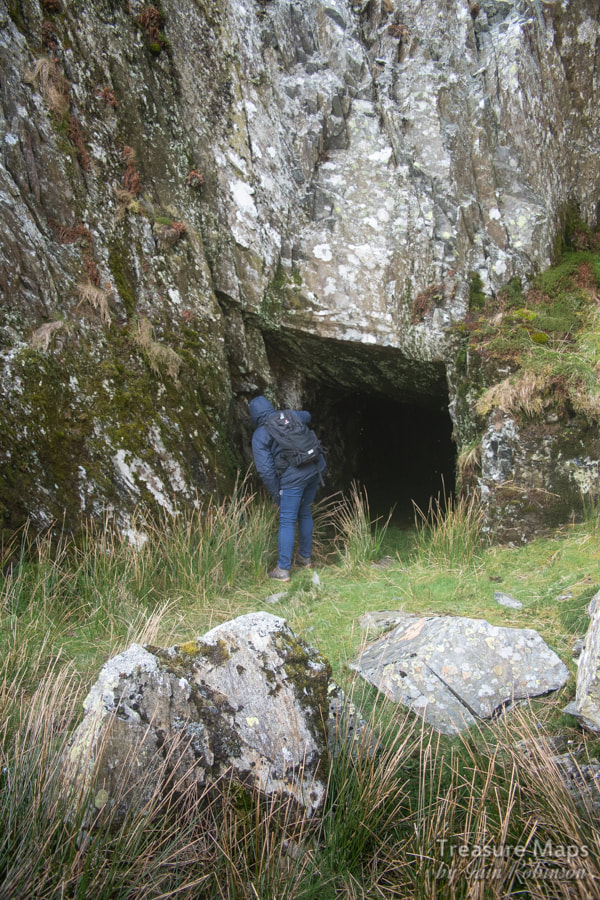
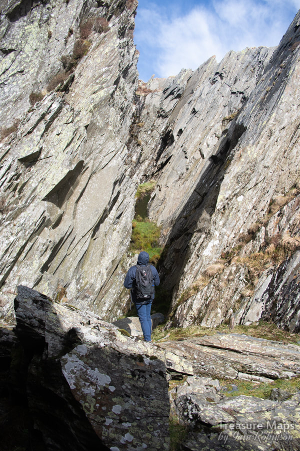
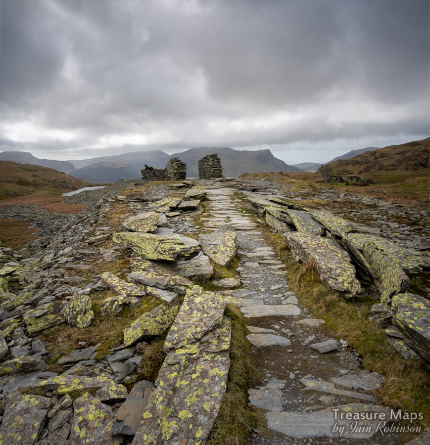
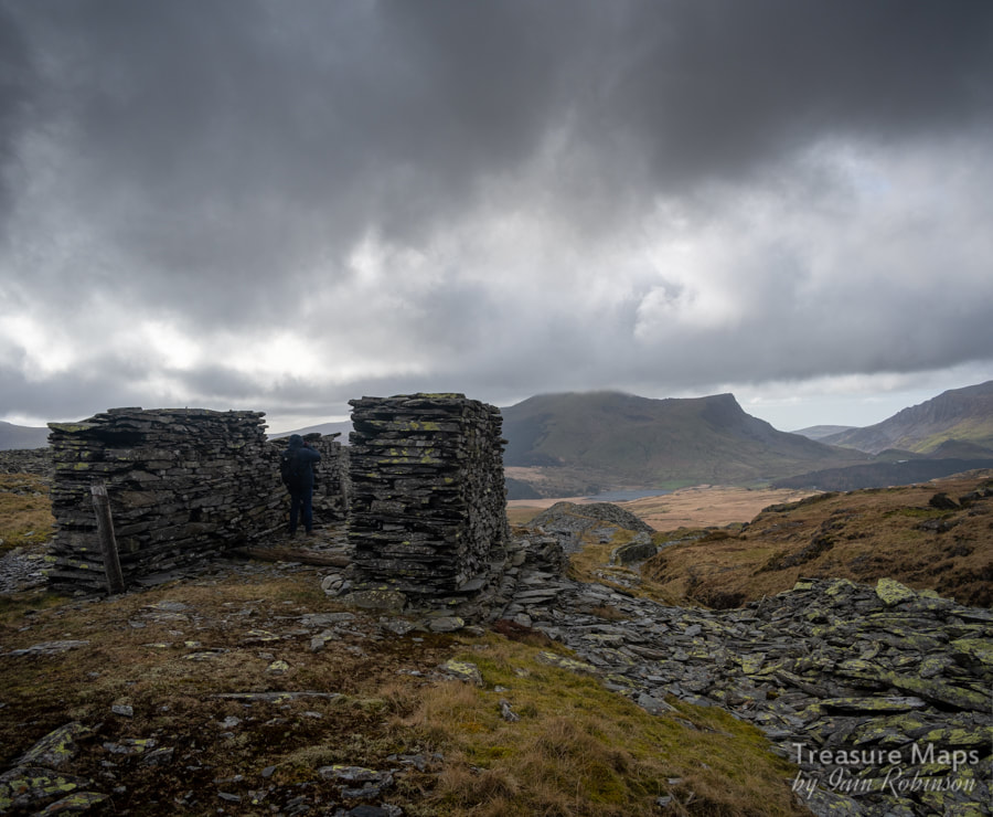
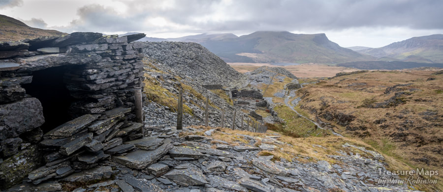
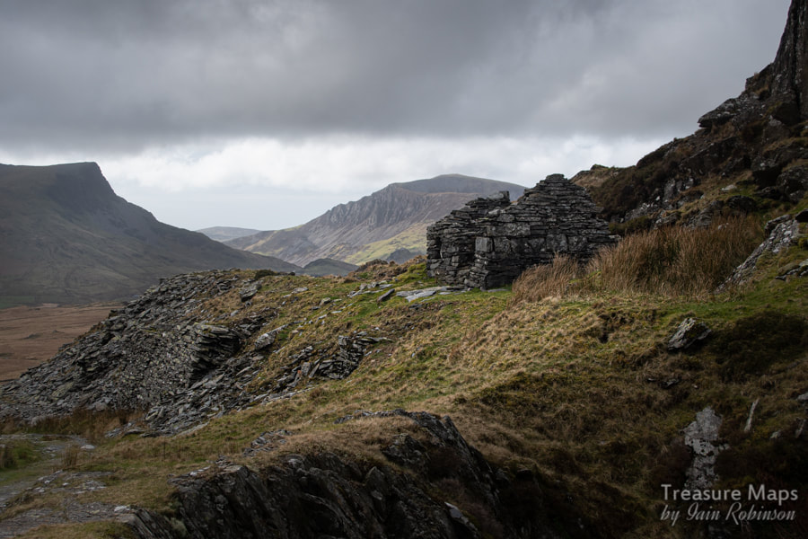
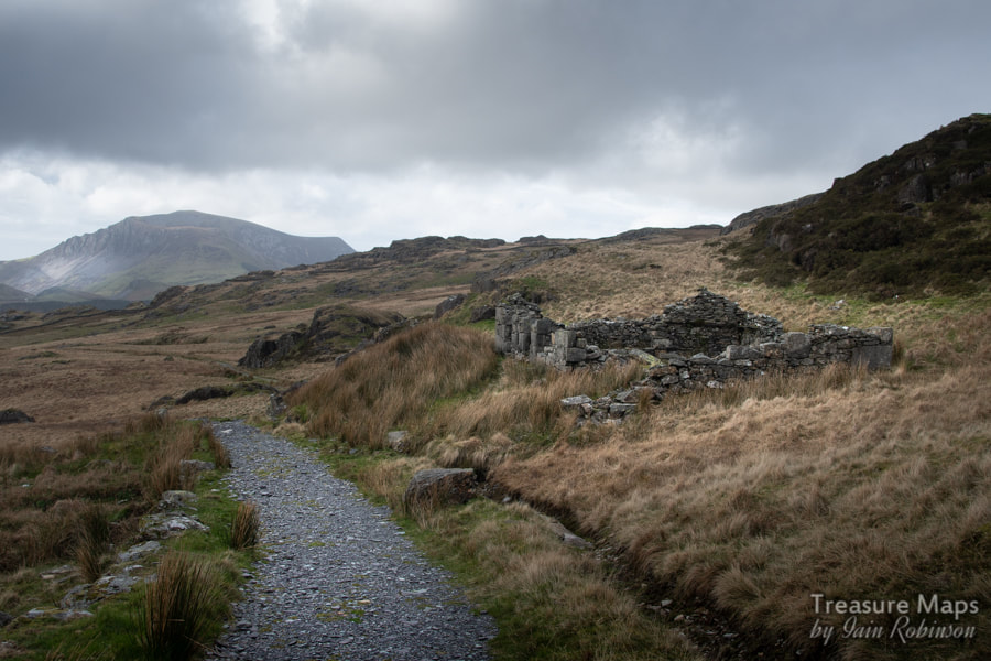
 The middle incline head, with the brooding mass of the Nantlle Hills in the background. An explore undertaken in February of 2020, before the great lockdown emptied the hills of human activity. Bwlch Cwm y Llan is a fascinating quarry with some impressive pits and a few intriguing remains- as a glance at the place on Google Earth will show. Sadly, most of the buildings were removed by the desperate crew of Robert Jones of Nantlle, who in the late 1940s, stripped the place of any workable slate. That said, the melancholy lacunae of the pits set against the backdrop of the Nantlle hills, leave a lasting impression to those susceptible to these things. Slate tips, ruined structures and silent adits, bastions and unexplained lumps and bumps in the land tend to bring on a kind of infatuation in me, a yearning for more knowledge- although these days I do try to simply enjoy looking at what there is and not fret so much! Starting Out...Our day began bright and early from the Rhyd Ddu WHR car park, on a cold February morning. There were a few other hardy types about, setting off for Snowdon, while the lonely house across the road, near the start of the Lyn-y-Gadair track, had a lazily smoking chimney. The smell drifting across made me nostalgic for the sight of a steam locomotive- we didn't suspect that due to the impending Corona crisis, it would be some time before one came this way again. It's an easy pull up to the first interesting thing, Fridd Isaf slate quarry, which lies mostly to the right of the track. The pit has been infilled, but the cutting looking towards Llyn-y-Gadair is still a spectacular feature. It is all that remains of the "open cutting level" of 1863. There used to be traces of the barracks here, but all has recently been removed. In that vein, we noted twenty or so large bags filled with slate waste from the tip, presumably to repair the Snowdon path from the expected ravages of thousands of feet. 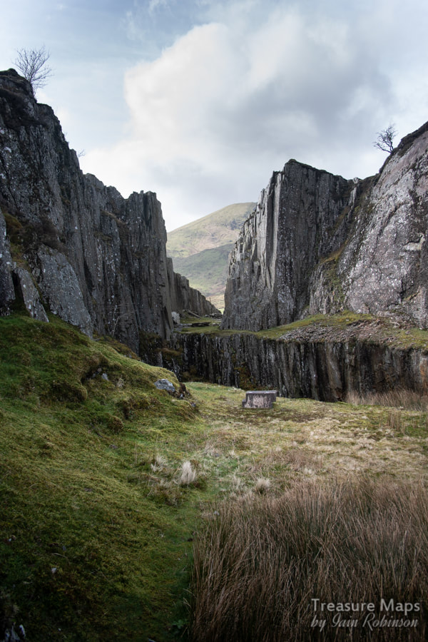 Fridd Isaf quarry The powder house for this quarry sits atop a knoll further down the track, above the WHR station- I confess that I didn't actually notice it until we came back. It is a typical circular structure which at one time had castle-like crenellations- it must have looked rather intriguing back in the day. 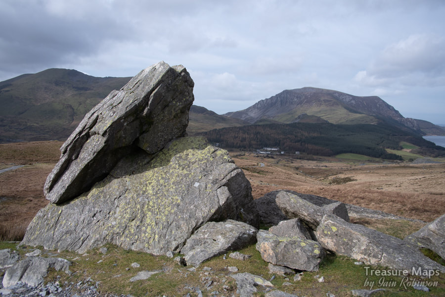 The erratics, looking towards Mynydd Mawr and Llyn Cwellyn. The track carries on uphill, past some interesting erratics. Views open up across the valley towards the Nantlle ridge, while to the north, the workings of Glanrafon slate quarry can be made out. Ahead, the formidable bulk of Llechog and Bwlch Main command the gaze, sunlight flitting across their flanks. On our visit, the summit of Snowdon revealed itself, for once without the usual war banners of cloud. The wind was getting up, making it a tough slog and rendering fingers and faces numb with cold despite thick gloves and balaclavas. I was glad that few people saw me in my warm headgear- I didn't realise that it was very pointy and made me look like a large and rather feral looking hill-elf. The Quarry wish List After a while, we reached a gate where two paths diverged. We were to follow the right hand path, much less trodden, but to us, infinitely more fascinating. The climb began again after a spell of easy gradient over marshy country. I noticed that the sides were revetted in places and that there was the occasional slab bridge over a stream. This would have been the cart track to the quarry, the route for the slate won, but the cause of many damaged slates, I would guess. It was also expensive, costing 2/- a ton in 1896. A project to build a two mile branch from the WHR with an incline was investigated, but the cost, at £2,064 was a little too much for the quarry owners. They kept it on their "wish list" however, as the land for the line was secured in a 21 year lease at £2 per annum. Sadly for industrial archaeologists, nothing was to come of this, as quarry profits declined slowly with the turn of the new century. Quarry remains at last! The path became steeper and turned gradually to the right, to climb the flanks of a rocky spur. A ruined structure on the side of the spur was interesting and I later discovered that it had been the barracks for the quarry. Scattered rubble suggested that there had possibly been a stable also on the site. Above here the game is properly afoot, some ruined structures lie to the right with a tunnel into a deep pit. The tunnel connects this pit with another, slightly higher up the road, which winds to the right of the openings. The buildings were possibly a small mill, with associated tips consisting of fines as well as more solid block waste. We sheltered in the remains of the mill and sipped coffee from a flask, although as usual, I was so excited at the prospect of the quarry and remains to be found that I couldn't wait to get going again. 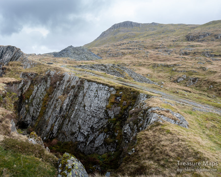 The lowest pit, with later workings above. Yr Aran is in the background. A Holding Reservoir We walked on up, finding more and larger pits. There was also the dried out remains of a reservoir, perhaps a holding pond for the lower mill which disappears into the tips from the workings above. It hardly seemed large enough to contain enough water to drive machinery. 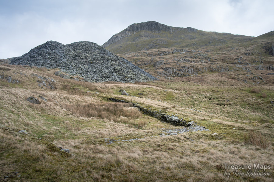 The dried up remains of the holding pond. We walked on, and came to the remains of a further mill, more extensive- and a long tip run, held back by a long bastion, which may be the launder that Richards describes in his book. . On this tip lies the body of a wagan dipio, used by American troops in WW2 as target practice- as the late Gwynfor Pierce Jones remarked, it would now serve better as a colander! Walking up to the incline head, Petra noticed a small, slate-lined pit a little way from the drumhouse. I was puzzled by this until I read that it had been a sheave pit. Of course, both of us neglected to photograph it! Both the inclines on site were gravity inclines and most of the useable slate had been robbed from them. 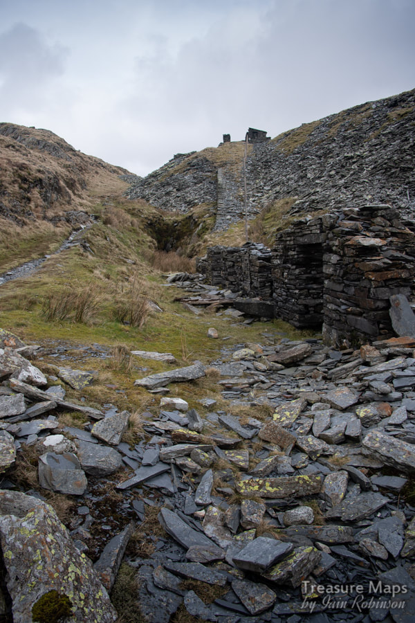 The middle mill, with the very damp adit leading to the pits on the next level. The incline head can be seen above. Another reservoir We walked south from the incline head to see the reservoir on this level, snug against the encroaching tips. There was plenty of water trapped behind the dam, which was a good example of double wall construction. There were also a couple of unexplained features which show best on Google Earth...what could have been some kind of incline or causeway. This is between the tips -I suppose it could be the remains of tip bastions. Playing to the gallery The next pit had benchwork and was extensive. According to a valuation document by Bowen Jones in 1901 there was a gallery in this pit which connected to the sinc level of the pit above, but much rockfall had ensued over the years and while there was perhaps a hint of a tunnel, we couldn't be certain. These great man-made defiles are big features on the landscape -all readily spotted from Google Earth. But their emptiness and mystery has become something in it's own right now. I almost feel that the quarrying was but a small event in time and that now, they are being drawn back into the silent narrative of the hills, "y llonydd gorffennedig" which (I think) translates as the finished, or the accomplished silence. Of course, the pits do give up their secrets. The differing types of blast lines, the quarrymen's marks, remains of overburden clearance and excavation and the type of tunnelling, to mention a few of the clues. All tell their subtle stories and add to the fascination. Finally, we reached the highest pit- the deepest, with the ruins of a weigh house and other structures. It is accessed through a cutting and a short tunnel. . Inside the pit, there is a wide shelf or bench, with excavation continuing downwards. I assumed, without any real evidence, that the lowest level would be accessed by a tunnel from the lower pits. 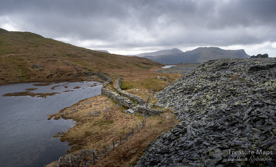 The main reservoir is sited at this level, reached by a path snaking across the tips. It's a fine spot. The bonus quarry... We located another working afterwards, a small cutting leading to a collapsed adit. This has been roughly dated to the 1840s, when a Henry Stock from Beddgelert, financed by some London backers, went looking for promising slate outcrops in the area. He opened an "old working" the name is intriguing in itself, and struck the best deposit of slate in the area before Glanrafon was started. We noted a lovely keyhole shelter on this highest site, probably a blast shelter rather than a powder store as it is quite near the opencut. The views of Yr Aran when coming out of the opencut were spectacular. 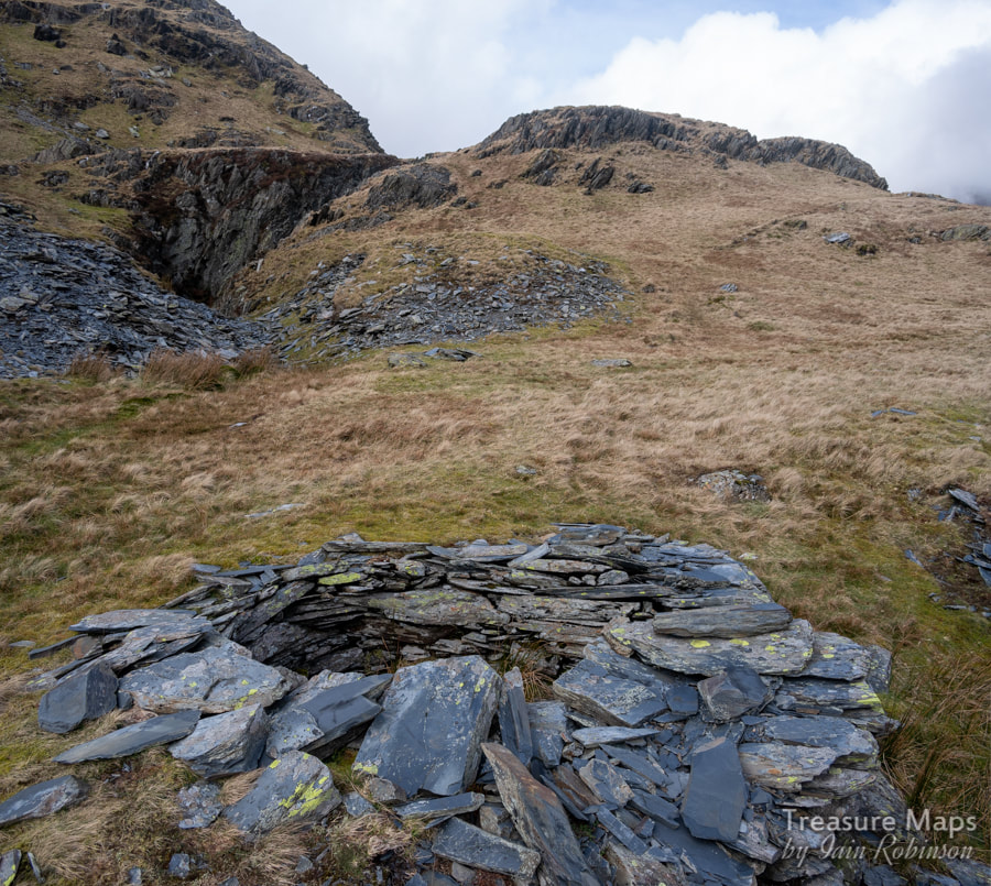 The keyhole shelter. Mysteries Of course, there are a couple of unsolved mysteries, as always. Studying the Google Earth photos and the NLS maps, a large reservoir became apparent at SH 60246 52596, with a small mine working to the south west of it. The reservoir must be something to do with the Bwlch Cwm y Llan enterprise as there is not enough working spoil in the little mine nearby. Yet there is no evidence of a leat or a launder. Come to that, there are no remains of waterwheel pits on the site either...but 1901 inventory listings for the quarry show an entry for a "25' waterwheel and launder". I guess these pits were filled with spoil from the later 20th century work. Neither Alun John Richards in his Slate Gazetteer, or Gwynfor Pierce Jones in "Cwm Gwrfai" mention this, I wonder why? Slightly above the site to the north at SH 5992 5220 are the remains of a three-celled ruined building, and to the north of this, the ruin of a circular plan powder store. To the east is what looks like a more modern powder store. Sadly we didn't see those on our visit, and will have to return at some point. 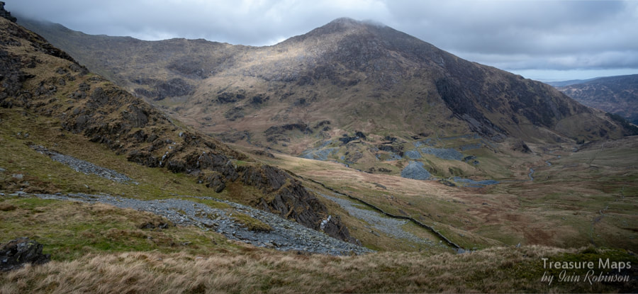 The view from the bwlch, looking towards Cwm y Llan and the South Snowdon Quarry. The Lliwedd ridge runs against the sky in the background. The bwlch A short uphill walk from the 1840s trial took us to the bwlch where we looked down on Cwm y Llan and the workings of the South Snowdon quarry, visited a few years ago and noted on the blog here. That's one of the nice things about roaming in the hills; when you join up the pieces of the landscape in your head and discover different views to places you know. I look forward to doing more of that when the lockdown eases. Sources: "Cwm Gwrfai" Gwynfor Jones and Alun John Richards, Carreg Gwalch 2004 "Gazetteer of Slate Quarrying in Wales" Alun John Richards, Llygad Gwalch, 2007 "Snowdon, the Story of a Welsh Mountain" Jim Perrin, Gomer, 2012 Some extra photos of the quarry... |
TracksReceive the occasional Treasure Maps Newsletter- and alerts when a new post is available!
If you enjoy my content, please buy me a coffee!
Check out my other online activity...
Index
All
|
 RSS Feed