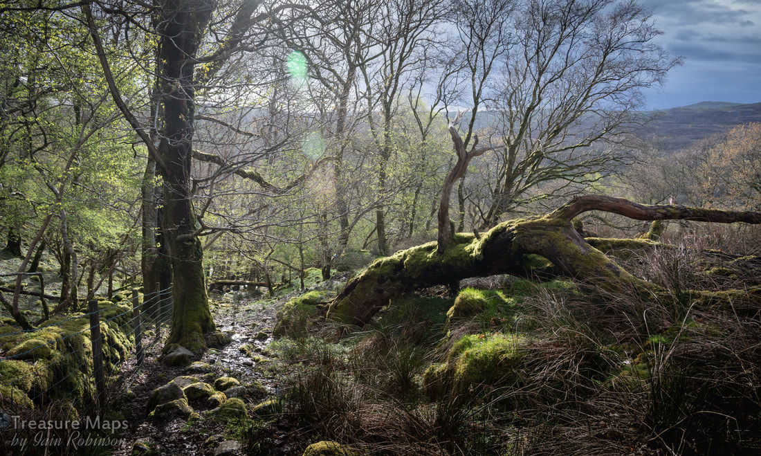
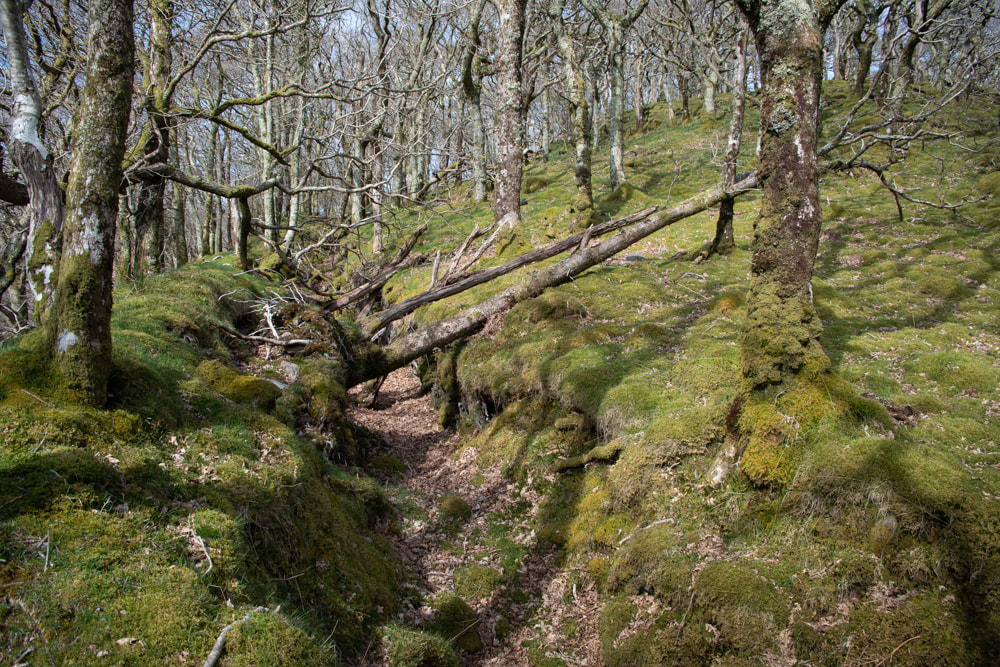
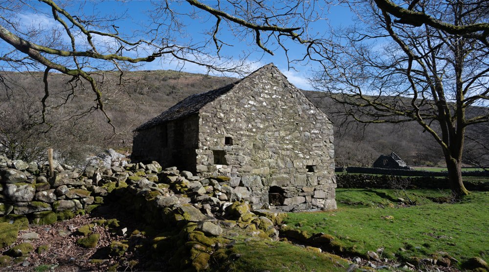
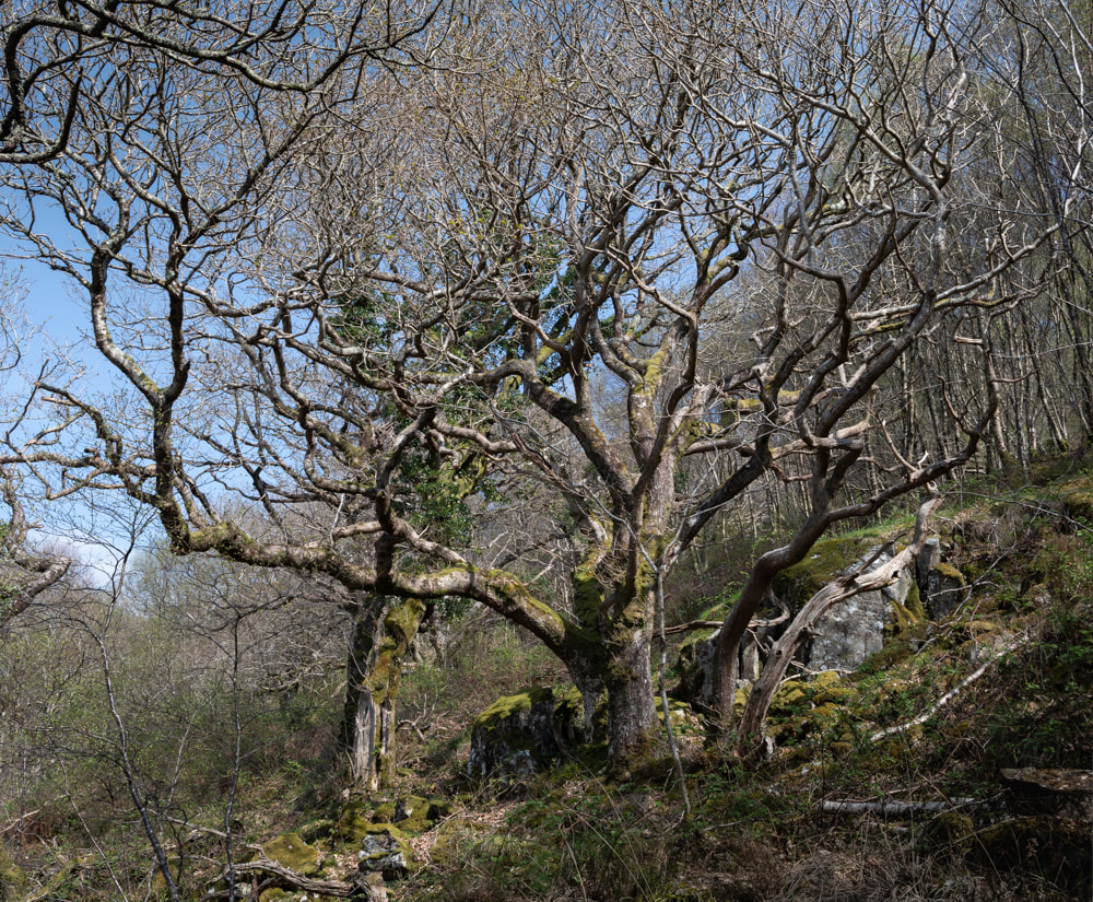
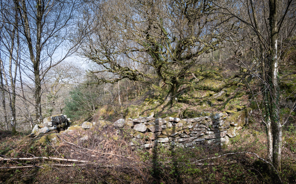
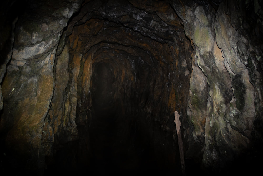
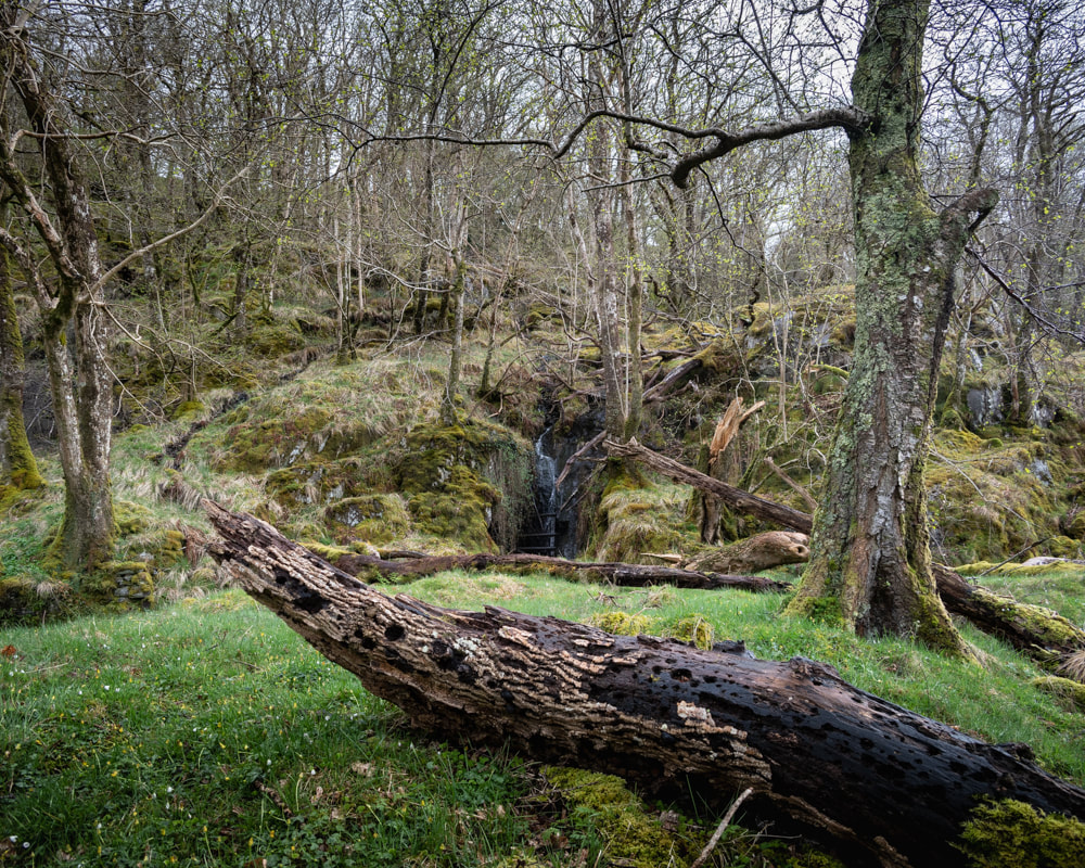
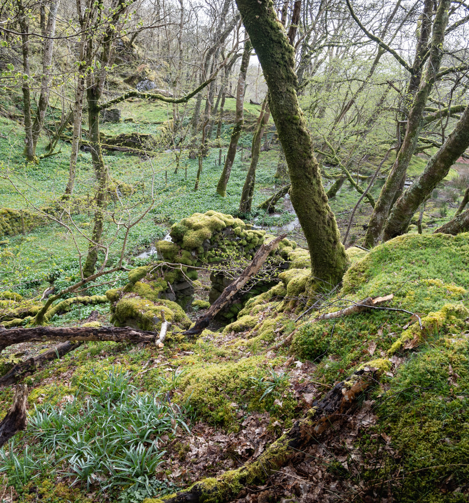
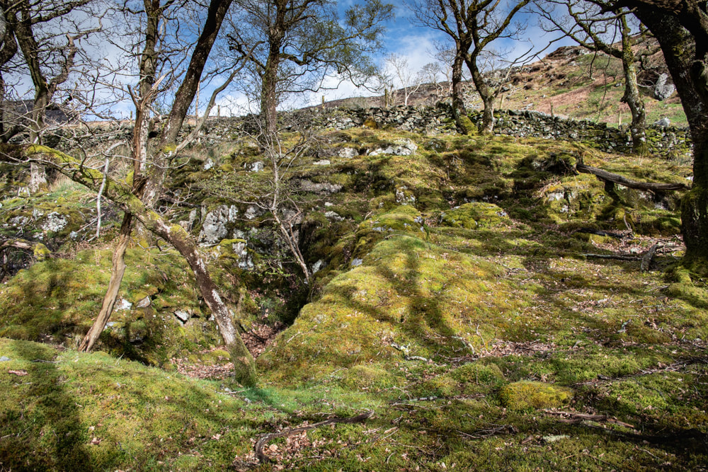
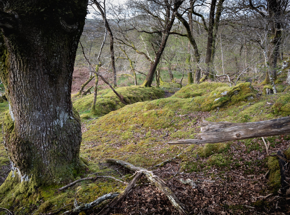
 Along the trackway up to the top of the Coed Crafnant. It all started one dreich winter Sunday, with a walk up Cwm Bychan and the "Roman" steps. On the way to the head of the cwm, we passed some wonderful, intriguing stretches of ancient boskage. Once home, I scurried about on the internet and found that the woods also concealed some mines... a more detailed study of the area began immediately! We ended up making several visits- every time we returned, we discovered more. 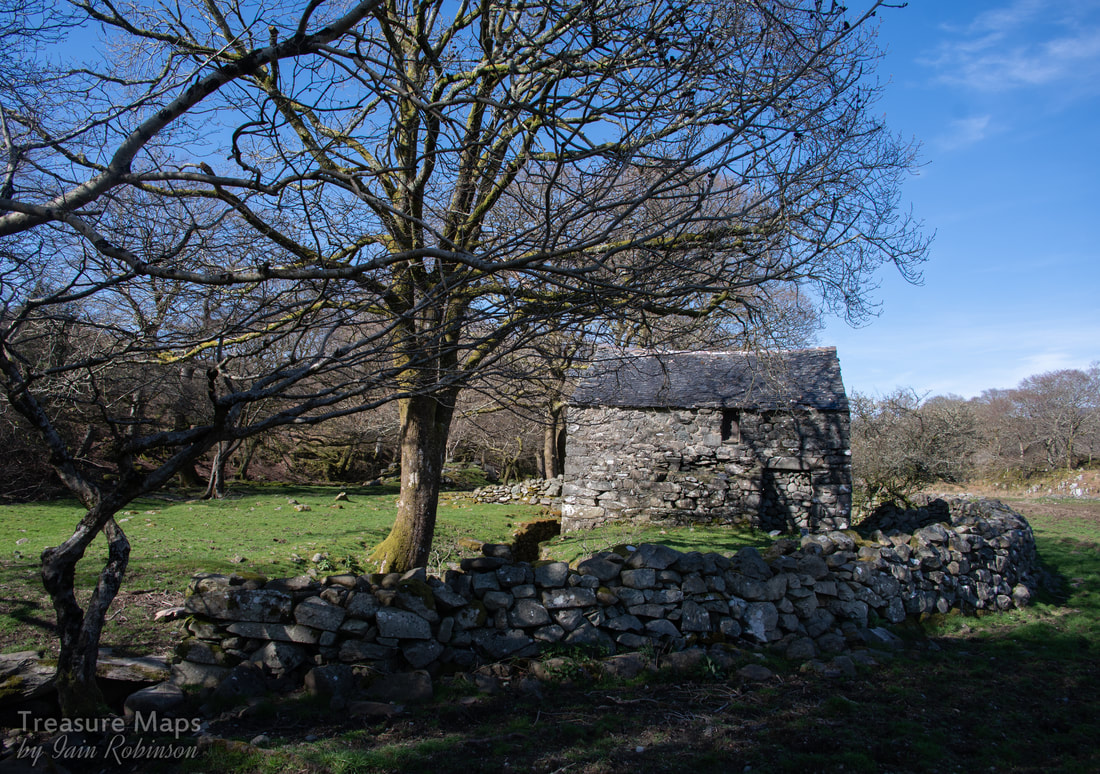 The old Corn Mill at Pont Crafnant. 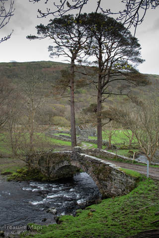 Pont Crafnant, with the old barn in the background. Pont Crafnant is the portal to the woods. It's a surprisingly elegant structure, made from fine blocks of local stone in the early 1800s. We were enticed off the road initially by two intriguing structures nearby, either side of the Afon Artro. One is ruinous, but the other was tantalisingly intact. This was a corn mill, probably dating again from the early 1800s. It was water powered, as can be seen from the leat running alongside and the wheel pit. As if further confirmation were required, the top step leading upstairs was made from a grindstone. Downstairs, there were some old cartwheels- and a lot of sheep poo. This room is obviously in use as a cosy caban for the woolly ladies. The low beams were age-worn and worm-eaten, punctuated by old House Marten's nests, but despite the aromatic features, the space had a lovely feeling about it. I stood there under those beams, with the light streaming in from the door, and in my imagination, I could see the seasons pass. The smile of summers and the cruelty of winters, folded like a timelapse. Humans moved too ephemerally to register, only the light's flickering span was a constant. 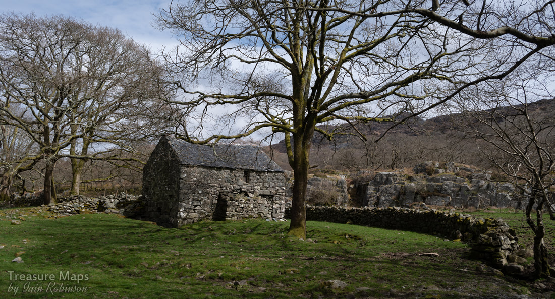 The Corn Mill Further on towards the woods and we could see that the barn hadn't fared well. The roof was losing the battle against the elements, rafters lay in disarray. The lambs were using the interior as a play school, jumping effortlessly onto boulders, like puppets, seemingly without effort. We walked on, up a very rough road. It was metalled with small rocks, what a quarry manager would call scalpings. It wasn't easy walking, especially as a stream had found the road to be the point of least resistance and was boisterously charging at us. Above, the trees made an arching canopy, hints that spring was on the way showing in the bright dots of young shoots. We were already in a good mood, but when Petra spotted the first adit it felt like a sign. She scrambled over the high fence and inspected proceedings. It was very wet, and seemed to be a shaft, protected by some flimsy lengths of tree branches. There was little in the way of a tip outside, so I would assume that this was an early trial for the Crafnant mine, looking for copper. 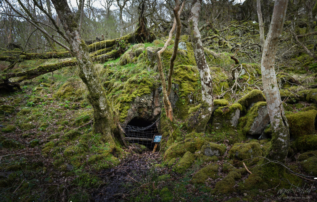 Petra's photo of the trial adit. Going on uphill a bit, arguing with the stream, another adit could be seen on the right. This was as picturesque as a mine can get, with a small waterfall emptying into it. Mine explorers will be interested to know that It goes in a short way to a rise and a flooded winze. It then continues on the lode over a second flooded winze. It's not remotely safe, and I would strongly discourage entry as the winzes, disguised by water, are deadly. As if to underline the sense of peril, a rotten bole of an ash tree lay on the ground, looking like a deceased monster, consumed by giant worms. "This could be you if you go in there!" it seemed to say.  This could be you! 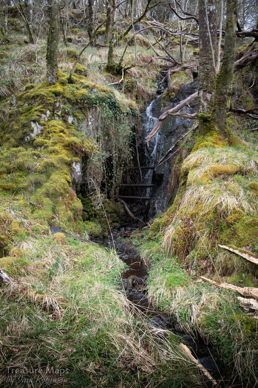 Next to the adit was a working area and a structure which we later realised was a smithy. This would be the main working area for the mine. The blacksmith's hearth was completely overgrown with moss and felt like an art installation. There was a modest tip, and a walliau which may have been roofed over at some time as a place to cob the ore out of the rock from the adit. We lost ourselves for a while, thinking about the miners here...the mine was active between 1847-1859 and I wondered who they were. Were they Cornishmen, with clay pipes and wide brimmed felt hats? I turned, saw a dark shape on the distant rise and almost thought I saw one, out of the corner of my eye. It was a couple of birches, grown together, but to my highly strung optical nerves, it was a shift in time. 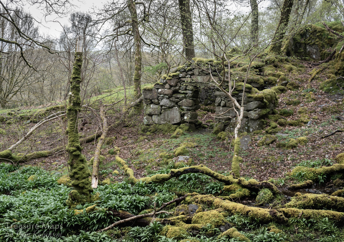 The forge structure I can only think that there wasn't much good ore found here; perhaps manganese was more plentiful- as the tip was small and there was little copper waste. I picked up a couple of suspiciously heavy rocks...dark grey in colour...like manganese ore. The whole site was overgrown with Ramsons. These were thought by the old mine prospectors to be an indicator of manganese in the ground. 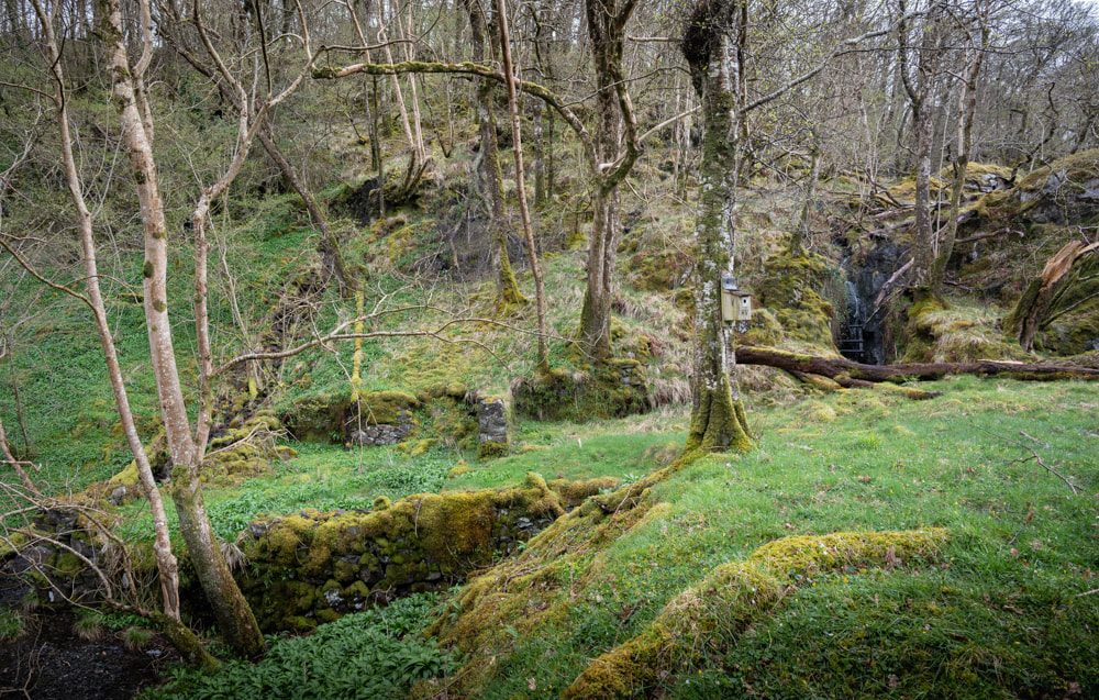 The adit and cobbing/processing area to the left. Note the nest box. We walked a little further until we were almost out of the woods and took some photos of the beautiful old oak trees there. They shared the ground equably with some really ancient birches, whose trunks were gnarled and almost unrecognisable from the smooth ones normally seen. The trees were covered in lichens, tree lungwort and liverwort plus many other varieties that, while fascinating, were beyond our powers of identification. So many mosses and lichens, so little time!  One of the manganese trials at the upper margin of the woods. As we turned round I noticed the unmistakeable signs of trialling for manganese ore (above); a semi-circular excavation in one area, and a lateral one further up. The sides of the opencut for the latter trial was built up with deads (waste rock) in typical fashion. This convinced me that the game was afoot, and I was optimistic that we would encounter the manganese mines that were supposed to be buried deep in these woods. 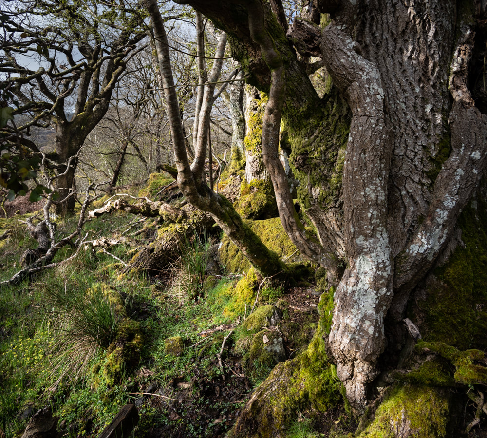 The oak and the ash... We retraced our steps back down and then struck off into the shadowy depths of the woods. The way was blocked by several fallen trees. Here, there was a predominance of oak, ash and birch. Most of the casualties were ash trees, thrown down by the high winds of the winter. The woods are managed because of their status as a temperate rain forest -and I read that rangers actually took some of the rarer lichens off fallen trees and grafted them onto suitable healthy specimens. I'm afraid the Ash Dieback has begun to hit here quite badly, but these fallen trees didn't show many signs of it. 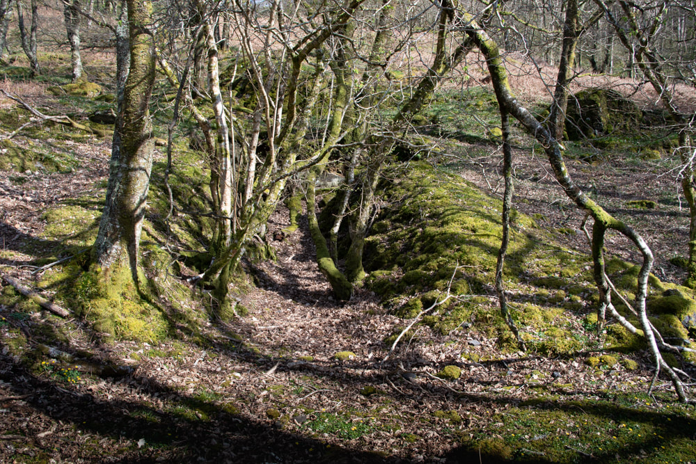 The tree-choked adit seen first on the lower trackway. The further into the woods we went, the more substantial the track (and the bramble jungle) became. We passed a very overgrown trial on the right, followed by an even more ruinous level, almost eclipsed by tree growth. Then we reached a very low bridge, almost a ford, into a clear area. We immediately spotted an adit- high spirits were quenched by finding it disappointingly short and infilled with deads. Above it, an opencut went along the contour for some way- typical of manganese workings. It may not seem like much to the casual observer, but we had seen enough mines to know the signs. A modest amount of work had been done here. According to Dave Linton's excellent "Merioneth Manganese" site, this mine had been active between 1886-87, although it limped on under different owners until 1918. 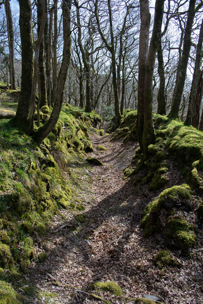 The start of the opencut. 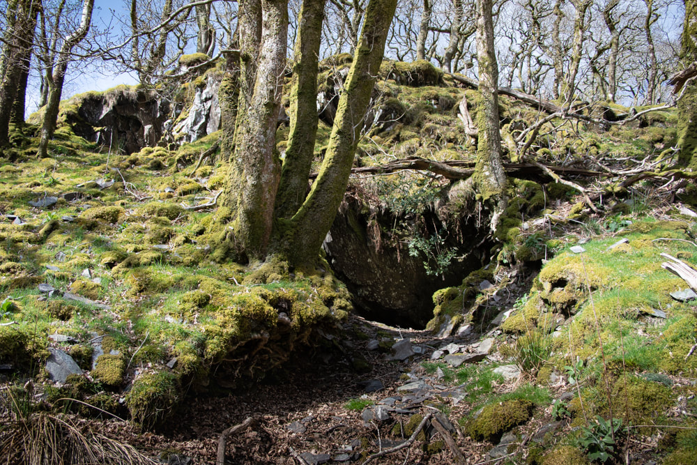 The short adit, with the opencut above. The opencut felt like a sunken way, with the trees on either side. I would have loved this place as a child- even now as a grumpy old git, my imagination was working happily away, expecting to encounter some buckram green-clad outlaw with a bow and arrow. There was an old reservoir near here, almost silted up. It was more of a bog, really...but obviously made to power some machinery for the mine. It was so still and quiet- later in the year it would be a haven for dragonflies and all kinds of life. Petra spotted a baby frog and knelt to photograph it. Sadly her autofocus was suffering from frog blindness and preferred a blade of grass. 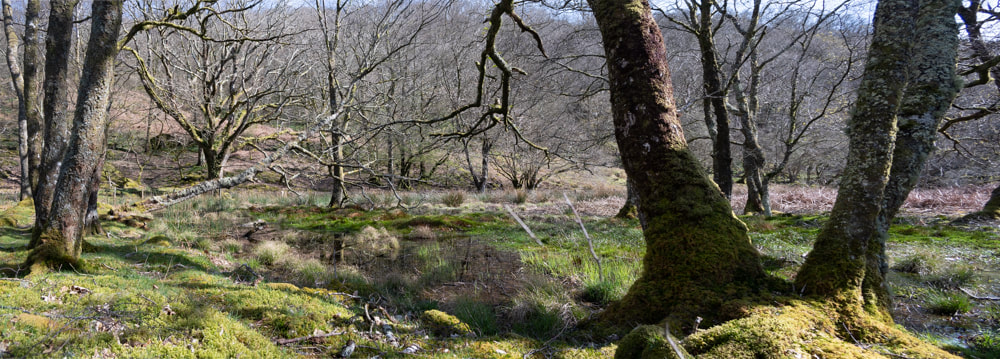 The amazingly still and quiet reservoir. We sat and had lunch, sitting on a fallen tree. The woods were busy with birds and new growth- our visits were all in April 2018 and the sounds of wrens and other birds soon rose again as we sat still. The cuckoo was also noticeable, calling ocasionally. What we hadn't expected were a couple of goats, who came ambling past. They looked slightly, comically, wary of us- but not much. Luckily for my appetite, the wind was blowing the whiff of the goats away from us. There are still some adits/levels to explore above the trees, the remains of the Crafnant South mine. It's difficult country above the forest, rough, bramble infested and full of ticks- but we may return at some point to find out for sure. 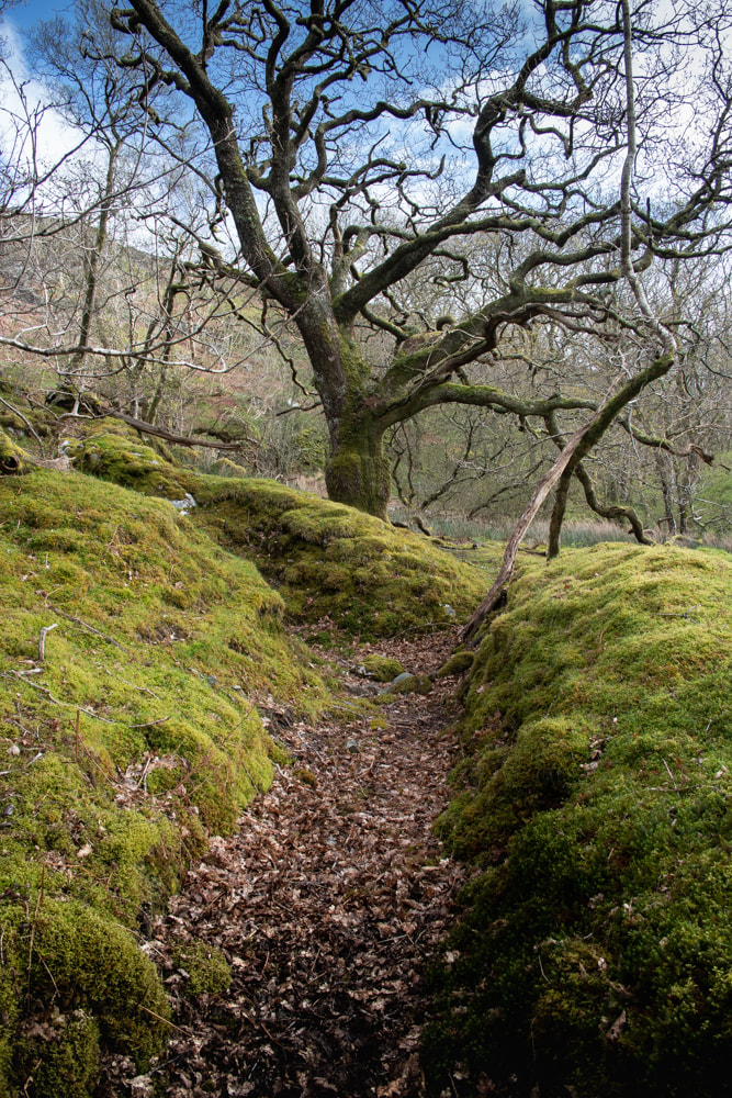 A manganese trial at the top of the woods. The Factoids For the exact location of the mines, the Merioneth Manganese site has a very good map and details here. You may find yourself searching the site for yet more interesting places! Pont Crafnant is at SH 6171 2896. Parking Cwm Bychan is, like many places in Wales, notoriously short of parking places. Luckily, there are some near the old corn mill. The first is at a lay by, marked on the OS as "parking" at SH 6184 2931. At the time of writing, the farmer has stacked a huge store of hay in the lay-by, but there's still room for a couple of cars to park. I was amazed when checking this on street view to see that it was actually a tarmac parking place- it doesn't look like that now! The Wales Wildlife trust, who run a reserve here, suggest parking at SH 617 290, which is the farmer's access- we know that he uses this a great deal, so I would suggest parking inside the gate (if conditions are dry), off the road and out of the way. The old maps on the NLS database are invaluable for insights into the land use, dates etc. All the places mentioned in this article are on rights of way, or on open access land. Incidentally, you will pass a gate on the way up to the mines, leading to the excellent Wales Wildlife trust reserve. Do take a look. It's magical, so much so that I will be writing a blog post about it very soon. It has mines, too... |
TracksReceive the occasional Treasure Maps Newsletter- and alerts when a new post is available!
If you enjoy my content, please buy me a coffee!
Check out my other online activity...
Index
All
|
 RSS Feed