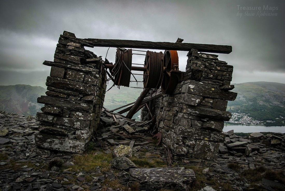
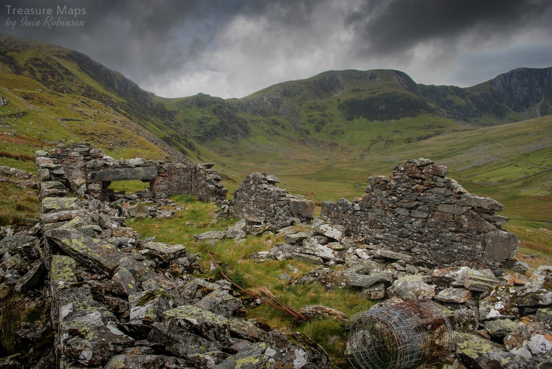
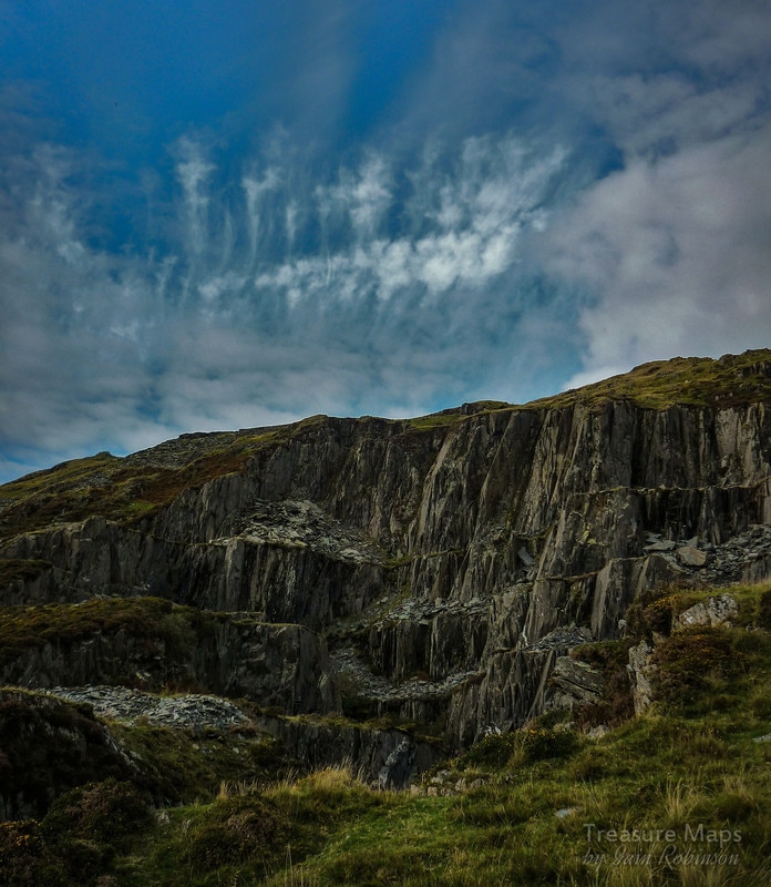
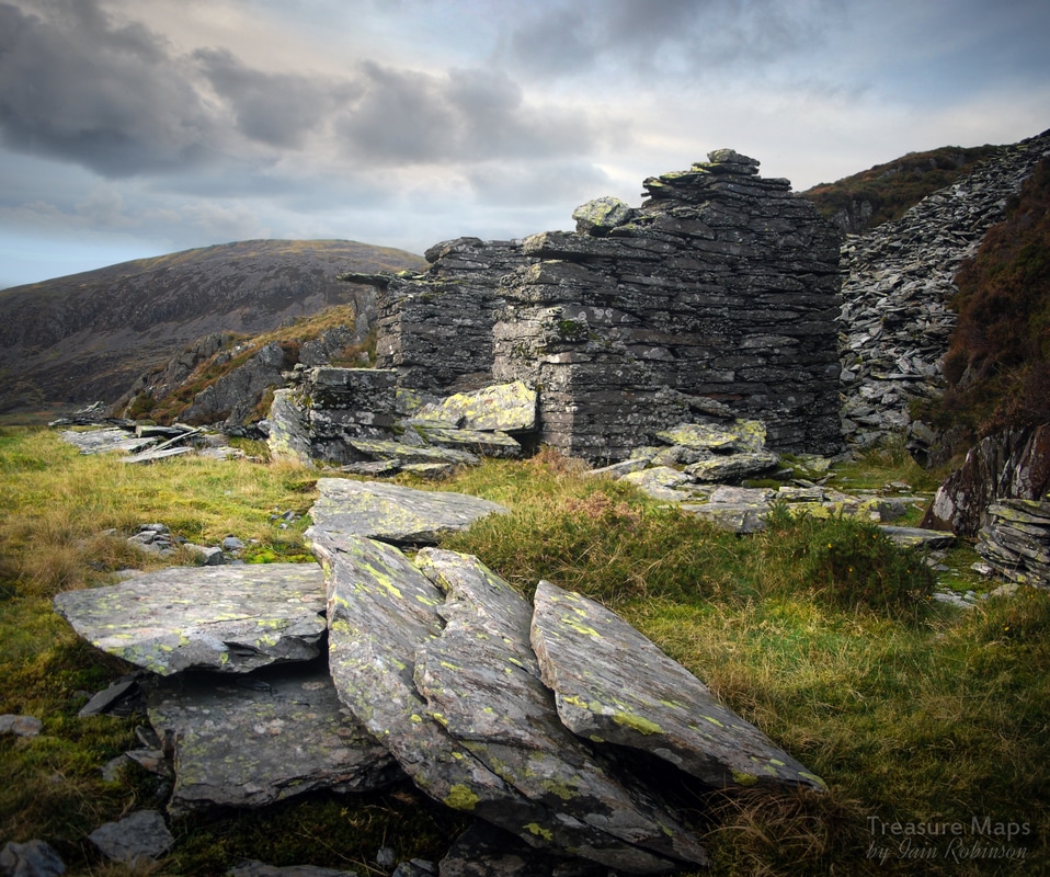
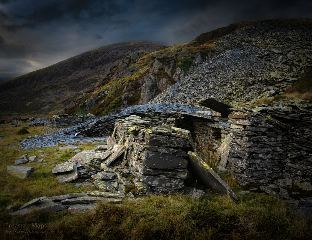
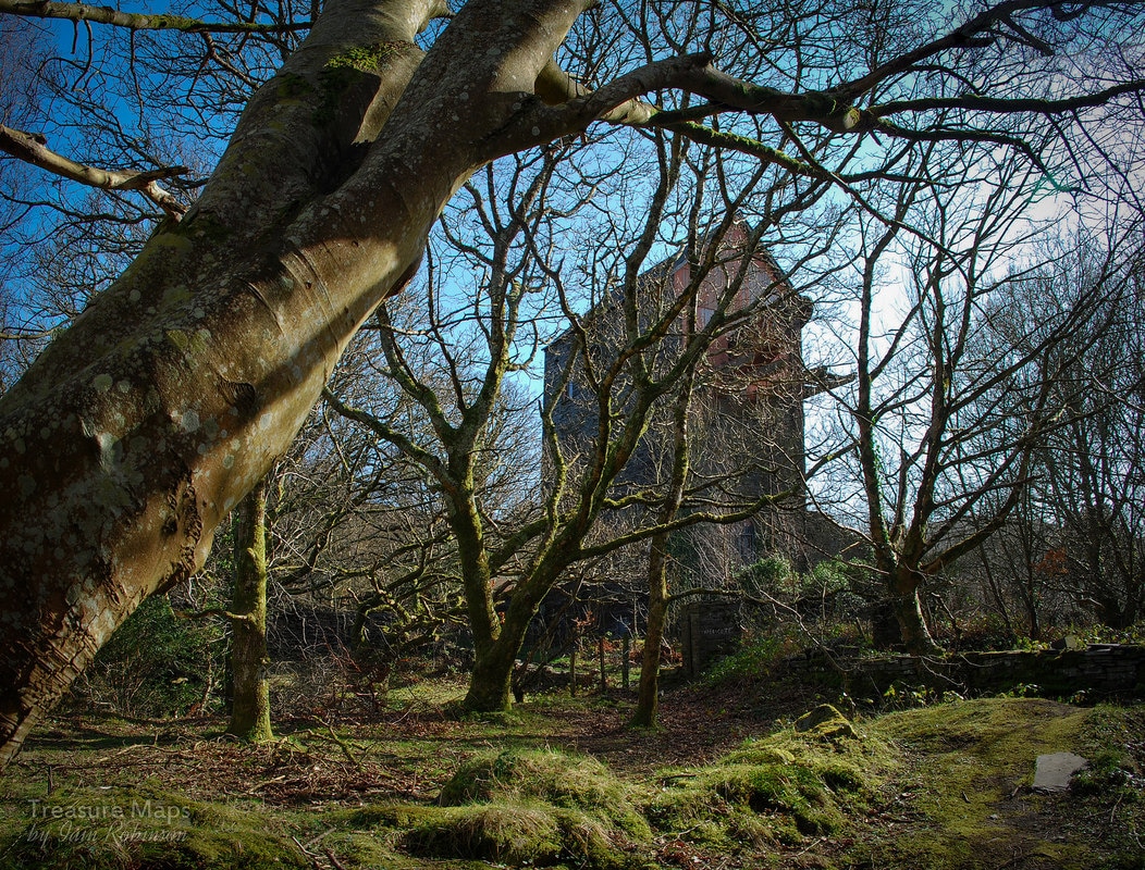
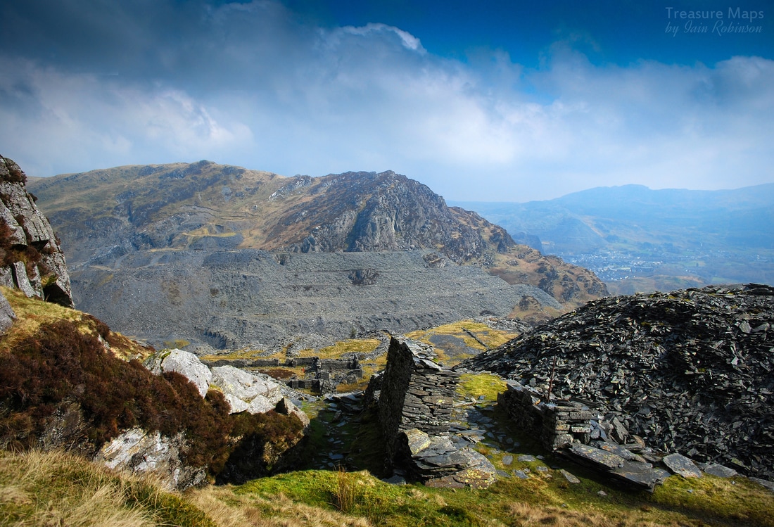
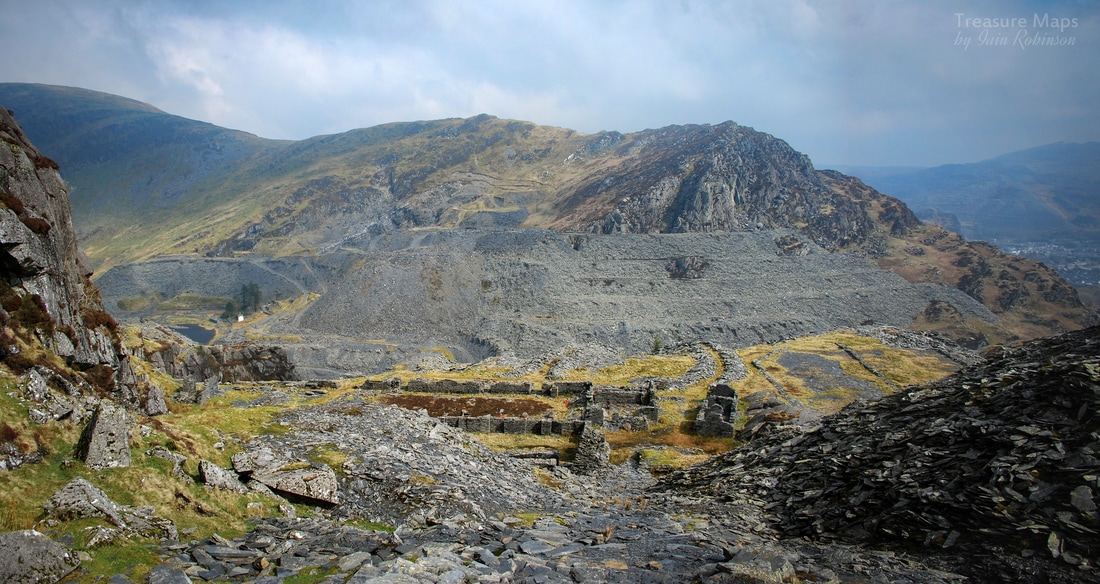
 I know what you're thinking. It's about Dinorwig, so he'll have almost fallen over one of those vertiginous drops in the Garret sinc. Well, sorry to disappoint you, I'm still alive and typing - although there's time, it might happen yet. No, this is a shave of a different kind. So...Dinorwig. I was confident that Petra and I would be impressed by the vast Australia Mill, the Compressor House, or the Caban with it's old coats and boots. How could we not be, after the anticipation engendered by all those wonderful photographs on the web. They didn't disappoint- and seeing them in the raw slate was so much more vivid and intriguing. And yet...I found myself becoming attached to a couple of locations that seemed to have a definite atmosphere about them; something hard to quantify, but places that chimed with me. Places that were overlooked and little documented by the folk who love the place. 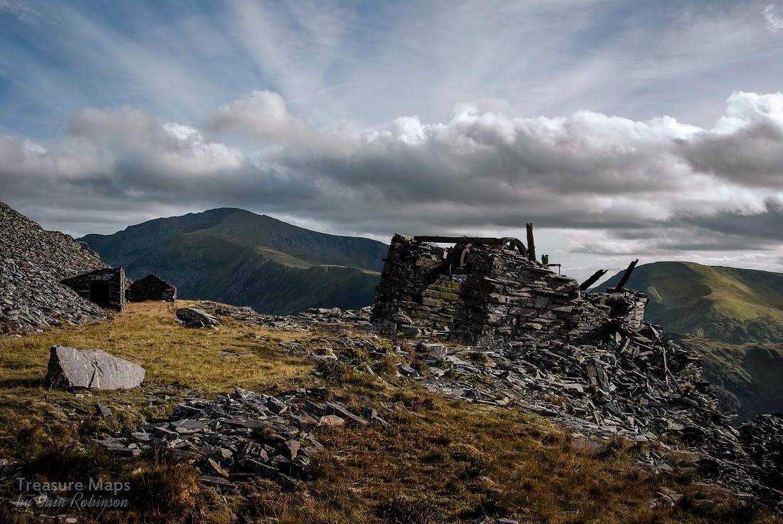 One such is the little drumhouse a couple of levels above Australia; I think we are talking about the Lernion to Panws incline, a straightforward Drum installation, although as always, I am open to advice on this from wiser heads than mine. 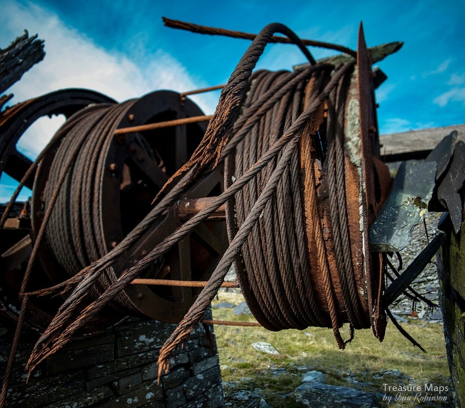 The point of this ramble is that the place is an isolated one, 1,800 feet above the valley. The ruined drumhouse is in the last throes of vertical life and will soon slowly sink to one side; gracefully, I imagine. It looks beautiful. Yes, I know, I have a strange idea of that concept since I like my landscapes punctuated by quarries and tips, but trust me, I trained as an artist you know. And there we were, soaking up the atmosphere on an unusually sunny day hereabouts, not a soul to be seen anywhere. Petra was in the ruins, taking photographs. I was standing outside, gazing across the valley to Snowdon. Then it happened. A curious sound, like the whoosh of an arrow. I felt something on my cheek and was very briefly aware of a shape; then it was gone and I saw a Sparrow Hawk come out of the crimp and soar upwards at fantastic speed. It took me a few moments to realise what had happened and, as the hawk flew off, a lovely little skylark emerged from the drum and quietly flitted away, seemingly unpeturbed by it's brush with death. 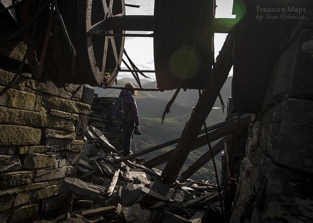 Grazed by the arrow of a hawk...they say that an accipiter's brain can perceive time more slowly, that it can plan it's incredible moves in detail, rather like a program to predict and compensate for the inherent instability of a fighter jet. It saw that lark, did a hawk-type risk assessment in split seconds and plotted a course through the steel spiders of the Drumhouse. It only made a tiny error, and caught me so gently as it flew down. One way or another- that was a close shave. 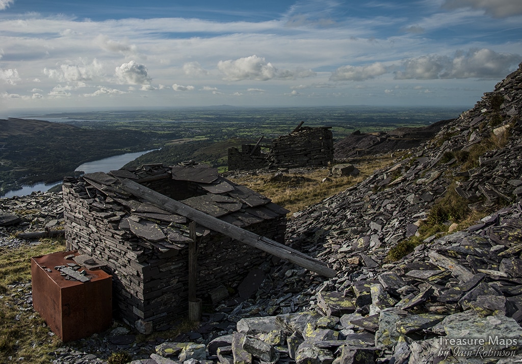
2 Comments
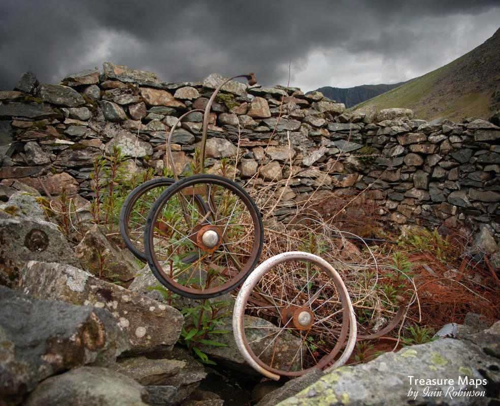
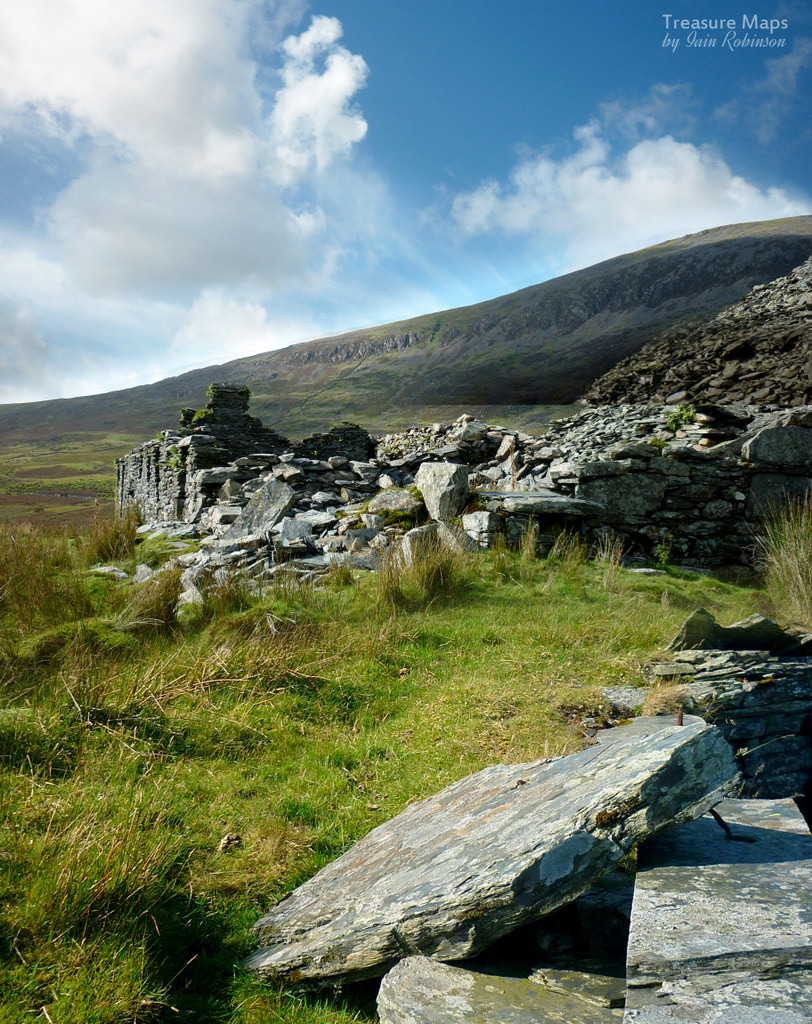
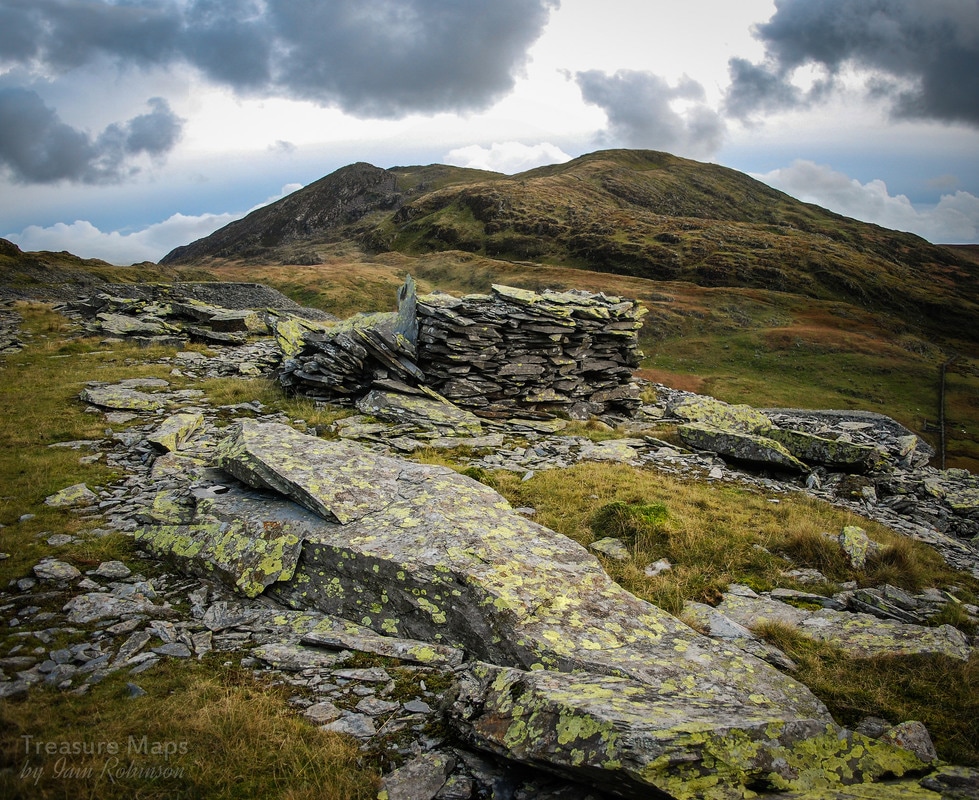
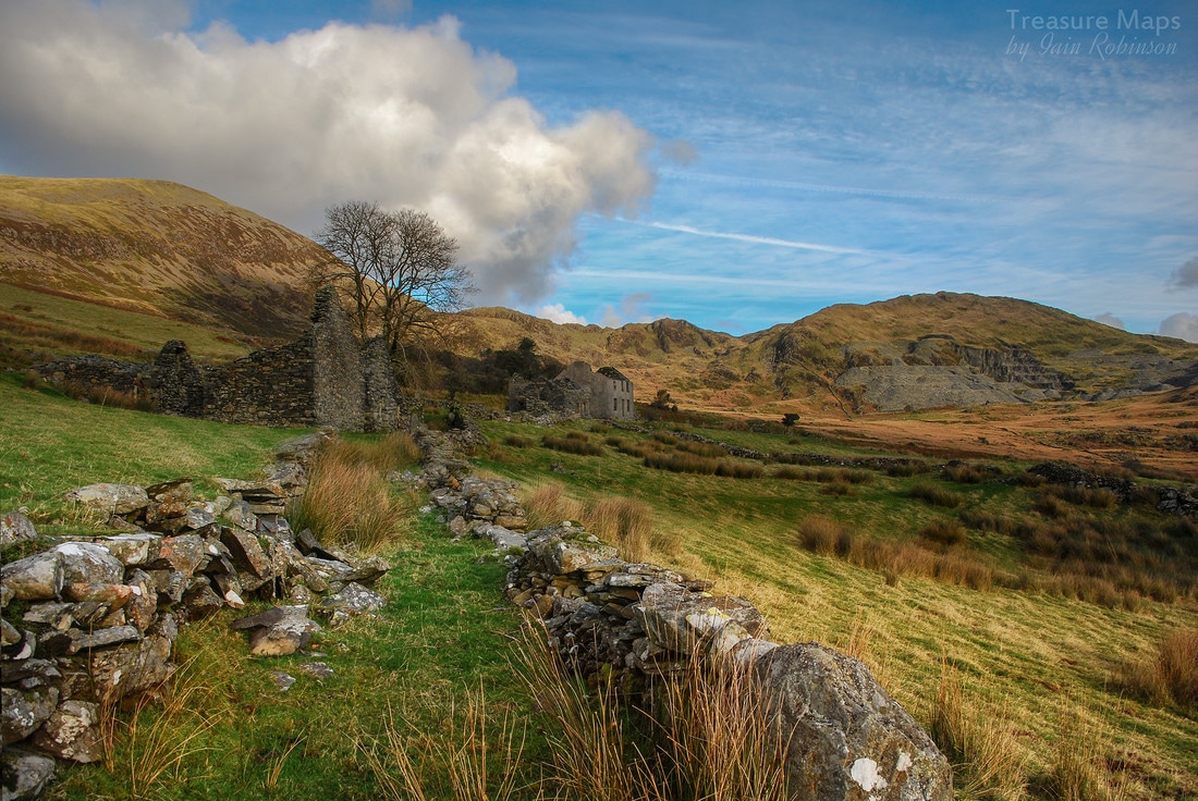
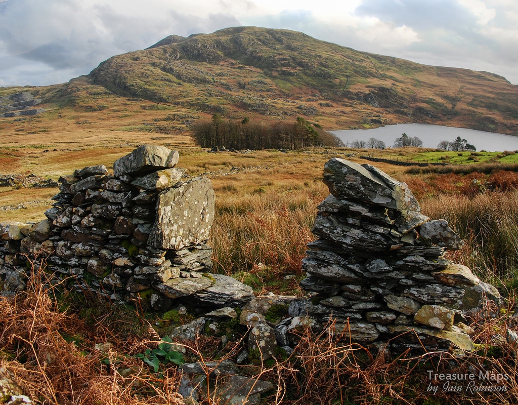
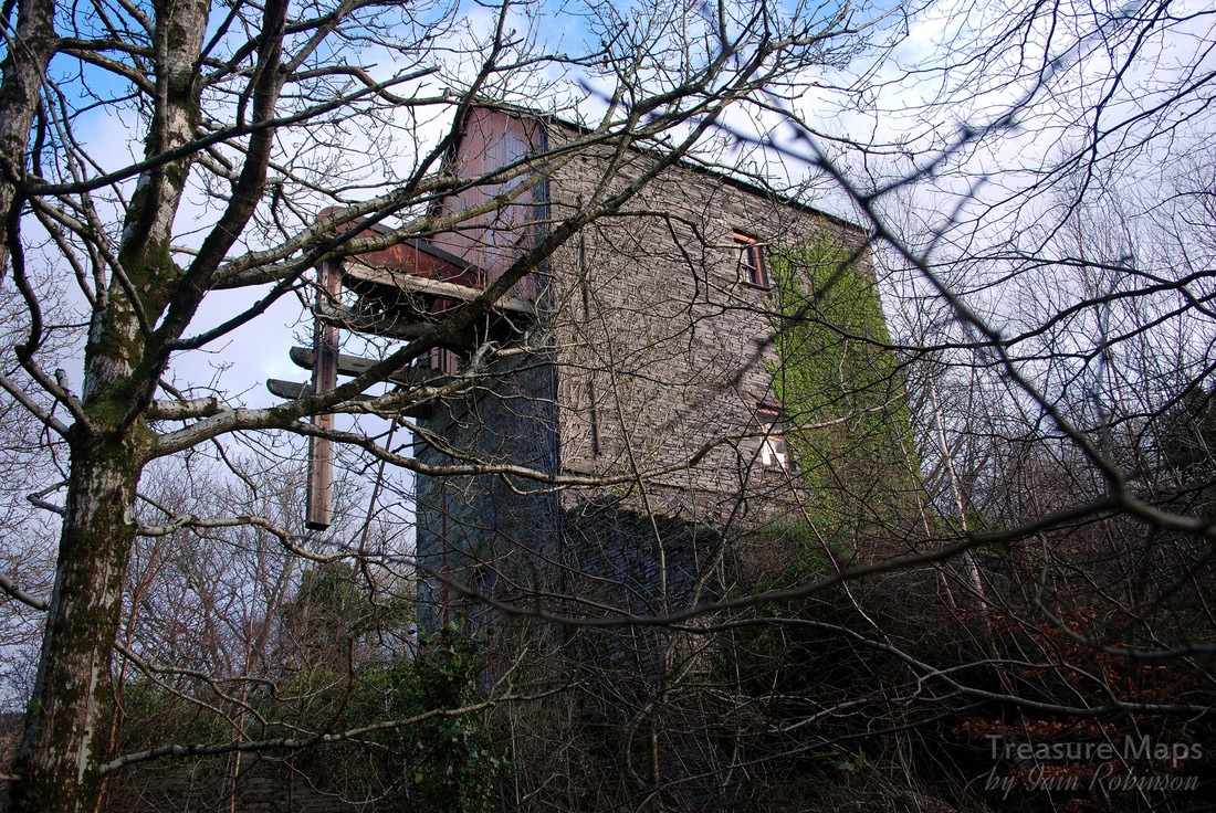
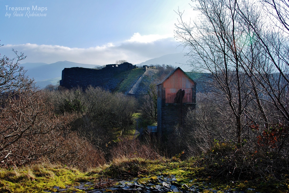
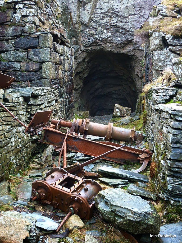
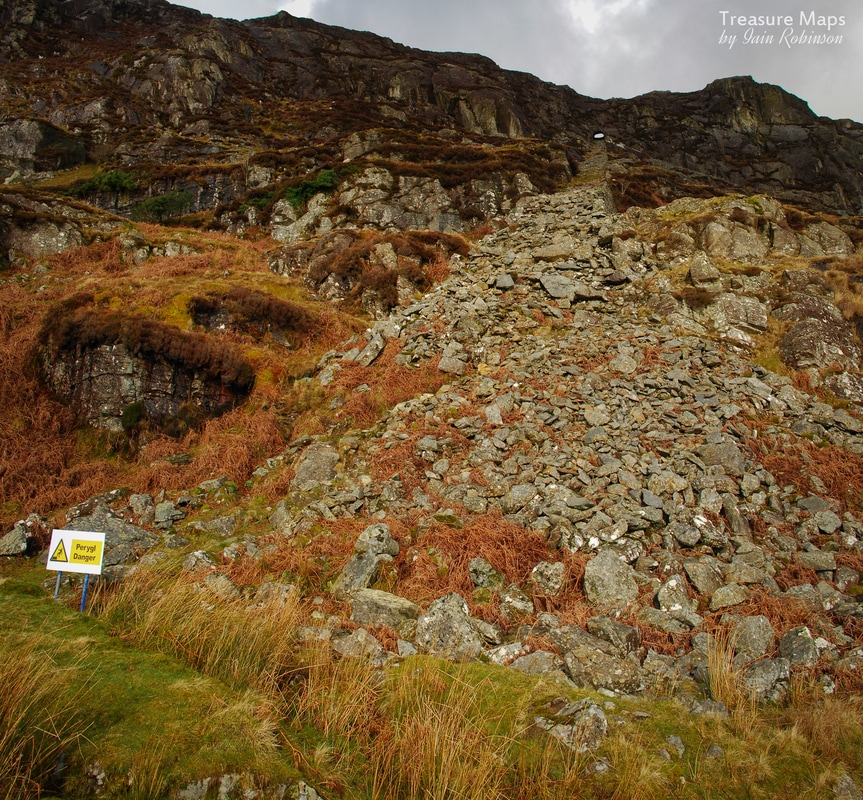
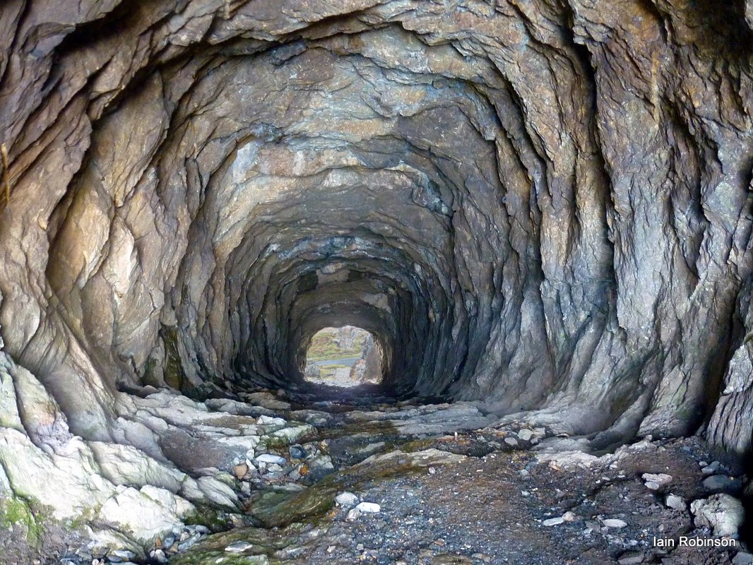
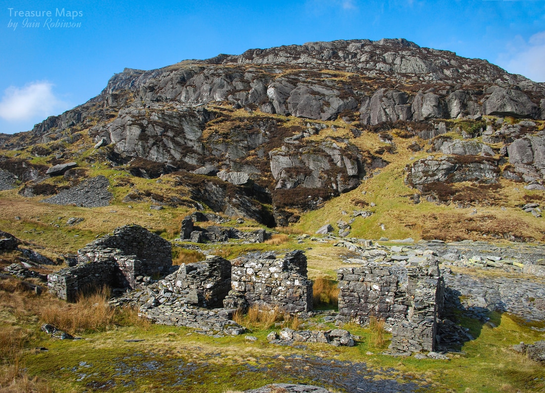
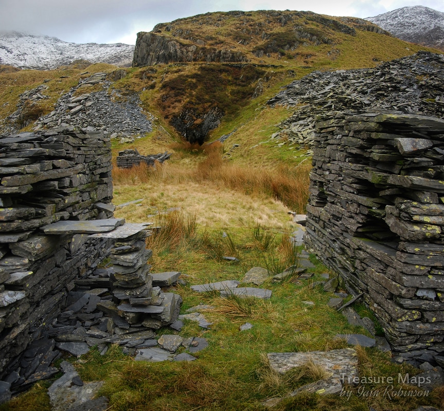
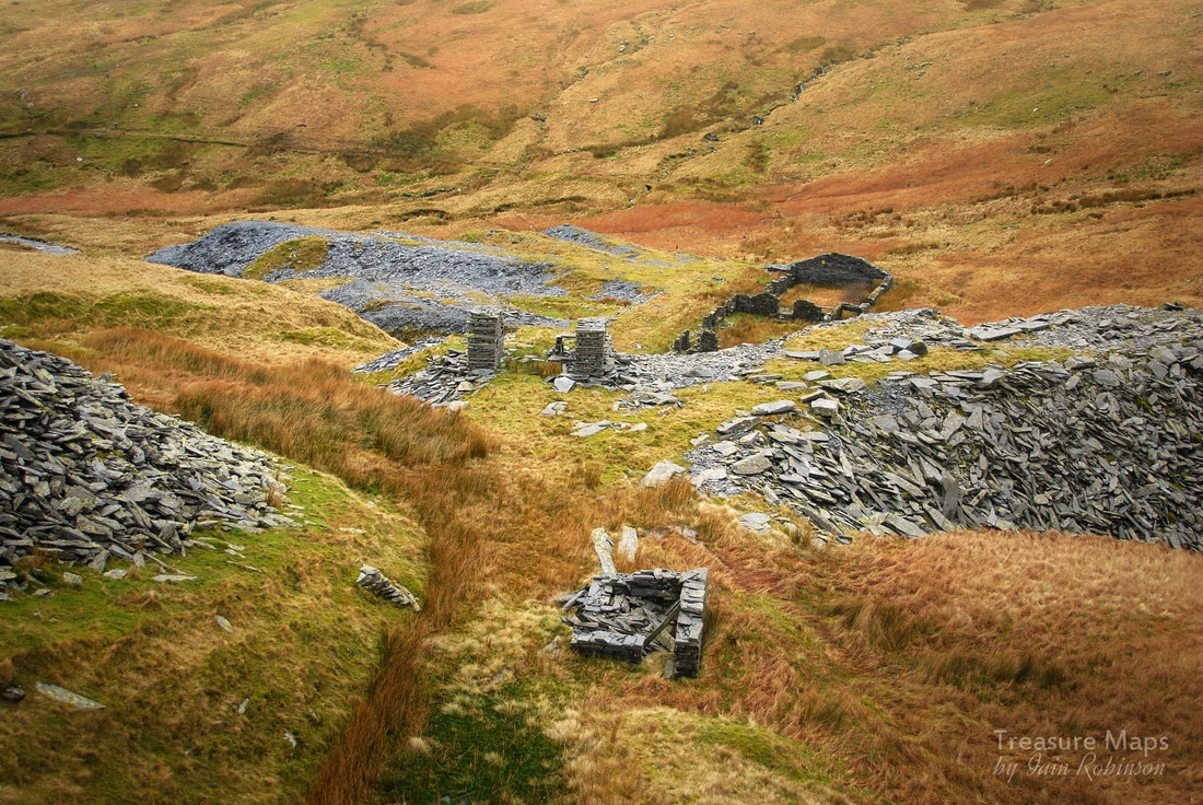
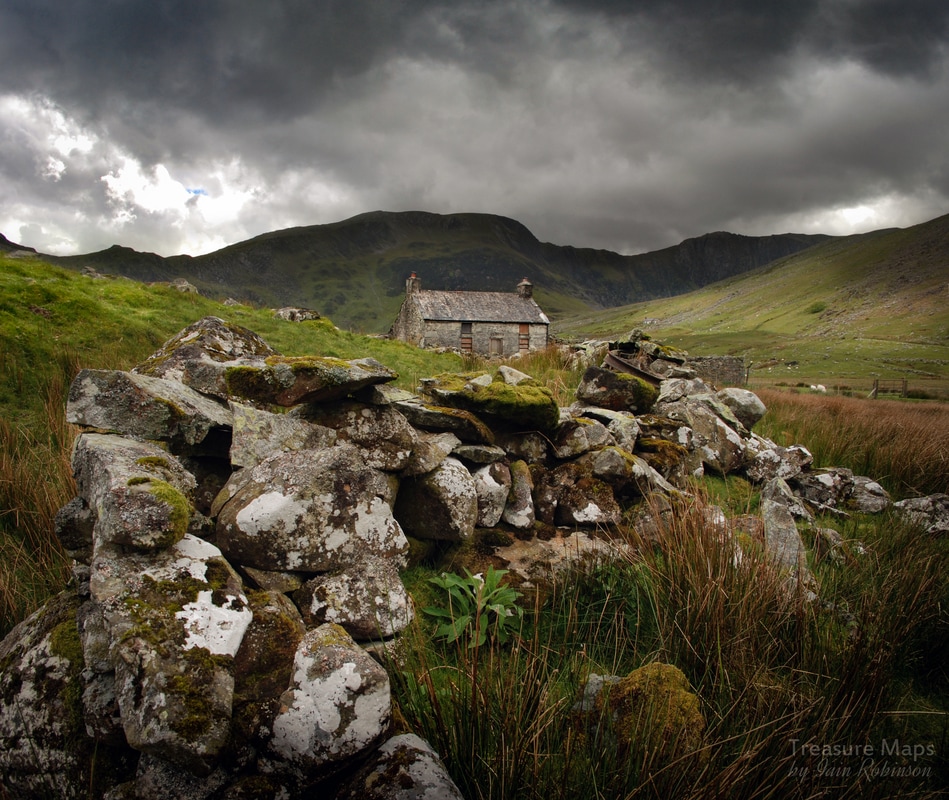 The deserted farmhouse of Cedryn. The single track road from the B5106 at Talybont reared and bucked like a wild Carneddau pony. We hung on for the ride and after a couple of switchback miles, arrived at the trailhead. You can park in the free space at GR SH7317266305, there's room for 15 cars, but this is a favourite starting point for exploring the Carneddau peaks, and was almost full when we arrived, a little after 1.00pm on a Saturday in May. We weren't planning on peak bagging so headed off up the well-made track towards the dam. The weather didn't look encouraging, but what the heck, some of my best shots are done in dreich conditions...in fact, I've developed a real aversion to fine, bright weather. Just as well - living in Wales, I won't ever be disappointed! Straight off, this seems like a wild and isolated spot. There's a feeling of dread here, or perhaps it's just the way the cloud covered hills looked a little like Mordor. For now, we headed up the track towards the Cedryn dam.. 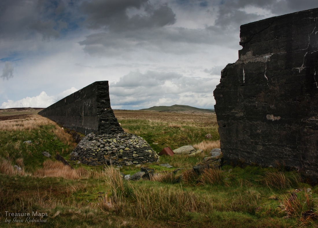 The breach in the dam, with the remains of a Hudson tipper body lying in the channel cut by the escaping waters. The dam is an imposing and surreal sight in the landscape here, when everything else seems so wild. It was built in 1917 to supply water to power the Aluminium smelter in Dolgarrog- and must have been the biggest thing that had happened in the cwm since the last ice age. We took a detour to look at the breach - which happened in 1925, allegedly caused by cost-cutting by the contractors. The concrete isn't exactly construction grade, it's remarkable that it has survived the elements. Tragically, 16 folk lost their lives when the waters swept down to another dam below which eventually collapsed under the strain. We carried on towards the top end of the dam, where the wall has been dismantled. I lost my sense of direction here, so I'll mention that you carry on left at this point and then keep on the track, don't go up to the beautifully situated Hafod y Rhiw, which looks as if it is inhabited, or a holiday cottage. For now, we were walking on a cart track which had been built after the dam, taking a slightly higher route along the cwm. The old quarry tramway, constructed c.1859, can be made out below. Its course was flooded until the dam was dismantled. It runs along the floor of the cwm until Cedryn quarry is reached, where it takes off again towards a mill, and then the more remotely sited Eigiau Quarry. It's possible to follow the line of the tramway over small bridges and through modest cuttings, but I must warn that it is a soggy business, as if the land has still not recovered from being inundated by the dam. In 1863 the North Wales Chronicle printed a verse by local poet Robert Jones in praise of “Ffordd Haiarn Cedryn” (the Cedryn iron road), whose MacGonigalesque verses predicted the awe that would greet the railway's opening. Another verse praised the railway’s civil engineer James Spooner, best known for his work on the Ffestiniog railway. Spooner must have spread himself thinly about, because his name seems to crop up again and again at this time. The "iron road" is little more than a Spooner pencil scribble on the map, yet like all these old routes, it has a considerable charm. 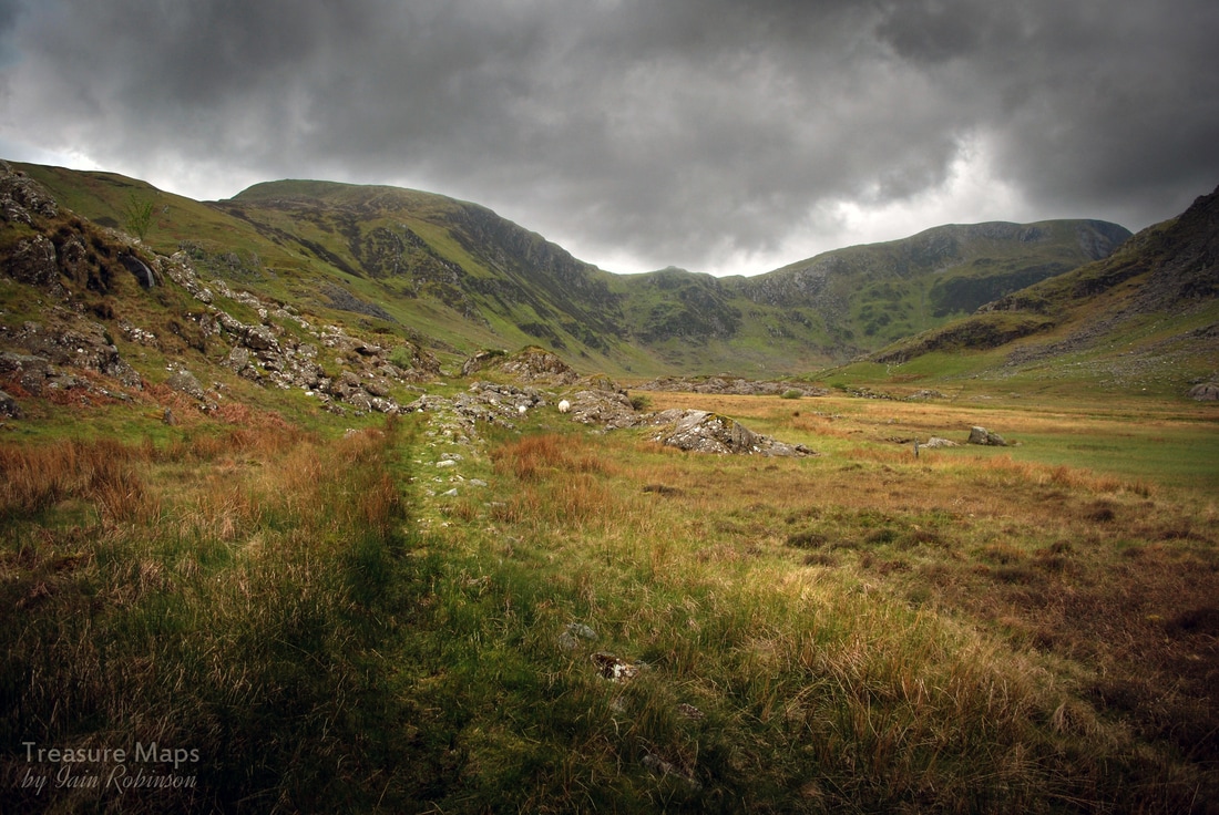 The quarry in the distance and the tramway, passing through a small cutting. Being set now on reaching the quarry, we diverted from the track at SH7212664130 and forged uphill towards the barracks. These are quite substantial and constructed from country rock, probably found on the hillside or quarried from one of the dolerite outcrops in the cwm. Records show that quarrying for slate at Cedryn dates back to 1827, at which point pack horses or mules would have used the track to the barracks and beyond. All supplies must have been brought this way, and finished slate taken to the quays on the river Conwy at Dolgarrog. 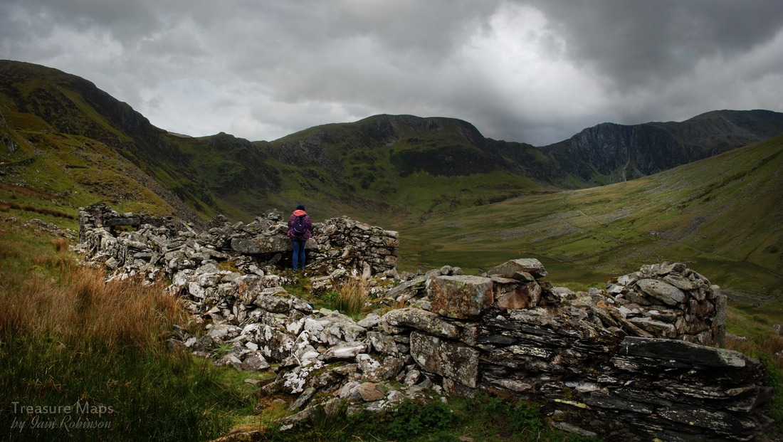 The ruinous barracks At the quarry pit, (SH7197763538) it soon became apparent that the slate was not of the best quality, fit only for lower-grade roofing slates. Building remains were vestigial, although it was obvious where entrances to the pit were made, now run-in. Little remains of the incline drum-house or any shelters, and I failed to find sign of a powder house. It is, however, an intriguing location with fine views, and we enjoyed half an hour there trying to work out the remains on the ground. The incline is well deliniated in the landscape- it falls down to the valley bottom and once crossed the river on a wooden bridge, now lost. Across the river was a mill, which I will deal with in a future post, as the light was almost non-existant when we looked there! An advertisement in the "Law Times and Journal of Property, 1844 to 1845", lists the quarry as: "The Cedryn Slate Quarry, of great extent, situate in Caernarvonshire, North Wales; the slate is of excellent quality, and can be had in abundance under a very thin cover; the work is already about 40 yeards wide and is capable of being extended to 180 yards in width, and at least half a mile in length, without any obstruction, and as deep as any parties may feel inclined to go- 4000 guineas." An idea of the precarious nature of the quarry comes from a letter in the Gwynedd archives from J.M. Hopkins, Liverpool Crescent, St. George to Lord Newborough, re the Cedryn Slate Quarry. They have already obtained advances of between £1200 and £1500, but need more money. They say that the quarry has already cost them between £6000 and £7000 and now they want permission to obtain more shareholders. Incredibly, Newborough agrees to the sale of more shares. Obviously it didn't go well for any of the parties involved! 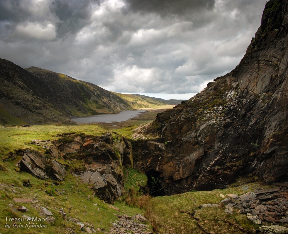 Cedryn quarry pit, looking towards Llyn Eigiau After exploring the quarry pit, we descended back down the cart track and then cut across to the deserted farmhouse of Cedryn. It's a beautiful, if isolated spot, although back in the middle of the 19th century I suspect it was quite a busy place, producing food and supplies for the quarries. The house is in good condition externally, wind and weathertight. It seems to be in use as a store for the farmer and is surrounded by sheep pens and tidy bits and bobs of the agricultural persuasion. On the dry stone wall outside, a mine cart wheel was resting on the cap stones. Another cottage lies higher up, above the mill. This is a mountain bothy maintained by the Mountain Bothies Association. By now, the wind was getting up and rain had started lashing us, so we turned back for the car park. With a final glimpse of the cloud beseiged tops we retreated to the trail head car park, to explore Cwm Eigiau quarry and mill another, hopefully slightly drier time. Some interesting facts- The mountains at the end of the cwm are called Pen yr Helgi Du (Hill of the Black Hound) and Pen Llithrig y Wrach (Hill of the Slippery Witch) - wonderfully evocative Welsh names! Cwm Eigiau and Cedryn quarries eventually amalgamated and the mill served both concerns. According to Alun John Richards, author of the indispensable "Gazetteer of Slate Quarrying", the mill had a total of 5 Hunter saws, the largest known assemblage of these fearsome machines, all probably installed around 1864. The Cedryn and Cwm Eigiau quarries were sold in 1881 after three years in rent arrears. The chief assets were tramway inclines and rails worth £140 and six railway wagons valued at £36. The quarry tramway was horse operated throughout it's life. Sadly, there are several air crash sites in this area...Pen Llithig yr Wrach has wreckage of an Anson from 1944 and a Vampire from 1956. Most if not all of the wreckage has been removed. Craig yr Isfa has engine wreckage from a Bristol Blenheim, from 1944. Link to Graham Stephen's blog post about the site here. 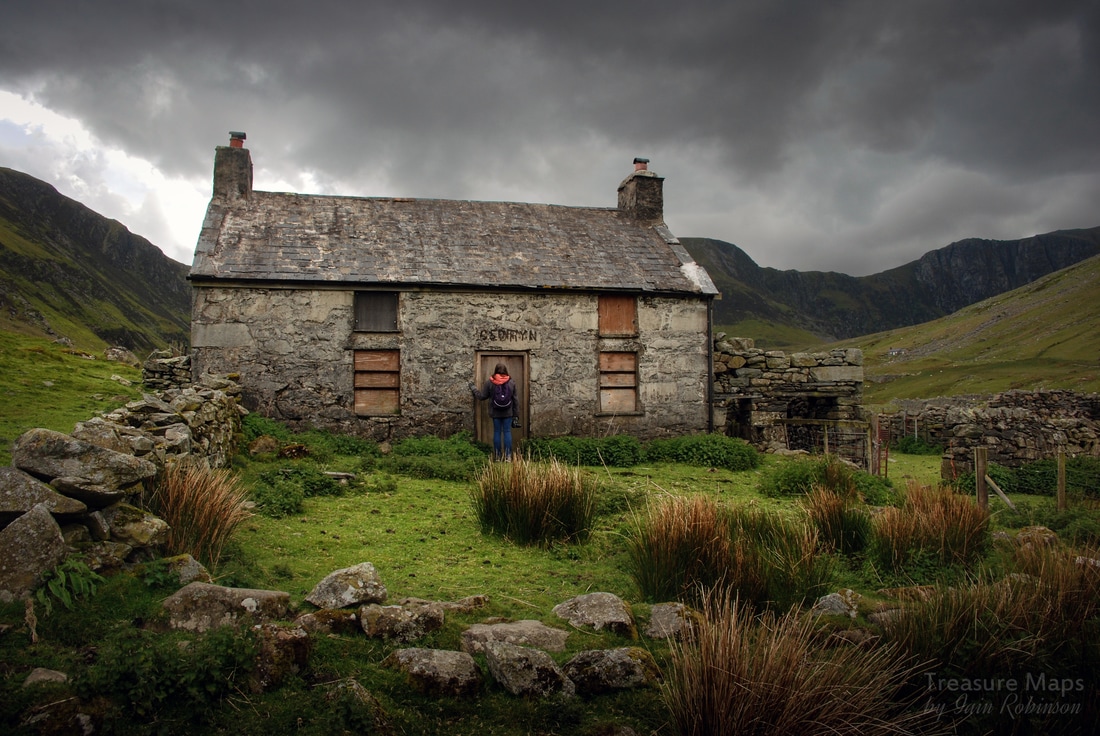  Leaving the grounds of the manager's house and following the tramway to the Gorseddau Quarry. This is a very foreshortened telephoto shot...the quarry is a lot farther away than it looks! The history of the Welsh slate industry is littered with glorious failures, white elephants and might-have-beens. Perhaps none more so than the story of the Gorseddau Quarry, high up in the hills above Cwmystradllyn, near Porthmadog. It was started on the crest of a wave of optimism. Fortunes were being made out of slate across in Blaenau Ffestiniog, in Dinorwig and Penrhyn; so it’s no surprise that the quarry followed the successful model of all these enterprises and built a link to the sea via a narrow gauge railway. There, sadly, the resemblance ends. In 1845, Robert Gill of Mansfield and John Harris of Darlington took out a lease on land at the head of Cwmystradllyn, costing £2,000, in the name of the recently floated “Bangor & Portmadoc Slate and Slate Slab Company”. They must have been very persuasive salesmen, for over the next few years they extracted well over £125,500 from investors hoping to make a quick killing from their enterprise. A great deal of money in those days when the average weekly wage was a few pennies. Extracting quality slate, however, was never going to be so easy. The quarry closed in 1867, not ever having made a profit. Exploring the Quarry and remains Today, given reasonable weather, it’s a pleasant walk up to the quarry from the car park at the Llyn at Cwmystradllyn, (SH5593344002) along the remains of the tramway. Originally built as a three foot gauge line, this section remained unchanged when the line converted to a fashionable two-foot gauge at Braich y Big and headed off to the Prince of Wales quarry and the Cwm Dwyfor Mine. It’s wet underfoot for most of the way, but quite flat until the quarry is reached. The first interesting structure to be encountered is the smallholding of Tyddyn Mawr, which has an old undershot iron waterwheel at the side, hidden behind walls. The steadings here, now ruined, show signs of once having been very extensive. It’s speculation of course, but perhaps this unusually large range of buildings housed animals to supply meat to the quarry workers, perhaps also a dairy. 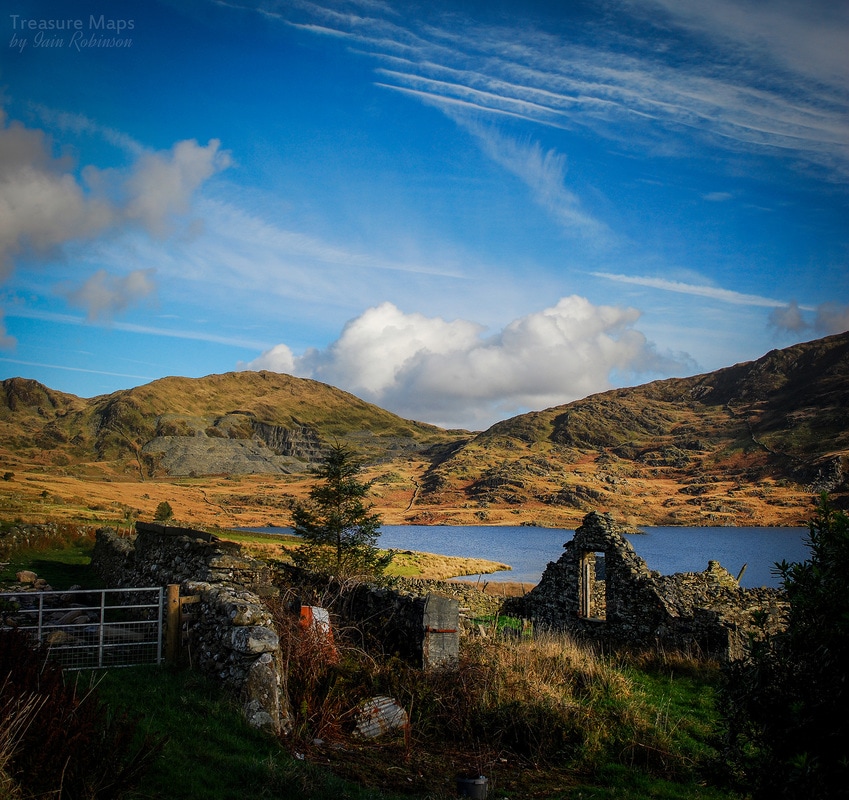 Further along the tramway there is yet another ruined farm, at SH5588944811...this is Talyllyn farm, in an enviable situation with a lakeside view and a vista over the Llyn to Moel Ddu. Again, there are an impressive range of outbuildings including stables, for the quarry horses perhaps. Walking on, a junction in the track can be seen at SH5591444864, just a few yards after Talyllyn farm. Up the hill to the left, there are various fascinating ruins- the vestiges of Treforys, a village, which was planned to house the workers. This can be seen very clearly on Google Earth (SH5604945371) It's well worth a detour from the tramway to go and have a look at this, and imagine the poor quarrymen and their families during the harsh winters. Gill and Harris didn’t do things by halves even though as quarry masters they were slightly less effective than the Chuckle brothers. Building a village for the workers was nothing - they even engaged the services of one of the most eminent civil engineers of the time, James Brunlees, (later “Sir” James) to build the tramway and also the very grandiose Slab Mill at Ynyspandy, “Ty Mawr”. 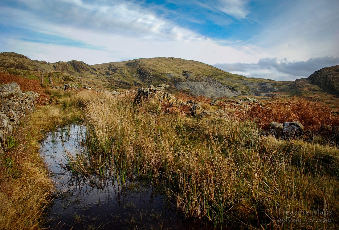 Named after Robert Morris Griffith of Bangor, the owner of the land, Treforys ('Morris's town') is a development of thirty-six crog-lofftydd cottages, each with a nominal quarter-acre, erected in 1857 along three parallel roadways on the hillside for quarrymen at Gorseddau. The 1861 census lists only nine dwellings as being inhabited, and all had been abandoned by 1871. A poignant site, it contrasts sharply with the inhospitable terrain of the rest of the landscape- and it is still a fair hike to get to work! 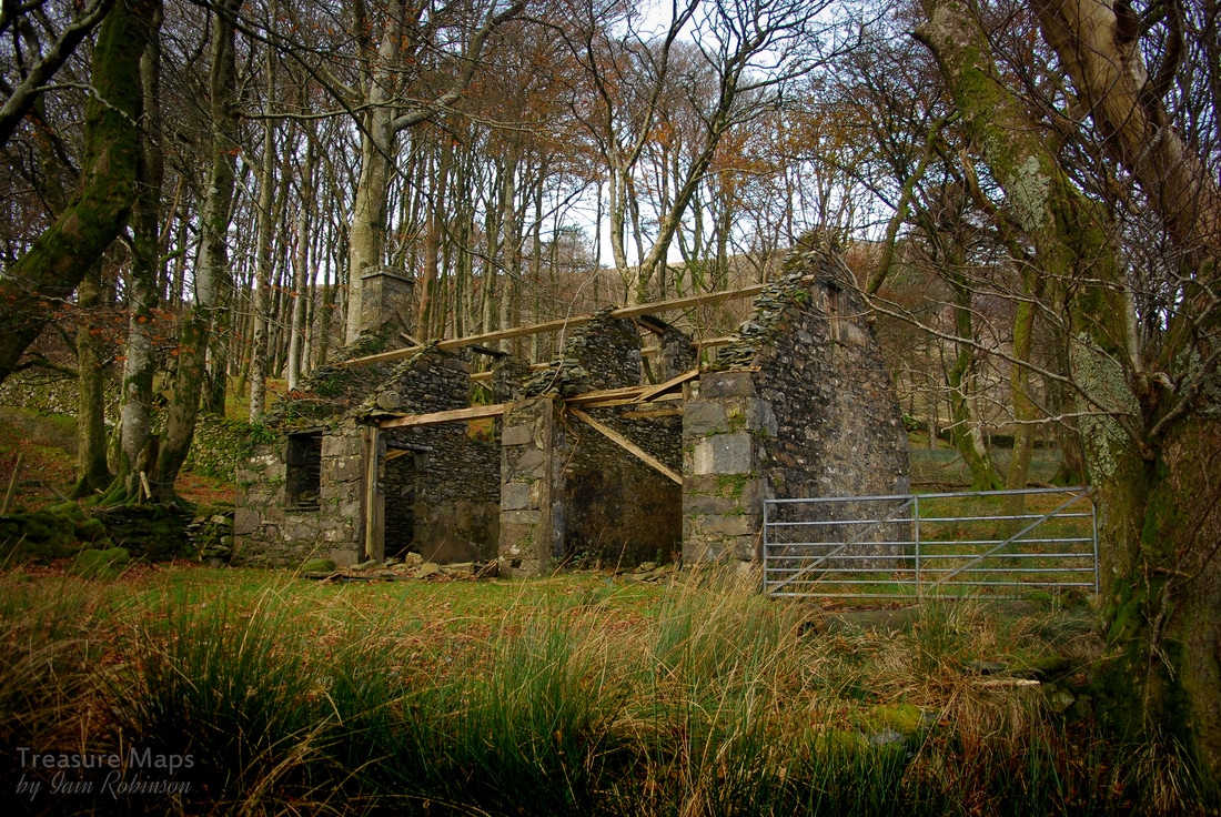 Back on the tramway, before long the manager's house, or rather the shed for his horse and cart, appears in a wooded copse. The house itself is sadly no more than a pile of rubble - this is, or was the grandly titled "Plas Llyn". Open country surrounds the tramway as it climbs very gently towards the quarry workings which have been in view since the start of the walk. Now they come into focus. 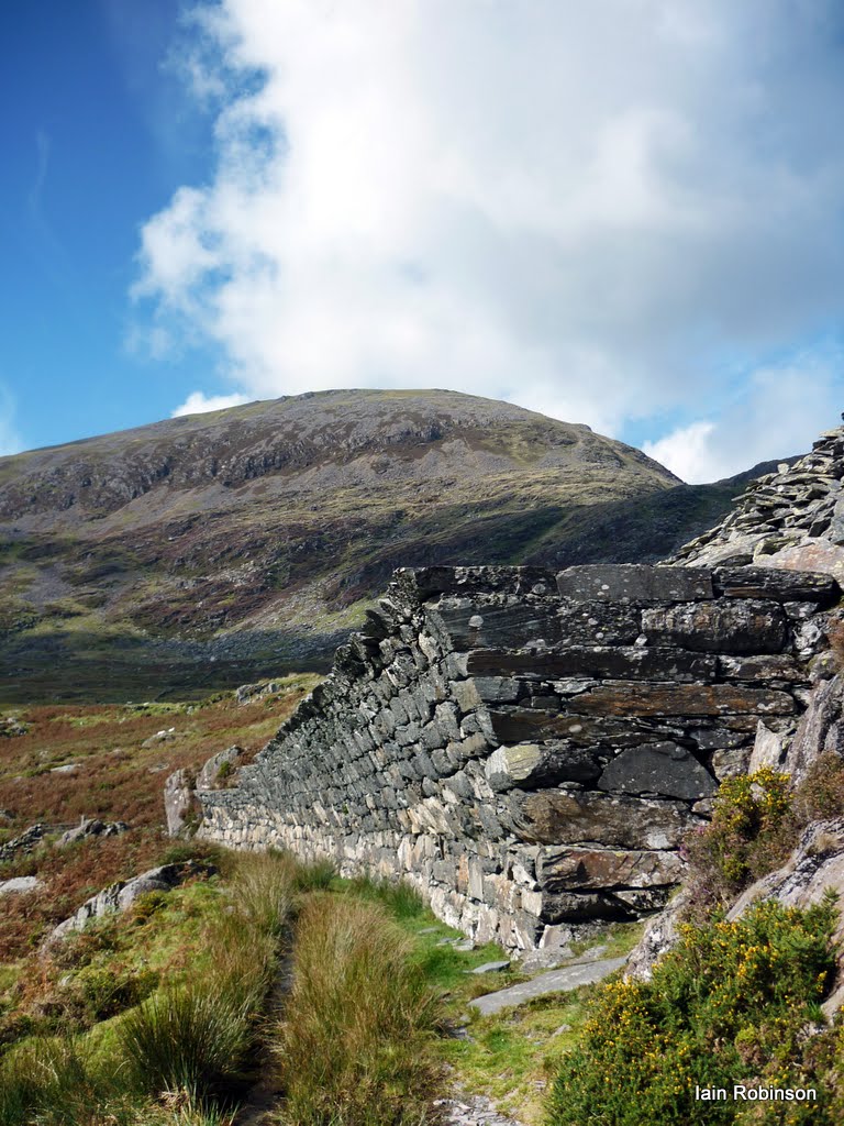 Entering the quarry proper, a strange wall comes into view, skilfully built over at 45 degrees above the railway. If one thing typifies the way things were done at Gorseddau, this is it. The wall was built, at great expense, out of huge blocks of stone to stop waste slate from the encroaching tip falling on to the tramway. There was space to the side of the line to slew the formation...even though the ground was boggy, the company had plenty of slate waste to make it stable. That just wasn’t the way the Gorseddau did things. 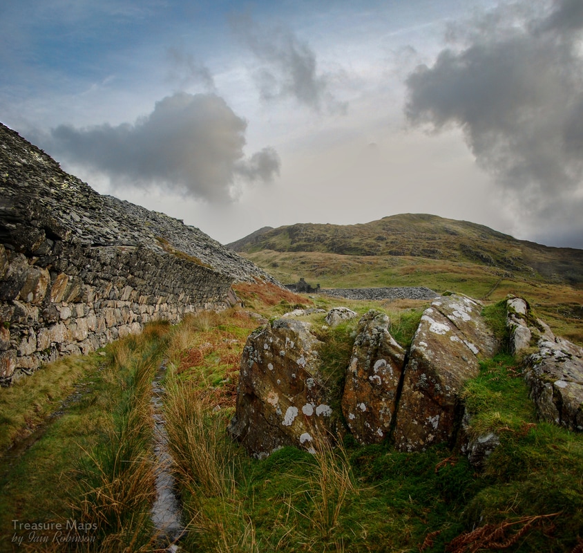 Even allowing for the fact that the quarry closed in 1867, the ruined workings are in remarkable condition. There are nine floors, connected by a fine dry stone incline, only breached where the levels themselves were possibly spanned by wooden trestling which has long since rotted away. The main activity was concentrated in a large quarry twll further to the east, and here, the sad story can be read in the rock strata. The productive slate vein, whilst fairly wide near the surface, dived deep underground like a wedge, becoming narrower the further down it went. Even to a layman, the country rock here looks unpromising. Underground workings were made in a desperate attempt to win the deeper slate; as evidence, a swampy drainage adit comes out under the first level just before the east quarry is reached. 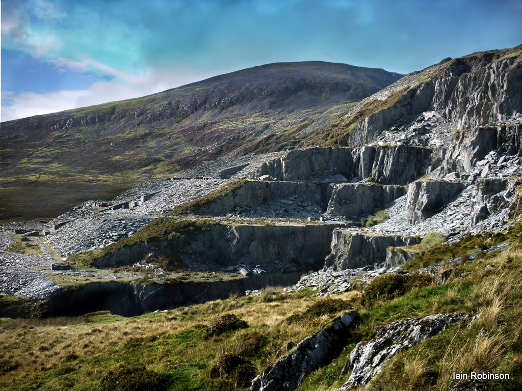 The quarry from the East There are feint paths making it easy to ascend between levels and gain a view of the whole undertaking...these can be seen by the incline. On the eastern side of the twll, there are fine views of the workings to be had and it is easier to ascend from here. The site is dotted with wonderfully preserved little cabans and walliau for the rock men and tip masters, including some with what look fancifully like compartments for the men’s lunches- but are probably candle alcoves. As well as incline houses and an impressive pit, there are some wonderful "beehive" type blast shelters...and evidence of rail being chaired directly to slate slabs for sleepers. Perhaps that was one use for Gorseddau slate that the owners might have tried to market! 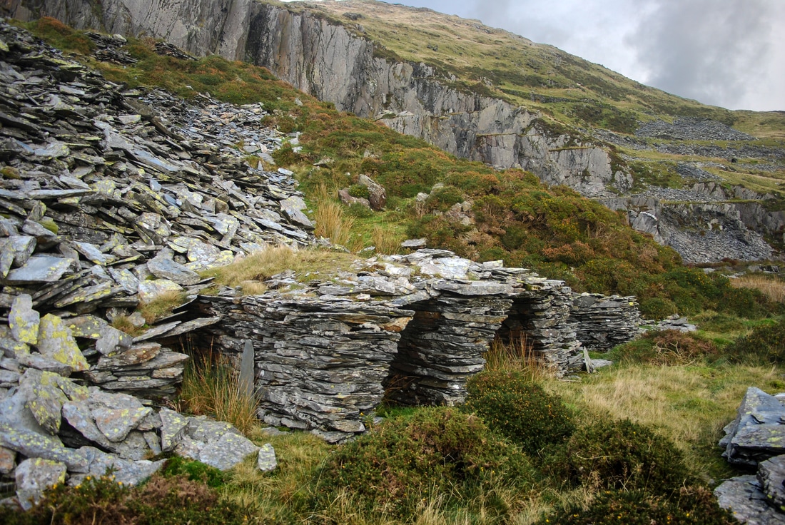 The blast shelters... 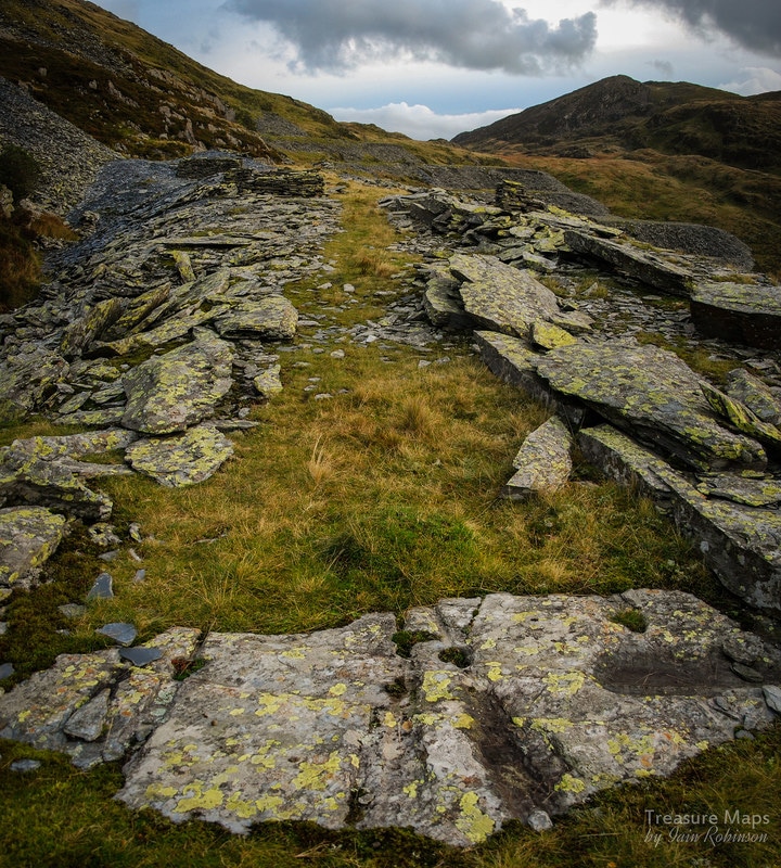 A slate slab used as a sleeper, with the marks of diverging wagon wheels. The site is a fascinating one, combining a wild landscape with fine views towards the sea and the Lleyn Peninsula. A short walk to the top of the bwylch above the quarry rewards with views of the Moelwyns, Cnicht and Snowdon. Rather poignantly, looking towards the sea, the magnificent mill of Ty Mawr is only too visible in the middle distance, a constant reminder of the folly and hubris that followed the enterprise from the start.  I was a little hesitant in publishing yet more photos of the Holman Cornish engine house at Dorothea. After all, there are hundreds of photos on the web, most taken in the last few years. When you dig a little deeper and look for information, most people seem to have paraphrased Dave Sallery's excellent description on his web site, adding nothing more of interest to the discussion, which goes round and round.  In a way, this echoes the events on the ground. A world-class chunk of industrial archaeology slowly sinking to ruin because no consensus can be reached over funding or care. A look through the Coflein catalogue of images will show just what has been lost at this site in the last few years. There's more than a little will to do something about it- the people of the vale, for the most part, seem to appreciate what they have got. There are things going on, quietly in the background, but at a geologically slow pace. Meanwhile the artefacts in the quarries that make up the Dorothea complex slowly sink into rubble and rusty oblivion. 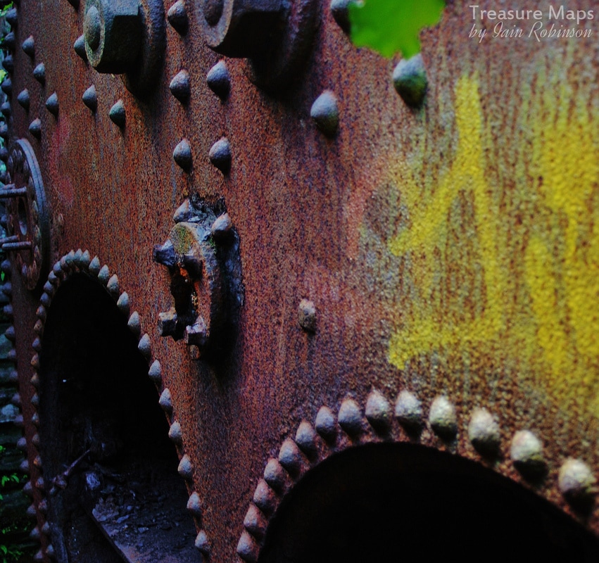 I don't really mind: I like my industrial archaeology rusty and forlorn and I hate the suburbanising of spaces as has occurred on other sites with their interpretation boards, trails and visitor centres...the "National Trust" effect. I just hope the alternative isn't the no-man's land of "landscaping" or bulk extraction, rather than careful conservation. Whatever happens, the area is a haven for wildlife and is much loved by local people. It needs to be handled sensitively, or not at all. 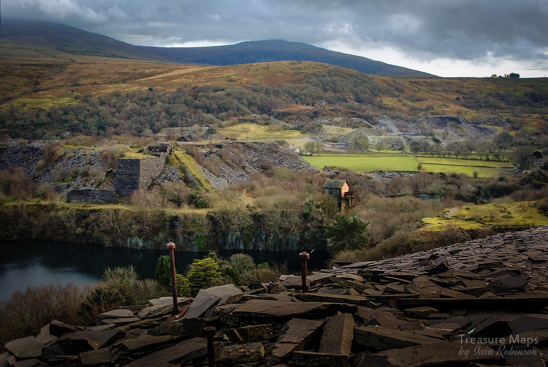 A significant fact, if one were needed, to justify the importance of the site is that the design of the engine at Dorothea is fundamentally unaltered from Newcomen's original of 1706. That this engine was one of the very last Cornish pumping engines to be erected, 200 years later, is an incredible thought. Some notes on the early years of the engine house...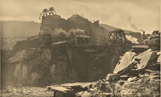 View of the sinc from across the quarry on an undated postcard. This shows the pyramid with chain inclines and the original chimney of the Engine House on the right. Walking around the place, with it's Lancashire boilers and various mysterious looking fragments of pipes made me think of the difficulties experienced in the earliest days of construction at Dorothea. The technology of the engine might well have been old school, but the problems faced at the quarry were very much of the immediate kind. Documents from the Dorothea papers* shed interesting light on the difficulties. The sinc, or quarry pit, had attained a depth where it needed to be de-watered, in order for extraction of further slate to take place. Various pumps had been tried, notably some from H Owen & Son, Caernarfon. These were worked with steam from the winding engines, for instance, "steam from engine number 12, gallery Quarry C which was idle" according to notes made by the quarry manager. It was to no avail. It's difficult to see how the sinc was dewatered prior to this, possibly by buckets attached to a chain incline, but one thing was clear, something had to be done and soon. In 1899 the first sods were cut for the "Big Shaft" and it's sinking done by John Williams and Owen Powell, likely small-time, but skilled local contractors who would hire gangs of men as and when needed. The shaft was to be 155 yards deep by 9 feet square. At the same time, a tunnel from another shaft, dug simultaneously in the sinc was to be driven, 135 yards away laterally, to meet the big shaft. It took 19 days to dig through topsoil and overburden (such as glacial till) to reach rock. A temporary engine house and head frame was soon needed to lift the spoil from the shafts, and a new winding engine ordered. It must have been quite a scene of activity, with the smoke from the engines, men and horses manoeuvring equipment and spoil. 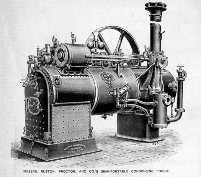 An engine from Ruston's, similar to the engine used at Dorothea to pump water from the shafts. Engraving by courtesy of Graces Guide. Another engine arrived from Nantlle station on 5th April 1901- a Ruston and Proctor 6nhp semi-portable. It was needed, as water was beginning to be a problem in both shafts. Then, on August 7th 1901, the granite was encountered, underlying the slate vein at 40 yards depth. This was actually pre-Cambrian porphry, the first time this had been encountered at Dorothea. Water flowed in copiously and the shaft had to be constantly pumped and bailed out by hand. Eventually, at a depth of 90 yards, (30 yards deeper than the South Dorothea sinc) the miners had to give up until steam pumping could continue on a 24 hour basis.  New pumps were requested from Joseph Evans, Wolverhampton. Their representative was a Mr Brindley, who "laughed when he heard that the quantity of water to be raised from the shaft was only 350 gallons per hour" Brindley recommended two smaller pumps, to be powered by yet another steam engine, a Robey 14nhp, working at 60psi. It would also have to drive ventilation fans and the winding engine, so was perhaps not such an extravagance. The pumps were assembled and put in place on 21st December 1901, but proved impossible to start. The quarry engineers tried from the Saturday continuously through to Sunday night, but went home, exhausted and disheartened, "saying they could do no more". Brindley was sent for and announced that everything was "capital work" but failed to make the pumps function. He announced to Hugh Williams, a fitter, that "A doctor cannot cure every patient" and left without informing the quarry management. Brindley was to be back again several times at the behest of Dorothea. Owen Evans, from Caernarfon, (the supplier of the original pumping equipment for the sinc) was asked to intercede with Brindley. Brindley's response was that "In as much as the pumps had gone for an hour...they ought to go on for ever." Evans asked him why they stopped so often but he could not say. He then left, "on the 2.05 train from Talysarn" not to be seen again. On January 1902, the pumps and pipes were raised from the shaft, "being quite impracticable for the place." Work stopped, and the expedient of driving another tunnel from the Twll Coch sinc was tried, in order to drain the shaft. On July 16th 1902, miners broke through, tapping the water and draining the big shaft. Work continued with further minor difficulties due to pumping until May 1903, when a fall in the sinc blocked off the shaft and buried engine, drum and pumps. This took until July to clear and in the meantime, the big shaft was allowed to fill up with water. At last, the quarry's luck began to turn as the miners in the lower tunnel encountered a fault in the rock and "all the water that was coming hitherto into the shaft came into the tunnel". Work continued until the required depth was attained in November 1903. It had taken them slightly more than three and a half years, without a single injury to the workforce. The first foundations of the engine house were laid by Evan Thomas, mason and his gang, on June 21st, 1904. In October, the beam of the "New Engine" arrived at Nantlle station and was found too heavy for teams of horses to pull. It had to be hauled by a traction engine, hired from Abergele. The pumping engine took until June 1905 to be assembled, whereupon a great many teething problems were experienced, some due to the engine and pumps, some due to the brick lining of the shaft allowing water in to the shaft. Eventually, on August 21st, 1906, the pumps began to work properly and "have worked since without any trouble" (W. J Griffith, Quarry Manager) Some factoids: The engine in the house weighs a little over 91 tons 3 cwts. and has a 68" bore cylinder. The main beam weighs 22 tons, 12cwt. The first engine house chimney was made from two old boiler tubes, weighing 6 tons and 60 feet high. This was later replaced by a cast concrete chimney. Sources: Power from Steam: A History of the Stationary Steam Engine By Richard L. Hills *The Dorothea papers, Gwynedd County Record Office 614 and 627. Alan Carr, "Dyffryn Nantlle, A Landscape of Neglect" Great thanks to Petra for sourcing the archive information. 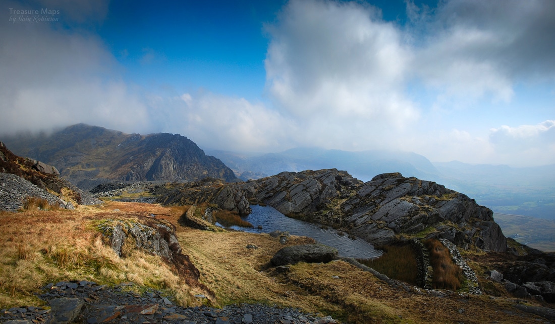 The tiny reservoir for Wrysgan Quarry, high up above the Vale of Ffestiniog. Like many folk, I stravaige about North Wales looking in hope for the poignant traces of forgotten structures and settlements. Never straightforward, they tell their stories in an obscure, difficult language with many a deception along the way. Despite studying the territory for many years, I am still struggling. Sometimes, it helps that other folk have done the work for me, allowing me to study the margins of a site without feeling completely mystified. Wrysgan is one of those places where clues have been found and enough records left to get an idea of what went on. It's a place near to home, but there is a ferocious climb up a slippery slate track to get there, so I don't go as often as I should. It's a busy spot, too...hard to get a sense of the place with folk hurtling about having the time of their lives.
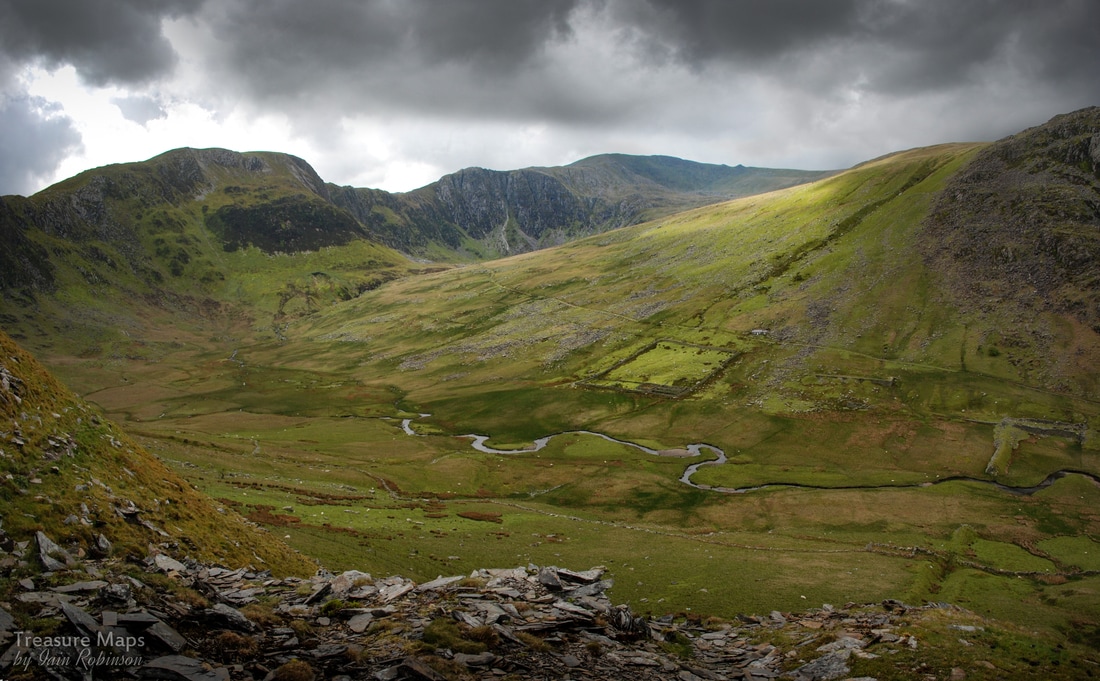
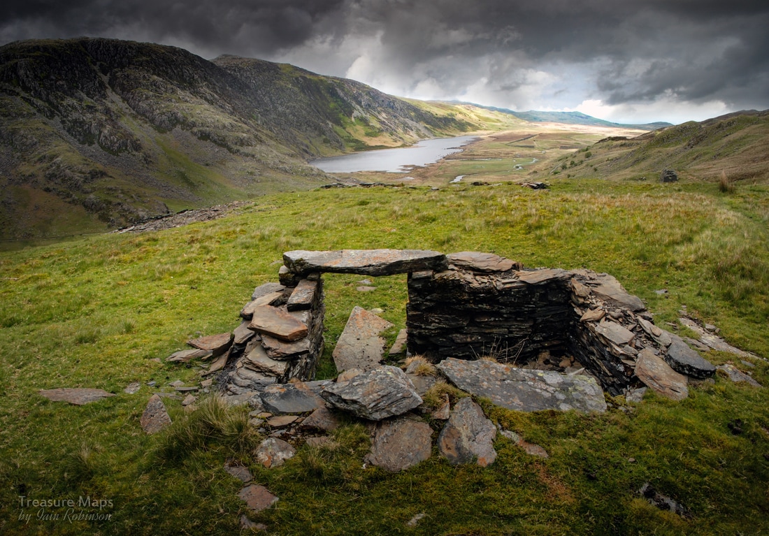
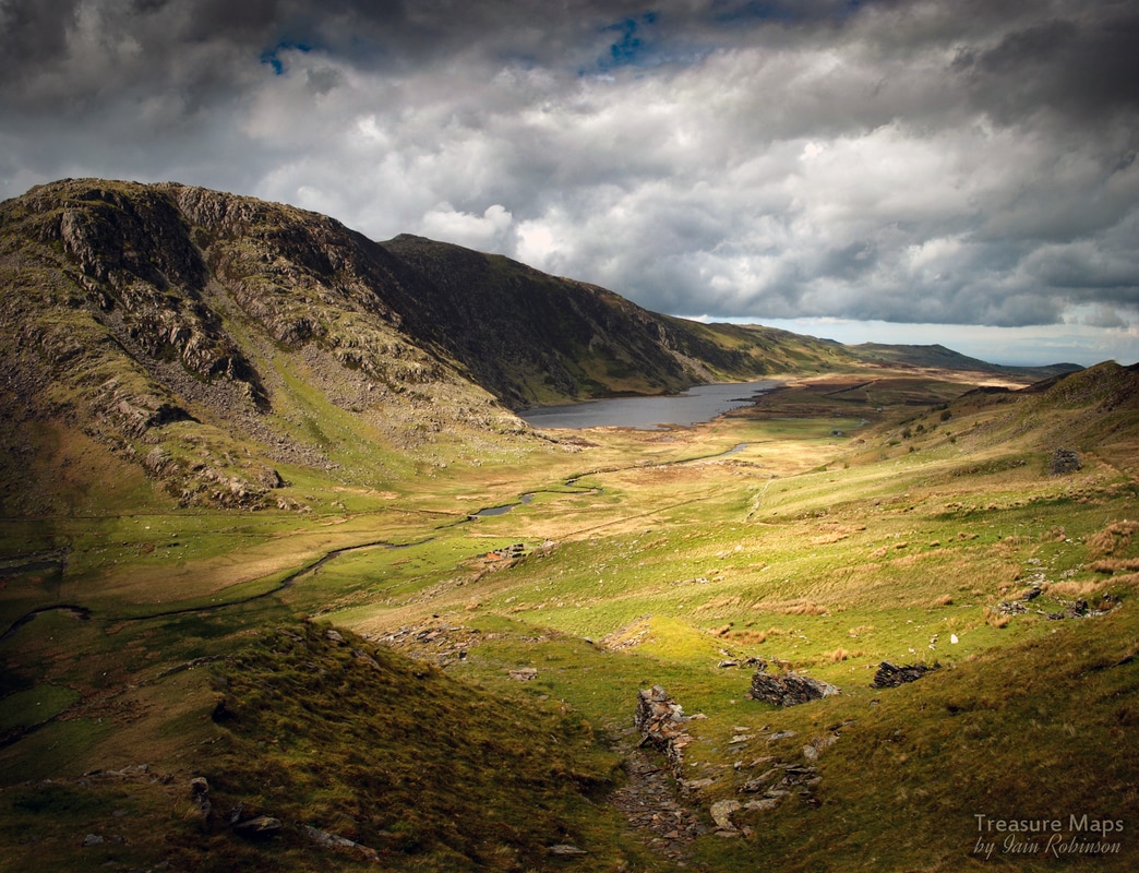
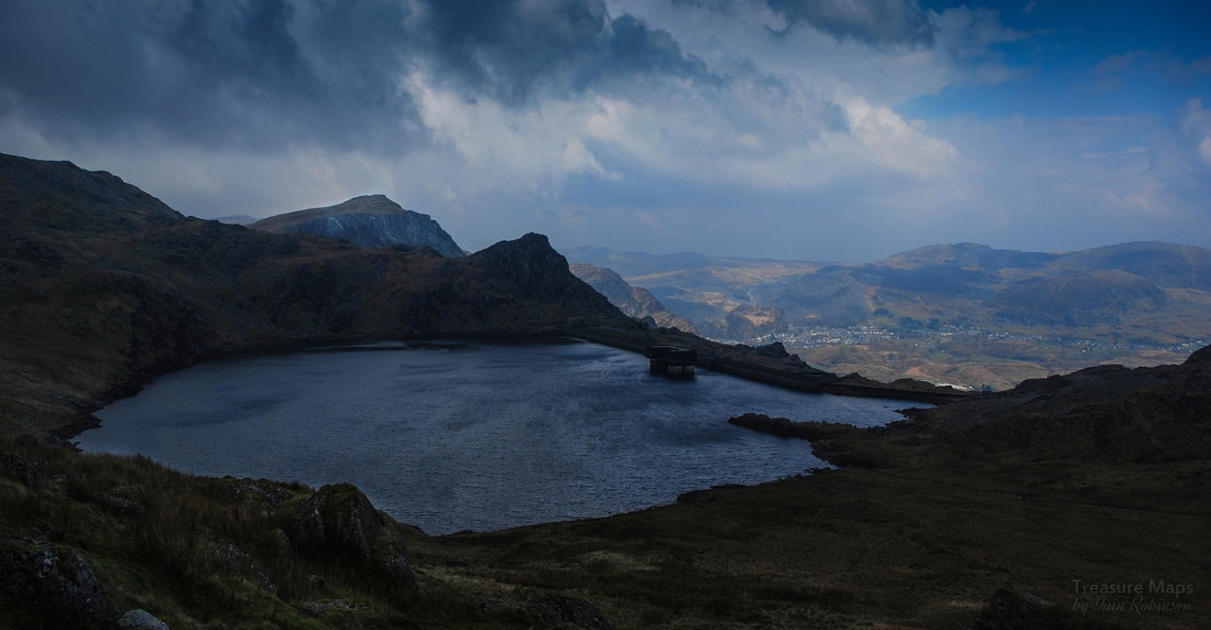
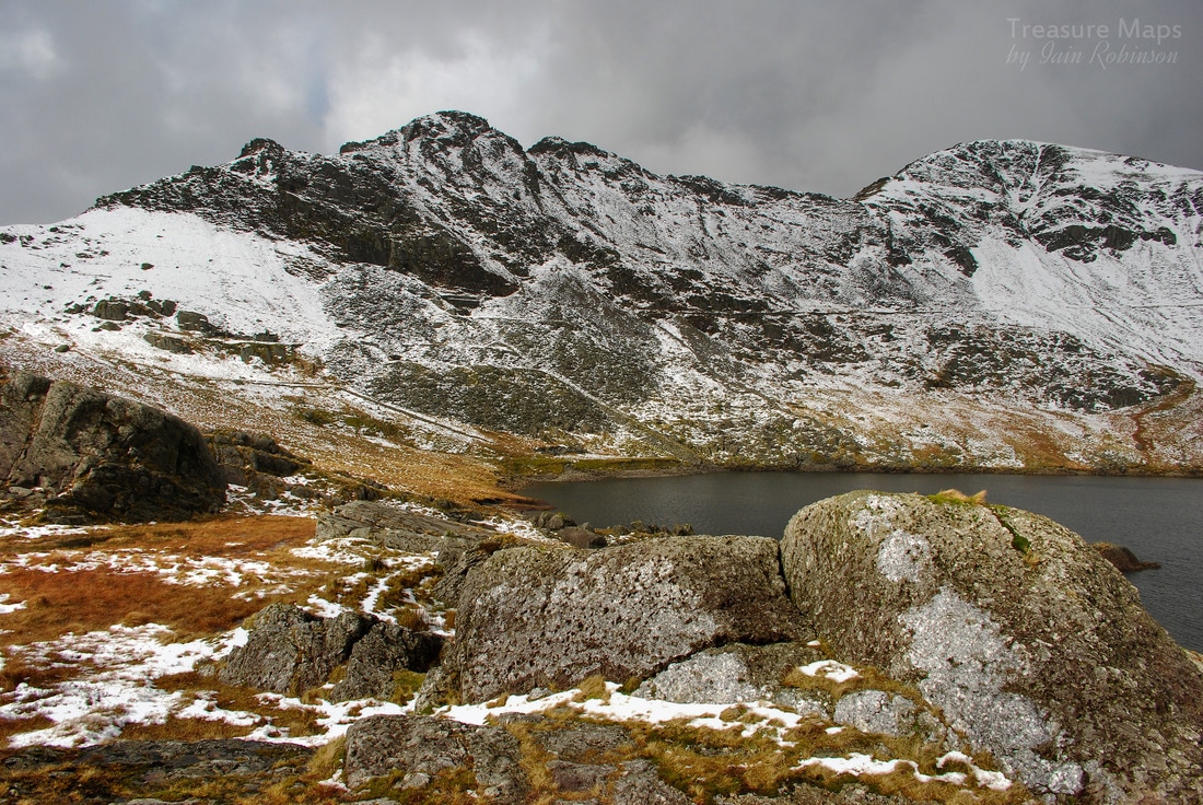
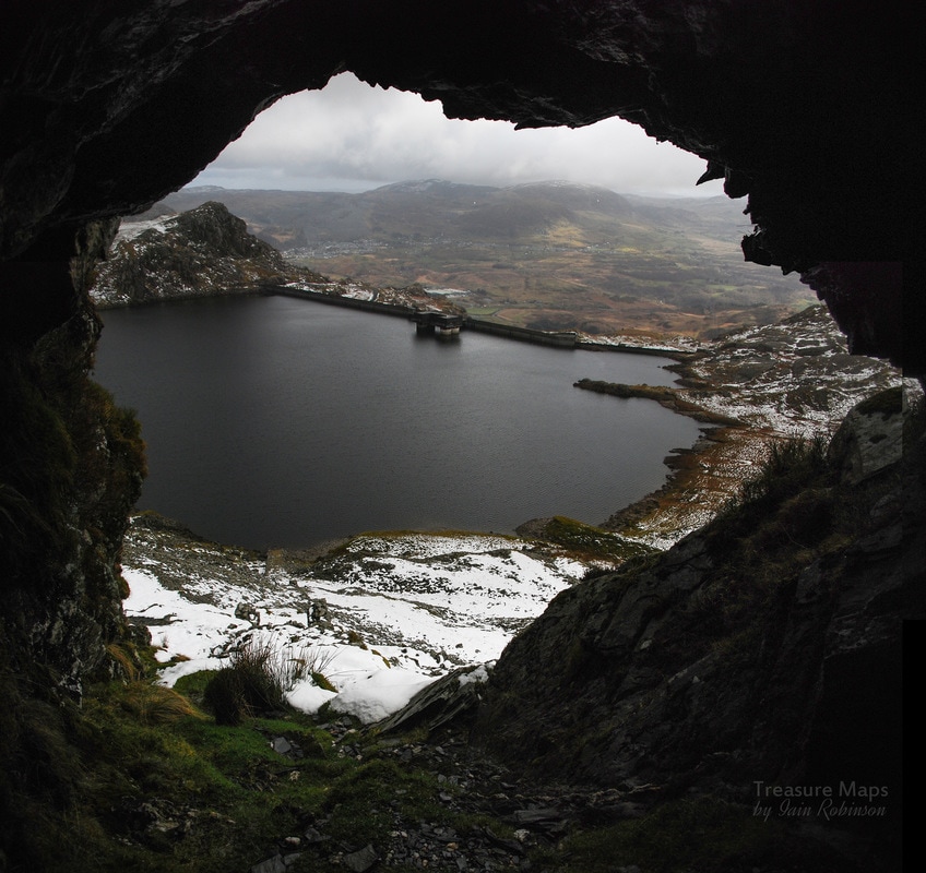
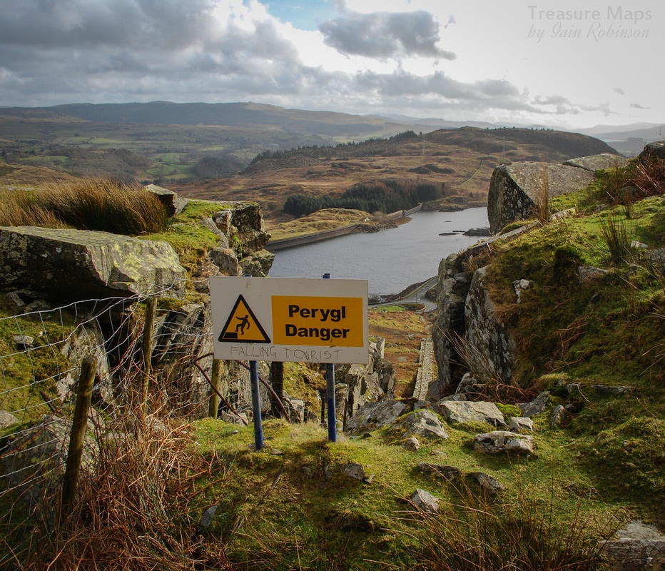
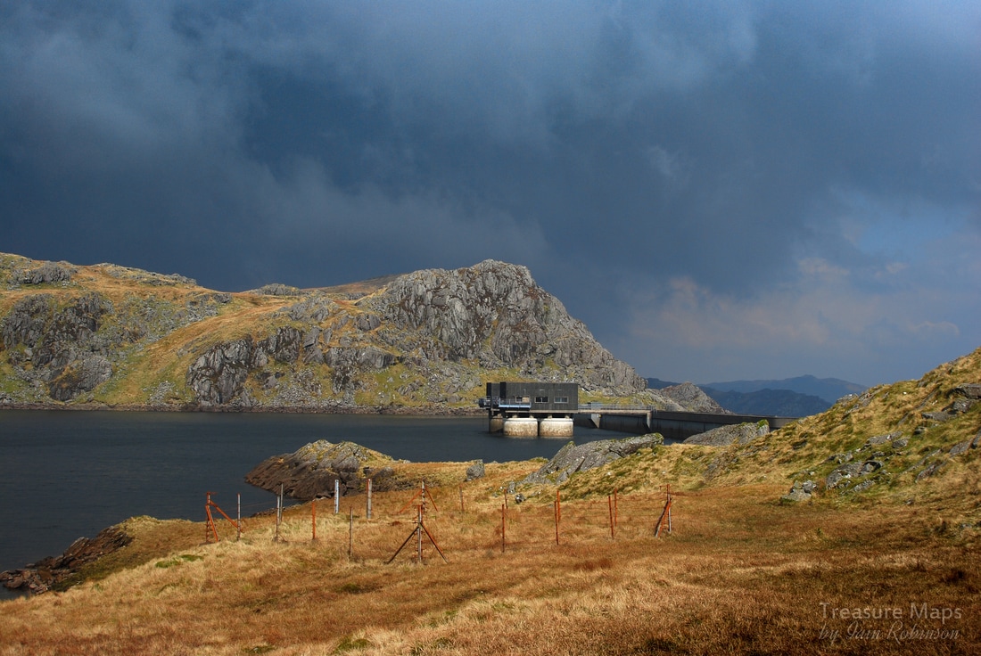
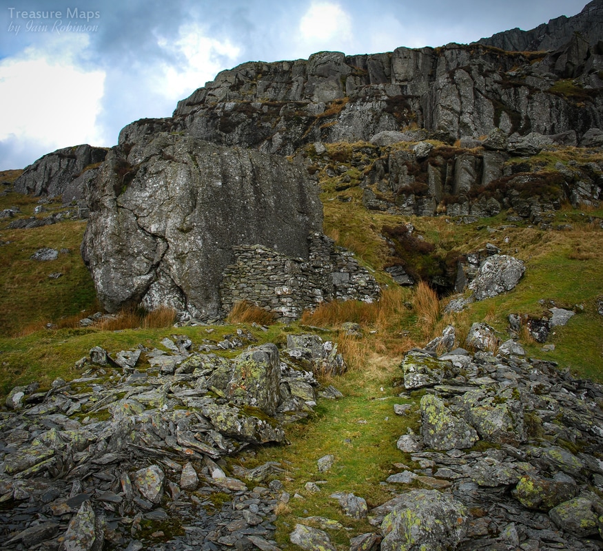
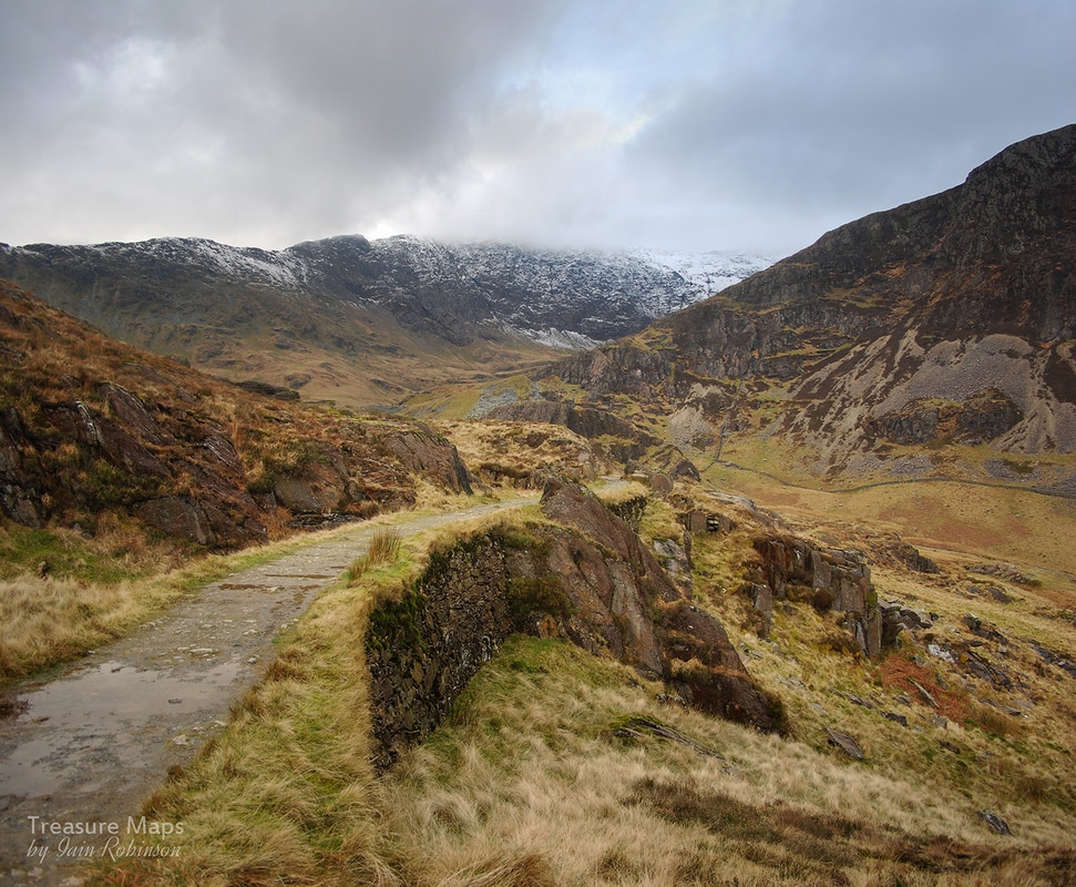
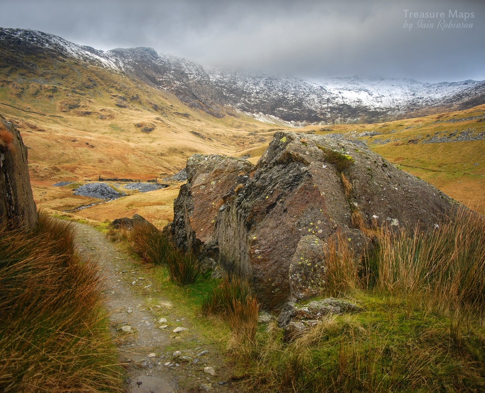
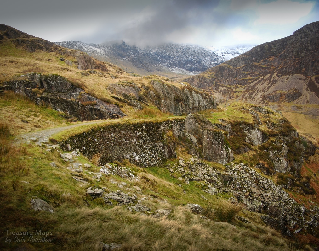
I set off up the dam road and, unusually, had company almost immediately. A very pleasant guy called Wayne, who was going to walk around the Moelwyns. The dam road is a great way to access the range and we talked about the mountains for a while. Then I reached the spot where I reckoned I could make it up to the bwlch. Wayne gave me a doubting, concerned look. "You sure? Doesn't look safe to me!" It would have been very fine to stay on the road with my convivial new friend, but I had to see. I really had studied Google in detail, I was sure it was do-able, although yes, probably not safe. 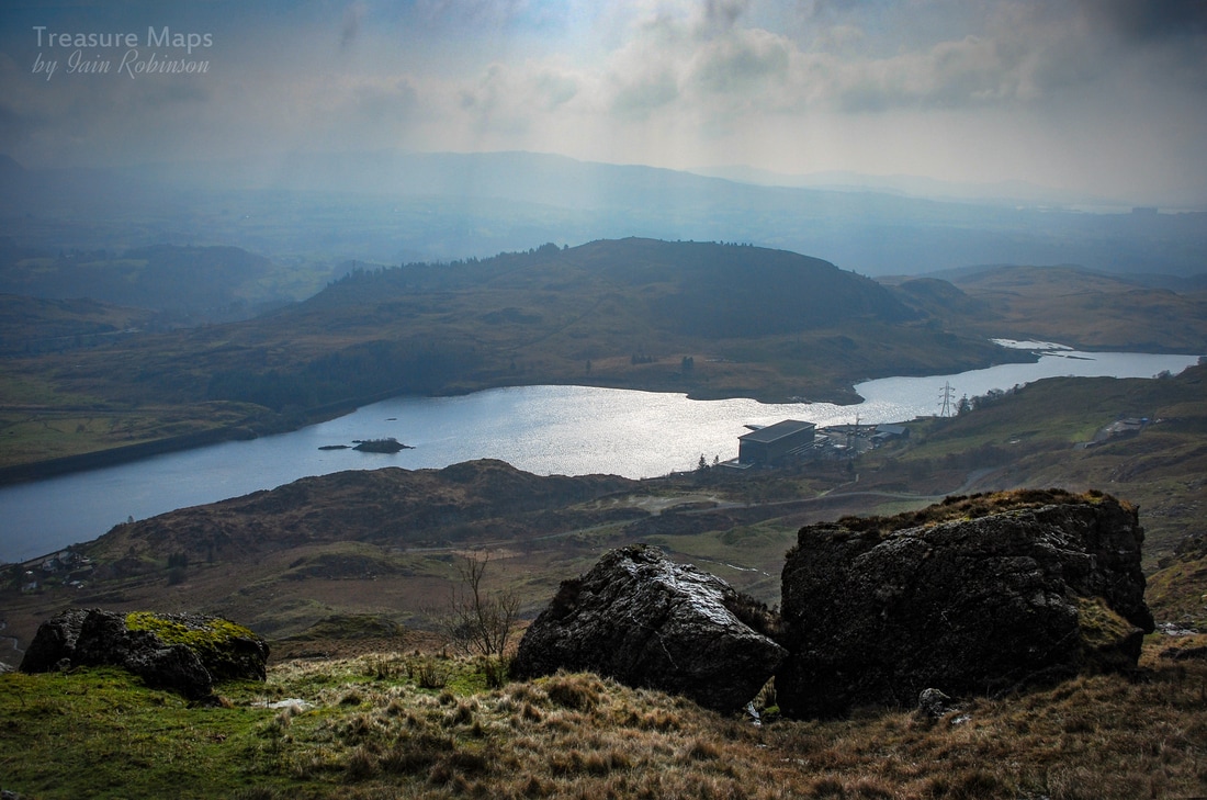 The view from my route once I had negotiated the house sized boulder, which looks nothing like that in this shot. Below is the power station at Tan y Grisiau, and in the right distance, the less than delightful outline of the Trawsfynydd decommissioned nuclear reactor. We parted company and I hopped over the wall, following a stream and on to the flanks of a spur. It was steep and much like climbing a wet sponge. After a few short pitches, I came to a place where a gigantic boulder the size of a house was perched above the stream. The only way seemed to the right, as I didn't fancy trying to go through the low passage under it. After this, the climb was pretty much like a routine steep hill-walk with the odd bit of scrambling.  Probably a shepherd's shelter or what the map euphemistically calls a "sheepfold". The image isn't tilted, by the way... I made some interesting discoveries. Almost at the top was a tiny shelter built into the rock...perhaps for a hermit, or a shepherd, although it's not exactly a handy place for anything. Another surprise was a row of the most improbable set of launder pillars, making for the tiny Llyn yr Wrysgan at the bwlch. I couldn't make out where these had come from, and supposed they must have somehow tapped a stream, further to the west. Then after another short scramble, I made it to the top. Not a route I would choose to go down, that's for sure, but a pleasant and airy route up. 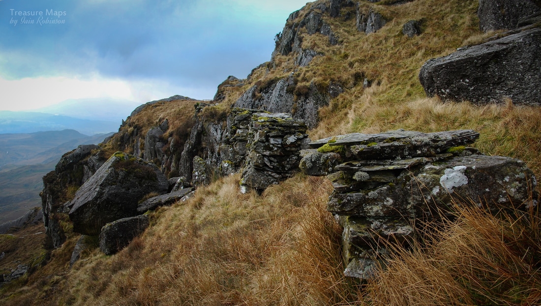 The leat pillars. I had a lightbulb moment when I realised that the old OS maps called these features "Aqueducts" which is logical when you think about it... Above me, Moel yr Hydd's crags looked forbidding. I was on a steadily rising pleateau of ground that sloped down to Wrysgan to the north east, and up to the Rhosydd twlls and Moelwyn Mawr to the south west. In my immediate vicinity was an old mine with curving tip runs. Quite a lot of spoil for a trial, but no sign of a weigh house. I took a look inside. The adit was very wet and curved away to the east. I didn't fancy getting my feet wet, so I came back out. Walking down towards Wrysgan, more adits and workings broke out to bank on the left, but the most attractive feature was the Llyn, built in an opportunistic site beside some rock outcrops and re-inforced by two dam walls. Shortly after this, the land slopes down sharply. There's another adit beside an incline and some nice remains of an early mill, dressing sheds and barracks. I reckoned this was floor 3, counting from the top, which would have been the earliest excavation. A sketchy drumhouse presided over an incline down to the floor six mill. You can easily see the remains of a pit for the waterwheel from here, although I can't imagine it having much water at its disposal. The mine gave up in the 1890 and installed a steam engine in the mill, another one was installed underground to power an incline- you can imagine the fug. A ventilation adit was driven to provide an escape for the smoke. 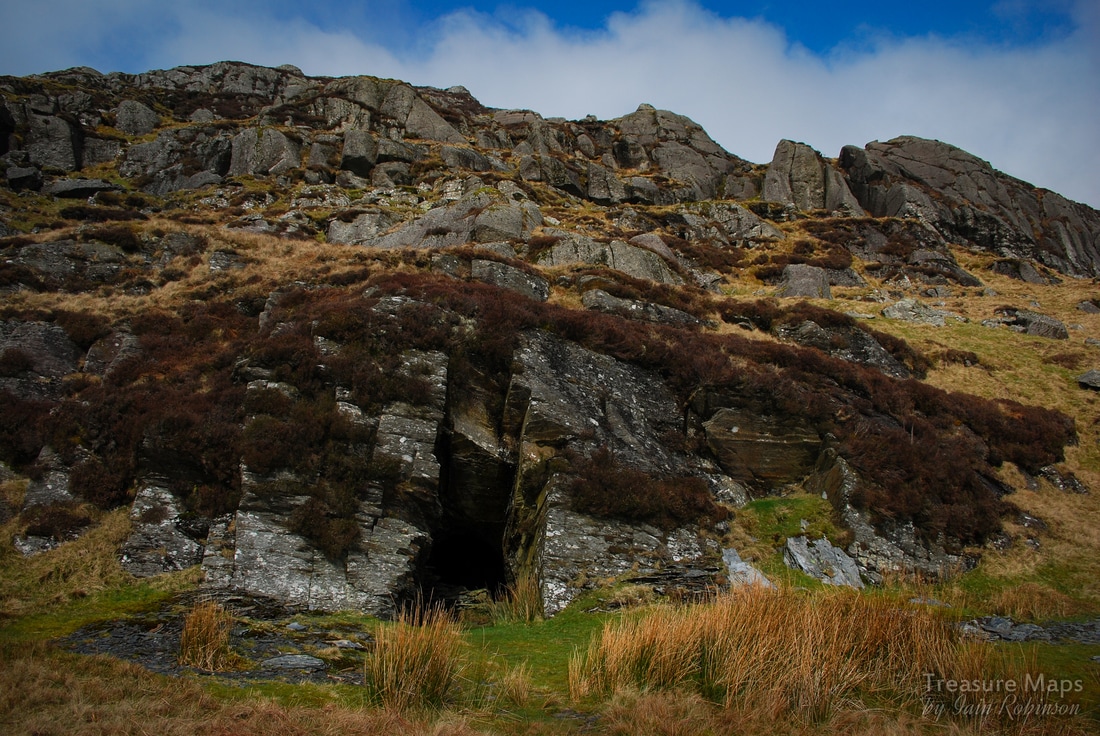 The smoke flue adit. Beware, it ends in a 40 foot drop. While studying the old structures on floor 3, a mighty bellow, followed by screams, came up from down below. I wondered if it was the Balrog, and that Gandalf's services would be required. I decided to put some distance between me and the mine. My usual partner in crime, Petra, wasn't with me due to work pressures- and I found I had no appetite for underground exploration without her. Carrying on uphill, the smoke flue adit was passed, then a deserted, wild looking plateau opened out. Huge boulders had been dislodged by the glacier here on the right, while on the left, the crags of Clogwyn yr Oen and y Bustach leaned where they had been scraped by the glacier, millions of years ago. I stopped and had my lunch here, sheltering out of the wind with my back to a tuff boulder. I closed my eyes, savouring the coffee. A skylark was singing and I just lay there, soaking it all up. It had been so long since any decent sunshine and I could feel the vitamin D seeping into me. I was woken from my reverie by a rustle and there, not two feet away, was a sheep looking at me, an outraged expression on it's face. Once it saw that I was alive, the creature retreated slowly, still not fazed by me. 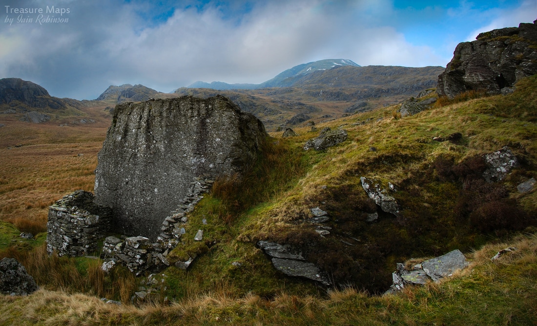 Further along, another adit opened out. This one had the unusual feature of a gigantic boulder almost outside the portal, with an office/shelter built against the rock. There was a fireplace and a fine gable wall left, plus a length of modern plastic Marley guttering, which perplexed me. This adit is marked as disused on the 1840 OS map, so is of some age. I've no idea what the Marley guttering was about. The huge rock was an interesting mixture- on one side, it was a classic Tuff, a rock built up from layers of ash which had then settled and been compressed at great pressure. On the other side was dolerite, probably from a sill of cooling magma a few hundred million years old. The little house that it sheltered was made of slate waste, so that was obviously what the mine was about. The hillsides here are dotted with small diggings and trials, although this was a little special. 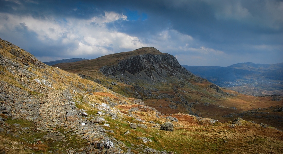 Looking back along the track towards Moel yr Hydd. You can see that the mule track is a slightly different colour and is well revetted. After this, the plateau became more open and I climbed to the bwlch where a gate led onto the bleak top area of the Rhosydd mine. I could see the twlls and across in the distance was the long, low form of Cnicht against the sky- a different vista to the normal view of the mountain. A figure was energetically walking around the openings in the distance- I sensed that he or she was fascinated and felt happy for them. I had planned to go over to Rhosydd and descend into Cwmorthin, but for some reason (probably thinking about that awful road down to Cwmorthin) all enthusiasm for that left me. I wandered about for a while and then settled on a course towards Moelwyn Bach, thinking to get down to Stwlan this way. I followed a feint track, which soon became a revetted path, a mule track. This was looking good. I met a young woman with a fine collie dog, who told me I was on the right track and asked me where I had come from. When I told her, she laughed and said that was the way she was going...so I wasn't crazy after all, although respect to her for descending that way off the mountain. 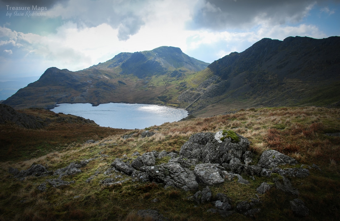 The impressive view towards Llyn Stwlan and Moelwyn Bach, with the quarry incline shining at the centre. Soon, an impressive view of the Stwlan area came into view, with the Moelwyn presiding over the eponymous slate quarry remains. I'd been here a few weeks earlier in the snow, and felt much happier descending while I could see where I was going. Last time, I had to use my "bum-mat" (a cut off from a yoga mat for sitting on at meal-times) as an impromptu sledge. The adits at this mine are all gated, as a poor chap fell to his death here in 1992. There is quite a drop within the top adit and without proper lights it would be easy to miss it. There's the remains of an impressive incline and a lovely barracks, settling slowly back to nature. There were miners families living here in the 1870's with the children going down to school in Tan y Grisiau! That's heroic dedication to learning. 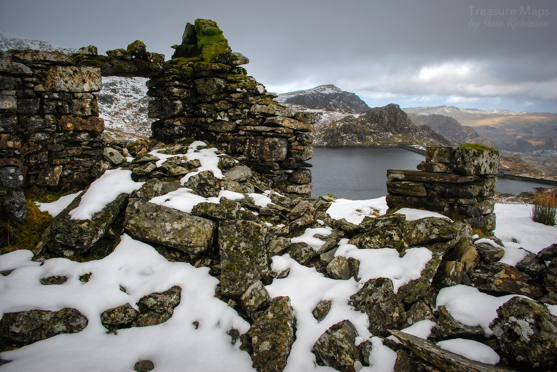 A snowy view of the barracks with Llyn Stwlan in the distance Much still remains at the mine- and the site is worth further study, with an old forge and more barracks down by the lake. Incidentally, this Llyn was originally called Lyn Trwst-y-llon, which by my faltering Welsh means "Lake of the cheerful noise"...? The modern reservoir has cut the line of the incline, which carries on past the dam to another lower mill area and a series of inclines to the Ffestiniog Railway. The Moelwyn mine was active from about 1860 to 1900, although never very productive. The pumped storage scheme here has changed the landscape, but provides a very good access route for walkers. Crosville used to provide a summer service up the dam road for tourists in the 1980's, and by all accounts it was popular. It's an easy walk anyway, even descending with sore knees. On the way back I was amazed, as always, by the Wrysgan incline, it's engineering and audacity. That hole at the top through to the mill is surreal, yet intriguing. There is much to discover on the periphery of the Moelwynion, and it's a rewarding day's tramp discovering small landscapes and the intimate remains of mines, without ever feeling the need to scale the summits. I'll leave that to the Corbett baggers. 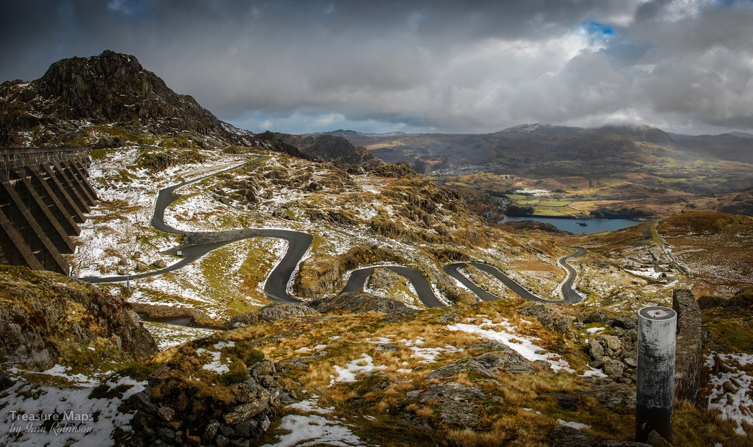 The Stwlan Dam Road as it snakes it's way to the top. The rocky bit above the dam wall is Craig Stwlan. 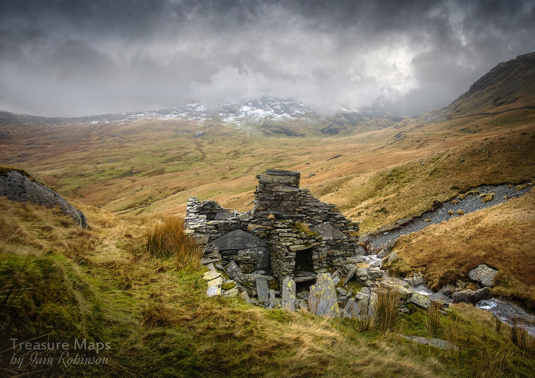 The smithy/forge and workshop at a lower level, slightly above the mill. Another look at the tramway and pit at the South Snowdon Slate Quarry... Cwm y Llan, or South Snowdon quarry is a large site in a very exposed location. Reading Gwynfor Pierce Jones' account of the trials and tribulations of the works manager, Pierce Davies (formerly foreman of Moelwyn Mawr slate quarry) leaves one in no doubt of the local difficulties. He kept a diary which has entries such as: "Feb 22: Great gale damages buildings... January 1884: entire forge carried away by weather... Aug 22: Big Weather halts work, forced to open lake..." The day we visited, the elements were distinctly hostile towards the quarry, as can be seen from the photos. But, despite all that the weather could throw at the place, they did at least manage to produce some slate. Inclines and tunnels were driven as the pit grew ever deeper; many of these can still be seen today. The mill was set up on a lower level, on a base of tipped slate waste, although it seems hardly any more sheltered than anywhere else. The quarry was the biggest producer in the Beddgelert area, although that isn't really saying much- it certainly never produced enough slate to justify the expenditure on the infrastructure. A waterwheel was installed and two reservoirs higher up the cwm, above the site. It must have been difficult to find enough water so near the watershed. The thick walls of these still survive. There are remains of two other buildings, possibly mills higher up the site, used before the lower mill came on stream. 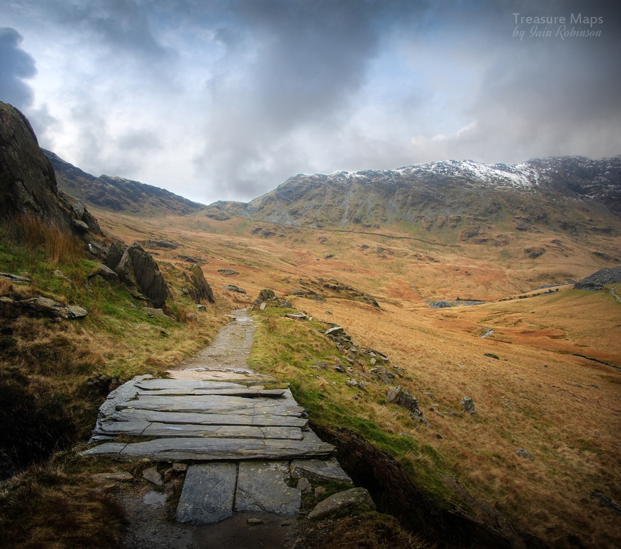 Looking back towards the quarry from the tramway, with a fine slab bridge The exit tramway makes a fine stroll; it is well built and spacious- there are a couple of bridges using big slabs, and revetments all along the way. As we walked away, the weather became steadily brighter until the view down Nant Gwynant was almost spring like. A glance back to where we had come, however, showed that the weather gods had not finished with Cwm y Llan. If you wish to have a feeling for the history of the quarries surrounding the WHR, I can recommend "Cwm Gwyrfai" by Gwynfor Pierce Jones and Alun John Richards. The scale of GPJ's research is impressive and he really brings the quarries alive. One name which crops up in the writing is Alan Searell, a Devon man who, as far as I can see, was some kind of over-manager for a number of mines, of which Cwm y Llan was but one. Like many men of those times, he was possessed of super-human capabilities, for he thought nothing of walking to Porthmadog to get the wages, for instance. When he left Cwm y Llan for Cwmorthin, because of the irregular payment of wages and the lack of weatherproofing of his house, he came back several times to consult for McKellar, the leasee, saying "It is but a walk of 2hrs from the Snowdon quarries" ! It seems that Searell was a decent man always trying to fight the men's corner with wages and bargains agains McKellar who invariably wanted Searell to get work done on "acceptable terms" (cheaper). It's good that we have so much information about the human side of this enterprise as, although it is a fascinating site, knowing the struggles and epic weather endured brings it to life when you walk the slopes of the quarry. I often wonder what happened to the men, their lives for the most part undocumented, save for the slabs on the waste heaps, or a fine bit of stonework on a drumhouse or mill. They were a hardy breed. And yet...this wasn't the end for the South Snowdon Slate Works. Although the site officially closed when abandoned in 1889, and the track of the tramway was lifted in 1913, there were some small-scale attempts to revitalise it. The first and most determined was in the 1930s-40s, by William Pritchard of Rhosgadfan. He installed some probably secondhand machinery in the mill and re-roofed part of it with corrugated iron. One of the saw tables is now preserved in the National Slate Museum. Later, in the 1960s, another attempt was made, to fashion useable slate from the blocks of the barracks. This was carried out by Dafydd Williams of Llanlyfni, who barrowed the slate down to a temporary stockyard near the waterfall. Unfortunately, one weekend, walkers threw the entire stock of slate into the river. As GPJ puts it: "after that, they gave up..." At least we still have the barracks and it hasn't been reduced to damp proof course slates as happened at Glanrafon, for instance. "Cwm Gwyrfai", ISBN 0-86381-897-8  Petra goes to explore the lower mill 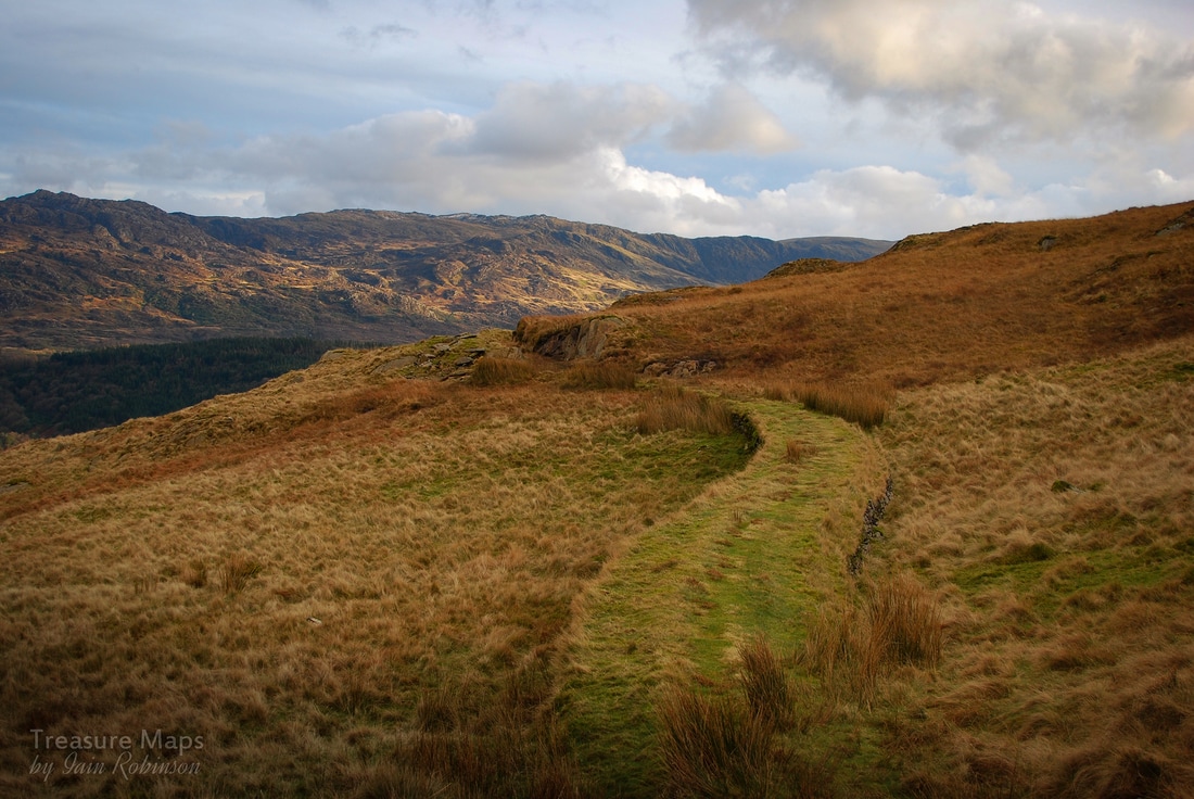 Almost at the crimp of the big exit incline 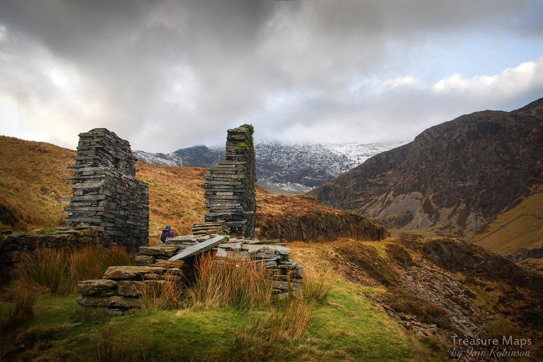 Looking back up to the quarry from the incline crimp |
TracksReceive the occasional Treasure Maps Newsletter- and alerts when a new post is available!
If you enjoy my content, please buy me a coffee!
Check out my other online activity...
Index
All
|


 RSS Feed