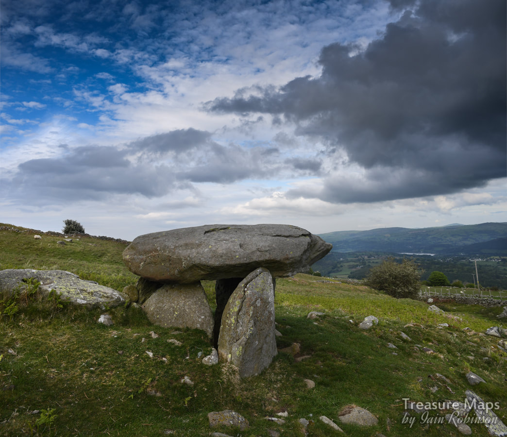
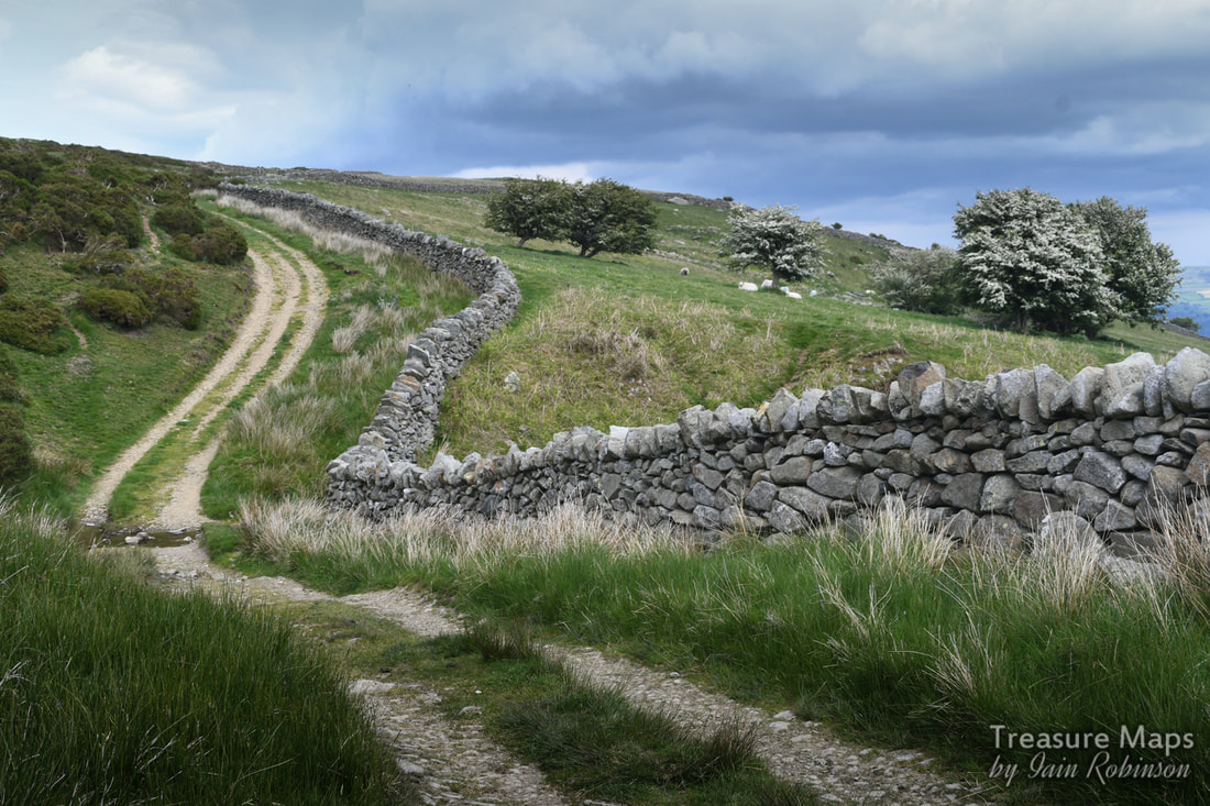
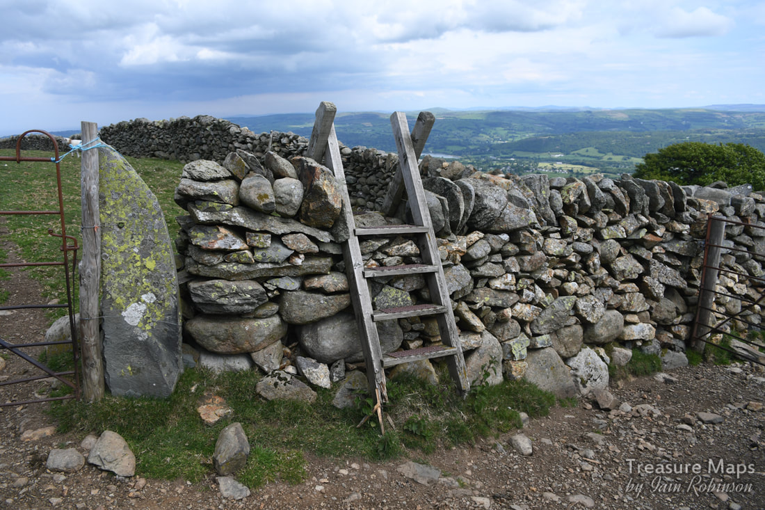
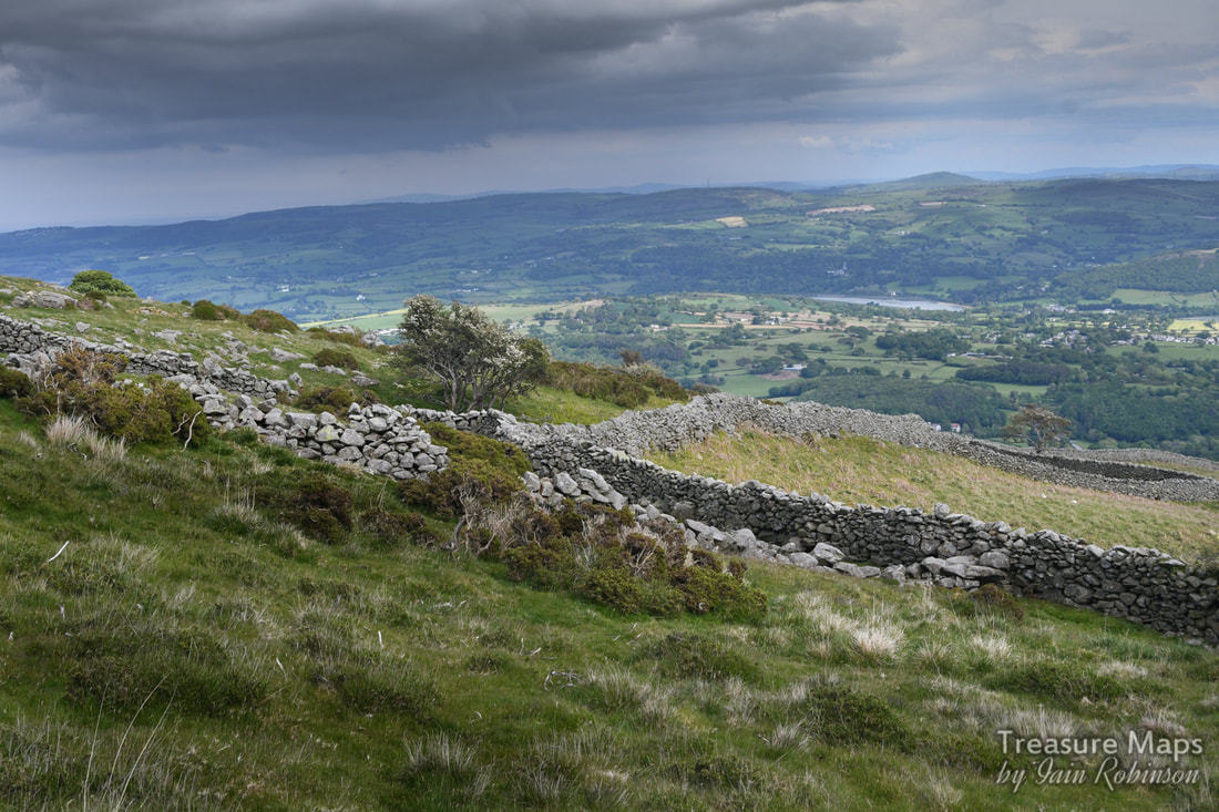
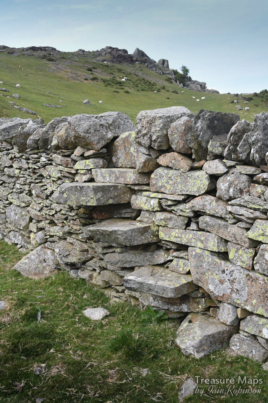
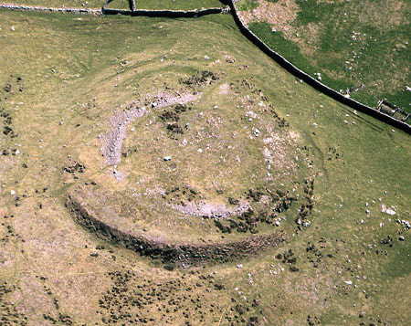
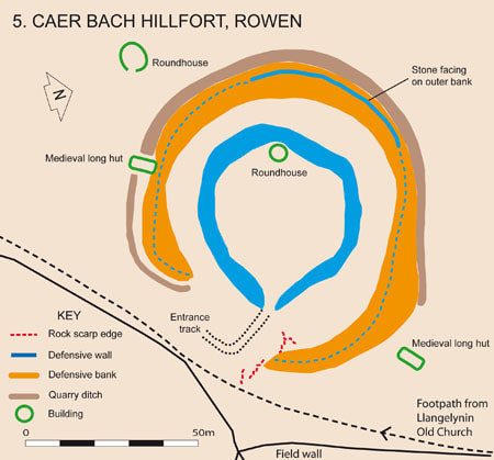
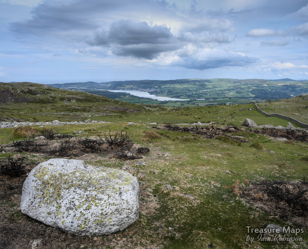
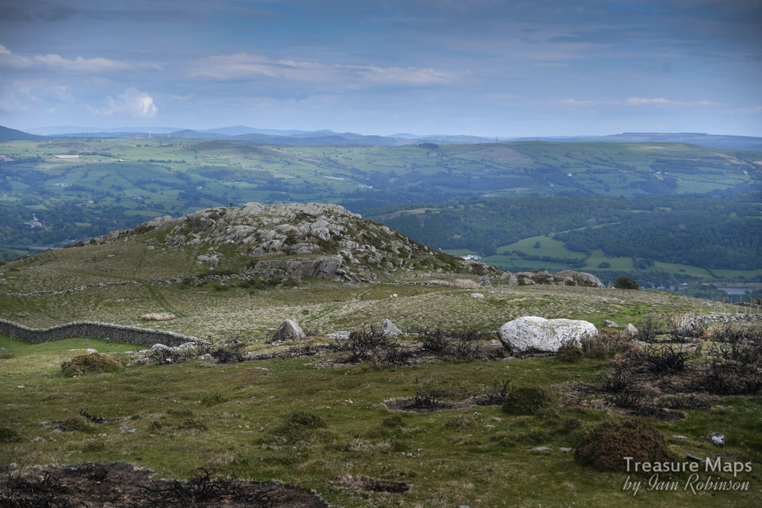
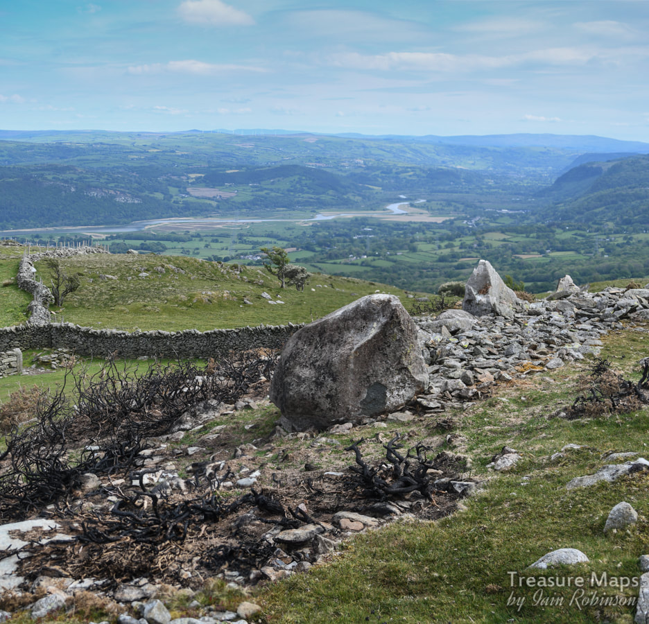
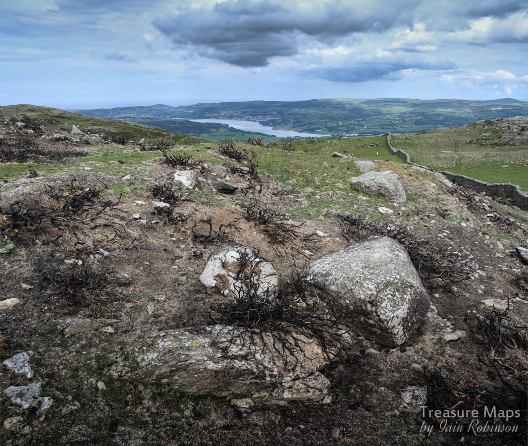
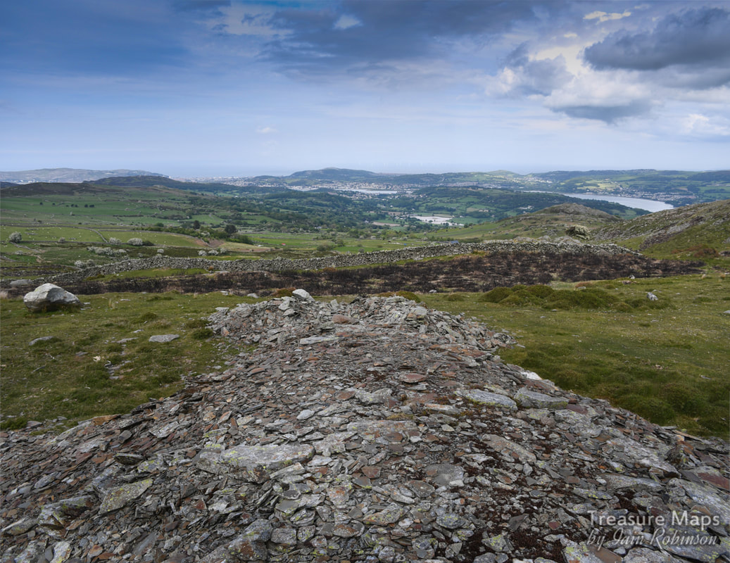
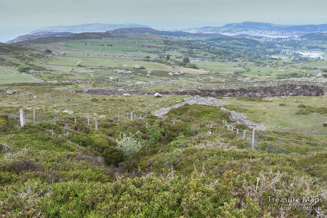
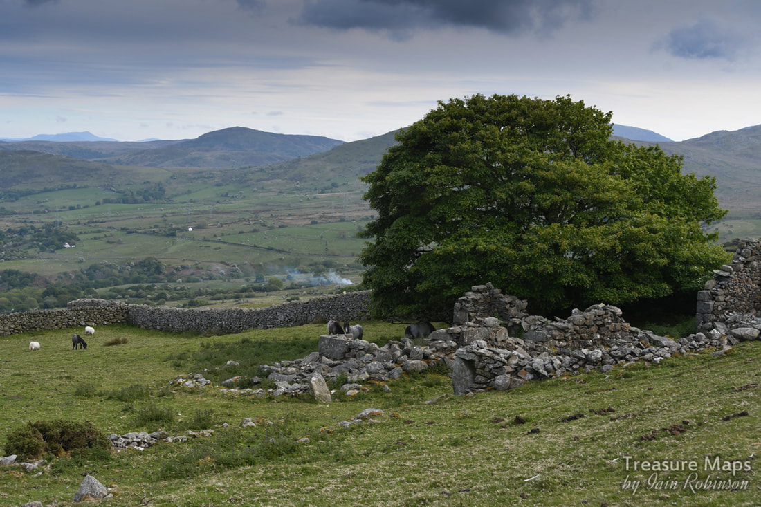
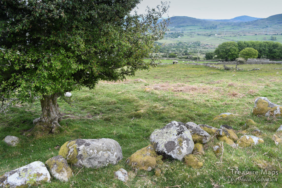
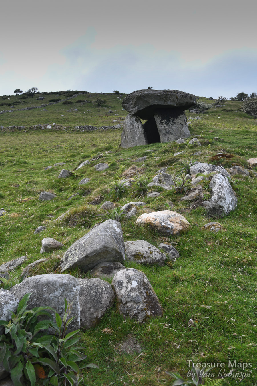
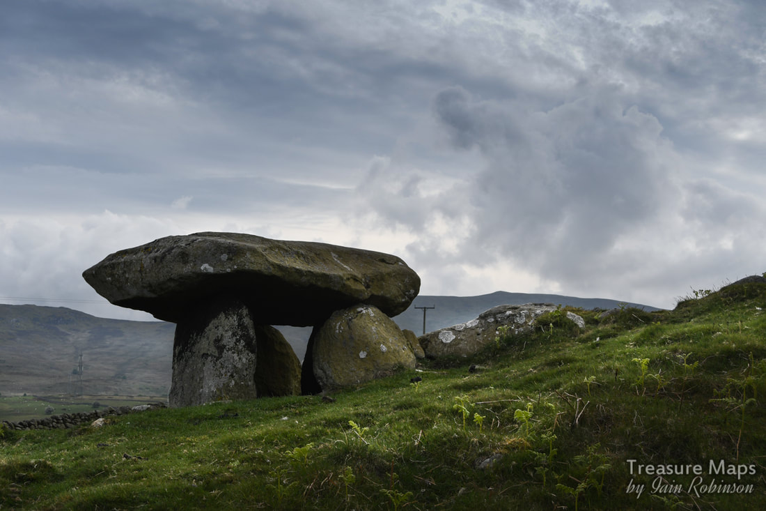
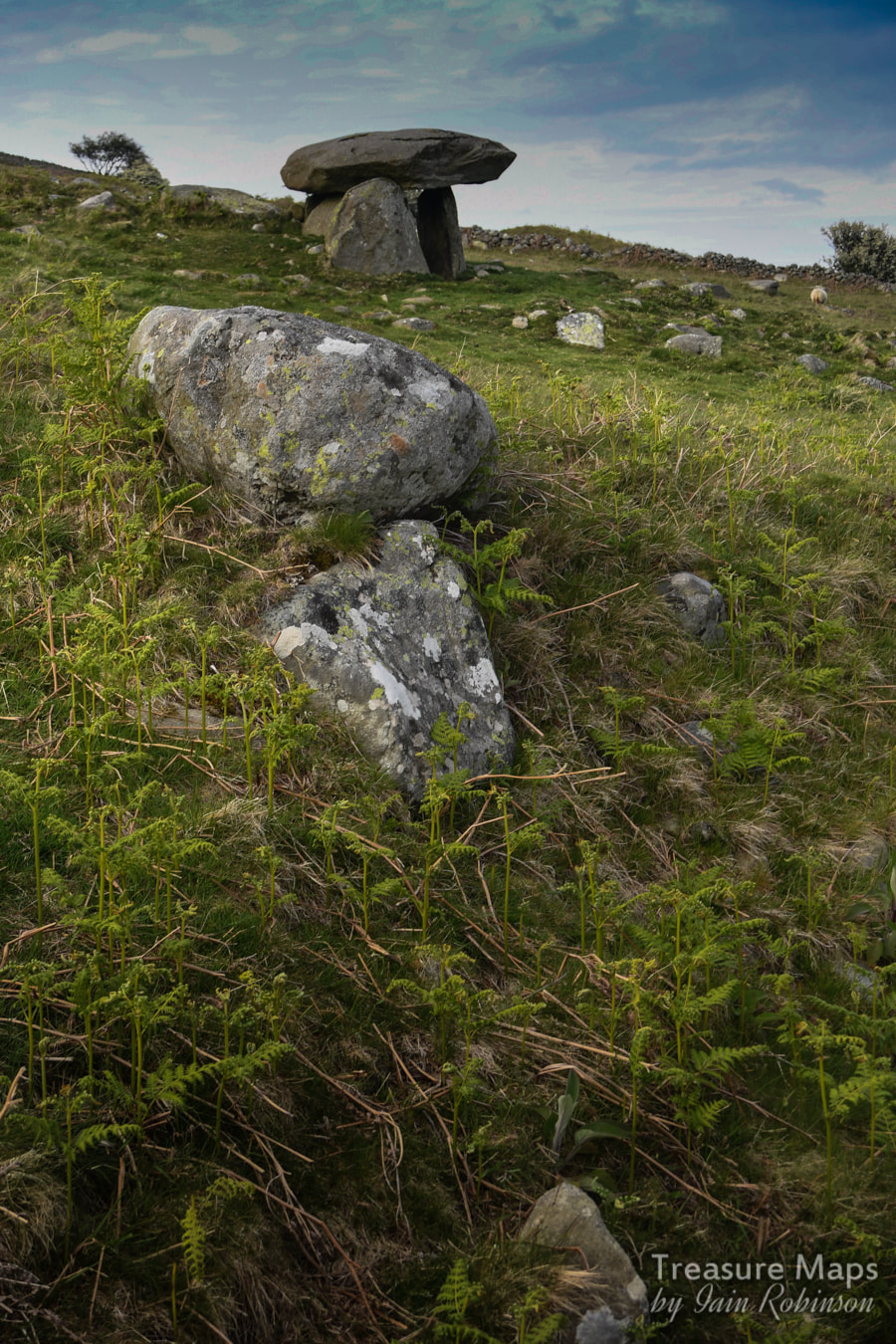
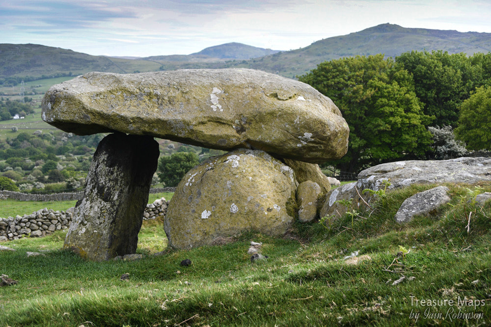
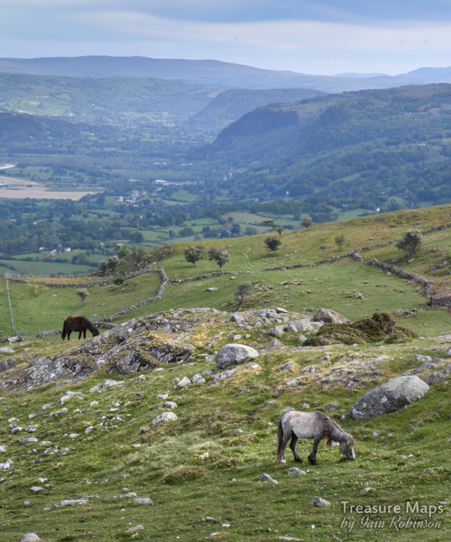
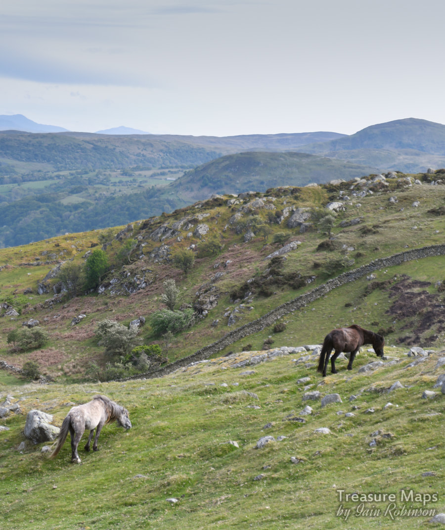
 We take a look at a couple of megaliths and the vestiges of a fort, plus a bonus mine near Tal-y-Fan mountain. And ponies... You might remember a couple of posts ago that I mentioned we were going to have a look at the area south of Tal-y-Fan which is rich in prehistoric remains. We finally got round to it, and it was better than we could have hoped. Remains of prehistory are thick on the ground here, from obvious standing stones to more subtle manifestations of our distant ancestors. 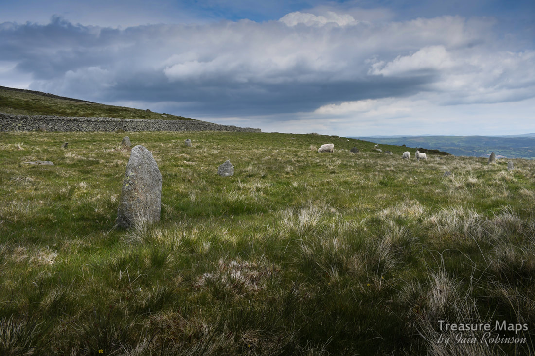 Cerrig Pryfaid stone circle Cerrig Pryfaid stone circle Cerrig Pryfaid stone circle SH72457132 We started from the Bwlch y Ddeufaen car park. Unlike our last few visits (here), we headed east along the road as it heads back towards Rowen-just for a short way. Within a few minutes, we had arrived at the site of Cerrig Pryfaid stone circle. It's unassuming, shall we say. You have to sit for a while and soak up the place (and it's stunning location). The stones fight for attention with the tussocky grass, but after a while you begin to see ten or twelve stones in a ring about 22 metres across. There appears to be a stone missing towards the north west end of the circle and there are a couple of outliers. Looking at Coflein's map, it seems that there were many other prehistoric features immediately nearby- a burnt mound, some hut circles and a longhouse. These things all take time to discover and to recognise, so it looks like we'll have to go back. One thing is for sure, this area was of considerable significance in neolithic times. 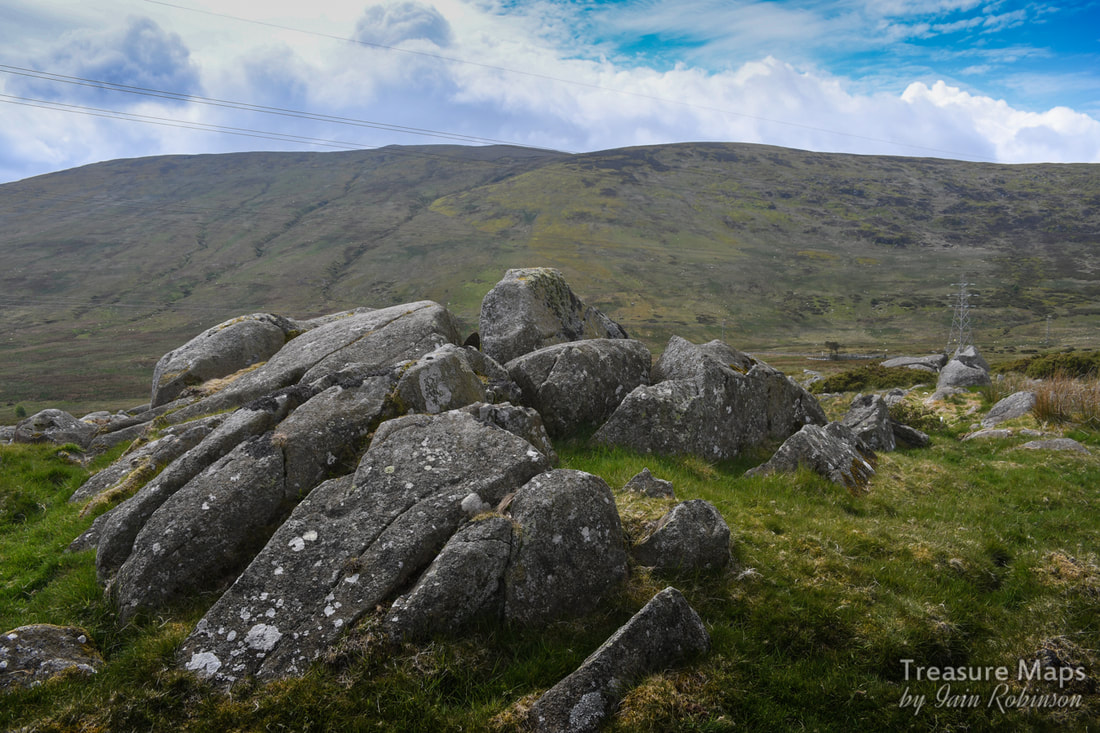 An impressive rock outcrop near to Cerrig Pryfaid. After trying very hard (and failing) to take any meaningful photos of Cerrig Pryfaid, we walked on until a fork in the road at SH73187147, where we went left and then through a gate.  Cae Coch The road becomes a trackway here then winds uphill through a wonderful landscape of low hedges, boulders and walls, always with a panorama of hills as a backdrop. We stopped by a big pile of rocks which must be an ancient clearance cairn and had our lunch. In the distance could be seen the hillfrot of Pen y Gaer (link to previous post). Areas of burnt gorse made me realise that when we'd been at Pen y Gaer last, the smoke had come from over here. 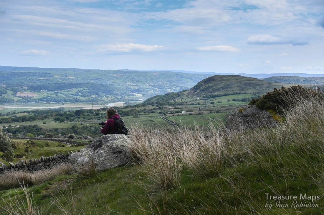 Petra looks over to the hills east of the dyffryn Conwy- Pen y Gaer hillfort is that darker eminence on the right...its commanding position is very obvious from here. After a pleasant ten minutes or so, we came to a sheepfold- not a very old one. A carving on the very fine gatepost gave the game away...1884. 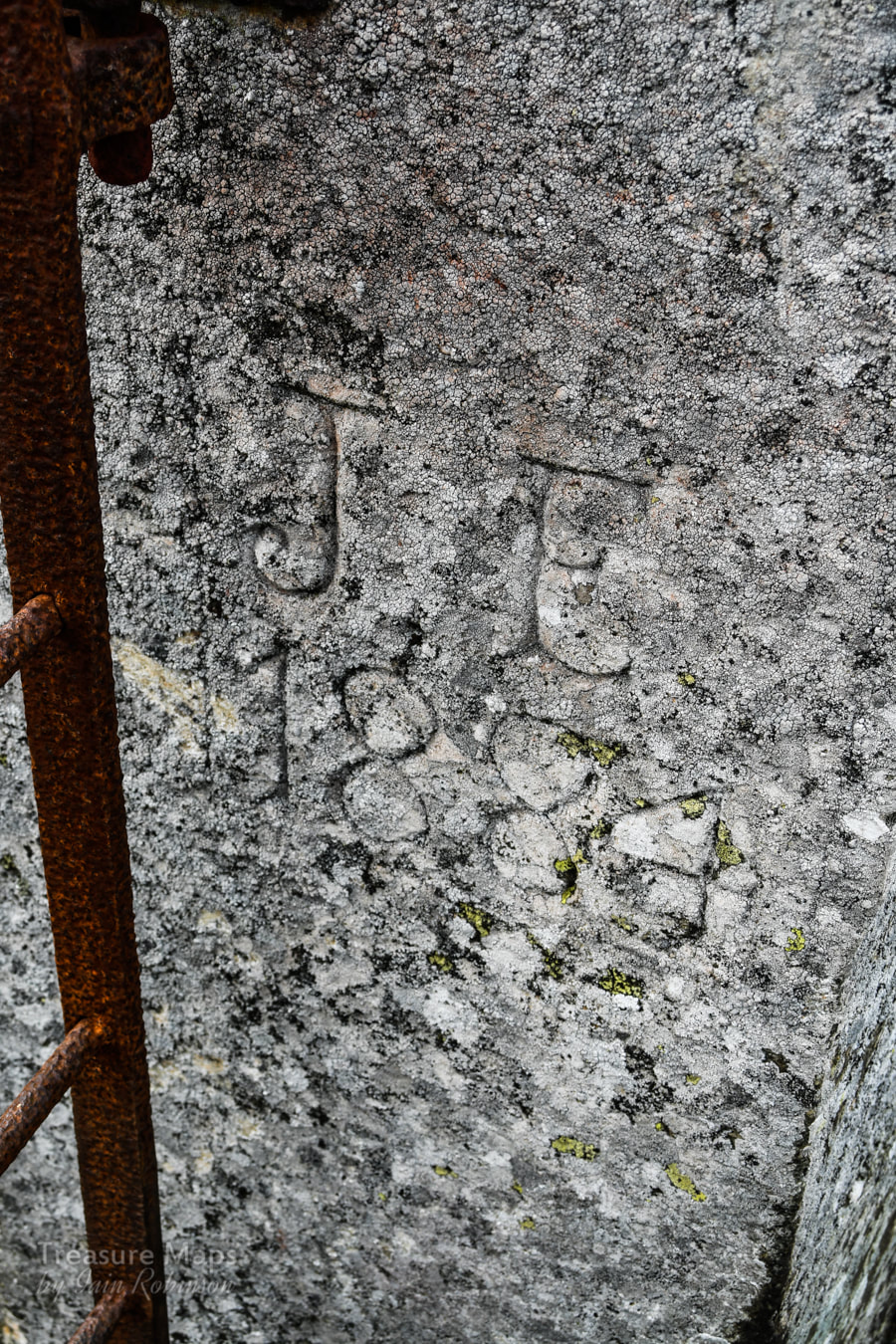 The fields here are littered with stones left by the glacier as it retreated. It must have been quite a job to clear the fields of these monsters, each weighing a good few hundredweights. 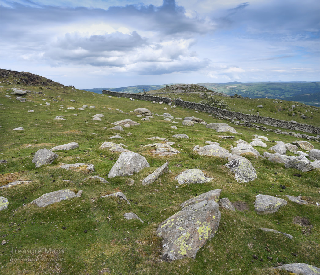 The glacial erratic boulders. That twmp in the background is Craig Celynin, and behind it is St. Celynin's church, visited in a previous post. We had been walking beside a wall, which gradually petered out until it was simply a line of boulders. It wasn't particularly straight, either. This type of wall, probably medieval, is known as a "Wandering Wall" which seems a nice image and fits these things very well. The rewarding thing about walking round an area is that gradually you begin to join the dots and see things from different perspectives. So here we were coming up to Craig y Celynin towards the east- a hill that we had walked around from the South, the Parc Mawr direction a few weeks earlier. Wales is compact and bijou- but that's it's charm, after all. 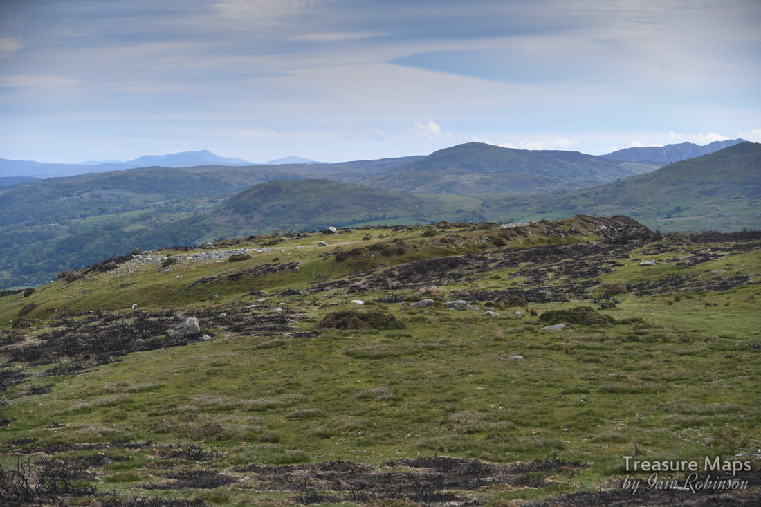 Caer Bach Hillfort from the north. Caer Bach Hillfort SH74427296 It was time to walk up to Caer Bach hillfort. From the south east it looks like nothing at all, but once on the site it's origins are obvious. The atmosphere wasn't helped by the gorse having been burnt over the hillfort, but at least it cleared the ground and made the remains more visible. It is a small fort of only 38m internal diameter. Strangely enough, it is built on a spur of land above the trackway, not a naturally strong position for defence as it is overlooked from above. However, it has a massive internal wall 5-6m in width and an outer defence of a large bank and ditch. This outer bank is unusual in that had a stone outer facing, some of which can still be seen on the west side. Little remains of the inner wall and the lack of tumbled stone has been suggested to show that it was unfinished or had been robbed to create the outer rampart in a second phase of use. Who knows...but the remaining stones left in the platform are useful for photography! We made a little detour here to visit a mine; what I expect was a trial adit for the Tal y Fan slate mine a few hundred feet above. This was at SH74347332 and shows up well on Google Earth satellite view. The opencut was too choked with gorse to even attempt a look without some serious bush cutters. There is quite a quantity of spoil, but no discernable trackway to the mine. 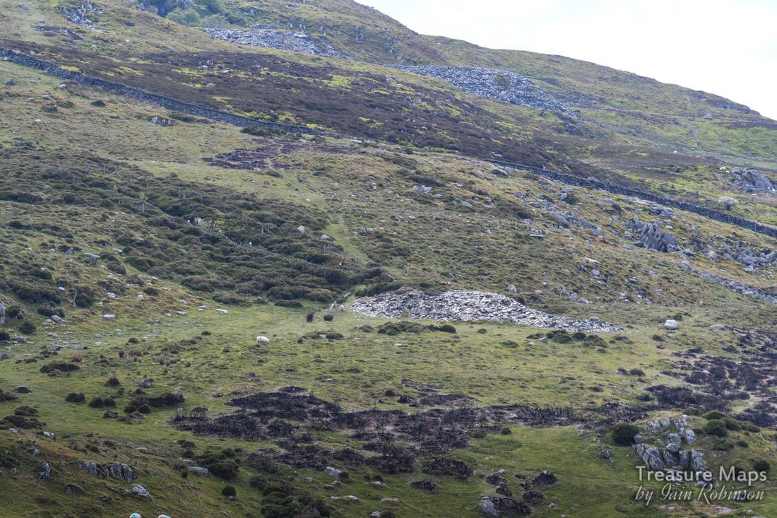 The trial mine viewed from Craig y Cellynin. Above are the tips of the Tal y Fan slate mine. Just for the heck of it, we decided to scramble up to the top of Craig y Celynin...there were some impressive rocks on the top and I thought there might be a view towards the church below, but that was masked by some small drumlins. What we did see were some wild horses, so there are some gratuitous Carneddau pony shots at the end of the post. Maen y Bardd SH74067178 It was time to walk back and go cross-country to find Maen y Bardd. We retraced our steps, then picked up a path going downhill through the ruined farmstead of Pen y Ffridd. 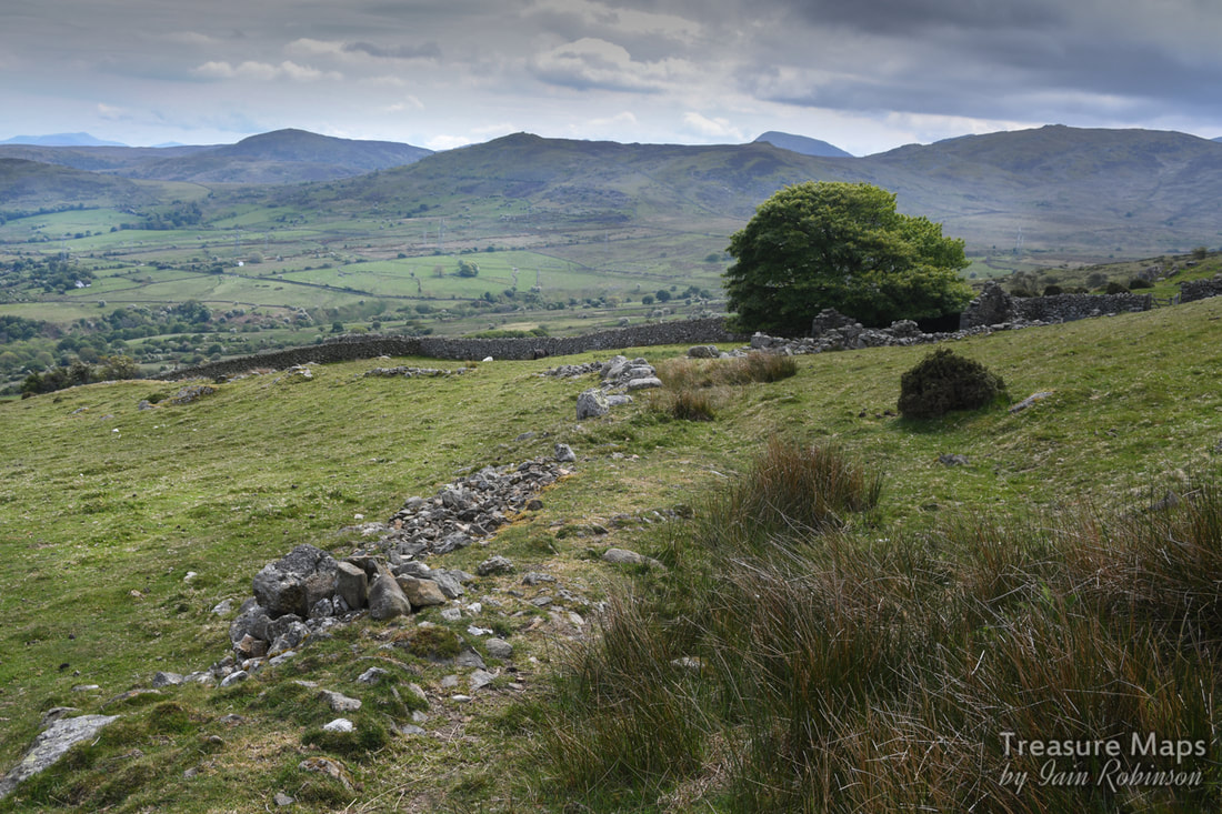 The remains of a wall going across to Pen y Ffridd in the trees. There are all sorts of remains here, from victorian farm remains through to medieval field systems and long houses. Everything you see seems to have some past significance. Gradually we descended towards Maen y Bardd. 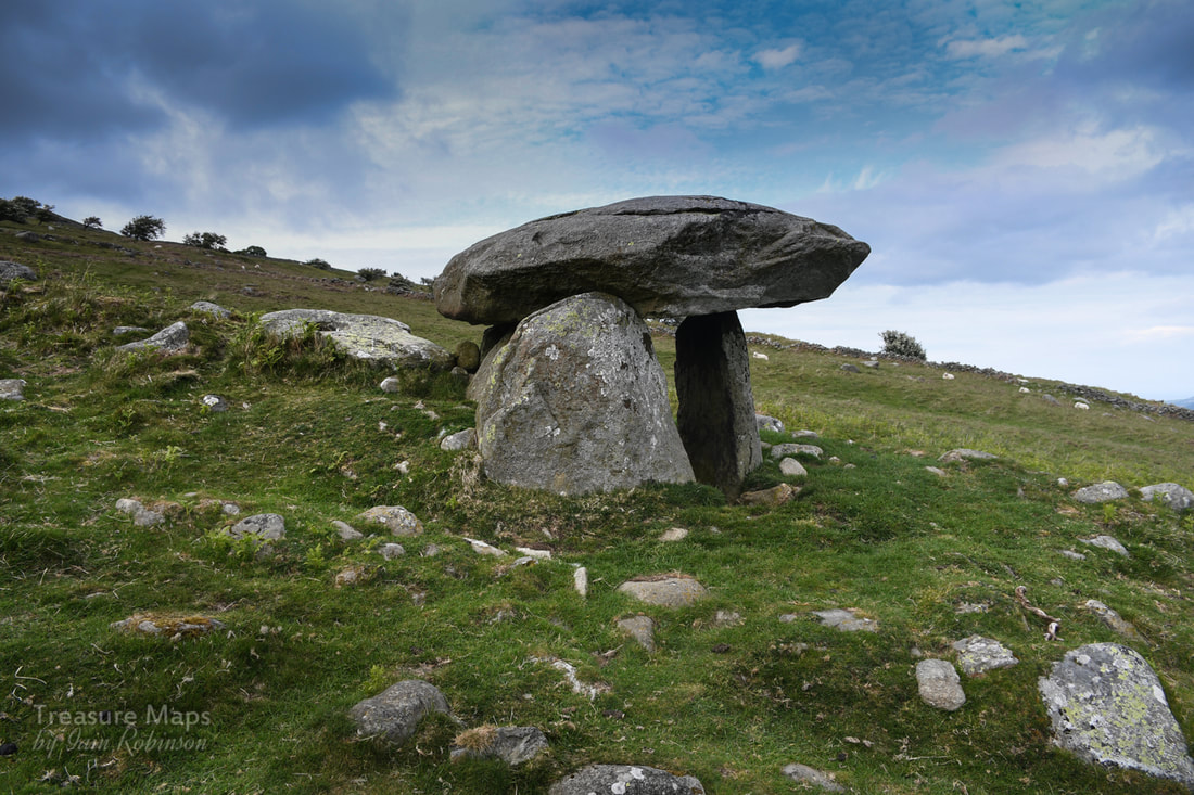 So here we were at last. Maen y Bardd, 'Bard's Stone' is thought to be all that remains of a burial chamber built around 3500 BC. Tradition suggests that the dolmen was originally covered by a large cairn, but only scattered traces of stones remain. The burial chamber consists of a large, flat, capstone supported on four standing stones forming a rectangular inner chamber. The chamber is about 1.2 metres high (roughly 4 feet) and the capstone projects beyond the upright stones to form an entrance, or portal. For that reason this type of burial chamber is often called a portal dolmen. The chamber is sometimes called Cwrt-y-Filiast (Kennel of the Greyhound); a reference to an ancient legend that says that a giant's (in some versions, Arthur's) sheepdog took shelter under the dolmen and his master threw a spear across the valley at the hound, who sheltered in the chamber. It's a fine spot, all the more so for being surrounded by other remains in a rich landscape of prehistoric settlements and fields, the majority probably belonging to the later Iron Age and Romano-British periods. It also lies adjacent to a sunken trackway which bisects the earlier fields, thought to be the line of a Roman road. Ffon-y-cawr standing stone SH73927170 The trackway that leads past the stone connects it to a couple of other interesting megalithic remains. The next one was the standing stone of Ffon yr Cawr (the Giant's Stick) or Piccel Arthur (the Spear of Arthur). 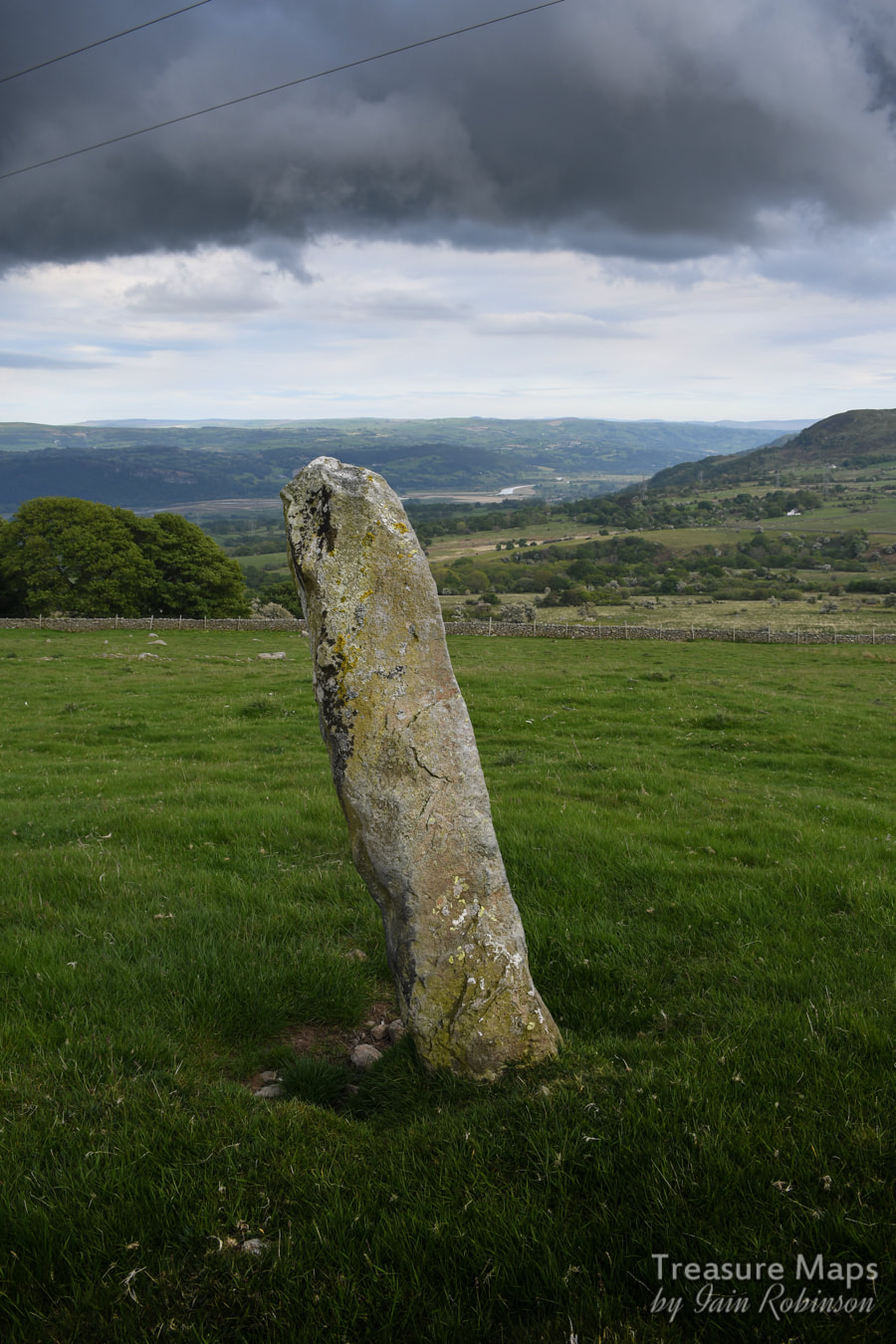 Legend has it that this stone, over 7 feet high was originally a spear belonging to that all-purpose mythical figure, Arthur. Apparently, Arthur was gathering his sheep on Pen y Gaer but the dog ran off and sheltered in the dolmen. Arthur threw his staff in exasperation, and it landed nearby. Not a bad shot. By now, it was becoming rather gloomy and my shot of the Cae Coch standing stone further along the sunken trackway (SH73557164) was pretty useless. Luckily, Terry Hughes had taken an excellent shot for which I give grateful thanks. We managed to miss quite a few things on this part of the walk, meaning that a re-visit will have to be done, but that's the fun of it, isn't it? 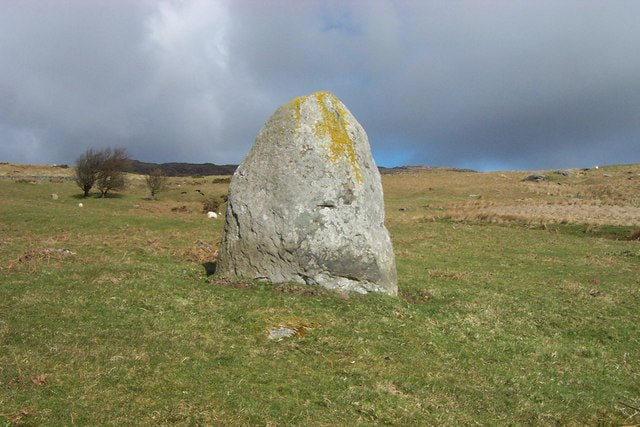 Cae Coch standing stone cc-by-sa/2.0 - © Terry Hughes - geograph.org.uk/p/196627 And to finish off the post, some Carneddau Pony shots, as promised... 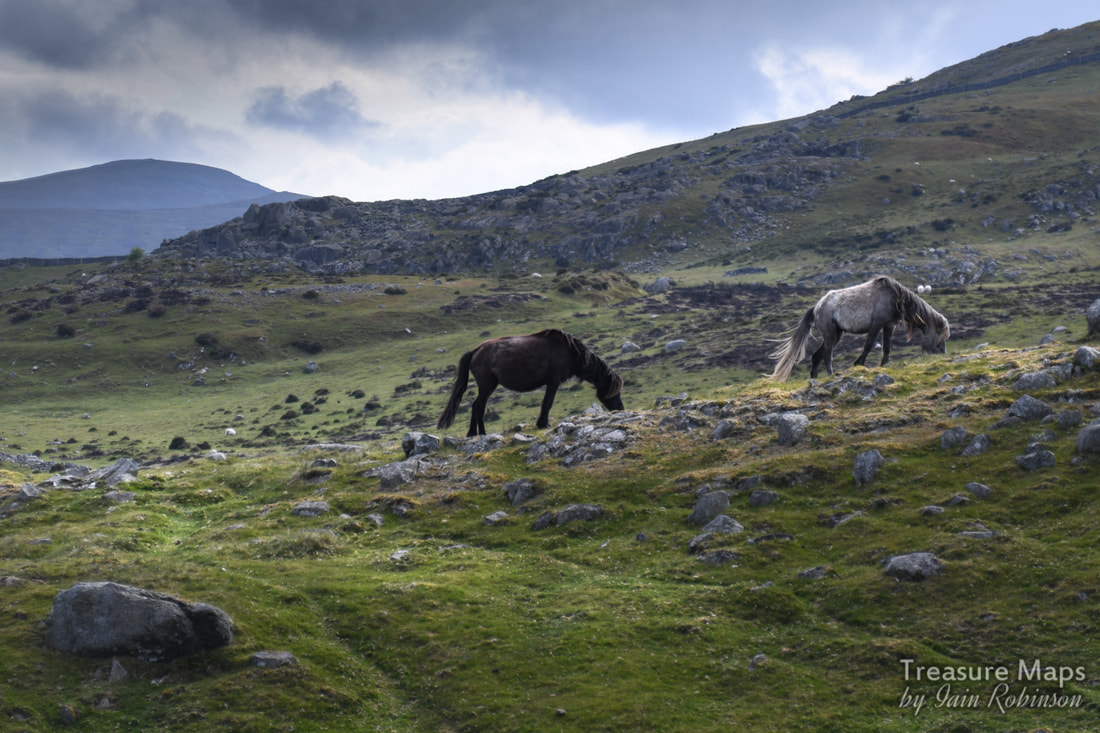 Comments are closed.
|
TracksReceive the occasional Treasure Maps Newsletter- and alerts when a new post is available!
If you enjoy my content, please buy me a coffee!
Check out my other online activity...
Index
All
|
 RSS Feed