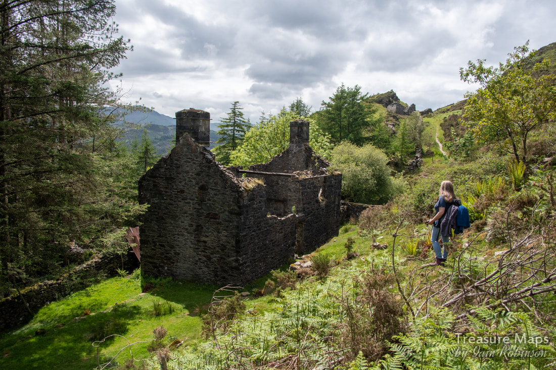
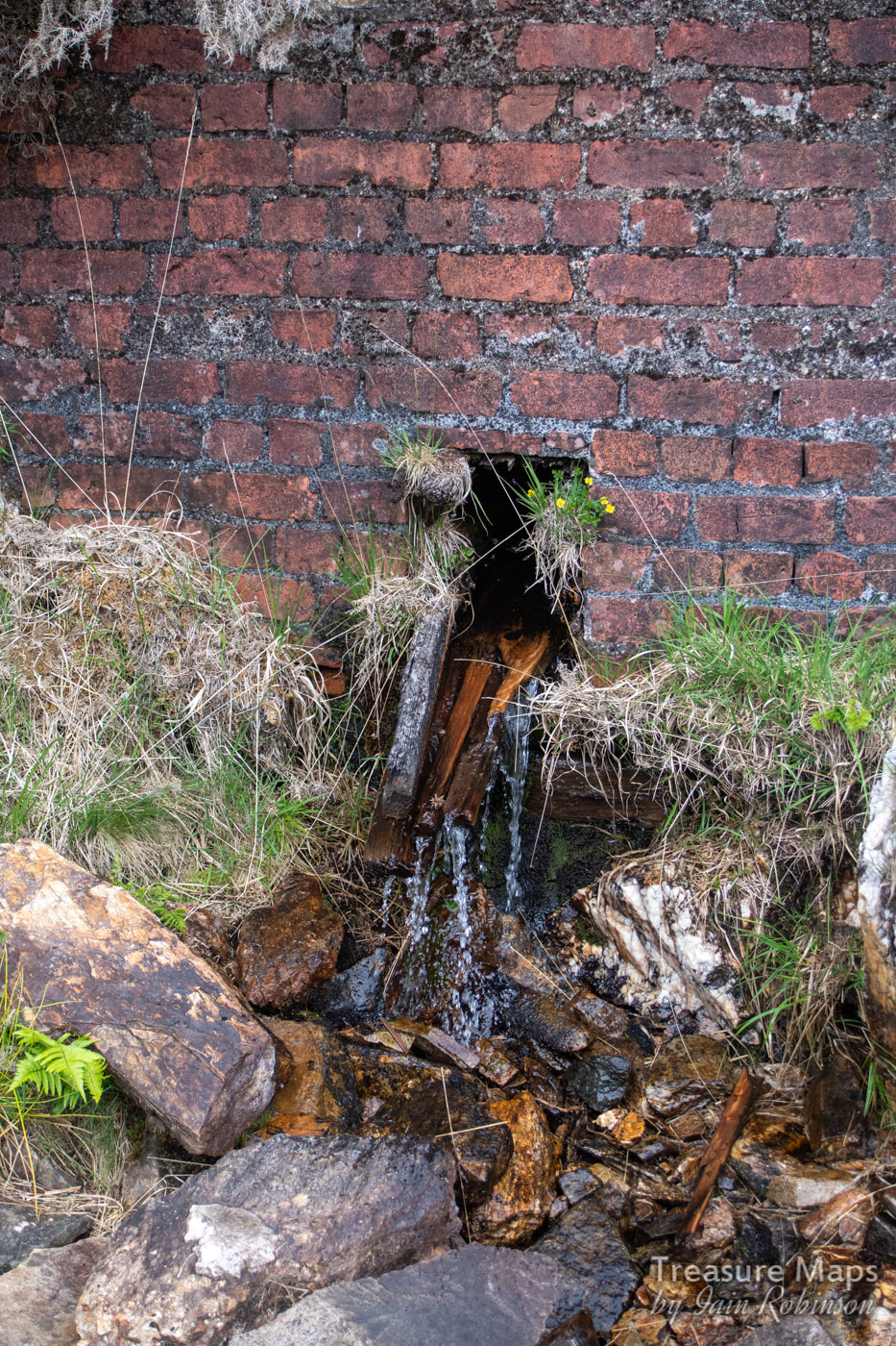
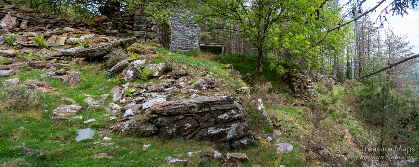
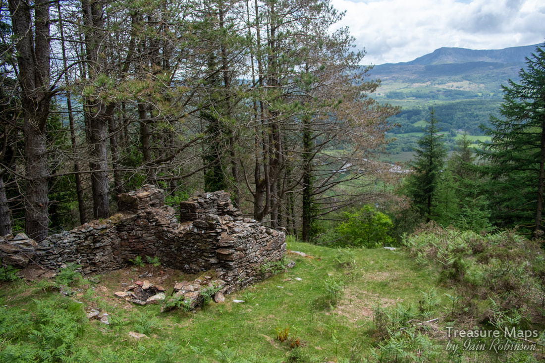
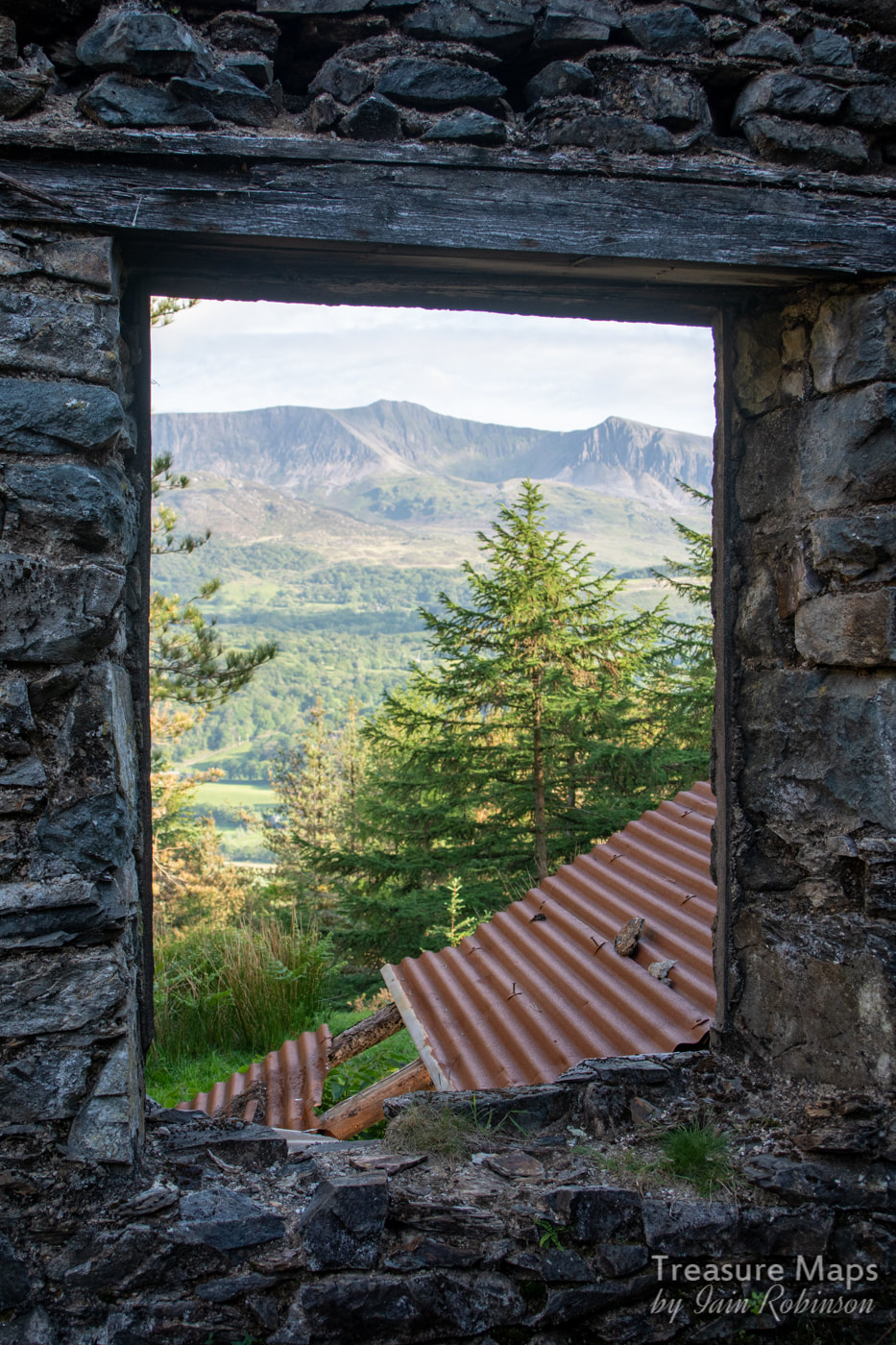
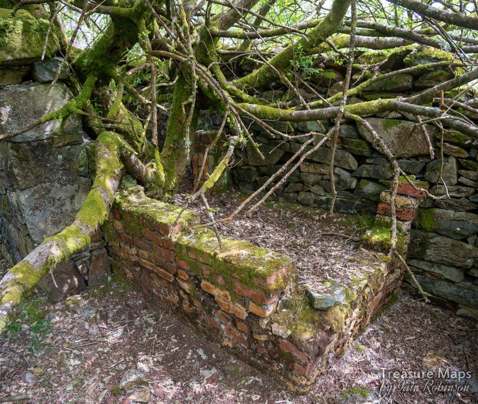
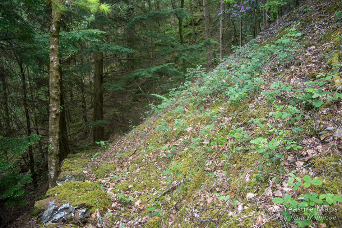
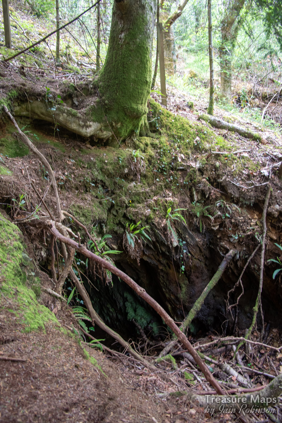
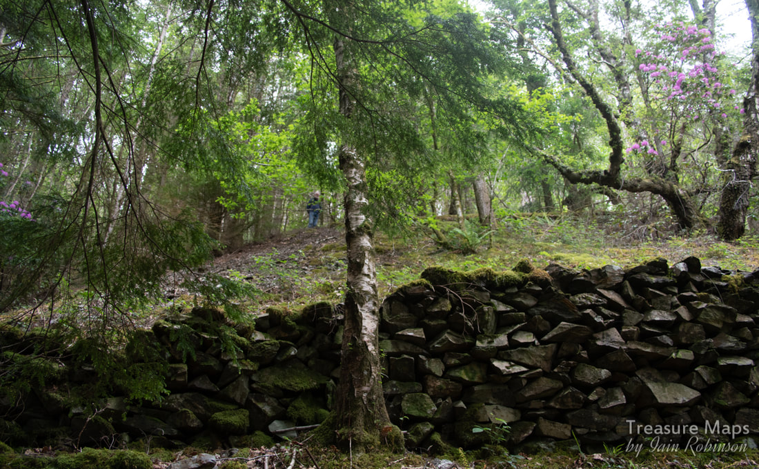
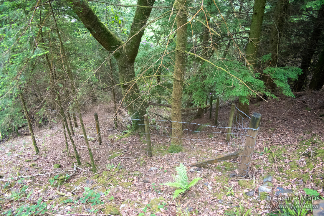
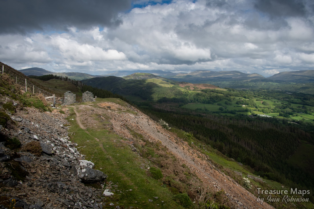
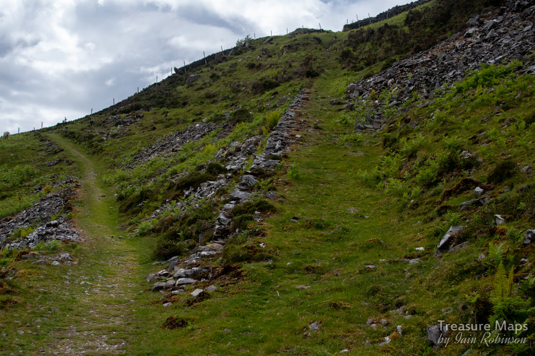
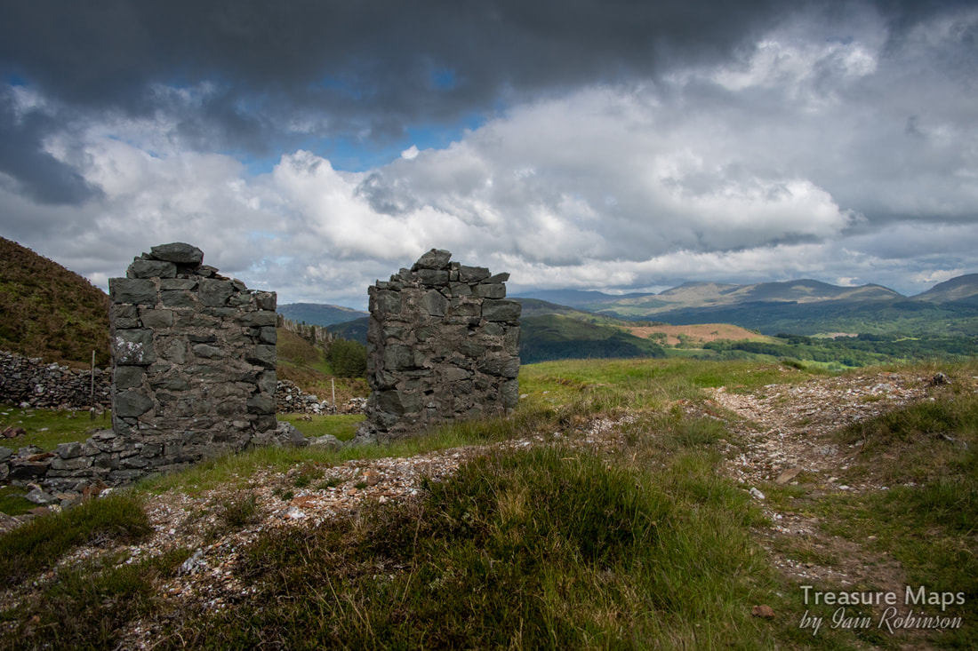
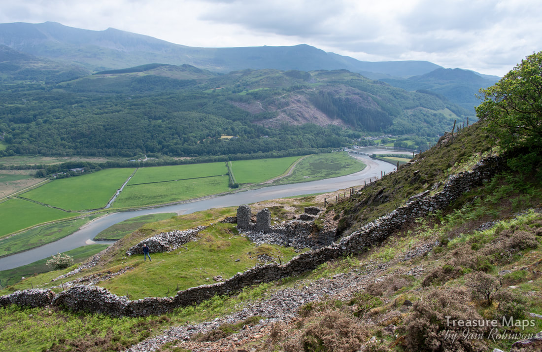
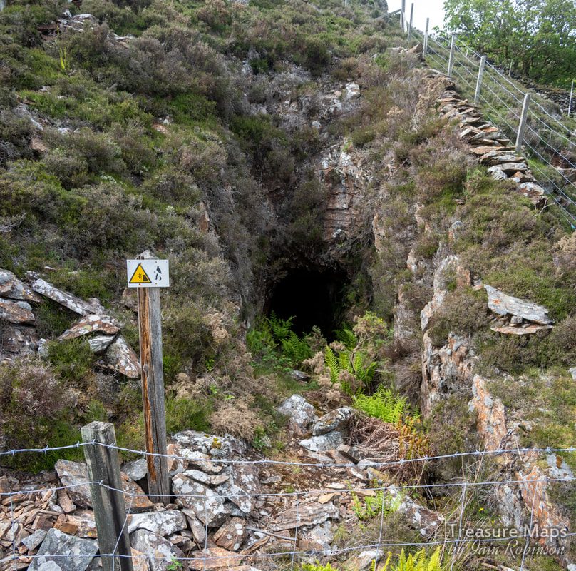
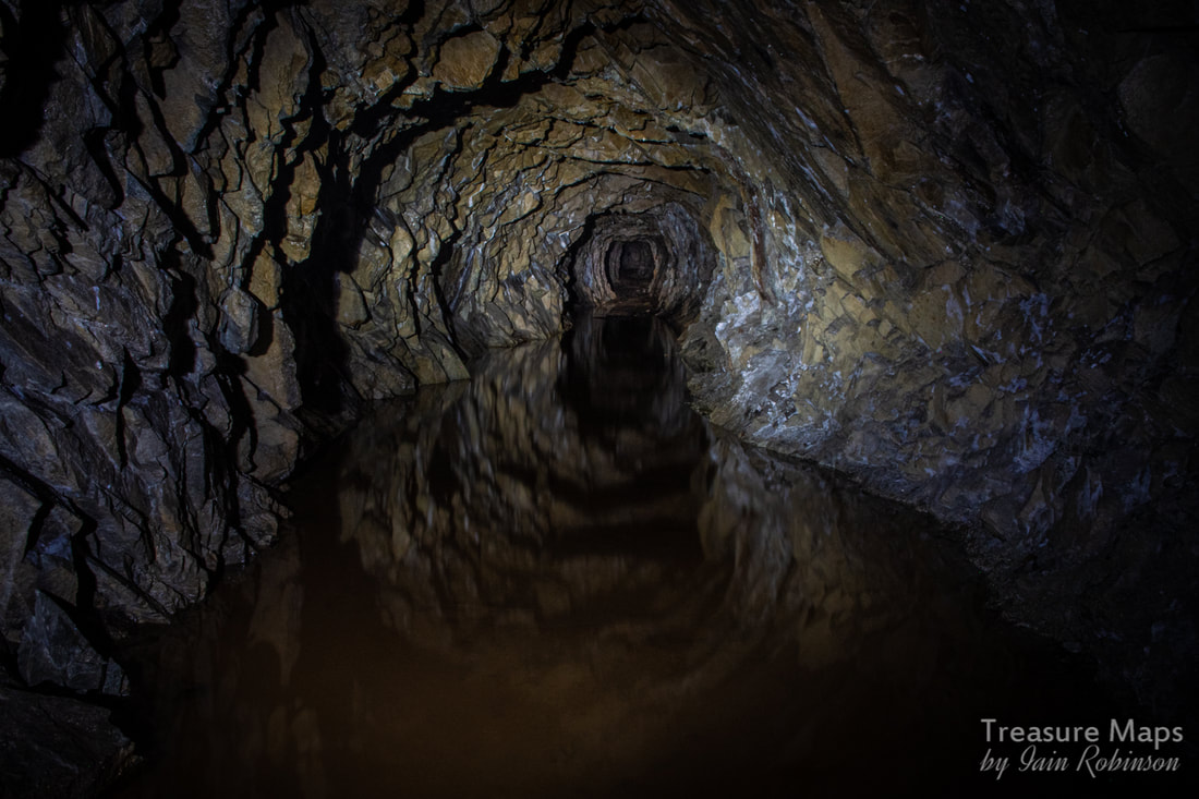
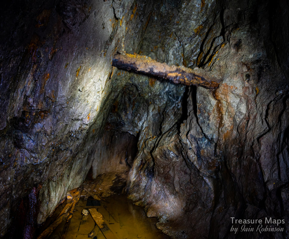
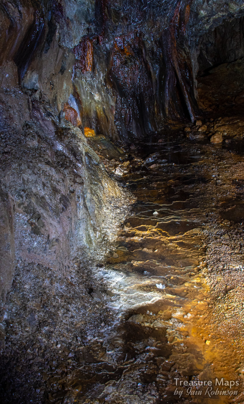
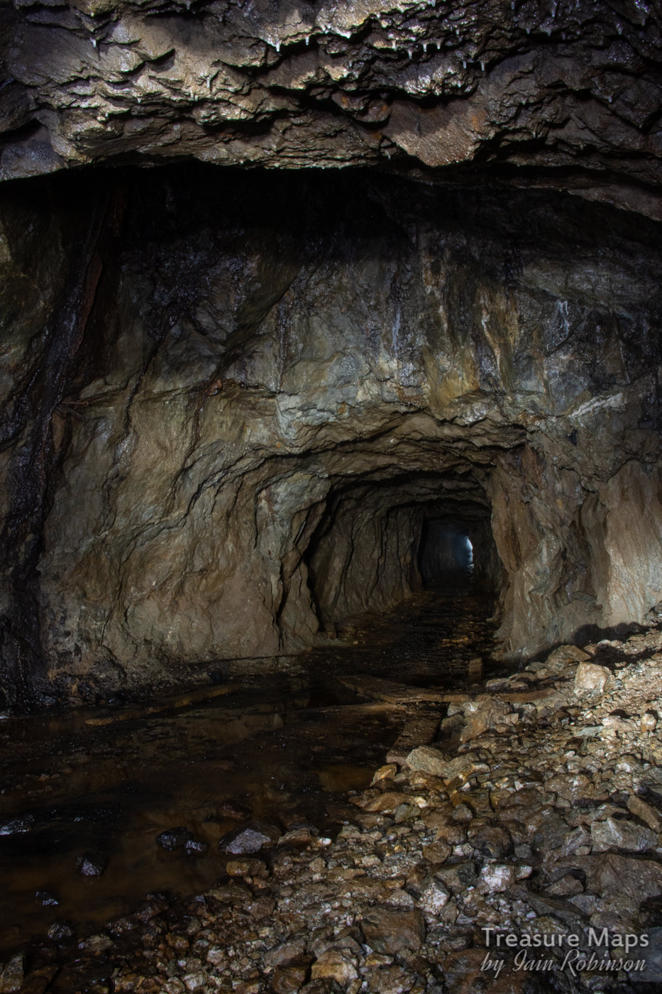
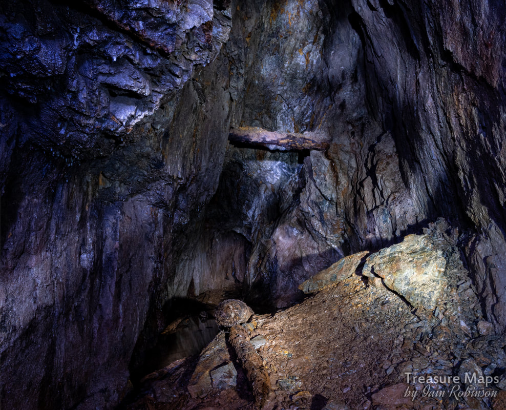
 The old farmhouse/barracks along the New Precipice Walk. We've been back to Foel Ispri and it's fascinating mining remains a few times now. As always, the more we find, the more the mysteries gather, but a clearer view is emerging of the workings- we've also discovered some adits hidden deep in the forest and an aerial ropeway jetty. Approaching from the steep path up from Llanelltyd, a stile crosses over the wall out of the forest. The path continues left past the old farmhouse, towards the precipice walk. Petra had spotted some marks along the hillside facing the stile, that looked like the formation of an old tramway... we investigated and found that they came from a large opencut and workings along the stream that runs under the new(ish) bridge for the path. At the opencut there were piles of worked fines and cobbed rock. Following the sketchy tramway east, it crossed a stream- the ruins of a stone bridge were plain to see.  The working area on the tramway, above the walker's bridge. The opencut is behind the camera. As we carried on, it curved round following the hill contours and disappeared into the forest. Except that, when we looked closer, we spotted what was unmistakably a jetty for an aerial ropeway. The boundary wall had a clear section in it that had once been a gate, to let the tramway through. 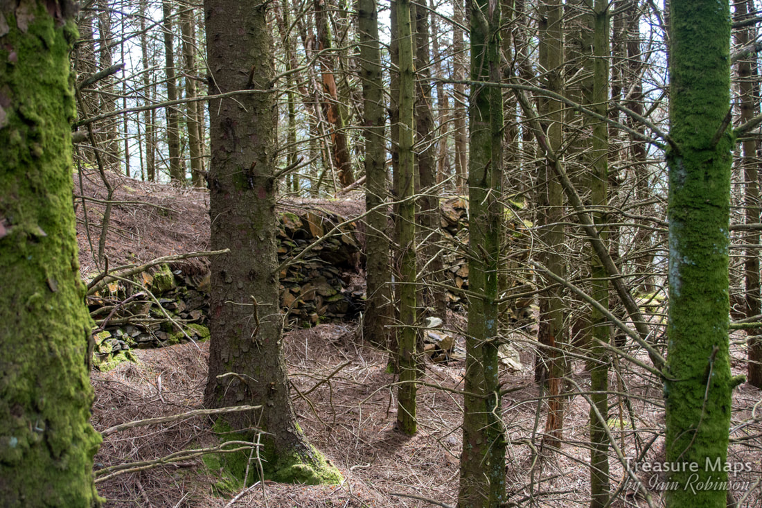 The ropeway jetty. Not easy to photograph in dense forestry! The question is, where did this go? Was it to the mill belonging to the Prince of Wales Co. down by today's A496 road- or was this ropeway intended to bring material up from several adits we eventually found in the woods? After our most recent visit. I felt that the woods below the old farmhouse needed more investigation. The structures around the place are strange, not quite agricultural yet not particularly industrial. There's what might be the remains of a waterwheel, for instance... 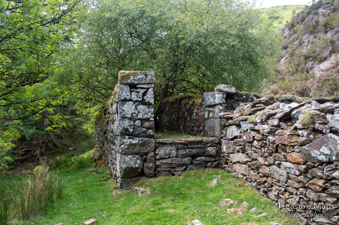 Supports for a waterwheel? The wall between the sides looks to be an addition. There's no sign of any mountings for journals on the top- but perhaps it was originally higher? I can't make my mind up about the farmhouse area. To the man with a hammer, everything looks like a nail- and I might be viewing things from a desire to find significance where there is none. And yet... a shaft is marked slap bang next to the house on the 1900 Ordnance map. We decided to take a look round... 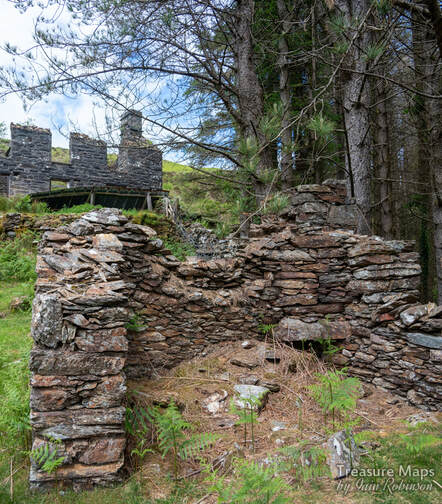 The two-celled structure below the house. It is made of different rock to the house, although the latter has been rendered at some time with a dark grey covering. 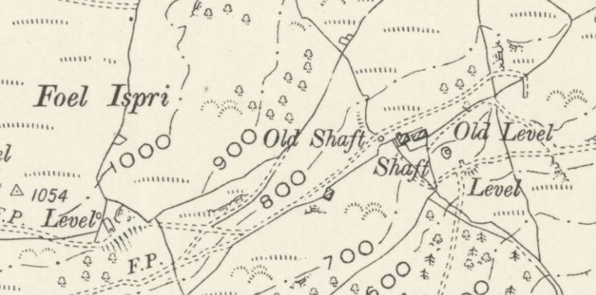 The shaft below the house and a level on the 1900 Ordnance survey. The ropeway jetty is at the hooked end of the trackway marked just above the word "level". Map by courtesy of National Library of Scotland. 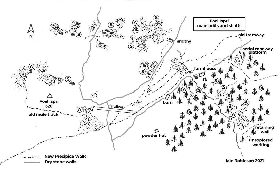 "A" denotes adit, "S" denotes shaft. There are also a multitude of crown holes over the site. We crossed over a fence next to the structure below the house. It was steep here and difficult going because of the trees/bracken/gorse/holly cocktail that the forestry encourages. I shouldn't grumble, because it does promote biodiversity- and it stops non-mine obsessives from discovering the place and staging their barbecues etc. Strange, I know, that some people aren't interested in mines... It wasn't long before we found the shaft. A steep openwork with exposed rock that goes down into the depths...difficult to photograph meaningfully, but here's my attempt anyway... 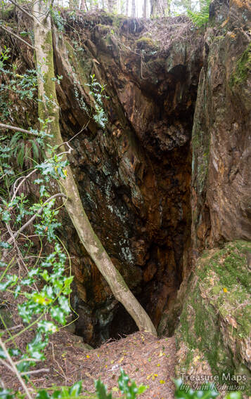 This was well fenced off- and in a tight situation on the steep hillside. Looking downhill from the shaft, we could see fencing that protected another excavation below us. We investigated and found an adit... 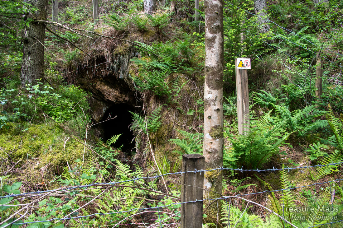 The adit below the shaft. This adit looked promising, although I noted that there was only a minimal quantity of water emanating from the portal. In our experience that means it's choked near the portal and will be very wet. We will explore it soon; but for now, we wanted to carry on and see what else there was. Thirty metres down hill, another fenced excavation was encountered- this time a shaft... 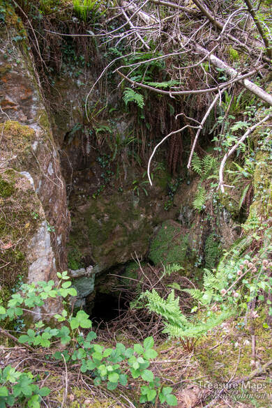 Things were hotting up now. A big excavation loomed below. We struggled through and down, until we reached what had been a fairly extensive digging. A shaft first, followed by a large adit portal to the left. We realised that the bosky platform we were standing on was actually a tip, reclaimed by nature. There were some really old birch trees growing on it that had amazingly fissured bark. A check of the leaves and yes, they were birches. But, to the adit! 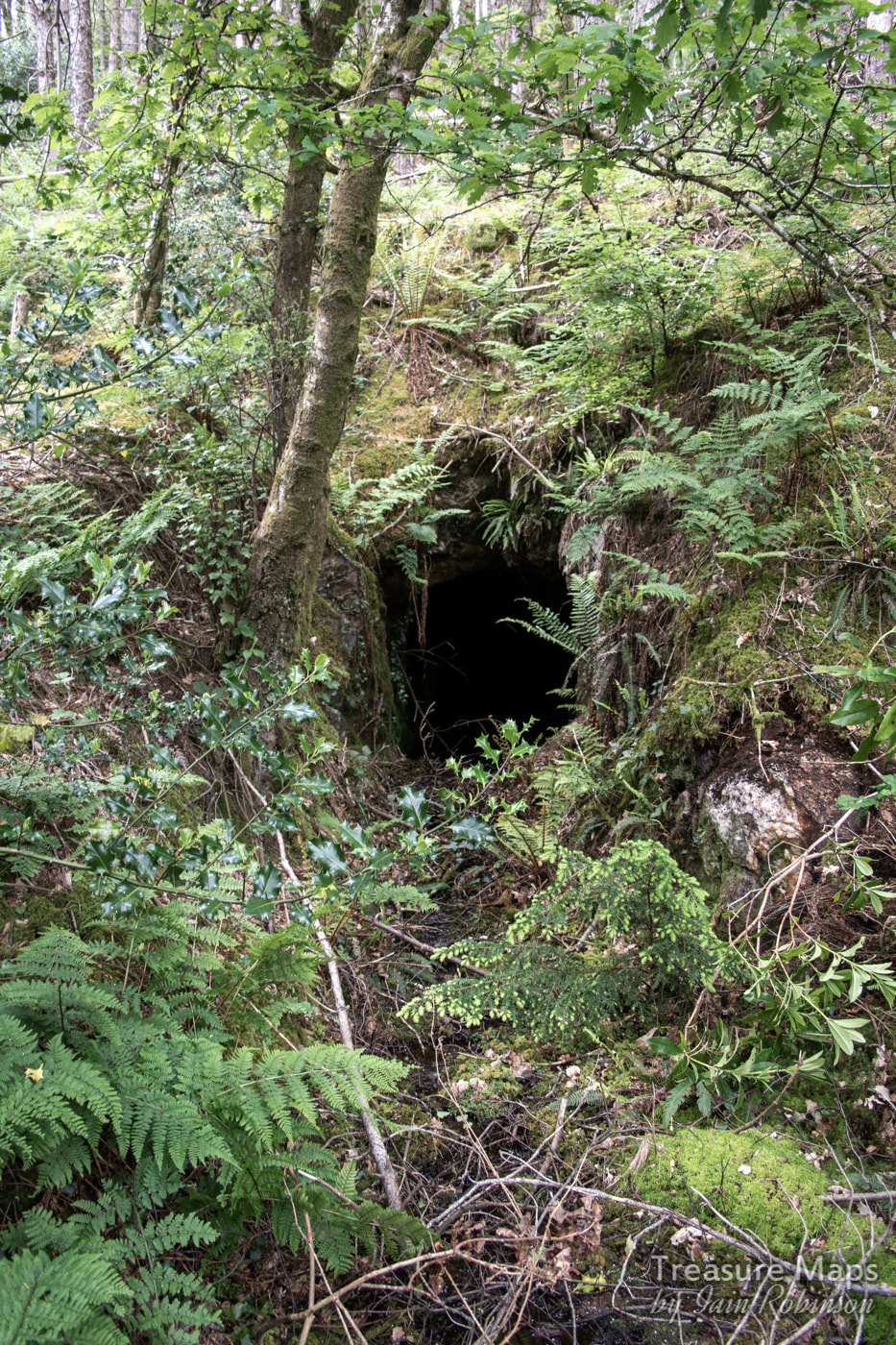 This was the most promising adit. Again, little water issuing, but a huge tip. We couldn't pass this one up. We could see more fenced off areas below, but this portal looked so tempting...so we put on the safety gear, grabbed the lamps and in we went... 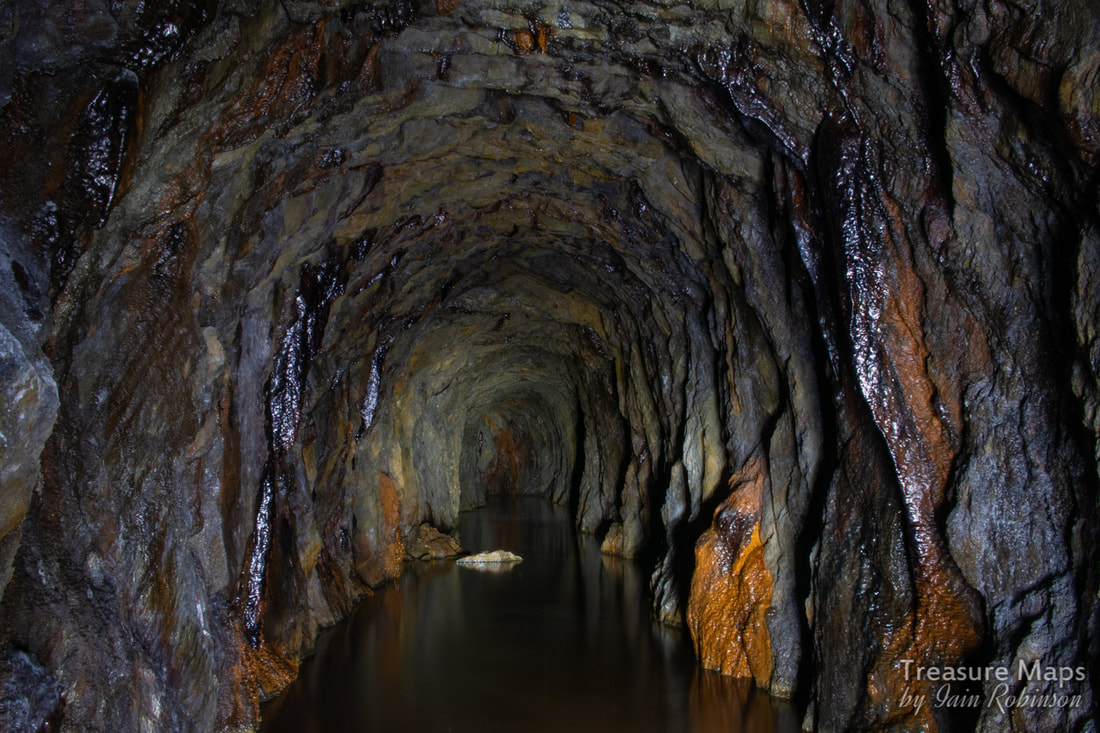 Looking inbye...nice iron formations. As soon as we entered the adit, (water thigh deep and freezing cold) a passage was noted going to the right a little way, then abandoned. We carried on for a long way, noticing the marks of sleepers on the floor and a couple of alcoves where a crosscut attempt was made then abandoned. 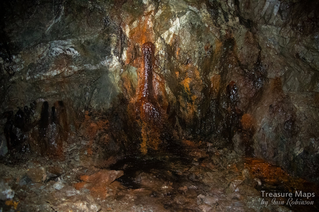 There were some great little formations in the mine, mostly iron, with some calcite straws from the roof. The adit ended after 350 metres. Somehow, with all the shafts, I was expecting false floors, but the tunnel was sound all the way. It even dried out towards the end. It felt like a long way in that cold water, but worth it. Outside, I explored the tip while Petra went down to the next level. A little way below the tips was an adit that opened out onto the stream. It was impossible to reach from my side due to erosion of the stream banks- perhaps that's why there wasn't much spoil. I took a shot, hoping that it would look like something. 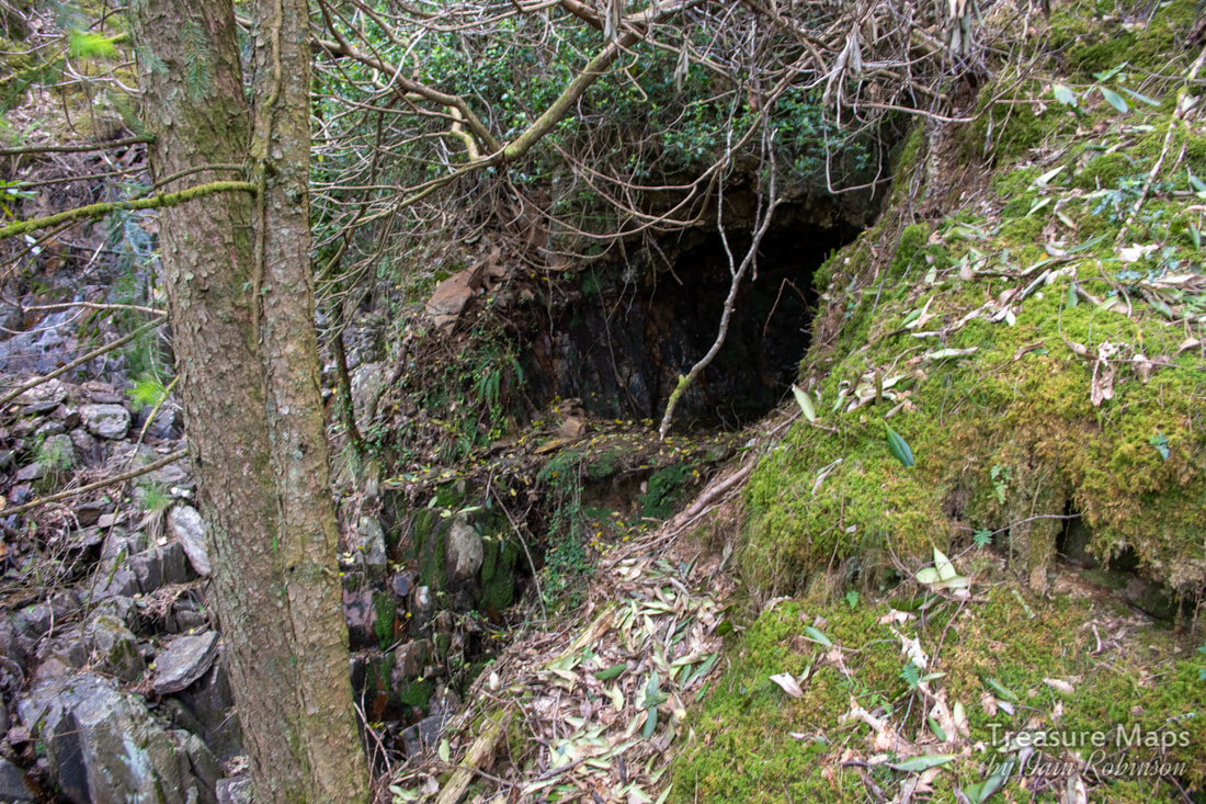 Doesn't really look like much, does it? The ground fell away vertically to the stream bed to my left. 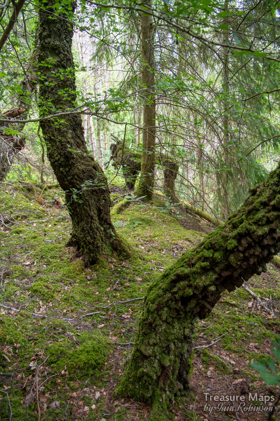 The ancient birches on the tip. The dead tree in the middle startled me when I first saw it- I thought it was a gorilla :-) Petra bravely battled her way to the lower workings, to find a large opening of some sort... it was very difficult to access due to the slope and at the moment, we can't tell whether it is an adit or a shaft. There was yet another working below, but we were both running out of energy by this time, battling away through all the vegetation on a 1 in 5 slope. We decided to come back another day. We climbed wearily back up to the old farmhouse and sat for a while, munching oatcakes spread with marmite peanut butter. Surprisingly refreshed, we wandered back to the barn, amused to see that the lintel was held up by some bridge rail. Arriving at the bit of the path where it joins the incline, we looked at each other. There was an adit up there that we hadn't explored. It must have been the peanut butter, because we dashed up the incline... There was what looked like a processing area at the top comprising several weatherbeaten remains of buildings including some sorry-looking brick pillars. The main structure was what looked like two walls standing on their own, no sign of a lintel between them. There must have been a sheave here, or some winding apparatus, but there was little trace of it. After enjoying the view, we entered the adit. The adit continued into the mountain for a good 4-500 metres, after which it branched. One way led into an area where stulls had fallen over a false floor. I wasn't prepared to go on as it looked too sketchy; but we'd seen a fine set of formations and some interesting little side excavations, so honour was satisfied. We had also spotted the powder magazine earlier, although neither of us fancied struggling down to it- a photo will have to suffice. It was well out of the way, should an explosion occur. 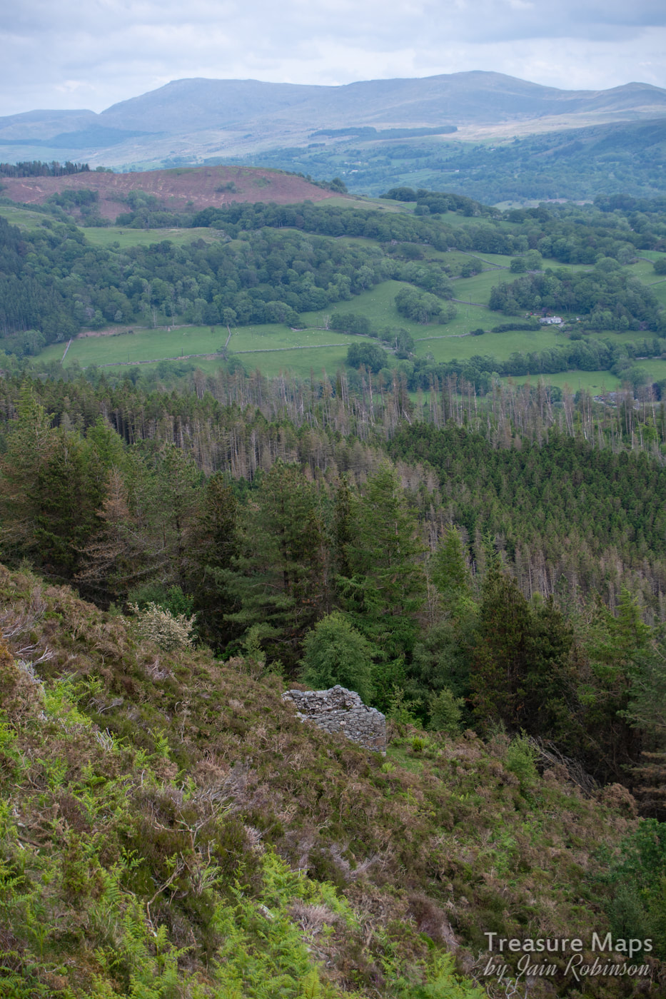 The powder magazine. While at the adit, we noticed a track going away in the opposite direction to the incline. Curiosity got the better of us and we followed it. It turned out to be a mule track to the other adit that we had explored a few days before, described in my last post- the one with the flooded stope at the entrance. So material would have been brought on the track, circumnavigating around the rocky knoll above , to send down the incline- that made sense. Looking at the old maps, on the 1880 survey, the adit at the end of the mule track is the only one on the hill, leading me to wonder if it is the earliest digging. There is a level marked on the 1880 map below the farmhouse, but the smithy hadn't appeared yet. The car was parked at the end of the walk , so we used the mule track and then dropped down to the car park. Like the miners, we hadn't found any gold, but we'd some fabulous memories of the day.  From the mule track. The New Precipice walk is a good bit below this. Comments are closed.
|
TracksReceive the occasional Treasure Maps Newsletter- and alerts when a new post is available!
If you enjoy my content, please buy me a coffee!
Check out my other online activity...
Index
All
|

 RSS Feed