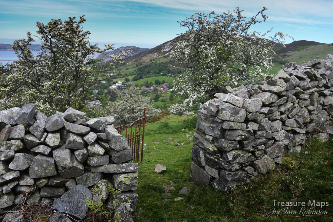
The old track up to the Graiglwyd workings above Penmaenmawr, used by prisoners of war in 1917, during the 1914-18 conflict. They were kept in Graiglwyd Hall, (now in the middle of a caravan site) a mile below.
Part One- the Neolithic quarries.
A few years ago, Petra and I made a fairly extensive study of the Penmaenmawr quarry complex in all it's fascinating, ransacked glory. But we didn't really touch on the adjacent Graiglwyd workings, something I always felt that we should remedy. This year, we've developed a side-interest in the prehistoric remains of Wales, and I had noted some interesting mentions about a neolithic axe factory on the slopes of Graiglwyd. I had the idea of contrasting ancient and "modern" in one swoop, but as always happens, it took a good few visits to fully quarter the place and attempt to do it justice. Graiglwyd is a large hill a little north east of Penmaen head. Hard to believe today, but at one time (about 300 million years ago) it was an active volcano. Because of the way the volcanic magma cooled here, it left a plug of diorite. (Microdiorite or augite granophyre) This is a hard rock, but within this deposit there were even tougher veins of what the geologists call chilled rock, with special breaking properties. Simply put, when it breaks it is with a very sharp, durable edge. One of the reasons Victorian quarrying got into difficulties here was that the rock was too durable for cobbles/setts- in the pre-motor car era, horses would slip and carts skid on the smooth surface. Four thousand years earlier, this was the very reason the rock from Graiglwyd's slopes was prized.
I should say from the start that nothing should be taken from this area (it is highly unlikely that you would find any axes or roughouts in any case). As always, we were concerned to find evidence of activity, not artefacts. If we had found anything, it would have been left in situ and a report lodged with the Penmaenmawr museum, accompanied by a precise GPS location of the find. Take nothing but photos, leave only footprints :-)
I don't know how those early men knew to dig here- we do know that they had a complex civilisation based on trade, rather than the territorial aggression that was assumed when I was at school. We know that the site soon became very important to them, so much so that a complex of settlements, cairns and stone circles were built almost within axe throwing distance. An ancient trackway was just a couple of hundred yards away- a co-incidence, or deliberate? We'll never know. Excavations of the (later) Druid's circle nearby* and other sites have revealed unused tools from Graiglwyd; whether these were prior to the circles or not, they were deposited in those locations, which is significant. A red herring? I was put off the scent initially, since the map reference on Coflein is for an area to the north east of the hill top, quite a bit lower down than I would have expected. But that was due to my ignorance, no fault of Coflein. We quartered the area and saw nothing suspicious, even by the standards of neolithic sites, which usually require rather a liberal gaze from the "eye of faith". Other sources said that the neolithic quarry had itself been quarried away by modern working. We came away a little depressed, although we had seen a couple of great victorian powder magazines, an amazing blast shelter and an interesting drum house for the next visit. Ah, yes, recent industrial archaeology- remains you can actually see without excavating. (gives a wry smile) Meanwhile, I read an account on Megalithic portal. It sounded from what they were saying that the axe factory might have been on some outcrops on the southern top of the ridge above the modern-ish quarry. This seemed to be a sensible theory. A discovery Then I made a breakthrough, managing to get sight of an excavation report written by Samuel Hazzledine-Warren in 1921. He was an eminent archaeologist of his time- an expert on Middle Pleistocene sites (c.400,000 years old) of the Clacton area. He'd been on holiday in Wales, looking at the Druid's cairn a few hundred yards away from Graiglwyd, when he found a stone axe lying on the ground. He continued to find axes, tools, broken tools and countless flakes all over the area, but most were concentrated in an area where Coflein have their grid references. This was the early 1920's, remember. Needless to say, Petra and I scrambled back up there as soon as work and family commitments would allow. 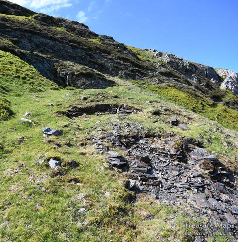
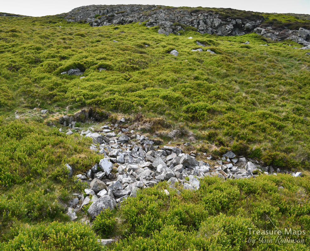
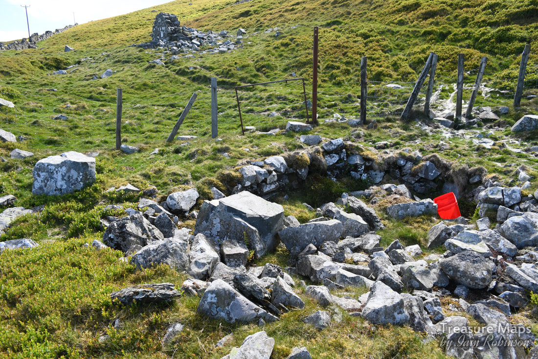
A slate trial! Below the outcrops from which the stone axes were quarried.
Of course, as always, we managed to find a slate mine! A small trial working into an opencut, showing some very oxidised slate in the tip, with plenty of iron evident. Sedimentary mudstone in the close vicinity of a volcano- the wonders of geology. But, above the mine, with it's cute little magazine, were the neolithic workings...along the line of Clip yr Orsedd.
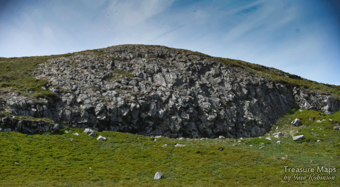
Quarrying, neolithic style. Nothing much has changed.
It's worth quoting Coflein: about the site:
"At Graig Lwyd blocks of raw material were selected from the natural scree and crags and firstly roughly flaked into manageable form before being worked to roughly the correct shape and size. At this point the `roughouts' as they are termed, appear to have moved from the site and were ground and polished to their finished form elsewhere... ...in addition to the large quantity of flakes and roughouts noted across the hillside, five working floors were discovered."
I wonder what these working floors were like? At any rate, here are a couple of photos carefully taken at an outcrop near the present top of the hill, at Clip yr Orsedd. I can't imagine what the holes left by material extracted four thousand years ago must look like, but it seemed that there had been a fair bit of extraction here, with plenty of tipping.
An investigation by John Llywelyn Williams in 1992 revealed percussive marks in stone that could possibly have been made in order to dislodge rocks here. In other sites, notably those excavated by Hazzledine-Warren, there was evidence of fire-setting ( dislodging or inducing rock to split by means of heat and then rapid cooling) and large hearths were uncovered, which H-W thought might be for calcining the roughouts to make them easier to work- although this must have taken a great deal of skill to judge the amount of heat required. 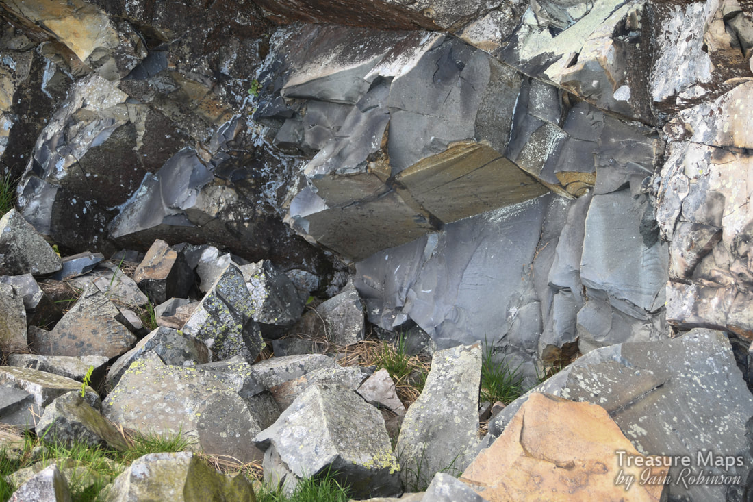
Might this be a remnant of the excavation by Mr Hazzeldine Warren?
It seems that the greater quantities of stones used for axe making were taken from the scree which fell off the rock faces. Before the quarry, there must have been a huge selection to choose from. Using a hammer stone, chunks or flakes were then broken off, shaping the workpiece to the desired form. I guess this technique was achieved empirically over many years of working. The "roughout" was then removed elsewhere for final shaping and the much longer task of polishing. Ultimately, the stone would be fixed to a wooden handle.
Flakes, hammerstones, and axe heads have been noted in various stages of manufacture at Graiglwyd- in fact they have been found in a wide area radiating as far away as Dinas, at the gateway to the Bwlch y Ddeufaen. Finished axe heads from Graiglwyd have been found all over Wales and further abroad. Bangor and Shrewsbury Museums have exhibits of axes and tools from Graiglwyd, Cardiff and Manchester also have examples. There are also some axe heads and tools in the museum in Penmaenmawr. 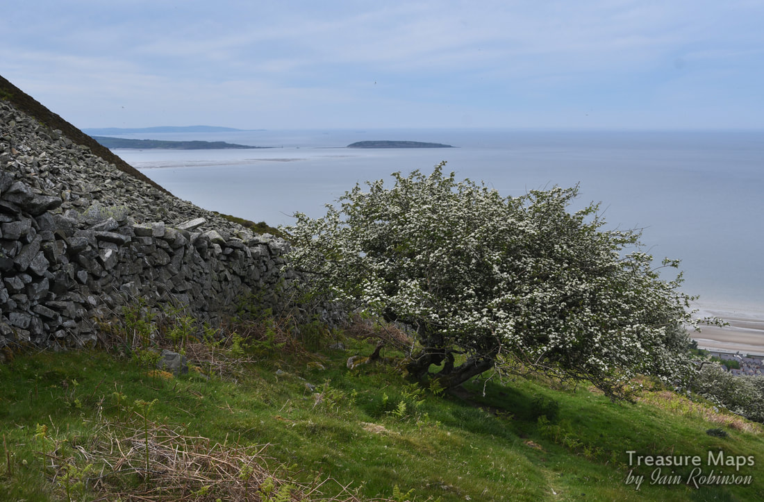
The point where Samuel Hazzledine Warren made his excavations. Penmon, on Anglesey, with it's limestone quarries and Puffin Island are in the distance.
Hazzledine Warren's account of his work is a thorough, learned treatise, but it is also a charming one. He writes that work was continually interrupted by the blasting operations from the quarry-
"The actual amount of the danger is not great, but it is always present, and sheep are occasionally killed by flying splinters of rock... stones of considerable weight come across with very formidable velocity, and our working party had one very narrow escape. I advise... to avoid the shelter of the stone walls as these are breached by the heavier projectiles and only make additional missiles..."
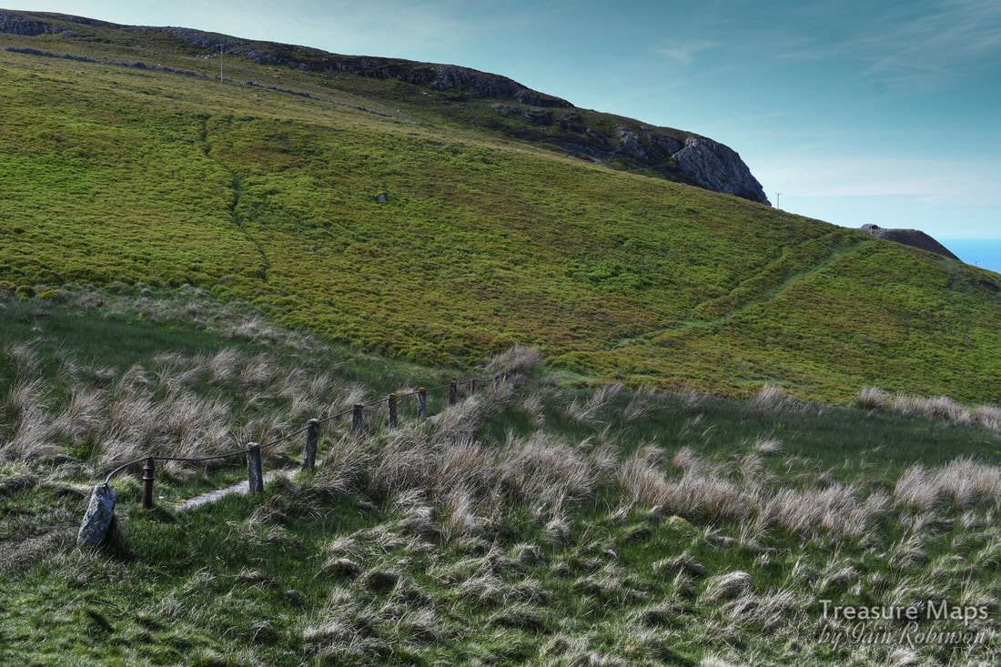
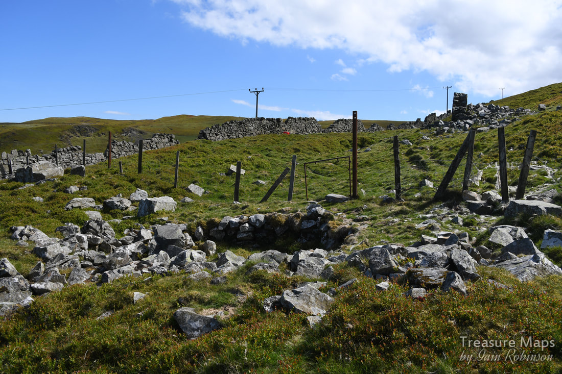
The shoulder of the hill where several hut circles are marked on the map. The quarry built the ruined hut in the foreground and also the blast hut in the distance.
We spent some time quartering the ground beside the grid references given on Coflein, without seeing anything significant- but then most remains would be below the earth, even as recently as the 1921 excavations. I was hoping for a little sign of some ground disturbance, but never mind, I could imagine the activity that must have gone on here.
So we switched our attentions to the shoulder of the hill where the quarry breaks the skyline. Along here, there were the opencut sites, which we examined carefully and thought we might be seeing some evidence of stone shaping. The OS map marks some hut circles here and these were evident- Hazzledine Warren mentions them, but considers them to be of a later date than the axe workings. He excavated them and found 200 flakes and more than a dozen axes in various stages of manufacture. But axes were also found built into the walls of the hut- these were deeply patinated and thought to signify the later date of the huts. The settlement is easier to pick out from Google Earth than it is on the ground, but I was saddened to see that the quarry had ransacked the place, due to ignorance, I am sure, followed by the farmer who had left the inevitable plastic concentrates container. 
Photograph of Samuel Hazzledine Warren at "Sherwood", Loughton, in October 1931 taken by Professor K. Absolon. Essex Naturalist. Vol. 30. Plate 9 p. 144.
Who was Samuel Hazzledine-Warren?
Warren was born and brought up in Essex, the son of a wholesale merchant. He entered the family business but was able to retire to concentrate on geology and archaeology in 1903. Most of his fieldwork was carried out in Essex notably at the Middle Pleistocene sites (c.400,000 years old) of the Clacton area where he identified the Clactonian industry and found the tip of one of the oldest known wooden spears. He also researched late Glacial deposits in the Lee Valley. He was a prominent member of the Essex Field Club, the Geologists' Association where he recieved the Stopes Medal and the Geological Society. He published many papers about his fieldwork and made significant contributions to early 20th century debate on a chronological framework for the Quaternary period. In 1936 he gave part of his collection to The Natural History Museum and bequeathed the remainder to the British Museum. (Extract from the Bibliography- Oakley, K.P. 1959. The Life and Work of Samuel Hazzledine Warren, FGS. Essex Naturalist 30, 143-161)
If you were wondering what an axe from Penmaenmawr looked like, here's a link to Coflein: Digitised images of axe finds at Penmaenmawr
Here's a film from English Heritage, showing how one goes about making axes from flint, but the principle is, I guess, pretty similar:
Some useful links for further information:
GAT/Cadw document- Group VII Axe-working Sites and Stone Sources, Llanfairfechan, Conwy- a fascinating account of the sites shown here and a report about a local historian and recorder of axe finds, David Jones. The Waun Llanfair Project- excavations and investigations carried out in 2004, 2006/7 by George Smith of GAT and John Griffith Roberts of Cambridge University. Penmaenmawr Museum
Other "Treasure Maps" posts about Penmaenmawr quarries-
0 Comments
Your comment will be posted after it is approved.
Leave a Reply. |
TracksReceive the occasional Treasure Maps Newsletter- and alerts when a new post is available!
If you enjoy my content, please buy me a coffee!
Check out my other online activity...
Index
All
|
 RSS Feed