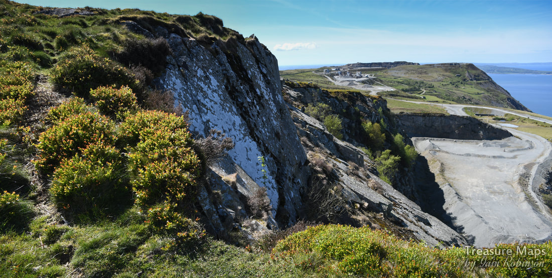
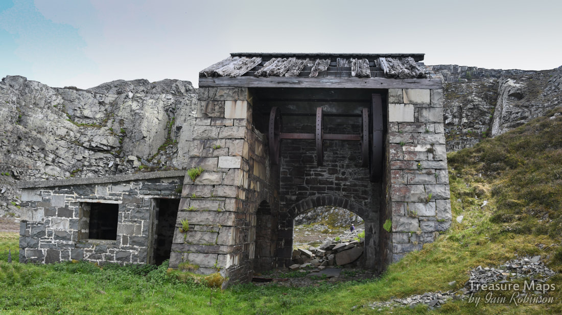
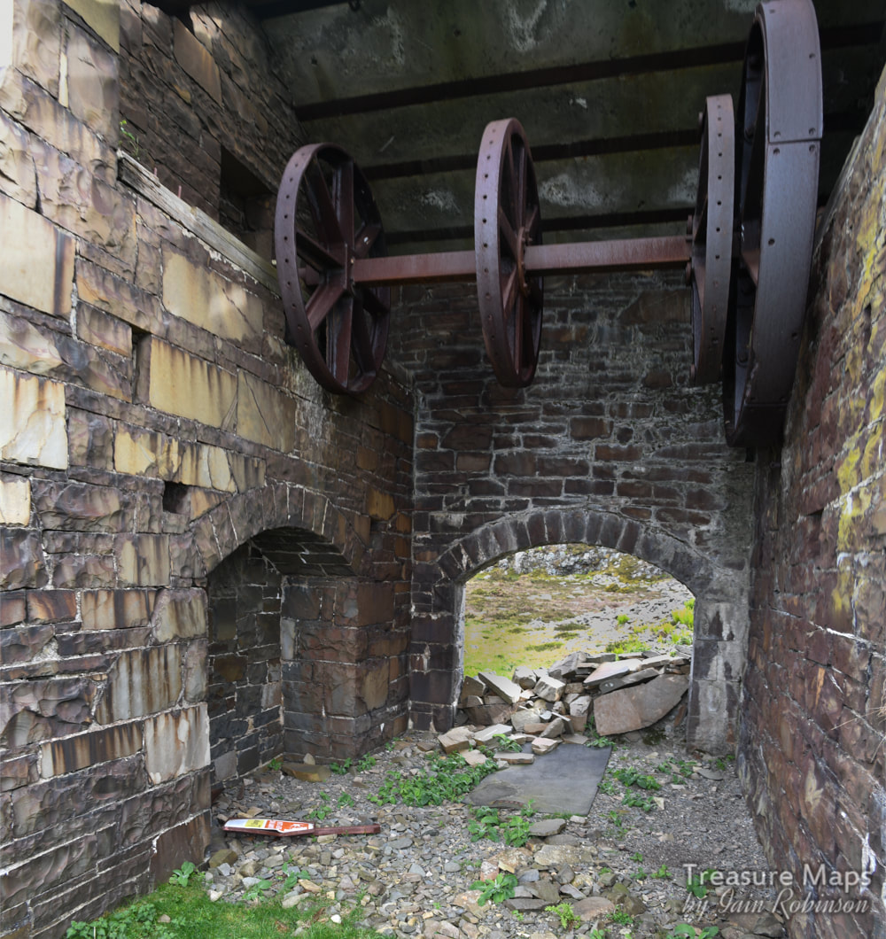
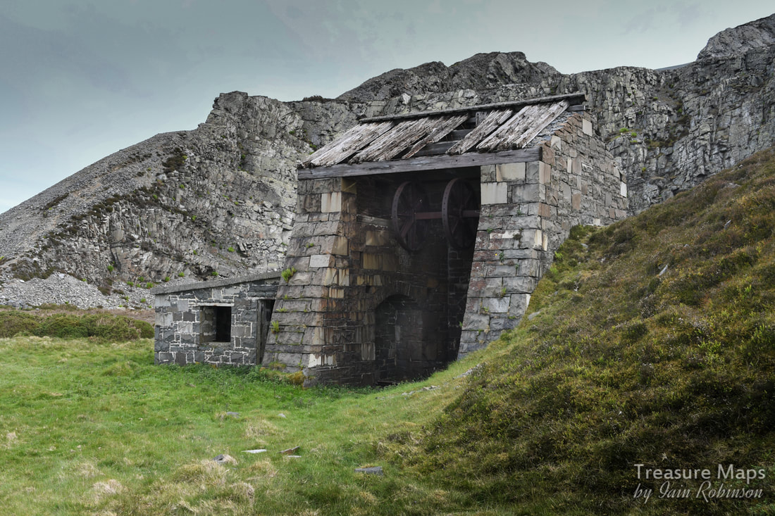
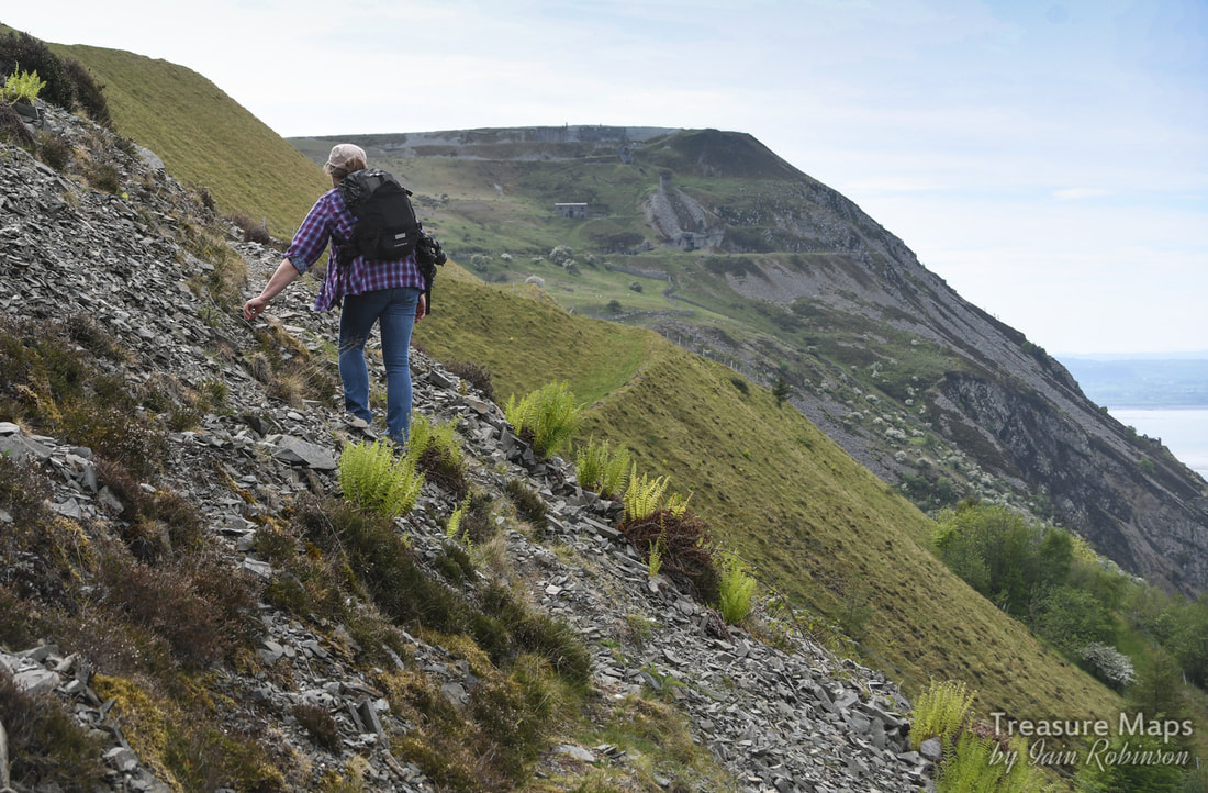
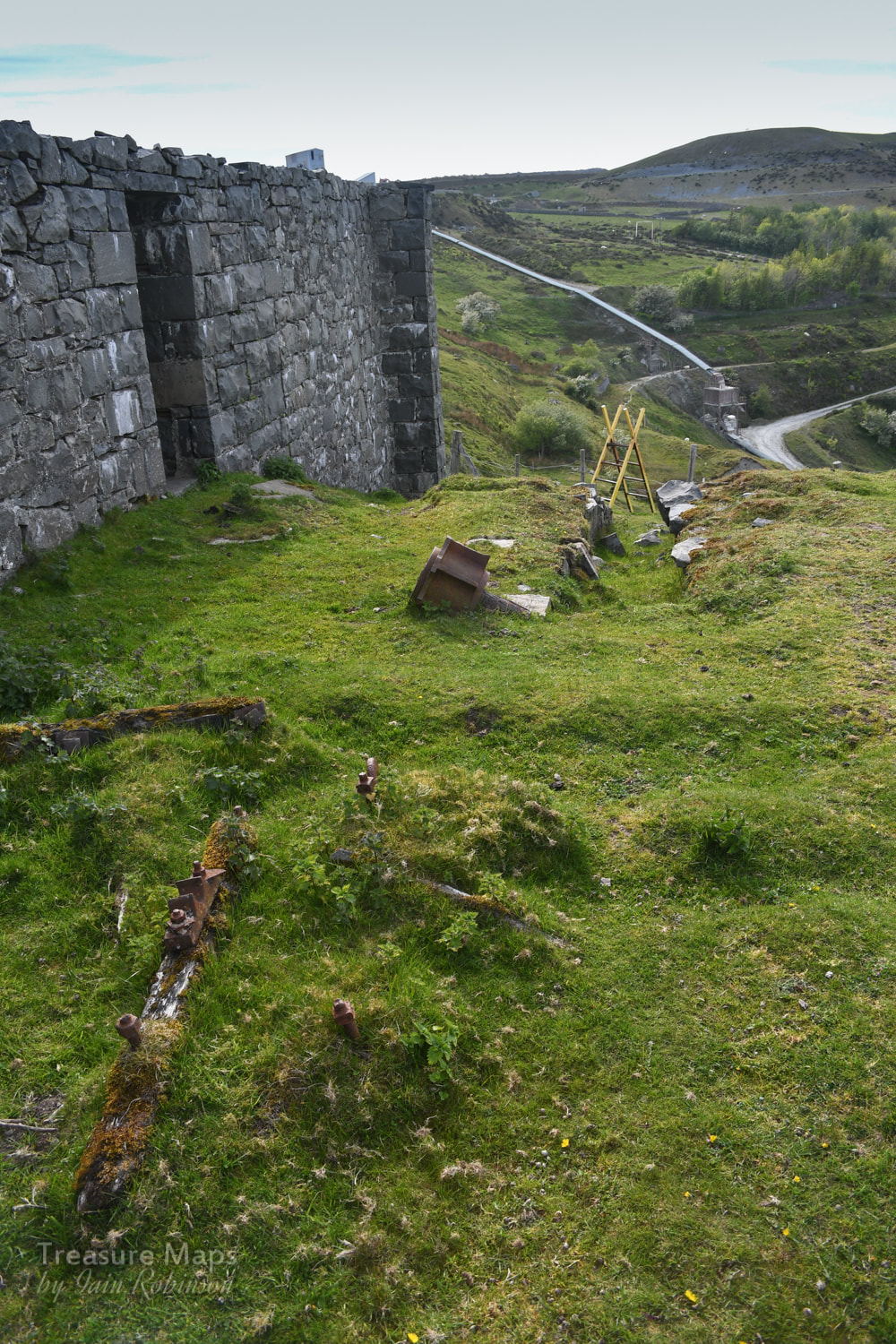
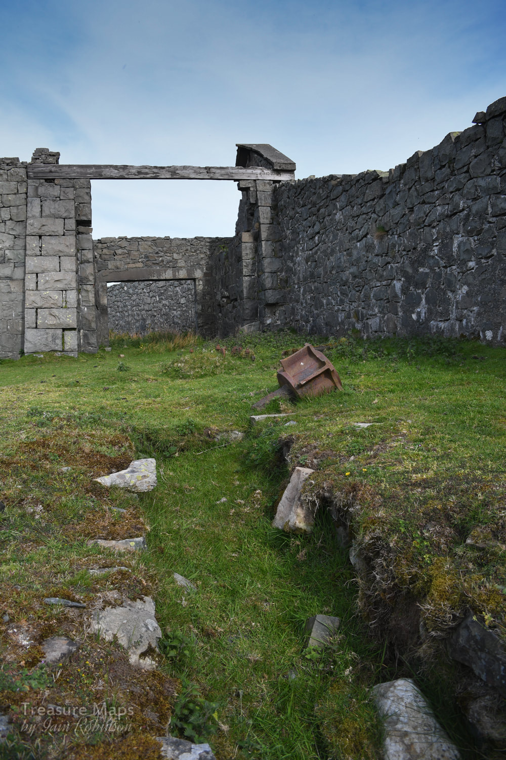
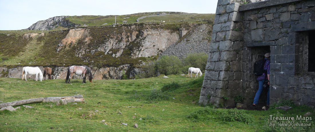
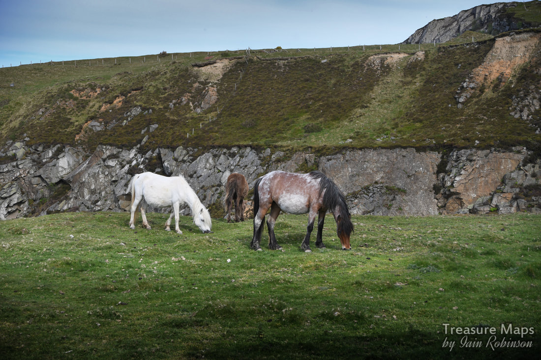
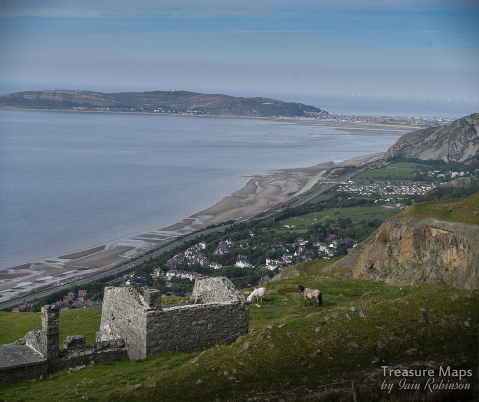
 A view of Graiglwyd old quarry from above Clip yr Orsedd. During our search for the axe factory sites, we had plenty of opportunity to look at the disused workings of Graiglwyd quarry. For a long time, from 1834-1911, this was a separate entity from the quarry on Penmaen head, seen in the distance in the photo above. That quarry is still being worked, albeit sporadically, with a handful of workers. But with modern equipment, that's all you need. Walking over from the moorland side, I was excited to see what the quarry looked like from a new angle. Unexpectedly, I had a strong sense of the hubris of the quarry company, back in the early C20th. That these people could think nothing of making this gigantic scar, destroying the signs of ancient landscapes in a rapacious desire for money. Taking 500 feet of the top of a mountain (and destroying a prehistoric fort) just because they "needed" to. It would probably still happen today, I don't think it's any use saying "times have changed". The archaeological significance of the site was acknowledged even in 1900, but according to Alwyn S Evans, author of "Populating the Past: Penmaenmawr's Mysterious Beginnings", "...economic interests came first...the quarry people had said, 'Maybe we can keep a lookout for old remains'. This was ridiculous. It would be a non-starter because of the conditions under which the men were working, although the working men might have wanted to look" Yes, I know, the jobs. But everything can be justified if you think that way, can't it? Don't get me wrong, the place fascinates me. I love trying to interpret the processes, the machinery and the buildings that remain. I am fascinated by the stories of the old quarrymen and their struggles to survive- paid a pittance, risking their lives to line the pockets of the owners. Perhaps in the early C20th, this place was a monument to the workers...less so now, as more efficient, less labour intensive extraction and bigger machinery overlays the marks left by the old men. It's more an advertisement for the removal capacity of modern excavators. I've gone a bit Kier Hardie haven't I? But within me, and within many amateur industrial archaeologists I suspect, there is a dichotomy- a fascination with historical industry, then a feeling of shock when, with the scale of 21st century processes, this gets out of hand. The need, always, for growth. Sometimes it feels as if mankind is a parasite, leading to the destruction of anything that gets in the way. Certainly, looking over the ravaged mess that is the quarry today I felt that it had benefitted nobody but a few rich capitalists. Anything of industrial archaeological interest had been taken away to yield scrap money. Signs of historic industrial useage were removed by "landscaping", making even the telltale signs of the old levels into strange, alien shapes that are meaningless, owing nothing to geophysical processes or what came before the quarry.. To give an idea of what might have been lost, I have included an extract from Sir John Wynn of Gwydir's "An Ancient Survey of Penmaenmawr " at the end of the post along with Coflein's information. OK, I've had my ten pence worth. Normal industrial archeology will resume... 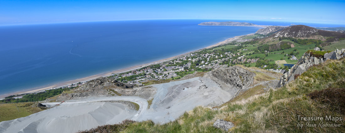 While pottering about at the axe factory site, we noticed what looked to be a drum house on the level below- we decided to go and have a look at this. But first, we took a close look at a blast shelter on the edge of the quarry above. 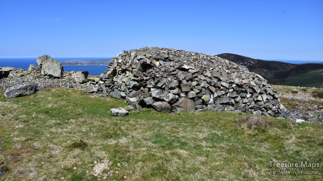 The blast shelter. You could be forgiven for thinking this was some kind of prehistoric structure- and it does bear similarities to a very old peat cutter's building on the moors behind Penmaenmawr. But it is also very similar to a blast shelter at Tal-y-Fan slate quarry, a couple of miles to the south on the moors, built when that operation was active in the 1840s. 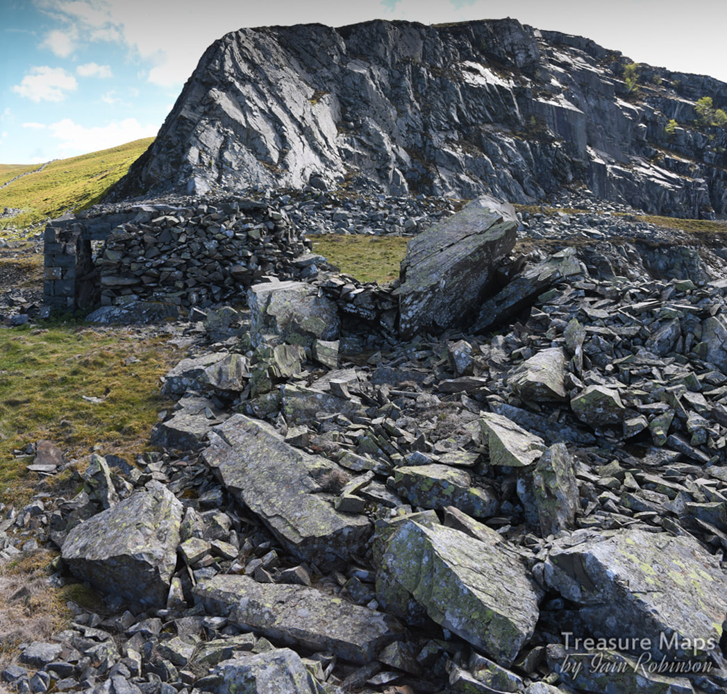 This view of the structure gives more of an idea, with the working face behind. In fact, the building was a small concrete box, overlaid with several thicknesses of stones to protect the workers as they sheltered. I wonder if they added stones every now and then, when they could! 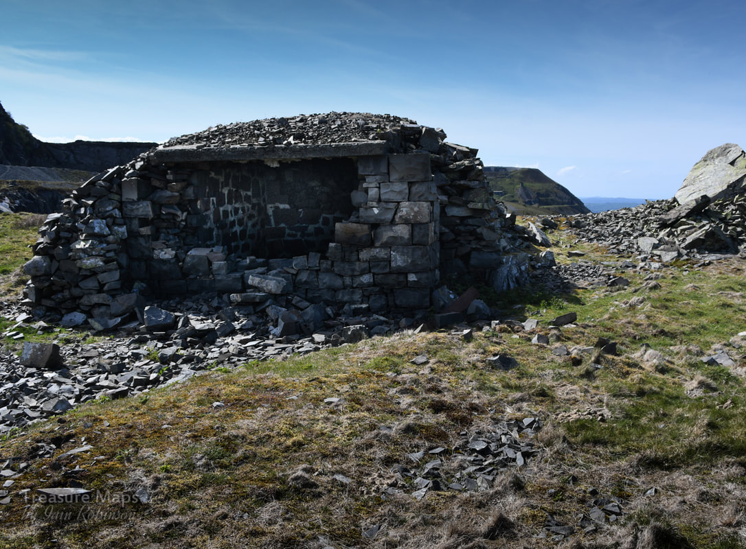 I'm not sure what could have caused the destruction on this side, away from the quarry. It looked too determined to be vandalism. By now, the drum house on the lower level was calling to us. The first of a few that we encountered, left alone, no doubt because it would be too expensive to demolish. I could see that it was going to be a struggle to access, but it would be worth it. 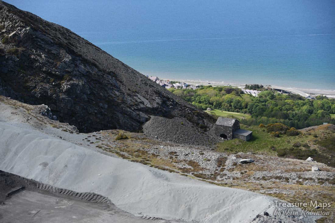 Seen from a couple of levels up. The top parts of the Old Quarry seem to be used to store finely ground stone chippings- here a berm has been formed to protect the edge in front, a drop of a hundred feet. After a conference, we decided that the best way to reach the drumhouse was to go down and round the perimeter wall, to the base of the incline. It was a steep walk, but a delightful one as the Hawthorn trees were in bloom and underfoot there was a profusion of wild flower growth. To our right was the great Orme and nearer, the bare slopes of the Sychnant Pass. Eventually, we found the old path used by prisoners of war in the 1914-18 conflict. They were brought here to stay at Graiglwyd Hall and marched up by armed guards daily to work. Most of the men at that time had gone to the forces, but the quarry needed more production for the "war effort"- and to make more money, of course. The Galloping Colonel A battalion of quarrymen was formed by the quarry owner, C. H. Darbishire. Tragically, 72 of the men didn't come back, killed in the unneccessary slaughter. Darbishire himself, give him his due, was as keen as mustard to get over and fight the enemy. But his age was against him and he was refused- in 1915, he would have been 70. He'd already funded the building of a drill hall for the men in 1901 and had made himself Colonel of the volunteer regiment. What do you think he did next? He had a uniform made for himself (that of a private soldier) bought tickets to Egypt, where his troops were fighting, and tried to join them. But he was apprehended and sent back with a stern warning to behave himself. You have to admire his spirit! 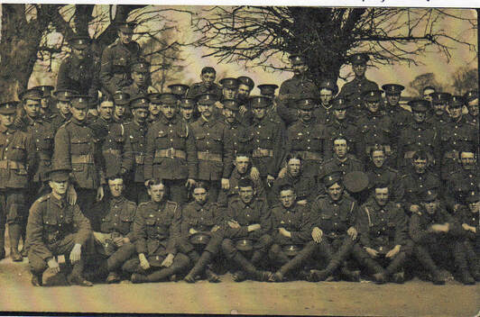 The Penmaenmawr Quarry boys in training at Northampton. Photo courtesy of Dennis Roberts 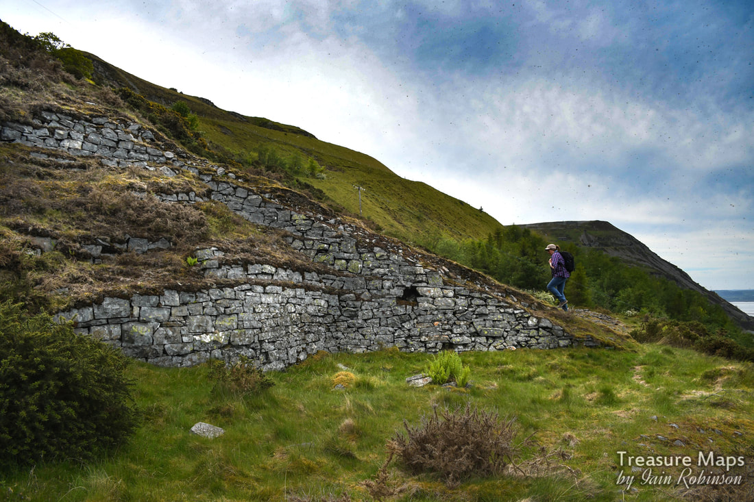 Petra walks up the base of the incline towards the drum house. Meanwhile, we had reached the lower level and began to walk up to reach the drum house. The incline became overgrown with gorse and we had to detour off it onto the spoil, never a good idea. It was a tense fifty yards of uphill scrabbling, trying not to dislodge pieces of rock, but we managed it. 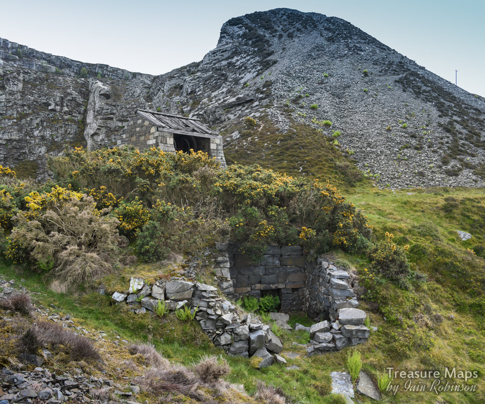 Our first view of the drum house and what could have been a weigh house (note the fireplace, vital in this exposed location). Walking up, we had been aware of a strung-out line of rusty equipment which I realised must have been a conveyor, something that replaced the incline in the forties. 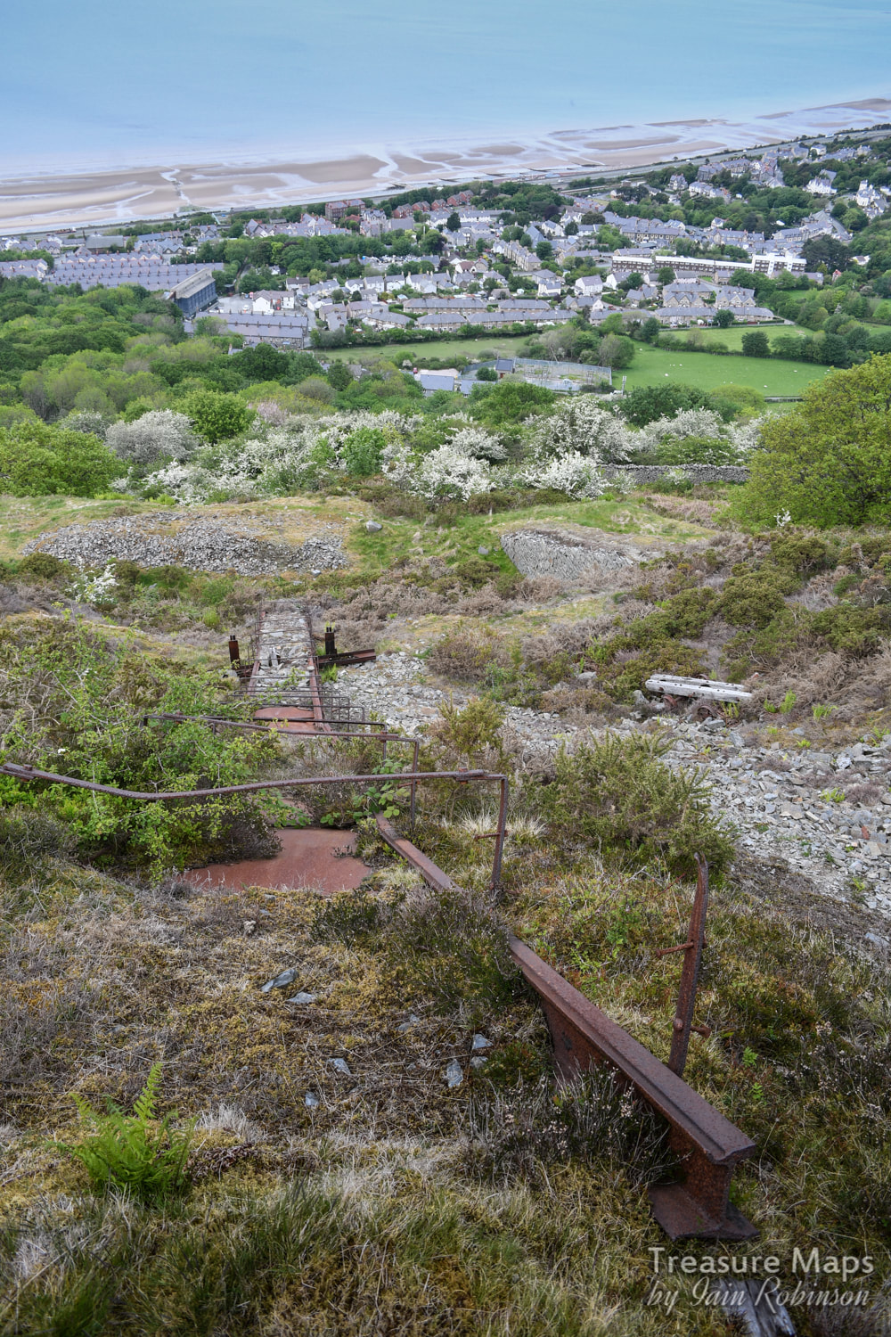 It seemed to be constructed from very heavy duty tram rail, but perhaps someone more knowledgeable could advise there. It was a rare gem at any rate. Its interesting that this drum house, and the twll behind it, does not appear on the early OS maps. It only makes an appearance after 1912. Thus the structure is of relatively modern construction. The roof is fascinating, seeming to be laid with massive rough-hewn timbers which are felted over, or perhaps cemented- it was difficult to tell. There's an arch between the crimp and the brakesman's cabin, which has been filled in. 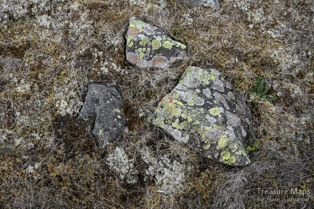 One of the environmental advantages of inaccessibility- the rich profusion of lichens, algae and fungus on the twll floor. After a while, we wondered how we were going to proceed. Neither of us fancied going back down the incline. After some thought, we set off along a narrow sheep/goat path on the tip, going west. It required a great deal of care. After some tricky moments, we made it over a fence to a landscaped area where the levels had been turned into something resembling a golf course on a 45 degree slant. Very strange. The main haul road was now above it, but we took advantage of a gap in the fence and crossed on to yet another landscaped level which led to Nant Dwyll, meaning "the dark hollow"... according to Dennis Robert's excellent booklet about the quarry. It felt a strange place, neither one world nor the other. 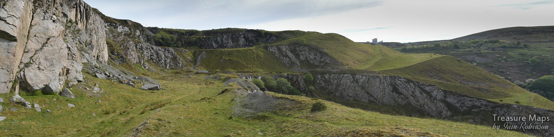 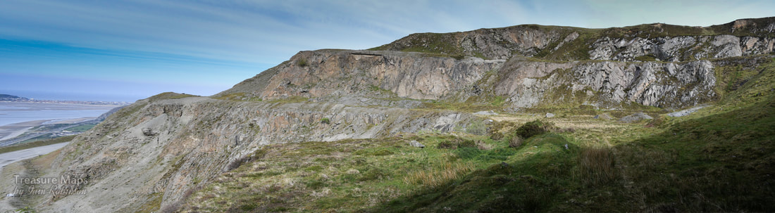 At last, we found a way to get out from the landscaped tedium of the middle twlls, up via the formation of a 1943 tramway branch which had once run from Penmarian to Fox Bank. There was another formation immediately above it which we thought might have been a leat, but according to John M Lloyd's map in Boyd's "Narrow Gauge Railways in North Caerns" this would have been a branch laid in 1888. 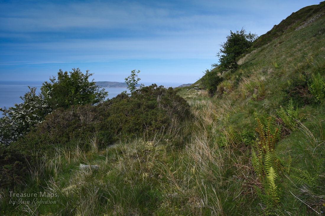 A formation that we mistook as a leat. There were several things of interest along the formation: a remarkable view across to Fox Bank and Penmaen East quarry, and a sight of the remains of Braich Lwyd Mill. 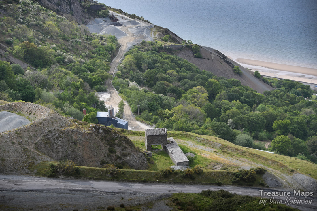 Looking down at Braich Lwyd mill, with the Bonc Jolly area behind. A very much degraded incline was spotted crossing the formation. This must be the one on the map that is marked 1924, but there was hardly any sign of it. The presence of a bright yellow stile indicated that we had now finished trespassing, and were on a right of way. This would be the path that we had spotted several years ago and wondered where it went. It eventually reached a drum house on what seemed like the highest level... 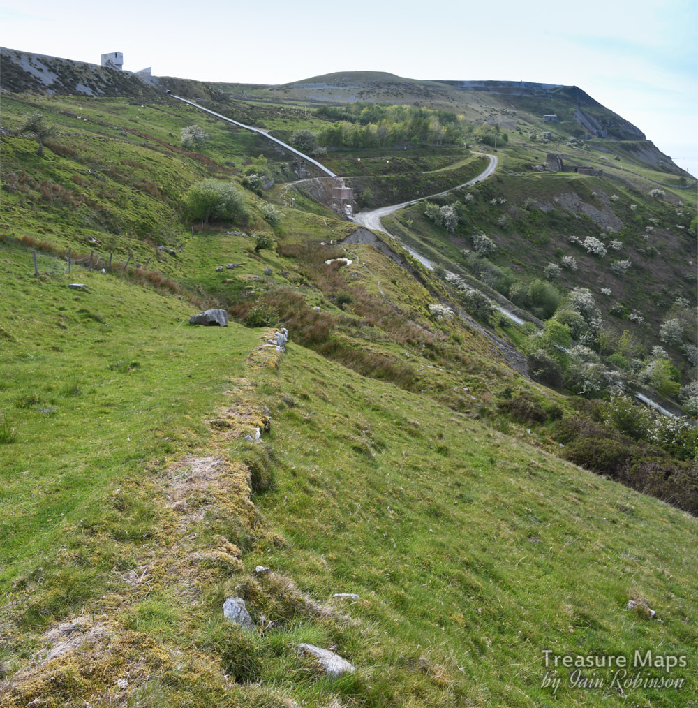 The vestigial incline running across to Kimberley Bank loading station. Above- three shots of the incline house at the top coming from Kimberley Bank. It had a long wall, presumably to shelter waggons from the wind at this location, above the 1000 foot contour. 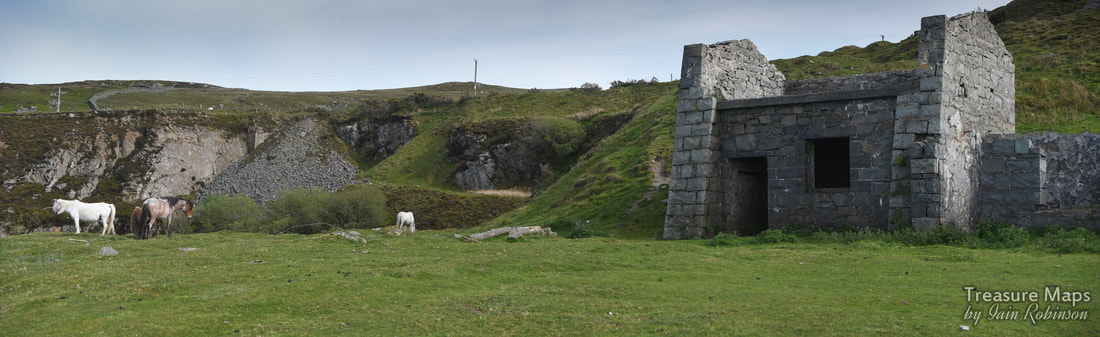 Now we were on the top level of Graiglwyd, looking across at some sett sheds. To the left of the sheds was what looked like another drum house, which was confusing. I couldn't see any sign of an incline, nor was there one on the map. But there were some wild horses here, who seemed unconcerned by our presence- it was so nice to see them. They had watched us as we walked along the level below; now I stood and listened to them crunching away at the grass contentedly.  The sett makers sheds on the top level. From the sheds here, it was a short walk up to the quarry haul road. Our way took us above and past the offices and out onto the older quarry road that descends down to Plas Heulog, above Nant-y-Pandy in Llanfairfechan. Although this was a weekday, we hadn't seen any activity at the quarry; all semed to be in a dormant state. Obviously, we wouldn't have considered exploring if there had been any chance of blasting. 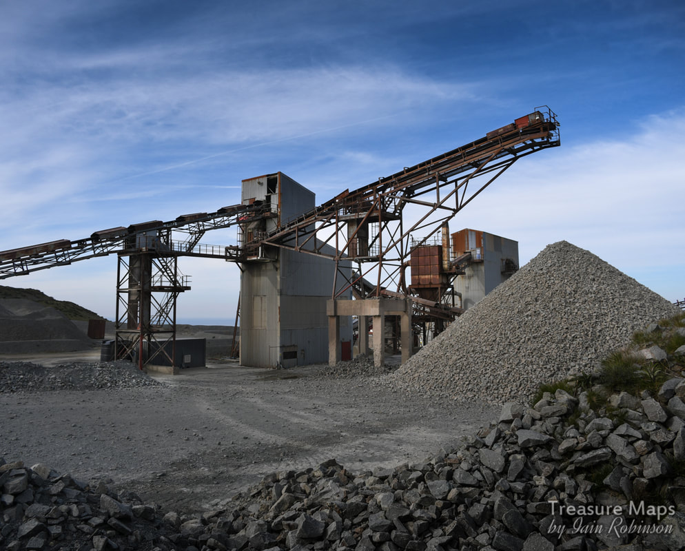 Not Graiglwyd, of course, this is the processing area in the main Penmaen East quarry. Appendix While researching the subject of the prehistoric remains on Penmaen Mountain, I came across a few choice nuggets. One was this illustration from from Sir John Wynn of Gwydir's "An Ancient Survey of Penmaenmawr ". It's an early view of Braich y Dinas hillfort, formerly on the summit of Penmaenmawr, which appeared in "The Sphere" for November 19th 1910, during the controversy surrounding the hillfort’s imminent destruction due to the expansion of quarrying at Penmaenmawr . 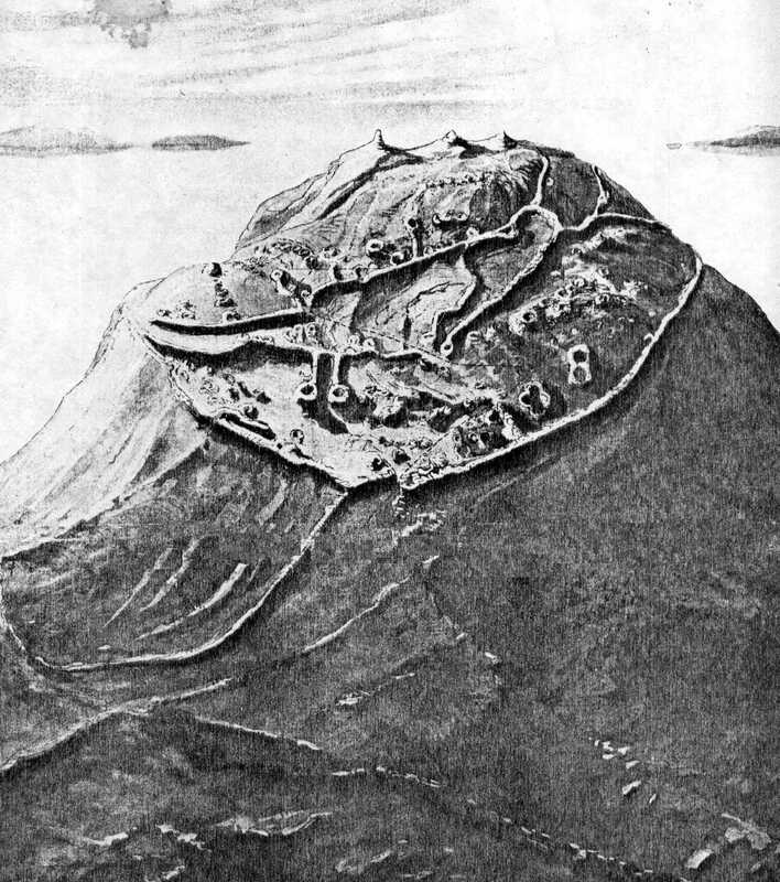 Here is a link to the text of "An Ancient Survey of Penmaenmawr " which makes for fascinating reading; pages 11 and 12 refer to the fort. Coflein have a very interesting collection of photographs and documents about Braich y Dinas and its destruction. Wikipedia Page for Braich-y-Dinas. Dennis Robert's excellent booklet about the quarry. "Penmaenmawr, Rails of Granite" by Mike Hitches, Irwell Press, "Narrow Gauge Railways in North Caernarfonshire, Volume 3" by James I. C. Boyd, the Oakwood Press. 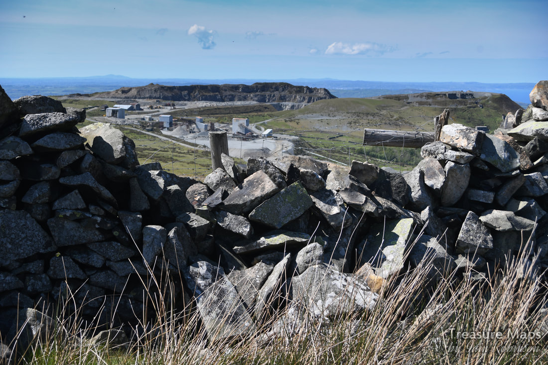 Other "Treasure Maps" posts about Penmaenmawr quarries-
2 Comments
Nial Cain
20/5/2019 07:16:53 pm
Hi Iain
Iain
21/5/2019 08:51:37 am
Hi Nial, Your comment will be posted after it is approved.
Leave a Reply. |
TracksReceive the occasional Treasure Maps Newsletter- and alerts when a new post is available!
If you enjoy my content, please buy me a coffee!
Check out my other online activity...
Index
All
|


 RSS Feed