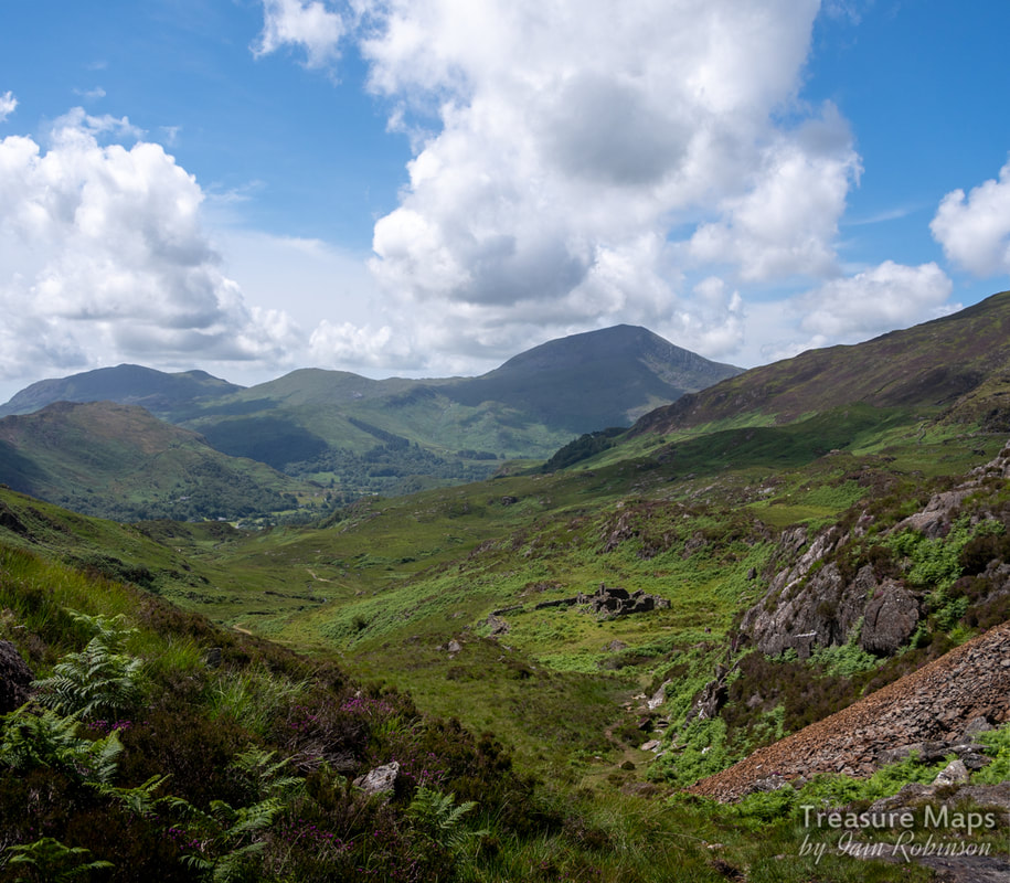
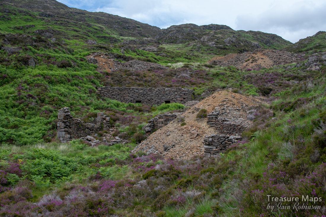
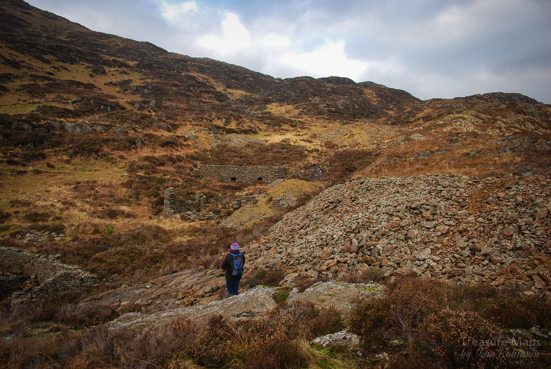
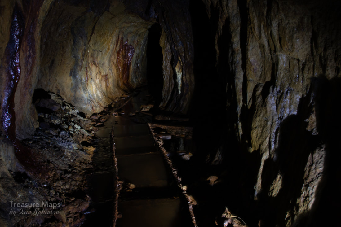
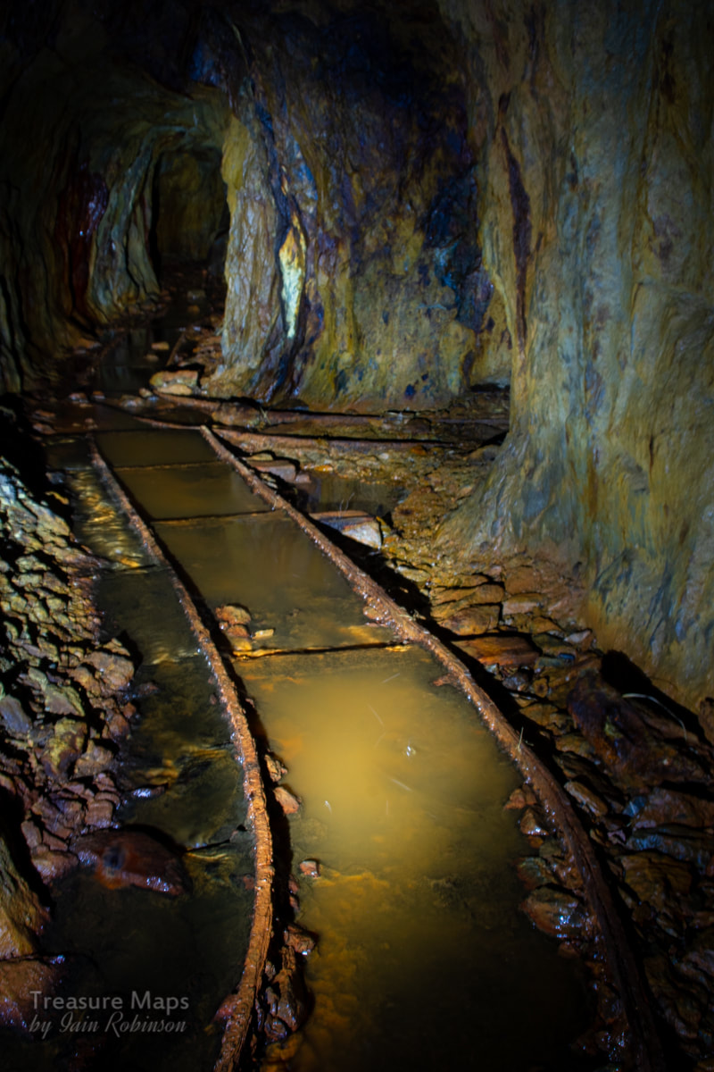
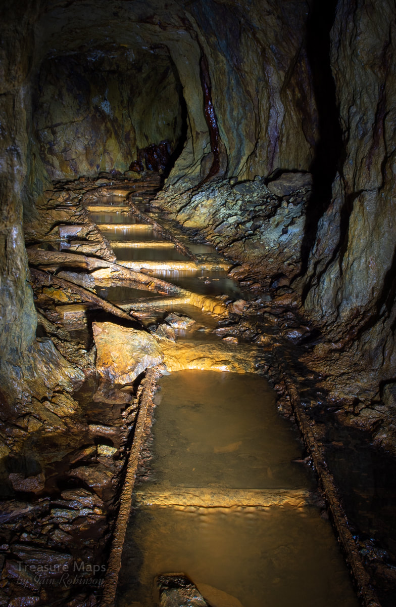
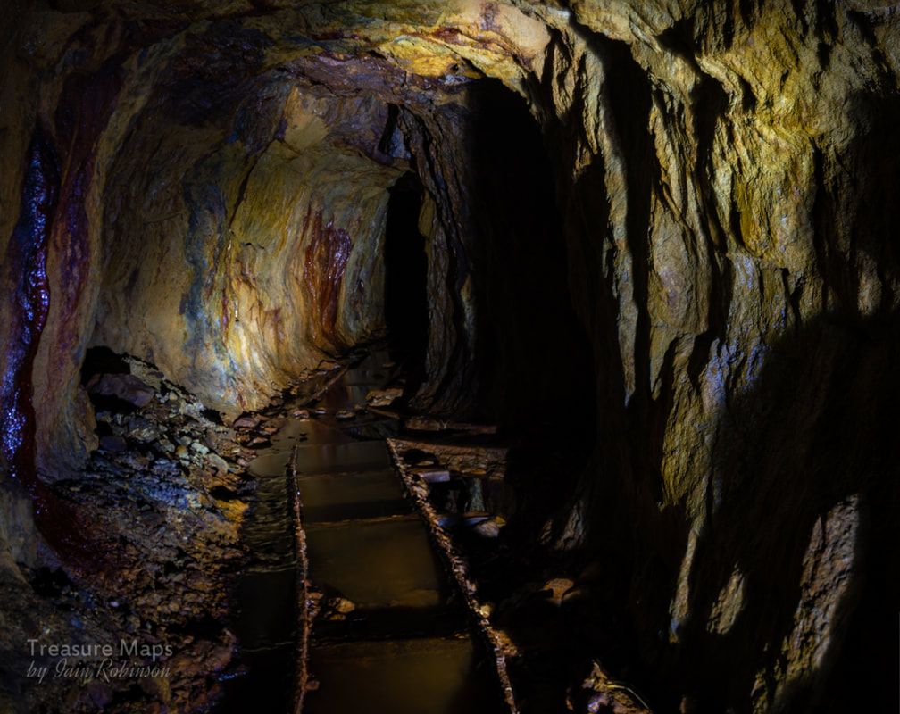
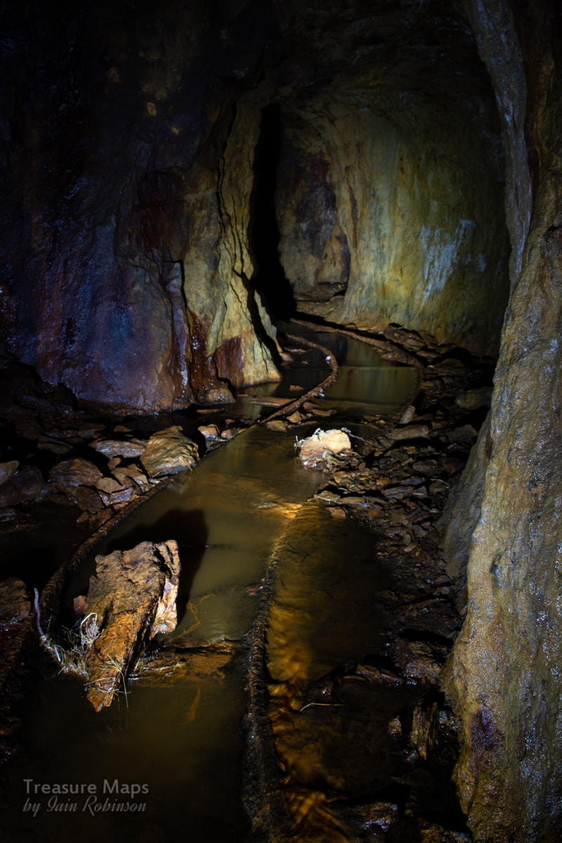
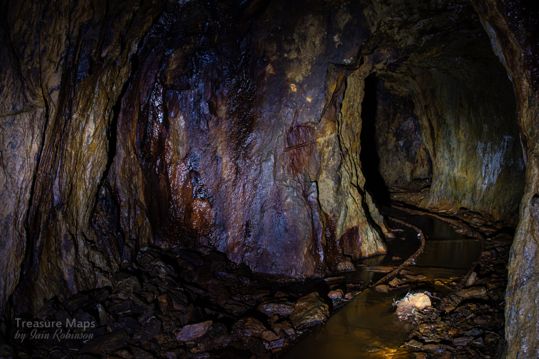
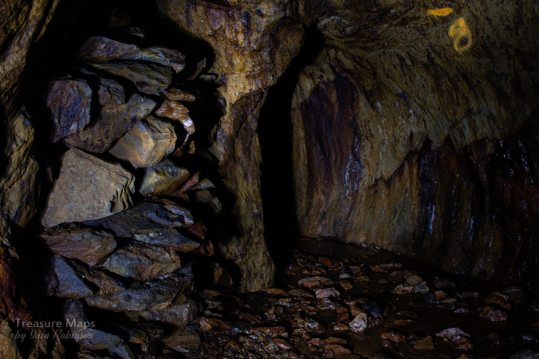
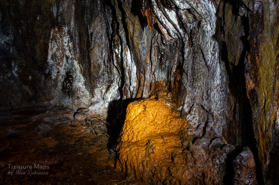
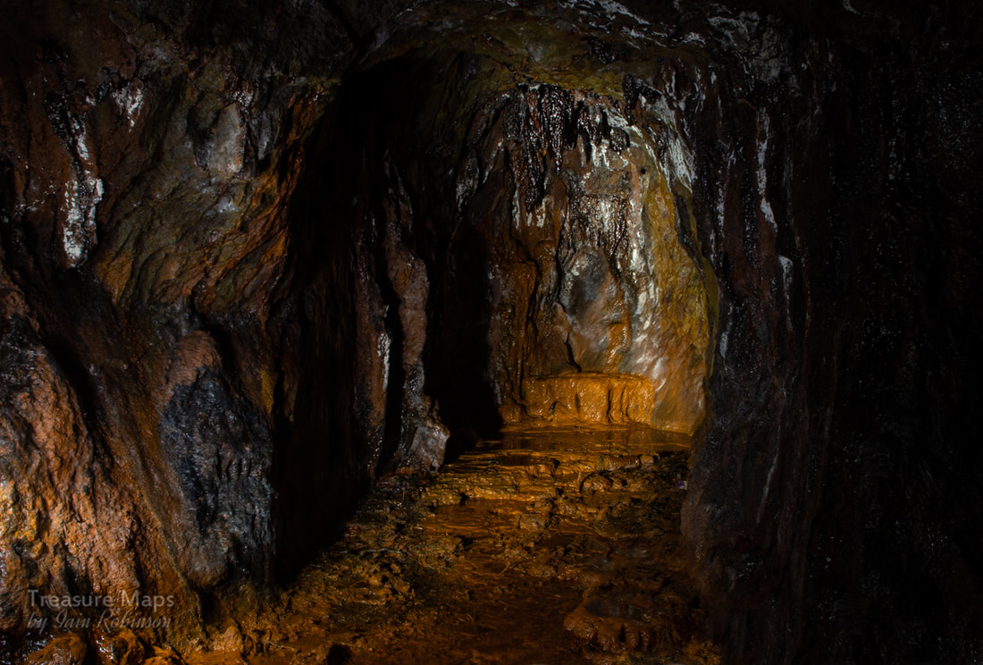
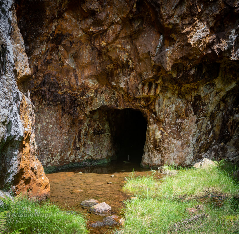
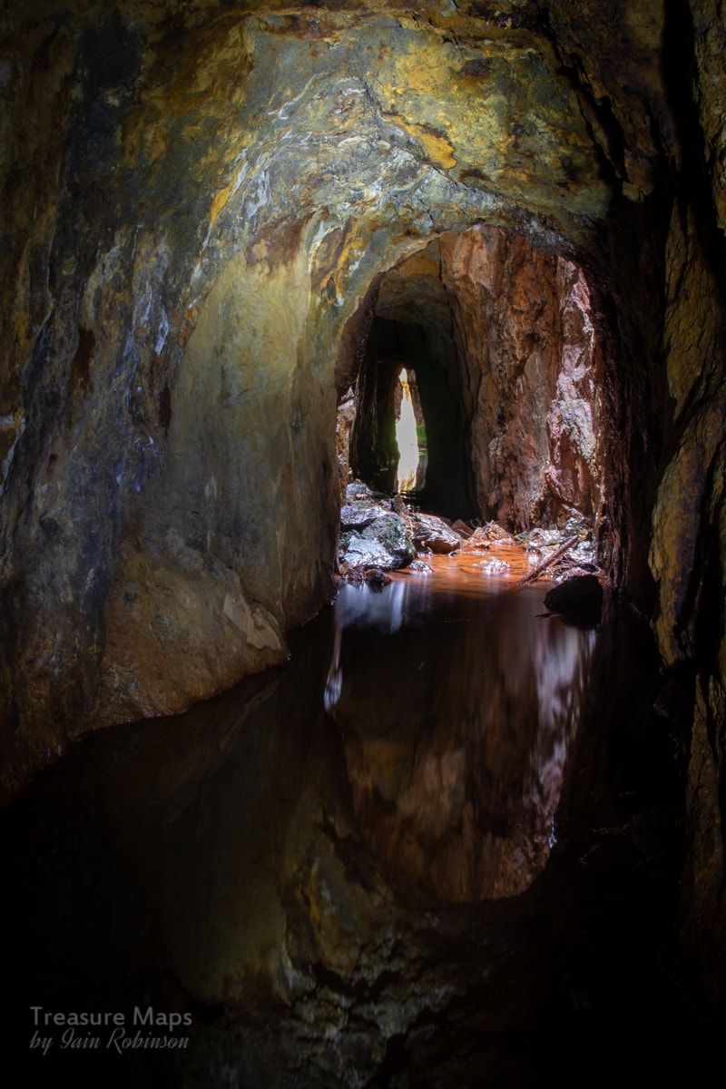
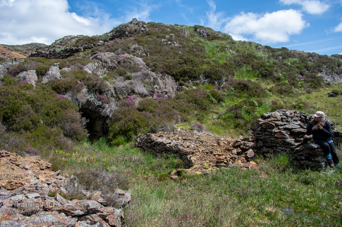
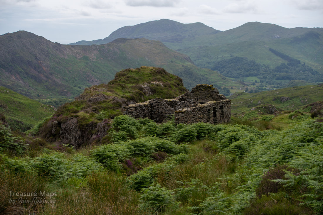
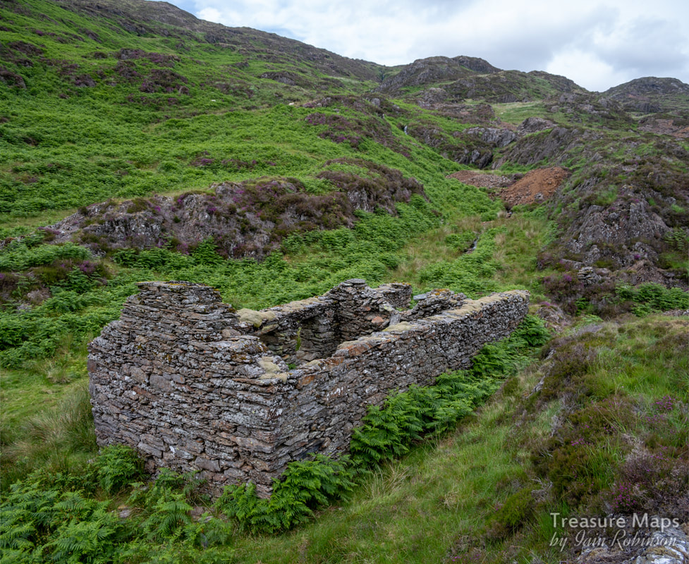
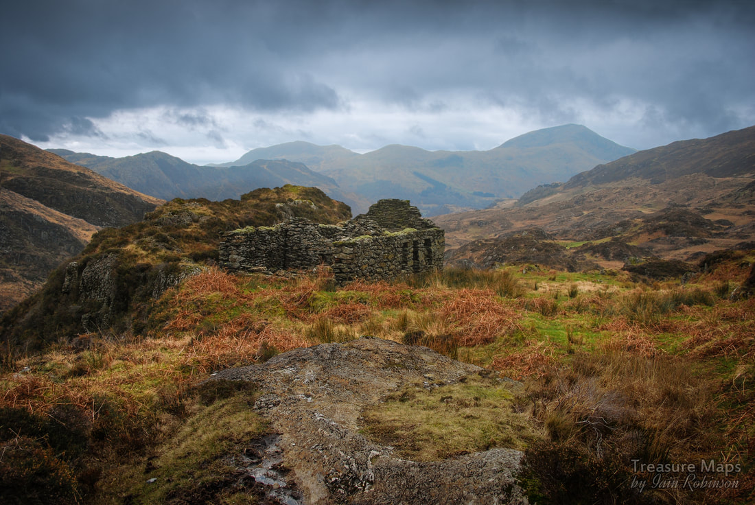
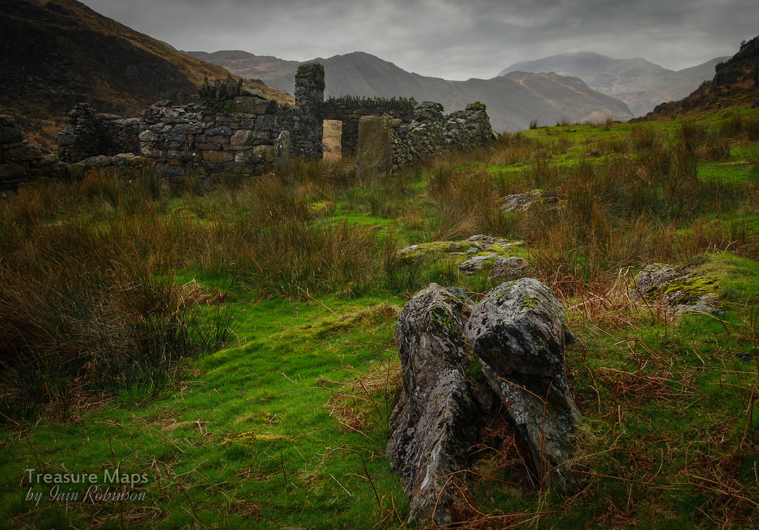
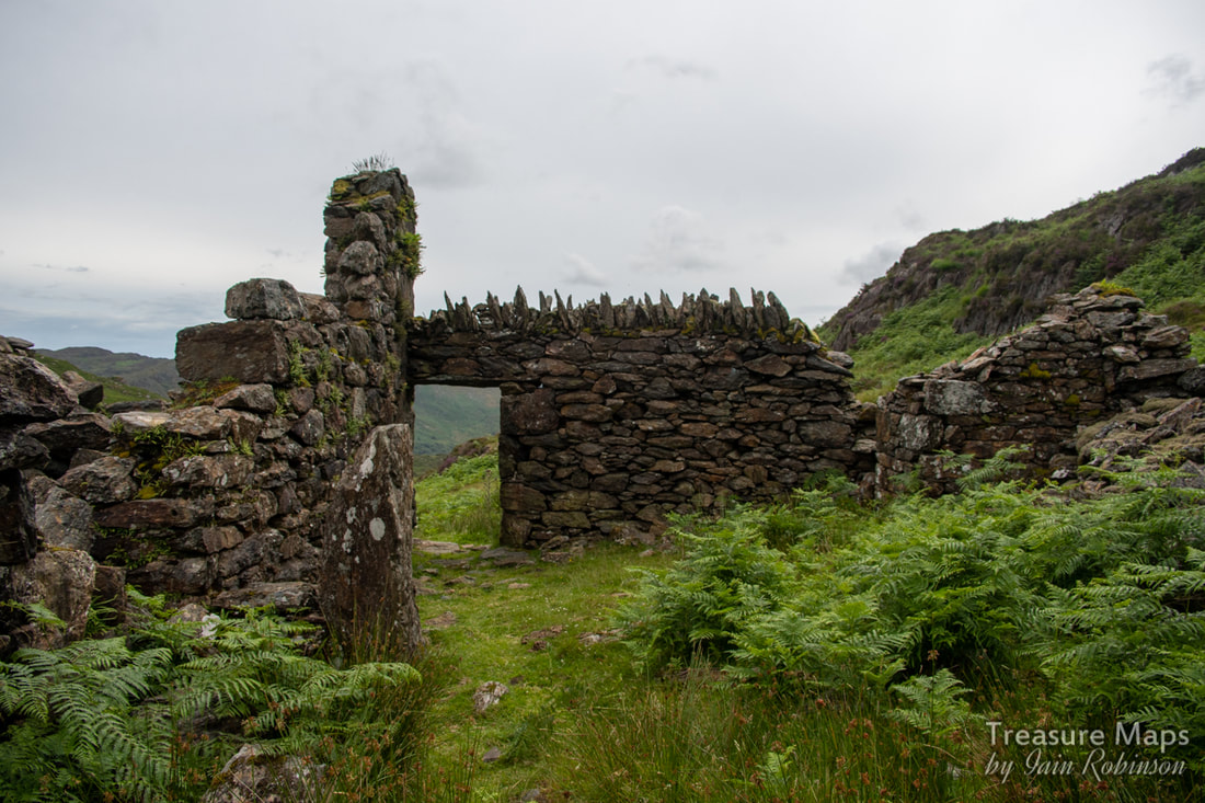
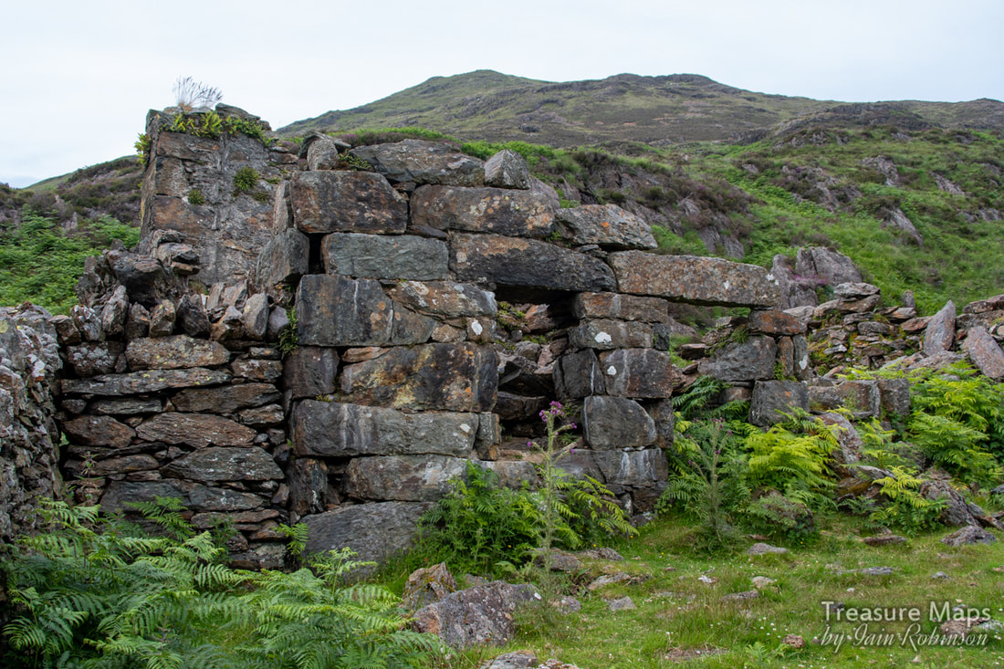
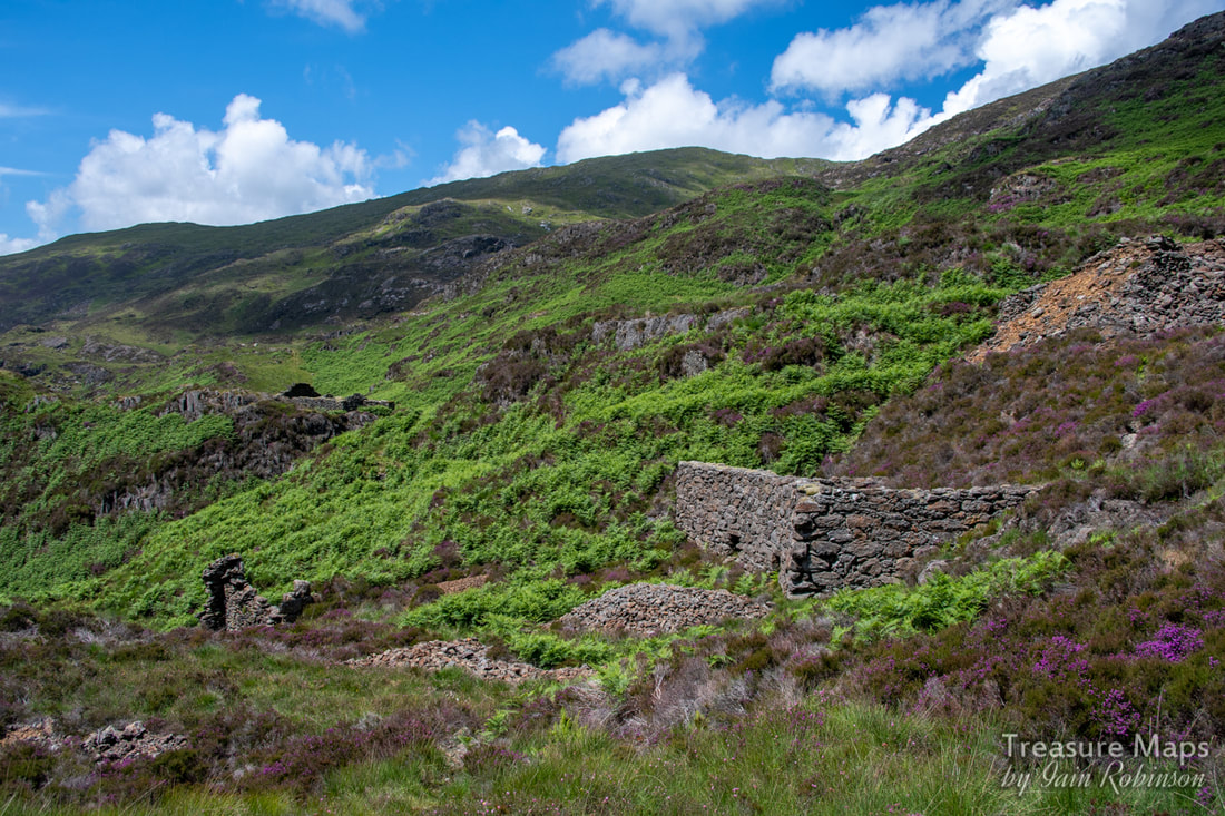
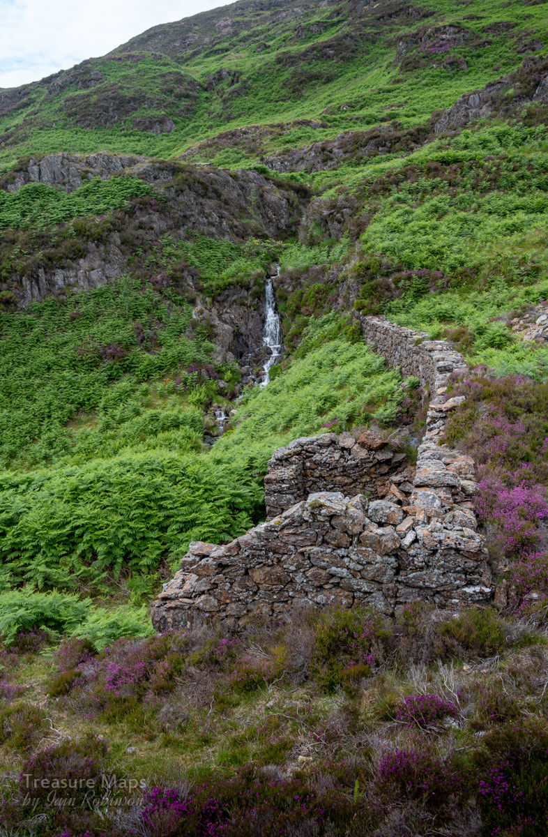
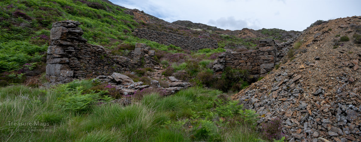
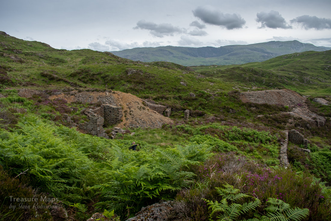
 Our first view of the mine- the managers house in the middle ground, with Moel Hebog in the distance. To the right are the tips from No3 adit. We've had a few visits to this fascinating mine, set within splendid scenery and isolation at the head of the evocatively named "Cwm yr Bleiddiaid" (Cwm of the Wolves). The last few occasions, we'd come up from Craflwyn, which, to be honest, is a bit of an epic pull. This time, I wondered about going up the Watkin Path and taking the small path that peels off to the south west, at the foot of the mighty South Snowdon Incline. It was July and the Snowdon path was mighty busy, the air full of excited chatter and the smell of fabric conditioner. Yet, when we diverged on our way to Hafod y Porth, we only saw two other folk the whole day. It was a steep but well-made path, more like an old cart road- I wondered if this was actually the way that ore was carried from the mine to the Hafod-y-Llan mill, which is just out of sight, up the cwm in the photo below. 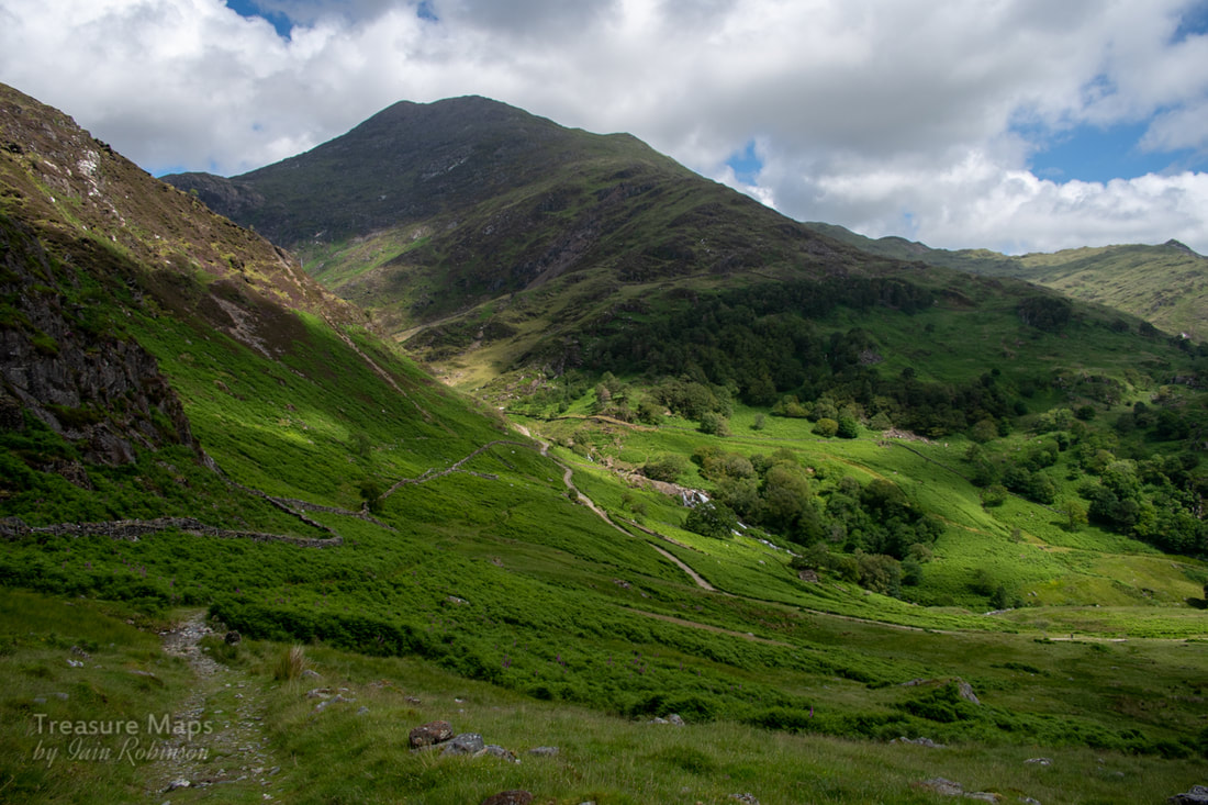 The mighty bulk of Lliwedd towers over the lower stretch of Cwm-y-Llan. The South Snowdon Incline can be seen running down from Clogwyn Brith on the left. 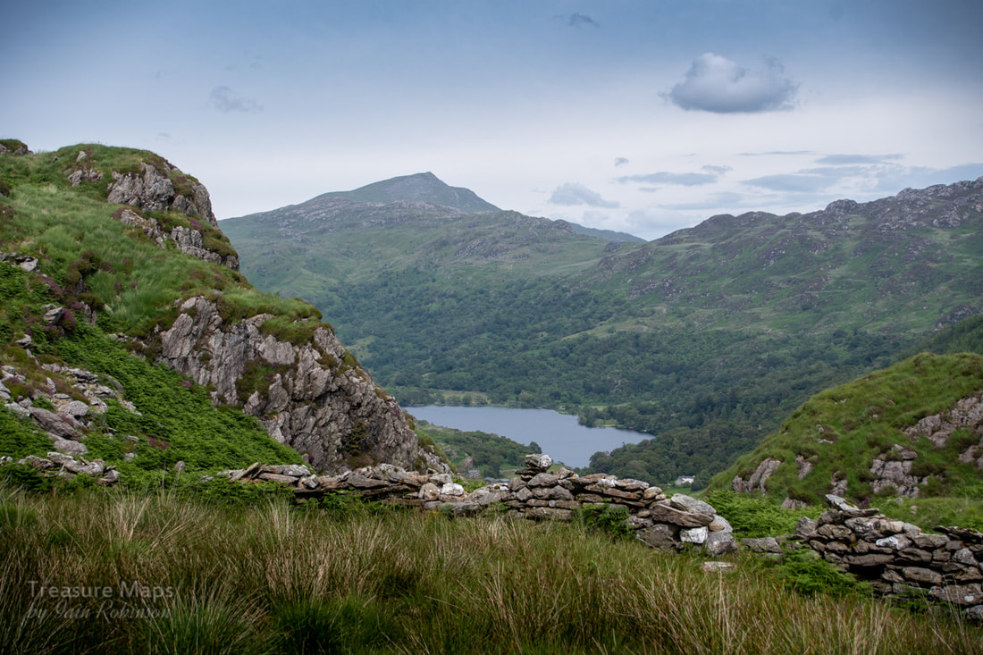 The path passes Bwlchiau Terfyn, a sort of small scale roche moutonee. It affords some fine views towards Carnedd-y-Cribiau and Moel Siabod (above). The path continued over some boggy ground, but the way is made considerably easier by being punctuated by specially laid, large flat boulders like stepping stones. The great advantage of this new route is that it deposits you halfway up the hillside, well above the manager's house- sparing you of the energy sapping climb up. The last time we'd visited, it was early spring. The weather was dull and the vegetation in it's winter colours. As you can see from the two photos below, it was quite a shock to see the change from an ochre coloured landscape to a verdant green one this time! So...what was the story with this mine? It seems to have covered a few acres and there are many structures, some difficult to interpret, including one at the top of the sett that seems like something from a fairy tale. Records are sparse, and I am indebted for some information to J.L.Agnew, who studied the mine as part of his Msc course in 1988. According to his research, the first record about the mine appears in 1755, but it is likely to have been in operation well before this, as with the copper mines of the Migneint. We do know that that there was a 24 foot waterwheel and a 8 head stamp battery, plus many other unexplained structures, but according to official returns, the mine was never profitable. Smaller mines were not required to make official returns before 1867, so perhaps there was some obfuscation with the figures. However, in 1869 the mine only produced 18 tons of dressed ore, with 6.4 % of copper. The record books close on the mine in 1890, when it was abandoned after changing hands for the last time. Looking in some of the adits (there are seven) it becomes apparent that the search for ore was a fairly unsophisticated one with, as Agnew puts it, "no real geological insight". The adits are fairly stable, wet, unpleasant and yet....rather charming. No.3 is the most interesting and illustrates well how the miners literally chased a vein through fault zones, looking for clues in the rock. This is the largest excavation, and switches backward and forwards underground. It is punctuated by shafts from above, some of which may be for ventilation. In places, rails, to a gauge of 19" are still in situ with sleepers. The rail is a mixture of bridge rail and light gauge flat-bottom, spiked to wooden sleepers. There's an interesting crosscut in the mine that has been blocked by stacked deads, and a beautiful grotto with stalagmite formations. Further in to the mine, the floor is covered with deep orange mud which isn't pleasant to negotiate. One of the shafts has some big wooden posts in it, which Agnew speculates, could be the remains of a headframe to winch material out. This area is a waterfall and difficult to negotiate. The adits are numbered from the bottom of the mine upwards, please see the plan below. Adit 1 is short- about 60 metres, flooded and contains some copper staining. Adit 2 is flooded and was not explored. Adit 3 Is fairly long, possibly 100 metres, with several short side passages. There is a shaft from above which allows large quantities of water into the workings. This adit winds left then right before ending in a blind drive. Adit 4 is flooded at the entrance but soon becomes dry and is about 25 metres long. Adit 5 is approx 15 metres long and contains some pyrite on the walls.. Adit 6 is 35 metres long but flooded to 1 metre. Some pyrite decorations on the walls. Adit 7 this is approxiimately 15 metres long. The rocks of the tip and within the adit are dark blue and there is pyrite on the walls inside. When in No. 3 adit, the noise of the water made taking photographs difficult, as I couldn't hear when the shutter was operating- it's difficult enough taking photos in a mine as, once underground, you tend to forget everything you know about the camera anyway, so that was an added stumbling block! The rock is a fascinating mix, as you would expect from an area of volcanic activity. According to geological opinion, there was a hydrothermic system which erupted from the side of a caldera, so that the rock here is varied from Breccia, Tuffs, Rhyolite, Dolerite and surrounding measures of sandstone. 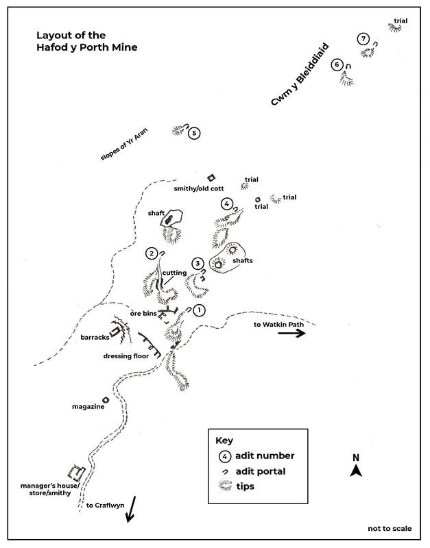 The structures at the mine are very interesting. The barracks is set on a sheltered area behind a rocky knoll to the west of the mine. Lichen grows all over the building, especially on the tops of the walls, giving it a delicate appearance. 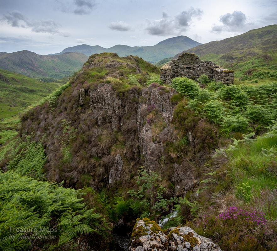 The ravine below the barracks has a waterfall...a very scenic spot, but I hope none of the miners sleepwalked! 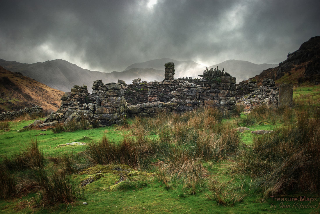 The manager's house on a wild day in March. The place is actually a complex of Smithy, Office, Store and House. Further aspects of the structure are shown below. Above the Manager's accommodation is a typical round powder store... 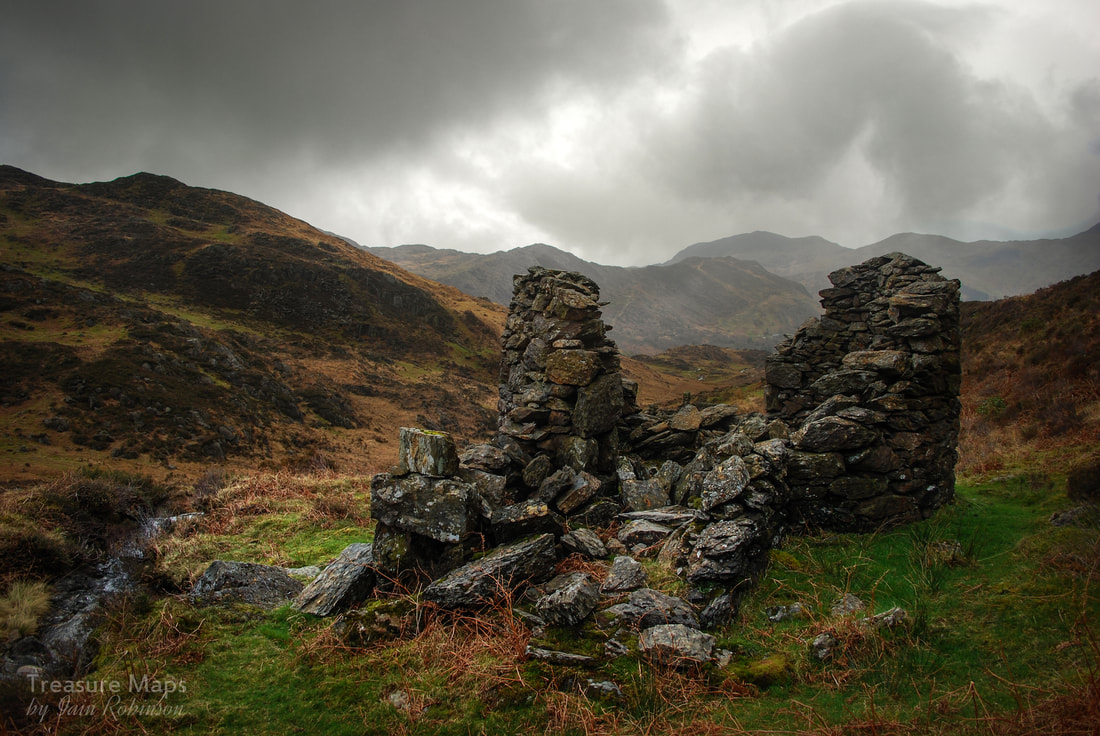 The processing area of the mine is very difficult to interpret- there are tips, obvious ore bins, and the remains of tramways. There's a cutting from one of the western workings to a tip. There is little evidence of the 24' waterwheel or a reservoir to supply it. Near the top of the workings is a curious structure, looking like something from a fairy story. Some sources think it had been a smithy, others that it was a shepherd's cottage...I wonder if it was repurposed as extra barracks for the miners? 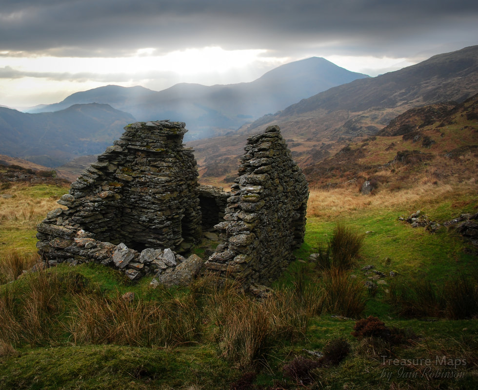 In conclusion, yet another fascinating site, almost quixotic in nature- yet people worked hard here, there was evidence of considerable resolve and determination. Perhaps it supplied some people with wages for a few years; back in the mid 1800s that was perhaps all a miner could ask for. I wish we had some records of the workers, who they were, where they came from. Ironically, a geophysical survey of the site came up with a zone of intense magnetic activity (indicating mineral deposits), around the margins of the complex. There was a plan in the early 1970s to explore this by drilling, but luckily nothing came of it. 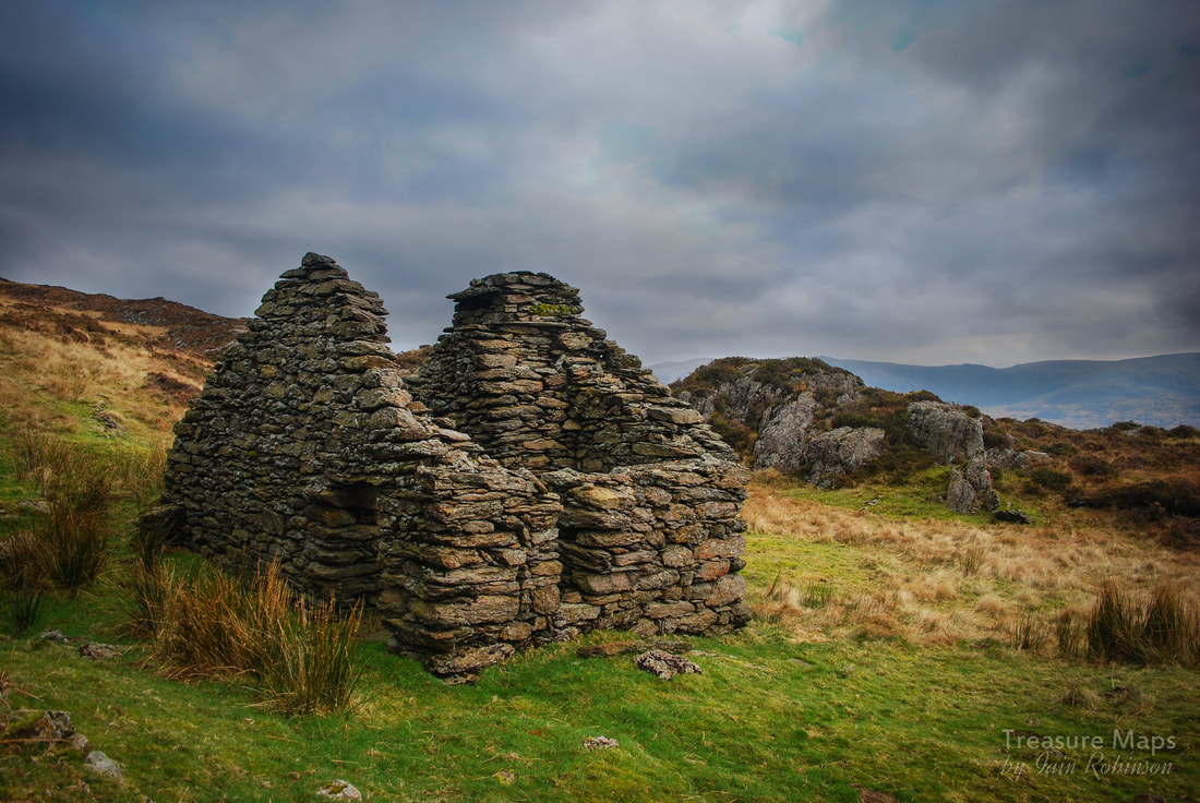 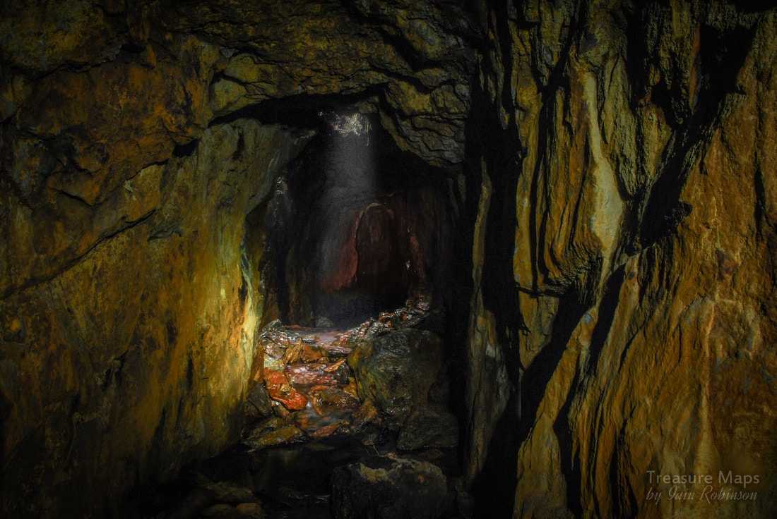 Inside the No.3 adit at one of the shafts, with water pouring down over fallen deads. The tunnel can be seen continuing further. Comments are closed.
|
TracksReceive the occasional Treasure Maps Newsletter- and alerts when a new post is available!
If you enjoy my content, please buy me a coffee!
Check out my other online activity...
Index
All
|
 RSS Feed