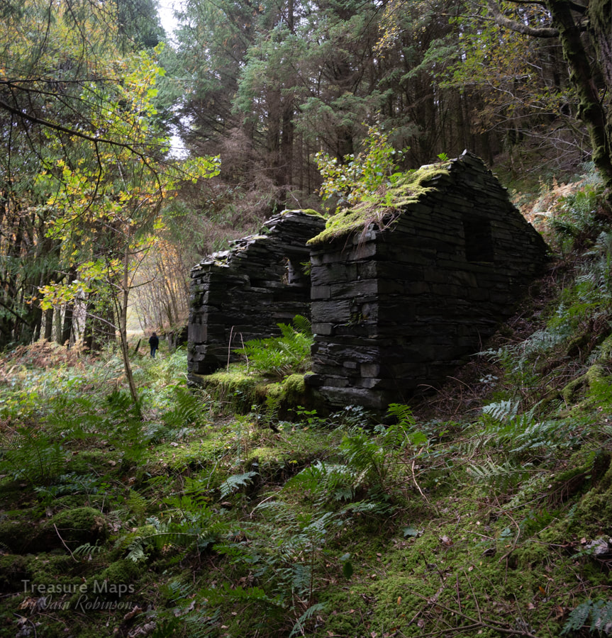
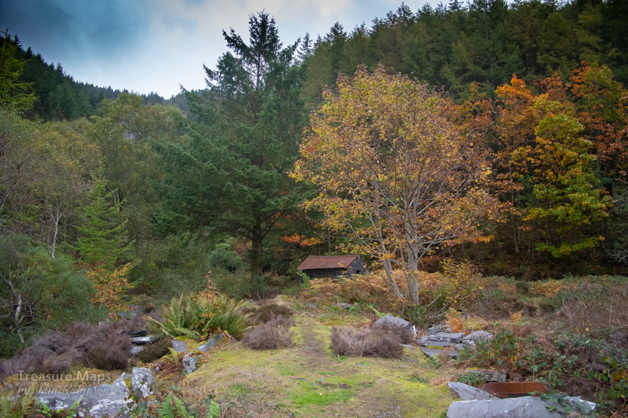
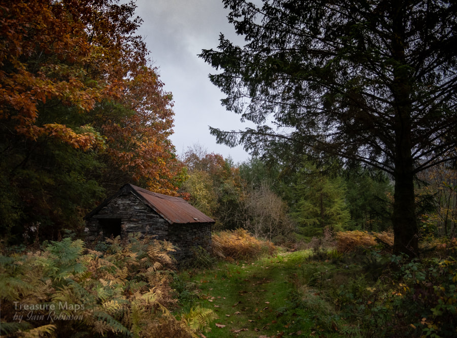
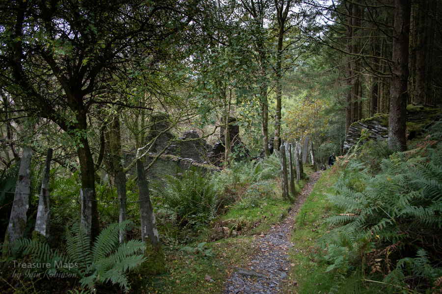
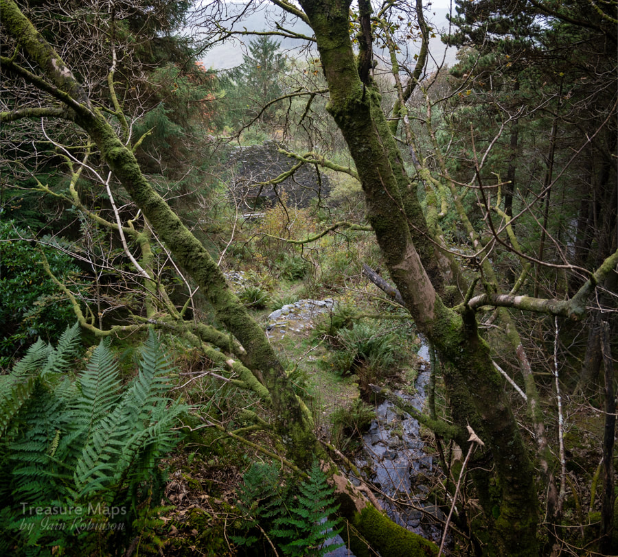
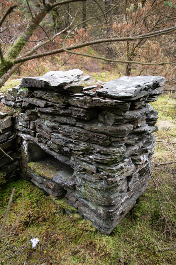
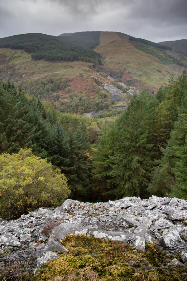
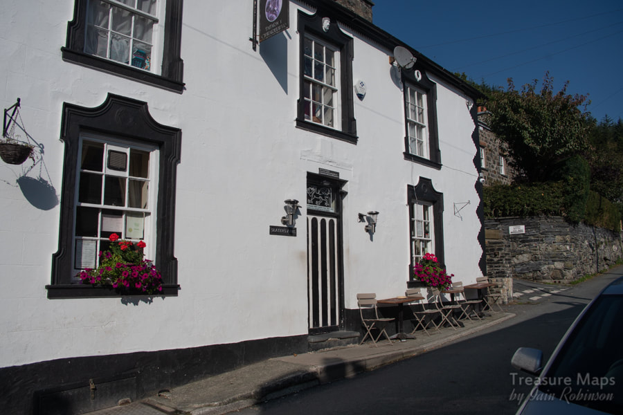
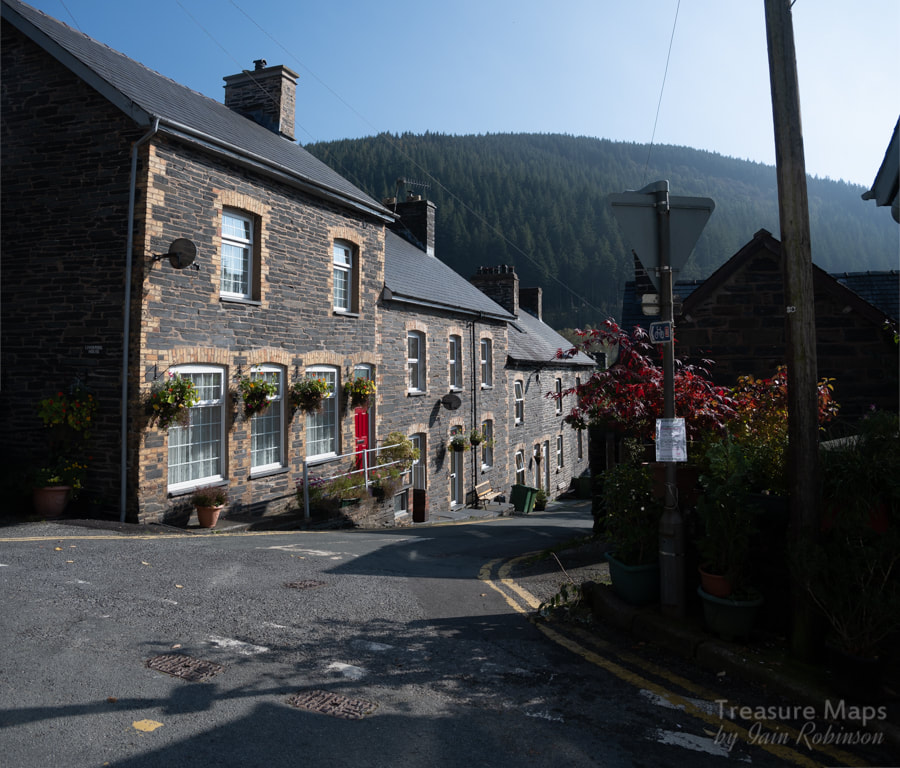
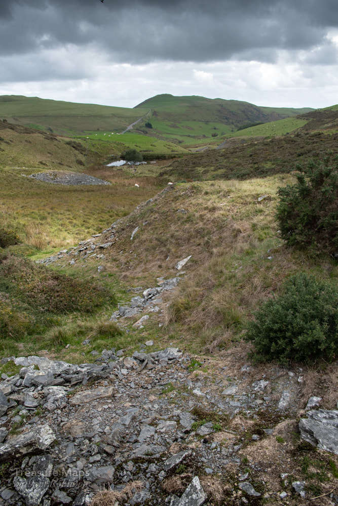
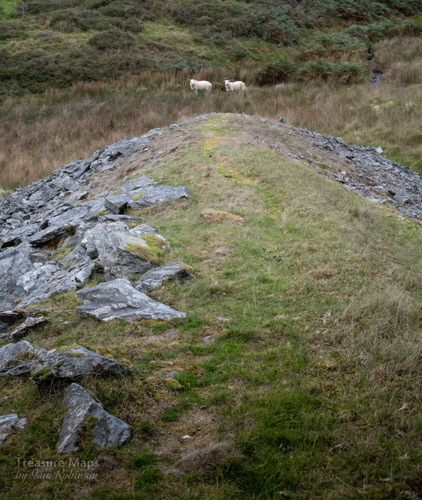
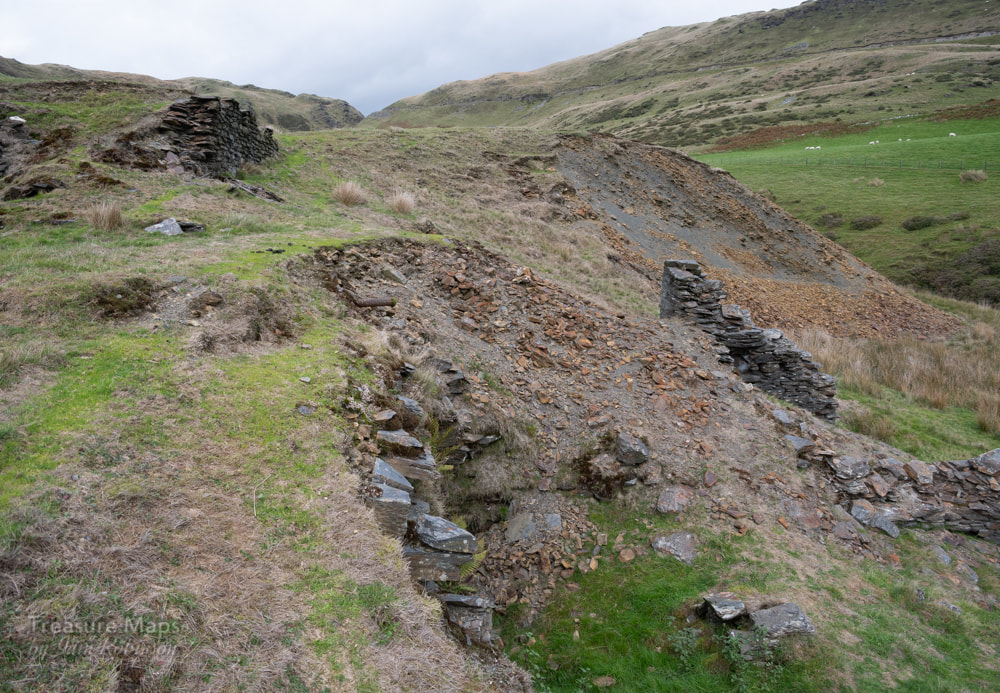
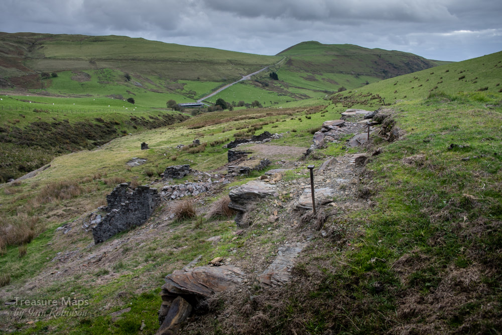
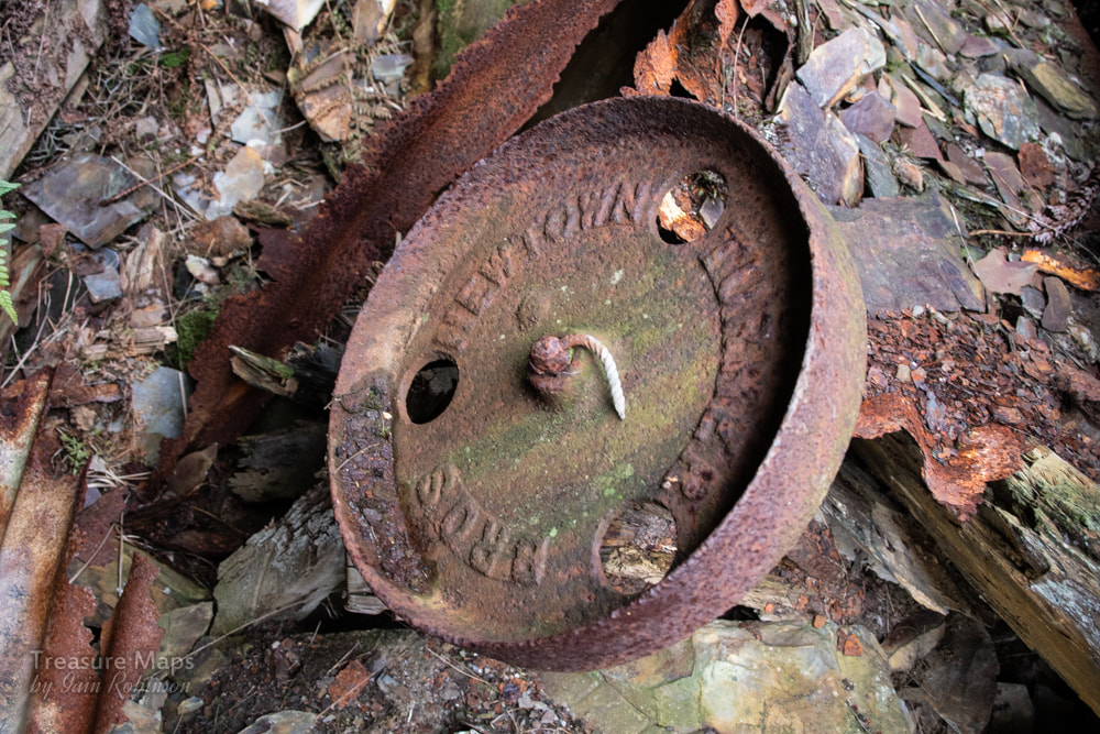
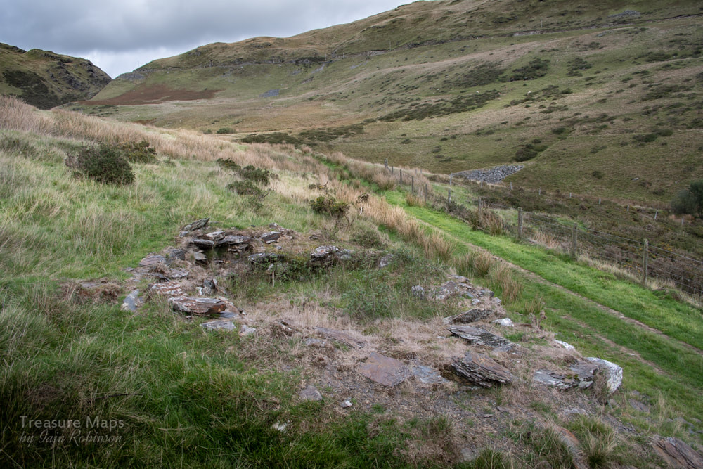
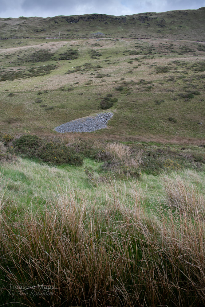
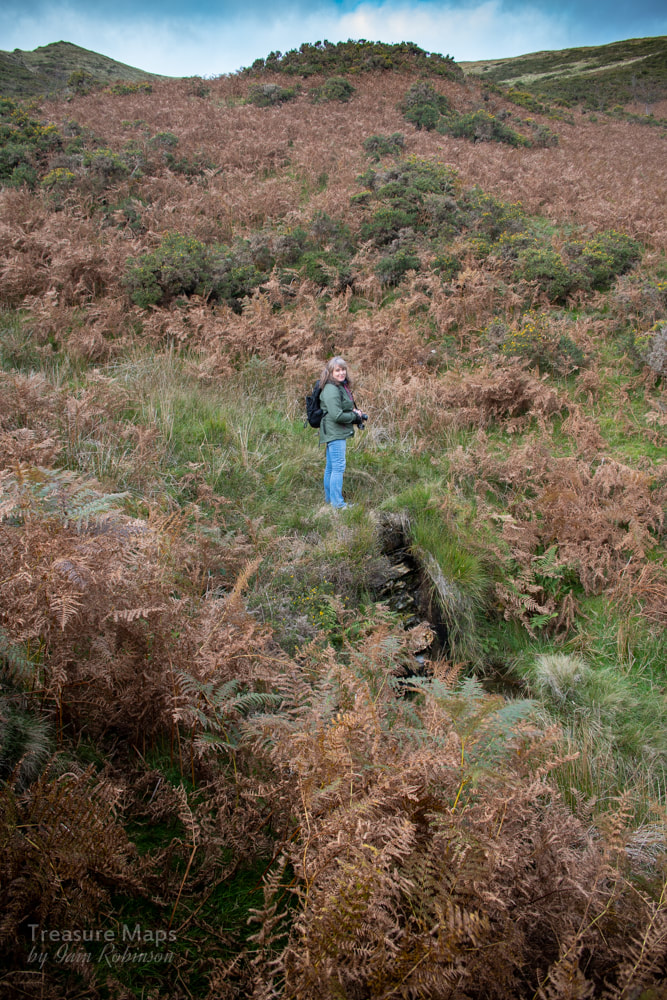
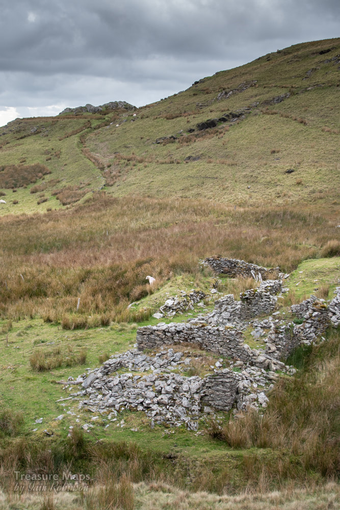
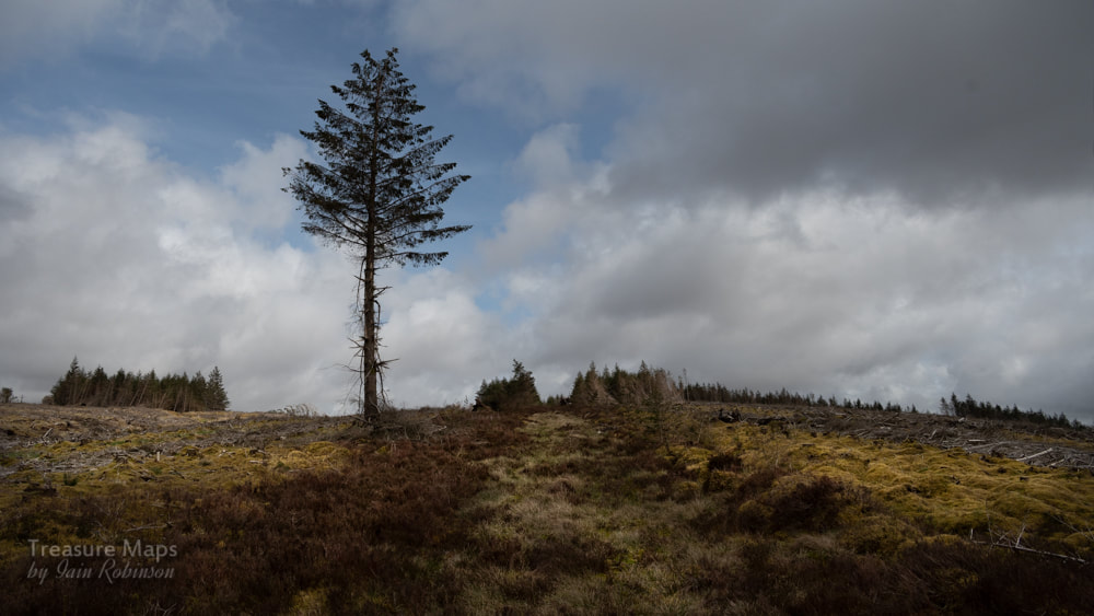
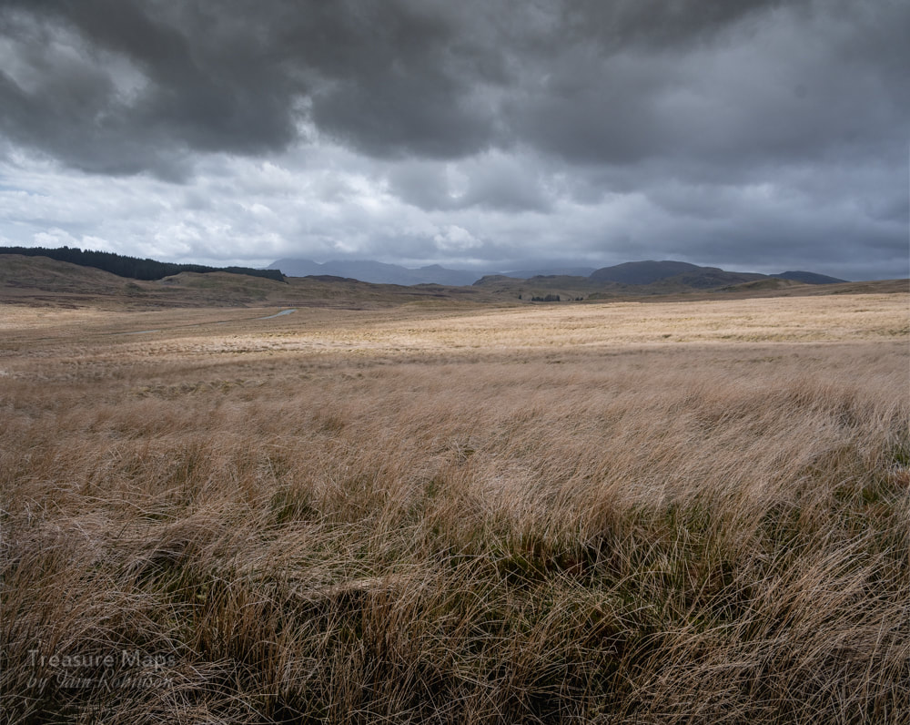
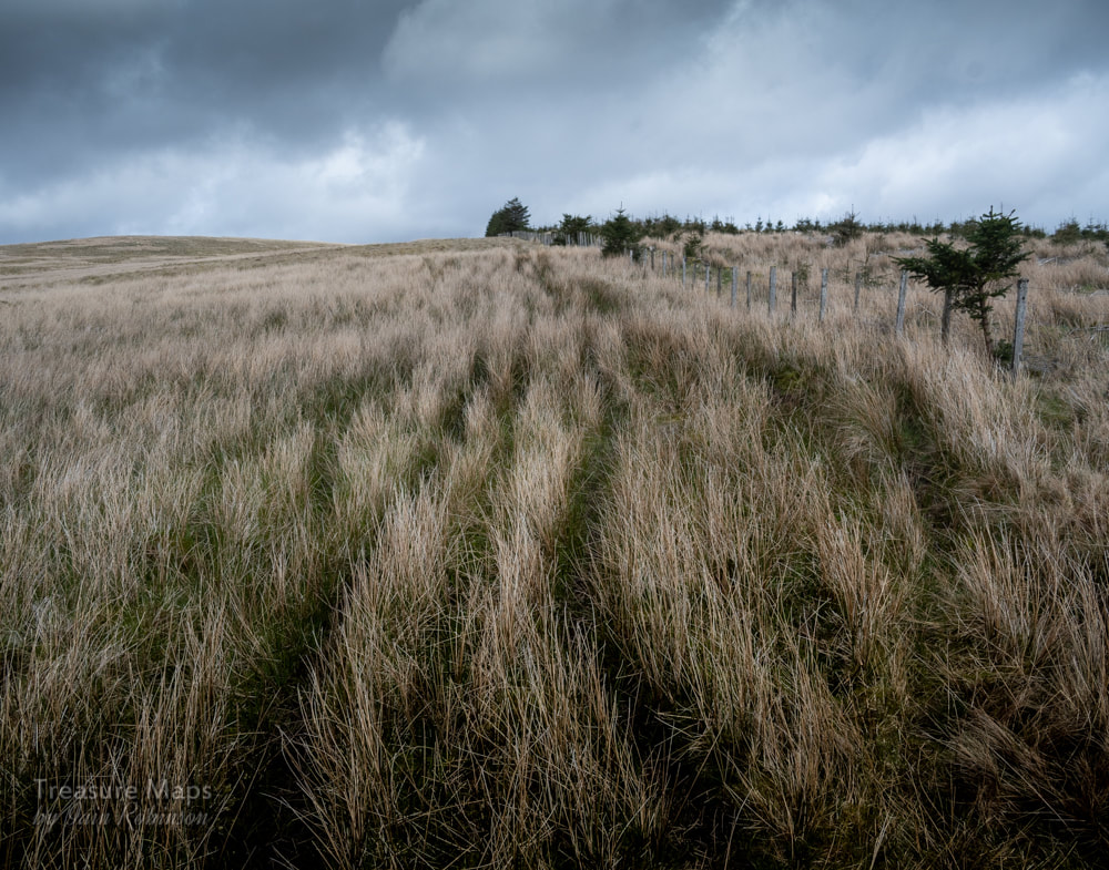
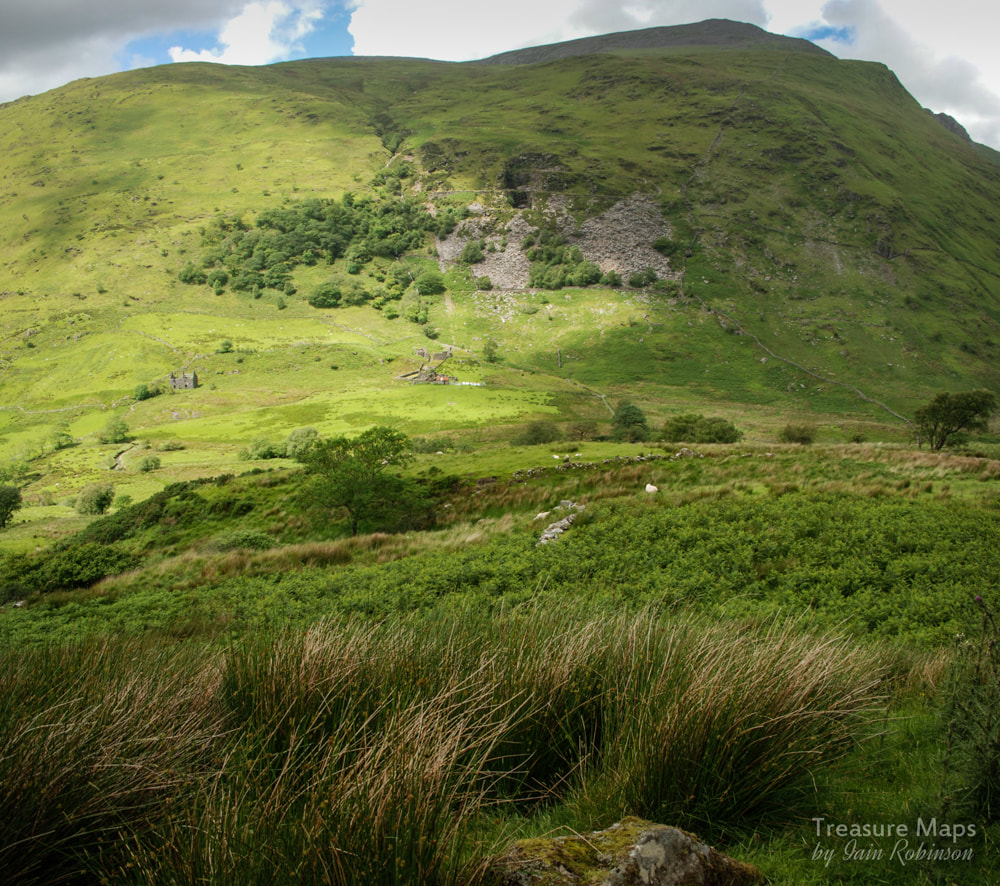
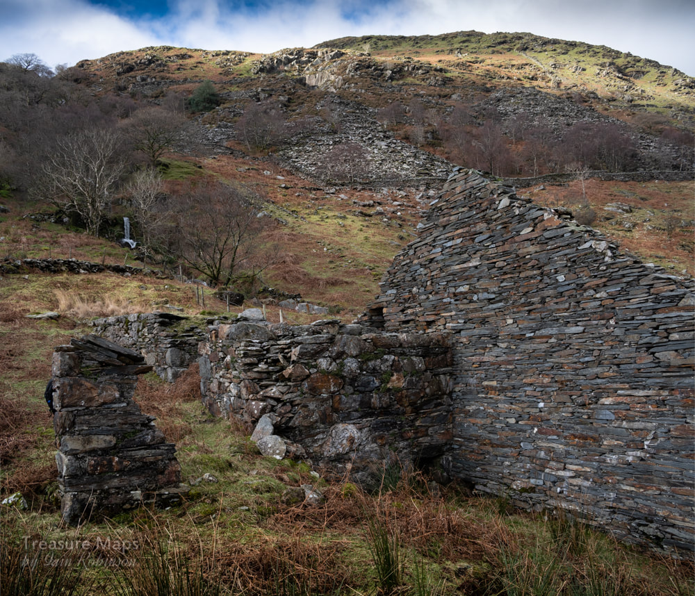
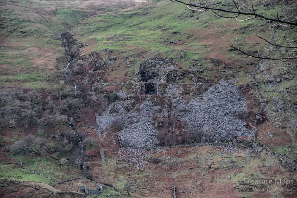
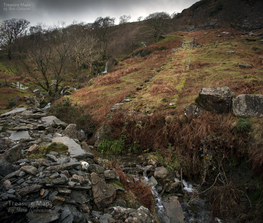
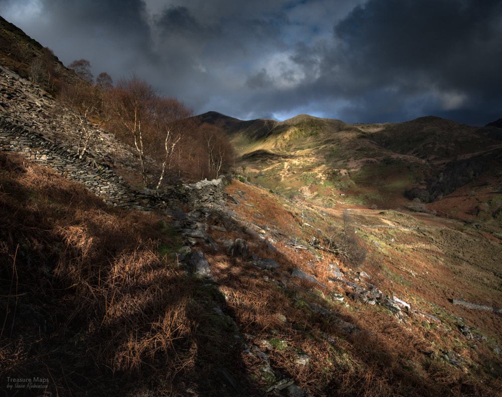
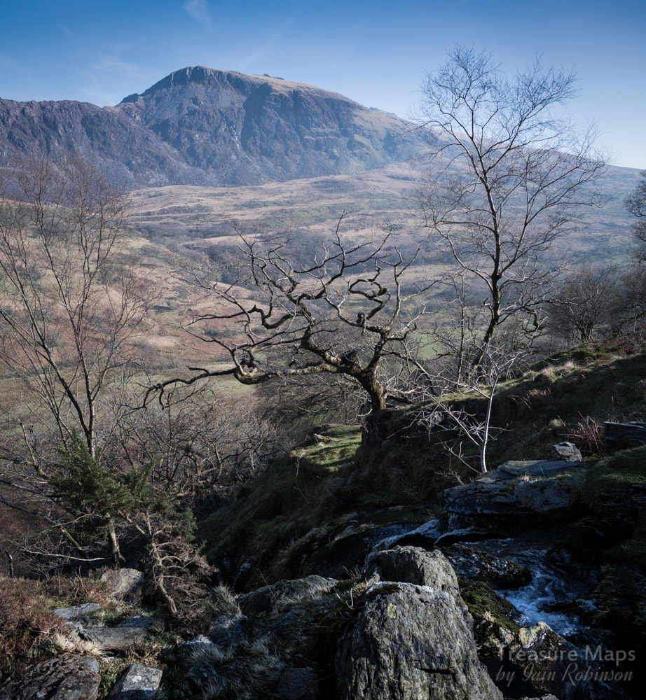
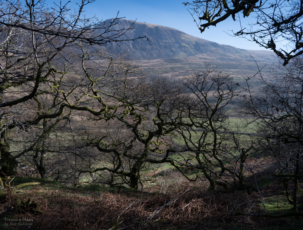
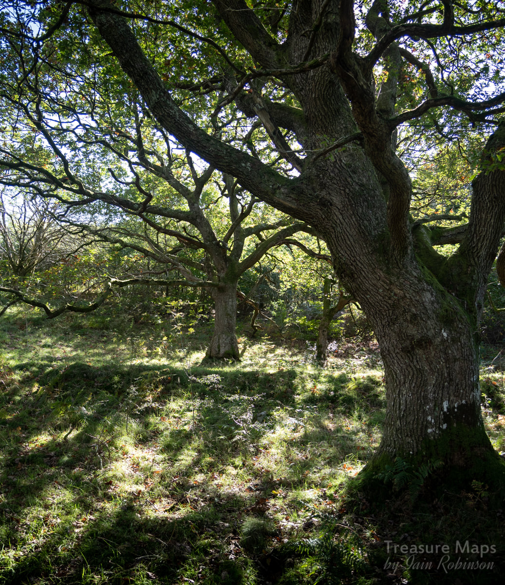
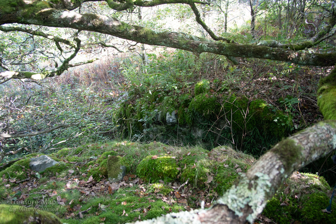
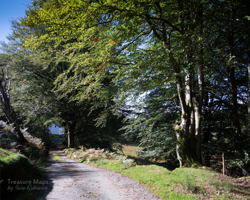
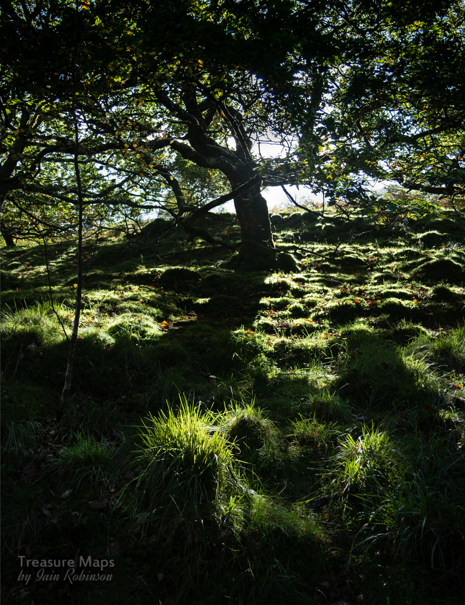
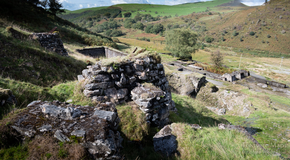
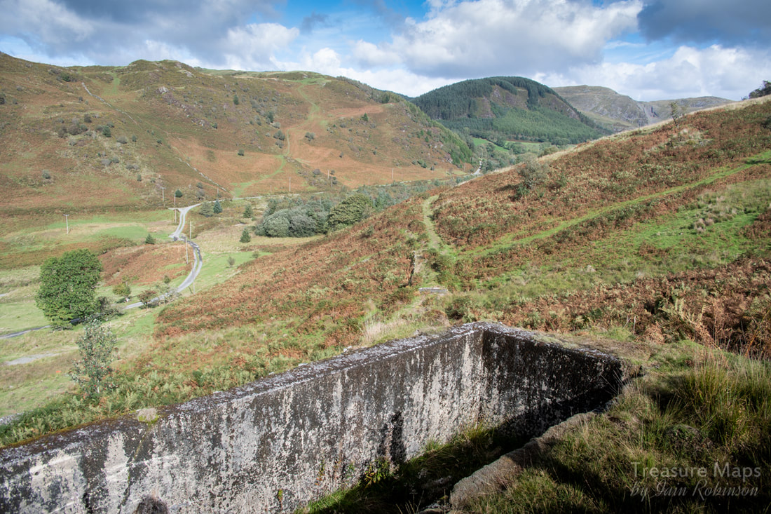
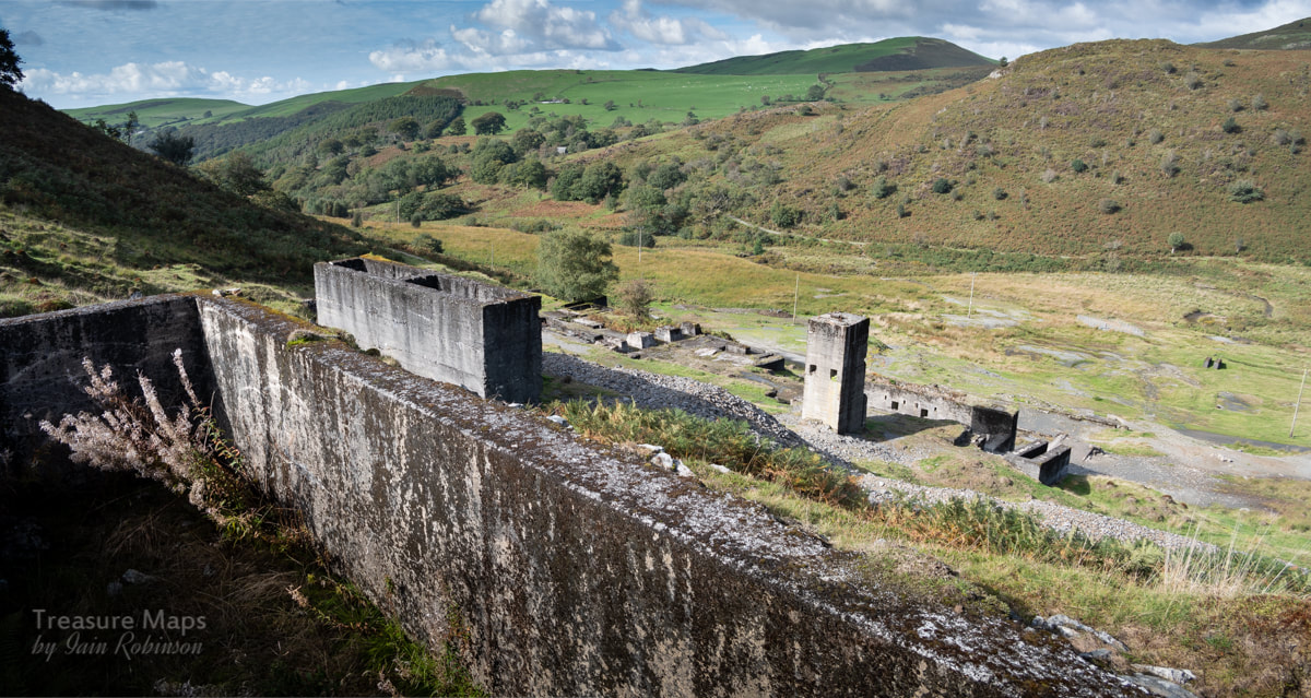
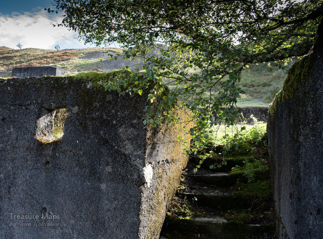
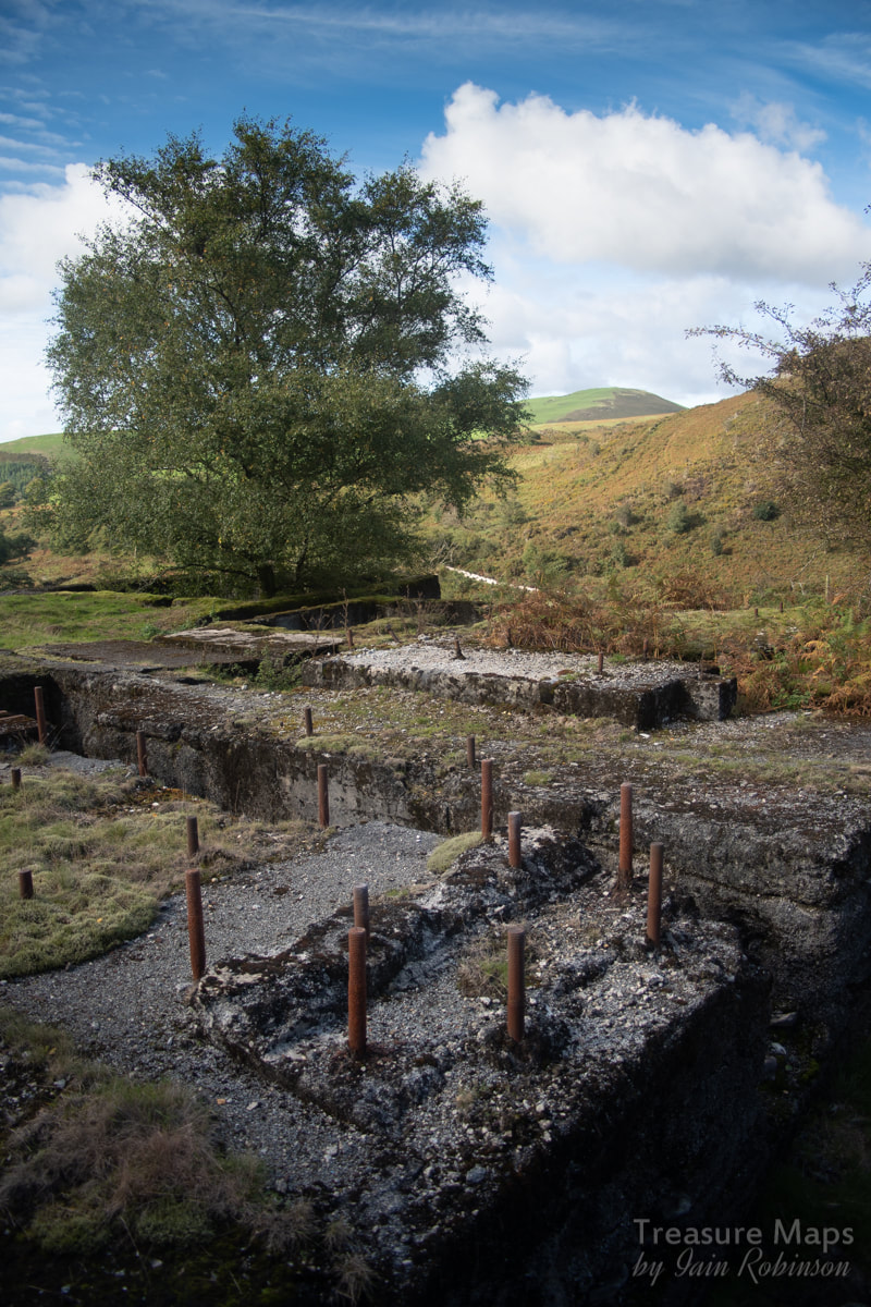
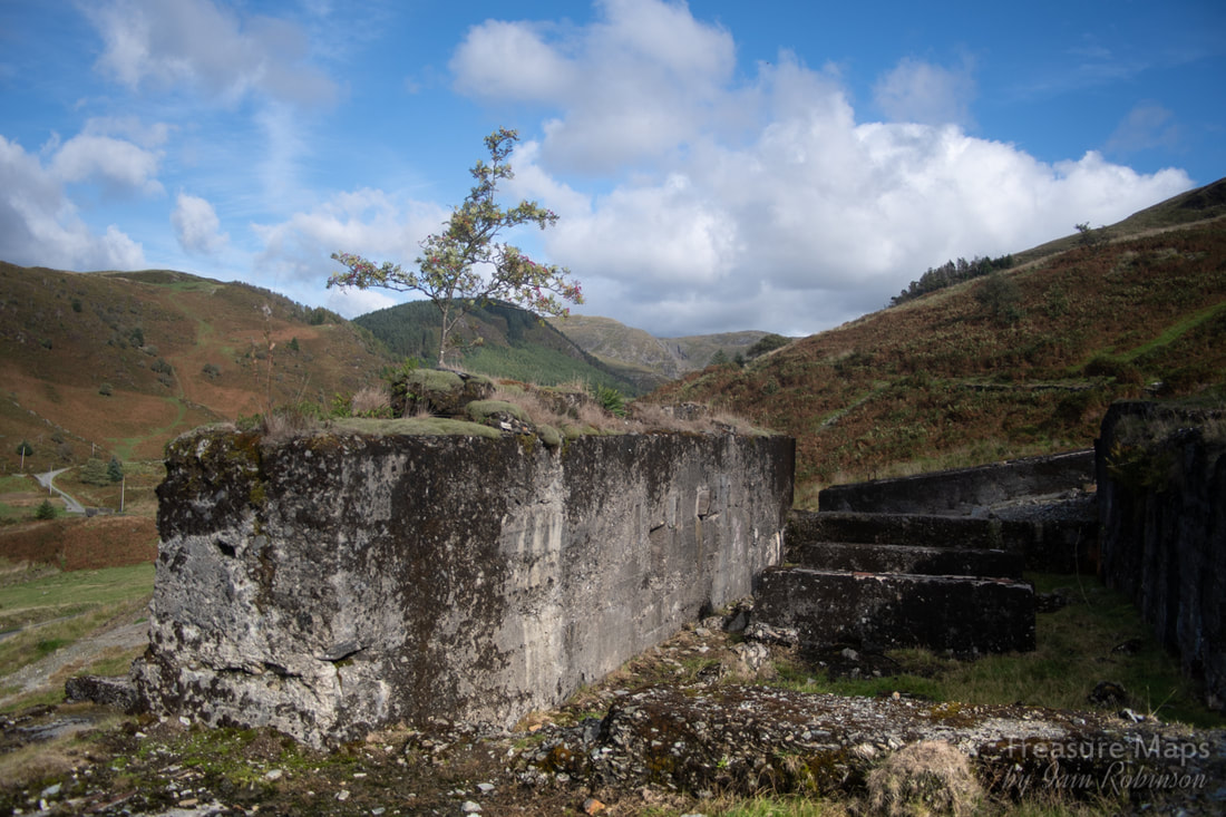
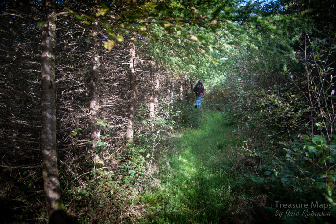
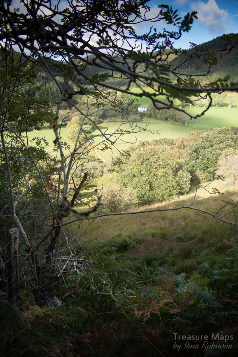
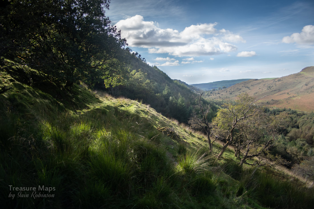
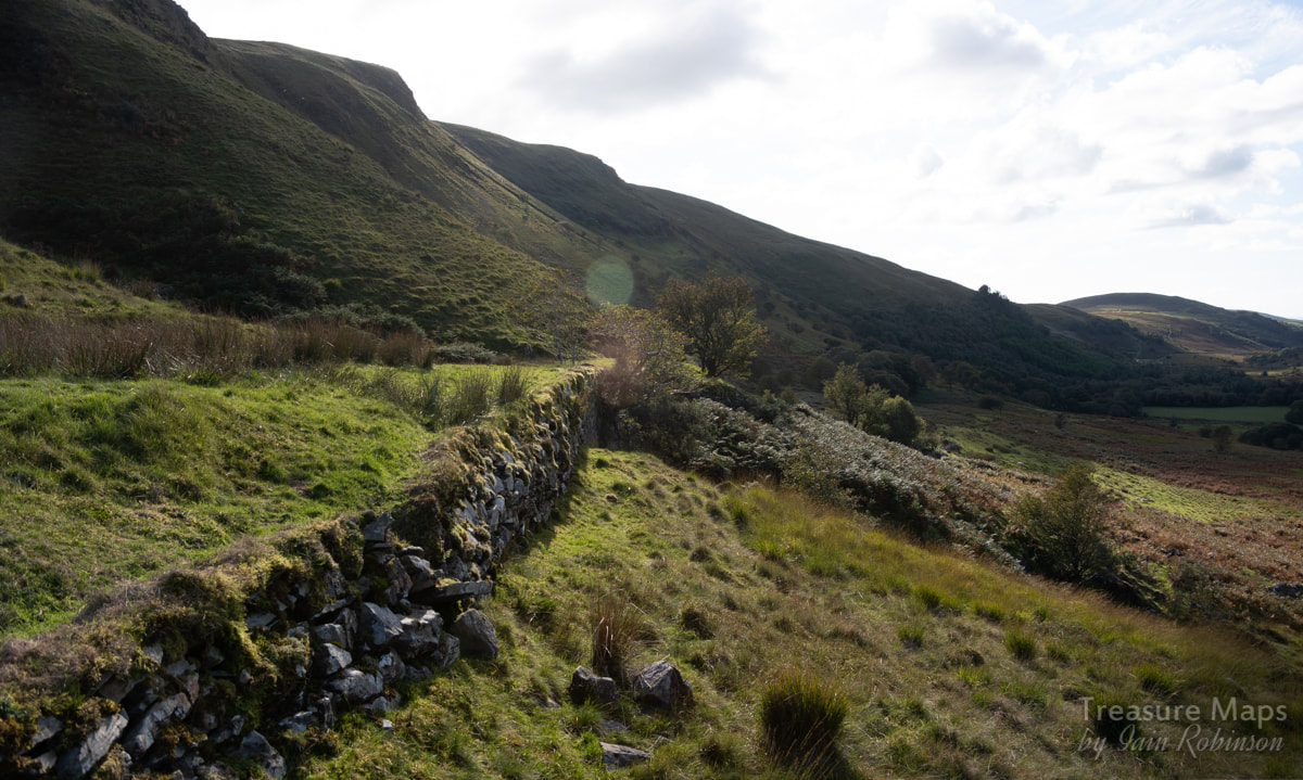
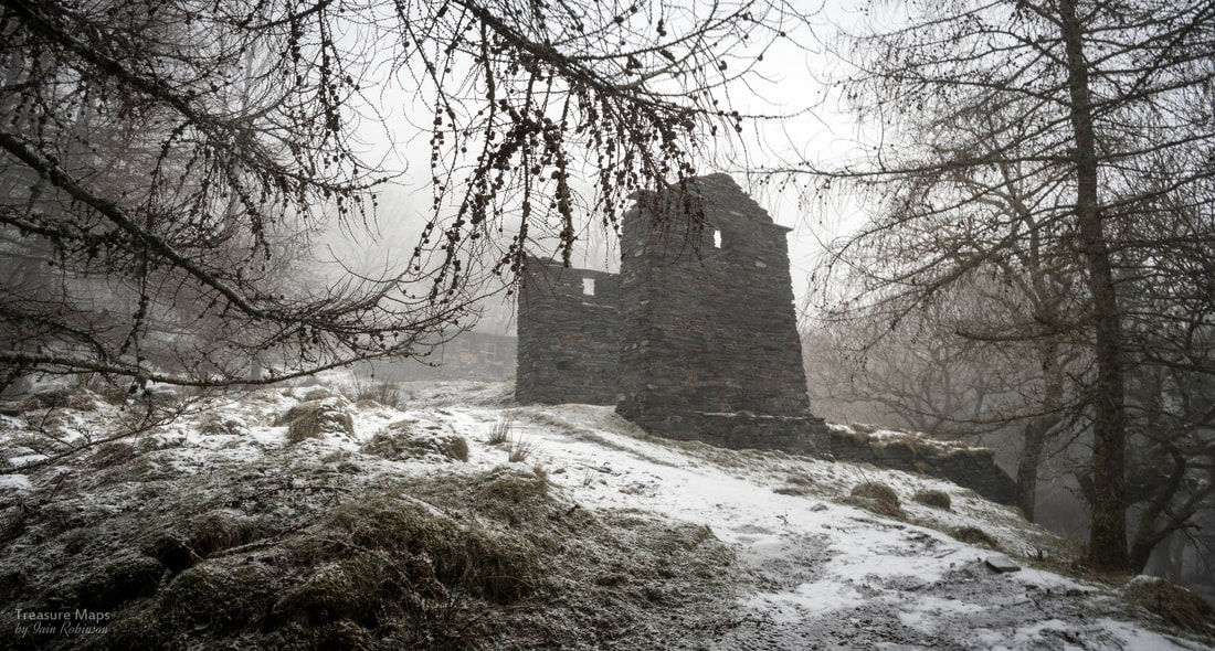
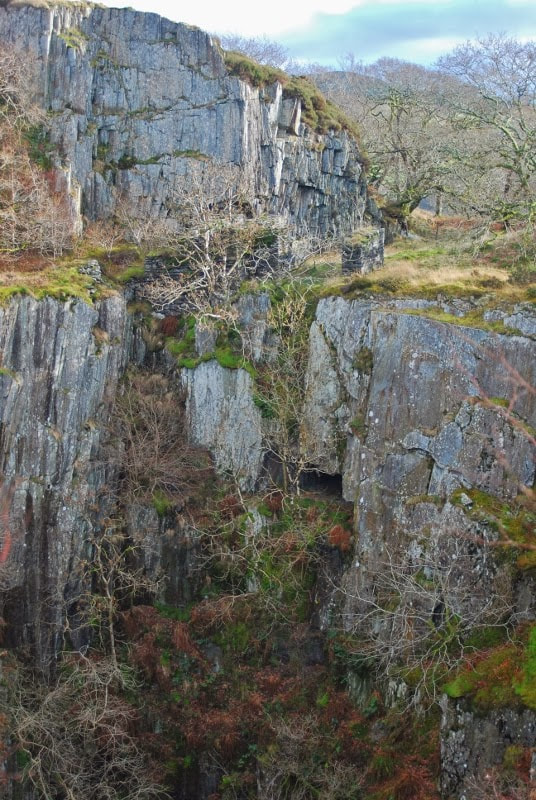
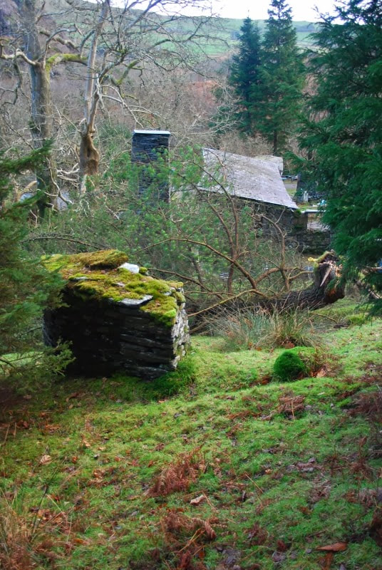
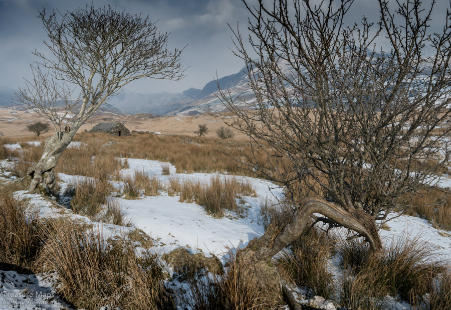
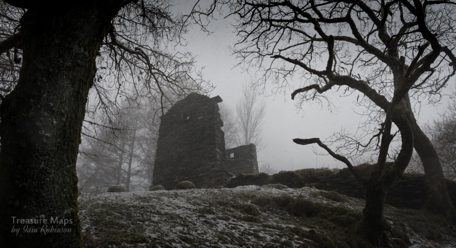
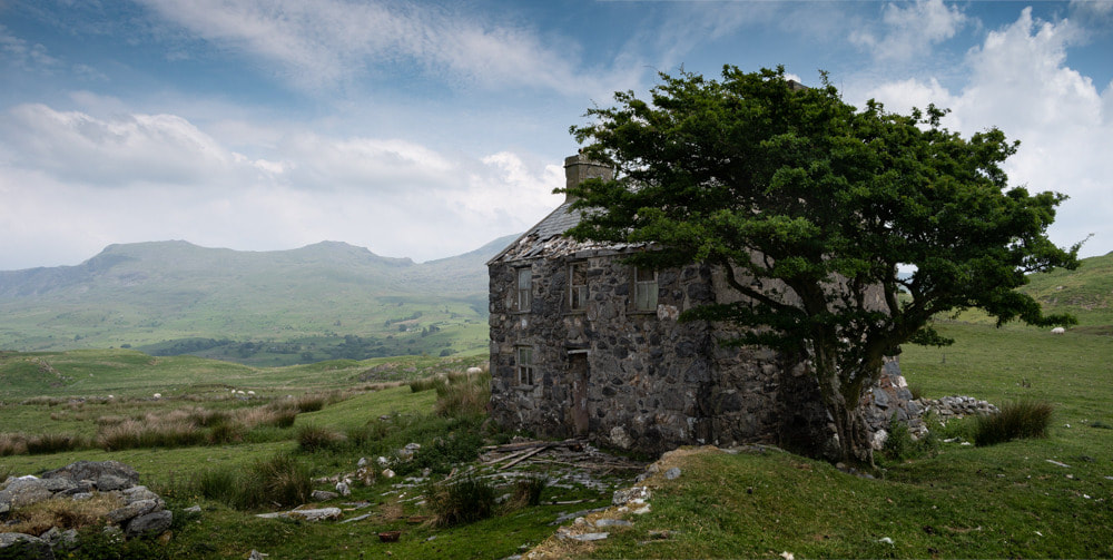
 Abercorris, or Cwmodin as it is locally known, has been on our radar for a while. You hear other explorers talking about the heart-attack inducing climb and the lack of adits, others that there are too many conifers. I can say confidently that it's a "yes" to all those- the site presents all the worst excesses of our spruce-loving friends. Add to that, mother nature has vigorously asserted her right to claim back just about everything. But you know mother nature, she might obscure stuff for us amateur Industrial archaeologists, but as a result, there is a real charm about the site. And you can't have enough deciduous trees, at least. We climbed up on a dull day, rain threatening, skies lowering- but the allure of the place shone through the conifers like warmth through a threadbare curtain. I'm glad we made the effort. 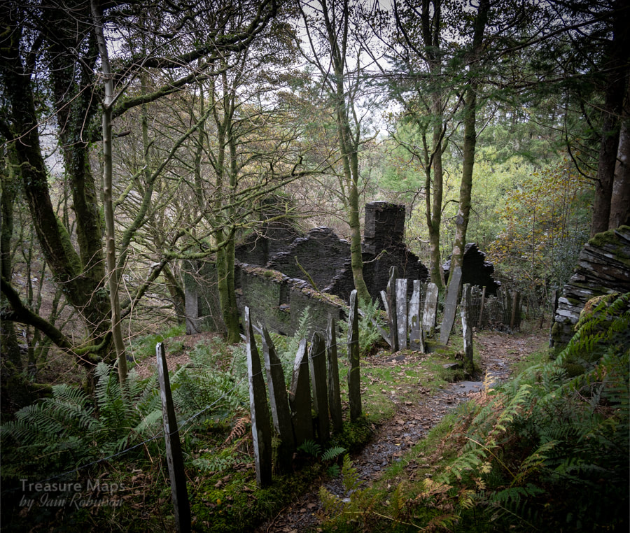 The best approach is from the village- we parked in the Corris Railway car park, as it was off-season and the railway was closed. Parking spaces in Corris are few and far between, because the village is packed into the confines of a narrow valley. We walked out and right, up the main street until we reached the crossroads where a small street turned left and uphill towards Corris Uchaf. There's a pub on the corner, the grade 11 listed "Slater's Arms". Even in these first few yards, we were aware of the old trackbed of the tramway as it crossed the Afon Deri on a tall slate bridge. It's a very pleasant walk, with a chapel and old miner's cottages lining the road for a quarter of a mile or so. Then things quickly become more rural and a footpath sign points uphill along a rough road. We climbed for a while until we were surrounded by mature conifers. Then we encountered a delightful surprise, a weathered, old Italianate miniature village. I'm itching to show you, but want to find out more about it first...it will be the next post, I promise!  After some more gentle climbing, we came to the first level of the quarry. A weigh-house, remarkably well-preserved, sat before some spoil tips, while in the woods, the ruins of what must have been the mill loomed in the trees. 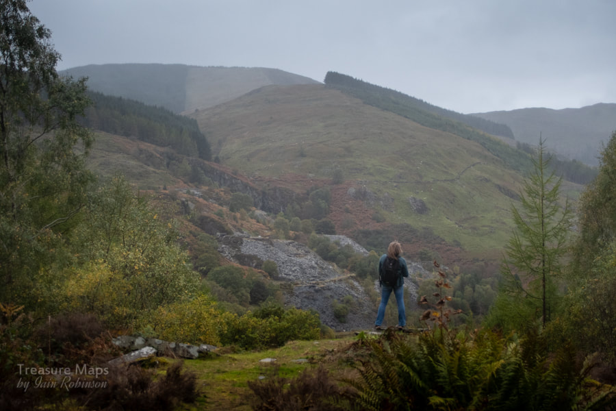 Petra strode out to the end of the tips and looked down on an unexpected view of the Gaewern Quarry, across the valley. You don't normally see it from the main A487 that goes through Corris. That quarry has been in the news recently as it has been offered for sale. The consensus of opinion among mine explorers is that the cost of clearing away the many old car wrecks dumped there would put buyers off. We live in a slate mill, but to be honest, I wouldn't mind a quarry to go with it. Meanwhile, I was preoccupied by the size of the spoil on the tip...it was a bit chunky, there were no fines. That was solved later by my discovery that Abercorris mainly produced slab- as the slate, from the Corris Narrow Vein, was not easy to split into thin slices. 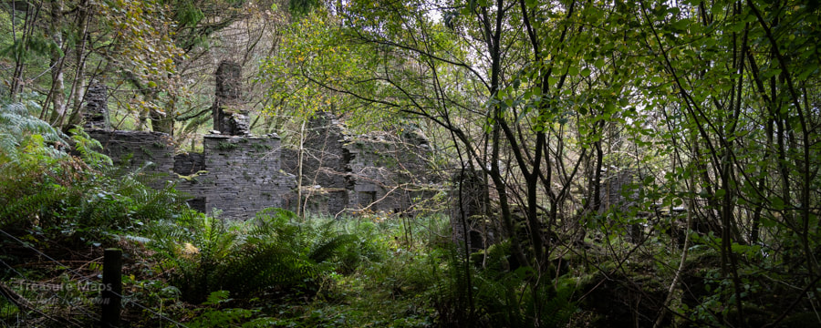 The workers' houses. The footpath headed off downhill at this point, not where we wanted to go, but we could see some shapes looming through the autumnal trees. They were the remains of worker's houses and a mine office. One of the characteristic Corris narrow slate fences marked the boundary. This place, shaded by ash, oak and birch trees was magical. I could have spent a long time here. Strangely, it reminded me of another place, not far away- Ratgoed, with it's terrace of houses and the demolished shop. 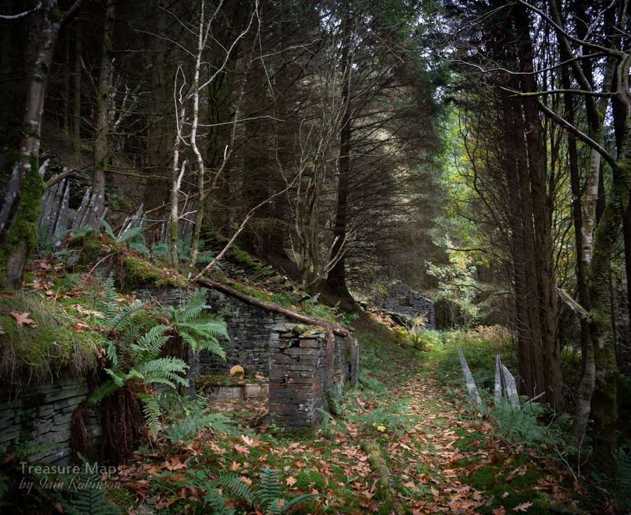 The drumhouse in the distance, with the privy to the left. Now it was time to walk back up and explore the first level where a tramway had run to a remote Incline drumhouse. The incline once swooped down to the valley bottom, where it met a branch of the Upper Corris Railway. These days, it's hard to make it out, the regimented rows of spruce have all but obliterated it. Thankfully the drumhouse was spared- it is a fine one and stood in a beautiful clearing, made more pleasant by a stand of Larches, turning gold in the autumnal gloom. 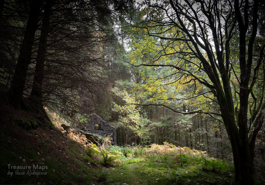 The beautiful clearing with the drumhouse sitting as if placed there by Capability Brown. Before the drumhouse was an unusual structure, still with some roof beams in place. Circular holes in a long bench looked familiar and then the, er, penny dropped. This was a privy! The seats were very well preserved, and reminded me of a similar arrangement at my Granny's farm when I was a boy. 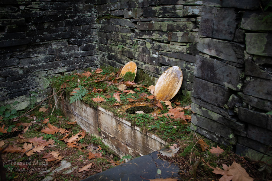 The facilities... We retraced our steps back up to the level and the well-preserved weigh-house. A gable wall jutted out from the undergrowth and we followed a well-worn path to see more. The mill was certainly ruinous and hard to interpret, but the one surviving gable was very impressive, buttressed internally and with cables set into the stone. A machine base stood near the door, hinting that there were four saws, a planer and a dresser here at one time. 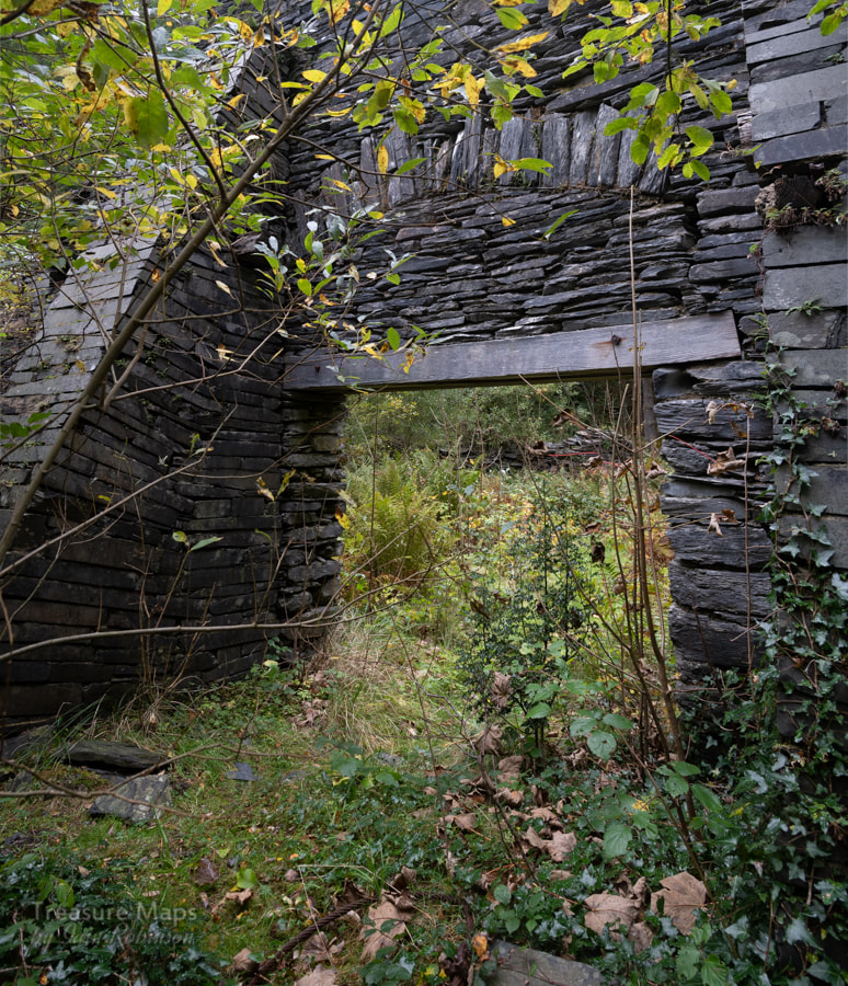 I'm standing in a bramble patch to take this photo- such are the sacrifices to bring images to the viewer... Other buildings stood clustered at this end of the level- a caban for the men and possibly a smithy. The path carried on towards a waterfall which looked at first like an adit, but we were disappointed. Petra set off up the incline, which was only just recognisable as such, so aggressive was the growth of bracken and heather. Above the waterfall was a small reservoir... 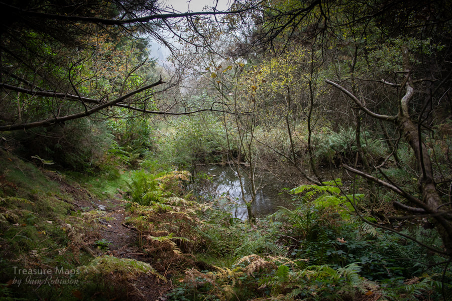 The reservoir- you can see how overgrown the site was! The reservoir, according to Richards in his book "Slate Quarrying in Corris", contains the remains of a wagon which ran away down the incline. We couldn't find any sign of a waterwheel around the mill, but there must have been one for this reservoir to be built. We carried on climbing. The incline was a single-pitch table incline (Richards). It was, still is, 670 feet long and gains almost 400 feet in height. The lower part was easy enough, through the conifers. 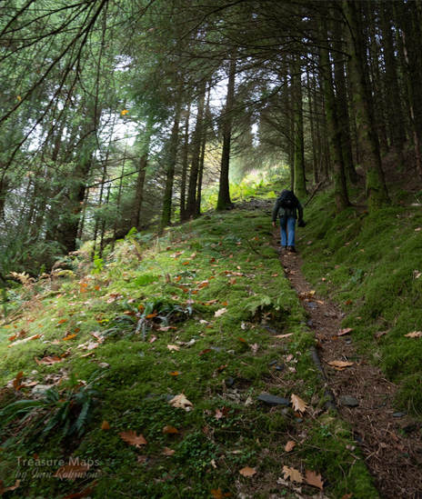 The lower part of the incline. Apologies for the blurred photo, it had started to rain by now and I was puffing like an old steam engine trying to keep up with the chief adventurer. A compressed air pipe carried on beside the incline, perhaps a remnant from the 1930s working of the site. The trees to the east of the incline are significantly older than elsewhere and less densely planted- they are marked on the 1888 Ordnance survey. I had to admit that their fine, straight boles were rather majestic- and the fact that they were Lodgepole Pines, rather than Spruce. At this point, it began to rain on our first visit (we returned on another day, one of those wonderful bright October days- but we only tackled the incline once.) Eventually a level opened up on our left- I was pleased, as the climbing had become very difficult. Sadly, while there were impressive tips here and views across to Gaewern quarry, the adit had been blocked. 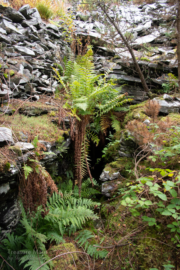 The blocked adit. It wasn't even "breathing", so it was well and truly stopped up- what a shame. 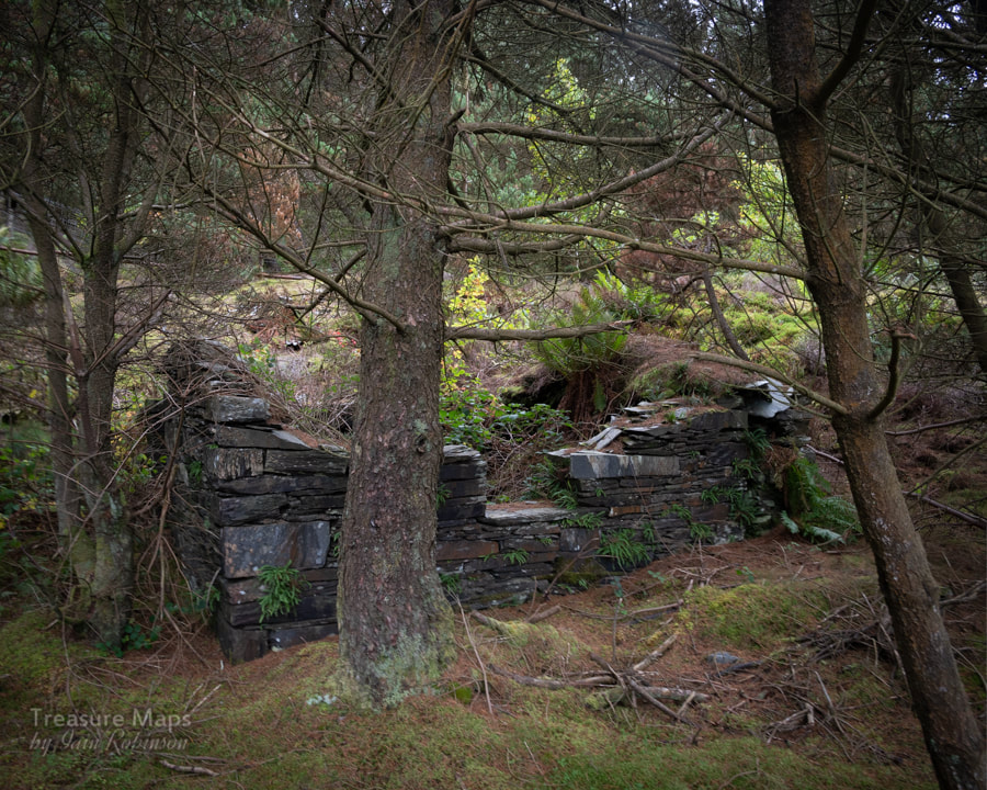 The remains of a weigh house We had a small discussion about whether it was wise to go on, as the rain had become heavy and the ground was ever more dangerous. I was concerned about the downward journey...but more of that anon. We decided to carry on up to the next level, as we could see the remains of a building tempting us. This time it was worse, the slope seemed steeper, and I was forced to pull up using heather stalks. The last portion was overgrown with young spruce trees- not much fun.  Becoming steeper - and wetter! Never mind- it was worth the effort, as there was a superb drum house at the top, and to the east, the sight in the woods of a big pit. We bashed our way about on this level, trying to find any sign of an adit, but it looked like spoil had been tipped over the adit here. Once again, we looked at each other but this time, decided after much debate, that we would go no further today. Perhaps if there is another dry summer, we will come back and explore the top adit. But now, we had to descend. The rails at the crimp described the top of a parabola as they started their journey- it reminded me of similar inclines at Penmaenmawr Granite Quarry. 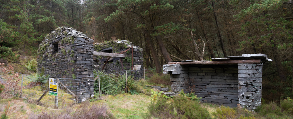 The fine drum house at the penultimate level. 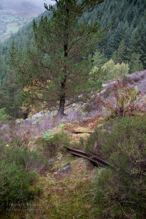 The rails at the crimp. It felt dangerous coming down- the slate, where exposed, was very slippery and the incline was covered in brambles, ever ready to trip you up and send you hurtling downwards. Petra worked slowly down without fuss. But after a while, I'd had enough, got out the bum-mat and came down on my ample posterior. I just hoped that I wouldn't end up in the reservoir! But here I am, none the worse except that my jeans look a little more distressed than is, perhaps, socially acceptable. On our second visit, we scouted out the lower level where the tracks from the incline joined the Upper Corris Tramway. A bridge is reached over the Afon Deri by means of a couple of switchbacks. The incline has been totally lost in the spruce trees, but the bridge, in rebuilt form, remains as a footpath. There's a very pleasant circular walk that takes in the houses of the quarry workers and gives a glimpse of the lower workings, as a glance at the present day OS map will show. We encountered a couple of very pleasant walkers with their dogs. We were also aware of a very loud lady on our second visit, somewhere behind us. She passed with two other, much quieter folk while we were photographing the cottages, continuing to berate her hapless companions, complaining about "another quarry". Gradually the noise of her discontent abated and the birds started to sing again. I noticed that the group had gone up the incline. Then, the air was ripped apart by a shout: "I'm not bloody well going up this!" Fine, now we all know... 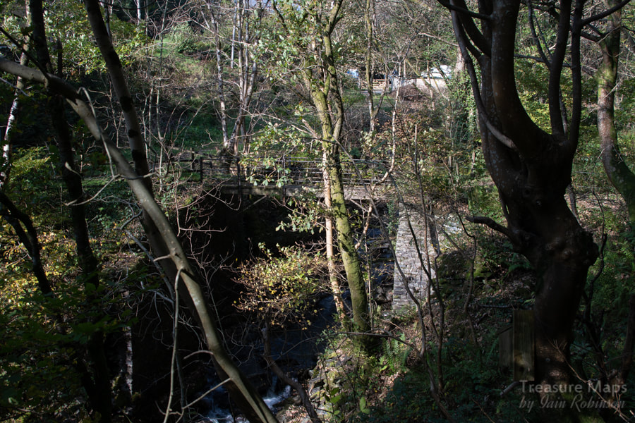 The remains of the tramway bridge at the bottom of the incline. The Factoids The definitive source for the quarry are the two books by Alun John Richards- Slate Quarrying in Corris, and The Gazetteer of the Welsh Slate Industry, both indispensable to the student of Slate in North and Mid-Wales. Paraphrasing from AJR, it seems that the first record of work here was in 1863, although a note in the Mining Journal mentions previous work done at the quarry. In 1874 The Cwmodin Slate and Slab Quarry company was formed, but was almost immediately in trouble. The quarry closed, but was then reopened in 1880 by the Abercorris Slate and Slab Quarry Limited. So it continued, progress at first,as new owners took over, then faltering as poor trading conditions and short-sighted management took their toll. The Corris Railway was frequently owed money, cheques bounced and slate was impounded by the railway. The quarry struggled on until the thirties. In the fifties, it was re-opened for a couple of years and worked in conjunction with Braich Goch (now marketed as "King Arthur's Labyrinth"). Another feature of the quarry was that the directors insisted in taking large fees, where a little restraint would have allowed the operation to have carried on. The miner's houses lower down at the mill were abandoned in the 1930s. The mill was at first powered by water, later by a steam engine and finally by electricity from Braich Goch, although this was limited sometimes to 4pm until midnight, as the larger quarry had the first call on power. 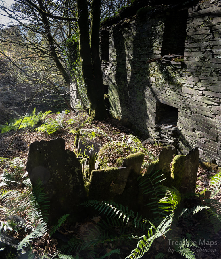 The miner's cottages below the mill.
4 Comments
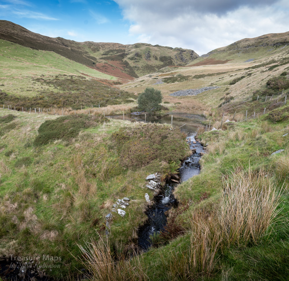
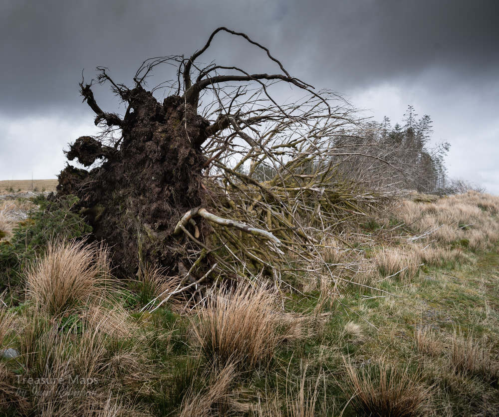
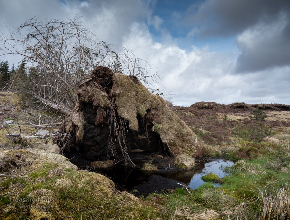
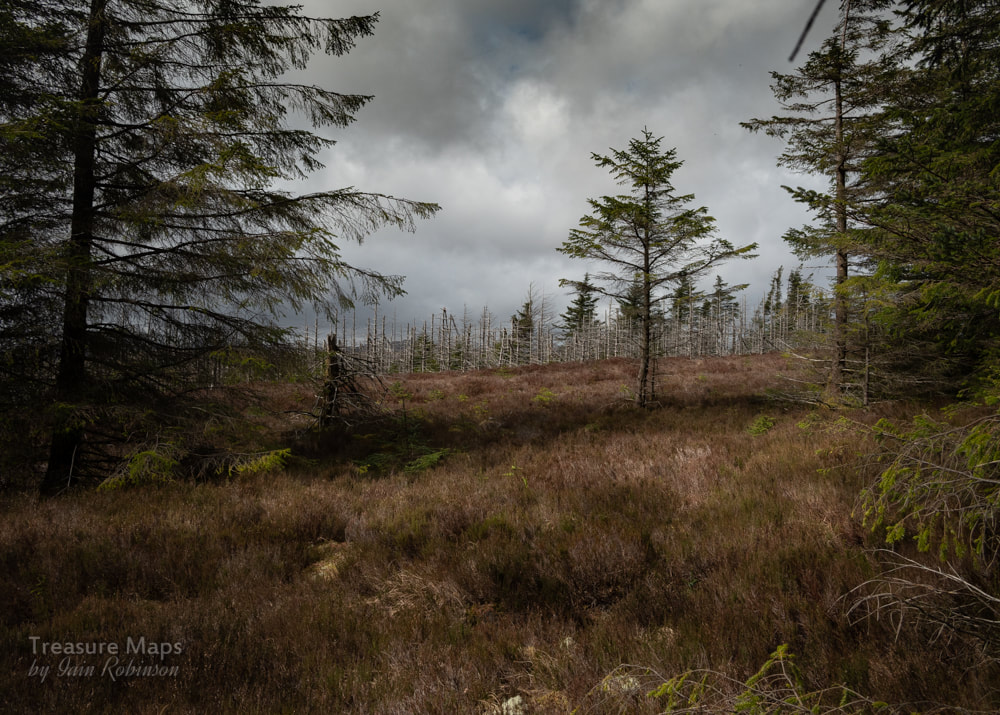
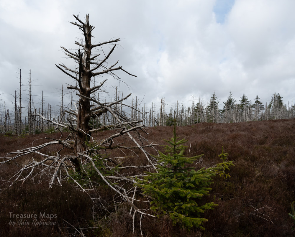
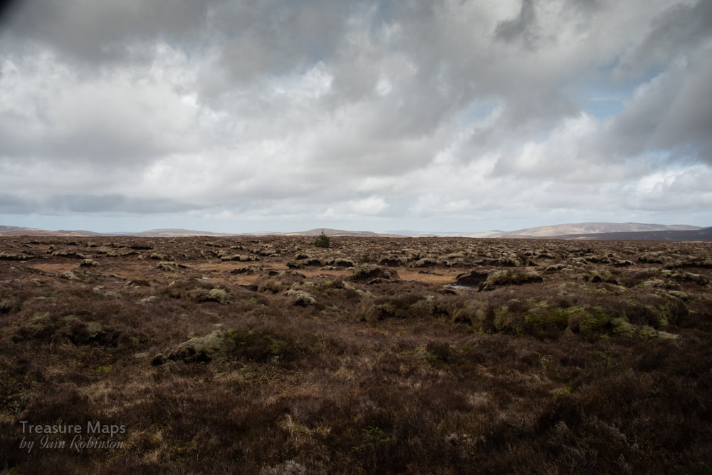
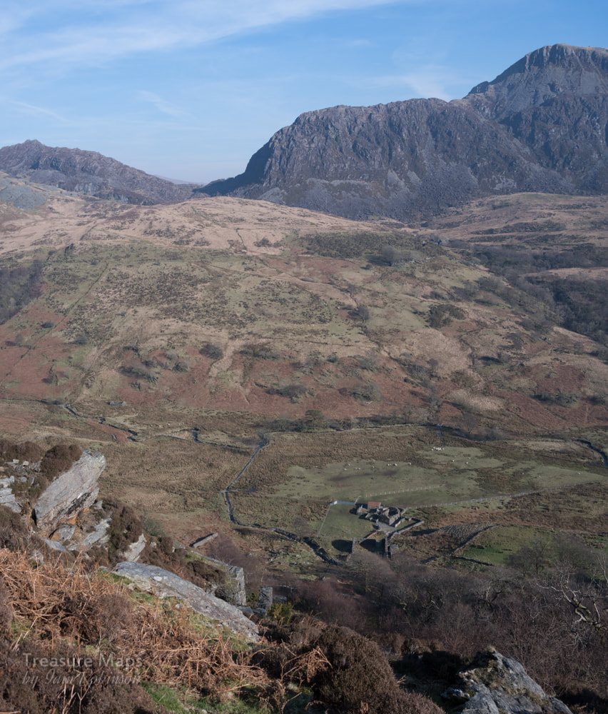
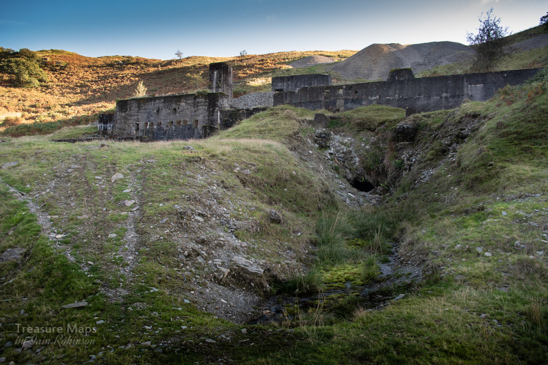
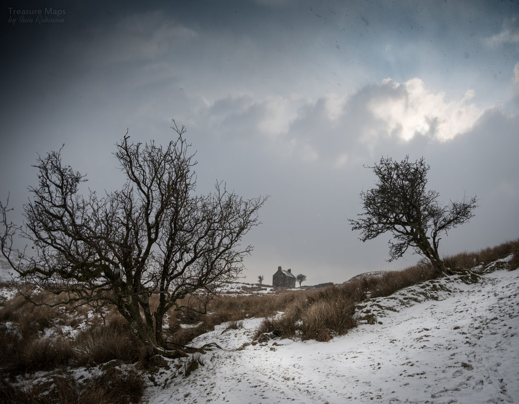
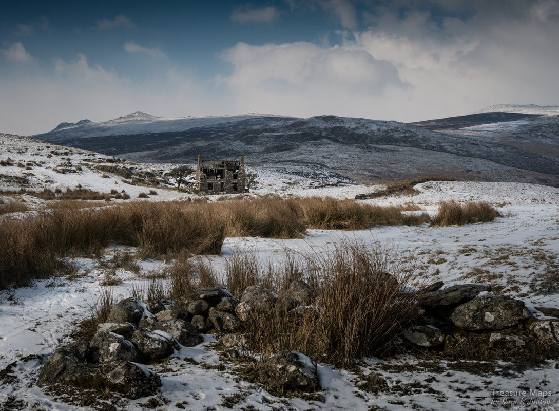
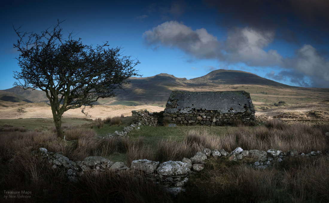
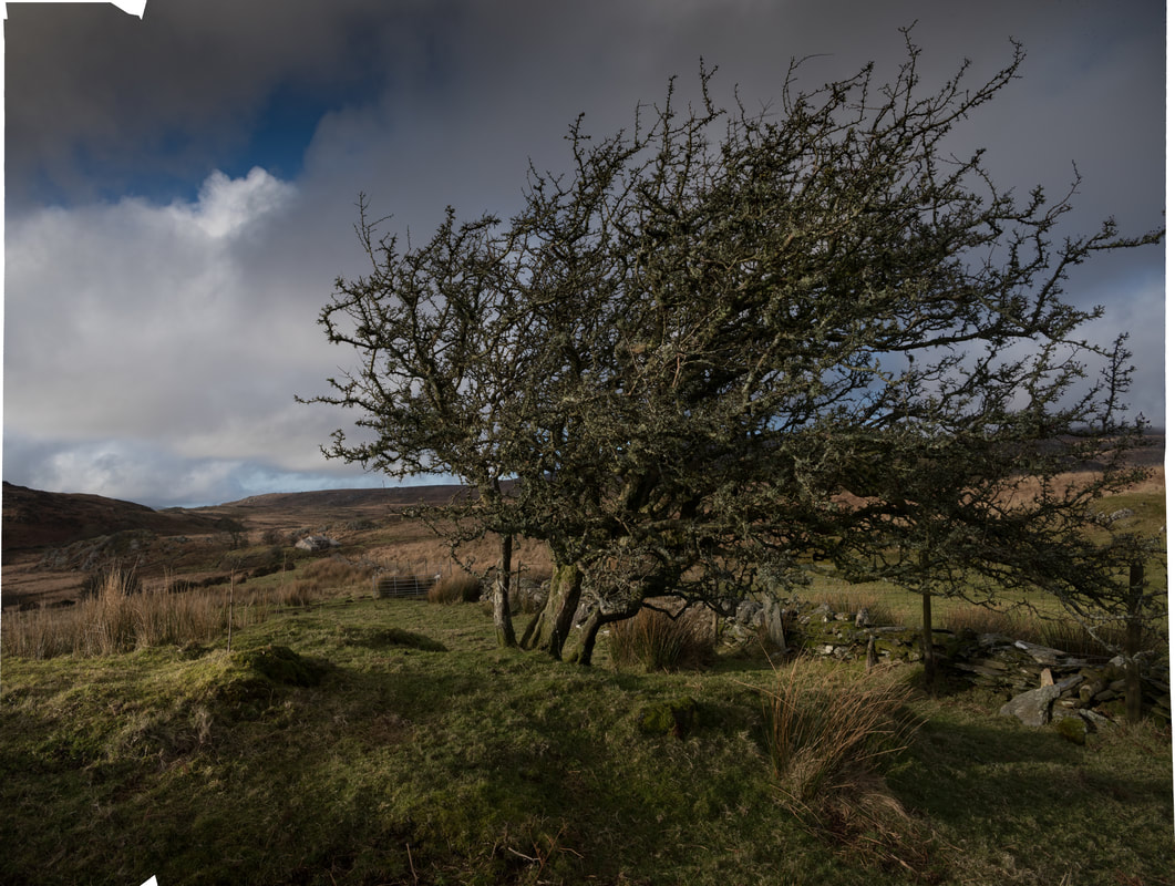
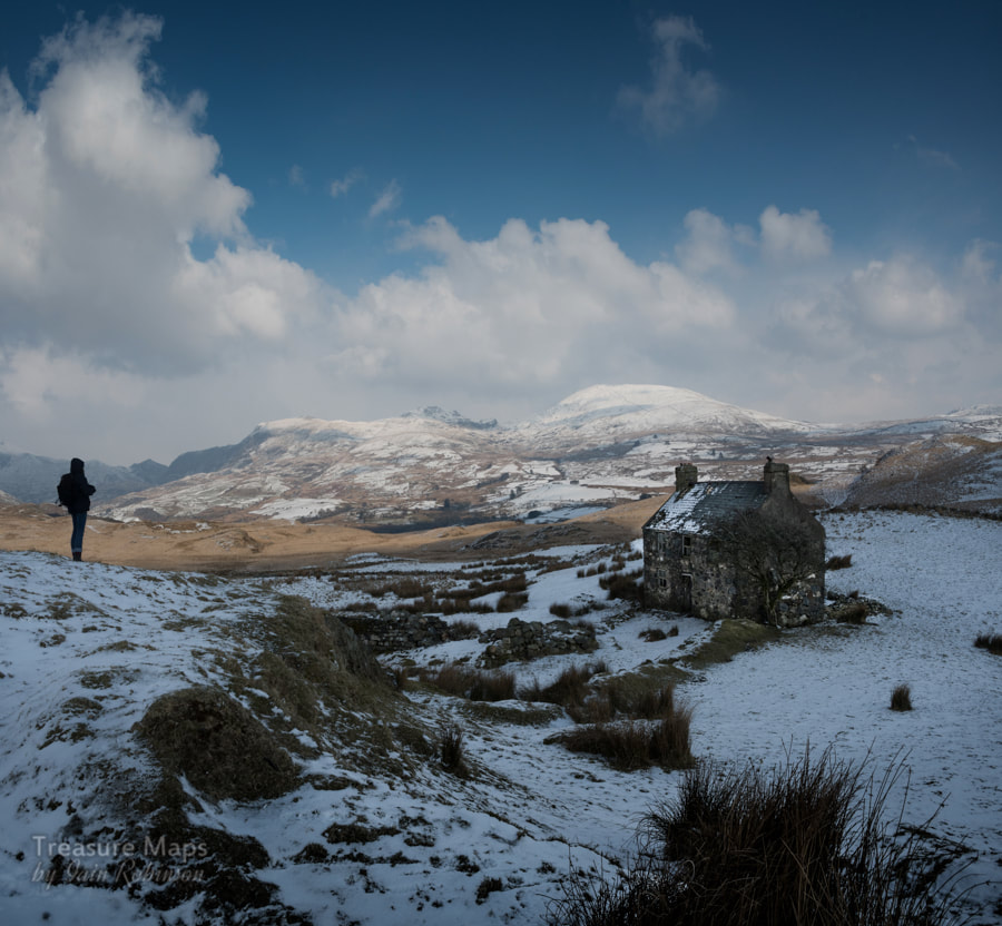
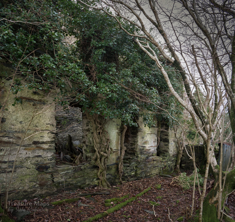
 First view of the mine from the road. The lone tree marks a shaft, presumably the destination for a wire rope line from the engine house. The copse of trees in the ravine top left also hides the remains of an adit. At bottom left, the flotation pits and buddle area can just be discerned. For our next Mid-Wales adventure, we decided to take a look at the Blaen Ceulan mine, the one tantalisingly seen from the narrow road that winds scenically to the top of Cwm Ceulan. The mine is on a public footpath, which starts from SN72139085 and goes off the vertical rather dramatically down a 1:3 slope. Almost immediately, we spotted some trial adits- these are generally referred to as the Bwlch-y-Garreg trials. The first one was open, (a little way, anyway) with a modest tip. Most of the adits here have arched portals, an attractive feature. Unfortunately this one didn't go very far before ending in a headwall. Nearby was that inevitable accessory, a car wheel trim that must have whizzed off from the road.  One of the Bwlch - Garreg trials. We made our way past a few more trials until we came towards the reservoir for the mine. Here there was an extensive trial, although the tips had the feeling of a slate mine about them; there were a lot of chunks of rock and very little in the way of minerals. This trial was an attempt to find the Esgair Hir lode in 1873. The trench is 50 yards long and 7-8 yards deep. Sadly, nothing was found, and the excavation was abandoned.  The prospecting trench, looking north. It was strange that although we could see the Blaen Ceulan mine from the road, down here by the old trials it seemed to be hiding. It wasn't until we were nearly upon it that it was revealed, hidden up until now by the moraine spurs that skirt the stream.  The reservoir, with evidence of trials in the background. This was obviously a big operation for a while, judging by the spoil. Our first glimpse revealed the fossil impressions of floatation tanks and buddle pits highlighted in the fitful sunshine. The main adit, a brick arched tunnel was obvious, although rather underwhelming, as it only went in about fifteen feet before ending in a stone wall. I got the feeling that there might be a lot of water behind that wall. 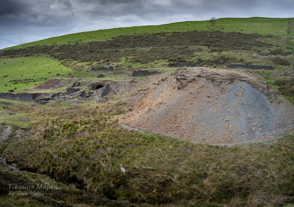 The tip from the deep adit, paradoxically above and to the right of the main adit. 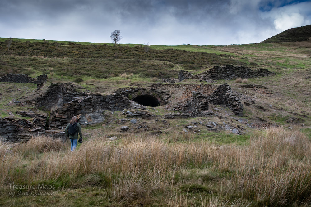 Petra makes her way to the mine. There was a confusing array of ruined structures, and one we could identify- a wheel pit. I wondered if the big tunnel was simply for transport or access, and that another tunnel struck the lode and connected with it. Another theory is that the tunnel was simply an alcove for a steam engine. It is known that the Perran Foundry supplied a 16in horizontal "Puffer" and a 20 foot boiler. This would explain the lack of spoil or roadway here, near to the crushing floor. A 40 foot waterwheel and a 36 inch crusher were ordered from Perran and must have been in this vicinity. The stone for the buildings, incidentally, came from the opencut at the deep adit. There were the remains of a shaft further up and behind the mine- this could be the engine shaft. We know from Bick that the company purchased a steam engine from the Castle Hotel, Aberystwyth to drain the mine. It was a an 8nhp engine by Bennet of Deptford- lowered down the shaft to a purpose-cut chamber, the engine started pumping on 15th June 1870. Unfortunately, returns did not match the investment, and the engine was retired and presumably still languishes in it's chamber, rusting slowly into oblivion. From 1873, the pumps were worked by a wire rope from the 40foot wheel- something that the 1880 O.S. maps show clearly. 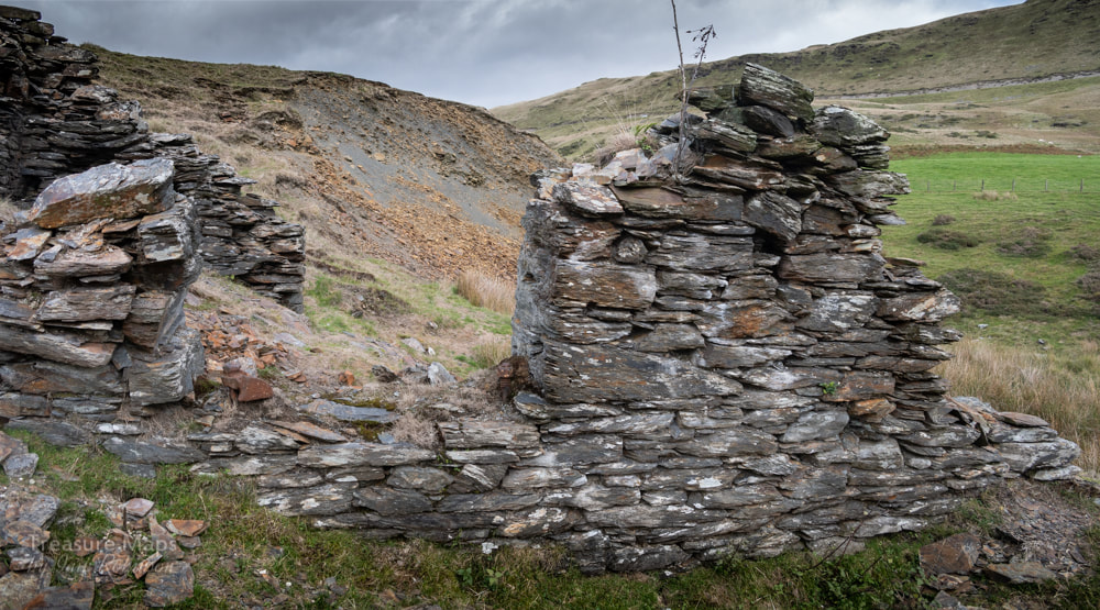 The ruins of what could be an engine house near the main adit. The remains of bearings in the opening are interesting. 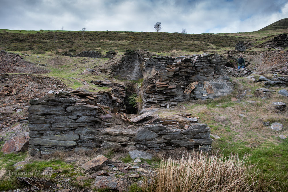 The waterwheel pit and processing area. We roamed around happily for a while, examining the minerals in the spoil and speculating about the structures. Further up the hill, there was a long ruined structure beside an adit that was choked with gorse and vegetation. This was the deep adit, rather wet and inhospitable- and impossible to photograph.. 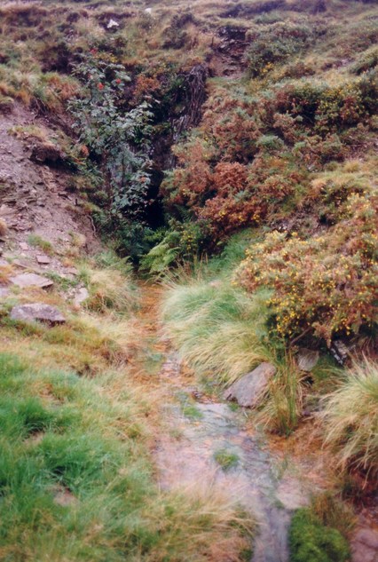 A photograph taken in 1990 of the deep adit, from Graham Levin's photo archive, by kind permission of the Welsh Mines Preservation Trust. 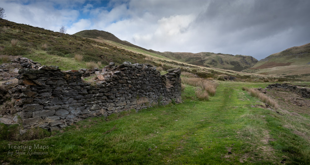 The deep adit lurks behind the buildings. We made our way east on a farm track which gave us good views of the trials along the south side of the Bryn Mawr valley. I had been wondering where the powder house could have been, when I nearly stumbled over it, just the right distance from the workings. 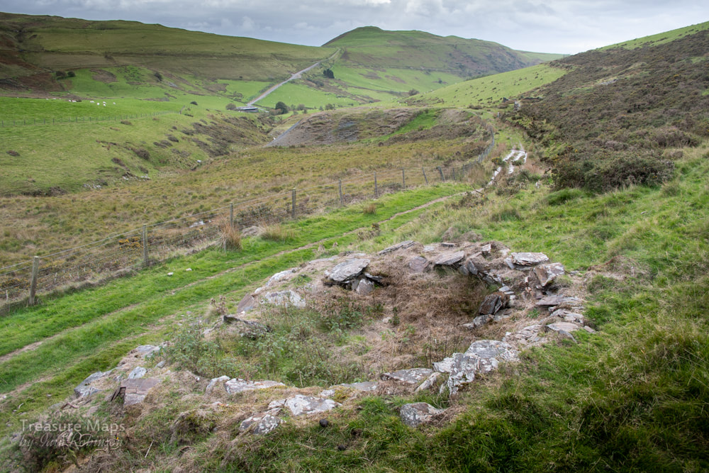 The remains of the powder house, or magazine. It is rectangular in shape, although my photo makes it look round! Obviously, the coffee we'd had earlier in Newtown hadn't worn off, as Petra decided that we'd try and find the old road marked on the 1880 OS maps from Bwlch y Garreg farm. We ended up making for the end of the cwm through an area of gorse and bracken that wasn't pleasant. The gorse is a direct result of sheep farming, as the poor beasts won't eat it, so it spreads unchecked. Some breeds of cattle have a taste for it, but they weren't in evidence here. 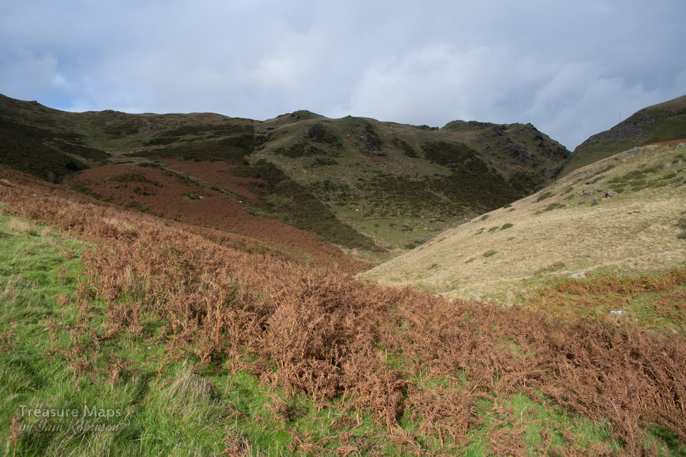 Towards the bwlch! The gorse awaits... We found ourselves on a very steep slope towards some crags. Petra went up big-style, but I had the wrong boots on (that's my story). I wasn't wearing my trusty Vibram soled climbing boots, but a pair of lightweight Merrells- I'd envisaged this as an easy potter about, not an attack on K5. Of course, the inevitable happened and I slipped, descending twenty feet or so very quickly on the grass before doing an ice-axe belay with my walking pole. The rest of the slope was taken very slowly while you-know-who looked on patiently. 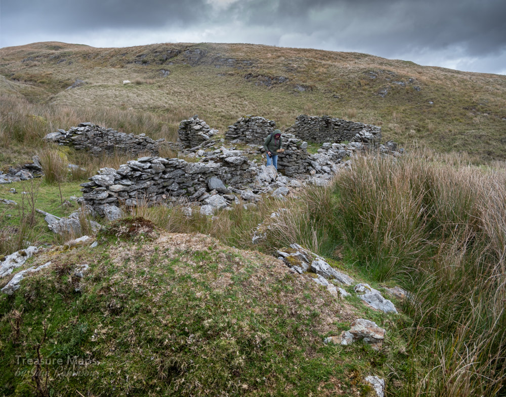 Petra examines a Newtown-made brick in the farmhouse. It had started to rain by now- luckily our car was parked at the bwlch. We eventually found the road, which took us down to the old Bwlch-y-Garreg farm, sheltered in the lee of another moraine. It was still an exposed spot and I didn't like to imagine what conditions must have been like for the occupants, especially before the road was built by the mine company. There was a hollowed out area in front. perhaps another wind-break that might have been planted with bushes. Beside the farm was a pig-sty. We walked back to the car, feeling thankful for the 21st century and all it's mod-cons.  The view from the rocks at the top of the bwlch, looking towards Tal-y-Bont. The Factoids... The mine works a continuation of the Esgair-Hir vein, exploited by the mines to the north east at the bwlch- Esgair-Hir and Esgair Fraith. My post about Esgair-Hir is...here. The earliest workings are impossible to date, but Foster-Smith considers a date of 1723, when some shallow shafts were sunk on the vein. In 1732-3, take-notes were issued from the Gogerddan estate to miners, probably unemployed, to raise a little ore and work the tips at Blaen Ceulan. In 1852 a deep adit level was driven- it found the vein and was then connected to the engine shaft. While the ore was stated to be rich, it was inconsistent and tapered off. The mine was working from 1852-54, then closed until 1868-76. During this period the recorded output was 438 tons of lead ore, 7 tons of zinc and 18 tons of copper ore. An account of a visit to the mine by the Welsh Mines Society (Autumn 2008) notes that "One discovery of the day was ironwork on the river bank that might have been associated with an aerial ropeway from the mine to the road." That might explain some of the mysterious holding down bolts. The cart wheel we found in the waterwheel pit was made by Turner Brothers, Cambrian Iron Works, Newtown, Mid-Wales. They were agricultural engineers who also specialised in making equipment for slate mines- the works was founded in 1795. Sources: "The Mines of Cardiganshire", J Foster-Smith, Northern Mine Research Society 1979. "Lead Mining in Wales" W. J. Lewis, UWP 1967. "The Old Metal Mines of Mid Wales, part 3" David Bick Pound House 1974. "Metal Mining in Mid-Wales" by G. W. Hall, WMS 2014 Graham Levin's photographic record of the mine- these are proper film photos, back when you needed skill to take a photo :-) 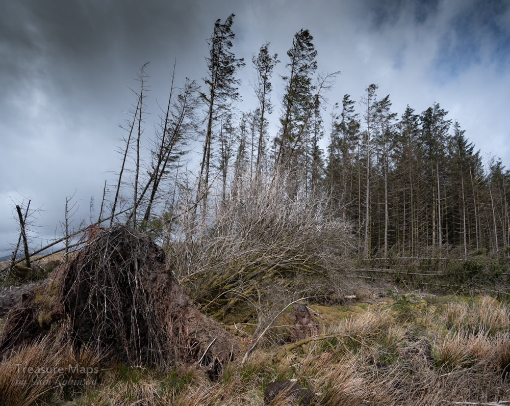 “Man is the most insane species. He worships an invisible God and destroys a visible Nature. Unaware that this Nature he’s destroying is this God he’s worshipping.” The above quote, by the Canadian scientist and thinker Hubert Reeves has been coming to the forefront of my mind often just lately. Earlier this year, Petra and I took a walk over a battlezone, where heavy machinery had torn up the ground. Destruction had been waged on all sides. The remains of vehicles, temporary structures, microwave ovens, fridges and fuel drums were strewn over a wide area. Occasionally a pungent smell of diesel oil would signify where a bowser had refuelled heavy plant, spilling fuel. 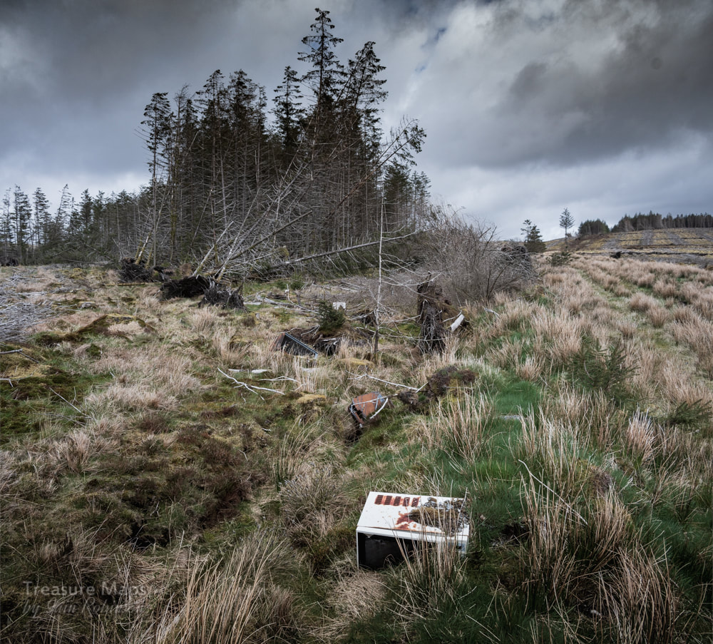 This is a mile from the nearest road, so the junk was left by the contractors- a band of monkeys, by the look of it. We were on the Migneint, an area of outstanding biodiversity in North Wales, a fragile place where blanket bog covered the ground surface, clothing the rock beneath with a carpet of moss and lichen, supporting a wealth of insect and bird life. But here in the forestry plantation, no birds sang. What we were seeing was the aftermath of a typical forestry clear-felling and the destruction and chaos it brings to the environment. But the destruction had started 70 years previously. The ground was drained by a big machine that made equally spaced ditches, "riggets" which would get rid of water fast, turning the bog into a drier substrate that could support the young roots of a conifer monoculture. 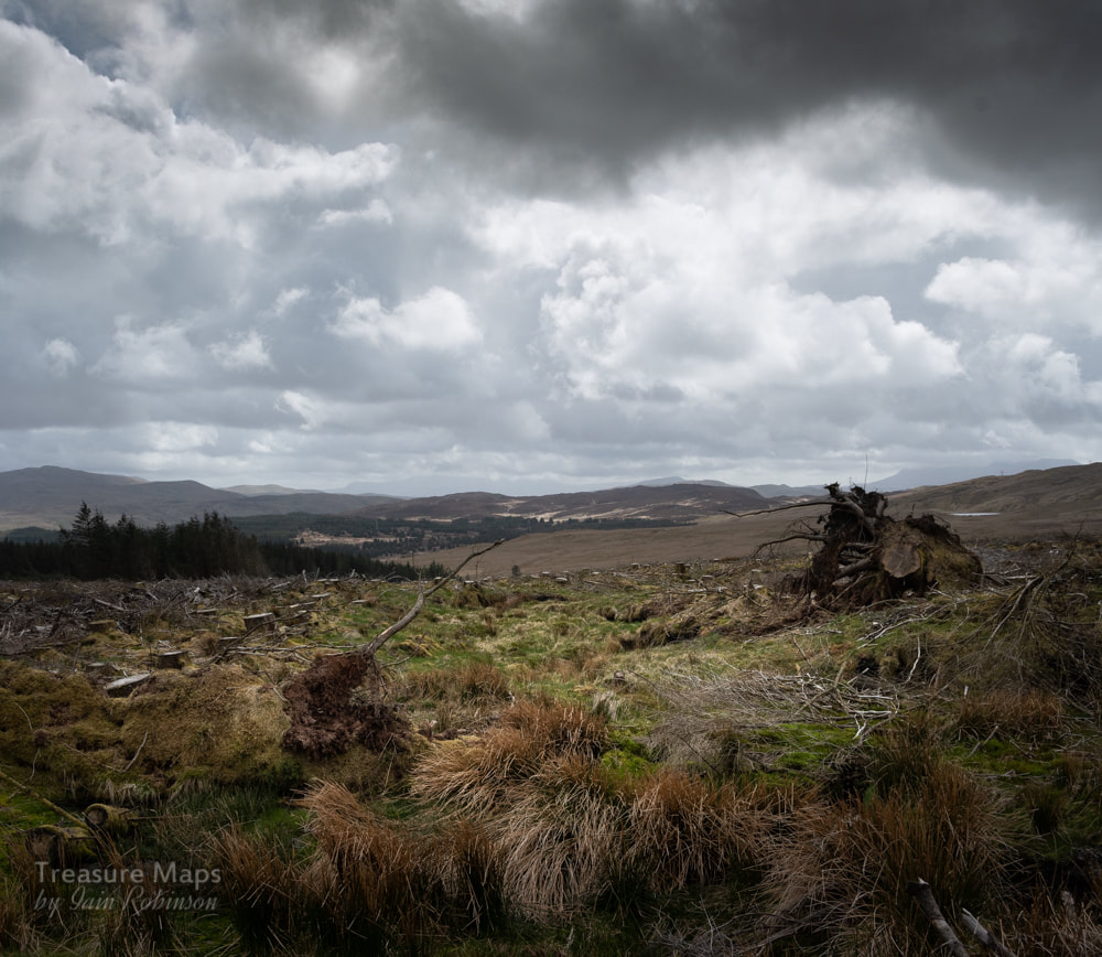 A lot of forest in the distance. Admittedly, there has been a bit of a step-change in thinking these days. The sense in planting deciduous trees as well as conifers is slowly leaching through the podzol minds of the forestry folk. Instead of the march of the endless borg spruce, we could have beautiful woodlands, as at Coed Felinrhyd, or Coed Cwm Mynach. Or the woods outside my back door at Coed Cymerau- thank you, Woodland Trust. So, you see, I'm not against woodland. Not at all, actually. I'd like to see woodland spring up everywhere, where possible...the birch colonisers, followed by the holly and the hawthorn, then the beech and oak. Natural woodlands. Supporting wildlife as diverse as it would be plentiful. To quote the great Oliver Rackham, who has written more and better about woodland than any other living author: "Trees are wildlife just as deer or primroses are wildlife." Woodland grows through our history and culture, and that's natural woodland – not monocrop timber plantations – that we should value and guard as jealously as any other part of our private and shared cultural heritage. 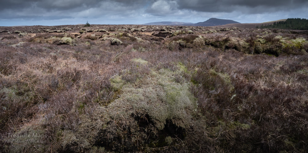 A Carbon Sink. The original moorland with a struggling, self-set conifer. Unfortunately, my inadequate photo doesn't do justice to the many subtle colours in the landscape here. But back on the Migneint, the forest had been imposed on (and obliterated) a landscape that already fulfilled an important ecological role, that of a carbon sink, a natural system that sucks up and stores carbon dioxide from the atmosphere. Plants grab carbon dioxide from the atmosphere to use in photosynthesis; some of this carbon is transferred to soil as plants die and decompose. Bogs are particularly good carbon sinks. Forests like a giant sardine can full of monoconifers, not so good. The land wrecked by the harvesting of said conifers? Zero environmental value. An eyesore, a real one, a festering open wound. Now, the wrecked plantation is being re-colonised by self-set conifers, the process of creating a wild desert, as Mike Perry calls it, starting all over again. Thankfully, changes in agricultural and environmental thinking are happening, but still on a geologically slow timescale. At this rate, by the time we take the turning towards making changes, the road and the destination will have gone. Useful sources: Mike Perry- "Land/Sea", Ffotogallery Wales, 2017. Web site here. "The Hills are Dead"- George Monbiot- link to article here. Oliver Rackham on Wikipedia. The Woodland Trust  The quarry in winter, viewed from the Gorseddau Tramway- with the backdrop of Mynydd Tal-y-mignedd. The remains of Dol-Ifan-Gethin farm can be seen highlighted by sunshine at the base of the quarry. We first encountered this quarry eleven years ago on a miserable, wet day. We'd had big plans about exploring this and the Prince of Wales quarry, but in the end, the weather proved just too damp. I made a mental note to come back, but somehow didn't. Every time we went to the end of the valley it was a case of "Oh, there's the Dol-Ifan-Gethin, but we have to get to somewhere else... Finally, in the spring of 2018, we made a dedicated trip. I rather liked the look of the woodland to the side of the quarry, along the Ceunant Dolgarth, itself the motive power for the quarry's machinery. I'd also read in Richards' Gazetteer that there was a hint of copper mining on the site. Petra and I figured that if there had been, we would sniff it out. As it turned out, we had to make two dedicated trips, because the first time there was a frost which just didn't thaw and I ended up slipping and falling down the incline some twenty feet...(luckily without injury except to my pride). 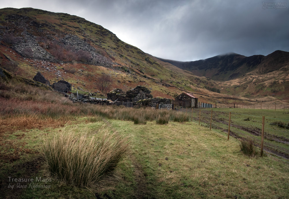 The mill buildings, with a hint of quagmires to come... As usual, I'm racing ahead. The start of the explore was from the car park at the end of Cwm Pennant after Beudy Newydd farm at SH5401849207. You don't cross the stile, but walk on the farm track which leads to the quarry. This is a public right of way, although in winter can be a diabolical mudbath as you near the ruins of the mill. But first, the ruins of the Farmhouse.  Dolgarth, or Dol-Ifan-Gethin Farmhouse. The farmhouse is an imposing structure- and looks to be two dwellings side by side. Was one used as a barracks for the quarry? This farm was owned in the mid 1800s by a Maurice(Morus) Davies, who might have leased the land to the quarry, then returned it to agricultural use when the quarry closed down. The farmhouse can't have been abandoned much before the nineteen fifties, as there were still beams in place and remains of cast iron bedsteads. 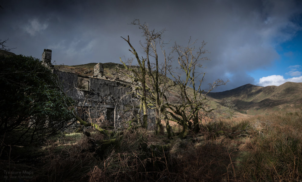 The farmhouse from the front, looking up towards Cwm Dwyfor. After puzzling over the farmhouse for a while and soaking up the atmosphere, we walked on to the buildings at the foot of the quarry. These have been taken into agricultural use, and the present farmer seems keen on improving the land. However, so far there has been little impact on the structures. The largest structure seems to have been used as a mill, with a waterwheel pit beside it. 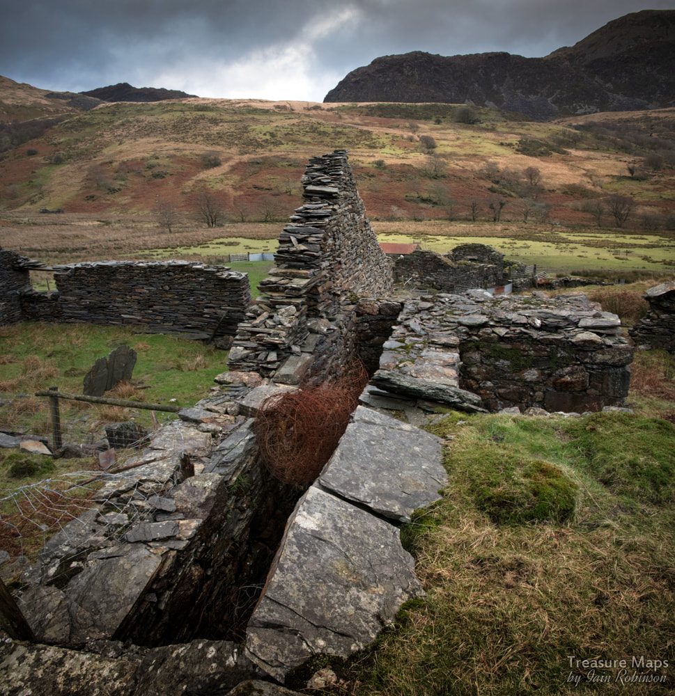 The waterwheel pit next to the mill. The mill and waterwheel are quite recogniseable as such, but I was a little more doubtful about the structure beyond. Perhaps it had also been a dwelling, but there was no mention of such on the Tithe maps...perhaps it was a storehouse for the quarry, later converted to agricultural use. We had a look at the mill leat, which runs in an impressive slate-lined course above the mill.  Not too many slabs left now, but you can see that once, the leat it was lined with some big chunks of slate. The tips of the Prince of Wales quarry are in the distance in the top right of the photo. Having tried a couple of times to climb the incline, and finding that it was passable until the last pitch, where the amount of loose slate makes it dangerous, we climbed up the left side of the Ceunant Dolgarth. The woods are beautiful, and I've included some shots in the gallery at the end. But first, a shot of the incline looking down... 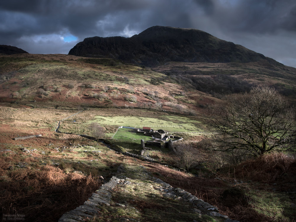 The low sun really highlights the buildings at the bottom of the incline here. Back along the stream, we encountered a small dam and holding pond. 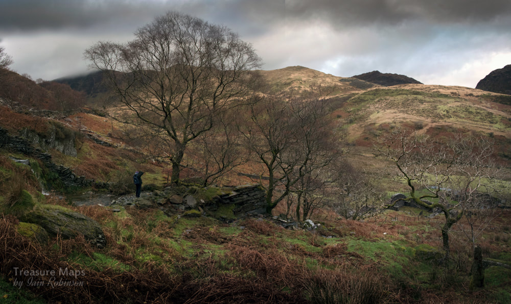 I'm guessing this was needed to provide a back-up of water for when the weather was very dry and the stream's flow became intermittent. I can't imagine it was often dry... The woods became steeper, but eventually we emerged across from the drumhouse. This was of the standard type, with a drum (long since rotted away) sitting on a substantial slate platform. We crossed over the stream, but collapses of the level by the drumhouse meant that we couldn't get near the pit from this side. So instead, we made our way upwards, hoping to find evidence of the copper mine- and also a structure marked as a powder house at the top. 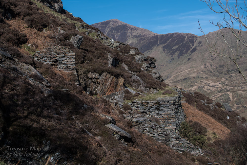 The drumhouse and platform, with the pit beyond. The steepness of the site can be seen from this shot. We soon found evidence of an old excavation for copper above the drumhouse. There was a moderately revetted little road, probably a mule track from a run-in adit along the line of the stream, going towards a small tip, which even now exhibited traces of chalcopyrites in the spoil. It couldn't have been profitable, judging by the quantity of spoil. 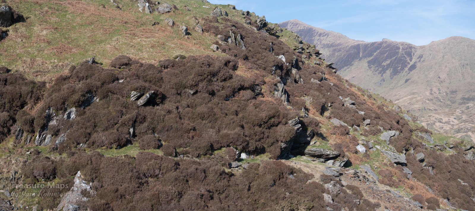 The trackway to the adit, left. The modest tip is at the right. Waste was also dumped in the ceunant- it might also have been used for some primitive processing/washing of the ore. 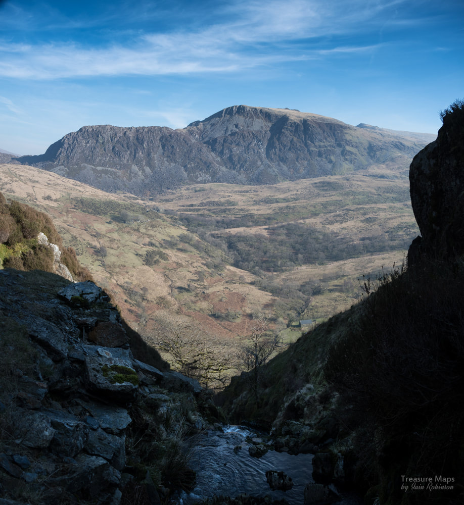 The view from the adit, across the cwm to the Gorseddau Tramway and Moel Lefn. It had been a steep climb, but an enjoyable one, with a few interesting things to see. We knew that a little bit further up the hill, according to the early OS maps, there might be a powder hut. I hadn't been able to make anything out when we had been walking a few weeks earlier on the other side of the valley, even with field glasses, but somehow I was hopeful. Petra went ahead- it wasn't long before I heard a shout that told me we might have found it- and it was pretty well preserved, given the time it must have stood in that exposed place. 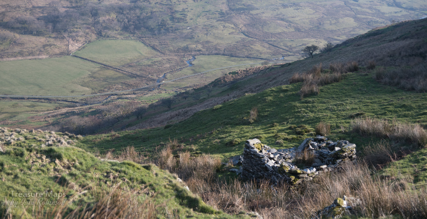 The powder hut/magazine. Quite a bit above the quarry, it can't have been a popular job, having to go and fetch powder from here. It was getting late in the day, but Petra had a plan to descend through the quarry and have a look at the levels from the north side. I concurred, but needed a coffee and a snack, so we sat for a few minutes and enjoyed the wonderful view. A Buzzard was patrolling below us, harassed occasionally by a pair of Ravens. I wasn't looking forward to the descent as my knees are pretty knackered...it's a steep place, but I reckon a young person with perfect knees would find it easy enough. After the coffee, this old mule was ready to explore again, and we made our way down the steep slope. 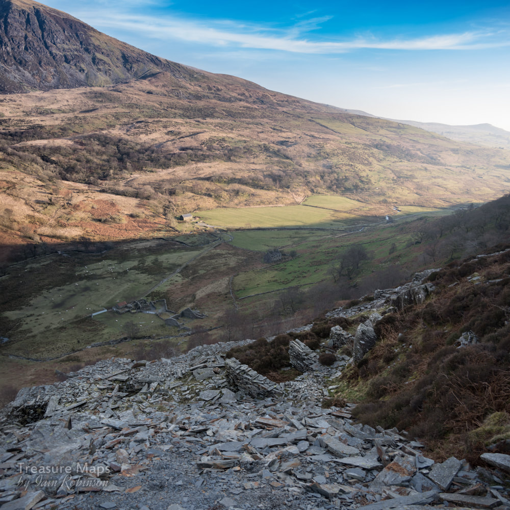 Here's the walliau on the second level. The way to the pit was blocked by a fall, leading to a precarious ledge...we weren't keen. By now, the light was getting low. We tried to see into the pit at each of the levels, but on every occasion, the way was blocked by debris, or a fall, turning the level into a narrow ledge, inches wide. A pity, as I'd wanted a shot of the twll. Obviously the effects of weather and time have not been kind to this place. We made our way slowly down, through more ruined walliau and sketchy levels. It was almost dark by the time we reached the car, but at last, we'd been up close to the place. It was a fascinating site, one that is unlikely to be much disturbed as the years pass by. A pity there aren't more details of it in the records, I searched but could find nothing. 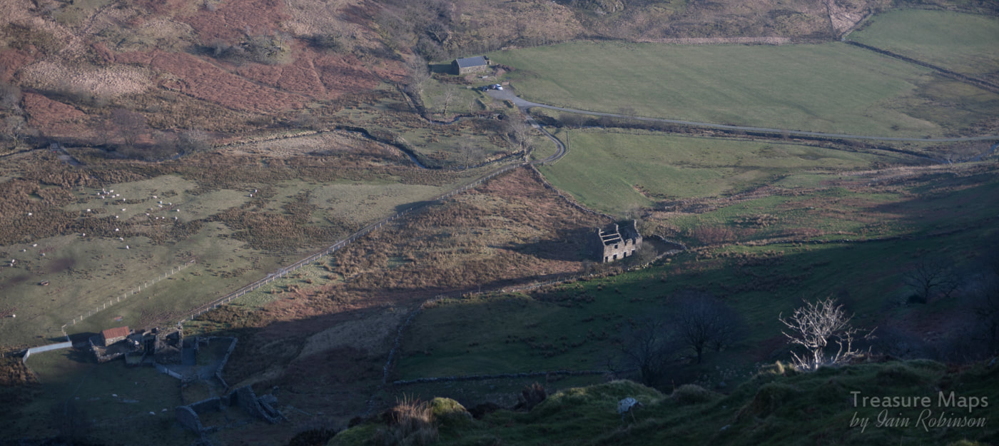 The evening rays bathe the old farmhouse and beudy as our car awaits. The Factoids Dol-Ithan-Gethin, Dolgarth or Pennant Vale as it was also known, opened in the early 1870s. Alun John Richards in his "Slate Gazetteer" reckons it closed ten years later, but from the evidence of the early maps, it is active on the 1st edition Ordnance Survey map of 1889, where the quarry is named as Dol-Evan-gethin but disused by the 2nd edition of 1900. Then again, Wilkinson's Gazetteer has this entry: 1911-Henderson, A, (Owner or Operator) from the Home Office List of Quarries 1911. Perhaps the quarry was only nominally "active" by then and had actually been closed since 1900... The copper mine/trial seems much earlier- and is an inhospitable site, but then the Moel Hebog mine is hardly sheltered! A cursory search of the archives and the Tithe maps revealed little. Another site lost in the mists of history, but a fascinating place nonetheless.  A distant view from above the tramway leading to the Prince of Wales Mill. 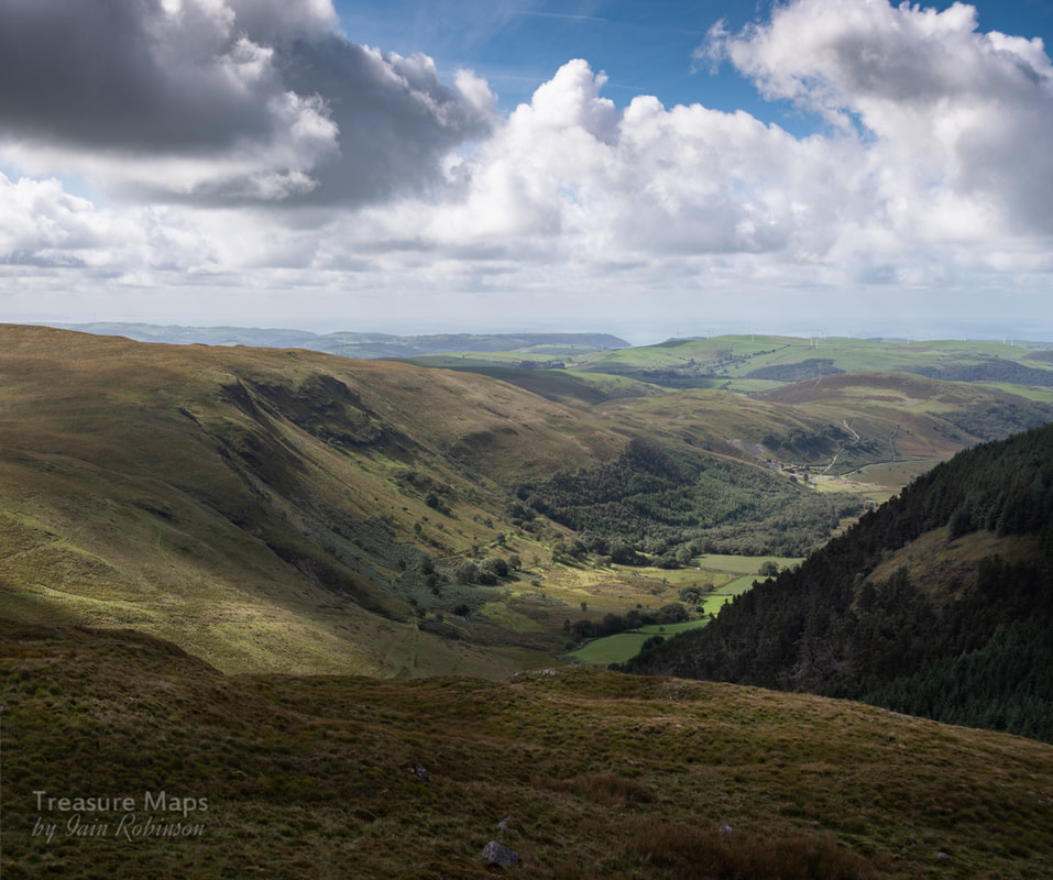 The view of Bwlch Glas from Cerrig yr Hafan. The mine is in the right distance, and you can make out the tramway snaking through the forest and out past the mine. When we were standing at the top of the Hafan incline a few weeks before, what looked like a large mine with extensive tips was visible in the distance, a couple of miles or so down Cwm Ty-nant towards Tal-y-Bont. We knew that we would have to see it, but we were exhausted after scrambling around the mines of Nant-y-Moch that day. We didn't fancy trying to descend the Hafan incline again- an easier route would have to be found, if there was one. We approached from Tal-y-bont, but instead of taking the road signed to Nant-y-Moch, we carried on up increasingly smaller and narrower lanes, following the course of the Afon Leri. On the right side of the valley, (the south side if you're looking at a map) we could see the course of the Plumlumon and Hafan tramway on it's way to Hafan, as it followed the 150metre contour. Amazing that it is still visible after 119 years of abandonment. There is supposed to be a viaduct built for the tramway, but lost in the woods just south west of Tal-y-Bont...it's on private land I'm told, but I hope to find it. There are a few old mines along the Leri valley, most notable being the Cefn Gwyn mine below Bontgoch. The old maps show many old shafts and levels, but sadly, the passage of the years has erased them from the landscape. Cefn Gwyn still has a few adits, but the surface remains have gone. Fancying a flattish walk and suspecting that there would be one or two things best viewed as a pedestrian, we parked the car where the road starts to become a farm track, at SN68988848. There was a wide lay-by, so we wouldn't be bothering anyone. We walked off into a beautiful autumn day, showing off the trees on either side of the road just as their leaves started to turn brown. I couldn't resist a couple of contre jour shots. 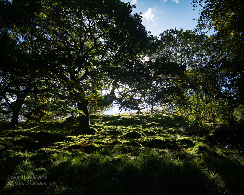 After half a mile or so, we encountered what looked like a stone-built dam to the south of the road. Petra thought it might have been a wheel pit but after some debate, we decided it was probably a valve or sluice, as the ends were curved outwards. The woods were too thick on the north side to see where the water would have gone, but I am guessing it went to a mill. I don't think it was mine-related, but you never know. 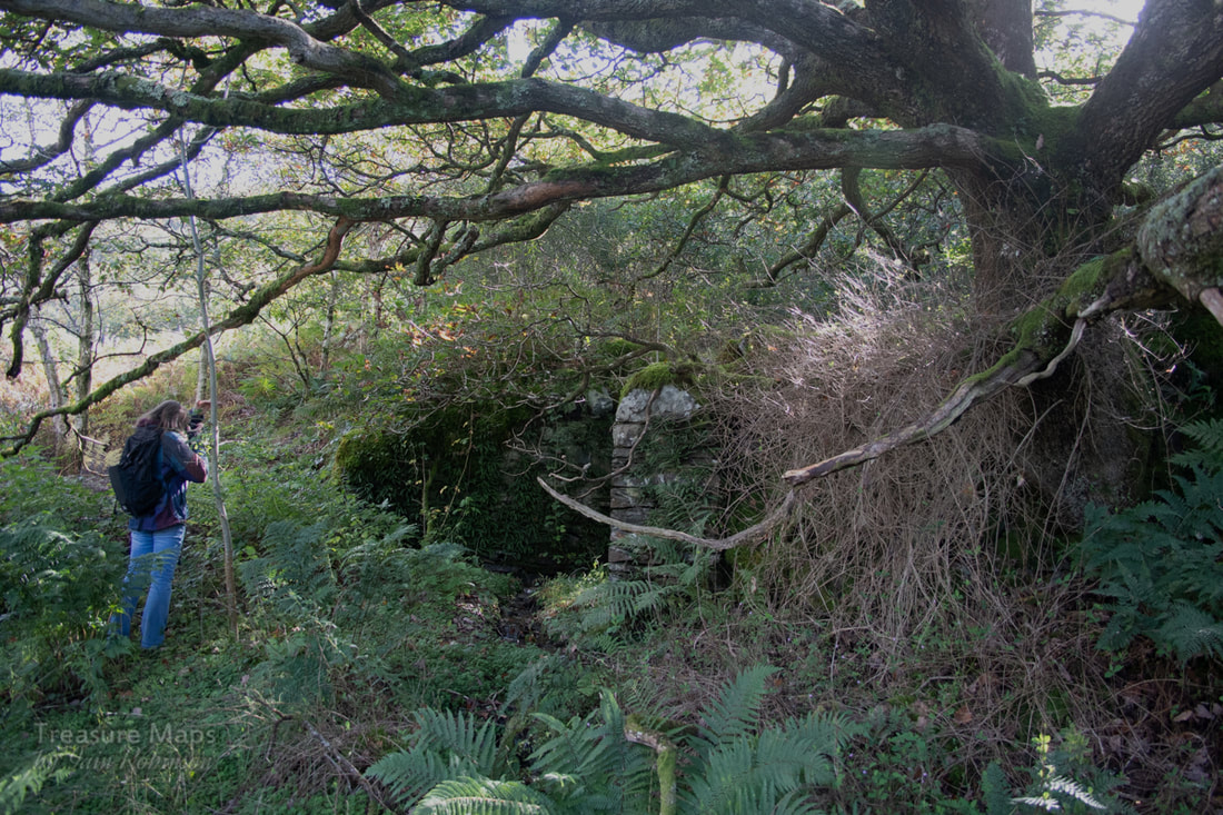 After a while, the Afon Cyneinog can be heard to the left, below the road. We spotted the formation of the tramway above us, running behind a lovely little cottage, Dolgarnwen. From the old maps, it would seem that this had been much larger at one time- it's a super spot, and appears to pre-date the tramway. After a hundred yards, the tramway joined the road, at which point we could see the tips of Bwlch Glas. It's ironic that the mine was opened after the tramway closed, otherwise it would have been a good source of traffic. 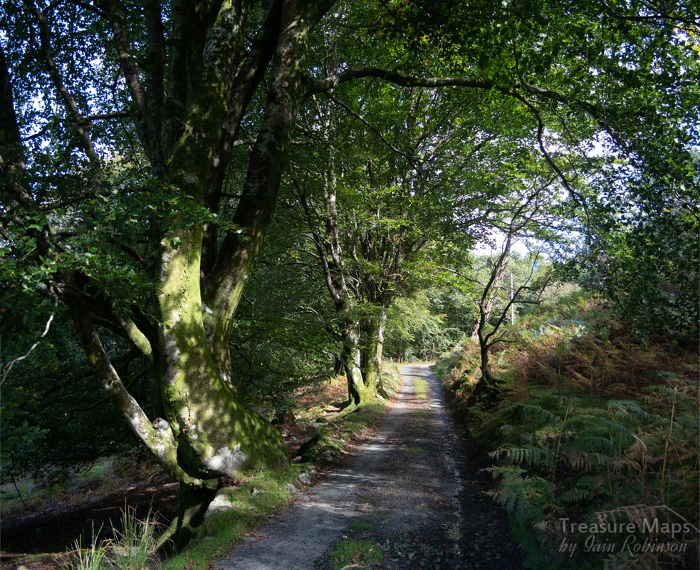 The road ramps up to take over the tramway formation. 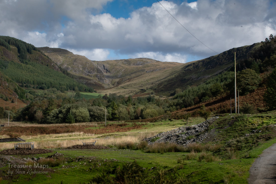 Our first sight of the mine tips. In the distance are the excavations of the Hafan mine and incline. The mine is impressive. There must have been a great deal of work, as the tips were extensive. A small inspection revealed quite a few different minerals and types of rock, from the Hafan Greywacke through to quartzy Breccias and iron rich sediments. But the remains of the buildings were vying for our attention. Apparently it is the only mine in Ceredigion whose surface works are made almost entirely of concrete. Supports and plinths for machines were arrayed in a monosyllabic manner, brutal in their lack of ornament- no fancy stone arches here, or any mason's work. Yet I was impressed by the skill of the shutter-builders and by the sheer amount of material that must have been needed. 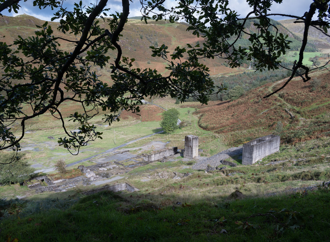 An overview from some tips at the shallow adit level. The tramway is very obvious as it winds off towards Hafan. 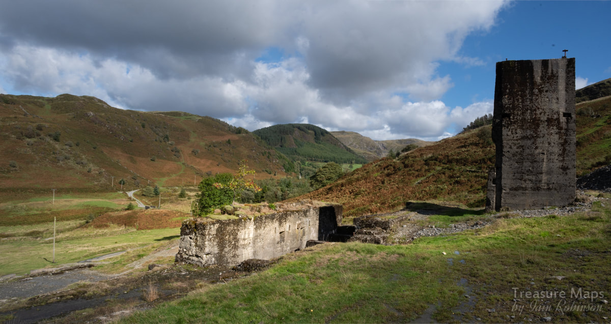 From the first level above the road. 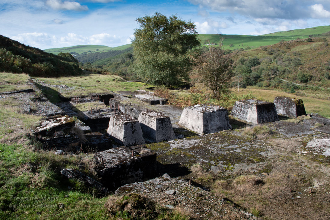 Holding down bolts emerge from concrete bases... I imagined that when the mine was in operation, everything would have been covered over in corrugated iron so that the place would have presented the appearance of a large factory. Holding-down bolts strained from their imprisonment in the concrete blocks like rusty Ladies of the Lake holding threaded swords aloft. These blocks would have supported jigger tables, stamp batteries and grinders. The length of the bolts attested to the size of the machines. It must have been a noisy place to work. There were some more excavations further up the hill, a shaft and a couple of run-in adits. The shaft had the unmistakable outline of a headframe, grass-grown but still visible. 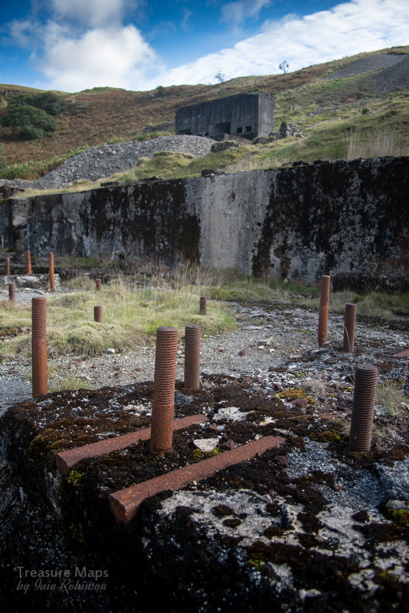 More holding down bolts We didn't venture far underground on this occasion- the adits were very wet indeed, although that doesn't normally stop us. But I can tell you that the lower, deep adit ends in a fall after a few yards. The upper adit leads to a series of deadly ladders to lower levels, where there is a proper old rusty mine cage to transport the work force down to work and product to the surface. Ropes and a mastery of SRT techniques are neccessary to explore those delights, but there are several good shots available on the internet if you are curious. It seems that some machinery was water powered, although by the time of the mine, internal combustion engines were becoming more prevalent, and I can't imagine the mine cages being powered by anything but steam or i/c. Since writing this, a friend has pointed out that the mine cage is equipped with the remains of an electric light, so there must have been a generating set on site, undoubtedly i/c powered. (thanks Dave!) Further research has since revealed that a gas plant was installed on site in 1907 when lead prices rose to £20 a ton. The mine at this point was being worked in conjunction with the Loveden mine. Later, in 1919, Hydro Electric power was used, presumably from one of the schemes in Nant-y-Moch as there didn't seem to be any evidence of this near the mine. (source: British Mining 1909, vol 86 p112.) 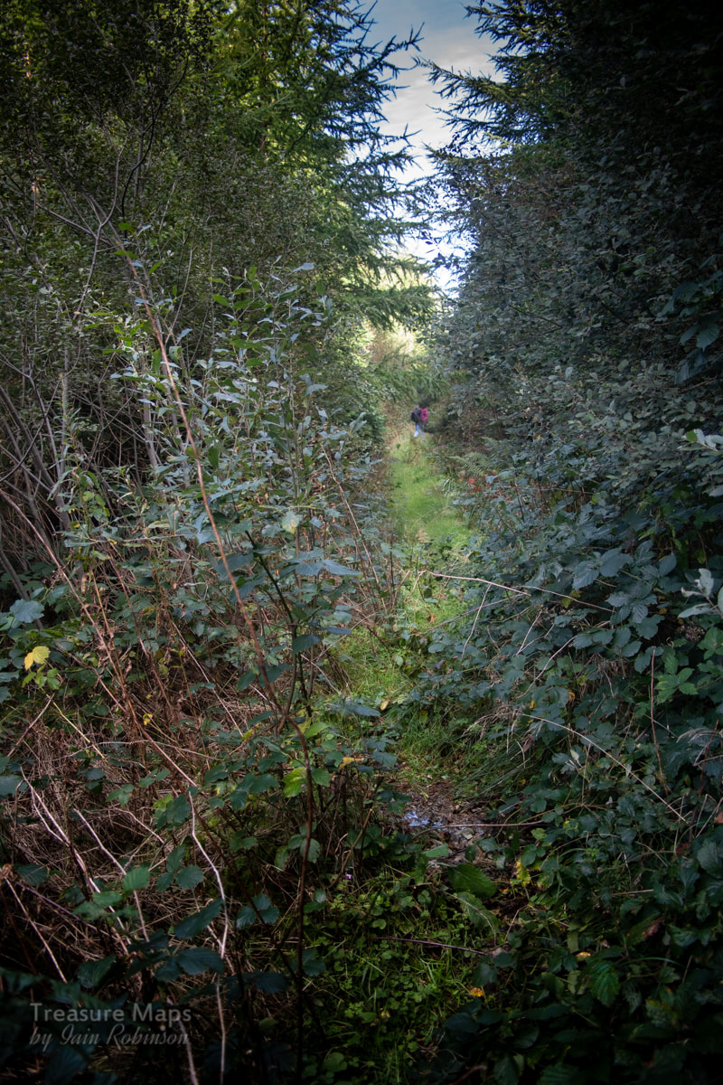 The tramway runs through a forestry plantation While inspecting the mine, we were aware of the tramway heading off east towards Hafan. I didn't take much persuading to go and try to follow the formation to the base of the Hafan incline. It was a very pleasant walk, even when the line is swallowed up by a forestry plantation. Apparently the way was cleared through here a while ago by the "Railway Ramblers"- if you want to see their take on the tramway and lots of other interesting stuff, their site is here.  Cyneinog farm in the distance from the tramway. I appreciated the help from the ramblers, even if things have grown back a bit since they cleared a path. But soon we were out of the trees and back onto the sides of the hill, with great views down towards Cyneinog farm. 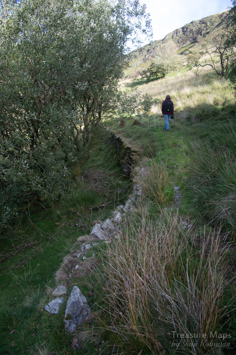 There were sections that were revetted and embanked on the hillside, and elsewhere a small bridge had been made to cross a stream. 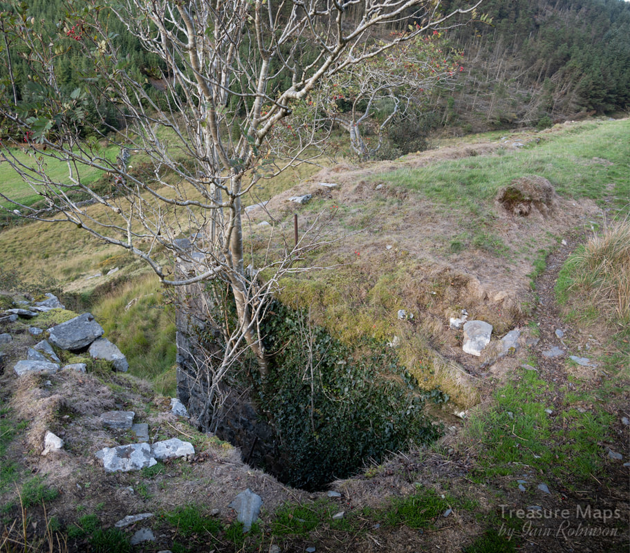 The remains of a bridge across a small stream. Before long, we came to the base of the Hafan incline. I certainly didn't feel like climbing it again- (or perhaps it was the descent that worried me with my ancient knees). One thing was for sure, it had been a fascinating walk and another bit of the Hafan and Plumlumon tramway explored. 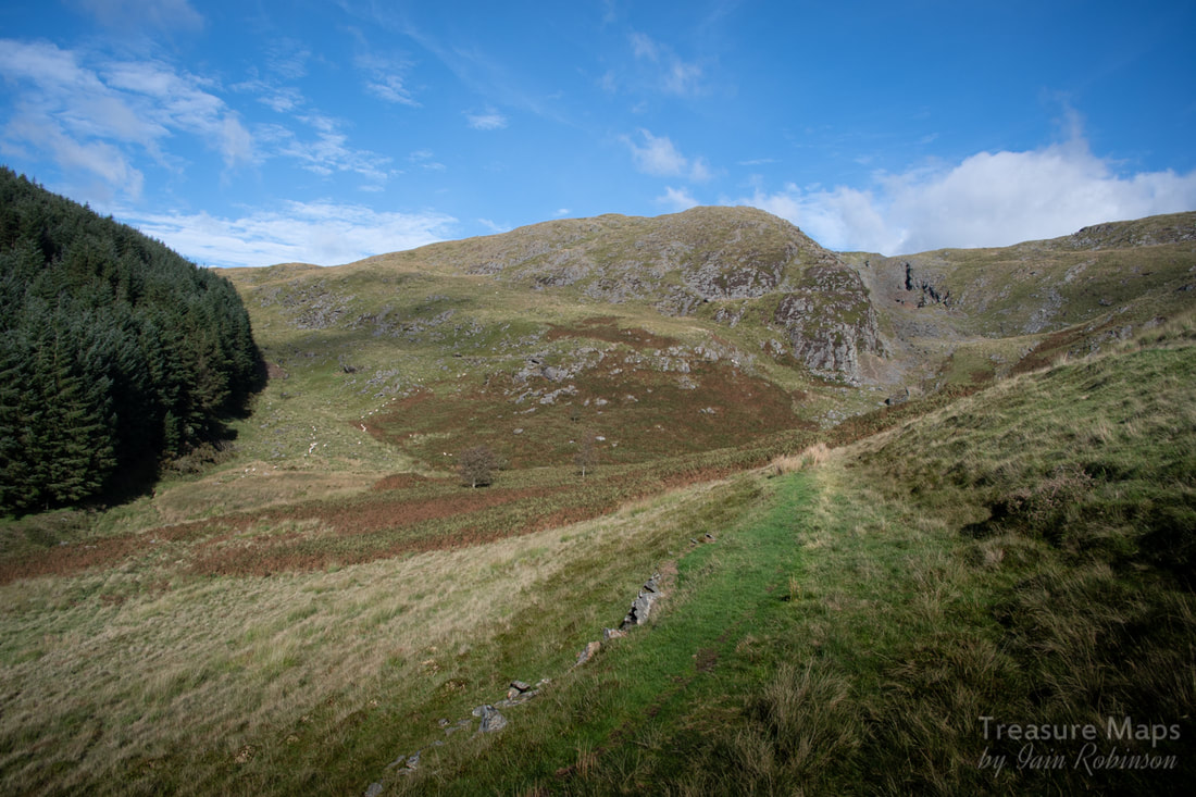 Nearing the incline up to Hafan. What a wonderful view- and the diminutive Cyneinog mine can just be seen beside the forestry, halfway up the hill. The Factoids: Initial investigations at Bwlch Glas started during the 1880's when a level was excavated to intercept two parallel veins of ore, which outcropped further up the hill. Serious production at the mine didn't start until 1909, when an impressive processing mill was constructed and other levels opened. The Scottish Cardigan Lead Mining Company Ltd. finally closed the mine in 1923, having worked there on a fairly intermittent basis for a number of years. The mine produced 1240 tons of lead ore and 99 tons of zinc ore. Further Reference: The Metal Mines of Mid-Wales: Part 3 Cardiganshire - North of Goginan', David Bick, 1988, pp.34-35. 'British Mining No.12: The Mines of Cardiganshire', J.R. Foster-Smith, 1979, pp.44-45. 'The Plynlimon & Hafan Tramway', E.A. Wade, 1997 (2nd Edition), p.141. 'Special Reports on the Mineral Resources of Great Britain. Vol. XX.-Lead and Zinc. The mining District of North Cardiganshire and West Montgomeryshire', O.T. Jones, 1922, pp.57-59. Lead Mining in Wales: W.J. Lewis, 1967 p193, 340. 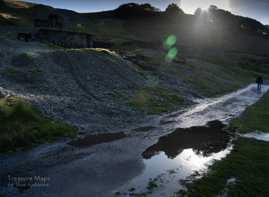 Cheerio for now! A look at Moelfre Slate Quarry and a discovery on the moors above Pennant  Llwyn y Betws, seen from Hendre Ddu. Moelfre slate quarry is an intriguing place. The quarry track runs up to the moor surrounded by wonderful mature oakwoods, beautiful in any season. The views across the Pennant towards Moel Isallt are fascinating and rewarding as you climb up a path that was once part of an incline for the slate quarry. And yet, I've never felt quite comfortable walking up here, despite it being a public footpath. I've felt a forbidding air of menace about the place, as if my presence here is begrudged. Probably my imagination, or some arrangement of the landscape playing on my sub conscious. At any rate, for those wanting to try, the path comes off the Pennant road at Gyfyng, just after the bridge over the Afon Dwyfor, when the road begins to ramp up. There's a little road to the left, which passes over another bridge. 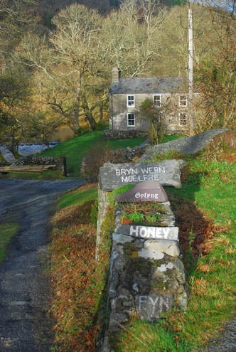 The footpath gets diverted through the remains of the slate mill, to the left of the house. The mill is fascinating, dating from the 1870's and was water wheel powered, later by a turbine. There are some towers in the woods to the right of the mill that are the remains of leats, bringing water to the turbine. These days, rather than try to pick my way through what feels like someone's back garden, I carry on up the road past the house, until the track turns left and starts to climb upwards to the quarry. 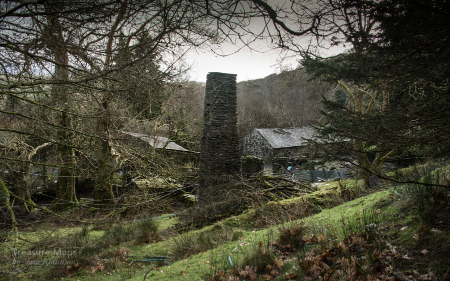 The mill and a launder pillar. The woods here are exquisite. Marred recently by the landowner fixing galvanised steel fences, which are rather unsympathetic, if functional and long-lasting. There are some adits as you climb up- waterlogged, impassable -and probably the water supply for the houses, so best not to explore. After the impressive drumhouse is reached, there is a strange, low slate structure which might have been walliau at one time, but is now a kind of backwoods retreat, although it doesn't seem very weathertight. It's attractive though and would be fun for a night or two if it wasn't too cold. There is evidence of an old working area here and some run-in tunnels above. 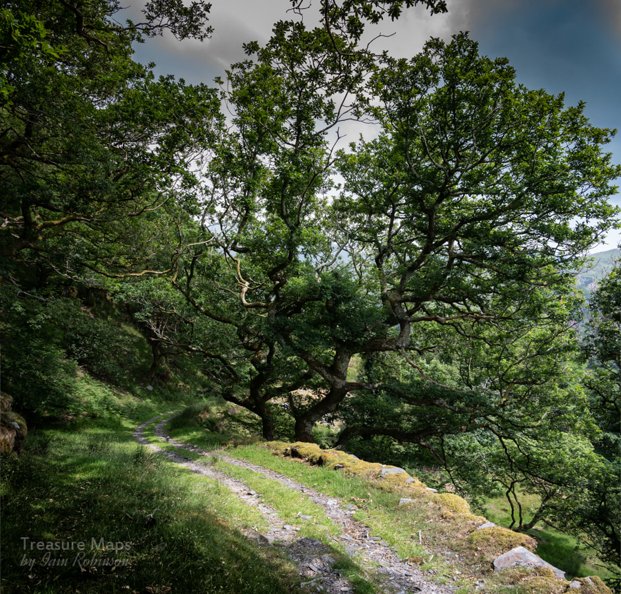 Exquisite woods... Walking upwards, there is a line of new fences to the right, going into the woods. These lead to the ruins of the manager's house, an intriguing place, if impossible to photograph. There's a nice old shed, which again seems to have been used as a kind of overnight bothy at some time in the past. 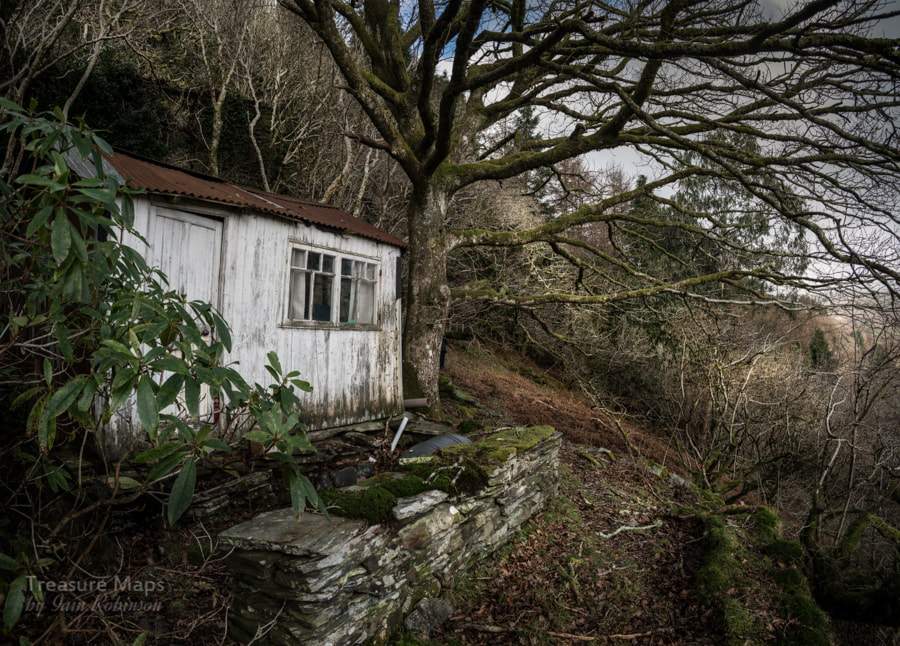 The old shed, manager's house ruins in the background. Then, the trees give way and the views across the valley become clearer, Moel Isallt and it's attendant slate quarry showing as a grey scar on the flanks of the hill. There is a small pit to the left, then a larger pair to the right. These are the remains of the main quarry- ruined weigh-houses and structures can be seen on the tip runs below. The quarry was a development of an earlier metal mining operation, and from some angles it is possible to see the old tunnels, and the remains of a waterwheel powered chain incline out of the pit. The pits are infested with gnarly vegetation and young birch and oak trees, making it very dangerous to do anything but gaze at the place from a distance. I did get to the south western side of the pit during a nightmare stravaige across country from Hendre Ddu once, but it's not something I ever want to do again! 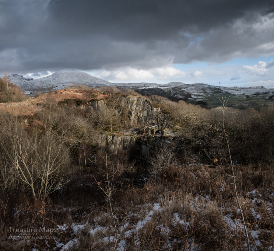 The pit, with the waterwheel winder remains. There's a gate here with a stile, marking the boundary with open farmland. We usually stop and have sandwiches here, as the climb is a sharp one- yes, any excuse, really.  The stile. Moel Ddu looms under cloud behind the craggy slopes of Moel Isallt From here, an old cart road makes it's way across the moor. It's hard to follow, but at one time it was a substantial trackway with stone supports and revetting. We usually head towards the powder house, which is a fine round pattern similar to the rather dilapidated one at Hendre Ddu. True to type, the farmer has filled this powder store with old barbed wire and rubbish, but it is still a good sight. There's the remains of an old beudy, or field barn nearby, then the trackway ramps up toward the plateau.  The trackway, with some revetment in evidence as it climbs the last few yards to more level ground.  The powder house, with Moel Hebog showing to the left distance. At last, slightly more level ground is reached. The first time we came this way, we encountered yet another makeshift shelter, this one a little more watertight, locked up and seeming to have been used by hunters. We walked around it and then I noticed something about half a mile away and gave a start. A most incongrouous structure, a house of a victorian suburban design, sitting slap in the middle of the moor with nothing around it. Oh, and half it's roof off as well. 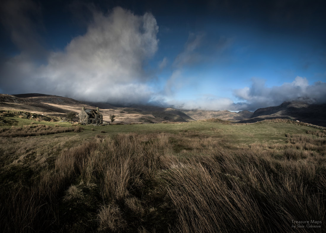 The house looks as if it has landed from space... We've made half a dozen visits since, in all weathers- and the place still has this effect on me, it's strangeness stands out from the surrounding grass and rock, without any visible overtures to the landscape around it. sadly, it is now impossible to get inside the house due to the sketchiness of the roof and the delicate state of the walls. The windows are open to the moor, a sad tatter of curtain flapping in one of the upstairs windows. Looking in from the kitchen window, it seems as if this place had also been cannibalised as a kind of bothy in the last twenty years. Gas cannisters and tins of food lay alongside a saucepan. But the house itself dates back to at least the late 1870s. All I can find out is that it was last occupied in the 1960s. Was it a hunting lodge? It looks so uncompromising that I wonder if it was a wealthy person's statement in the landscape, a hunting retreat for city dwellers. 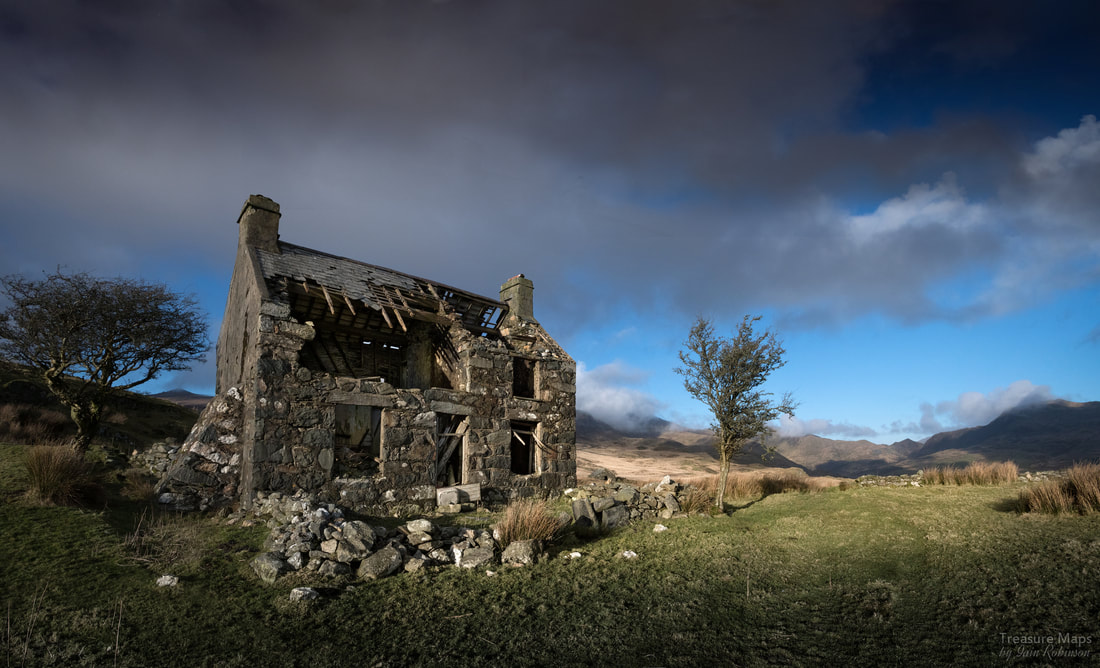 The funny thing is, that once we had seen the place, every time we travelled further in Cwm Pennant we saw it again in the distance, even from the slopes of Moel Hebog, or from Moel Lefn. It became a sort of talisman on our explorations. It must have been an exposed spot, and a lonely one as well. There are some outbuildings, a couple of pig sties and a beudy a little further along. We visited this one day in a blizzard, and went in to shelter. It was filled, feet deep, with sheep poo, but it was still preferable to the storm raging outside. Petra found what she thought at first to be an adit nearby, but later we decided it must have been a cold store, dug into the rock. 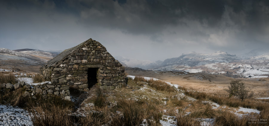 The blizzard approaches... I tried to approach the place from Chwarel y Plas once, a little to the north. It seemed like an easier way from the map- but I was wrong. There are some impassable fences and ditches and a large expanse of "Johnny Breakaleg" grass. You know the sort, unstable hummocks with deep ankle breaking pits between them, filled with water. If you want to see this mysterious house, best to approach from Moelfre. A couple of years on and I am still none the wiser as to the story of this place- if anyone reading this knows, please put me out of my misery. The factoids about Moelfre
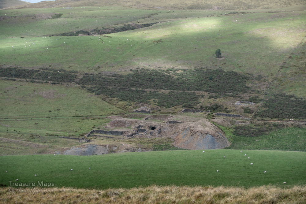
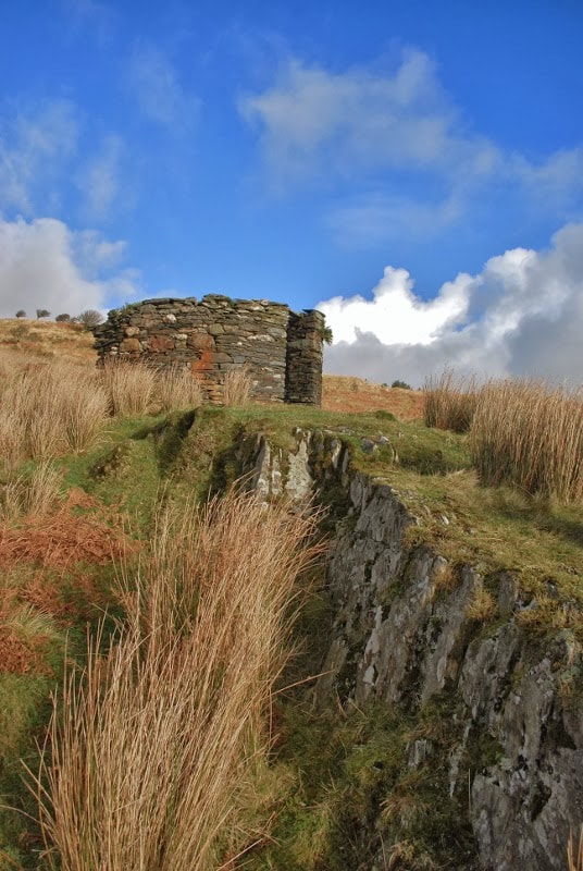
The slate quarry was developed in the 1860 after workings to exploit copper were abandoned. These workings could have been extensive, as the adits still show in the pit. At first, material was taken out of the pit via a tunnel, later a chain incline pulled it out to a mill on an upper level. Later in the early 1870s, a lower tunnel was driven to the incline and slate was taken down to the lower mill. In it's heyday, 30 men were employed, producing 600tons per annum. The operation closed in the 1880s, although the place was worked sporadically after that until the 1930s. There are reputedly two disused turbines and generators still on site from the early days, while a third one, supplied by an unsightly plastic pipe is still in use. source: "Gazeteer of Slate Quarrying in Wales."- Alun John Richards, Llygad Gwalch. |
TracksReceive the occasional Treasure Maps Newsletter- and alerts when a new post is available!
If you enjoy my content, please buy me a coffee!
Check out my other online activity...
Index
All
|


 RSS Feed