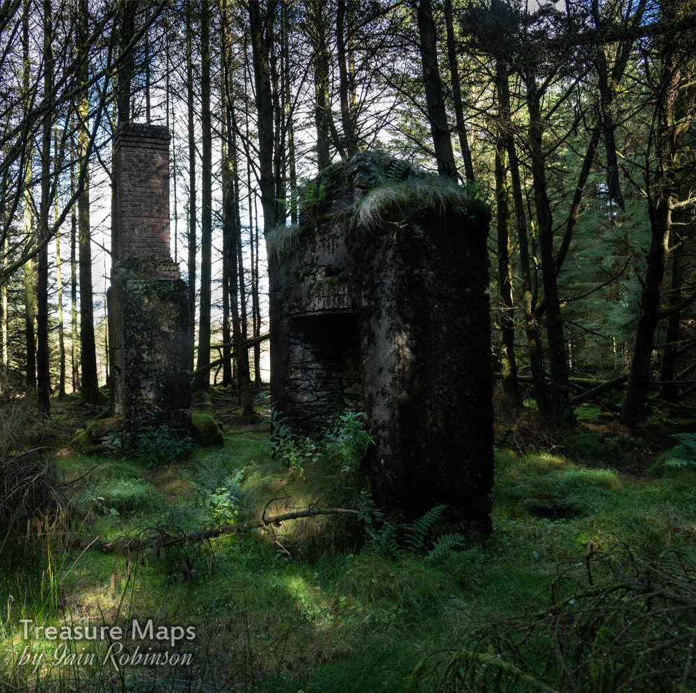
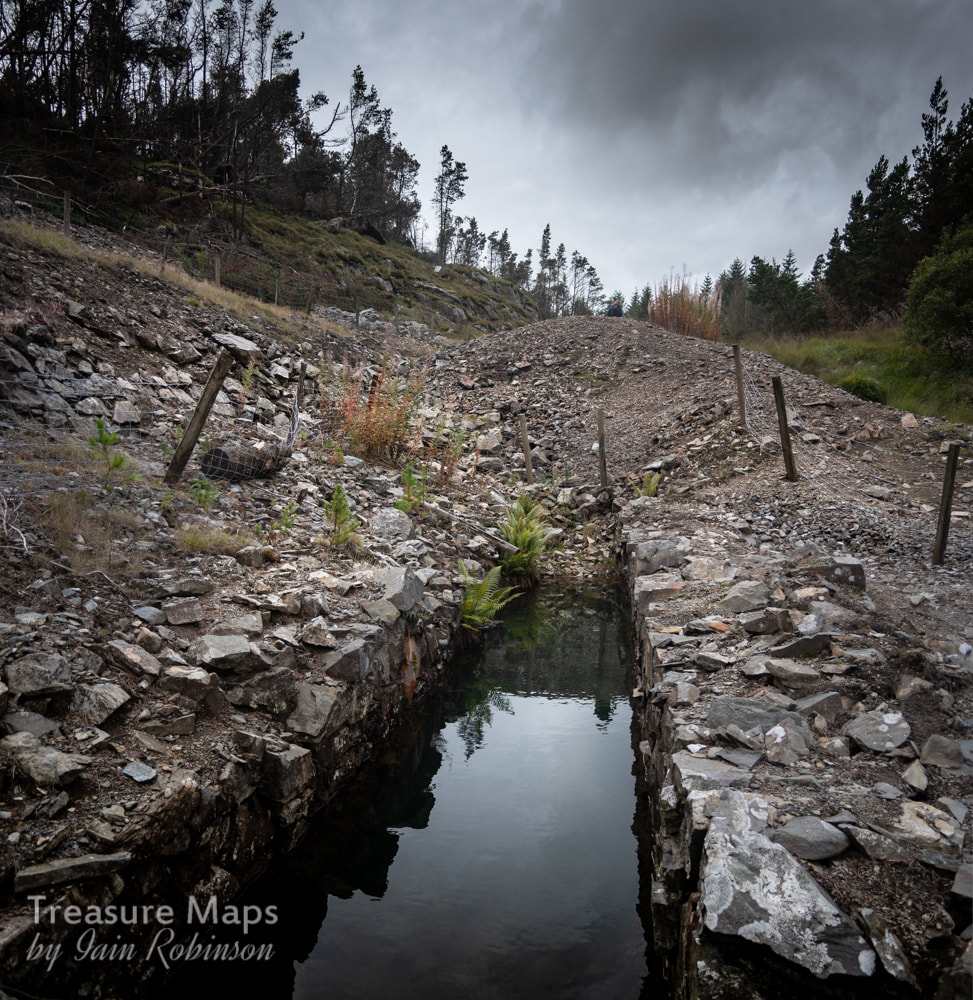
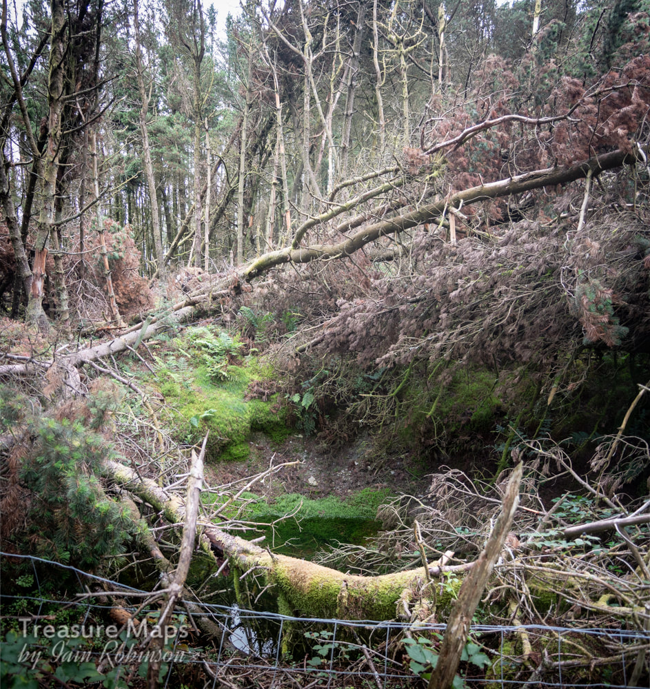
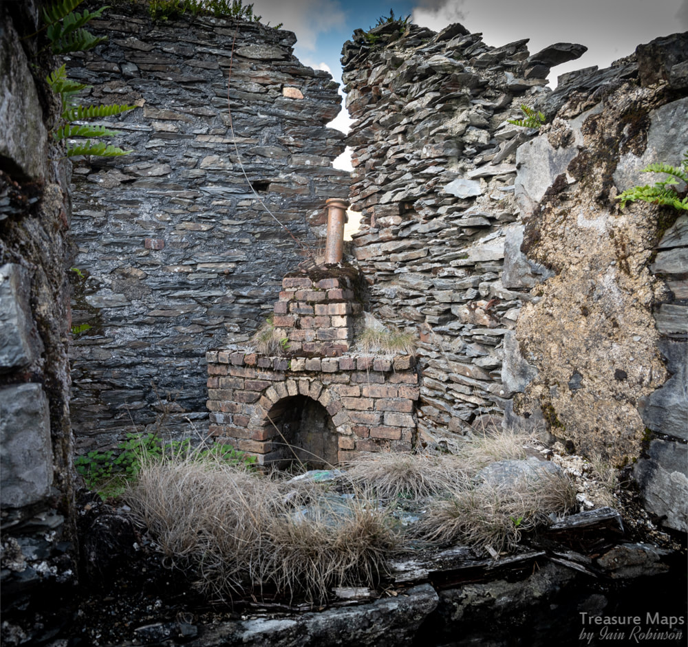
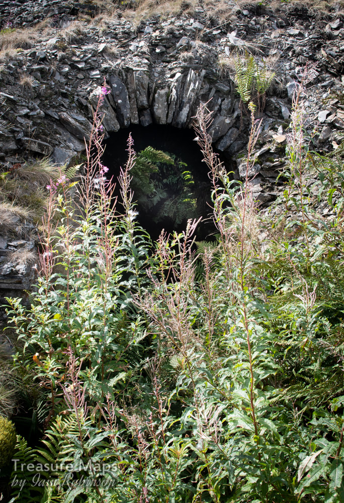
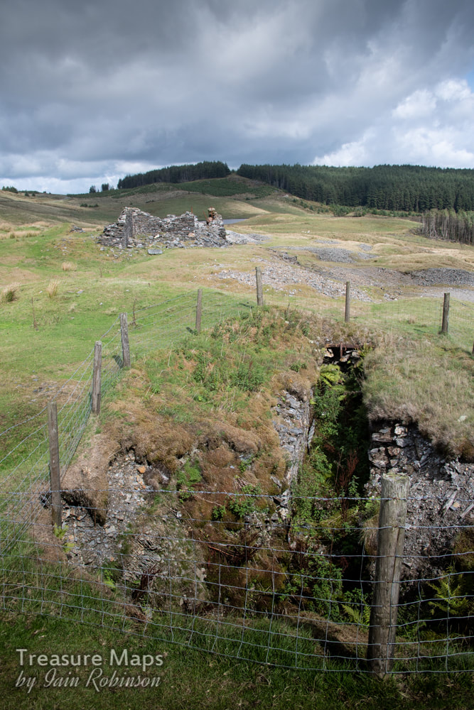
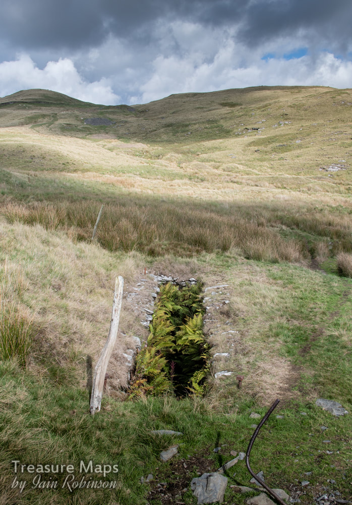
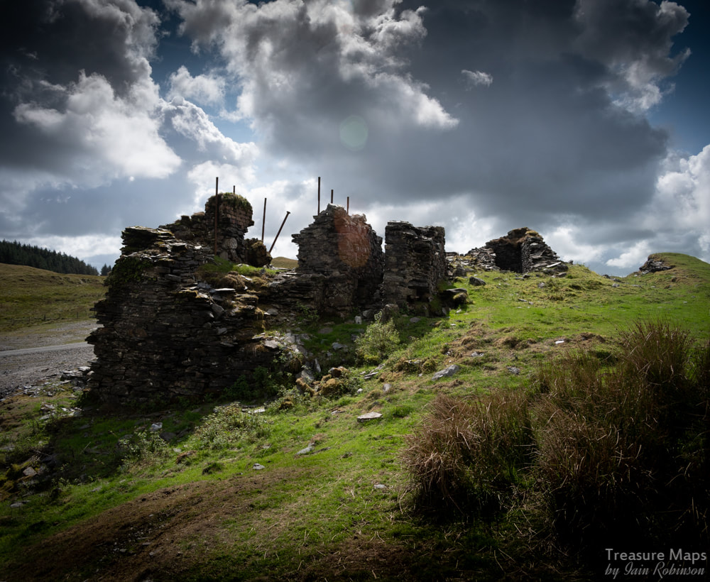
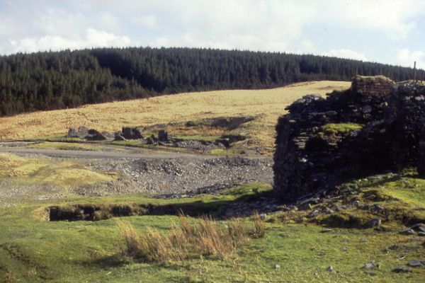
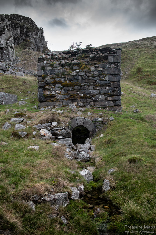
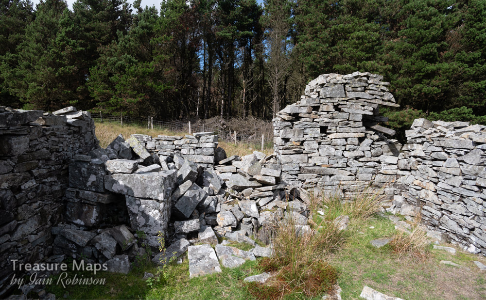
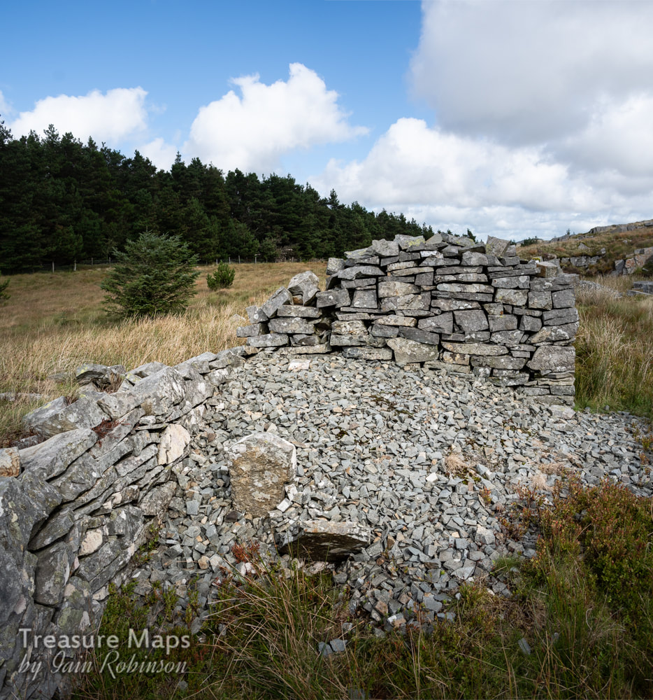
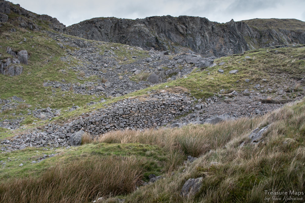
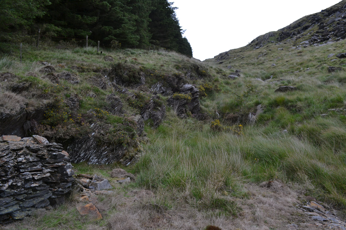
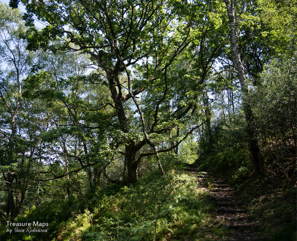
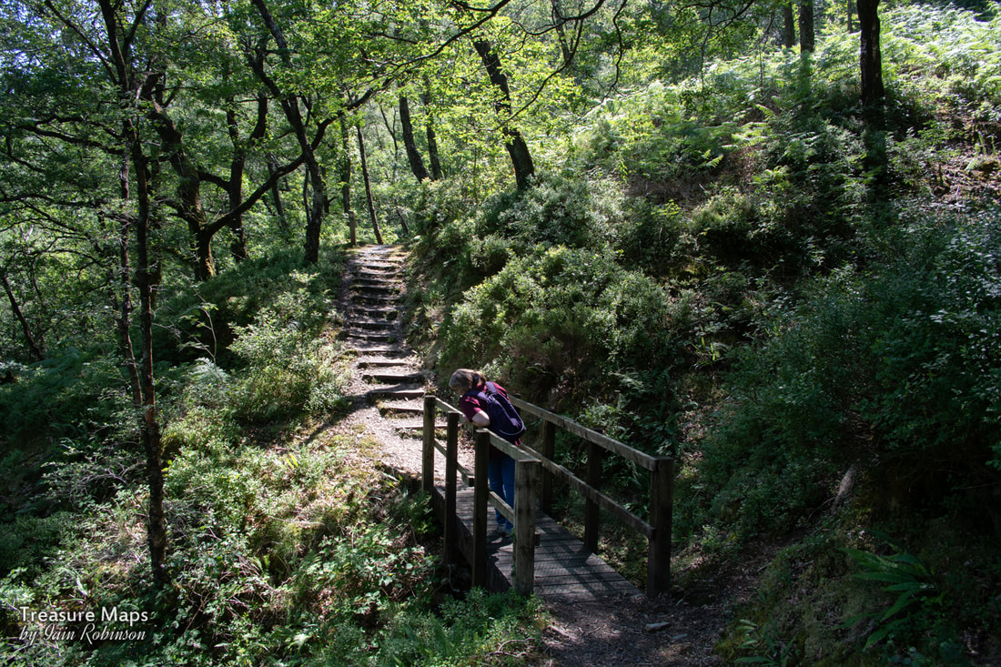
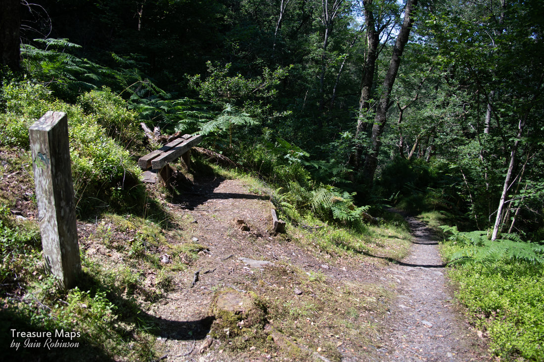
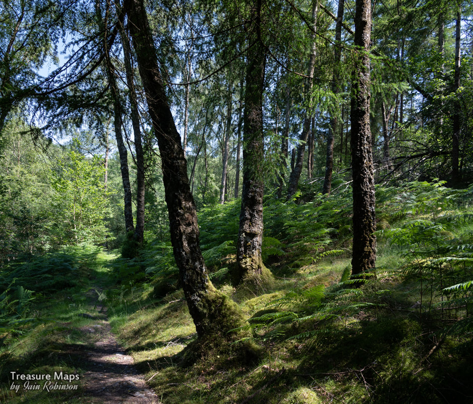
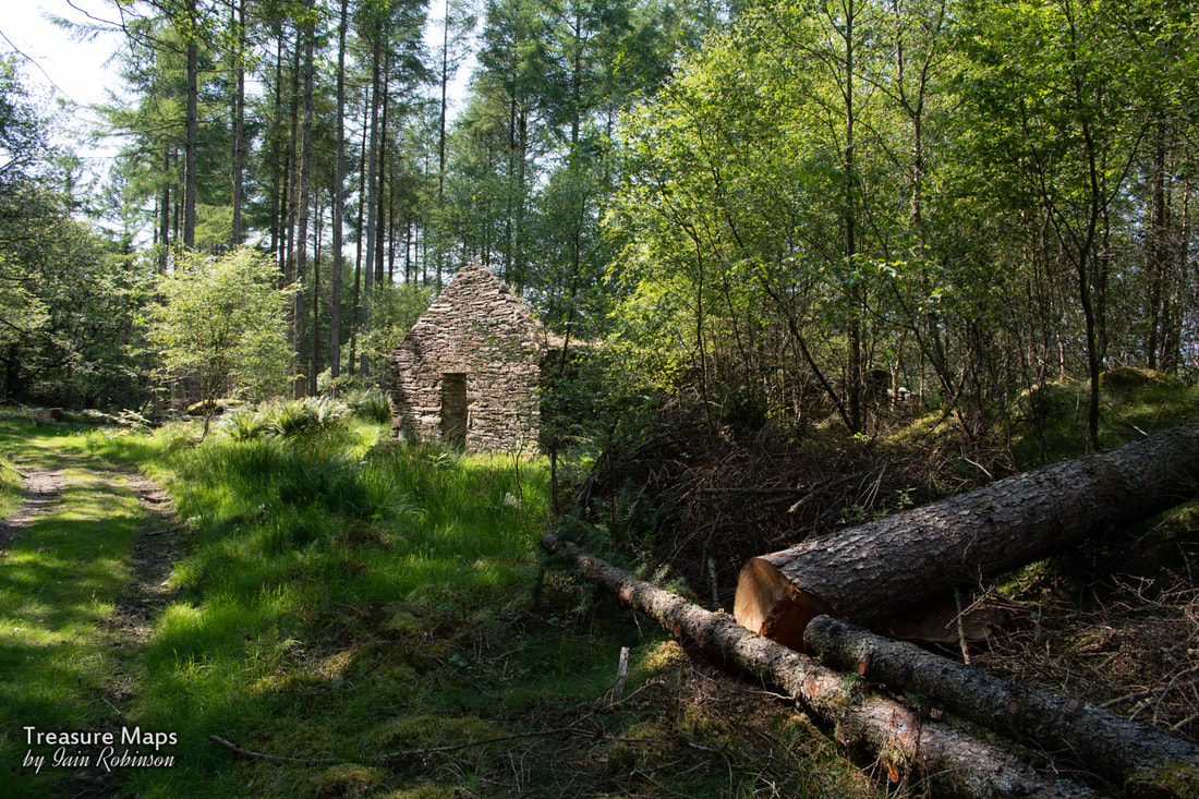
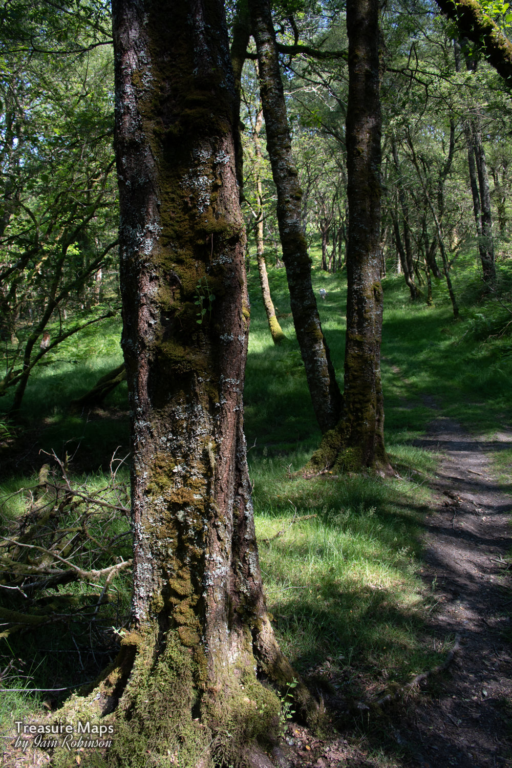
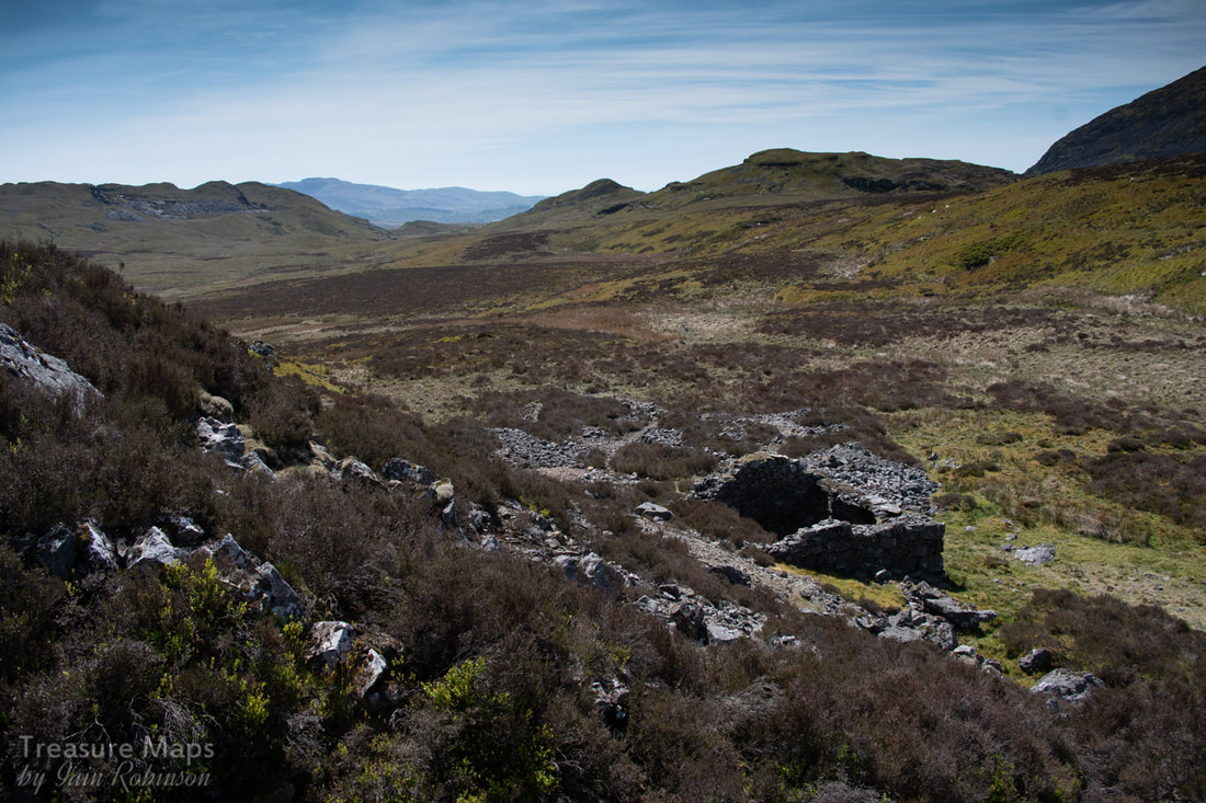
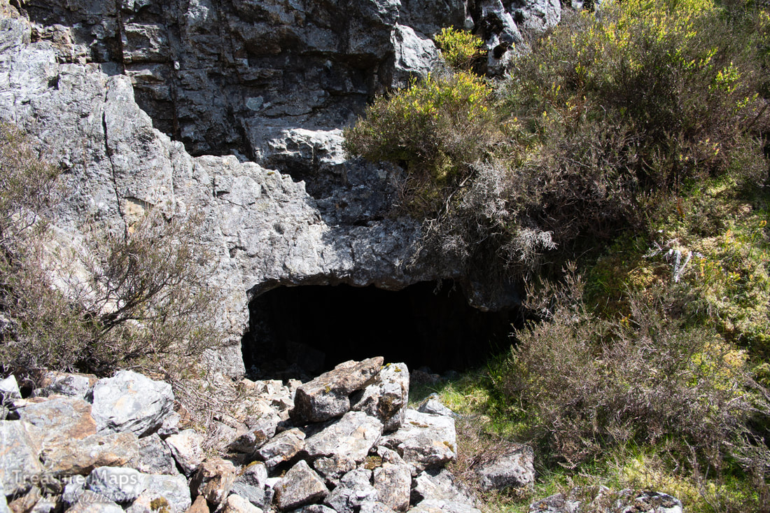
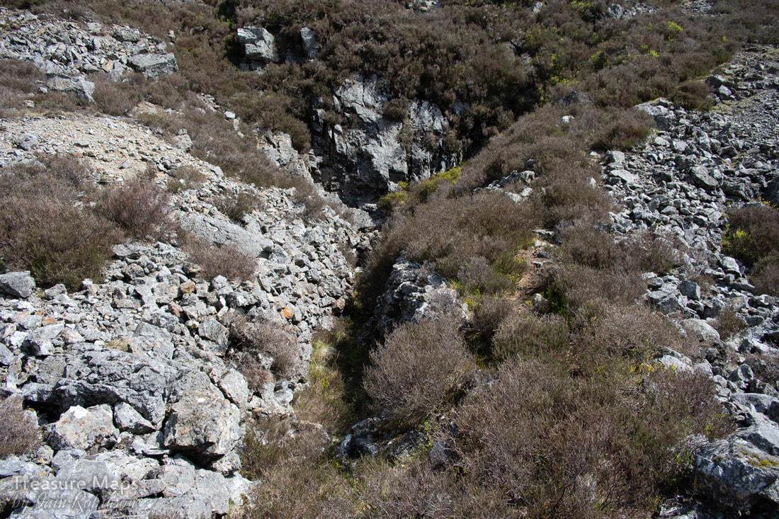
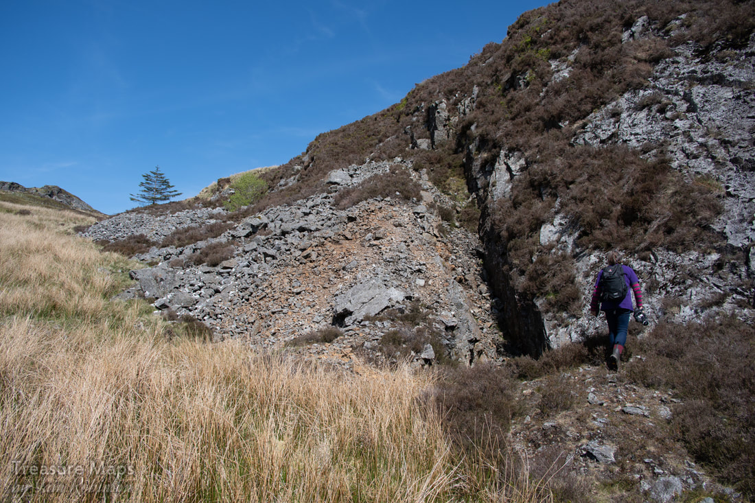
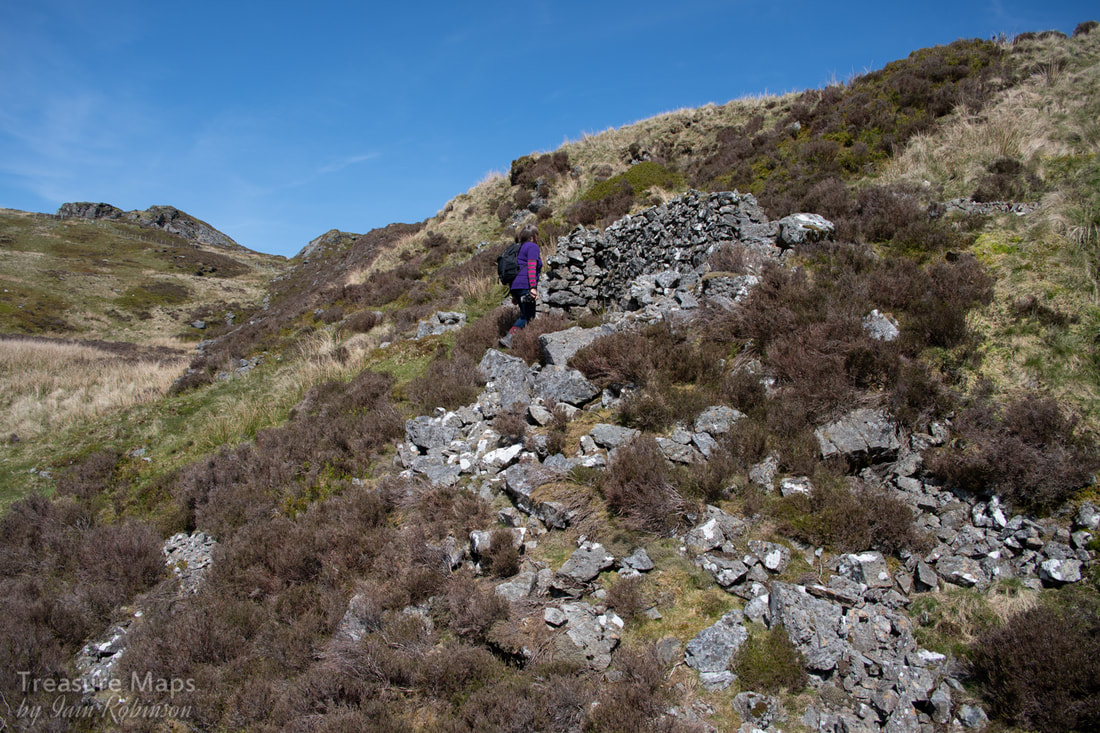
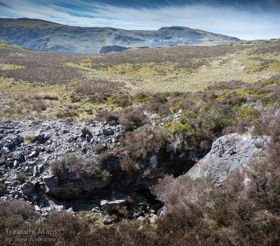
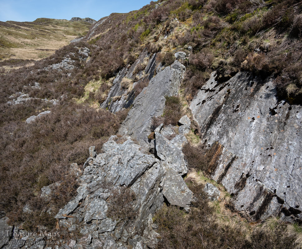
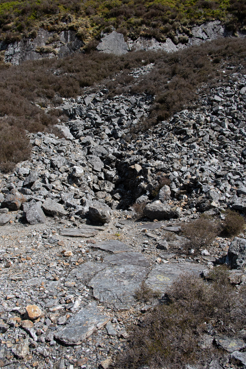
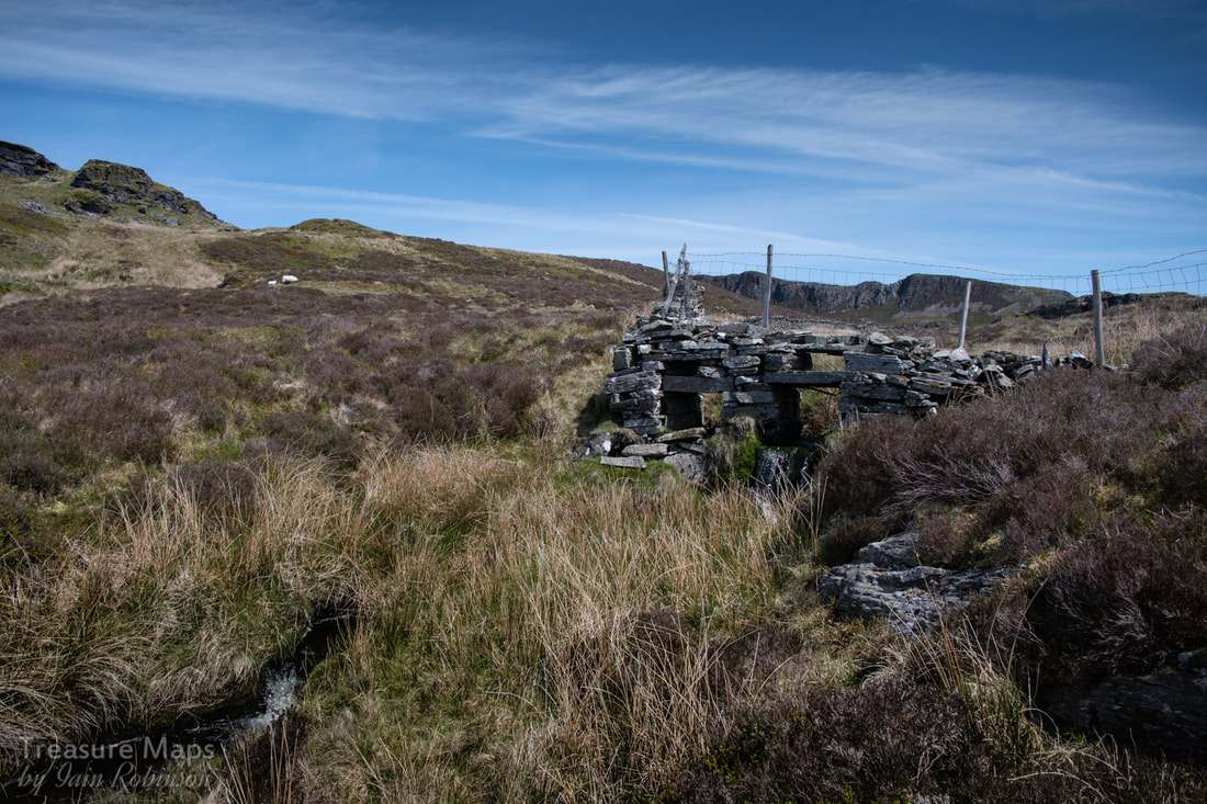
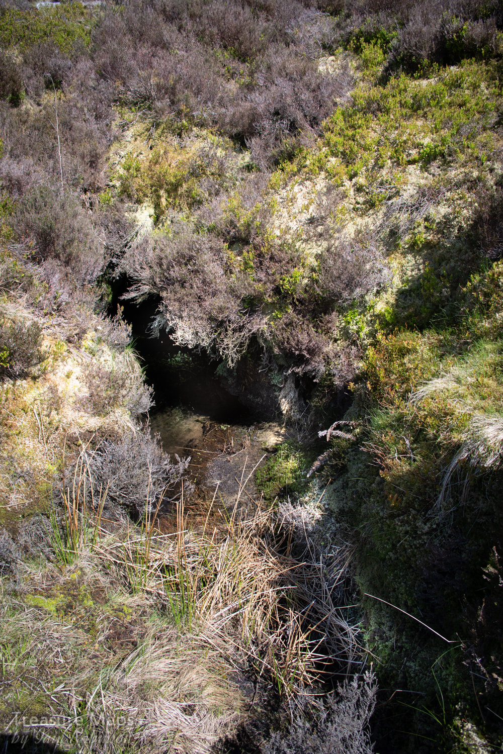
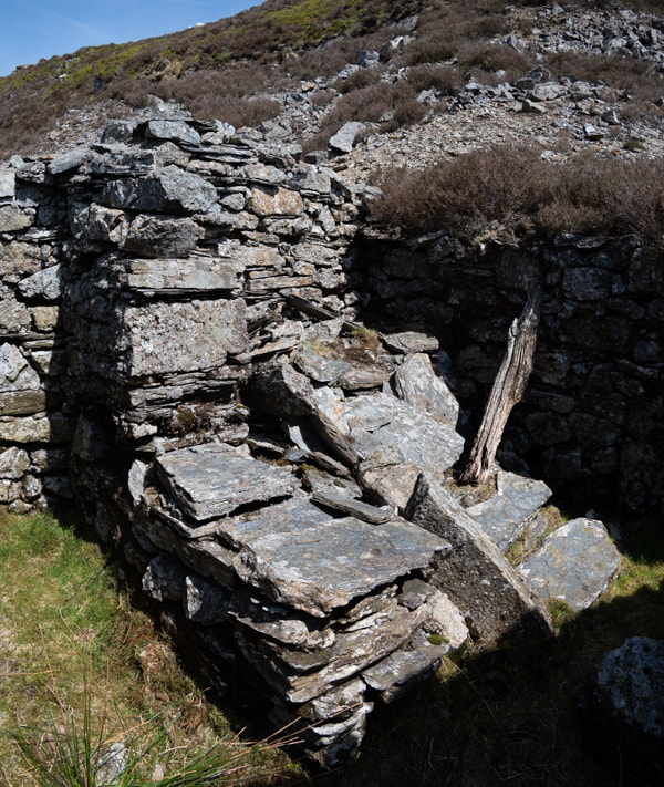
 Another intriguing discovery hidden in the woods beside Nant-y-Moch. I have been unable to find much about the history of this mine, which was nevertheless a productive one in it's early days. It is thought to have been opened before 1750, and worked in conjunction with the Hafan mine, slightly uphill and to the west. Work here continued until 1892. In it's latter years, it was sold to Sir John Molyneux, a Lancashire man with deep pockets. He was the moving force behind the Plumlumon and Hafan tramway, which passed less than half a mile by the mine. There is some speculation that the two mines were joined underground- some leading lights in the contemporary mine exploration field have had dicussions about the possibility and it is true that a survey taken in the adit here seems to show that the heading is correct. Unfortunately, the drive ends in a collapse, so we shall never know. I quote Roy Fellows' article on the mine: "The geological survey seems to suggest that the two mines do connect but without saying so in so many words. It describes the Henfwlch Adit as “draining the principal or Hafan shaft to a depth of 24 fathoms. About 83 fathoms further west the Bog shaft is drained by the same adit”. Plotting the course of the adit on the OS map puts the collapse at my dig to correspond with the shaft on top of the hill adjacent to the quarry (NGR SN735882). This must be the principal shaft referred to by the British Geological Survey. Plotting the rest of the adit on the map takes one to a point only about 80 metres from the head of the Hafan incline, where the Hafan workings start. To add to the controversy, David Bick describes Hafan Deep Adit as being driven for 250 fathoms (500 yards)! This would most certainly take it below the horizon of the Henfwlch workings." (1) One probable development is that the Henfwlch shaft below the Cwm Owen quarry close to Hafan might have been used for removing material. An amusing snippet that has emerged, from the book on the tramway by E. A. Wade, is that communication between Hafan and Henfwlch was by carrier pigeon! Most of the mine's output was before the legal requirements to state volumes of ore raised came into force, so the official figures of 623 tons of lead and 25 tons of copper are probably well short of the mark.  The supports for the uprights remain as moss covered blocks in the ground. The remains The site has been given the forestry treatment, but the general layout can be divined with the aid of the OS six inch map of 1888. The lower adits have been tipped over by later work. The most attractive thing about the site are the ruins of two hearths and chimneys, possibly all that remains of the barracks and office. Where the rest of the huts ran can be imagined by rows of concrete supports on the ground. I imagine these were typical mine structures, made of wood and corrugated iron. Near the road, the remains of a trackway runs above the verge for some way, possibly a remnant from the early days, before the tramway above was built. A quarter of a mile away to the north, at the side of the reservoir there was a chapel (Capel Tabor) and a house called "Spain", but there is no trace of either, sadly. A site well worth a visit to soak in the atmosphere and wonder what things were like here in the late 1600s...no conifers, for sure. I get the feeling that the area was quite busy with several mines open and busy, a chapel and some farms. Oh, for a time machine. 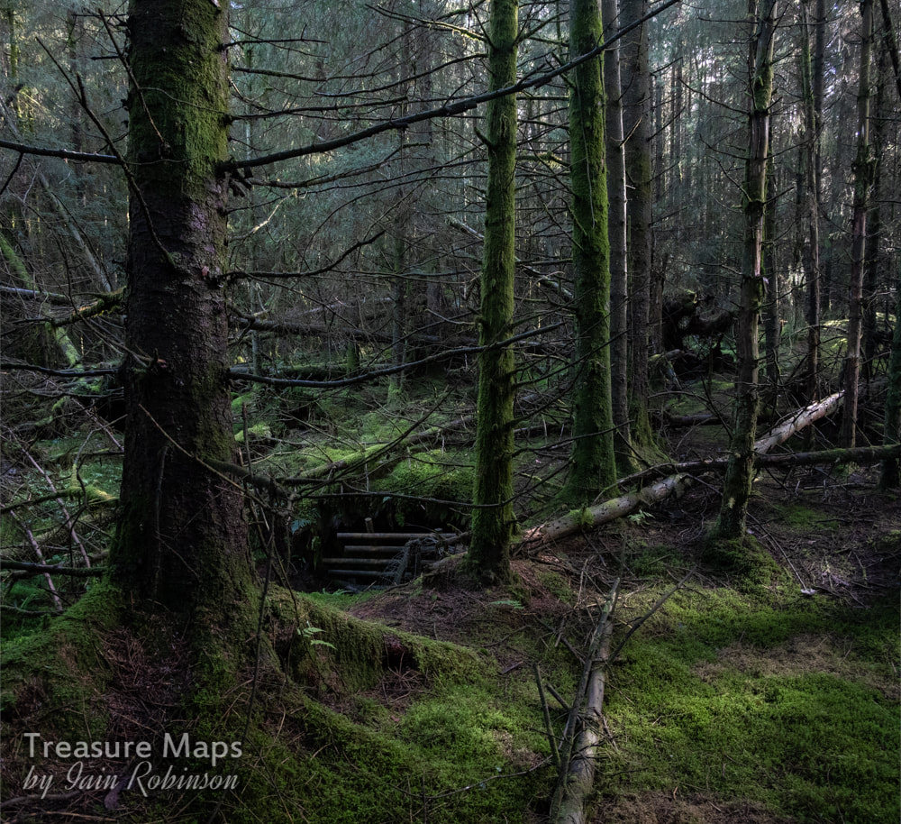 The wet and very uninviting adit, deep in the woods. (1) Roy Fellows is a respected mine explorer and conservator, being responsible for the setting up of a trust to conserve the Cwmystwyth Mines and keep the access open.
4 Comments
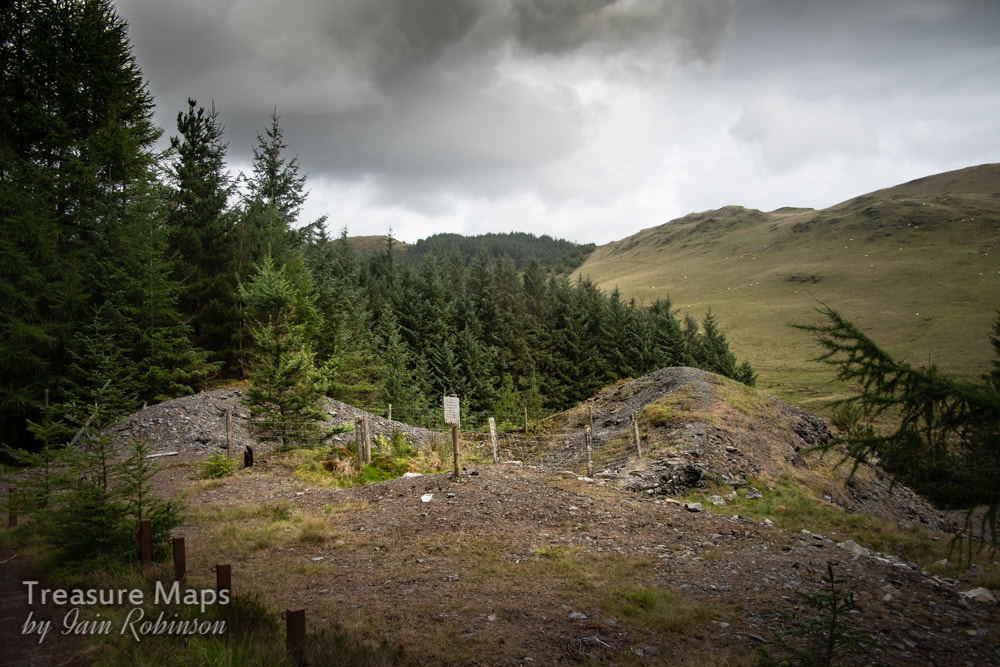
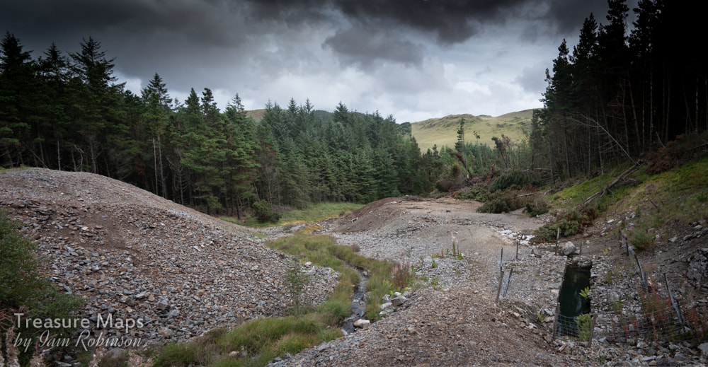
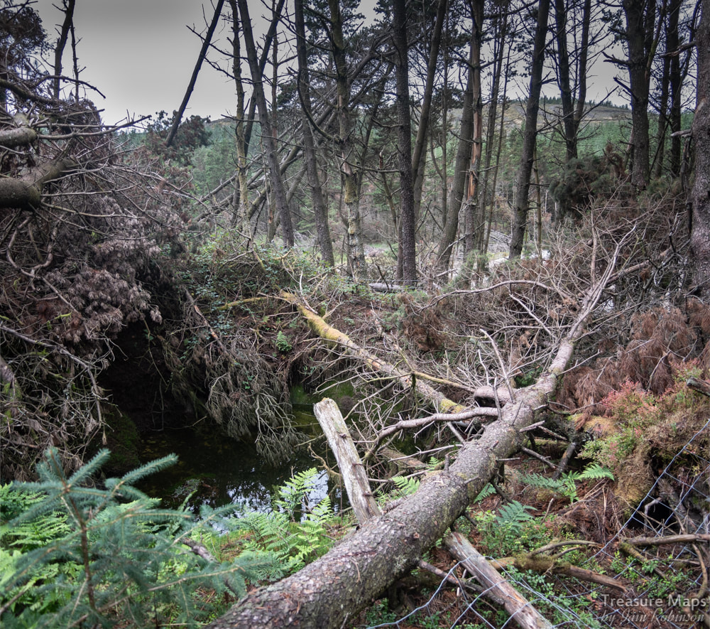
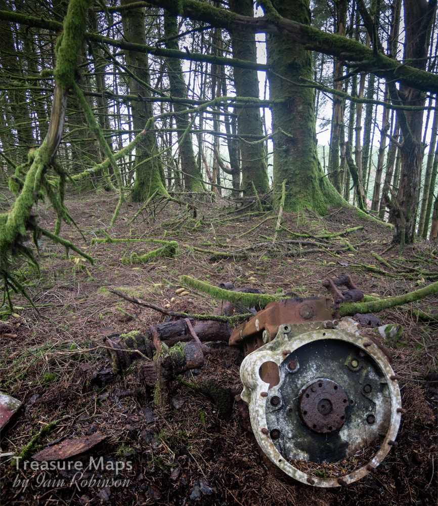
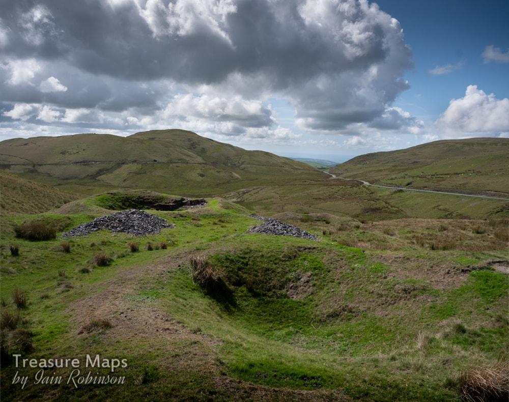
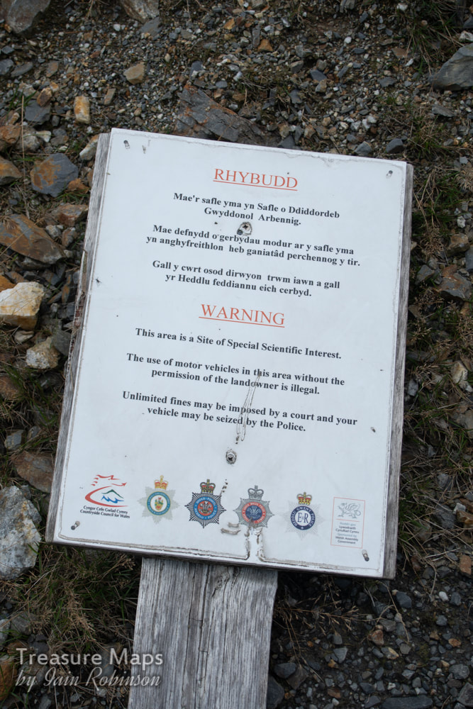
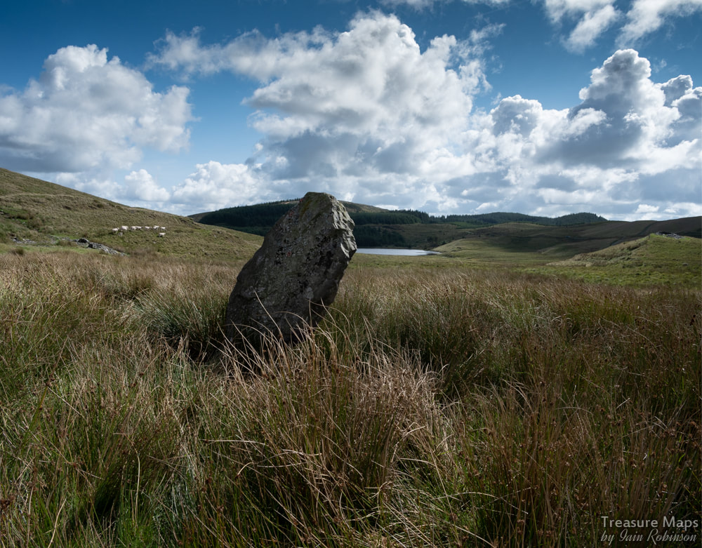
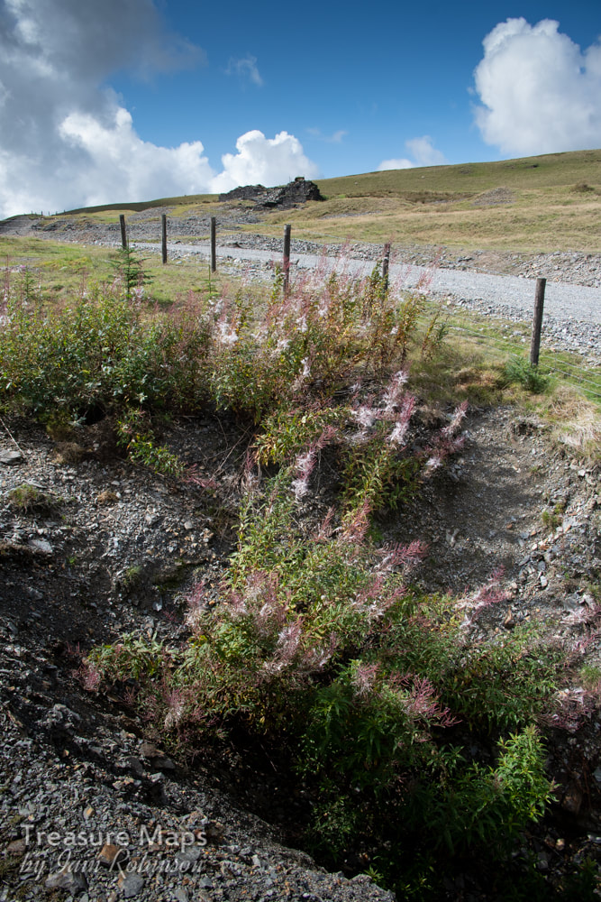
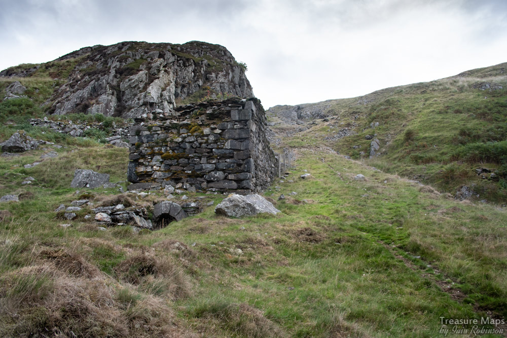
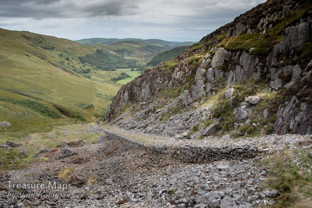
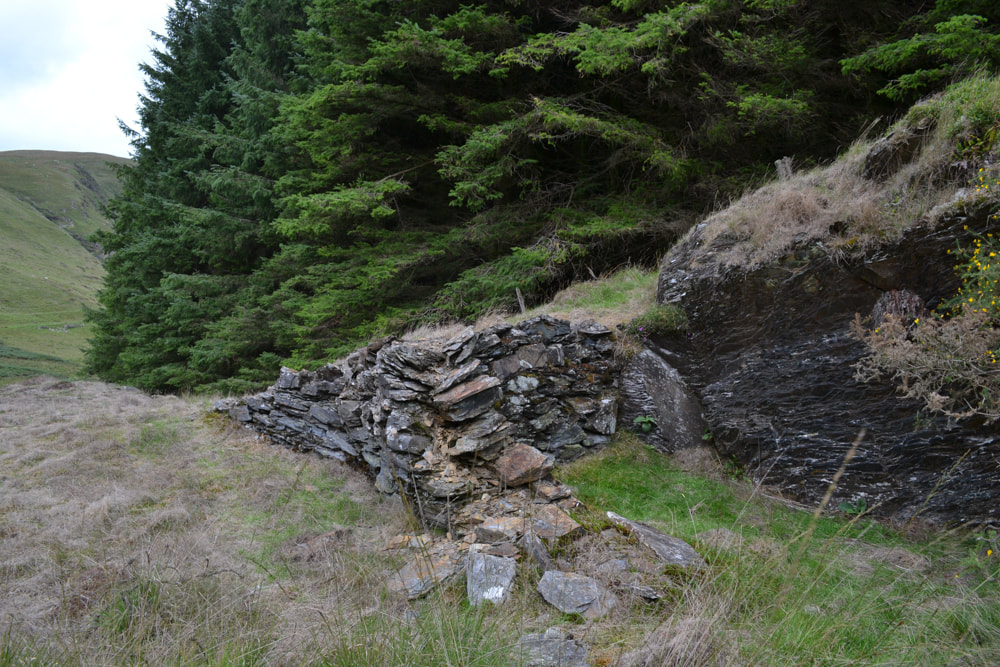
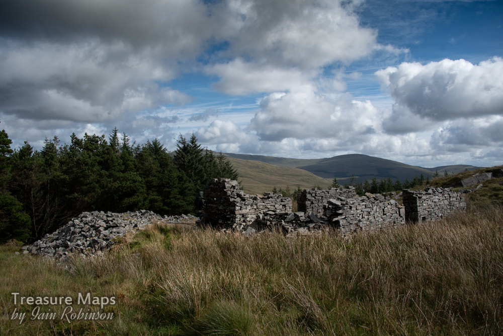
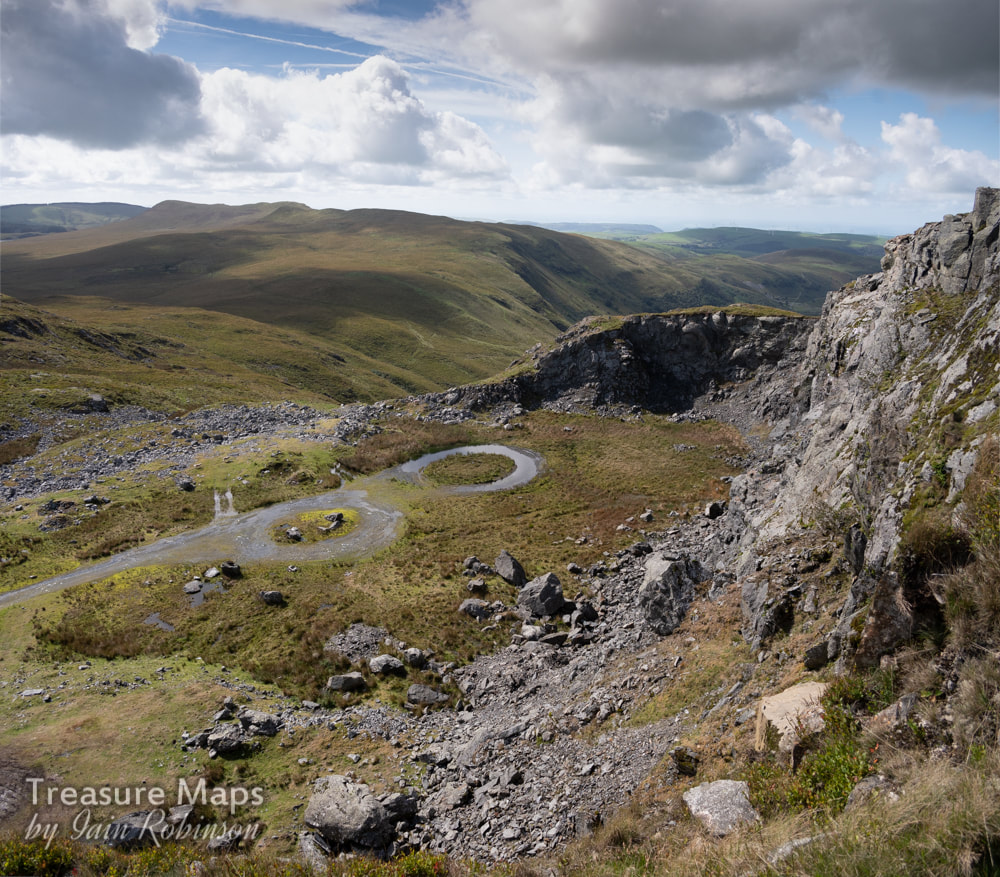
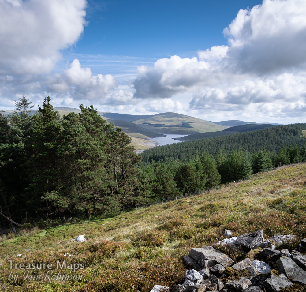
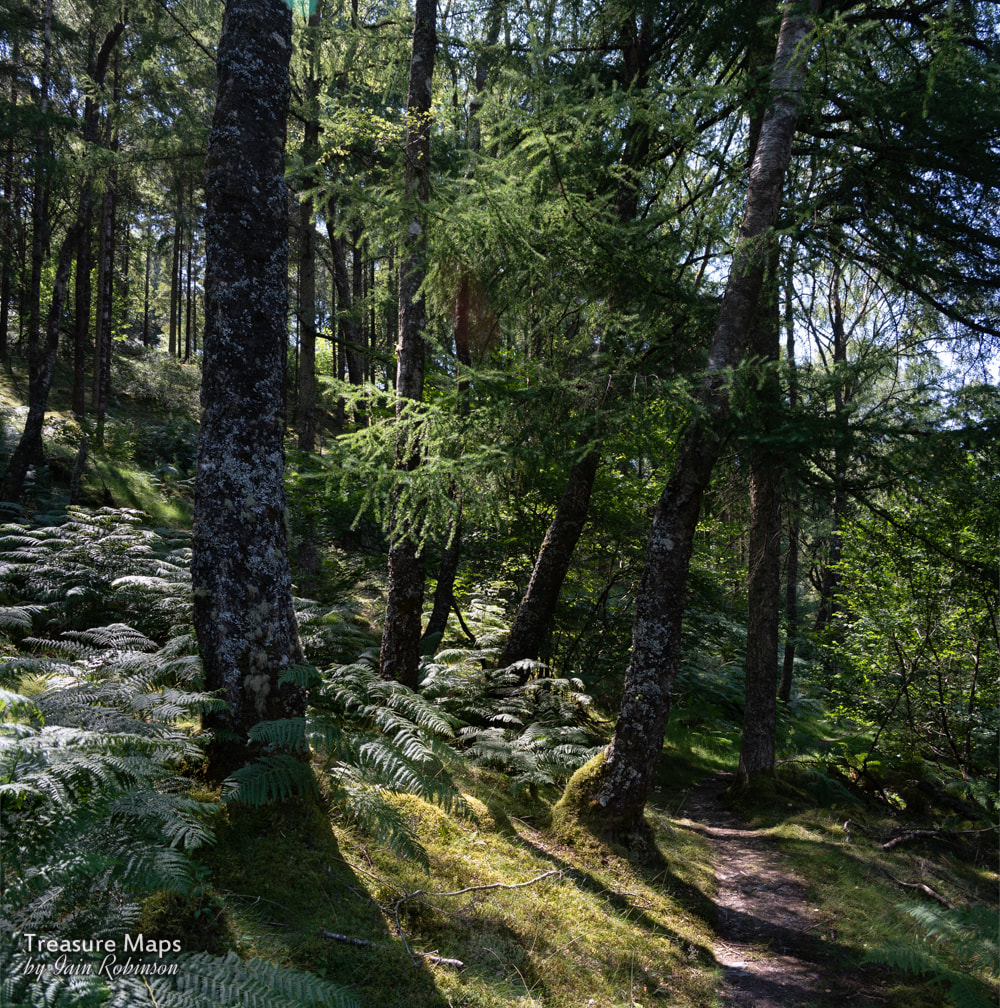
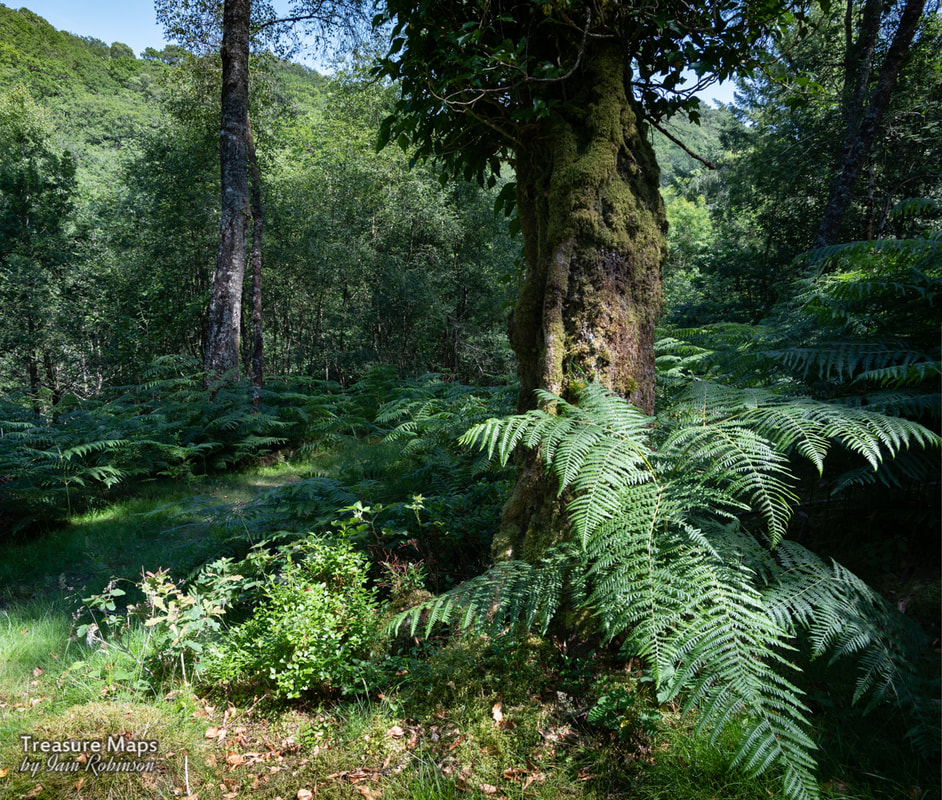
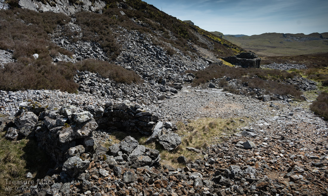
 The lower wheelpit at Nant-y-Cagal. A mineral-rich delight on the shores of the Nant-y-Moch reservoir, this is the Eaglebrook mine, also sometimes called the Nant-y-Cagal mine. Of course, the place has been worked over to within an inch of its life by the forestry commission, "landscaped" to some extent- and yet, despite that, (and the dreich weather when we visited) there is still a sense of magic here, with much to wonder at and imagine. The remains This site is bisected by the road that runs along the shores of the reservoir. The road dips and curves, no doubt because of a change in the levels caused by the mine tips, which are extensive. The tips on the lakeside reveal a capped shaft. Uphill from the lake there are more tips and shafts tantalisingly showing between the spruce trees. The history The mine was first opened under the auspices of the Company of Mines Adventurers, the ill-fated body that was responsible for a less than sparkling period in the life of the Esgair Hir and Fraith mines, uphill and across the valley from here. This was in the early C18th until 1722. The mine then lay fallow until the middle of the C19th, with activity continuing until 1875. At the east shaft, beside the "new" reservoir, the mine is said to have sunk to an amazing 50 fathoms. 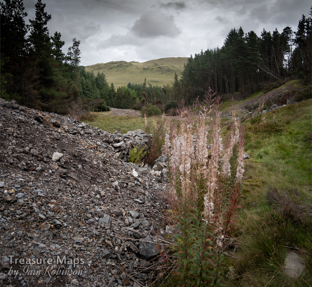 The highest working area, with a run-in adit showing to the right middle. ,All that can be seen today are some tantalising remains, a run-in adit and a shaft buried deep in the forestry. The tips are particularly rich in minerals- if the mine had been worked with modern processes, there wouldn't be anything left but inert rubble. However, bear in mind that this is an SSSI and mineral collecting is strictly forbidden here. It's also very selfish, just like the mountain bikers and two strokers who ignore the signs and go roaring around the place in search of thrills. There are the remains of two waterwheel pits and un underground culvert, not to mention the impressive tips, which size for size confirm the reports of the 50 fathom level. There was a lot of work done here- I just wish the forestry could have left some of the structures to weather and decay, so that industrial archaeologists could get some nice photos :-) We sighted some magnificent Red Kites and other fascinating birds of prey when we visited, and despite it being an overcast day, the atmosphere in the woods was rather special. I was slightly gratified when brashing around in the trees trying to find the shaft (box ticked) to find the remains of a forestry commission vehicle, an all-terrain type, but not a Land Rover as there was no aluminium or recogniseable "Landy" bits. The site is easily accessible beside the road at SN7361489247. 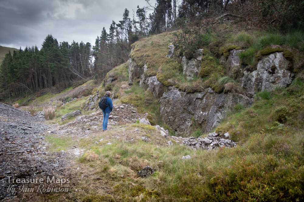 Petra studies the remains of a shaft on the upper levels. 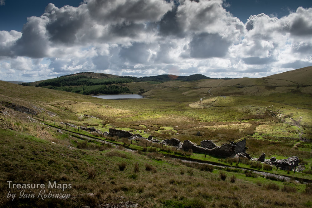 The barracks, viewed from the hillside and looking south west towards Llyn Nantycagal. Yet another fascinating site that we found while driving over from Cwm Ceulan towards Nant-y-Moch. What intrigued us initially were the remains of barracks for the workers at Esgair Hir and Esgair Fraith mines. Whilst exploring these buildings, a line of crown holes was spotted, climbing up the hillside. We felt sure that there would be something interesting over the ridge- and there was... A little bit of history The story of the mine begins in 1690, when Sir Carberry Pryse found an outcrop of silver ore on his land. He wanted to mine it himself, but fell foul of the Society of the Mines Royal, who had the monopoly of all gold and silver mines worth exploiting. He took the matter to court and won a landmark case- on the 8th February 1693, an Act of Parliament was passed, which removed Crown Ownership of mines containing gold and silver. This allowed local landowners to develop or lease mines on their own land. Sir Carberry soon found that mining was expensive and he began to look for partners in the venture to help with the considerable financial exposure. He produced a fanciful estimate of profits for the mine which suggested that with 600 miners working and each one bringing half a ton of ore per week to the surface, the mine would yield a profit of £70,500 in the first year, after which more miners would be needed! If only mining were that simple. There was silver, lead and copper to be had in the rock below, but the surrounding material was hard and there was also a problem with water ingress, something that would trouble all the companies who tried their luck with the mine. Carberry Pryse died in 1694, after which William Waller, the manager of the old company, issued some extravagant claims for the fortunes to be made here. Connoisseurs of mining history will not be surprised at the claims made- ‘the richest in all Wales'- or that a new company was floated called the "Company of Mines Adventurers of England" who, it is said, raised some 2000 tons of ore between 1703 and 1708. There was the matter, also, of Waller calling the mine the "Welsh Potosi" after the incredibly wealthy Bolivian mine in the C17th and claiming that he was going to construct a town of the same name near the mine. Four other companies attempted with various levels of success and duplicity to exploit the ore underground. Finally after 1886, a ragged group of partnerships stripped the place of any easily won mineral and combed the tips until 1904 when working ceased. For a more thorough overview of the history, I wholeheartedly recommend Marilyn Palmer's monograph on the mine in the Northern Mine Research Society's series of papers. I will provide a link at the end. 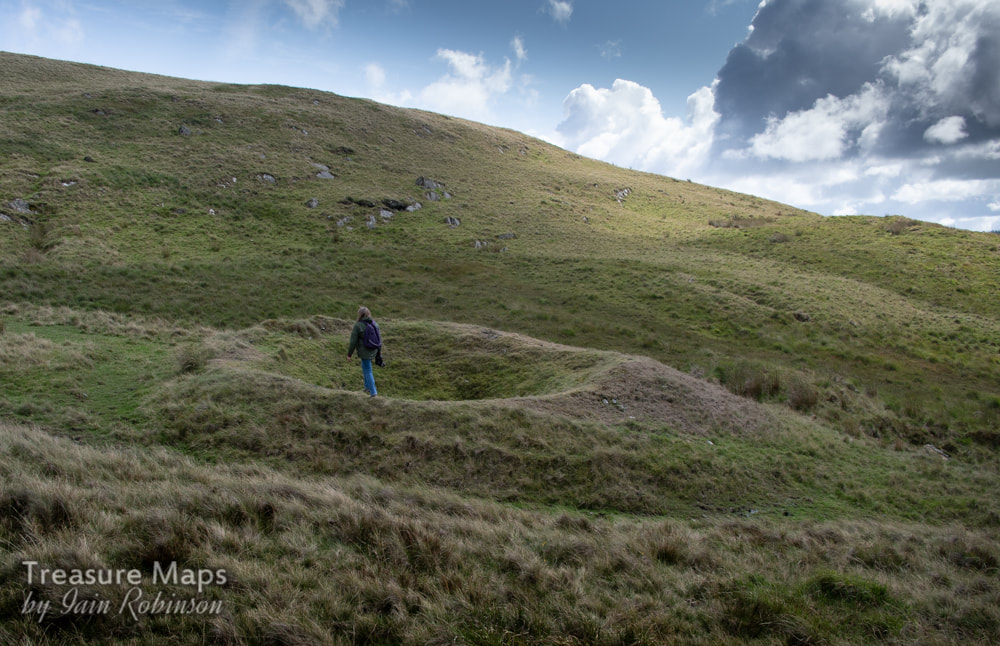 One of the crown pits, with Petra for scale. The Remains We parked up at the start of an unsurfaced road at SN 72322 90958, this comes off the mountain road which was itself engineered by the mining company in 1840. Walking along the road, the line of crown pits is easily seen. They are probably of some antiquity, dating from the earliest days of the mine and since each one represents a blocked shaft, considerable effort must have been expended. Below the line of shafts is an almost run-in adit, the West Level, which was driven under the auspices of William Waller in a hopeless attempt to drain the mine. It is still possible to see into the adit, but exploration is definitely not recommended. 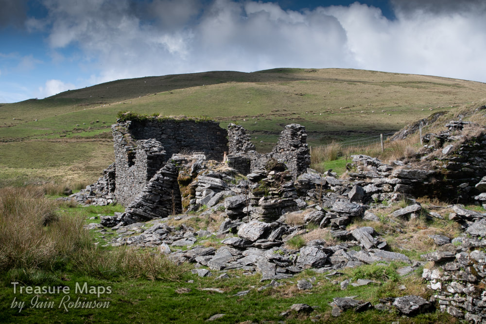 The barracks, showing typical buttressing by miners more used to shoring up adits underground! The barracks are an interesting range of structures, perhaps not big enough to house the six hundred men Pryse had in mind, but substantial none the less. A large single-pitched room seems to have been the kitchen and has the remains of a range. A turf house was situated nearby but there is no sign of that now. Standing next to the ruinous walls, open to the weather's attentions, it's hard to imagine the conversations that must have gone on here between the miners. It's a life that is difficult to imagine for most of us, few creature comforts, isolated on the moors for the week, longer in the winter when the snows blocked the pass. 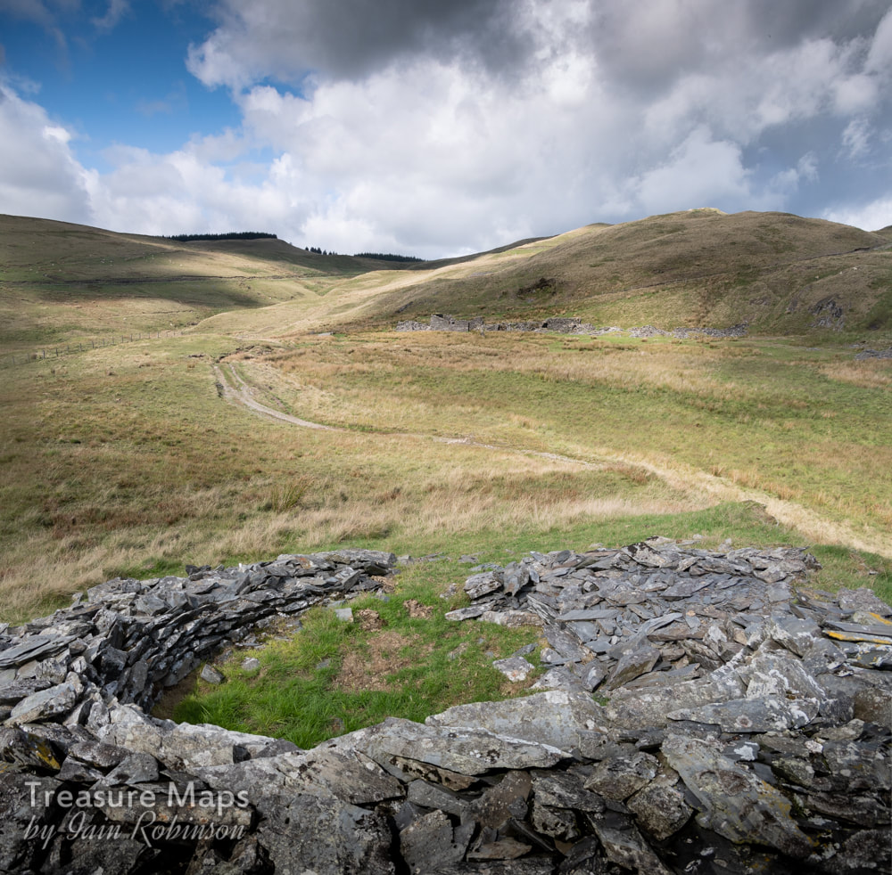 The powder house, with the barracks in the background. The mine is behind the hill above the barracks. I was pleased to find a ruined powder house on a knoll to the west of the barracks, a round pattern that now looks more like the nearby bronze age ring cairn of Carn Owen. Just under the access road are a couple of water wheel pits and run-in adits that may be from other mining enterprises, as the West Level is stated as the outer edge of the sett. Judging from the tips, these excavations were not fruitful. 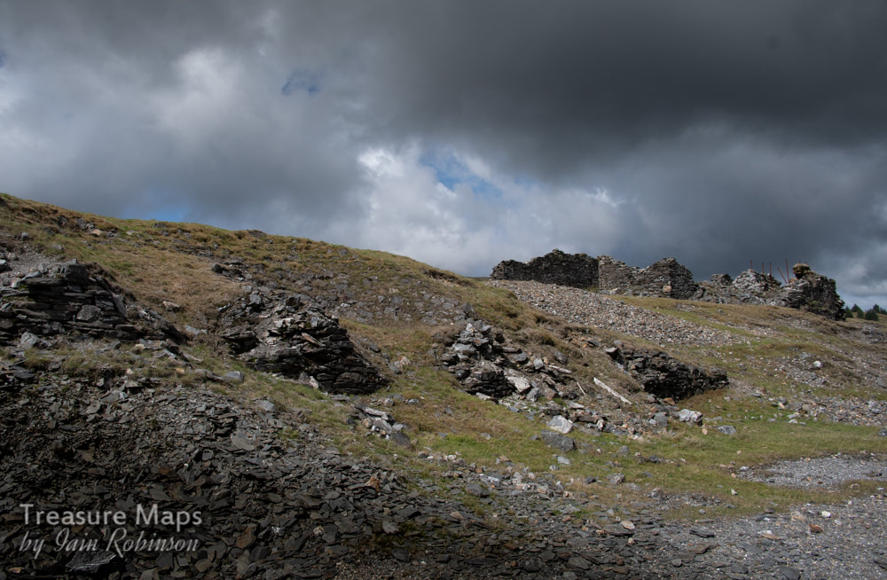 The remains of the ore bins with the crusher house and engine house above. Walking up to the bwlch which is the watershed of the Afon Lluestgota, more shafts are found, then a flat area which was at one time the site of ore bins and a processing floor. This has unfortunately suffered the attentions of the forestry commission and their roadmaking gangs. Mine tips are always easy pickings for road making, even if this one was a SSSI. There are other dark clouds on the horizon in the shape of the Scottish & Southern Energy (SSE) proposals, to build a wind power station of 62 turbines up to 481ft high – much larger than any yet built in the UK – on the foothills of Pumlumon overlooking the Nant y Moch reservoir. Several would be sited above Esgair Hir and I have no doubt that the tips and buildings at the mine would be ransacked for easy hard core. The Cambrian Mountains Society is fighting hard against this- let's hope they are successful. 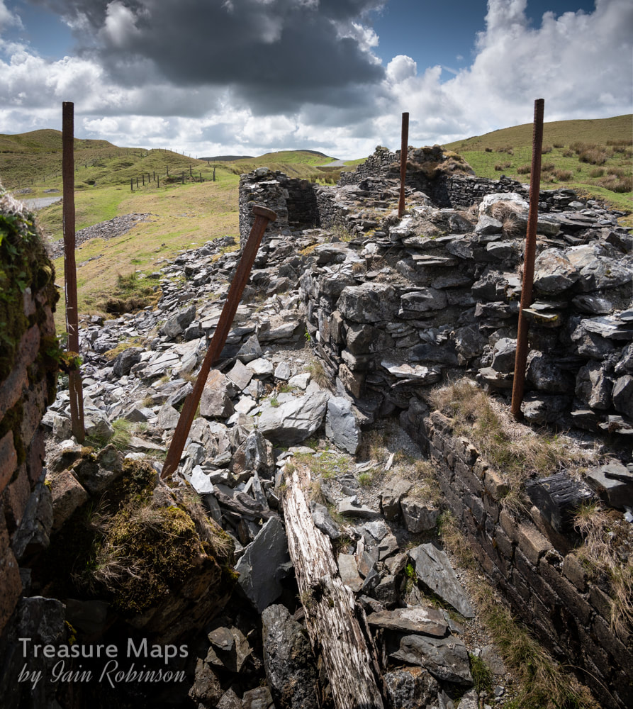 The engine house, looking west towards the Penybwlch shaft, fenced off in the background. The ruins of a complicated looking structure are visible on the left- the engine house and crushing mill of 1872. The foundations to the left are probably for the boiler. On the right, long steel rods supported a winding wheel. As recently as 1979, there was a gable wall and window still standing here, but gales and rain have seen it off since. A little way off to the left is the finely engineered stonework of Shaft Glas, with a pump-rod tunnel designed to de-water the mine and then utilise the motion of the rods to power other machinery, two thirds of a mile away at Esgair Fraith. 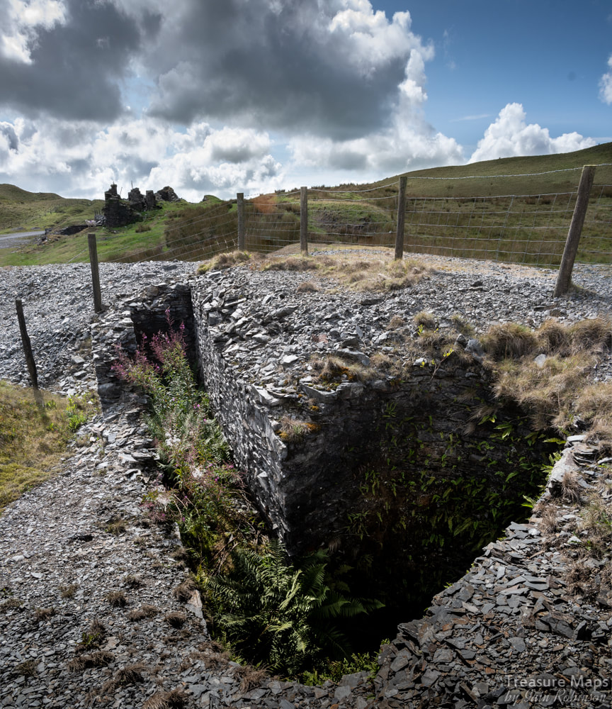 Shaft Glas, with the pumping rod tunnel to the left. Our visit terminated with a look at the mine offices and workshops, a long, low and ruinous structure whose claim to fame was that George Borrow sheltered here one night while on his travels, described in "Wild Wales". I managed somehow to not take a photo, so I am very grateful to Chris Andrews for his excellent shot. Nearby is the opencut of Shaft Moses, filled now with rubble, old washing machines and bits of car. Sadly, we ran out of time on our visit, but will conclude the article with a description of Esgair Fraith as soon as we can. References: Welsh Mines Preservation Trust survey British Mining No.22- "The Richest in all Wales" by Marilyn Palmer, available as a purchaseable download from the Northern Mine Research Society here. 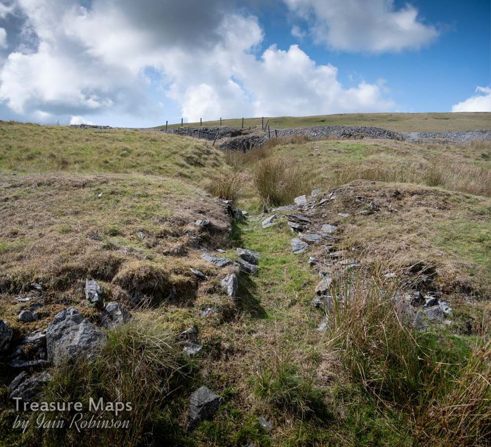 The flat rod line from the engine shaft- later a wire rope was utilised, running over dollys supported by posts driven into the ground. 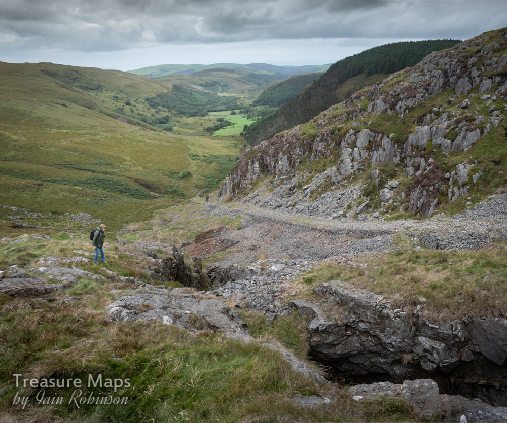 Petra looking into the stopes at the Hafan Lead Mine. The Incline from the stone quarries is in the background. Drive around the picturesque shores of Nant-y-Moch, nestling in the hills to the west of Pumlumon Fawr, and you could be forgiven for thinking that there was no industrial archaeology, that it was a featureless, if very beautiful landscape. But nothing could be farther from the truth. Despite the massive efforts of the Water Authority and those hired vandals, the forestry commission, there is still a good deal of fascinating evidence that survives. 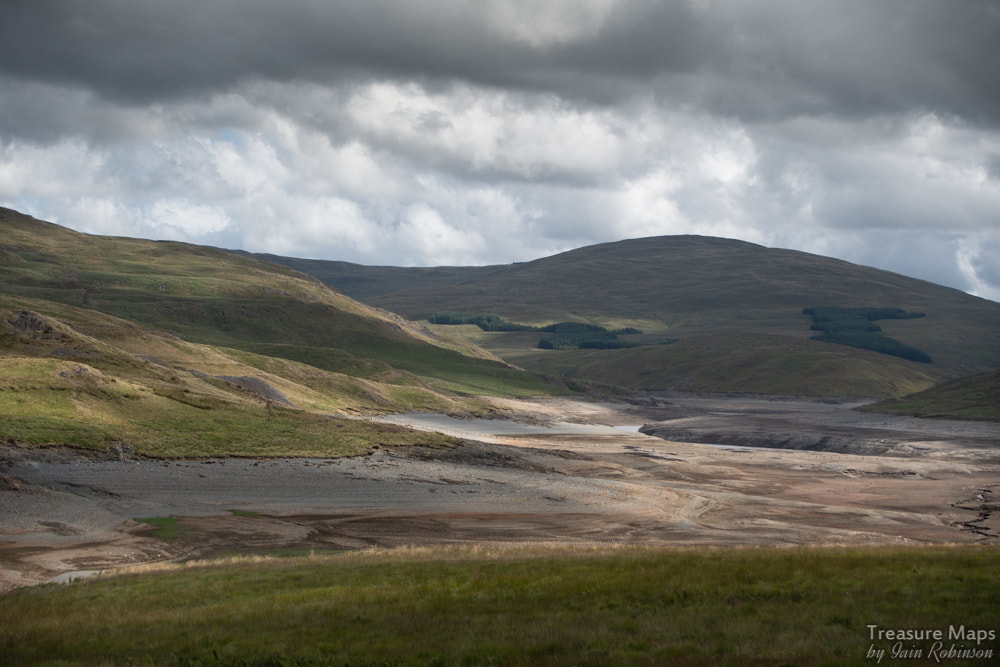 Almost empty! A mine can be seen to the left of the picture on the opposite bank. Our first introduction to the area was in June of 2018, when the air crackled with heat- and the reservoir was almost empty after weeks without rain. We'd taken a turning from Tal-y-Bont on the Aberystwyth road just to see where it went, and were soon on a narrow mountain road with few passing places. Of course, Tal-y-Bont is well-known for it's mining history, but as we skirted the side of Bryn Mawr above Cwm Ceulan and saw the remains of the Blaen Ceulan mine below, my mining senses began to wake up and be fully attuned. The unclassified road carries on past intriguing ruins half-glimpsed on the moor, past grass-grown tips and ruined barracks until the serried Sitkas of the spruce planting maniacs smother the hillsides. This is Nant-y-Moch, which means the stream of the pigs, but is actually a steep valley which at one time harboured several significant mines. It has now been flooded by a reservoir. At this point, looking around, I had a vague memory of reading something by the legendary Roy Fellows about a mine here. To the seasoned gaze there were many signs of mining in the sterilised slopes across the dry reservoir. It had been landscaped, but thankfully, not enough. Petra and I parked the car and took a walk up an old track which showed evidence of some crown pits (where a shaft has been plugged and later collapses, leaving a depression like a volcano). Tips could be seen shining in the light amid spruce plantations. 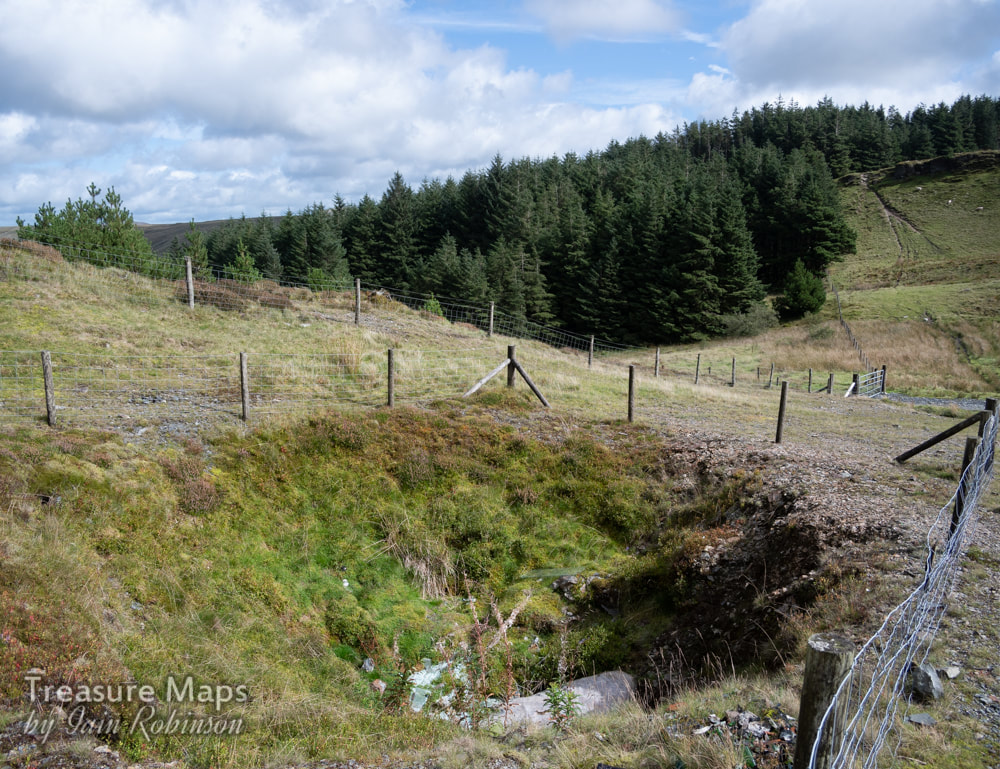 A crown pit, full of rubbish. Probably a shaft from the Henfwlch mine, in thick forestry behind. We drove away determined to explore the area and much time has been spent poring over old maps and books, trying to get a sense of what there is to find. I'll start with a site that gives a nice taste of what is left, the rocky slopes of Cerrig yr Hafan, which reveals some fascinating old quarries, a modern quarry and an intriguing lead mine. And a bronze-age summit cairn, too, if that floats your boat. We parked up at a turning made for the new quarry at SN7362888551. It's a right of way and goes through a SSSI site. Signs encourage you to tread lightly, something that doesn't seem to have been heeded by the 2-strokers who have churned up great ravines with their noisy bikes. Once we reached the top of the slope, we were in an area that had been "landscaped", sterilising the place to a great extent. However, I could still see a sizeable crown hole, full of mattresses and broken glass, beer cans and discarded plastic. This hole masked a shaft from the Henfwlch lead mine, further below in the woods. I will cover this fascinating enterprise in another post. 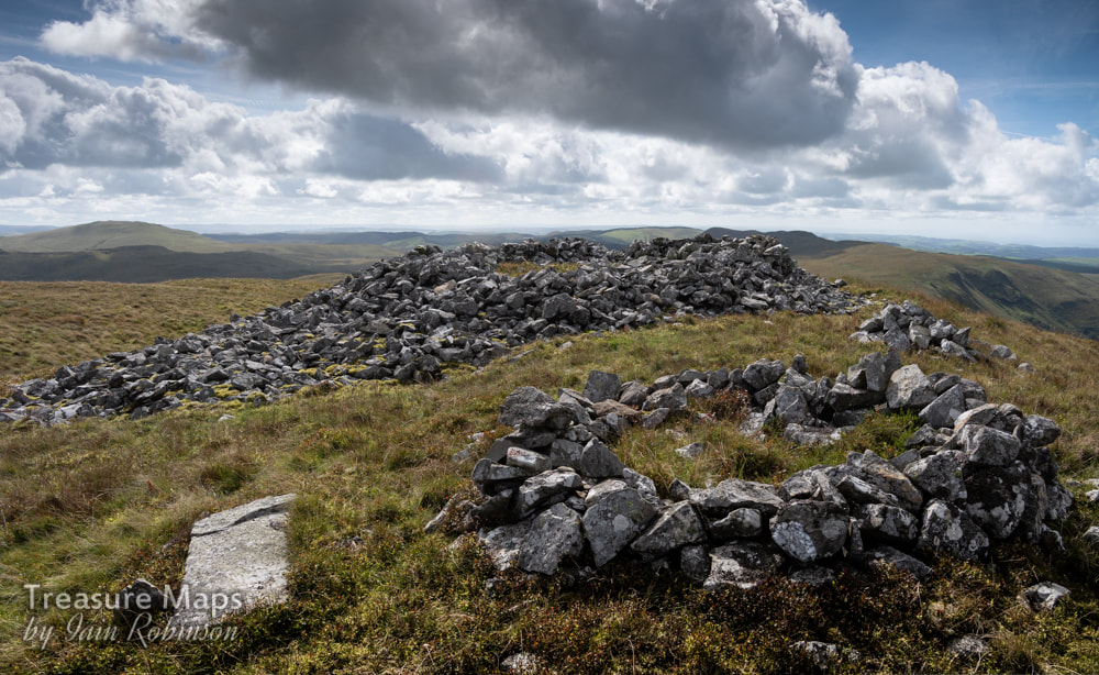 The Bronze age cairn of Carn Owen, made from sandstone blocks. For the moment, we ignored the modern quarry pit, worked from 1956-61 by McAlpines. This is Carn Owen quarry, opened in connection with the Rheidol Hydro-Electric Scheme. It's development obliterated a tramway that ran from higher above on the back of Cerrig-yr-Hafan, serving a couple of old pits, marked on the old maps as "White Stone Quarry". There were some structures up there which still survived, according to Google Maps. We climbed the steep slopes above the quarry and sat by the bronze age cairn. I confess that despite my fascination with pre-history, the tramway was bothering me; there was something familiar about the name. I gazed east towards Plumlumon and suddenly the penny dropped- this was the beginning of the fabled "Plumlumon and Hafan Tramway"! For those who don't know, this was an ill-fated enterprise designed to link the mines in the area with the sea. It was begun in 1896 as a two-foot three inch gauge line which actually carried passengers as well as minerals, but sadly was only open for a year. The track remained in place only until 1914, but the line's fame has proved to be much longer lasting. One of the line's locomotives, a Bagnall 2-4-0T later went to the Vale of Rhiedol Railway and survives to this day, regauged as their no.3, Rheidol. 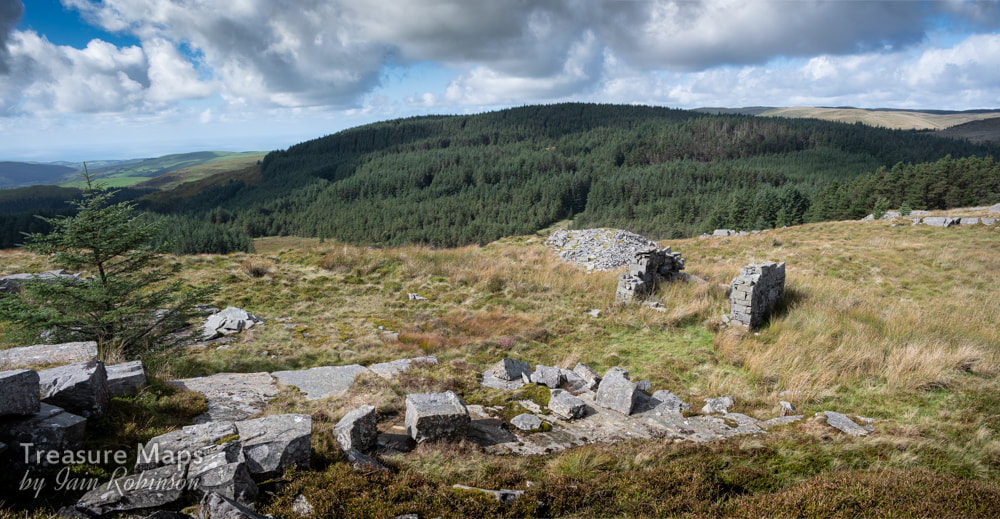 The highest quarry, with sett-makers shelter. The lower quarry is to the right of this photograph. The Cerrig-yr-Hafan quarries Energised by these thoughts, we made our way along the back of the hill until the first of the quarries was reached. The rock, a sedimentary, very hard mudstone occurs on the surface and has been crowbarred out. Deep pits have not been formed, although the tips show extensive working of stone, which must have left the site as blocks and setts. There are piles of fine chippings, made when the blocks and setts were worked by hand. Some exposed blocks show evidence of their marine origin with the appearance of wave-moulded sand patterns. The highest quarry is the one marked as the "White Stone Quarry" on the maps, another, more extensive quarry is below. This has a couple of sett-makers shelters, and further towards the formation of the tramway, a large structure lies in ruins. This seems to have been a workshop and smithy- perhaps part of the building was a stables. For a while, I was confused by the maps of the quarries here, as they didn't seem to correlate with what was on the surface. Then I realised that the northern part of the site is buried under forestry. Now it all made sense. We will have to try and reveal some of that quarry with another visit, although I'm not relishing the prospect with all those tightly packed trees! 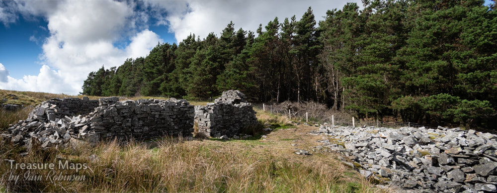 The workshop and smithy. The tramway continues on underneath the trees... 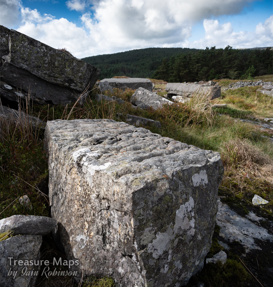 One of the large blocks, showing it's marine origins. Heading south again, we followed the formation of the tramway. It is fairly obvious, being revetted and drained. It passes a couple of trial workings before reaching the McAlpines' workings again. It must have been an airy journey along the steep hillside, and quite exposed during bad weather. No locomotives were used on this section, so I imagine the trains would have been worked by horses. In an article in the "Cambrian News" of December 1898, it is noted that: "The Plynlimon and Hafan Company own one of the finest macadam quarries in Great Britain, the results of experiments exceeding the most sanguine expectations. It is purposed erecting new machinery for crushing the stone and the machinery will be driven by water power." It seems that massaging the facts is not a modern phenomenon. 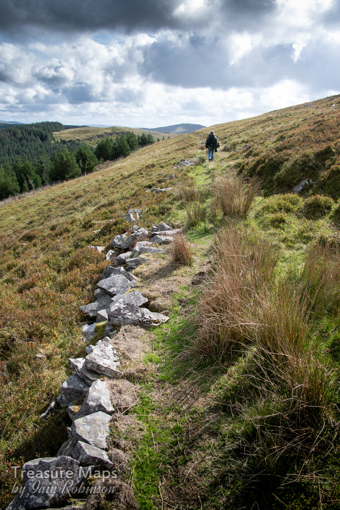 Petra walks back along the remains of the tramway. Carn Owen Quarry. This is an imposing site, the most recent excavation carried out in an uncompromising way with modern machinery. However, it is enlightening because of the way that it reveals the rock strata. I refer to John Mason's account of the quarry: In the main quarry, "the hard Upper Ordovician sandstones of the Drosgol and Brynglas Formations are exposed along the axis of a NNE aligned pericline (dome structure), with the younger, softer, shaley Cwmere Formation rock exposed around the flanks. The contact between the two is strikingly obvious in the change of slope." For more insights and geological information on how this area was once under the sea and ended up as a hill, it is well worth visiting John Mason's excellent site: geologywales On the northern slopes of the quarry there are still remains of inclines or sledgeways, revetted with stone, that must have been used before the advent of the tramway. 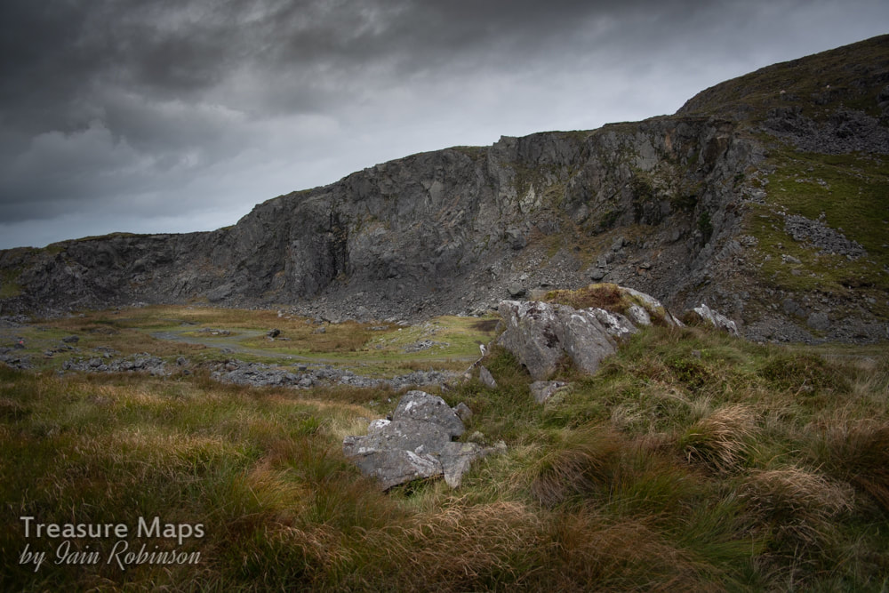 Carn Owen Quarry The Hafan incline and mine, and the Cyneiniog Mine Immediately below the Carn Owen Quarry, the tramway descends into the valley of the Afon Leri and Cwm Ty Nant by a spectacular incline, dry stone built and still in good condition considering how long it has been out of use. As you are going down the incline, to your left are some open stopes from the Hafan Lead Mine. These seem quite extensive and are accompanied by ruined processing areas with much in the way of hand worked spoils. Low dry stone walls remain from the structures that protected the workers cobbing the ore. However hard the work must have been, I hope the ladies hammering the ore took some comfort in the lovely view below them. 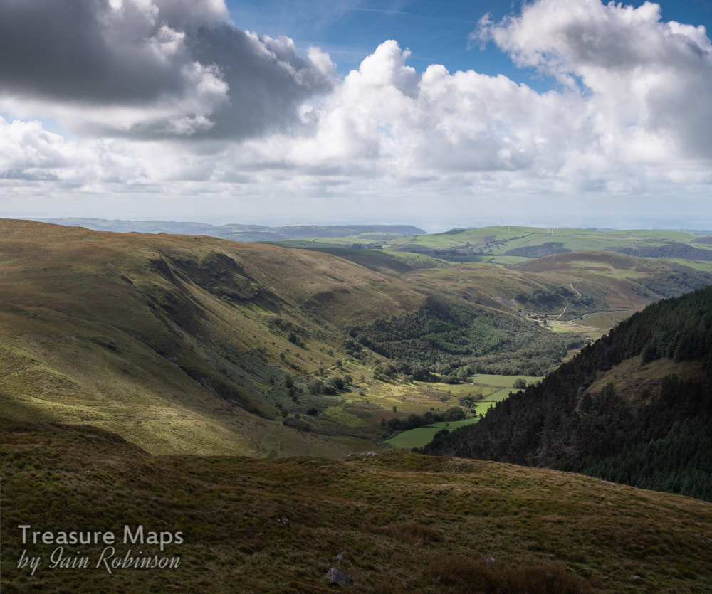 The view down the valley towards Aberystwyth in the distance and the sea. In the right distance is the Bwlch Glas mine, subject of another post soon. 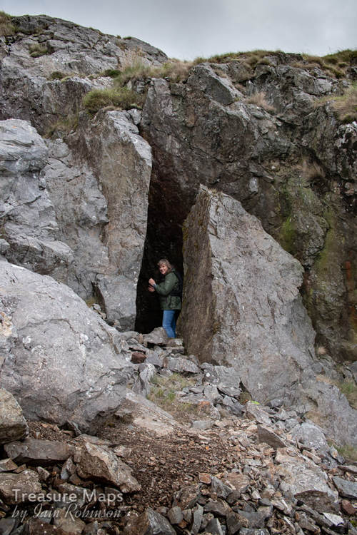 Petra takes a look into one of the stopes beside the incline. At the bottom of the incline is a large waterwheel. According to the Welsh Mines Society, this is called "Barbery's" wheel, after an engineer, or possibly a lessee of the mine. The tail race has a fine arch. There are a couple of fine arched adits at the foot of the incline, corresponding with the tip runs, but I am ashamed to say that we missed them on our visit. They are supposed to be almost lost in the ground, but it would have been nice to see them. 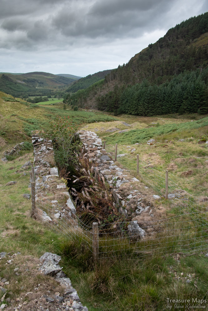 Barberry's wheel pit at the bottom of the incline. Following the tip runs, we came to a ruin which was undoubtedly the powder house, on a small area of ground beneath the modern forest. Above that, Petra spotted another adit on the side of Nant-y-Maes Mawr. It was open, but flooded to waist height. It looked as if there might be a shaft immediately inside, and since neither of us fancied getting wet, we left it alone. This was the Cyneinog Mine, and judging by the Chalcopyrites in the tip, was a copper trial, as the tip wasn't too extensive. 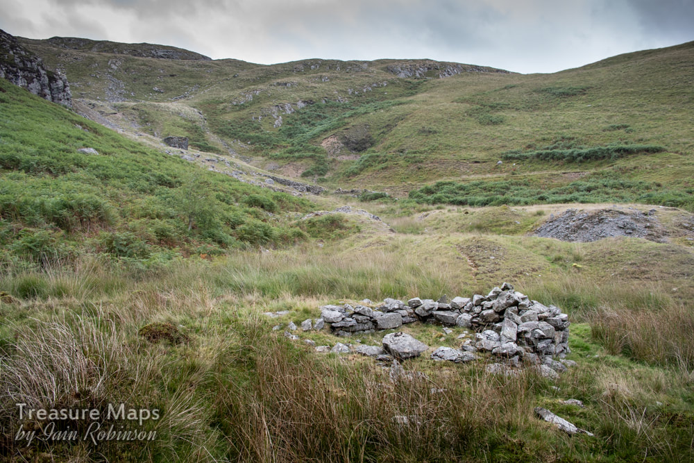 The rather sketchy remains of the powder house. A well-preserved and engineered leat ran from the adit towards the water wheel, utilising the outflow of the mine to good effect. An article in the "Welshman" of 27th March 1857 gives details of a dispute between the Lord of the Manor, Pryse Loveden, wishing to open a mine, and the lessee, a Mr Matthew Davies, an "influential gentleman" of Cyneinog Farm, who objected. Davies had built a wall around the land. The Lord got together a gang of men and demolished the wall, hence the dispute appearing at the Assizes. The plaintiff won on this occasion, but since a mine later appeared, we can assume he eventually lost- or was bought out. More on the Mines of Nant-y-moch next time... 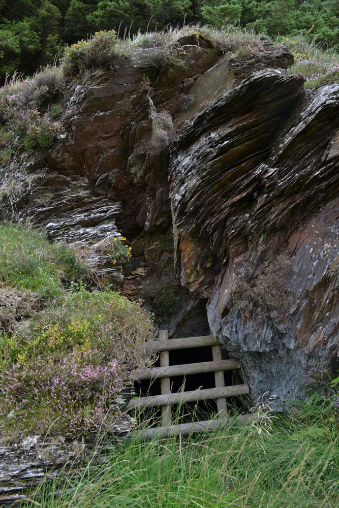 The adit entrance at the Cyneinog Mine 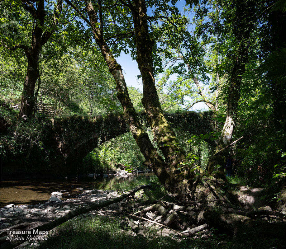 There seemed to be no end to the heatwave, nowhere to go to escape the glare of the sun. Not that I'm complaining, I have enjoyed the current phase of liquid gold, but taking photographs of mines and quarries in this weather results in very stark photographs and is beyond my skill level. Petra suggested having a look at the Coed Felinrhyd, which is near to our home- we'd never been before. It looked like a handy trip without too much sweaty driving, but I wasn't too enthusiastic...another forest, close to a power station... Of course, I was hugely mistaken. The place is really special, as I hope the photos show. We took a path close to the Afon Prysor- the river was very low- but this was to prove an advantage. We soon encountered a wonderful old bridge, about six feet wide with no parapets, but with ivy growing down like Lianas. Because of the low water, we were able to get quite close and take some shots from the river bed. I think for the best photographs, you would need early morning light, but my shot here gives the general feel, I hope. 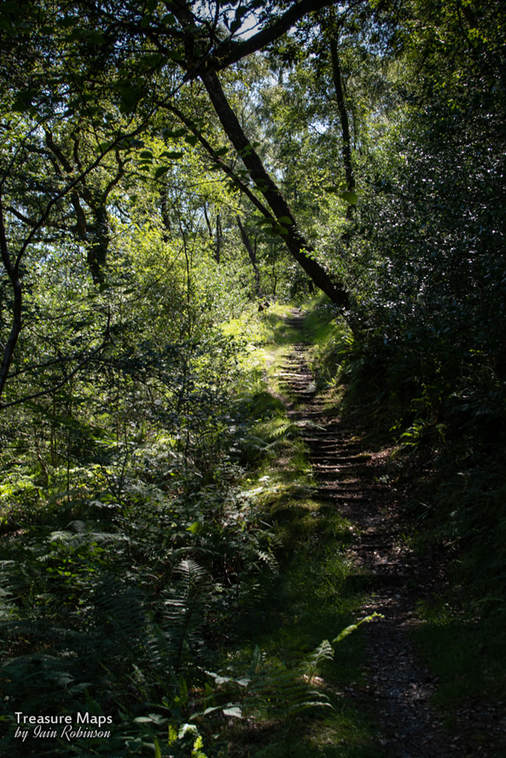 The path started to ramp up in a series of steps through ancient oak and birch woods. I wondered if Tolkien had been here, and had been inspired to create the woods of Lothlorien, as I was feeling the sense of enchantment with the place. What put the icing on our cake was the discovery of a mine (well, a trial, really) above the path. The tip had been degraded by the construction of the trail path, but there was a fair preponderance of rustic slate about. There is a record in Wilkinson's Gazetteer of a gold mine on the north bank of the river possibly on the same lode- we will have to investigate. We carried on- up until this point, we had the place to ourselves, but soon we noticed a school group doing some gorge walking in the river. The place is so enclosed that after walking a very short while from them, we couldn't hear them shouting. We eventually reached the Rheadr Ddu, normally a raging torrent- it was barely a trickle. I get the feeling that in wet weather, this would be a waterproof footwear type of walk, but during the heatwave it is a delight to wander and not encounter bog in Wales, even if the waterfall was non-existant!  There was a great variety of wildlife...from signs of badger activity to the unmistakable sound of wood warblers, long tailed tits, redstarts and flycatchers. Sadly, the moss and lichens that the reserve is famous for were all under great stress- great banks of moss were fragile, dry confections of light green fibres. We did note some wonderful trees in the woods, including some amazing oaks that had survived attempts to kill them in the 'forties and 'fifties. 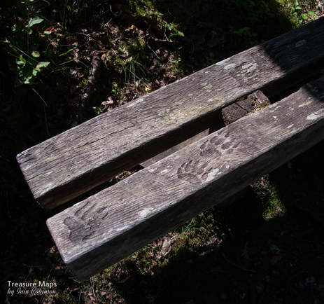 A bench with some interesting markings... This woodland was rescued by the Woodland Trust, who had to fight a stiff battle against the invasive rhododendron and the widespread coniferisation of the area. I didn't see one rhododendron, so they have succeeded there. I noted some dog's mercury and wood sorrel in some of the clearer areas. Some of the conifers, being mature trees, have been left to protect the oaks and ashes from the weather, although I did note quite a few with the dreaded red circles on them. I can recommend this place if you like a peaceful walk with plenty of trees and wildlife, or if you just want to sit for a while and enjoy the peace of one of Wales' oldest woodlands. Maps: OS Explorer OL18 and Landranger 124 Grid reference SH656389 Woodland Trust web link for the reserve Parking for five or six cars is available in a lay-by across from the Power station at Maentwrog. 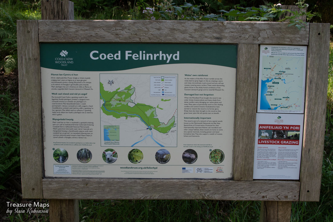 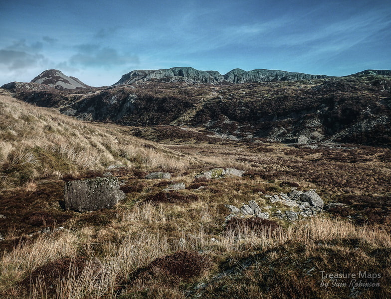 A 2011 view of the mines from an old trial adit across the valley. The mines are under the escarpment, but between them and where I am standing to take the photograph is nearly half a mile of gloopy bog! There's not much out there on the internet about this secretive mine, and it's neighbour, the Afon Gamallt mine. Looking on the map, or Google earth, it's easy to see why- the place is surrounded by a good deal of boggy ground -and where the ground isn't quaking gloop, there's knee-deep heather. Nevertheless, Petra and I have had a long-term fascination for this magical place, being gluttons for punishment. We first visited in 2008...my memory of that epic day was of falling thigh deep into a morass and emerging covered in sphagnum and the aforementioned gloop. Since then, we have made a few expeditions to the Gamallt and found out more fascinating details each time. 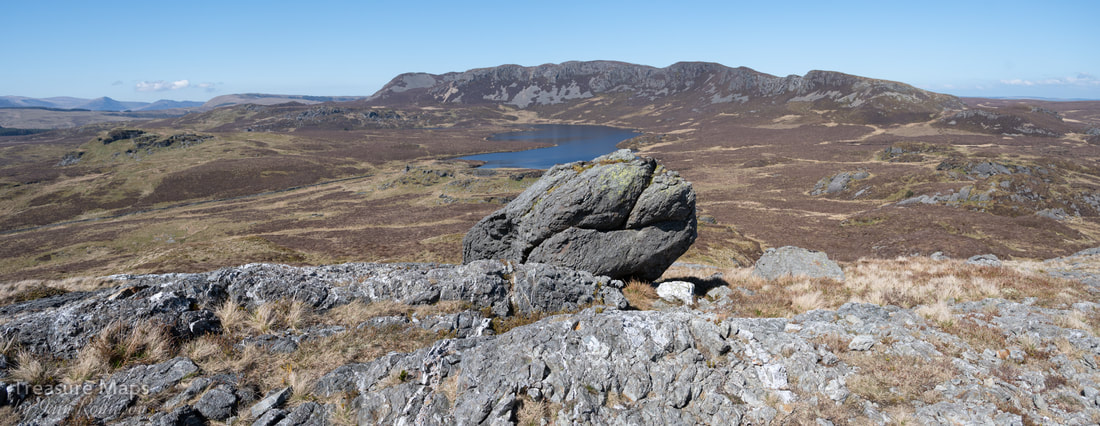 The Gamallt from the north slopes of Y Garnedd. The mines run in front of the escarpment to the left distance, and the trial mine was on the end of the first rocky outcrop. Our latest sortie was in a spell of unseasonably dry weather. The moor was like tinder, the moss crackling underfoot. There wasn't a cloud in the sky, although there were still some very soggy areas that were best avoided. We approached by the south west side of Y Garnedd, near Foel Gron. We kept high so that we were on dry ground-it's not such difficult country until you hit the moor. We sat a couple of hundred feet up on one of the outcrops of Y Garnedd and looked at the country below, where a sheep was happily munching next to a particularly virulent green patch of bog. We made for the east side of the valley between the Sarn Helen/Carreg-y-Fran ridge and the rising ground below the line of Graig Goch. The country between is a series of bogs and low-lying morass- it's possible to traverse this with care, but having done so once, years ago, enthusiasm for it was weak. Petra also had an idea that there might be a small trial on the southern extremity of the ridge, so we made for that. As we got nearer, large boulders were scattered around. It became more difficult to make progress due to the mixture of heather, bilberry and tussock grass, but we eventually attained the higher ground. 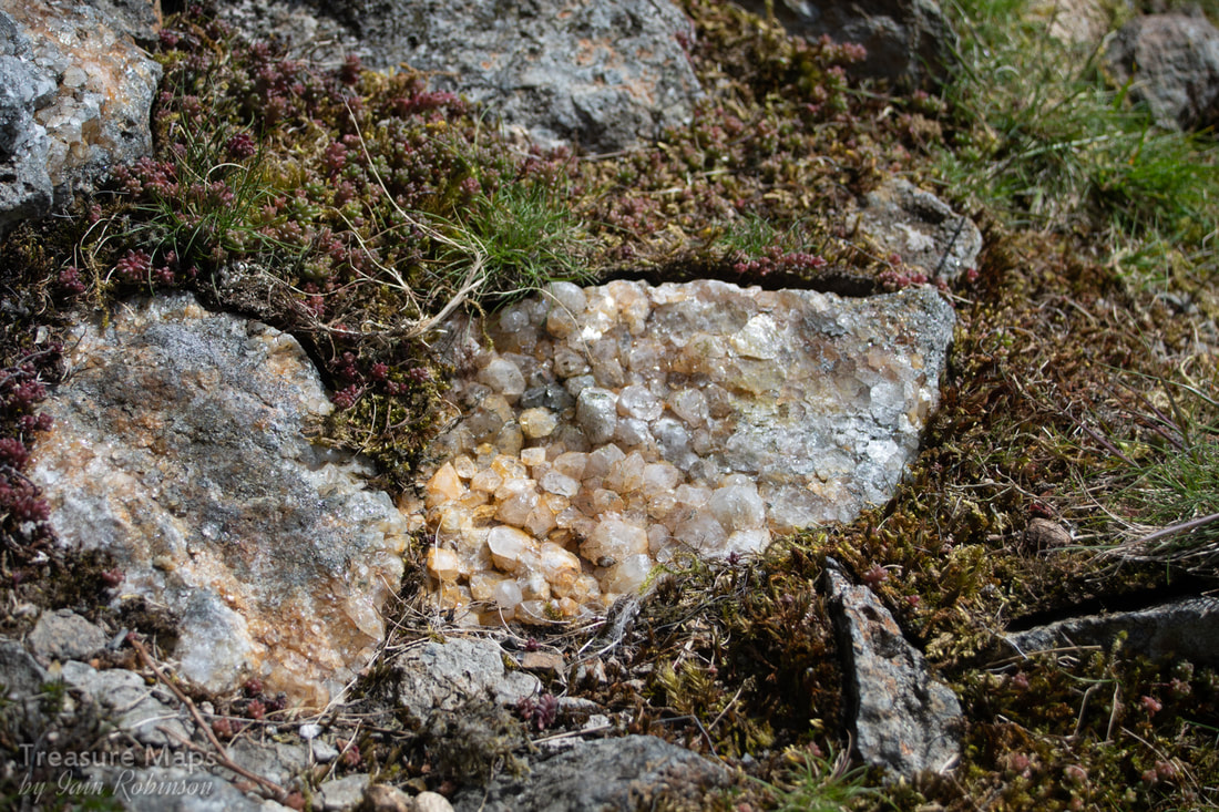 Crystal growths in the rocks of the first trial we encountered. It was just possible to make out what might have been a level and a shallow digging here, covered now in a growth of heather. But the tip was the giveaway- it was still bare of vegetation and displayed some fine crystal growths in the rocks. 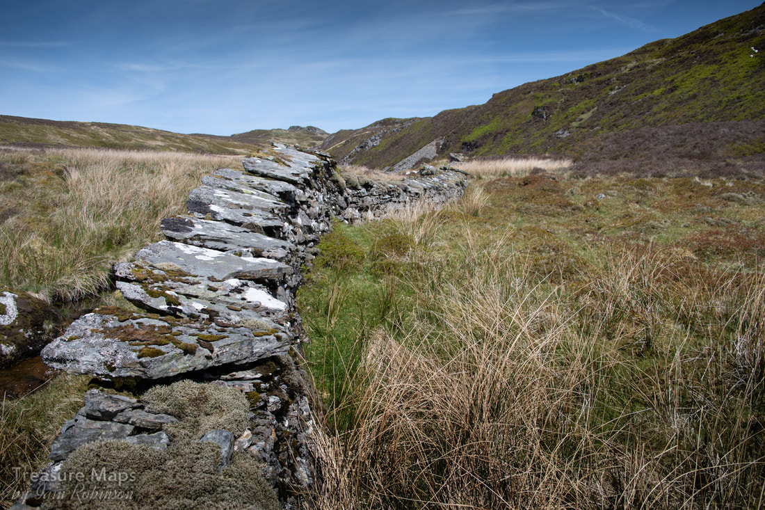 The old wall- the mine is directly ahead beneath the pile of spoil in the distance. We carried on in a northerly direction and realised that it had been a mistake to climb up to the plateau, as although we were only a hundred feet or so above the floor of the valley, the ground was very difficult to negotiate. Further onto the plateau it was covered in short heather and sheep nibbled grass, but here it was a breakleg world of huge boulders and deep old heather. After a great deal of cursing and stumbling, we eventually dropped down to the floor of the valley where a wall ran, separating the grassy bog with the steep sided rampart of the gamallt plateau. I was very grateful for my walking pole, which saved me more than a few times. 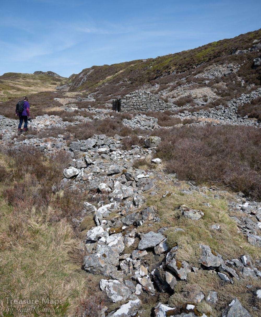 Piles of spoil near the mine The wall was old, but very fine. We stumped along on the left side of it, northwards until at last, we could see the ruined building in front of one of the adits for the mine. Here the spoil lay about in heaps, shimmering and sparkling in the sun, betraying a great deal of effort by people hammering and prising the ore out. There were some flat slabs of rock set into the ground, presumably to use as anvils for cobbing the ore. Far different to the rock near the trial earlier. here the rock was sharper, more abrasive. I knew that, on closer examination, there would be nodules of lead in the quartzy boulders, along with iron sulphides. Intitially, it was thought that gold was present, one of the developers referring to assays of 2oz per ton of quartz from the deposits. 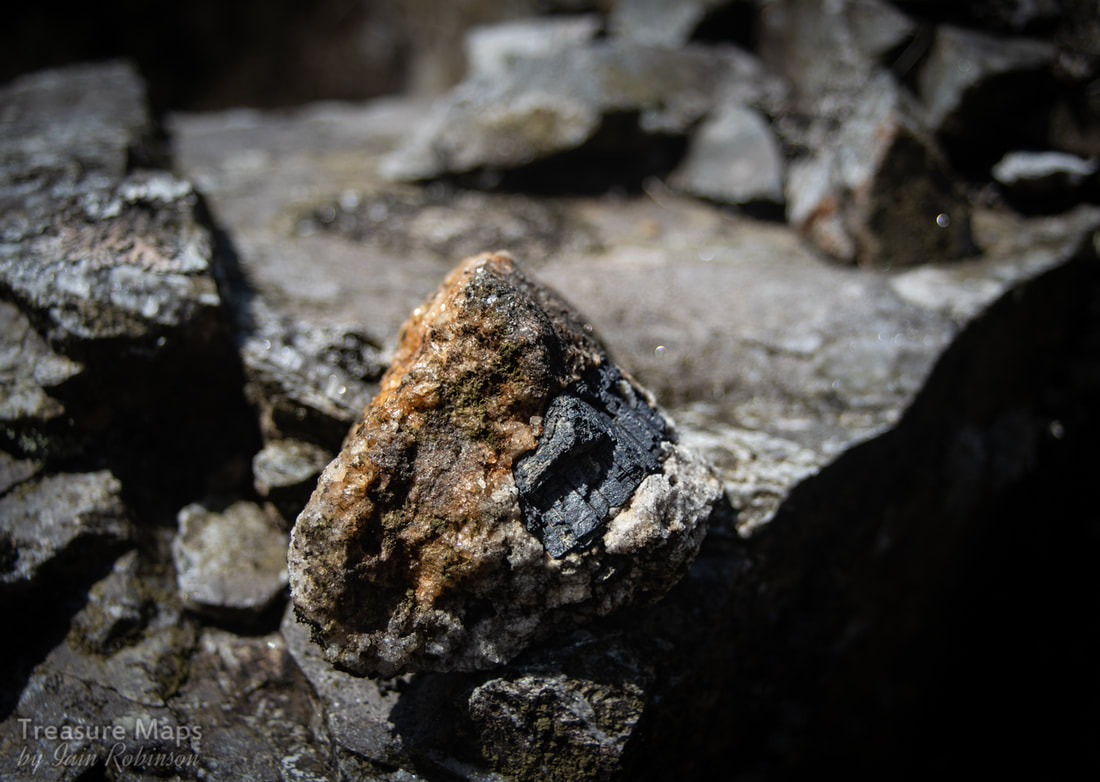 Some lead ore in a matrix of quartz. We had our lunch in the dilapidated building, it's roof open to the sky. I have read that this structure was possibly an office but tend to disagree, the built up area inside looks remarkably like a hearth- and surely the smith would be one of the most important people at the mine. The structure is built from country rock and reminds me of the structure at the Moel Hebog mine, with thick gable walls and the hearth against the north end. Roughly cut moss slates lay on the floor, perhaps from one of the slate trials nearby. There are two other structures here, a curious round-walled structure, almost completely ruinous, and a three-sided building further up the hill, reminiscent of a similar structure at Drum quarry, also unexplained. 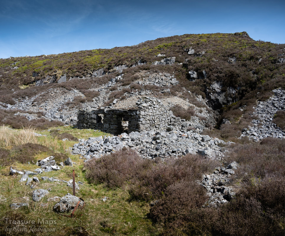 The structure which I suspect may be the smithy, outside the adit. Excavations seem to have concentrated on a wall or outcrop of ore-bearing rock twenty five feet or so above the workings and adits. Mineral deposits seem to have been chased down in an opencut, then when this became impractical, an adit was driven to exploit the mineral from below. The adits along the escarpment are fine but quite short, although at least two are run-in. Petra then made an interesting discovery below the mine- examining an area that might have resembled a low tip run, she discovered a very overgrown and flooded adit. I would guess that it must be of some age, given that the spoil on the other tips is still exposed, similarly with the old slate trials on the west of the valley. A rudimentary exploration of the tip with a boot revealed some quartzy rock, so certainly not a slate trial. We knelt down in the soggy heather on the floor of the opencut here to peer into the adit- it was probably belly-deep in gloop, but the drive appeared to run for quite a way. It felt much like one of the Afon Gamallt adits I mentioned earlier, but too overgrown to see if this one had a masonry portal. 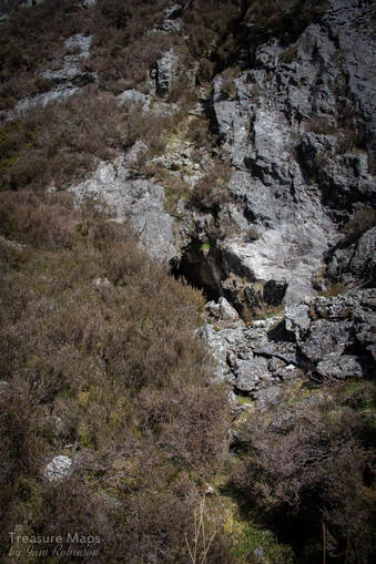 One of three adits into the rock at the base of the escarpment. Two are open- this one drives in for a hundred feet or so. 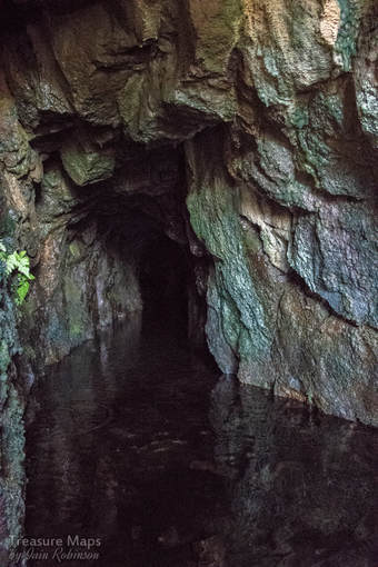 Sadly, the mine was too far away from anywhere to be profitable; the country was too boggy to be able to make a road cheaply. Although a tramway was considered briefly in conjunction with the slate trials nearby, it would have had to have been heroic in it's engineering, given the gradients to be encountered along the way to Llan Ffestiniog. Sadly, all these schemes, and the mine itself, floundered in 1892. The factoids: If you are feeling like a dip in mud, or some bog-hopping, the mine is at SH 7428 4439. The mine was only worked intensively for two years, between 1890-92, although some of the other workings and the valley floor adit are obviously of some antiquity. There are references to Sir Owen Wynn having his men mining here in the 1650s. Sources: "The Old Copper Mines of Snowdonia", David Bick, Pound House Publishing, 1985. "Lead Mining in Wales", W. J. Lewis, University of Wales Press, 1967. |
TracksReceive the occasional Treasure Maps Newsletter- and alerts when a new post is available!
If you enjoy my content, please buy me a coffee!
Check out my other online activity...
Index
All
|
 RSS Feed