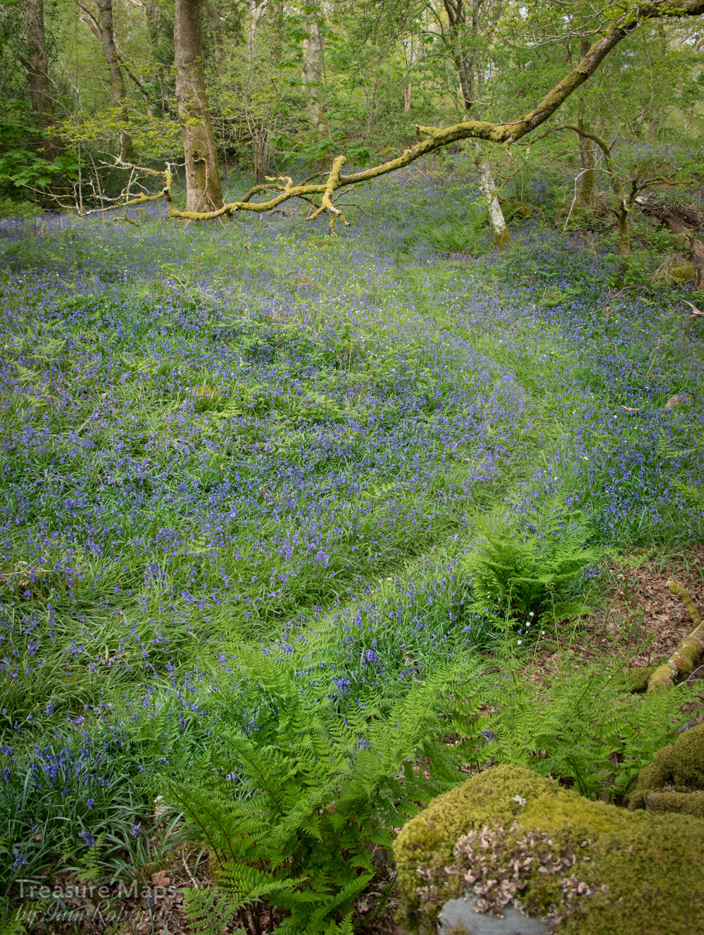
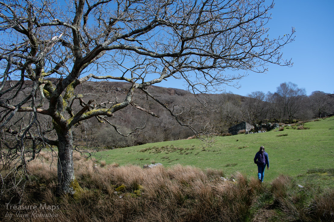
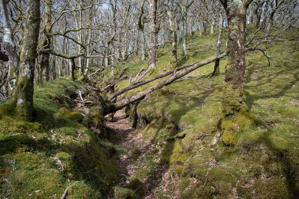
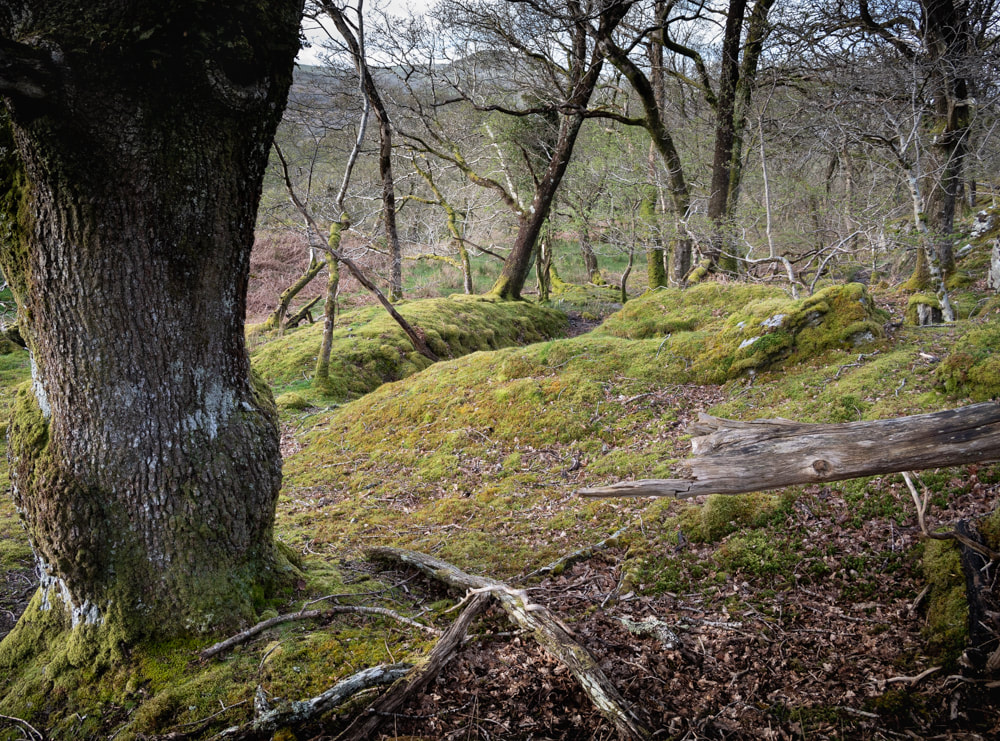
 A path through the bluebells, Coed Lletywalter. I am a stravaiger. A wanderer, often aimlessly. I'm not normally one for footpaths. I like to photograph views that few others have recorded; a different take on a well-known site, perhaps, or an unusual viewpoint. This approach is not without it's responsibilities. Earlier this year, Petra and I revisited the delights of Cwm Bychan and walked up the famous route along the so-called "Roman Steps". It was busy, even in April. It wasn't long, however, before we both saw the possibilities of a hawthorn tree above a small waterfall, some 250 yards off the main track. It was a difficult spot, certainly not somewhere to clamber down, but it made a good photograph. Or it would have done, if my camera hadn't been almost knocked from my hands by a party of ladies who brushed imperiously past me, thinking that I was selfishly blocking the path. I realised that they had been following our steps- and others were coming, too. Honestly, sheep would have had more sense. I felt annoyed at first, but then remorse got a hold of me and I felt responsible when I saw the ladies struggling down the rocky sides of the waterfall. I guess the moral is, just don't let them see you.  Ratgoed Lately I have been studying Cwm Pennant. There are quarries, mines and ruins enough to keep Petra and I happy for a few months. But I couldn't plot a way to get to some of them, at least not easily, or without tramping over miles of bog. So I fell to studying the maps, and scried a network of footpaths throughout the cwm, marked on both the 1:25,000 and the 1:50,000. The 25k map is my favourite - all that delicious detail. The paths, my reasoning argued, would give a legal method of attaining access to sites of interest. Of course, these were not places open to the public, but at least I could get up there without encountering some petty lordling with an issue over my trespass on his fiefdom. Once at the site, I would take my chances. Except that, on the ground, these paths didn't seem to exist. Well, a couple are still marked with the familiar signs, but most are obscured and obfuscated. Some lead into quagmires or nests of rusting barbed wire. Some are deliberately blocked.  "some are deliberately blocked..." I've tried a few of these paths now, in the company of my partner in crime. I probably wouldn't have the nerve to try them alone, even though I have a legal right to be there. Why is it that paths aren't marked? Do the landowners want to discourage walkers, or is it just a lack of funds and/or an overseeing body? Certainly, these days, there is precious little profit in putting up footpath signs.  Morben Close attention to the maps is needed, because many of the the paths have all but disappeared. Yet it is very heartening when, unsure if you are on the right track, you suddenly encounter a stile, or a kissing gate, classic signs of a right of way. Every one of the paths I have "discovered" has yielded some special gem, an old ruin, perhaps a view or an intriguing geological find. Most farmers and landowners that I have encountered are perfectly reasonable and are often very helpful in pointing out routes. These people deserve our grateful thanks. But there are others, those who obstruct the paths, who need to know that there are legal responsibilities that come with rights of way and that there is an obligation to keep them open. And despite what some people might tell you, a path does not go out of use because nobody has walked it for ten years, Or fifty years, or a hundred years, or ever. A path is for life. 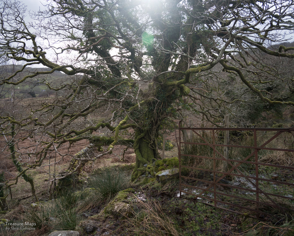 A footpath that has gone out of use and that needs to be walked again- the right of way from Plas farm in Cwm Pennant, to the open access land above Chwarel y Plas. I know that my views won't be popular with some folk, but I believe that we are simply the stewards of the landscape, that it is our responsibility to take care of it well, holding it in trust for future generations. None of us should own it, or have the right to keep people off it. With respect and careful measures on both sides, access can work- and footpaths are a good compromise. I hope I can encourage people to use the footpaths more; to seek them out and find out for themselves what gems are hidden behind the rusting signs or the dilapidated stiles. 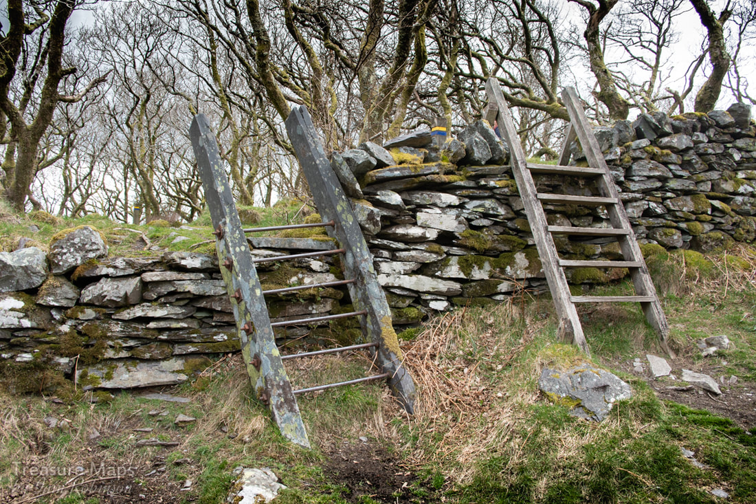 Old and new stiles in Padarn Country Park- many wonderful paths within the park, but also a fine network in the countryside around- well worth an explore. I was talking about our network of footpaths with an American friend recently and he was astonished that we were actually allowed to use them. In his country, he said, you would be liable to be shot, or crossbowed- especially in the hunting season, if you crossed private land. To an American, it would seem, private property and possession is everything. How fortunate we are in Wales to have a network of paths, even if some of them are a little reticent and would rather not be rediscovered. Walk them, open them up again. Enjoy the wonderful landscape and the fascination that it offers. We don't want to lose this precious liberty. 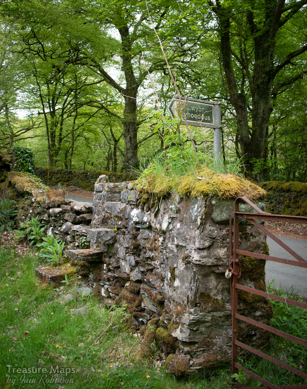 Coed Lletywalter 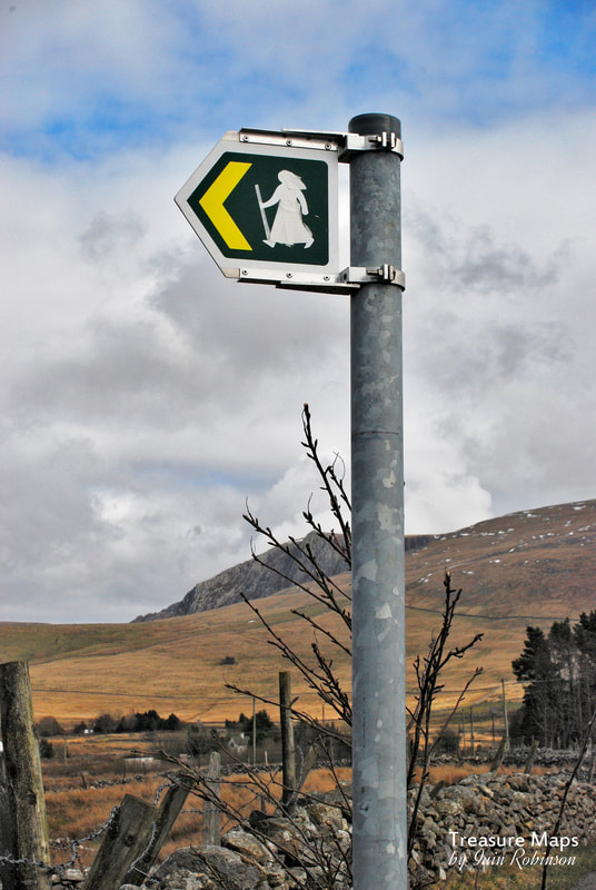 Nebo. Druid, Gandalf...?
0 Comments
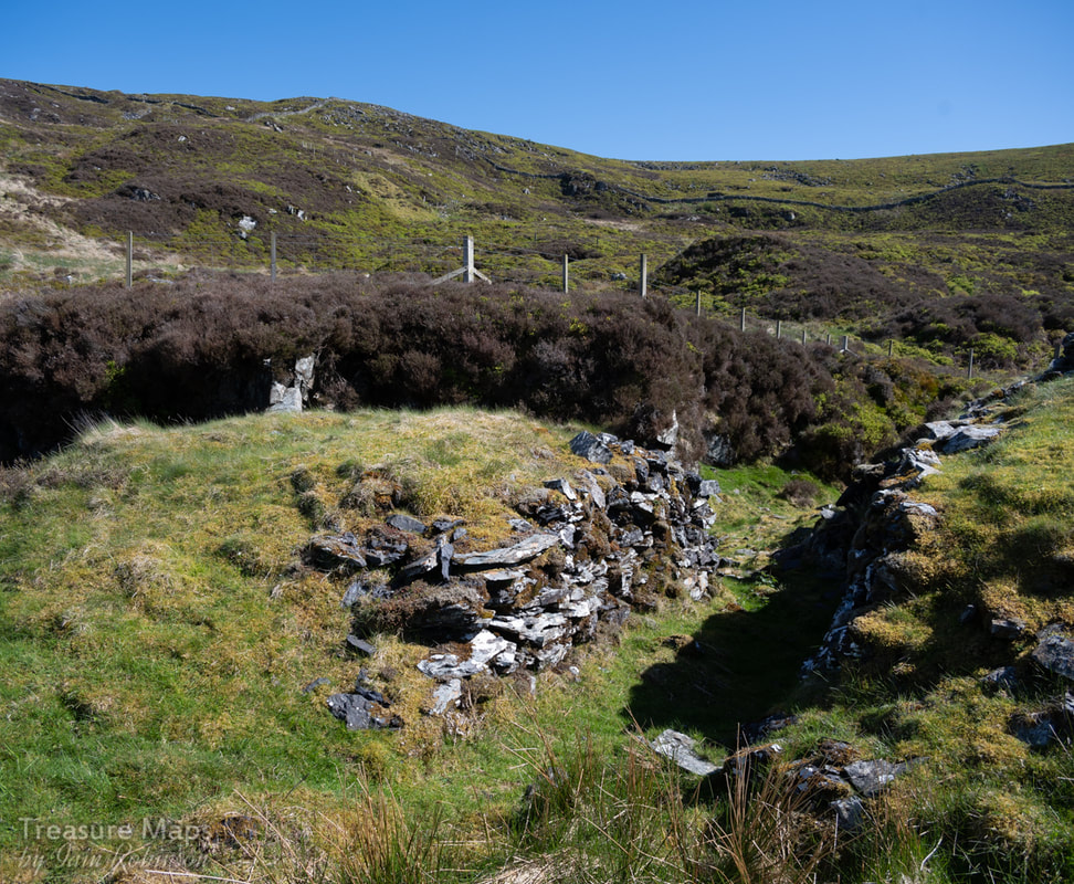
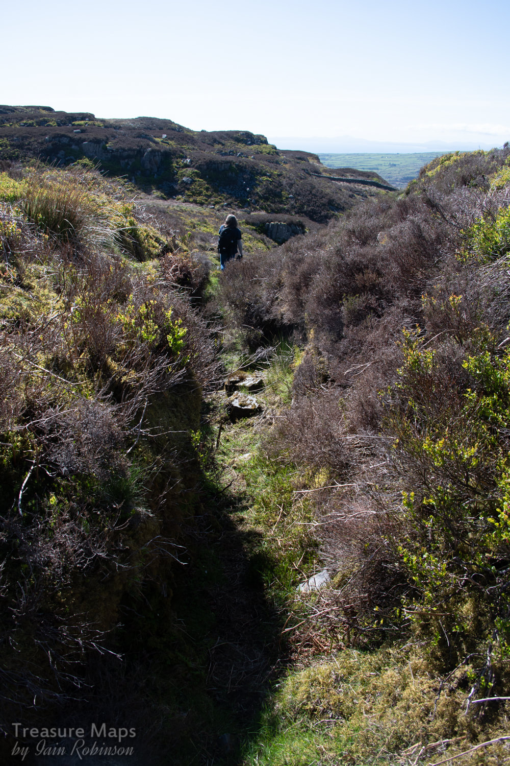
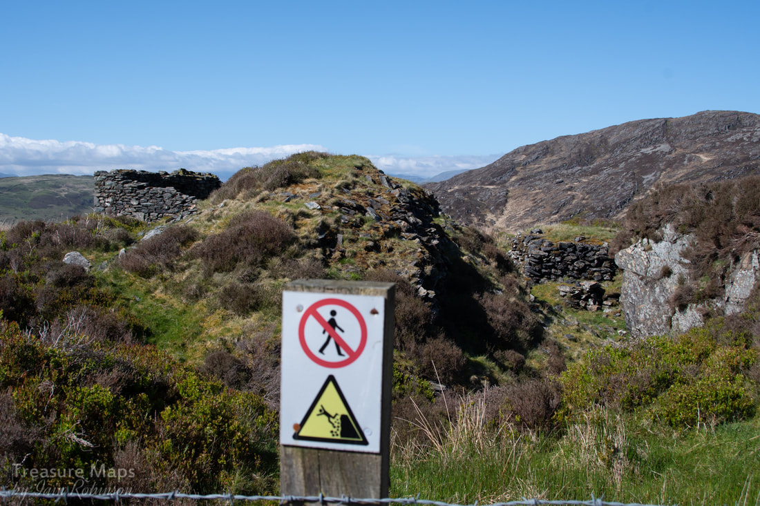
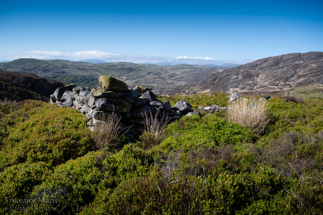
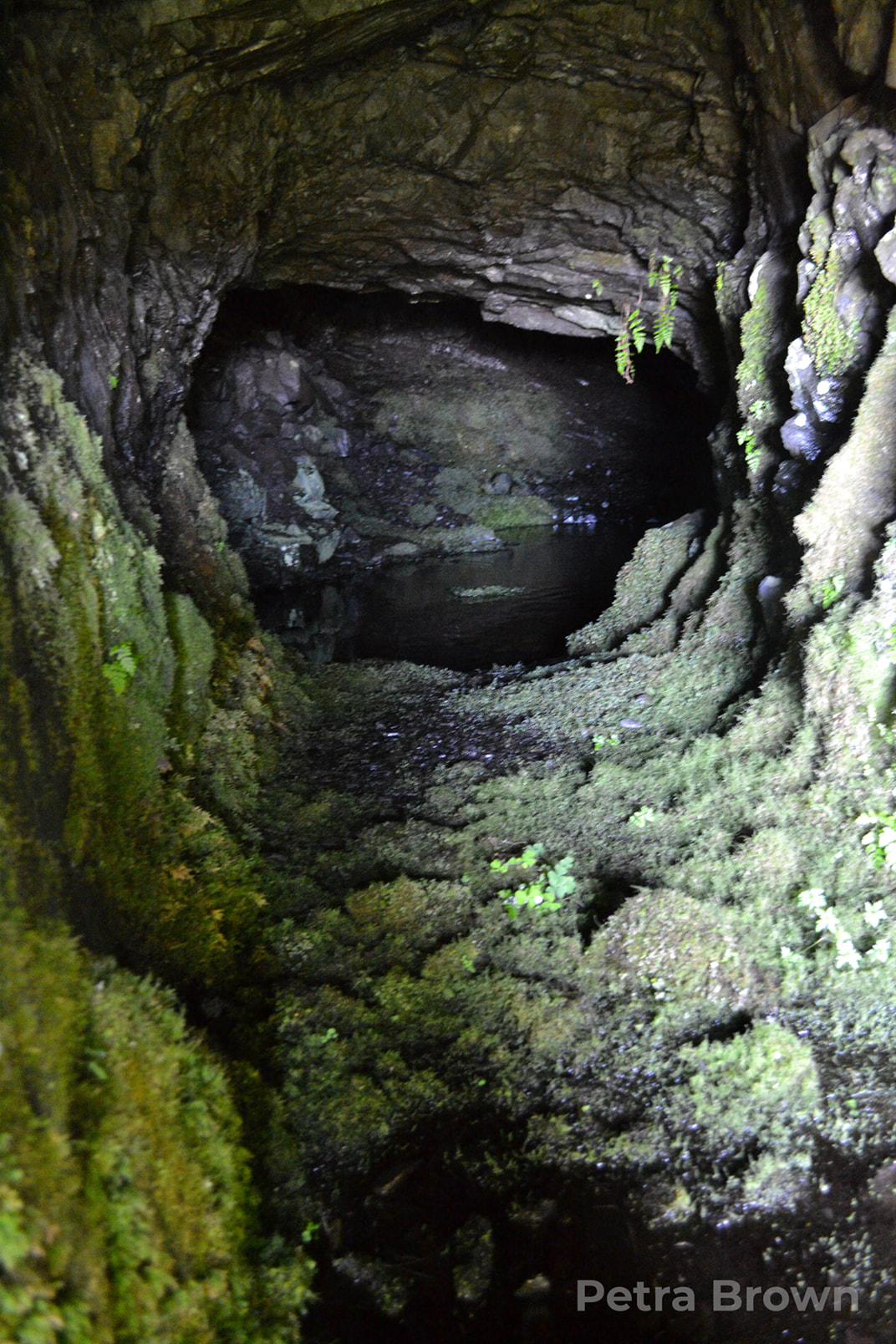
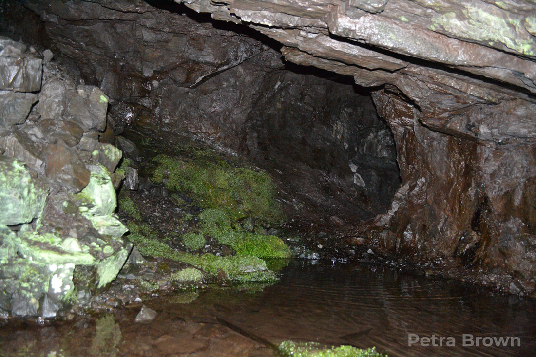
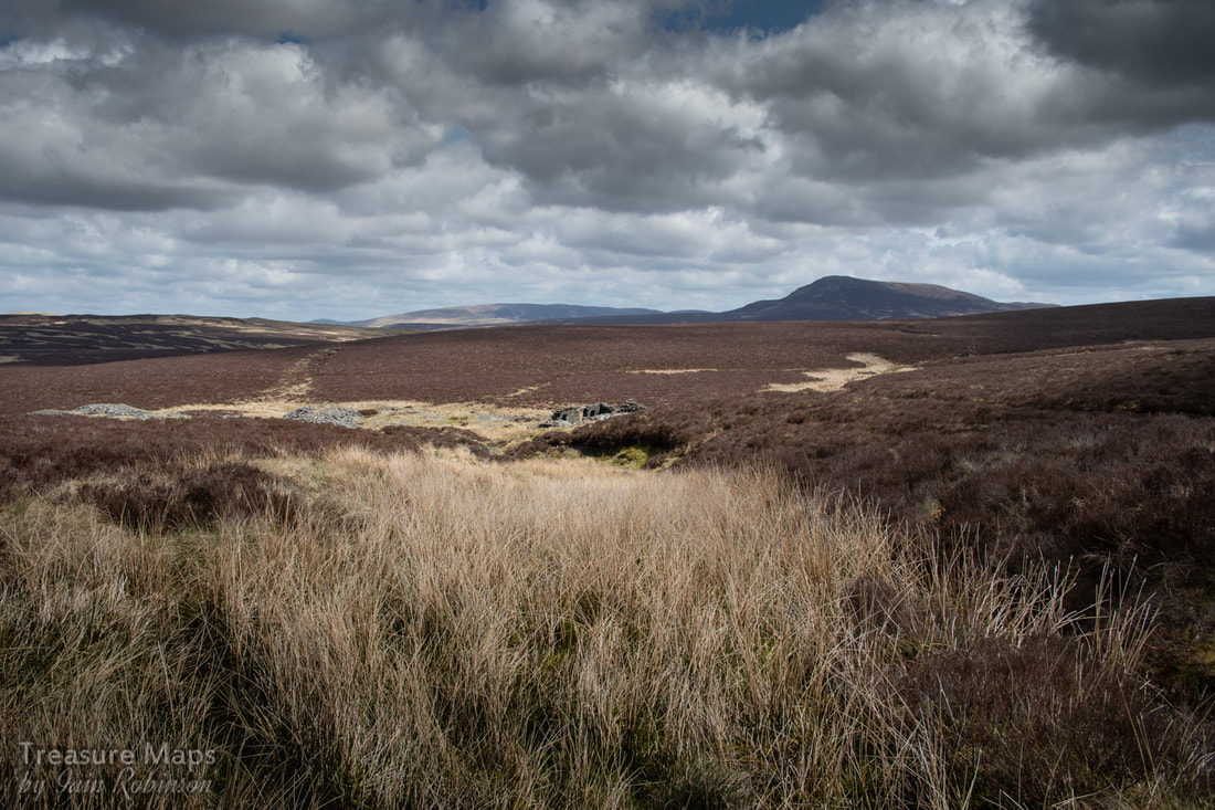
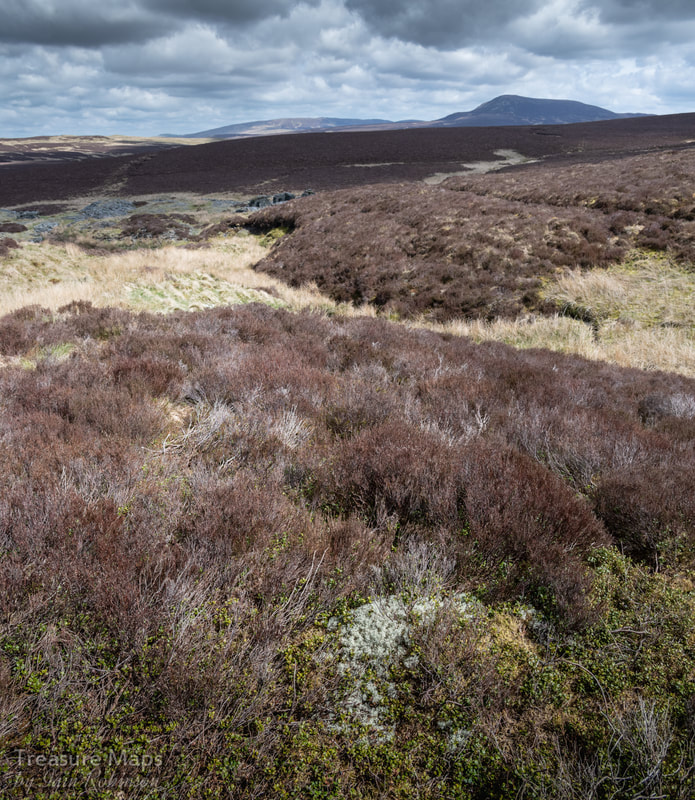
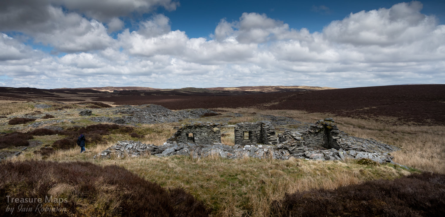
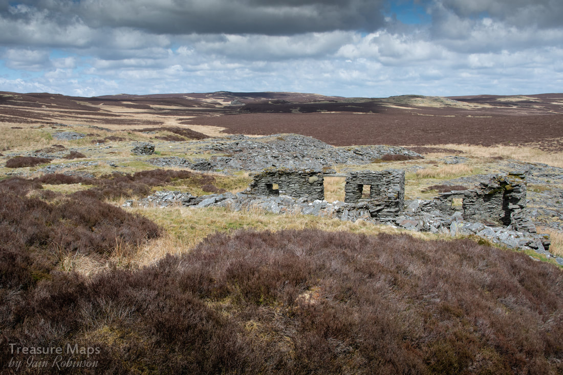
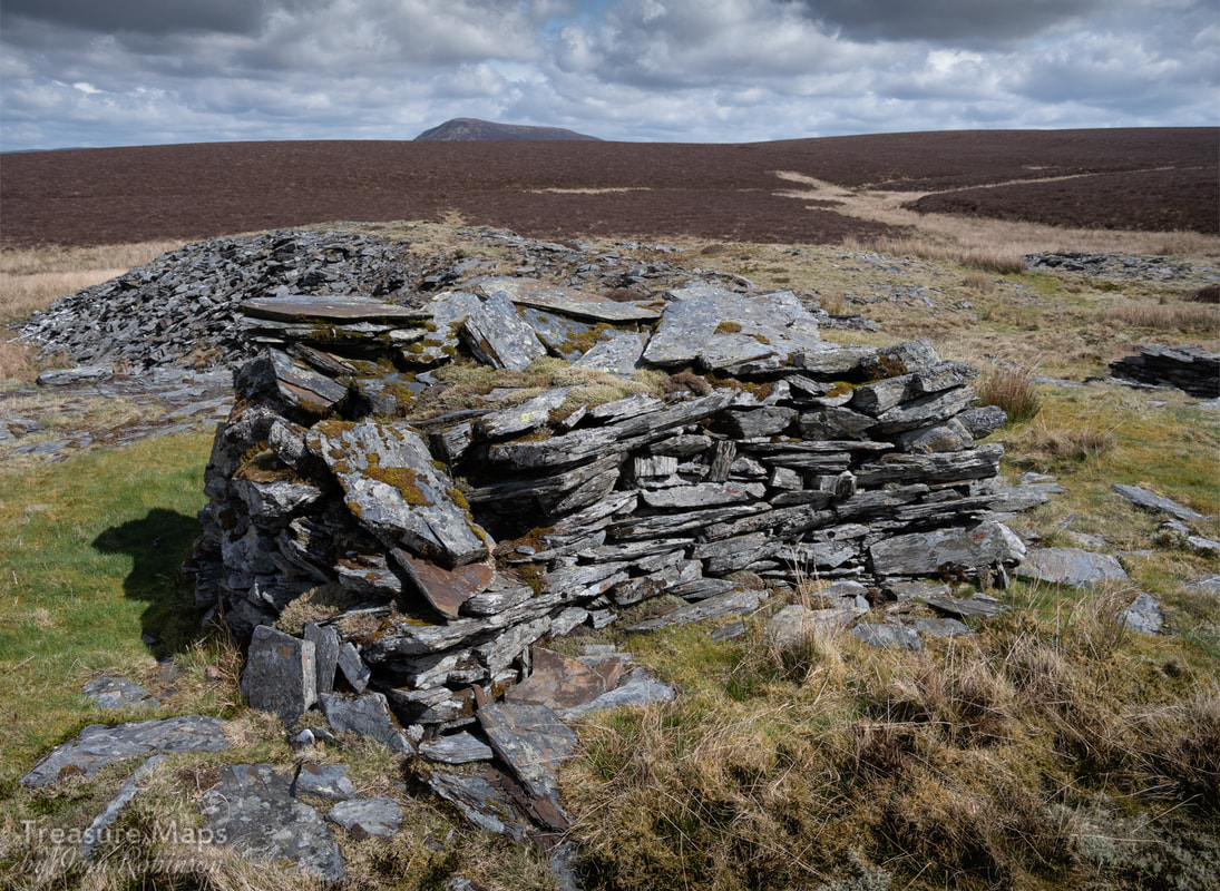
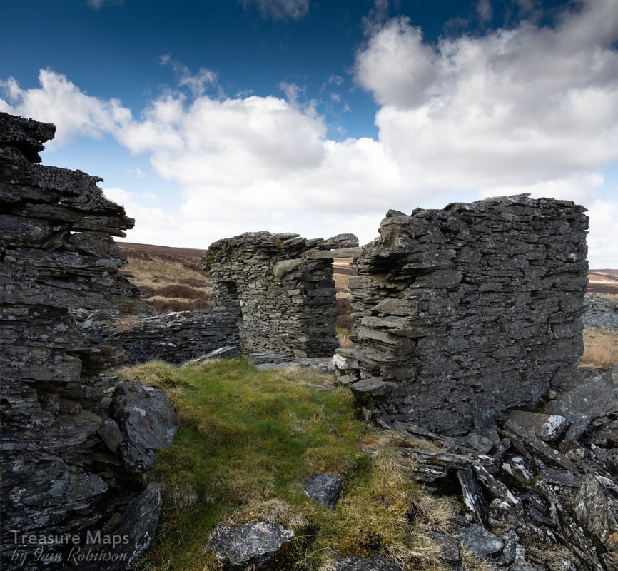
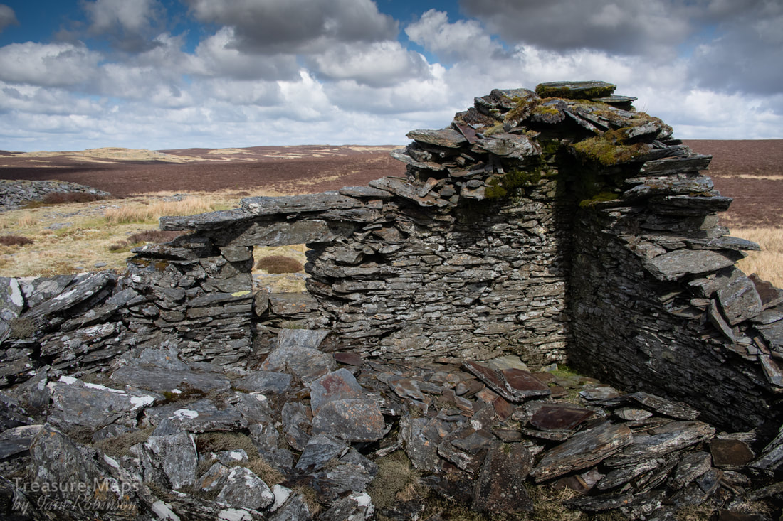
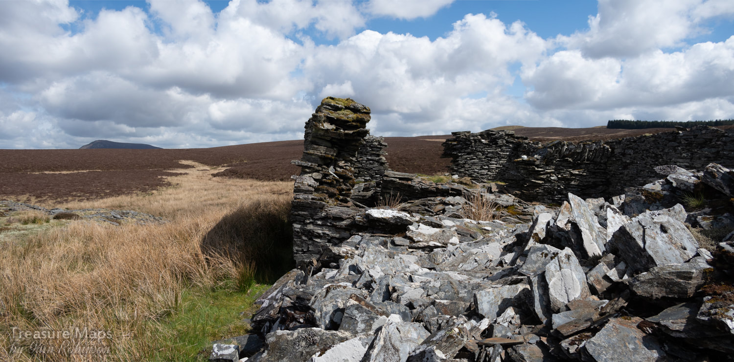
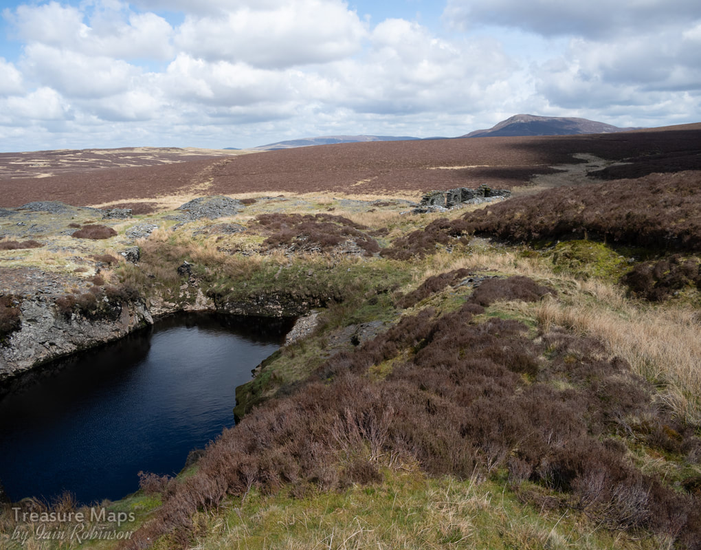
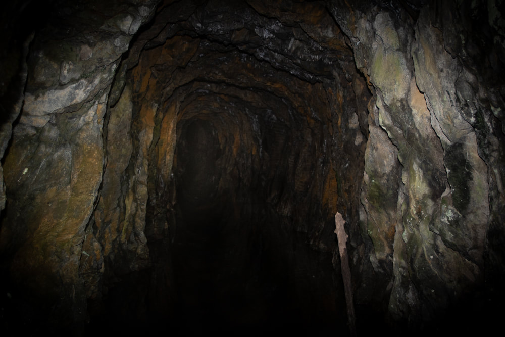
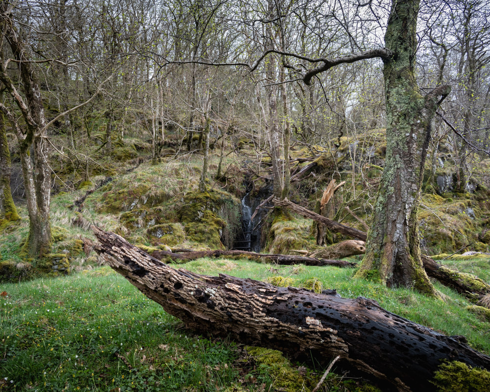
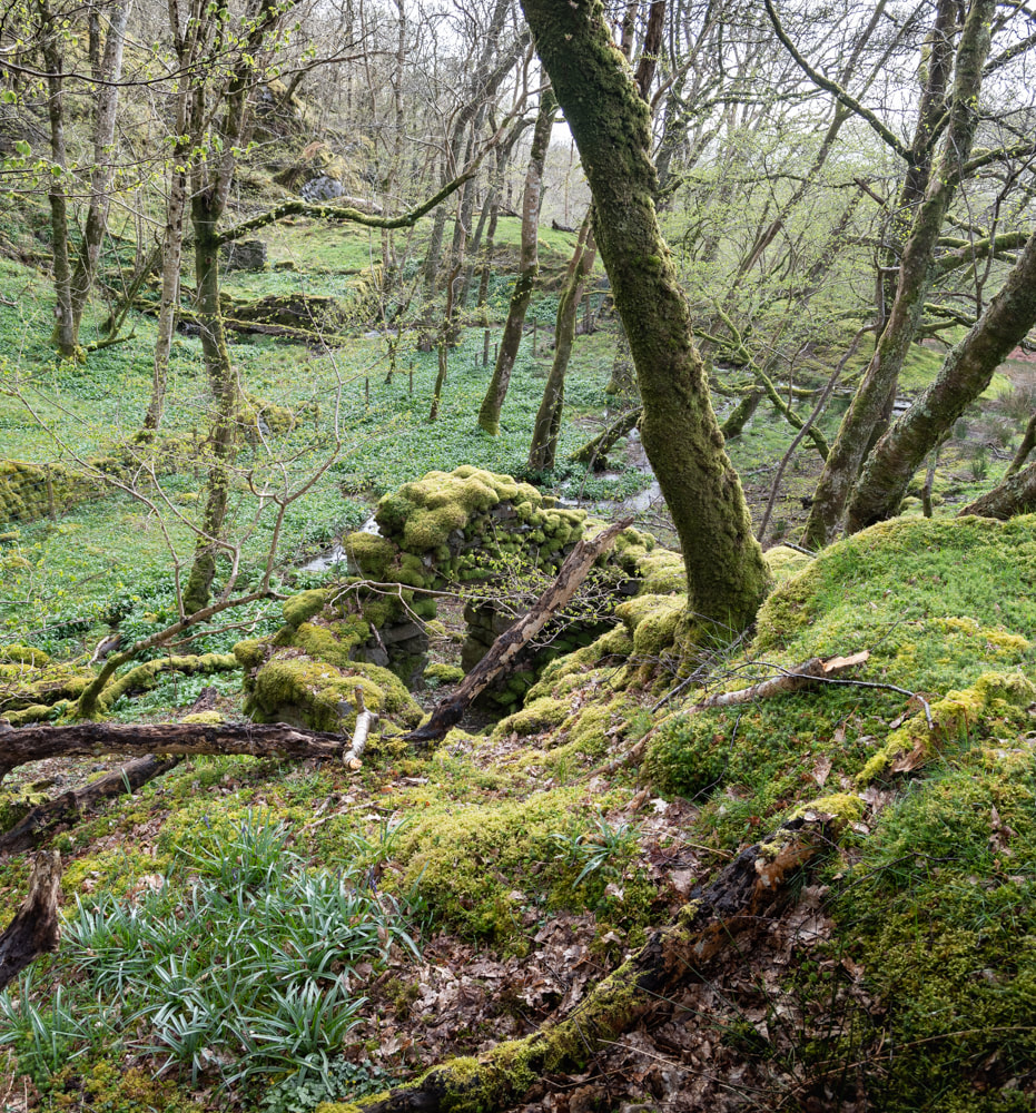
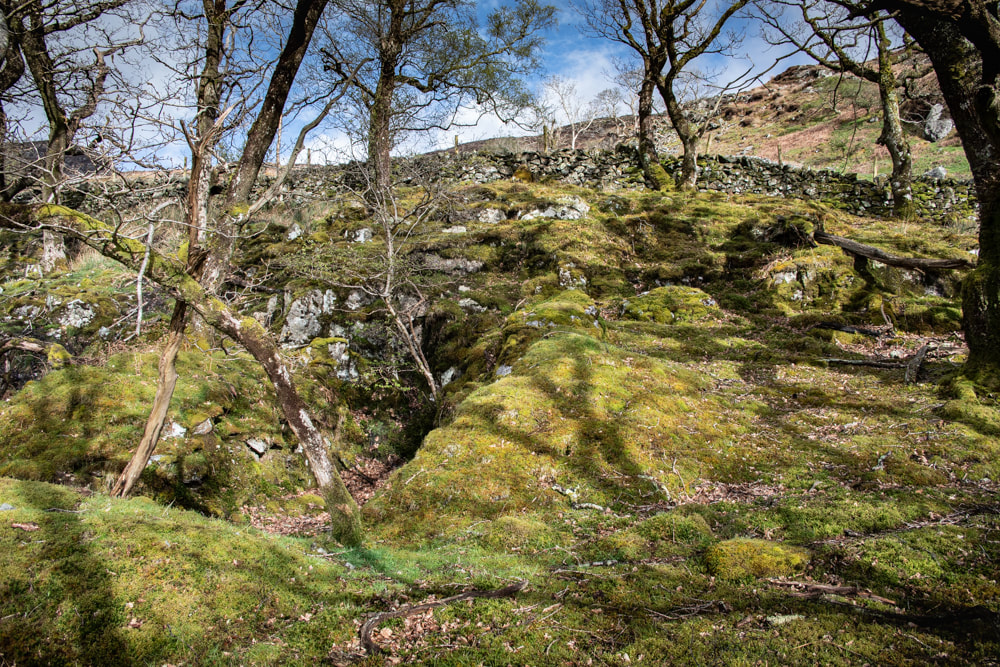
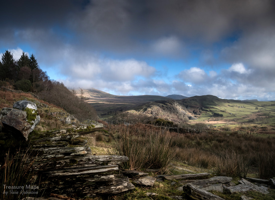
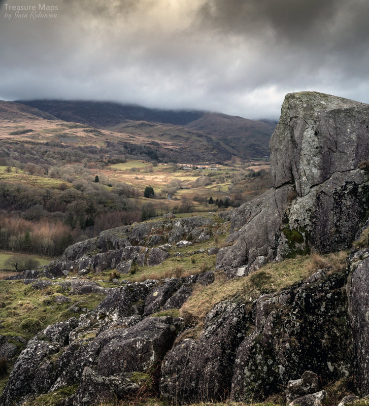
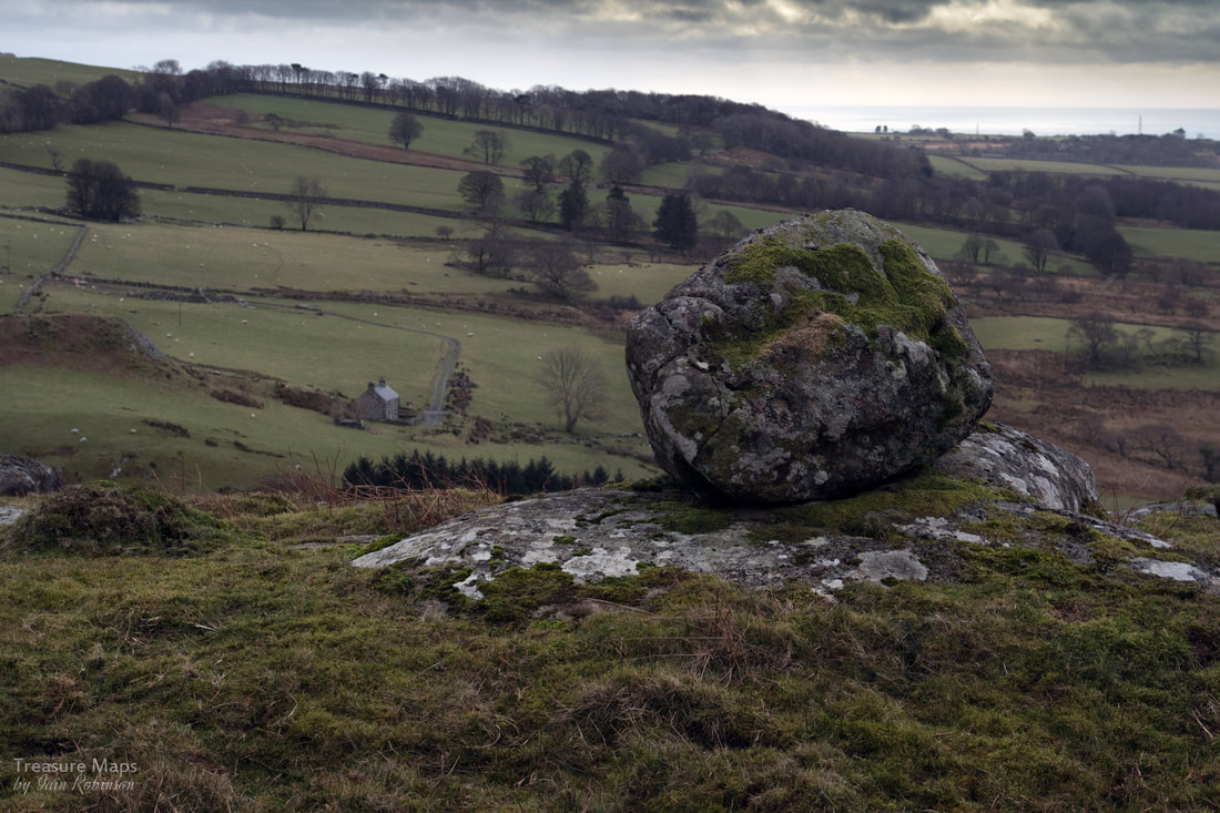
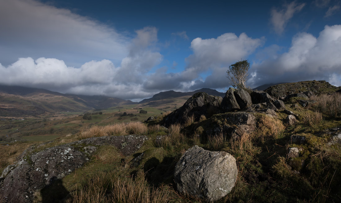
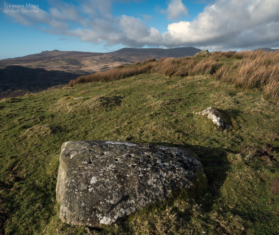
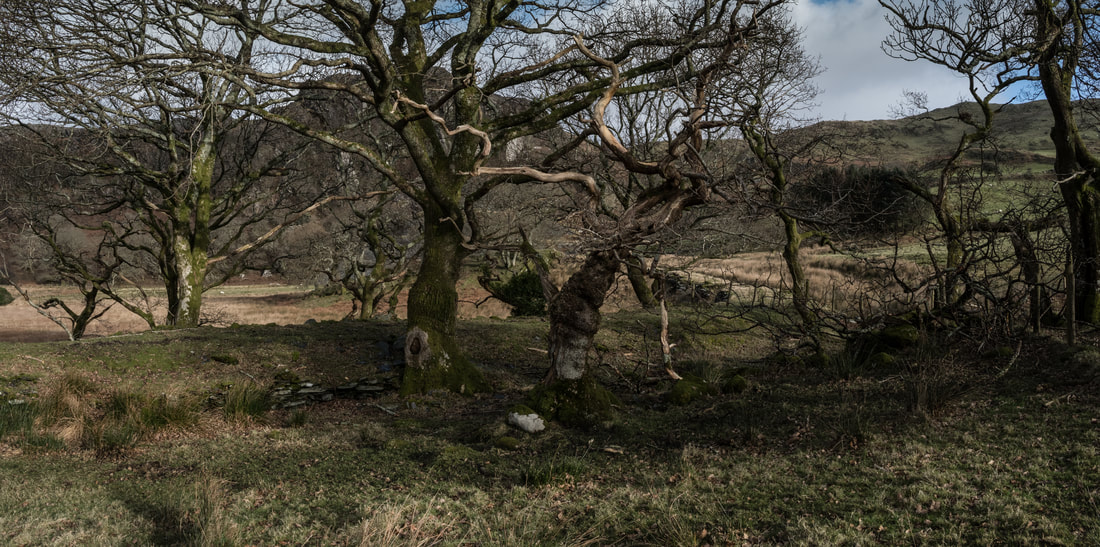
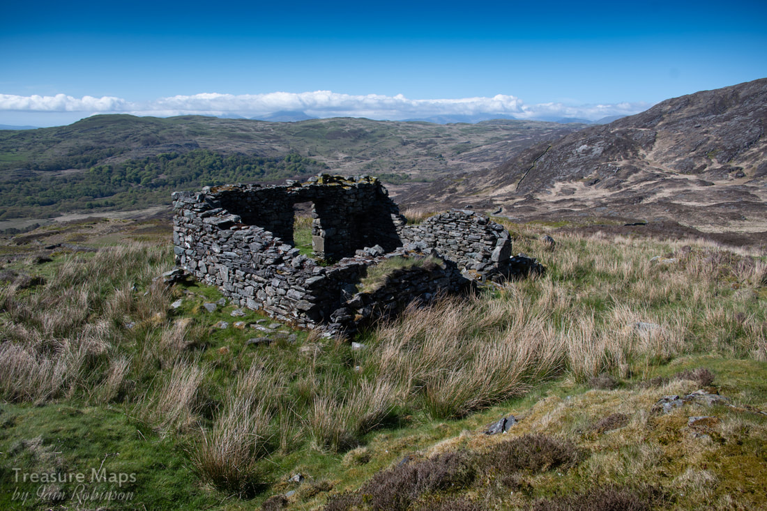 Possibly a Smithy, looking towards Mynydd Drws y Coed, then Moel Hebog in the centre and Snowdon (Yr Wyddfa) under some cloud to the right. The Rinogiau are rightly known for their difficult walking terrain, unyielding rock and almost total heather cover. But they are also remarkably beautiful- and studded with the intriguing remains of some mines. We spent a couple of days exploring one of these, the Cwm-yr -Afon mine. It's a long slog from the road that goes through Cwm Bychan to the mine, an uphill trek that includes a lot of bog and treacherous tussock grass. On the days we explored, the weather was perfect- not good for photography, but ideal for enjoying the landscape- which, despite the sunshine was still very boggy indeed. 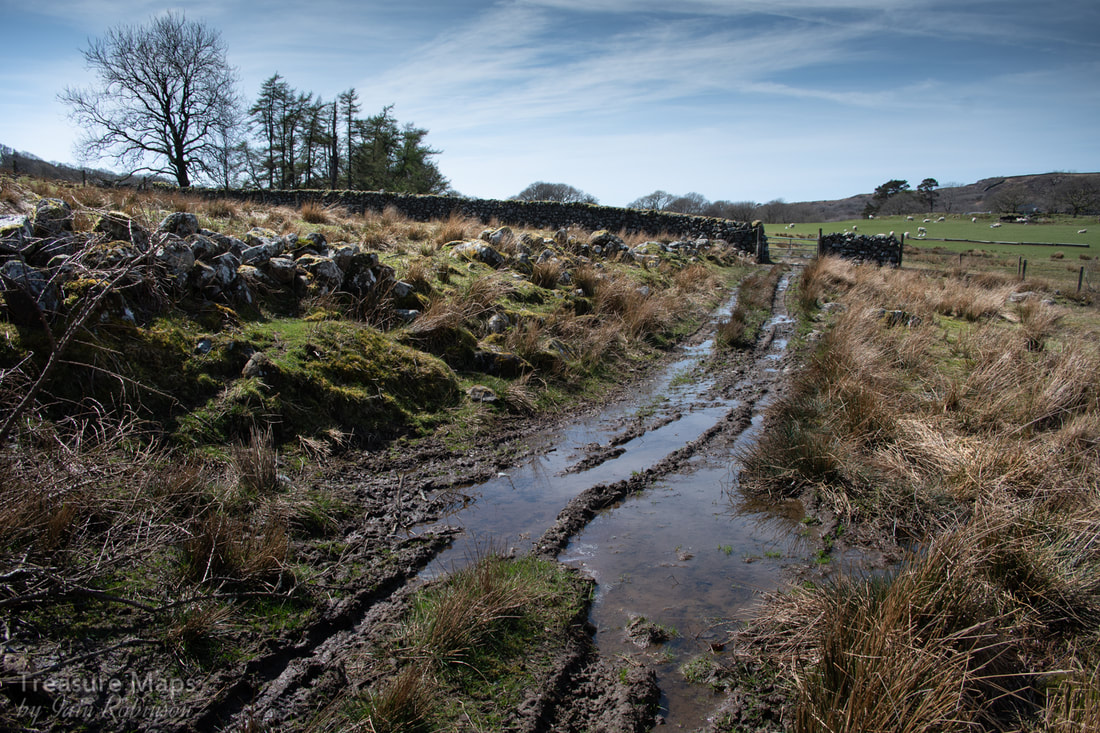 The soggy right of way through Cwm yr Afon farm. There are several ways to reach the mine, but the least exhausting is probably the mine track up from Cwm-yr-Afon farm. Coming this way also lets you view a very fine trial beside the Afon Artro, almost directly below the farm. I have found no information about this, but since the small tip includes some bluestone rocks (a low-grade rock found around the ore), I am fairly certain this is a manganese trial. 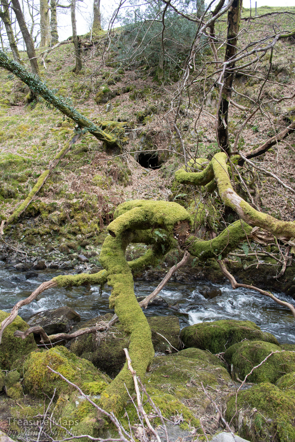 The trial adit below the farm, beside the Afon Artro The route takes you up a cart road which was the only way to transport ore from the mine- quite a thought. It's steep and narrow, and I pitied the poor horses having to hold back a load of ore coming down the track. On one of our visits, we took a slight wrong turn and ended up at the ruins of an old mill, Pandy, where in the remains of an old barn, there was a horse-drawn cart (with Ford Model "T" wheels) and on the floor, some old wooden cart wheels. It was nice to speculate for a moment if this was the remains of one of the mine carts, but I don't think so!  The cart road, almost lost in the moor. The road twists and turns uphill through boggy ground. Increasingly it can be seen that the sides of the road were revetted with big stones and the road itself was surfaced with cobbled rocks. The landscape goes up in a series of steps, gaining height until a plateau is reached. Here and there, are evident investigations at the side of the road, diggings that may have been explorative trials that came to nothing. 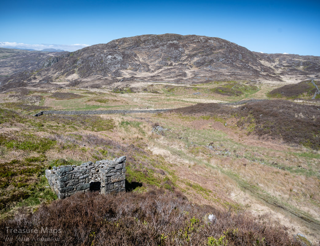 Looking down on the (possible?) Powder Store. In the background is Carreg y Saith. The mine sits on rising ground between Carreg-y-Saith and Carreg Fawr. We came to a point above Cwm Bychan where the footpath went one way, left towards, Carreg-y-Saith, while the road went through some particularly boggy ground ahead. A cuckoo was calling almost constantly, occasionally flying between the solitary Hawthorn trees to be found up here. Petra was for going on up the footpath, but I persuaded her to go along the road, knowing that as soon as she saw the mine I would not be able to stop her. So it transpired, she caught sight of a ruined building and I was rewarded by a smile and the sight of her racing ahead. We noted a structure that I first thought was a powder store; square(ish), no windows, a respectable distance away from the mine. But apparently, black powder was rarely used in manganese mines, the rock being crowbarred out. I still think the structure looks like a powder hut...what else could it be, sitting in the middle of a moor? 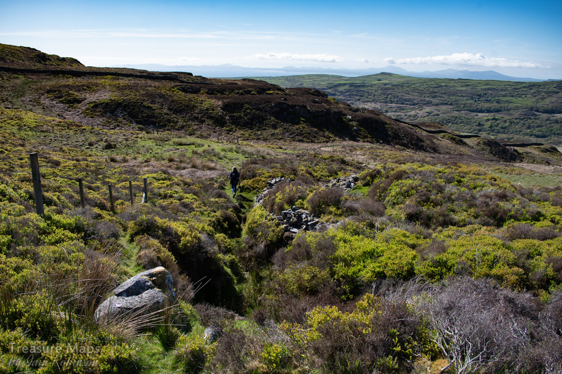 A typical opencut, with more beyond. We followed the track onwards and upwards- it was obvious that the mine was extensive and opencuts lay all the way up the slopes towards Gloyw Llyn, out of sight beyond a false summit. The workings were easily spotted because of the fencing around them, although since none were more than ten feet deep it seems a little bit "H&S". 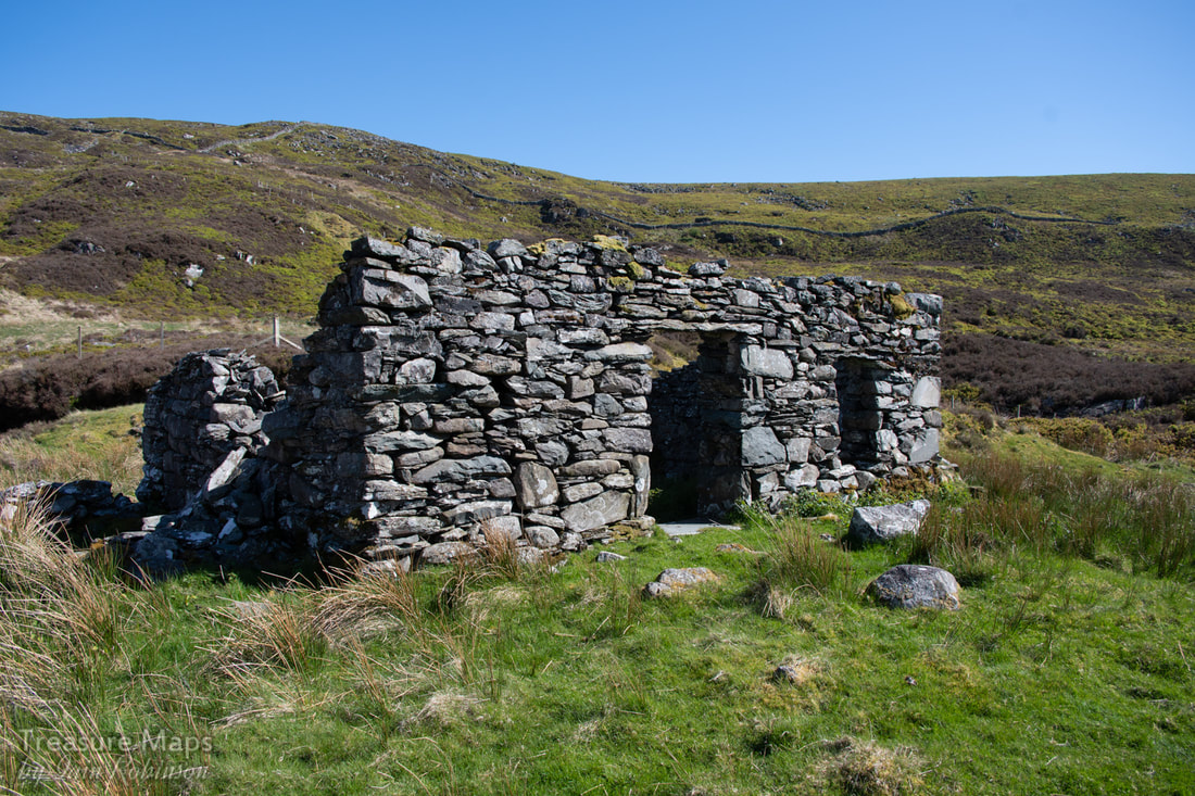 The smithy, with more workings stretching up the slopes beyond. We eventually made our way up the steep cart road to another ruined structure, called a smithy in C. G. Down's NMRS book. This was a great spot, commanding a superb view across the cwm and on to the sun-kissed waters of Cardigan Bay. We sat and had lunch, listening to the solitary bees as they fussed over the little spring plants on the ground. The landscape was magnificent and we had it totally to ourselves, apart from the cuckoo. 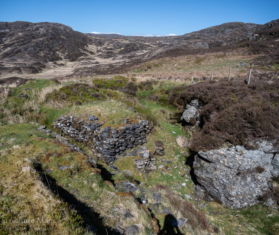 The opencut behind the "smithy" showing a stone built platform where manganese ore would be stored, then loaded onto a cart. Behind the smithy was a classic scene, an opencut with neat stacks of "deads" piled up, the excavation assiduously chasing the vein cross country, bending back on itself. We stravaiged all over the site, quite exhausting because of the deep banks of heather and the rocky terrain. In an upper area there were a couple of adits and a sizeable tip. In typical fashion, the adits were stacked with deads inside; once an area of the workings was exhausted, the workers used spoil to support the roofs. More workings appeared uphill, which we reached by following the twists and turns of the old cart road. There was a substantial tip and a couple of adits at one level, with a loading bank built out from the tip- it looked as if some crude processing had gone on here. The adit seemed to have been extensive, but as usual, was infilled with deads. 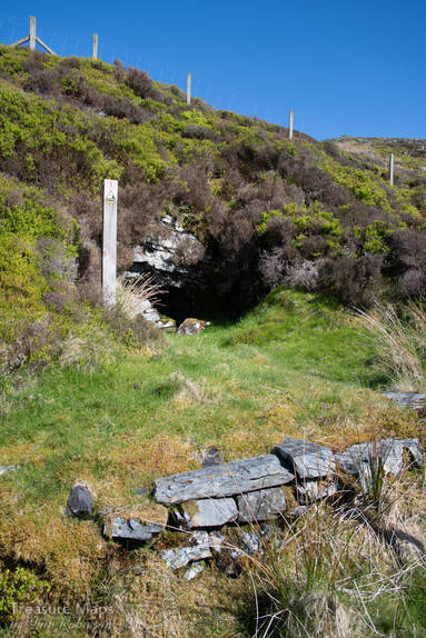 We also found an opencut and adit on the other side of the boundary wall, but the wall was high and topped with barbed wire. We tried to find a way through, but by the time we had searched up and down the wall, there was a substantial climb back up. Tiredness overcame us, and, thinking of the long walk back, we decided to leave that one for another time! On our way back, a troupe of goats were spotted, about 400 yards away- the only wildlife seen all day. Some facts: The Mine The Cwm-yr-Afon mine, also called Drosgol or Foel Ddu, was active from 1889-1923 in sporadic periods. The recorded output of the mine was 472 tons in total, although these figures are the returns from the official records; often actual production figures were higher. Typically, only a couple of men worked at the mine, although the figure went up to six in 1891 and ten in 1918. A surprising amount of work was accomplished when that is taken into consideration! As we've already seen, ore was carted down to Cwm Bychan and on to the railway at Llanbedr. One mystery is that while the mine appears as a series of structures on the 1:2500 Ordnance map, current edition, it doesn't appear on any of the older editions, robbing us of the opportunity to study what it looked like in the late 1800s. The excellent maps in C. G. Down's book (see references) make up for that. The mineral The manganese mined in the Harlech Dome area is found at the bottom of a thick layer of shale. The actual ore occurs in a bed some 10-18 inches thick, beneath a deposit of "bluestone" which was the miner's term for the heavy, dark rock that surrounded the actual deposits. The bluestone is extremely hard, but only weakly manganiferous. The ore bodies form as the result first of precipitation; a gel of rhodochrosite with clay and silica alongside iron hydroxides. These gels are then the subject of metamorphism, heat changing the sediments, resulting in crystallisation, the bluestone on top, then the manganese and underneath Iron oxide, which presents as iron pyrites where it is exposed by mining. It's uses Manganese was used in the production of bleach, and was much in demand from the cotton industry of the north west, to bleach cotton fabrics. It was also used for bleaching in glass production. The greatest use of manganese was (and is still) for strengthening and increasing the wear characteristics of steel - almost 90% of all manganese is used in steel manufacture. Less pure ores (the welsh ones) were used as an addition to the blast furnace, acting as a deoxidiser. Manganese is also used as a disinfectant in the form of Potassium Permanganate. Sources of information as always, the excellent Merioneth Manganese site by Dave Linton. British Mining No.14 "The Manganese Mines of North Wales" by C. G. Down- available from the Northern Mine Research Society. Thanks to Tom Cotterell for the use of his Conference Paper, "Manganese Mineralisation in North Wales." which was super-helpful in identifying samples in situ. 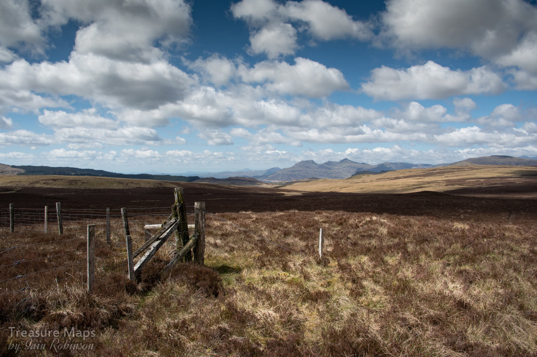 Looking back- our last glimpse of the Moelwyns as we descend into the moor, on the way to Serw. There was nothing but the moor. It stretched in every direction, as far as the eye could see. We were sitting on a low wall in the ruins of Serw slate quarry, eating home-made flapjacks, exulting in the peace and quiet. Except that somewhere, hundreds of feet up, a transatlantic aircraft was making the air rumble with kerosene thunder. No matter how far you go, we grumbled, you can't escape the sounds of the modern world. Meadow Pipits rose from the heather, their cries piercing the plane's thunder like tiny needles. It was too early in the year for the Curlews, although this was the perfect country for them. 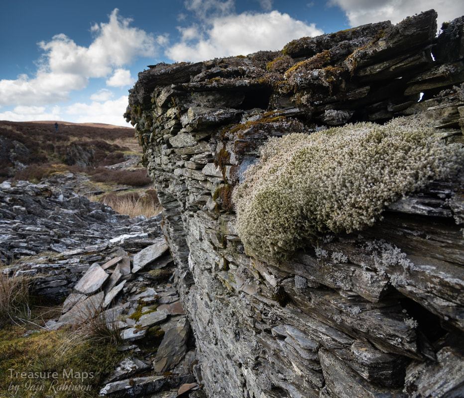 The leaning wall of the barracks, with lichens and moss softening the outlines. Micro-landscapes of lichen, moss and slate could be found everywhere- on top of a lintel, clinging on across a doorway, inside a candle alcove. Scale here was all relative in this seemingly limitless landscape. There was a kind of magic about the location of the old quarry. The ruinous, roofless barracks, one wall at a crazy angle, like a frayed, crushed cardboard carton. There were the usual shipwrecked features of an old extractive site; the tips, some sketchy slate piles that once had a discernable purpose, something that could have been a walliau or a caban. 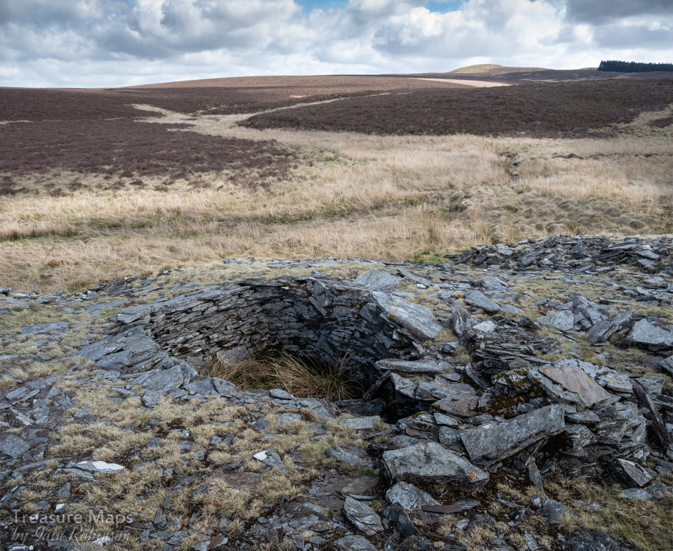 The tear shaped hut, possibly a powder store. Petra shouted me over. She had found a tear-shaped, ruined hut. It was sunk into the ground and showed signs of the roof having been cantilevered inwards to form a dome over the structure. I took some photos, aware that they wouldn't really convey what was special about this place. Most of the appeal was to something made in the imagination, conjured from the remains. 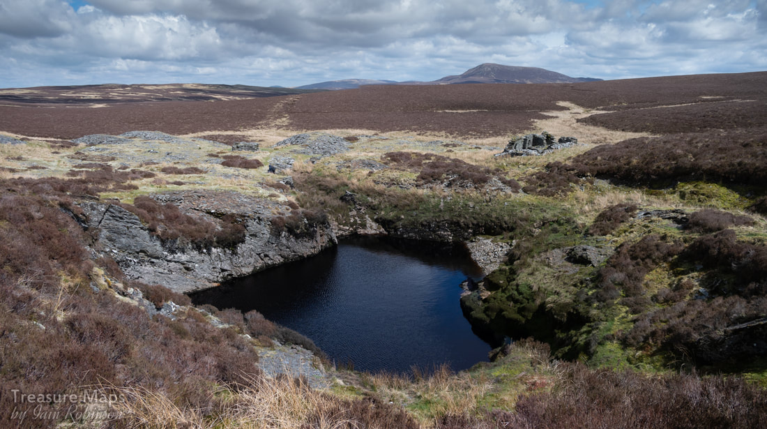 The largest of two quarry pits at Serw, the other is behind and lower than the one seen here- it is also probably older. The quarry pit behind the berms of waste was a mysterious dark basin of unknown depth, the water brown and murky. There didn't seem to be any aquatic life, yet the grass where the slate had long-ago been hauled out seemed flattened down by some animal. We wandered among the remains, enjoying the sensation of being the only humans to visit for a long time, but eventually, we had to start back for home. Ravens flew over, casting their runes to fall around us, making rich, burbling noises, or a sudden, metallic "bok!" They were considering our presence in their dominion. 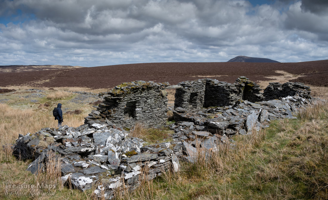 The quarry was closed before 1842, so these barracks have survived very well, considering the weather that rages over these moors. The heather around the quarry gave way to sphagnum underfoot, absorbing strength from our legs. It took an age to stumble and pratfall our way to the top of a slight inclination in the moor. I felt guilty, treading in massive pillows of moss or lichen, almost destroying a grouse nest, preoccupied as I was with the effort of high-stepping over berms of vegetation. We must have looked like a comedy duo, staggering and falling about. Finally, we reached firmer ground, relieved to see the ochre and yellow of the mat-grass and fescue. It might have been the result of chronic overgrazing in the past, but it was slightly easier to walk on. 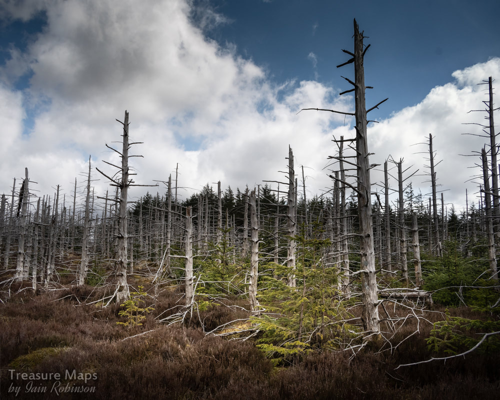 The dead forest On our way down the hill, towards the road, we passed an area of completely dead forest- the trees looked to have been about thirty years old before something had happened. Earlier, we had occasionally encountered the top of one of these dead trees sticking out of the bog, blown there by the fury of the wind. Nearer the road, we found a slate slab, sticking up like a milepost, except that it was on the way to nowhere. We encountered an apologetic group of five ewes and lambs who scurried away from our presence, as if they felt suspicion rest upon them. Soon, the sound of speeding car's tyres was heard, then a convoy of motorcyles, ripping the silence with their selfish noise, like the mewling of spoilt brats. A drinks can bounced away, disturbed by the bikes' passage down the road. We were back from the nineteenth, into the twenty-first century.  Very roughly cut slates. The quarry at Serw was unmechanised. 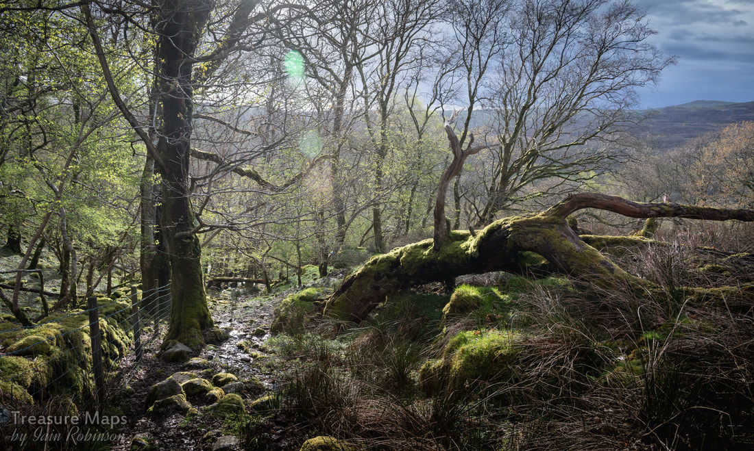 Along the trackway up to the top of the Coed Crafnant. It all started one dreich winter Sunday, with a walk up Cwm Bychan and the "Roman" steps. On the way to the head of the cwm, we passed some wonderful, intriguing stretches of ancient boskage. Once home, I scurried about on the internet and found that the woods also concealed some mines... a more detailed study of the area began immediately! We ended up making several visits- every time we returned, we discovered more. 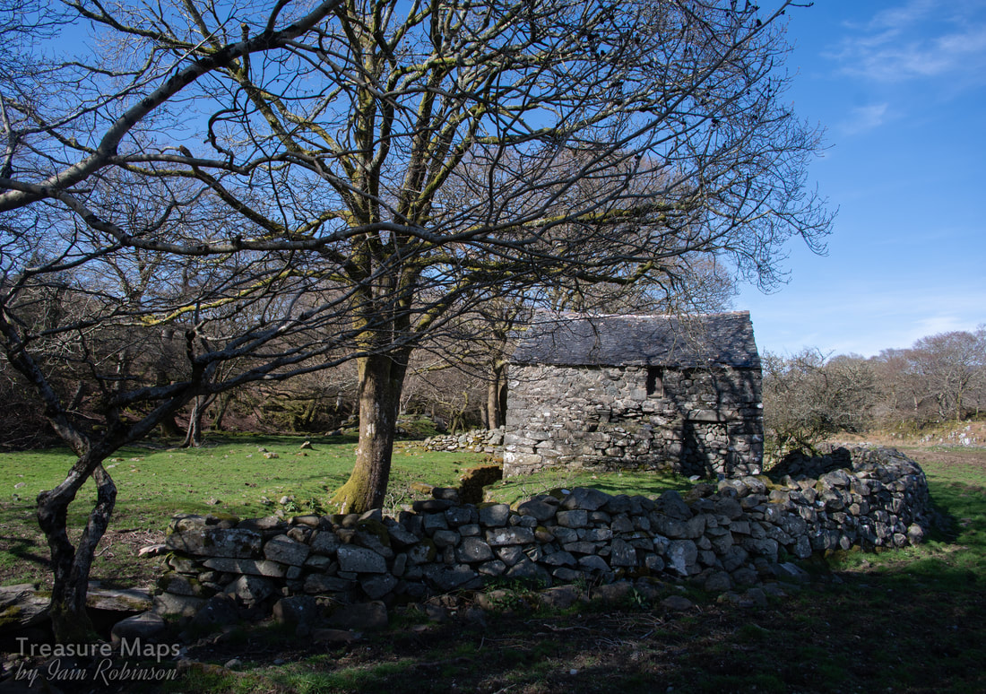 The old Corn Mill at Pont Crafnant. 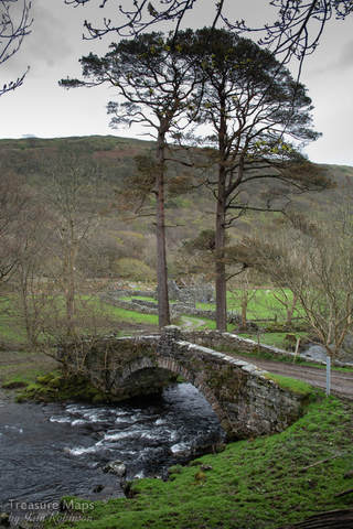 Pont Crafnant, with the old barn in the background. Pont Crafnant is the portal to the woods. It's a surprisingly elegant structure, made from fine blocks of local stone in the early 1800s. We were enticed off the road initially by two intriguing structures nearby, either side of the Afon Artro. One is ruinous, but the other was tantalisingly intact. This was a corn mill, probably dating again from the early 1800s. It was water powered, as can be seen from the leat running alongside and the wheel pit. As if further confirmation were required, the top step leading upstairs was made from a grindstone. Downstairs, there were some old cartwheels- and a lot of sheep poo. This room is obviously in use as a cosy caban for the woolly ladies. The low beams were age-worn and worm-eaten, punctuated by old House Marten's nests, but despite the aromatic features, the space had a lovely feeling about it. I stood there under those beams, with the light streaming in from the door, and in my imagination, I could see the seasons pass. The smile of summers and the cruelty of winters, folded like a timelapse. Humans moved too ephemerally to register, only the light's flickering span was a constant. 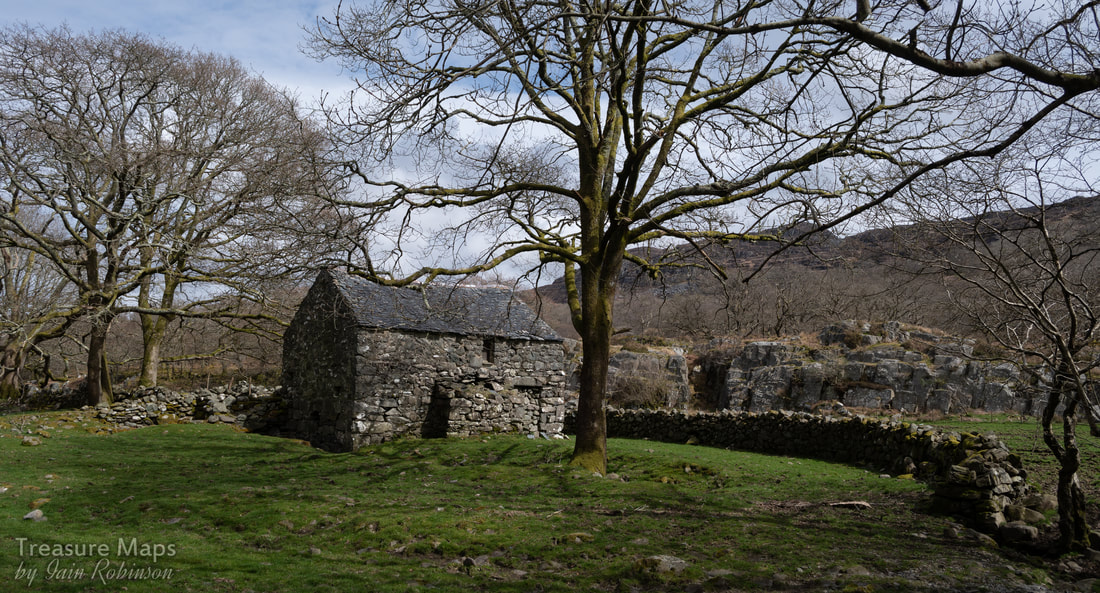 The Corn Mill Further on towards the woods and we could see that the barn hadn't fared well. The roof was losing the battle against the elements, rafters lay in disarray. The lambs were using the interior as a play school, jumping effortlessly onto boulders, like puppets, seemingly without effort. We walked on, up a very rough road. It was metalled with small rocks, what a quarry manager would call scalpings. It wasn't easy walking, especially as a stream had found the road to be the point of least resistance and was boisterously charging at us. Above, the trees made an arching canopy, hints that spring was on the way showing in the bright dots of young shoots. We were already in a good mood, but when Petra spotted the first adit it felt like a sign. She scrambled over the high fence and inspected proceedings. It was very wet, and seemed to be a shaft, protected by some flimsy lengths of tree branches. There was little in the way of a tip outside, so I would assume that this was an early trial for the Crafnant mine, looking for copper. 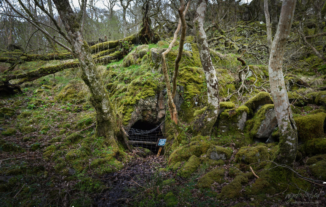 Petra's photo of the trial adit. Going on uphill a bit, arguing with the stream, another adit could be seen on the right. This was as picturesque as a mine can get, with a small waterfall emptying into it. Mine explorers will be interested to know that It goes in a short way to a rise and a flooded winze. It then continues on the lode over a second flooded winze. It's not remotely safe, and I would strongly discourage entry as the winzes, disguised by water, are deadly. As if to underline the sense of peril, a rotten bole of an ash tree lay on the ground, looking like a deceased monster, consumed by giant worms. "This could be you if you go in there!" it seemed to say.  This could be you! 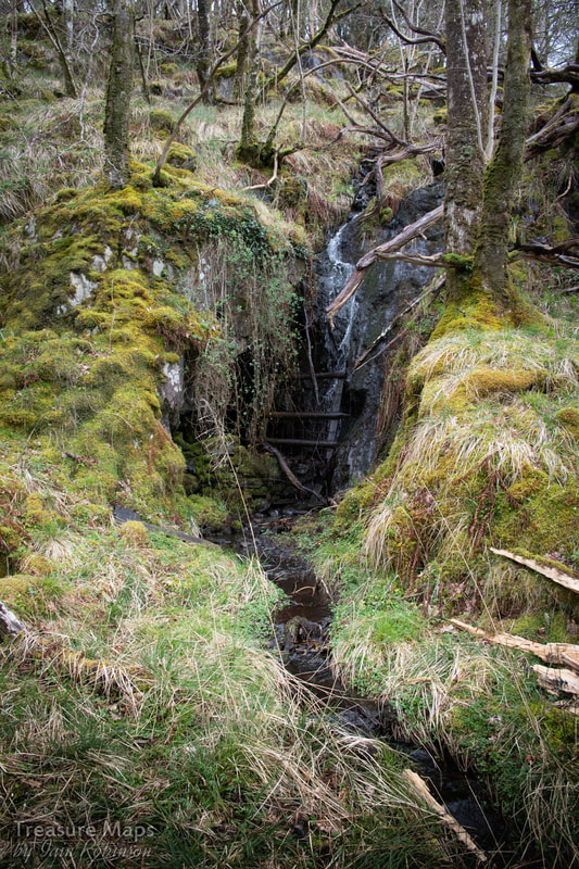 Next to the adit was a working area and a structure which we later realised was a smithy. This would be the main working area for the mine. The blacksmith's hearth was completely overgrown with moss and felt like an art installation. There was a modest tip, and a walliau which may have been roofed over at some time as a place to cob the ore out of the rock from the adit. We lost ourselves for a while, thinking about the miners here...the mine was active between 1847-1859 and I wondered who they were. Were they Cornishmen, with clay pipes and wide brimmed felt hats? I turned, saw a dark shape on the distant rise and almost thought I saw one, out of the corner of my eye. It was a couple of birches, grown together, but to my highly strung optical nerves, it was a shift in time. 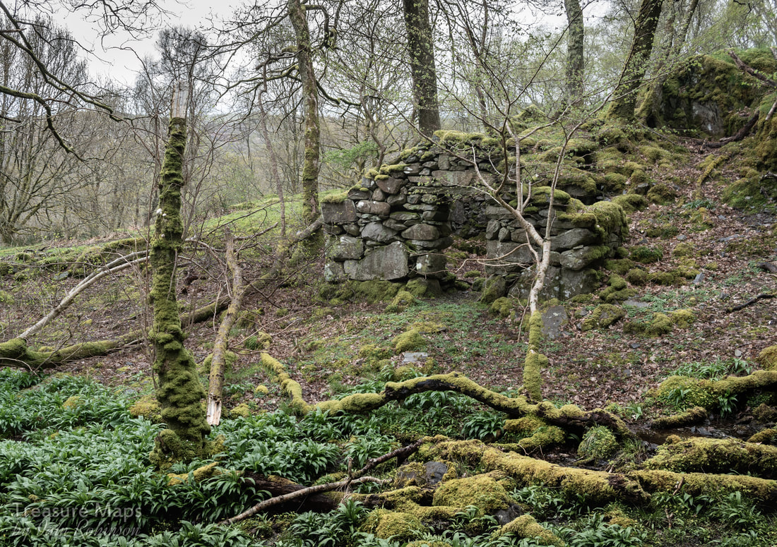 The forge structure I can only think that there wasn't much good ore found here; perhaps manganese was more plentiful- as the tip was small and there was little copper waste. I picked up a couple of suspiciously heavy rocks...dark grey in colour...like manganese ore. The whole site was overgrown with Ramsons. These were thought by the old mine prospectors to be an indicator of manganese in the ground. 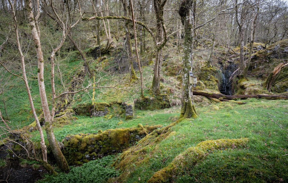 The adit and cobbing/processing area to the left. Note the nest box. We walked a little further until we were almost out of the woods and took some photos of the beautiful old oak trees there. They shared the ground equably with some really ancient birches, whose trunks were gnarled and almost unrecognisable from the smooth ones normally seen. The trees were covered in lichens, tree lungwort and liverwort plus many other varieties that, while fascinating, were beyond our powers of identification. So many mosses and lichens, so little time!  One of the manganese trials at the upper margin of the woods. As we turned round I noticed the unmistakeable signs of trialling for manganese ore (above); a semi-circular excavation in one area, and a lateral one further up. The sides of the opencut for the latter trial was built up with deads (waste rock) in typical fashion. This convinced me that the game was afoot, and I was optimistic that we would encounter the manganese mines that were supposed to be buried deep in these woods.  The oak and the ash... We retraced our steps back down and then struck off into the shadowy depths of the woods. The way was blocked by several fallen trees. Here, there was a predominance of oak, ash and birch. Most of the casualties were ash trees, thrown down by the high winds of the winter. The woods are managed because of their status as a temperate rain forest -and I read that rangers actually took some of the rarer lichens off fallen trees and grafted them onto suitable healthy specimens. I'm afraid the Ash Dieback has begun to hit here quite badly, but these fallen trees didn't show many signs of it.  The tree-choked adit seen first on the lower trackway. The further into the woods we went, the more substantial the track (and the bramble jungle) became. We passed a very overgrown trial on the right, followed by an even more ruinous level, almost eclipsed by tree growth. Then we reached a very low bridge, almost a ford, into a clear area. We immediately spotted an adit- high spirits were quenched by finding it disappointingly short and infilled with deads. Above it, an opencut went along the contour for some way- typical of manganese workings. It may not seem like much to the casual observer, but we had seen enough mines to know the signs. A modest amount of work had been done here. According to Dave Linton's excellent "Merioneth Manganese" site, this mine had been active between 1886-87, although it limped on under different owners until 1918.  The start of the opencut.  The short adit, with the opencut above. The opencut felt like a sunken way, with the trees on either side. I would have loved this place as a child- even now as a grumpy old git, my imagination was working happily away, expecting to encounter some buckram green-clad outlaw with a bow and arrow. There was an old reservoir near here, almost silted up. It was more of a bog, really...but obviously made to power some machinery for the mine. It was so still and quiet- later in the year it would be a haven for dragonflies and all kinds of life. Petra spotted a baby frog and knelt to photograph it. Sadly her autofocus was suffering from frog blindness and preferred a blade of grass. 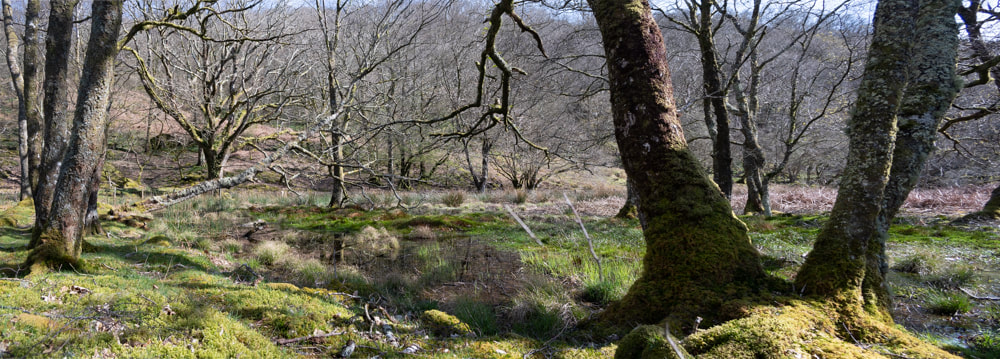 The amazingly still and quiet reservoir. We sat and had lunch, sitting on a fallen tree. The woods were busy with birds and new growth- our visits were all in April 2018 and the sounds of wrens and other birds soon rose again as we sat still. The cuckoo was also noticeable, calling ocasionally. What we hadn't expected were a couple of goats, who came ambling past. They looked slightly, comically, wary of us- but not much. Luckily for my appetite, the wind was blowing the whiff of the goats away from us. There are still some adits/levels to explore above the trees, the remains of the Crafnant South mine. It's difficult country above the forest, rough, bramble infested and full of ticks- but we may return at some point to find out for sure. 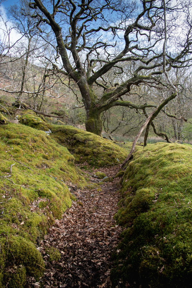 A manganese trial at the top of the woods. The Factoids For the exact location of the mines, the Merioneth Manganese site has a very good map and details here. You may find yourself searching the site for yet more interesting places! Pont Crafnant is at SH 6171 2896. Parking Cwm Bychan is, like many places in Wales, notoriously short of parking places. Luckily, there are some near the old corn mill. The first is at a lay by, marked on the OS as "parking" at SH 6184 2931. At the time of writing, the farmer has stacked a huge store of hay in the lay-by, but there's still room for a couple of cars to park. I was amazed when checking this on street view to see that it was actually a tarmac parking place- it doesn't look like that now! The Wales Wildlife trust, who run a reserve here, suggest parking at SH 617 290, which is the farmer's access- we know that he uses this a great deal, so I would suggest parking inside the gate (if conditions are dry), off the road and out of the way. The old maps on the NLS database are invaluable for insights into the land use, dates etc. All the places mentioned in this article are on rights of way, or on open access land. Incidentally, you will pass a gate on the way up to the mines, leading to the excellent Wales Wildlife trust reserve. Do take a look. It's magical, so much so that I will be writing a blog post about it very soon. It has mines, too... 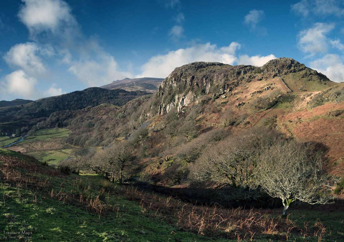 Craig Isallt from above the top pit of the slate quarry. Moel Isallt is the obstacle every traveller has to negotiate, before the true nature of Cwm Pennant shows itself. It's a hill of differing characters, depending on where you approach it from, but it is always the gatekeeper. Upper Cwm Pennant is a hanging valley, watched on the east by Moel Hebog, Moel lefn and Moel Ogof, while the west side is firmly policed by the mighty Nantlle Ridge. In the Pleistocene era, when glaciers scoured down the cwm, Isallt was already ancient, a tough outcrop of volcanic rock, stubbornly blocking the way. It caused the ice to build up, then climb over on it's journey to the sea. 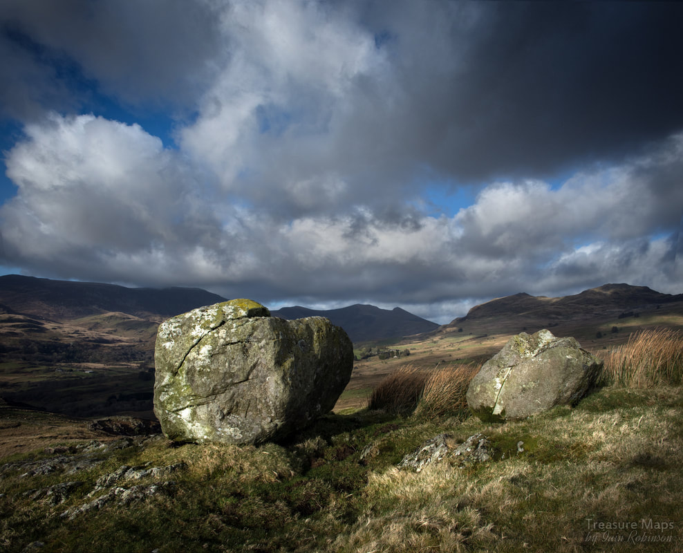 Erratics, huge blocks of rock, left by the ice. It was almost as if they were arranged deliberately, for effect! On the south side, facing the coast, it is sheer, almost vertical in places- a classic Roche moutonnée. On the top, the surface is smoothed and scarred by rocks, carried by the ice, as it careened slowly, inexorably over. To the north, there is a huge slope of glacial till, clay and stones, deposited as the ice ramped up. Then, in an instant of geological time, the climate warmed and the ice melted, leaving some massive rocks stranded on top- "erratics" in "O" level geography speak. Something else happened, too. A lake formed with meltwater, until eventually it spilt over at the lowest point and cut a channel. This channel is now where the road climbs steeply up, over the threshold. It's called Gyfyng, or "narrow place". 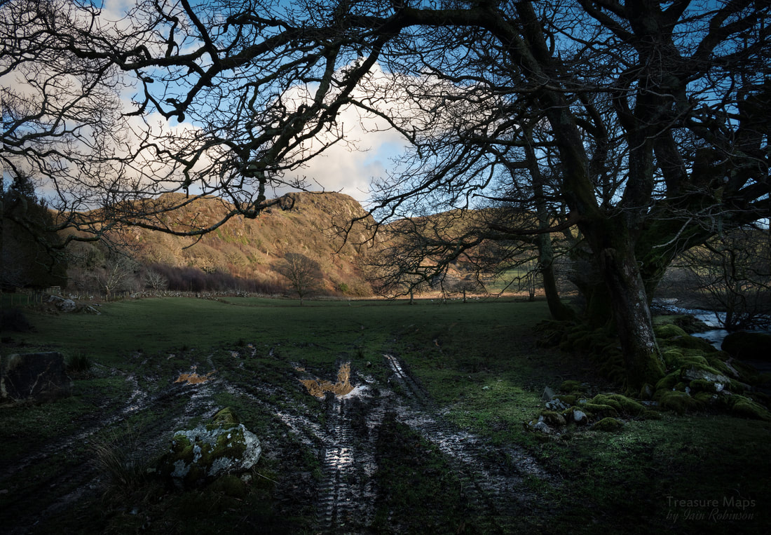 Craig Isallt, from the north side of Pont Gyfyng. So much for the origin of Moel Isallt. But what is there to see now? At the base of the hill is the bridge over the Dwyfor, once a meltwater channel. It's an old bridge, dating from the early 1800s, slate boom days when infrastructure in the valley was overhauled to take carts full of product from the quarries, such as Moelfre and Chwarel Y Plas. To stand by the bridge, before the road starts to rise up, is to feel opressed by the hill as the wooded slopes rise steeply above. This part of the hill, where it resisted the glacier best, is known as Craig Isallt. Incidentally, there is space here for 2 cars to park considerately beside the road after the bridge. Almost at the top is a charming schoolhouse and teacher's accomodation. The school closed in 1939, and after being extensively restored in recent years, is now a holiday let, like so many properties in the cwm. Almost on the level now, the road skirts the flanks of Isallt along a beautiful lane, with the magnificent peaks of Snowdonia providing an exciting backdrop in the distance. Soon Pennant chapel comes into sight, where the explorer must turn right up the steep Rhwngdwyafon road and park. 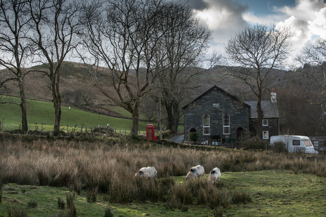 Pennant Chapel, from the meadow at y Ddol. Pennant Chapel is a simple yet dignified structure, built in 1834 as a Calvinistic Methodist place of worship. It was rebuilt in 1870, but by 1998, had fallen on hard times. At the time of writing (2018) it has been under reconstruction and will probably become holiday flats when completed. To the top! It's time to get the boots on and take a hike to the top of Moel Isallt. If possible, park in the small lay-by immediately after the chapel at SH 5314 4538. (If that is full, turn round and try in the space just after the bridge). Then walk steeply uphill until the road turns left. Here, at SH 5341 4534 on the right, is a gate which is a right of way. The gate has been firmly fastened every time we have visited, but nevertheless, it is a right of way. Follow the soggy path uphill gaining height quickly through a waterlogged field until it meets the 200m contour- follow the fence on the right until a gate appears. Go through that and you can reach the top of Craig Isallt. Beware, the southern aspect is almost vertical, and the Craig proceeds in a series of steps- make sure you are wearing very strong boots and are confident about heights. 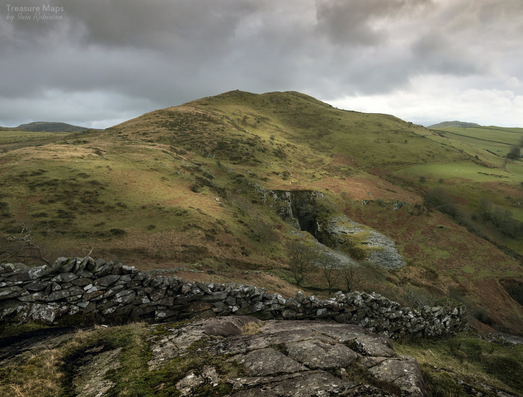 Moel Isallt from the highest point of Craig Isallt. There is a considerable drop behind the wall, which seems to have been built almost in the air. The rewards for this endeavour are some superb views of the mountains to the north, while to the south you can look down on the deserted Llanfihangel-y-Pennant church and the slate quarry. Meanwhile in the distance, Cardigan Bay sparkles on warm days. A significant bonus is a rock-cannon on the top of the Craig, somewhere around SH 5299 4507. 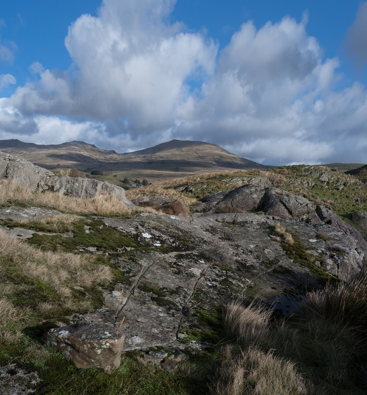 To reach the eastern top of Moel Isallt, I am afraid you will have to retrace your steps back to the footpath, as impassable terrain and unscaleable walls block the way east. There is a surprisingly steep but brief pull up to the top, (286m) but again, the views are great- across to Moel Hebog and over the panorama of the Gorseddau to the east. On the day that Petra and I climbed to this summit, you could see towards Ty Mawr, the Gorseddau quarry slate mill. Again there is the surprise of a rock-cannon, smaller this time and slightly away from the summit. High days and holidays must have been noisy occasions in this area! Below towards the east is the deserted farmhouse of Caerfadog Ichaf, which I shall cover in a future blog post, while to the west the Isallt Slate Quarry opens up below. I covered this on my old Blogger site, here. Moving off the top, it is best to keep to the west and head for the rough road and dry stone wall, as the ground was extremely boggy- and to add some spice, there were some very frisky bullocks around when we visited. 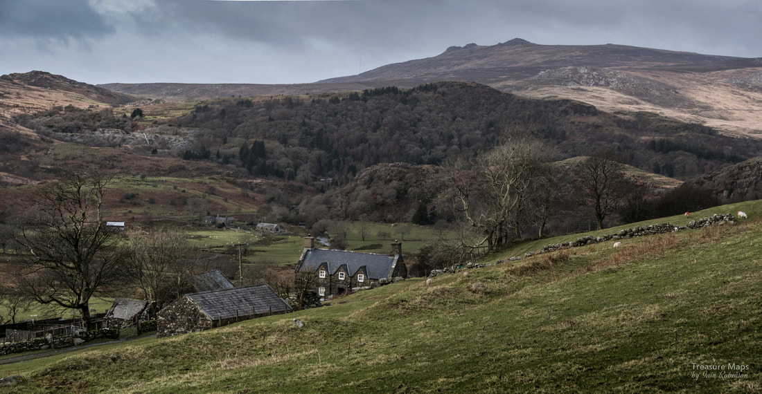 Isallt Fawr farmhouse, with the peak of Mynydd Graig Goch looming in the distance. Moelfre slate quarry can be seen on the hill behind. The House of the Bone-Setters After negotiating the mud and cattle, Isallt Fawr farmhouse is visible, waymarked haphazardly until you reach the farm yard. This is a very fine house, grade 11 listed and dating from the 1570s. It has associations with the Roberts family who were well known bone-setters (surgeons) in the area. One notable member of the family was Griffith Roberts 1735-1808. It is interesting to note that between them, the Roberts and Owen families of Isallt Fawr produced over 100 doctors and surgeons. A snippet of trivia is that J.B.Priestley once stayed at the farm. 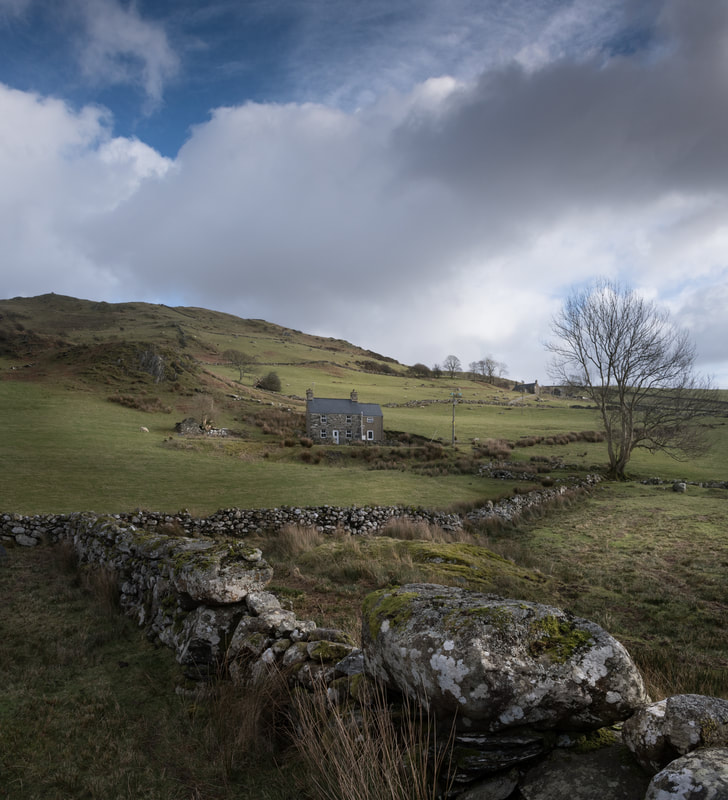 Isallt Bach, with Moel Isallt rising behind. Isallt Fawr is up and to the right . Now you will need to take the road downhill, until Isallt Bach is reached, at which point the right-of-way goes across boggy country again, down towards the river. There is a temptation to follow the tramway formation here from the quarry; it would be easier, yes- but there is a fence to cross and this is private land. I confess, we have done it and I preferred it to wading through gloop on the east bank of the Dwyfor, which is what the footpath wants you to do. We have only been here in wet weather- perhaps the path is passable in dryer times! However you reach the road, there is now a tarmac hike of a mile or so uphill to the parking place- unless you had parked beside the bridge at Gyfyng. The walk I've described takes in some spectacular views and interesting structures. I recommend setting aside two and a half hours to do it justice- and you will need some tough waterproof boots. It's a fine introduction to Cwm Pennant and the sight of some of the distant summits may well, I hope, tempt further exploration. 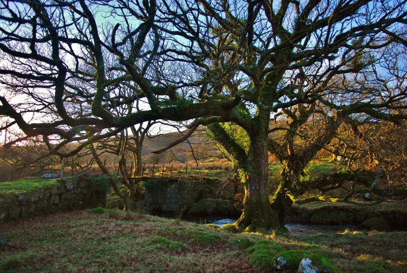 The tramway bridge just before it meets the road. 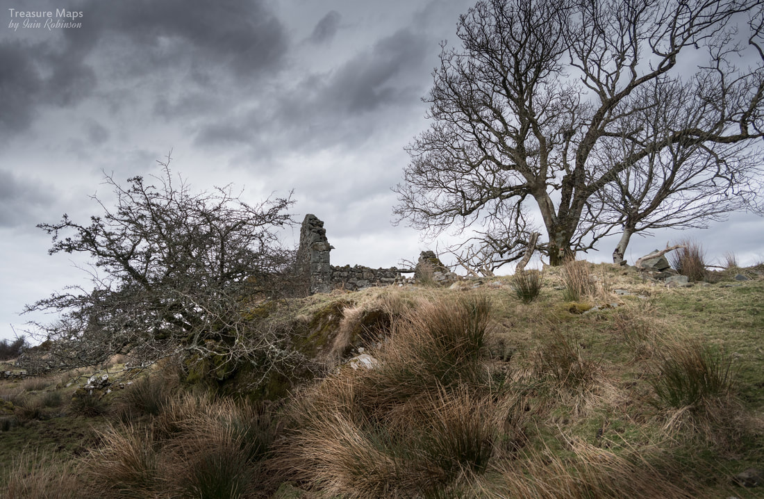 I first noticed Cil Drygwr when we were wandering about on the west side of Cwm Pennant. We'd been having a look at the remains of Castell Caerau, on the rocky slopes of Craig-y-Garn. It's an iron age fort, but looks more like a collection of random dry-stone walls- still mindblowing, nevertheless, to think that the rocks were put in place by the hands of our distant ancestors.
READ ARTICLE |
TracksReceive the occasional Treasure Maps Newsletter- and alerts when a new post is available!
If you enjoy my content, please buy me a coffee!
Check out my other online activity...
Index
All
|

 RSS Feed