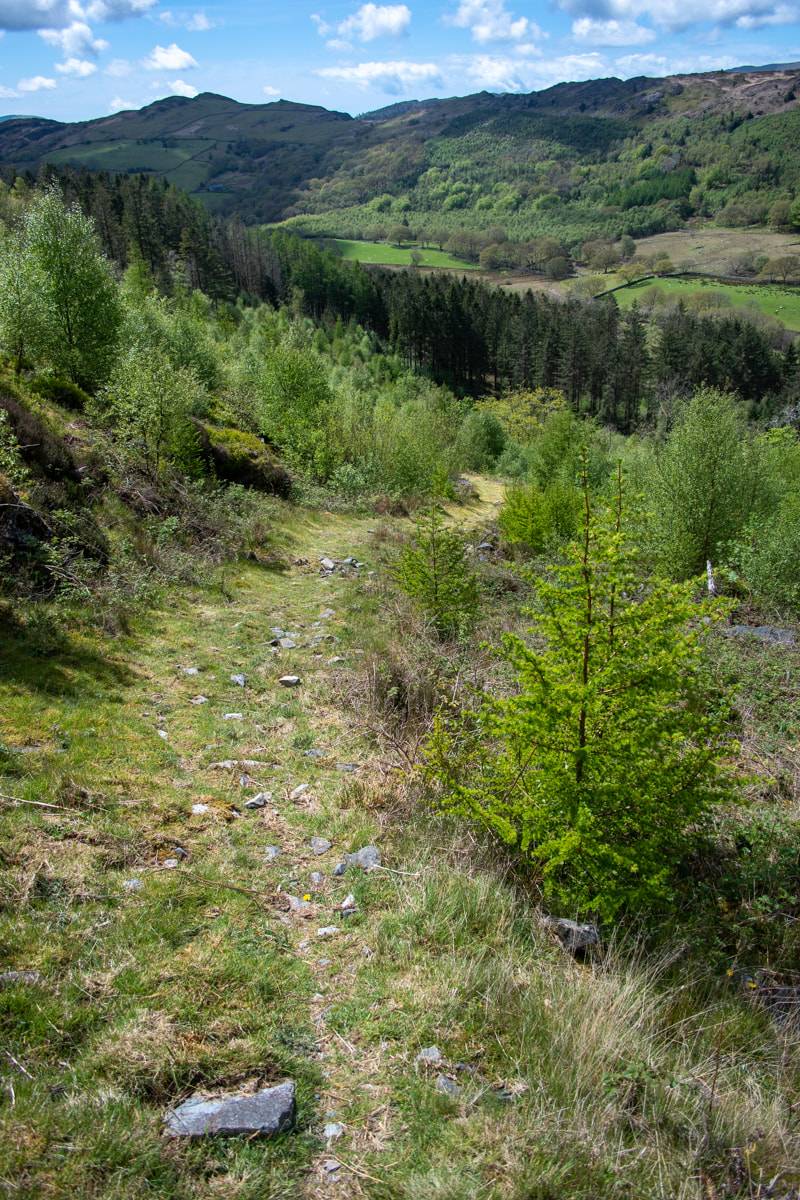
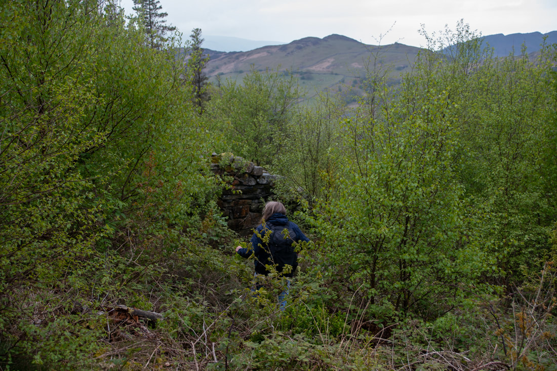
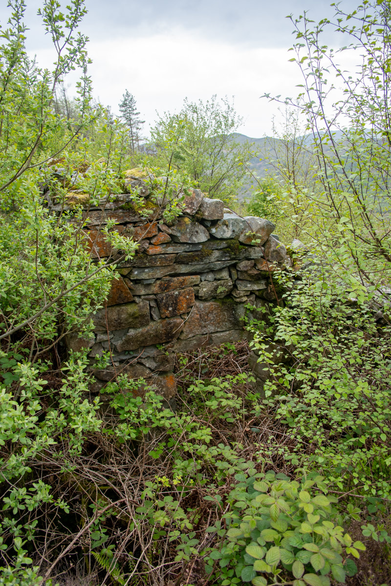
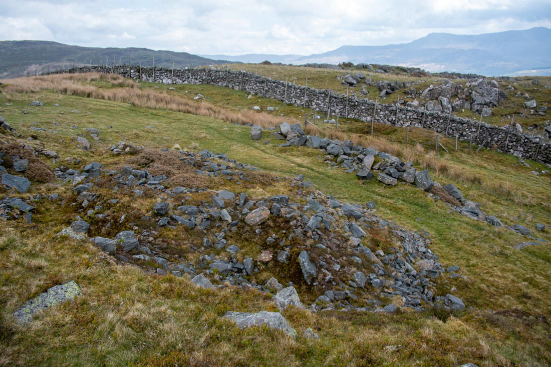
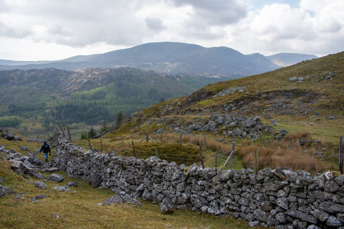
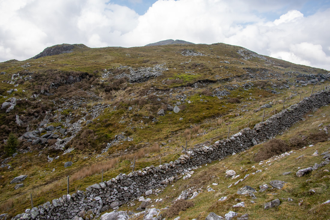
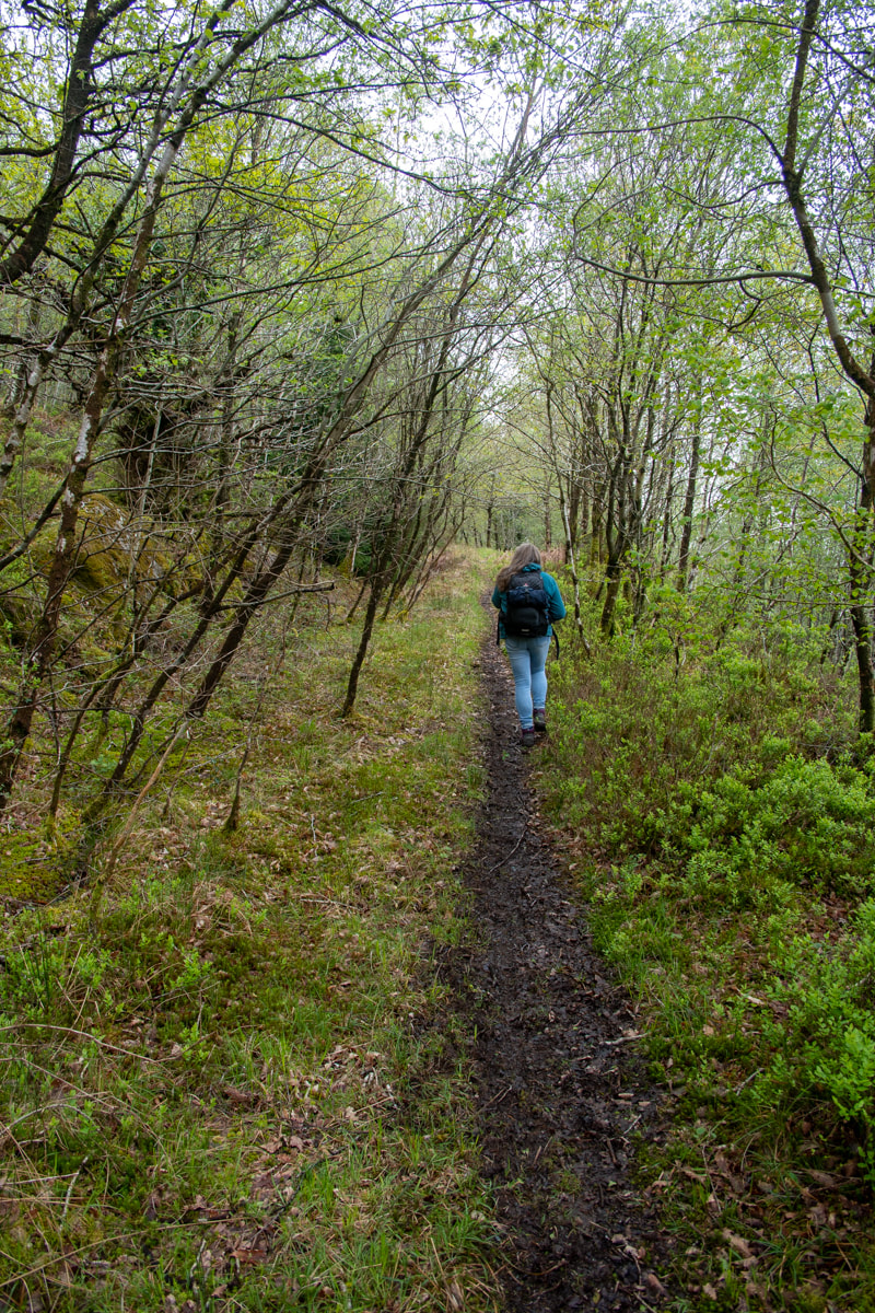
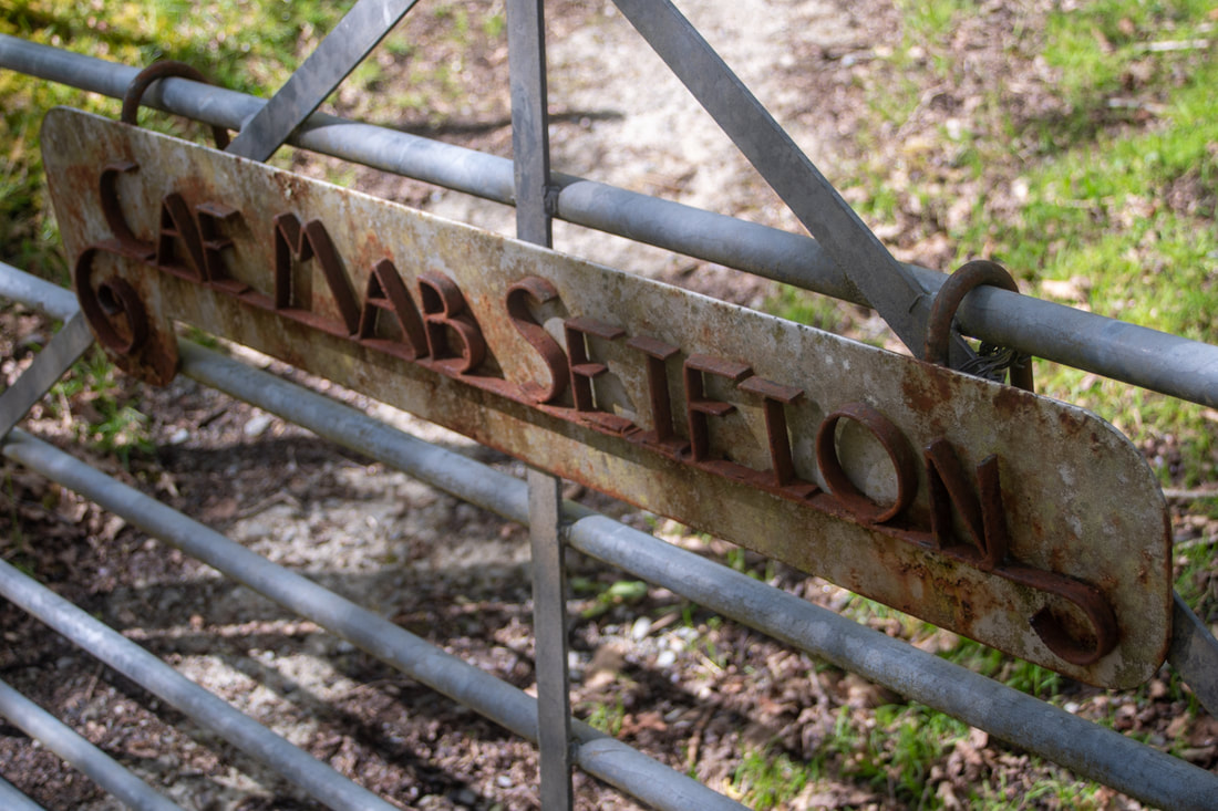
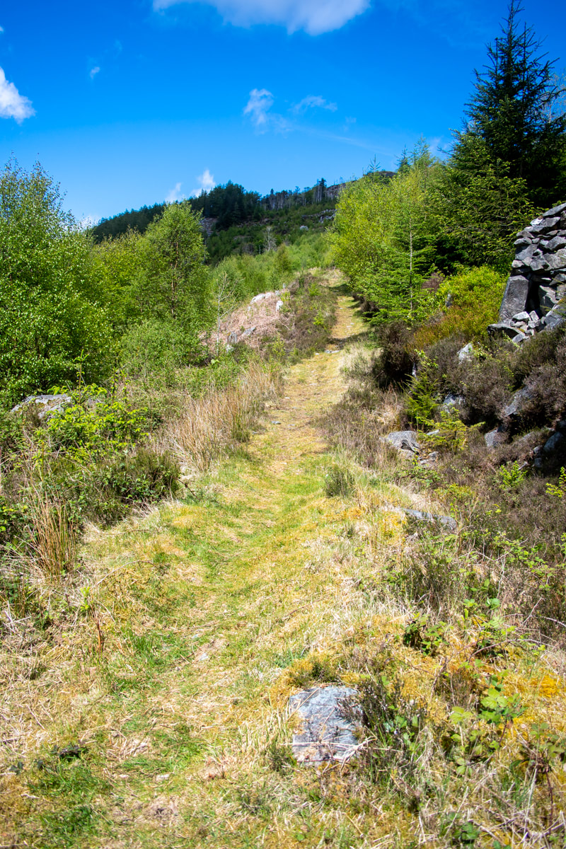
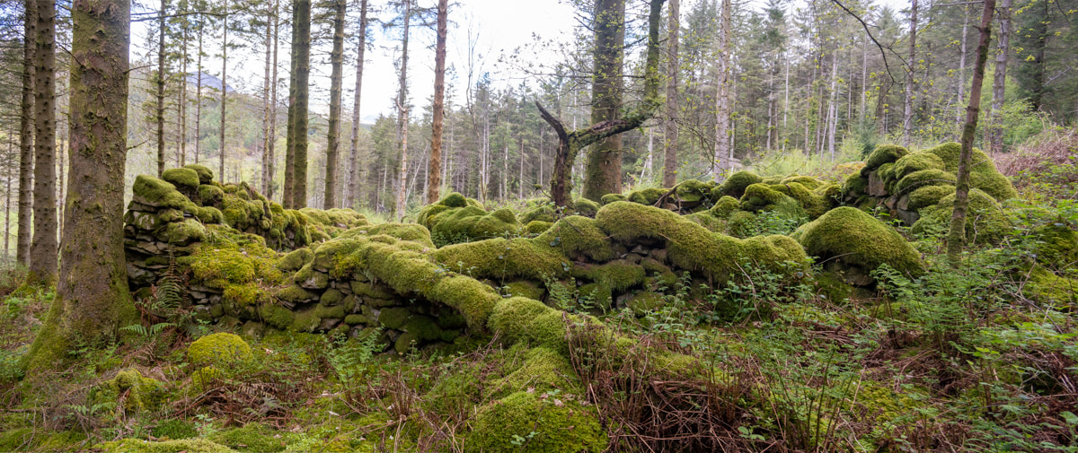
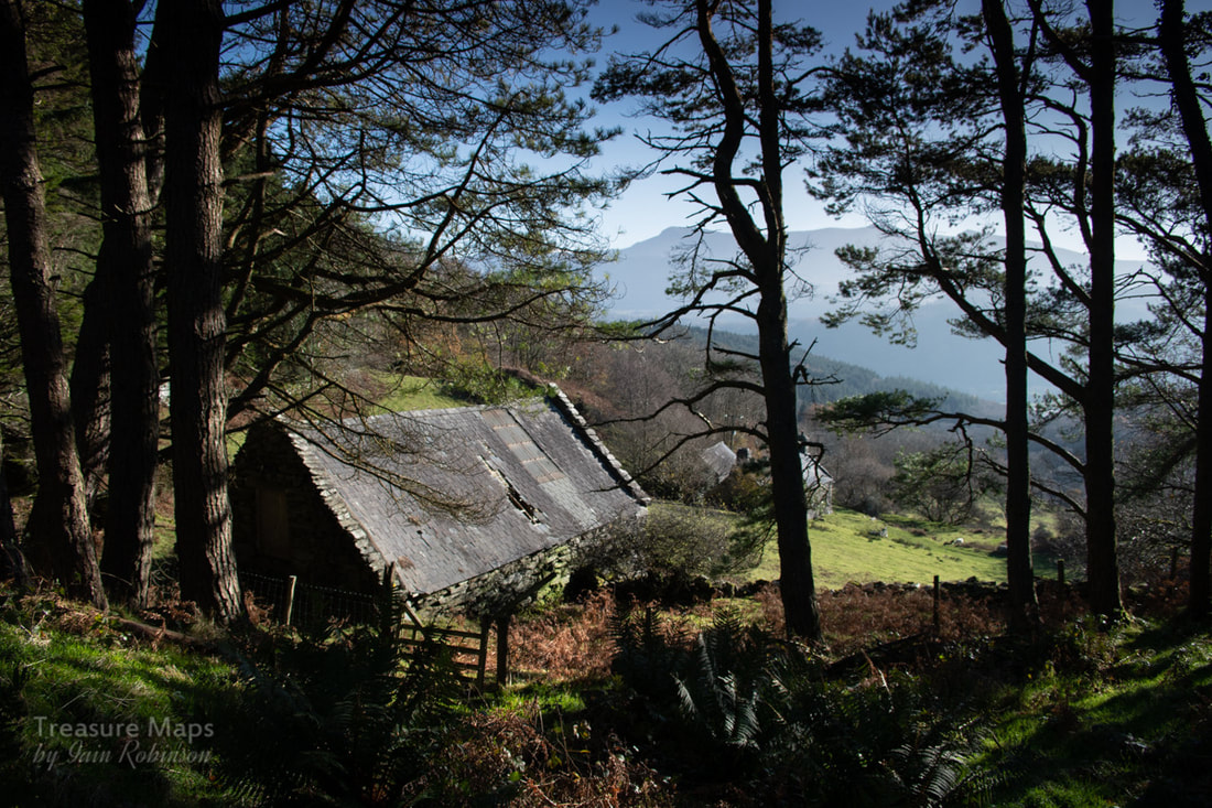
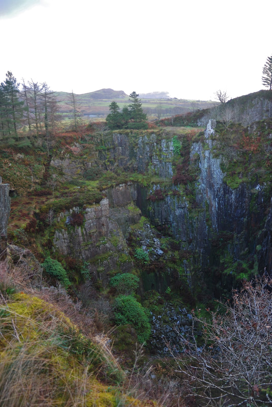
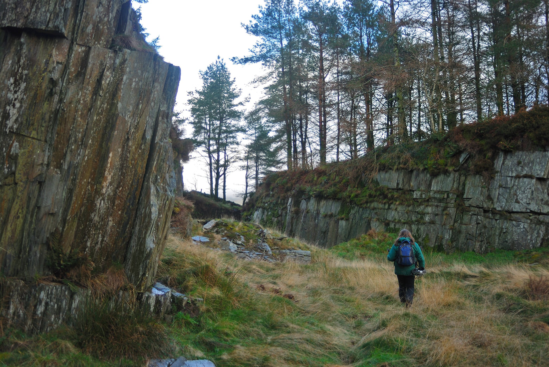
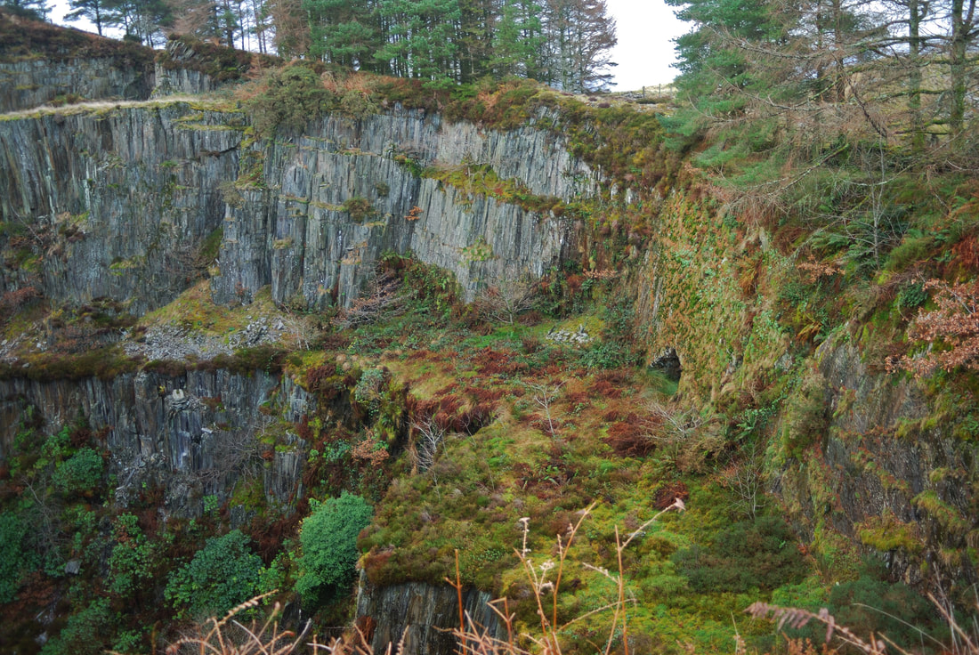
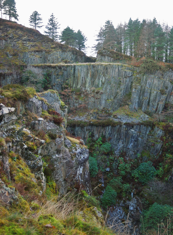
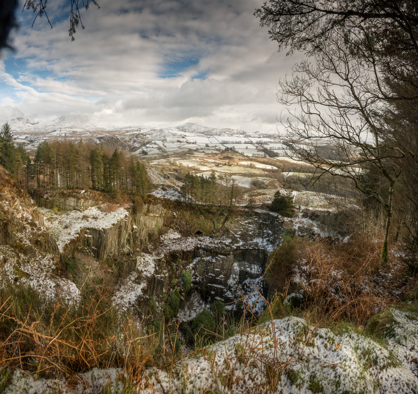
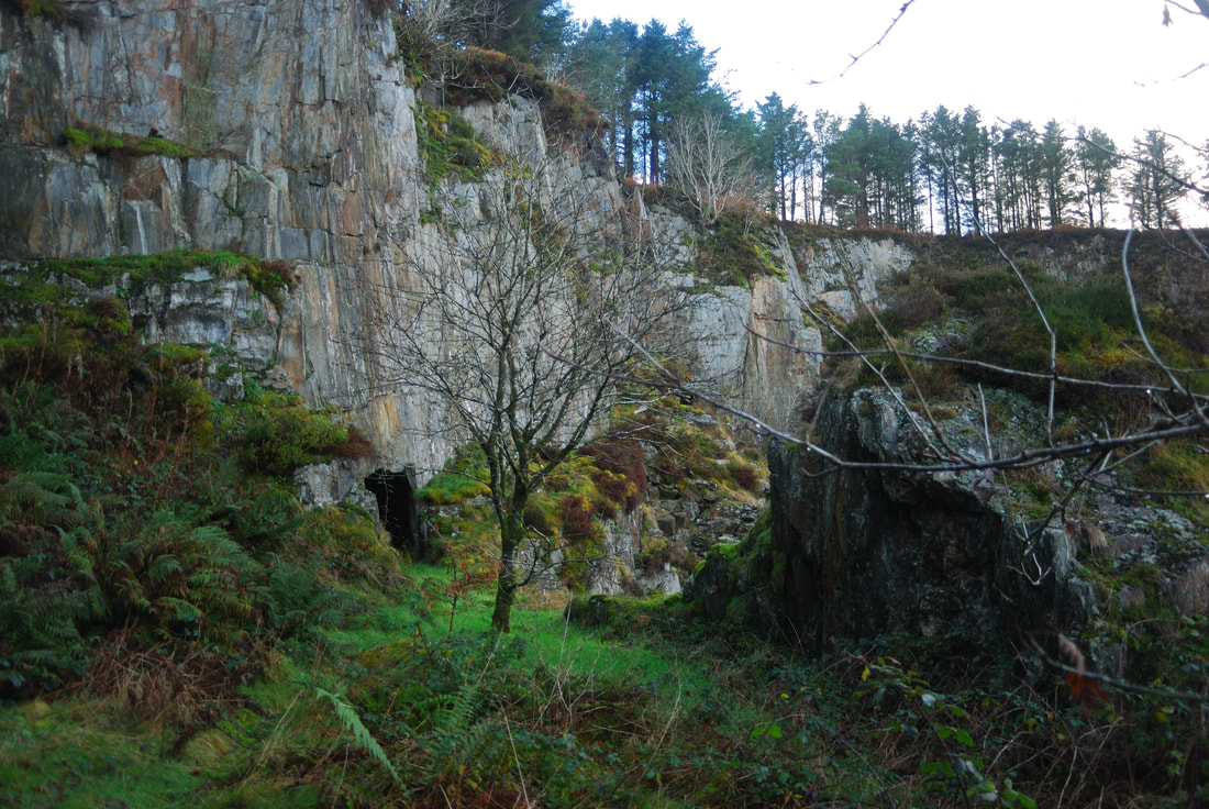
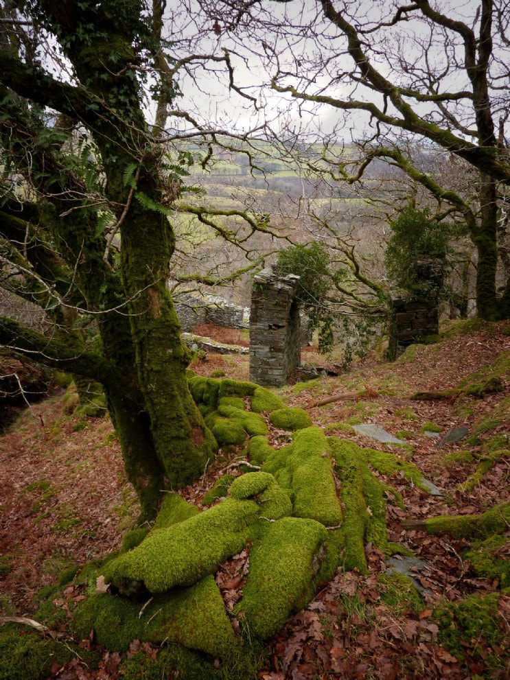
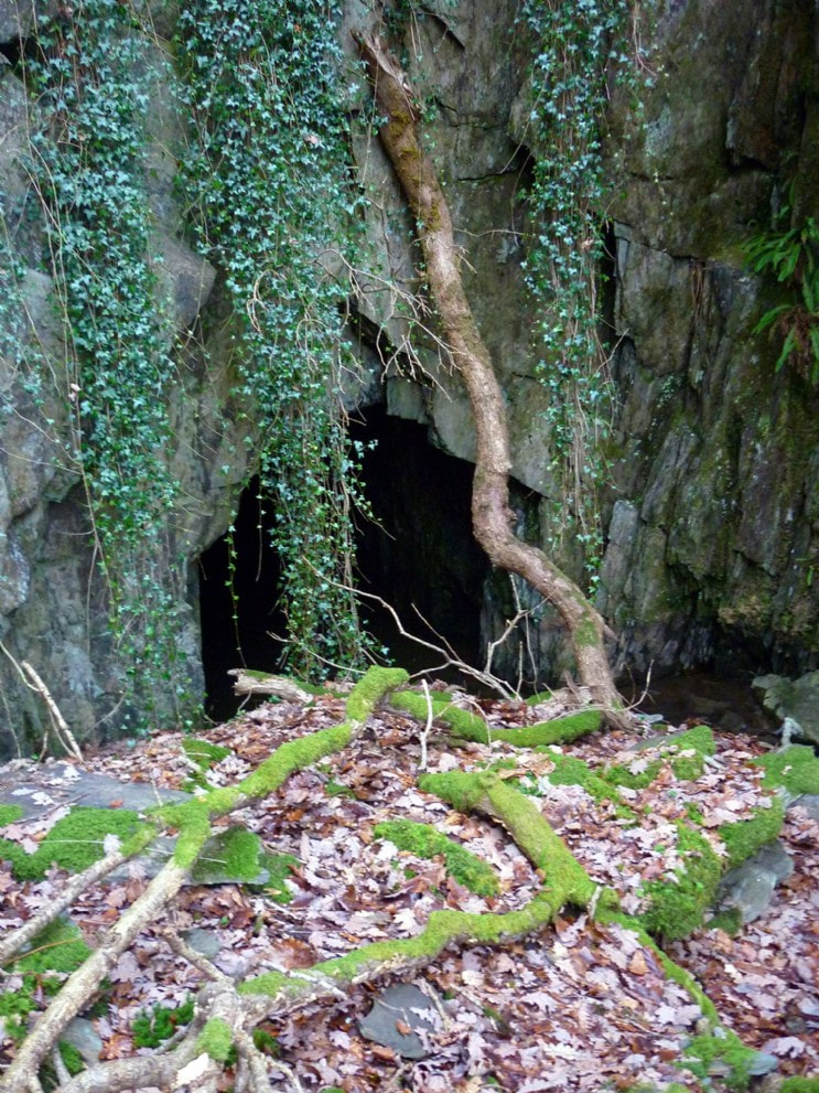
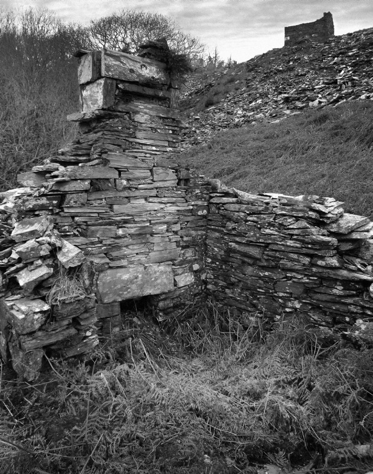
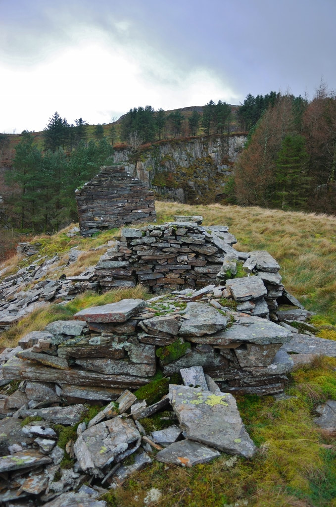
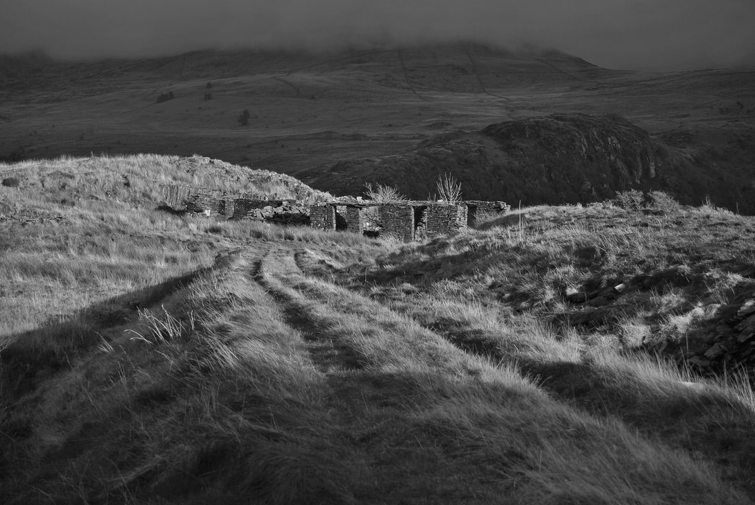
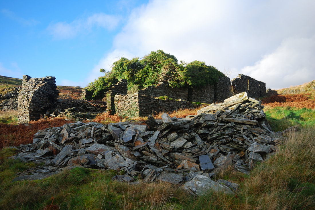
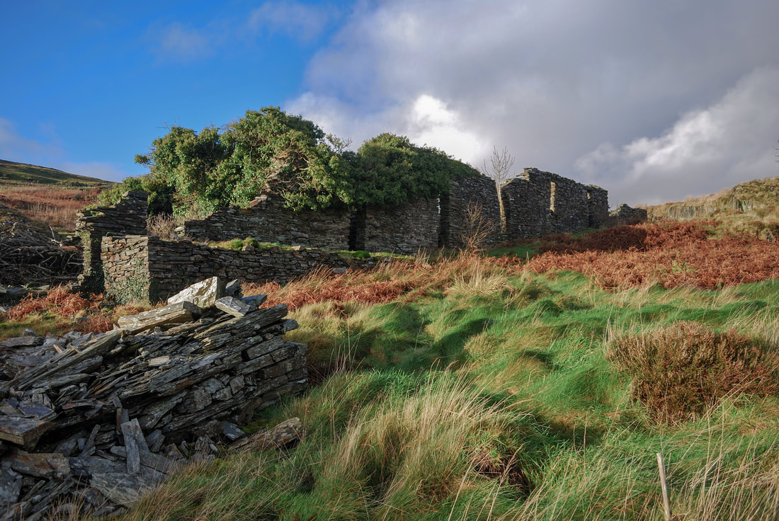
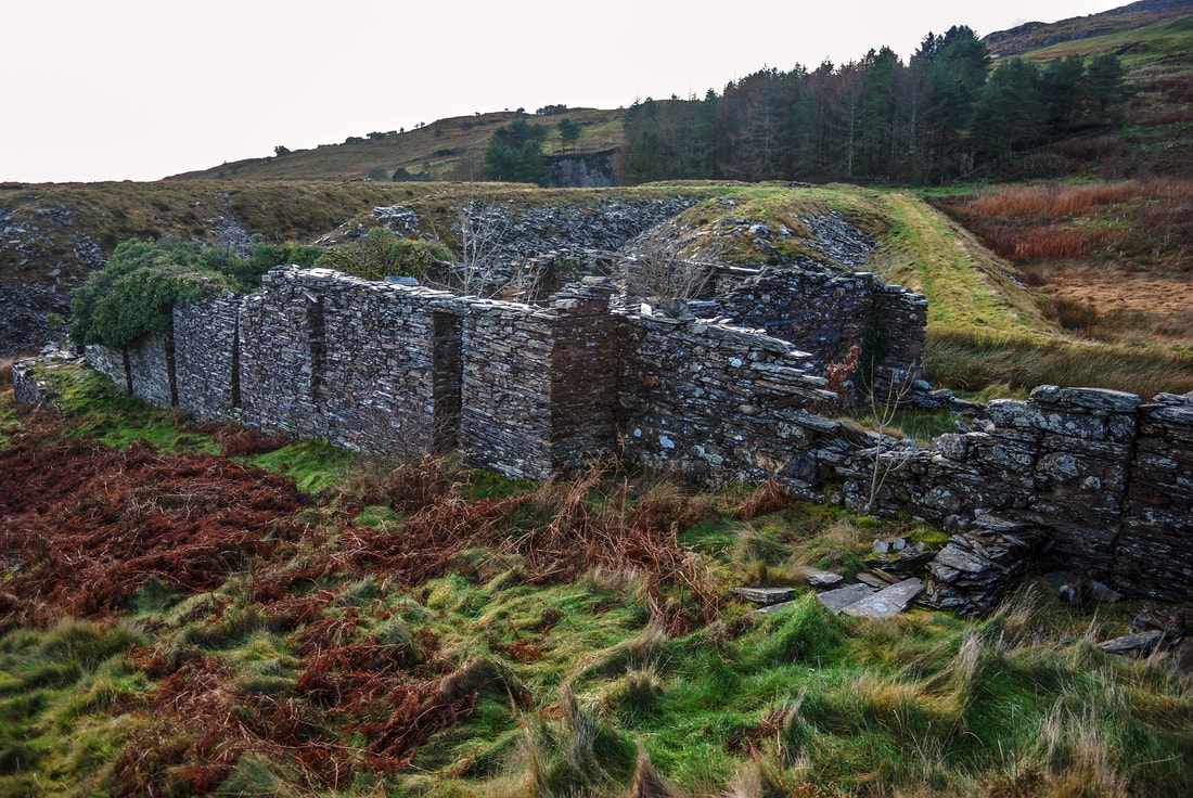
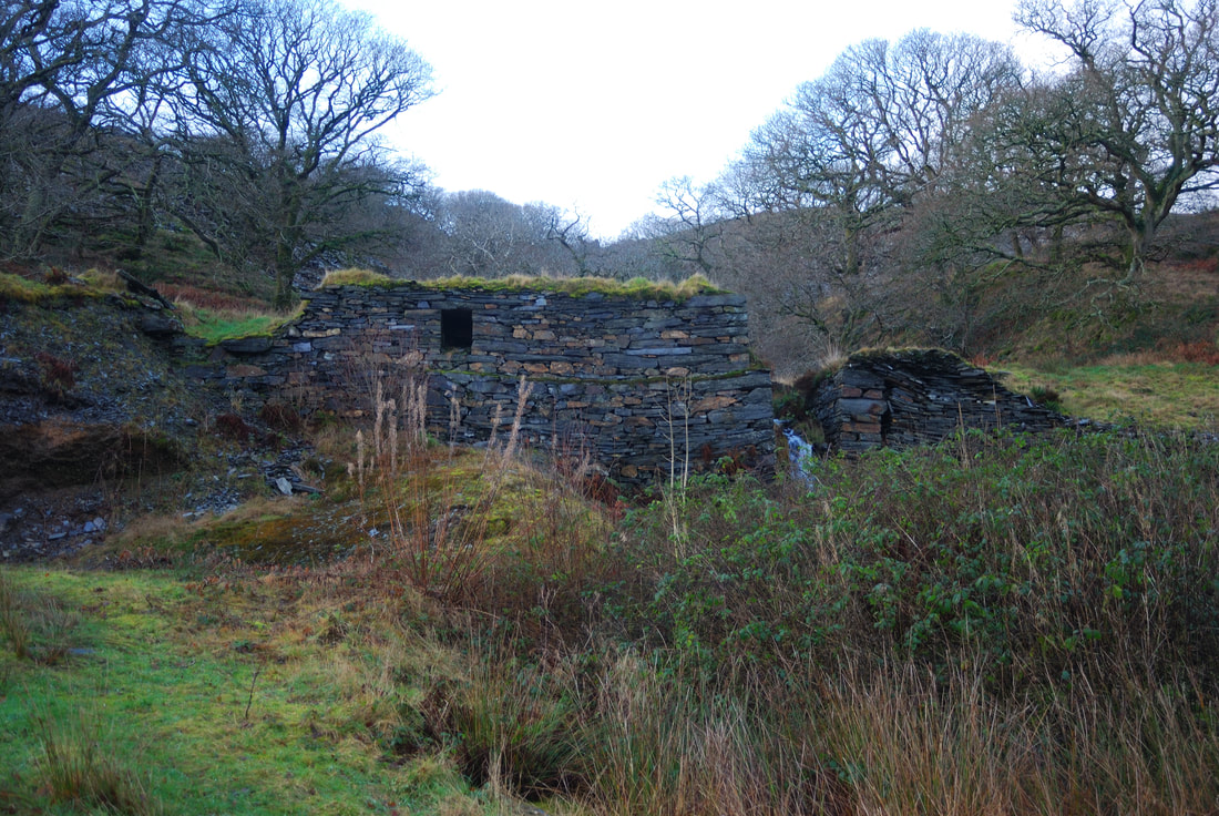
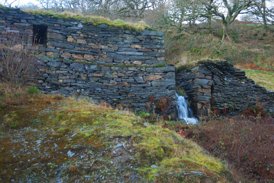
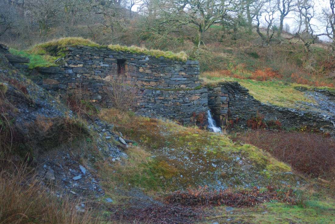
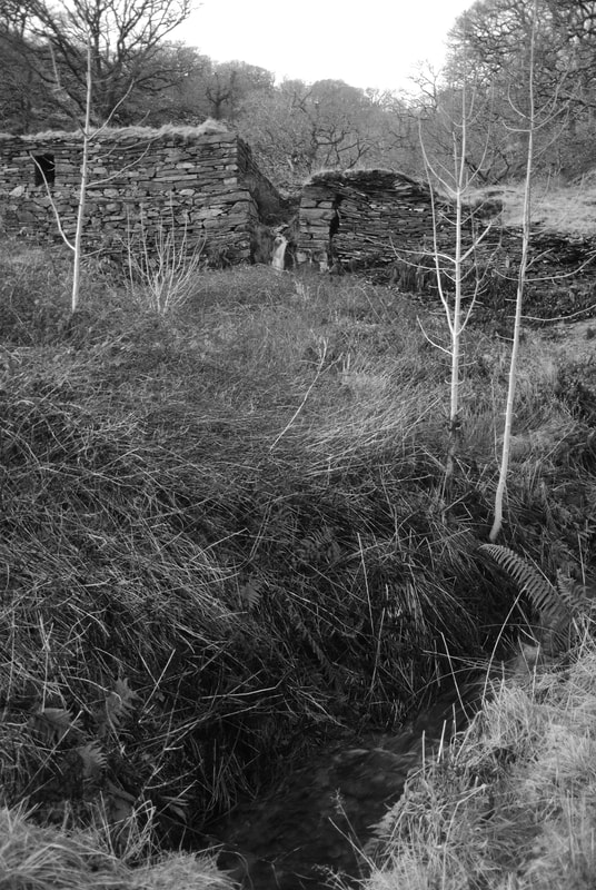
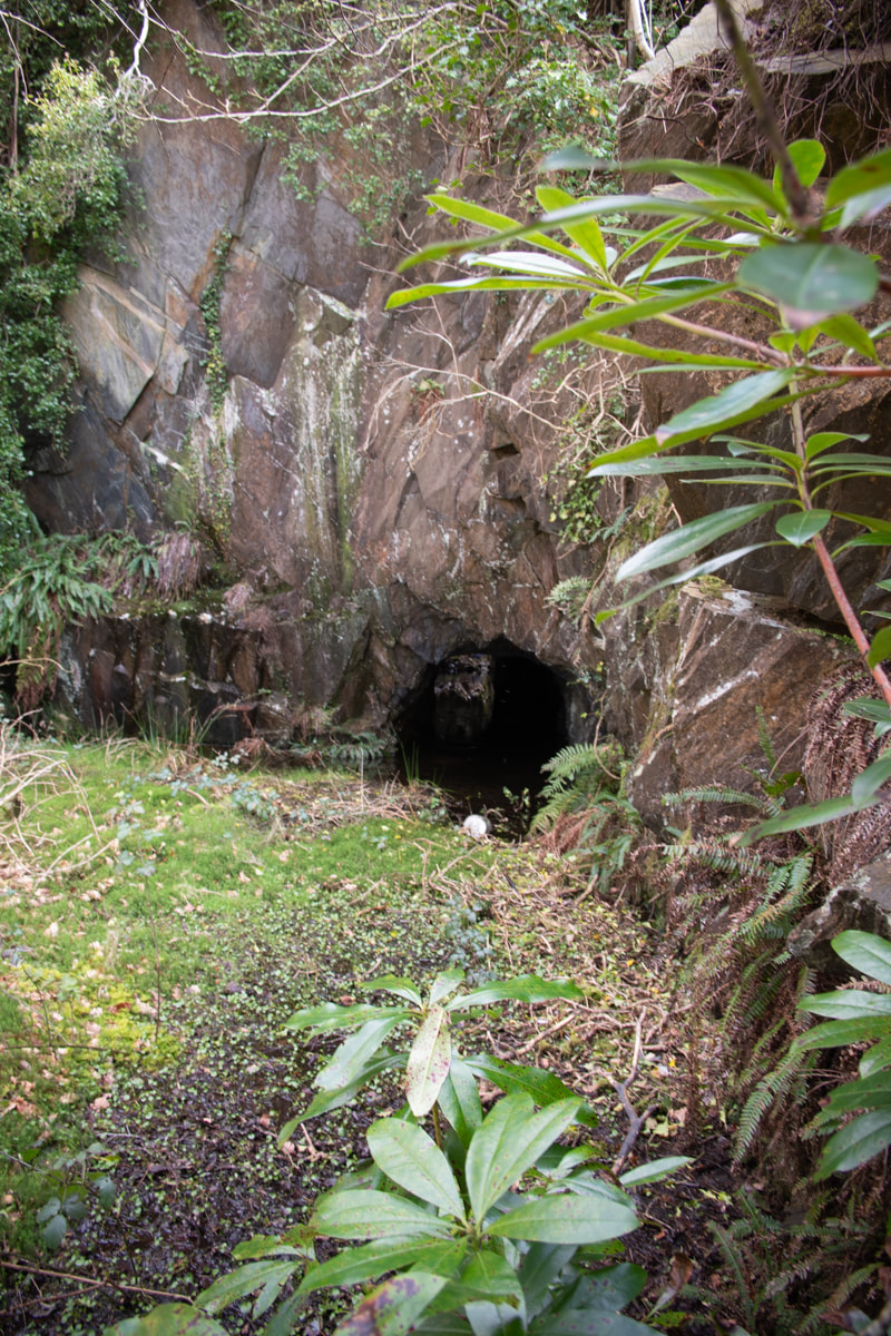
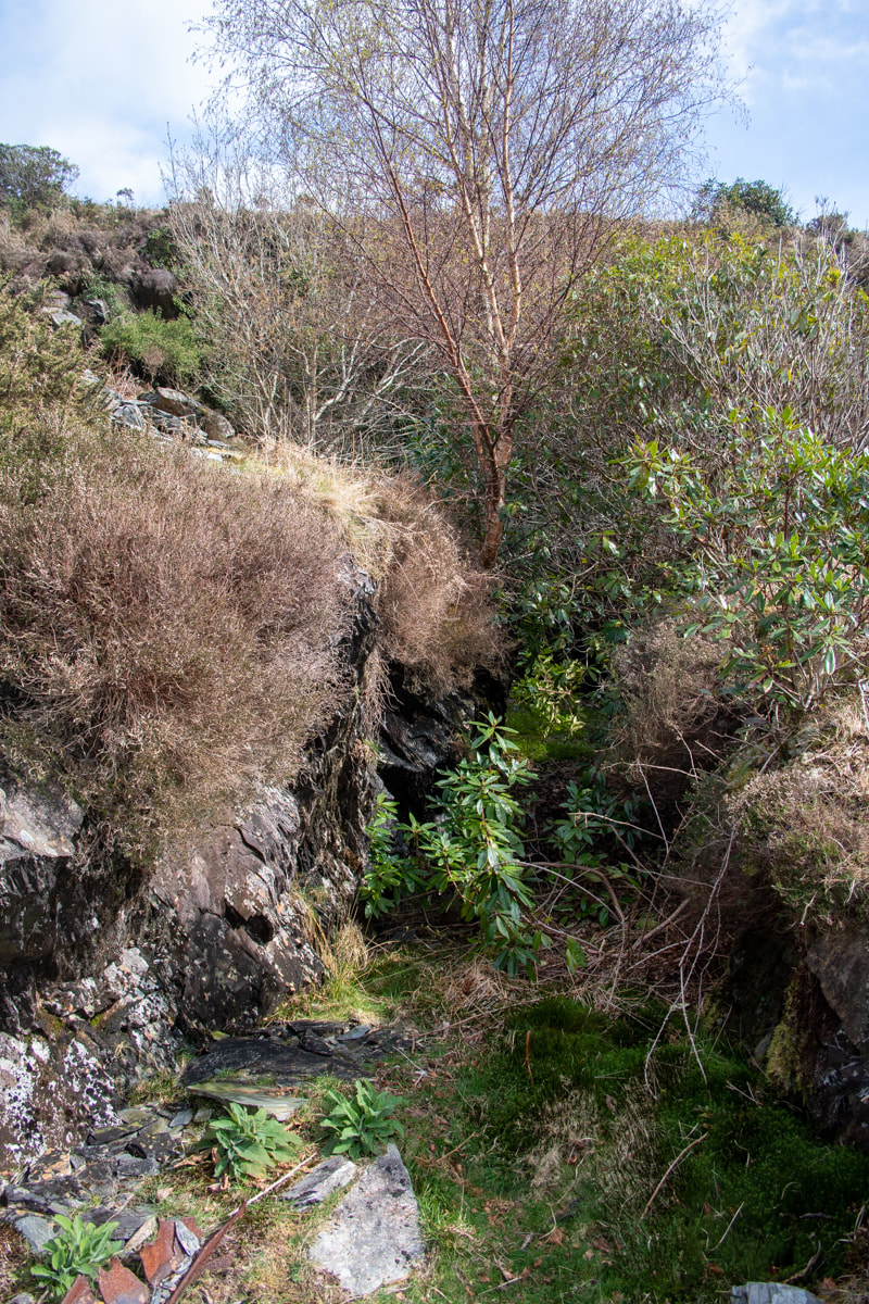
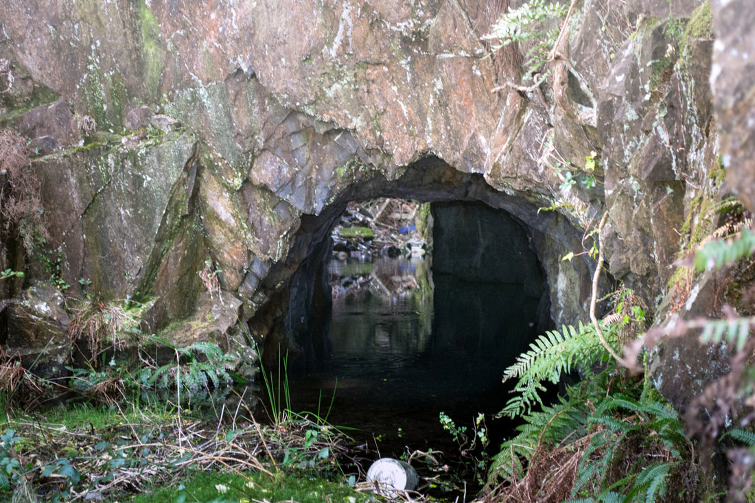
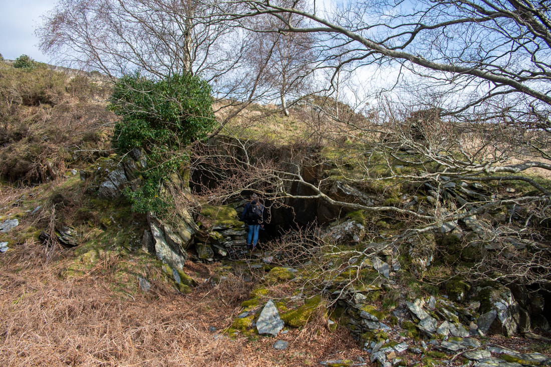
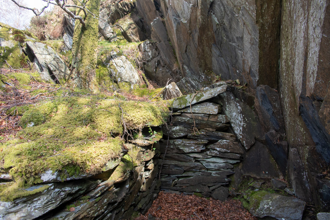
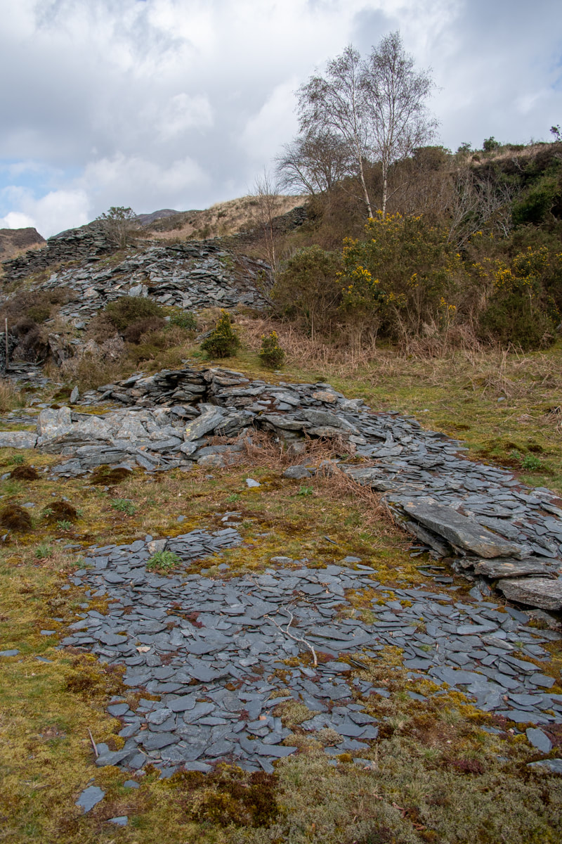
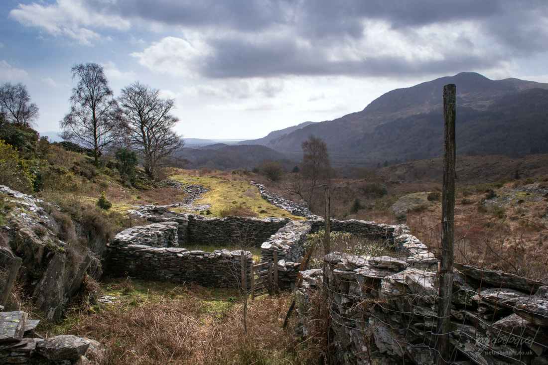
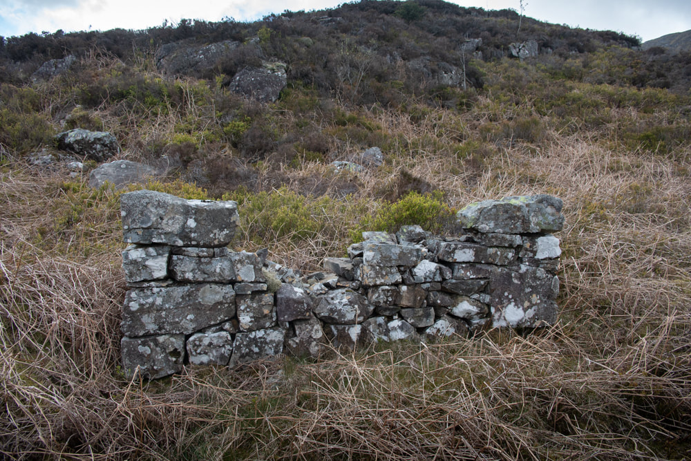
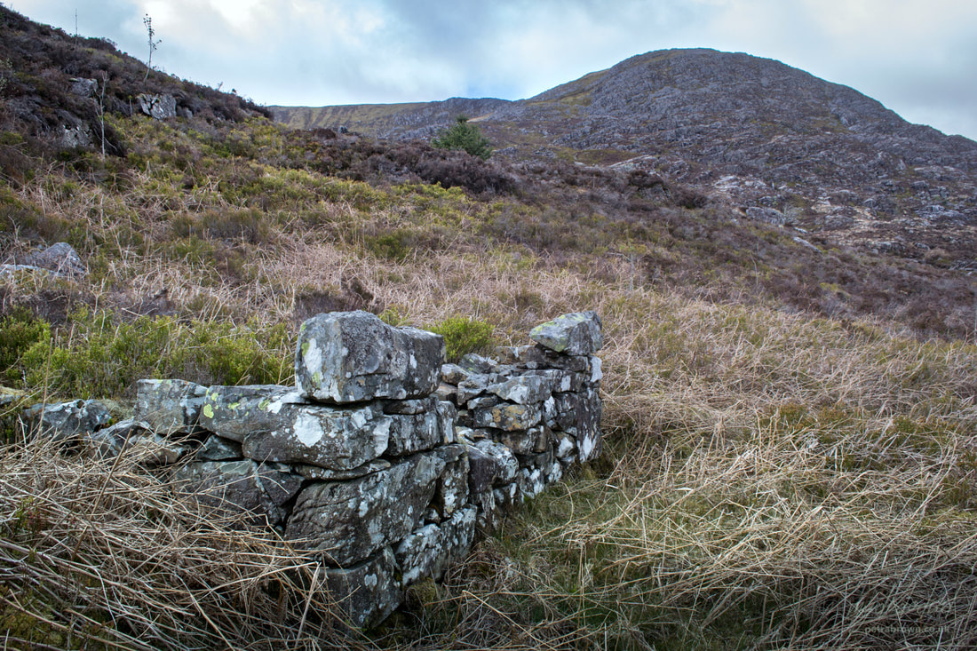
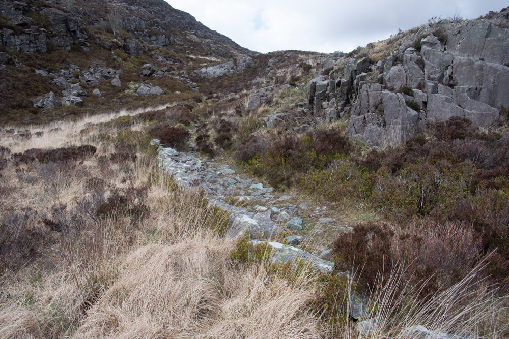
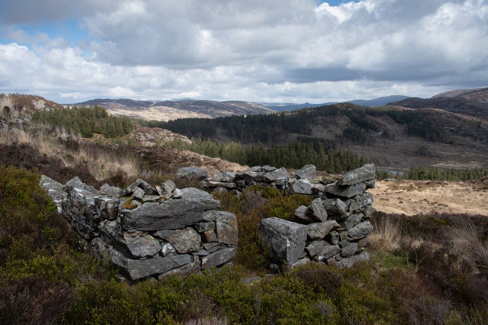
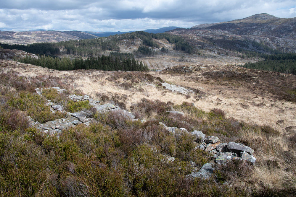
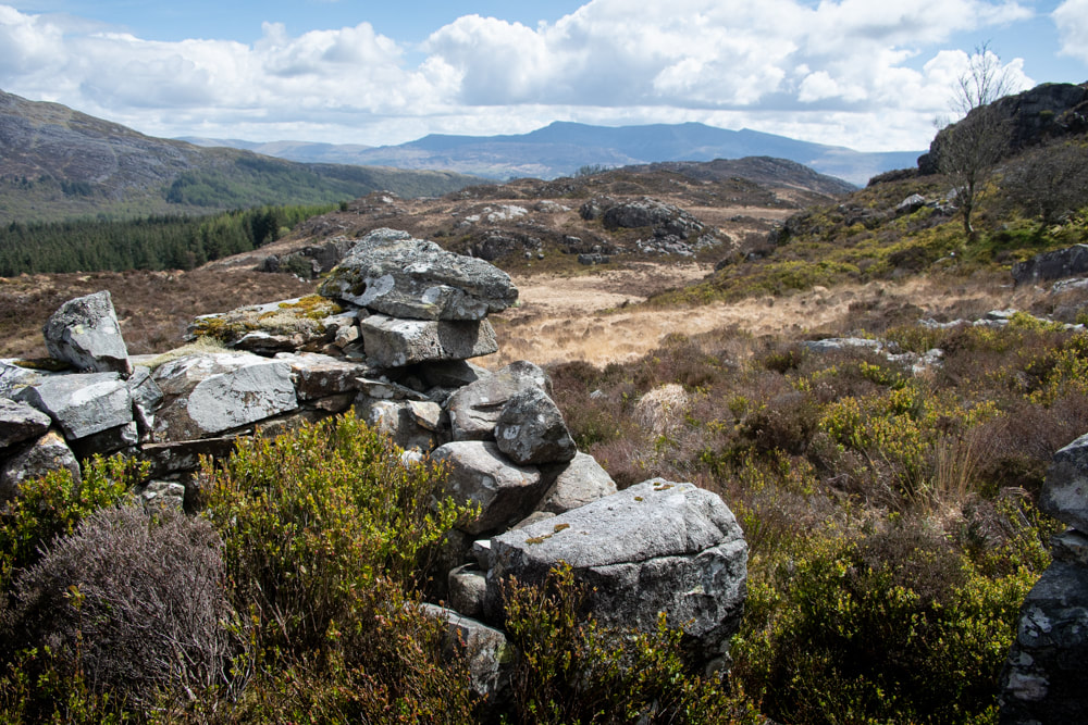
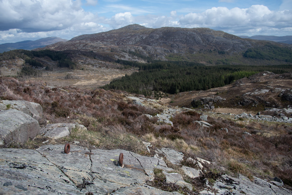
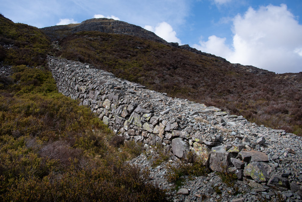
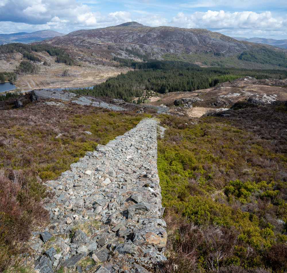
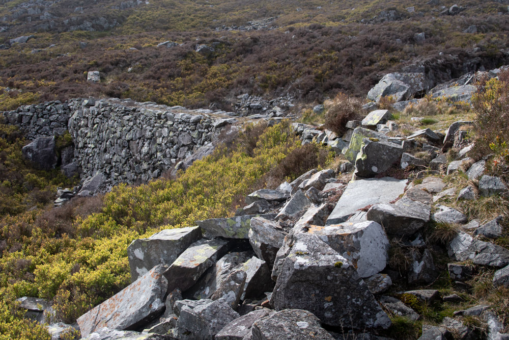
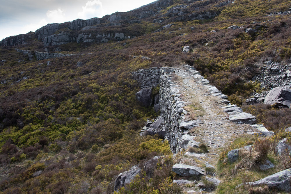
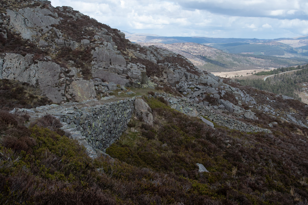
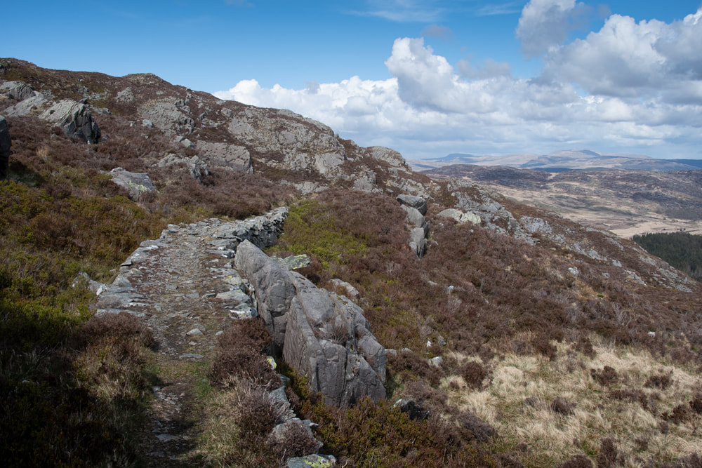
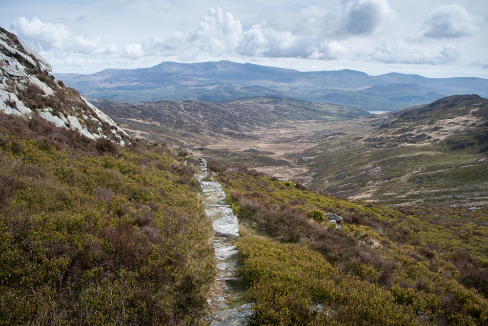
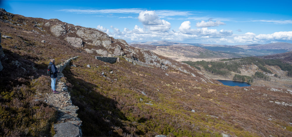
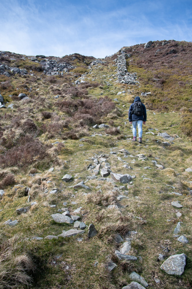
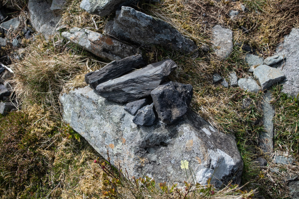
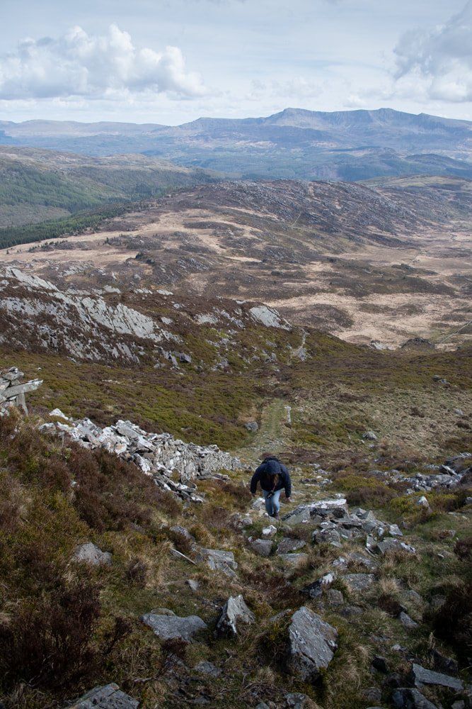
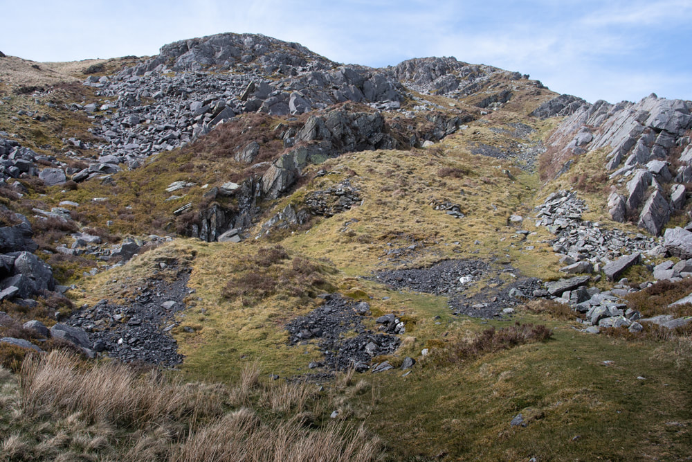
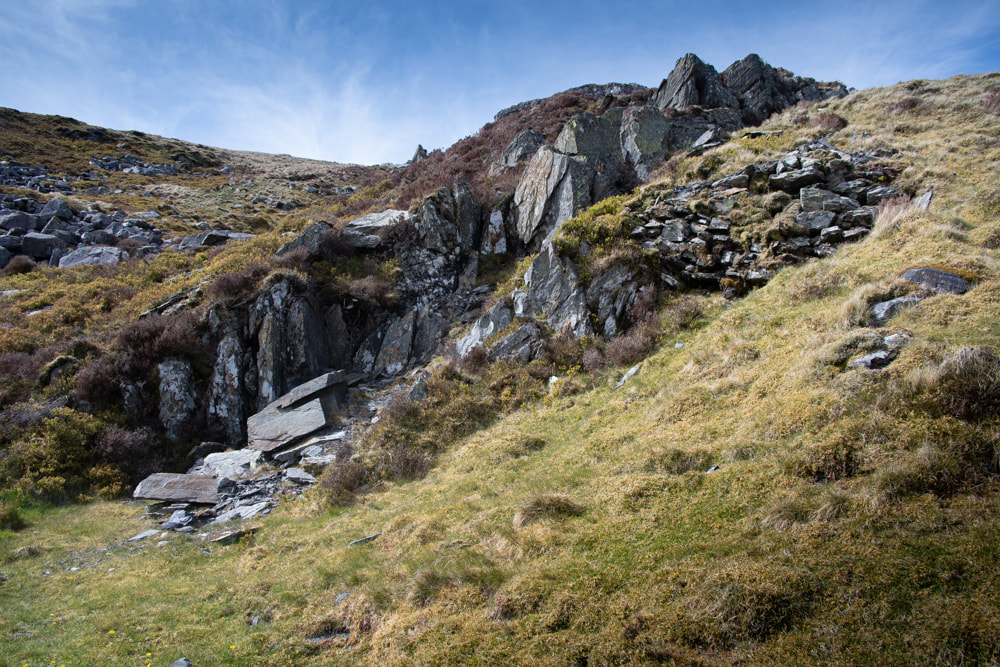
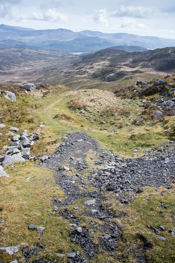
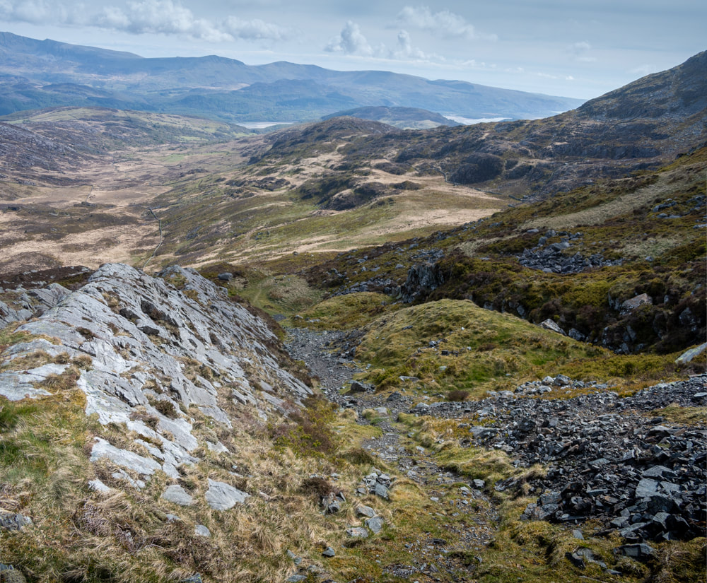
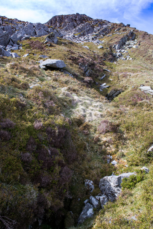
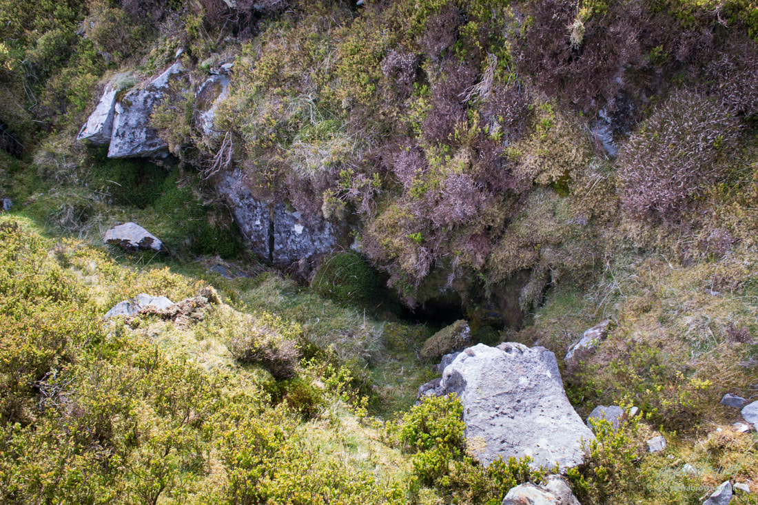
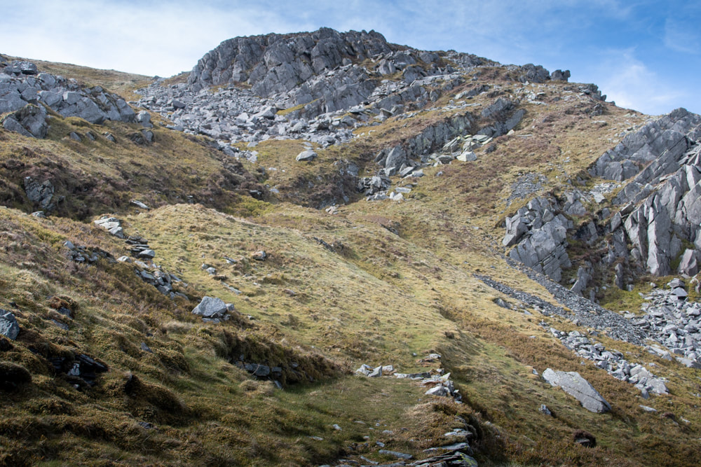
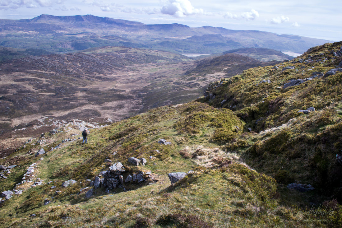
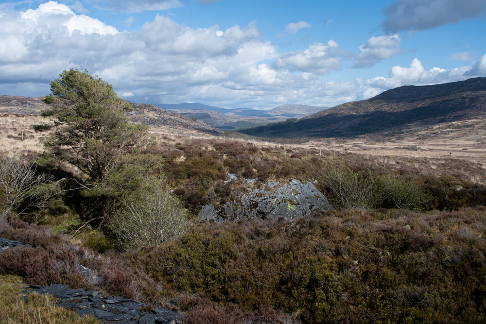
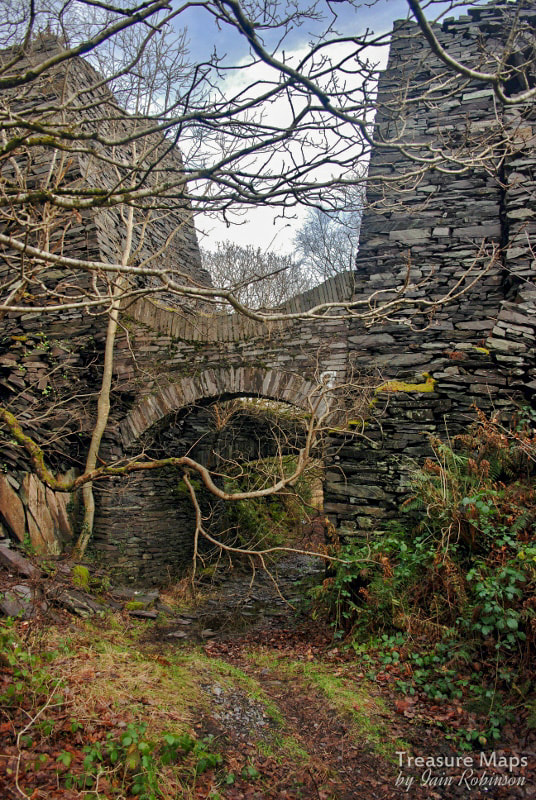
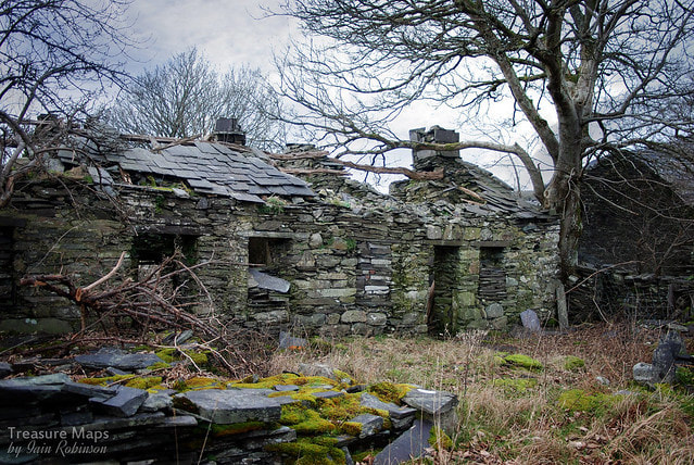
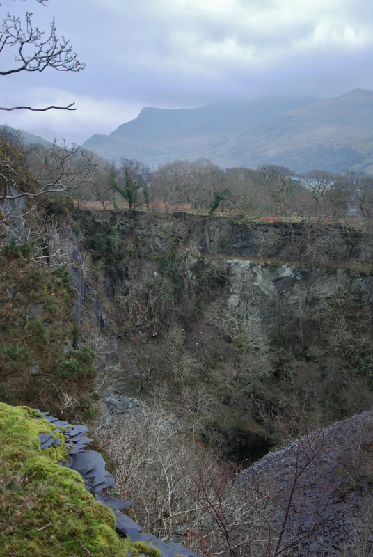
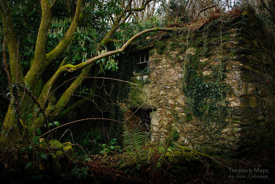
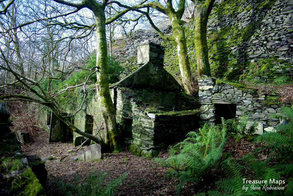
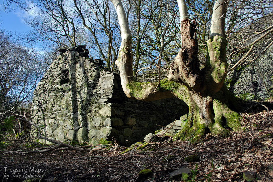
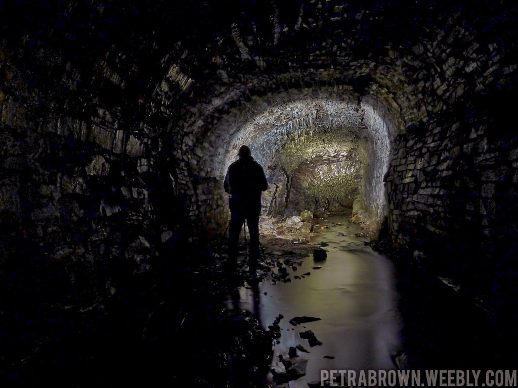
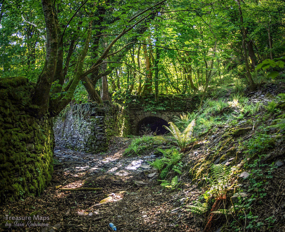
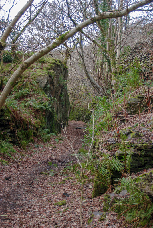
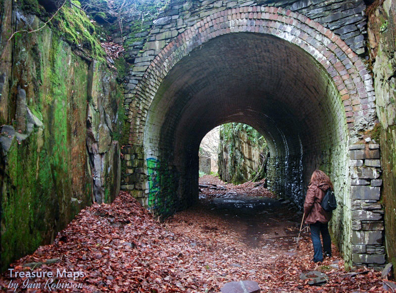
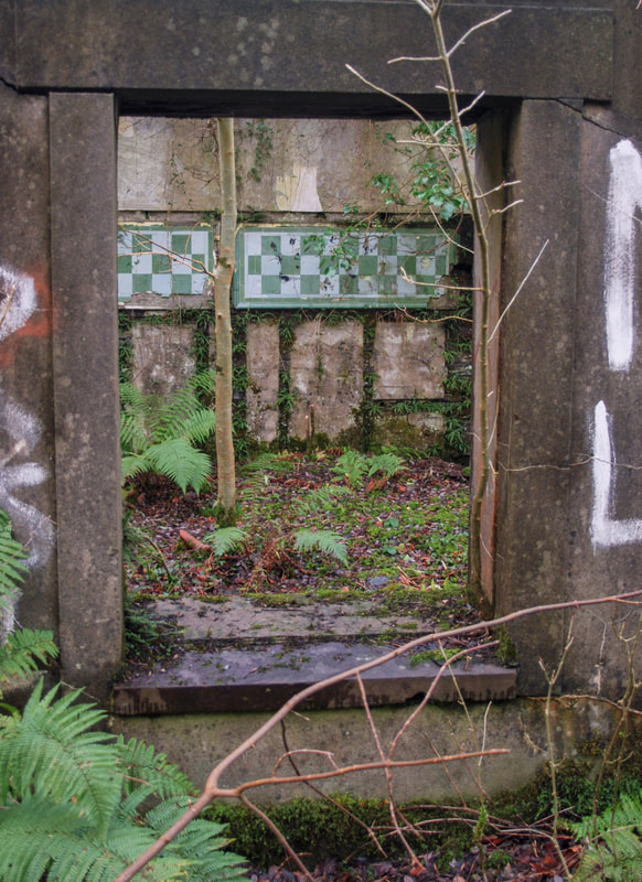
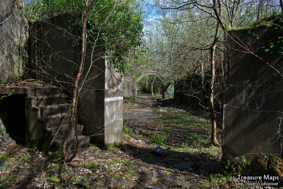
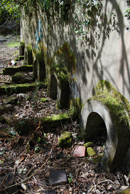
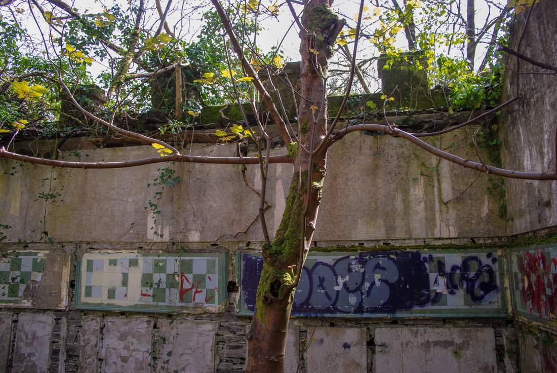
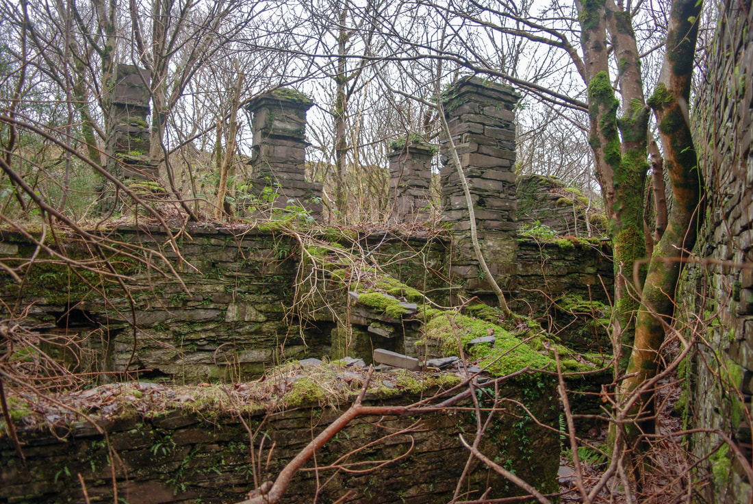
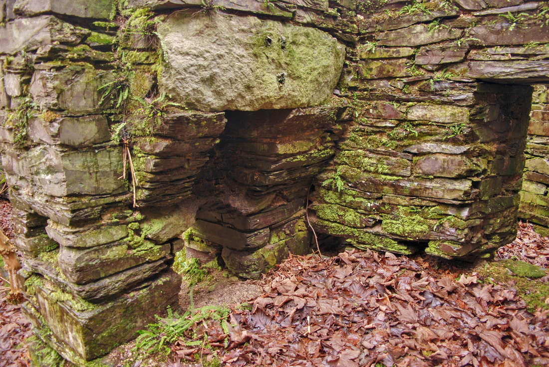
 Mines? On the manicured "miner's path". Since lockdown ended, we've been determined to try and find the Manganese mines in Cwm Mynach and have made three resolute forays- but those forestry people have beaten us. There's very little mine content this time. We did, however, find a mystery mine that we didn't expect- so perhaps every cloud has a silver (or gold?) lining. 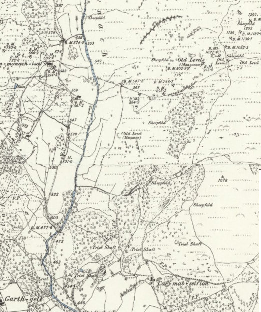 Map courtesy of the National Library of Scotland, OS 1887 survey. The mines we were looking for are at the top right. The bonus mine is marked as a "level" near the sheepfold. Cae Mab Seifion is the start of our adventure. A couple of years ago, we found an impressive portal in the woods which could only be a gold mine. There was a Masonry lined opencut, even a fine wall above the arched portal. Of course, I didn't have my camera... The place was the very devil to access, due to brambles and fallen conifers- it will be even worse now, as the area has been infiltrated with birch trees. If you are of a masochistic persuasion, the GR is SH6858820775. It looks on the map as if it's not too far in to the woods- don't be fooled, the venture is like the Blair Witch Project, once in those woods, the bramble gets you and won't let go. I like birch trees. Heck, I like all trees, except perhaps the Sitka Spruce en masse.. I love the way that the birch is an early and optimistic coloniser of disturbed and marginal ground, such as slate tips. It paves the way for oaks and beeches. Cwm Mynarch is owned by the Woodland Trust, and I really can't quarrel with them. 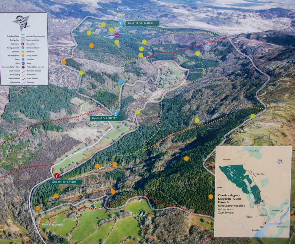 The Woodland Trust's signboard at the entrance to the reserve. The "mines" track is marked as orange. We decided to approach the mine listed in Dave Linton's Merioneth Manganese site as the Cae Mab Seifion mine, by walking up a forestry access road. It looked simple enough. Except that when we were actually in the forest, the ground either side looked impassable. I really need to invest in a drone for situations like these. We tried a couple of tracks, none of which did what they were supposed to do on the the Ordnance map. They were rather lovely, all the same. 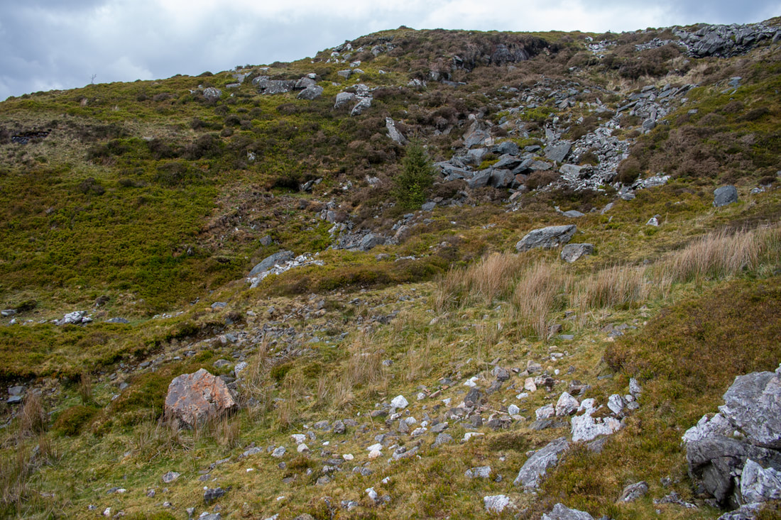 There is an adit in there...honest! Petra figured that the mines would run on a lode from the overgrown and heavily fenced in adit we'd discovered by the road at SH68682140, up towards SH688214... in theory this was correct, but in practice, the ground soon became impassable. Harvested trees and brashings had been left lying- birch regrowth and the inevitable supporting act, brambles, made progress very difficult. 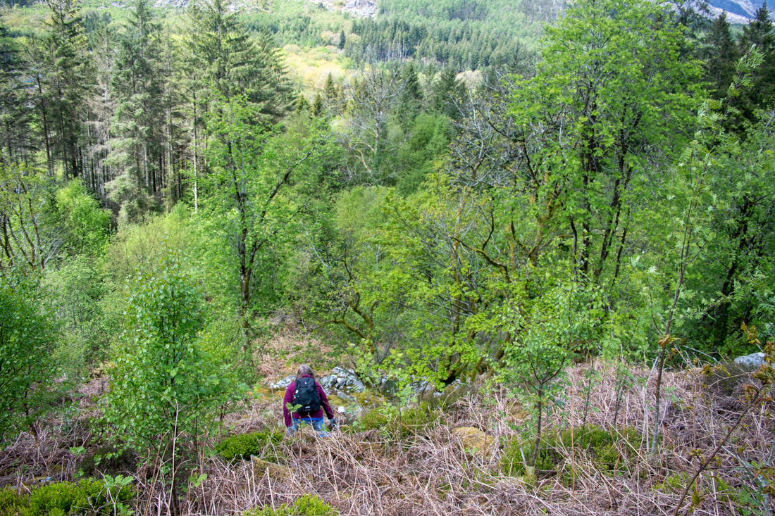 Petra looking for signs of bluestone in the jungle. We regrouped after trying, in desperation, the climber's path to Rhino buttress (not a bright idea, it took us well off piste.) We made a detailed study of the Woodland Trust's own map of the site at the entrance to the reserve, which is marked with a "Mining remains" route. Yes! The game was afoot! But after slogging up the track for half a mile, I began to wonder. Don't get me wrong, the track is wonderful, revealing stupendous views of the Rhinogiau and of Cadair. Weirdly, it had also been strimmed, which was a little jarring. Almost at the top, we noticed a little opencut to the right, then some bluestone spoils above us. Both these had been "neutralised" by the forestry folk, and there was no sign of an adit or workings. 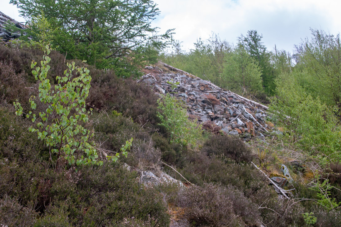 The first sign of bluestone tips...the adit above was backfilled. Petra determined to make a recce below the path where she thought the adit might be that we'd seen in Merioneth Manganese. It was, she reckoned, under the sycamore tree we could see sticking out of a waving ocean of birches. 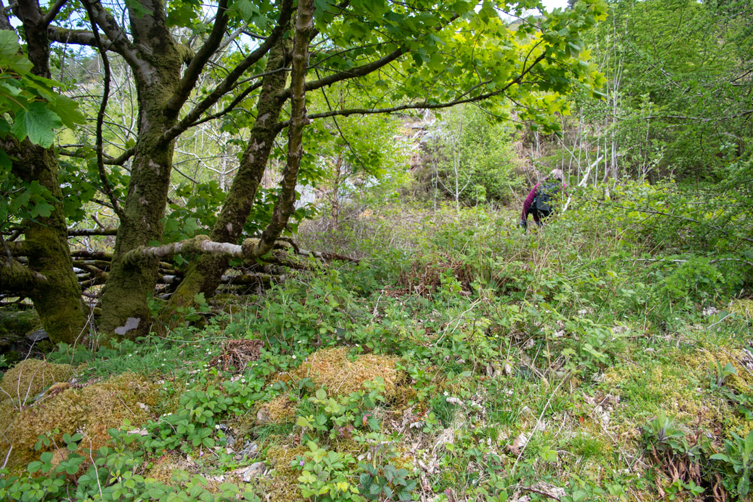 In the opencut...it's impossible to show because of the sycamore tree, but there are several fingers of built up bluestone go out from here. Pleading aching knees, I stayed on the road, but after some serious bramble bashing, Petra shouted up. There were no excuses now. I stumbled steeply downhill- she'd left a good track to follow. We found ourselves in a level with a lovely funnel of bluestone spoil, leading to what looked like it might be an adit behind a bramble explosion. The aforesaid sycamore was right in the middle of proceedings, making photography meaningless.  At the adit, about to remove some brambles... 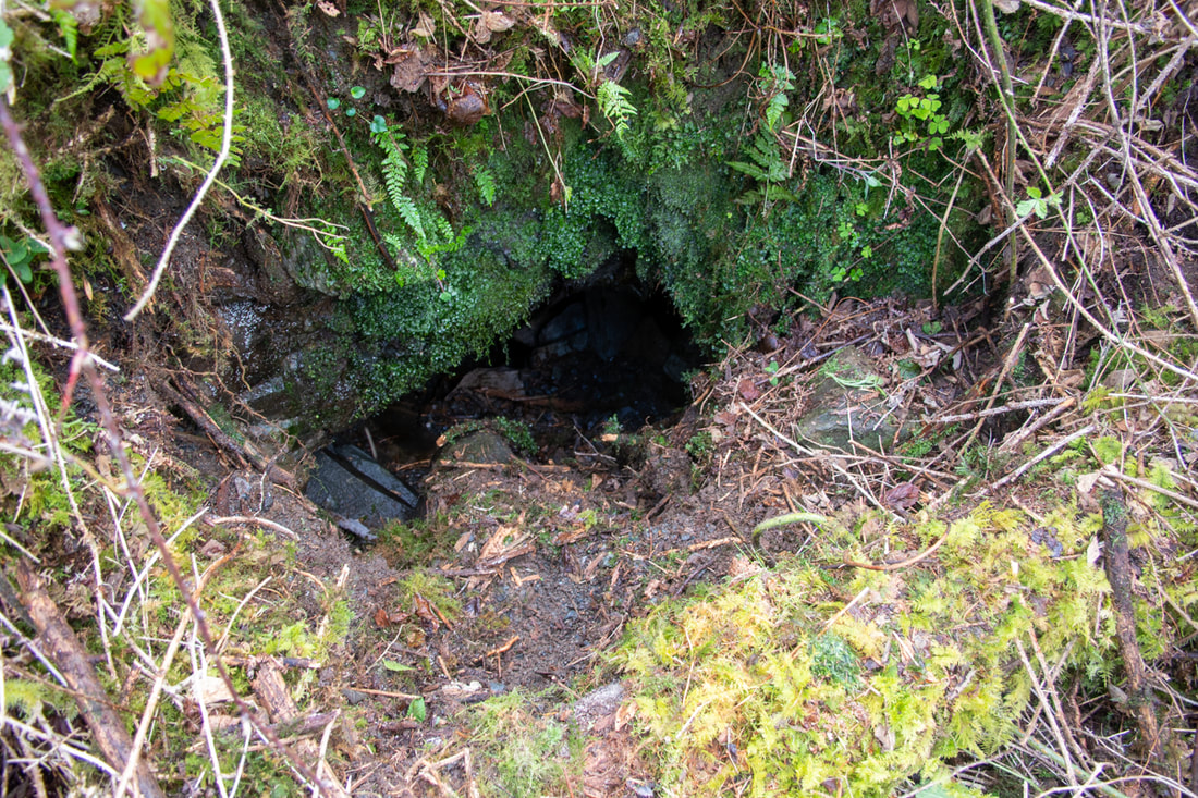 The entrance to the workings, after a little gardening.The backfill sloped very steeply down and was too unstable to attempt an explore. We cleared the brambleage with our sticks (luckily Petra had insisted we wore gardening gloves, suspecting something like this.) But it was no use. When we exposed the portal, it had been backfilled- there was a measly six inches of air space from which we could hear the delicious sound of dripping water. Comparing it with the photo on Dave's site, we felt rather deflated. Much shaking of fists at imaginary forestry crews ensued. After refuelling with crunchy bars and water, we carried on further up to the top adit, SH6889521675 where the story was much the same. There was a structure there, a stone hut with a low window at the end of an opencut, itself choked and filled. I don't really blame the forestry folk. They have trees to harvest, trees to plant and they are not paid to conserve mining remains for strange folk who like to go looking for them. I'm just very grateful that there's a record of these sites on Merioneth Manganese. From the photos on there, it looks like it was tough going- and that was nearly twenty years ago! I should also stress that no trees were harmed by our recent incursions into the forest zone, only brambles felt the steel of our walking poles- and they had it coming. But there's a twist to this story. Being a completist, Petra suggested going to the top of the track to see where it went. We came to a sheepfold, where our path continued over a fragment of railings, "farmerised" into a deadly burlesque of a stile. Out of the woods, all manner of mining activity could be seen. A tip run, several run-in opencuts and a crown hole, filled with the inevitable farmer's detritus. Over the wall in another field was an adit, albeit only a very short one. Further up, a terrace could be seen, where the bluestone had been cut away. Entropy had reduced everything to within an inch of its life, but we were happy. At last, a sign from the mining gods!  A crown hole and the workings above 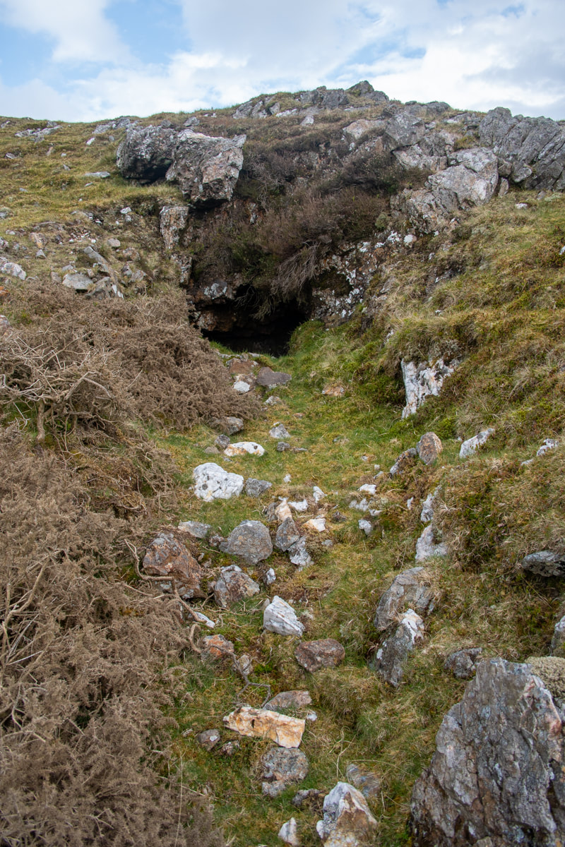 The adit...there was an awful lot of quartz about in the tip- I wonder if this was a gold trial? I do wonder about the Woodland Trust naming that path the "Mining remains" path, though. I shouldn't wonder that every year, there will be folk who are not happy. Wandering up and down expecting to find headframes and winding gear, dark adits leading to chambers that soar "beyond the light of caplamps"... they're going to be disappointed, aren't they? Check out how things looked 20 years ago on Merioneth Manganese. There's also an excellent history of the site. 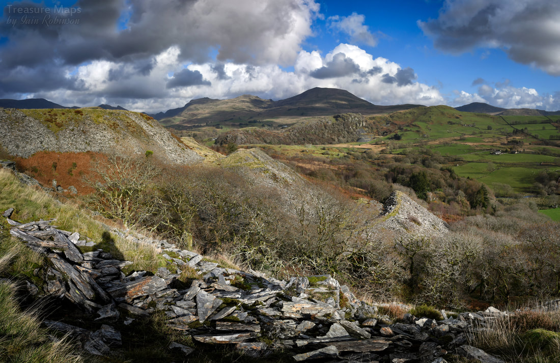 Hendre Ddu from the middle tips, looking over to Moel Isallt and Hebog. In a cwm full of interest and mystery, Hendre Ddu makes an intriguing study for the mine enthusiast. Apart from it's archaeological allure, the place has a haunting atmosphere that I've noticed with other quarries in Pennant. It has a deep and forbidding pit and a fine range of tips with views over the cwm to Moel Hebog and Moel yr Ogof. 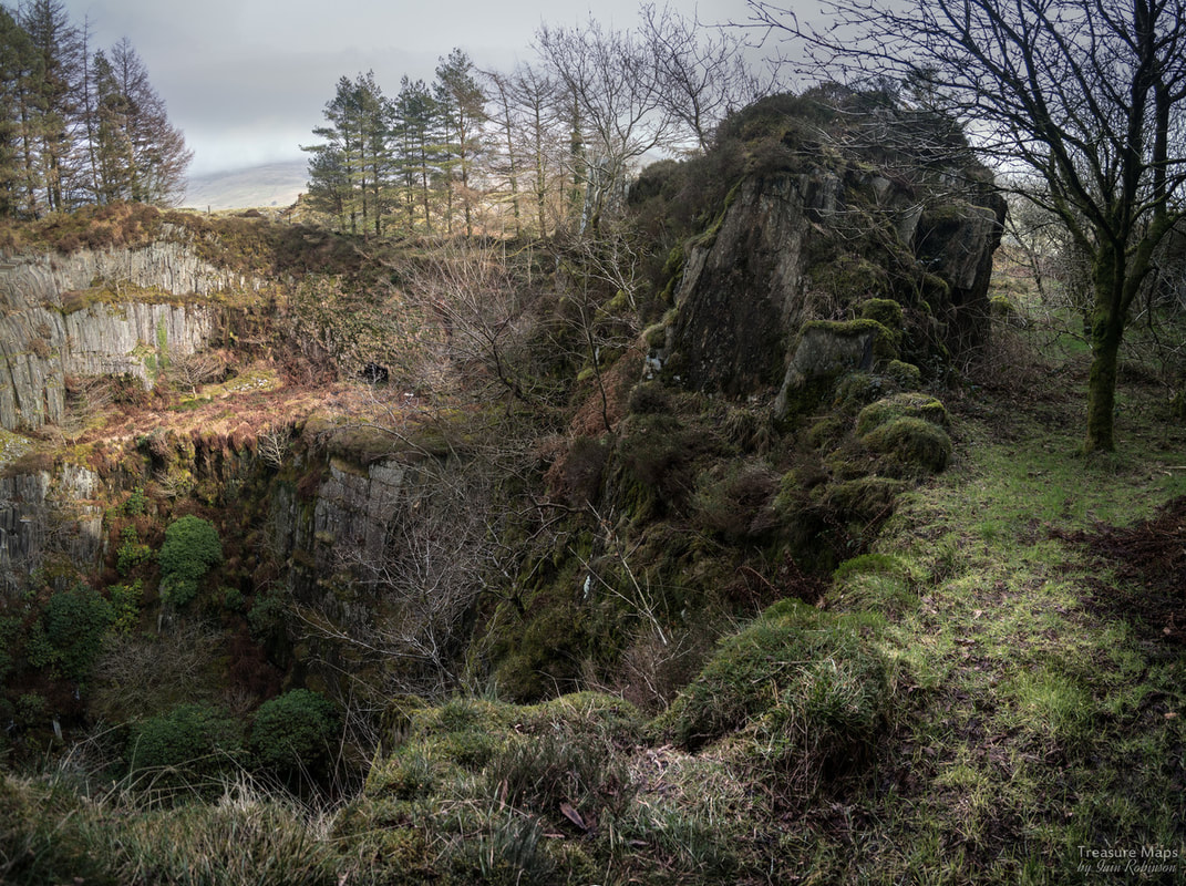 A looming leviathan of gangue rock hangs over the pit. The usual way up to the quarry is via the access track from the unclassified road. There's no parking here; I usually park at the bridge near St Michael's church, north of the quarry- It's not too far. As you walk up the steep access track, it used to be possible to see the round powder house on the left. It is still there, but these days it has been engulfed by brambles and young oak trees and is inaccessible. It's a similar pattern to the one at Moelfre slate quarry, just a little bit further up the cwm. 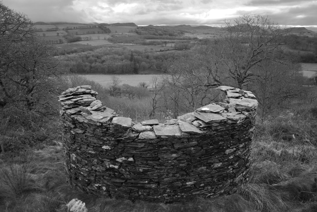 A photo of the powder house that I took in 2009. There are also some opencuts nearer the quarry, beside the road. If these were trial adits, they have run in now. To the right, the tips have been worked over to provide some roads on the site. Oak trees have been extensively planted, a good thing, but the new roads on the site and tip robbing demean the character of the place. A few years ago, I created a bit of a stink about this and a friend took it up with the National Park. Some people from a well-known mine exploration site said: "What's the difference between 21st Century mine activity and 19th century?" meaning, of course, that it was all part of the process, couldn't I see? But this isn't mine activity, and in any case, the miners didn't have gigantic CAT shovels and enormous tippers. They made these tips with their slate gnarled hands, the tips are their only monument, their crabbed copper plate handwriting on the landscape. I know there has to be progress, and I'm behind the planting of oak trees for sure, it just saddens me to see the tips disappearing. 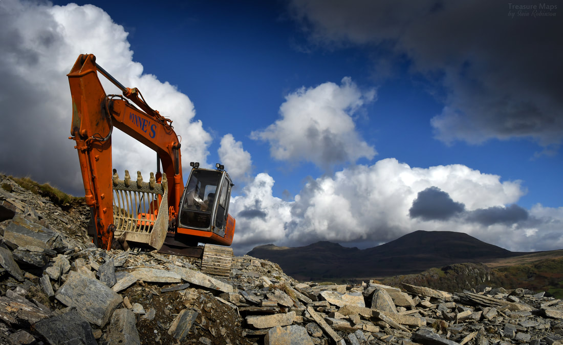 Agent of mischief. The access road comes out level with the lip of the pit, where you can cross a wall and look in. It's possible to see a couple of adits coming in from the lower levels, and also to see an early opencut that emerges into the pit from the north side. The photos above were all taken in 2009. On our first visit, we struggled down the incline at the east side of the quarry and looked at the adits. I got into trouble because the lady who owned the site read my account of the place, on my now defunct Blogger site. She took me to task, very nicely but firmly. I didn't realise, but her water supply comes from the adit...oops. It's not a good idea to explore the adits anyway, as one has a deep winze hidden by the water. The thought of stepping unawares into something like that underground is a chastening thought. On our first visit, the inclines were reasonably accessible and had charming drumhouses, one angled nicely into the hill. Nowadays, the tree growth and brambleage has gone completely rogue and while it's still possible to look at the incline, you'll need a kevlar suit against the prickly plants. 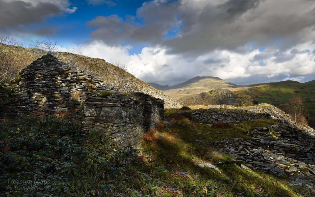 To explore the levels, it's best to go along the tips and clamber down- to find this structure, possibly a workshop or a dressing shed. One of the interesting remains here is the barracks block, although it is degrading quickly- every time I visit, it seems to take on more of a distressed air. It's an interesting building with very tall window openings... Petra wondered if they were doors with windows above them. Part of the barracks, the room at the south end, seems to have been used as a smithy and there is a loading bank that is difficult to explain. The photos above were all taken in 2009 There are some other interesting ruins, a weighhouse and what could be an old dressing shed. The tips are extensive and make a fine statement, especially on a day of sun and showers, when they sparkle. 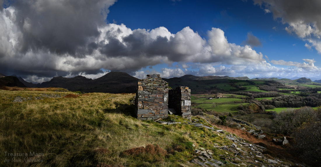 The weigh house on the top level, with a fine panorama of hills, looking towards Moel y Gest on the right It's well worth a walk up above the pit to take in the views from this spectacular location. There are a couple of trial opencuts there which show how determined the desire was to find good slate. A footpath goes off to the south west towards the start of the cwm, it follows an old cart track that was probably used when the quarry was in it's youth. There are a couple of small quarries along the way and an unguarded shaft. It's a charming walk, and the right of way takes you down to the road again via Dolwgan Uchaf and Tyddyn Graig. Back at the quarry, at the top level, a footpath goes through and on to the north. A quarter of a mile that way, there is another trial digging below on the right, fast being engulfed by young oaks. There are another two which we've failed to find on the slopes of Craig y Garn, although these may be mineral trials. Close to the road is a built-up platform with heavy stone retaining walls and a level, paved surface, on which probably stood a slate processing mill of wooden construction. Above are some shots of the lower mill by the road, taken in 2007/9. A look at the 1887 map shows a reservoir above in one of the opencuts. There's no water there today. 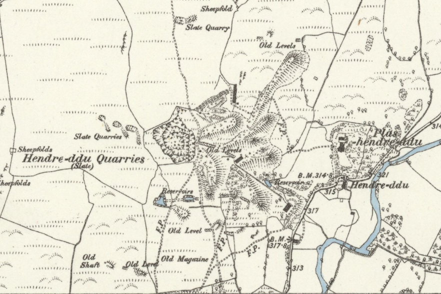 Extract from the Caernarvonshire XXVII.SW, surveyed 1887 by kind courtesy of those lovely folk at the National Library of Scotland. The factoids Hendre Ddu is an early C19 enterprise, gaining pace in the 1860s with the installation of a steam mill, perhaps on one of the upper levels. It employed over 60 men, but production fell short of profitability. A fresh start was made in 1872 with a turbine mill beside the road. with a waterwheel pit which could have accommodated a waterwheel 35ft (10.3 metres) in diameter and 5ft (1.5 metres) wide. A covered channel under the floor probably housed a shaft transmitting power to machines above. At SH5203544324 is a small reservoir excavated in the bed of a narrow rocky ravine. However, in 1875, the reservoir dam wall collapsed...was this the upper one? It's hard to tell today. The quarry fidgeted on for a few years, until 1880, when the project finally expired, leaving the intriguing remains for us today. Location: SH5180044400 Sources Gazetteer of Slate Quarrying in Wales, Alun John Richards, Llygad Gwalch 2007. Coflein W J Crompton, RCAHMW, 23 September 2010. 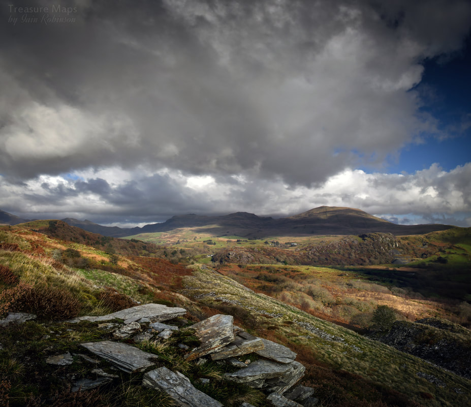 The lower tips from the middle tips. This view has been spoiled now as a road has been driven through from left to right, presumably for timber harvesting. (2019) 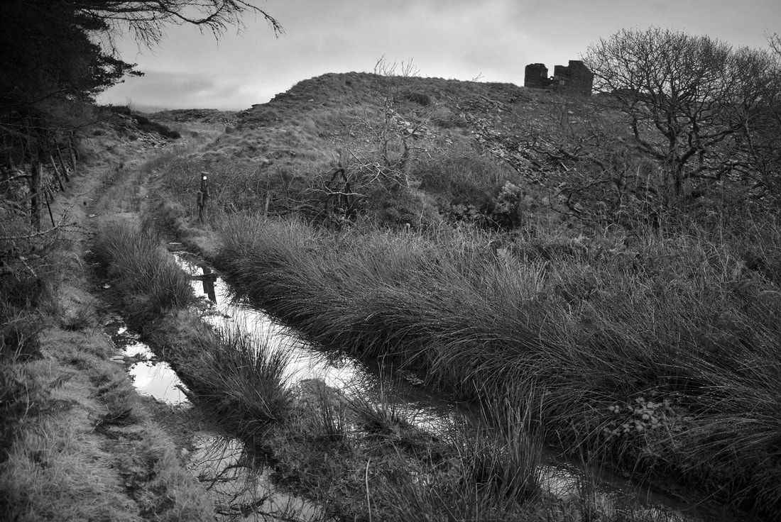 Atmospheric view of the footpath running through the quarry (2007) 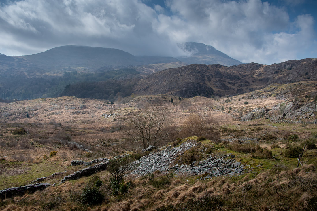 The view from the tips above the small pit. Mighty Hebog lurks in cloud behind. Many years ago, we were in Cwm Bychan, photographing the aerial ropeway pylons and scoping the mines there. Coming back down the path, I looked over to the east and spotted a distant slate quarry. We paused and considered the ground- it looked difficult, to say the least, but I made a note to try and find a manageable way to get to the mine. Fast forward ten years and we're driving around the very narrow roads to the east of Nantmor, looking for a way to the quarry. In the end, we parked at the start of a footpath that we often use, to photograph the beautiful woodland there. It just so happens that there is a branch of the path that leads (rather tortuously) to Cwm Caeth. If you like doing puzzles and fitting jigsaws together, we parked the car at SH608454 opposite the footpath sign for the Dolfriog woods.  A gratuitous tree photo from the Dolfriog Woods. A more convenient approach to the mine (if you aren't that keen on trees) is by turning left by the chapel on the way out of Nantmor at SH608458. You carry on up that tiny track until the road does a jink and starts to rise up. This very minor unmarked road is a footpath- you could actually start from the Nantmor car park and walk up- it would still be easier than the route we took. I'll cut to where we met the unmarked road, which we crossed. We carried on over the fields following the line of a wall- for some reason we took the right hand side, which we were to regret very soon. These are high dry stone walls and it's not advisable to try and climb them. Luckily we found a gap and crossed to the correct side. Now it was just a matter of walking in approximately the correct heading until the quarry tips come into sight. We sat and had our lunch by some rocks- a lady, probably from the farm, passed by with her very friendly dog. She remarked that walkers were rare on this hill. That was a good sign. 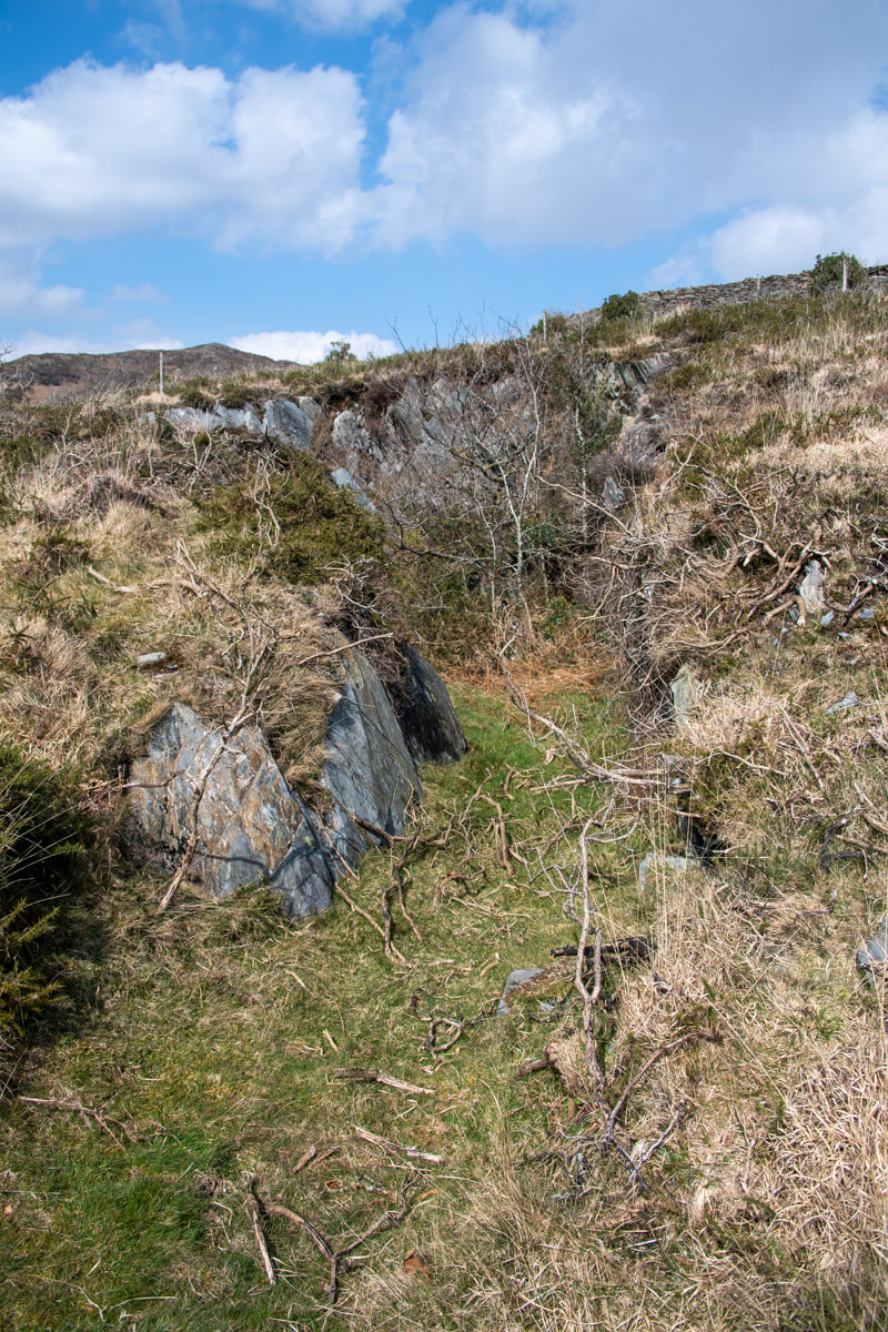 The Upper Pit, from the south. The views here are absolutely sublime, Hebog had his best coat on and was trying a selection of off-the-shoulder clouds, making for some nice photos. To the south, the sea was sparkling and Porthmadog could just be made out beside Moel y Gest. The mine was, to put it kindly, a slight anti-climax. The tips were grassed over as befits a long disused operation (it was marked as disused on the 1842 Ordnance Survey) and the pits were tree grown. Richards says: "An ancient working developed in the 1870s, when a water powered mill was built..." but then contradicts our findings further by saying: "Employed about twelve men 1867-79....It failed to survive the late 1870s depression." We looked around, failing to find any meaningful camera angles. We walked towards the lower pit, but as I expected, the adit was knee deep in gloop and didn't look too exciting. Above: Some views into the lower pit... We looked about at the remains of structures that had obviously been "farmerised", put to fell purposes not connected to quarrying. It was hard to imagine the little mill and the wheelpit. We wandered around looking for the adit Richards describes as "leading to chambering"- this was blocked by stones, presumably to deter mine exploring sheep. There was a large rectangular area to the west of the mine which is described on the Zoom map as a mill, but in Coflein's entry for the site they describe it as a post-medieval livestock enclosure. They don't mention the slate quarry. Perhaps they were disappointed too. Here are a couple of shots of the little mill building which must have had a waterwheel to it's right, and of the working area with what look like vestiges of shelters. The quarry is at SH606465. The 1842 map extract (kindly reproduced from those lovely folk at the National Library of Scotland) helps make sense of the place, as does the extract from Zoom Earth below.  Map by kind permission of the National Library of Scotland. That isn't the slate mill- it was the two-cell building beside the river where a wheelpit can be made out...we missed that... (Satellite image by kind courtesy of Zoom.) We noticed those long stone enclosures to the south of the mine, but we thought they were probably agricultural. There's very little out there to find out about the place, but it does make for a fine stravaige on a good day- the slate quarry is a bonus. I'd still like to see behind that wall into the adit, though... Thanks, as always, to Petra for the use of some of her photos.  The gap in the wall. 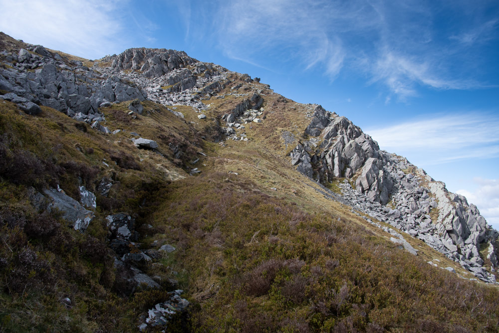 Top o' the mine, Ma! The workings at the 550metre level. The much subsided opencut leads almost to the ridge. On our way down from Cefn Cam (previous posts) we spied a footpath sign leading off into the forestry. When we got home, I decided to have a look on the map- and sure enough, there was a footpath, but much more interesting- there was a mine. Further research on the Merioneth Manganese site revealed that this was an interesting place, worth a stroll to see what was left. Although, thinking about it, perhaps my use of "stroll" was a little optimistic. This is the Rhinogiau, after all! Some red herrings We parked the car at the gate where the Woodland Trust notice is, at SH683209. Funnily enough, there are two other mines with inclines or tracks fairly close to this spot. On the left, after passing through the gate and walking for about 100 yards, you come to a pillar and a footpath sign. The pillar is the remaining masonry of a bridge that went up to the Votty Manganese mine. Over the stile and past the footpath sign, the track follows an old incline. Beware though, there is so much forestry mischief that it's almost impossible to make much out. On the right of the road is the modest but once fascinating Cae Mab Seifion mine. We have tried several times to find this, but it's not much fun struggling though conifers. We did find a fine adit, but although it's two years ago, the memory of the sitka and bramble hell is still fresh. Back on track Leaving those digressions and walking up the road, we passed Cwm Mynach Isaf farm on the left, then went through a very well-oiled gate. This was the start of Cwm Mynach proper. It's quite a way yet, steadily uphill. The road gradually deteriorates and recent tree felling has made the area a bit of a mess, but it's still a great walk with lovely views. The footpath sign and vestigial remains of a loading bank are at SH68002321. If you have eagle-eyes you might spot some chunks of spilled bluestone from when the ore was transferred to horses and carts here to be taken down the track. Finding evidence like this is a wonderful link to the past; it feels very satisfactorily like detective work.  Nicely revetted flat causeway near the beginning of the tramway. The path/tramway leads through a delightful bosky cutting before coming to a stone causeway. There are some strange mini-stockades made of felled timber and brashings along the way which are intended, I suppose, to protect young trees from fallow deer. We did see quite a few deer in the woods.. 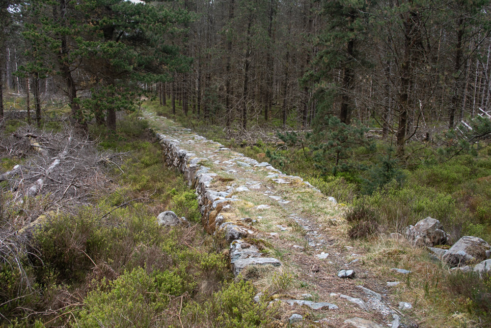 Looking back towards the Cwm Mynach track. Mini-stockades to the left. 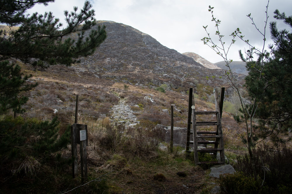 Rough country ahead. Pretty soon, we crossed a stile and got to terms with the rock and heather landscape of the mountain. It was easy going so far, and in a few minutes, we spotted the powder house on the left. Not much left of this- testament to the weather in these parts. It was a heck of a walk for the person tasked with carrying the black powder up to the mine. 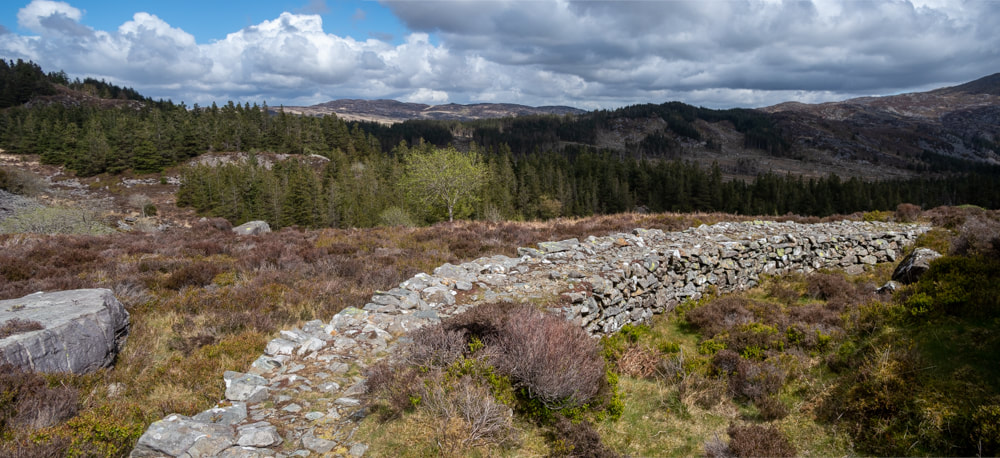 Pretty soon, the revetted tramway did a left hand turn around a large crag on this very fine embankment. So far, the tramway had been gently climbing towards a sheltered area underneath the first bastions of Diffwys. There was a nice slate bridge, then the track headed towards what looked like a dead end. I suppose without Dave Linton's Merioneth Manganese site, we might have (eventually) worked out that there was a ropeway here, but it would have taken a lot longer, so thanks, Dave! Here at the bottom of the ropeway, there were two anchor eyes- one for each rope as it was a dual wire operation. There's a diagram on the Merioneth Manganese site which makes sense of this very nicely. 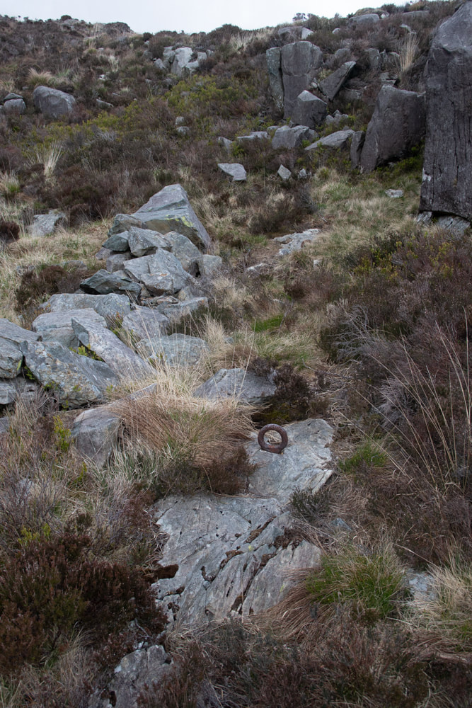 Here's the bottom anchors- the second one is partially hidden by grass in the flat stone, above and behind the first one. The climb up to the ropeway staging point was a little gnarly. I wasn't so worried about going up, but coming down would be something else with my mountain ravaged knees! The stone upper ropeway platform was still intact- and there was an amazing view from the top.  Now the tramway made progress using inclines, with short pitches of level causeway inbetween. Before we started up the inclines, we paused for lunch and I took this improbable comp shot...the upper ropeway station is at the left. 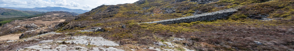 The incline began to ramp up a bit, although it was good underfoot. The causeway is filled with grit, faced on the outside with stone. It crunches satisfactorily as you walk. There was a superb view across Cefn Cam and the eponymous slate mine. You can see the yellow "Johnny Breakaleg" grass from here. Every mile a lifetime of agony... 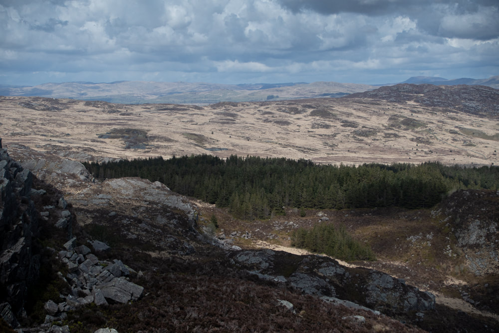 I zoomed in a bit to show the slate mine- it's just above the forest at middle left. This is looking towards the north. From this point the tramway became what the guides describe as "airy". It was delightful, especially on the day we had. It reminded me a little of the Moelwyn Manganese tramway, but the curves and diversions around crags made it far better. The wildlife was great too, with larks, stonechats and Chiffchaffs singing, while the call of the cuckoo rose up from the forest below. Until now, this had just been an amble along gently sloping inclines, apart from that section by the ropeway. But things got real after the contoured section- the inclines rose up as if trying to imitate slate mine inclines. It was tough work for a few minutes until we reached the bottom of the workings, where a small pile of bluestones sat beside the crimp. Suddenly we could see the workings in their entirety. An incline goes up to the right beside a series of adits and opencuts which have all run in. The waste tips are in the centre. It is still possible to see that a lot of work was done here at this rather exposed location- the miners must have been tough. I suppose, in terms of archaeology, it's not the most exciting mine. But the tramway and inclines provide the most wonderful way to see some amazing scenery. On a good day, that's all you can ask for, especially after lockdown!
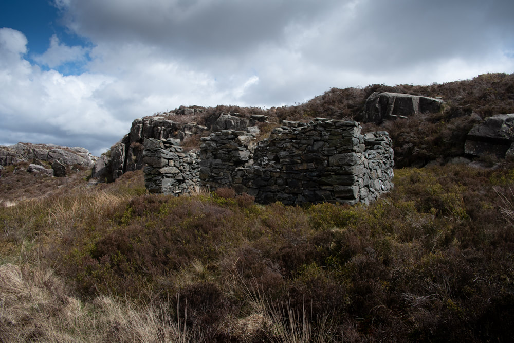
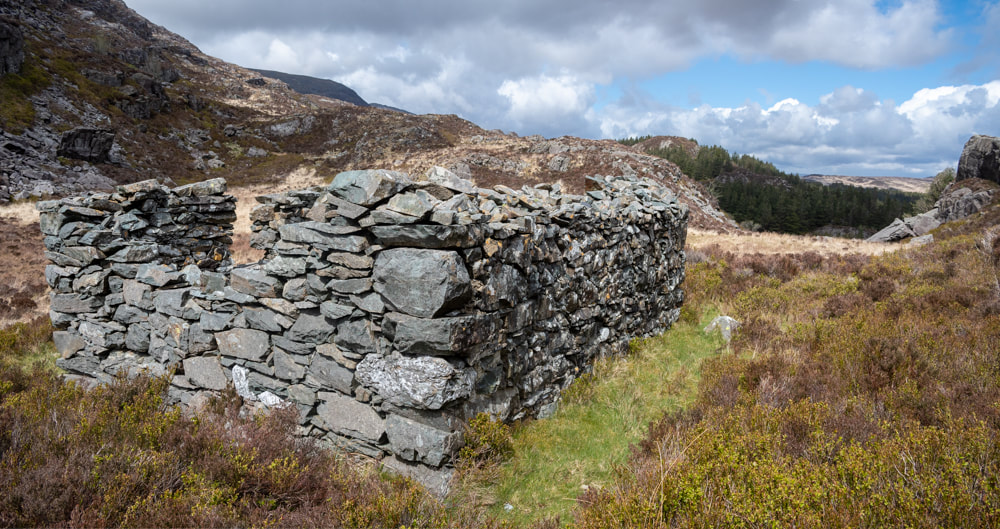
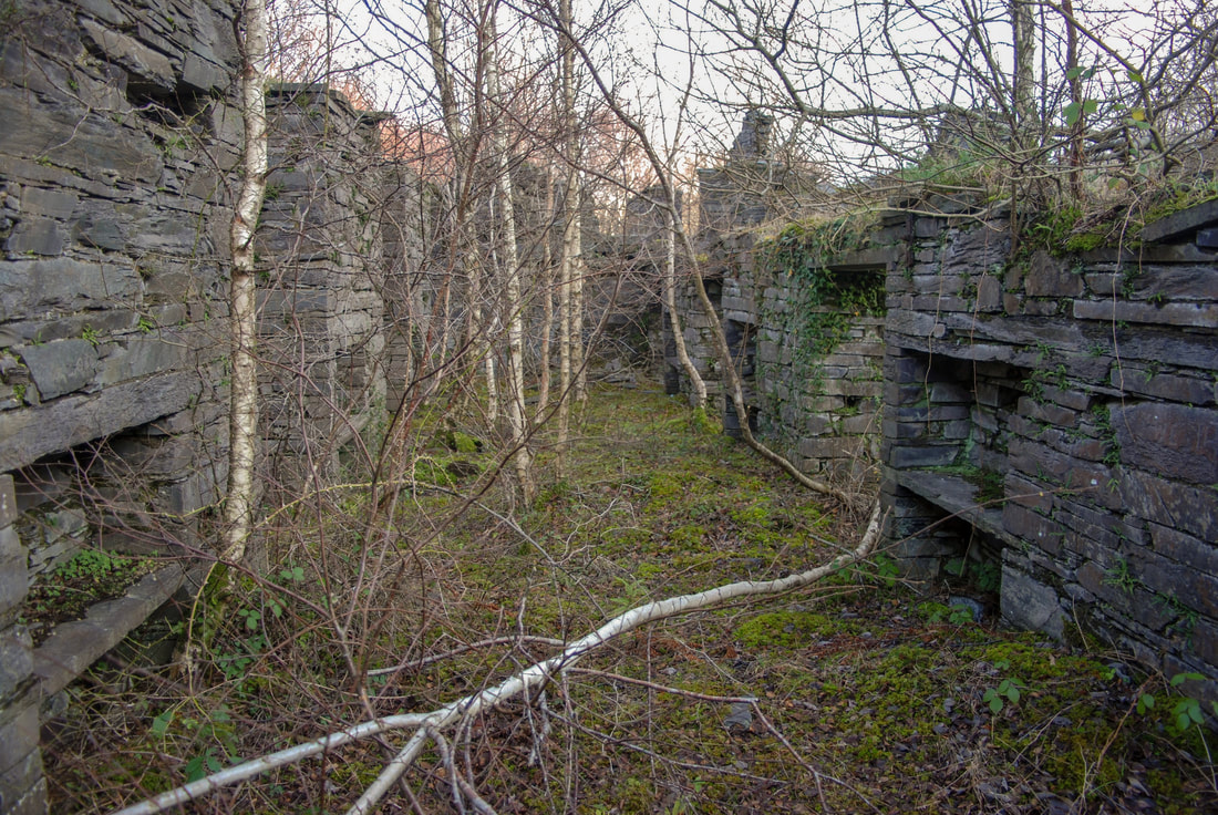
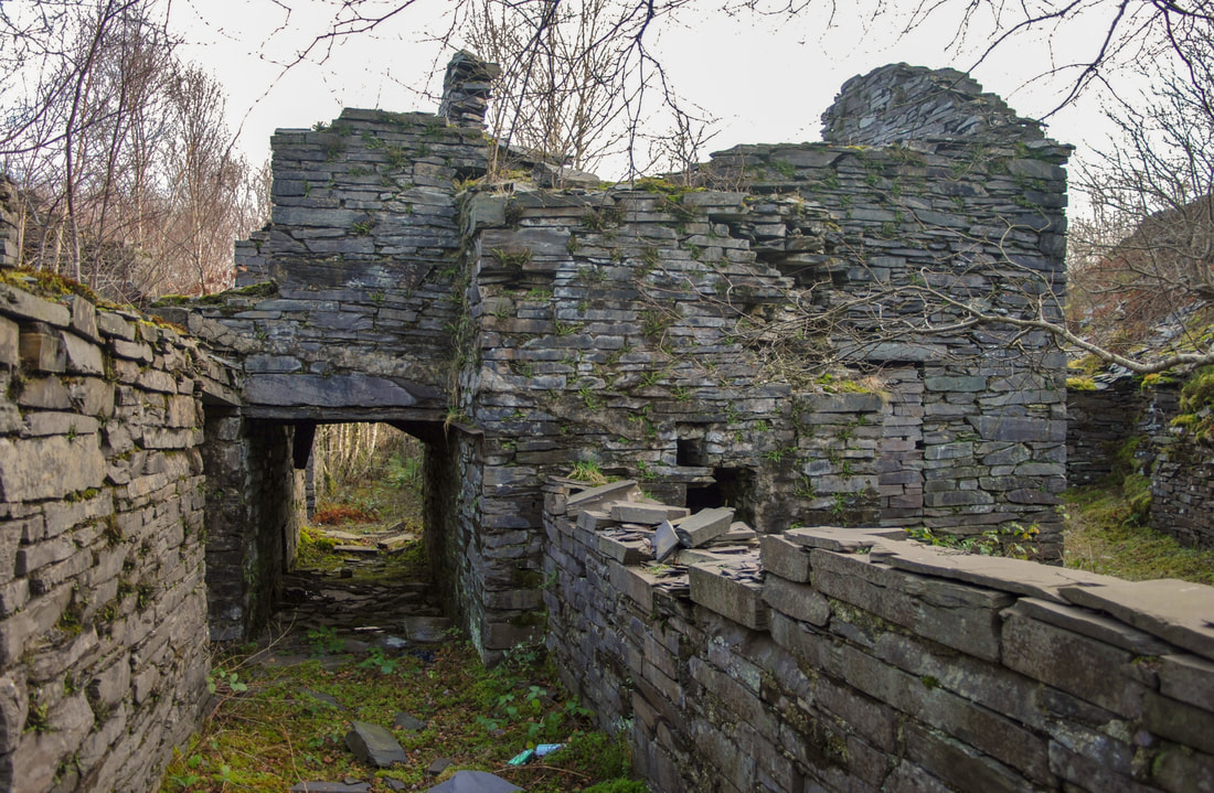
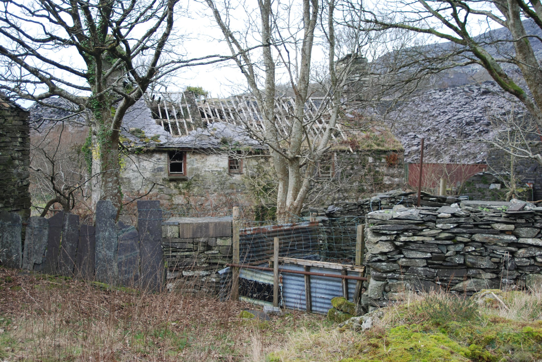
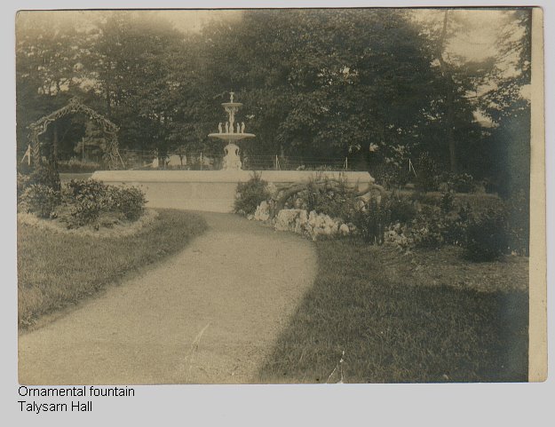
The factoids: Although the records show no output from this mine, the number of men employed and the extent of the waste tips suggest that a substantial amount of material was mined here. The records are very sketchy- the mine was supposed to have been in operation only between 1886 to 1887... something that's hard to believe given the impressive infrastructure. At the most, 15 men were supposed to be working here. Perhaps there was some sleight of hand to avoid having to declare profits? Sources: Merioneth Manganese web site C G Down, The Manganese Mines of North Wales, British Mining No. 14, Northern Mine Research Society, 1980, ISBN 0901450170 Location: Cwm Mynach, Bontddu, Dolgellau. A rare, rain-free reprise of this fascinating quarry 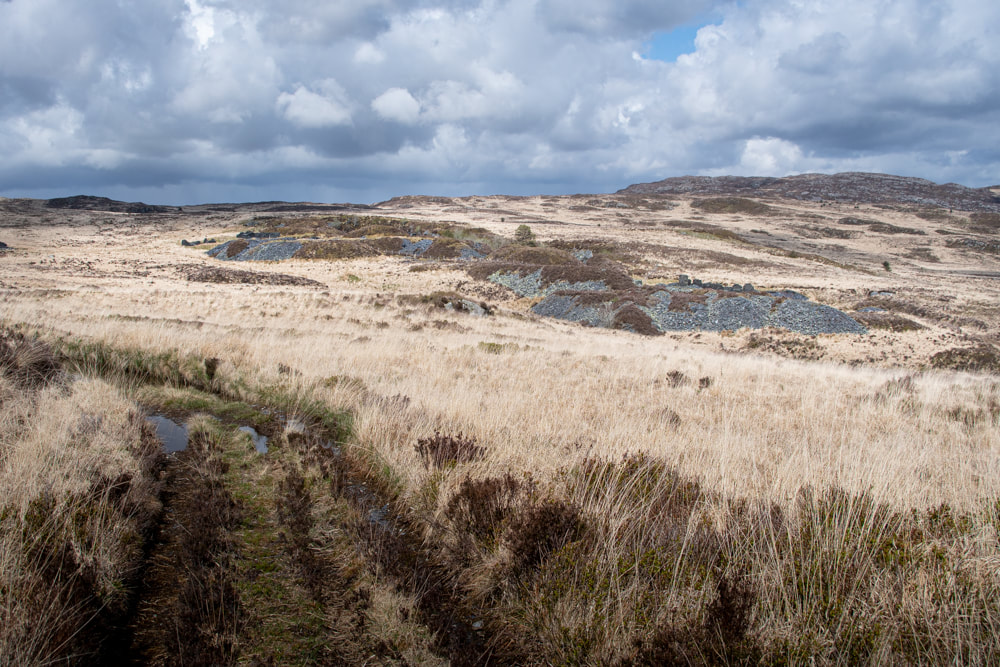 Our last two visits to this quarry and mine were blighted by dubious weather. (Link here) Probably because the area immediately to the south, Cwm Mynach, is designated a temperate rainforest with rainfall for 200 days a year- so I shouldn't really have been surprised. But, gluttons for punishment, we decided on a whim to have a look around again. Cwm Mynach- billed as Wales' hidden gem, an unspoilt, hauntingly beautiful nature reserve. I loved it last time we visited, despite the rain. But now. thanks to our old friends at the Forestry Commission, the area resembles a MOD shooting range. The beautiful Llyn Cwm Mynach, once a spot to contemplate the beauties of nature as the rain dribbled over your sandwiches - is drastically changed. 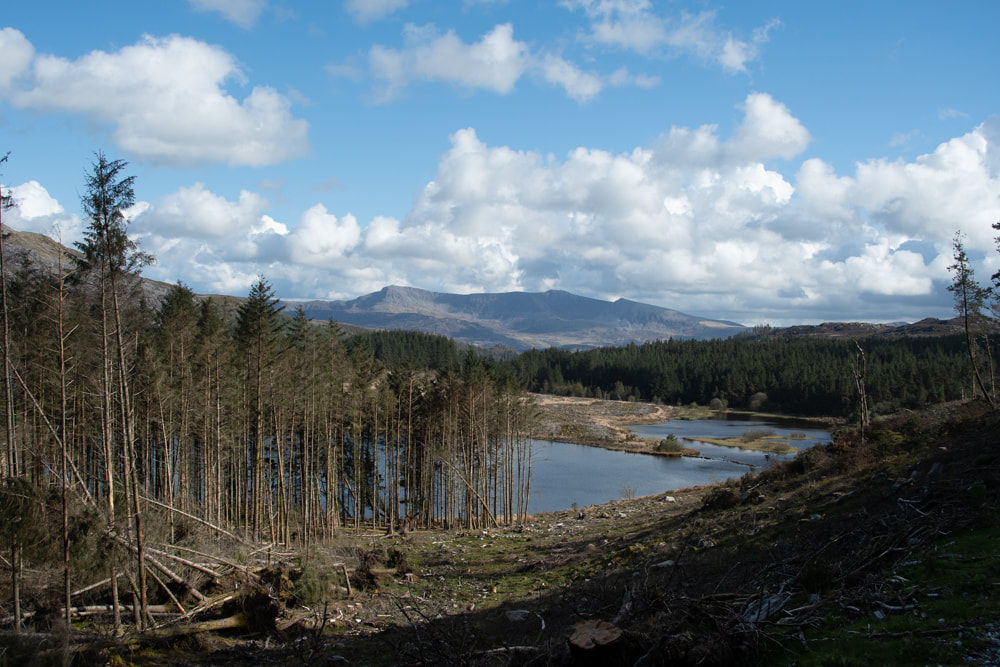 The changed view at Llyn Cwm Mynach, looking towards Cadair Idris. All I can say is that, once out of the ex-forestry and on to the moor, things were wonderful. Wide open grassland as far as the eye could see, a sort of Welsh Savanna. Of course, last time, we approached the mine by a masochistic yomp over a mile of "Johnny Breakaleg" grass. This time we approached directly by the access road to the architecturally dubious shooting lodge. 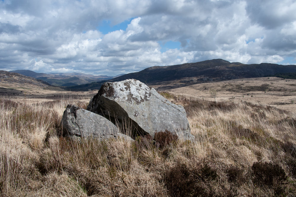 Looking East towards Ganllwyd. Garn Fach is the mountain nearest- in the distance is Moel cors y Garnedd. We learnt quite a bit from looking at the place again in a more relaxed manner. Approaching the Manager's house along the access road, it is clear that there has been an area beside the Afon Gamlan that has been flattened for cultivation. This explains the underground vegetable store- somewhere to keep the large quantities of victuals for the miners in this very remote spot. The flattened area is immediately south of the attractive bridge below- 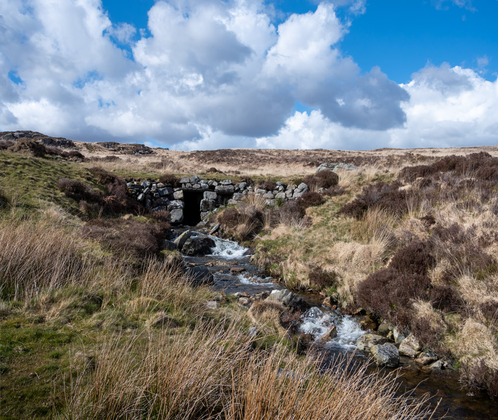 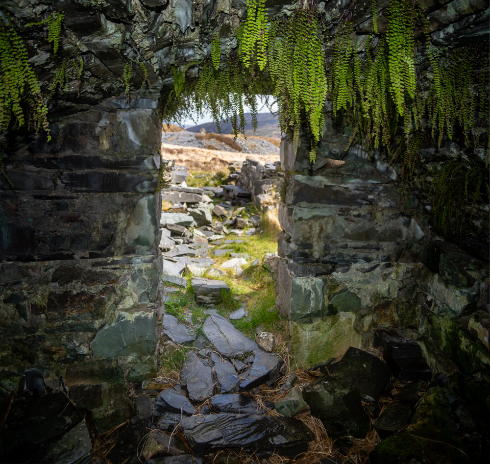 The vegetable store was covered in my last blog post, but this time I managed a photo from the inside... One thing that strikes you about this place is the number of structures- and their mysterious purposes. The first range that comes in to sight must be the manager's house. Coflein have a new improved site which shows the buildings and they also mark the first range as the managers. The other structures are slightly confusing. What Coflein calls the barracks (I agree, for what it's worth) looks to have been originally a field barn which was adapted- the foundation courses are country rock, then after a couple of courses, slate takes over. The presence of fireplaces also supports the barracks theory. You'd need somewhere to dry off all those soaking clothes. 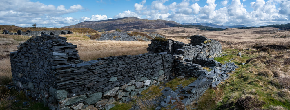 The barracks, with pig sties(?) to rear. 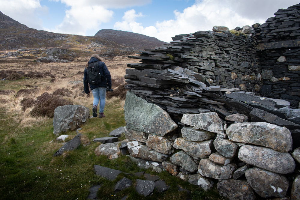 Showing the different materials of the lower courses. 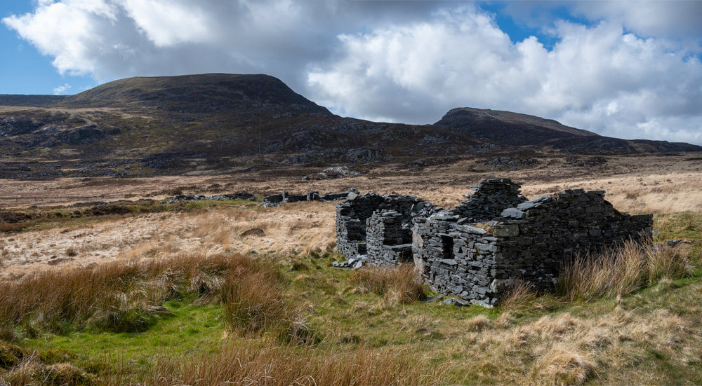 The barracks looking north west, with Rhinog fach to the right background and Y Lethr to the left. Manager's accommodation in the background. We headed into the pit next and had lunch. We'd arrived at the site via a three mile walk from Cae Mab Seifion, so we were quite hungry! The pit is axcavated on two levels, the shallow pit also has evidence of the most recent working, with trimming waste and some walliau. The slate face here looks as if it was worked a long time ago. We only saw one shot blast mark, so I wondered if material was crowbarred from the rock. There was a great deal of trimming/riving waste in the top pit. We'd intended to walk out through the opencut, but it turned out to be very boggy- and very long. There were signs of slate being won within the cut. At the end was the water-powered mill, which we'd inspected before. 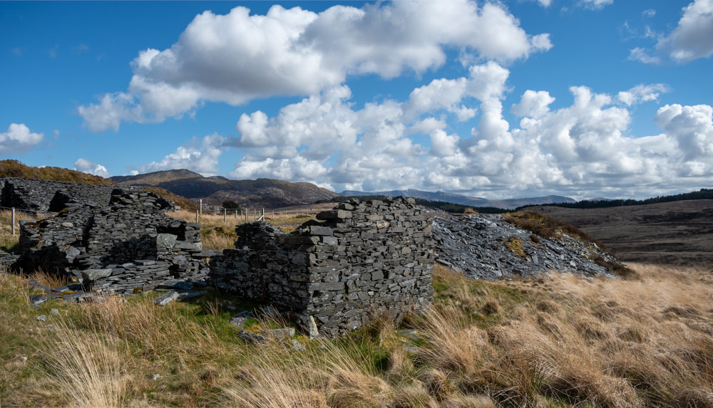 Possible workshops near to the pit. 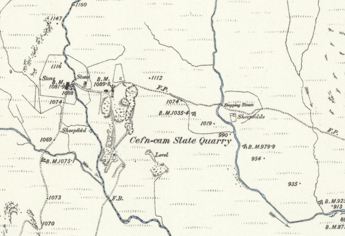 An extract from the 1888 OS map of the quarry. The level to the south east is thought to be a drainage adit, although there was no sign of an adit in the pit. Trimmed waste and a walliau were on the tips. The line marked "FP" leads to Ganllwyd, but I can tell you- it's long gone. (image courtesy of NLS) 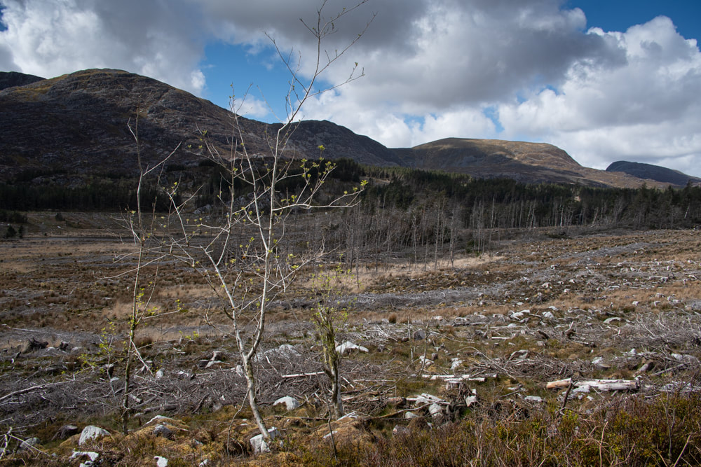 The sylvan beauty of Cefn Cam...post FC apocalypse. A walk around the Dorothea Twll and associated remains with Dave and Gwen Roberts. I was shown a photograph of a man riding a chain incline...something very much frowned upon, but which nevertheless happened almost as a daily occurrence in the quarries. The man is William John Roberts, Grandfather of John Roberts. He is thought to have been the manager of the quarry at one period. Here he is in all his nonchalant glory- 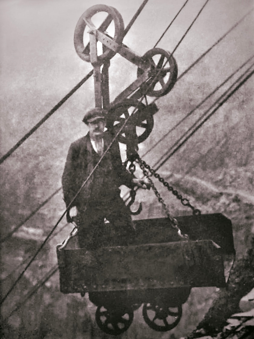 Dave asked me to show him where his illustrious forebear had worked, and it was my pleasure to share the place and some of it's secrets with him and his wife Gwen. The start of any exploration of Dorothea is at Talysarn, where the tramway from the quarries transshipped the slate to the standard gauge. Below is a photograph taken recently... 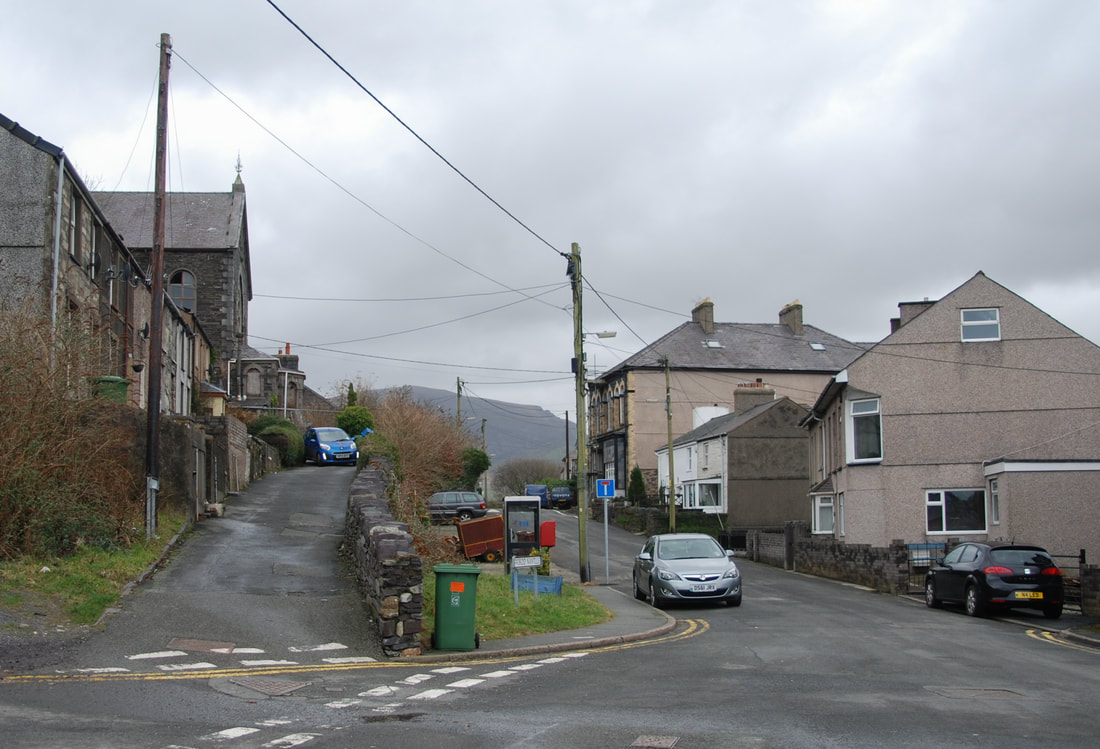 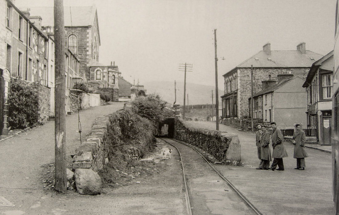 Then there's this, taken in 1957. Not very much difference, except that the remains of the tramway tunnel under the Chapel are still there. The wee dog looks a little bit annoyed! Also of note is the outline of the top of Bont Fawr in the background -and the double decker Crosville bus just in the photo. As you walk towards the quarries, a modern day roundabout is encountered, where the local buses turn around. Just along from here was the site of a massive, mostly dry-stone built slate bridge, a multi-era structure added to as the tips became higher. 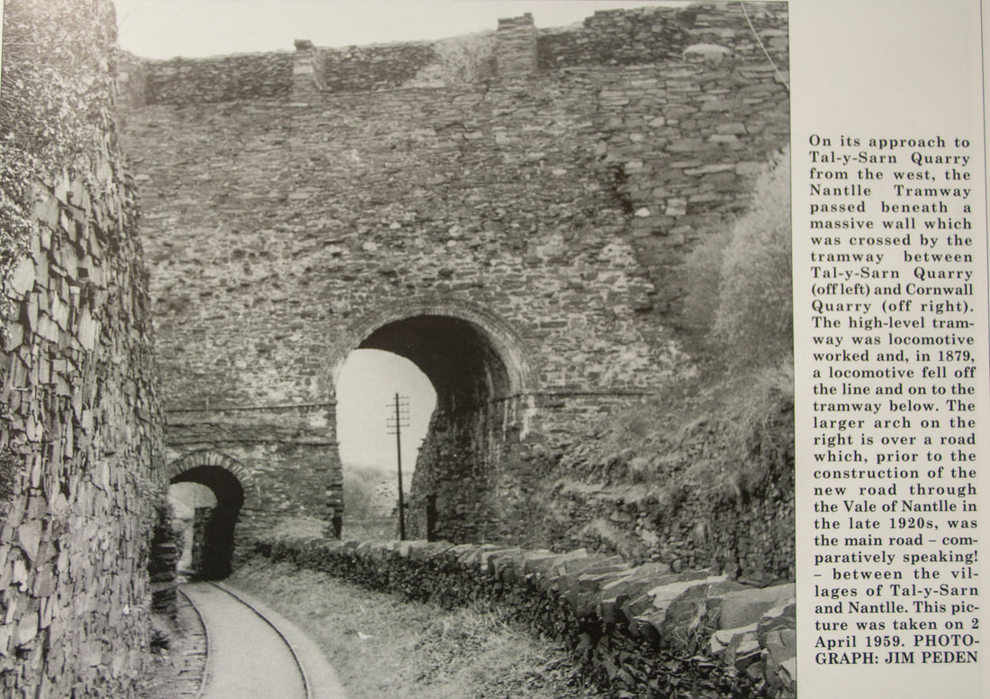 Bont Mawr It's hard to imagine this structure now as you walk along the track past Talysarn quarry- all that remains is a dry stone buttress at the side of the road beside the new gates that D.E.L. (Dorothea Estates Limited) have installed. The bulldozers arrived in November 1977 to start the clearing of the tips at Cloddfa'r Coed (the so-called 'Domen Fawr' behind Eifion Terrace) and the west side of the Talysarn Quarry. The photographs below give some idea of what a busy place this was. Sadly, nobody would have thought of Listing or Scheduling something like that in the mid-1970s. 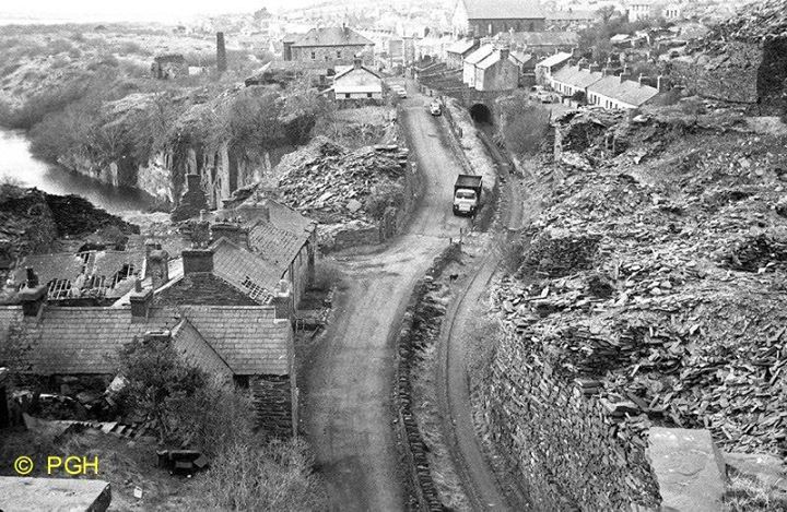 Here's a 1960s view from the parapet of Bonc Fawr. We can see the flooded pit of Gloddfa'r Glai/Coed Madog quarry on the left. The roundabout of today is roughly where the truck is and the mill chimney is from the Coed Madog mill. Land reclamation of 1977-78 included shaving down the village end of Gloddfa Glai /Coed Madog tip and dumping it in the shallow end of the lake, along with Bont Fawr and much of the mills area and production tips. Gloddfa Glai had already been landscaped in 1972 when they took down the old Wesleyvan chapel and the tramway embankment The Quarry was put out of action by a dam burst in 1913, luckily on a Sunday when all the workers were in chapel.  An older view from Bont Fawr, this time showing the incline on the right above the Talysarn twll and the rubbish bridge running between Cornwall and Gloddfa Glai. The houses on the left appear to be inhabited at this time. Chain inclines can also be seen above Gloddfa Glai twll. The Holman Engine Pump House After passing the D.E.L. gate we made our way to the Holman Engine House, through a landscaped area. Here was the first view of the Dorothea pit. Then we descended towards the Pump House. For an account of the sinking of the pump, there is a link to my article here. 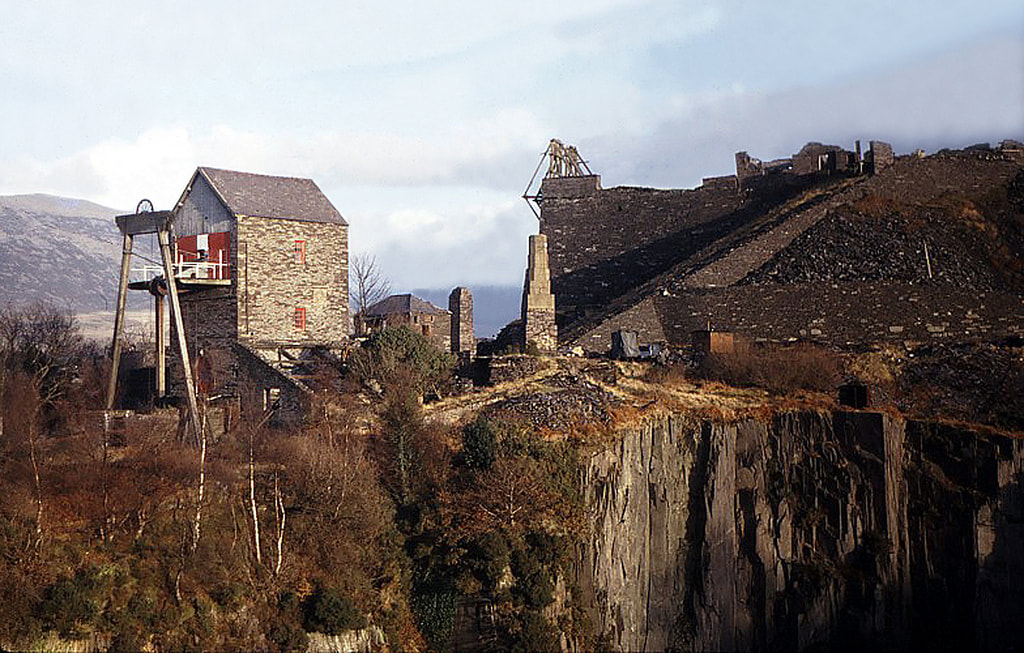 Above is a view taken probably in the late sixties, showing the pump house and beam intact, with the pump rod still descending into its pit. Cornwall twll is in the foreground, while the West Pyramid, with it's ruined engine house for the chain inclines and chain incline timbers, towers in the background. The chimney is for the two boilers that produced steam for the pump engine. The concrete one in the photo replaced two old boilers, rivetted together, which served for many years. The boilers for the Holman engine were already 10 years old when brought to Dorothea- second-hand from a mill in Bolton. One old villager who passed away many years ago, used to tell of seeing them as a child, being hauled on a low-loader (towed by the Drws y coed copper mine's steam traction engine) from the railway station. They somehow got these 30ft things round the tight corner by the Plas gates (on the old road now collapsed) by jacking up the transporter and placing timbers underneath. The boilers were then slewed bodily, using pulleys ropes and jacks. 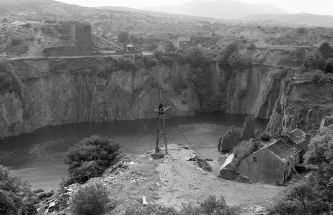 Above: Looking back towards the Pump House and the West Pyramid across the partially flooded pit, circa 1971. Foundry Terrace is in the right foreground, and a Blondin Pylon. The Western Pyramid The "Pyramids" were built because at Dorothea the slate strikes vertically- space for tipping is at a premium and has to be hauled from great depth. Thus the chain inclines were installed on the front/pit side, while an incline was built to uphaul waste. Wherever waste was tipped, it was likely to be over the top of valuable slate reserves. The Pyramids were surprisingly ad-hoc structures, sometimes modified slightly to adjust for the working face down below. This pyramid is thought to have been built in the late 1870s. 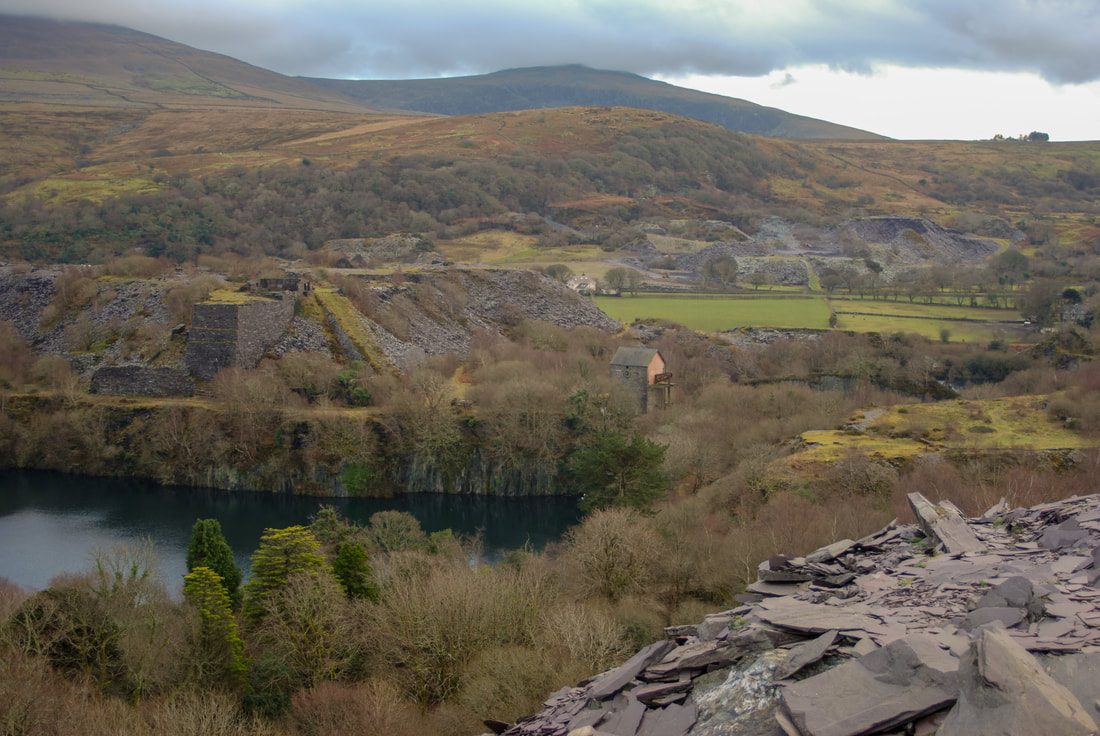 Above is a view of the Pump House and Western Pyramid from the Blaen y Cae tips. Ty Mawr and Nantlle Vale quarries are in the background, and behind them, Craig Cwm Silyn. To the Mill 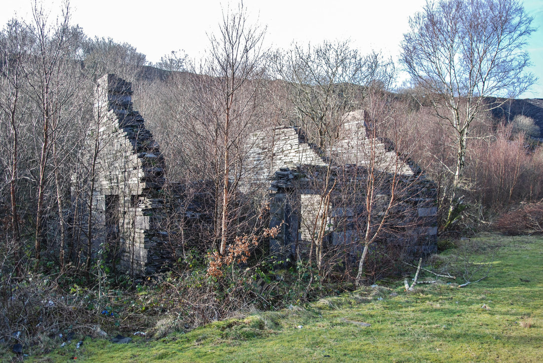 The remains of the Mill Office where the quarry manager oversaw the running of the quarry. This would be where Mr Brindley, from Evans and sons, Pump Manufacturers, met with the then manager W. J. Griffith on the 12th November 1901 to discuss sinking a shaft for the Pumping Engine. 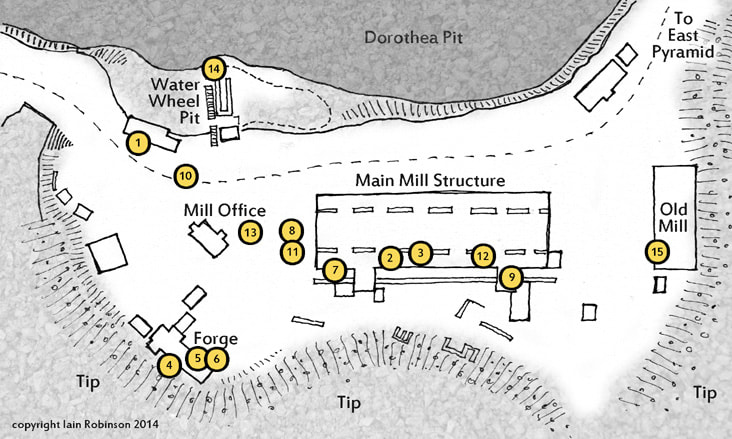 Above: A map I made to illustrate a previous article, but it is handy to show the plan here. .The numbers related to photos in the article. Of interest to us now is the office at 13 and the Forges 4,5,6, which we inspected. The structure to the left is the double roofed building that we thought might be an engineer’s shop. 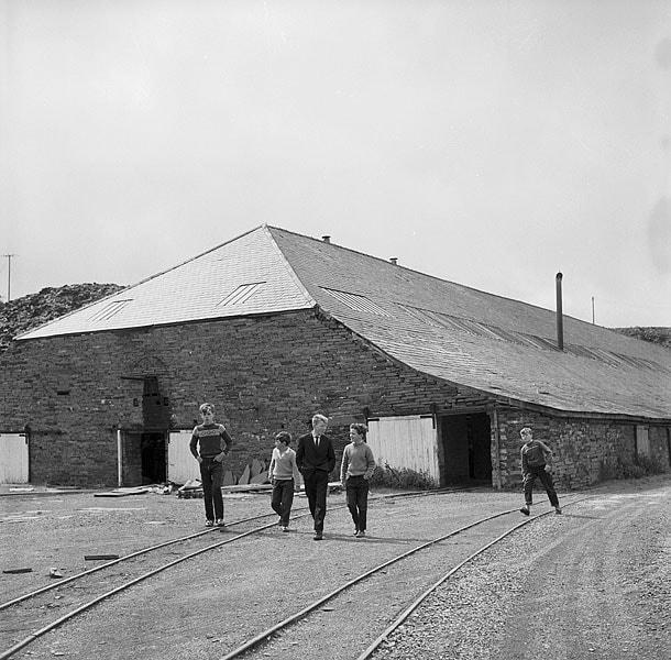 Above: A photo by Geoff Charles of some local hoggia outside the north gable of the mill. What a difference 70 years makes! Note the bearing box on the gable end and the blackening from the tallow used to lubricate the line shafting. The tips from the Western Pyramid can be seen behind. 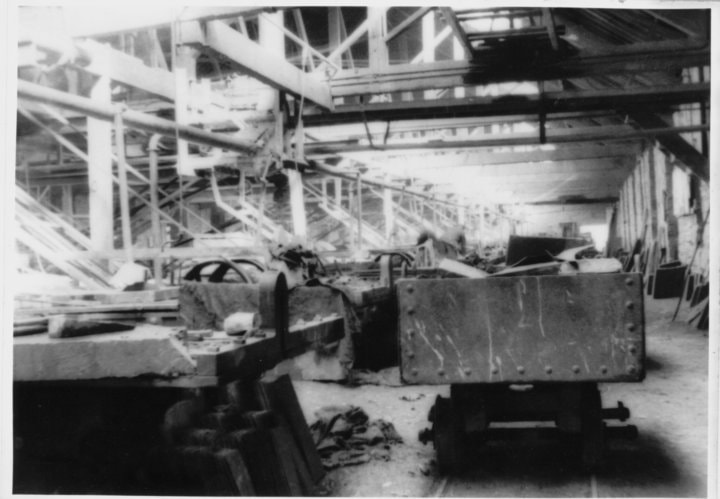 Above: A photo inside the mill showing the sawing tables and the line shafting belts going to the machines on the left. The waggon is a "car dipio" or rubbish waggon.  Some apprentices and a steward in the early fifties. There seems to be no dust extraction equipment in place, slate mills were deadly places to work and silicosis was rife among the mill workers.  Above: Showing the Dorothea pit with the mill at the lower left. It looks as if the mill is at the bottom of the pit, but the bottom is 600feet lower! You can make out the Pump house on the extreme left middle. Talysarn Hall (Plas Talysarn) is in the centre of the photo. Foundry Terrace is at “ten past” around the pit. The rest of the village had fallen into the pit a few years previously. You can just make out the stables, Tommy 'Run's' house and Mr Pritchard’s house behind Foundry Terrace. Tommy 'run' was the man who worked the horses up and down the tramway, while Mr Pritchard inhabited an old farm that pre-dated the quarry and was now used to feed and take care of the quarry horses.  Above: a group of quarrymen being presented with watches for serving 50 years (!) at Dorothea. The manager in the 1950’s is second from the left. Plas Talysarn can be seen in the background. It is believed that the gentleman second from the right was a locomotive driver. Another superb Geoff Charles photo. Above: some photos taken of the mill in 2010. The structure has deteriorated since then, sadly. The two on the left are of the engine house- the steam engine was housed above floor level and stone steps went up to it. The arch is to carry the rubbish tramway.  Above: a photo taken after abandonment in 1968. The hills in the right background are those above Trefor, Yr Eifl. The radio mast can be seen on the slopes of Mynydd Graig Goch. The Eastern Pyramid 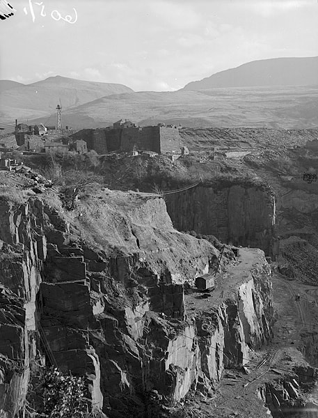 A shot of the pyramid above a dry pit, before closure. It's a miracle this is still standing. I would have thought that this structure started subsiding as it was being built (late-1870s, completion of winding machinery in 1881). The "foundations" comprised an uncompacted slate tip. It is quite a complex structure, and I think that they realised after starting to build it that it was on the wrong orientation for the required slate face development, so it was modified with extra 'bits' to face more south-east. Thus, it is most peculiarly un-square in plan. 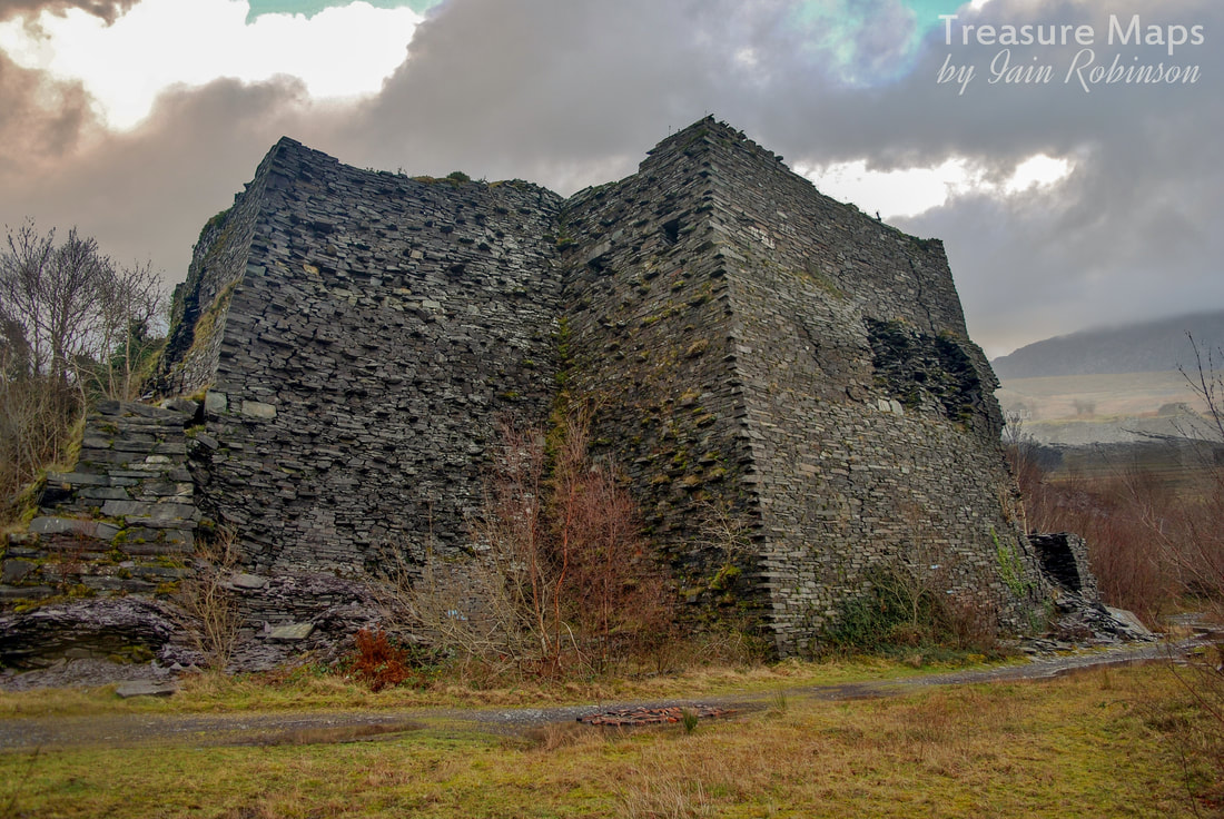 A 2010 shot of the path in front of the pyramid- this route is barred now. It shows the multi-angular construction and the cracks which started to appear in the 1880's! As with the Western Pyramid, this would be topped with chain incline hoists. 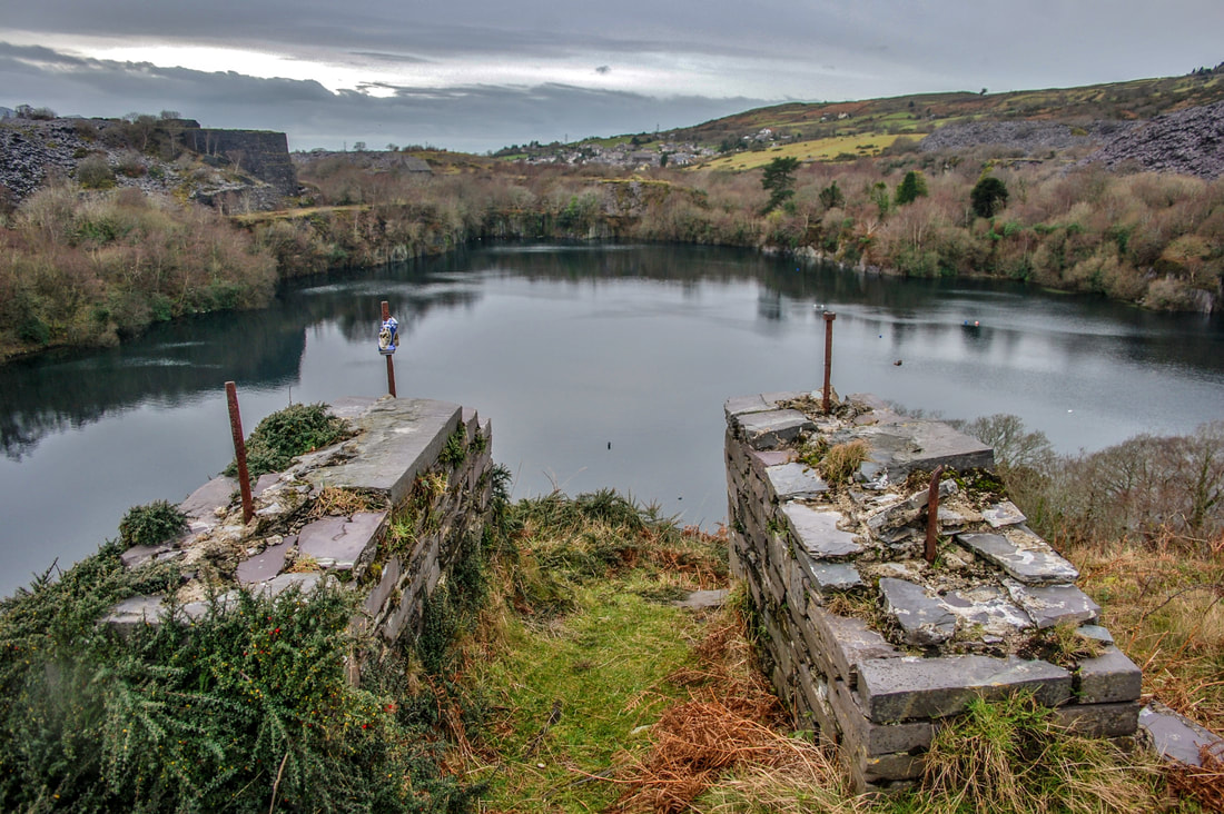 A view from the top of the Pyramid, showing the base of the Chain Incline hoists. 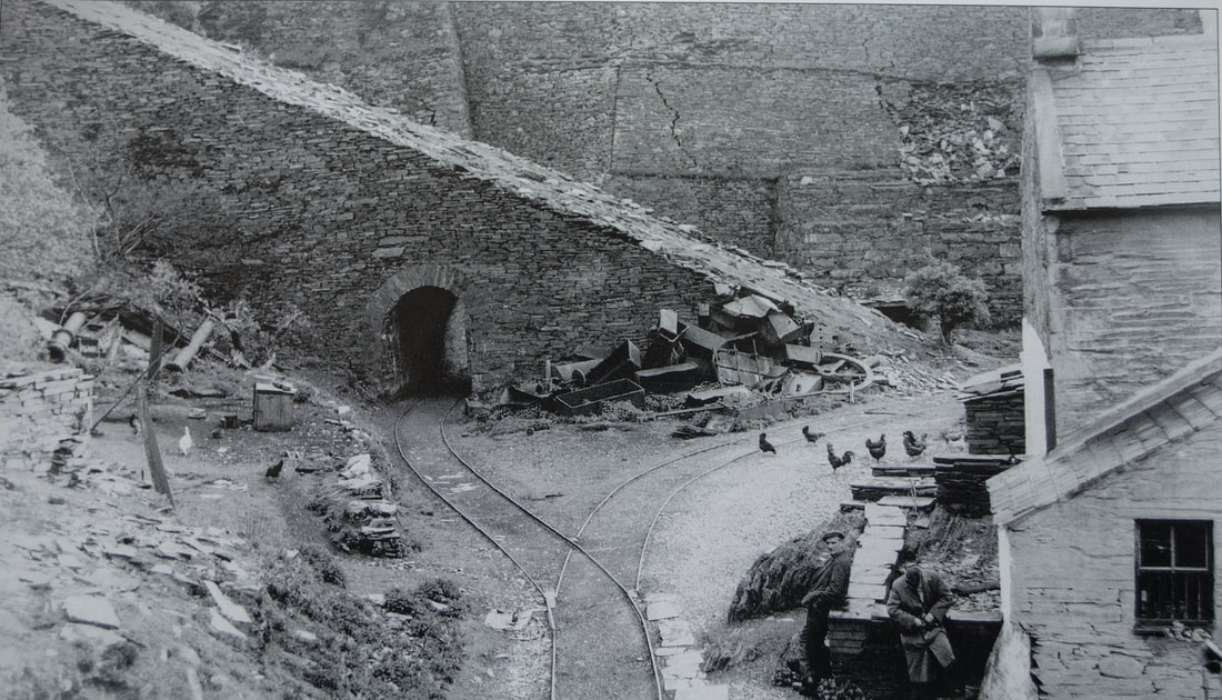 A delightful shot, courtesy of C.H.A.Townley, of the side of the Pyramid, with the tramway tunnel on the left. This was taken in April 1957 and the Commercial Hotel is still open for business. The incline for rubbish is out of use with no rails on it. You can see the ad-hoc construction methods in the bastion walls behind... 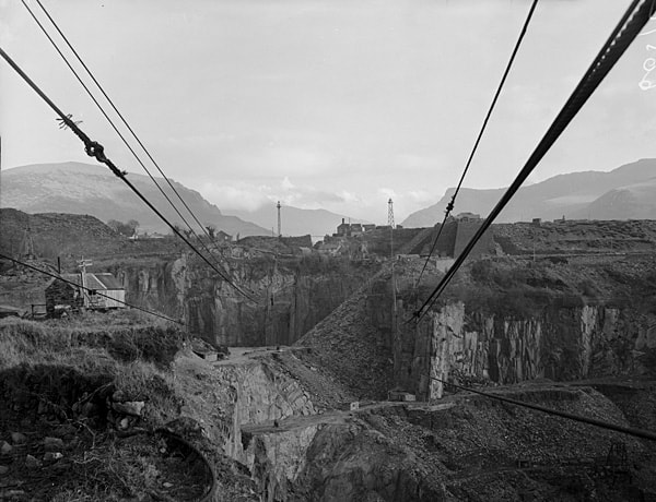 Blondin cables running from across the quarry towards the Eastern Pyramid. You can just see the right hand wires going to the new pylon above the pyramid. The hotel still looks good. By this time a road was driven to the base of the pit and diesel trucks were being used. 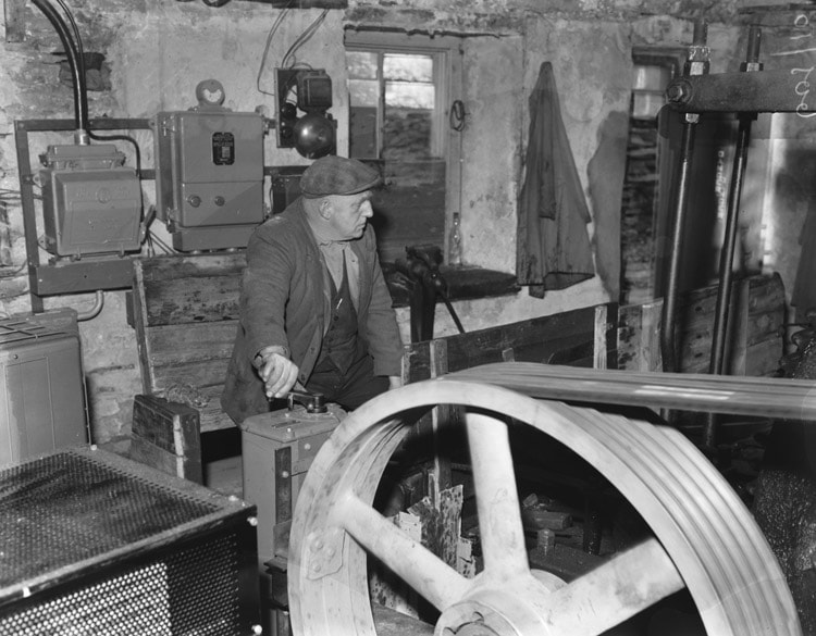 Above: Inside a Blondin operating cabin. The rollers were powered by electricity and had an early form of dynamic braking. It was an extremely difficult and skilled job. This photo was taken at Dorothea by Geoff Charles in the early 'sixties. Working the Tips 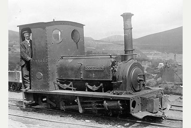 This is “Dorothea”, a Hunslet locomotive used all it’s life at Dorothea on the tips from the East Pyramid. It was new from Hunslet’s in Leeds in 1901 and cost £587.19s. 5d. I wonder how the 5d was arrived at! 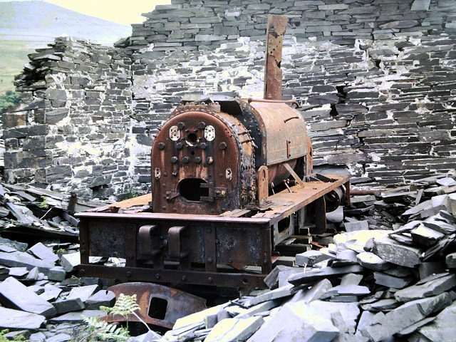 “Dorothea” looking very sad in her shed, which has fallen down around her on the tips. She was rescued in the 1970s...her cab was being used as a blast shelter down in the pit- it was recovered using one of the last remaining Blondins, accompanied by a shower of sparks from the disused and damp electric motor! The rest of the engine was careened down the incline. After a very long restoration, completed in 2005 by Kay Bowman, she now lives on the Launceston Steam Railway in Devon. The Flying Buttresses To the side of the pyramid and now inaccessible thanks to D.E.L. are these buttresses, miracles of the quarryman's art. They support the pillars above the line of the tramway, and were built in 1870 to take Dorothea waste and dump it in the Pen y Bryn lower twll. To Pen y Bryn 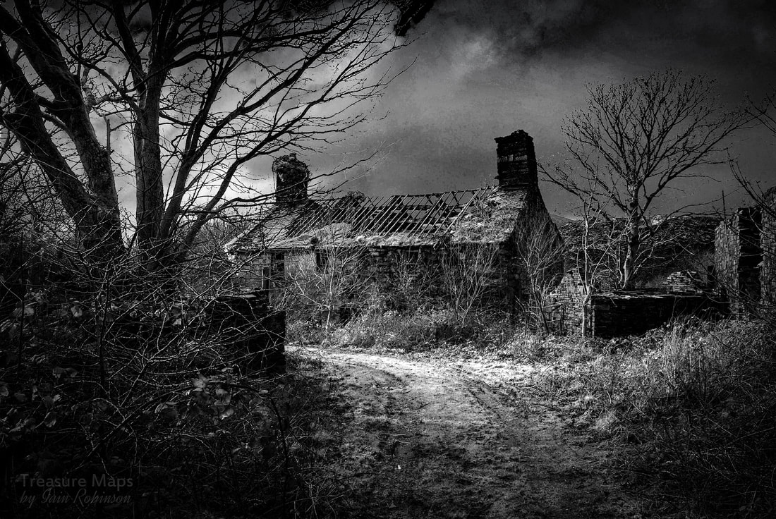 An infra red shot of Pen y Bryn farmhouse taken in 2011 We walked up as far as the mill (above) and glimpsed the workers houses, which had previously been farm cottages- thought to date from the C`18th. They are of the “Crog Lloft” style of construction. The farmhouse dates from the C15th. The bottom left shot is of the twll at Pen y Bryn, seen from behind the mill. Below are the remains of the DeWinton engine that drove the mill, now to be found at the back of the Slate Museum at Gilfach Ddu, Llanberis. 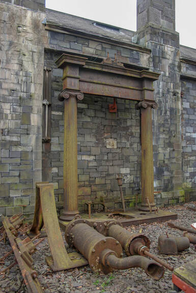 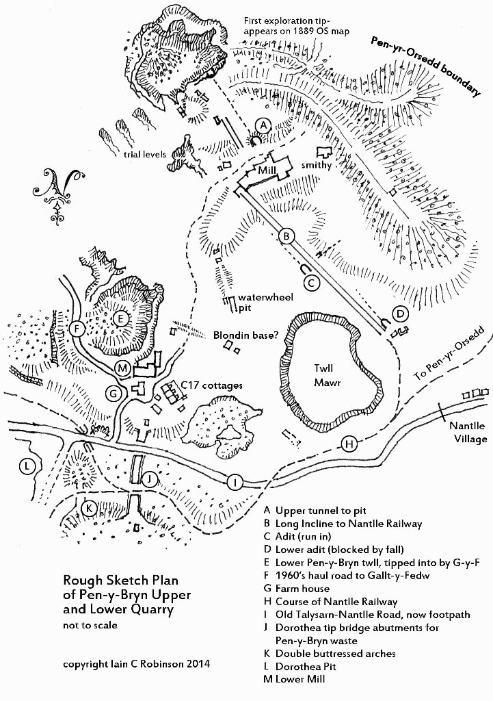 The Stables and Talysarn Uchaf village Before seeing the stables, we noted Foundry Terrace at the edge of the pit. These were a row of houses for the workers in the foundry, which was the last building on the right, now host to a Portaloo. You can see the Eastern Pyramid in the background. 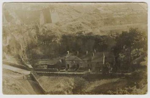 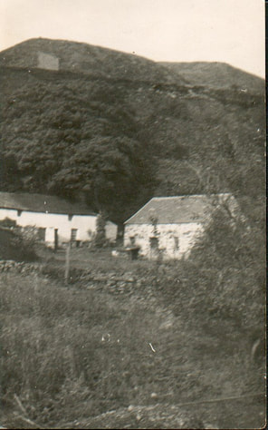 Above, to the right, are the stables. To the left is Tommy 'Run's' house. Mr Pritchard's house is to the right, out of the photo. Coming here after last visiting in 2018, we were shocked at how much the vegetation has engulfed the place. Mr Pritchard's house was almost obliterated. However, it keeps them secret, which is a good thing. John Williams Pen y Bryn, the last person to have lived in Pen y Bryn farmhouse, told us that as a boy, he remembered the sound of the chaff cutter outside the stable, making the horses food in a morning. Some photos taken in 2016 of Mr Pritchard's house, Tommy 'Run's' and the stables. After The stables had been inspected, we saw the tunnel for the tramway- Petra's photo of me trying to take a photo, and the tunnel with the later formation running to the left. This is the original 1820s route of the Nantlle Railway, as the 'Tramway' was originally called. It is a partly cut-and-cover cutting through the orchard of the mansion; if you walk the ground above it, you'll see it is not very deep underground at the eastern end, and it is just possible to see the cut edges. It is of two distinct sections, with the western part being narrower. That bit is also very squashed due to the massive Blaen Cae Quarry tip overlying it presently. It was the need to deposit that rubble that almost certainly made John Robinson, quarry owner, divert the railway past the back of the house. Making money was more important to him than having the noise of clattering wagons disturb the house in workday hours; he was personally superintending the Works, unlike many other owners. Just before the stables, the tramway goes through a couple of deep cuttings and a tunnel under the road- 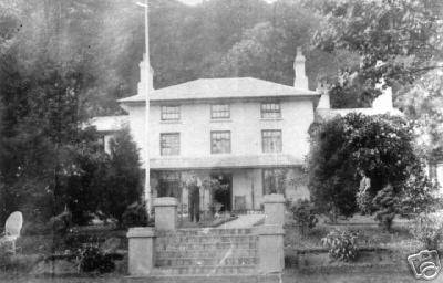 Plas Talysarn The remains of the hall built by John Robinson, owner of Talysarn Slate Quarry came up next. The hall was very swish in it’s heyday, with extensive gardens and an ornamental fountain. The fountain was made for the last surviving daughter of the Plas on her 21st birthday. Mrs Breen Turner (latterly of menai Bridge) Date of the photo is c.1910. The statue off the fountain was sold in the 1950s, and despite attempts to trace it (to either Betws y Coed or Llangollen - stories vary) it has not turned up. 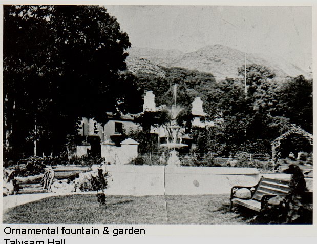 The Hall (first part-built in 1825 on the site of a C17th farmhouse) was owned by the Robinson family from the 1870s. John Robinson lived there and ran the Talysarn Quarry- he was a Victorian “dragon” who cast a spurious net of only half-real schemes across North Wales, to chase the prospect of more money… the “John Robinson Tramway” comes to mind, where the locomotives and rolling stock only ever existed on paper :-) Prof. Gwynfor Pierce Jones, late and much lamented local historian writes that despite this, he was a much loved and respected figure locally, a man of the people and generous to those in need. “He feels the loss of Gwynfor the oracular, benchmarked and underlined in Cymraeg. History and stories fell out of that man: tales of Tommy Run and Jones y Glo, of Robinson and his Italian Countess.” John's young second wife moved 'home' to London and his son Tom's second wife seems to have left in 1910, leaving local staff to look after the house, which was used as a holiday home and also part was a flat used by a brother-in-law from Bolton who visited to oversee the running of the quarry until it succumbed in 1925. The family held on to the house (but the abandoned back wing had fallen down in the 1930s) until sold to Dorothea Co in 1942 for use as offices (whence new rendering put on, bay windows and glas verandah removed), but the wife of the official who should have lived upstairs refused to go there. The place was boarded up and was progressively looted of electric cable etc in the 1950s. D.E.L. Have Blocked off the house and adjacent stables now as they are undoubtedly unsafe, so I have included some photos taken in the 2010-2015 period. After the quarry took over the Plas, the stables were used as a shower block for the workers, hence the tiles on the walls in a couple of the shots.. The photo middle right is of the dog kennels- The Plas family, like some other major quarry owners of the time, copied the aristocracy in 'country sports' ie hunting and shooting, so that the kennels were for hunting dogs (there were iron grille cages outside each brick kennel unit). I don't know the details of the Robinsons, but I'm told that some of his businessmen associates used to go on a private hired train from Talysarn (with horses and grooms) to places like Sir Watkyn Williams Wynne's estates in the Vale of Clwyd for a hunting weekend. 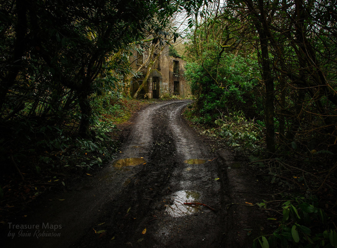  The photo (above) is of the chapel on the original driveway to the Plas, which was later occupied by the gardener, and last lived-in in the 1930s. It is a complex range of buildings having a complex history. The portion next door (to the right) has a very old cottage as its lower inside, with a new bit built on the front and over the top (1st floor). The back end of this (with a main door and porch opening onto the tramway) was the Talysarn Quarry main office. The part nearest the camera, which has the remains of the stained glass window, was indeed a private church for the Mansion for a while, then being converted into a back office. There was no church closer than Llanllyfni before the one at Talysarn (St John, 1871) and that was paid-for by John Robinson of Talysarn Hall. The east window is dedicated to his first wife, who died young in 1871. The house (and office?) were used by Dorothea quarrymen as a mess room & stores when work started to expand Dorothea into the Plas gardens after the war, but an arsonist saw the end of the place in the early 1950s . 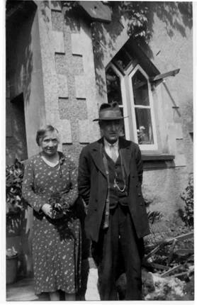 Above: The gardener and his good lady outside the “Chapel” , this must pre-date the 1930s. The windows are in remarkably good condition. Glen Cottage and the Forges Glen Cottage was the gatehouse for the hall, although nowadays it is submerged in boskage. It is connected to a series of workshops and forges called Ty r Efail and another ruin is all that is left of a large pump house for the Talysarn pit. Some views of Glen Cottage and one below left showing the forges and the building for the Pump. It looks a bit different now. Pump shaft superstructure is centre left. Prof. Gwynfor Pierce Jones tried to get Time Team interested because it was the site of very rare pump engine on edge of the pit, with a shaft originally inside the building, (a 'Bull Engine' like the 90-inch one at Kew) and also there were remains of an 1840s waterwheel possibly with former colliery-type wire-rope haulage in 8ft square tunnels...now all lost. Some modern day views inside Ty Efail... Prince and Corwen No account of Dorothea would be complete without a mention of the two celebrity horses, the last ones to haul slate from Pen yr Orsedd to the standard gauge station at Talysarn. Here below is Geoff Charles’ wonderful photo of the pair- 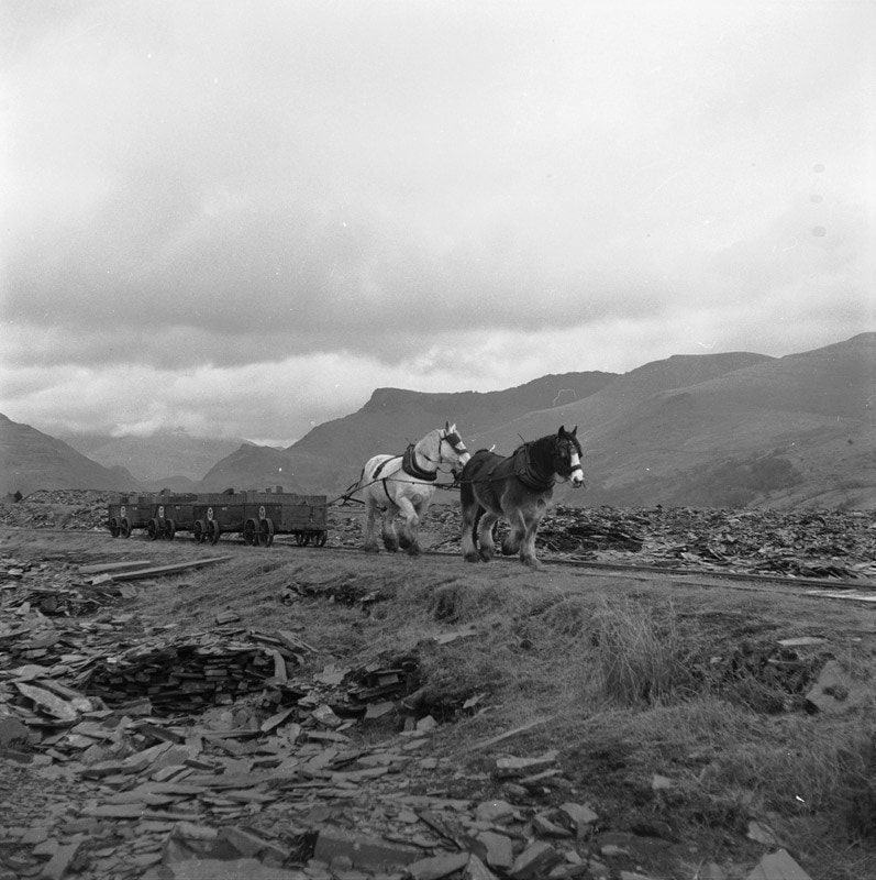 The dynamic duo are pulling a short run of wagons from Pen yr Orsedd along the lovely, airy length before Pen y Bryn. Mynydd Drws y Coed is in the background, with Yr Wyddfa under cloud. Corwen is the Mum- a white mare, while Prince is her son. Perhaps Tommy is behind Prince, but they were quite capable of doing the job by themselves. 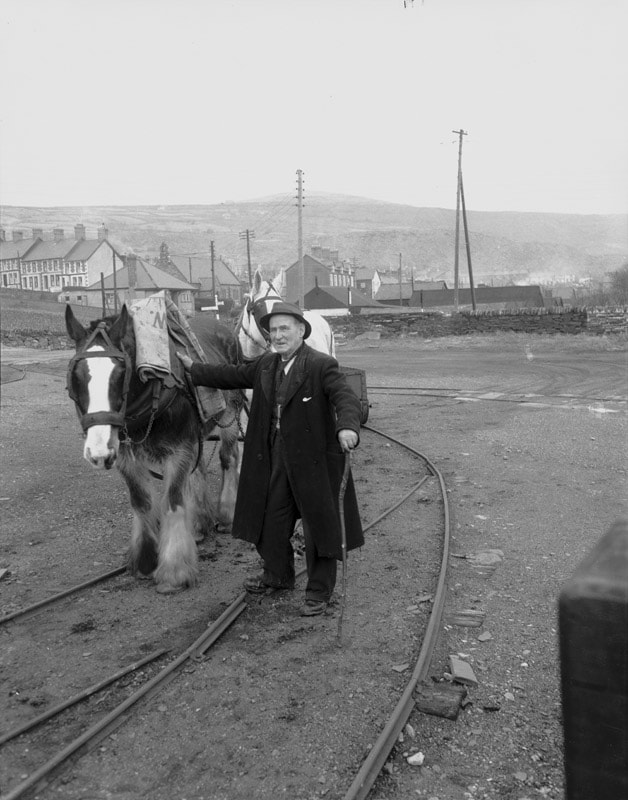 Geoff Charles' lovely shot of Oswald Jones with Prince and Corwen in Talysarn yard. He was the “owner” of the horses, but they were generally managed by Tommy “Run” -Thomas Williams (Thomas Williams 'y Ryn' = title for a journey of the horse train). 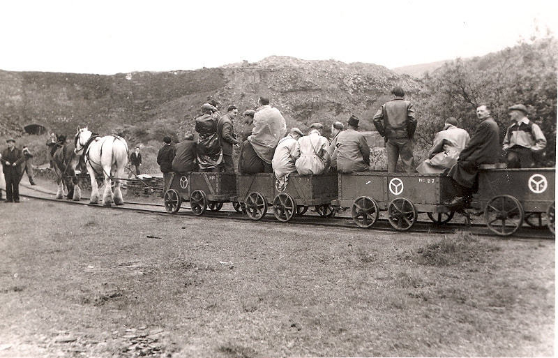 Here, the pair wait patiently in charge of a railway enthusiasts’ trip in 1958, stopped near Bont Fawr. A short while later, the pair were to run amok after having been given sugar cubes by a lady passenger. No harm was done! The waggons bear the Nantlle Railway symbol, designed to be recognised by workers who couldn’t read. Bits and Bobs Subjects that didn't quite fit... 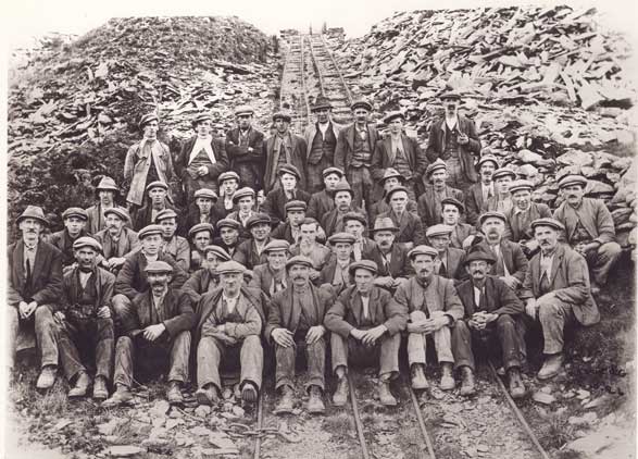 This is titled "Dorothea Quarrymen" but I don't recognise the incline... The day the road caved in to the Pit... In the photograph below, the road past the Plas is being mended after it fell into the pit Note the original road going round the outside of the wall was to the right - with the collapsed portion visible (it fell on the evening of 12 Jan 1924 just after a bus went by!). There is an emergency drainage culvert on it, to stop Dorothea being subjected to water influx from the land drainage that had been severed as well. The straight-through road is a temporary one made through the mansion gardens to await the building of the 'New Road' (the present B4418) opened on 1 March 1927 that was clear of the quarries. This photo is probably at the opening of the new temporary route. Wish I could read the notice though, and get a better look at that steam roller! 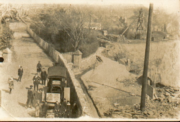 A wonderful biro sketch (below) by the late Prof. Gwynfor Pierce Jones, of Talysarn quarry. Glen Cottage is at the lower left. Stables and chapel etc at lower right. It must have been a very busy, noisy place. The drumhouses going up the John Robinson inclines are still there and there are vestiges of the two mills in the lower middle. A solitary chimney survives of the mill two levels above- everything else has gone. 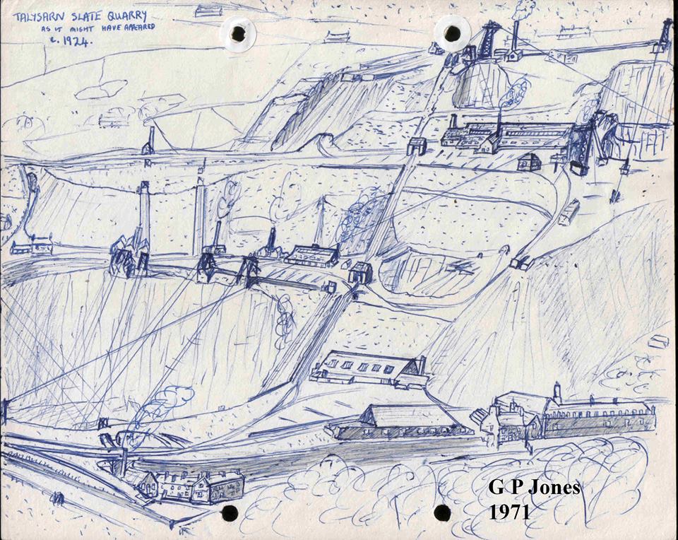 |
TracksReceive the occasional Treasure Maps Newsletter- and alerts when a new post is available!
If you enjoy my content, please buy me a coffee!
Check out my other online activity...
Index
All
|


 RSS Feed