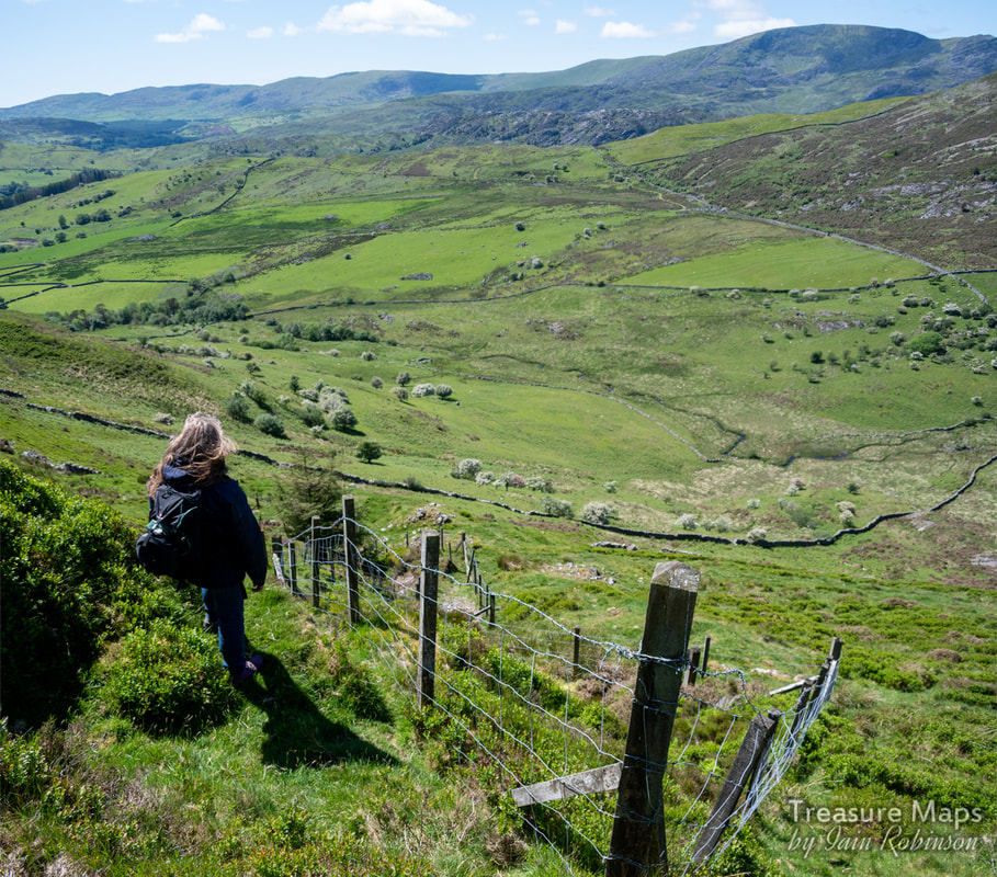
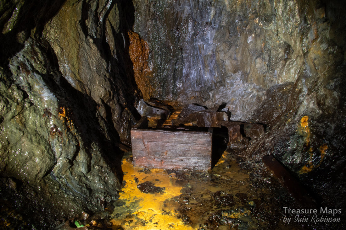
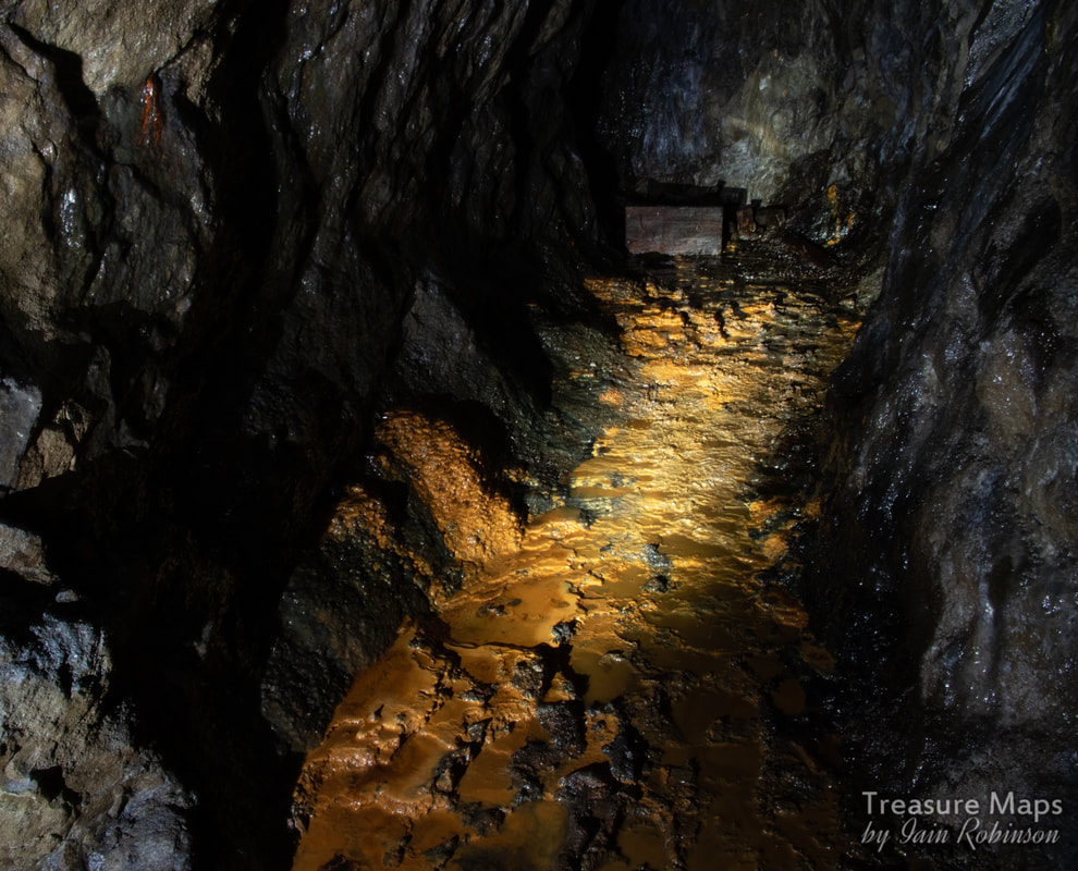
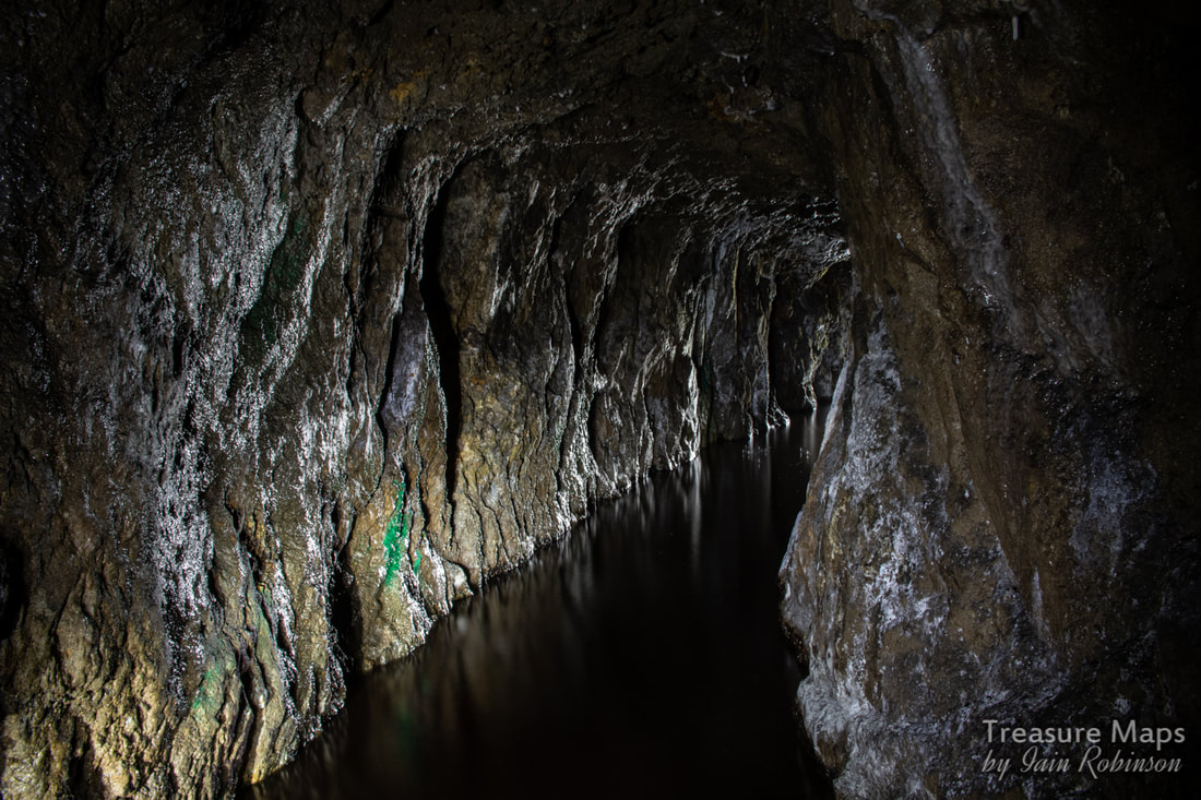
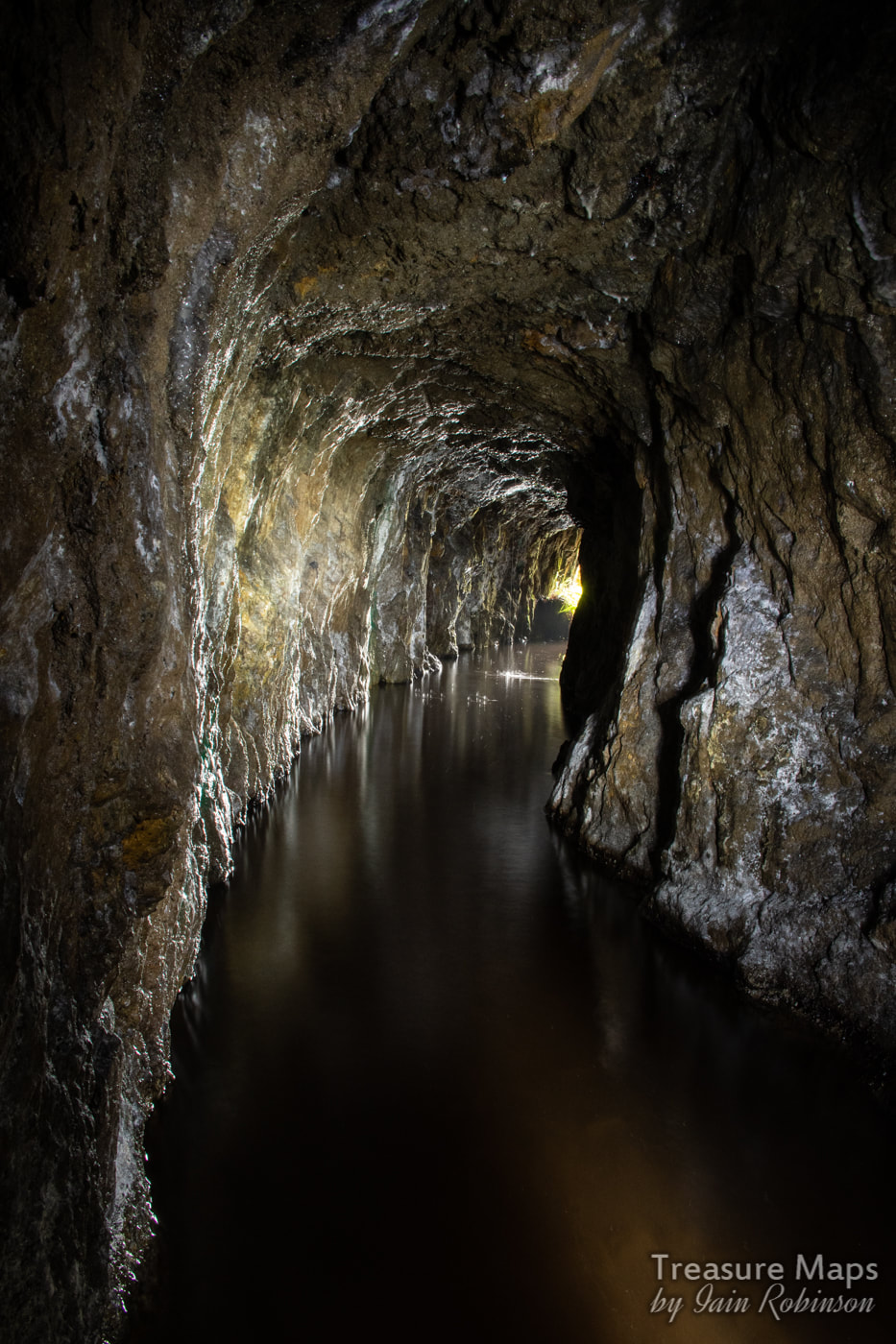
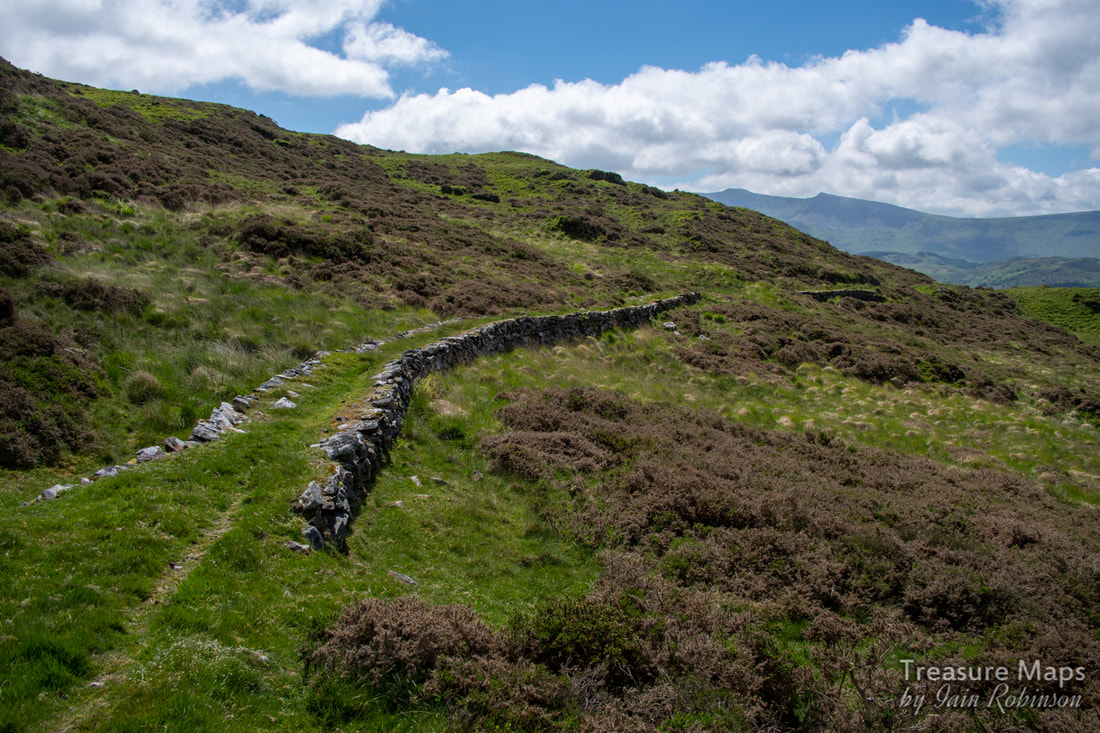
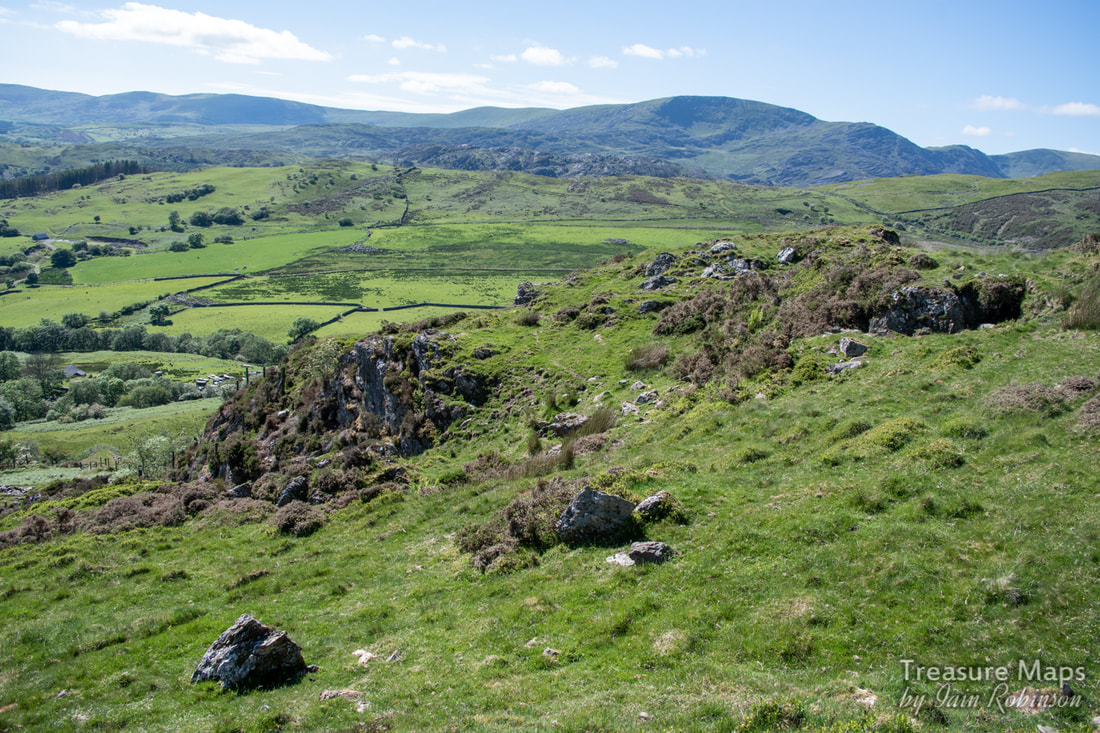
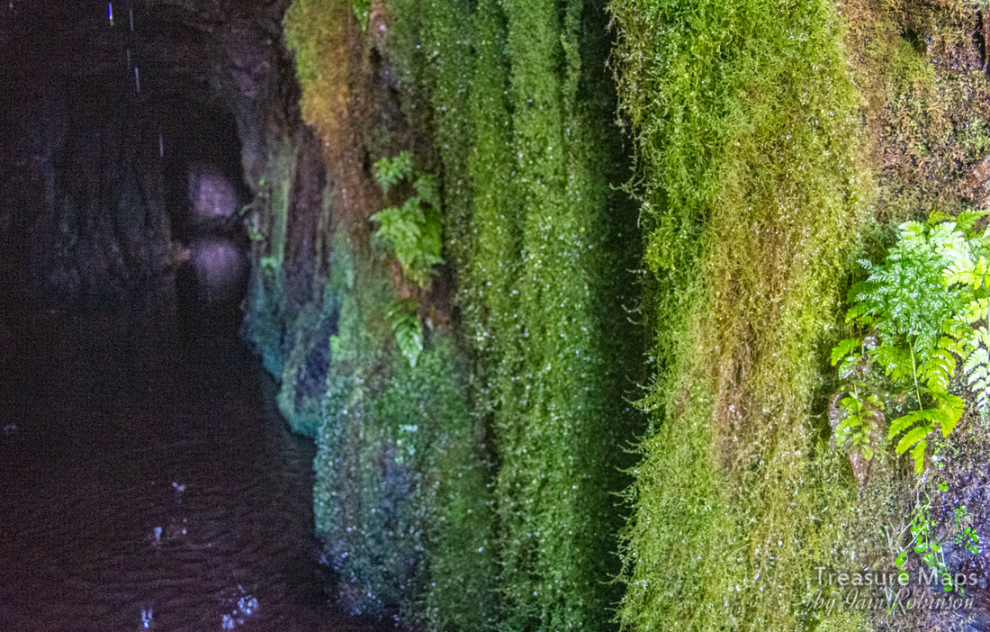
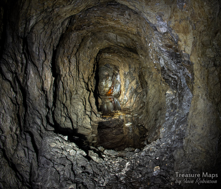
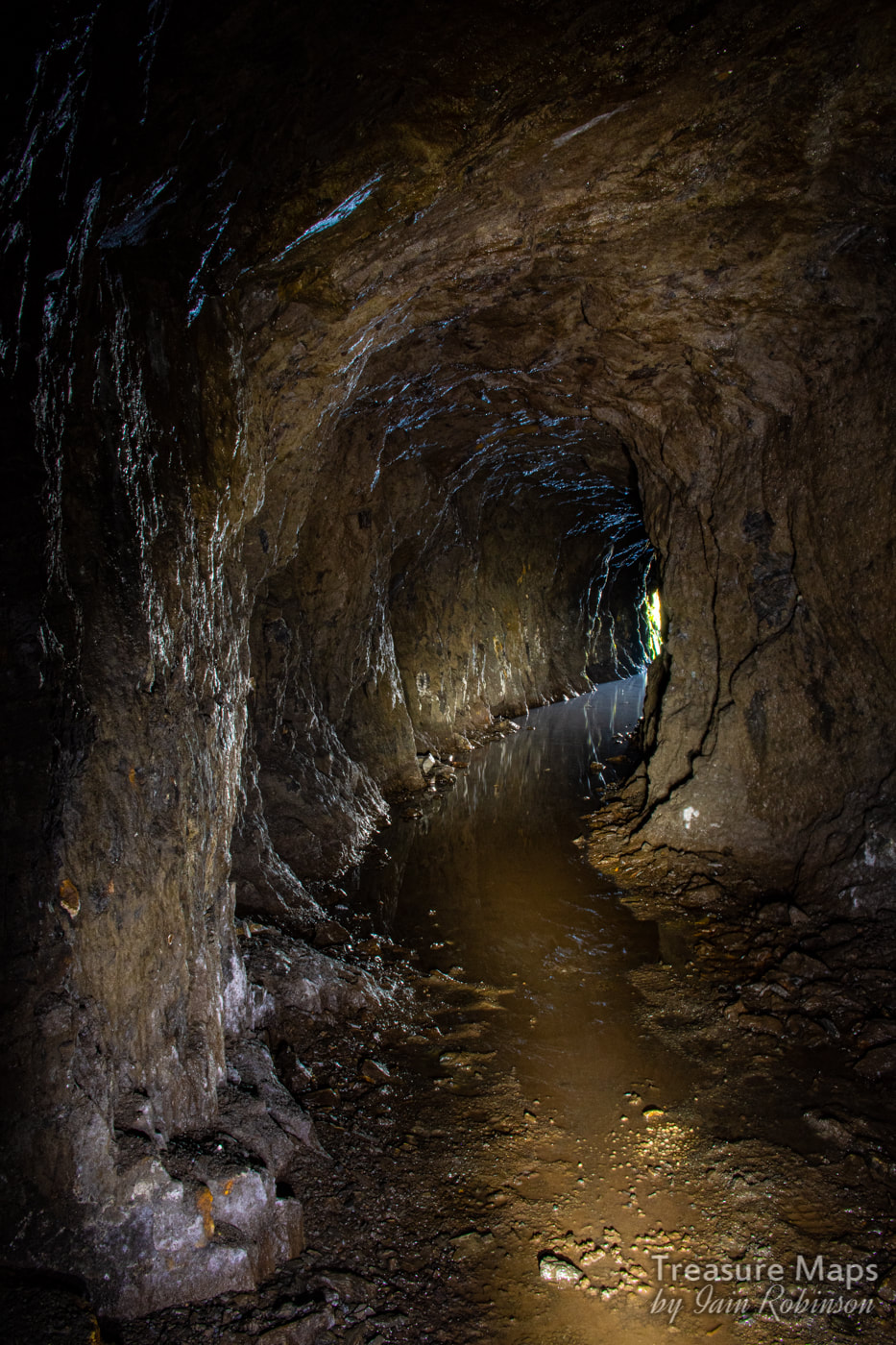
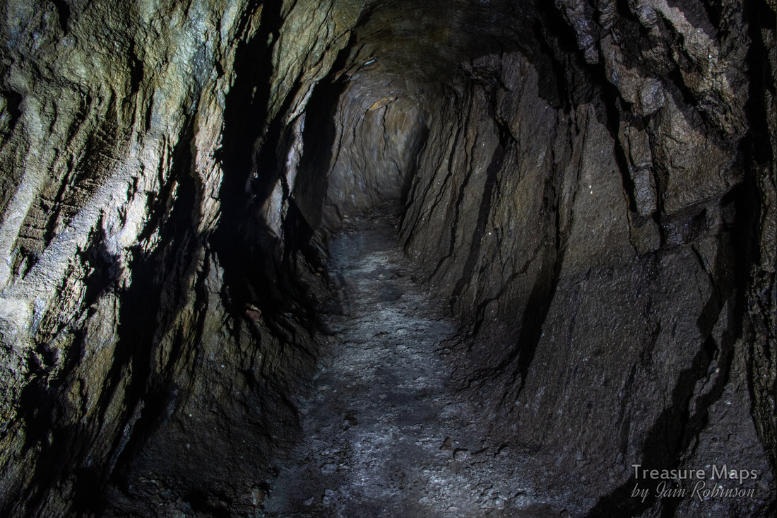
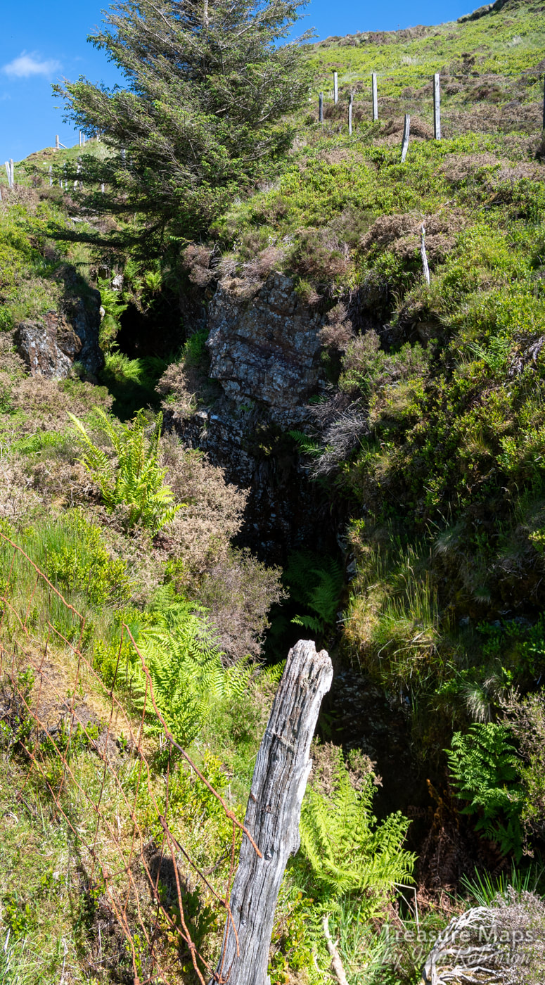
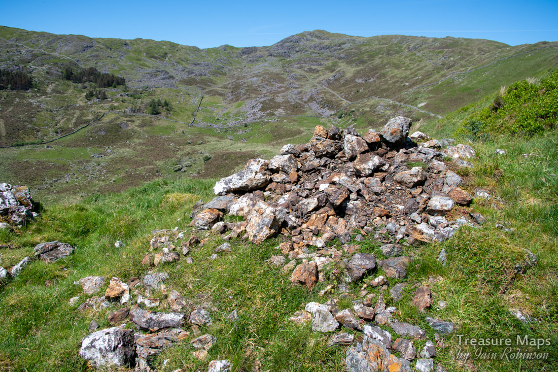
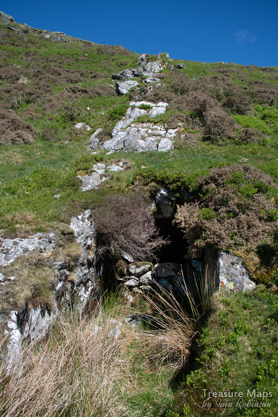
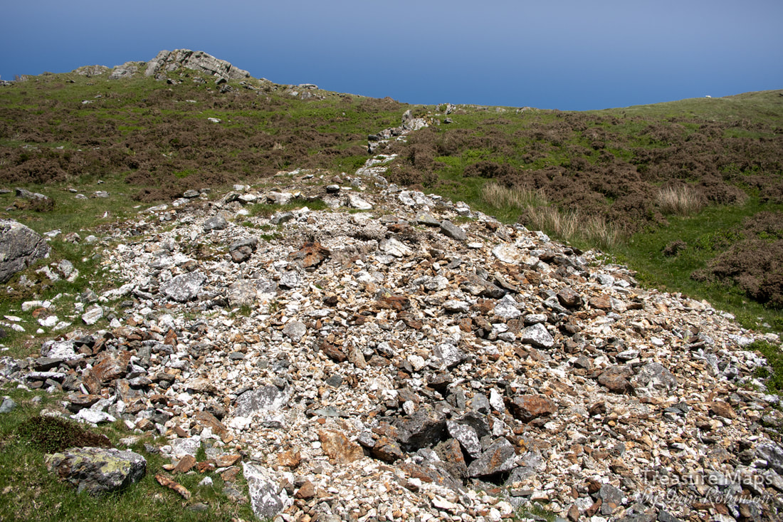
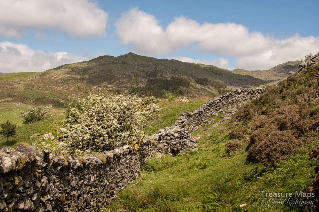
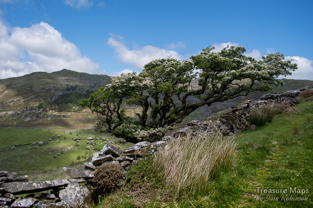
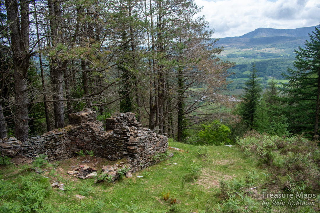
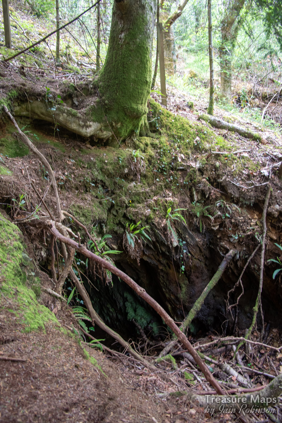
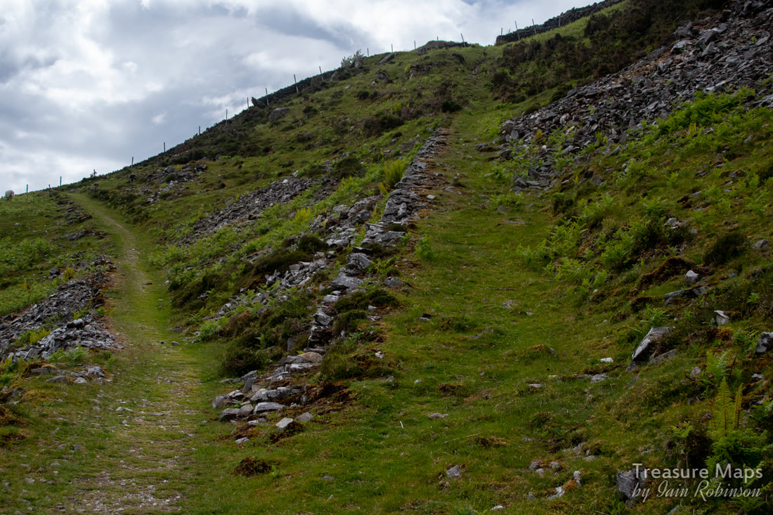
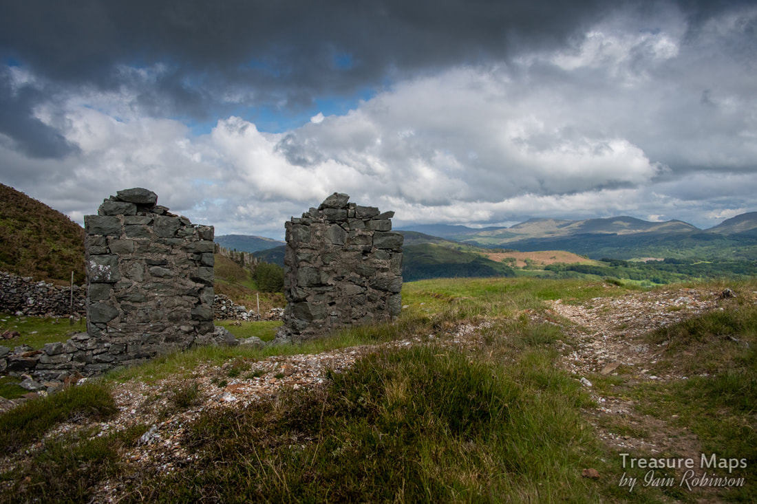
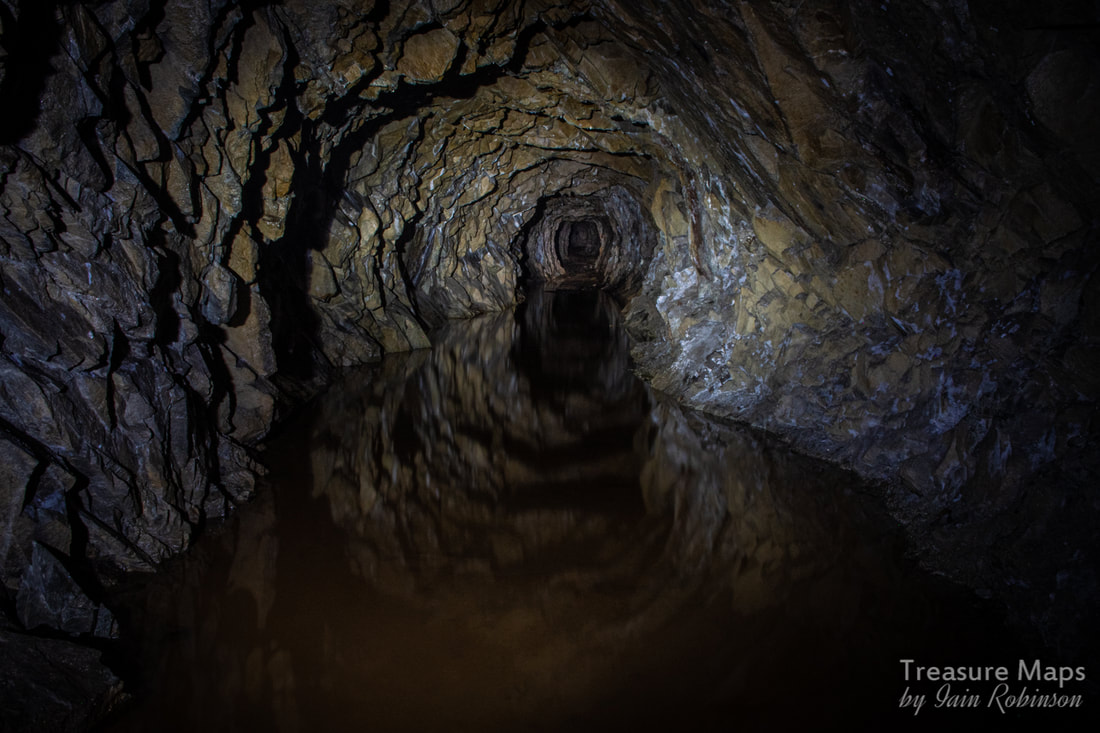
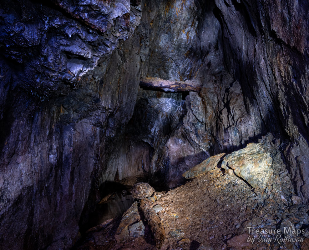
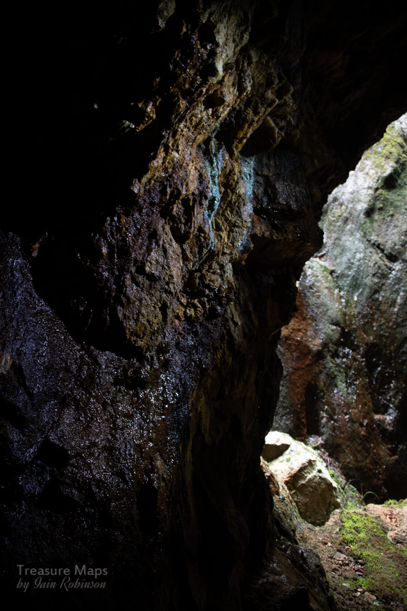
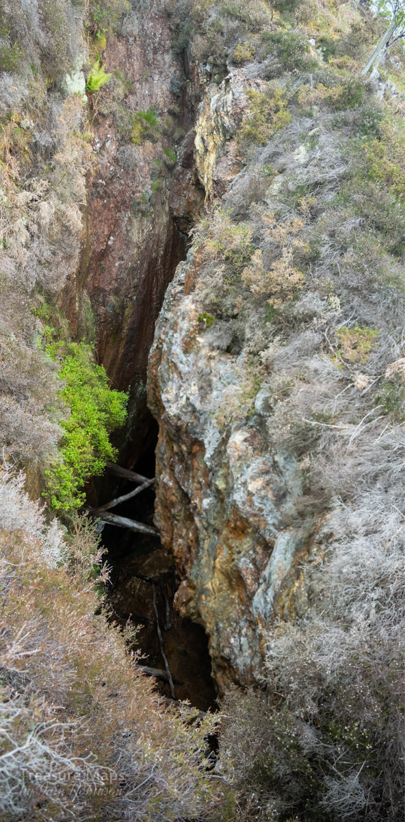
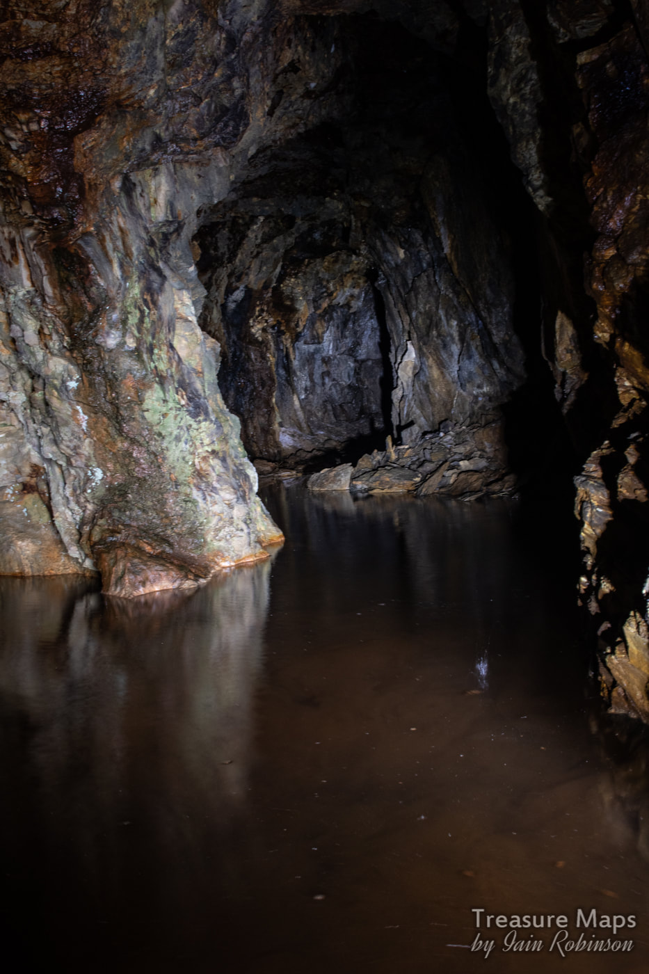
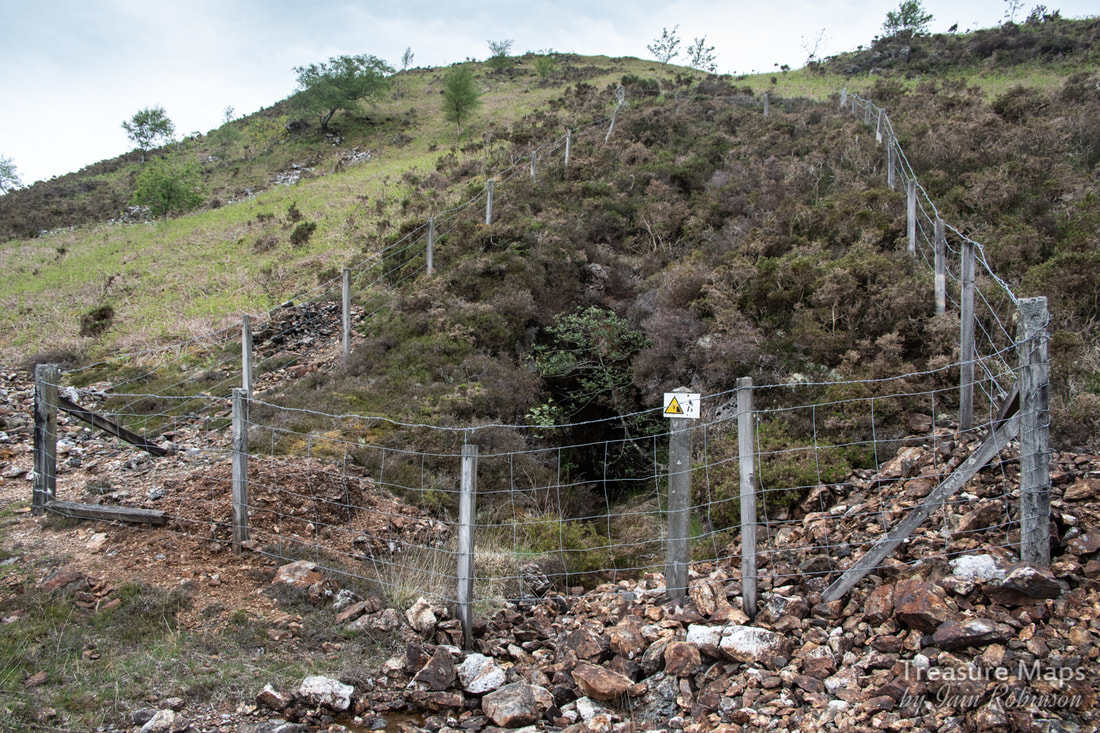
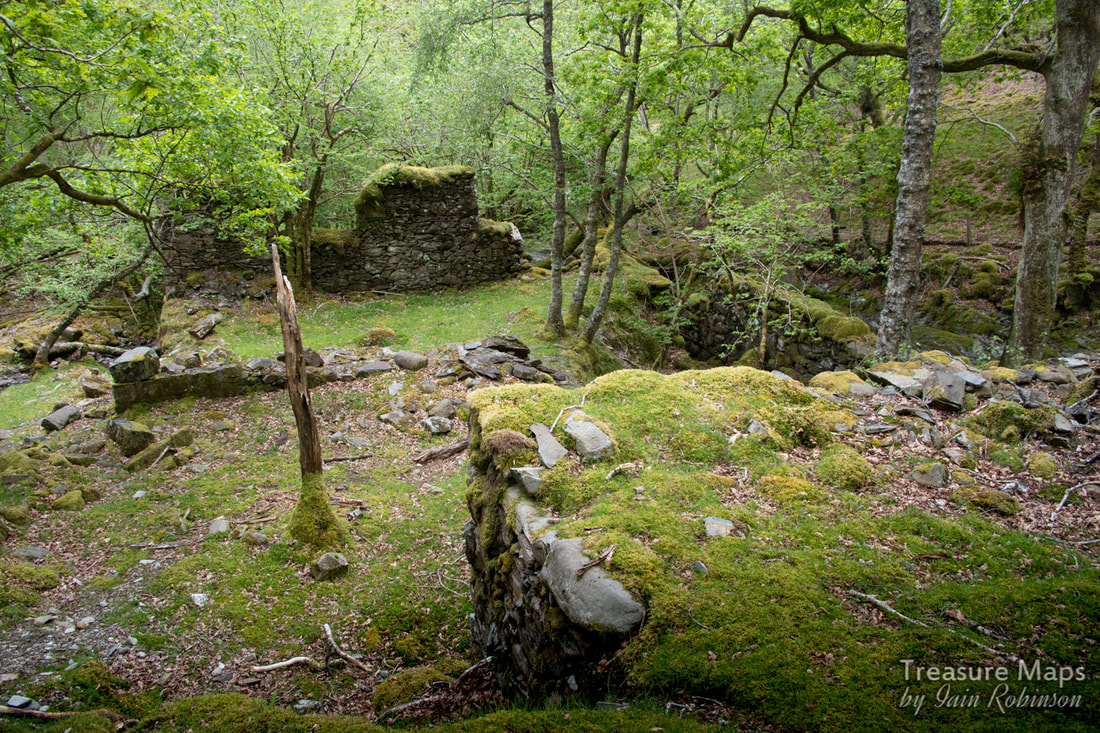
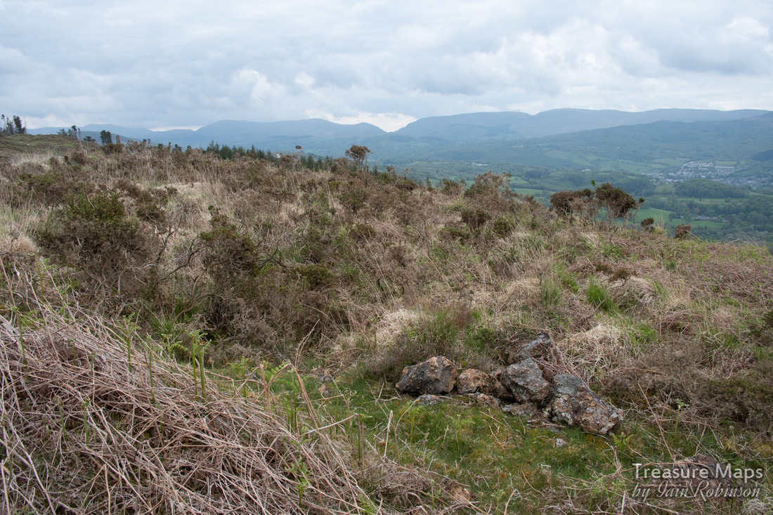
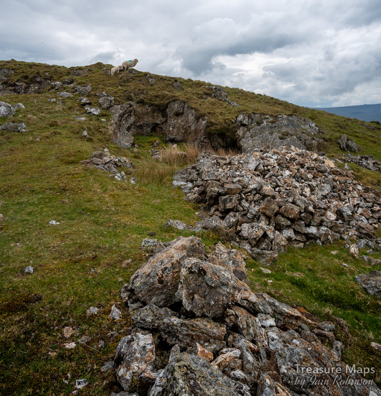
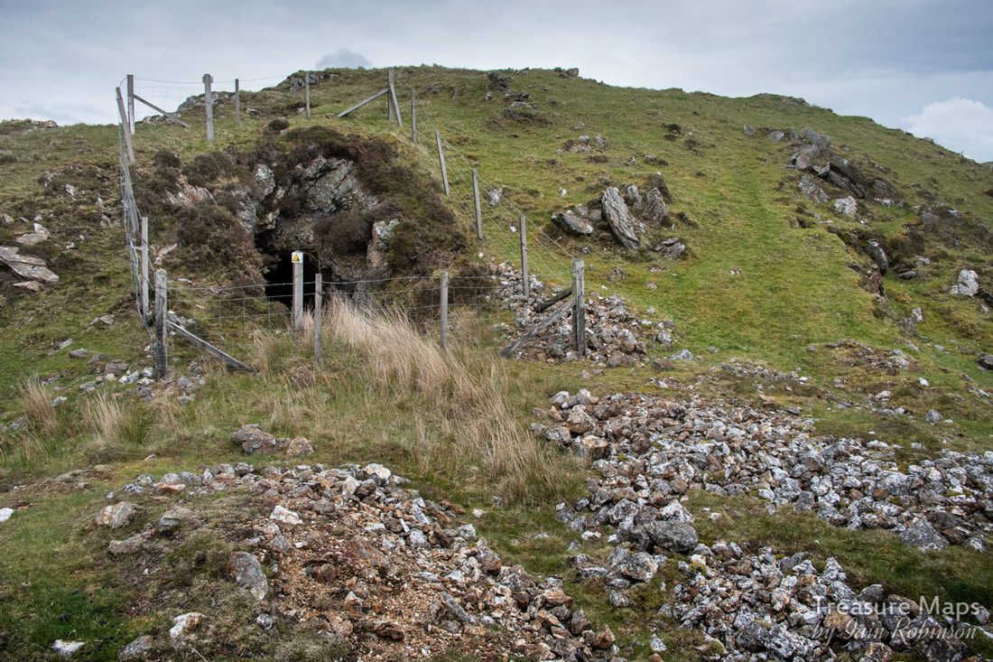
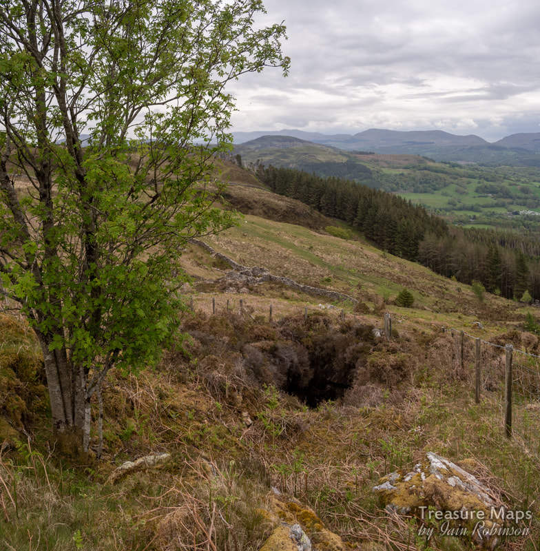
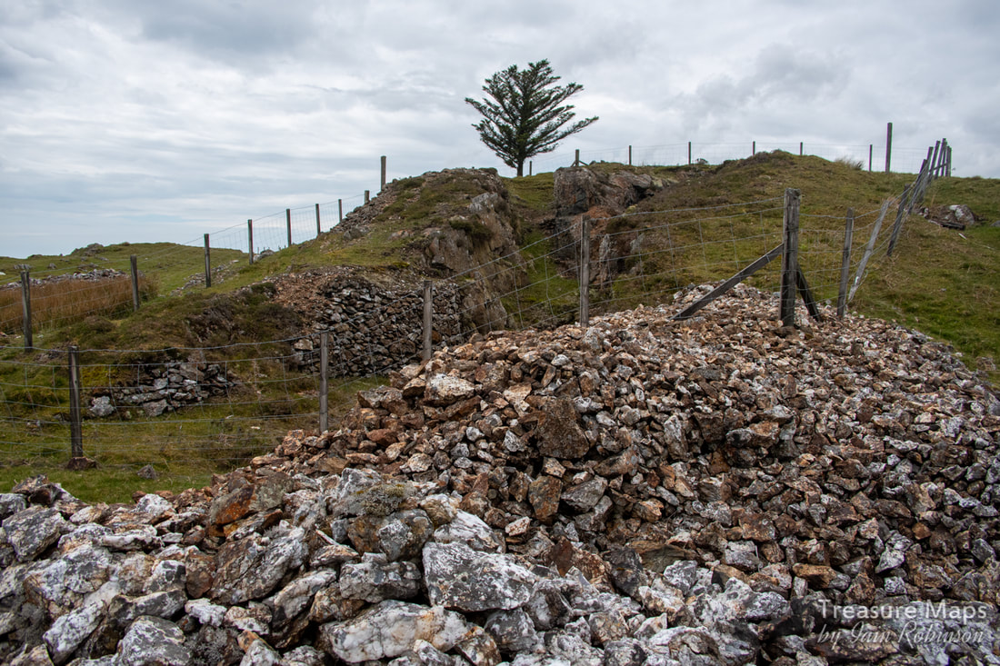
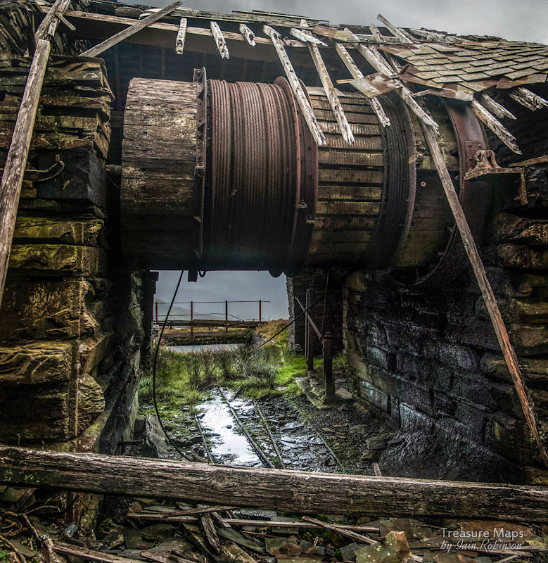
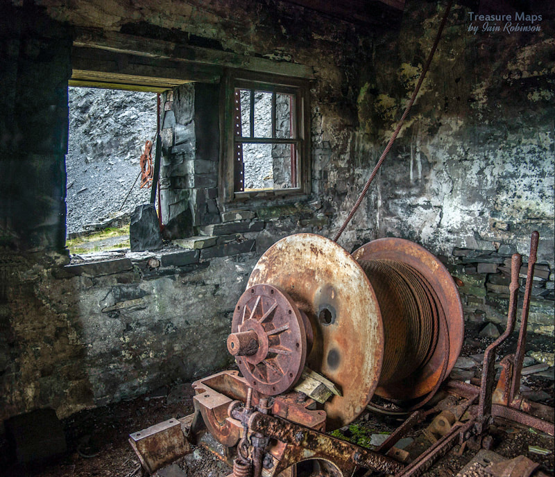
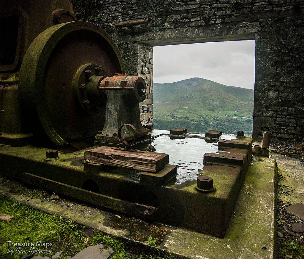
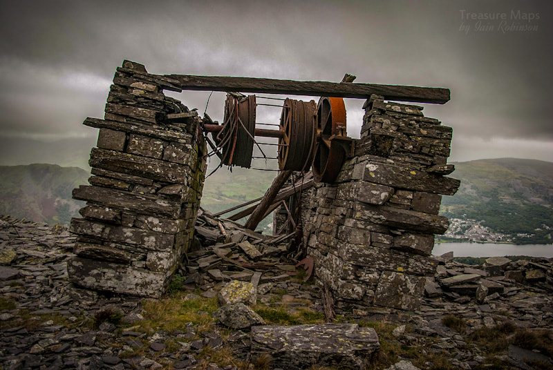
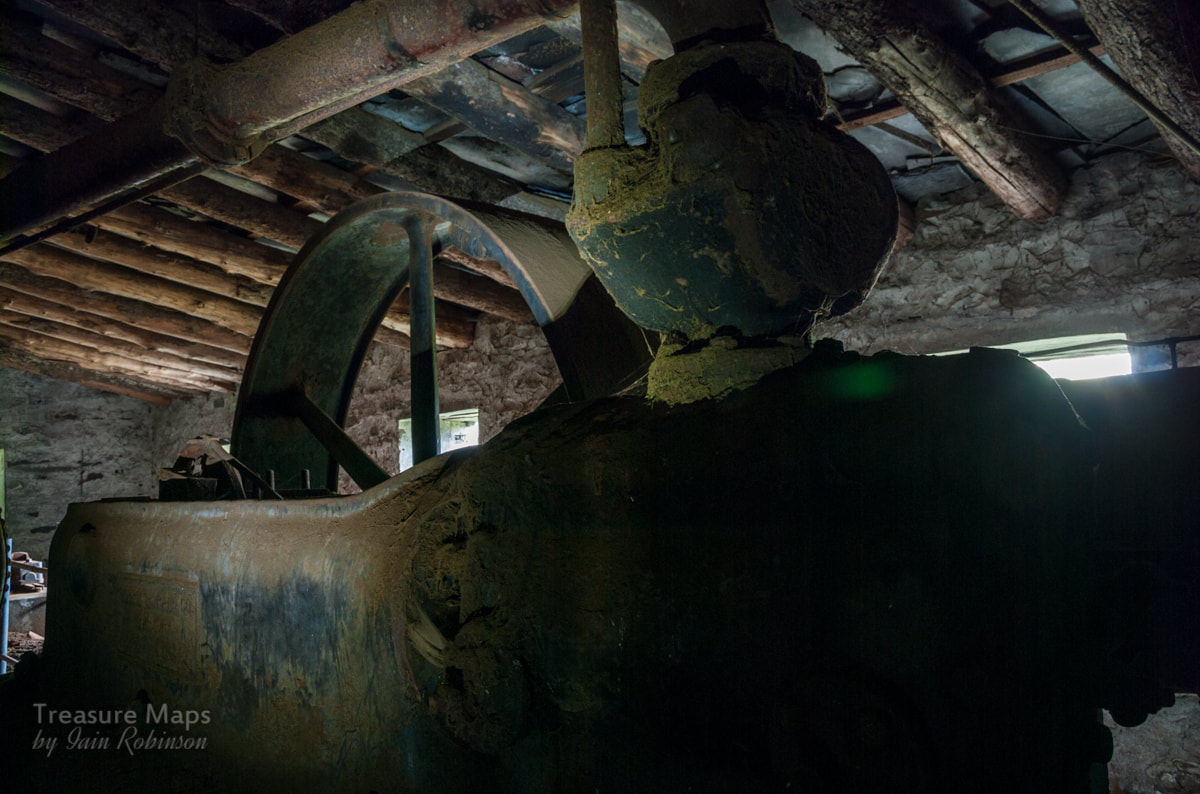
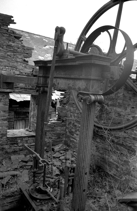
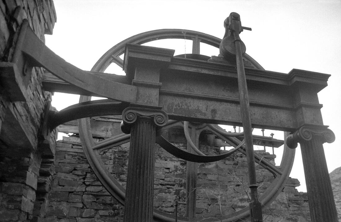
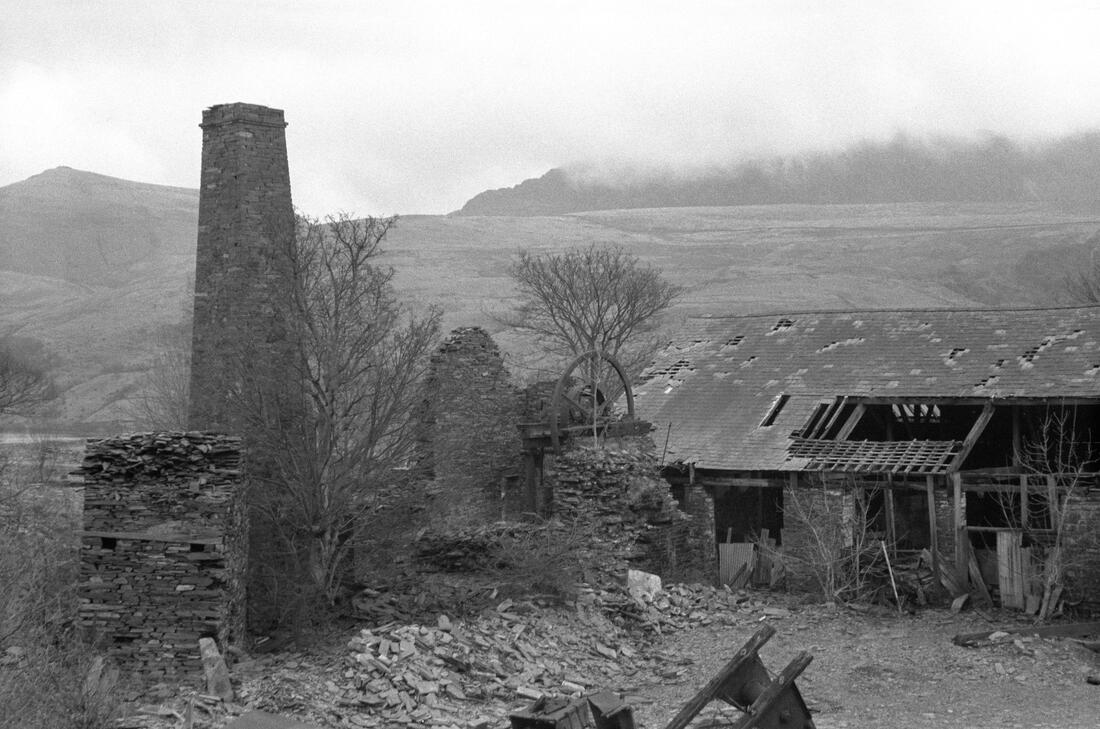
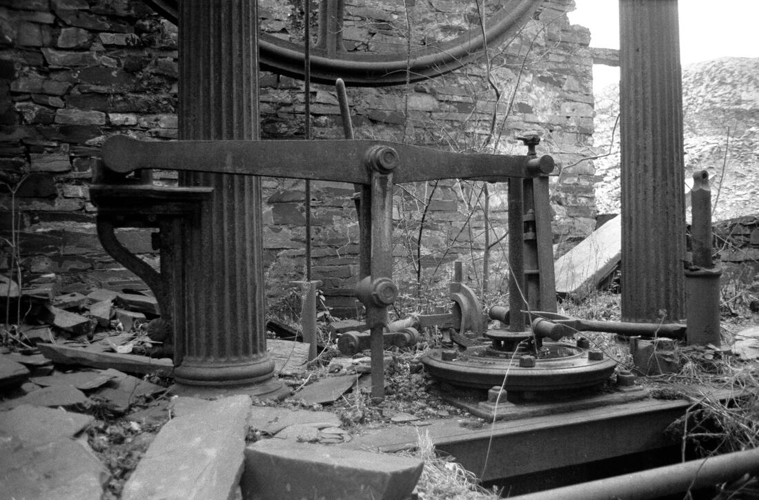
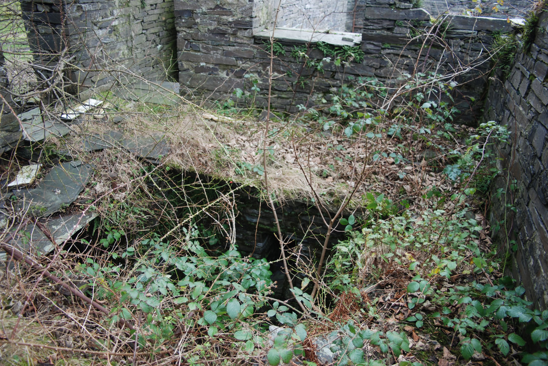
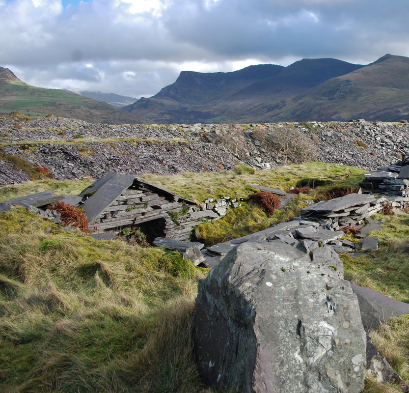
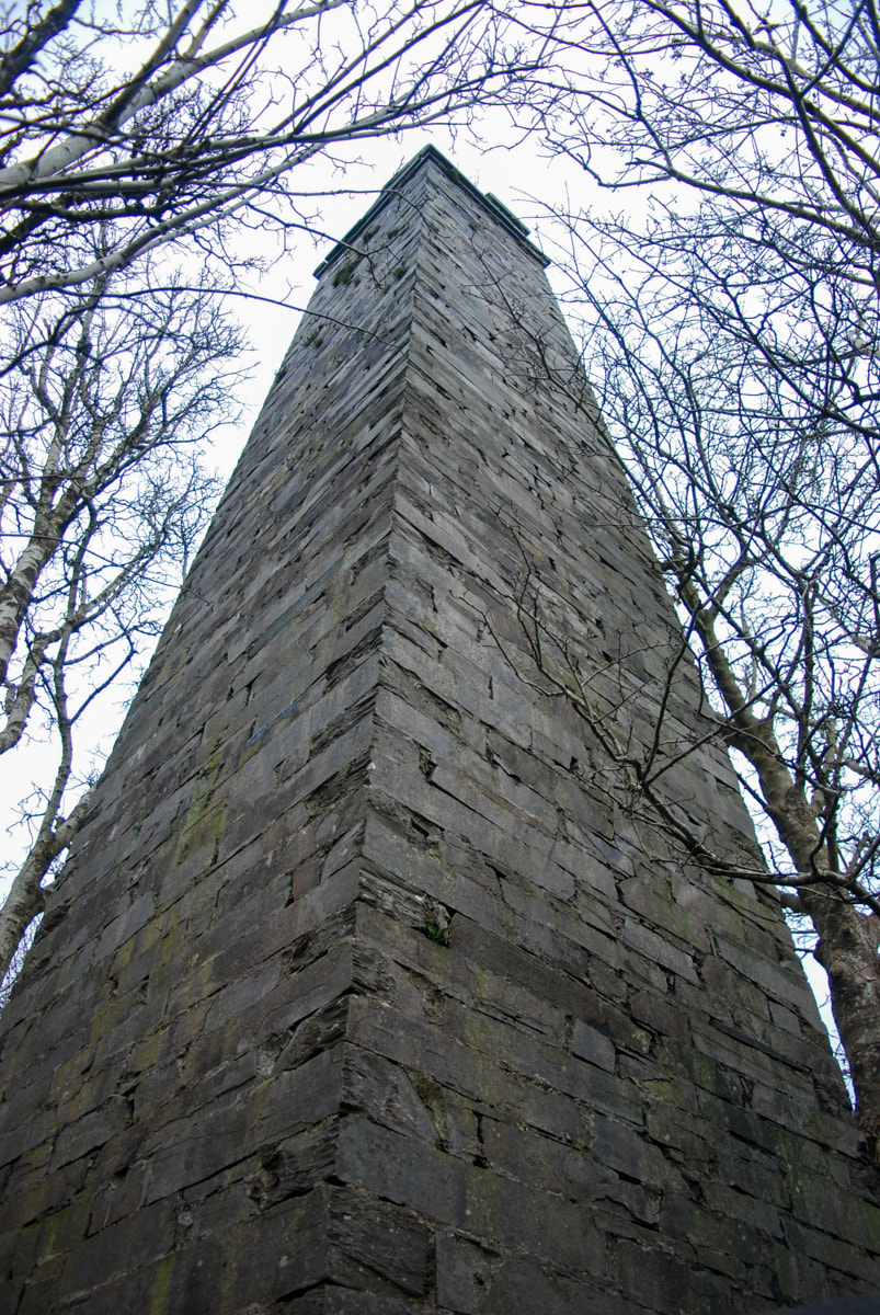
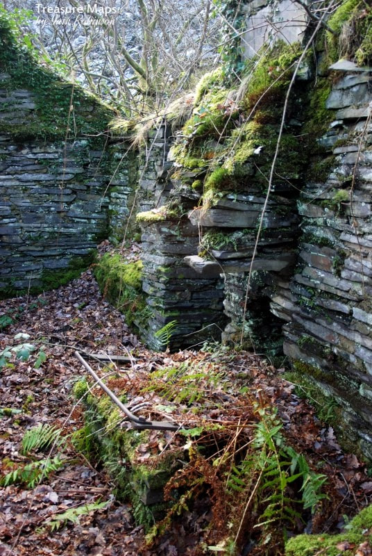
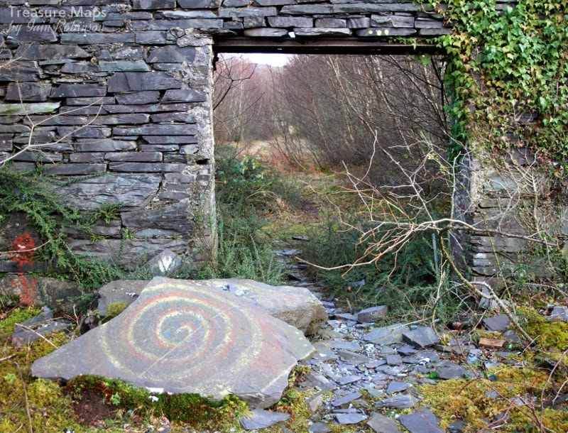
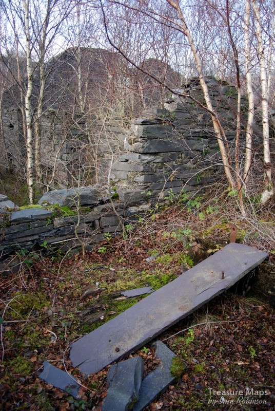
 Petra surveys the view from the top stope of the Cesailgwm uchaf trials. The Cesailgwm mines ticked all the boxes for me. The workings were sited in a lovely, lonely cwm, which became more beguiling as we walked up to the highest diggings on the West slope of Foel Ddu. We sat for quite a while there, listening to the skylarks and drinking in this idyllic place. Petra spotted another, higher working below Y Garn and of course, we climbed up to that too; it felt even more remote and still. I gazed at the spoil, basically all quartz, and wondered about the men who made the workings which occur like a rash on the mountains here. It's almost as if they were possessed with the idea of finding gold. I wondered what they ate, where they slept and whether they were paid. 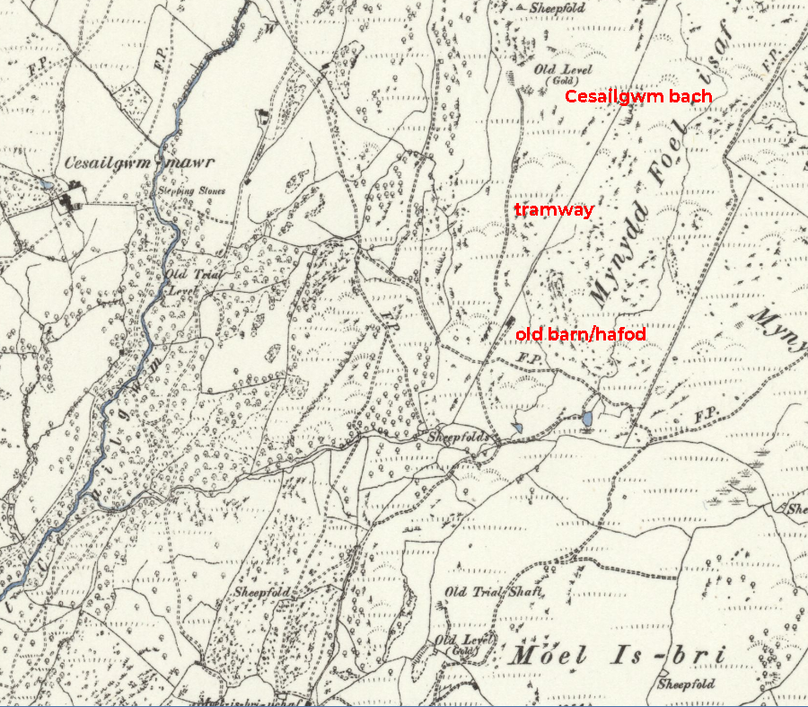 1880 Ordnance map of the Cesailgwm Bach trial. Used by kind permission of National Library of Scotland. We started with the Cesailgwm Bach mine, as Wilkinson calls it. An intriguing working which follows a vein of what the miners were hoping was auriferous quartz up the side of Foel Ddu. It starts as little scrapes in the ground at the top, gradually becoming more determined as things progress down the slope. Just how determined the miners were can be seen on the Zoom satellite view below, where you can see the little diggings all over the hill. 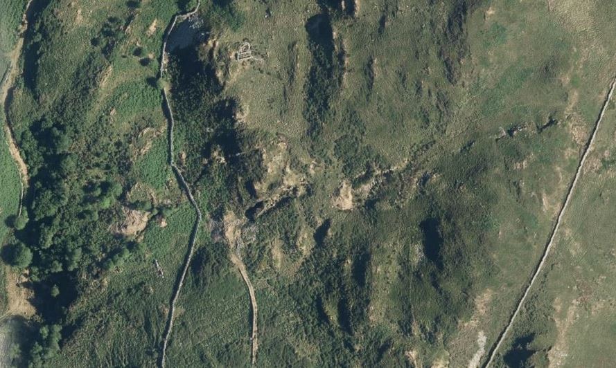 The Zoom Earth view. You can see the vein being chased all the way up to the top of the ridge by the wall. A cart road approaches the mine, revetted and levelled. At first I thought it might be a tramway, but it takes a turn near the boundary wall and dives down, curving towards the valley at a steep gradient...so perhaps not. 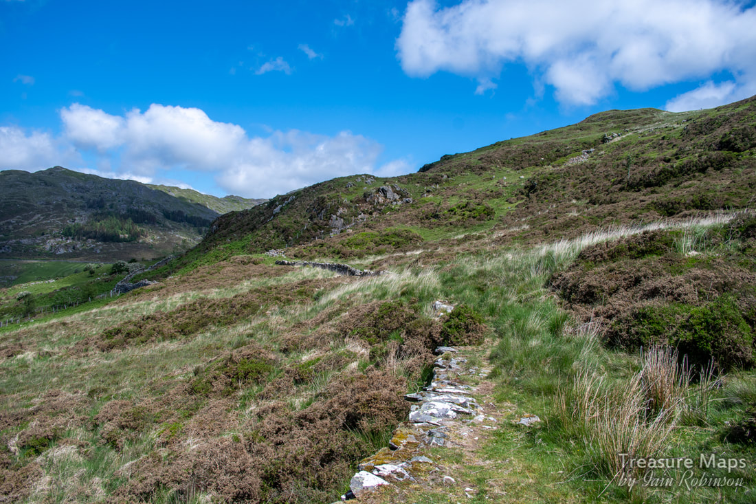 Looking north on the cartroad. The mine is on the ridge in the middle, going left to right uphill. 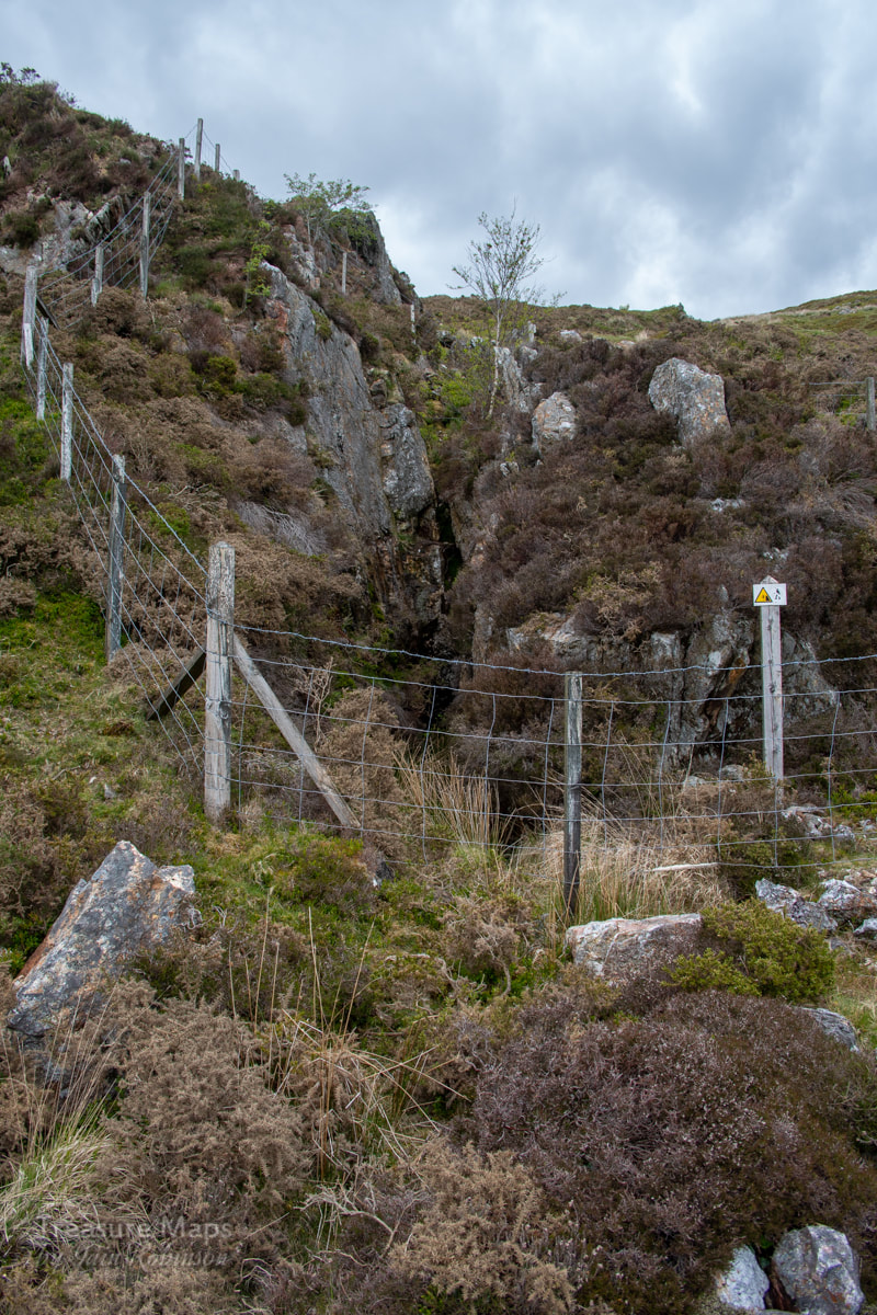 The opencut...an adit lurks... There were two adits- neither looked very encouraging, but we tried the one nearest to the revetted cart road. Looking more like a stope than anything, the cutting did a jink to the right, and then- a dank looking portal appeared. We were in business! The adit was wet, up to knee height, although it dried out further in. All adits are driven with a slope to drain them and to make tramming rock out just that little bit easier. The tunnel jinked and passed several attempts at crosscuts, all abandoned. Eventually the drive ended in a forehead. To our surprise, there was a gunpowder box and a small box for fuses sitting in a pool of iron run-off. I really hadn't expected to be able to access the workings, so this was a treat, even if the water was freezing. I am convinced that there must have been a tramway inside the adit, even if the causeway was simply a cart track. The lumps of rock sitting on the tip outside couldn't have been carried easily by men, or even a mule. 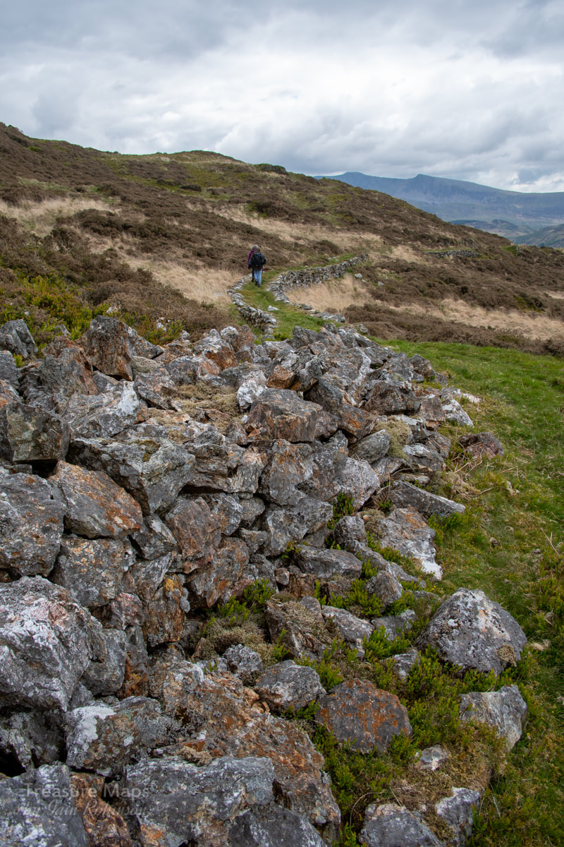 Rocks piled up by the adit. The revetted causeway goes off south in the distance. The adit below looks worthy of study- we didn't explore it because of the difficulty of getting over the wall, which looks as if it might be damaged by us climbing over it. The farm of Cesialgwm bach is below- there were some mines close to the farm which are supposed to have been connected to the Borth Company's mill by aerial ropeway. (post here). There's not much to see down there, apart from an extensive collection of abandoned cars and agricultural equipment. I note on AditNow that Britten Pans were found near the farm in the eighties, but they have disappeared now. Strange, since they seem to have saved everything else! 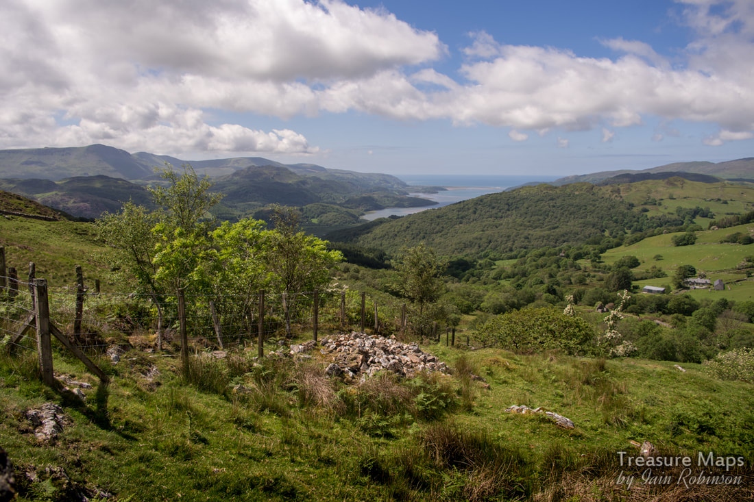 An adit with a view- the lower adit. After we'd savoured the atmosphere of the Cesailgwm bach mine, we moved on towards the trials in the north. I'm not sure they are part of the Cesailgwm operation, there is absolutely no record of them, but I'm going to call the trials "Cesailgwm Uchaf". We kept to the wall, climbing steadily until we met a cart road coming down from Mynydd Foel Isaf...it's a relatively modern track and doesn't appear on the old pre-1940 maps. This went towards the mine, which we could now see stretched for a fair way up the hillside. 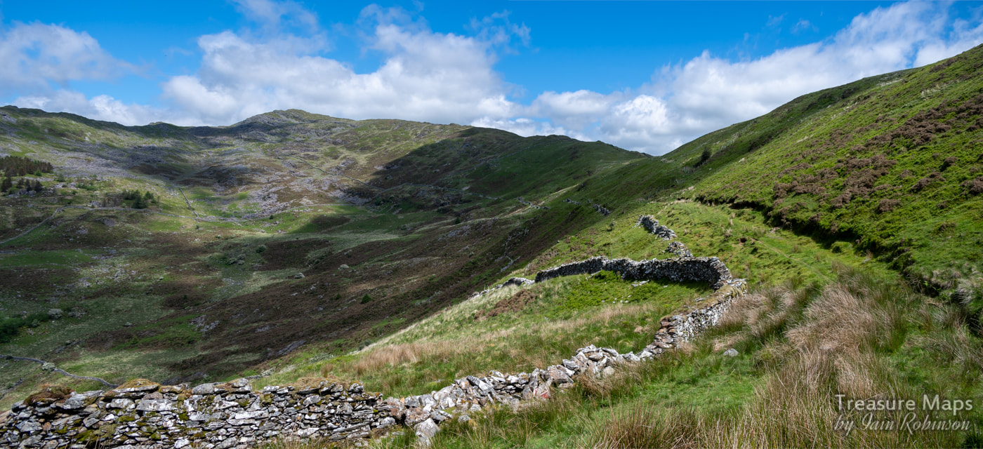 Our first view of the mine, which follows the line of the shadow on the hillside. 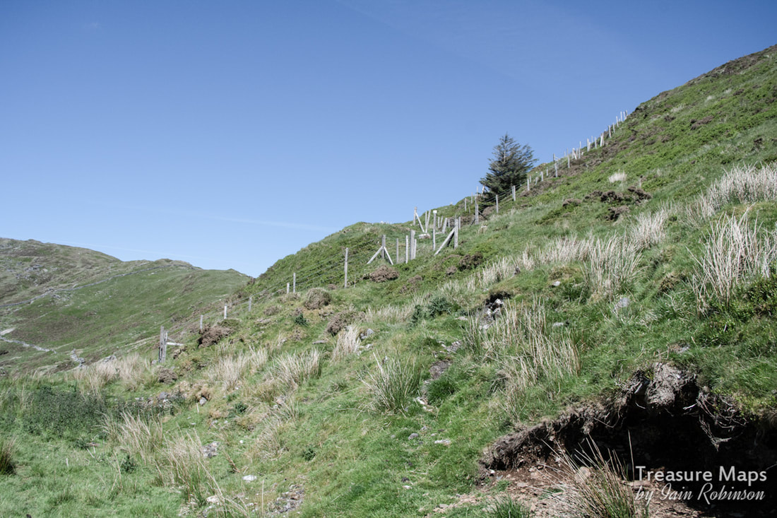 Looking up from the trackway...adits and stoping continue up the hillside. We looked at the adit next to the track...it went in for no more than a couple of metres. Then Petra set off downhill to a fenced digging below the track. It was quite a steep slope, so I stayed behind nursing my aching knees, a product of too much running and Munro bashing in my youth. I was nevertheless delighted when she cried "You should see this!" 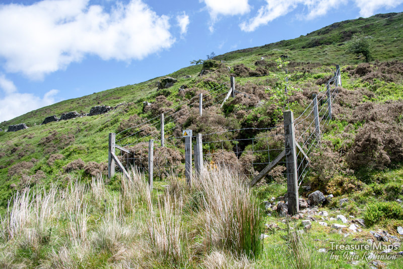 The adit below the track... On the way down, I noticed a much earlier digging, it's opencut and tips grassed over, before I reached the level Petra was looking at. Once I saw what the adit beside Petra looked like, I deployed the trusty tarp, covering the barbed wire and enabling us to climb over without injury. The adit was a long (and wet) one, easily 400 metres, but twisting and turning. Again, I had the feeling that there was a determined search for the lode going on. It eventually dried out just before the forehead. At one point, there was a hanging wall of rock, what in slate mines is called a "bon". Here it represented gangue rock. Quartz veining was encountered, but to my untutored eyes, there was nothing that spoke of gold. The interesting feature of this adit was that there were no footsteps in it; we were the first visitors for a very long time. That felt good. We came out into the warmth and light again and spotted a further adit downhill- after we'd taken all the wetsocks and gear off, of course. It was over a wall and in a patch of bracken and gorse...at which point our resolve failed us, and we decided to go for the metaphorically low hanging fruit above us. 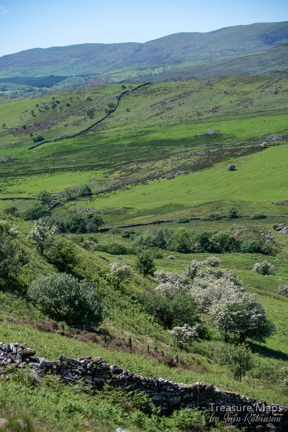 The lowest adit...not encouraging, but you never know...That's Cwm Mynach in the distance, over the first ridge. We climbed up to the other diggings on the hill. The first was a stope, a lengthy opening with stulls visible in the depths below. I had hoped that one of the adits would have opened out into this, but it was not to be, sadly. 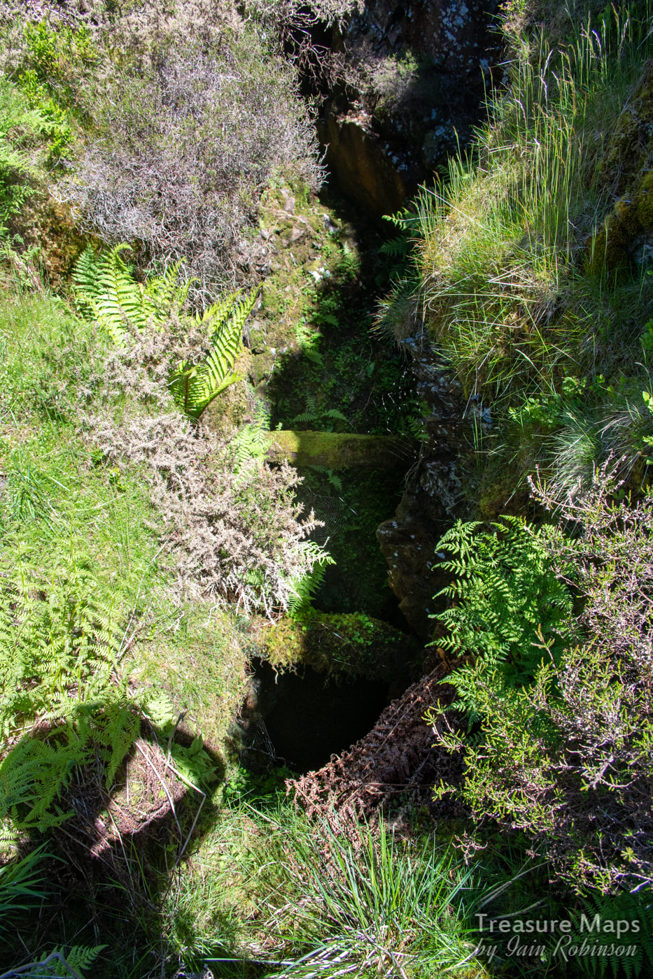 The stulls were easy to see by eye, but difficult to show in a photo...you can just make them out... 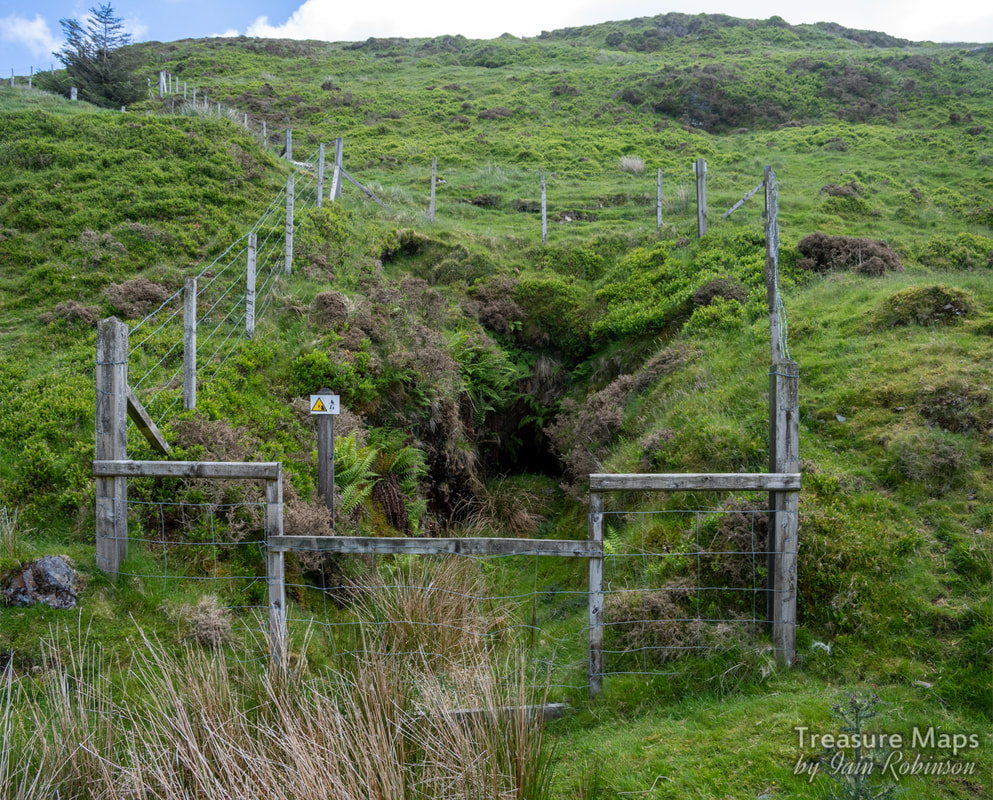 The adit next to the trackway. Once we'd reached the top adit (only a very short one) we paused for more refreshment- it was a very hot day by now. As we enjoyed our food, Petra's keen eyes caught something that looked like a mine in the distance- so off we went again! It was on the slopes of Foel Ddu, within shouting distance of the headwall of the cwm, and as we walked closer, we could see that it was at the base of a sizeable outcropping of quartz. It was only a short trial and is not marked on any maps. But the tips proved that the miners were looking for gold; there were flecks of fool's gold in several chunks of quartz that I picked up. After raking the tips for any nice samples, we reluctantly turned back along the spine of Foel Ddu. Near the ridge, more diggings appeared, as frequent as every twenty metres apart. Each digging would have taken a day or so and represented a huge effort. It reminded me of the trials above the Gamallt mines, although those were for lead. Getting to the mines: Of course, there's no easy way to get to the Cesialgwm trials. We usually set off from the car park at the western end of the New Precipice Path, although it still requires quite a bit of climbing- tiring with a rucksac carrying a camera, tripod, helmet, lamps, mine exploration gear...and lunch! You go immediately uphill along an old cart track, keeping the rocky screes and tips of Mynydd Foel Isaf to your right. You come to a wall, with a lake in view on the moor a quarter of a mile away. Take the left hand branch over a stile. Now the track meanders through gorse and heather, past a cute little Llyn. An old ruined hafod can be seen in the distance and a couple of suspicious diggings on the heathery hillside, marked on the old 1880 map as "trials". Once at the hafod, go left along the wall and cross over the stile. This wall is the spine wall which marches over the ridge between Foel Ddu and Mynydd Foel Isaf. The track becomes more definite now and soon turns into a revetted way. Pretty soon, you can see the workings on the hillside ahead. The Factoids: Very few, I'm afraid, and what I have is culled from Jeremy Wilkinson's Gazetteer. 1900–1903 St David’s Mining Development Co Ltd Operator 1903 Isaacs, J Mine Agent 1904–1905 Roberts, Thomas H Mine Agent 1904–1905 Roberts, Thomas H Operator The Cesailgwm bach trials appear on the 1880 OS as "Old Levels (gold)", suggesting perhaps that they were started much earlier than 1900. A note on pronunciation: The "C" in Cesailgwm is pronounced as in "Cat". I'm told locals abbreviate the name to "silcoom". Above: a couple of nice shots of Hawthorn bushes in blossom on the way up to the trials.
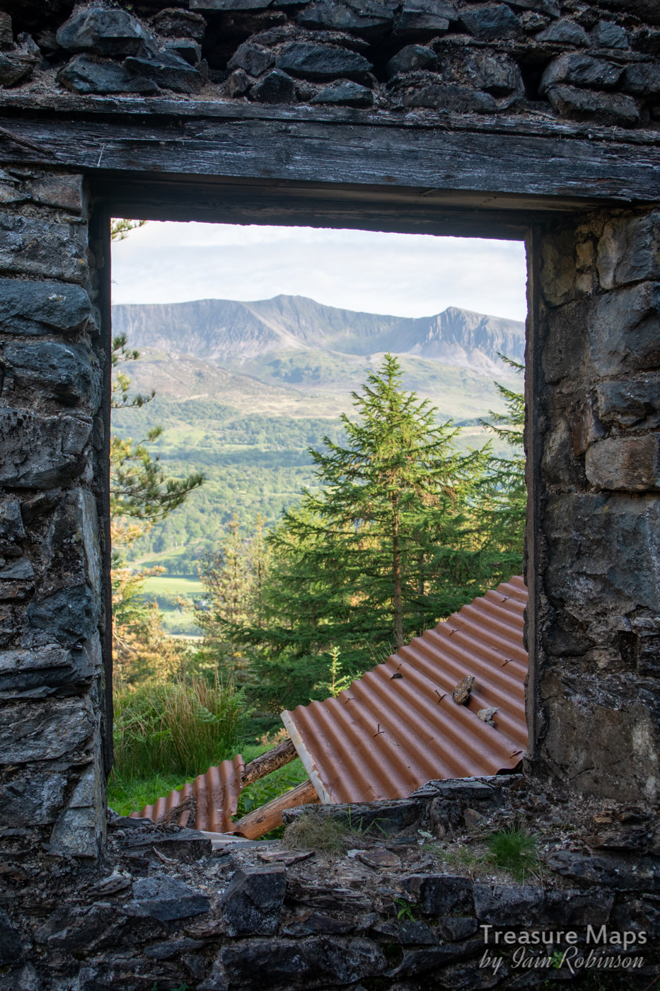
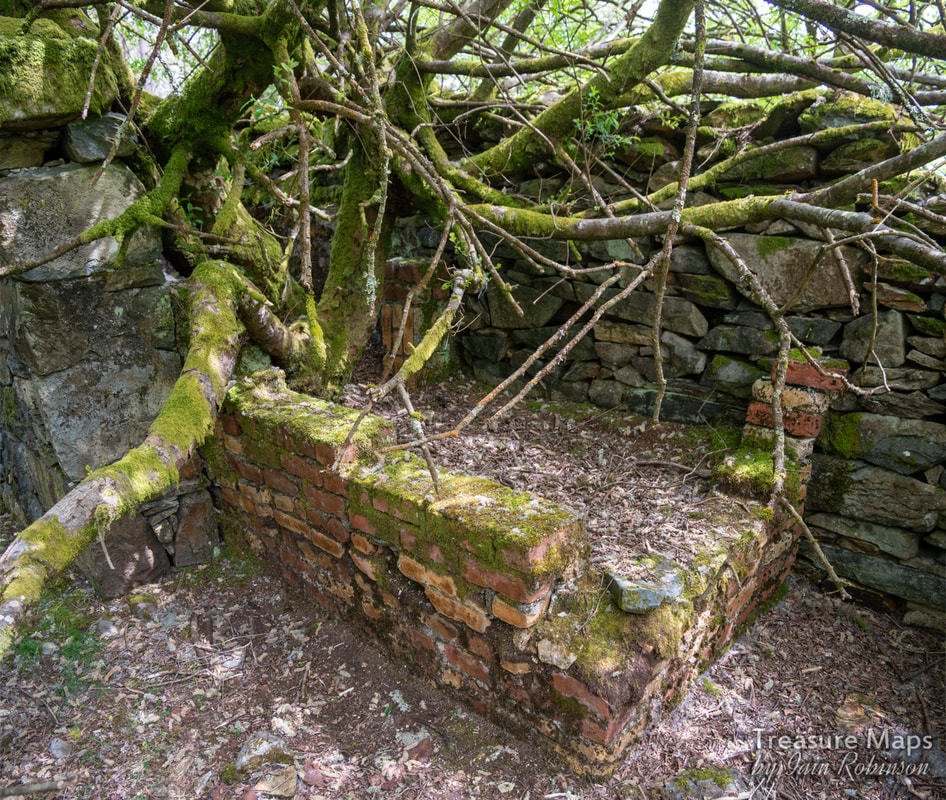
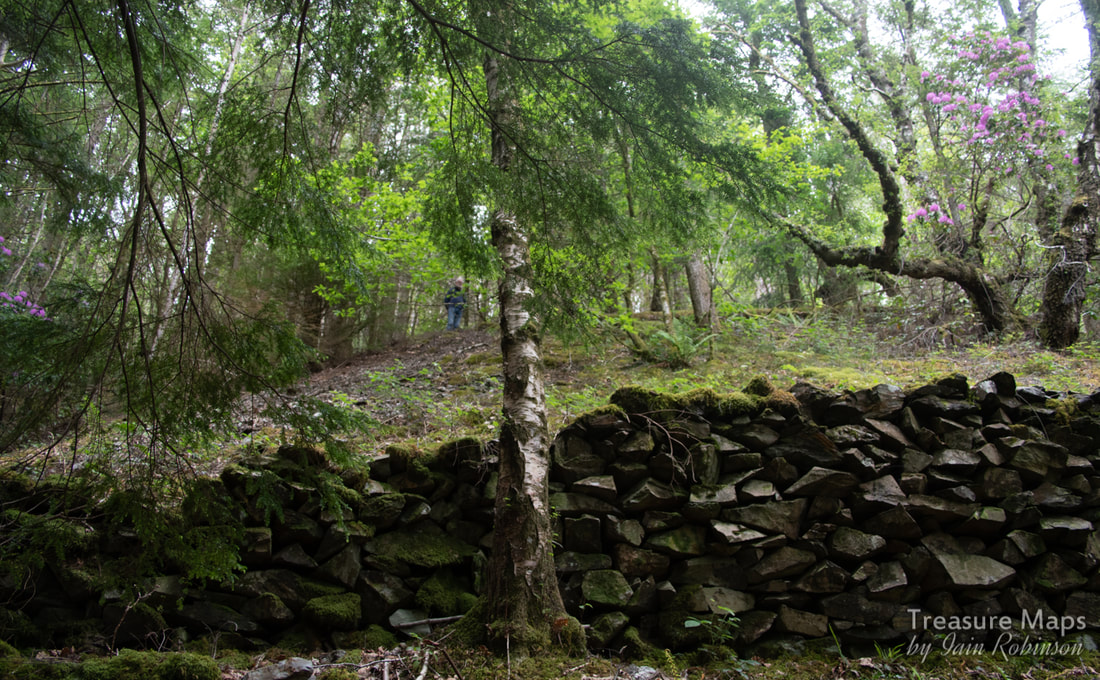
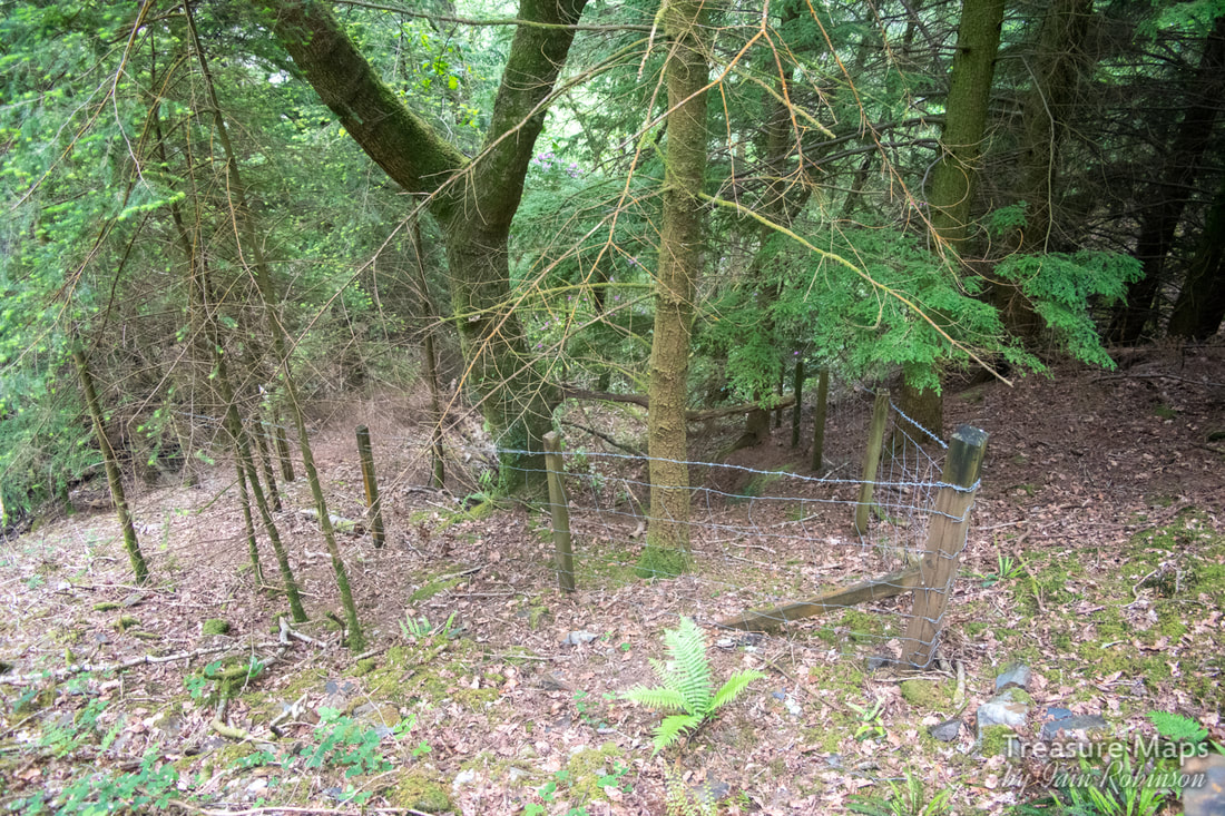
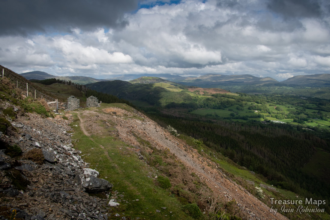
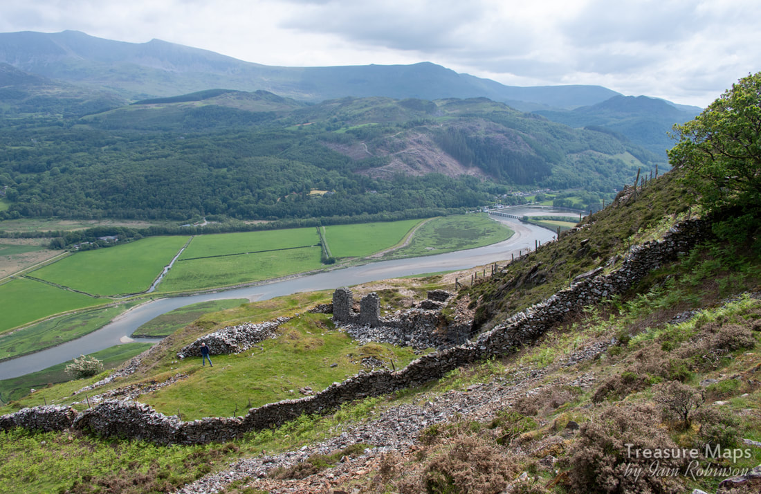
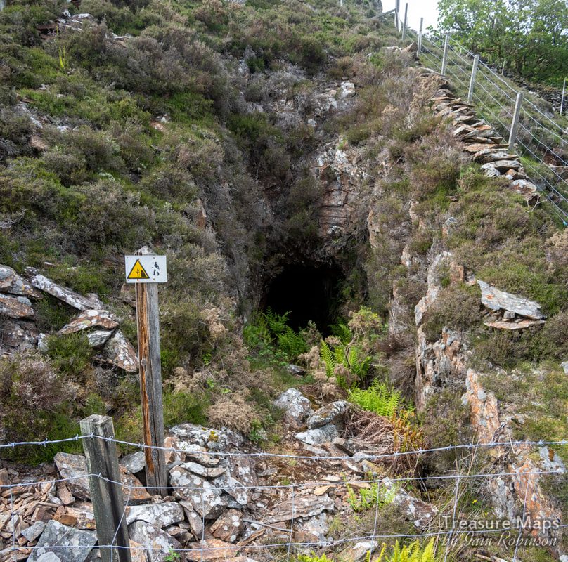
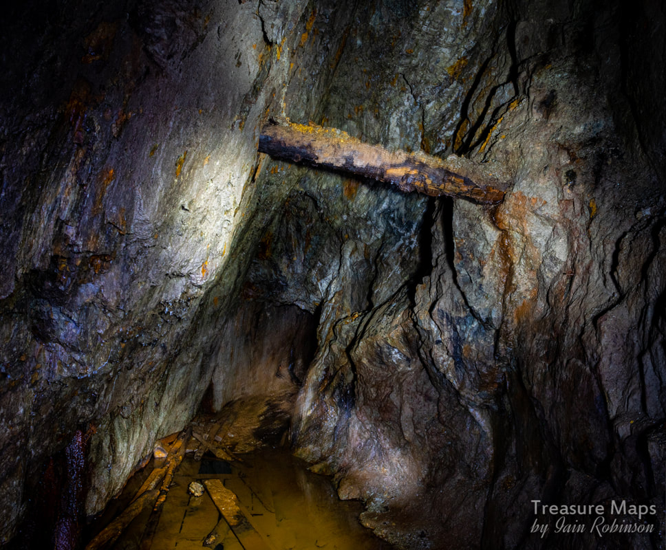
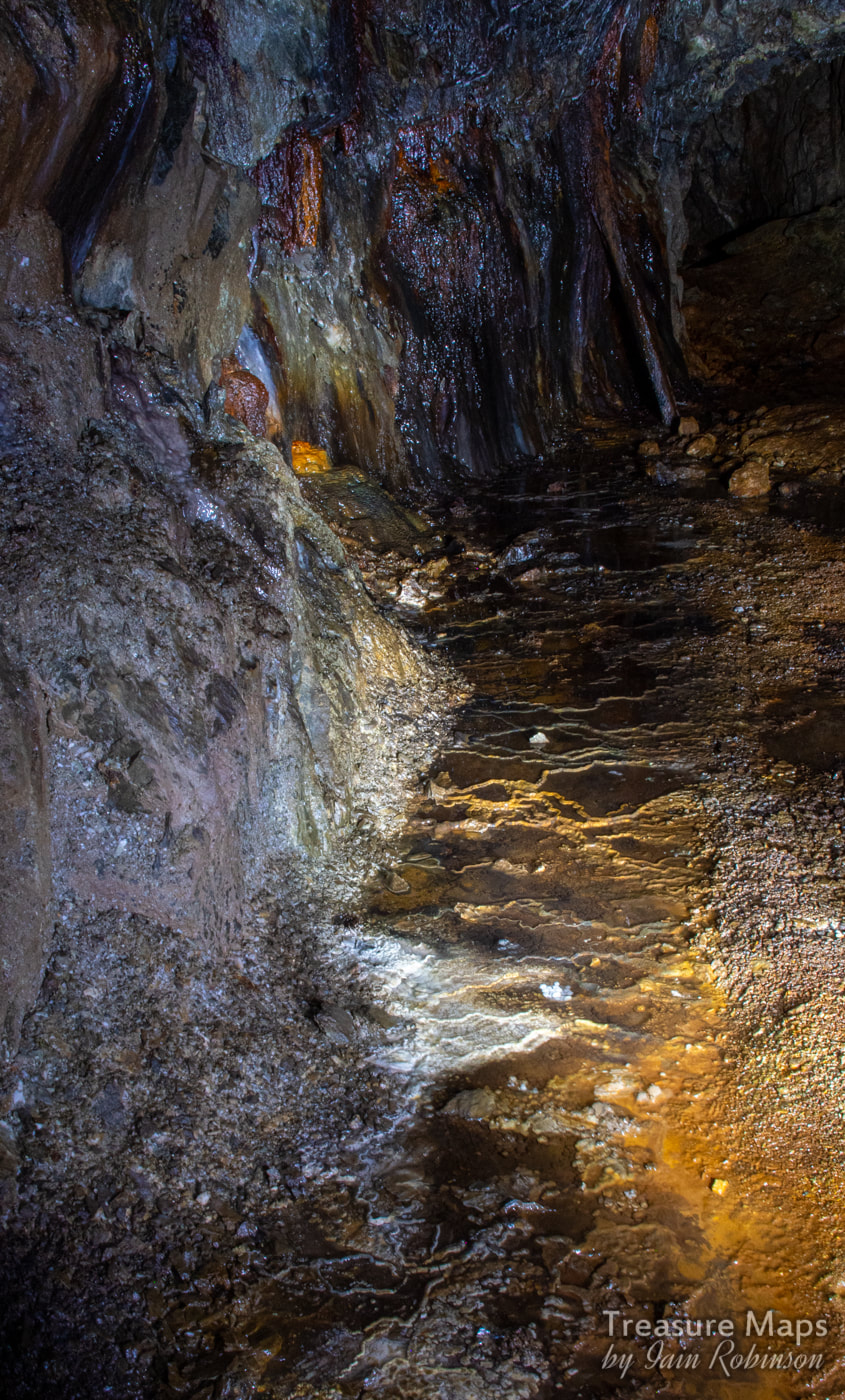
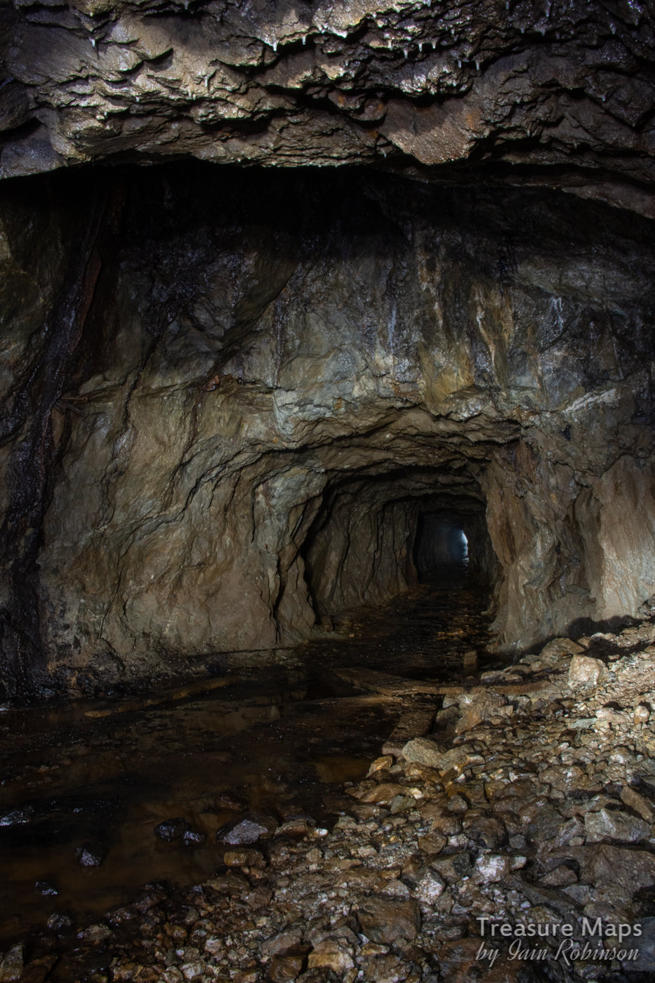
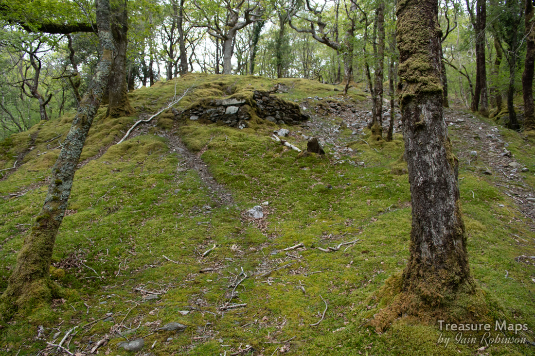
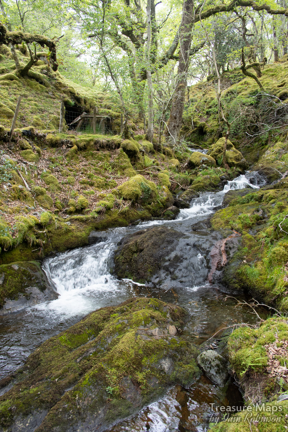
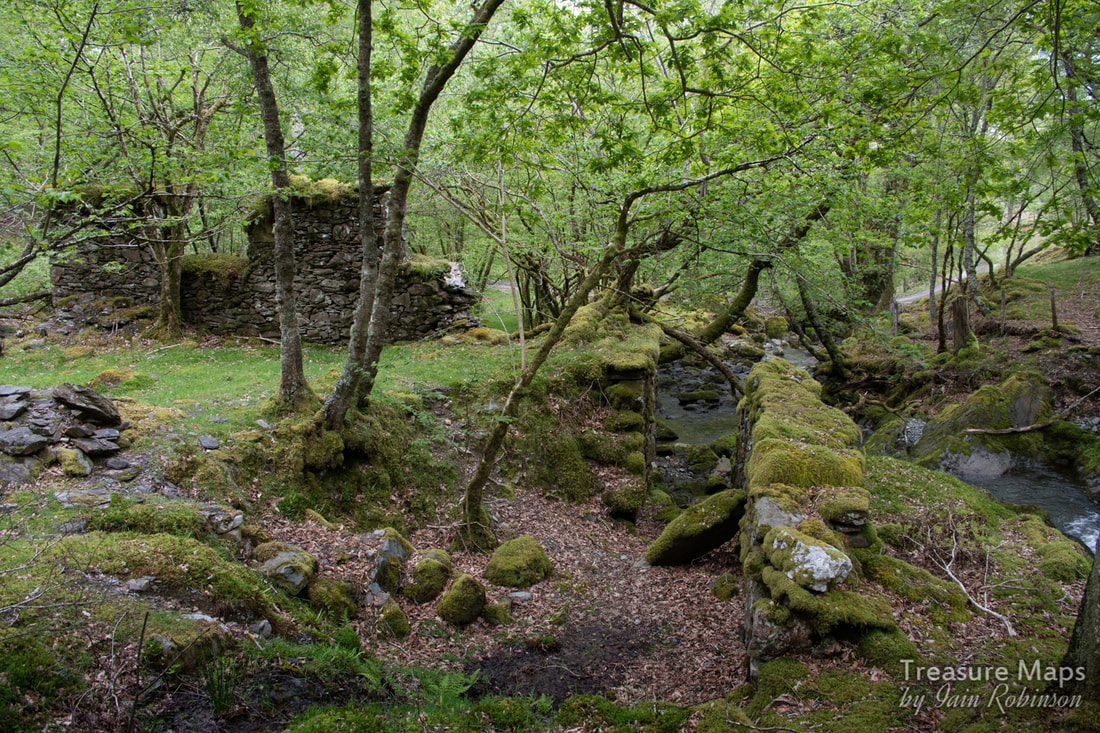
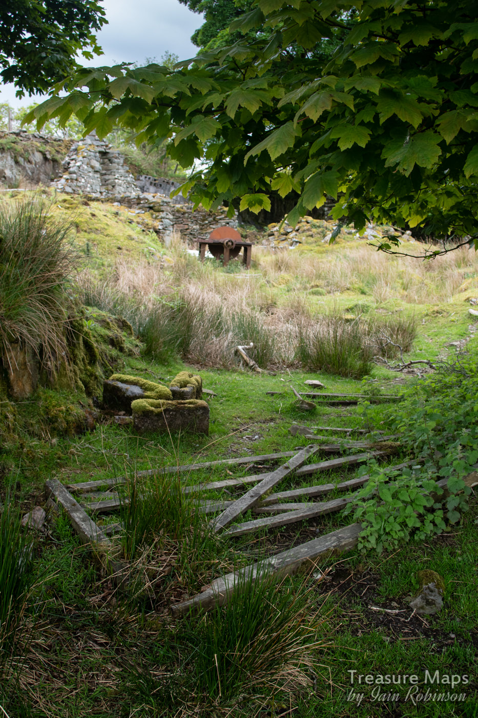
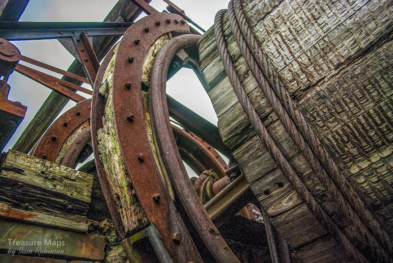
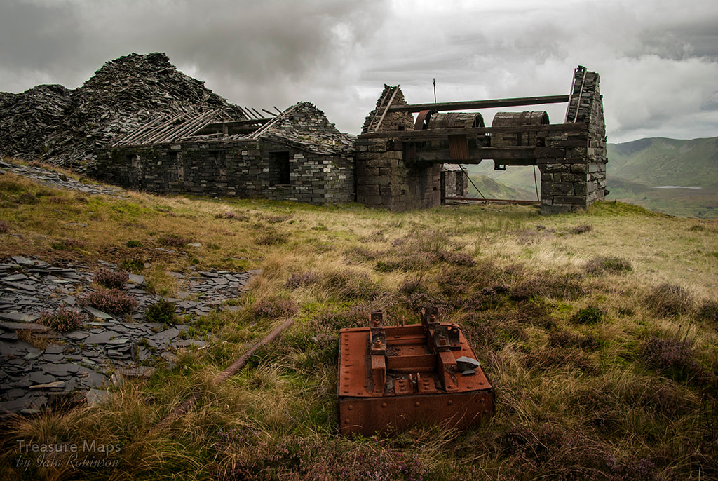
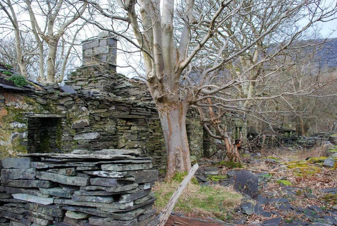
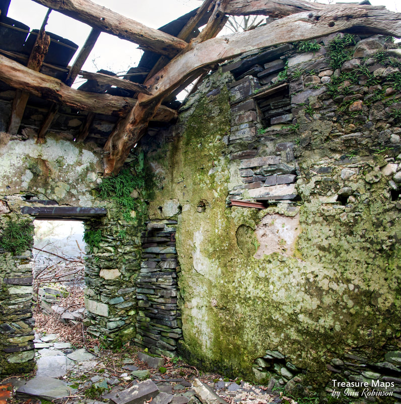
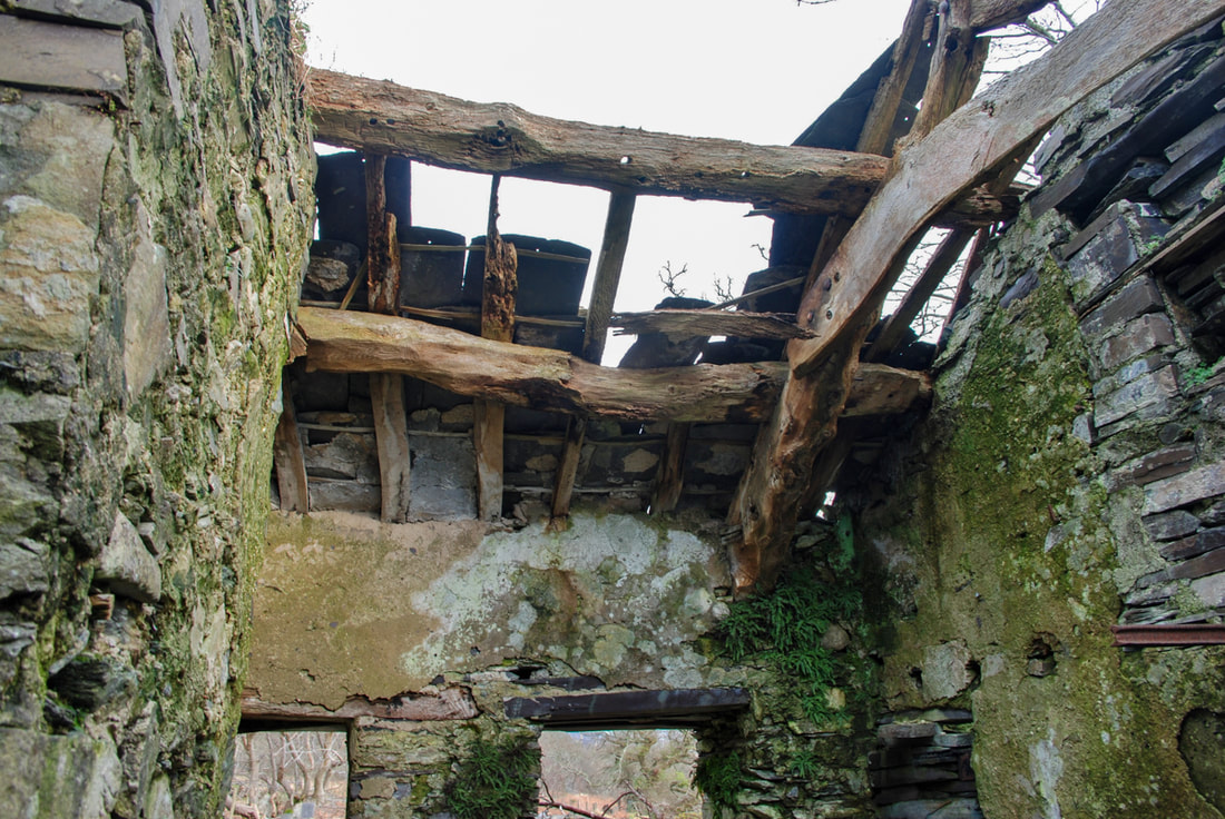
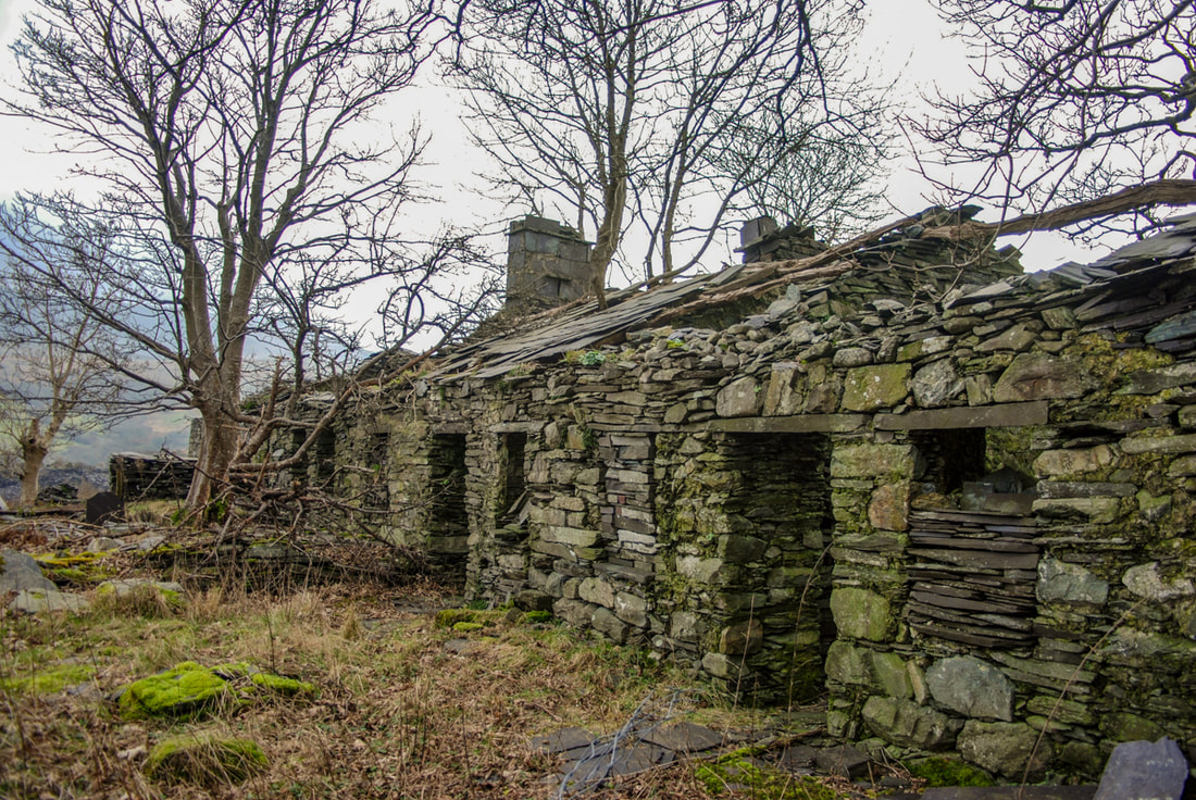
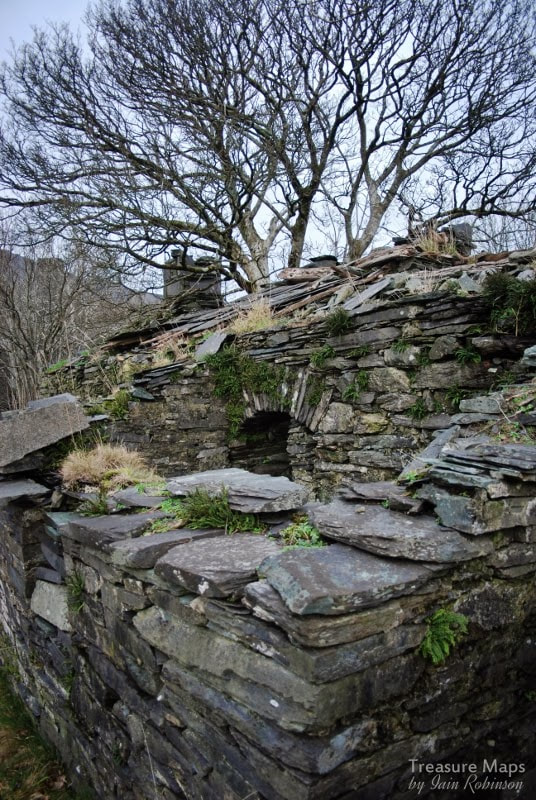
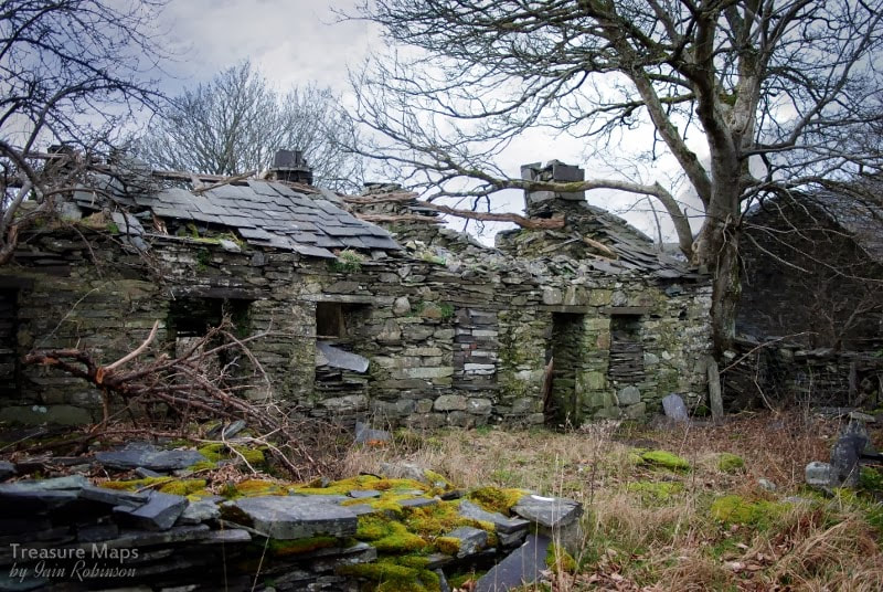
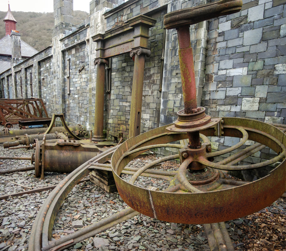
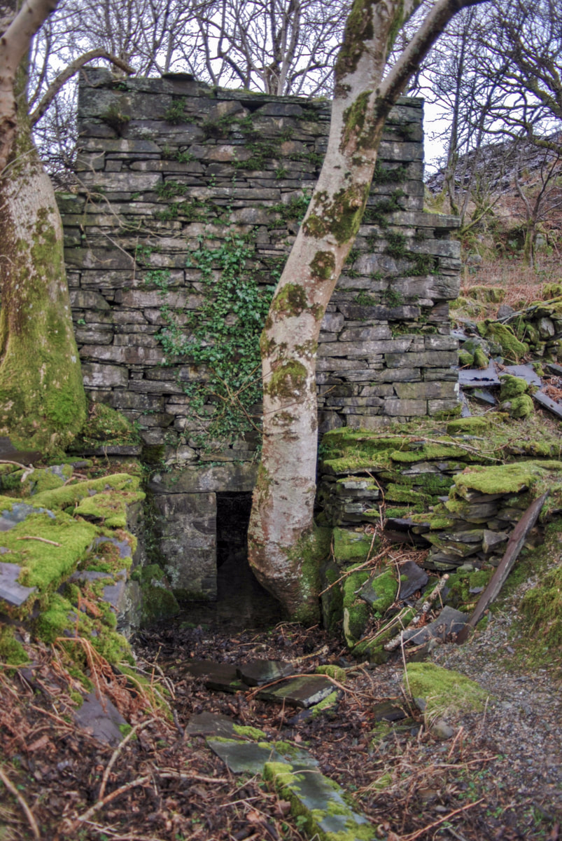
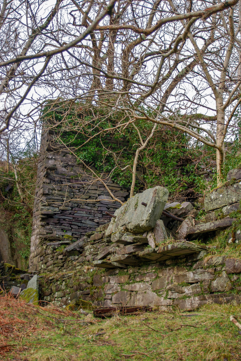
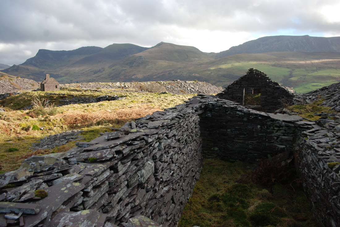
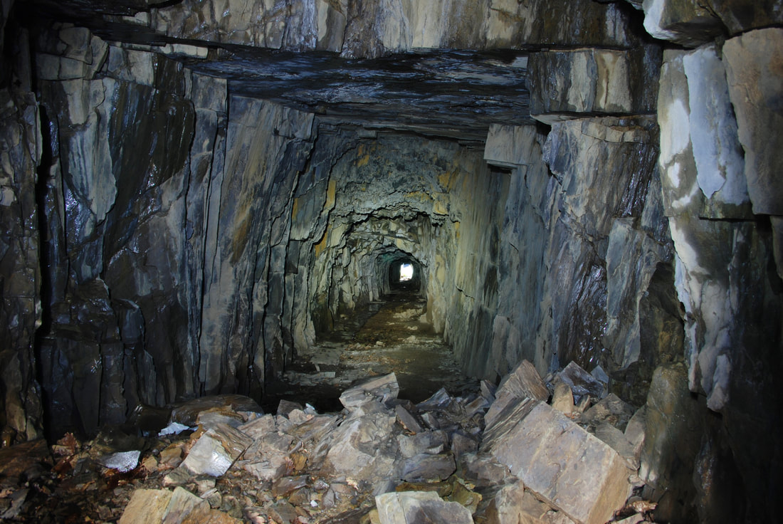
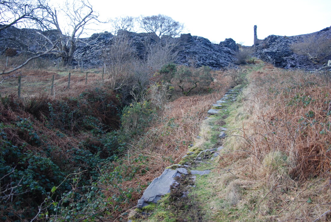
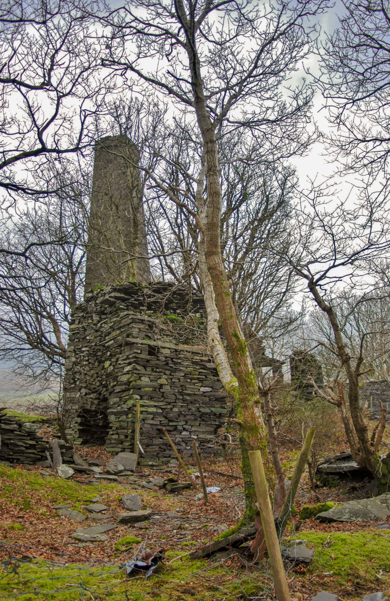
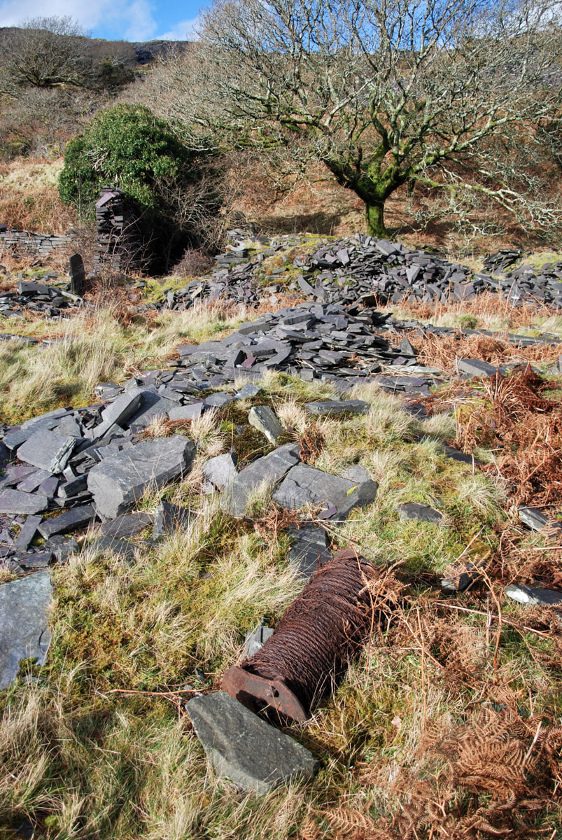
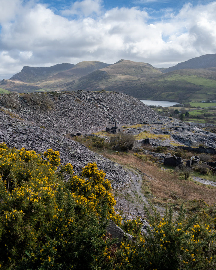
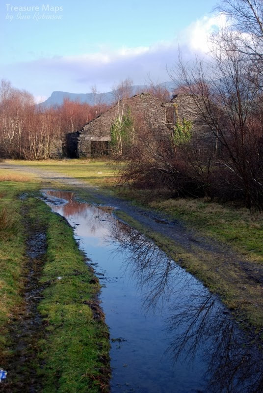
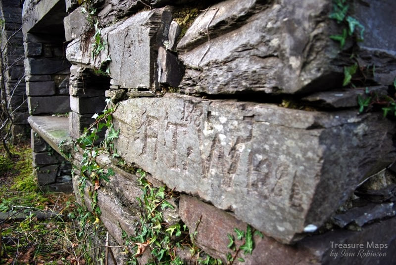
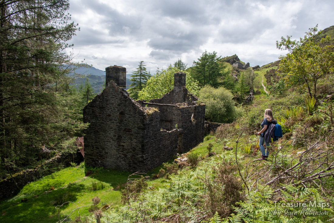 The old farmhouse/barracks along the New Precipice Walk. We've been back to Foel Ispri and it's fascinating mining remains a few times now. As always, the more we find, the more the mysteries gather, but a clearer view is emerging of the workings- we've also discovered some adits hidden deep in the forest and an aerial ropeway jetty. Approaching from the steep path up from Llanelltyd, a stile crosses over the wall out of the forest. The path continues left past the old farmhouse, towards the precipice walk. Petra had spotted some marks along the hillside facing the stile, that looked like the formation of an old tramway... we investigated and found that they came from a large opencut and workings along the stream that runs under the new(ish) bridge for the path. At the opencut there were piles of worked fines and cobbed rock. Following the sketchy tramway east, it crossed a stream- the ruins of a stone bridge were plain to see.  The working area on the tramway, above the walker's bridge. The opencut is behind the camera. As we carried on, it curved round following the hill contours and disappeared into the forest. Except that, when we looked closer, we spotted what was unmistakably a jetty for an aerial ropeway. The boundary wall had a clear section in it that had once been a gate, to let the tramway through. 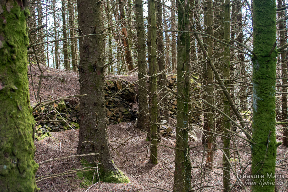 The ropeway jetty. Not easy to photograph in dense forestry! The question is, where did this go? Was it to the mill belonging to the Prince of Wales Co. down by today's A496 road- or was this ropeway intended to bring material up from several adits we eventually found in the woods? After our most recent visit. I felt that the woods below the old farmhouse needed more investigation. The structures around the place are strange, not quite agricultural yet not particularly industrial. There's what might be the remains of a waterwheel, for instance... 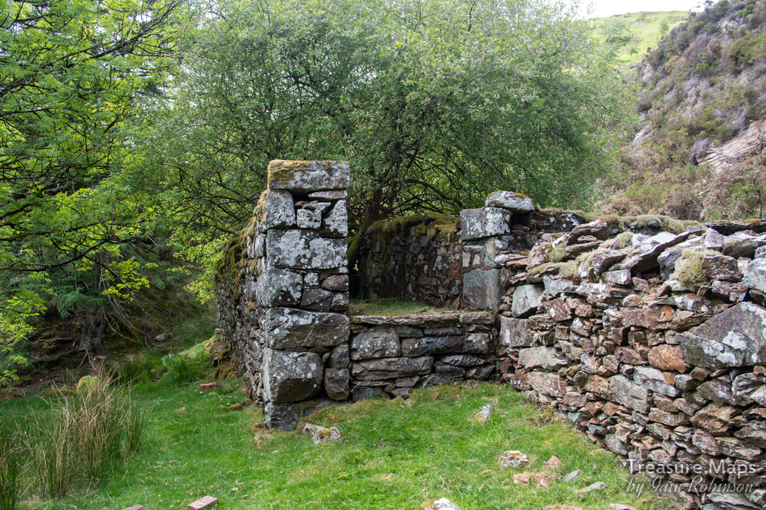 Supports for a waterwheel? The wall between the sides looks to be an addition. There's no sign of any mountings for journals on the top- but perhaps it was originally higher? I can't make my mind up about the farmhouse area. To the man with a hammer, everything looks like a nail- and I might be viewing things from a desire to find significance where there is none. And yet... a shaft is marked slap bang next to the house on the 1900 Ordnance map. We decided to take a look round... 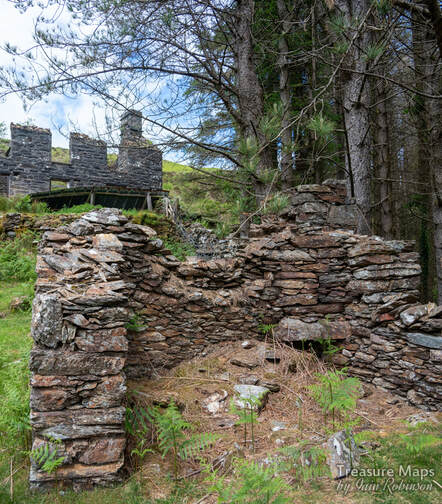 The two-celled structure below the house. It is made of different rock to the house, although the latter has been rendered at some time with a dark grey covering. 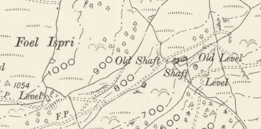 The shaft below the house and a level on the 1900 Ordnance survey. The ropeway jetty is at the hooked end of the trackway marked just above the word "level". Map by courtesy of National Library of Scotland. 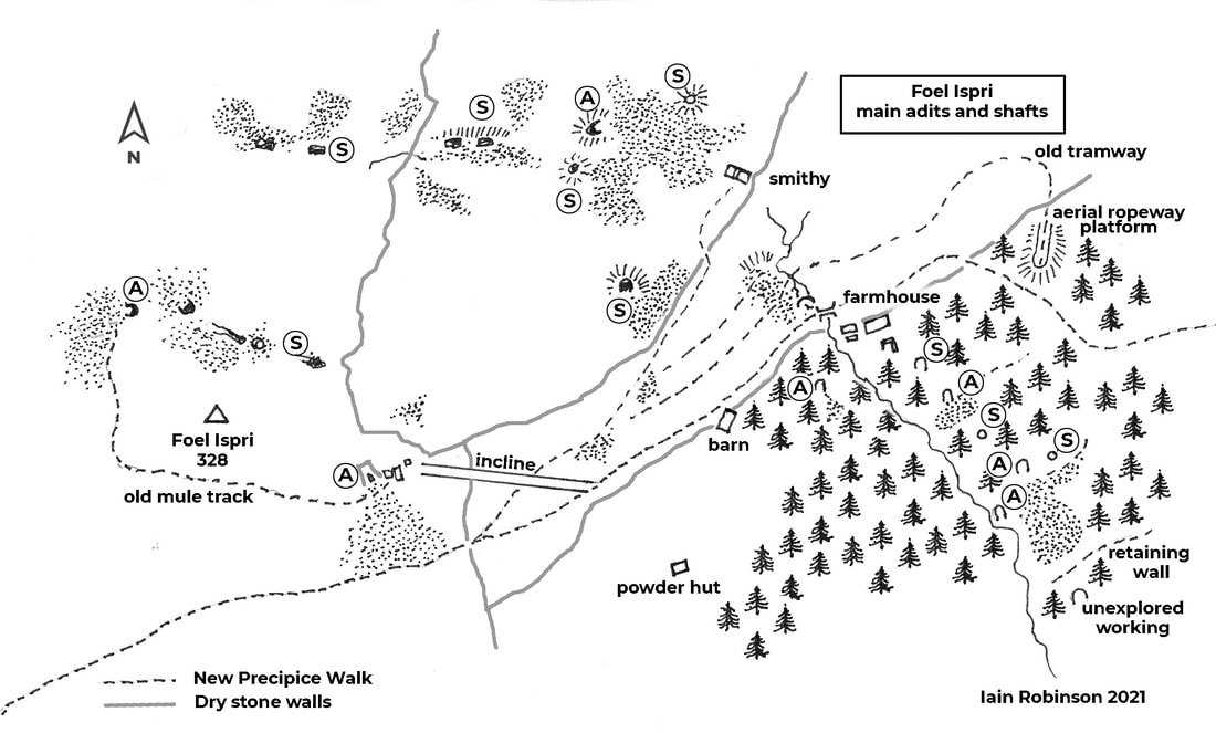 "A" denotes adit, "S" denotes shaft. There are also a multitude of crown holes over the site. We crossed over a fence next to the structure below the house. It was steep here and difficult going because of the trees/bracken/gorse/holly cocktail that the forestry encourages. I shouldn't grumble, because it does promote biodiversity- and it stops non-mine obsessives from discovering the place and staging their barbecues etc. Strange, I know, that some people aren't interested in mines... It wasn't long before we found the shaft. A steep openwork with exposed rock that goes down into the depths...difficult to photograph meaningfully, but here's my attempt anyway... 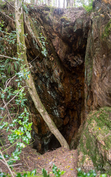 This was well fenced off- and in a tight situation on the steep hillside. Looking downhill from the shaft, we could see fencing that protected another excavation below us. We investigated and found an adit... 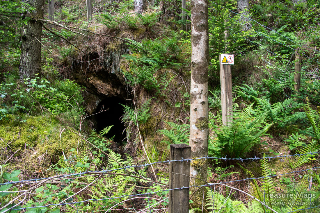 The adit below the shaft. This adit looked promising, although I noted that there was only a minimal quantity of water emanating from the portal. In our experience that means it's choked near the portal and will be very wet. We will explore it soon; but for now, we wanted to carry on and see what else there was. Thirty metres down hill, another fenced excavation was encountered- this time a shaft... 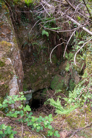 Things were hotting up now. A big excavation loomed below. We struggled through and down, until we reached what had been a fairly extensive digging. A shaft first, followed by a large adit portal to the left. We realised that the bosky platform we were standing on was actually a tip, reclaimed by nature. There were some really old birch trees growing on it that had amazingly fissured bark. A check of the leaves and yes, they were birches. But, to the adit! 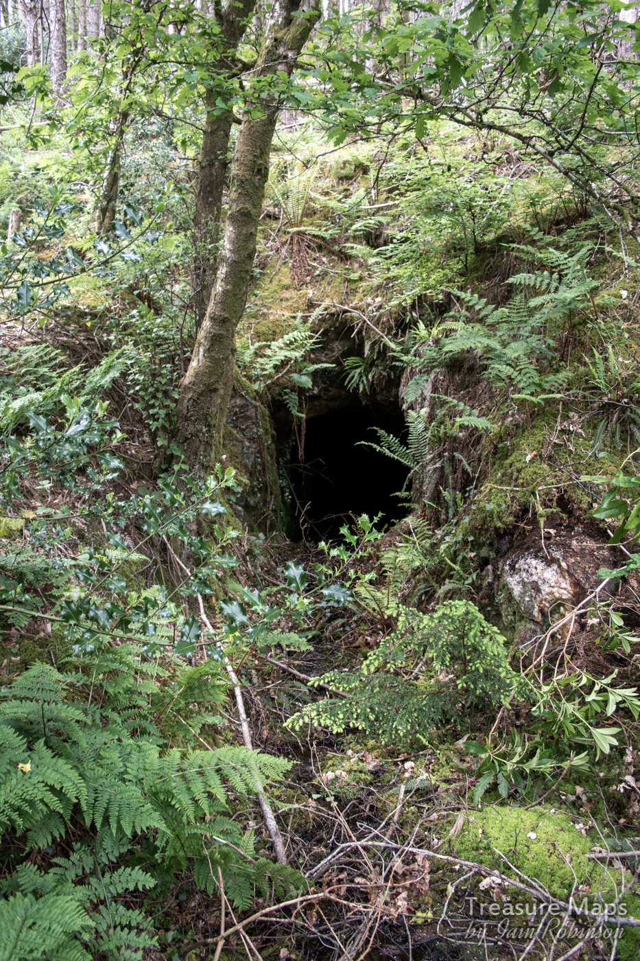 This was the most promising adit. Again, little water issuing, but a huge tip. We couldn't pass this one up. We could see more fenced off areas below, but this portal looked so tempting...so we put on the safety gear, grabbed the lamps and in we went... 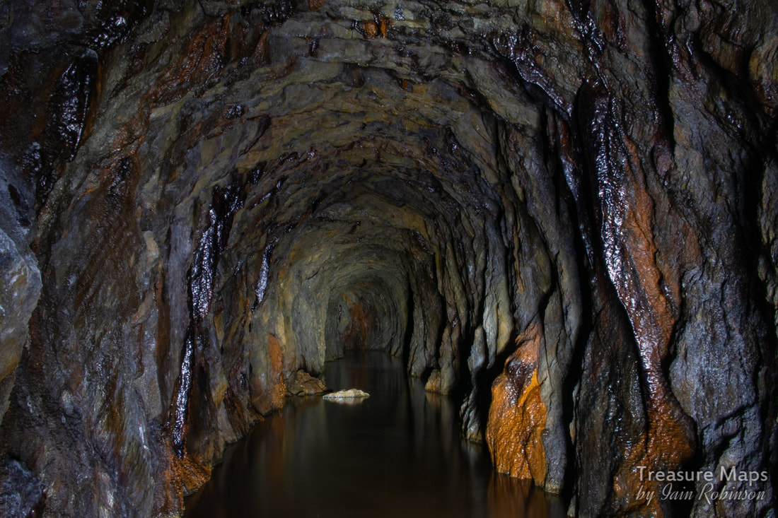 Looking inbye...nice iron formations. As soon as we entered the adit, (water thigh deep and freezing cold) a passage was noted going to the right a little way, then abandoned. We carried on for a long way, noticing the marks of sleepers on the floor and a couple of alcoves where a crosscut attempt was made then abandoned. 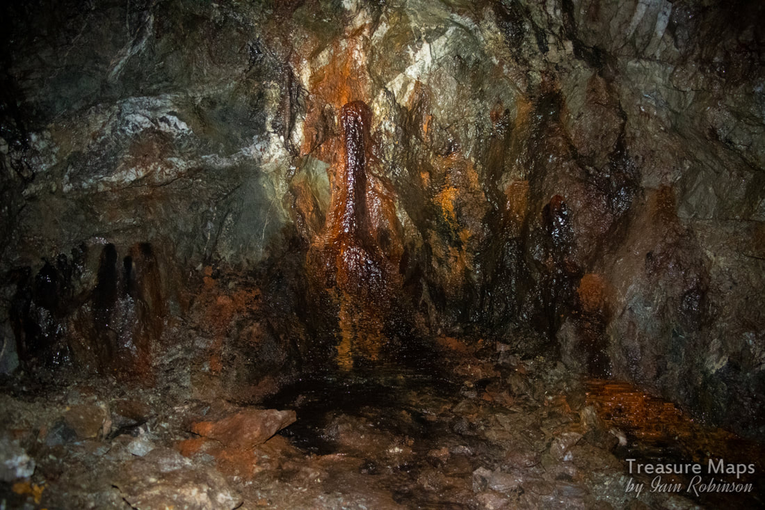 There were some great little formations in the mine, mostly iron, with some calcite straws from the roof. The adit ended after 350 metres. Somehow, with all the shafts, I was expecting false floors, but the tunnel was sound all the way. It even dried out towards the end. It felt like a long way in that cold water, but worth it. Outside, I explored the tip while Petra went down to the next level. A little way below the tips was an adit that opened out onto the stream. It was impossible to reach from my side due to erosion of the stream banks- perhaps that's why there wasn't much spoil. I took a shot, hoping that it would look like something. 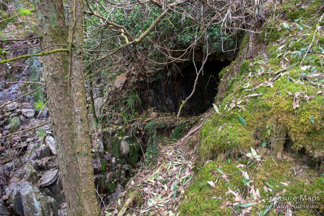 Doesn't really look like much, does it? The ground fell away vertically to the stream bed to my left.  The ancient birches on the tip. The dead tree in the middle startled me when I first saw it- I thought it was a gorilla :-) Petra bravely battled her way to the lower workings, to find a large opening of some sort... it was very difficult to access due to the slope and at the moment, we can't tell whether it is an adit or a shaft. There was yet another working below, but we were both running out of energy by this time, battling away through all the vegetation on a 1 in 5 slope. We decided to come back another day. We climbed wearily back up to the old farmhouse and sat for a while, munching oatcakes spread with marmite peanut butter. Surprisingly refreshed, we wandered back to the barn, amused to see that the lintel was held up by some bridge rail. Arriving at the bit of the path where it joins the incline, we looked at each other. There was an adit up there that we hadn't explored. It must have been the peanut butter, because we dashed up the incline... There was what looked like a processing area at the top comprising several weatherbeaten remains of buildings including some sorry-looking brick pillars. The main structure was what looked like two walls standing on their own, no sign of a lintel between them. There must have been a sheave here, or some winding apparatus, but there was little trace of it. After enjoying the view, we entered the adit. The adit continued into the mountain for a good 4-500 metres, after which it branched. One way led into an area where stulls had fallen over a false floor. I wasn't prepared to go on as it looked too sketchy; but we'd seen a fine set of formations and some interesting little side excavations, so honour was satisfied. We had also spotted the powder magazine earlier, although neither of us fancied struggling down to it- a photo will have to suffice. It was well out of the way, should an explosion occur.  The powder magazine. While at the adit, we noticed a track going away in the opposite direction to the incline. Curiosity got the better of us and we followed it. It turned out to be a mule track to the other adit that we had explored a few days before, described in my last post- the one with the flooded stope at the entrance. So material would have been brought on the track, circumnavigating around the rocky knoll above , to send down the incline- that made sense. Looking at the old maps, on the 1880 survey, the adit at the end of the mule track is the only one on the hill, leading me to wonder if it is the earliest digging. There is a level marked on the 1880 map below the farmhouse, but the smithy hadn't appeared yet. The car was parked at the end of the walk , so we used the mule track and then dropped down to the car park. Like the miners, we hadn't found any gold, but we'd some fabulous memories of the day. 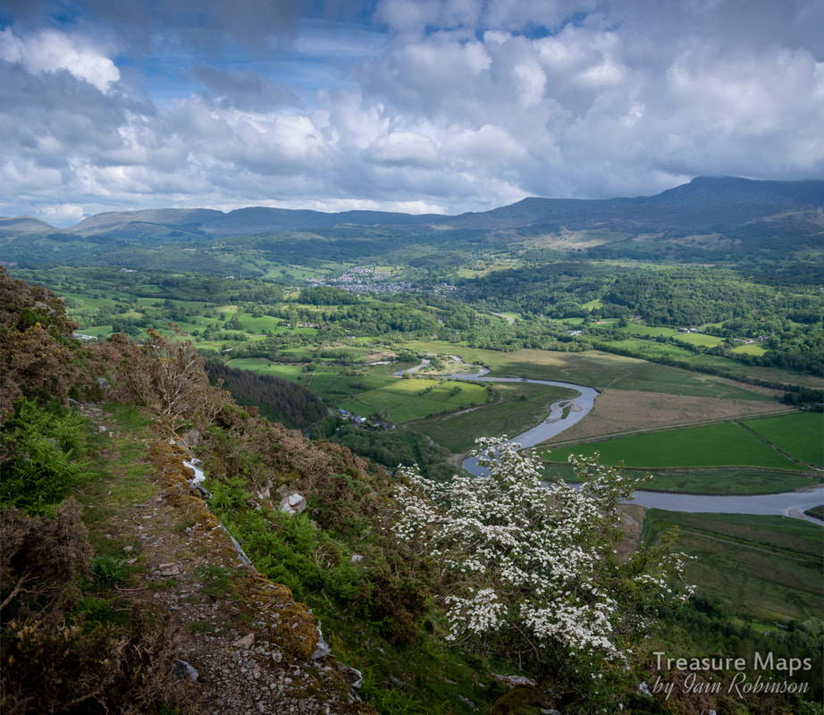 From the mule track. The New Precipice walk is a good bit below this. 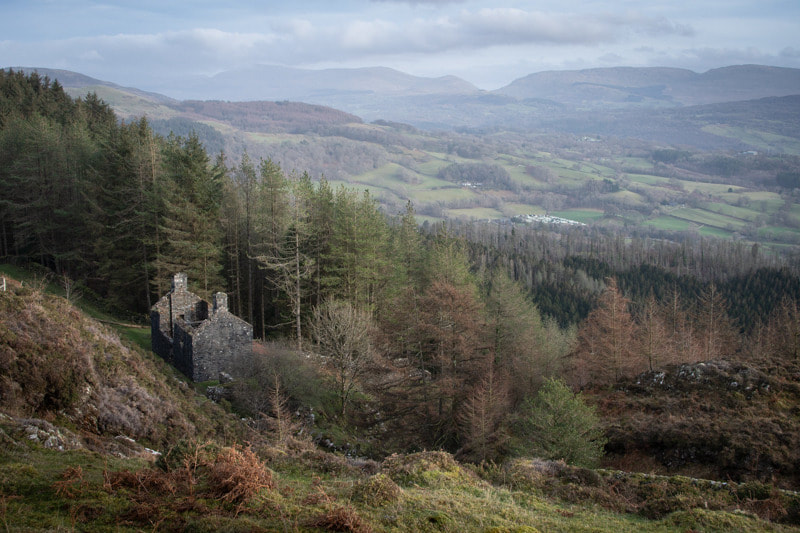 The (possible) barracks above the woods, looking towards Aran Fawddwy and Cae Afon. Driving from Dolgellau towards Llanelltyd on the A470, Foel Ispri makes an interesting sight above the trees, it's flanks coloured by the ochreous spoil from the mines. The name had always fascinated me, especially when I found out that it came from the welsh "ysbryd" and means "The Hill of the Spirits". I wondered about those spirits (and the mines) every time we drove that way.  A gratuitous view of the lake... On our first visit, we walked up a steep path from Llanelltyd through the conifer woods. This is probably the route most folk take to the New Precipice Walk- It passes a lake, originally built as a reservoir for the village. Eventually, we emerged from the woods to see a ruined building- at first glance it could have been a farmhouse, although seems a bit grand for the place with the remains of a veranda along one side. I wondered if it might have been repurposed as a barracks for the nearby mines in the 1860s. 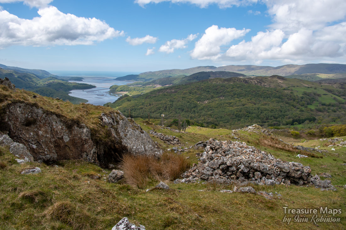 The workings at the top of the hill. The hillside above is pock-marked with adits rather like a dutch cheese- to a mine explorer, it presents an irresistible sight. We've made a few visits now, and have still to find all the adits and features. On one of our visits, we discovered the easiest way to access the area- to come up to the hill from the west. There's an unclassified road that runs through Taicynhaeaf up to the small farm of Foel Ispri Uchaf. Not a farm any more, I'm not sure anyone lives there now. I don't think tourists would want to stay there either, despite the views- as it's the last stop on a viciously steep single track road with few passing places. We were lucky to only meet one vehicle on the occasions we went up, but you do need nerves of steel. 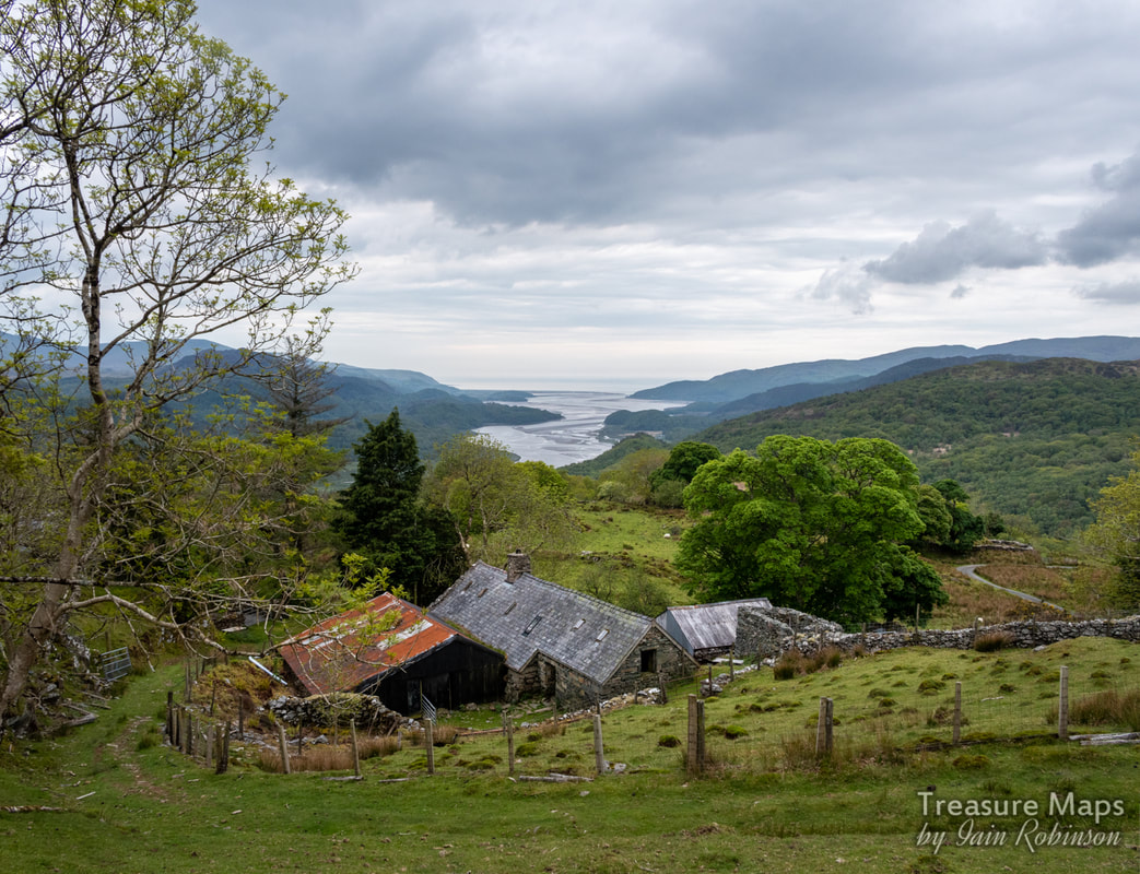 The farm, with obligatory view of the Mawddach estuary behind. The New Precipice At the farm, Foel Ispri Uchaf, there's some limited parking, enough for three or four cars. It's really meant for wheelchair users, so that they can access the walk. The walk itself is a flat footpath edged with rails- too heavy for tramway rails, but a nice touch all the same.* The footpath is, or was, the tramway from the Foel Ispri mine. It joined an aerial ropeway here to be taken to a processing area, (according to Hall), near Cae Mab Seifion farm. There are a couple of very likely places down there, surrounded by spoil. Apparently the mill was a timber and tin one, so would have been dismantled once the money had run out for mining. The tramway makes a pleasant walk with stunning views of the Mawddach estuary, even on an overcast day. The route hugs the hillside contours until some ruined buildings are encountered, where an incline from the workings cuts the path. The smaller of the structures is probably just a barn, the larger is the one I mentioned previously and might perhaps have been a barracks. It's beside a stream, but there's no sign of material being processed. 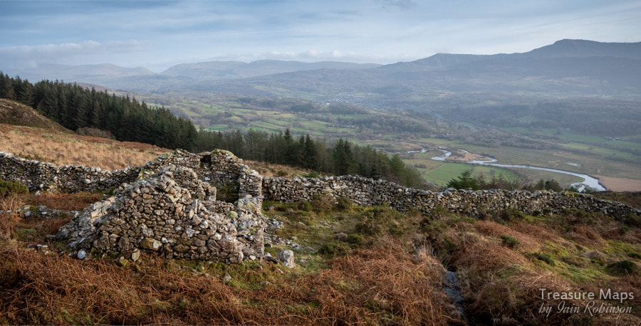 The Smithy The Smithy After a mooch around the buildings, we took off for the higher ground, passing over the incline. An old Smithy appears near to the main working area. Apparently, this was converted to house Britten Pans* to process the ore, although there is no record of any gold recovered at this time (1836). There are several crown holes in this part of the mountain, perhaps one is the shaft known as "Joe's Shaft" which had been sunk twenty fathoms to intersect the Champion and Fanny lodes. Around this area are several adits, one series stoping out to surface. Many adits are unpromising or run in, but the adit to the main stope was open. Exploration showed that it ran for about twenty yards before encountering the stoping. Stulls were in place, greatly eroded by weather. The adit continued on, frustratingly inaccessible. 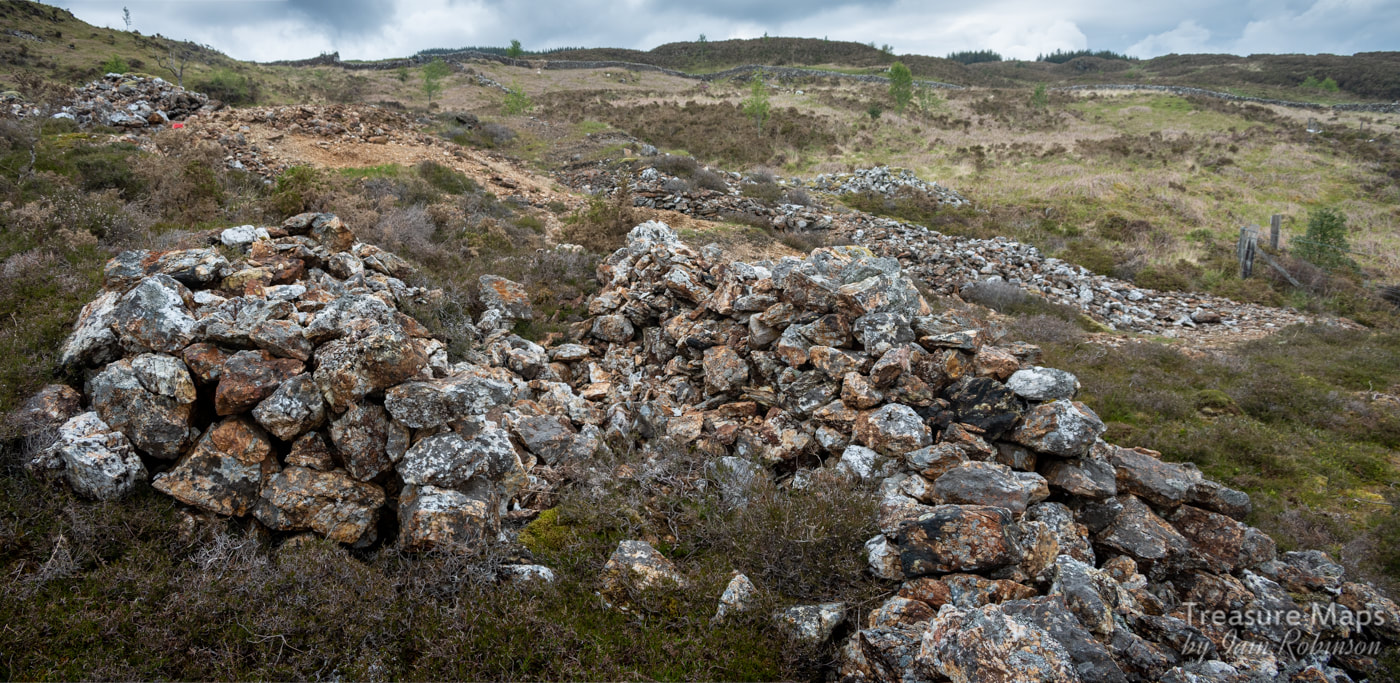 Piles of uncobbed ore. Probably worked by women and children in all weathers. The spoil outside is interesting- mostly quartz, but with occasional appearances of galena and sphalerite. There was also some pyrites in the quartz. We noticed several cobbing areas, wide scatterings of small quartz stones beside larger piles of rocks. The large accumilations were interesting because they all seemed to be spilt into two piles...was this to shelter the workers from the weather, or was it just the attentions of latter day gold seekers? 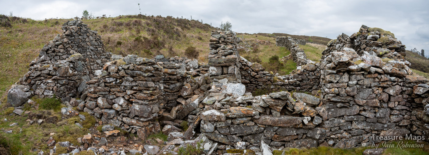 A composite view of the smithy, showing the extension on the left and an area in the middle that might have been a wheel pit. Adits We explored a couple of adits. I should stress that this isn't advised unless you are experienced in this sort of foolishness- and have the appropriate safety equipment. The adits were mostly uninviting- but the range of excavations above the smithy were fascinating. After a low portal and a flooded passage, the middle one opened out into stoping, with stulls in place. There's quite a drop here and it would be unwise to go too close to the edge. 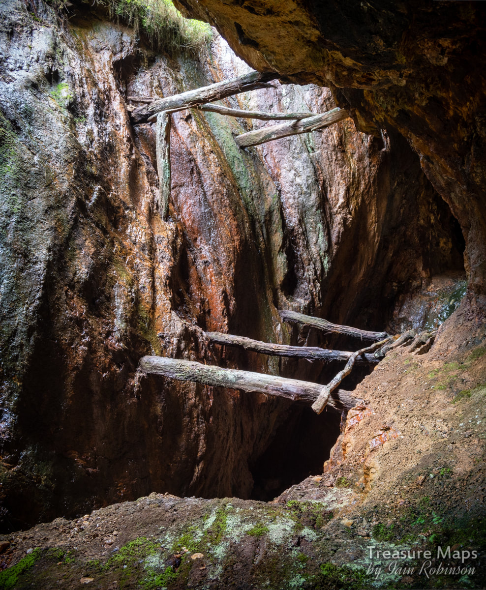 The stoping, with stulls in place. A passage carries on into the hill on the right. We carried on up the hill, where the diggings seemed to become older and more vestigial. The ones at the crest of the hill look more like lead workings in the way that they have been mined, following a rock outcrop along a fault. 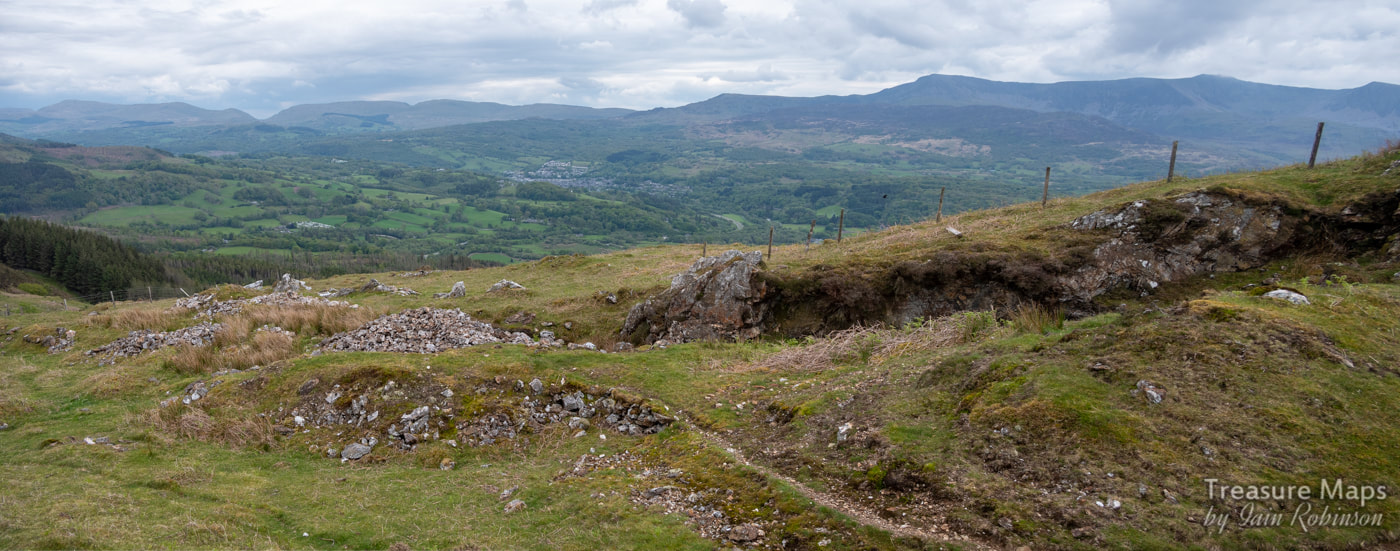 At the top of the workings. Over the top of the hill are another couple of adits. The most encouraging one had a large portal and looked inviting- I wasn't fooled, of course, knowing that such promise is always disappointing. The first few yards were mired with deep, sticky mud- we had to take care not to lose the wellies . Petra reminisced how I had been stuck for ten minutes in a similar situation at the Cae Fali mine- before she had pulled me out in a most undignified fashion. Then the water became deeper, over critical welly depth, but clear. Wet feet now, but who was caring about that when the mine beckoned? There was a branching of tunnels which looked most promising- until we noticed that our passage was blocked by a dark looming shape in the water ahead. This was probably a flooded stope. We'd been looking out for something like this, so weren't surprised, but it would be fatal for the unsuspecting. Stumbling into that, wellies and gear weighing you down... it wouldn't end well. Disappointed, we waded back outbye. We did manage to explore one passage safely, off to the left, which had some interesting minerals. Honour was satisfied.  Looking outbye from the right hand passage. Interesting mineralisation on the walls. As always, I felt the disappointment of not seeing past the flooded stope, feeling that it might have led to some undiscovered Moria, a golden mine of yore, with ore chutes and kibbles arranged for my delectation...in reality, both passages probably went monotonously on to blind foreheads, but nobody will ever know now. Further down towards the farm, another adit looked inviting, but we noticed a water pipe emerging from it; not wishing to pollute the supply, we stayed away. Afterwards, studying old maps and some frankly mystifying notes on the UCET site, we concluded that we'd missed a lot of stuff and should have gone up the incline where the principal adit lay waiting. Hopefully there will be a part two at some point soon! 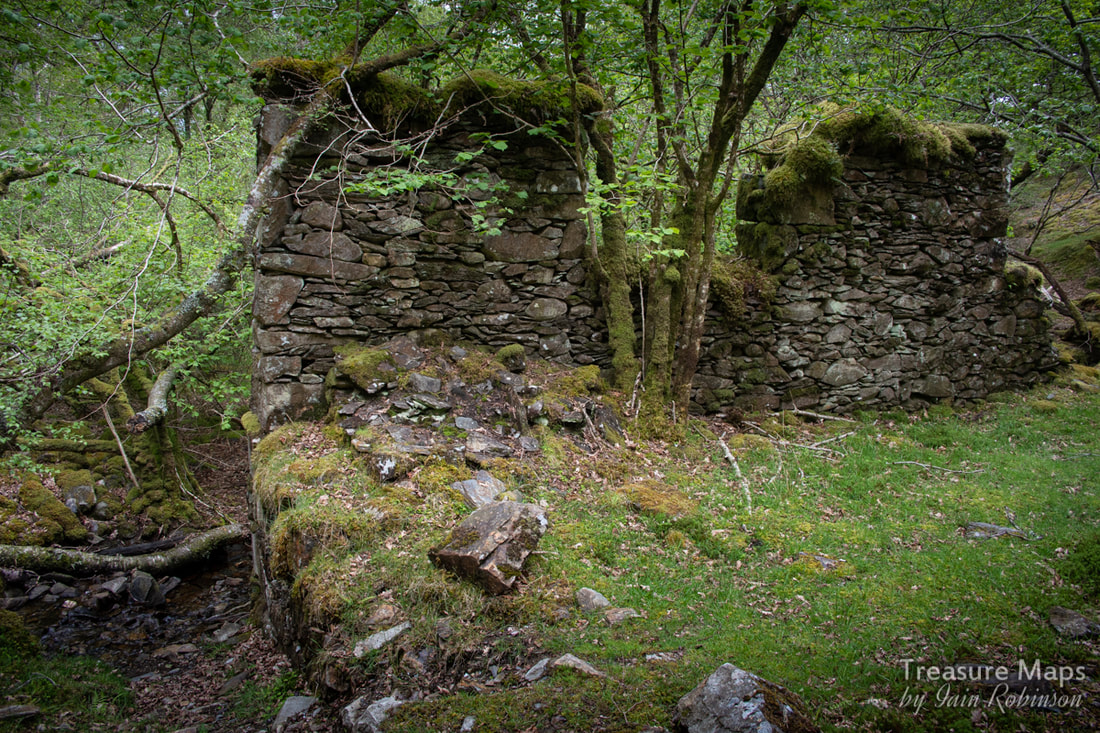 A Bonus Mill As we drove up to Foel Ispri Uchaf, we crossed a small tributary of the Afon Cwm Mynach. It was early spring and the trees weren't yet in leaf, so we were able to make out some ruins. The game was afoot! We managed to park on the verge and explored what was obviously some kind of mill with a water wheel pit beside it, some ancillary structures, plus what looked like the base for an aerial ropeway pylon. We were thinking "mines" even before Petra spotted an adit on the opposite side of the stream. In fact, what we'd stumbled on was the Borth Valley Company's gold reduction mill, in operation during the early 1900s. This served a few mines up on the Cesailgwm hills, connected by a ropeway as we'd suspected. The main source of the gold bearing quartz was a mine near Cesialgwm Mawr farm, of which there is little trace now. There are however, two mines to the east of them which I'll come back to in another post. The factoids The workings on the hillside cover a large time span, from very early scratchings for lead to C19th gold workings. Mining here was sporadic but reached it's peak of activity between 1862 to 1902 when the area was worked by a variety of concerns- the Foel Ispri Mine, The Voel Mine, the East Cambrian Mine, Prince of Wales, Gesailgwm and Wnion mines. A couple of the concerns operated until the 1930s, but none of the mines were ever profitable. The mine at the top of Foel Ispri was started in 1853. Over the years it was mined for lead and zinc, as well as gold. In 1890, 60 tons of zinc, 21/4 tons of lead and 88 ounces of gold were produced. Geologically, the chief vein filling is massive quartz in which much pyrite occurs. Galena, sphalerite and chalcopyrite also occur and the ore is auriferous in places Britten Pans Britten Pans were huge rotating cauldrons containing big iron balls rolling around inside . The pans were powered by waterwheels . Gold bearing ore was tipped in to the pans and reduced by the action of the balls to fine powder. Mercury was then mixed in, forming a coagulation called an "amalgam". This could then be poured out of the Britten Pan, leaving the unwanted material behind. The amalgam was placed in a crucible and the mercury evaporated off leaving (hopefully) a little gold. *Rails About those rails. We explored the remains of Foel Ispri Isaf farm, finding a stash of bridge rail and lighter gauge flat bottom rail. These would very probably have come from the tramway. 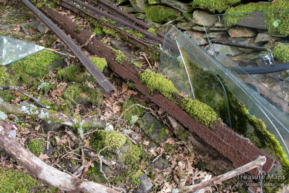 Bridge rail on the left. References "The Gold Mines of Meirioneth" by George Hall, Griffin Publications, 1971. "The Mines of Merioneth" by J. R. Foster-Smith, Northern Mine Research Society, 1977. I can't stress enough that exploration of old mines is unwise and could lead to injury or death. Please explore only with the proper equipment, lights, safety gear and preferably at least one highly experienced guide.  Morgan's Level from across the Garret twll. Yr Wyddfa lurks under mist behind- and if you look really closely, you can spot the little train! How many times have we been to Dinorwig now? It must be getting on for thirty, happy days spent gazing in wonder at the sheer majesty and grandeur of it all. The incredible ruins, the piles of waste slate, the audacity of the enterprise. A gigantic hole in the mountain made by extraordinary men, working with little more than glorified hand tools for much of the life of the quarry, before compressed air rock drills became the norm. Did I mention the weather? This place has it in abundance. What you would think would be unpromising conditions for photography turn out here to be the perfect set-up, if you don't mind waiting for the sun to break through occasionally...and if you appreciate very cloudy skies. Somehow, the grey days complement my emotional response to the quarry- it never seems to work as well for me on fine days. 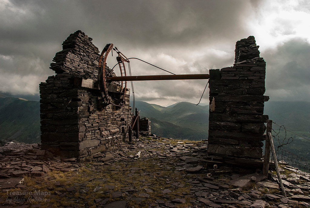 The A7 Drumhouse I remember our first visit to Dinorwig, up to the silent quarry of Marchlyn and over the hill, courtesy of the Hydro road. You come upon the quarry suddenly this way, after a tough walk uphill for a mile or so. I will never forget the view as the A7 incline Drumhouse appeared through the mist and all the galleries opened up below us. So this was it! 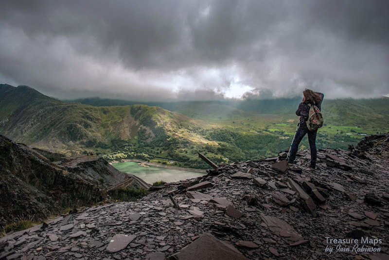 Petra tries a shot from one of the upper levels. We mooched around on Lernion level for a long while, taking in the views and trying to imagine how the mountain looked before all the extraction happened, trying to see the negative space. There were all sorts of things going on down there, little shelters, inclines, round huts, rusty things...it took a while, looking closely at the photos afterwards to begin to appreciate everything. It was a Bank Holiday weekend, the first time we visited; not the best way to see the place. There were folk on some of the galleries, bellowing and shouting meaninglessly as some people do when confronted by bigger things than themselves. Some young adults were chucking things off another level while climbers enjoyed the slate walls as a set of problems to be overcome-thankfully not being strafed by occasional missiles. Yes, this is why we hadn't visited, we thought. All the people. 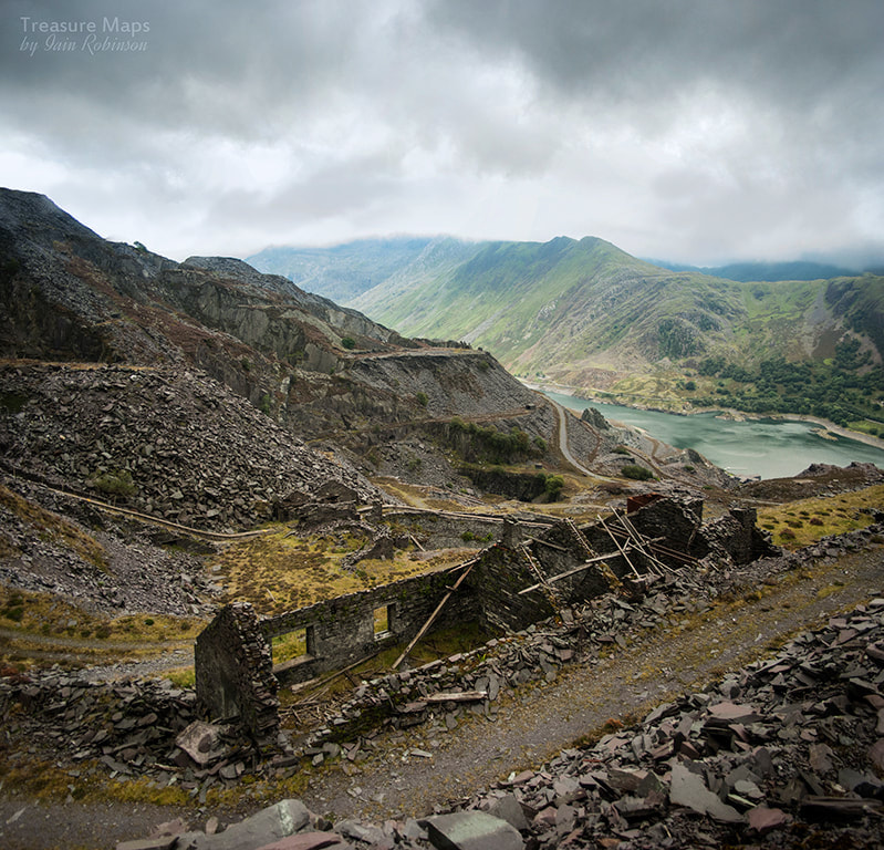 Upper Penrhydd loco shed and caban We left it a couple of days and decided that we had to go back. But on a weekday, the place was almost deserted and took on a haunted feel. We became aware of another aspect of the place and it's character, including an increasing consciousness of the poor souls who worked here in all weathers, for very little reward. Our weather was again just the same. This time we explored level Swallow and it's tunnel onto a gallery, went down another level to Tophet and Abysinnia and had a good look at the compressor house. Everything has been relentlessly explored, picked over, grafitti'd, examined and photographed, but it didn't spoil the sense of wonder we felt. 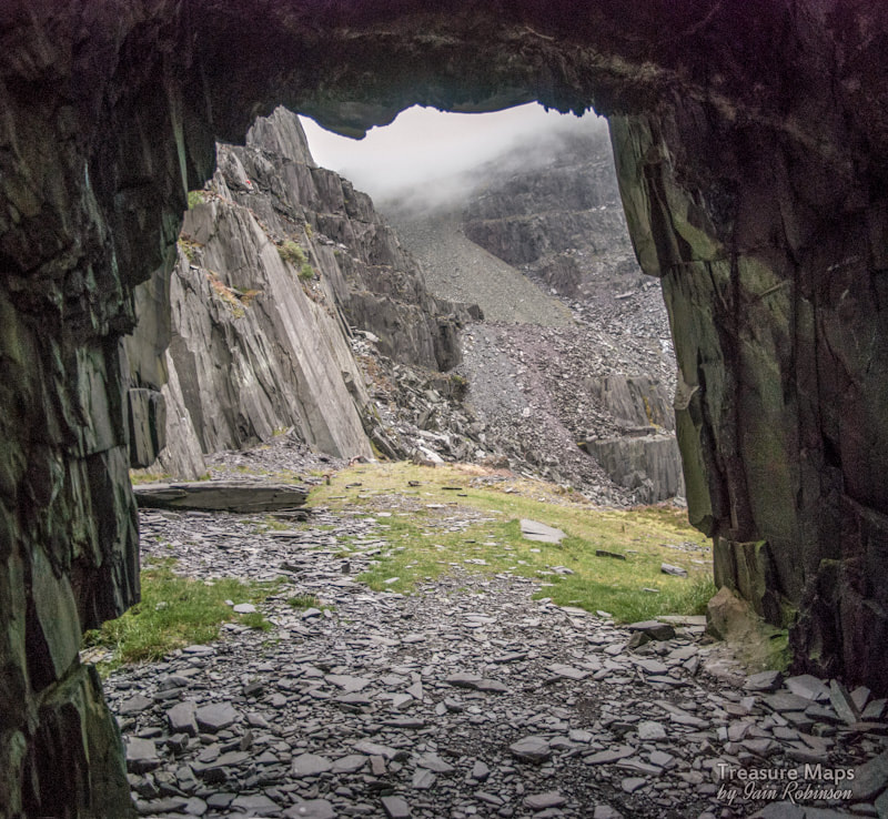 The tunnel on Swallow Level. Most features have a name at Dinorwig. Sometimes two names, as the climbers have taken many parts of the place and made it their own, giving evocative names to features. There's "Mordor", for instance, and "Lost World" to name but two. Fitting the proper names to features can be very difficult and is a study in itself, which is perhaps why the climbers have extemporised. I like that the place is many things to many people. Most who arrive here fall in love with it, for whatever reason. Even the folk the climbers call the "Tutters", who walk past on the narrow, fenced confines of the footpath, admire the place. Petra and I love it for the sculptural qualities of the galleries, for the dystopian perspectives of its ruined incline houses, and for the way that generations of men have carved out a sculptural space in the mountain, achieving grandeur and stature for themselves, far beyond that of their employers. 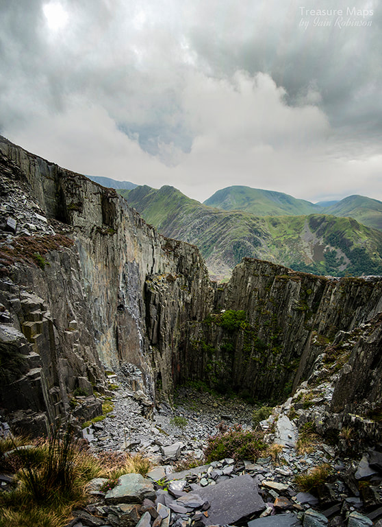 The "Lost World" or Sinc Braich. Sinc Braich and it's equally impressive neighbour, Sinc Mawr are very deep and forbidding holes which are only accessible by SRT, although we did manage to reach deep down by exploring adits that lead to ledges above the sinc. I'm not going to say where these are as finding things is half the fun. I was very impressed by the lines of marooned adits which open out into the pits, stranded a hundred feet up a quarry face.  There's a goat up there, on the right. Just nonchalantly munching on some grass... Of course, when mechanisation came to Dinorwig, it was on a fascinating scale. Drumhouses, compressor houses, machine sheds and saw mills, not to mention delightful little quarry locomotives, running on miles of tramways. It's incredible to think that the amazing artefacts that are left here today are literally a handful of what used to be. 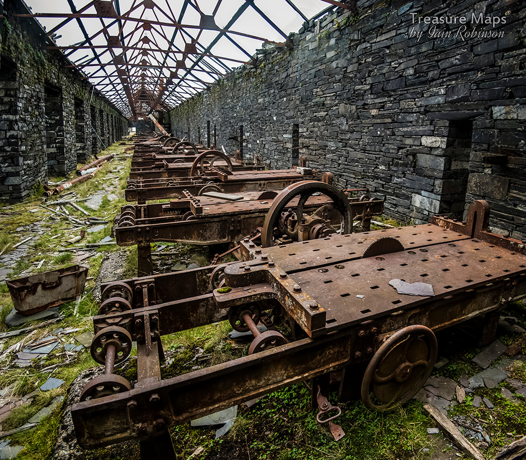 The saw tables on Australia level. 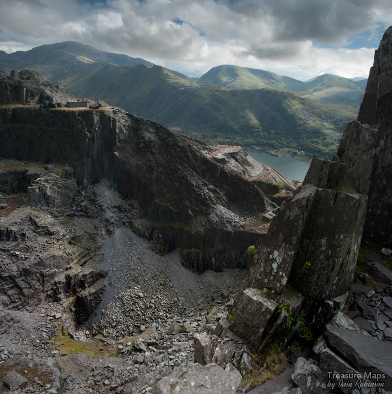 Looking down on Garret from Lernion A note about the pay of the workers: The working rock face in the galleries ranged between 53 and 86 feet in height. It was divided into 'bargains' i.e. working areas up to 18 feet wide each quarried by one half of each bargain gang of 6 or 8 men. The other half processed the quarried rock into finished slate. These working areas were termed 'bargeinion' (bargains) because a price had to be negotiated monthly with the 'stiward gosod' - the bargain setter. If the team made a good bonus the previous month, then the setter reduced the poundage the following month. In the hey day of the industry, the quality of the bargain allocated to a gang often depended on its religious and political affiliations. The members were paid a basic weekly salary which was topped up by the monthly bonus paid according to the number of slates produced based on the poundage agreed at the beginning of the month. However, each team had to pay for the powder and tools used, e.g. holes drilled by the foot (6d a foot in 1940), use of dressing machine (2s 2d), pay for ropes, pay the blacksmith for sharpening tools, labourers for moving waste, hospital money etc. All these ate into the bonus. It was not unknown for men to have slaved for a month and come home not only without a bonus but actually owing money to the company. This was in an age when the Hon. W.W. Vivian, the then general manager was left a cool £70,000 in his employers' will. I am indebted to Eric Jones for the above information, his Geograph photographs of Dinorwig are a fund of knowledge. Further Reading Jones, R. Merfyn. 1981. The North Wales quarrymen, 1874-1922 Studies in Welsh history 4. University of Wales Press. ISBN 0-7083-0776-0 Carrington D.C. and Rushworth T.F. (1972). Slates to Velinheli: The Railways and Tramways of Dinorwic Slate Quarries, Maid Marian Locomotive Fund. Douglas C. Carrington Delving in Dinorwig Llygad Gwalch Cyf, Llanrwst ISBN: 9780863812859 Reg Chambers Jones Dinorwic: The Llanberis Slate Quarry, 1780-1969 Bridge Books ISBN-10: 1844940330 James I. C. Boyd Narrow Gauge Railways in North Caernarvonshire: The Dinorwic Quarries, Great Orme Tramway and Other Rail Systems v. 3 Oakwood Press ISBN-10: 0853613281 Dave Sallery's feature on Dinorwig, within his excellent Welsh Slate industry site here 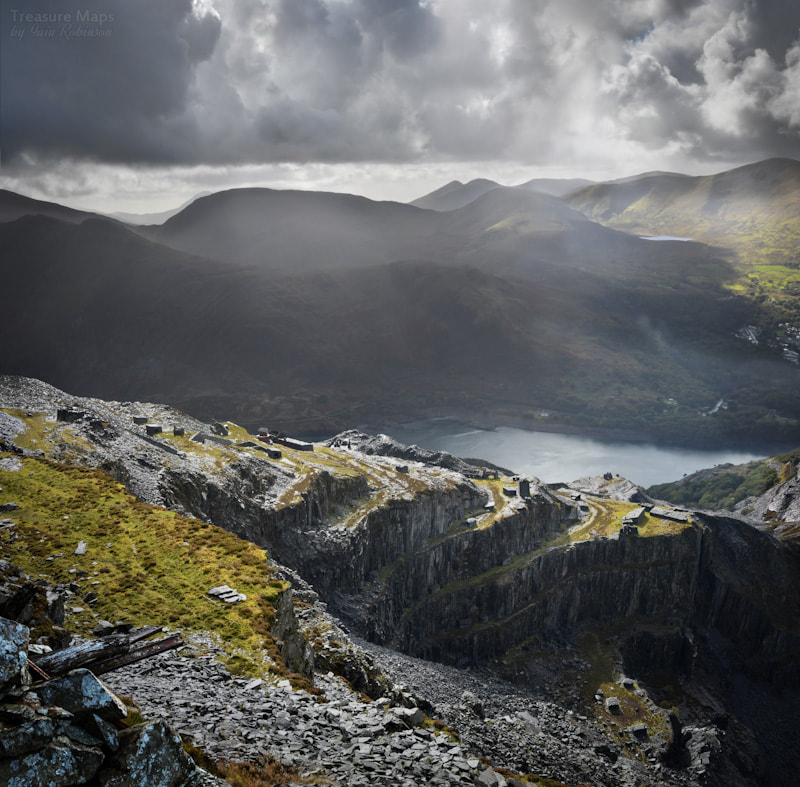 The view from Pen r ymyl, almost at the top of the quarry. 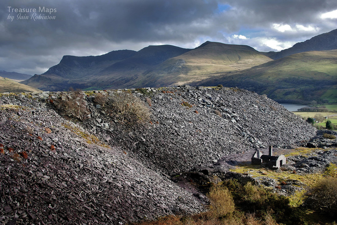 The smithy at Pen y Bryn upper quarry, overshadowed by the tips from the pit. Pen y Bryn is a lovely old site, north of the main pit at Dorothea. It rambles for a mile and a half up the hillside, squeezing itself between two mighty neighbours, Cilgwyn to the north and Pen yr Orsedd to the east. All old quarries are something of a mystery, but this one is rather special. At the southern, lower end it has a range of buildings that date from the C17th, a fine early 17th farm house and the remains of a C19th mill and steam engine house. There are at least three visible pits on the lower level, all worked out and tipped over, but still frighteningly deep. Over the years of silence at the quarry, nature has enthusiastically re-interpreted the place, doing a fine job. The lens of history is further clouded by the long period of activity here, from 1770 right up until the 1960's, with a good few fallow periods in between. Later developments, such as tipping and a new access road to Gallt-y-Fedw have confused things on the ground. 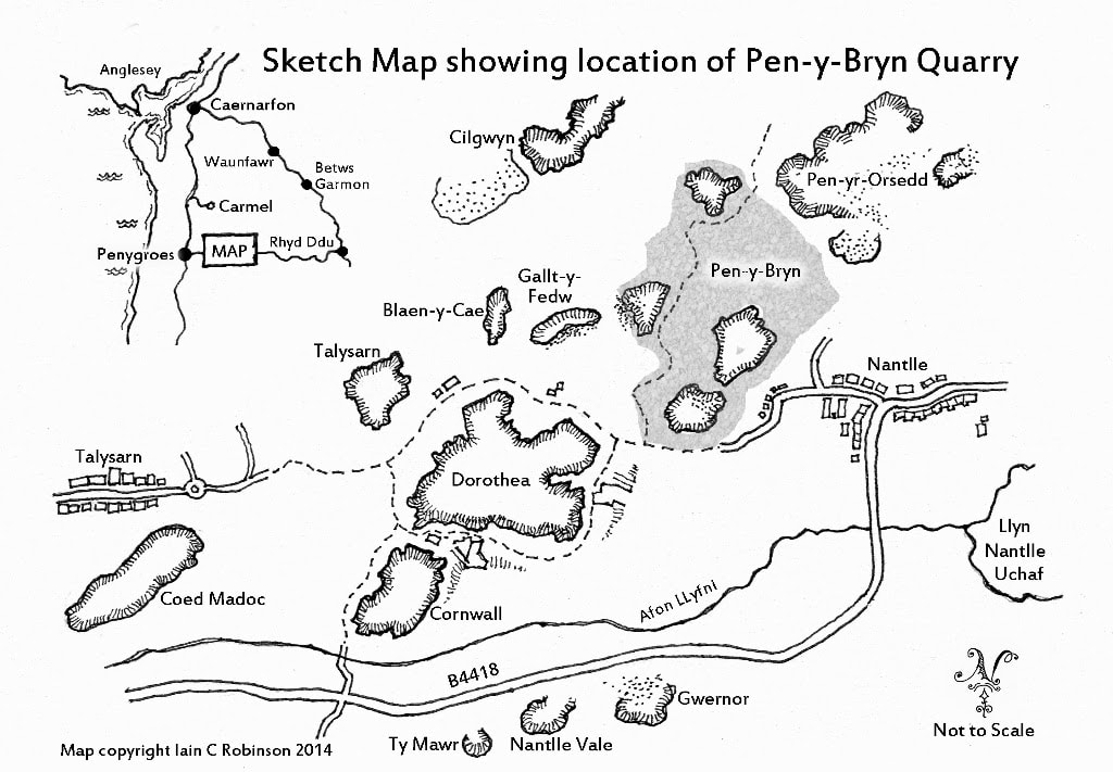 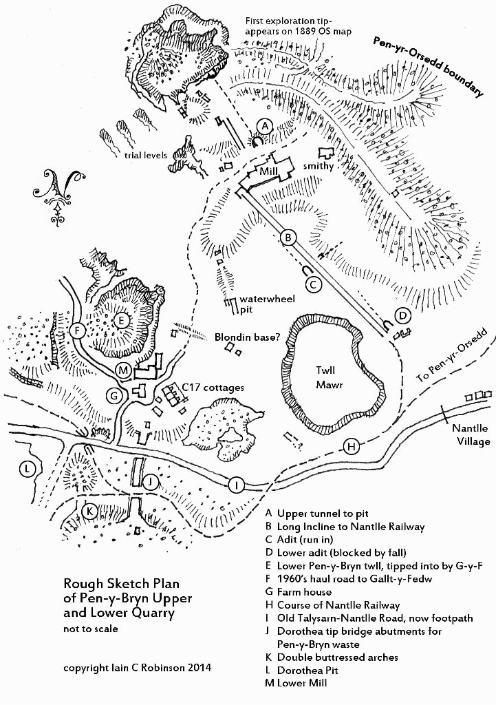 Let's have a look at the workings which give the quarry it's name. The first thing to be seen are the remains of a large old farmhouse, of 17th century origin. It's incredibly ruinous and looks as if it might fall down any minute. However, inside there are clues to it's age and also its remodelling in the 18th century. Large slabs of slate have been used as room dividers- and why not, when the material was to hand? 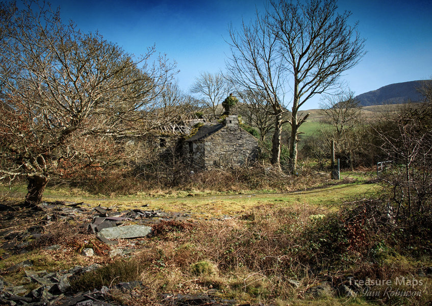 Pen y Bryn farmhouse, from the west. There's a row of very old cottages near the house, (below) which, like the farmhouse, pre-date the quarry. They have ancient beams, planed to shape with rough hand tools and the walls are made from igneous rock. The few slates remaining are of a considerable size, (probably Duchesses*) and I imagine they replaced smaller, "moss" slates quarried from outcrops by the builders back in the 1600's. Richards suggests that the cottages were used by the quarry as barracks accommodation from the 1830's onwards. The thinking these days is that these cottages were once part of a barn that was cut down to size to make accommodation for the workers. They must have used the original beams though, as they look to be ancient. In the photos above, we can see the beams from inside the cottages, which are now sadly falling in to disrepair very rapidly. The walls show evidence of much re-modelling but obviously, the layout was that of a "crog loft" - headroom must have been pretty minimal. Later, internal alterations are built using slate waste blocks. Note the length of light tramway rail poking out from the wall! There's also two fine arched windows, presumably left from the structure's first iteration as a barn. The view out from these structures is magnificent, even if the interior accommodation was sparse. The farmyard is shared with the remains of a substantial slate mill... 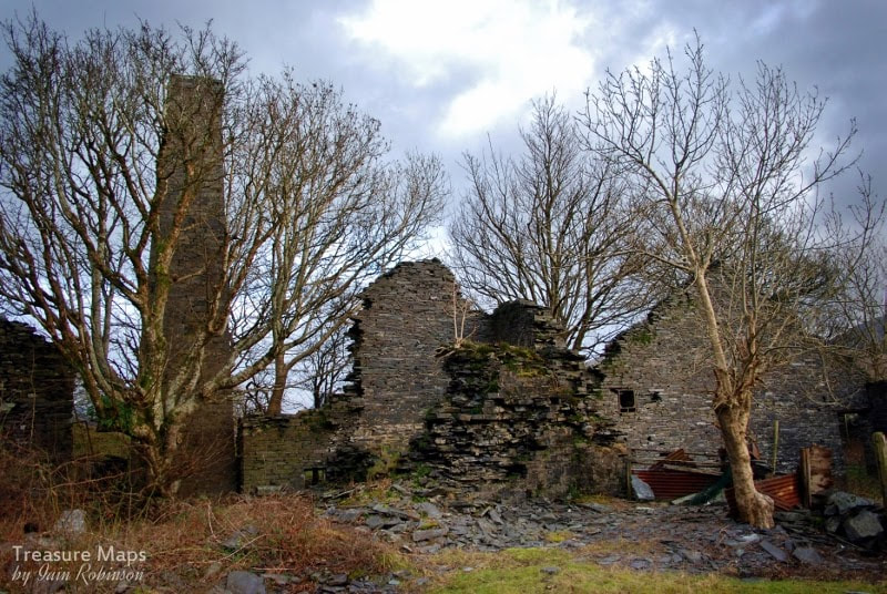 Until the late sixties, the mill contained the remains of a Mather Dixon Vertical Cylinder Condensing Steam Engine. Thankfully, Roberts of Ffestiniog, who were reworking the quarry at the time, realised what they had- and donated the engine to the Slate Museum. Nowadays the mill contains an impressive selection of old rusty bedsteads, the elders of a mighty clan who have scattered themselves all over this site and neighbouring Gallt y Fedw. I imagine they make handy and economical fencing and gates. I'm grateful to Amgueddfa Cymru/National Museum Wales for the mono photographs which give some idea of the engine's location. The mono shots are by Richard L. Hills, (Dr) and were taken in January 1968. 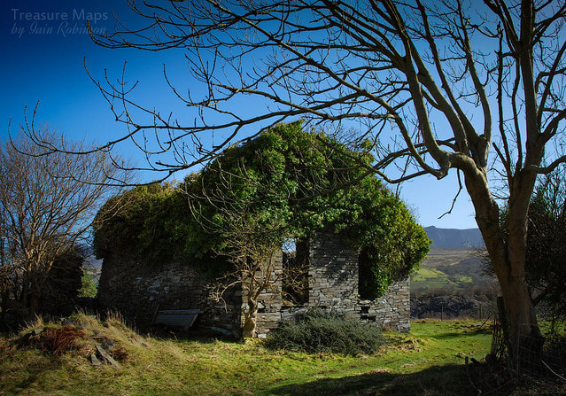 Retracing our steps slightly, there is a filled in pit called "Twll Ballast" which was one of the earliest diggings on the sett. A drumhouse (above) is at the top of a much degraded incline down to it. Material must have been uphauled from here to the mill. 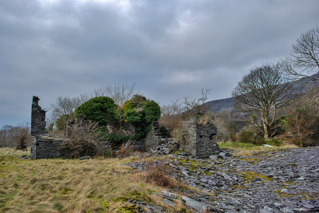 Looking at the winding house from the east, showing the range of buildings. There must have been a steam engine here and a boiler room. 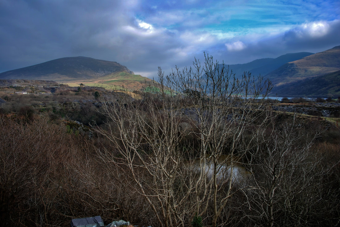 Walking down the incline a little way, this is the best view from here of twll Ballast. It was used in the fifties and sixties to dump all manner of dodgy stuff and it is an environmentally hazardous site today- although the wildlife here is surprising. A mine exploring friend has told me that there is a tunnel from the sinc at the middle pit which connects to Twll Ballast. Apparently in his younger years, he attempted to explore, but the bad air backing up quickly made the endeavour hazardous. 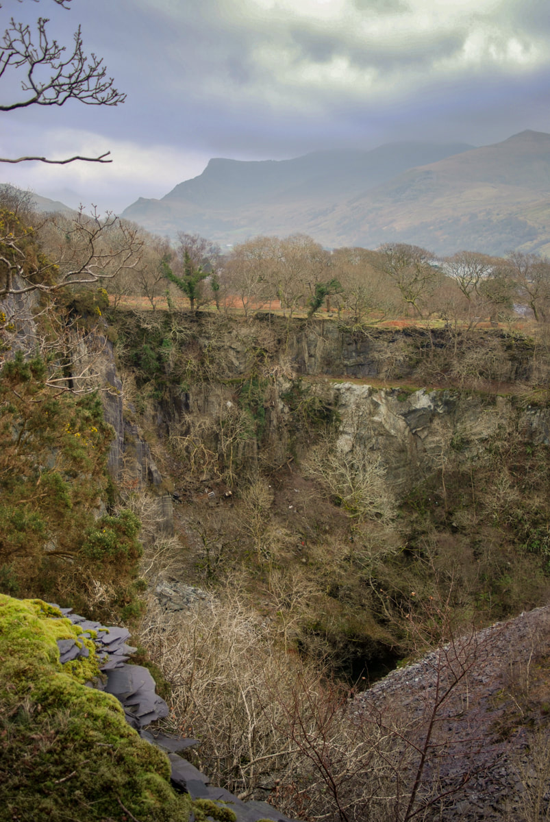 The middle pit. The waste on the right is from Dorothea, who bought the site and used it as a place to tip. The path up to Pen y Bryn uchaf goes up on the far side of this pit. About that buy-out by Dorothea... the problem with all the quarries in this area was that the slate veins were almost vertically inclined. Pits were the only way of winning the slate, with the attendant problem that wherever you tip, it may be on top of untapped slate reserves. So buying Pen y Bryn, a worked out quarry with several pits was a good idea. To that end, Dorothea built the two slate columns that cross over the Nantlle railway towards the mill as supports for a bridge- with a strangely incongrous weigh house on the top of one. That did kind of give the game away, didn't it!  The two columns that supported a bridge over from Dorothea (from the west pyramid) to carry waste slate trimmings. Walking up now along the east side of the pit, various workings and structures appear beside the track. Most are very difficult to explain, even with reference to the 1889, 1900 and 1960's 1:25,000 Ordnance maps of this area. For instance, we puzzled over this, below. Was it a feature for an aqueduct, a blondin base...or what? A depression cutting under the track lies parallel with it and is marked on the 1889 map as disused, perhaps when the pit was abandoned for workings further up the hill. My money is on some kind of chain incline support. 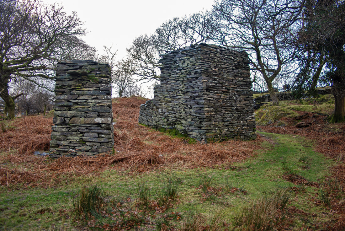 I've marked this on my map as "Blondin Base support"...it certainly supported something! The next thing to be seen is a waterwheel pit. Coflein says: "The 1st and 2nd editions of the historic 25-inch O. S. maps, published in 1889 and 1900 respectively, depict a waterwheel pit at this location, with what appears to be a watercourse supplying water. On the hillside above are the remains of a 260 metre-long pond, its upper reaches already shown as marshy ground on the 1889 map. The water wheel may have been used to pump water from Middle Quarry, which became disused before 1900. The waterwheel pit and its aqueduct are depicted on the 2nd edition map, but the aqueduct is not depicted in the 3rd edition map, published in 1916." By "Middle Quarry" they mean the one next to the mill. Twll Ballast and Twll Mawr were also disused by the late 1800s. Five minutes more walking uphill leads to the top mill, where the mysteries start to gather. Reading the late Dr. Gwynfor Pierce Jones's excellent book, "Chwarelyddiaeth Dyffryn Nantlle" I get the impression that the upper quarry was a later expansion...but it could be my Welsh, which isn't great. However, I think he suggests that there was unsuccessful effort to develop the highest land at Pen y Bryn as a new quarry in 1923. There had been a pit and a mill here certainly since 1889, although a glance at the satellite view will show how much it has grown since then. The enterprise failed due to the cost of removing overburden and of removing rock from the pit- and it closed in 1932, although further attempts to work it were made in 1949-51, and in 1963, but to no avail. 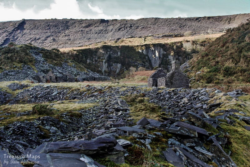 Weigh hut and ruined buildings at the edge of the upper pit. The tips above are from Cilgwyn. What has been left is a very deep pit, a long incline down to the Nantlle railway, the remains of a fine mill and a smithy. Several adits lead into the pit from below. The top one is open, but leads to a ledge over 100 feet above the bottom of the pit. Other adits and drainage tunnels lead off the long incline, but according to the maps, these were out of use by the 1900's. The lowest adit is a very long one and ends in a collapse after half a mile. 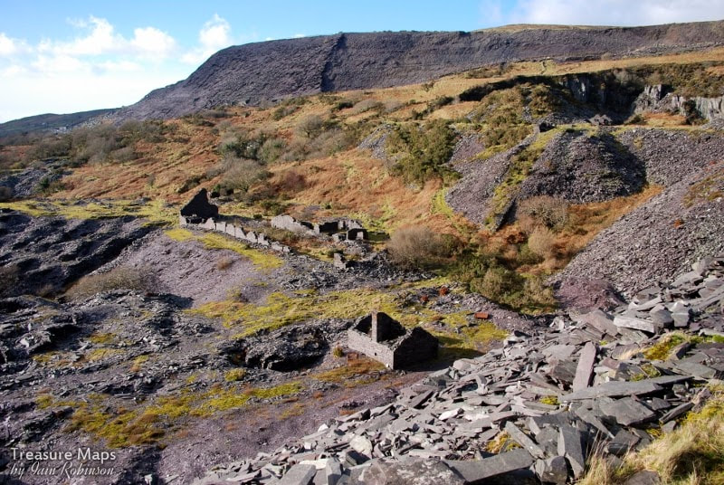 The mill, seen from the tips. The first building in the middle foreground is the smithy. Behind it is the mill, which has a drumhouse attached to the gable end farthest away from us. The incline can be seen as a dark shadow going off to the left. The lowest adit is a mystery. If it led into the pit, where would the rocks be processed? Surely they wouldn't be dragged all the way up the pitches of the long incline to the mill. Pen-y-Bryn was taken over in 1832 by Dorothea, but it seems unlikely that produce would be hauled to the Dorothea mill from here. Because of it's elevation, this tunnel must have been a late enterprise; I can only think in order to access the pit floor...although another mystery is the lack of exploration spoil from the tunnel, unless it was tipped into nearby Twll Mawr. 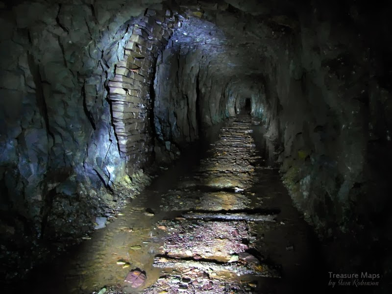 In the lower adit,which is sketchy and dangerous. A fall could be seen in the distance when we explored. 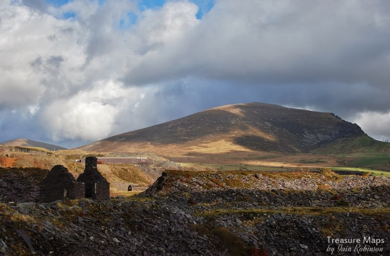 This is the top level, above looking across to Pen-yr-Orsedd through a breach in the tip tramway embankment. 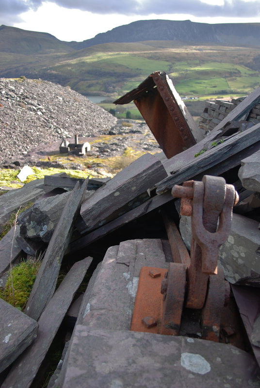 A view from the crimp of the top incline looking down on the tip and smithy. 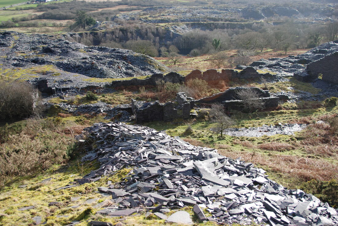 Looking down on the mill. In the background are Twll Mawr (left) and Twll Ballast (right). 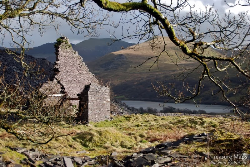 The end wall of the mill with the drumhouse. The mill itself contains few clues as to how it was powered, but the remains of a very large bore pipe suggests perhaps a water turbine- although just where the water came from is yet another mystery. There's no obvious water on the site. Some factoids: * A duchess slate is 24" x 12". Pen y Bryn was opened in around 1770 and in 1882 employed 240 men, producing 5083 tons of slate. As I mentioned earlier, a feature of the Dyffryn Nantlle style of quarrying was that exhausted pits would be tipped over and filled in. There are remains of pits here and there while others simply don't exist any more...this becomes apparent when studying the old OS maps and surveys. Pen-y-Bryn incorporated Cae Cilgwyn, Herbert's Quarry, Twll Penybryn, Cloddfa Lon, Dew's Quarry, Hen Dwll, Twll Balast, Twl Mawr, David's Quarry, Middle Quarry, New Pen y Bryn, Owen's Quarry and Twll Ismaliod. Some were absorbed into ever expanding neighbouring pits, as at Twll Mawr, others just disappeared under thousands of tons of waste. Pen y Bryn was an early adopter (1830) of the Chain Inclines which were so prevalent at Dorothea before the advent of the Henderson Patent ropeways. 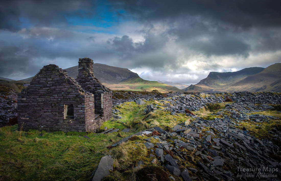 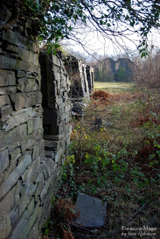 Image 1. The western gable of the mill seen from some offices at the edge of the pit. Nature is always there, patiently waiting; until we leave somewhere unattended and forgotten for a few years. Then she moves, with stealth and relentless energy, to transform the marks made by man. One such forgotten place is the Dorothea slate mill, in the Nantlle Valley. The numbers on the photographs refer to a location key map below: 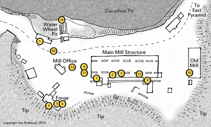 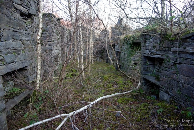 Image 2- the splitting booths In the lip of a giant crater and surrounded by looming citadels of slate waste, it is a place so changed by nature and time, that walking inside the vast machine area of the mill feels like taking a stroll through a forest. Birdsong echoes from the walls. The low beams that gave the place it's human scale have long gone, as have the saw tables. Sky is the roof, fringed with waving birch, while blackbirds bustle where the hoggia felin used to split the crawiau tenau into countesses. It now takes the eye of an aficionado to see the marks where the journals for the line-shafting used to sit, or the scoring on the slate wall caused by an ill-fitted flywheel. 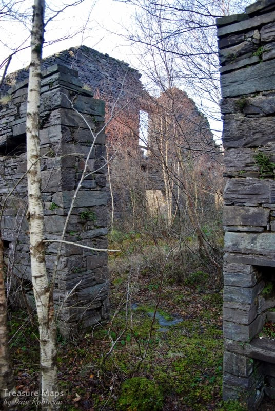 Image 3 So I was rather delighted to find the photographs below of the mill, taken by Tim Venton, on the 8th of July, 1974. The place had been abandoned then, of course. It had been lying quiet since 1968. The scrap man had taken all the metal of value, while the slates had been stripped from the great roof. No doubt the mighty beams would be next, to be re-used somewhere else. But these wonderful photographs mark a point in time, helping to make a little sense of what we see today. Apart from the (literally) ground breaking work of J. C. Burrow, who was taking underground photographs of mines in the most difficult circumstances from the 1890s, we have few records of what went on. Photography was so expensive and difficult in the 1870s that most photographs were of folk going off to war. The Victorians and Edwardians also didn't like to be reminded of the social conditions that powered their form of capitalism, so record shots of mines and quarries were rare. We have the en masse shots of the quarrymen, thank goodness, but that's about it. I'm just glad that Tim didn't have any such misgivings when he visited that fine summers' day in '74. 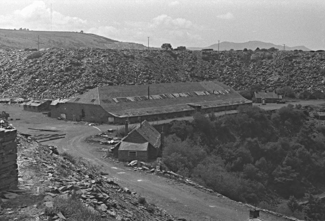 Photo by courtesy of Tim Venton. Taken from the tip run along from the eastern pyramid in 1974. 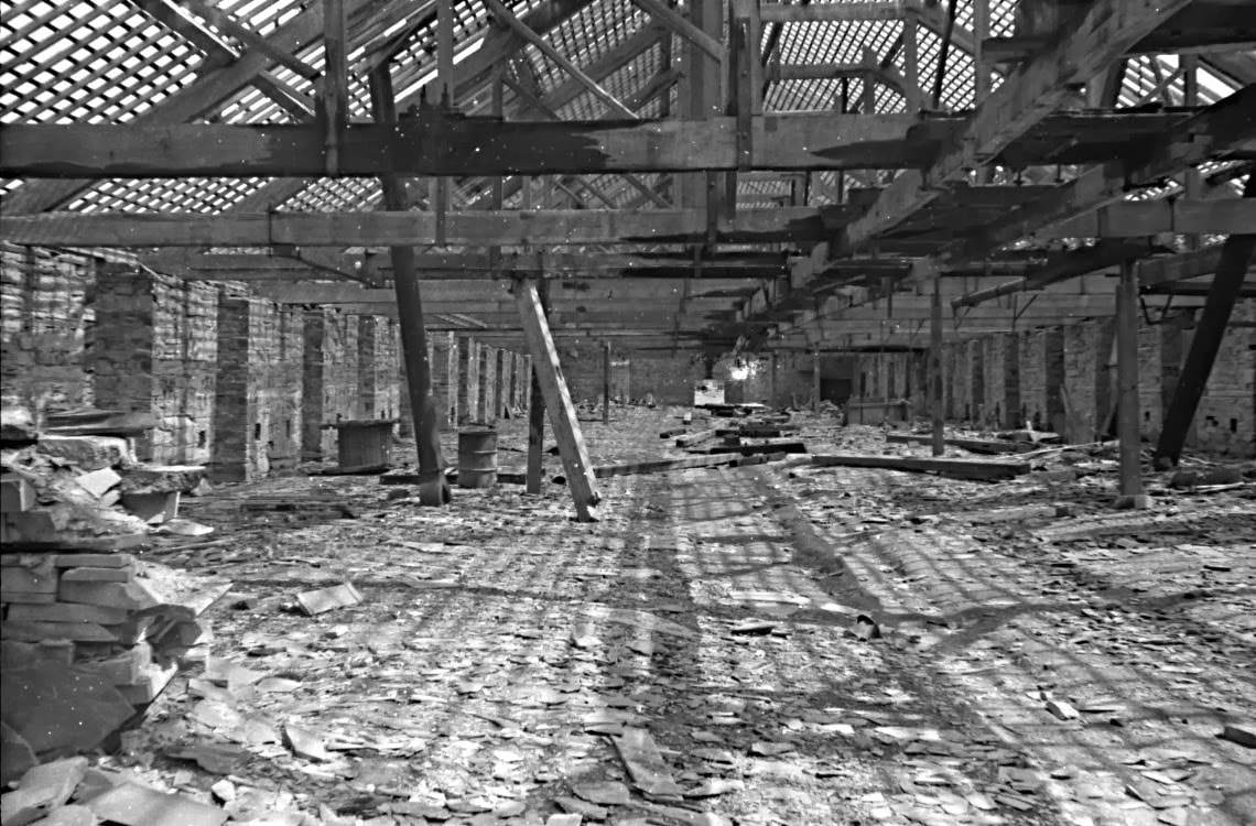 The mill interior in 1974, note the dark patches on the beams caused by the constant lubrication of the overhead line shafting journals. Photo by courtesy of Tim Venton. Some facts: Construction of the mill began in 1882. It was completed in four stages by around 1900, when it contained forty one saw tables arranged in two rows. The first section to be built consisted of the western gable with four bays. This housed ten saw tables and an elevated house for a steam engine to drive the plant via overhead line shafting. The bearing boxes for the shafting can still be seen on the gable ends today. The engine would be a single cylinder horizontal engine, formerly used as a winder. (It had been salvaged from an earlier landslip). In 1884 another six bays were added, housing a further twelve saws. Two years later a second steam engine was added to the existing one. This was a two cylinder horizontal. Dorothea had a habit of buying stationary steam engines such as the Robey 6nhp portable that was popular with the management, but these engines appear, from evidence of mounting studs in the engine house ruins, to have been fixed engines, similar to the remaining example at Pen yr Orsedd. Later, a further six bays were added to the mill. The rubbish tramway passed under the engine houses. An Earlier Mill This wasn't the first mill- a waterwheel powered mill was built in 1842 to produce slabs. This contained sand saws to cut the slate, the saws known as Melin Griffith. Today there is no trace of this mill, but it may well have been near the edge of the pit to take advantage of the waterwheel at (14). A smaller mill was constructed to the west and oriented north south, (15) but there is no information about this- it looks as if it might be older in construction. "We've always done it this way..." There appears to have been a rather inefficient layout at the Dorothea mill, but this might have been because of the very conservative attitude of the slate workers themselves. The semi-integral gwaliau or separate booths for hand-processing may reflect managerial acknowledgement, however grudging, of the quarryman's traditional self-image as a contracted bargeinwr. Such a man would deeply resent the implications of being considered a mere factory hand. His loyalty was to the other members of the bargain, rather than to the authority of a mill foreman. An example of this was when a "Time and Motion" inspector was invited to Dorothea by the management. He ended up being placed in a barrel and rolled down an incline! 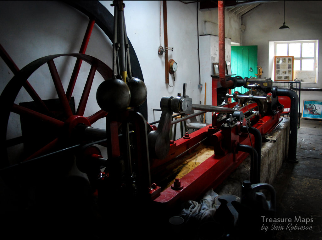 An 1854 De Winton horizontal engine similar to the type probably used at Dorothea. This example is preserved at Glynllyfon. 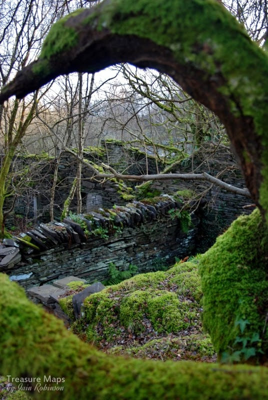 Image 4. The smithy buildings. Today, there's a well-trodden path beside the mill. When we stopped for a couple of hours to take photos, we were aware of folk nearby, walking their dogs or just out for a stroll. Most passed by without much of a glance, except to give a friendly greeting. A couple of folk stopped and gave us little snippets of information about the place, local pride showing in their smiles. I'm always keen to get any information from real people as opposed to books and archive finds, even if it is sometimes coloured with a sprinkling of mythology. Absorbed in looking at the back of my camera, "chimping" the shots, I didn't hear the two lads approach. The first thing I saw was a pit bull looking at me, gimlet eyes evaluating my ankles for chew value. Then I clocked a young guy, early twenties, standing slightly too close, sizing me up. He was holding what looked like a rifle, but was probably an air gun. His mate, obviously the lieutenant of the duo, hung a little further back, waiting to see what would happen. They were the classic "hoodies" of urban repute. Just like my son, who is about the same age. I bent down to the dog, who immediately responded, licking my hand. "He likes you", the guy nearest to me said, with what sounded like an ironic laugh. "Nice camera." I stood up, surreptitiously wiping off the pit bull drool on to my disreputable, bramble-harried exploring jacket, telling him that I'd been taking photos of the old mill for the last two hours. The vibe immediately changed. Both the guys were smiling now. "Have you seen the engine house? The mansion over the other side of the twll? There's a tunnel there, my taid said it goes to the next village..." I could have said that I knew about the mansion, although not much, I admit. But I hate it when folk go yes, yes, they know. So I nodded politely (there was still the matter of the gun, remember.) As it happened, I did learn much of interest from the lads. Among other things, they told me they were off to shoot tigers. As the current buzz-word goes, that's proper "re-wilding" for you. 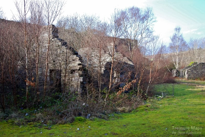 Image 13. The mill office. I wonder if it was in here that the discussions about the Pumping Engine took place with W J Griffith and Brindley, the representative from Evans' pumps? 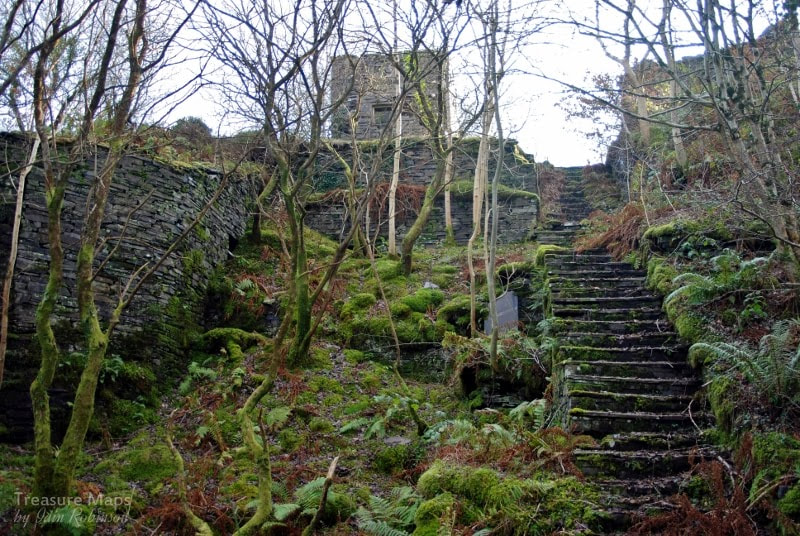 Image 14. The waterwheel pit on the edge of the Twll. 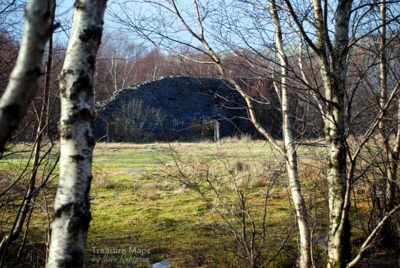 Image 15. The East end of the mill from the ruins of the earlier mill. 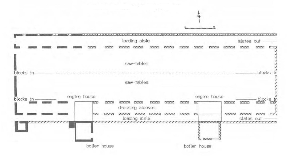 Sources and acknowledgements
Thanks to Dave Linton for reminding me about J.C.Burrow. Here's a link to an interesting article about him. Here's a link to my review of another book about photographs underground in Welsh mines. I'm very grateful to Tim Venton for the use of his photographs of the mill in 1974. Much use has been made of the Gwynedd Archaeological Trust report: GWYNEDD SLATE QUARRIES - an archaeological survey by Tilsley and Fardd, 1997 (GAT 252). Pierce Jones G: Dorothea Slate Quarry (UWB MA thesis) 1980. The Slate Quarries of the Nantlle Valley - Stationary Power 2 1985 13-41 . Gazetteer of Slate Quarrying in Wales, Alun John Richards, Llygad Gwalch, 2007. |
TracksReceive the occasional Treasure Maps Newsletter- and alerts when a new post is available!
If you enjoy my content, please buy me a coffee!
Check out my other online activity...
Index
All
|


 RSS Feed