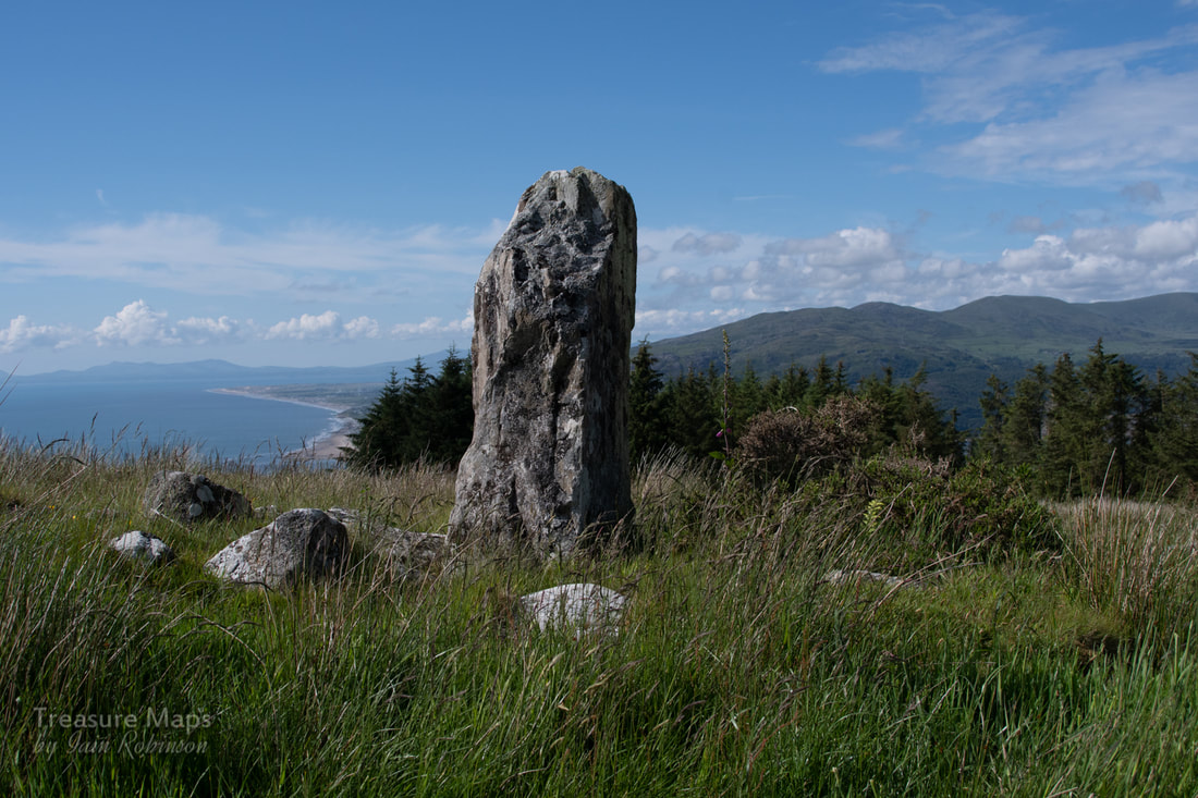
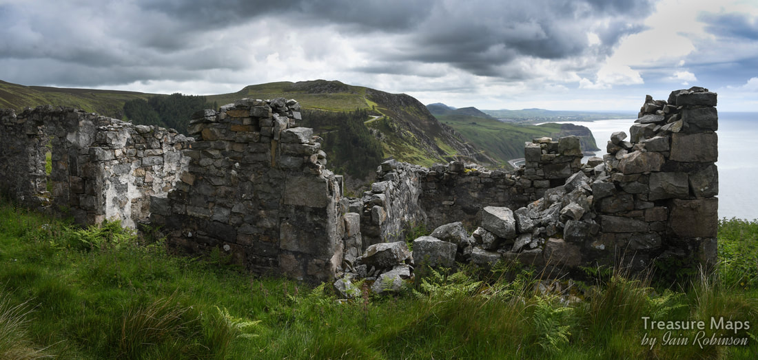
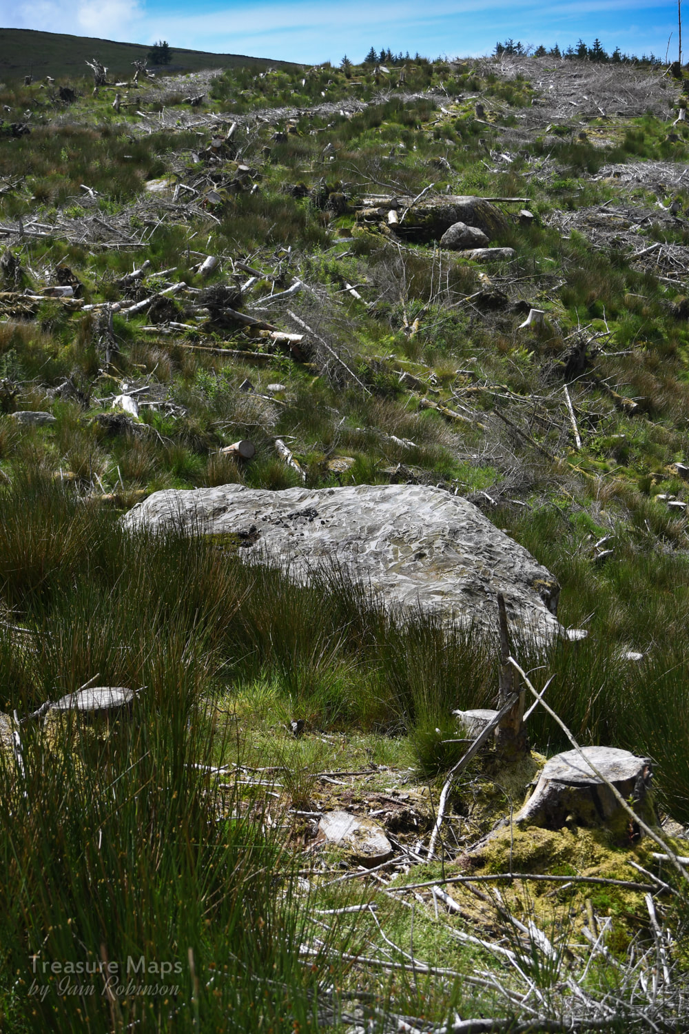
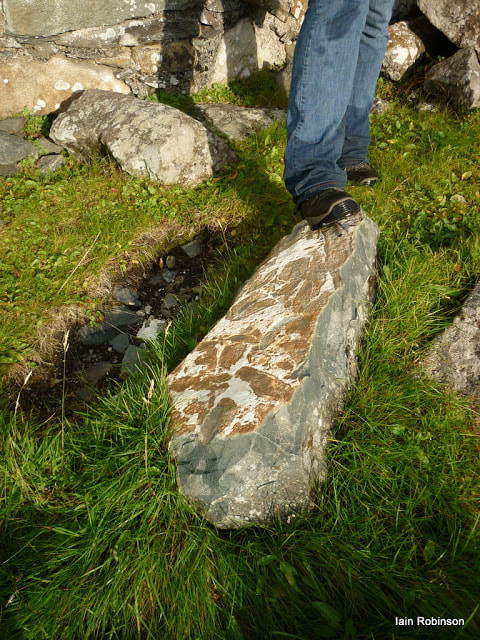
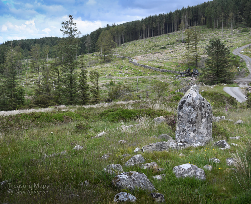
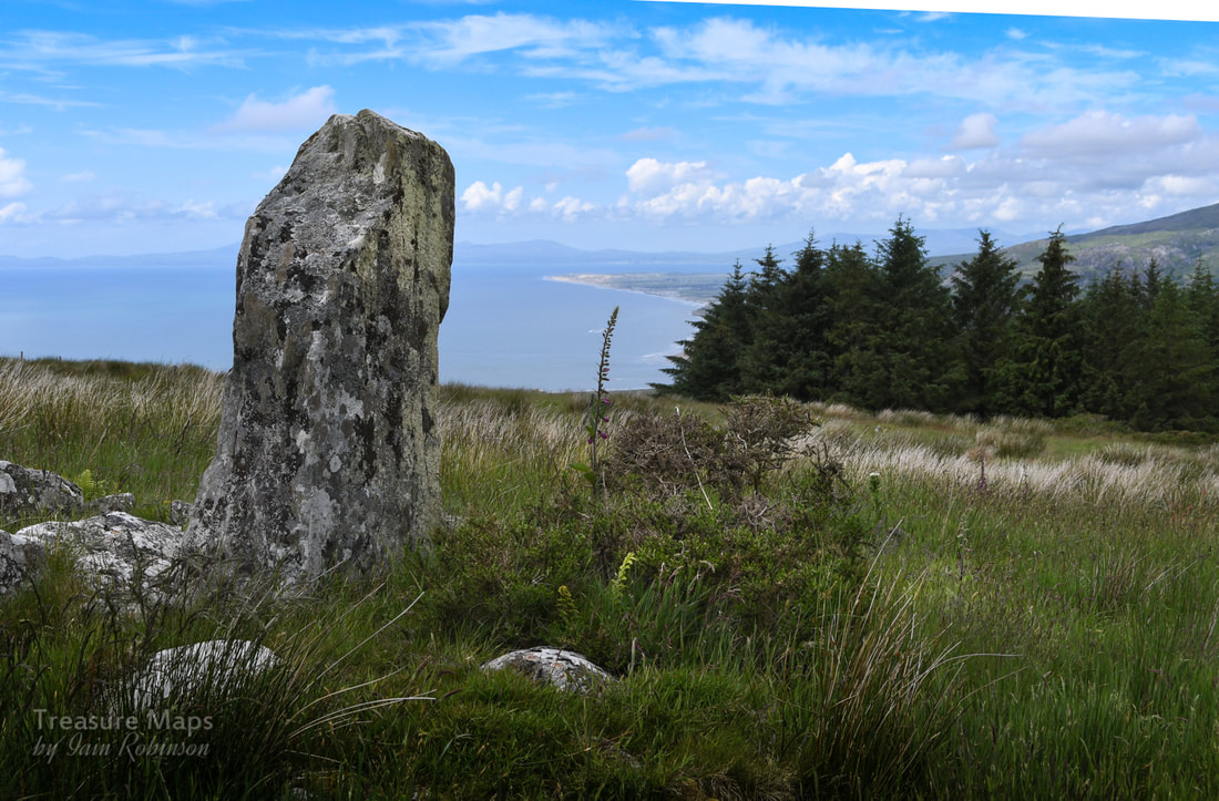
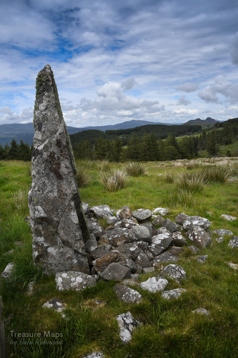
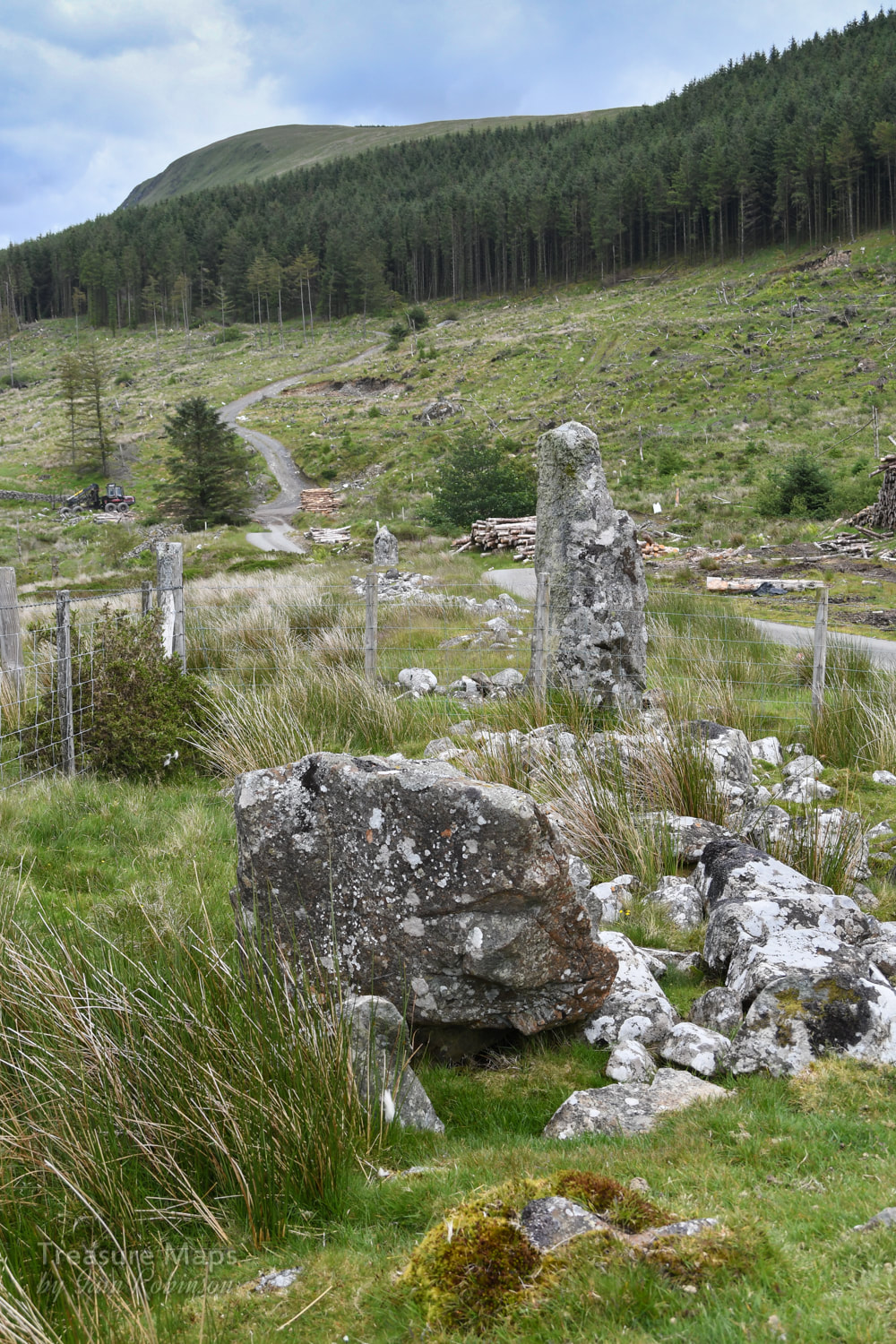
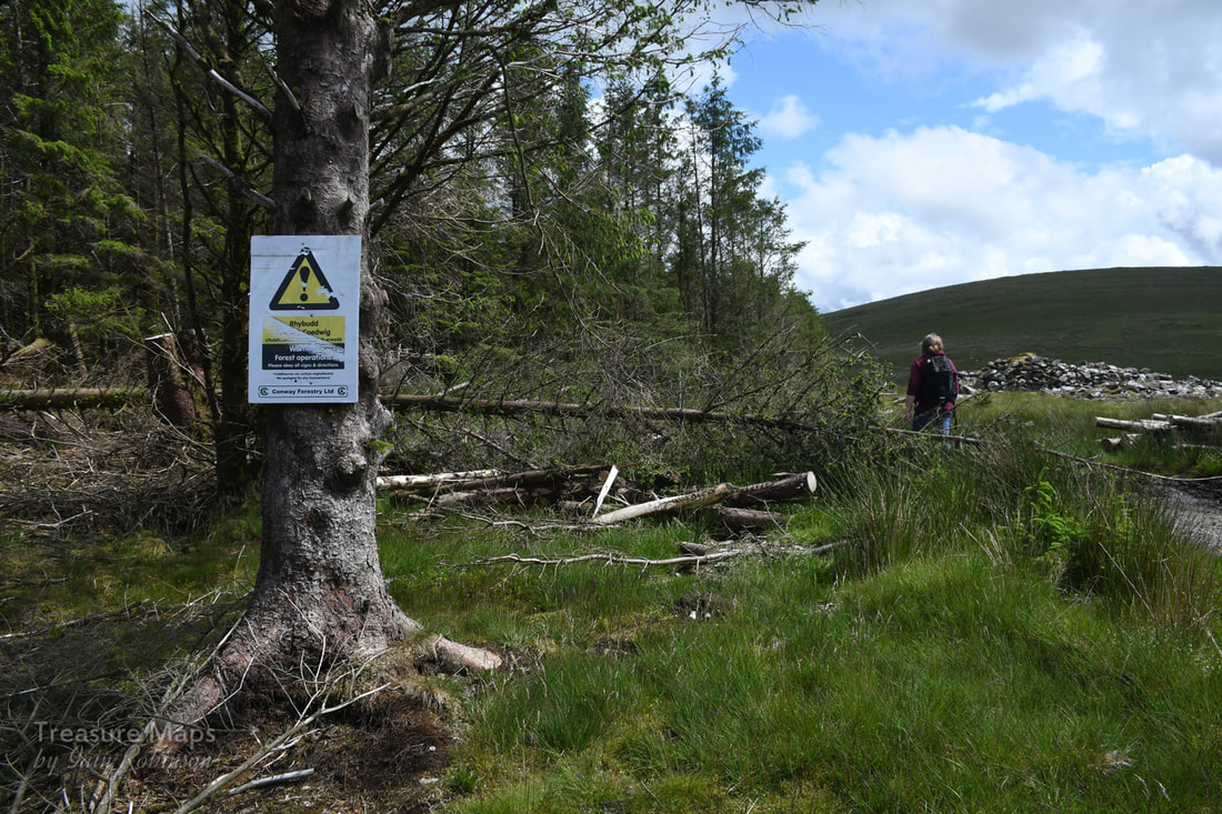
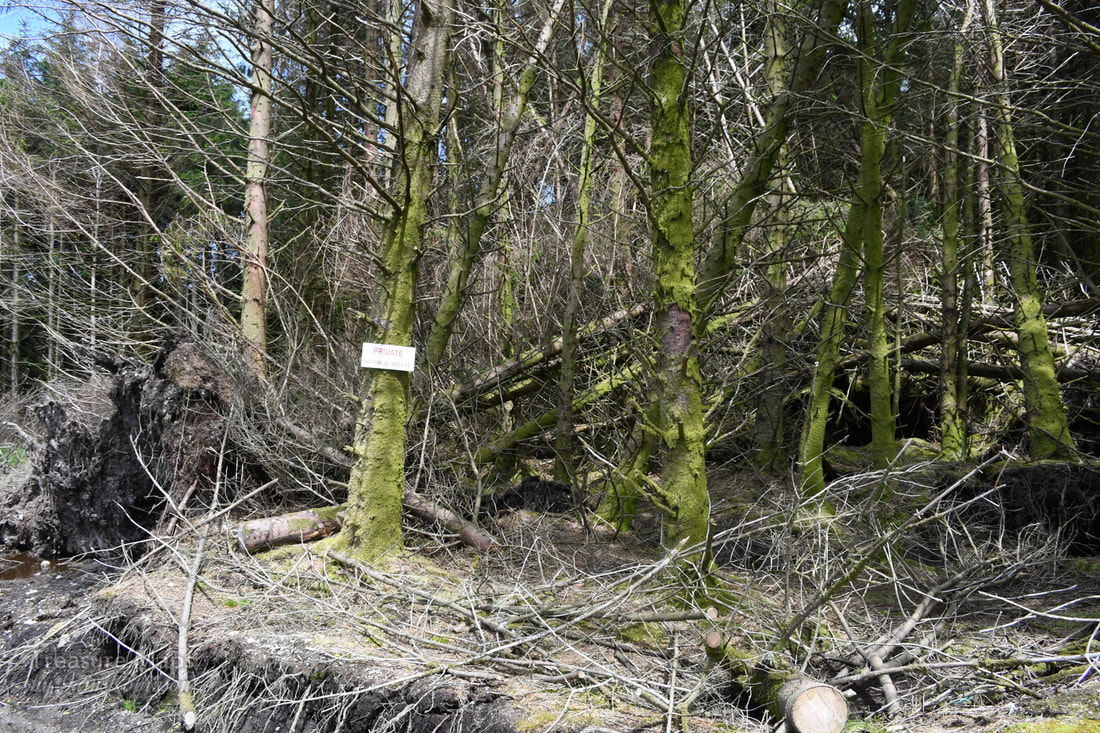
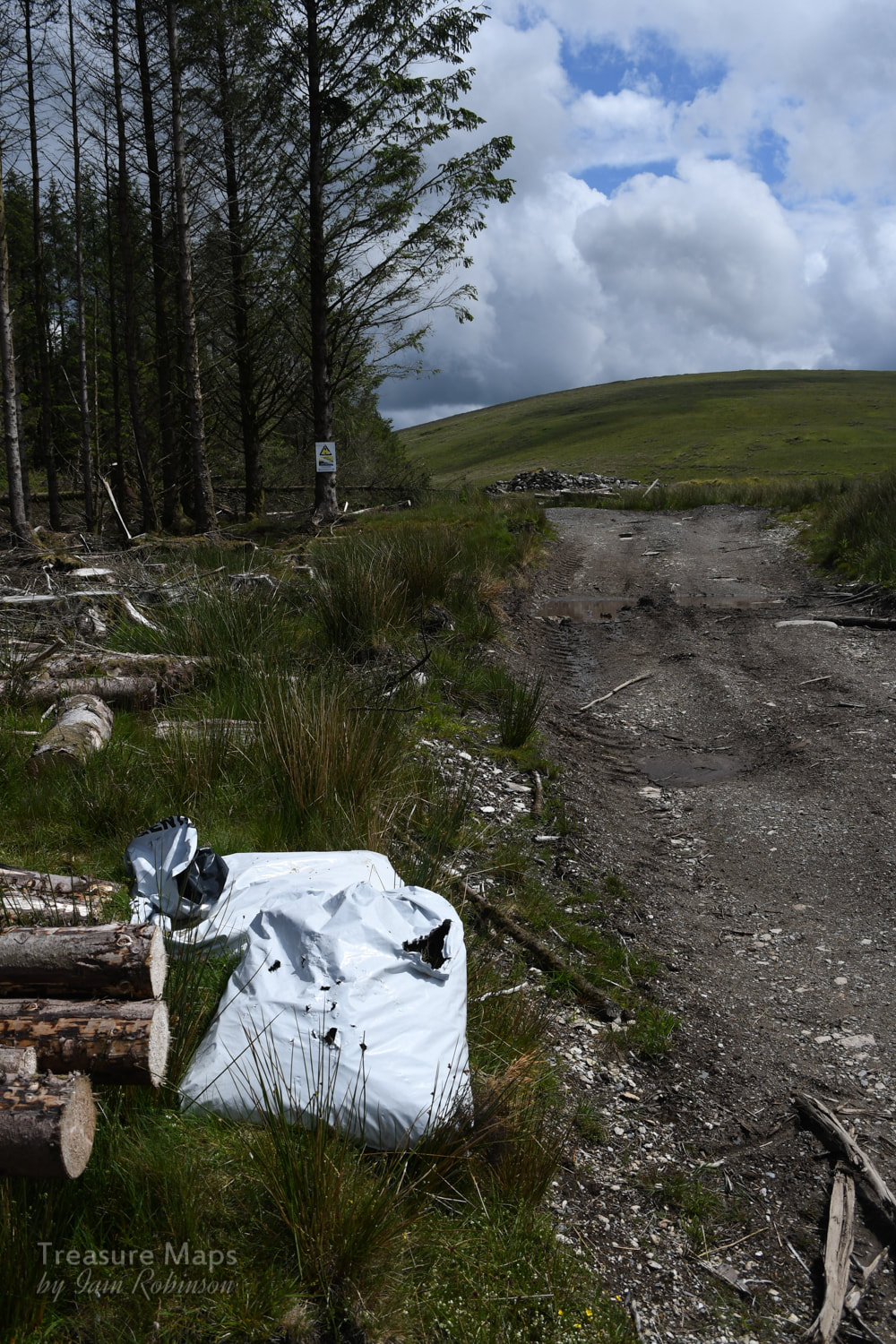
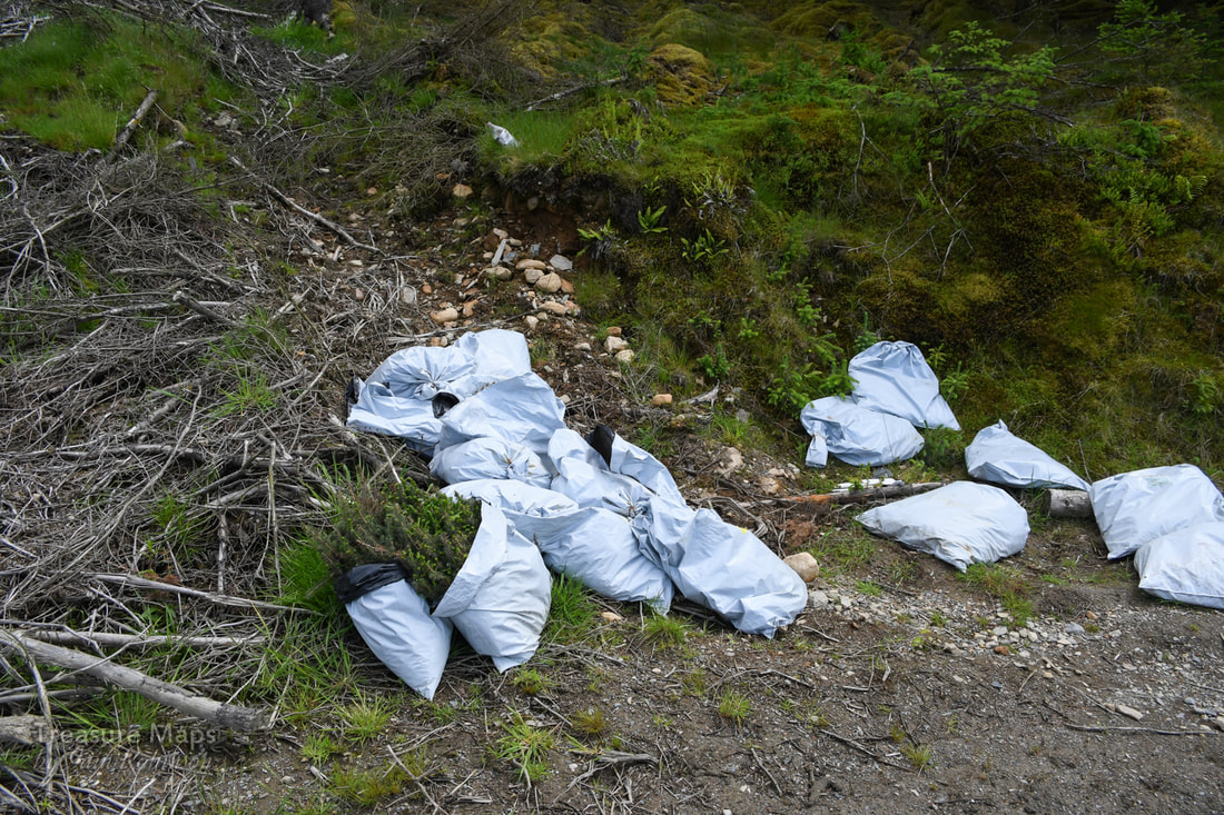
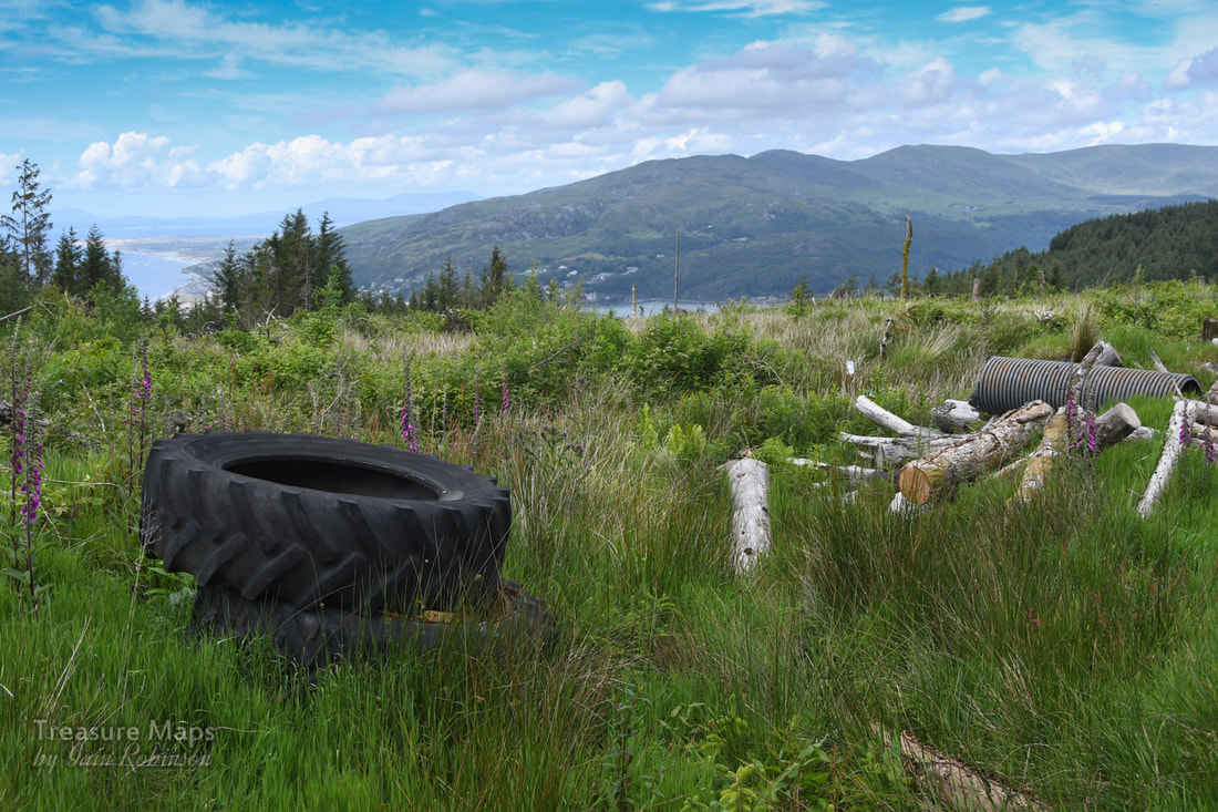
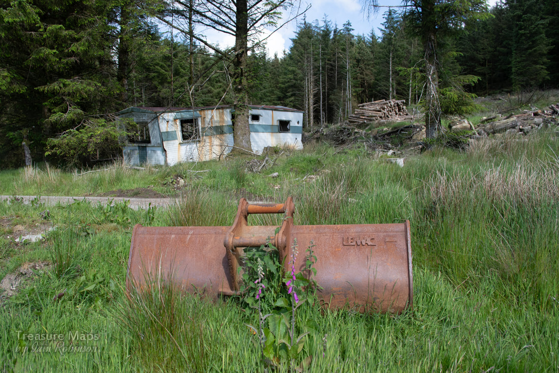
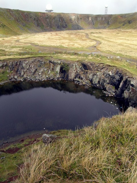
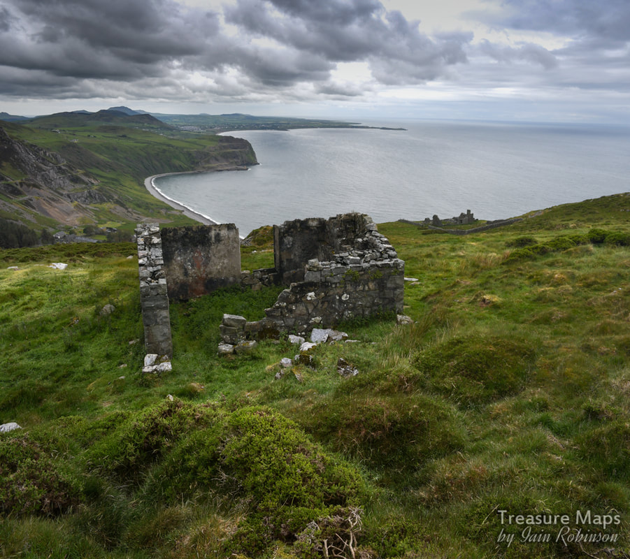
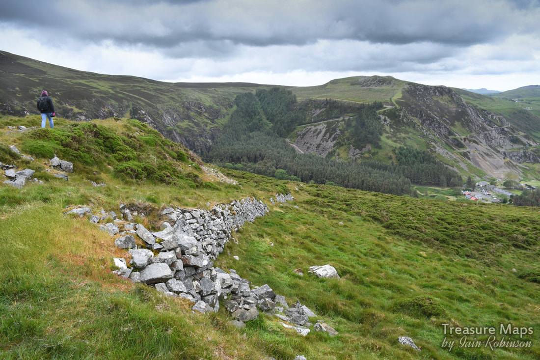
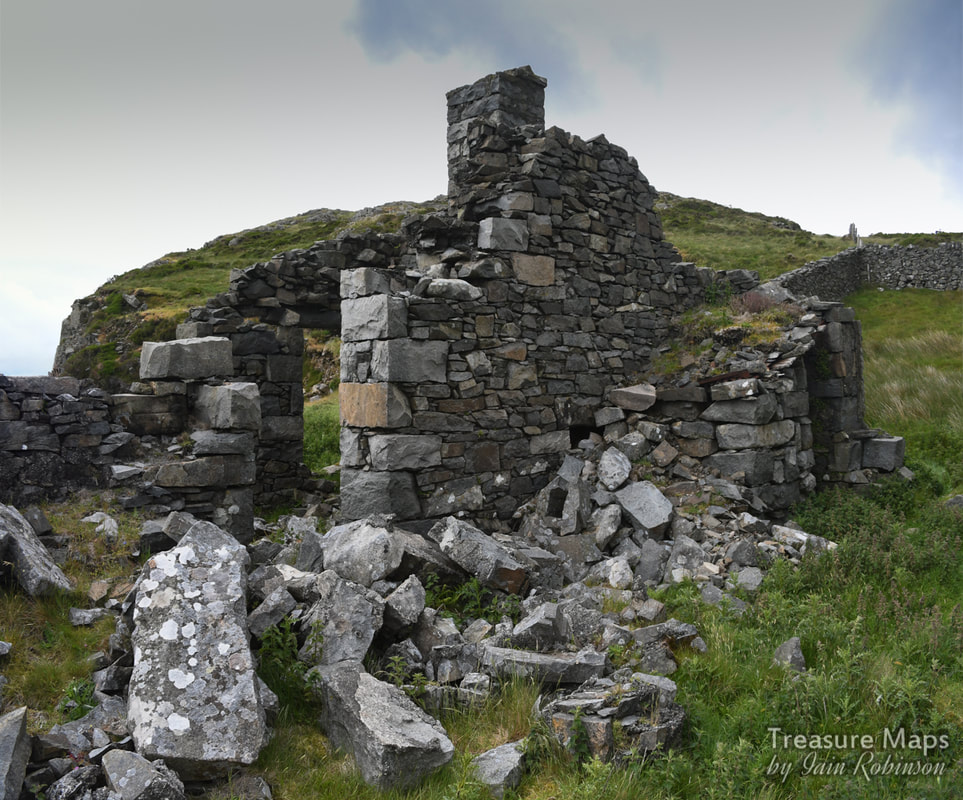
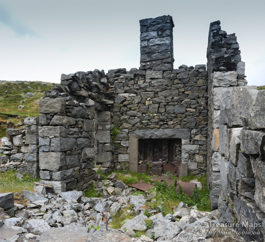
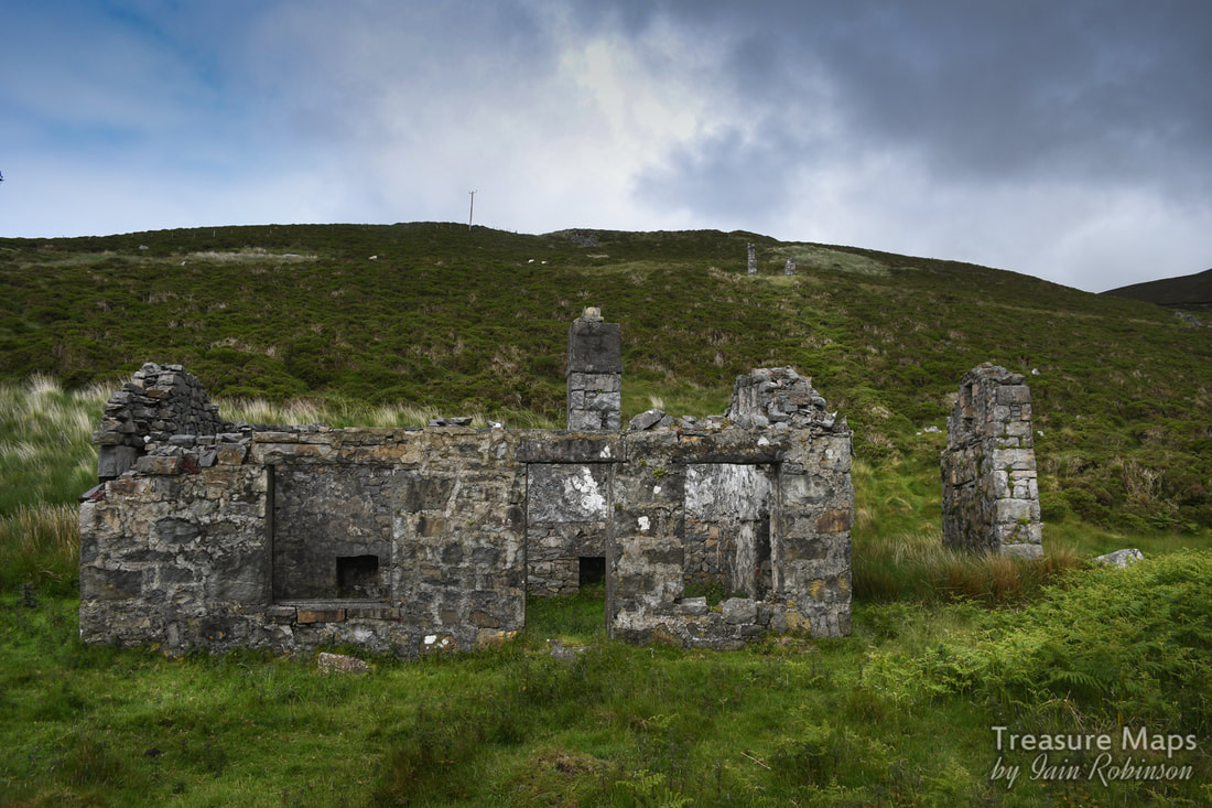
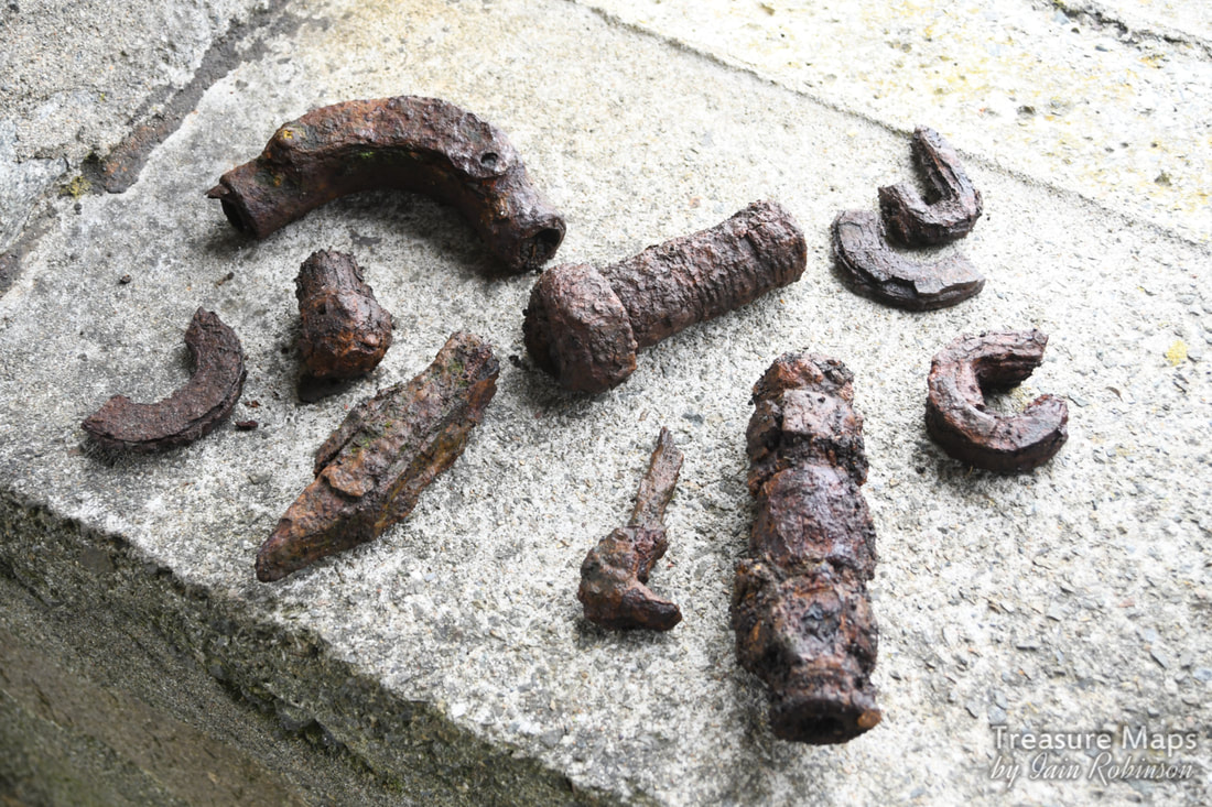
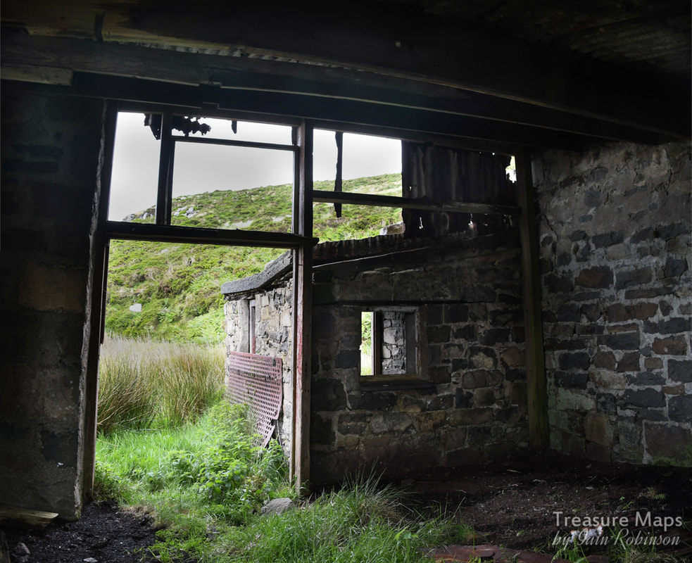
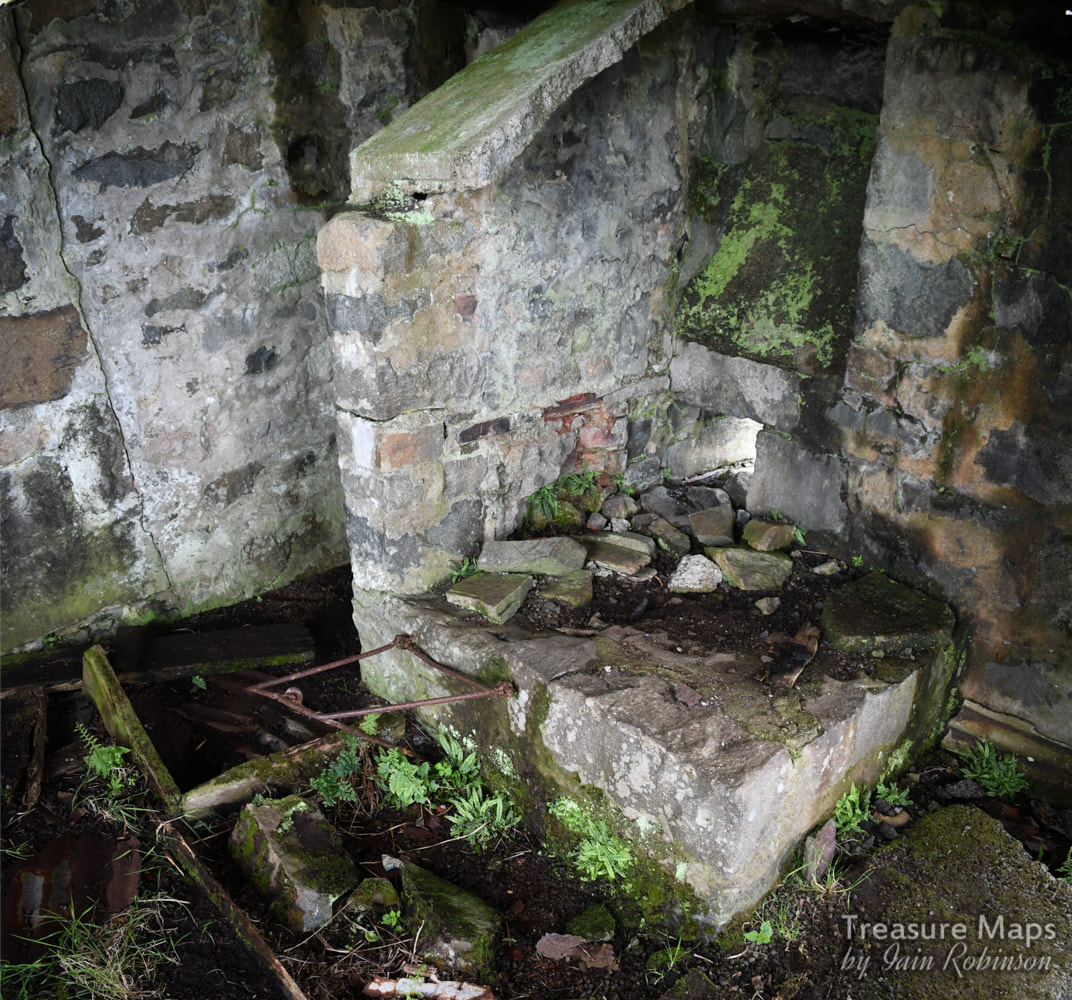
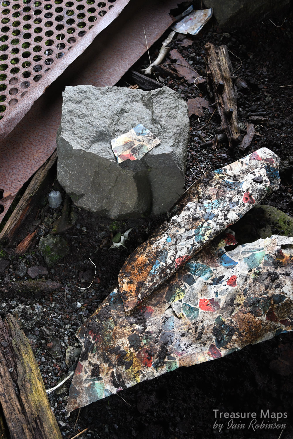
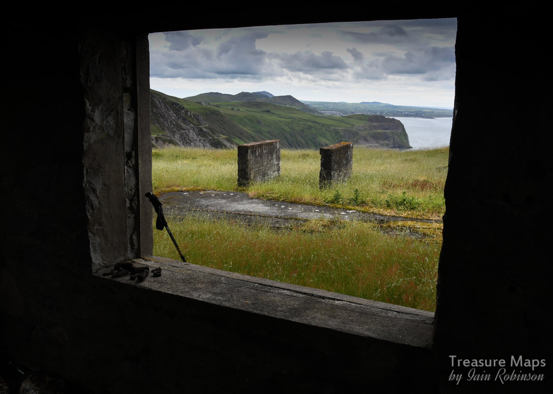
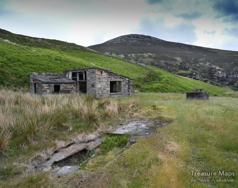
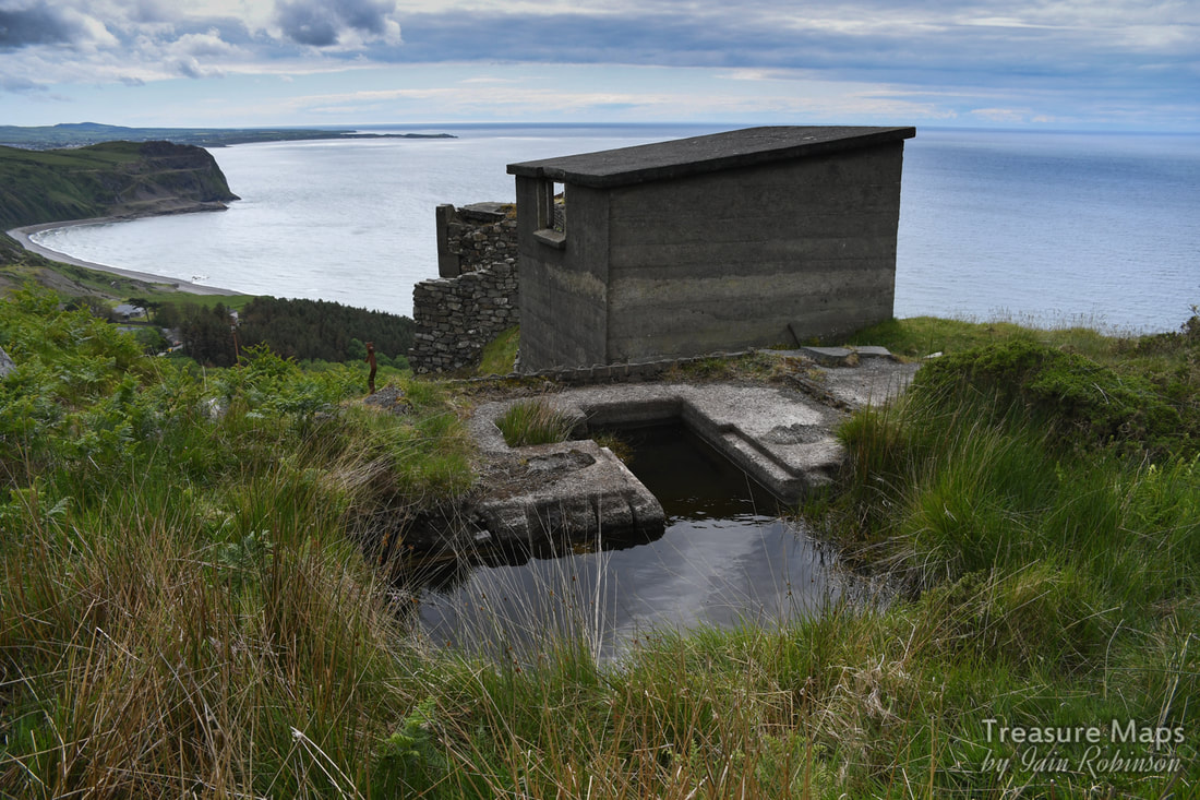
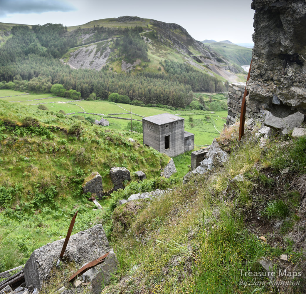
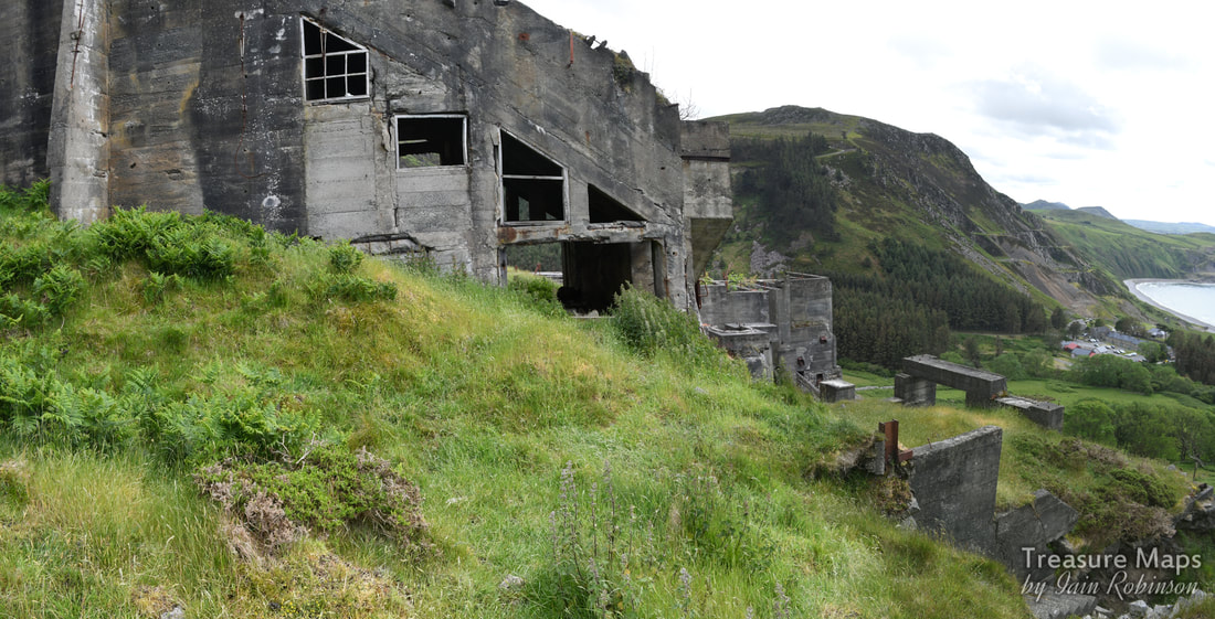
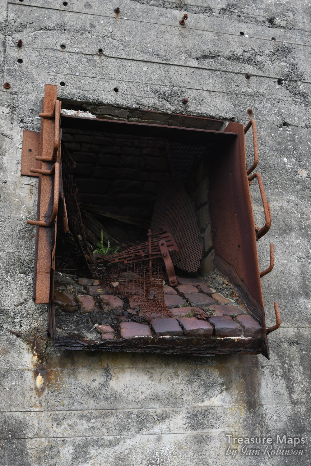
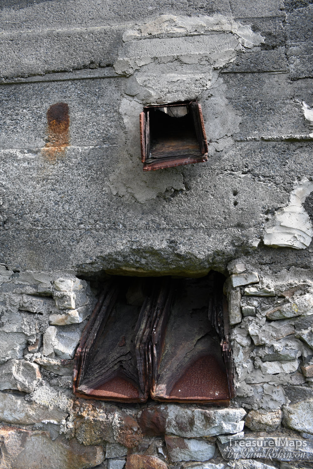
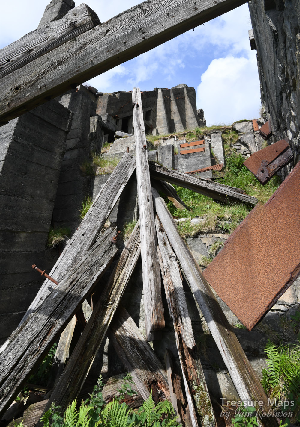
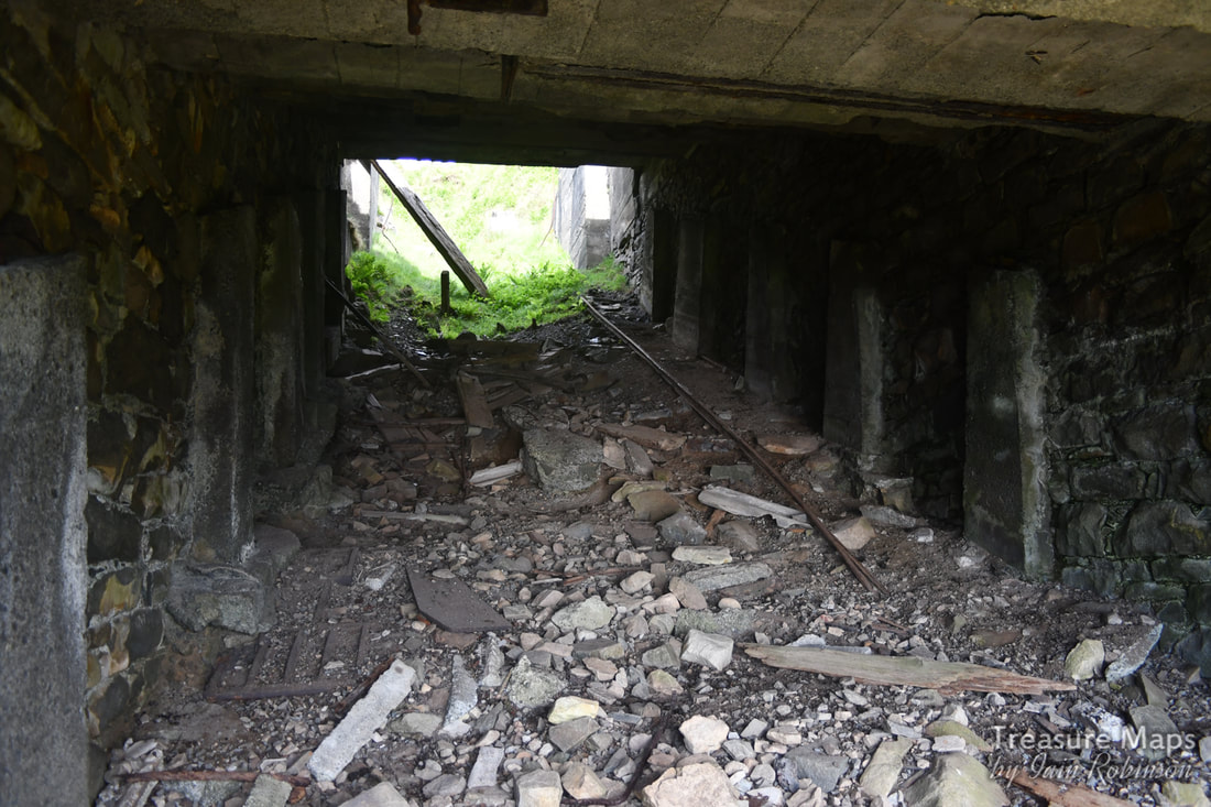
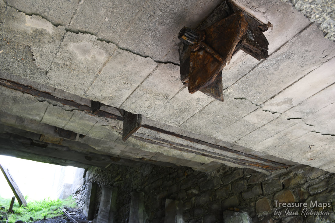
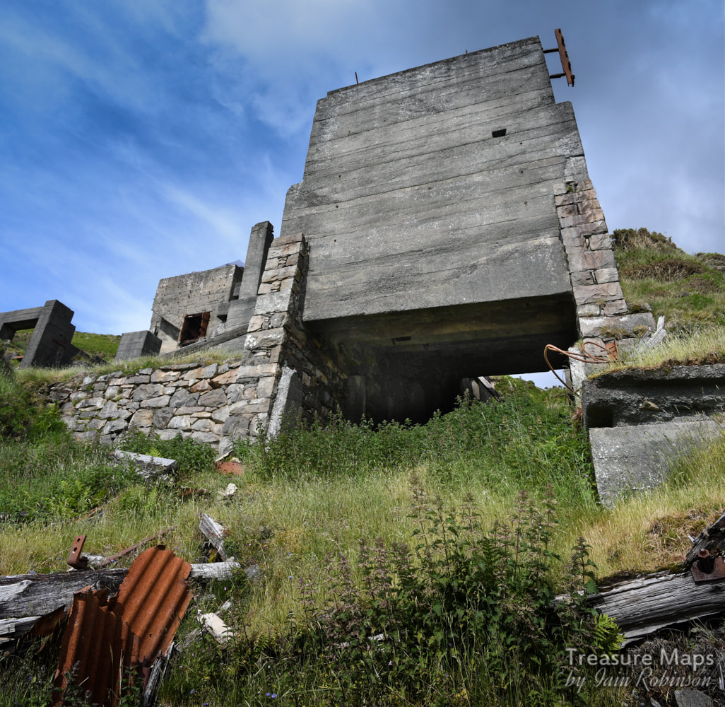
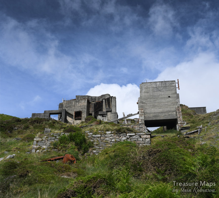
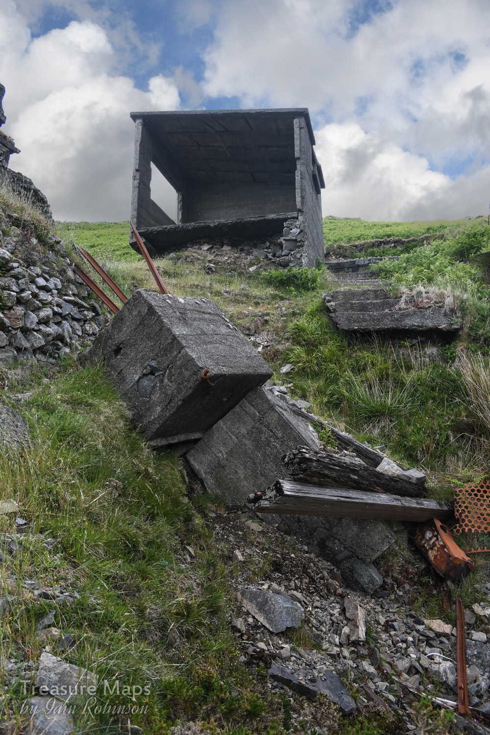
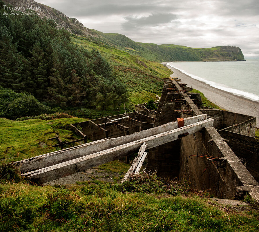
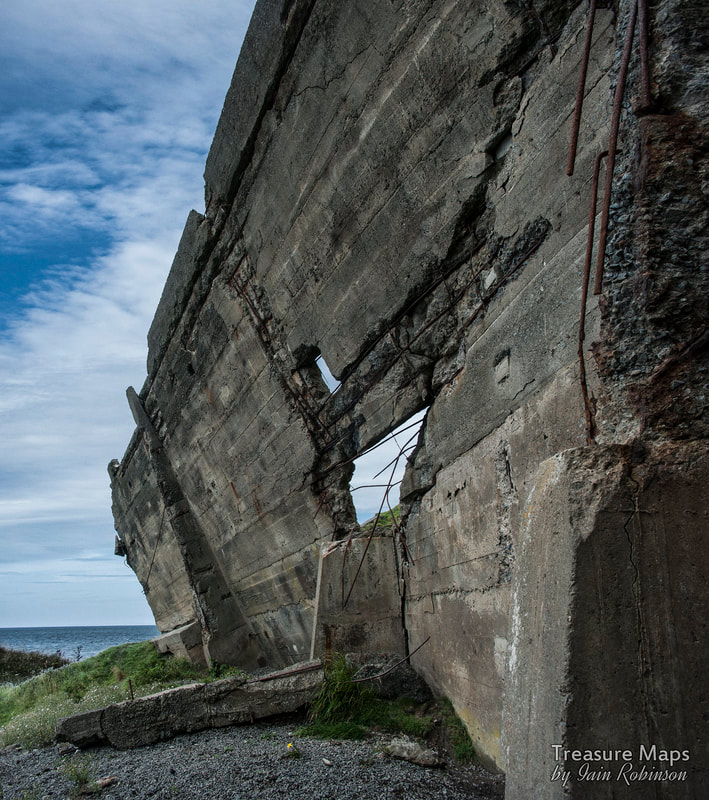
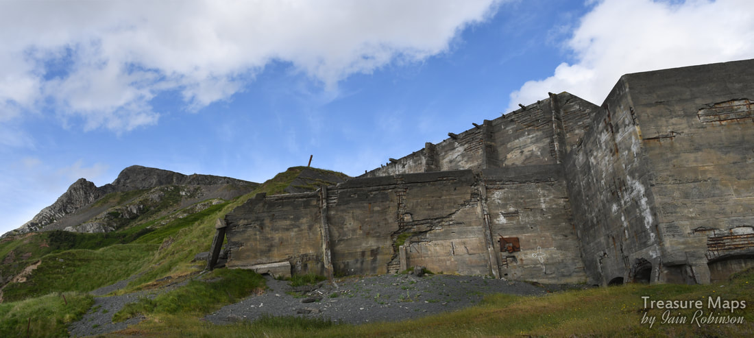
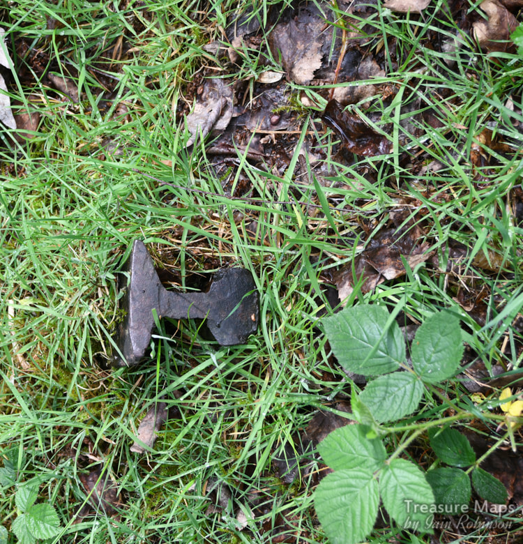
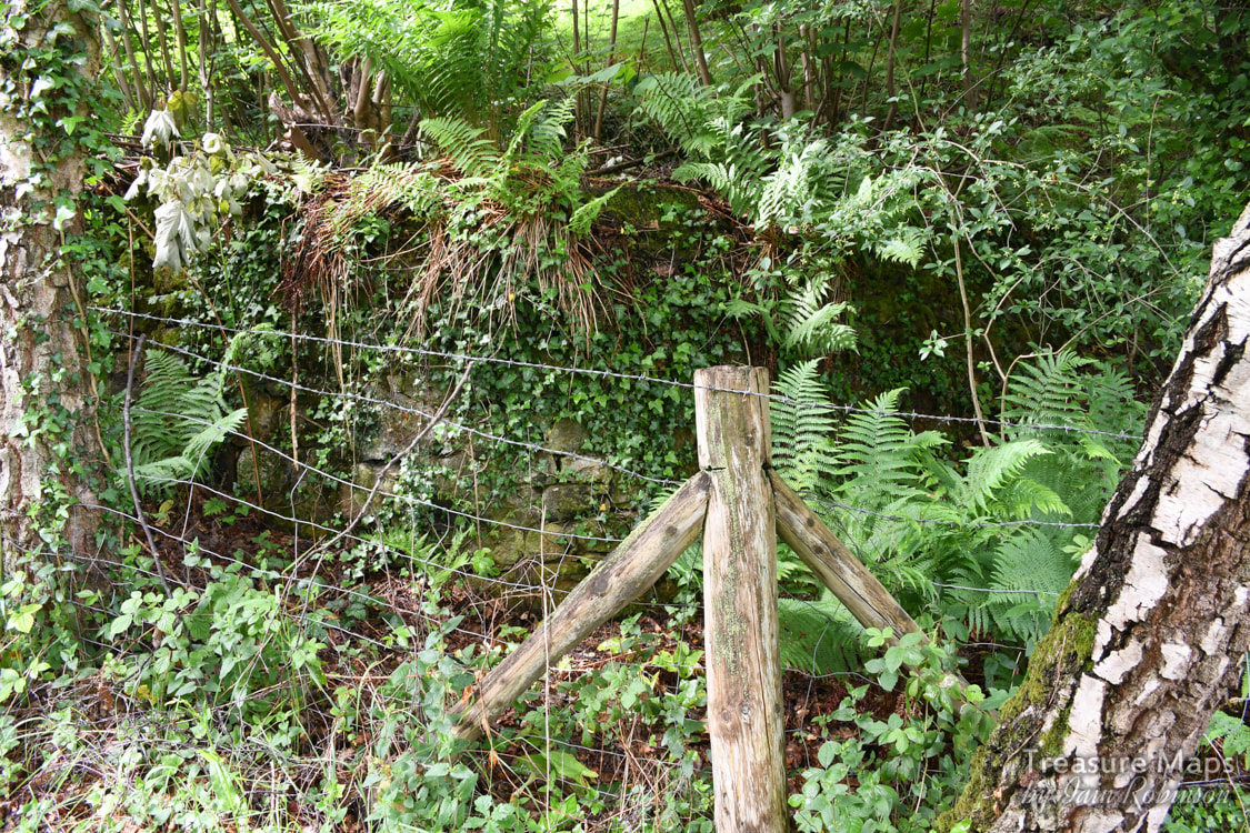
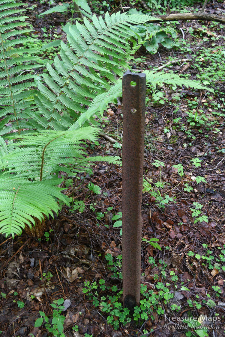
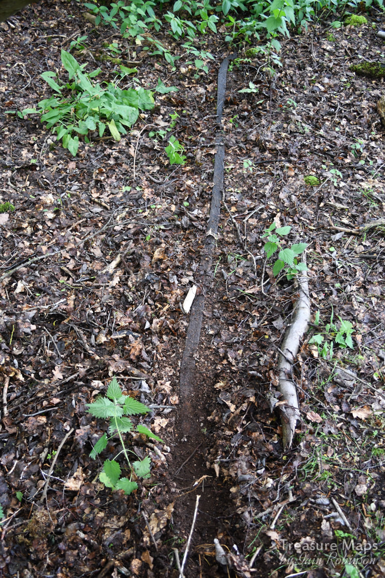
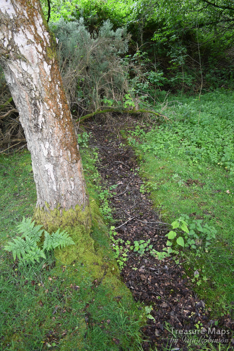
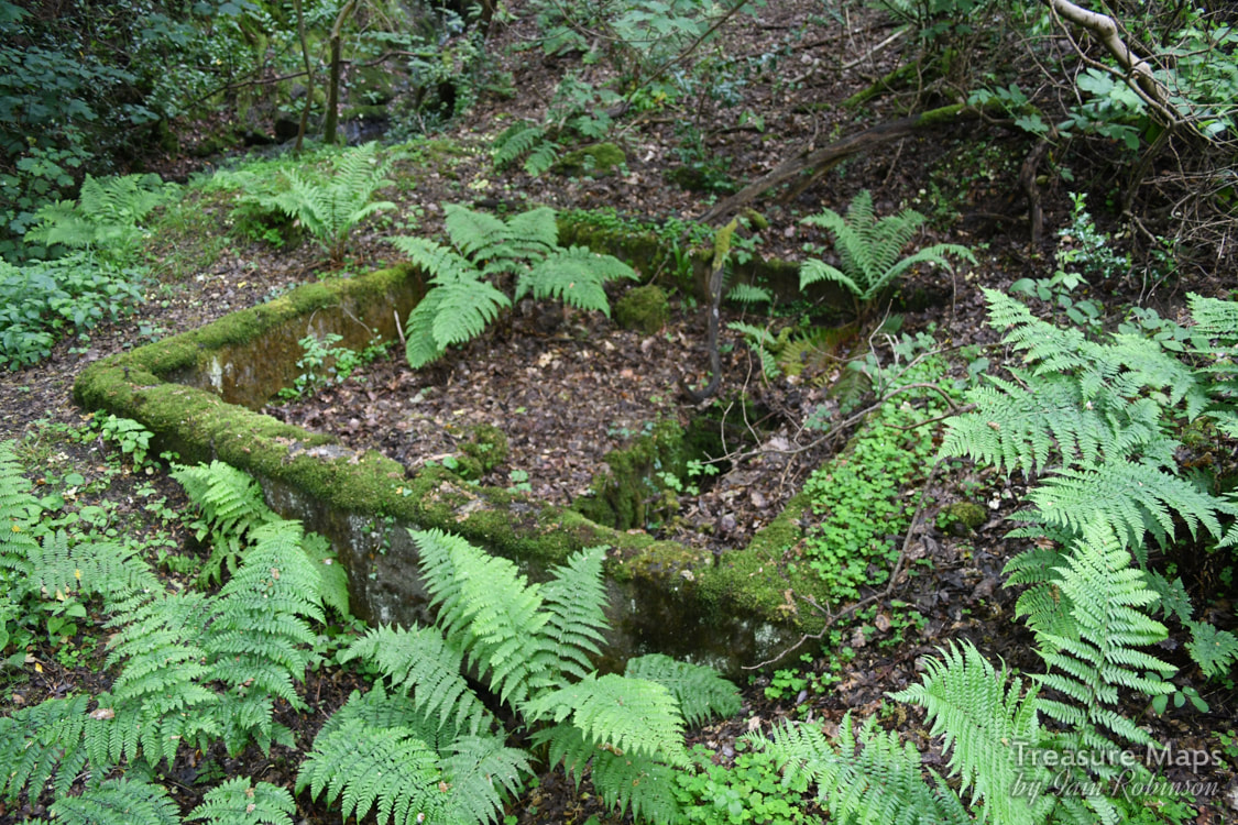
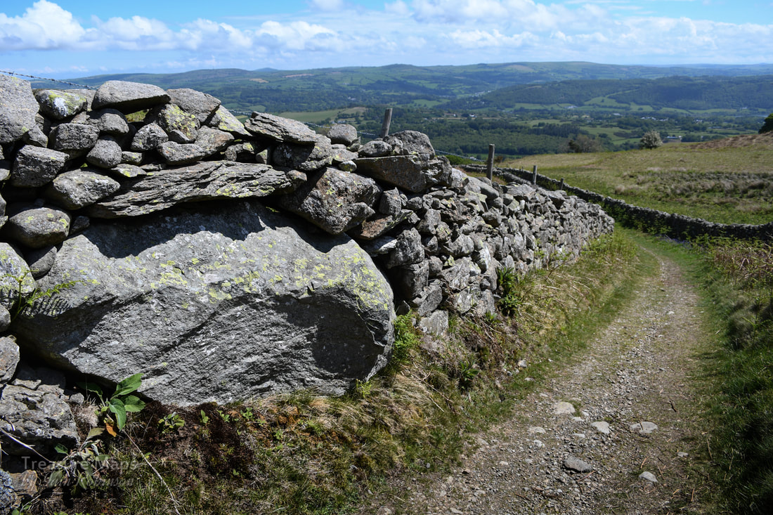
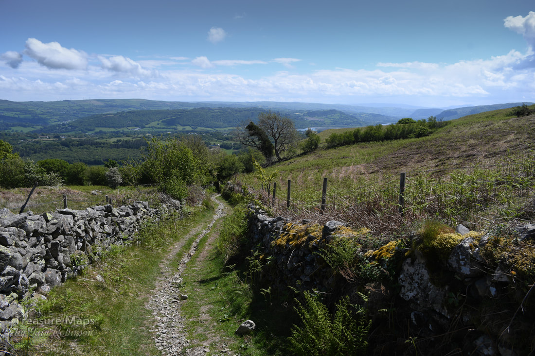
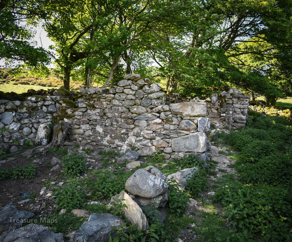
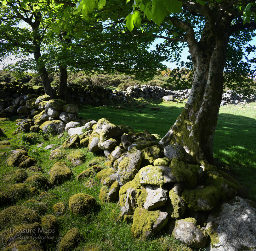
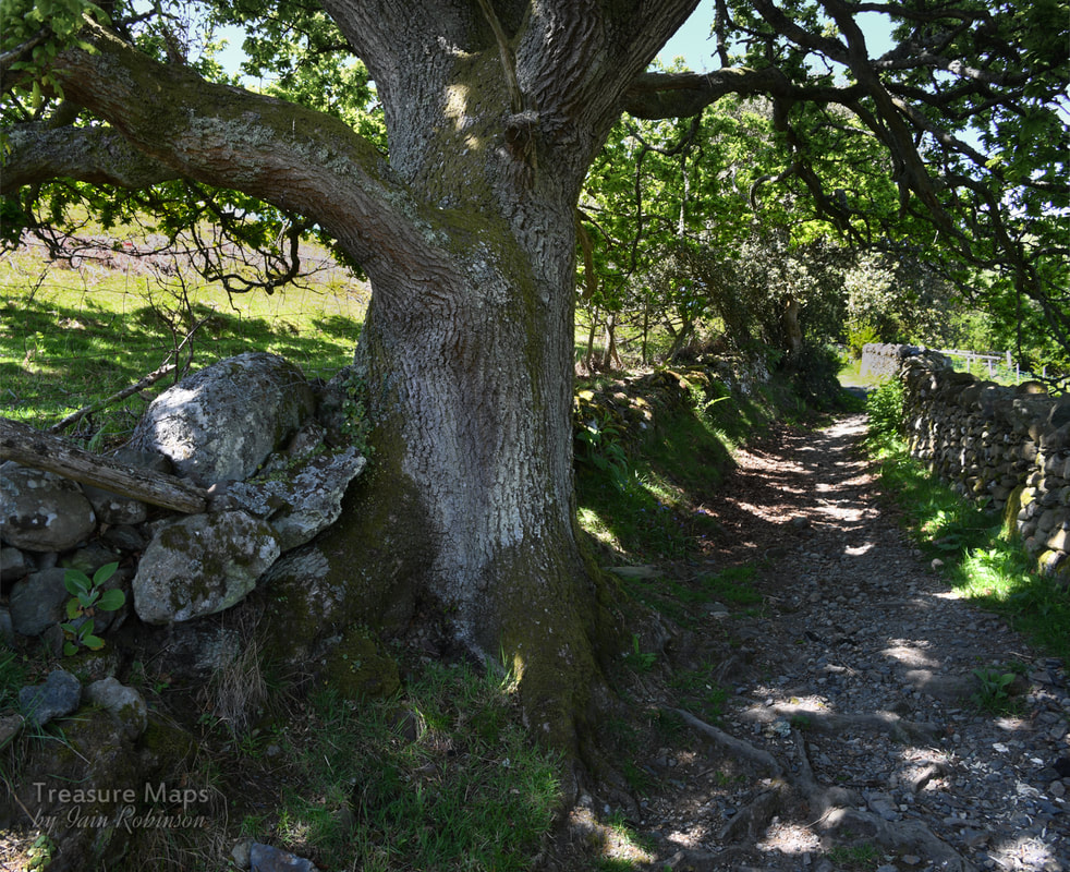
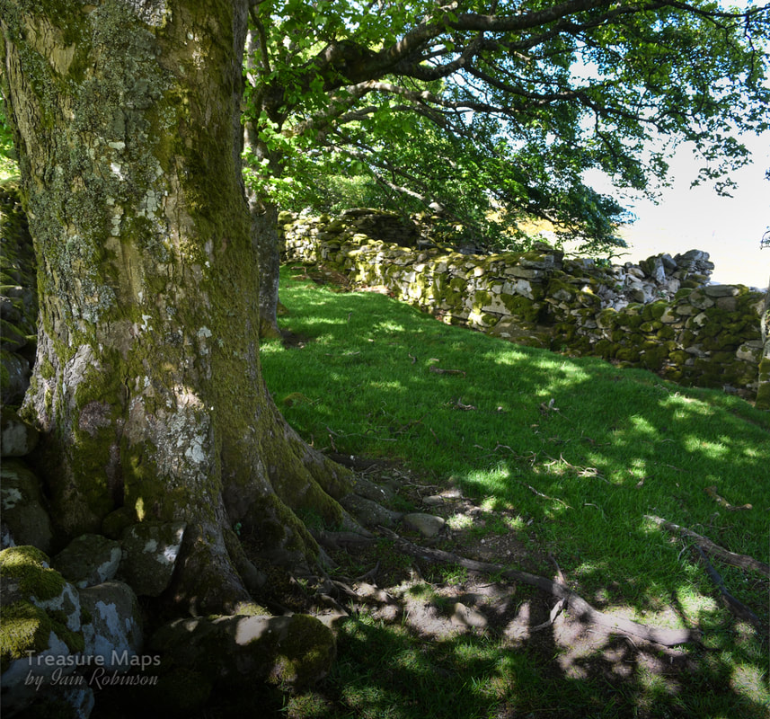
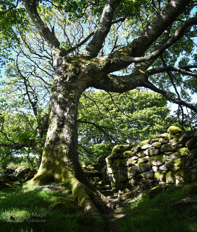
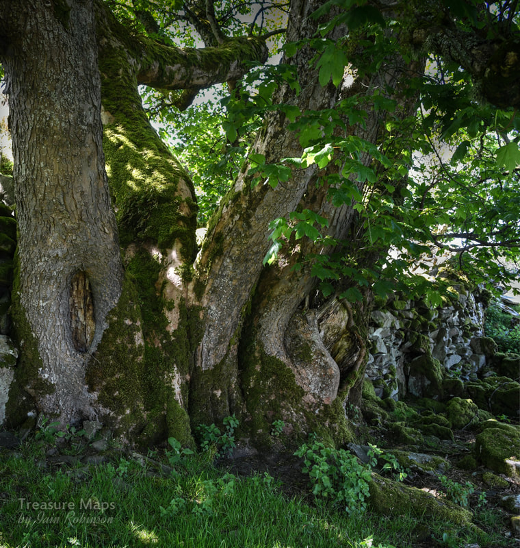
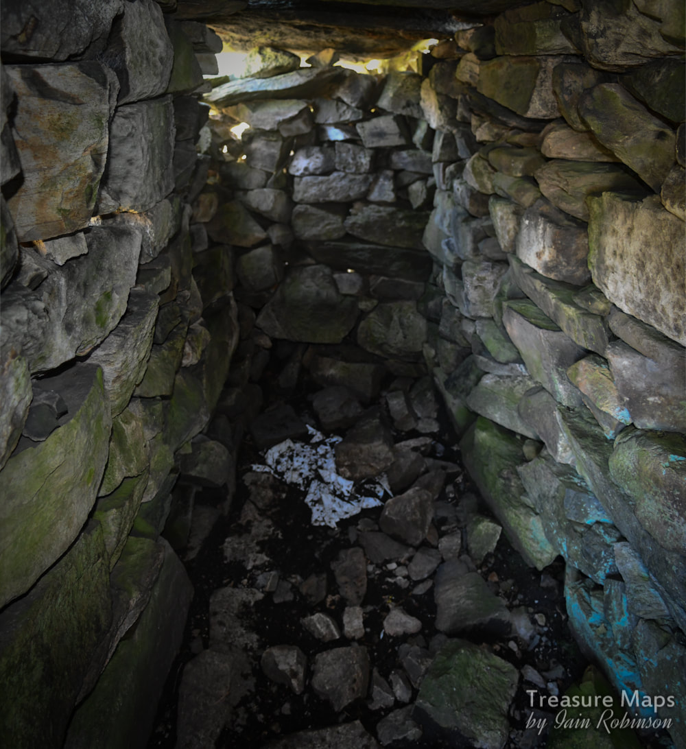
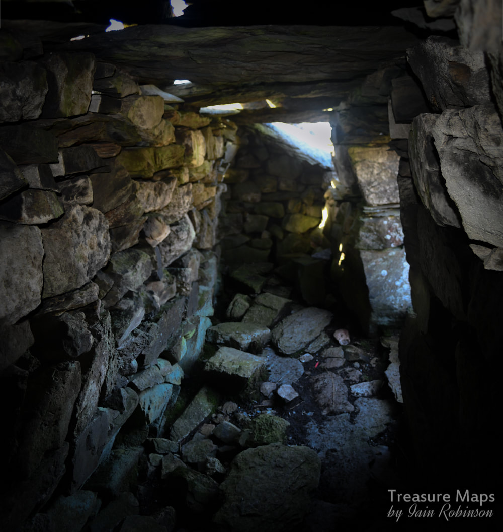
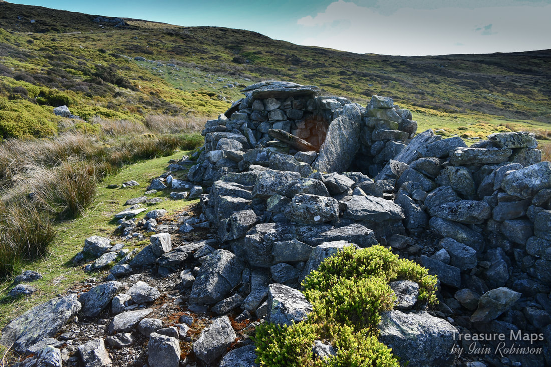
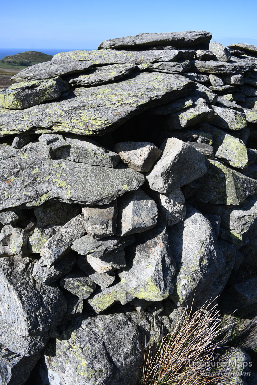
 Looking over the Riviera del Cardigan- one of the Bryn Seward standing stones. Where we find a wealth of prehistoric remains in the landscape- and an awful lot of fallout from forestry felling. We knew from our previous visits here that there were a good few remains of cairns and settlements to be found. Coming back, with the objective of looking closely at them, it surprised us how many there were- and how little care is taken over these remains, which date from possibly 2,000 years ago. We started by parking up in an area that has been used by Conwy Forestry as a storage area for their giant tree strippers and log movers- these days, nothing is done by hand. Rubbish was everywhere, plastic bottles, scrap metal, discarded piles of young trees in white bags...even a broken-backed caravan- the hallmarks of chaotic and disorganised conifer extraction. I suppose I am guilty of thinking back to the (thankfully) short time in prehistory when I worked for the F.C. in South Scotland, when we took trees out using a horse and cleared up after ourselves lest the D.O. would come by and bollock us all. Changed days, it would seem. Anyhow, we started up a footpath, marked on the map as such but we proceeded uneasily, because notices told us access was forbidden. We were aiming for Bedd-y-Brennin cairn and cist, marked on the map up in the woods above Cwm Llwyd. The footpath had had an upgrade, anyway. It seemed as if it had been used recently for a car rally. Luckily, it was dry and we managed to make a pleasant, if steep climb out of it. I wasn't expecting much of the "grave of the king" as Bedd Brenin translates. Apparently it was excavated in 1851, when human remains were found in the cist (an ancient coffin or burial chamber made from stone, pronounced "Kist") Shortly after that, a farmer built a sheep fold on top of the cairn. They were different times, eh? Here's the unedifying scene at the cairn. 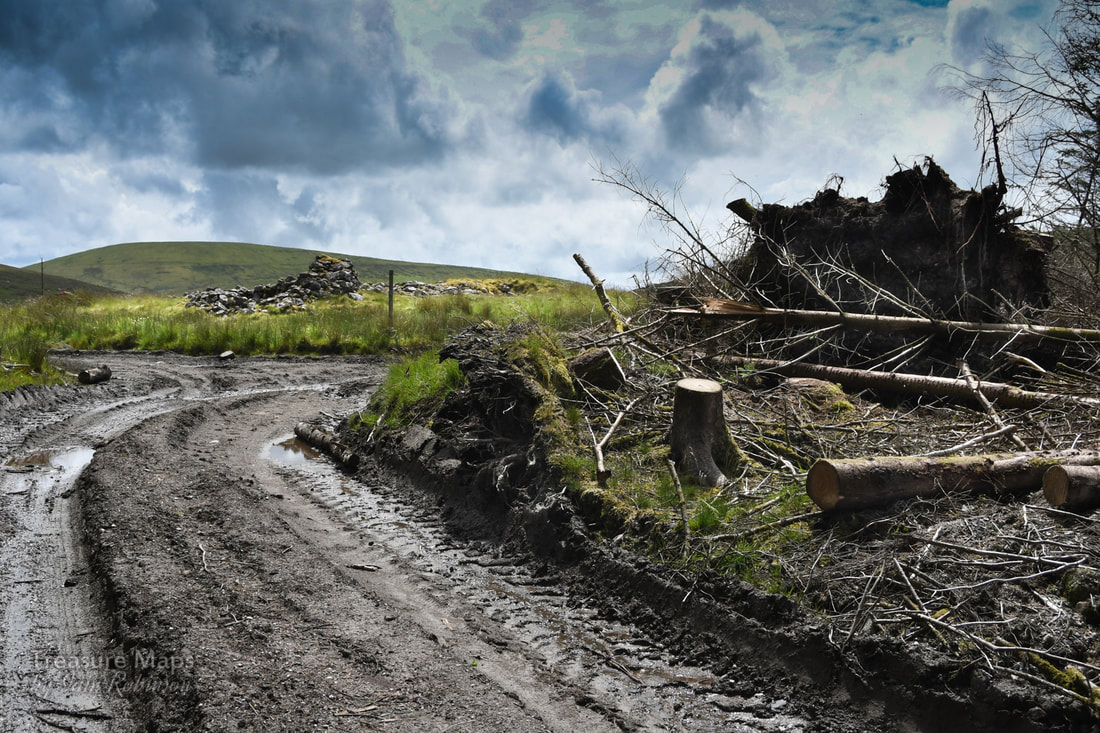 The cairn actually looks like a roundabout feature, doesn't it! 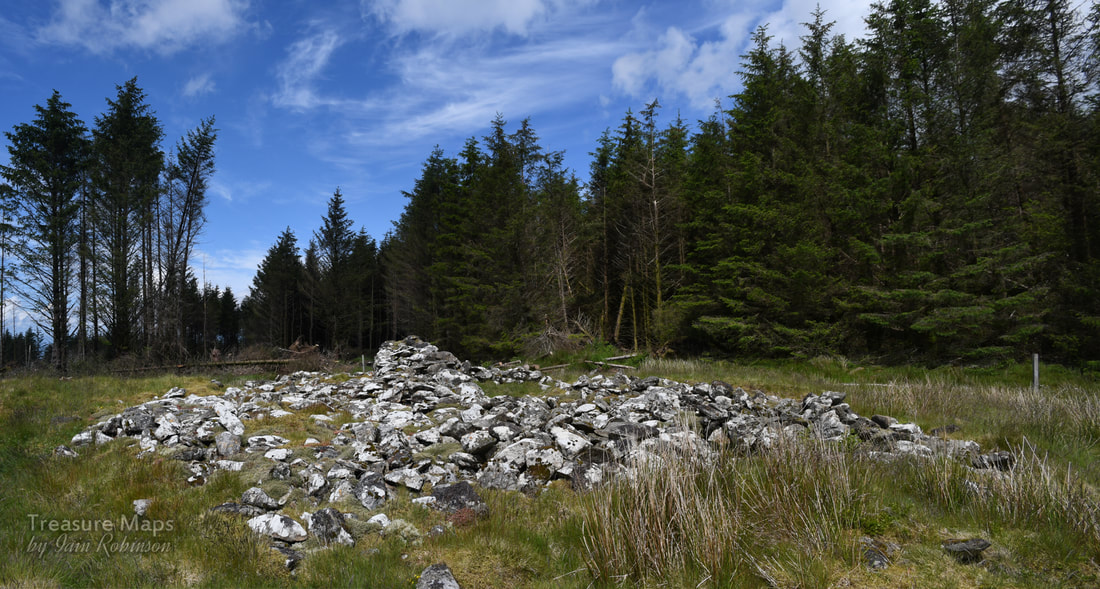 Here by crafty positioning and a little bit of photoshoppery I've managed to lose the road. From here it is still recogniseably a cairn. I think, considering everything, the cairn still looks impressive. Hopefully the scars of modern extraction will fade as nature heals them and the place will return to peacefulness and the songs of woodland birds. Next on our agends were some erratics which were supposed to be in the woods here. We followed the road back down and found them quite easily, since the trees had been taken away from three sides. Conwy forestry had arranged more litter, guest starring a diesel drum underneath the stones to add the finishing touch. Here they are... 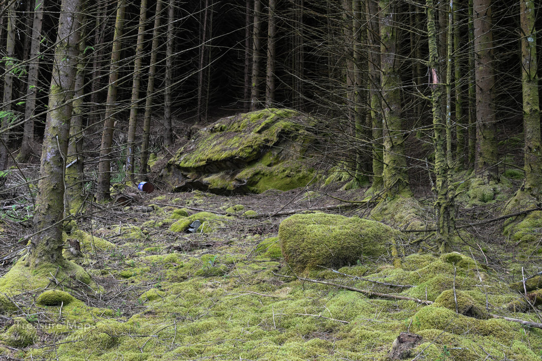 I guess these trees are coming down soon, then the scene will look like hell. Give it 30 years, maybe. Bryn Seward Stone Row We headed back to the road and on to the next feature, Bryn Seward Stone Row. Thankfully, this was still here and relatively unscathed, although some giant tyres had been placed nearby. I managed to elide them out of the photos. The stone row measures 61m long, including at least five medium and large-sized stones standing up to 2.14m high. It's situated on a north facing slope with sea and landscape views and reveals. It is considered likely to be of Bronze Age date, and have been built into a probable Post-Medieval field wall. The row is situated alongside the ancient trackway known as the Ffordd Ddu. However, in the 1970s the Ordnance Survey suggested that there are actually four stones, and although this view has been endorsed by many, it appears that there is no definite conclusion regarding the number of stones constituting the group - as they are incorporated into the field wall, several of the larger stones at the base of the wall could be part of the original group. [Thanks to Nina Steele, Gwynedd Archaeological Trust] At the lower end of the row was a large cairn on an eminence above a small valley. 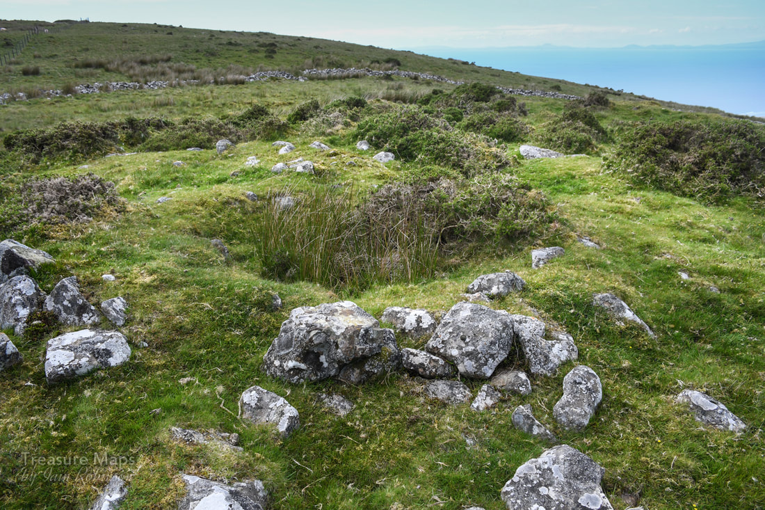 This is looking north west, out to sea and away from the road. It's obvious that this cairn has been robbed in antiquity, probably again in the 1850s. The cist has been taken, but enough of the structure remains for it still to be impressive. A wonderful trove We carried on over the fence and into the land to the north of the road, where we found a wonderful trove of remains...cairns, hut circles, field boundaries and settlement remains. 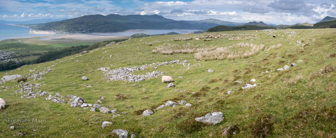 The largest structure on site, a textbook hut settlement within an enclosure. The walls have been much-robbed over the ages, but incredibly it can still be made out. 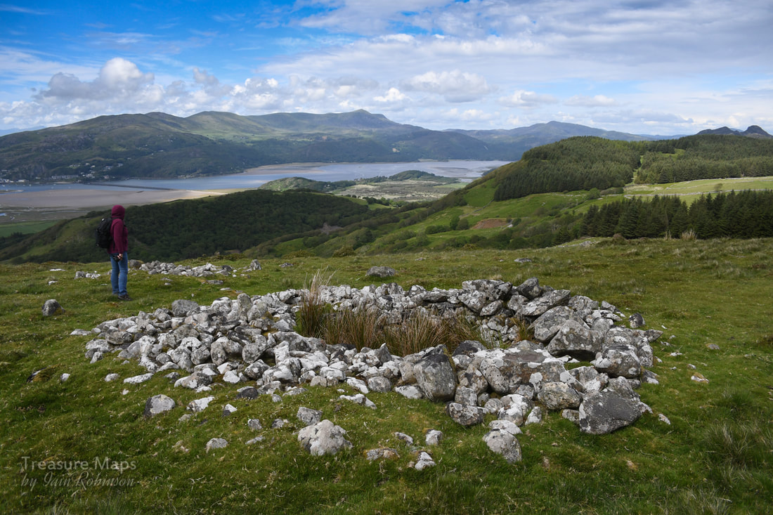 Coflein calls this a "sepulchral cairn"...it's very impressive. What a location! 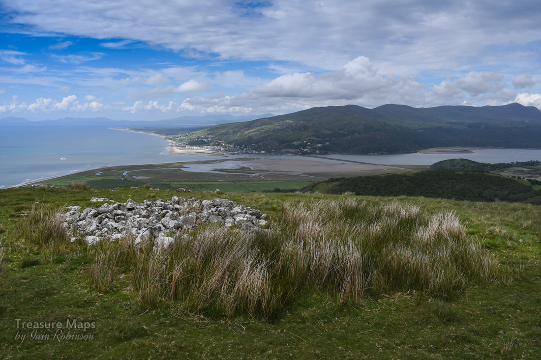 This could be a clearance cairn, but certainly ancient if the lichen and moss growth plus general vegetation cover are taken into account. As we moved further down the hill, the area below came into view. The blue pool, or Golwern Quarry- now sealed up because of irresponsible activity by tourists. At least it means that there will be a super nature reserve there. It's very difficult to access except by the blocked tunnel. Here's a link to our explore of the place some years ago. Some huge rocks loomed at us as we crested a small ridge and we had a pleasant lunch sitting in their shadow... 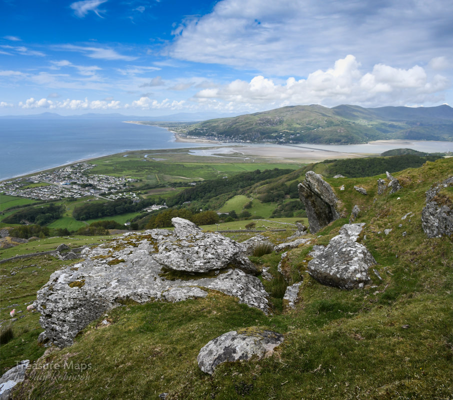 The rocks, looking down to Fairbourne. Across the estuary, Barmouth seemed to be in sunshine the whole day. Climate Change Refugees We looked down to Fairbourne and reflected that this will be the first settlement in North Wales to be lost due to climate change. It is only a few feet above sea level. I wonder where the villagers will be re-housed. The council have been trying to build a big flood defence wall, but it's a massive task, judging by the number of loaded stone trucks going past my study here in our old slate mill below the Ffestiniog quarries. Now, they have given up. It's also cost over £6 million, a good proportion of that from Europe. Although this is because of climate change, the council prefers to call it "decomissioning" the village. I feel very sorry for the folks losing their homes, as no compensation will be available for them. Ironically, some of the villagers refuse to accept climate change, being firmly in the Trump camp- one resident said it was "a load of la-la". I can understand it must be difficult to part with somewhere you have invested money and time into. Better to dig your head, literally, in the sand. Guardian article about Fairbourne Back to the Past... 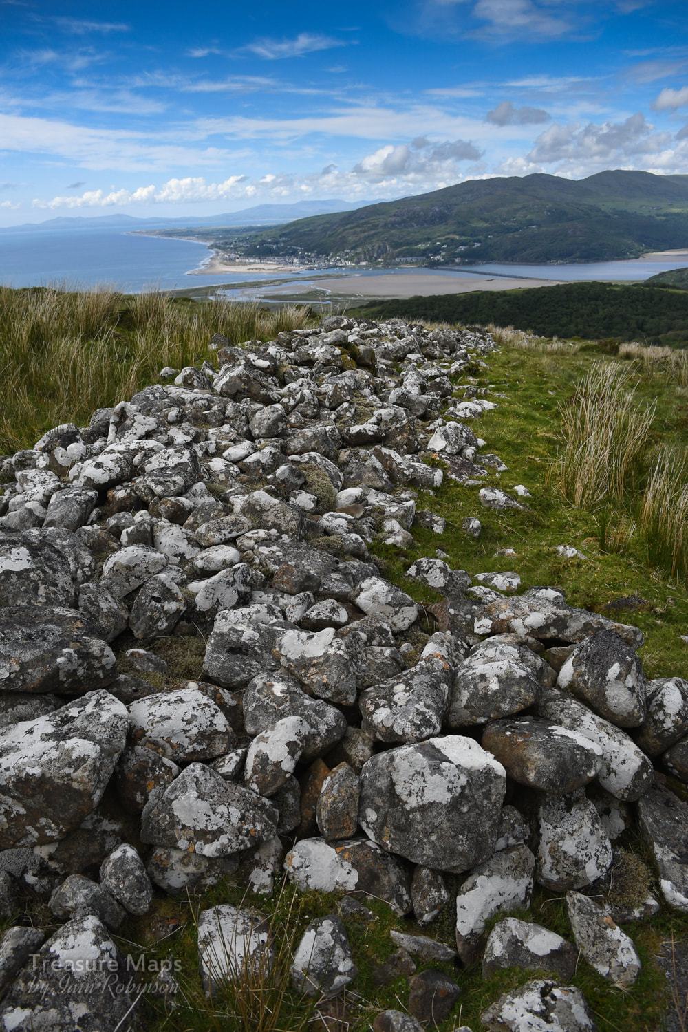 A massive wall, the remains of a serious boundary, probably from the bronze age period. A massive wall, the remains of a serious boundary, probably from the bronze age period. On the southern side of the road were a considerable number of remains: cairns, enclosures and clearance cairns. Coflein thinks they are all sheep folds, although I can't quite get behind that interpretation. Yes, some look like clearance ... 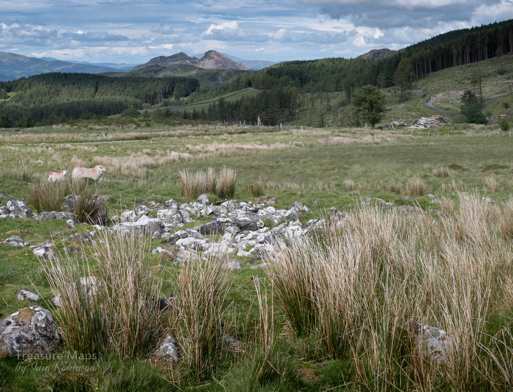 Probably a clearance cairn, but very old. The standing stone is in the background and beyond that, the beguiling bulk of Bryn Brith, 383m, by the Llyniau Cregennan. 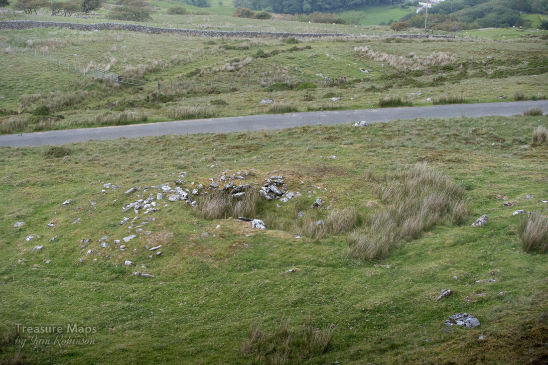 Looking down from Pen y Garn, this is a real cairn- obviously robbed, but still recogniseable. Another standing stone. We had a little time left, so we trundled across to Llyn Cregennan, to find another standing stone- and a bonus mine- there's always time for one of those! 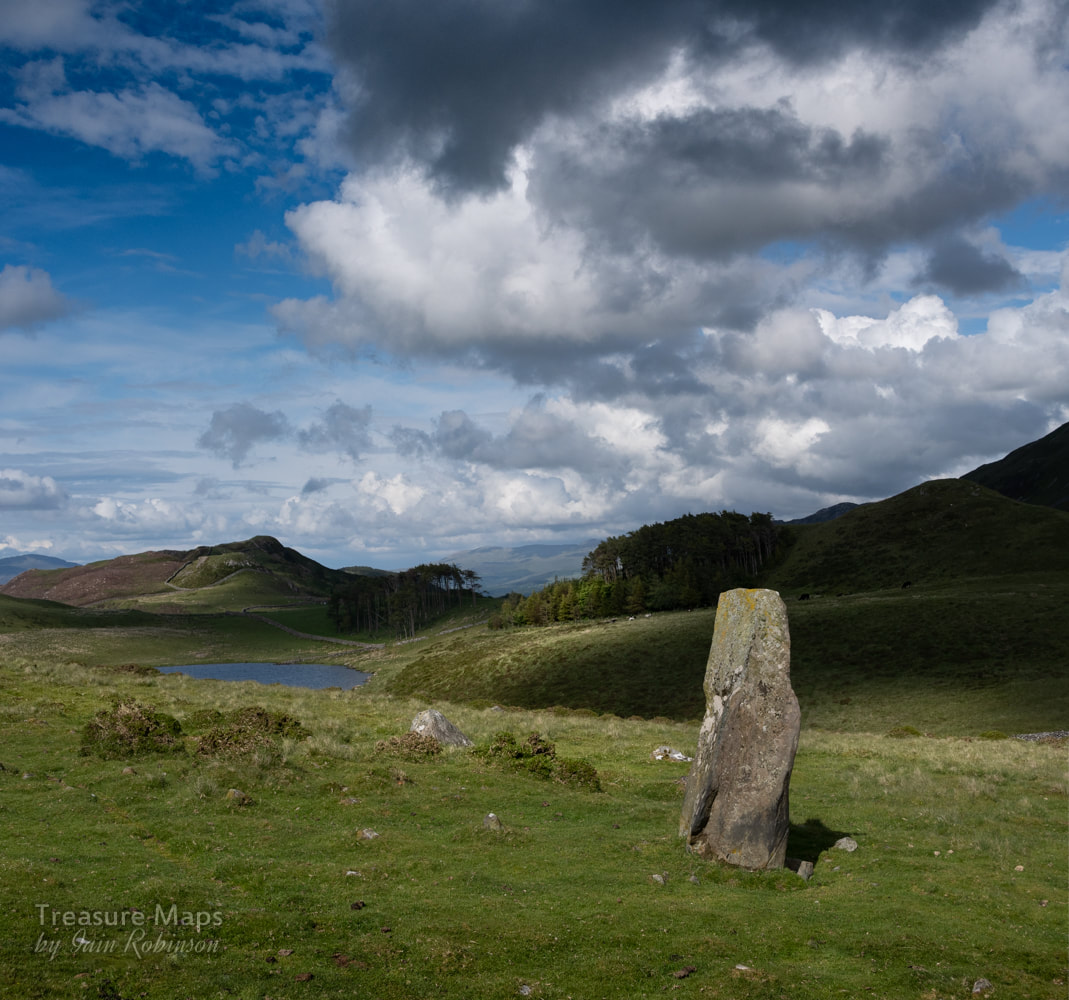 This is Carreg-y-Big standing stone. It measures circa 1.9 meters in height, 1.0 meters in width and 0.5m in thickness. Not too much to say about Carreg-y-Big, except that it is impressive and stands out for quite a way. A little way further north east, we found a mine- a manganese trial of some age, and probably associated with the ones at nearby Hafotty Fach. 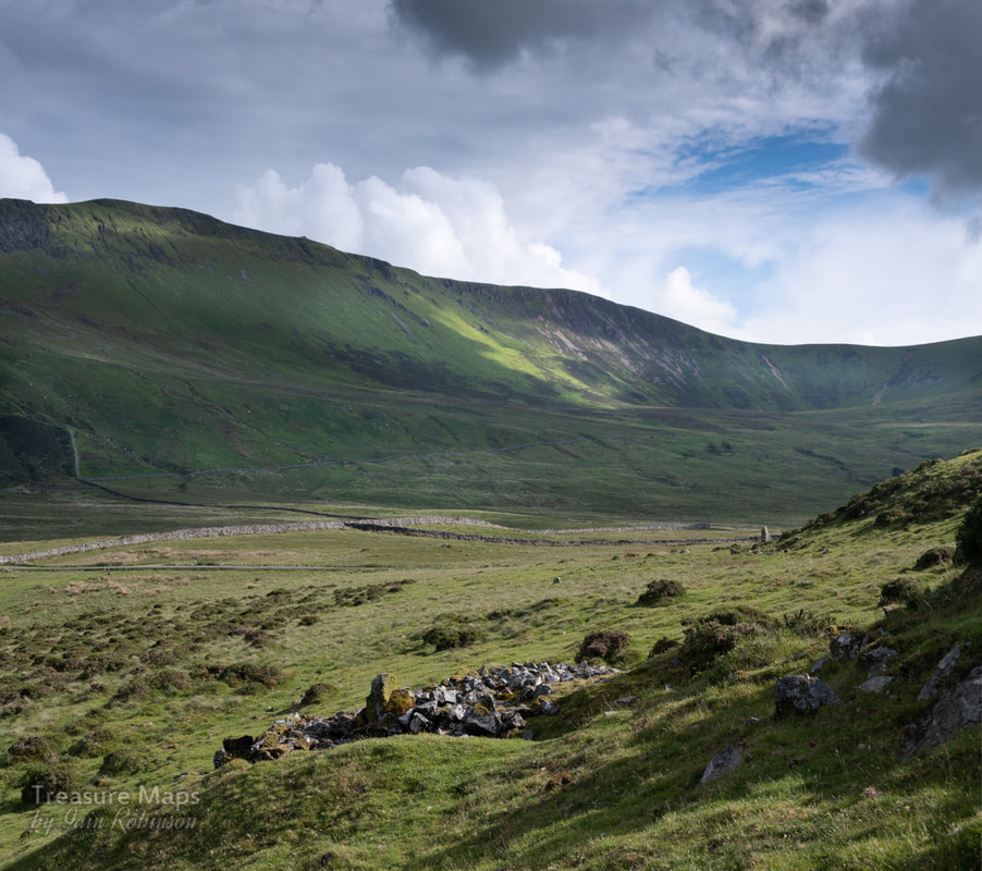 The view south east from the mine featuring the standing stone and in the background, Craig-y-Llyn, a satellite of Cadair Idris. Here's a gallery of images showing the forestry vandals handiwork...nothing too terrible, just a bit oblivious of them...as if they really didn't give a f... As your reward for reading this far, here's a nice photo of a farmhouse on the road back to Dolgellau :-) Pity about that power line. 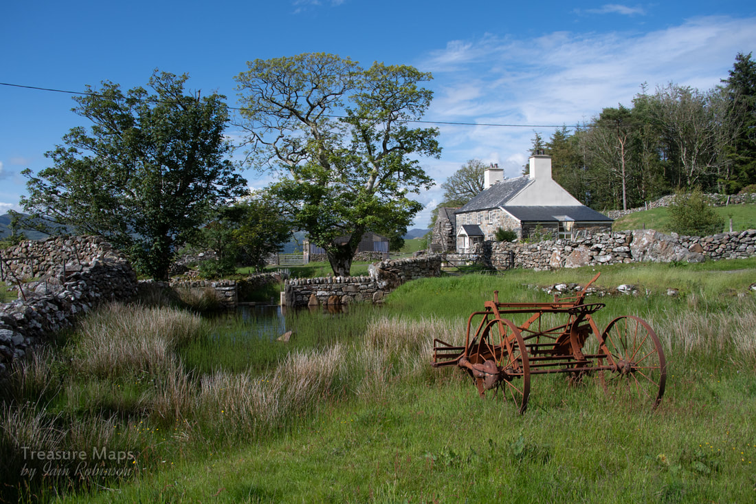 A very unusual excursion into England, and a trip in the time machine back to 2013...  In Ludlow with a few hours to kill before meeting a customer, I was idly studying an OS map when my eye caught the name "Clee Hill". It was only six miles away and by the looks of things, had a quarry. We fired up the car and high-tailed it up to the village of Clee. After the Georgian gentility of Ludlow, this place seemed like a Kentucky mining village. It has what must be the unfriendliest village shop in Shropshire; but I liked it. A pub called "The Kremlin" was also noted, surely a story there. Provisions purchased, we headed up by the sign marked "Dhustone". From the Welsh name for Dolerite, apparently, although the locals called it "Jewstone". Much has been written about the railways hereabouts, and I won't labour the point; there are other places on the web for that. I'll give some links at the foot for those who want to browse further. We rolled up the steep road, noting what looked like a ruined incline beside some lovely brick houses with fantastical chimneys, built by the quarry company for it's workers. One rejoiced in the name "Hedgehog Cottage". 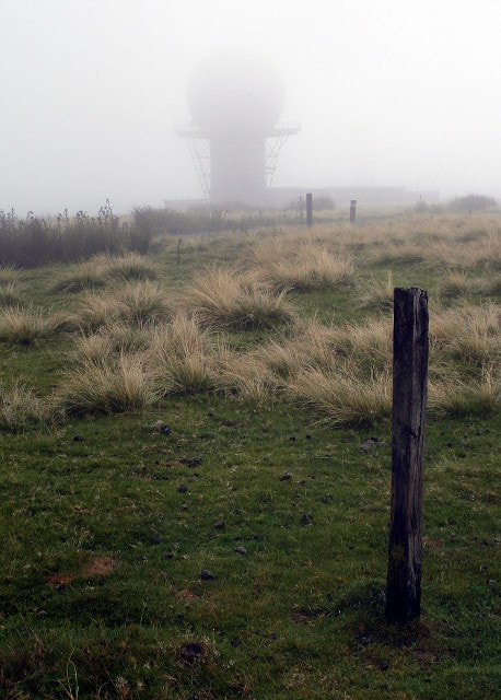 The weather wasn't promising at all, but as we reached a plateau, the bulk of Titterstone Clee loomed from the mist. It's not high by Welsh standards but it's imposing. 533 metres, and the third highest in Shropshire. From this distance it seemed more like a gigantic spoil tip, but I could make out the remains of rock bins and the concrete standings for machinery. We parked up and walked about, heading for a water filled hole. Rounding the corner of a spoil tip I had a sudden stab of alarm. Slowly revealing itself from the mist was an enormous white golf ball on the skyline, like something from a 1960's Dr Who episode. I checked, none were filmed here, although they should have been. I felt the scene needed a Cyberman coming towards me and imagined the Brigadier screeching to a halt in his Mk 1 Land Rover nearby. It was only a strangely disoriented gull, unfortunately, but it didn't spoil the magic. 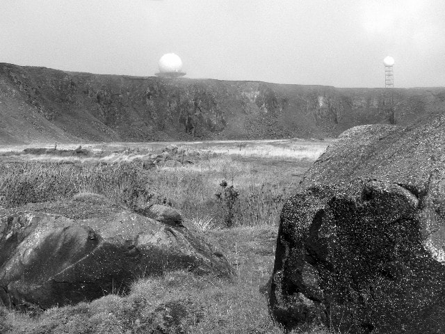 The golf balls; the larger one is part of a National Air Traffic Control radar network, it's little brother being a Met Office weather radar . There are also the remains of an RAF radar station here, too, mainly bits of concrete in the grass. A bronze age hillfort completes this embarrassment of riches, although I failed to note any evidence of ancient activity- but my eye was concentrating on the quarry remains. 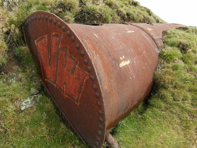 A pressure vessel with graffiti. We noticed graffiti everywhere with the motif "RIP Mitch". I wondered if someone locally had died here, but later found that it referred to Mitch Lucker, frontman and vocalist of a California Death Metal band called Suicide Silence. Their music is typical of the genre, but interesting...so the artist was a fan, I guess. As normally happens when we explore places, I charged about excitedly like a Jack russell terrier scenting rat and ran up to the summit. Petra more sensibly decided to mooch about near the stone crushers and crafted some fine images. All too soon, it was time to leave, as the mist came down to veil the hill again. Later in the afternoon, listening to my customer, I couldn't help but notice the hill in the distance, with it's two strange white shapes atop the crest. I couldn't help wishing I was back up there. It was a fascinating explore and one worthy of another expedition.  Looking towards Wales from the top workings. Links and interesting facts: I found a site while browsing for information which has some fascinating photographs of the quarry from 1955, with many other interesting details, called "Photos by D J Norton". Recommended. Factoids courtesy of the Industrial Railway Society: " The quarries date from 1858 when a railway was being constructed from Ludlow for the transport of coal. A quarry, opened to produce ballast for the Ludlow & Clee Hill Railway (opened on 24th August 1864), produced such good stone that the industry has flourished there ever since. Three main quarries have operated over the years and in one of these a 3ft 0in gauge rail system was introduced with horse haulage, going over to steam about 1910 when a second-hand loco was obtained. This 0−4−0 saddle tank (Bagnall 1717 of 1903) came to Titterstone Clee from H. Arnold & Sons Ltd, contractors for Embsay Reservoir, Skipton, on which job it was named MARY. It is assumed the loco proved to be superior to the horses, as a few years later a new 0−4−0 side tank was purchased from Avonside (1666 of 1913) and put to work carrying the name TITTERSTONE. This loco was followed by a new Sentinel 4−wheel geared-drive shunter (6222 of 1926) which was named LILIAN. Wagons were pushed by hand along tracks from the quarry face to a collecting point in the middle of the quarry known as "the turnout", from where they were hauled by locomotive to the crusher. From the crusher a mile long incline, which included a three rail section, ran down the side of the hill to an interchange point at Bitterley on the standard gauge line. Although the rail system was closed in 1952, the quarry remained in use until 1962, the stone being conveyed in road vehicles." There is a widely held belief in the local area that the Clee Hills are the highest land eastwards until the Ural Mountains in Russia. Hence the name of the pub in Clee Hill village - The Kremlin Inn. It has even been known for radios in the area to pick up signals via the air traffic control masts from Radio Moscow. The Clee hills are mentioned in A.E.Housman's poem "From Clee to heaven the beacon burns", which is a section of A Shropshire Lad.
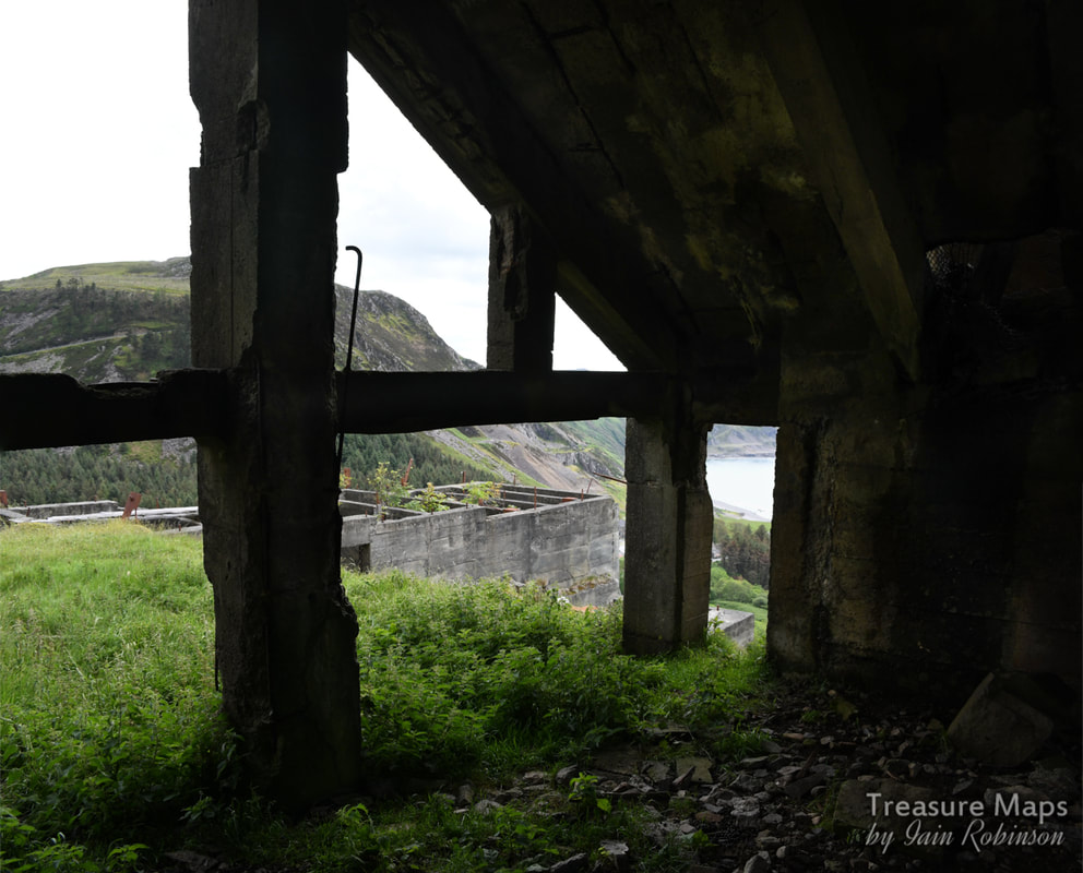
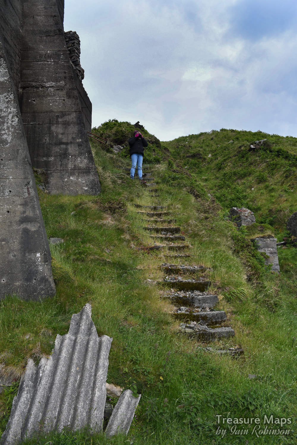
 Most people will know about Nant Gwrtheyrn, the erstwhile quarry worker's village on the Llŷn Peninsula that became deserted after the quarries closed. After some vicissitudes, the place was finally restored and has become a very fine centre for Welsh studies. Originally the village housed the workers from three quarries- Porth y Nant, Carreg y Llam and Cae'r nant. The Cae'r nant quarry levels tower above the village still today as a reminder of the skill and perseverance of the quarrymen. Looking up from the Welsh Language centre at Nant Gwrtheyrn, the quarry "benches" at regular intervals seem to be an easy morning's explore. However, once on the slopes it is a different matter! 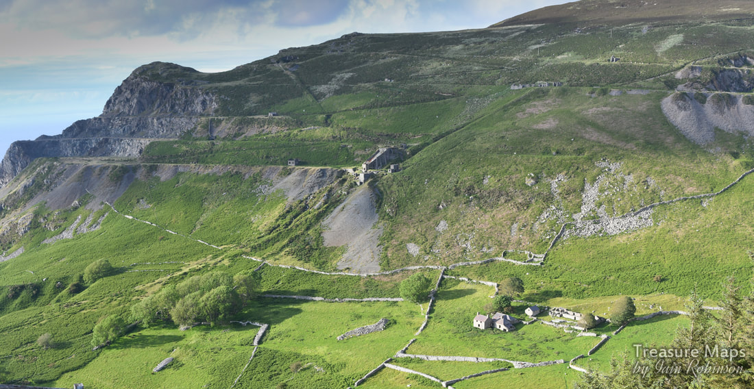 This is the view from the top of the corkscrew road going down to Nant Gwrtheyn. We started from the top level at the very top right of the photo. The darker green is all gorse... A couple of years ago we tried to reach the quarry from the stone hoppers on the beach, at the bottom of the incline. We were beaten back by the wet weather, it was miserable and everything was slippery. So this time, we thought about coming from the top and working our way down steadily. And- it was great, especially at first, before we encountered the gorse. At the very top, along the airy ridge, the views are superb. It was a real adventure and I felt like a kid again- as per, some would say. We had bags full of provisions and coffee, and it helped that the rain held off, too. 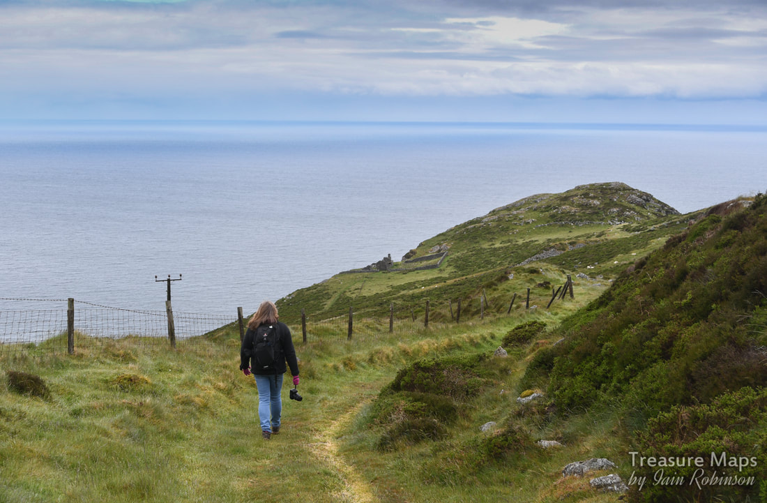 On our way to the end of the headland, Trwyn y Gorlech. We were to discover that quarrying actually goes around this headland. Just above the last fencepost on the right is the earlier incline. It wasn't too long before we encountered a hut here at the top level. There was quite a view from the window, which was unexpectedly large. I didn't think it was a weigh hut, perhaps a caban. There isn't much excavation on this level until you get to the end, but it does overlook an earlier incline coming from Trwyn y Gorlech. We mooched on and eventually got to the western end, where a surprise awaited us. The quarrying had continued around the headland. We walked round to the most northerly point and could see "West End" cottages on the way up to Trefor! These were the offices for the Trefor quarry at one time, and a tramway ran past the doors- before the big incline was built from the main quarry. 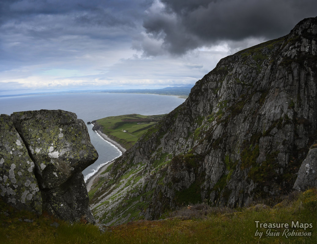 The sheer drop from that edge is a breathtaking 500 feet to the rocks below. The rock on the left is gangue material, left by the quarrymen as useless. "West End Cottages" are the white dot in the green gap near the middle. The sky began to threaten us with rain at this point, but we were resolute and saw it off. The quarry up here is rather like Carreg y Llam to the south, completely stripped of any artefacts or buildings. It was very impressive, but a little sad. There were no signs of human activity except these titanic gouges in the headland which could have been made by giants. I looked but couldn't even see a shot blast hole. 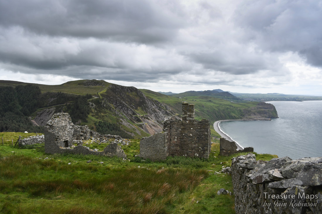 The building nearest the end of Trwyn y Gorlech. I am assuming it is a quarry structure, although it could have been a farm I suppose. What an inhospitable spot, though! I like to think that it was a canteen for the men, or a stables, perhaps, for the ponies that powered the quarry for a long time. Keen to move on, we crossed the incline to the rest of the level. First there was a range of structures that were easier to interpret. Unfortunately, the old tramways along the level were choked with thick gorse, so it was difficult at times to make progress. We were now at the main level of the original Cae'r Nant quarry, which is a series of excavations to the east of the later quarries. Here the incline comes down, linking with the big crusher house below. The incline was, according to Coflein, 830 metres long. At some time, there was a zig-zag trackway built between the levels, impossible to say whether this was a modern innovation or not, as the earth banks at either side are collapsing and the whole thing is covered in gorse. But I can't see diesel trucks winning out here, the difficulty of getting them on to the quarry when the inclines must have been an elegant solution outweighs any economic argument, I would have thought. So perhaps these zig-zags are just for the quarrymen. 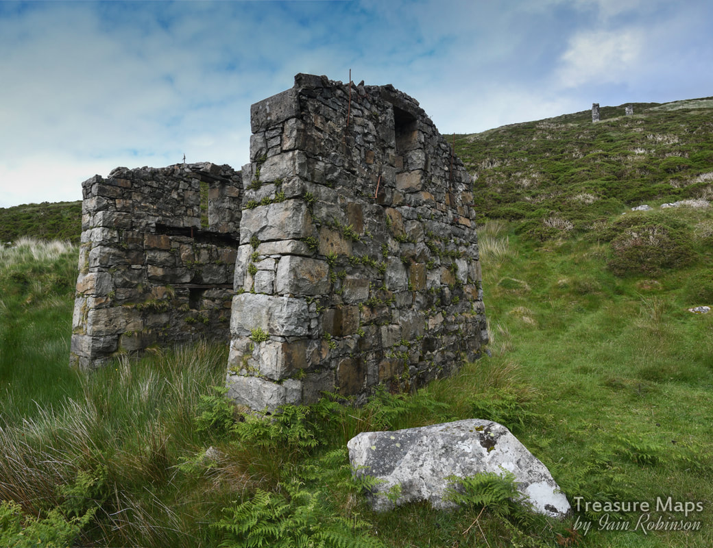 The drumhouse, with the top drumhouse above. This is the middle incline which goes down to the crusher house below. We were tempted by the spoil heaps at the original excavations and went over to have a look. Again, the place is devoid of any meaningful context, apart from the benchwork. But then Petra spotted a wheel, lying on one of the tips. Note to those folk who like to steal these things- it didn't have an axle and was very rusty. 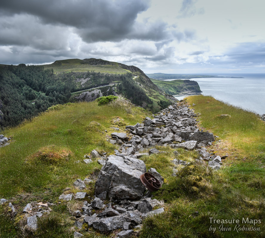 Looking over the corkscrew road and on to Carreg y Llam quarry in the middle distance. Down again to the next half-level, where the unmistakeable remains of a blacksmith's shop lay. Outside it was a fuel tank and an inspection pit- so at some point, locomotives were stabled here. Internal combustion, I would imagine, although if there was steam I would be willing to bet that it would be by DeWinton of Caernarfon! I wonder if a flimsy corrugated iron shed was put up to house a locomotive. But it wouldn't have lasted long in the winds here. The smithy was a treat. Inside, under the fragile roof, threatening to collapse soon, there were remains of iron and steel, a hammer head almost rusted away, and strangely, a few scraps of a distinctly 1950s style linoleum. I can imagine the quarryman's wife saying "Here, take this, it's no use to the house now, but it might do in the caban..." The floor was covered in cinders and rusty iron fragments. 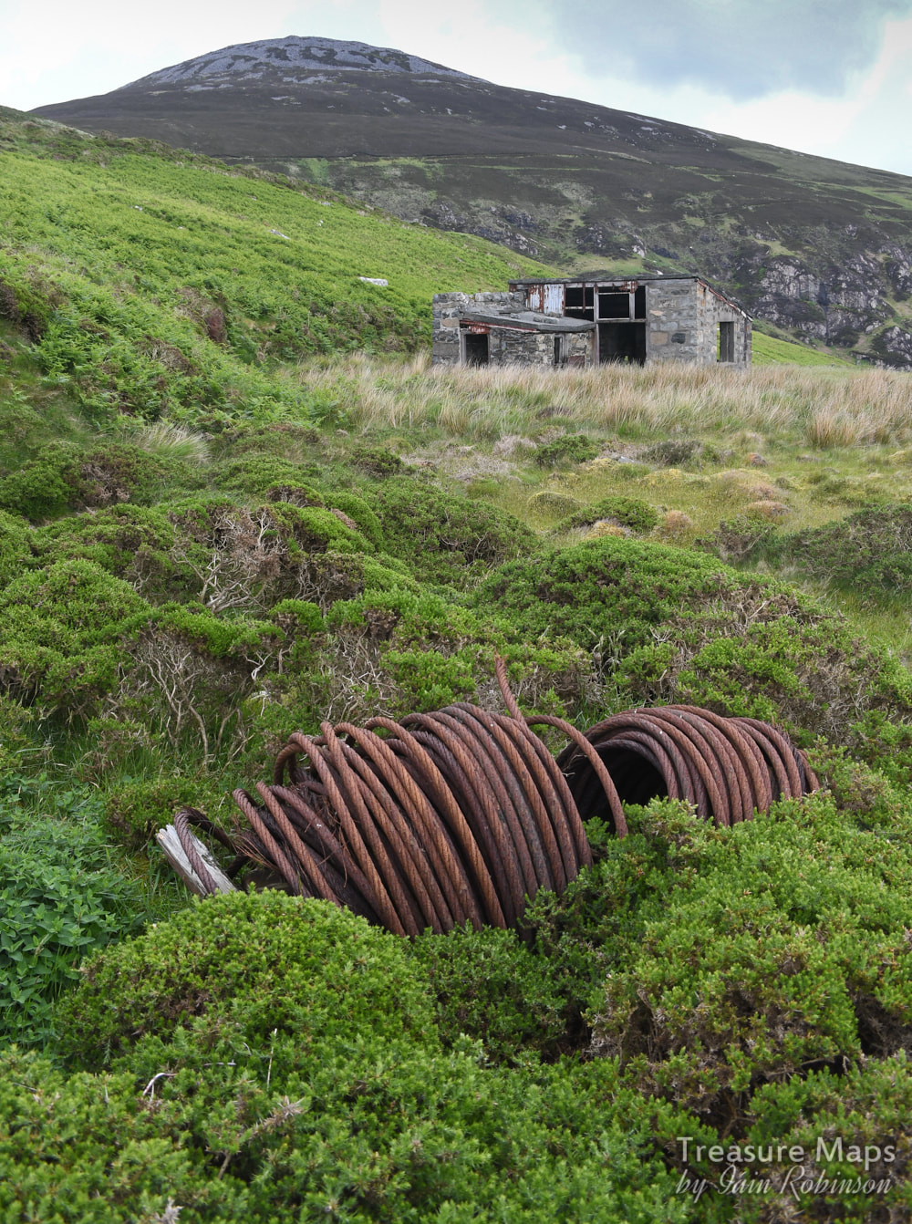 A spider in the gorse... We wandered off to the seaward end again, to look at the rock faces in the quarry. It struck me that here the rock was slightly different, there were shiny green veins through it and in other places, iron intrusions. The rock was complex occasionally and didn't look too good for making setts. I was struck by how much crushed stone was under foot, thousands of tons of the stuff...why was this thrown away- I couldn't understand. I wondered as always about the profligacy of it all, making great holes in the landscape, terraforming for money. But I then realised that the plant life was wonderful- nature was having a great time here. And hey, we humans are only going to be around for another thirty years or so anyway. Petra pointed out a Kestrel, chasing a pigeon over the benches here. The pigeon was surprisingly agile in flight and was almost a match for the Kestrel. Almost... There were skylarks singing and stonechats, but the most wonderful sight was the choughs, who scooted past us high above, with their skirling cries. 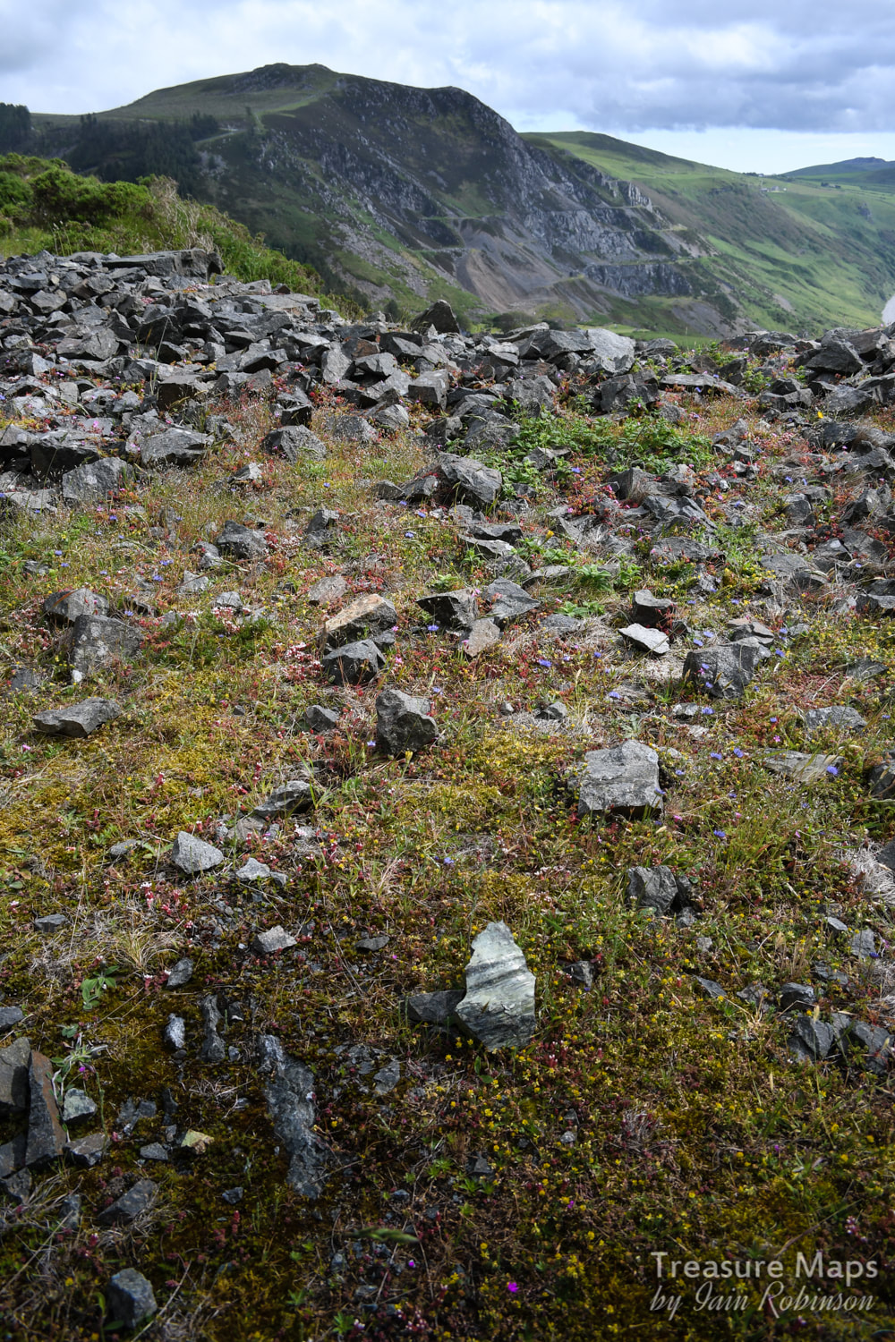 The profusion of life on these deserted quarry benches. There were many funnel-web spiders, too. We used the trusty zig-zag gorse path again to get down to the crusher house. This was an amazing structure, quite awe inspiring. So out of place in this landscape, so bold and insouciant...but wonderful. It was surrounded by the detritus of it's own decay, long baulks of wood were strewn about, bits of steel and concrete that had given up the struggle and fallen. The effect was incurably romantic- I was struck by the thought that it would make a fantastic painting. I couldn't begin to work out what happened here, as the stone hoppers were placed over the incline...but there was no visible way to transfer crushed stone to the hoppers. All that was lost in the fog of history, but if I find out, I will let you know.  Coming down the zig zag track to the crusher house. 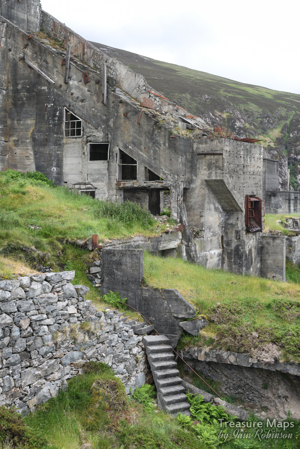 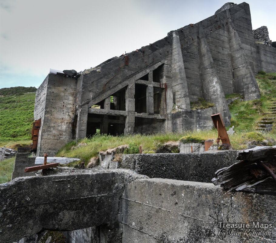 We walked around here wishing that there had been some photographs taken while everything was in working order. But then I do like things in this transitionary state, not working, not functional. Then they become like statements, or memorials in the landscape. That's fine. I also like the way some giant blocks of concrete have broken off and lie like enormous dice at the side, bits of rebar sticking out of them. After spending an age photographing the crusher house, we moved on to a compressor house a little further along the level. This was constructed from shuttered concrete and had a similar feel to the structures at Trefor. Inside were massive machine bases, all familiar to those who have seen other large quarries. 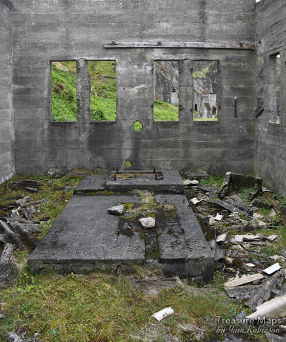 After some discussion, it was decided that it would be easier to go down to Nant Gwrtheyrn, rather than go back up and try to get through all that gorse again. This was quite a thought, because our car was at the car park at the top of the hill above. Never mind, it would be good to look at the incline and hoppers at the bottom again... 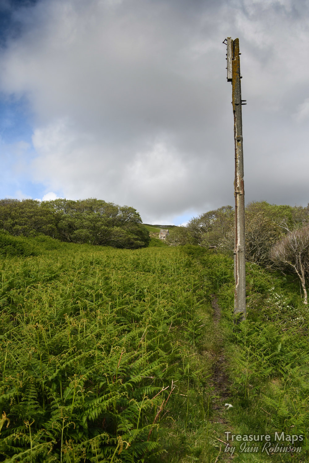 Almost at the bottom of the incline. The crusher house is well in the distance. The telegraph pole is actually made from re-inforced concrete. There was a quay at the bottom of the incline, where stone could be loaded onto waiting ships. It wasn't an easy or relaxing anchorage, and masters of ships would berth nervously, watching the weather. Small wonder then, that there were shipwrecks- the photo below shows the mortal remains of the "Amy Summerfield", wrecked here in 1951. The sad story can be read at the Rhiw web site here. Interesting that records show the ship foundered in 1951- when the quarry, according to some sources, had closed in 1939. Perhaps the latter operation in the fifties was simply selling the crushed stone, which is abundant everywhere in the quarry? 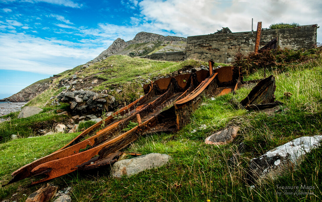 All that remains of the "Amy Summerfield". Before we came to the hoppers at the bottom of the incline, we spared a glance at the lovely old farm of Ty Uchaf, on sale at the moment for £750,000. A snip as it includes a section of beach and the quarry.  Ty Uchaf glimpsed through the trees. The wall on the right is over six feet thick- from the quarry it looked as if it might have been a disused dam, but I concluded it must be a consumption wall, built to clear the fields of the many stones.  A telling find near the farm- an old section of "Bridge Rail" contempraneous with Brunel's broad gauge. Very likely to have come from the quarry. (Also known as "top hat" rail.) Some facts about Cae'r nant: Modern quarrying started in Cae'r nant shortly after 1850 to supply granite setts for paving and construction work in large cities such as Manchester and Liverpool. Work finished in 1939...or in 1951, depending on which source you trust! While the ships that landed here took away stone, they often arrived with essential goods for the village- coal and food, plus items of furniture! The vessels would be called coasters today as they were only of 150-200 tons. 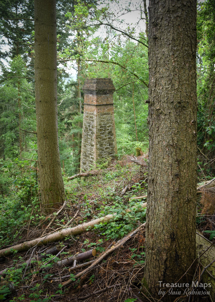 This is somewhere we'd been aware of for a while, having seen the chimney above the road a couple of years ago and putting it on the "to do" list. Finally, we found time to have a good look around, and although the greater part of the site is landscaped, it was still a fascinating explore. A medieval or even prehistoric origin has been suggested for this site, but there is no documentary evidence for mining in the area until 1753. It seems that the mine, known as the Pwllycochion mine, first came to public notice when a discovery was made by miners of £200 worth of lead ore and black jack (A miner's term for sphalerite, or zinc sulphide). The miners sold their shares in the mine to local entrepreneurs, but it was not a wise buy. In 1836 to 1848, an average of only 88 tons a year was sent down the Conwy river. In 1892, there was an increased demand for lead, resulting in mines up and down the county being re-opened and re-invigorated. The mine was re-started as the Trecastell mine and equipped with new plant- a water wheel, flotation pits and a series of flues to a chimney above the processing works, from a smelter stuated east of the road. This area had the largest workings, following several lodes, with stoping extending to a depth of 105 fathoms and accessed primarily via shafts. The mine produced 2,548 tons of lead ore and 12,554 tons of blende before 1913. After that date, the concern limped on until 1955. 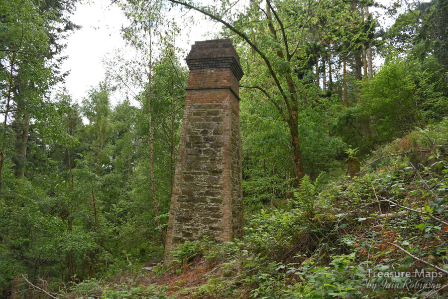 Sadly, there isn't much to see today. There are some adits/shafts further up in the woods, but they are gated and used by Lesser Horseshoe bats as a roost, so best left well alone. I confess, guiltily, that we did trek through the brambles to have a look at the chimney and the adits. It was very tough going, but we were rewarded by seeing how well the structure has been conserved. The upper adits were nearby, gated but looking very tempting. Afterwards we nursed our myriad bramble cuts and torn jeans, but we hadn't been in the adits and hopefully no bats were disturbed. 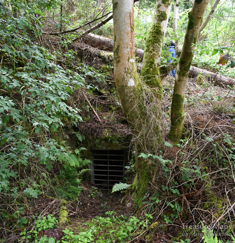 David Gwyn, (in his 1996 report to the Woodland Trust) states that the spoil was barrowed out from the adits, perhaps underlining the antiquity of these openings. Later on in the report, there is a mine plan which shows the depth and scope of the workings which are more extensive to the east of the road. Of the processing works there is little remaining- the site was "landscaped" a few years ago. There was a waterwheel there, a smelter and ancillary buildings. After our first visit, where we were focussed on something else (here) we studied the old maps and the new OS editions and concluded that there was public access on to the landscaped area to the east. As it happened, this was very worthwhile. 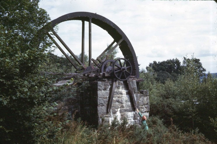 The waterwheel that was at Trecastell in the 1960s. The site has been destroyed since. Photograph by the late John Owen. Many thanks to Simonrail from Aditnow for permission to use this. There wasn't really much to see, but the outlines of the tips and the spoil was a giveaway. The river itself is heavily buttressed and the banks revetted. There is a wall which may have been a dam, choked up with vegetation and willow growth- but it may well be where the water wheel was sited. All around, there was the feeling that something had been concealed...and all there was to show for it were the tantalising shreds of evidence here and there. We did find some small clues in the undergrowth- rails, bits of iron and a curious length of angle that could have been from a hopper wagon. This was excavated using the well-known archaeological method, the "toe of the boot"! Of the shafts and adits east of the road, nothing remains except some substantial tips. It is however, a charming area of trees and undergrowth with some old beech trees which must have been there when the mine was working. Elsewhere, ageing birch trees, their job of colonising almost over, still choke the undergrowth and fight the onslaught of Gorse, which has become "leggy" and almost possible to walk under. I presume that the area was cleaned of any toxic fallout from the lead mining, as the remains here and there of the flue and the water tanks all look very healthy. It certainly makes a grand day out and an excuse to exercise the "eye of faith" :-) It is strange how both of us have developed a mining "sixth sense" where, no doubt due to some unconscious cues from the lie of the land, we feel an area is "miney". The senses were working overtime here. 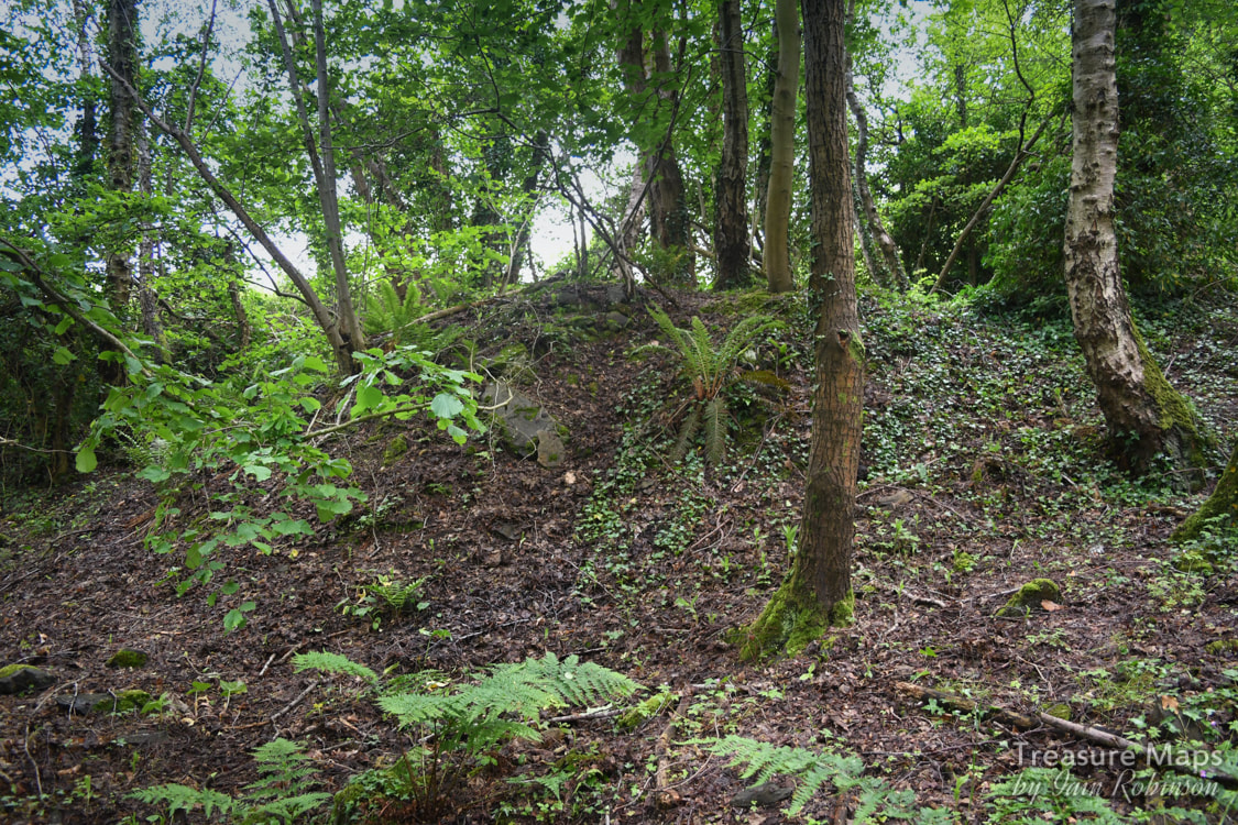 The tips, surviving despite the rest of the site being obliterated. 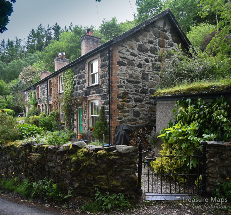 There is a terrace of houses directly opposite and above the old processing works- these are particularly handsome and were built for the miners- now cherished and probably rented from the Woodland Trust. We walked up above the woods (on private land...) and found more evidence of mining, in particular, a filled-in shaft at SH757746... 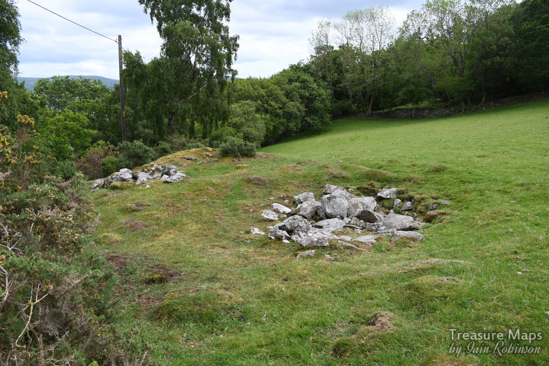 This shaft was probably what is left of the Tynybryn mine, a lead excavation. There is a heap of spoil down the bank from the filled-in shaft. There was a lovely old track (a bridleway) which runs up and around the top of the Parc Mawr, it had the feeling of a sunken lane and appears on the old maps, but seems to have been superceded by the modern lane. Below in the river, there were some concrete remains which might have been something to do with later mining in the 1930s but I couldn't say. We walked further along the road which winds above Parc Mawr and encountered a farm which looked as if it might have had an industrial past- but perhaps that's my mine-frenzied imagination at work! But at the back of the farm was this house, sadly derelict, which was in the same style as the Trecastell houses...could it have been a manager's dwelling? There were a couple of nasty looking farm dogs, obviously considering whether my ankles were worth a bite, so we didn't hang about here.  Interestingly, there are a couple of photos on Geograph of a mine adit along this road, something we failed to find- perhaps it was further north than we went. Amusingly, there was an older photo of the same thing on Geograph, but taken a few years earlier...with a twee display of flowers. Glad to see those had gone :-) very un mine-like! Thanks to Chris Andrews for this excellent shot, without flowers. I've since discovered that this is a shaft. 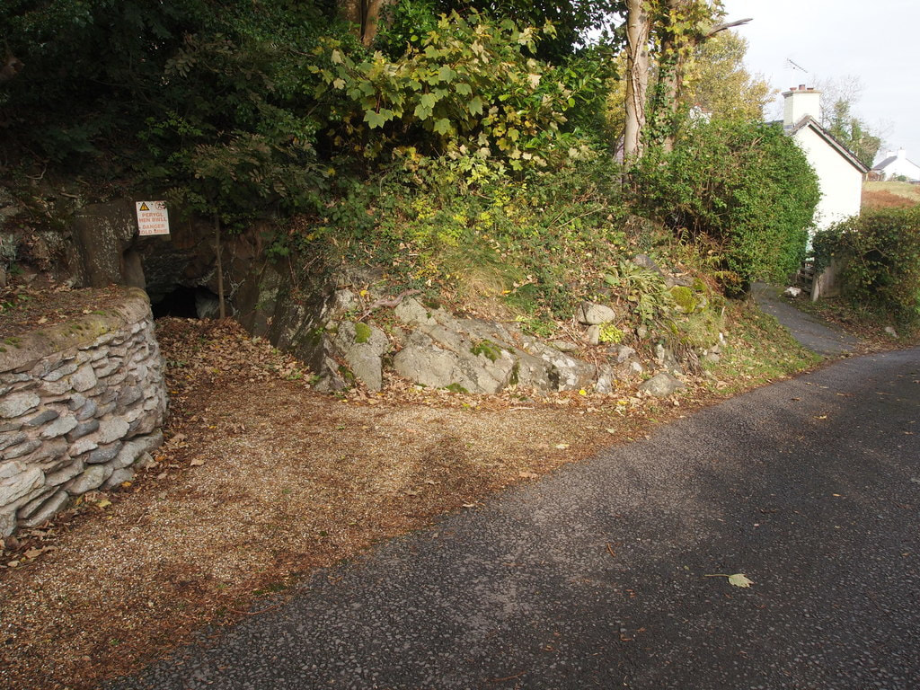 © Copyright Chris Andrews and licensed for reuse under a Creative Commons Licence.  Extract from OS series Caernarvonshire VIII.NE Revised: 1911, Published: ca. 1936. Reproduced with the kind permission of the National Library of Scotland 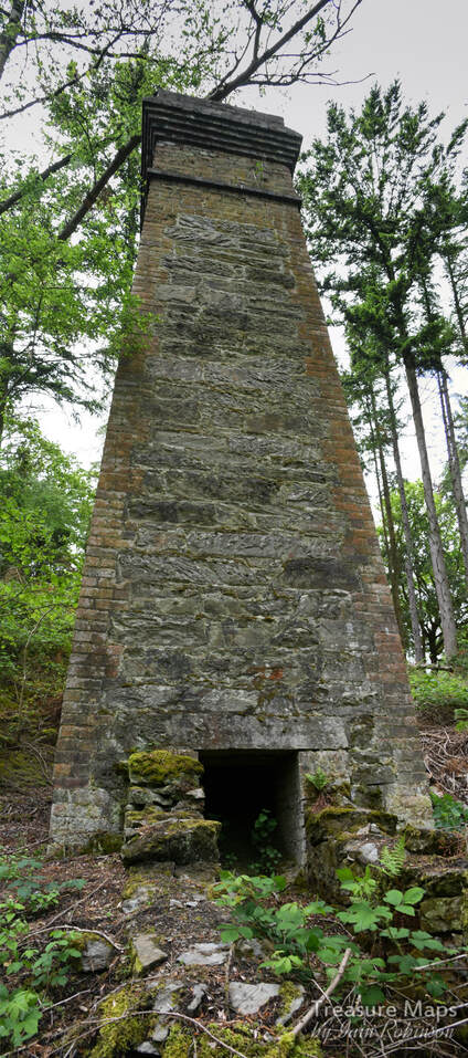 Further references for the Trecastell mine:
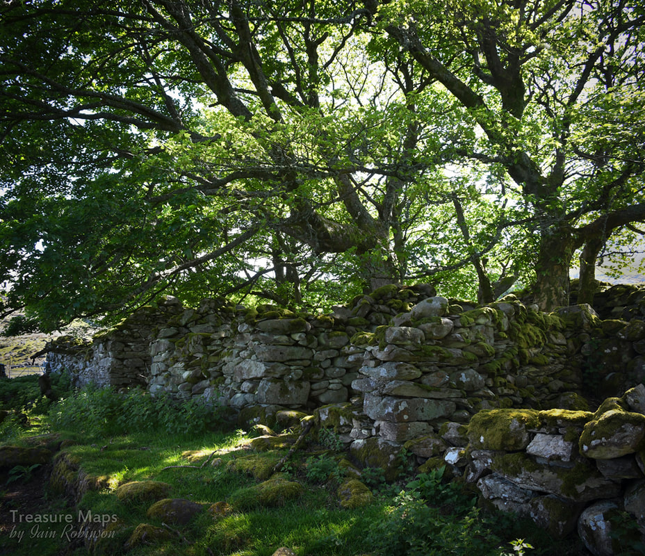
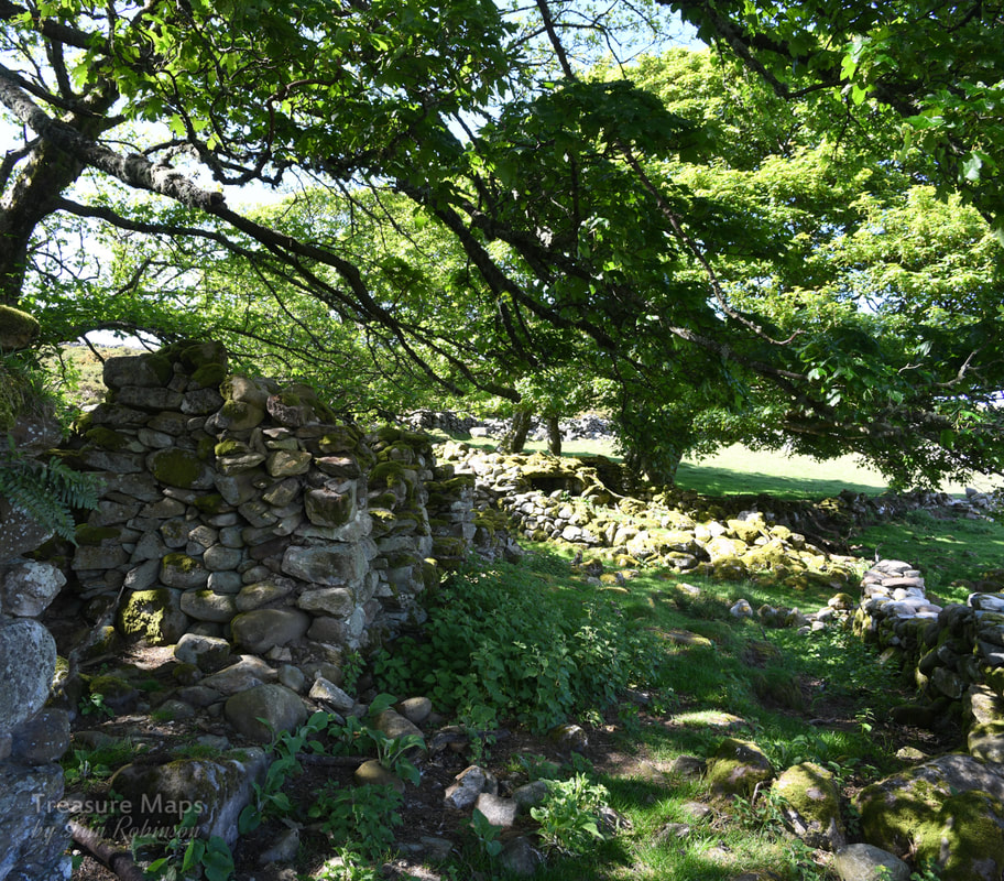
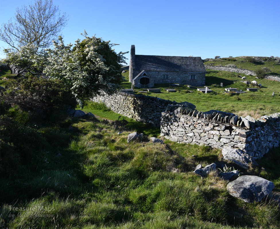
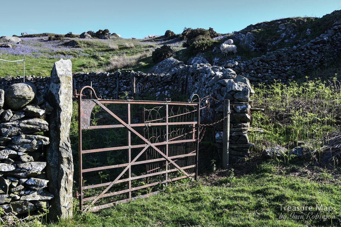
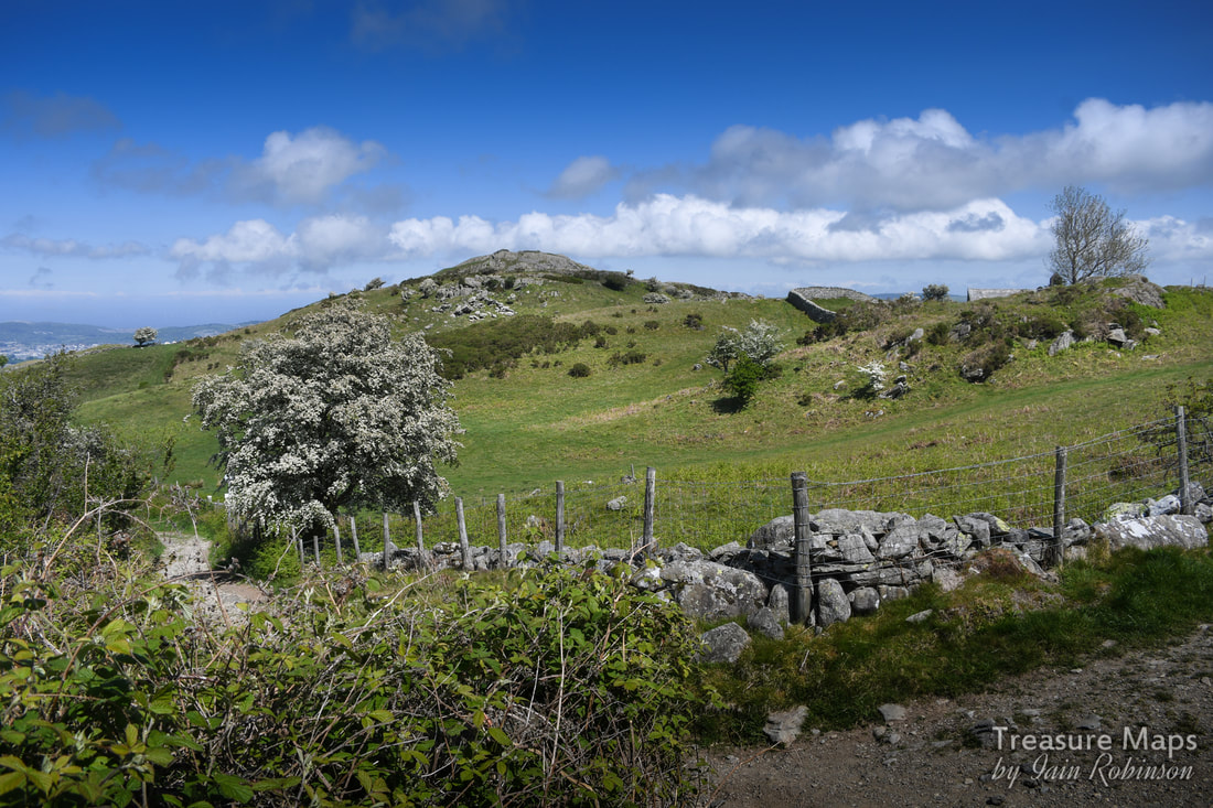
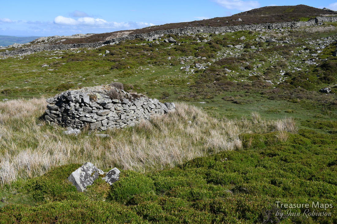
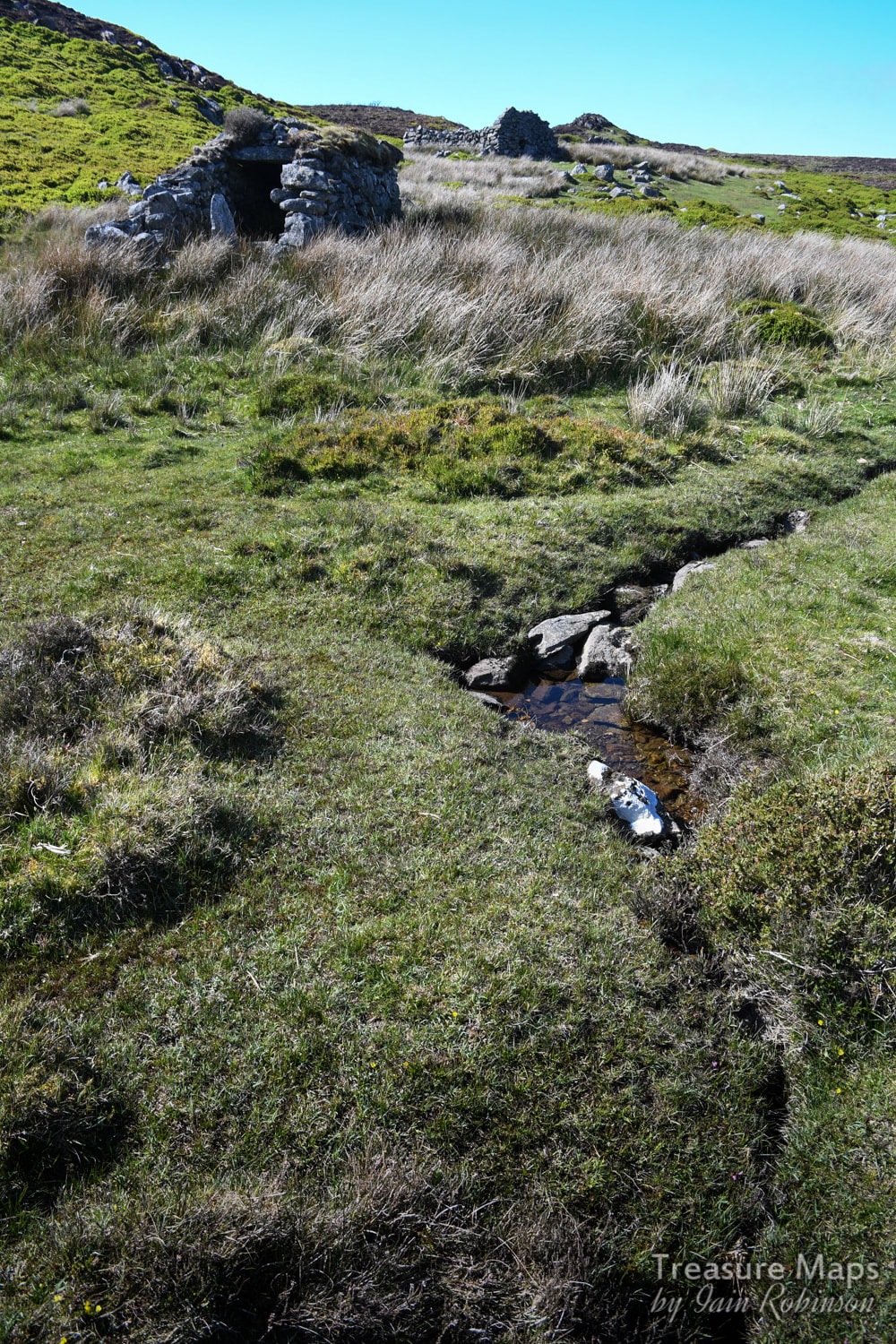
"Mines of the Gwydyr Forest Part 7", J Bennett and RW Vernon, Gwydyr Mines Publications, 1997. "Lead Mining in Wales" by W. J. Lewis, UWP 1967. AditNow photo album of the mine here Gwynedd archaeological Trust report 226 Williams C J "Metal Mines of North Wales," Rhuddlan 1980  Some ancient woodland, the old, remote church of Llangelynnin and Maen Penddu standing stone, all connected by a rather old path. Parc Mawr An area of woods to the west of Henryd, at SH757737, Parc Mawr is owned and managed by the Woodland Trust who welcome considerate visitors. There's a small car park/layby near the entrance, which is handy as there are few places to park hereabouts unless you start from Henryd. This is a mixed deciduous woods, on a very steep east facing site above the Conwy valley. But the first thing we encountered was an adit...  A low trial adit of the mine seen immediately as you enter the woods. Photograph by Petra Brown. 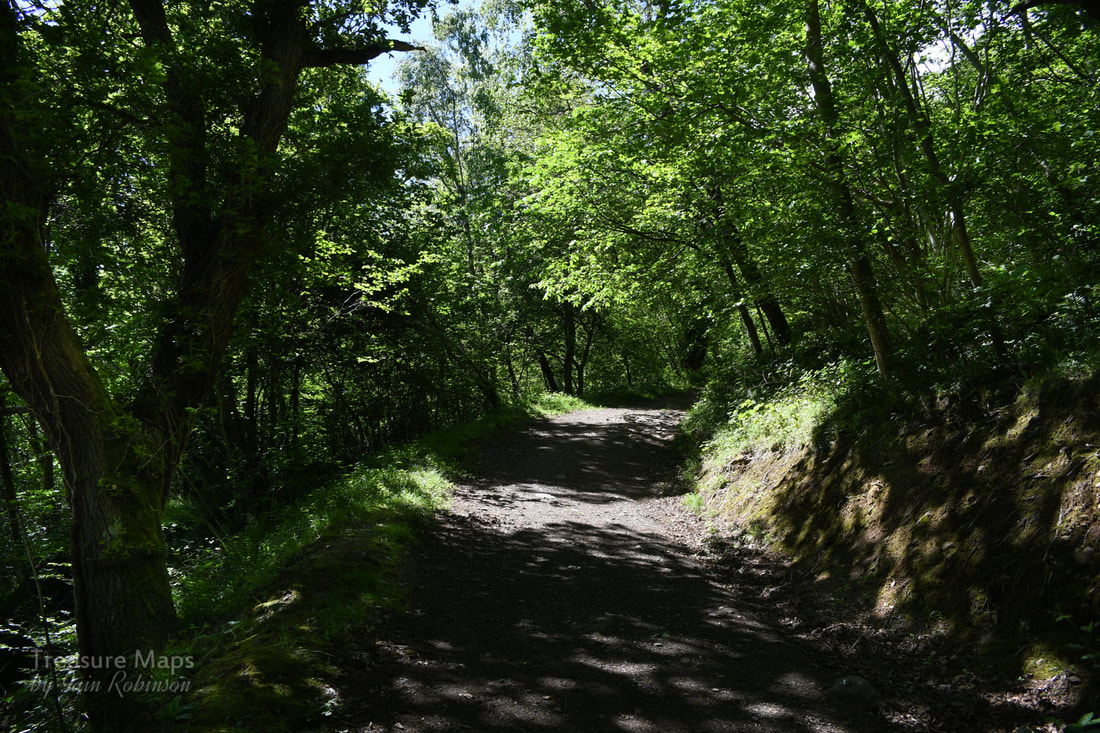 Into the woods! After having a nosey around the ungated trial adit, (more about this here) we set off up the main path which takes a route along the middle of the woods. The path climbs steeply for almost a mile, (a vertical climb of 110 metres in height), to a viewpoint with a handy bench. There are many fine trees to admire; beeches, sweet chestnuts, Douglas firs, and some fine old oaks. Conifers have been felled and left on the ground. We sat for a few minutes and gazed at the view across to Conwy, starting in on the snacks already, despite it being early in the day. Feeling slightly full, we walked on a little way until we encountered a trackway crossing from below. This is an old route which has been re-branded as the "Pilgrim's Path". We turned right and walked steeply up. It's surfaced with round stones and would probably be very slippery in the wet- even on the glorious day we had, it resembled a stream bed in places. It's interesting that on the way up the path, the walls vary in age and repair condition. Near the top, there is some ancient walling on display, parts of it originating from the middle ages. We went through another gate, with the Iron Age fort of Cerrig y Dinas looming on our right. The old church came into view now. 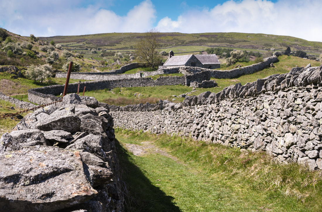 Looking at the walls as they strode up the hill, I realised that they were enclosure walls- perticularly noticeable in the higher land above the Conwy valley. I don't like the thinking behind them, the idea that a few people could divvy up land that folk had been living and farming on for thousands of years. Share it out between themselves and chuck everybody else off. But I had to admire the craftsmanship that went into building the walls. I have tried to build dry stone walls a good few times and I know how much thought goes into it- and how much frustration! St Celynnin's church I shan't say much about the church, since churches and religion are not my thing. But if it's your thing, then it is well worth a look. The site was dedicated to St Celynnin in the sixth century, although this ultra-modern imposter dates from the twelfth century. You can pick up a very good, free informative leaflet inside the church. Petra went in and took some photos- I will put them on here when her workload allows her to process them. 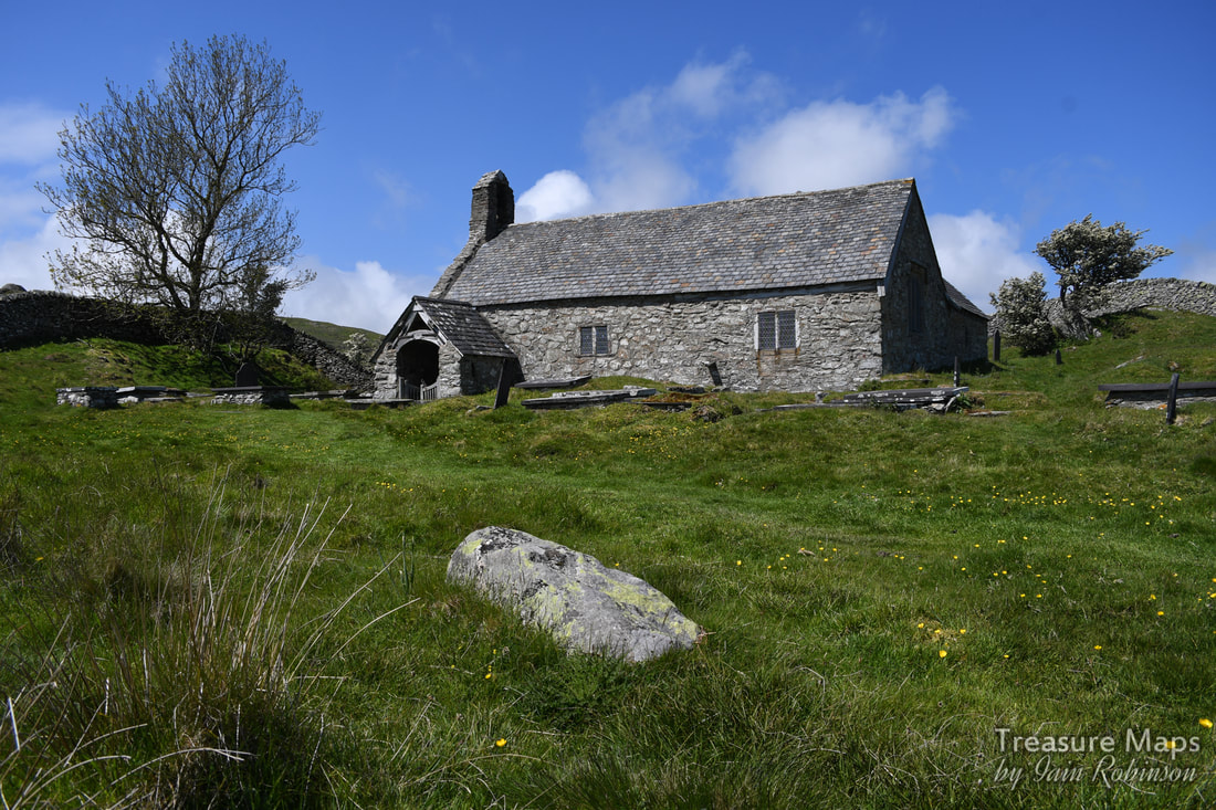 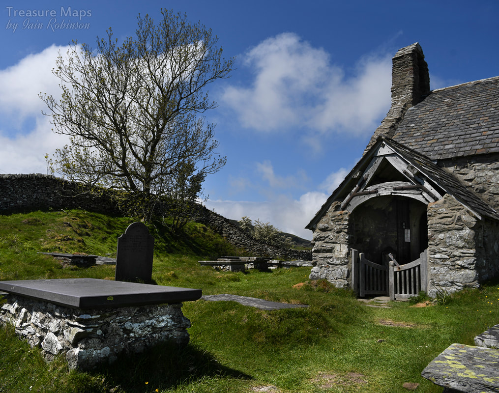 Once past the church, the moor opens out and horizons become wider. We walked past a very fine sheepfold. I'm glad to see there is renewed interest in these wonderful old structures that always fascinate me when I find them in the hills. Sadly, they don't photograph very well without a drone, or a tame pilot to do them justice! 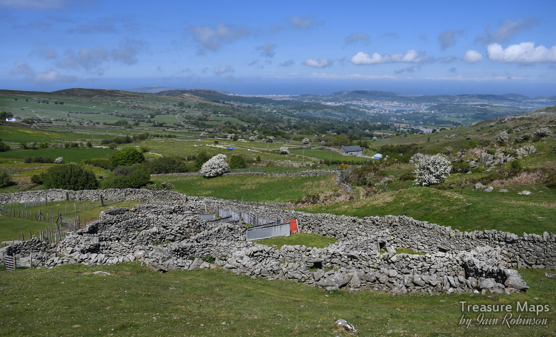 We headed upwards as the landscape became more remote, despite being only a few miles from Conwy. That is one of the attractive features of this area, as locals can come up and get some fresh air while it is relatively unknown to the majority of tourists, who tend to congregate on the Bwlch y Ddeufaen to the south. I don't think my readership is big enough to endanger the secret. The ruined medieval farm of Friddlys We were now on the lower slopes of Tal y Fan, and could see the eponymous slate quarry ahead. See post here. We were intrigued by some stands of trees below in the otherwise bare hillside. I wondered if the trees masked a ruined farm, so we went down to have a look. We found something rather magical in the shade of some old sycamore trees. According to Coflein, this was a medieval farmstead, which they call Ffriddlys, although it is marked on the 1st edition OS maps as Llwyn Penduu. Modern maps ignore it. The first thing that I saw was a pig sty, almost completely ruined, but still recogniseable. Then a cart shed. To the right, or south, there was a range of buildings- at the end was the dwelling house with a range still in position (just). I wished it wasn't so sunny (never satisfied) as the light was so harsh, but perhaps that added to the magic as well. 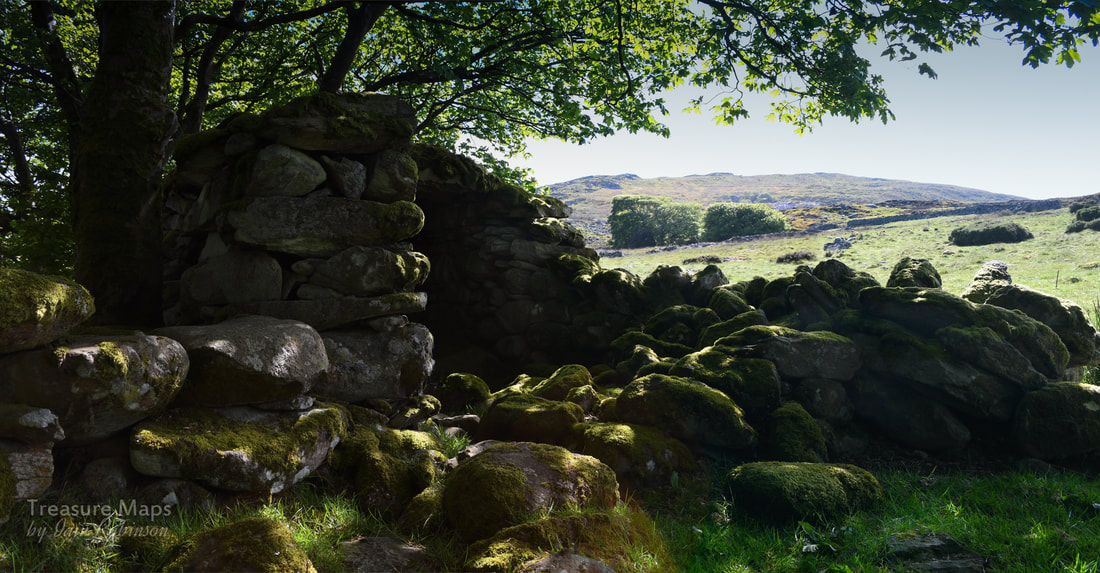 The remains of a cart shed. 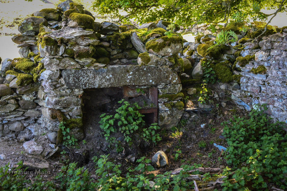 The remains of the kitchen fireplace. 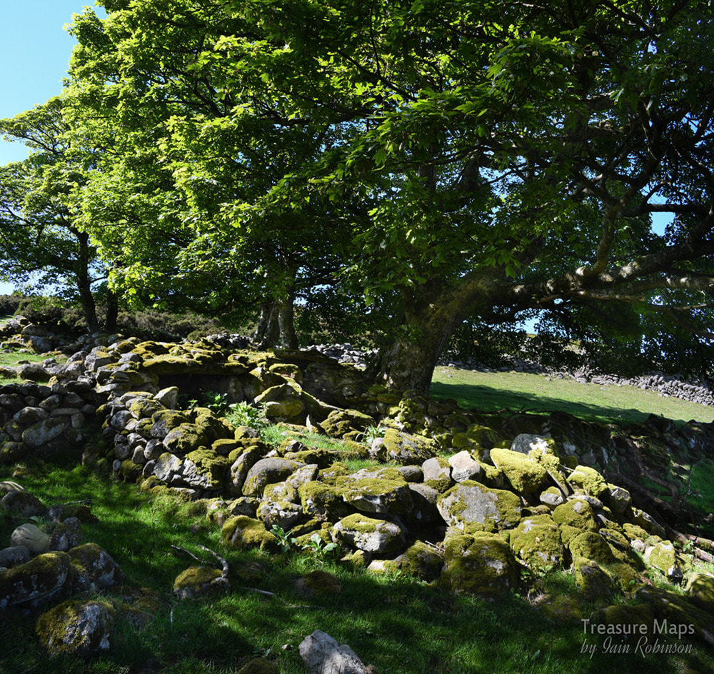 Remains of a double pig-sty. A little bit further up the hill, there was another, smaller set of more ruinous structures- I think they were a part of Ffridllys farm. I failed to photograph anything here, sadly, the differences between the light and the shade defeated me. There was a mysterious metal wheel leaning in a gate opening, perhaps from a machine like a hay rake. Maen Penddu We made our way uphill to an area which contained a number of old beudy structures, and the peat hut shown in a previous blog post here. These were all close to a very impressive standing stone, Maen Penddu. 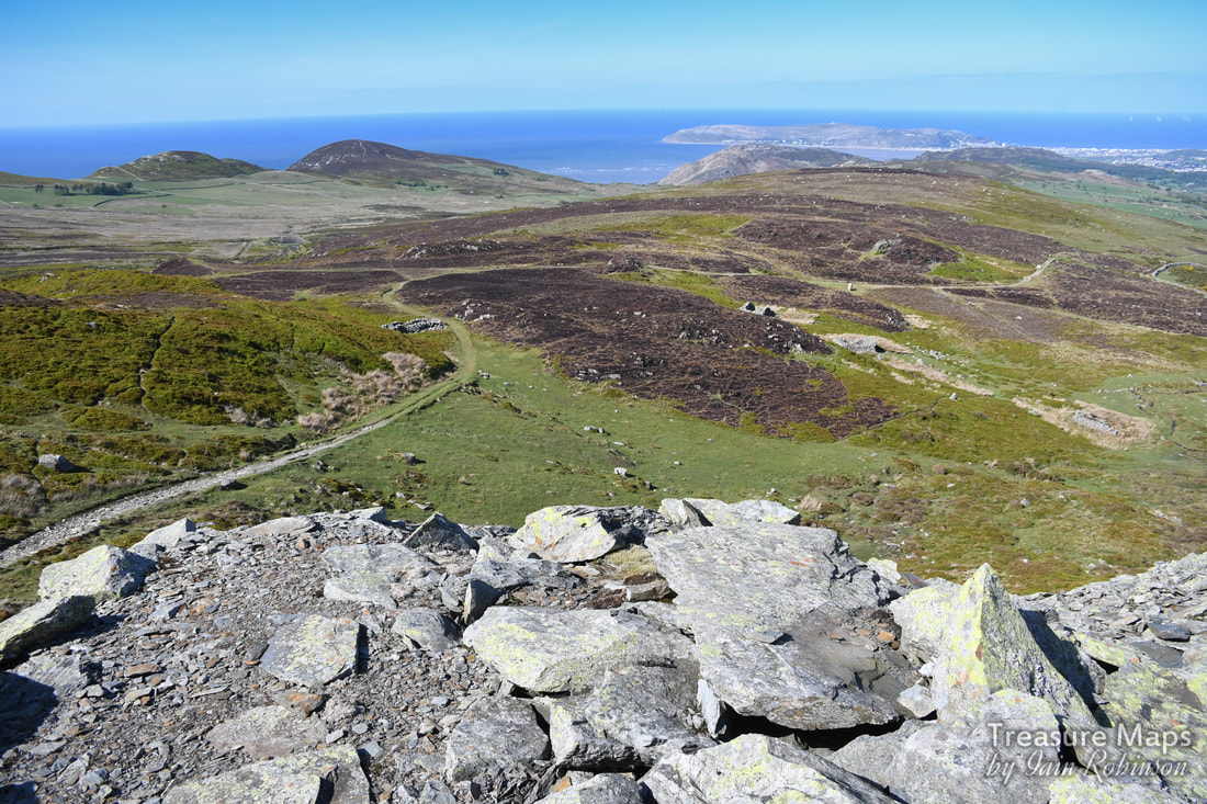 In a shot from the tips of Tal y Fan slate quarry- the beudy structures and the peat hut on the right of them. Maen Penddu is in a clearing to the right of centre. On the left is a sheepfold. In the distance is Penmaen bach and in the distance, the Great Orme. 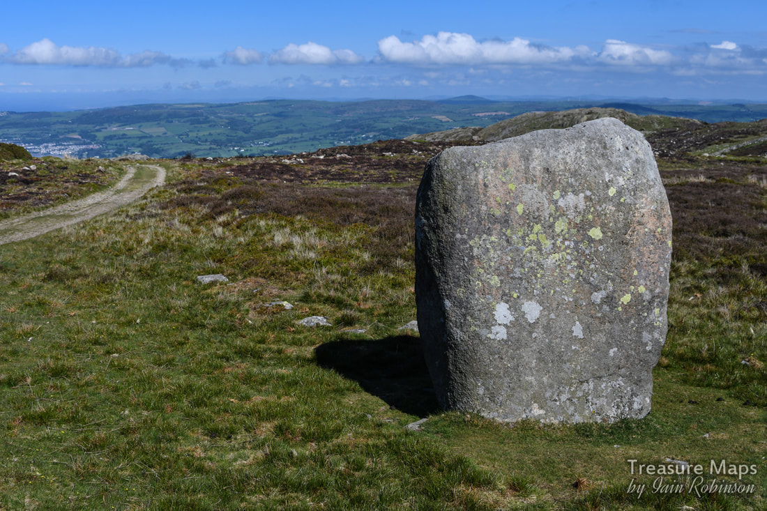 I quote Coflein NPRN 303070 which says: "The stone stands 6ft high and measures 3ft 6 ins x 2ft 6 ins at base. It has been incorporated in the line of an old enclosure bank on the S of a well-used track." Maen Penddu means "black headed stone". The side that faces the track coming uphill has sadly been defaced with some deeply carved names. The south elevation has a cross carved into it. Honestly, I can't find the words. At this point, we headed off up the hill to spend a couple of hours at the slate quarry. Our next adventure will be to take the lower track from here all the way down to the Bwlch y Ddeufaen-and it's many neolithic treasures. Coming soon :-) 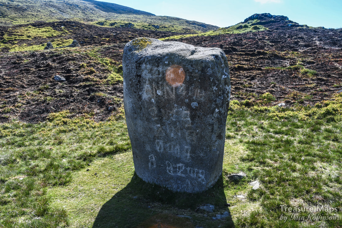 A few more images from the walk: 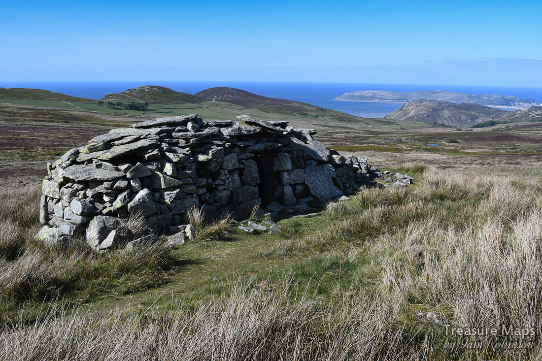 The first time we encountered one of these was while stravaiging west of Tal y Fan on the moors between there and the Penmaen hills. We'd seen a couple of old steadings and sheepfolods, but this structure mystified us. I wondered if it might be a shepherd's shelter, but a glance inside showed that there wasn't space, nor was there a chimney. It wasn't until we returned home and I consulted "An Inventory of the Ancient Monuments in Caernarfonshire" (RCAHMW) that the fog of mystery lifted. Apparently, these are peat huts...for the storage of peat. Accustomed to peat being stored outside in heaps to dry, this came as something of a surprise to me. But the guide says that they are called "Hafodtai Mawn" - and that they are not very common. 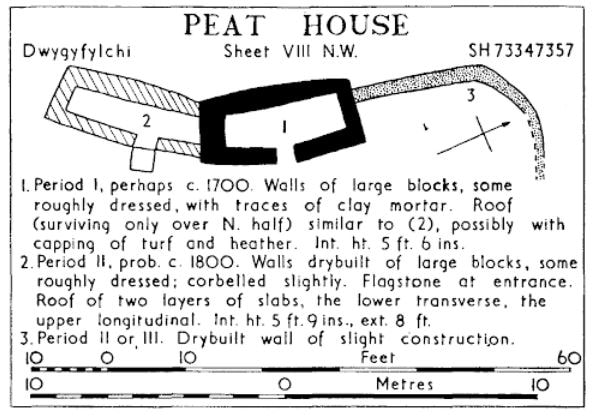 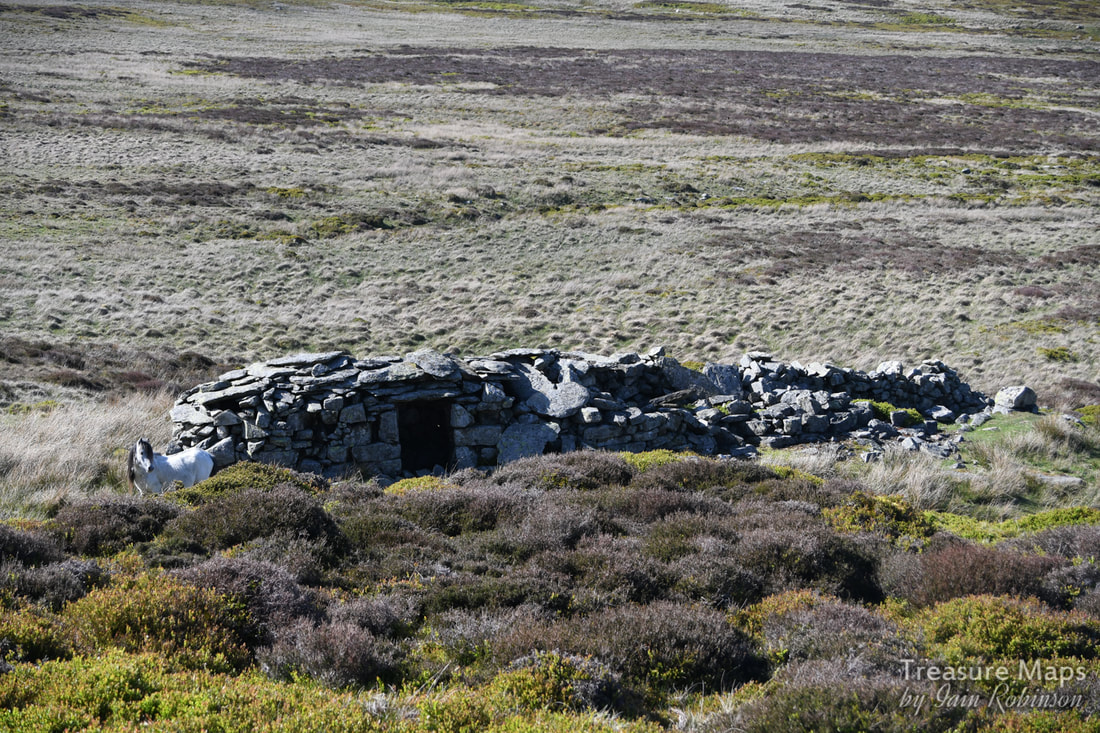 Overall view (with wild pony). Peat seems to have been more commonly kept in a heap that was thatched, resting on a peat stool ("Ystol Mawn") which is a platform of large stones intended to keep the peat off the ground. The guide says that these are very common and can be mistaken for burial mounds. Below are two shots from inside, showing the cramped nature of the accomodation. The grid reference for this one is SH 73347537. The day we explored, we were accompanied by some lovely Carneddau wild ponies, who seemed fairly relaxed about us being on their...er, turf. A few days later, we found another peat house. We were looking for a powder hut near the slate quarry at Tal y Fan and encountered something that looked as if it might be a powder magazine, but the more we examined it, the more it looked like a peat house. (Unfortunately, we didn't find the magazine) 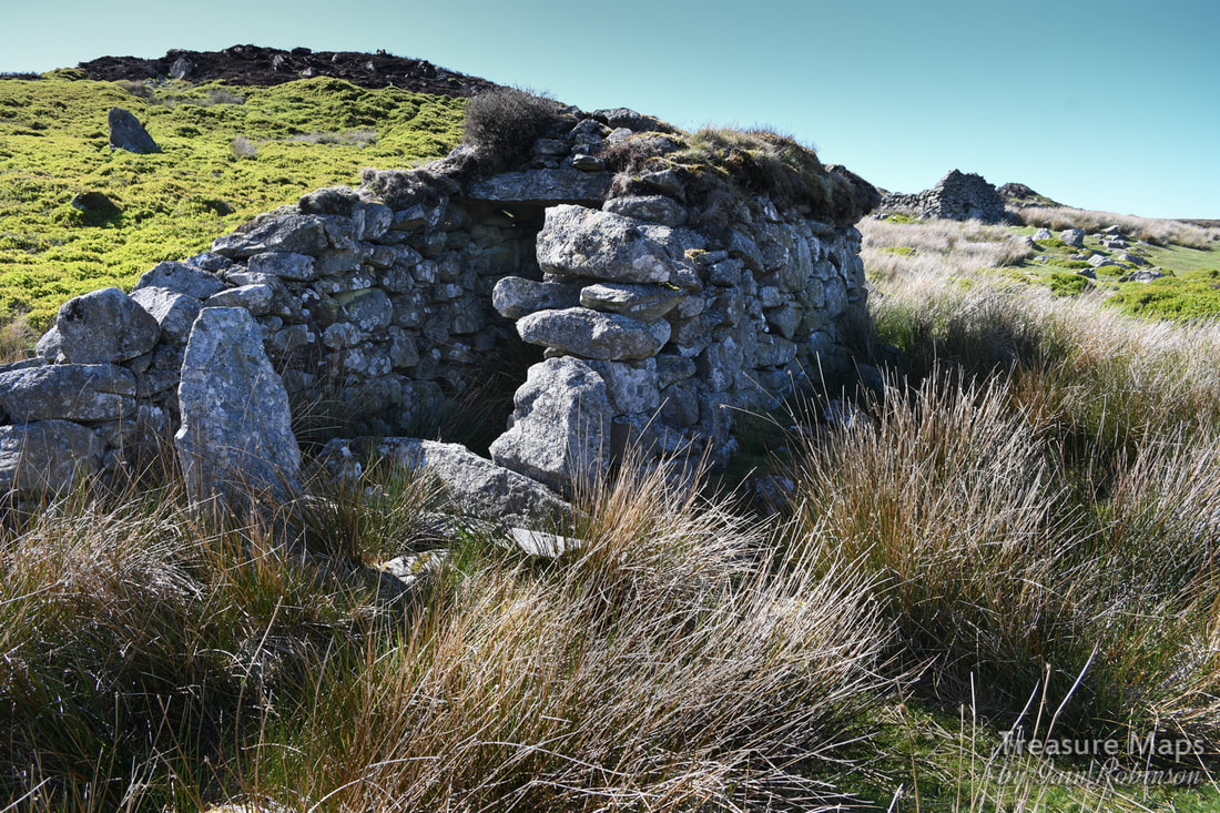 The remains aren't as well preserved as the one further north, although these are in company with a couple of old beudeau and an impressive, if vandalised standing stone, Maen Penddu. The grid reference is SH73917346. 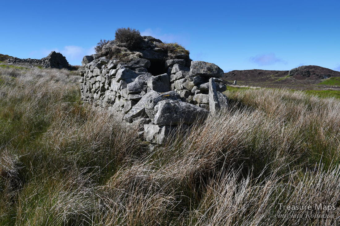 Maen Penddu lurks just to the right of the hut wall in this shot. It's amazing to think that these moors, which look completely uninhabited, have actually known human habitation for a very long time. These peat house remains are just one facet of a timescale going back four thousand years to the neolithic. 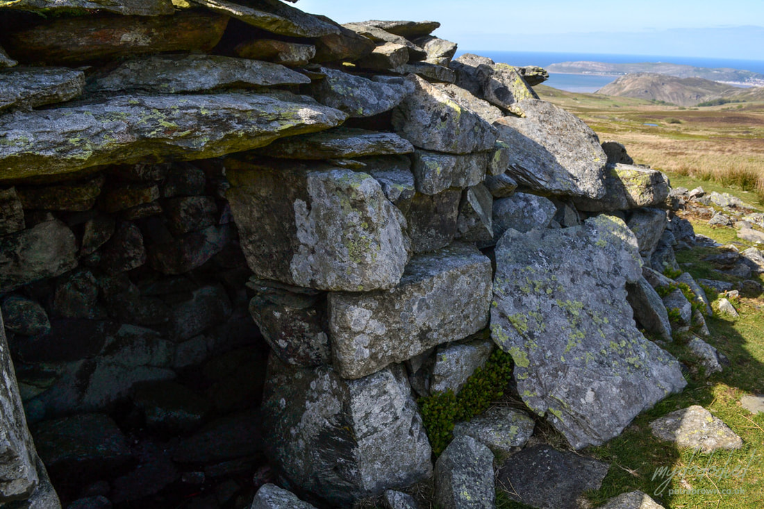 Petra's rather fine detail of the hut on the moors. |
TracksReceive the occasional Treasure Maps Newsletter- and alerts when a new post is available!
If you enjoy my content, please buy me a coffee!
Check out my other online activity...
Index
All
|

 RSS Feed