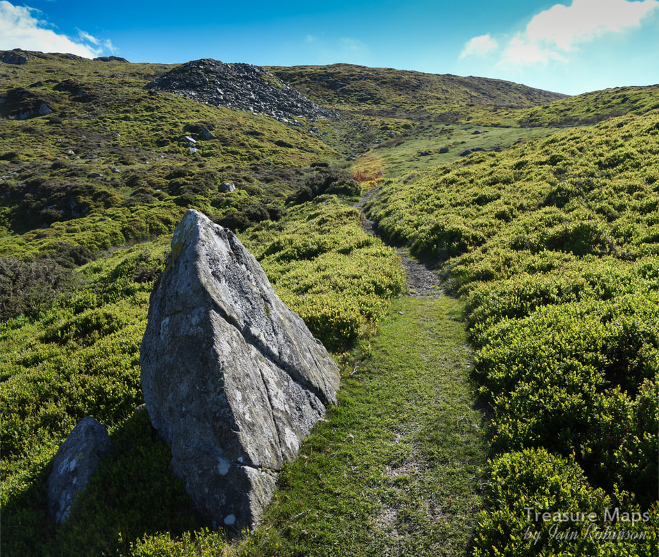
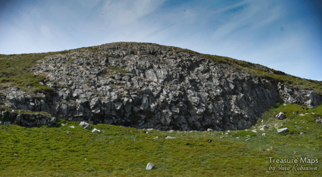
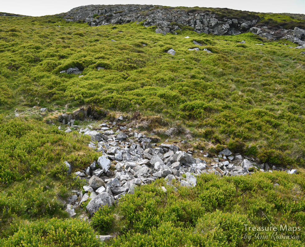
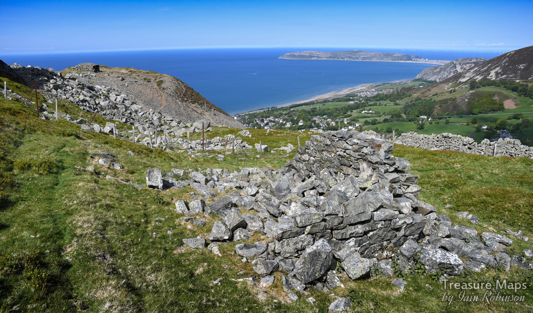
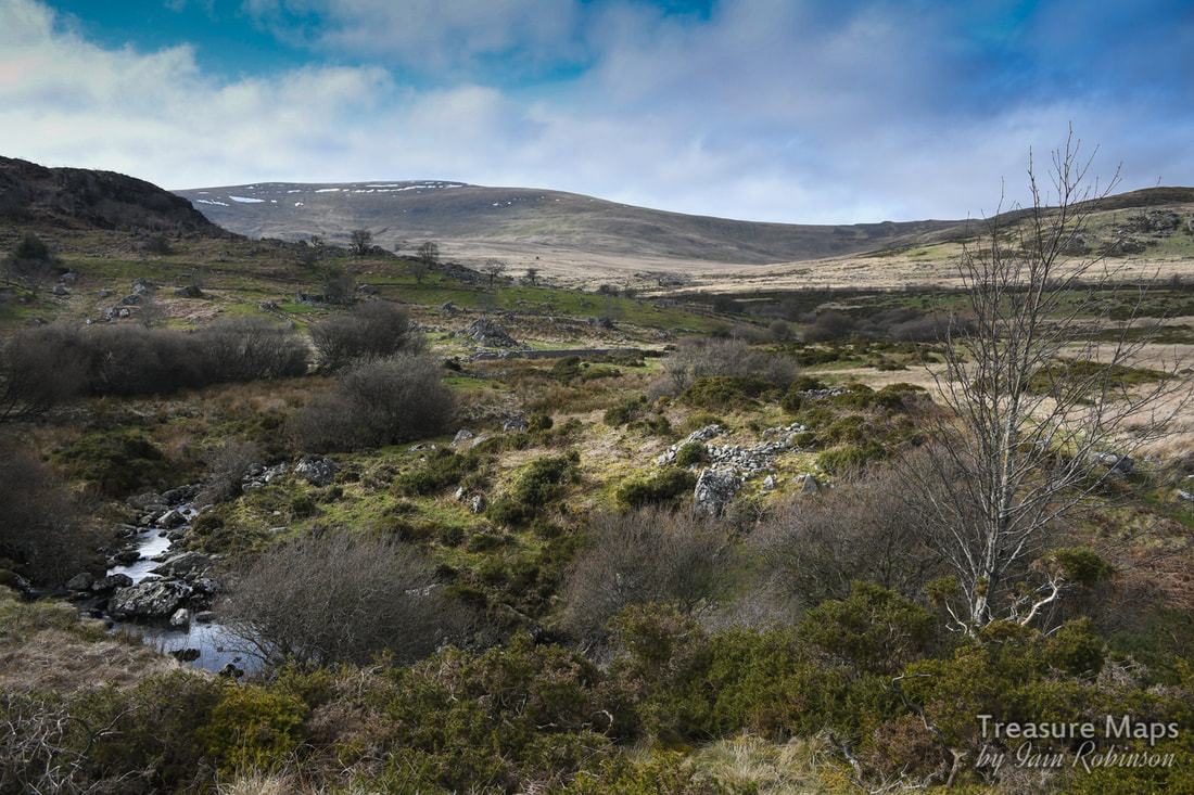
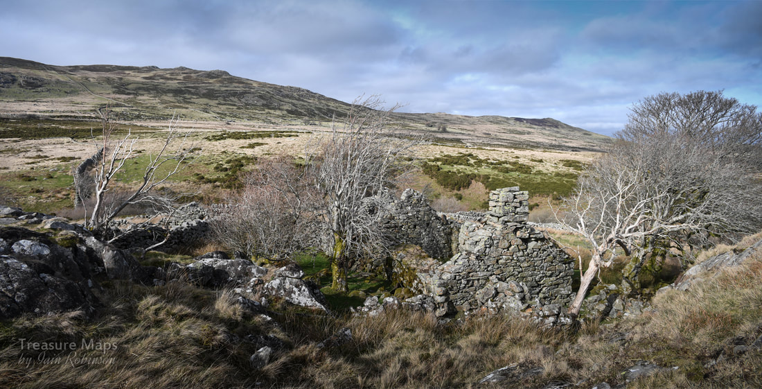
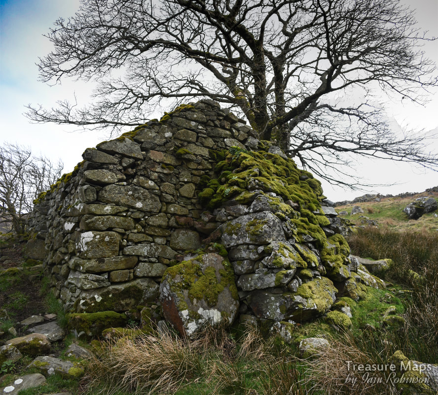
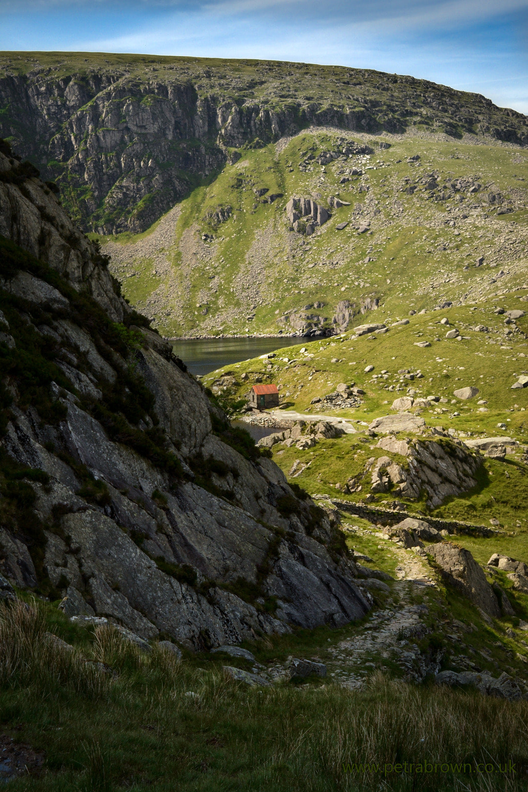
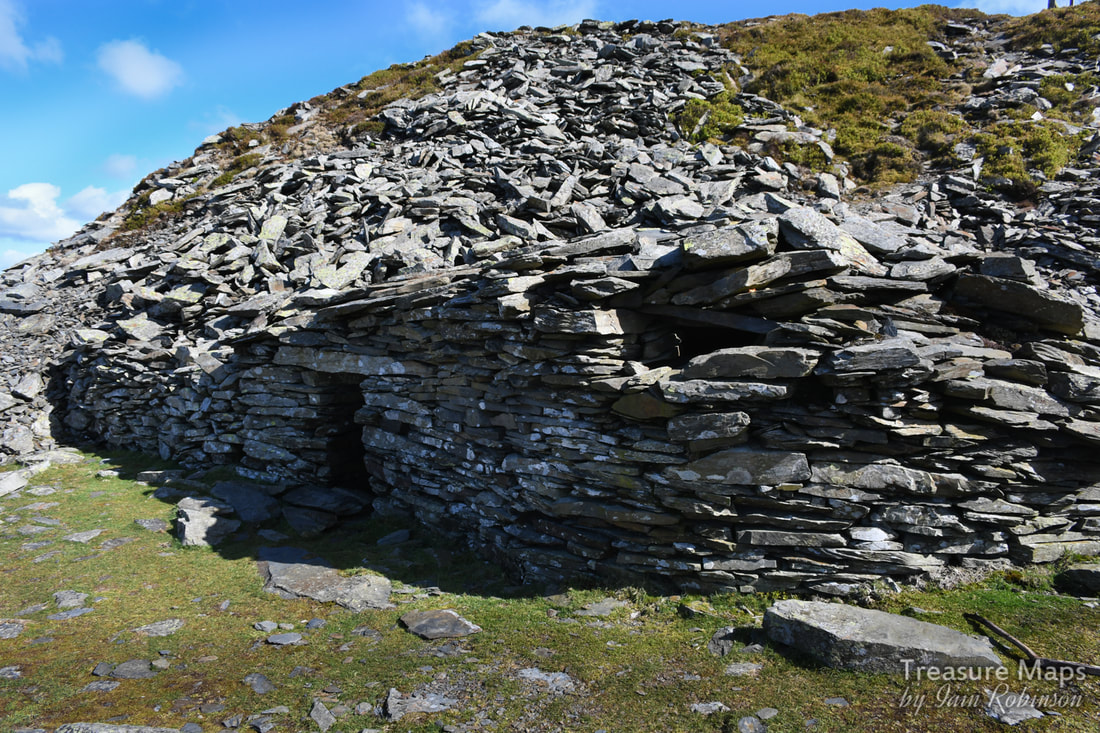
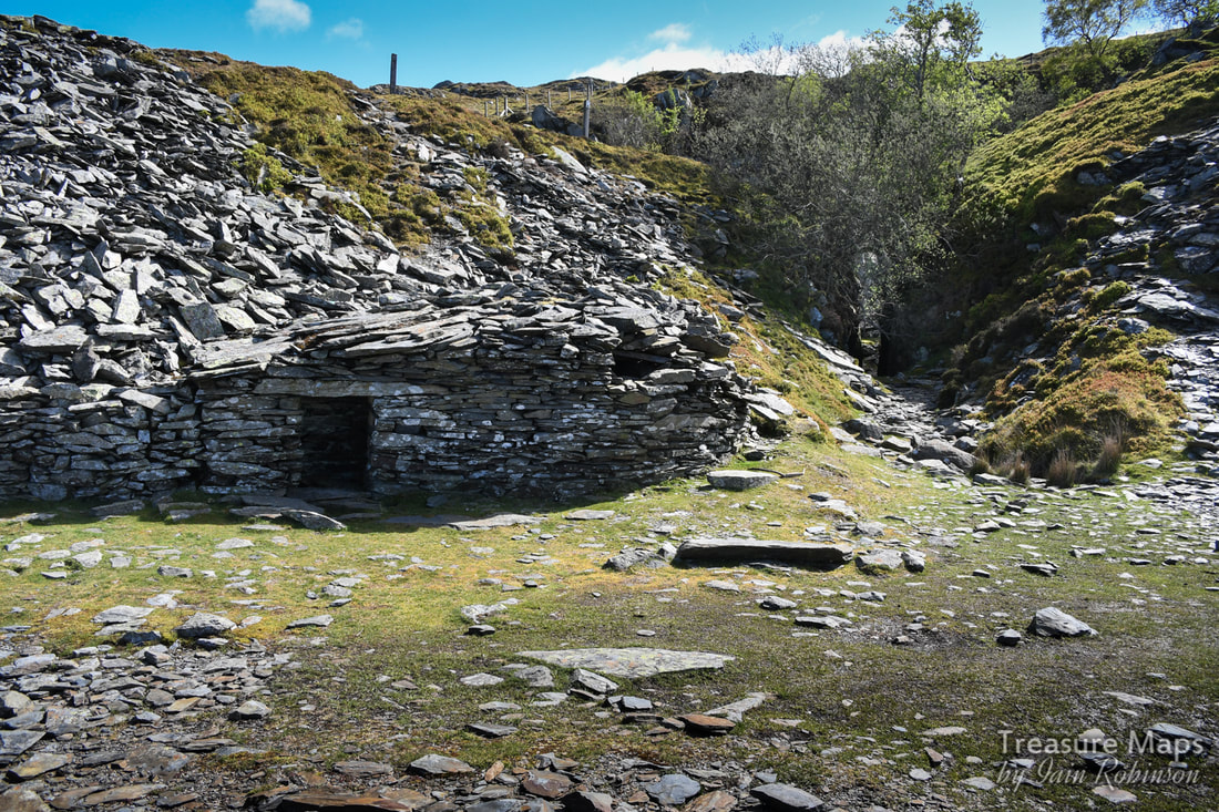
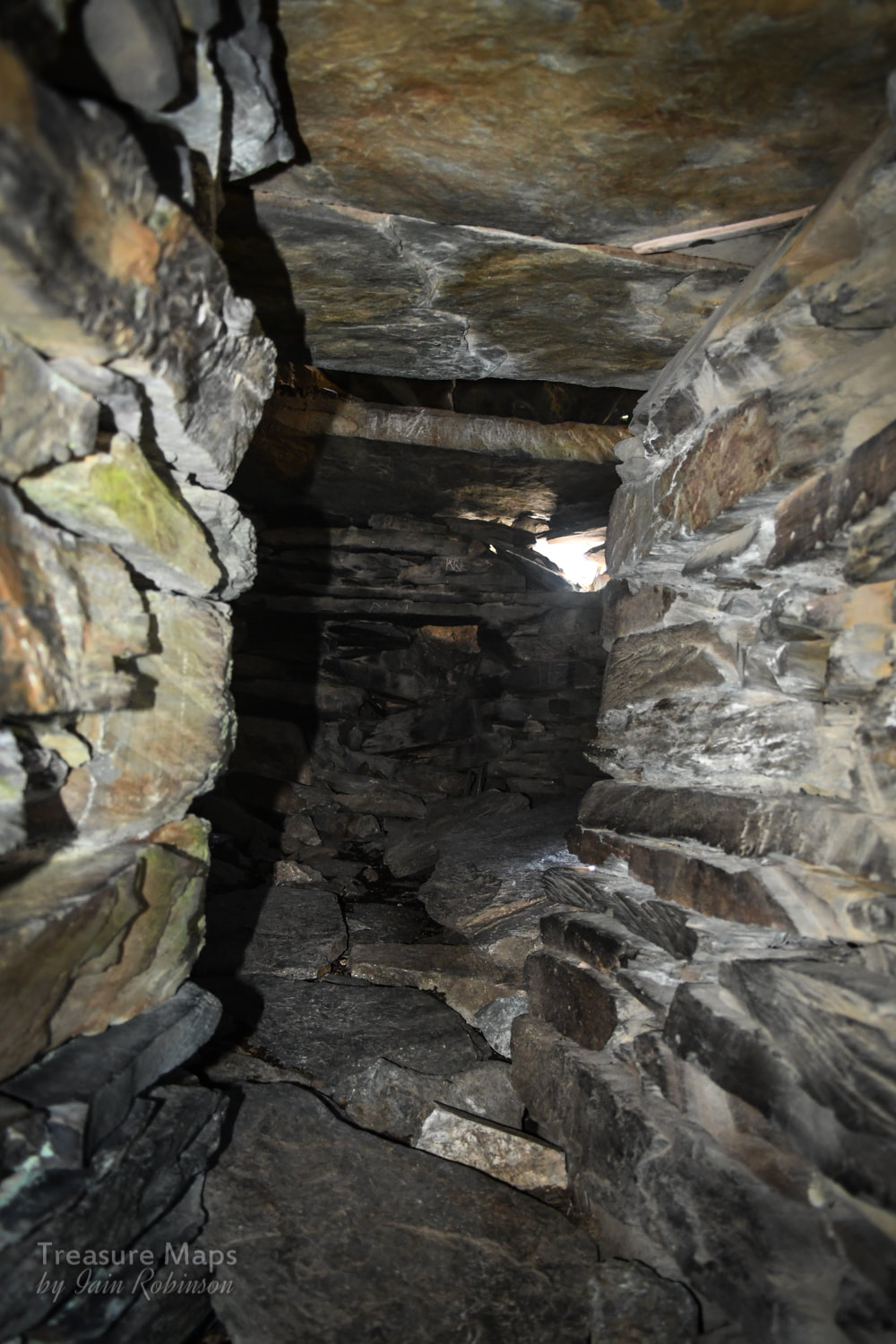
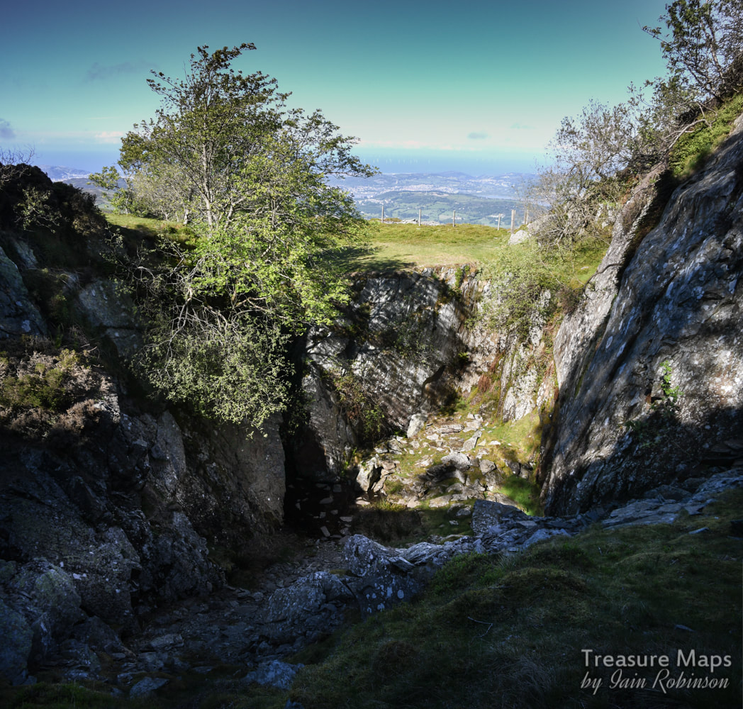
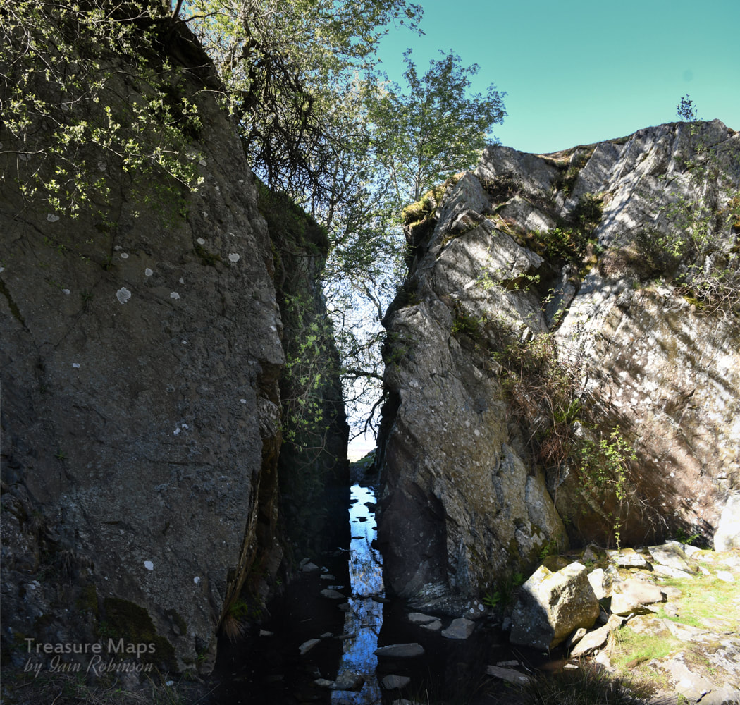
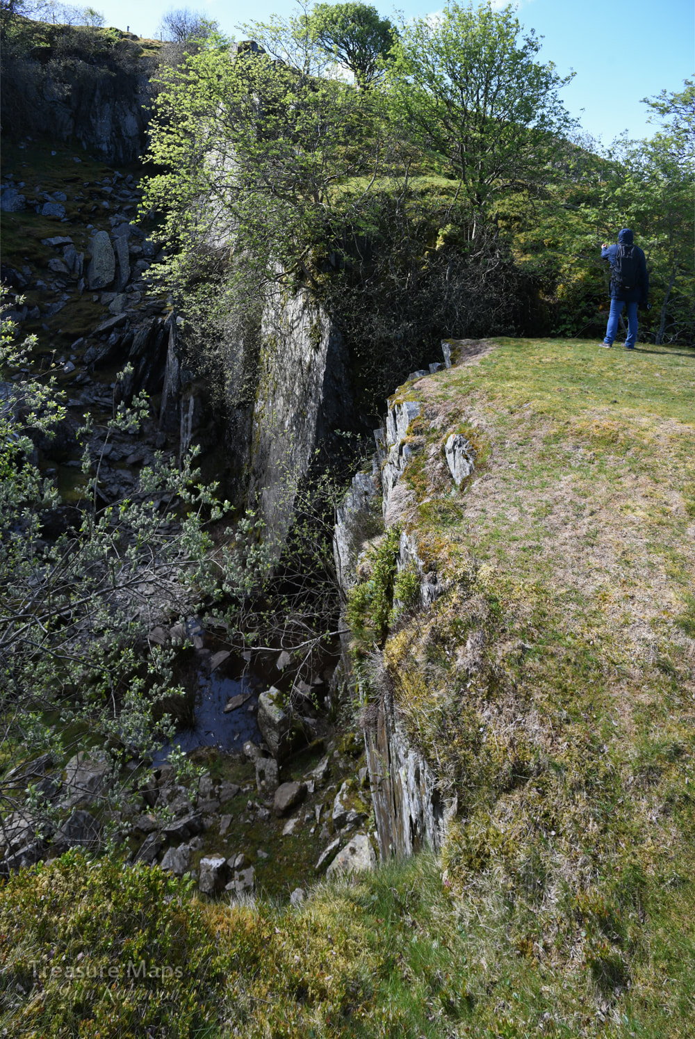
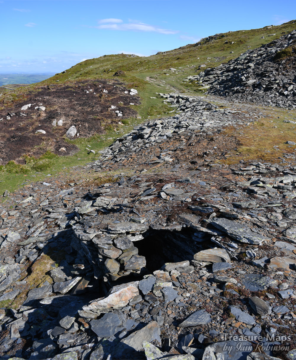
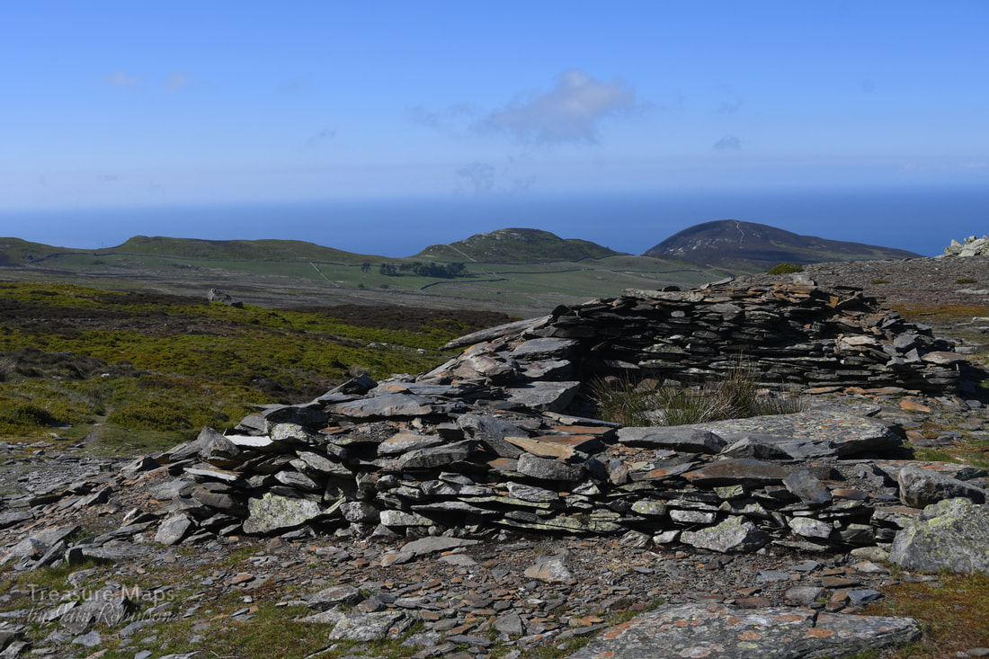
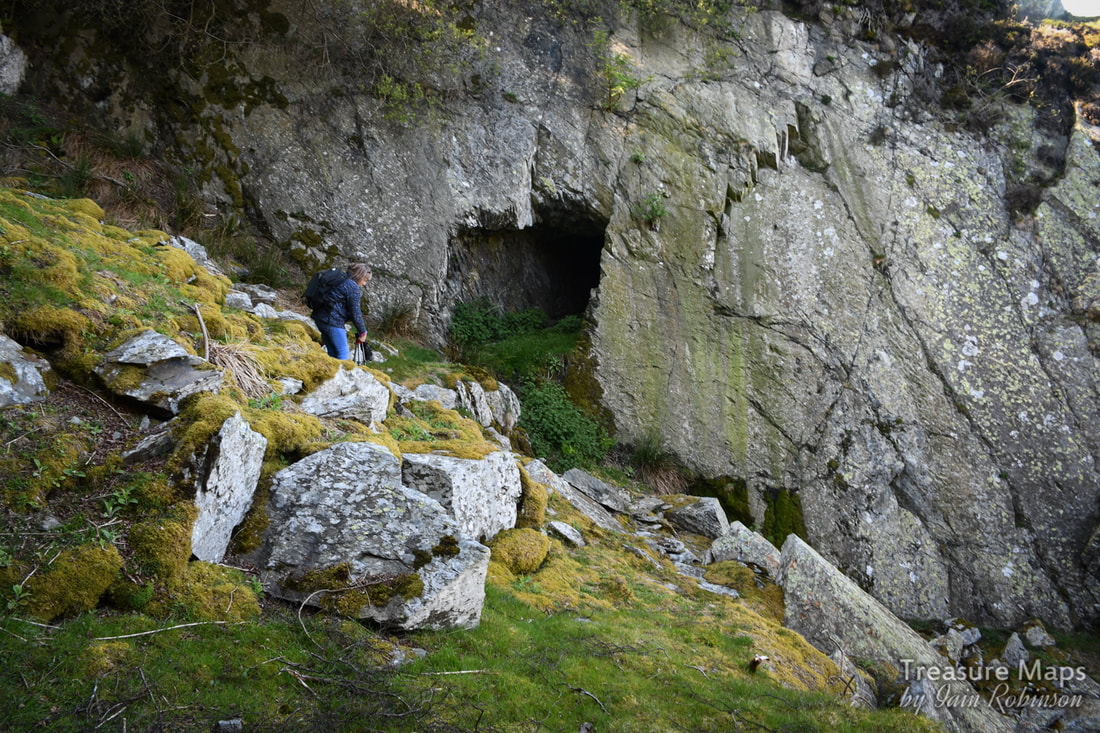
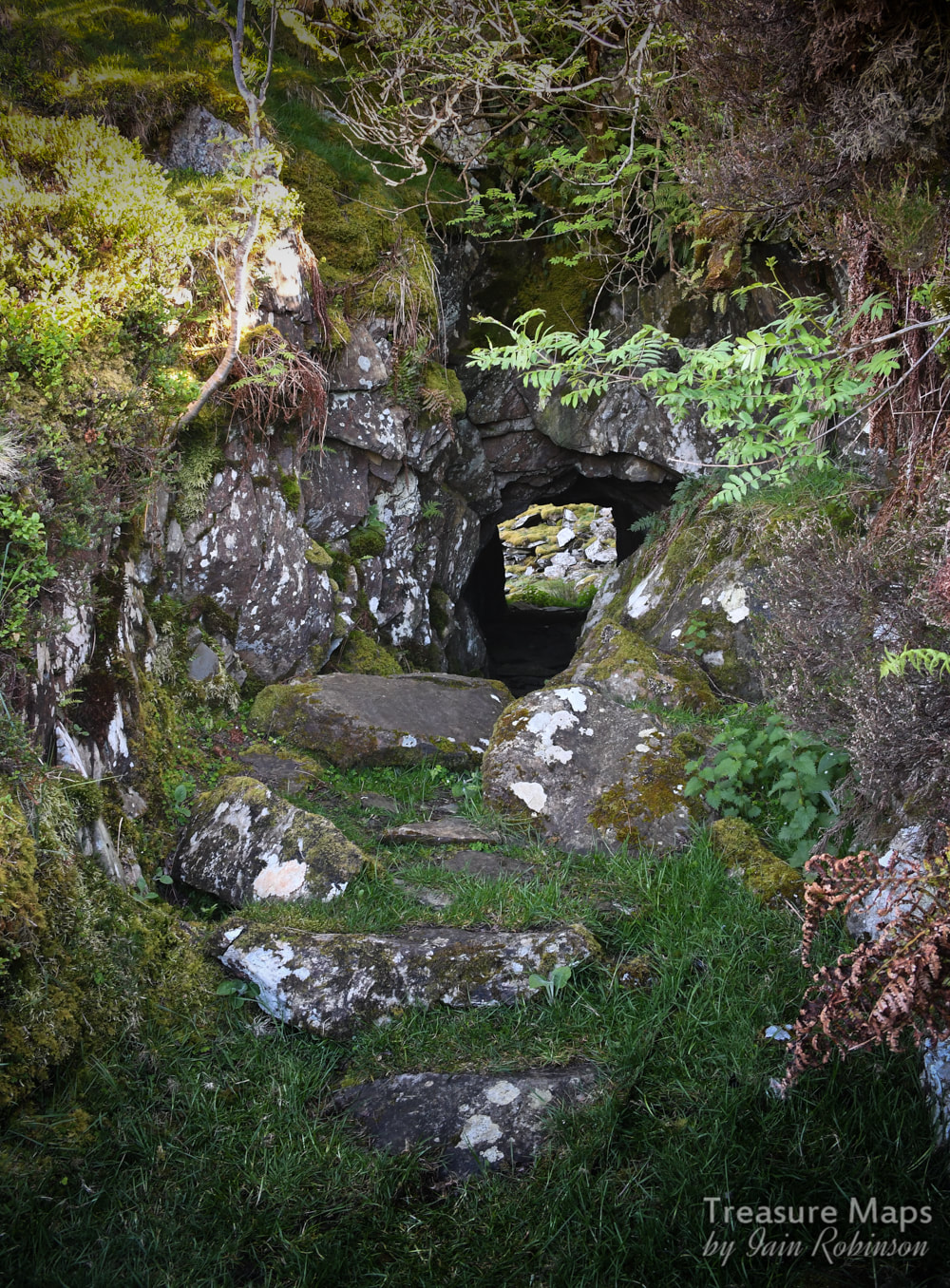
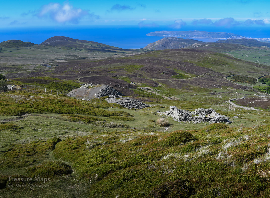
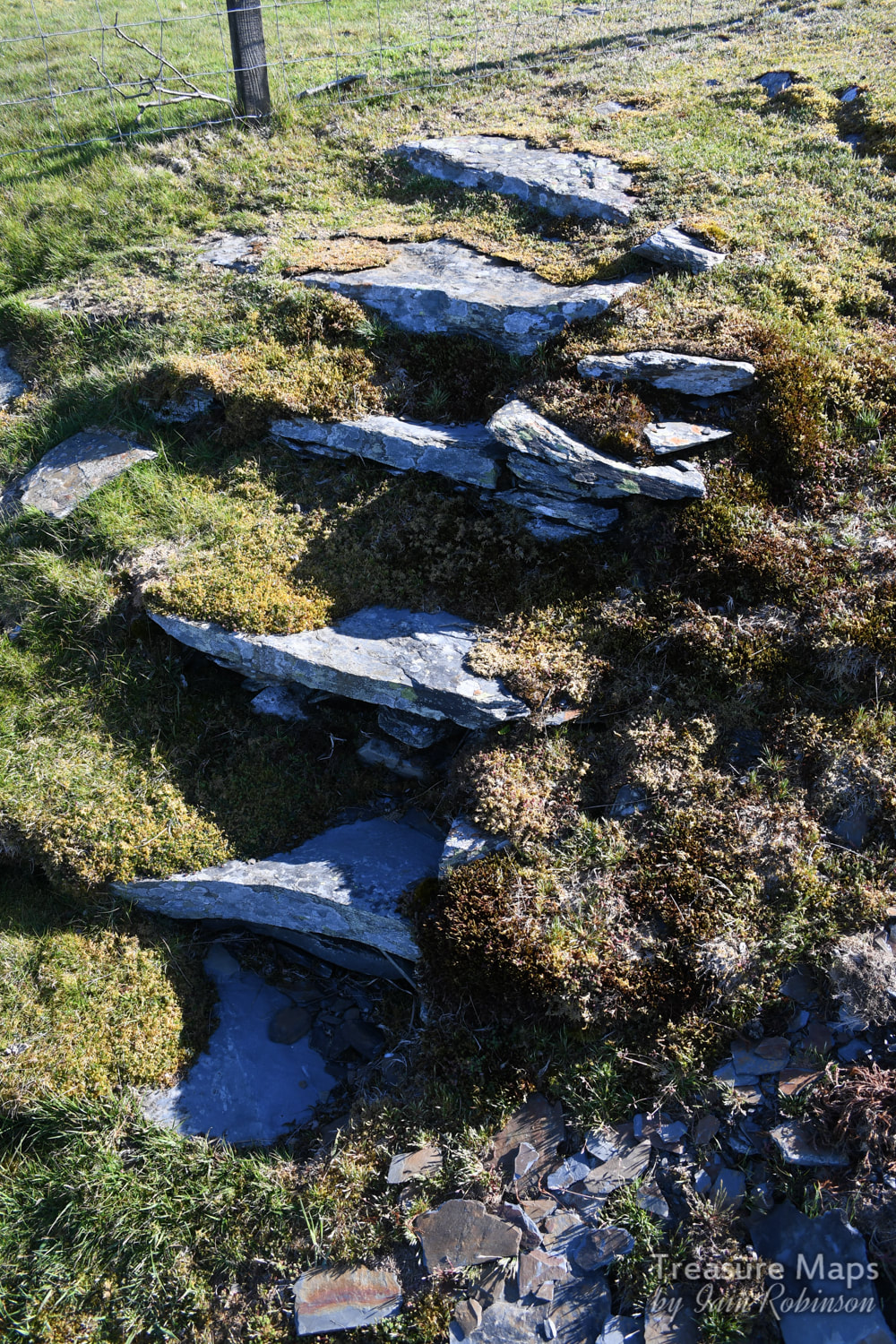
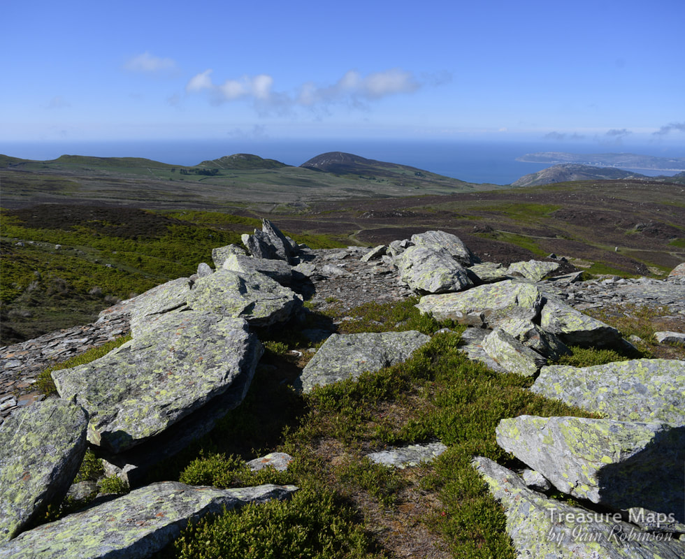
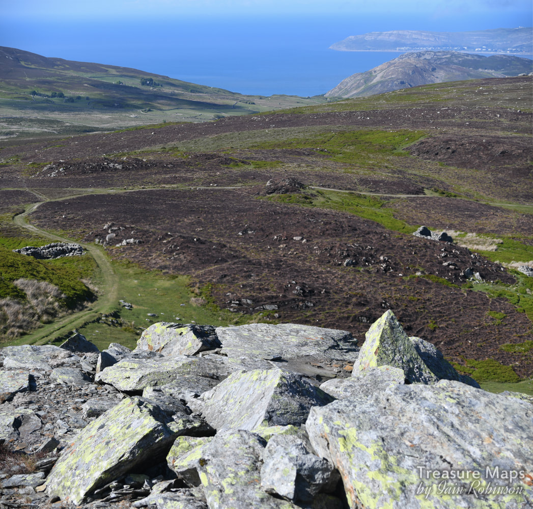
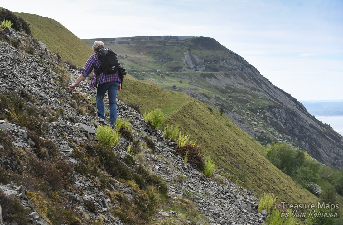
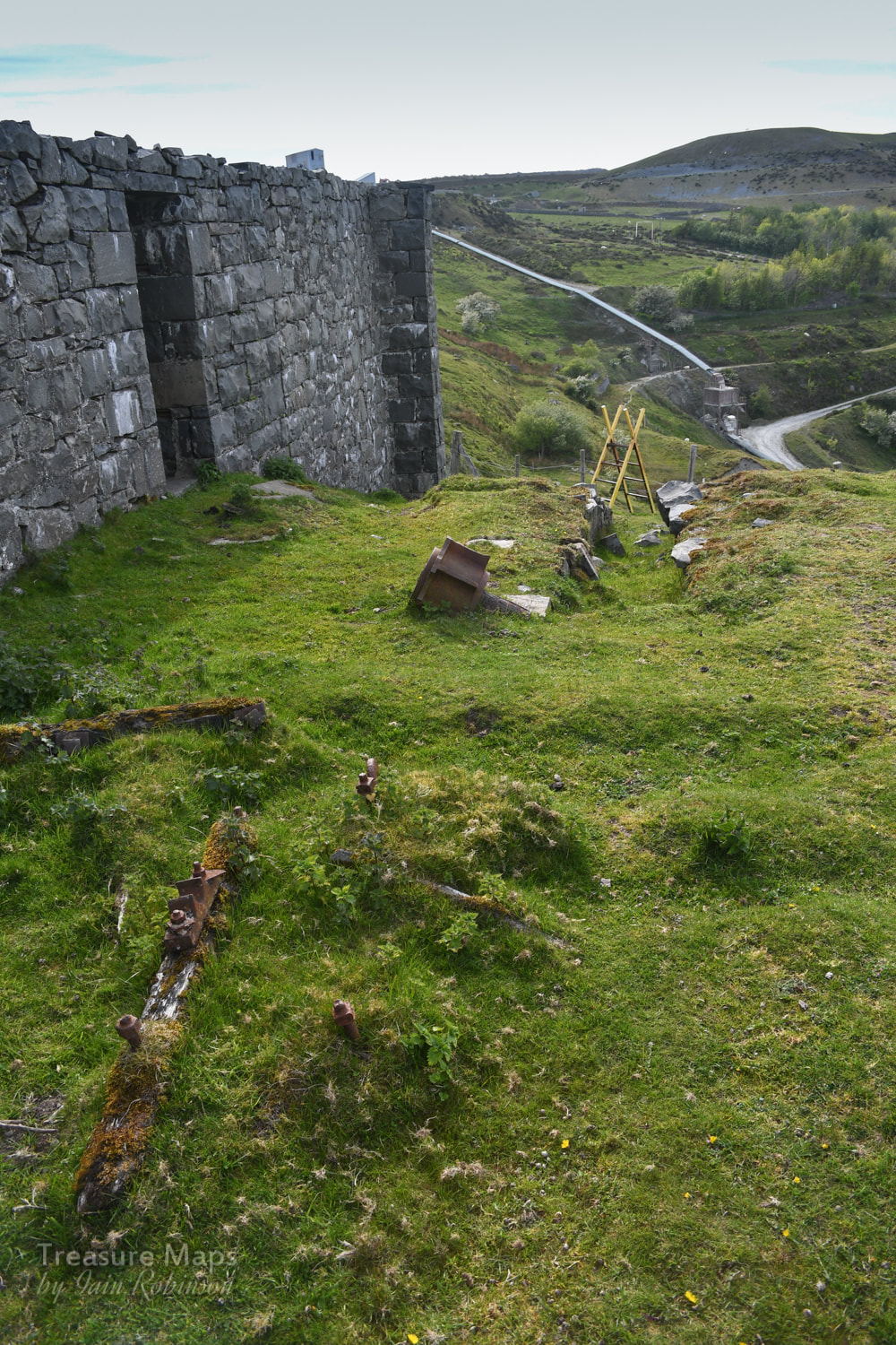
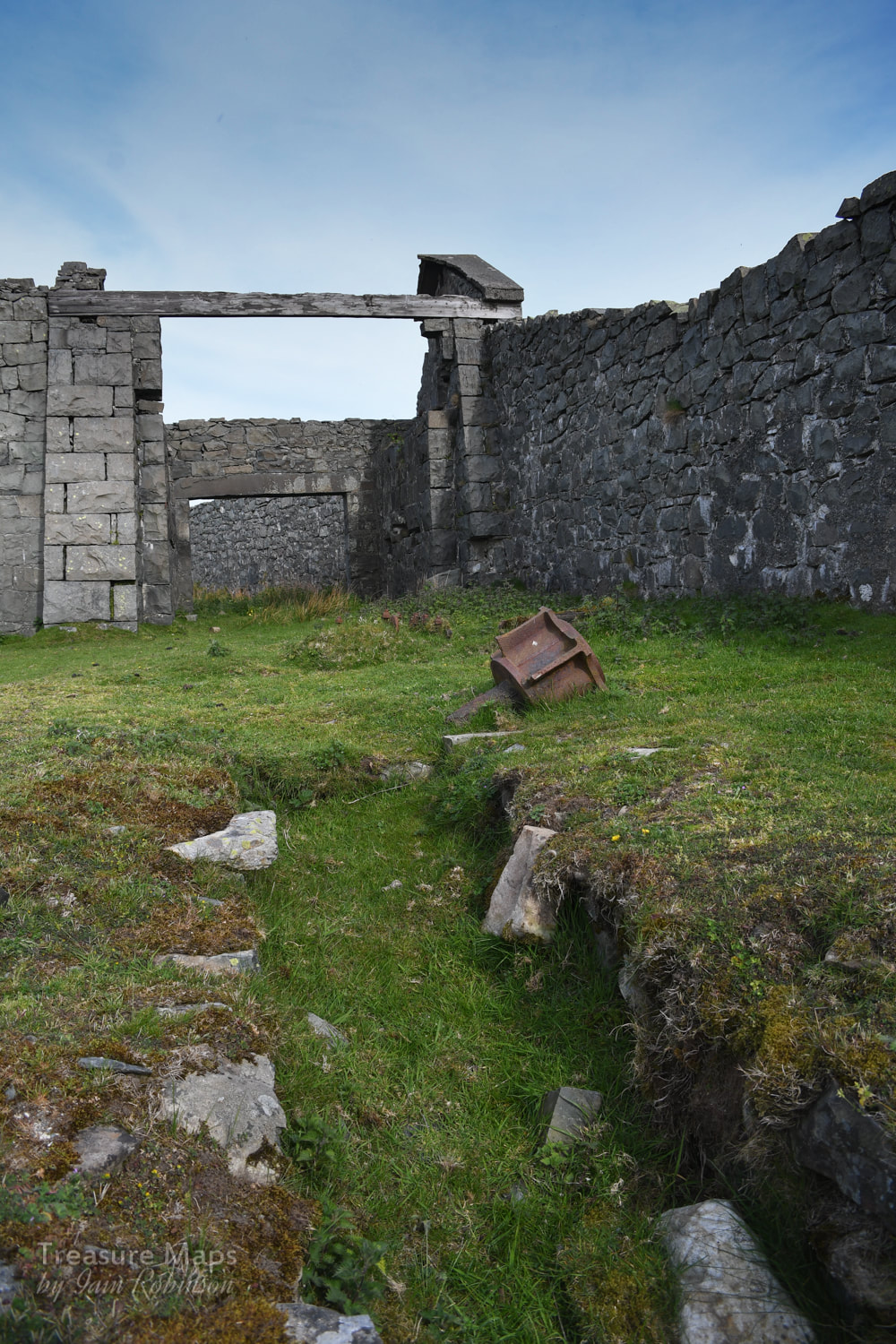
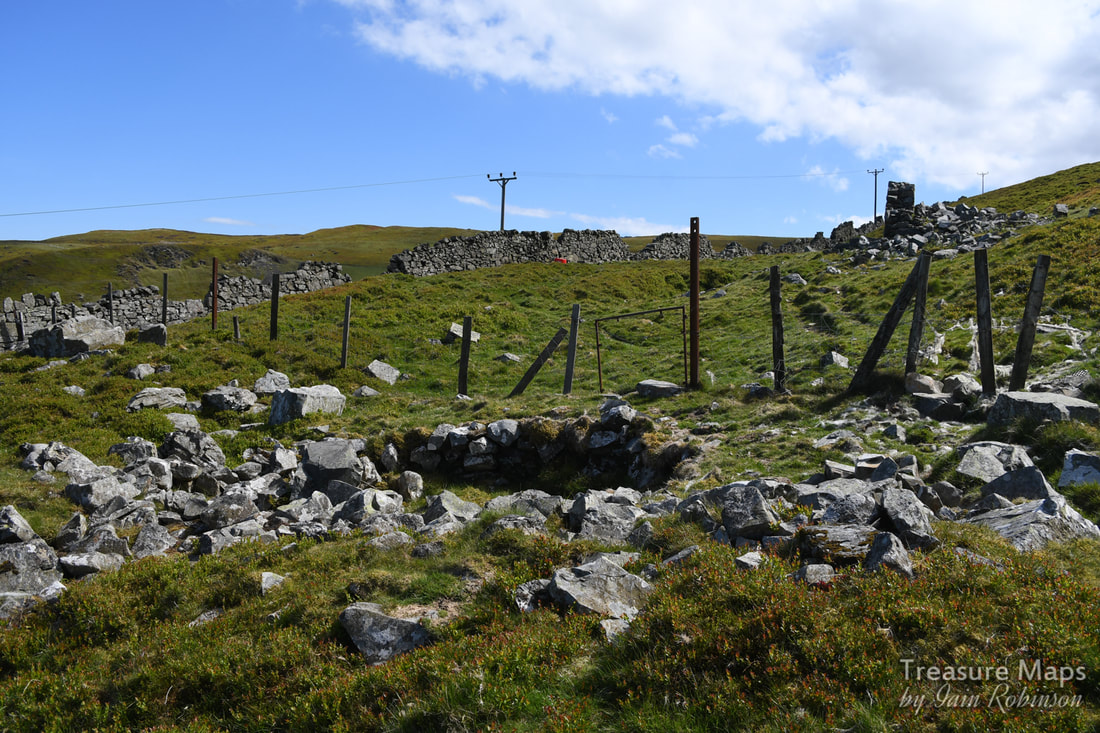
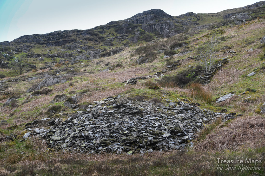
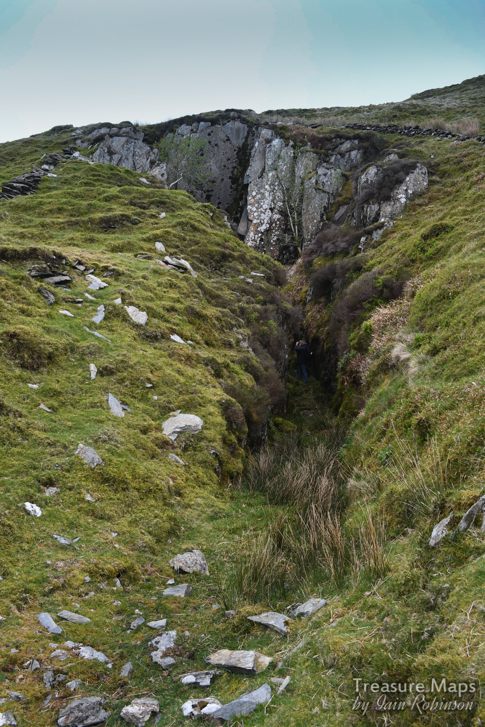
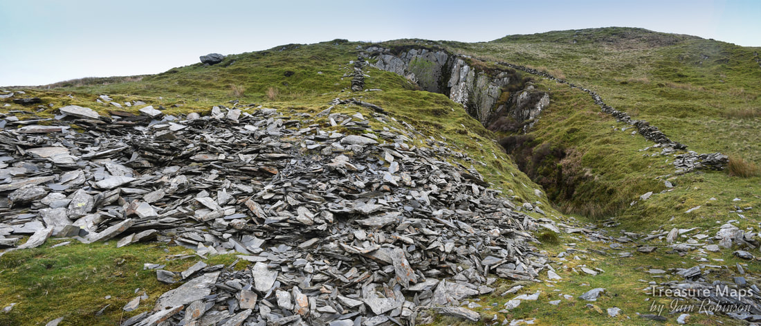
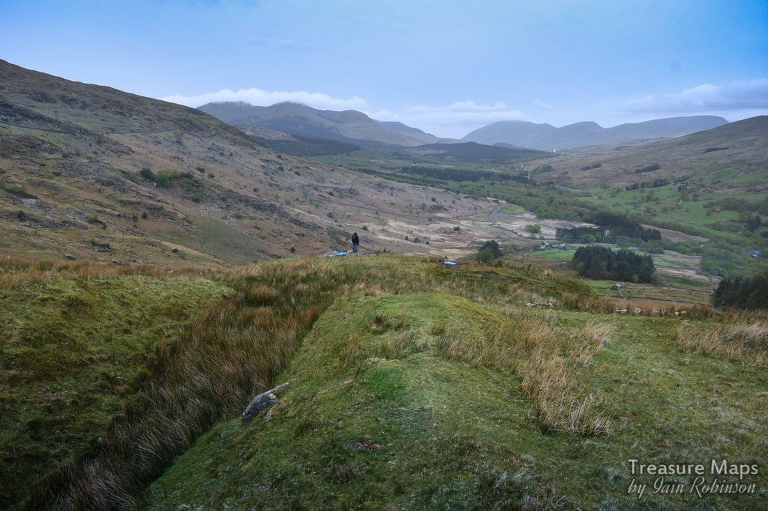
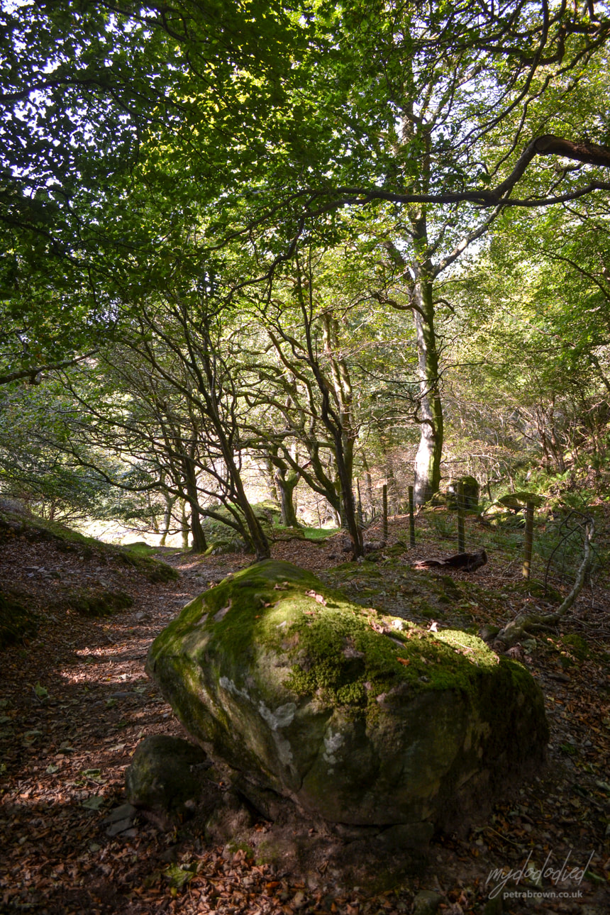
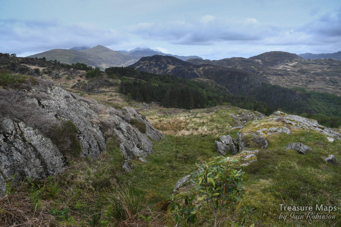
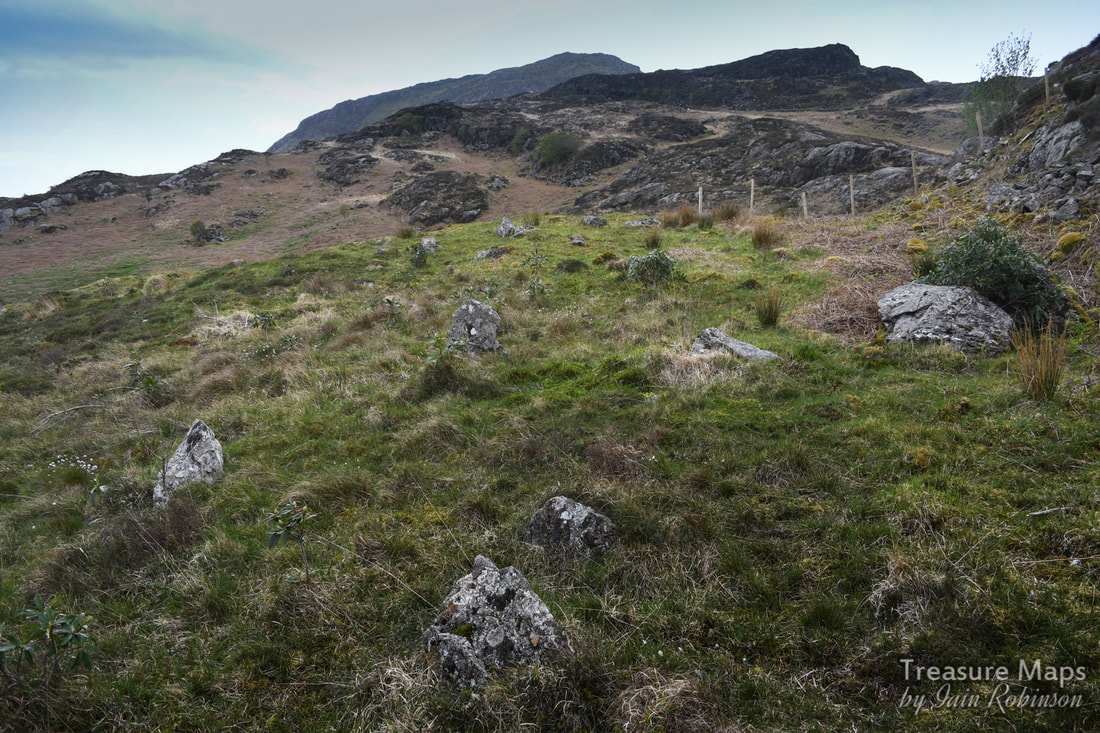
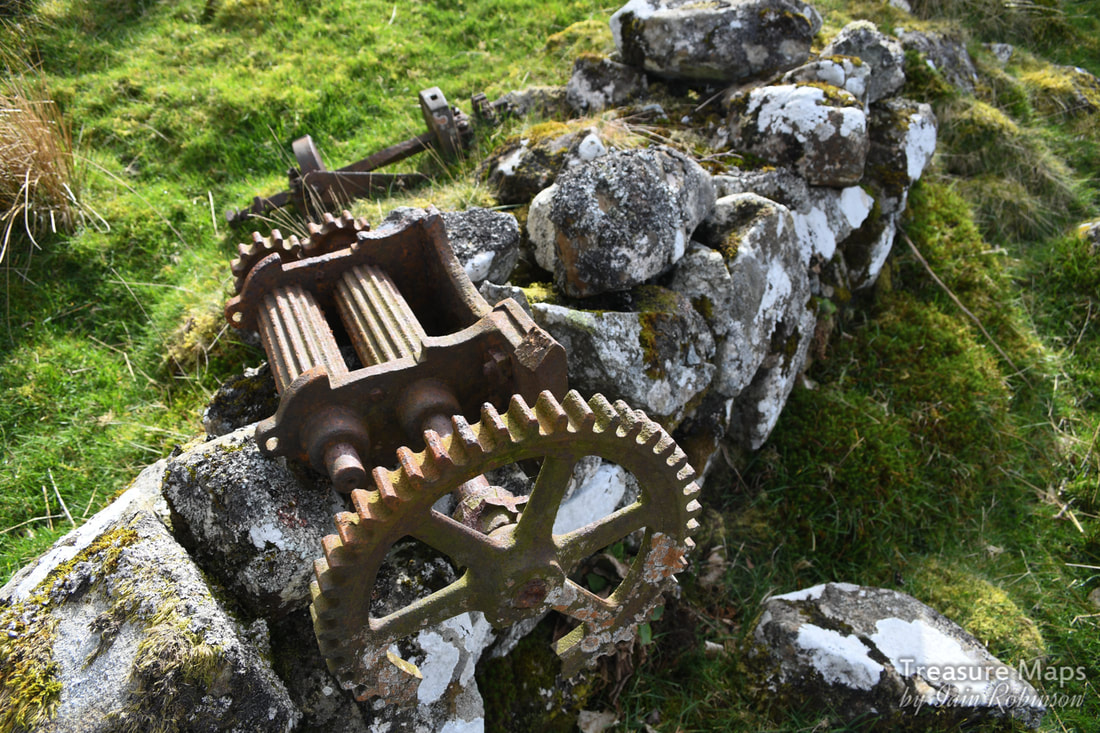
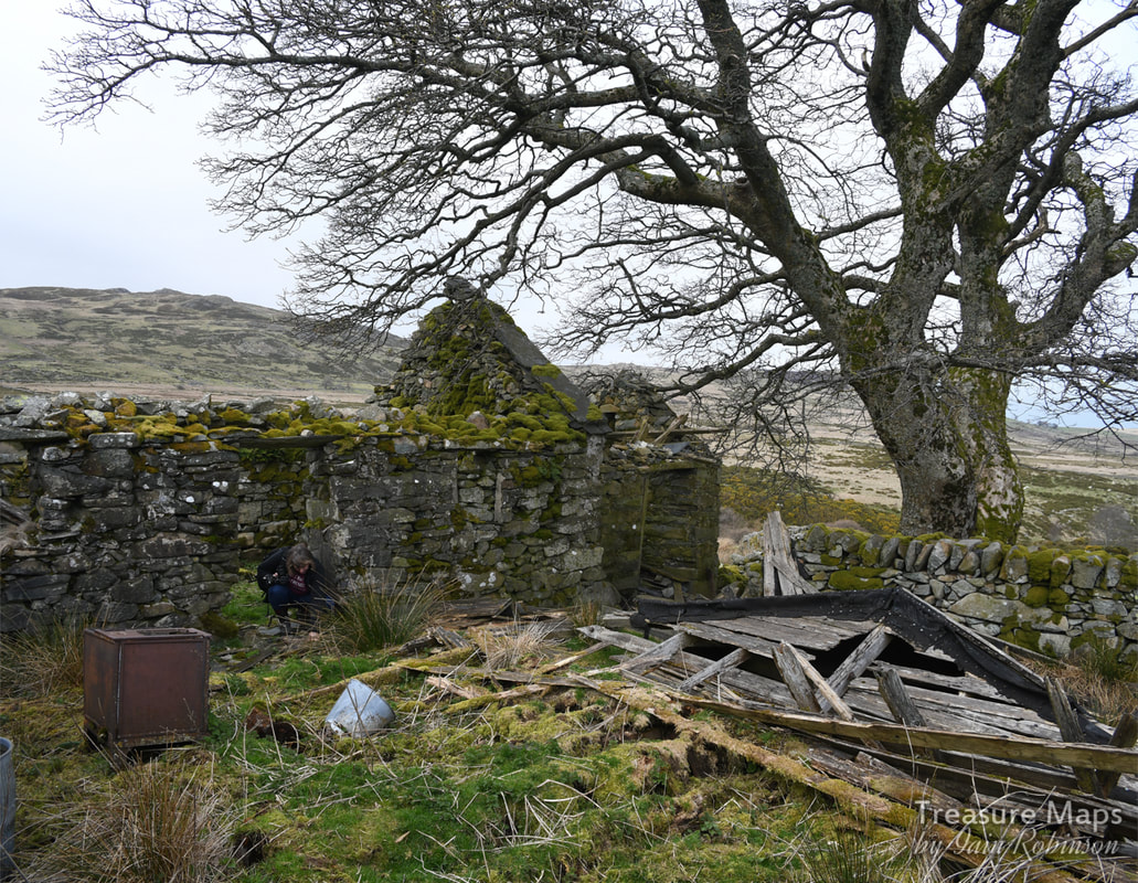
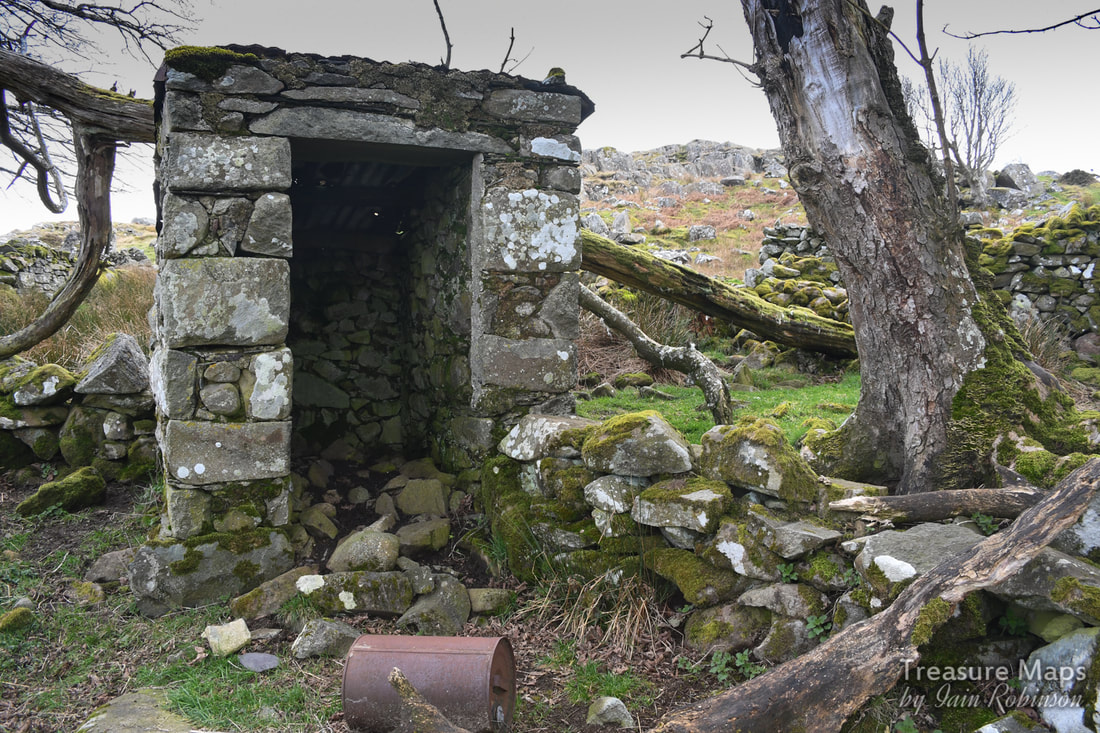
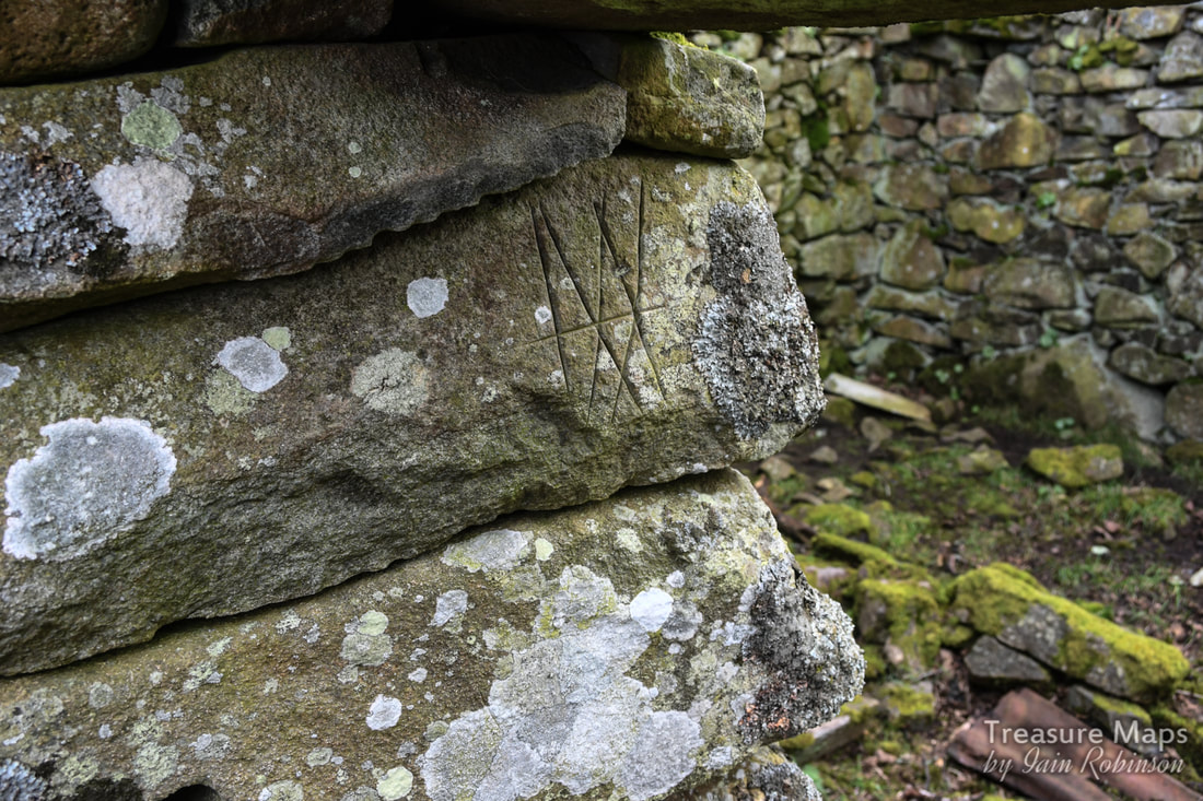
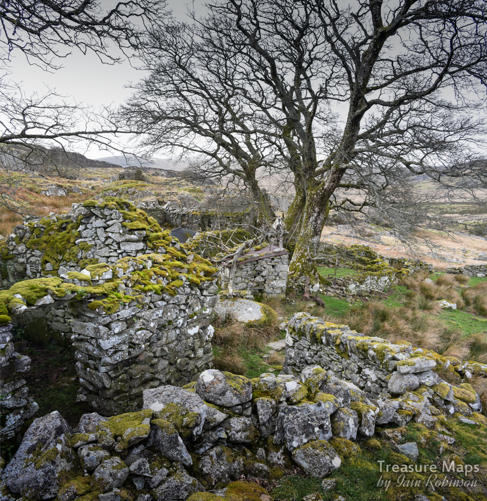
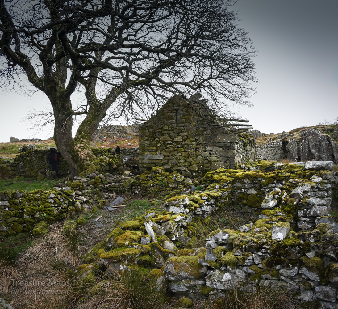
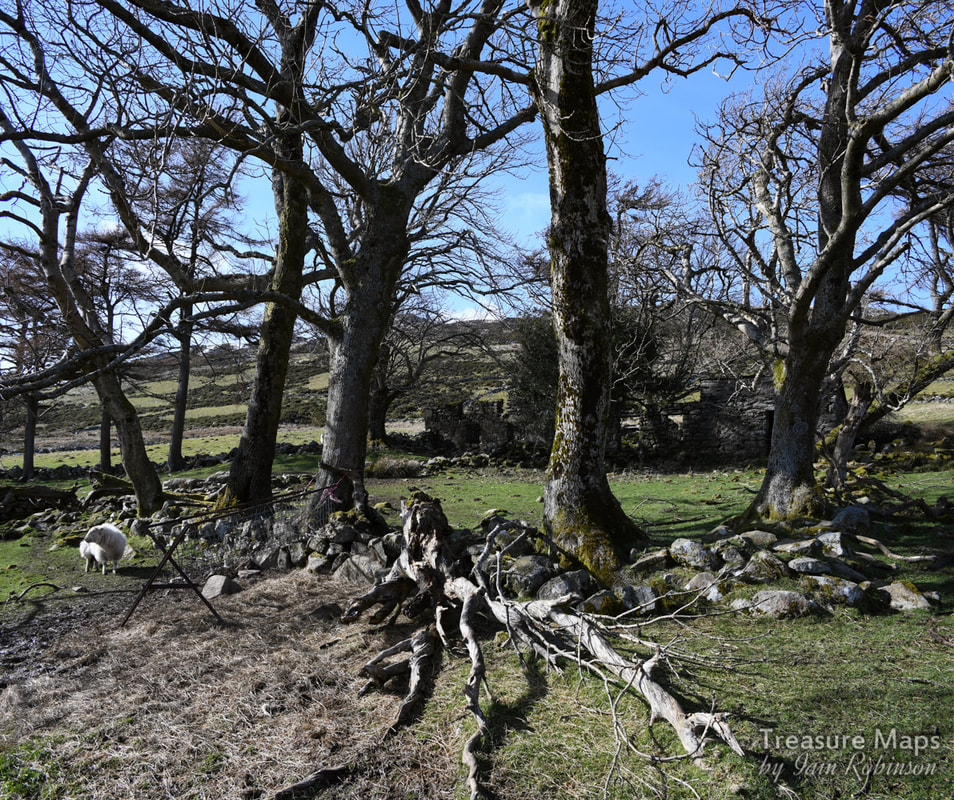
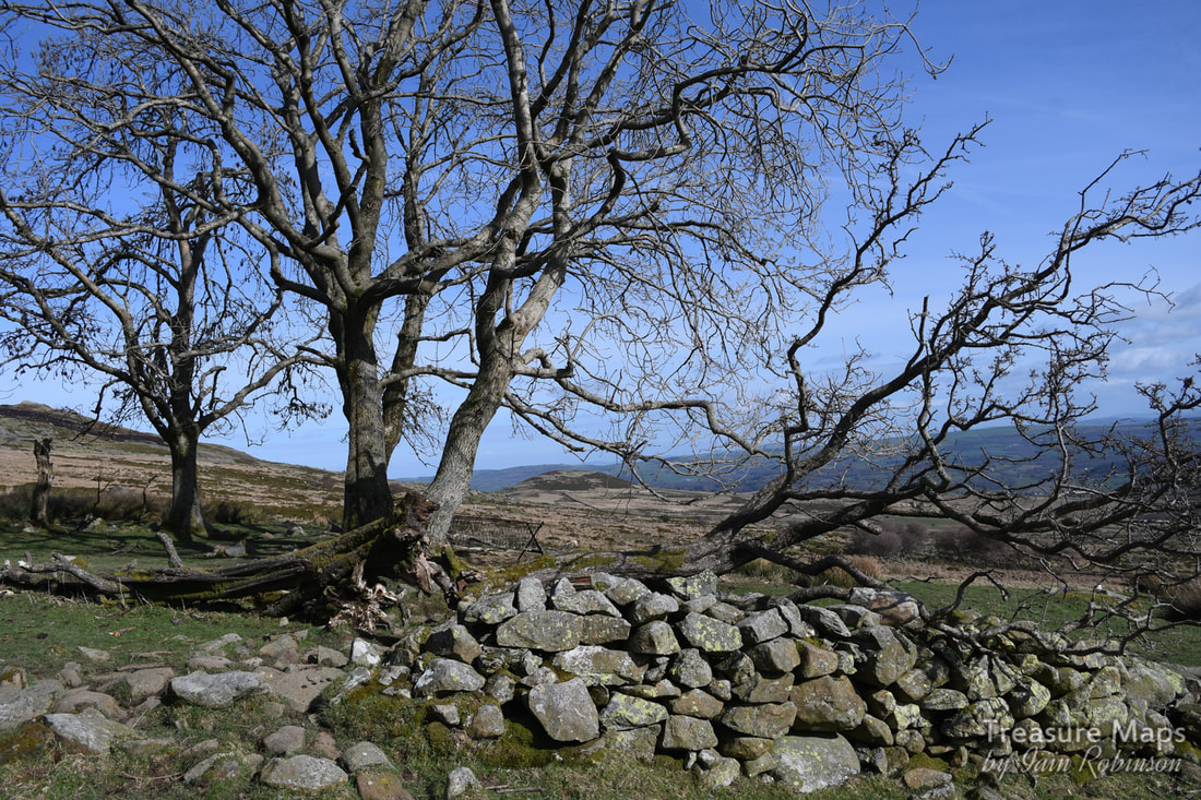
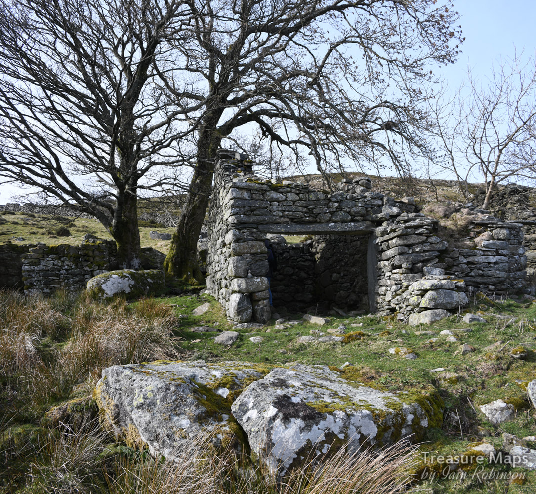
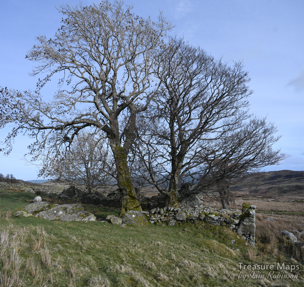
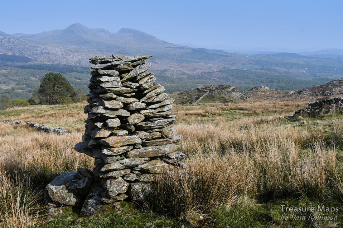
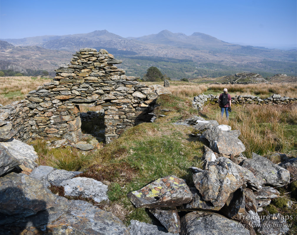
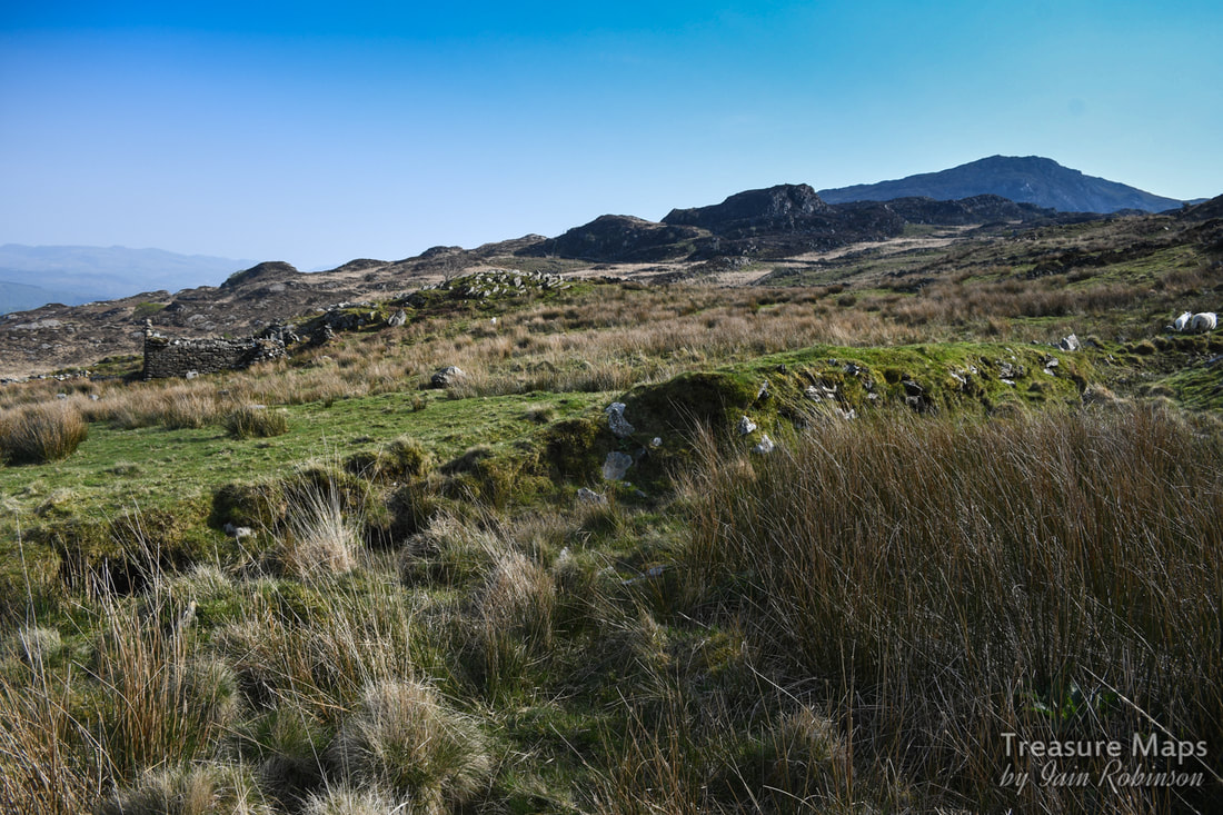
 The moors between Penmaenmawr in the north and Rowen in the south are a fabulous hunting ground if you like ancient remains, strange ruins and wild scenery. I can't say the moors are trackless, as there are a multitude of paths- the place is popular due to its proximity to Conwy and Llandudno- but there is still a wild, remote feel about the area. 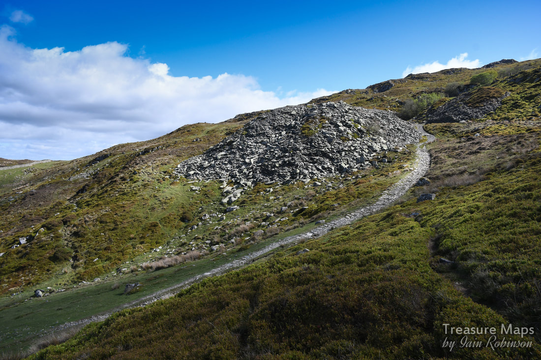 The first time we spotted the quarry, we were on a hunt for standing stones near the Cefn Coch part of the Coastal Path. You might know, there are enough antiquities in this area to last you for months of exploring, but Petra spotted what she thought was a slate tip in the distance. We found ourselves mysteriously quartering miles of gorse and moor as we drew ever closer ... 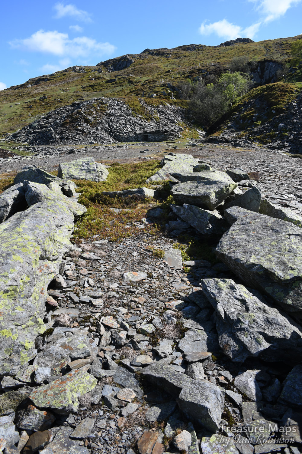 A view from the end of the tip run, showing the caban and the pit. There's a very well-engineered road that leads to the quarry from the east. I will produce a map of the area with all the access points in the near future. The first time we approached, it was from the Jubilee Path car park outside Penmaenmawr. There's space for only three cars and it's a very narrow road. The second approach (yes, there were things we missed the first time!) was from Parc Mawr, east of Henryd. Both are tiring walks with an uphill trend, but the area has so many interesting things to offer that you forget the tired legs in the haste to get to the next shiny bauble. The caban It's really a very small quarry, but it appears to have been worked intermittently from at least 1555 to 1913, for very little quality of rock. Our two visits were in very sunny weather, and the place had a very benign atmosphere. The first structure encountered as you arrive up the access road is the strangely constructed caban. It seems to be a near relative of the peat cutter's shelter/stores on the moors- at first I thought it was a blast hut, but the entrance is like a keyhole, opening out into a small area with a bench and a fireplace. Looking at older photos, it would appear that a small window at the right hand end has now fallen in. Perhaps the quarry was worked on an ad-hoc basis by local farmers, and the earliest ones built the strange caban in the only way they knew. They must have been small folk. The Pit At the first level, there is a fine entrance to the pit, where there have been a few collapses. It's a pleasant change to be able to access the pit of a quarry, normally they are flooded or blocked up. While we were in there, I thought I heard Choughs, but Petra informed me that they sounded like Ring Ouzels. Later, I found that they nest in here- if I had known that, I wouldn't have gone in- I hope we didn't disturb them too much. Just now (May) the place is full of slugs, which I guess would be rich pickings for birds. There are a few ruins on the first level, a working hut and something like a shelter, built into the side of the tip. This is small enough to be a powder store, but seems too near the quarry. It's hard to tell from the evidence on the ground, but it doesn't look like there was any mechanisation here. I didn't spot any saw marks on the waste blocks. There seemed to be a higher level, so we climbed up to have a look- it was a little treat, a tunnel with a ledge in the pit, obviously an earlier working before extraction had opened up the bottom pit. 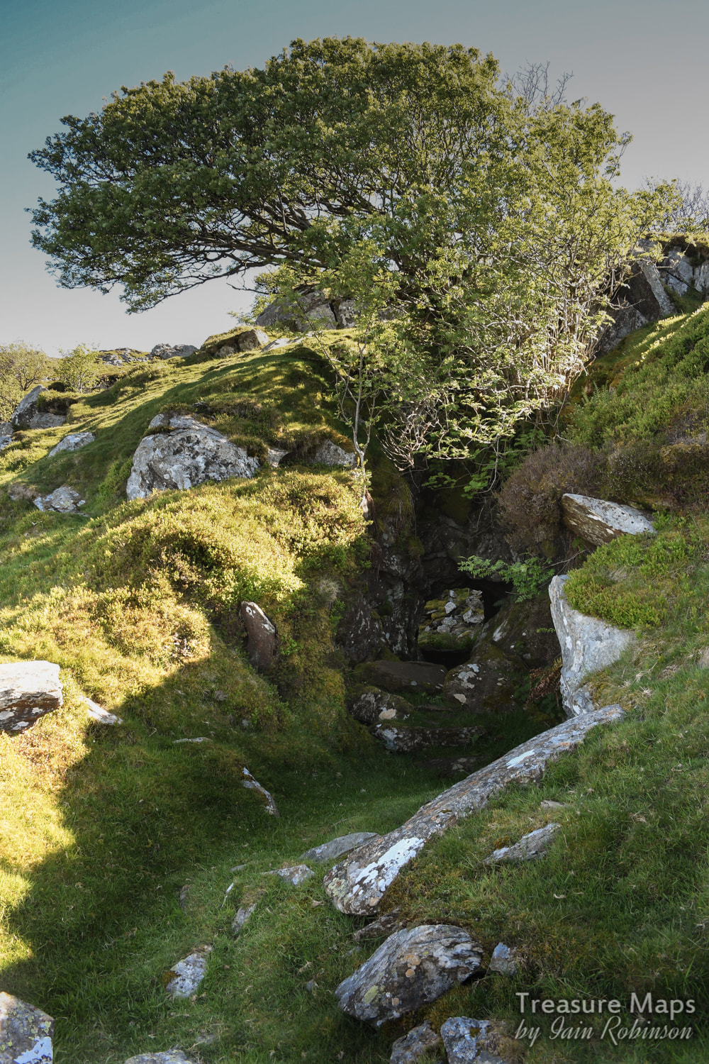 The opencut to the top adit entrance to the pit. On this upper level, there was a ruined hut- at first I thought it might be a weigh hut, but then that wouldn't apply to such a small operation, so I guess that it is a worker's shed where the slates were trimmed. 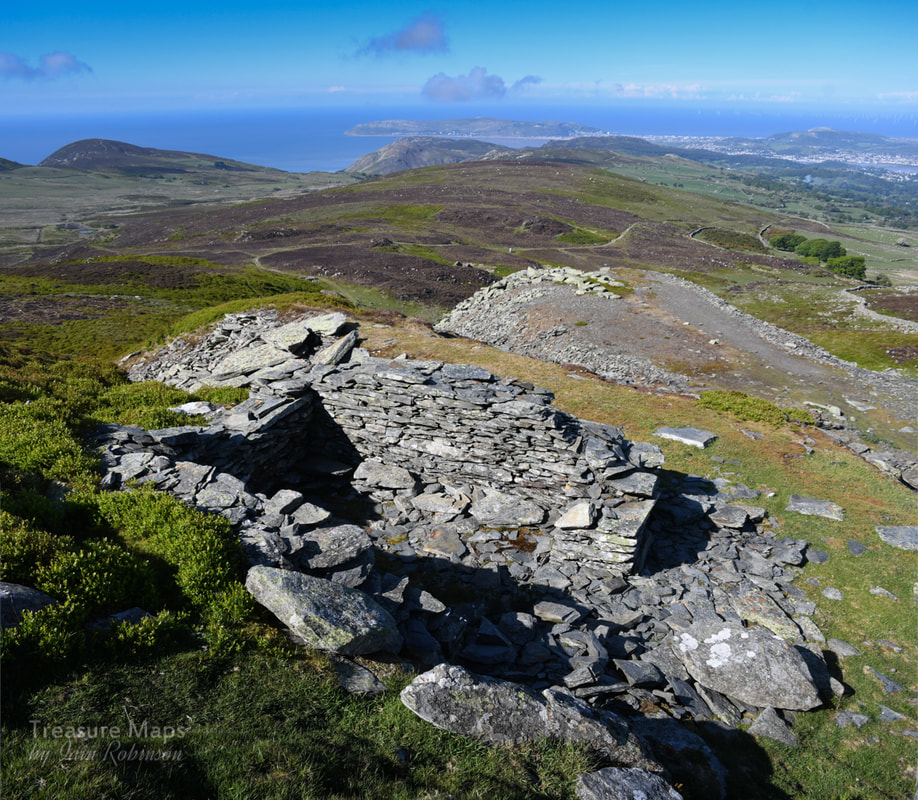 The hut on the upper level. Richards, in his "Slate Gazetteer, mentions a powder hut and a smithy. So we went up higher to see if there was anything more. There is a ruined structure which might have been a smithy at a pinch- it was too big for a powder store at any rate. There might have been a chimney at one end. Interestingly, it was very difficult to see this structure from below. 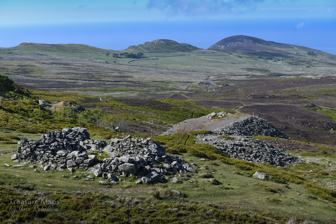 The possible smithy, with views over to Foel Lus and Craig Hafodwen. Bryn Derwydd is in the trees. We sat up at the top, enjoying the views and listening to skylarks. Neither of us had any inclination to climb any further towards the top of Tal y Fan, even though it is apparently the northernmost peak of the Carneddau, and Wales's second lowest mountain. The grid reference for the quarry is SH73807330. Coflein entry for the quarry
0 Comments
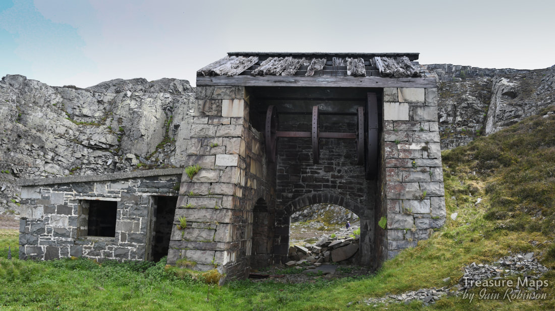
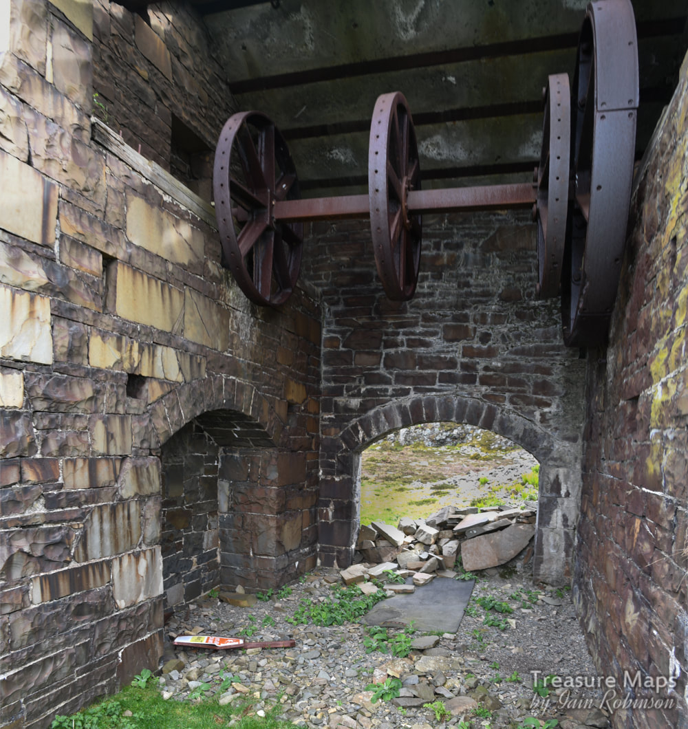
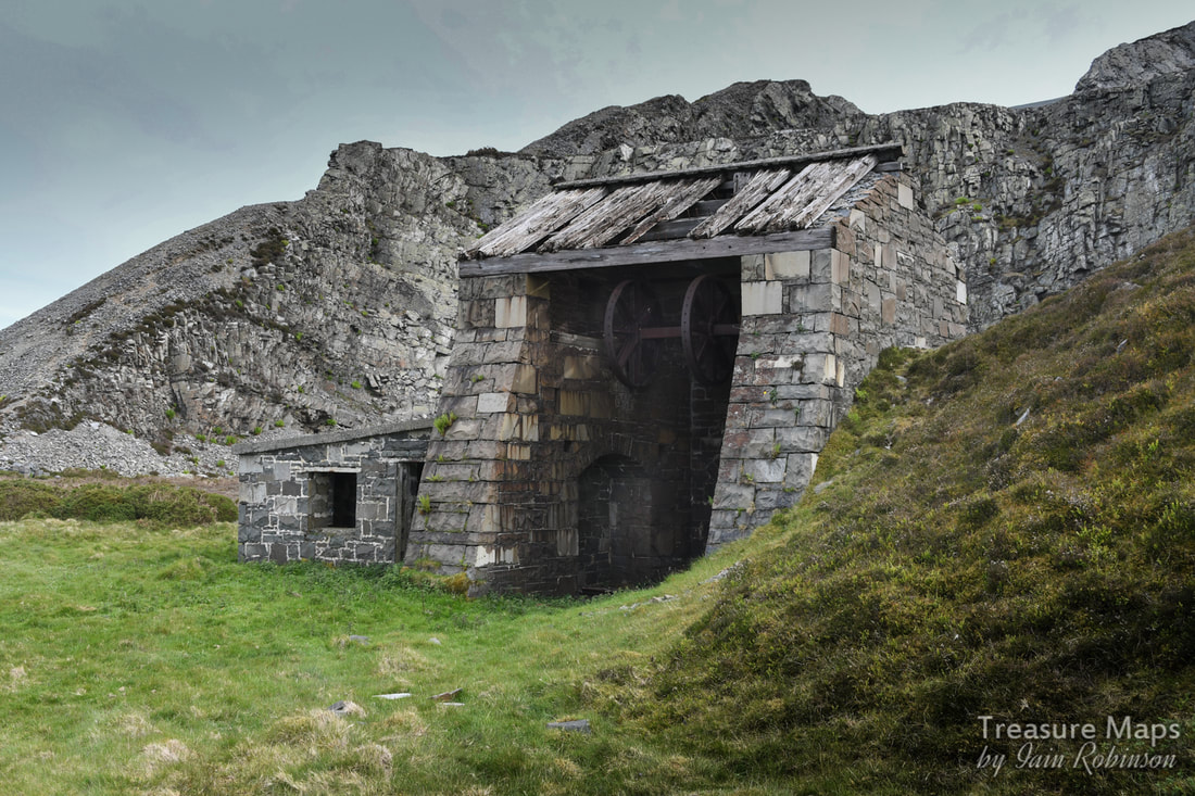
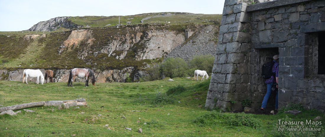
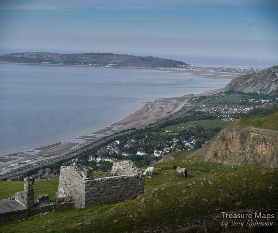
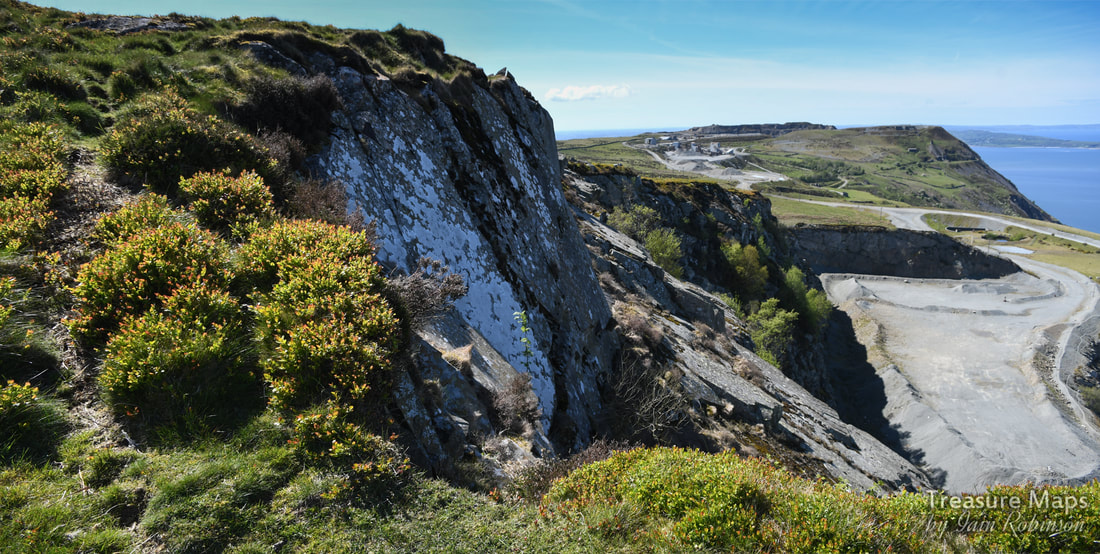 A view of Graiglwyd old quarry from above Clip yr Orsedd. During our search for the axe factory sites, we had plenty of opportunity to look at the disused workings of Graiglwyd quarry. For a long time, from 1834-1911, this was a separate entity from the quarry on Penmaen head, seen in the distance in the photo above. That quarry is still being worked, albeit sporadically, with a handful of workers. But with modern equipment, that's all you need. Walking over from the moorland side, I was excited to see what the quarry looked like from a new angle. Unexpectedly, I had a strong sense of the hubris of the quarry company, back in the early C20th. That these people could think nothing of making this gigantic scar, destroying the signs of ancient landscapes in a rapacious desire for money. Taking 500 feet of the top of a mountain (and destroying a prehistoric fort) just because they "needed" to. It would probably still happen today, I don't think it's any use saying "times have changed". The archaeological significance of the site was acknowledged even in 1900, but according to Alwyn S Evans, author of "Populating the Past: Penmaenmawr's Mysterious Beginnings", "...economic interests came first...the quarry people had said, 'Maybe we can keep a lookout for old remains'. This was ridiculous. It would be a non-starter because of the conditions under which the men were working, although the working men might have wanted to look" Yes, I know, the jobs. But everything can be justified if you think that way, can't it? Don't get me wrong, the place fascinates me. I love trying to interpret the processes, the machinery and the buildings that remain. I am fascinated by the stories of the old quarrymen and their struggles to survive- paid a pittance, risking their lives to line the pockets of the owners. Perhaps in the early C20th, this place was a monument to the workers...less so now, as more efficient, less labour intensive extraction and bigger machinery overlays the marks left by the old men. It's more an advertisement for the removal capacity of modern excavators. I've gone a bit Kier Hardie haven't I? But within me, and within many amateur industrial archaeologists I suspect, there is a dichotomy- a fascination with historical industry, then a feeling of shock when, with the scale of 21st century processes, this gets out of hand. The need, always, for growth. Sometimes it feels as if mankind is a parasite, leading to the destruction of anything that gets in the way. Certainly, looking over the ravaged mess that is the quarry today I felt that it had benefitted nobody but a few rich capitalists. Anything of industrial archaeological interest had been taken away to yield scrap money. Signs of historic industrial useage were removed by "landscaping", making even the telltale signs of the old levels into strange, alien shapes that are meaningless, owing nothing to geophysical processes or what came before the quarry.. To give an idea of what might have been lost, I have included an extract from Sir John Wynn of Gwydir's "An Ancient Survey of Penmaenmawr " at the end of the post along with Coflein's information. OK, I've had my ten pence worth. Normal industrial archeology will resume... 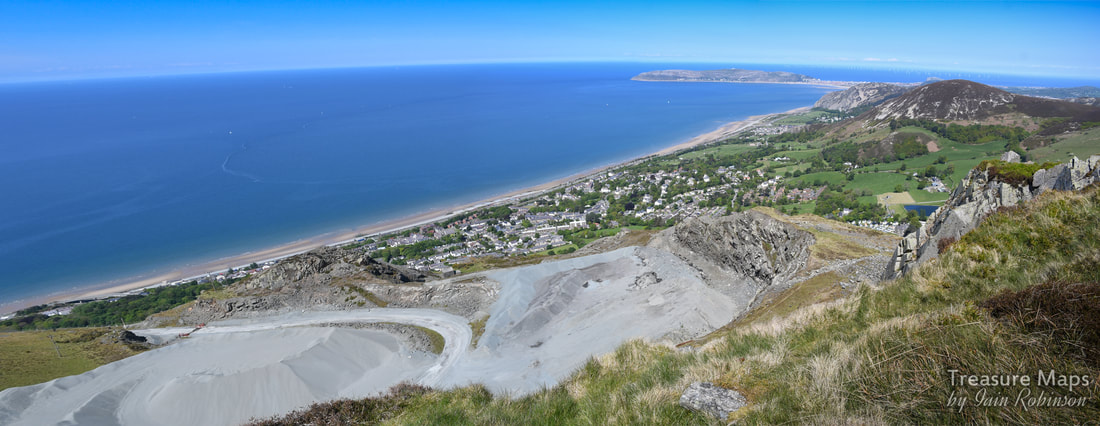 While pottering about at the axe factory site, we noticed what looked to be a drum house on the level below- we decided to go and have a look at this. But first, we took a close look at a blast shelter on the edge of the quarry above. 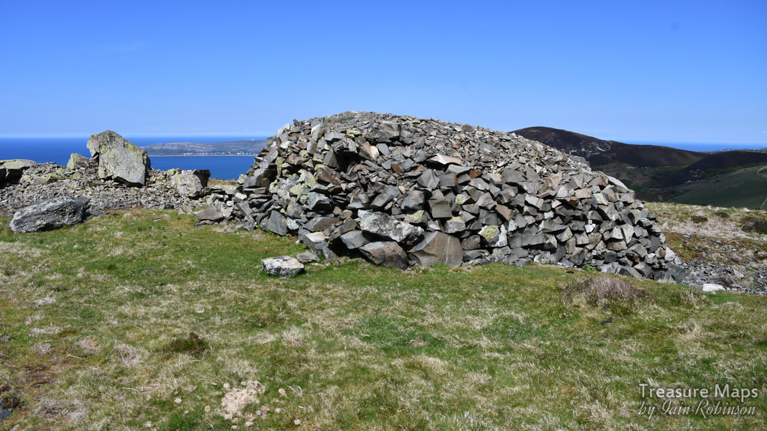 The blast shelter. You could be forgiven for thinking this was some kind of prehistoric structure- and it does bear similarities to a very old peat cutter's building on the moors behind Penmaenmawr. But it is also very similar to a blast shelter at Tal-y-Fan slate quarry, a couple of miles to the south on the moors, built when that operation was active in the 1840s. 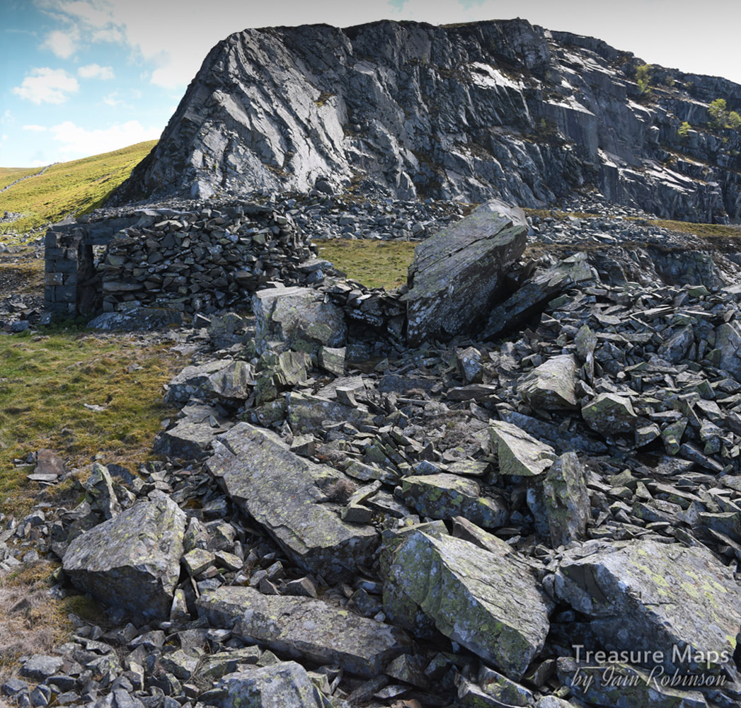 This view of the structure gives more of an idea, with the working face behind. In fact, the building was a small concrete box, overlaid with several thicknesses of stones to protect the workers as they sheltered. I wonder if they added stones every now and then, when they could! 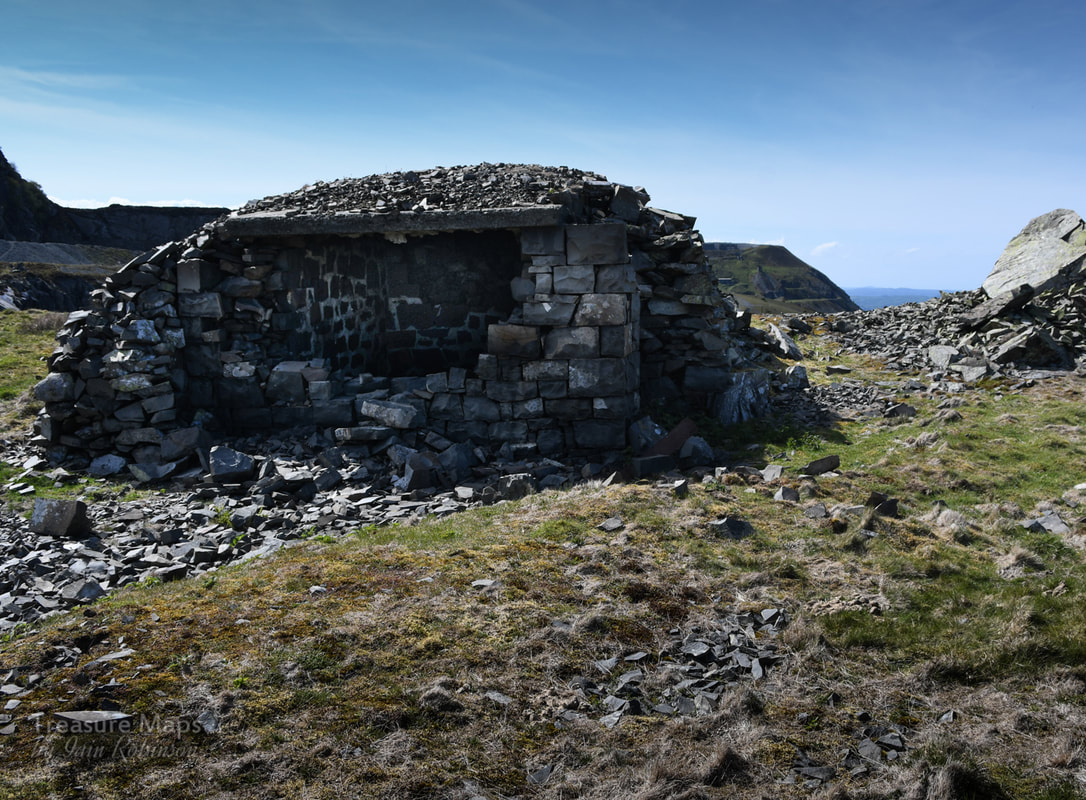 I'm not sure what could have caused the destruction on this side, away from the quarry. It looked too determined to be vandalism. By now, the drum house on the lower level was calling to us. The first of a few that we encountered, left alone, no doubt because it would be too expensive to demolish. I could see that it was going to be a struggle to access, but it would be worth it. 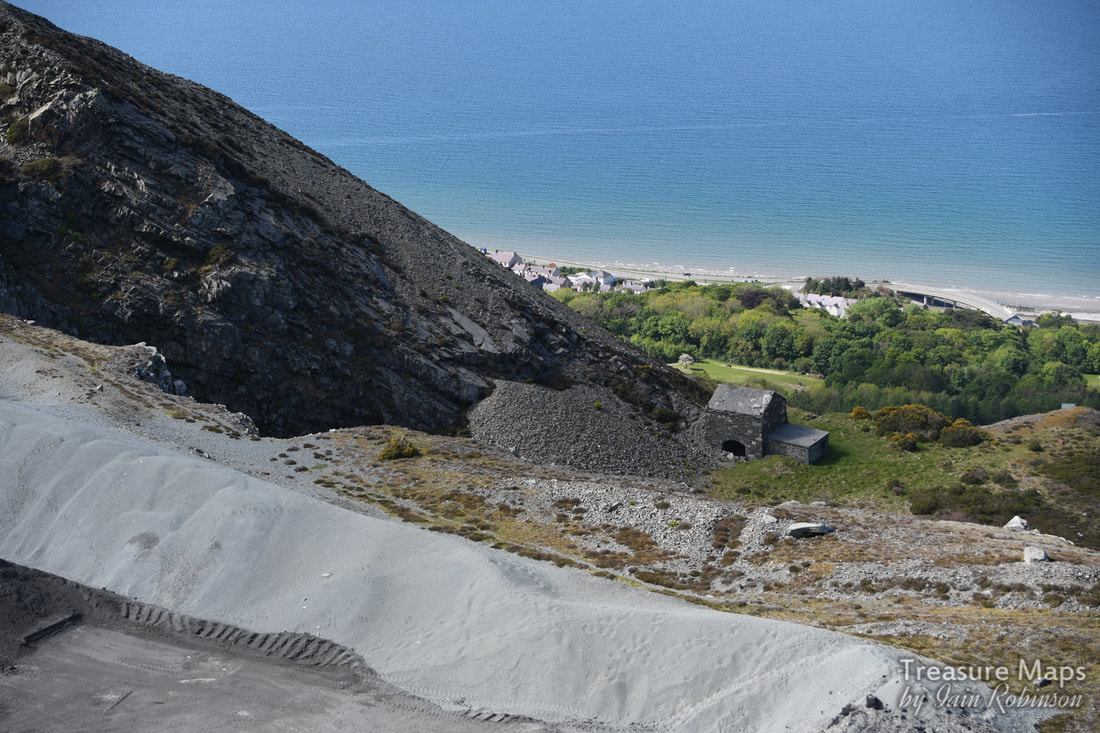 Seen from a couple of levels up. The top parts of the Old Quarry seem to be used to store finely ground stone chippings- here a berm has been formed to protect the edge in front, a drop of a hundred feet. After a conference, we decided that the best way to reach the drumhouse was to go down and round the perimeter wall, to the base of the incline. It was a steep walk, but a delightful one as the Hawthorn trees were in bloom and underfoot there was a profusion of wild flower growth. To our right was the great Orme and nearer, the bare slopes of the Sychnant Pass. Eventually, we found the old path used by prisoners of war in the 1914-18 conflict. They were brought here to stay at Graiglwyd Hall and marched up by armed guards daily to work. Most of the men at that time had gone to the forces, but the quarry needed more production for the "war effort"- and to make more money, of course. The Galloping Colonel A battalion of quarrymen was formed by the quarry owner, C. H. Darbishire. Tragically, 72 of the men didn't come back, killed in the unneccessary slaughter. Darbishire himself, give him his due, was as keen as mustard to get over and fight the enemy. But his age was against him and he was refused- in 1915, he would have been 70. He'd already funded the building of a drill hall for the men in 1901 and had made himself Colonel of the volunteer regiment. What do you think he did next? He had a uniform made for himself (that of a private soldier) bought tickets to Egypt, where his troops were fighting, and tried to join them. But he was apprehended and sent back with a stern warning to behave himself. You have to admire his spirit!  The Penmaenmawr Quarry boys in training at Northampton. Photo courtesy of Dennis Roberts 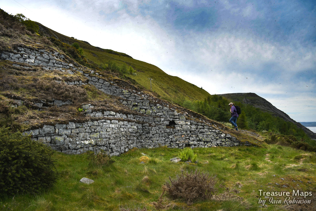 Petra walks up the base of the incline towards the drum house. Meanwhile, we had reached the lower level and began to walk up to reach the drum house. The incline became overgrown with gorse and we had to detour off it onto the spoil, never a good idea. It was a tense fifty yards of uphill scrabbling, trying not to dislodge pieces of rock, but we managed it. 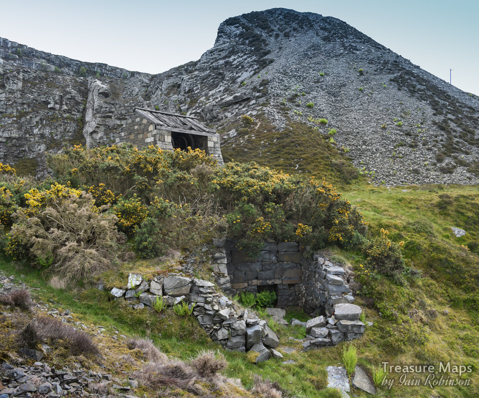 Our first view of the drum house and what could have been a weigh house (note the fireplace, vital in this exposed location). Walking up, we had been aware of a strung-out line of rusty equipment which I realised must have been a conveyor, something that replaced the incline in the forties. 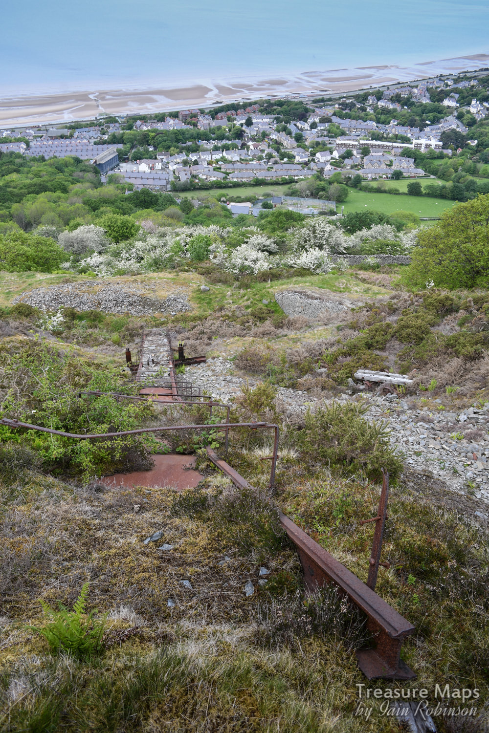 It seemed to be constructed from very heavy duty tram rail, but perhaps someone more knowledgeable could advise there. It was a rare gem at any rate. Its interesting that this drum house, and the twll behind it, does not appear on the early OS maps. It only makes an appearance after 1912. Thus the structure is of relatively modern construction. The roof is fascinating, seeming to be laid with massive rough-hewn timbers which are felted over, or perhaps cemented- it was difficult to tell. There's an arch between the crimp and the brakesman's cabin, which has been filled in. 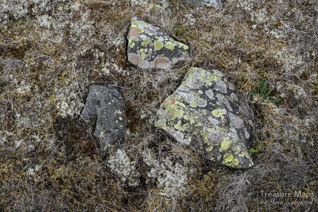 One of the environmental advantages of inaccessibility- the rich profusion of lichens, algae and fungus on the twll floor. After a while, we wondered how we were going to proceed. Neither of us fancied going back down the incline. After some thought, we set off along a narrow sheep/goat path on the tip, going west. It required a great deal of care. After some tricky moments, we made it over a fence to a landscaped area where the levels had been turned into something resembling a golf course on a 45 degree slant. Very strange. The main haul road was now above it, but we took advantage of a gap in the fence and crossed on to yet another landscaped level which led to Nant Dwyll, meaning "the dark hollow"... according to Dennis Robert's excellent booklet about the quarry. It felt a strange place, neither one world nor the other. 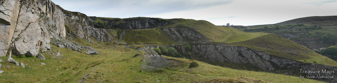 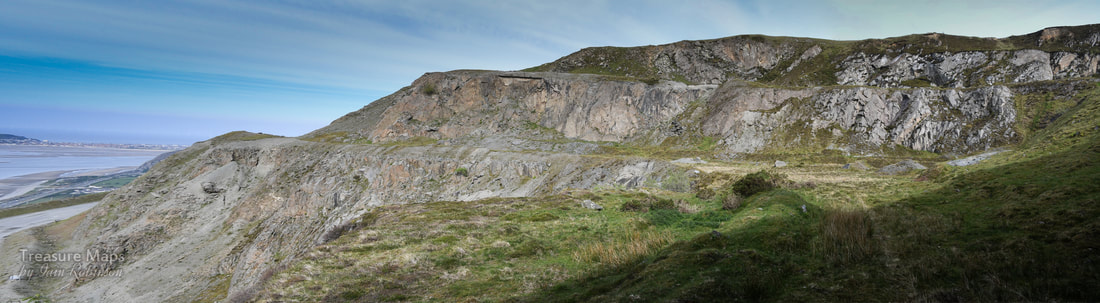 At last, we found a way to get out from the landscaped tedium of the middle twlls, up via the formation of a 1943 tramway branch which had once run from Penmarian to Fox Bank. There was another formation immediately above it which we thought might have been a leat, but according to John M Lloyd's map in Boyd's "Narrow Gauge Railways in North Caerns" this would have been a branch laid in 1888. 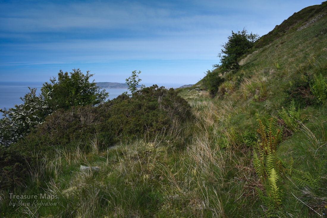 A formation that we mistook as a leat. There were several things of interest along the formation: a remarkable view across to Fox Bank and Penmaen East quarry, and a sight of the remains of Braich Lwyd Mill. 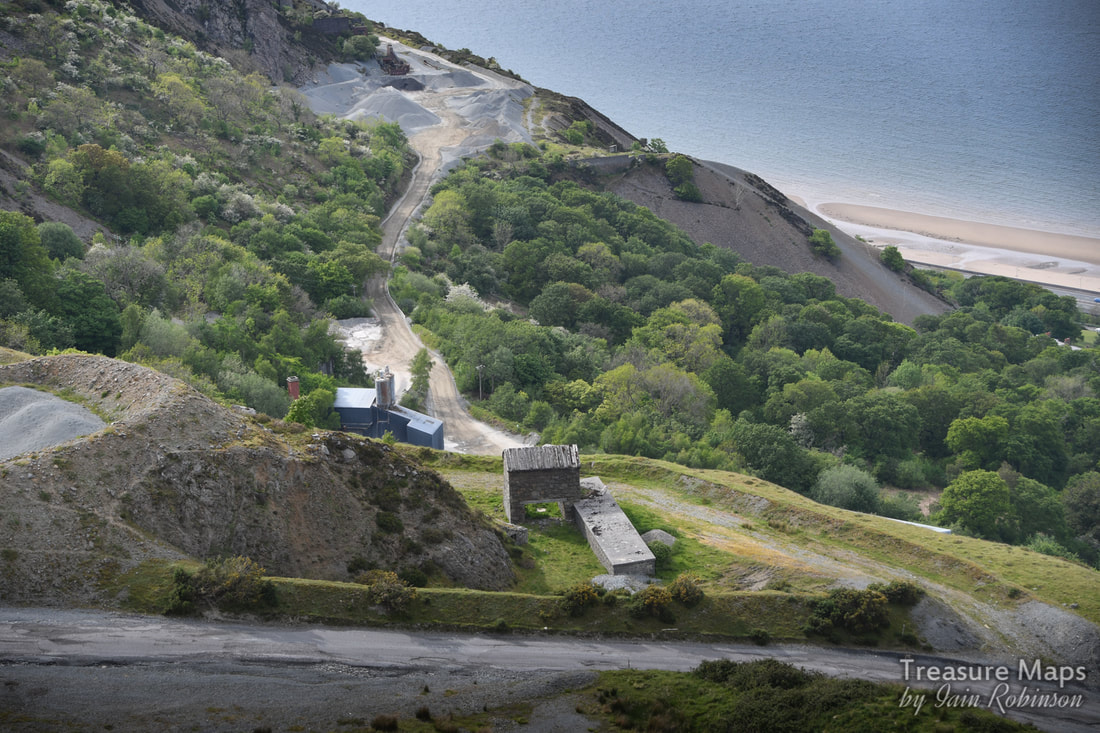 Looking down at Braich Lwyd mill, with the Bonc Jolly area behind. A very much degraded incline was spotted crossing the formation. This must be the one on the map that is marked 1924, but there was hardly any sign of it. The presence of a bright yellow stile indicated that we had now finished trespassing, and were on a right of way. This would be the path that we had spotted several years ago and wondered where it went. It eventually reached a drum house on what seemed like the highest level... 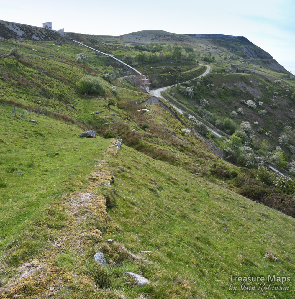 The vestigial incline running across to Kimberley Bank loading station. Above- three shots of the incline house at the top coming from Kimberley Bank. It had a long wall, presumably to shelter waggons from the wind at this location, above the 1000 foot contour. 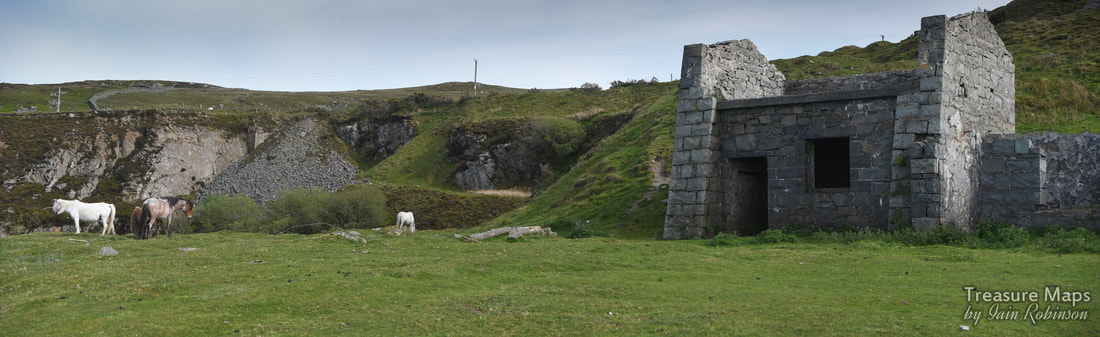 Now we were on the top level of Graiglwyd, looking across at some sett sheds. To the left of the sheds was what looked like another drum house, which was confusing. I couldn't see any sign of an incline, nor was there one on the map. But there were some wild horses here, who seemed unconcerned by our presence- it was so nice to see them. They had watched us as we walked along the level below; now I stood and listened to them crunching away at the grass contentedly.  The sett makers sheds on the top level. From the sheds here, it was a short walk up to the quarry haul road. Our way took us above and past the offices and out onto the older quarry road that descends down to Plas Heulog, above Nant-y-Pandy in Llanfairfechan. Although this was a weekday, we hadn't seen any activity at the quarry; all semed to be in a dormant state. Obviously, we wouldn't have considered exploring if there had been any chance of blasting. 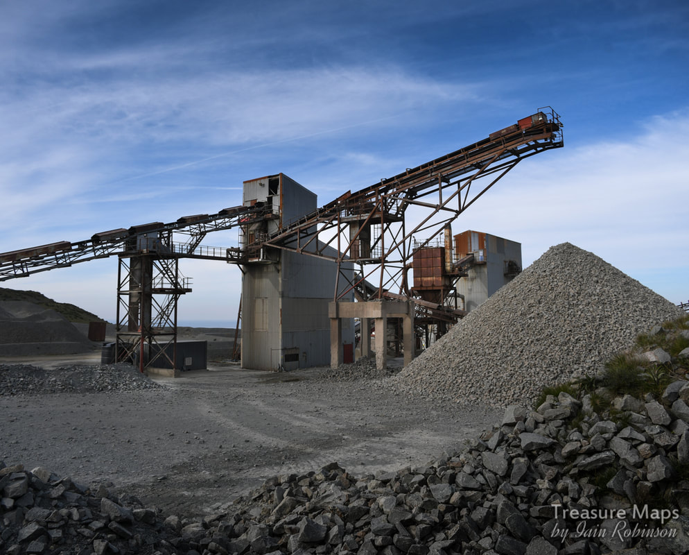 Not Graiglwyd, of course, this is the processing area in the main Penmaen East quarry. Appendix While researching the subject of the prehistoric remains on Penmaen Mountain, I came across a few choice nuggets. One was this illustration from from Sir John Wynn of Gwydir's "An Ancient Survey of Penmaenmawr ". It's an early view of Braich y Dinas hillfort, formerly on the summit of Penmaenmawr, which appeared in "The Sphere" for November 19th 1910, during the controversy surrounding the hillfort’s imminent destruction due to the expansion of quarrying at Penmaenmawr . 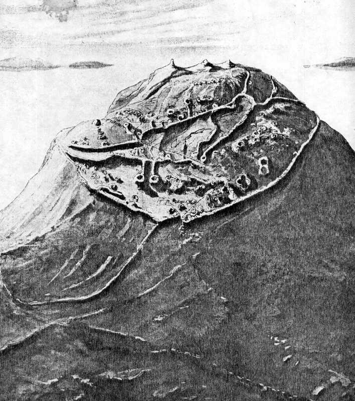 Here is a link to the text of "An Ancient Survey of Penmaenmawr " which makes for fascinating reading; pages 11 and 12 refer to the fort. Coflein have a very interesting collection of photographs and documents about Braich y Dinas and its destruction. Wikipedia Page for Braich-y-Dinas. Dennis Robert's excellent booklet about the quarry. "Penmaenmawr, Rails of Granite" by Mike Hitches, Irwell Press, "Narrow Gauge Railways in North Caernarfonshire, Volume 3" by James I. C. Boyd, the Oakwood Press. 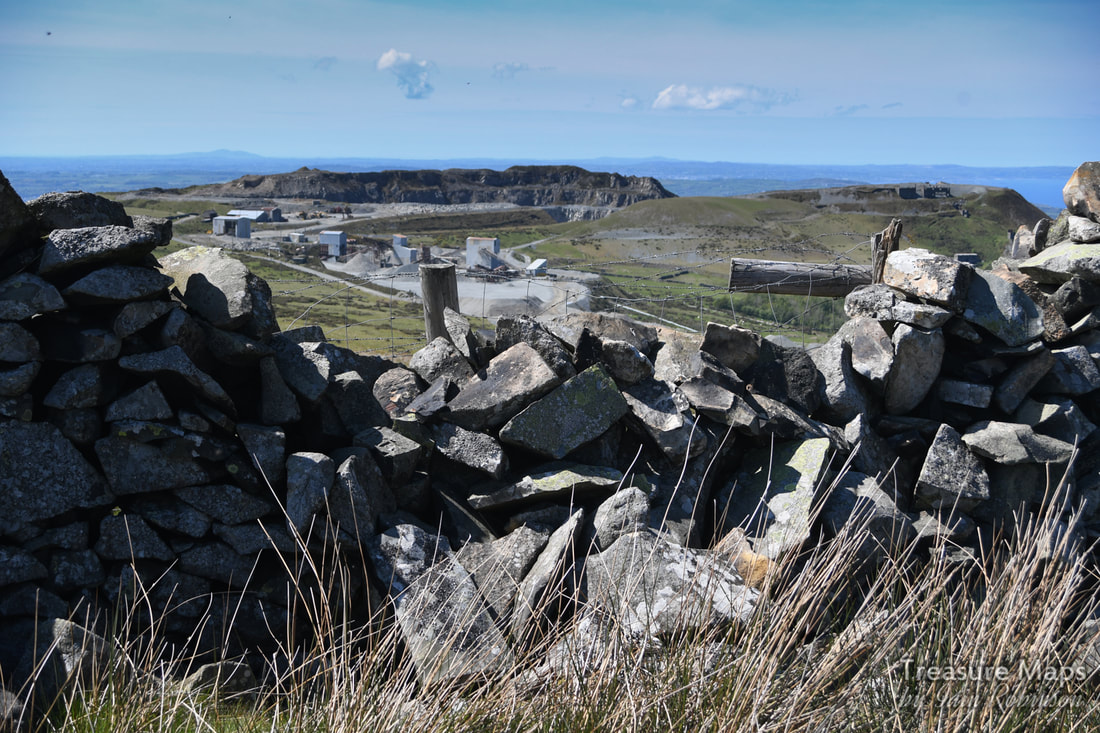 Other "Treasure Maps" posts about Penmaenmawr quarries- 
The old track up to the Graiglwyd workings above Penmaenmawr, used by prisoners of war in 1917, during the 1914-18 conflict. They were kept in Graiglwyd Hall, (now in the middle of a caravan site) a mile below.
Part One- the Neolithic quarries.
A few years ago, Petra and I made a fairly extensive study of the Penmaenmawr quarry complex in all it's fascinating, ransacked glory. But we didn't really touch on the adjacent Graiglwyd workings, something I always felt that we should remedy. This year, we've developed a side-interest in the prehistoric remains of Wales, and I had noted some interesting mentions about a neolithic axe factory on the slopes of Graiglwyd. I had the idea of contrasting ancient and "modern" in one swoop, but as always happens, it took a good few visits to fully quarter the place and attempt to do it justice. Graiglwyd is a large hill a little north east of Penmaen head. Hard to believe today, but at one time (about 300 million years ago) it was an active volcano. Because of the way the volcanic magma cooled here, it left a plug of diorite. (Microdiorite or augite granophyre) This is a hard rock, but within this deposit there were even tougher veins of what the geologists call chilled rock, with special breaking properties. Simply put, when it breaks it is with a very sharp, durable edge. One of the reasons Victorian quarrying got into difficulties here was that the rock was too durable for cobbles/setts- in the pre-motor car era, horses would slip and carts skid on the smooth surface. Four thousand years earlier, this was the very reason the rock from Graiglwyd's slopes was prized.
I should say from the start that nothing should be taken from this area (it is highly unlikely that you would find any axes or roughouts in any case). As always, we were concerned to find evidence of activity, not artefacts. If we had found anything, it would have been left in situ and a report lodged with the Penmaenmawr museum, accompanied by a precise GPS location of the find. Take nothing but photos, leave only footprints :-)
I don't know how those early men knew to dig here- we do know that they had a complex civilisation based on trade, rather than the territorial aggression that was assumed when I was at school. We know that the site soon became very important to them, so much so that a complex of settlements, cairns and stone circles were built almost within axe throwing distance. An ancient trackway was just a couple of hundred yards away- a co-incidence, or deliberate? We'll never know. Excavations of the (later) Druid's circle nearby* and other sites have revealed unused tools from Graiglwyd; whether these were prior to the circles or not, they were deposited in those locations, which is significant. A red herring? I was put off the scent initially, since the map reference on Coflein is for an area to the north east of the hill top, quite a bit lower down than I would have expected. But that was due to my ignorance, no fault of Coflein. We quartered the area and saw nothing suspicious, even by the standards of neolithic sites, which usually require rather a liberal gaze from the "eye of faith". Other sources said that the neolithic quarry had itself been quarried away by modern working. We came away a little depressed, although we had seen a couple of great victorian powder magazines, an amazing blast shelter and an interesting drum house for the next visit. Ah, yes, recent industrial archaeology- remains you can actually see without excavating. (gives a wry smile) Meanwhile, I read an account on Megalithic portal. It sounded from what they were saying that the axe factory might have been on some outcrops on the southern top of the ridge above the modern-ish quarry. This seemed to be a sensible theory. A discovery Then I made a breakthrough, managing to get sight of an excavation report written by Samuel Hazzledine-Warren in 1921. He was an eminent archaeologist of his time- an expert on Middle Pleistocene sites (c.400,000 years old) of the Clacton area. He'd been on holiday in Wales, looking at the Druid's cairn a few hundred yards away from Graiglwyd, when he found a stone axe lying on the ground. He continued to find axes, tools, broken tools and countless flakes all over the area, but most were concentrated in an area where Coflein have their grid references. This was the early 1920's, remember. Needless to say, Petra and I scrambled back up there as soon as work and family commitments would allow. 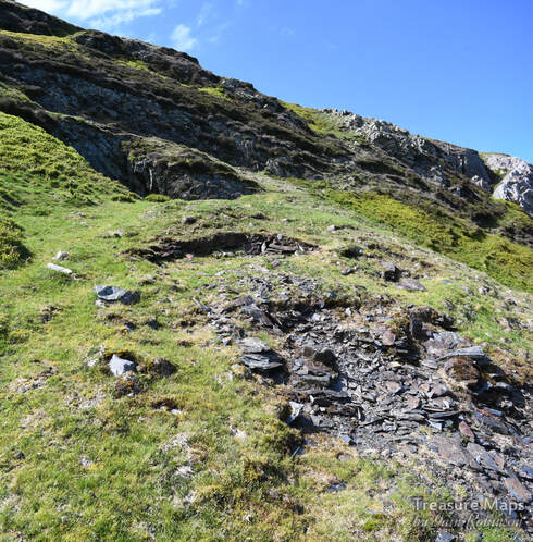
A slate trial! Below the outcrops from which the stone axes were quarried.
Of course, as always, we managed to find a slate mine! A small trial working into an opencut, showing some very oxidised slate in the tip, with plenty of iron evident. Sedimentary mudstone in the close vicinity of a volcano- the wonders of geology. But, above the mine, with it's cute little magazine, were the neolithic workings...along the line of Clip yr Orsedd.
Quarrying, neolithic style. Nothing much has changed.
It's worth quoting Coflein: about the site:
"At Graig Lwyd blocks of raw material were selected from the natural scree and crags and firstly roughly flaked into manageable form before being worked to roughly the correct shape and size. At this point the `roughouts' as they are termed, appear to have moved from the site and were ground and polished to their finished form elsewhere... ...in addition to the large quantity of flakes and roughouts noted across the hillside, five working floors were discovered."
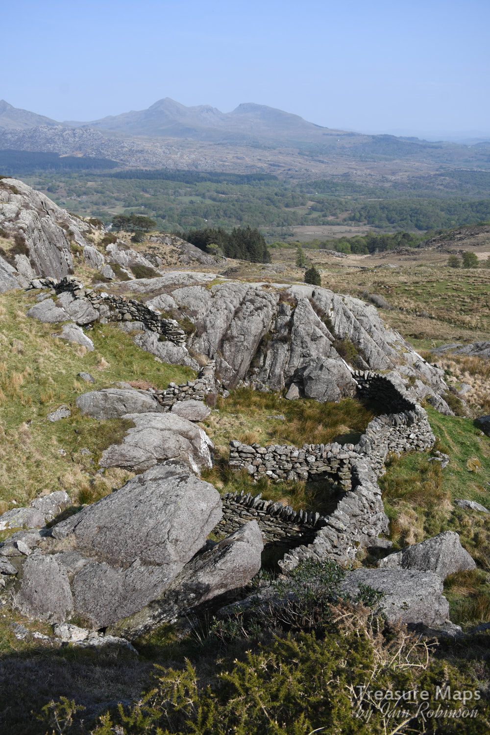
I wonder what these working floors were like? At any rate, here are a couple of photos carefully taken at an outcrop near the present top of the hill, at Clip yr Orsedd. I can't imagine what the holes left by material extracted four thousand years ago must look like, but it seemed that there had been a fair bit of extraction here, with plenty of tipping.
An investigation by John Llywelyn Williams in 1992 revealed percussive marks in stone that could possibly have been made in order to dislodge rocks here. In other sites, notably those excavated by Hazzledine-Warren, there was evidence of fire-setting ( dislodging or inducing rock to split by means of heat and then rapid cooling) and large hearths were uncovered, which H-W thought might be for calcining the roughouts to make them easier to work- although this must have taken a great deal of skill to judge the amount of heat required. 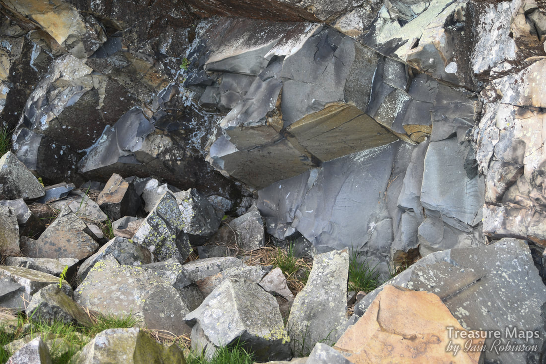
Might this be a remnant of the excavation by Mr Hazzeldine Warren?
It seems that the greater quantities of stones used for axe making were taken from the scree which fell off the rock faces. Before the quarry, there must have been a huge selection to choose from. Using a hammer stone, chunks or flakes were then broken off, shaping the workpiece to the desired form. I guess this technique was achieved empirically over many years of working. The "roughout" was then removed elsewhere for final shaping and the much longer task of polishing. Ultimately, the stone would be fixed to a wooden handle.
Flakes, hammerstones, and axe heads have been noted in various stages of manufacture at Graiglwyd- in fact they have been found in a wide area radiating as far away as Dinas, at the gateway to the Bwlch y Ddeufaen. Finished axe heads from Graiglwyd have been found all over Wales and further abroad. Bangor and Shrewsbury Museums have exhibits of axes and tools from Graiglwyd, Cardiff and Manchester also have examples. There are also some axe heads and tools in the museum in Penmaenmawr. 
The point where Samuel Hazzledine Warren made his excavations. Penmon, on Anglesey, with it's limestone quarries and Puffin Island are in the distance.
Hazzledine Warren's account of his work is a thorough, learned treatise, but it is also a charming one. He writes that work was continually interrupted by the blasting operations from the quarry-
"The actual amount of the danger is not great, but it is always present, and sheep are occasionally killed by flying splinters of rock... stones of considerable weight come across with very formidable velocity, and our working party had one very narrow escape. I advise... to avoid the shelter of the stone walls as these are breached by the heavier projectiles and only make additional missiles..."
The shoulder of the hill where several hut circles are marked on the map. The quarry built the ruined hut in the foreground and also the blast hut in the distance.
We spent some time quartering the ground beside the grid references given on Coflein, without seeing anything significant- but then most remains would be below the earth, even as recently as the 1921 excavations. I was hoping for a little sign of some ground disturbance, but never mind, I could imagine the activity that must have gone on here.
So we switched our attentions to the shoulder of the hill where the quarry breaks the skyline. Along here, there were the opencut sites, which we examined carefully and thought we might be seeing some evidence of stone shaping. The OS map marks some hut circles here and these were evident- Hazzledine Warren mentions them, but considers them to be of a later date than the axe workings. He excavated them and found 200 flakes and more than a dozen axes in various stages of manufacture. But axes were also found built into the walls of the hut- these were deeply patinated and thought to signify the later date of the huts. The settlement is easier to pick out from Google Earth than it is on the ground, but I was saddened to see that the quarry had ransacked the place, due to ignorance, I am sure, followed by the farmer who had left the inevitable plastic concentrates container. 
Photograph of Samuel Hazzledine Warren at "Sherwood", Loughton, in October 1931 taken by Professor K. Absolon. Essex Naturalist. Vol. 30. Plate 9 p. 144.
Who was Samuel Hazzledine-Warren?
Warren was born and brought up in Essex, the son of a wholesale merchant. He entered the family business but was able to retire to concentrate on geology and archaeology in 1903. Most of his fieldwork was carried out in Essex notably at the Middle Pleistocene sites (c.400,000 years old) of the Clacton area where he identified the Clactonian industry and found the tip of one of the oldest known wooden spears. He also researched late Glacial deposits in the Lee Valley. He was a prominent member of the Essex Field Club, the Geologists' Association where he recieved the Stopes Medal and the Geological Society. He published many papers about his fieldwork and made significant contributions to early 20th century debate on a chronological framework for the Quaternary period. In 1936 he gave part of his collection to The Natural History Museum and bequeathed the remainder to the British Museum. (Extract from the Bibliography- Oakley, K.P. 1959. The Life and Work of Samuel Hazzledine Warren, FGS. Essex Naturalist 30, 143-161)
If you were wondering what an axe from Penmaenmawr looked like, here's a link to Coflein: Digitised images of axe finds at Penmaenmawr
Here's a film from English Heritage, showing how one goes about making axes from flint, but the principle is, I guess, pretty similar:
Some useful links for further information:
GAT/Cadw document- Group VII Axe-working Sites and Stone Sources, Llanfairfechan, Conwy- a fascinating account of the sites shown here and a report about a local historian and recorder of axe finds, David Jones. The Waun Llanfair Project- excavations and investigations carried out in 2004, 2006/7 by George Smith of GAT and John Griffith Roberts of Cambridge University. Penmaenmawr Museum
Other "Treasure Maps" posts about Penmaenmawr quarries-
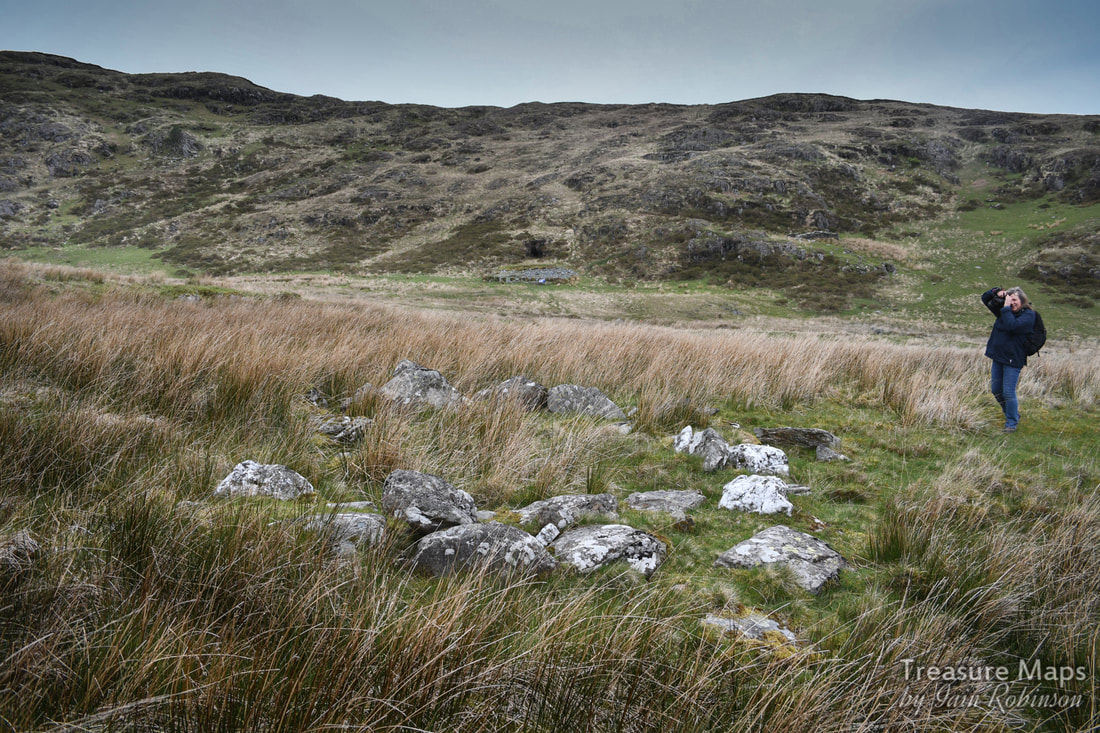
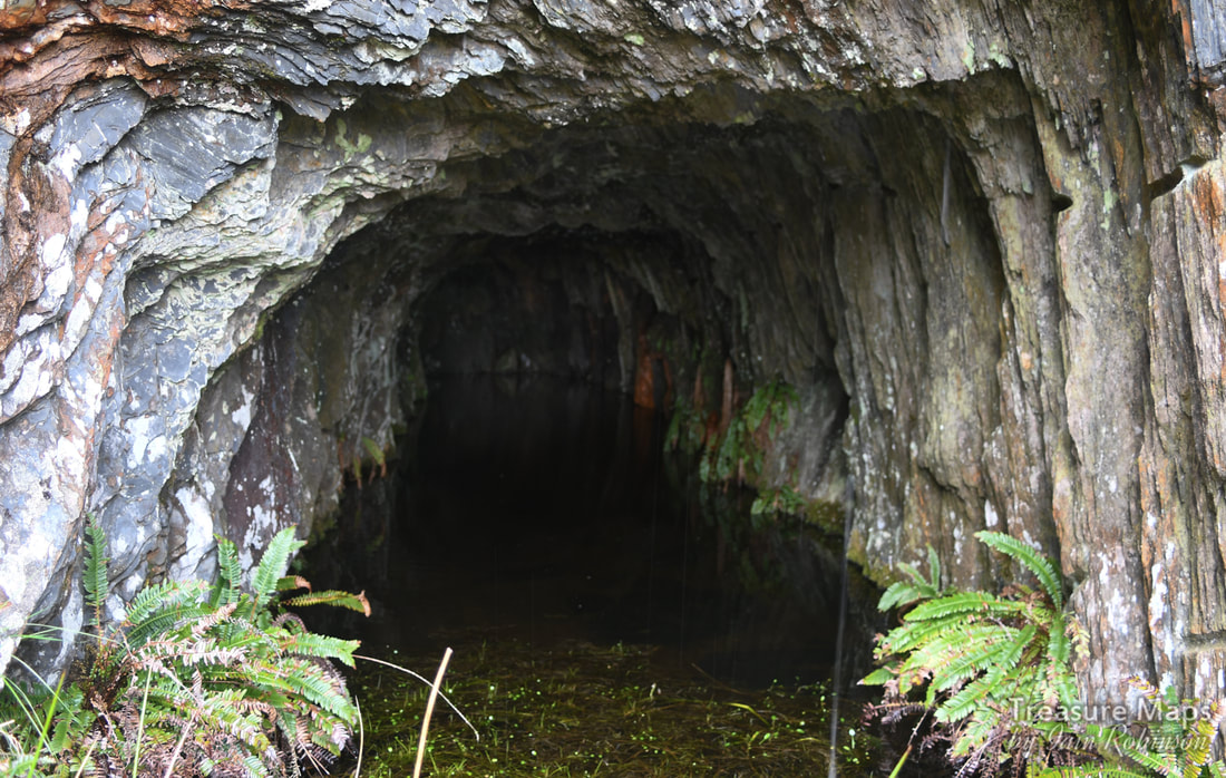
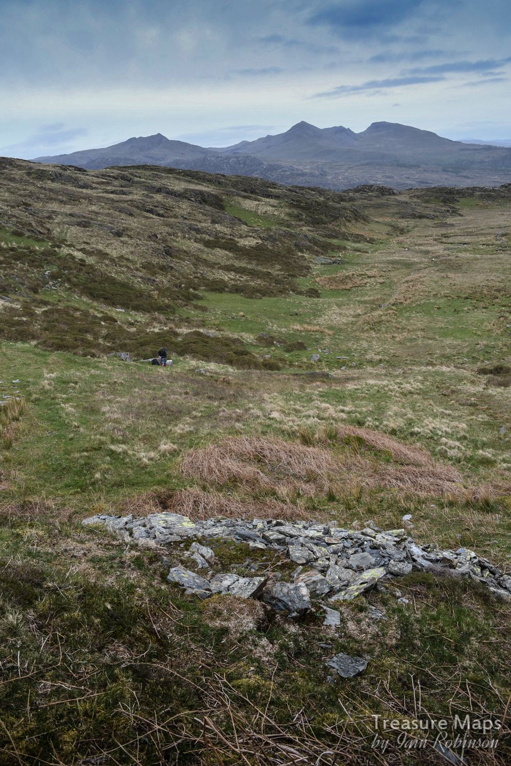
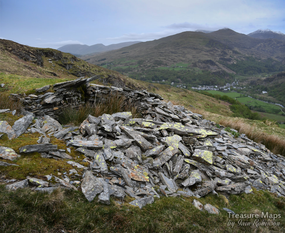
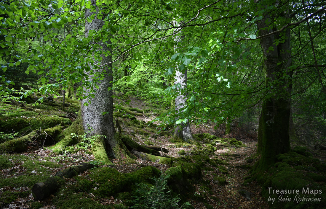
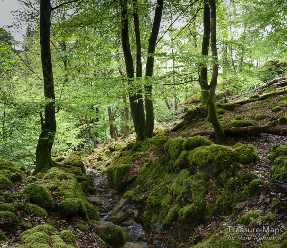
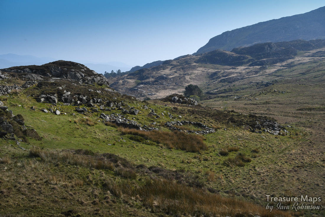
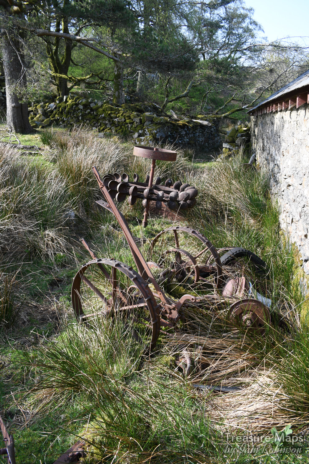
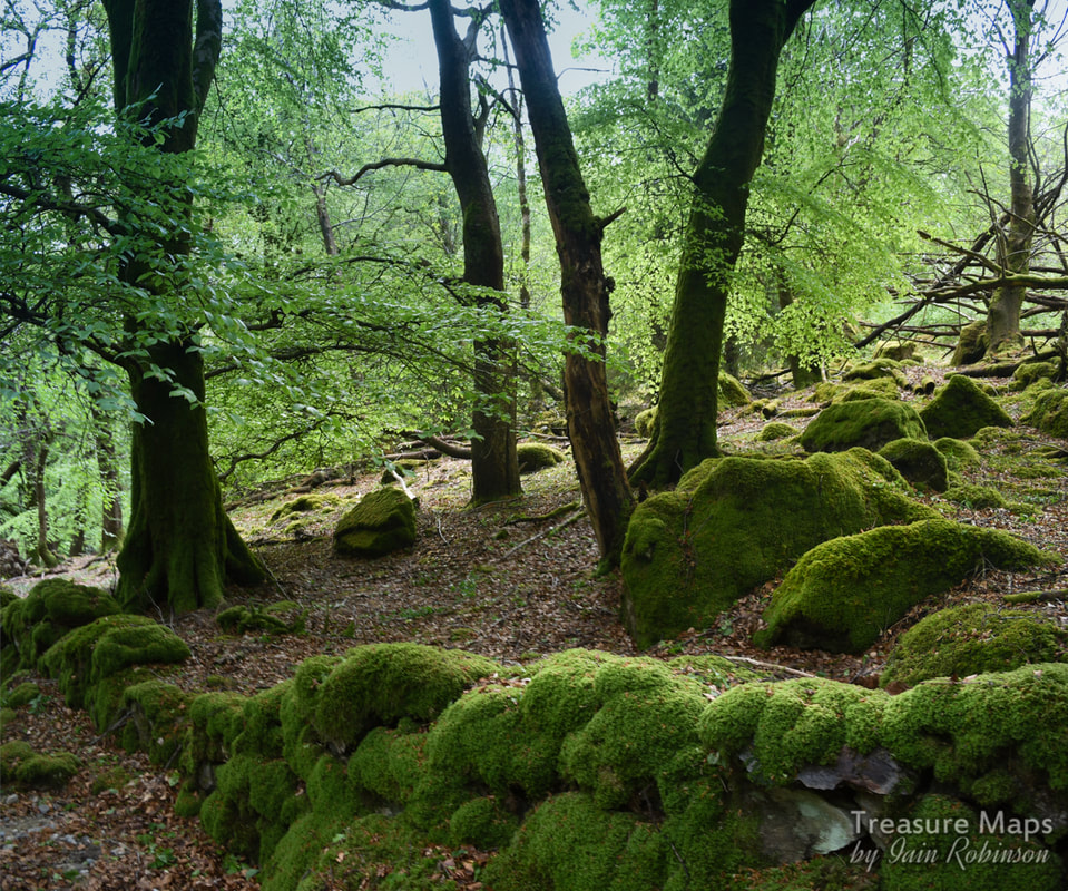 You might remember that in my last post about Aberglaslyn (here) I noted some trial levels in Cwm Cyd, on the moors high above the pass. Once Easter was finished with, we returned for a look-see and to have a bit of a clamber about on the ridge. Starting in the pass again, we parked in the same spot as before. Only this time, we took the left hand path uphill. This was a great move, as we found ourselves walking on an ancient trackway between two moss covered walls, climbing inexorably upwards. There wasn't a path, exactly, and in some places the trackway was in use as an impromptu stream bed, but it was magical nonetheless. 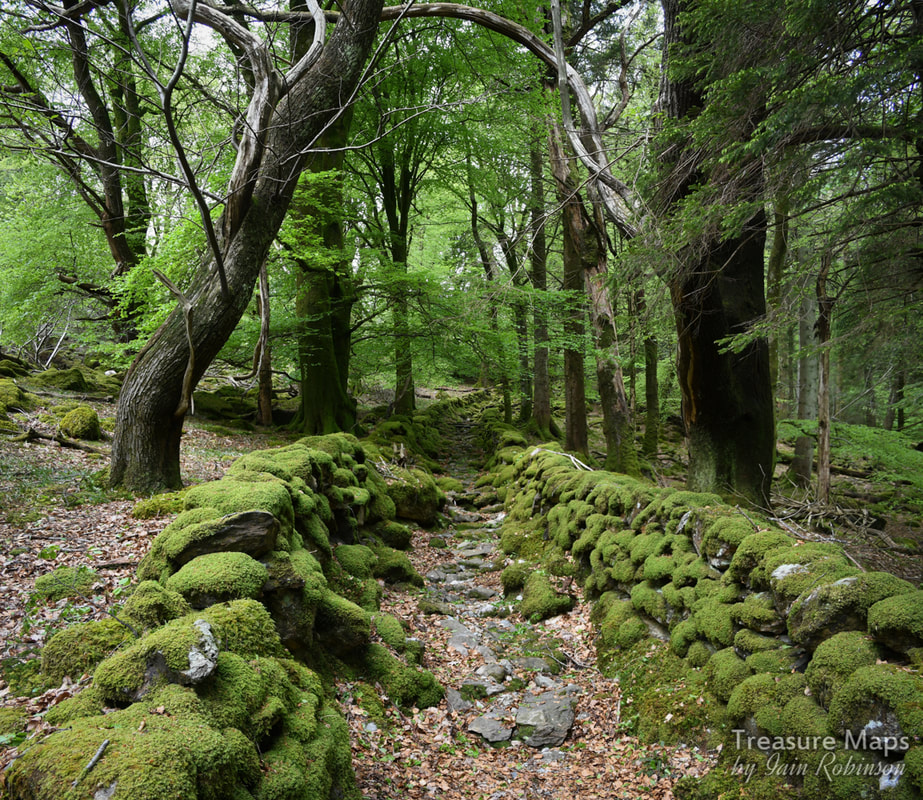 The light was perfect for photography and we both spent some time here, trying not to get into each other's photos. Eventually we emerged from the woods alongside the Afon Goch, a little bit below Oerddwr Uchaf farmhouse. Just before we came out of the woods, we encountered a strange shed made of logs that appeared to have been used as a bunkhouse for the Outdoor Education centre that used to be at Aberglaslyn Hall. What fun it must have been for the teenagers sleeping out here...a little spooky, too. Soon we were out into the open and striding out towards Cwm Cyd. The name means 'common valley'- yes, this was once common land. It was not unusual for locals to quarry slate on the common- in fact, the biggest quarries in North Wales began as ad hoc commons diggings before "the man" carved the land up like a priviledged pie. Very quickly, we made our first discovery- not a mine, but the remains of an ancient settlement. (Albeit next to a mine building which probably robbed the stone from the redundant round hut.) 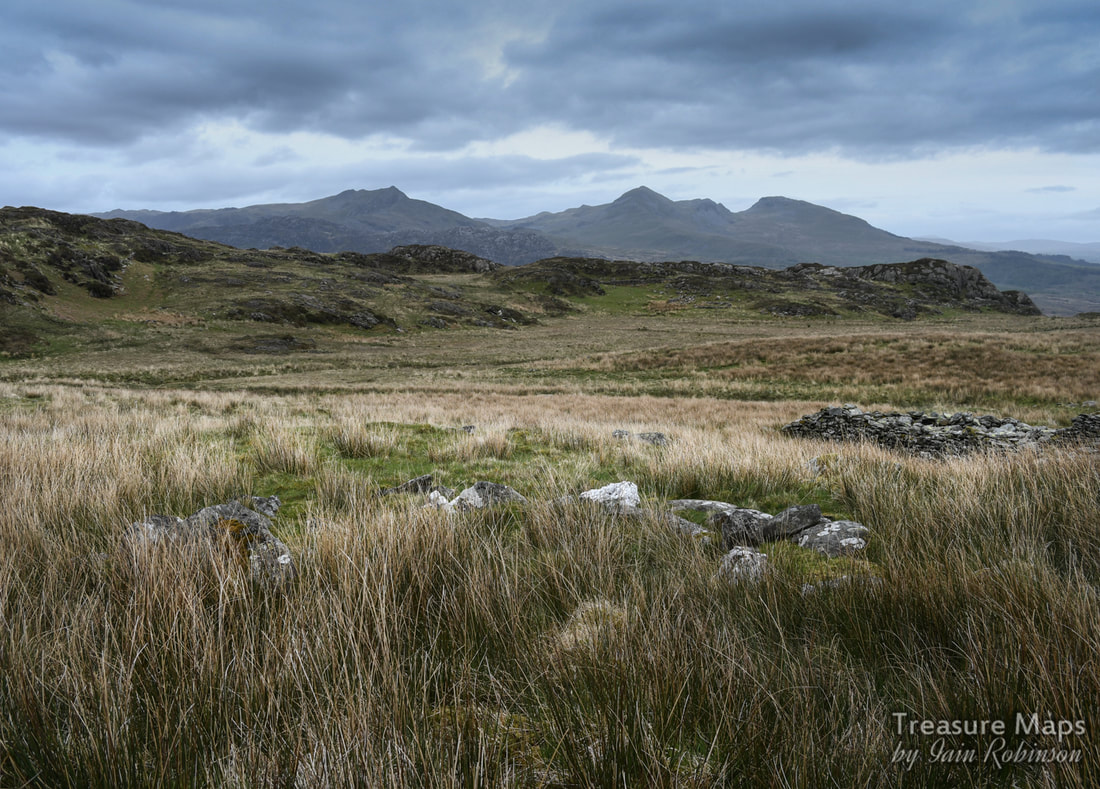 It doesn't look like much, but Coflein say that this is an ancient settlement- in this case the remains of the base of a round hut. That's the Moelwyn Massif in the background and Cnicht to the left distance. I am beginning to get a feeling for how these things present themselves in the landscape, but the surprise and wonder at finding something from far distant times doesn't easily wear off. Coflein have it down as bronze age or iron age- on the Ordnance maps it is just "hut circle". The mines were now in sight. We walked over the sodden pasture and forded the Afon Goch- I was wearing my winter boots, so water was not a problem- and Petra had given up and changed into her wellingtons. It was a wise choice as the ground was very waterlogged. The first mine, a trial, was at SH581465. It had a modest tip outside and was open, but only to a blind heading.  The soggy adit. Undeterred, we headed over to the next mine, marked on the old maps as a "level". This is at SH579465. It's sadly just an opencut, so was something of an anti-climax. It was for slate, though, evinced by the contents of the tip, which was pretty grim quality stuff. There were no buildings associated with these trials, apart from the structure near the hut circle. 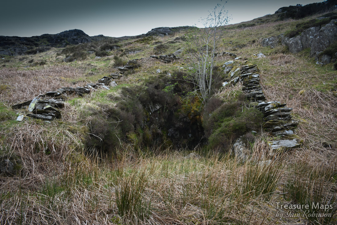 The upper level in Cwm Cyd. There was a wall above and I wondered if it could have been a shaft, but it was an inconveniently sited sheepfold. We knew that there were mines over the ridge to the north, so we climbed uphill over the slopes of Y Dduallt, noting as we did the close proximity to Moel Hebog. It looks so different from this angle; steep, bounded by cliffs- not at all the benign lump that it appears from Cwm Pennant. Surprisingly soon, we were over the top and heading down into Bwlch Goleu, the "pass of light". A mine could be seen to the north west- the Cwm Cloch mine, while below were the Bwlch Goleu quarry levels. While we had the advantage of height, we sat and had a late lunch, watching a Welsh Highland railway train climb and wind slowly away from Beddgelert towards Cae Gors. The whistle sounded mournfully in the distance, carrying over the wind. I don't think there's any more evocative sound, apart from Curlews, or Choughs in a quarry- but then I am biased. Down in the valley, countless motor bikes snarled and roared, making a nuisance of themselves and clamouring for attention. Snowdon was in view, and we tried to remember the names of all the peaks we could see. It was fun to look across at the Liwedd ridge and recall our adventures there earlier in the year. (the post is here) 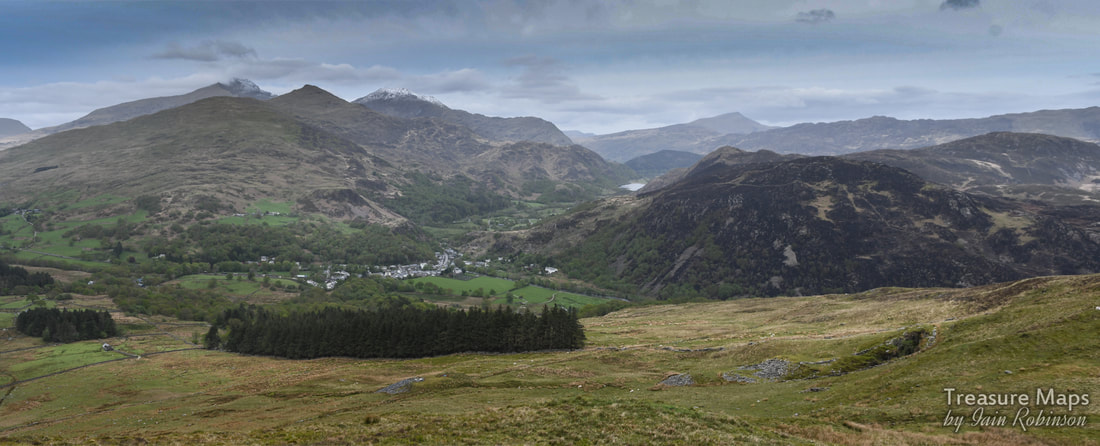 We climbed down to the Bwlch Goleu levels past a couple of tiny run-in trials. The quarry itself consists of a run in lower adit and a pit on the level above. Richards* states that the place was unsuccessful but there is an awful lot of waste and a reasonably sized pit. The waste does look fairly poor quality, and there are no remains of dressing sheds or walliau. An access track winds away east and then south towards Aberglaslyn- it had me wondering if we had come up a route that had taken slate on the backs of mules.  The remains of Cwm Cloch mine, SH579472. We looked across at Cwm Cloch, but neither of us felt up to retracing our steps and walking across for what Richards described as a "tiny working" with a collapsed adit. We could see the low ruins of a building, but decided against exploring there. So we followed the access track, hoping it would lead where we wanted to go- and it did. It also had a surprise up it's metaphorical sleeve... 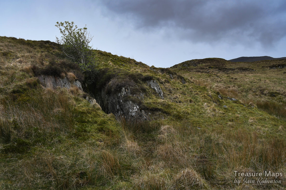 Could this be a mine? Yes. After walking back towards Bryn y Felin, what looked like a tip appeared above us, with perhaps an opencut. (SH586468) All fatigue forgotten, we ran up to see. While Jeremy Wilkinson's database of mines has this as a lead trial, the tip is resolutely slate . There is a curious round shelter dug into the side of the tip, reminding me of the one at Serw slate quarry (post here). It was a wonderful spot, anyway. It was now a case of returning back down to the valley the way we had come. But before we did that, the opportunity was taken for a further mooch around the wonderful Oerddwr Uchaf farmhouse and the Hill fort. I was peeved that I had forgotten to photograph the waterwheel last time. 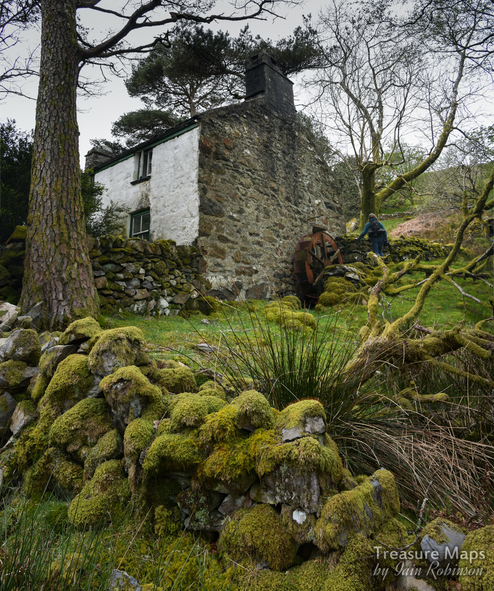 The house was still deserted, no second-homers had purloined it for a holiday rental business yet and it was as charming as always. We quartered the place again, then found a couple of garden chairs and had a drink of coffee from the flask while listening to the birds, savouring the peace and quiet. It is an idyllic spot, although not, I suspect if you had to farm it in the winter. On this day, it was the best place in the world. Coffee savoured, we put the chairs away and set off down towards the hill fort again for another nosy about. While we were stumping about the fort below the farmhouse, Petra made a discovery. There was a way, like a road, which I imagined was to lure attackers around to the south east of the fort. There we noticed a great many stones placed vertically in the ground. Could these be "Chevaux de Frise"? I haven't read much about this place, folk seem to think it isn't anything special, but to us it had a great atmosphere, even if the farmers have robbed the walls. As always, I am indebted to Alun John Richard's "Gazetteer of Slate Quarrying" for facts, the notes and jottings of Eric Jones, and the late Jeremy Wilkinson's Gazetteer, now curated by Dave Linton- thank you gentlemen! Below are some shots of the woodland road we walked up... 
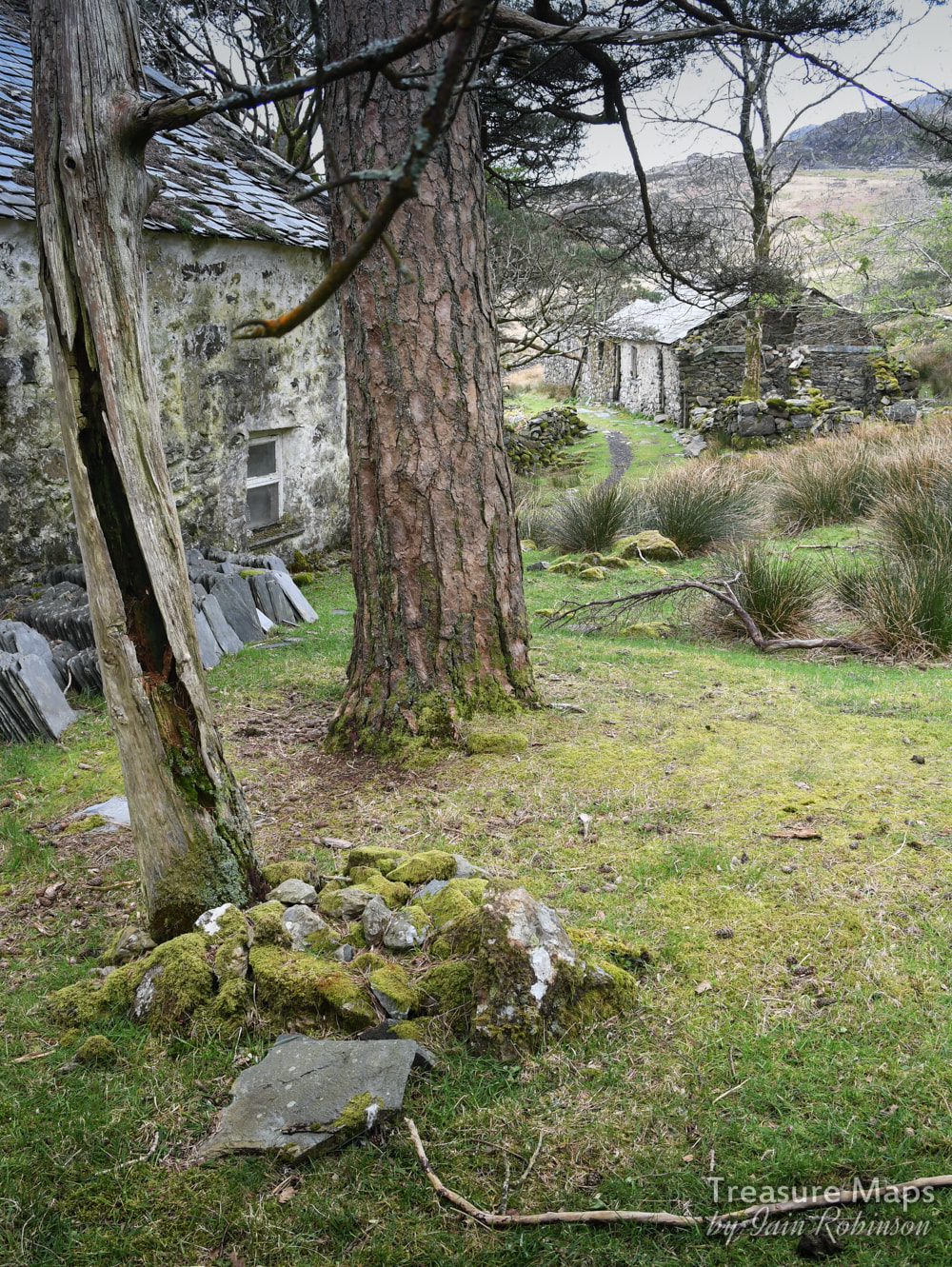
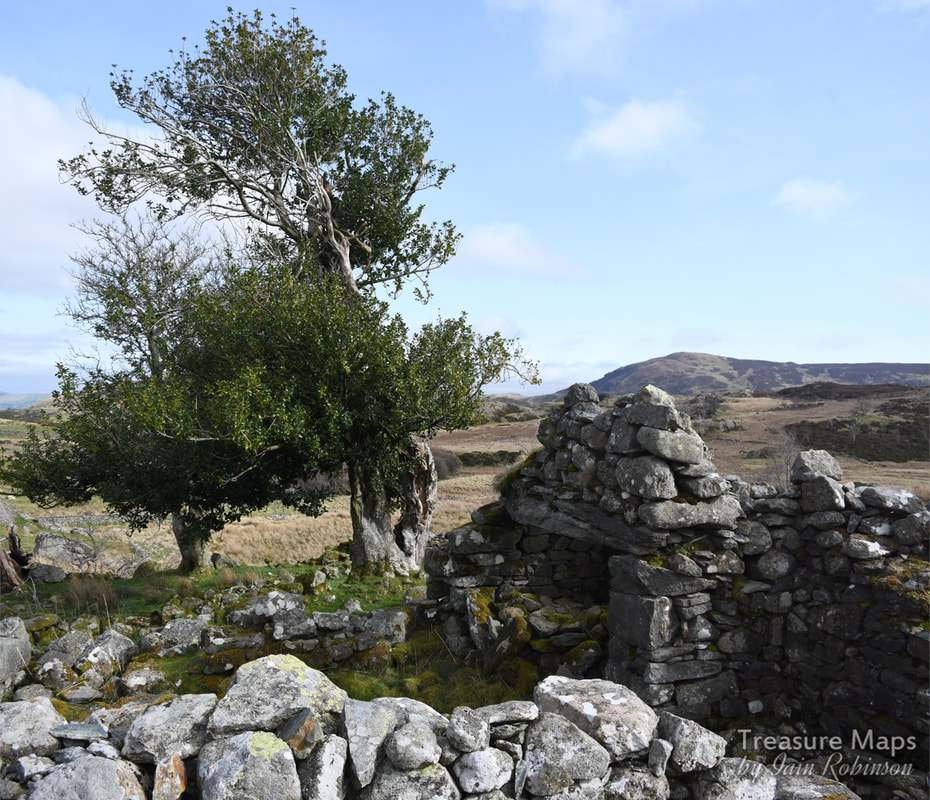
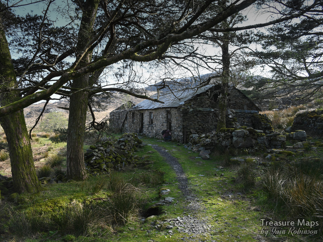
The ruins of Hafod Fach.
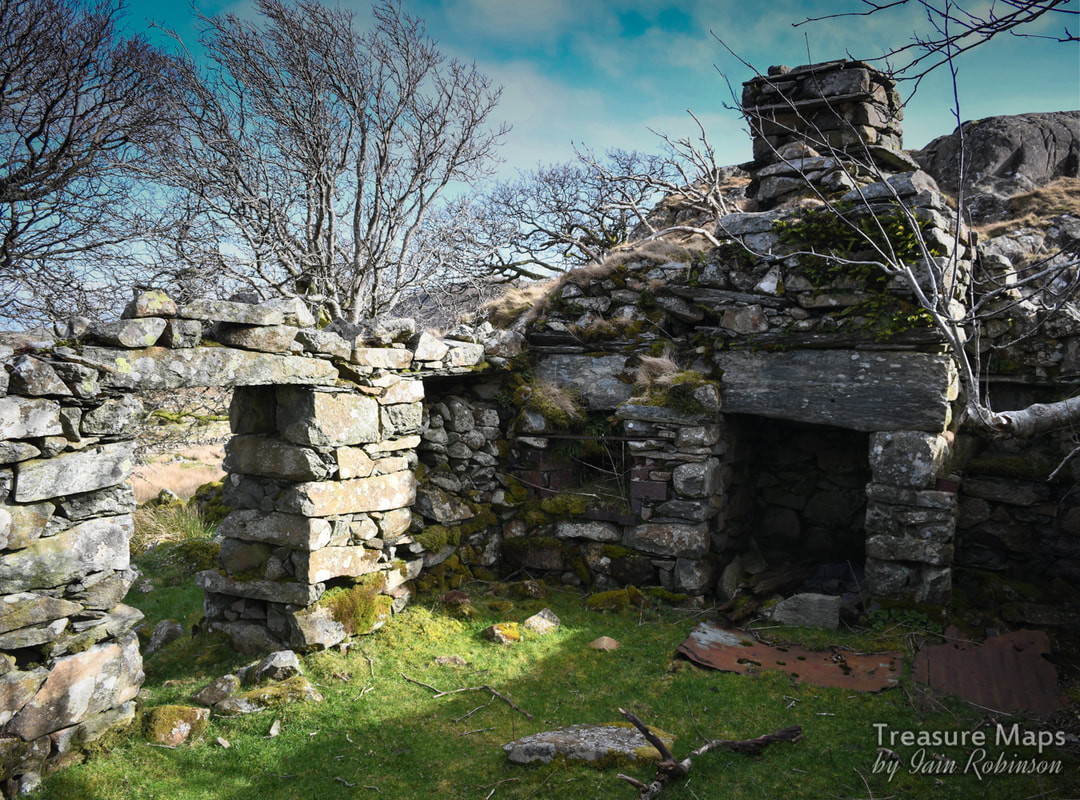
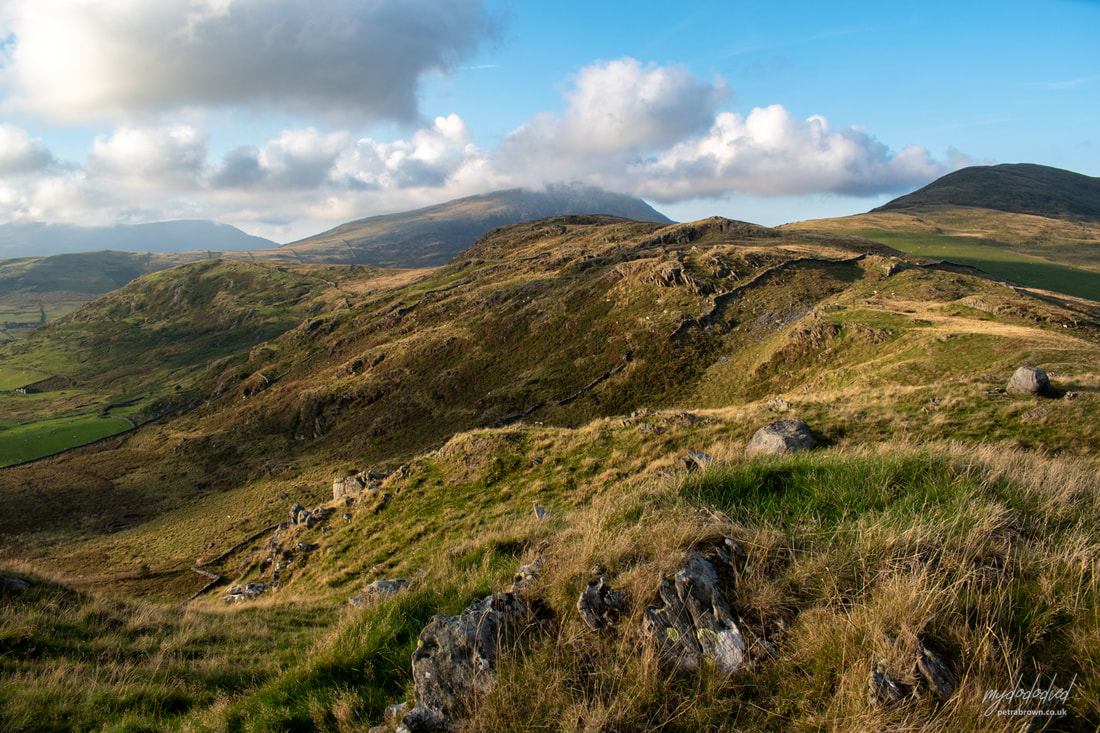
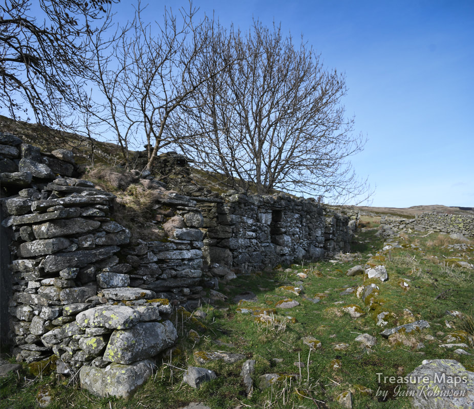
The wild high country to the west of Dyffryn Conwy feels like an uninhabited wilderness, a weather-ravaged land where the Carneddau brood in distant melancholy. These days it is wandered only by sheep and occasional walkers, their eyes on the trail, ideas fixed on the mountains. Yet, there are so many echoes of the people who made this place their home, from the stone age to the late Victorian era.
We have returned here a good few times, looking for the ancient settlements marked on the map, finding mysteries and studying the numerous old Hafods. Incidentally, a "Hafod" is the Welsh term for a summer dwelling- referring to the seasonal cycle of transhumance - the movement of livestock and people from a lowland winter pasture at the main residence (Welsh hendre) to a higher summer pasture, from roughly May through October. It has a slightly wider cultural significance too, as it has come to also mean a summer holiday retreat. I remember reading some humorous graffiti carved on one of the walliau at Glyn Rhonwy quarry, which read "Ty Hafod Jones". Anywhere less like a hafod would be difficult to imagine in that grim spot. The hanging valley of Cwm Dulyn is guarded by the imposing prehistoric fort of Pen y Gaer (see previous post). There are many remains of old settlements in the landscape- hut platforms, round huts, burial cairns and sheepfolds. While the sheepfolds generally remain, the huts are less obvious, and require a fair bit of imagination to interpret, but they are there. 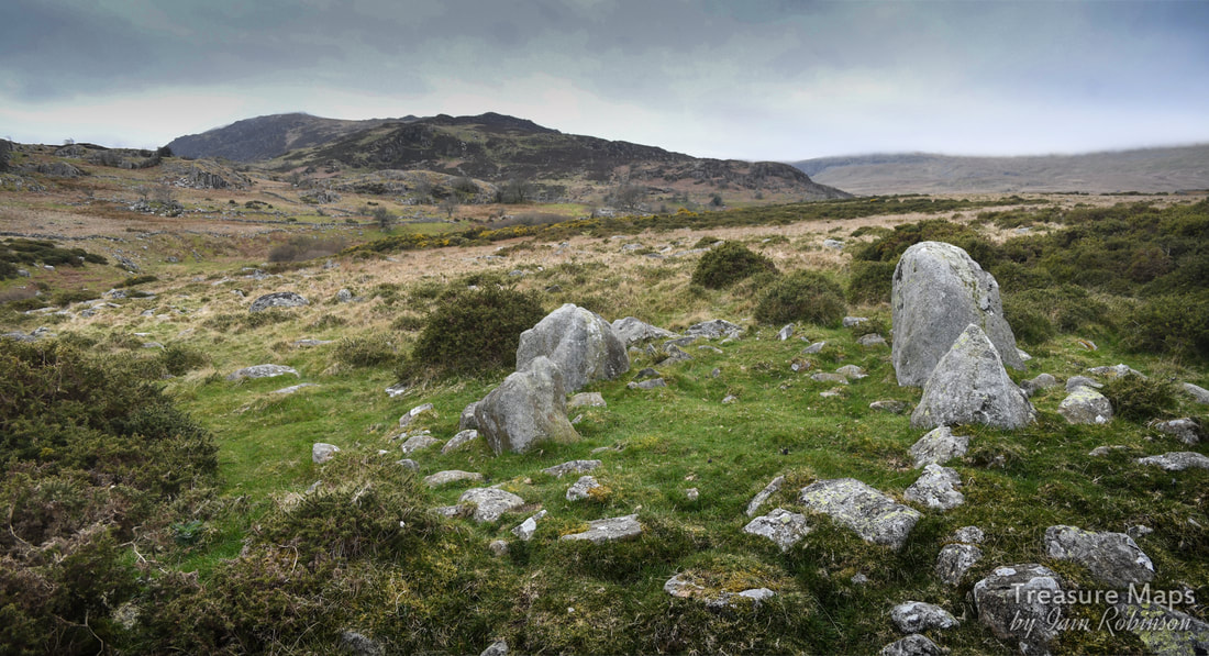
Hafod y Gors Wen ring cairn
There are a couple of ways to approach the area- one is to park at Pen y Gaer and walk along the rough road which carries on up to the Carneddau Mountains. It's a good route and we managed to see all the features of the northern slopes of the cwm in a day. The south side is best accessed from the Cwm Eigiau car park (blog post here). Instead of carrying on up to Cwm Melinllyn, you turn right towards Meineira. A year separated our two visits to this part of the cwm and I noticed that Welsh Water had "improved" the road so as to get workmen to their dam. It's still a great walk, and if you are feeling energetic enough, you can carry on to the hauntingly beautiful lake at the top.
The Prehistoric remains The best known prehistoric relic in the area is the Hafod y Gors Wen ring cairn (photo above). It's lost in an area of gorse at SH73366742 but is well-worth braving the herbage to find. Some public spirited soul (thank you, "Postman") has removed a fair bit of gorse growth without harming the stones, and deserves our thanks for that. Unfortunately on the occasions when we turned up, the light wasn't great for photographs, but I hope you get enough of an idea to want to visit it yourselves. It's technically a "four poster" as Coflein explain in their entry here. 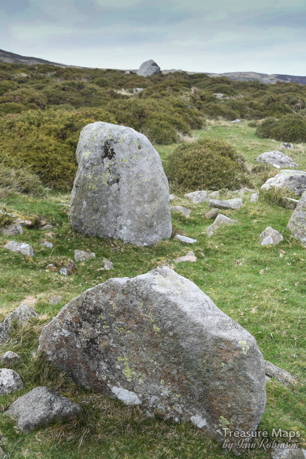
Hafod y Gors Wen, looking north, showing two of the orthostats.
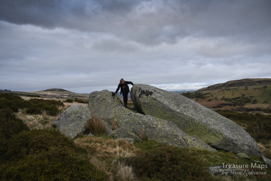
Near to the ring cairn are a couple of very impressive erratics-featuring Petra for size, and a bonus appearance of Pen y Gaer hill fort in the background.
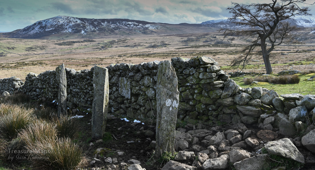
Going further north towards Pen y Gaer, there are a group of very fine standing stones at SH72946819, along a wall at Hafod Ffrith y Bont . Coflein are a bit sceptical about them, but they do look the real deal to me- and Megalithic portal agree, which is good enough, I reckon.
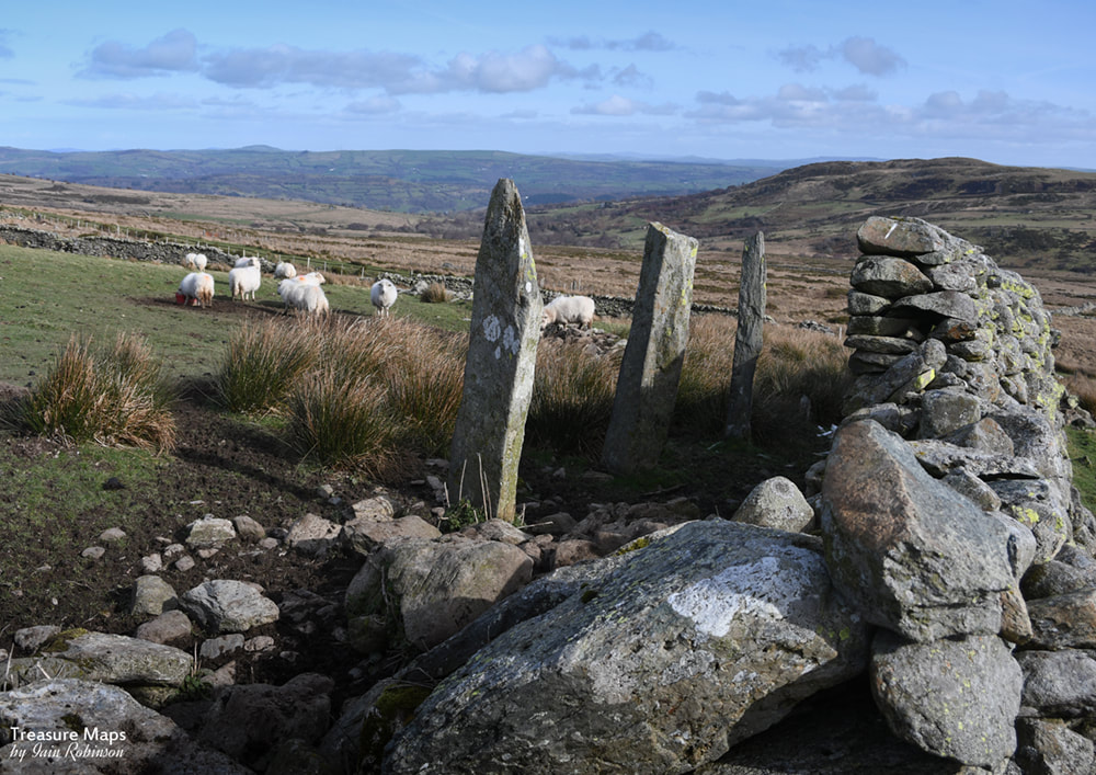
Ffrith y Bont standing stone row. There are actually four, but one has fallen. They are supposed to be aligned with Hafod Y Gors Wen, but I couldn't check that.
Here at Ffrrith y Bont, there are the remains of a couple of long houses (Coflein, here) -the whole farmstead is worthy of study, it's a fascinating place with subsistence agricultural structures built over several centuries.
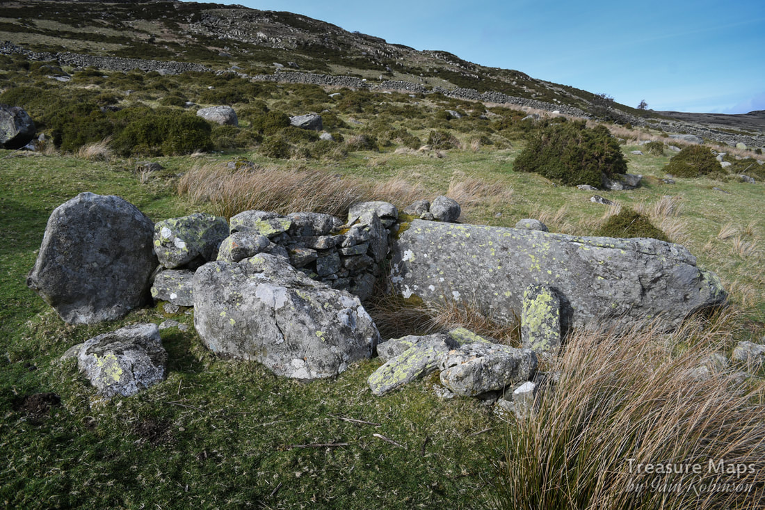
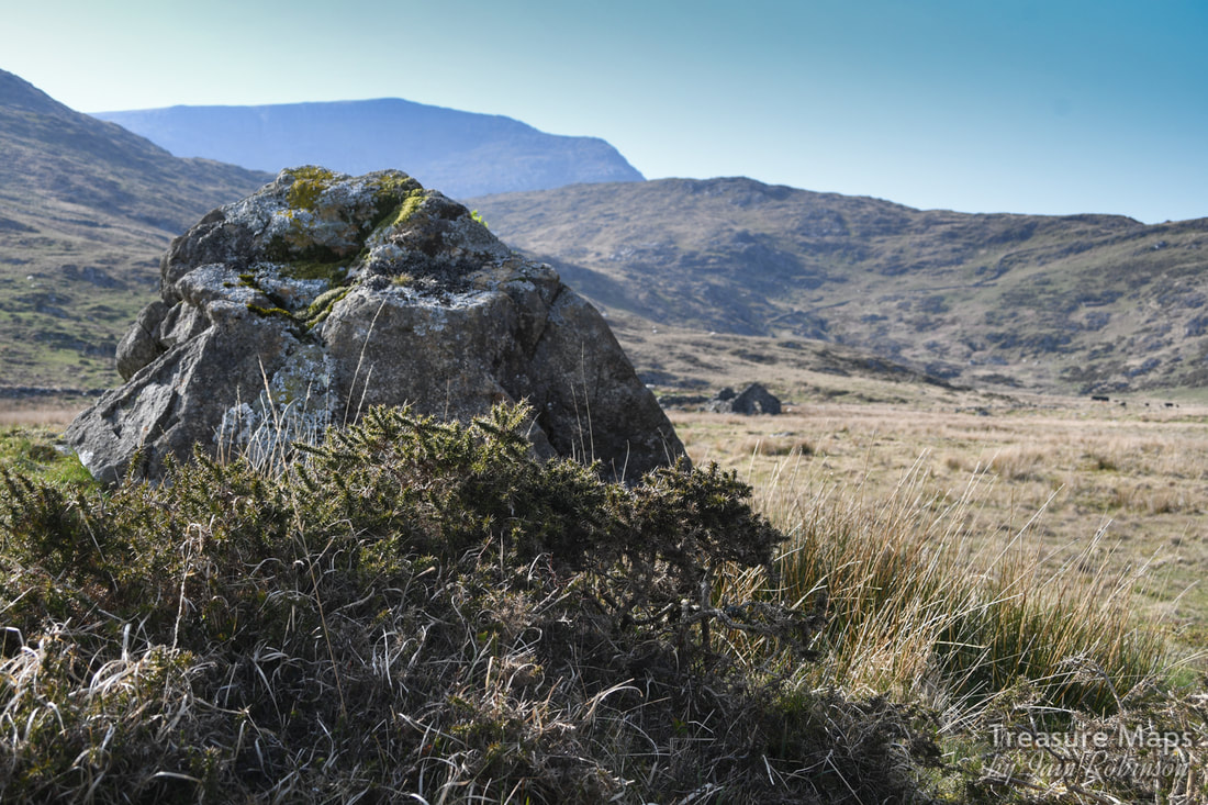
Crossing the Afon Dulyn, south of Hafod y Gors Wen, there are several old settlements thought to be bronze age or earlier. Surprisingly, the stones are still evident in the ground, perhaps because of the remote location- although this area must have been busy agriculturally from the earliest days. Hard to see why, since the land is not particularly fertile. 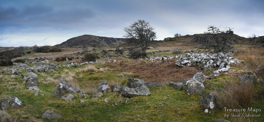
One of a number of round huts just south of the Afon Dulyn. The stones to the right are probably from field clearance.
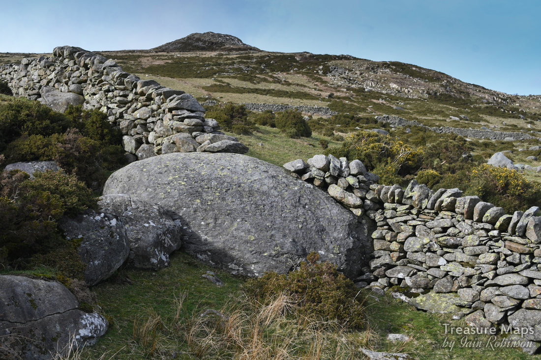
There are also ancient field boundaries and trackways across the moor here, difficult to trace except as depressions or ridges in the surface of the land. The field boundaries have been broken occasionally and it is occasionally possible to see the classic herringbone pattern of stone placement that sometimes typifies mediaeval builders. Very old sheepfolds are a feature of the landscape here- these are probably at least mediaeval in origin and incorporate some amazingly thick clearance walling. 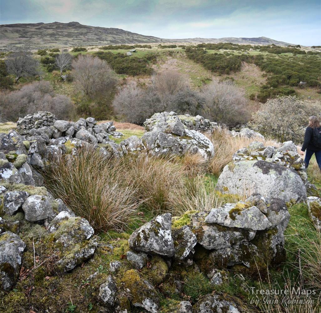
An old sheepfold with thick walls built to use up stones found in the field.
A bronze age round hut set in a bend in the river. It was very difficult to photograph clearly close up, this shot from the river cliff gives a better view.
The hut above is catalogued by Coflein as "prehistoric" (link) where it is catalogued as a hut circle.
The Hafods
Starting from the south, we come first to Maeneira. Today, this sits away from the road, but at one time was served by a trackway running below the present day road. I first glimpsed it through the branches of a wonderful Rowan tree whose roots has intertwined through some massive boulders. 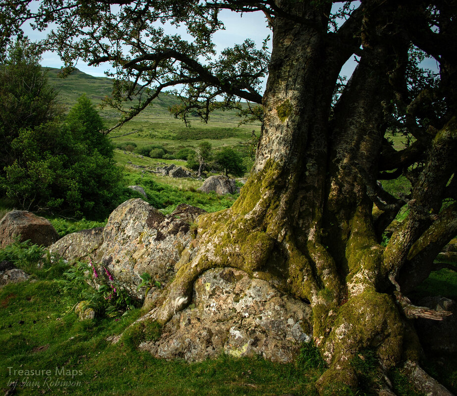
If Maeneira was a hafod, it was a well appointed one. The name, which translates roughly as "Snow stone" suggests all-year occupation. It was a fascinating ruin, with unruly trees disrupting the walls. There were barns and pig sties as well as a big kitchen range. The land, next to the river, seemed to be the best for miles around and had been clerared, with some fine old walls. Below are some images of Maeneira...
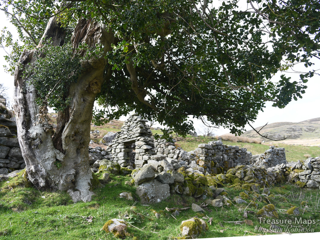
We walked east following the river and came to Hafod Fach (Little Hafod), a delightful spot surrounded by trees and nestled against a big rock outcrop. The people who settled this place certainly knew how to utilise the lie of the land- I wondered if they had built over where the prehistoric farmers had lived.
Hafod Fach
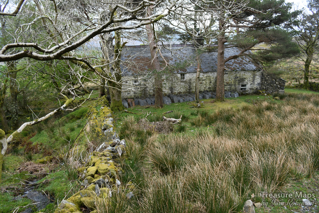
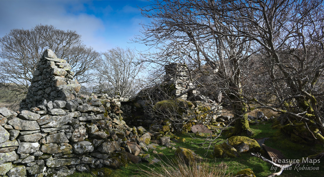
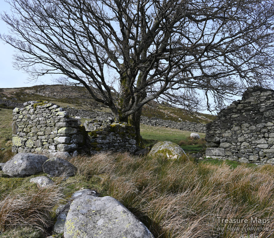
Next along the river, going eastwards, was Hafod y Garreg (Hafod of the rocks) which was a larger concern, possibly only abandoned in the nineteen sixties or seventies. There were some interesting remains and a couple of wonderful sycamore trees which probably dated from the first days of the hafod.

Hafod y Garreg
It looked as if there had been a wooden shed, possibly for poultry, next to the house. This was a substantial little farm, with an older dwelling (possibly the original one) in later use as a barn. This was impressively buttressed. I had the feeling, given that it was placed end-on to the slope, that it might have been built on the foundations of a long hut.
Some fine buttressing on the west wall of the original farm structure. It may have been a way of dealing with stone gathered from the field clearance.
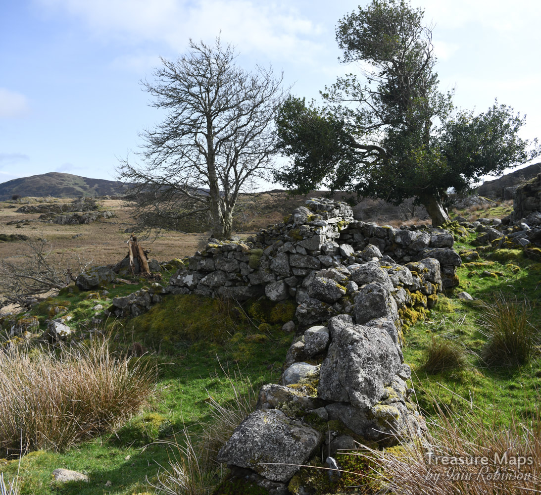
North of the Afon Dulyn
There are some farmsteads on the moor in the north side of the cwm. These are best reached by parking at the Pen y Gaer car park (SH 74375 69302) and walking along the old track. We missed the first ruin at Bwlch y Gaer, due to the presence of the farmer, who we guessed wouldn't have been too pleased to see us poking round the old place. The next ruin was a fine one, with the classic name of Tan y Bwlch (under the pass). It was a long structure, with the animal accomodation downhill from the farmhouse. 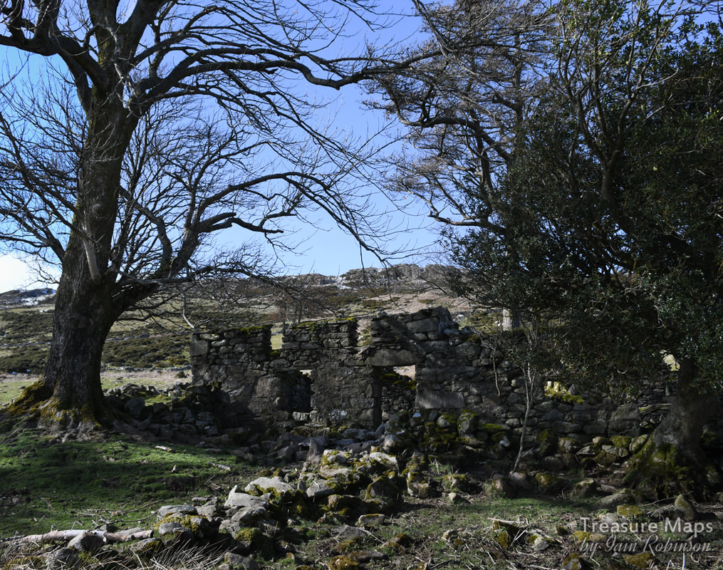
Tan y Bwlch.
The day we visited from Pen y Gaer, we kept the most fascinating place for last.
Ffrith y Bont This wonderful, rambling series of ruins and hafods is set in a landscape of giant erratics and mysterious rocks. The name means "Pasture or enclosure of the bridge", although I stand to be corrected with that one! There are several outbuildings and some strange clearance cairns, plus a stone row, covered earlier in the post. There wasn't much to glean historically apart from what there is on the Coflein map, but it did make a fascinating mooch- we came away with a feeling of respect for the farmers who put so much work into the place here. 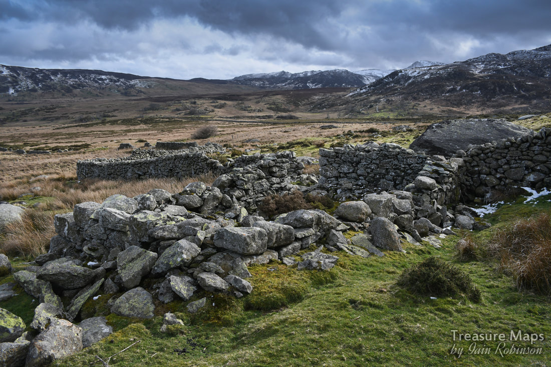
Ruins of an old barn, possibly built on a mediaeval long house, and a small hafod at the western extremity of Ffrith y Bont.
Some images of Ffrith y Bont...
Finally, as I have been mentioning the upper reaches of the cwm, I will add some photos to whet the appetite. There are more structures to be found as you approach Llyn Dulyn, a well-defined series of prehistoric settlements, standing stones and a bothy, plus the vestigial remains of a slate mine. We didn't do too well the day we visited the upper reaches as we had come over from Llyn Melynllyn and were distracted by the wonderful wild ponies of the Carneddau. It's a part of the cwm that we will have to return to.
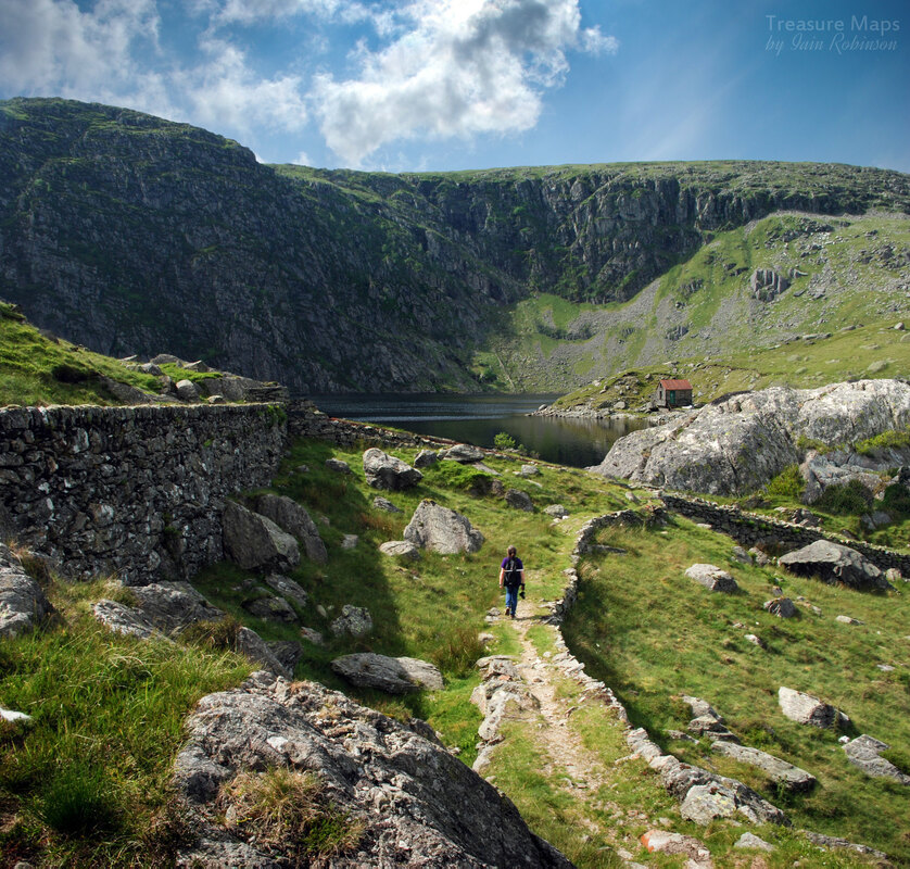
Petra makes her way along an old tramway formation- this is Llyn Dulyn, actually a man-made reservoir. It's a wonderful spot, although sadly the site of quite a few aircraft wrecks in the second world war.
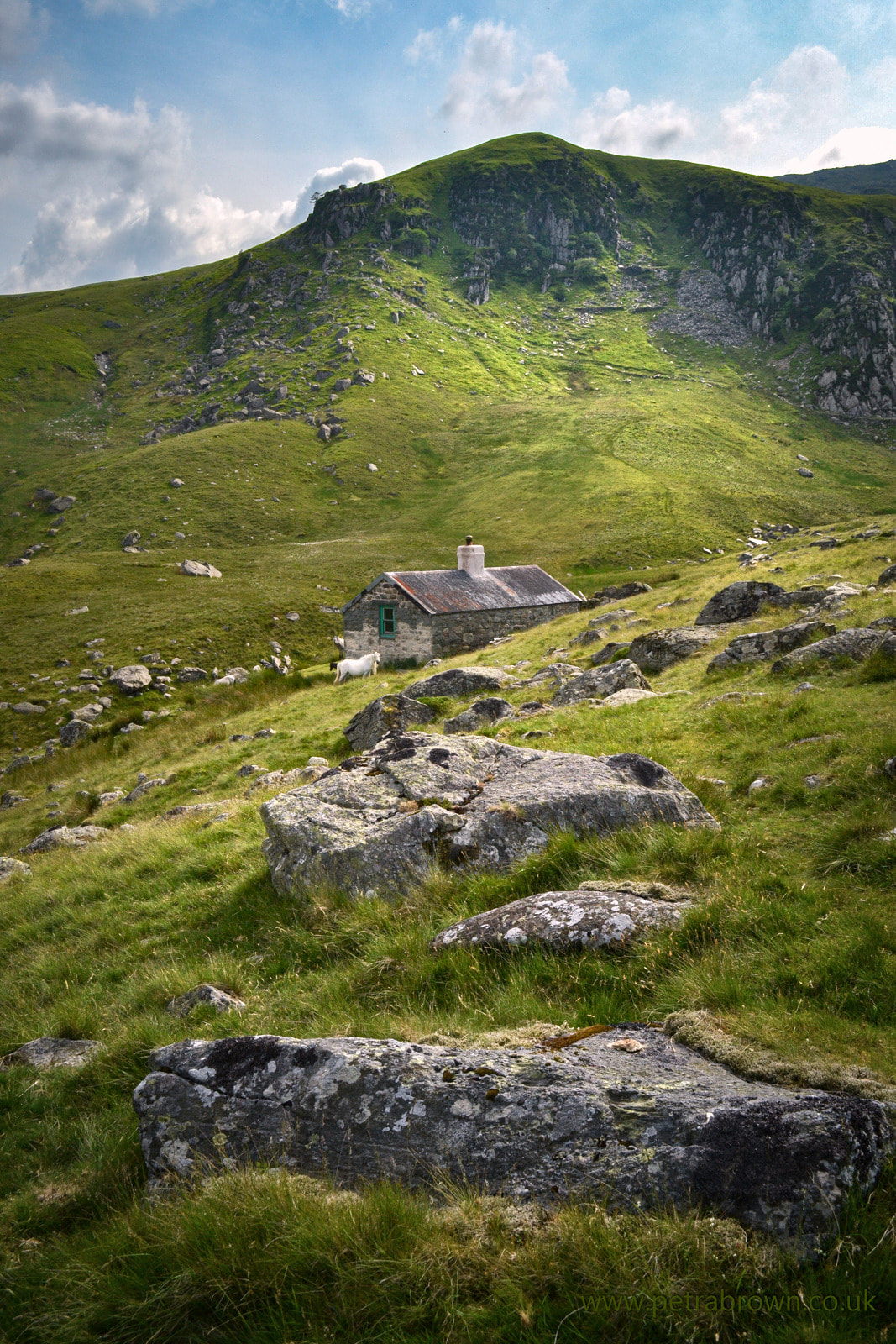
Petra's photograph of the bothy at the head of Dulyn, with the cliffs of Craig y Dulyn in the background. The trackway comes over from Melinllyn, and above that are two old levels from a slate mine.
Towards Llyn Dulyn from the Melinllyn path. Petra's photo.
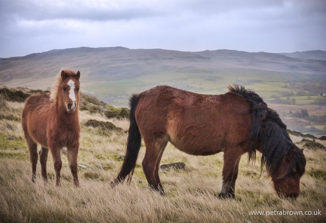
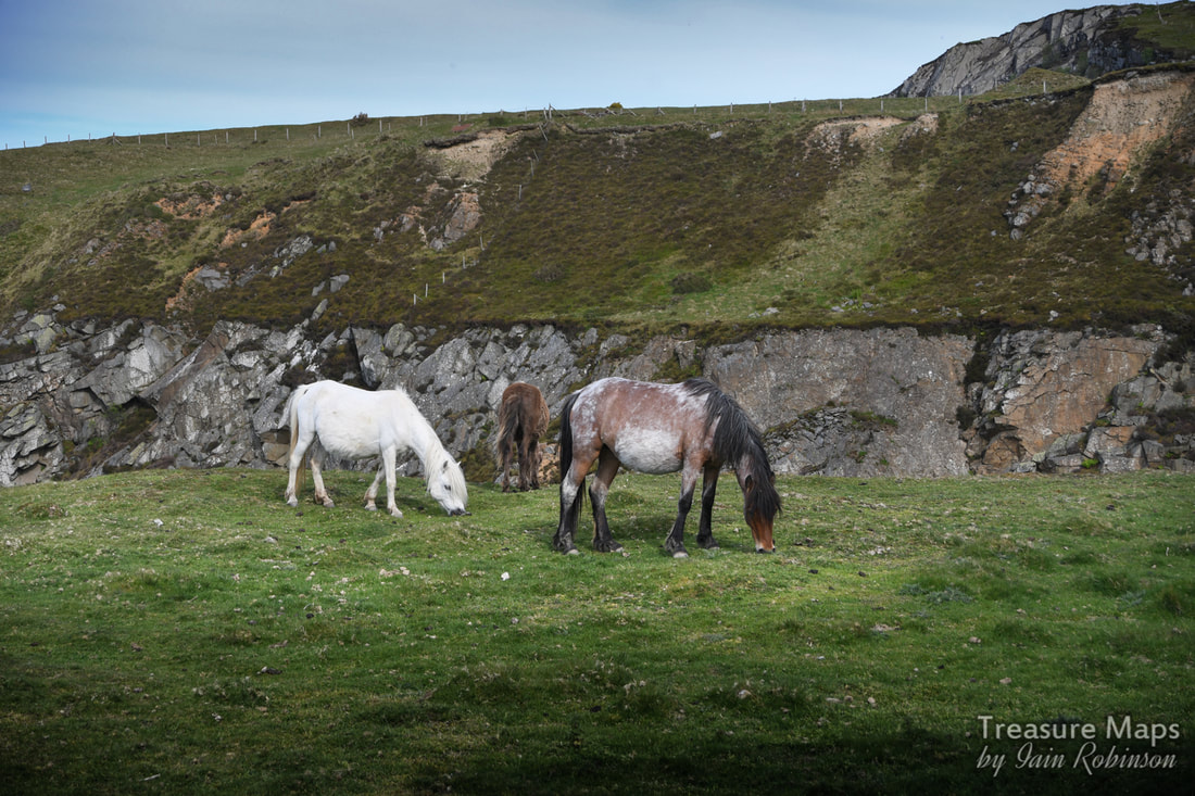
Carneddau ponies- photo by Petra.
A small film by Petra featuring the wild ponies. Keep watching at the end for bonus footage of Cwm Dulyn and the hone quarry.
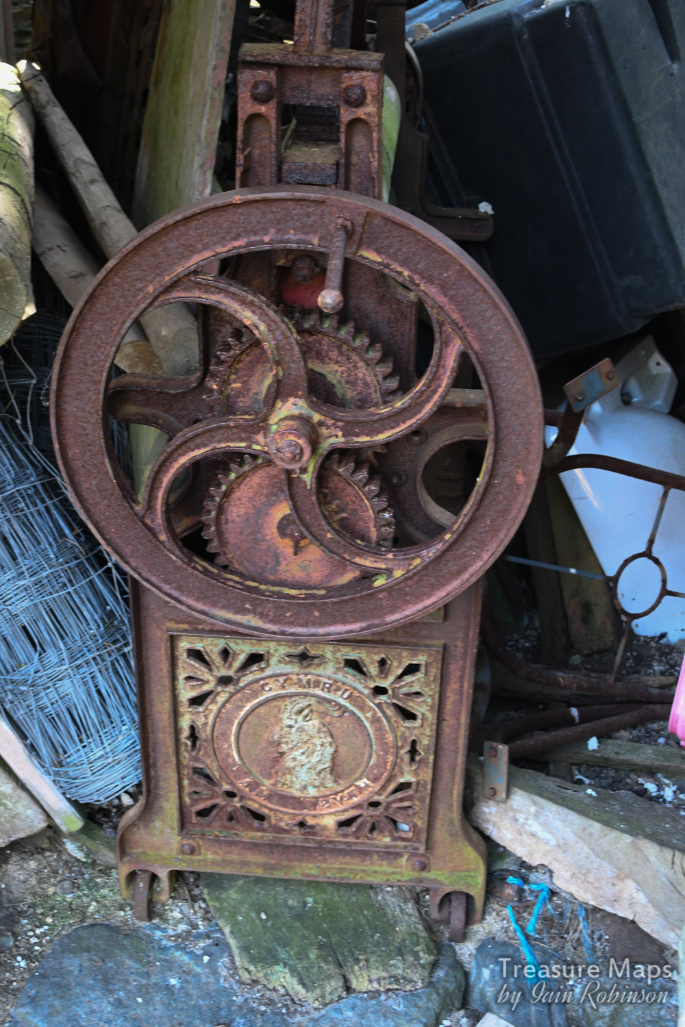
Part two of our adventures above the Aberglaslyn Pass.  The "defended enclosure" of Pen y Gaer seen from Oerddwyr Uchaf farmhouse. So, last time, we were on the hilltop at Bryn Du, having taken a wrong turn and wondering what we could do with the rest of our day. We started to wander back along the path towards the Coed Aberglaslyn. Then I had an idea that we could skirt the upper boundary of the woods and perhaps access the country that forms a plateau below Moel Ddu- the ground was dry and firm, after all- and it was open access land. And that was what we did- a bit of trackless stravaiging. It was tough, through heather and Johnny Breakleg grass, but when we got to the top of a big rocky ridge we realised that it was going to be good...we could see the fort that had been our original objective in the distance!  Our first sight of the objective, from the rocks above. Pen y Gaer is in the very middle of the shot, right of the tree in the distance. Moel Ddu is in the background. It wasn't even a particularly difficult scramble across to where Petra had seen a trackway. After a while, we stopped on a rocky knoll and had a snack. A raven was sunning him or herself while a Wheatear landed quite unafraid of us a couple of feet away. With the wonderful sunshine, it felt idyllic. I turned to the west and immediately spotted two adits in the hillside- yes, mines! We looked at the country and our time left and decided to leave those for another day. There was already a plethora of prehistoric and mediaeval stuff to investigate in this valley without yet another five mile detour. That will be my next post :-) We began to descend, looking out for the settlements and ancient cairns that are littered here, according to Coflein. What we didn't expect were the remains of old beudiau (is that the plural of "beudy", meaning field-barn in Sais?), of more clearance cairns, gorlans, burnt mounds and standing stones. We had a heck of a lot of fun identifying, photographing and debating over them. We found old boundaries that could have been pre-mediaeval, trackways, marker stones and so on. I am pleased that there was an upland study initiative in North Wales that catalogued all this stuff, allowing us ignorant folk to potter around having fun. Here are some photos of what we found. As we descended lower, towards the fort, something else emerged from behind a screen of trees- the most wonderful deserted farmhouse. It was so charming and looked like it had been used recently as an informal bothy- there was an (empty) whisky bottle in one of the windows. Outside were the remains of a pelton wheel and an old mechanical mower. I was quietly hoping to stumble over an old Fordson, (as happened to us at Bwlch y Plwym), but no such luck. The farmhouse was Oerddwr-Uchaf, ("Upper Cold Water") and the plaque on the wall told us that this was once the home of a noted Welsh poet, William Francis Hughes - Wil Oerddwr (1879-1966). He was a shepherd/poet who had spent some time working in the USA. I searched online for quite a while but couldn't find much out about Wil Oerddwr, except the rather ominous note in the Gwynedd archives to the effect that: "Beudy Brynybont ...was a cattle and hay shed and was last roofed by the bard Wil Oerddwr [William Frances Hughes] of Oerddwr [Uchaf]. Mrs. Jones mentions the storage of furniture here in her tapes (when the men were away and the villagers were herded out of their houses)." I wonder what that was about? 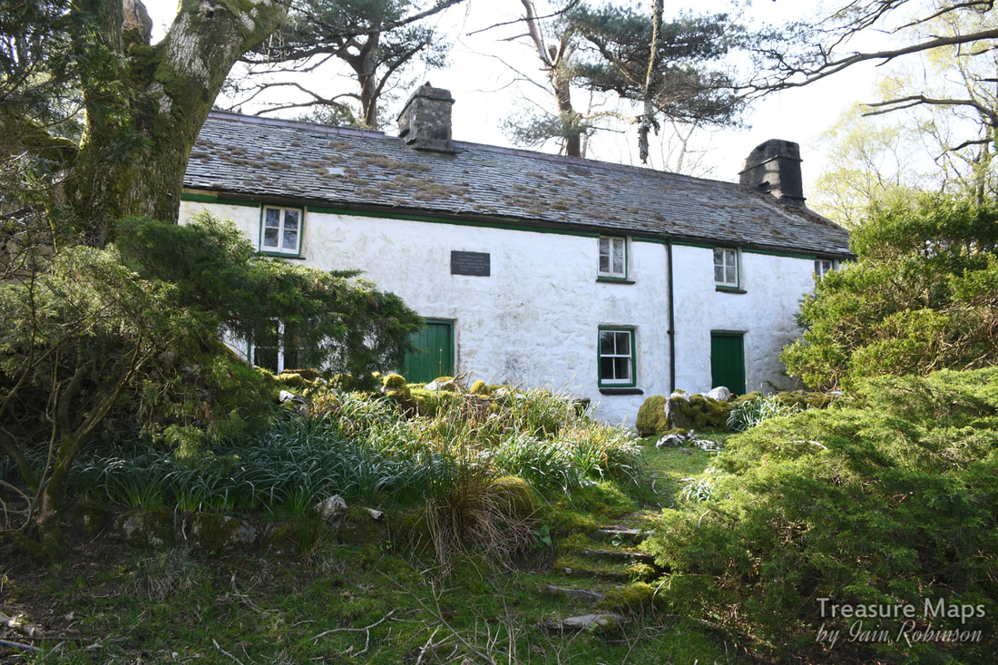 Oerddwr-Uchaf, looking very picturesque. I will update this when I have more to tell. The house had a good feeling to it, felt like somewhere I would have liked to stay for a good few years myself- but perhaps that was the weather lending everything a rose tinted ambience). Nevertheless, I felt that you would have to be made of stone not to be inspired to poetry by this exquisite landscape. Here are a couple more photos I took of the place: We made our way down to the hillfort, which Coflein describes as a "defensive enclosure". Someone, a long time ago, has robbed the walls of the fort to make a sheepfold (gorlan) but in some ways, it makes the place more impressive, if a tad less authentic. Coflein says: "Of roughly oval plan, it measures 46m east by west by 37m. It is defined by a denuded wall up to 3m thick and natural outcrops, on top of which is a post-medieval drystone wall up to 1.5m high. The interior is uneven and rocky, and no remains of huts were visible suggesting that the site was not permanently occupied. The entrance is on the east side. Integral with the post-medieval wall are two sheepfolds." One very interesting feature was the stones around the entrance which are some kind of brecciated plutonic rock. Fabulous. 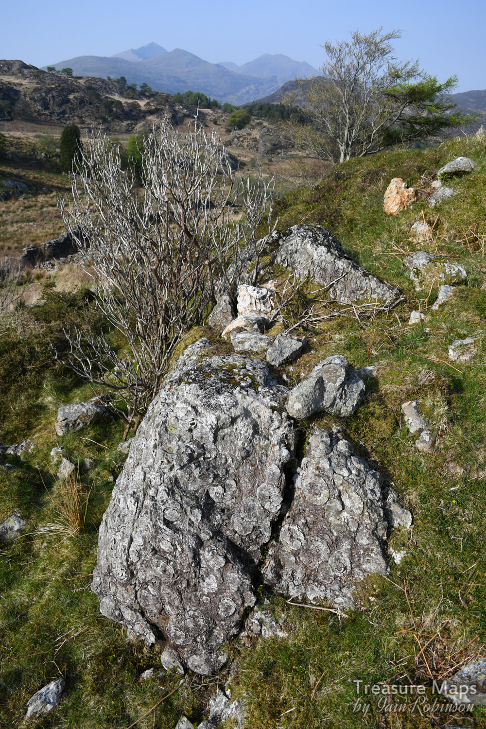 A remarkable chunk of brecciated rock at the entrance to the fort. The trouble with things like hill forts is that while they look great from a distance, they look like nothing from the inside- they are very difficult to photograph. We did study what looked very like some mediaeval house platforms in the small settlement fields beside the fort, and the ramparts were the ideal spot to scope out the surroundings. 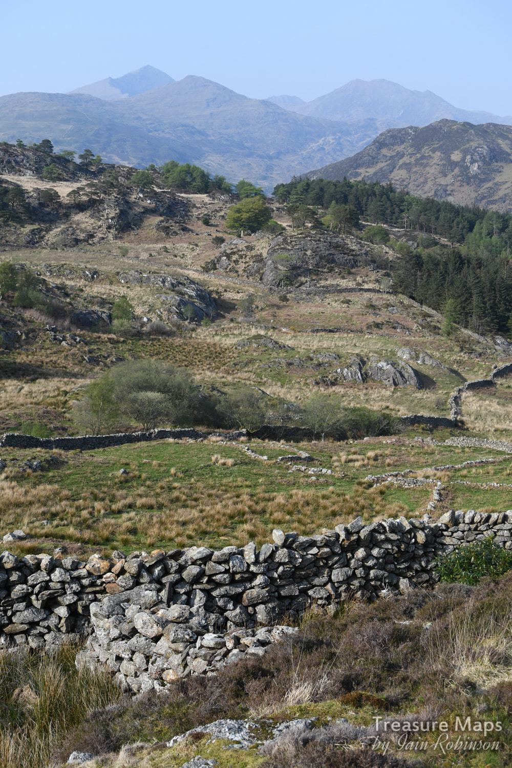 A house platform in the middle foreground centre- also what looks like it might be a chunk of the original fort walling. Snowdon makes the perfect backdrop. 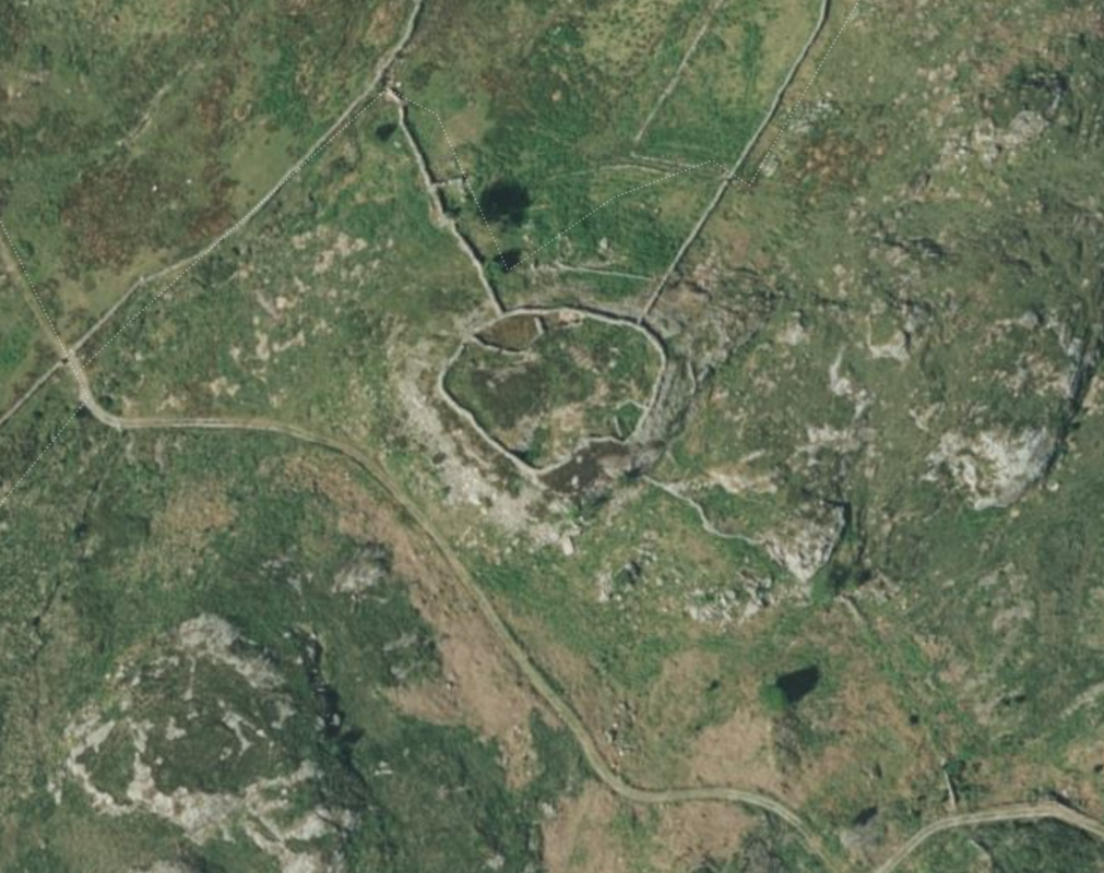 A Google Earth capture showing the fort- this gives a good idea of the layout. We reluctantly made our way down from the fort along a rough road- the road that Petra had seen on the map, leading to the farm. It was time for me to apologise for my high-handed dismissal of the route earlier, she had been right all along. We couldn't help noticing a great number of piled twigs every now and then beside the way- I suspected that they were the remains of rhododendrons, which still infest great parts of Snowdonia- those darned Victorians and their ideas. We passed another beudy, this one was the eponymous "Beudy Brynbont", now in ruins and being harassed by ruthless hordes of brambles. I imagined it full of Mrs Jones' furniture. The road became steeper, then joined a road from a very plush residence, Oerddwr Isaf, a very old house which has been restored and looks very loved. Farrow and Ball paint shades were noted. 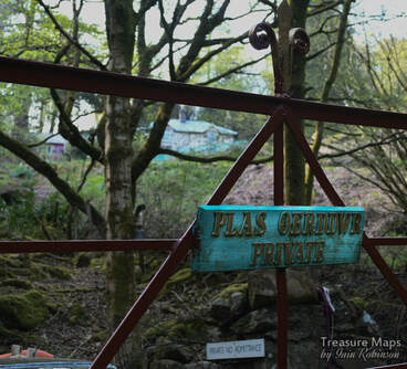 Finally, we were back on the main road which we would have to negotiate on foot, as our parking place, if you remember, had been near the bridge at Pont Aberglaslyn. The first thing of note were the remains of a slate quarry near the road- Dinas Ddu- somewhere I have often wondered about. Sadly, the mill and wheelpit have had their stone used for other things, although there is some leat work and a fine stone cutting leading to the adit. It looked too "occupied" to explore, so we didn't bother. The road walk was a trial...a dice with death. Cars came along so quickly and often an oncoming car would brake and move out to give us a foot or so, only for the car behind to nearly run into the back of them because they were following too closely and didn't react in time. Occasionally, we had to dive into the ditch as cars started to overtake at great speed, leaving us no room. I was very glad to get back to our car! Despite the near death experience of the road walk, it had been a great day. I can recommend the country below Moel Ddu for those who like a bit of reflection and study of ancient history in their landscapes. We'd been out for eight hours and had climbed and walked about three and a half miles, none of it seemed strenuous or difficult. And we'd hardly seen a soul, quite an achievement on an Easter weekend! 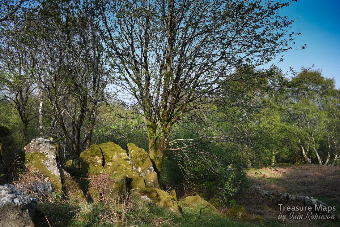 Evening light on trees below Oerddwr Isaf. What is a Burnt Mound?
These are features of roughly crescent shape, a spread of burnt stone and charcoal, surrounding and partially overlapping an oval trough. Water would have been heated in the trough using stones heated on a fire. The stones were added to the water and, after cooling, were then thrown aside, resulting in a mound of discarded, reddened, cracked stone. Whether food was cooked in the trough or, as some have imaginatively suggested, the trough was used for bathing has not yet been firmly established. Incidentally, if you are wondering why this place is also called Pen y Gaer, the name means "the Head of the Fort", so I guess it was a catch-all name for hillforts. Description and photographs of Pen y Gaer on the Modern Antiquarian A link to Petra's description of the farm on her blog, "Hinterlands" |
TracksReceive the occasional Treasure Maps Newsletter- and alerts when a new post is available!
If you enjoy my content, please buy me a coffee!
Check out my other online activity...
Index
All
|


 RSS Feed