|
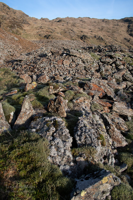
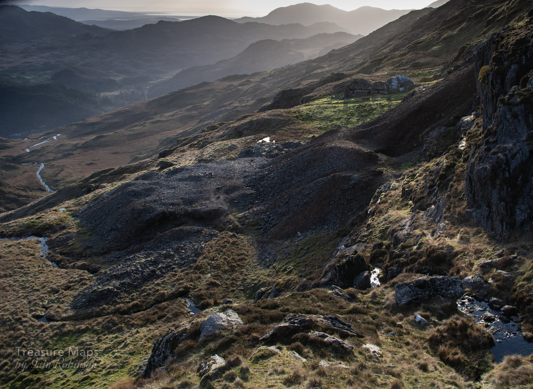
We return to the copper mine and finish off what we started. 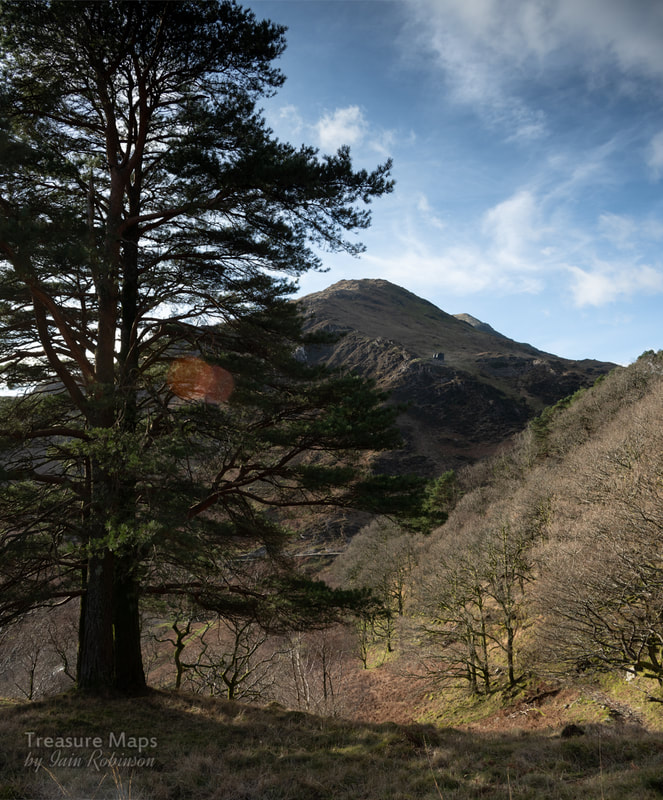 A view of the South Snowdon tramway's incline, from the old mule track up to the Lliwedd copper mine. Last time here, we ran out of time and light. So we hiked again up the thigh-sapping mule road into Cwm Merch for another look at this fascinating mine. This time, the weather was perfect and we didn't see a soul all day- peace reigned, except for the occasional buzzard, mewling high overhead. It was a case of rinse, repeat until we arrived at the Cei Mulod, (mule loading platform) where Petra had a hunch that a trackway up to the higher levels might be found. She was right; it was more a feint path, but it made a great way to access the upper working areas. We were unavoidably late setting out, so the sun was already low in the sky- but it made for some wonderful photo opportunities. The first thing we saw as we climbed up was this: 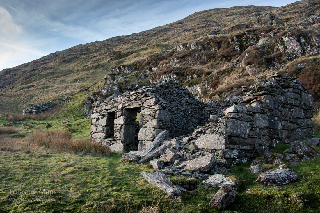 I'm assuming that this was the "office" building that Bick describes in his book. The smithy can be seen behind. It seemed a very inhospitable spot for an office, but then, the Moel Hebog mine's buildings were in a similarly uncompromising location, too. Definitely a case of "shut the door behind you"- I imagine that those mules must have brought as much coal up as copper down in winter. The smithy was a fine structure, unfortunately the hearth had collapsed in, and there must have been issues with one of the walls as a buttress had been built against the south wall. 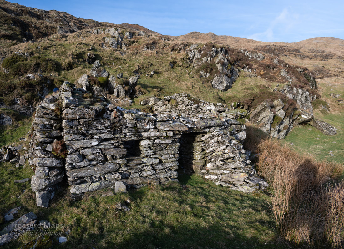 Note the double wall at the western end of the building. This was where the hearth was positioned. That's not Sasquatch on the right- just my shadow... Petra made an interesting discovery in the wall of the smithy, which we pondered about for a while. A number of holes drilled into a block, most at least six inches deep. I offered the theory that these might have been used as a sort of "Swage block" to bend hot metal. I know that it is the custom at mines to drill a hole above the hearth to commemorate comrades killed at work, but this didn't seem an auspicious location for that sort of thing- although it was at working height. 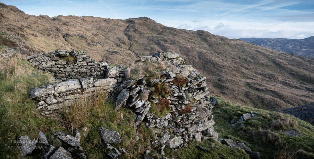 The thick west wall of the smithy, with Gallt y Wenallt in the background. We returned back to the office, where a well defined trackway went up again to another level. Here was a surprise- a reasonably well-preserved range of buildings which could only be the barracks. 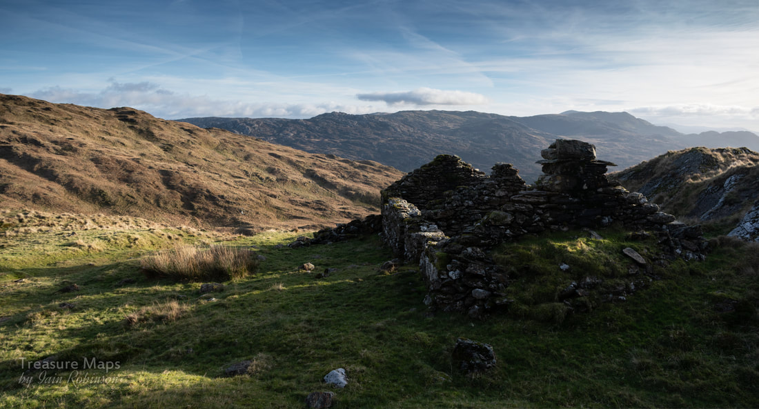 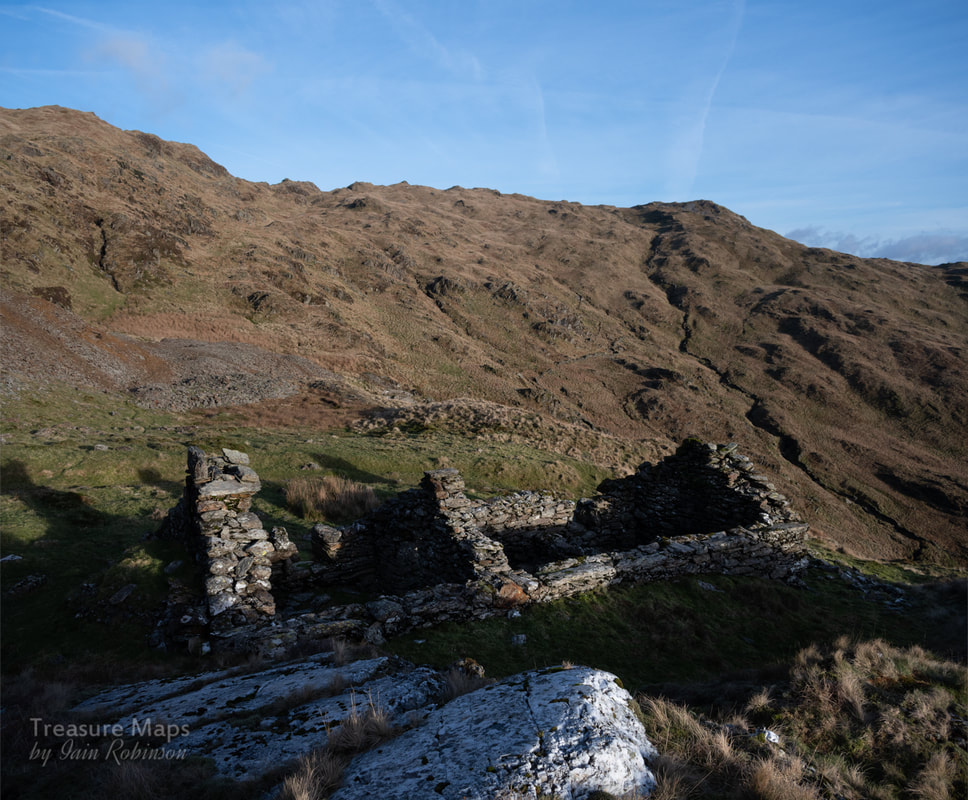 Behind the barracks can be seen the vast piles of cobbed spoil that litter the mountainside here. The barracks were nestled against a big quartz outcrop. Dividing walls inside had fallen down, but considering the location, this was in really good condition. The site here had originally been what looked like an intensive cobbing area, as spoil stretched over a wide, flat level- it had obviously been built up over decades of ore sorting. Not far to go to your work-place, anyway. There was a small stream issuing from the mountain nearby, showing where the miners got their water supply. Behind, up the mountain, gaping holes showed where ore had been stoped out.  Behind the barracks, the mountain is pocked with holes. Not a good route off the ridge in mist. We made our way across the working area and soon came to one of the biggest stopes on the site. 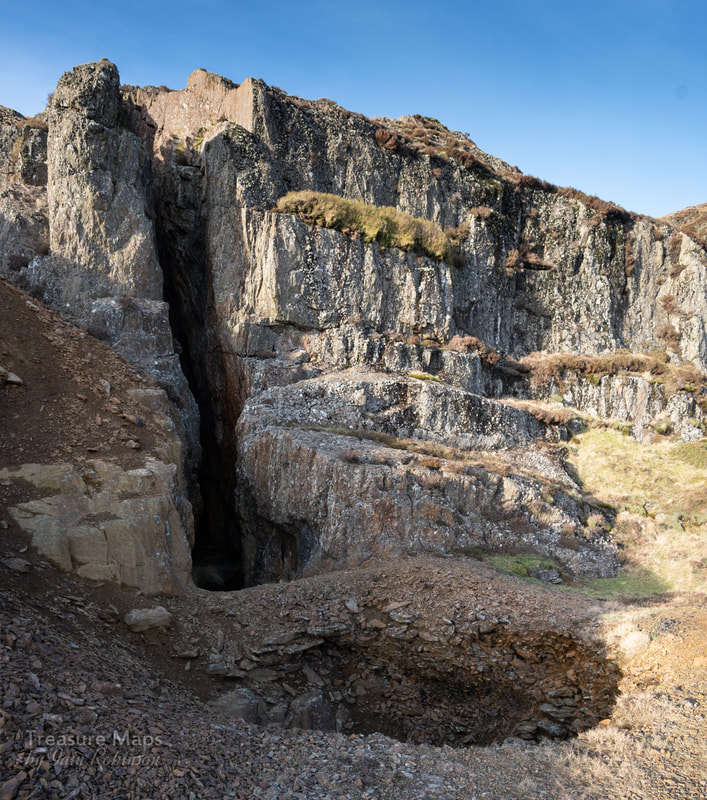 Imagine the ore that has been taken out here, then realise that it extends two hundred feet into the mountain. I suspect the rock has also been quarried here for ore. The depression in the front is actually another unfathomably deep hole. 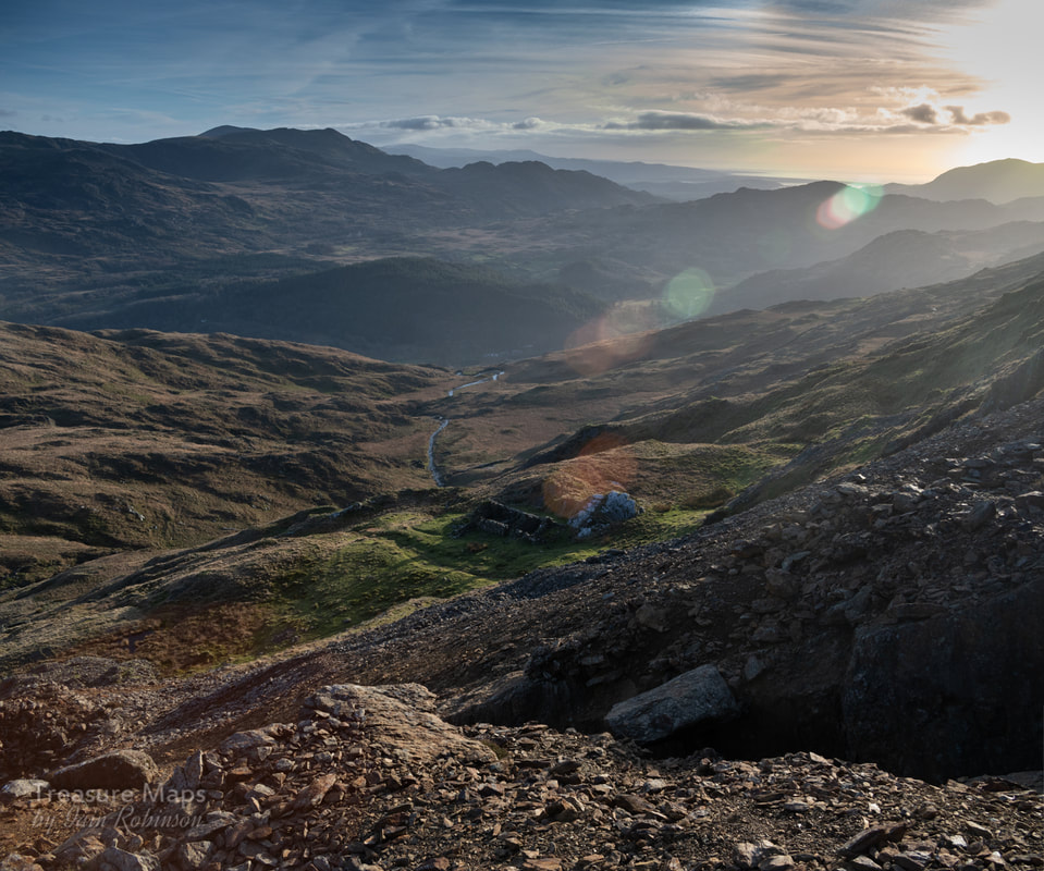 At the top of the stope, with the barracks in the middle distance. Cwm Merch runs in the centre of the picture while on the horizon the broad back of Cnicht obscures a view of the coast past Harlech. It was very tempting to stay and fossick around looking for minerals on the tips- I found a chunk of what Bick describes as "Peacock ore", an almost iridescent mineral, and many fine chunks of chalcopyrite and quartz. We carried on uphill again and found more buildings on a level that had perhaps been an early working. The structures were badly degraded, almost like walliau, surrounded by heaps of cobbed waste. The exposure here was a little bit frightening, with the proximity of those deep stopes. But the sun was getting low and I wanted us to make it back while some light prevailed, so we reluctantly retraced our steps downhill. We'd done what we'd set out to do and finished the job. 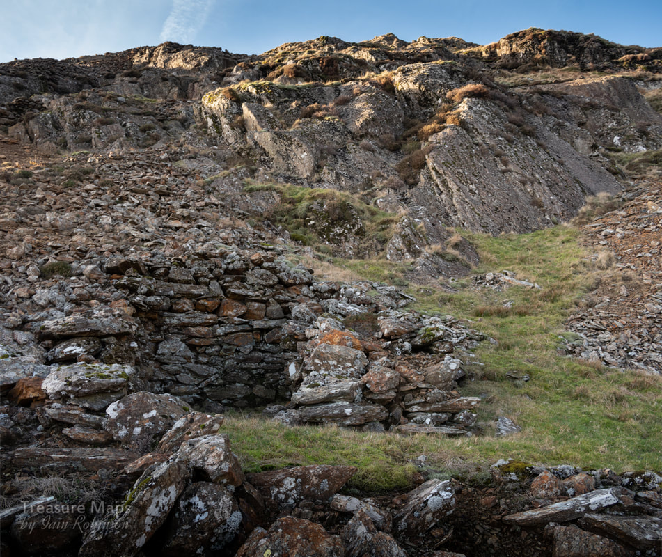 One of the ruinous structures on the top levels. The air is certainly clean here, as evinced by the lichen growth- Trentepohlia grew red on the walls along with the white Aspicilia Calcarea. 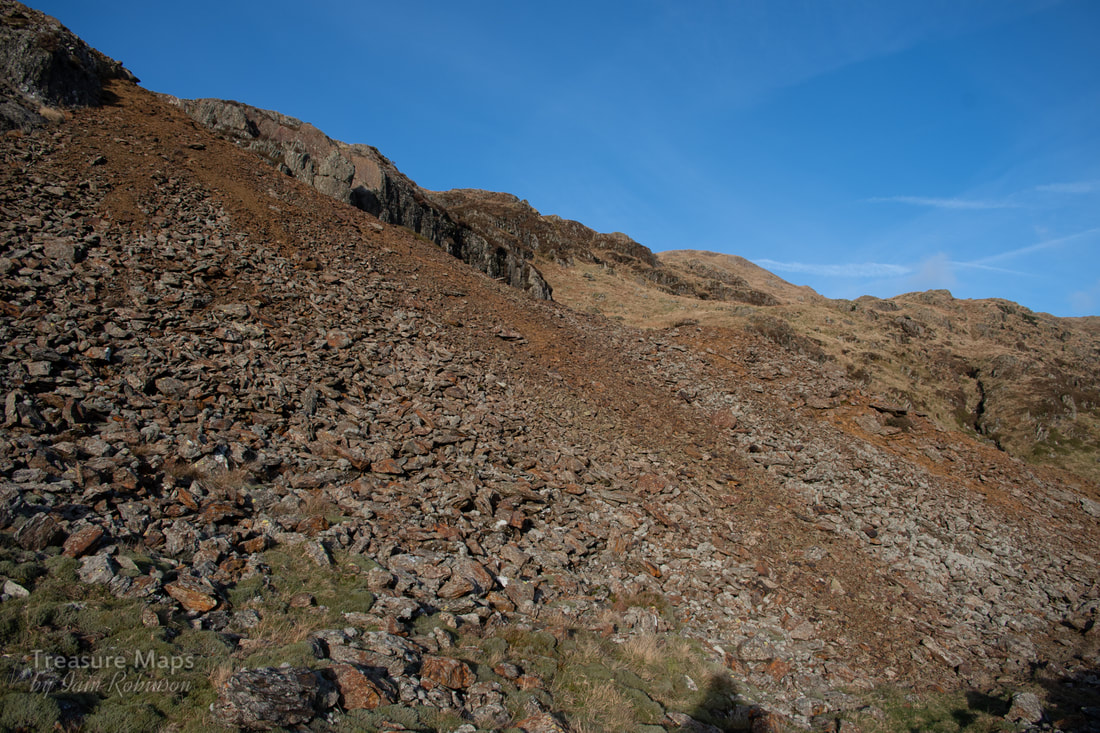 The vast quantities of waste. For a description of the lower areas of the mine, take a look at the first post in this series, here. 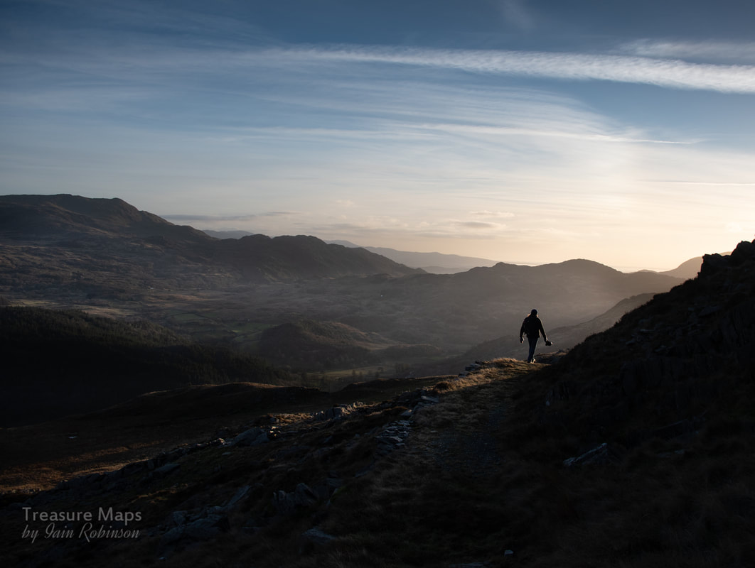 Until next time...
2 Comments
Laura
25/2/2019 01:48:29 am
Oh, I don't know, your shadow looks quite like a centaur in its home environ, more than as a sasquatch... ;)
Iain
25/2/2019 09:55:32 am
Thanks very much, Laura :-) Moss slates are very early, rough slates that were not split finely, probably just worked in an unskilled way, usually not from good slate- probably sourced on the hill somewhere. Your comment will be posted after it is approved.
Leave a Reply. |
TracksReceive the occasional Treasure Maps Newsletter- and alerts when a new post is available!
If you enjoy my content, please buy me a coffee!
Check out my other online activity...
Index
All
|

 RSS Feed