|
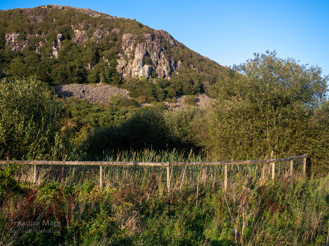
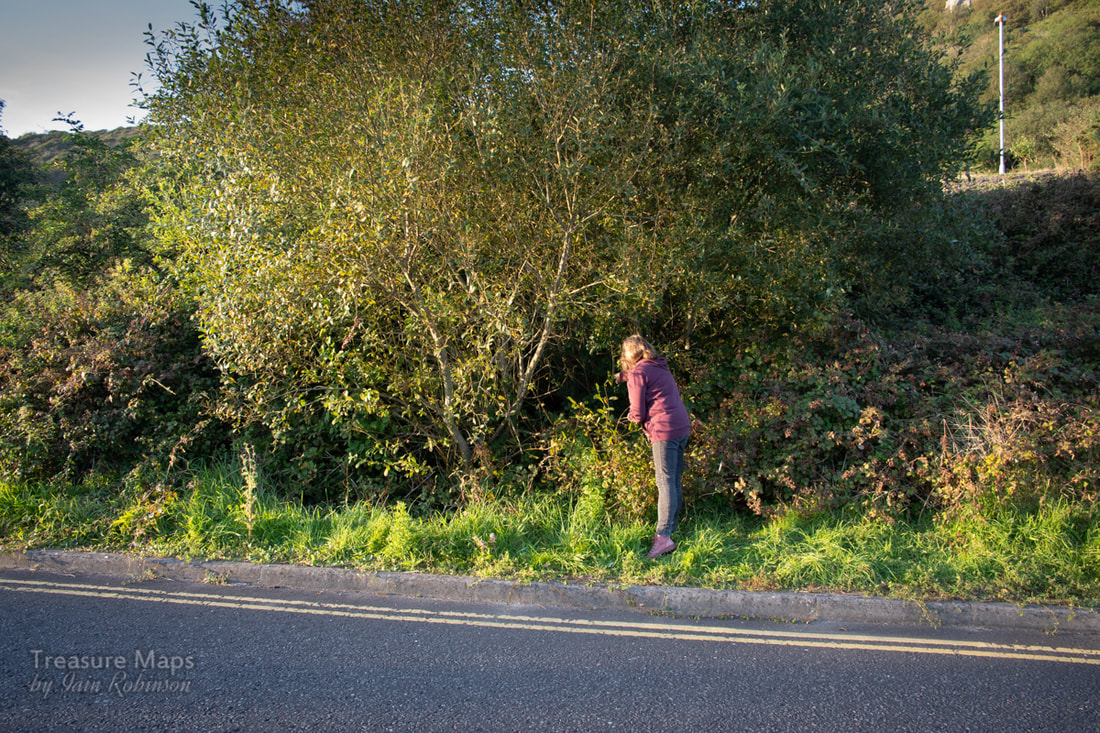
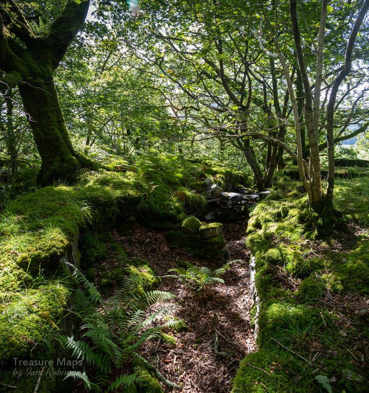
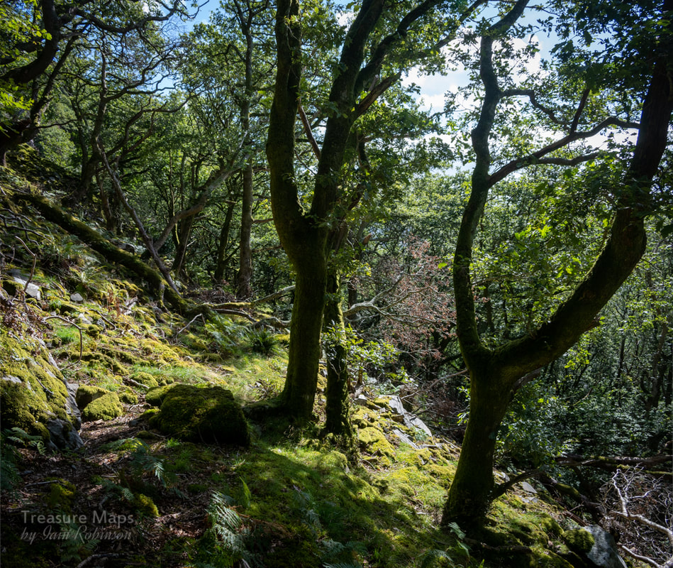
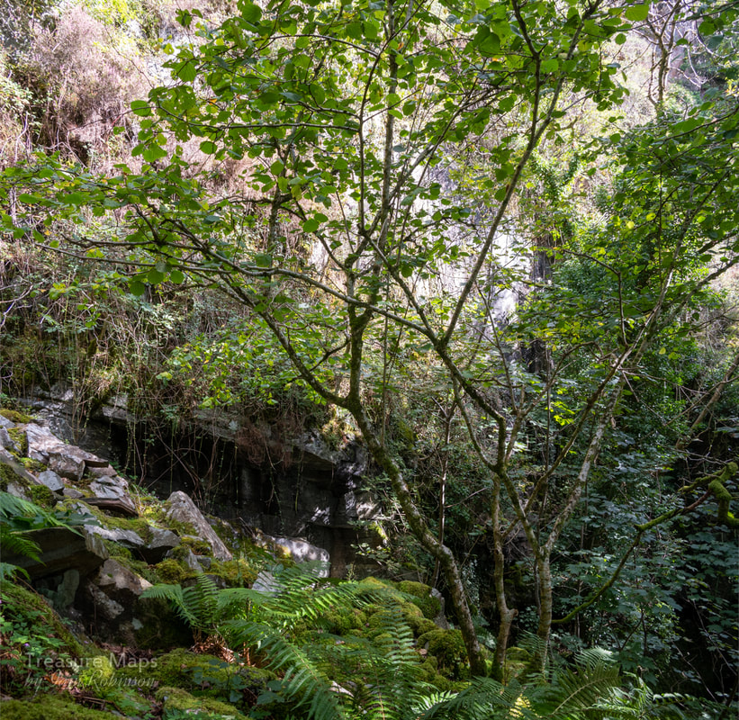
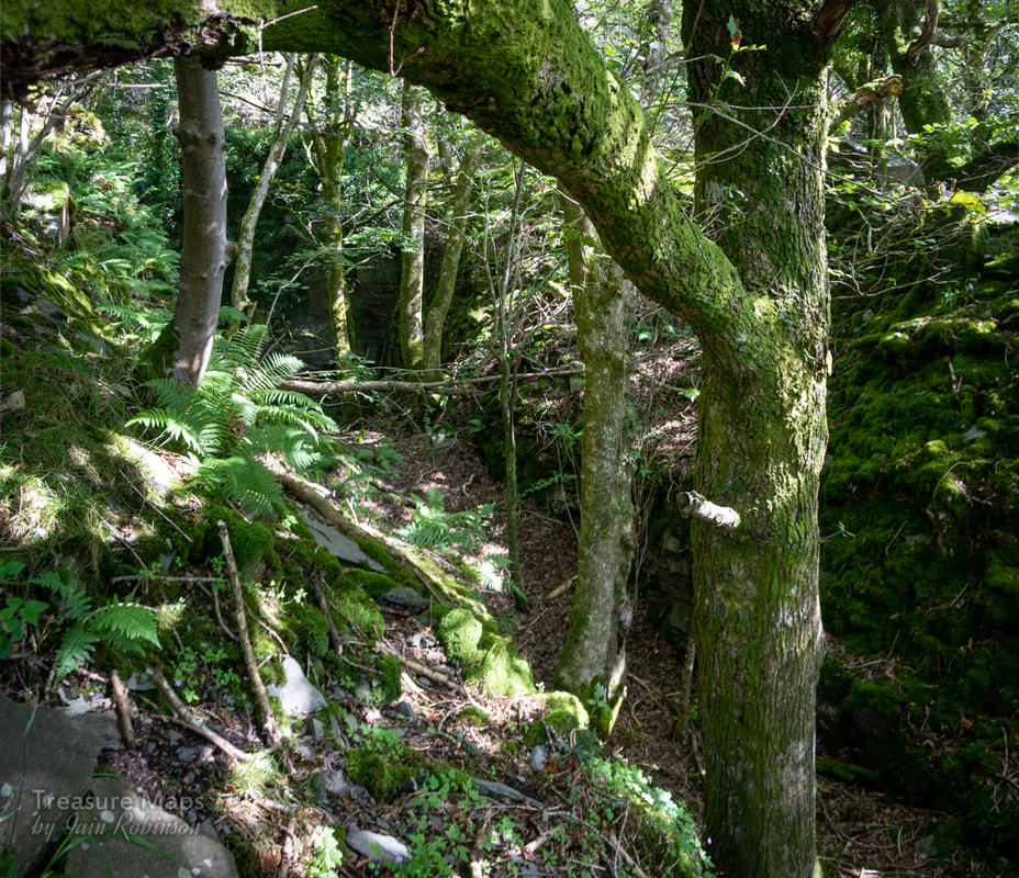
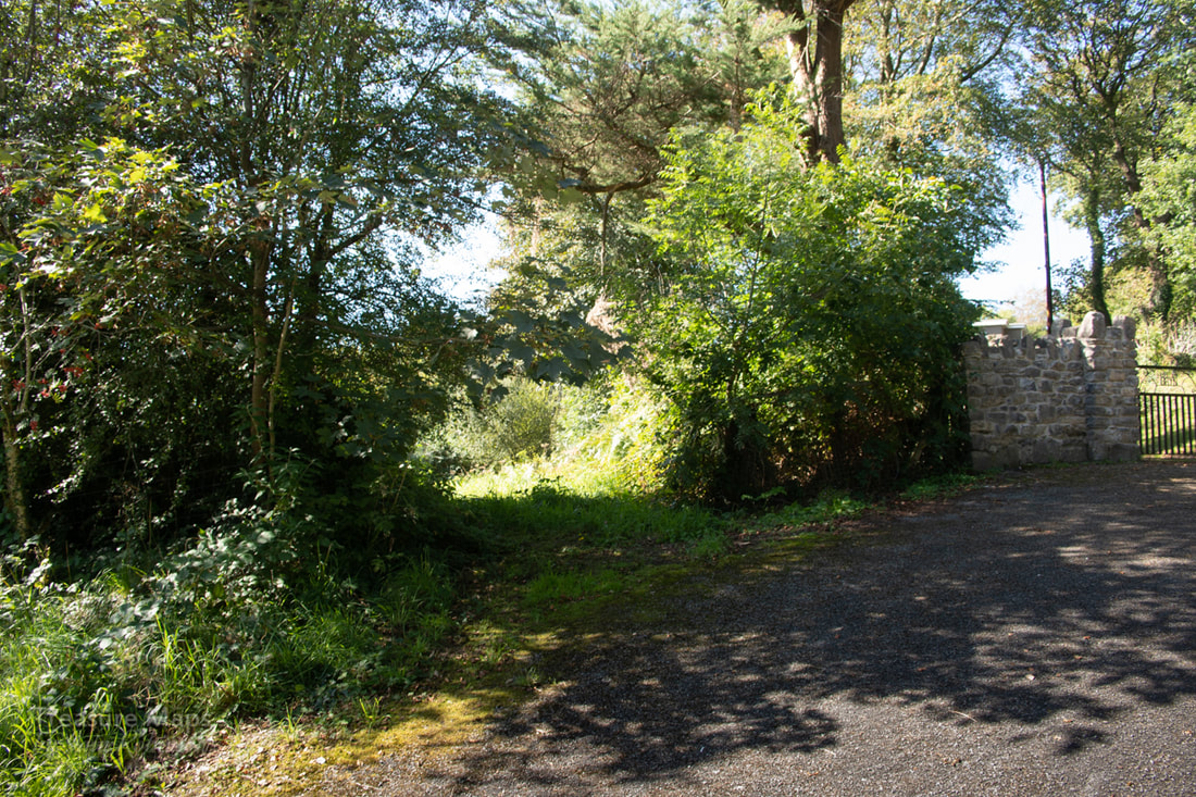
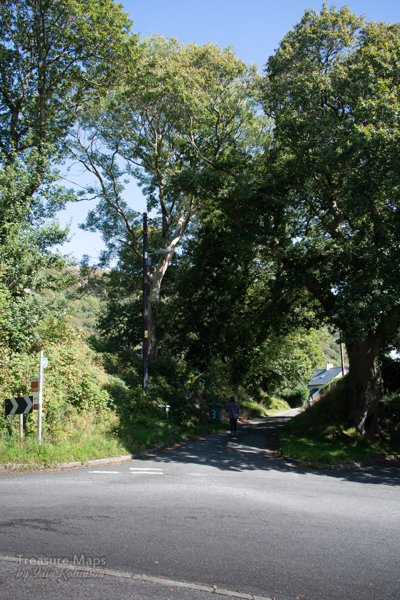
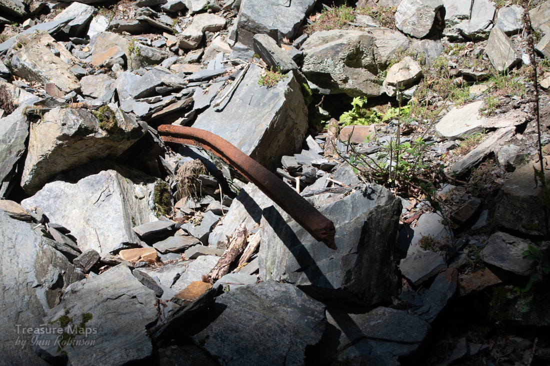
From Porthmadog to Cwm Dwyfor, high above Cwm Pennant. Part one: Allt Wen. 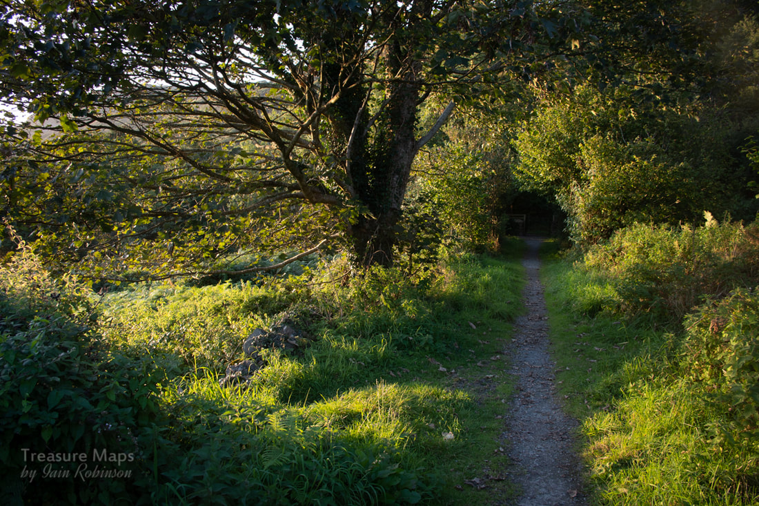 The tramway formation as it leaves Allt Wen on its way to the mountains. This is the first of a series of posts following the route of the Gorseddau tramway, in a kind of back-to-front way. I'm starting at Porthmadog, although the tramway was built looking in hope and optimism towards the sea. The short distance from Porthmadog to Allt Wen is mostly under tarmac or towpath -a few marks on the palimpsest disguised as a cycle route... but Allt Wen is where things start to become interesting. Some years ago, we visited an ailing relative at the Allt Wen hospital, underneath those impressive crags. After dispensing grapes and much sympathy we walked a little way on a lovely public footpath that beckoned from the hospital car park. I had a vague recollection that a tramway had run somewhere near, and that there had been a switchback arrangement...but all had been buried, I surmised, when the hospital was built. 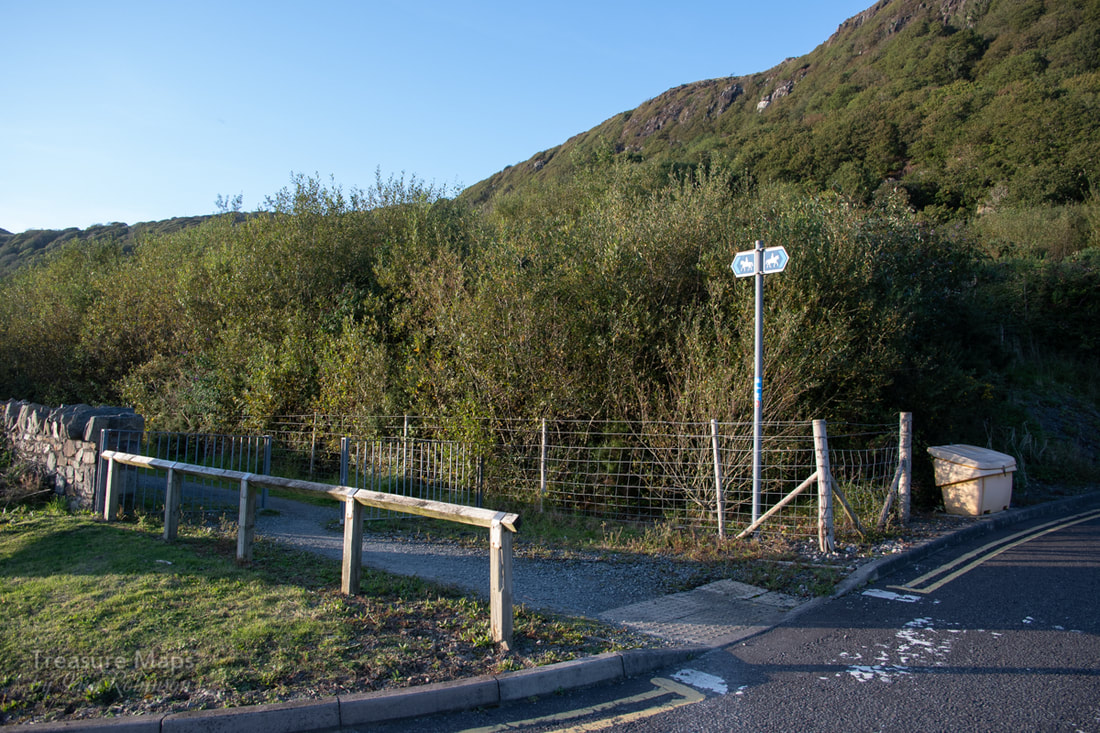 The bridlepath that runs from the Hospital on the formation of the tramway. It's also part of NCR 8, a cycle route that goes from Cardiff to Holyhead. The footpath out of the hospital is at the North West end. The rather anodyne buildings and soulless car park have covered over an area here which, a century and a half ago was once the site of an iron mine and a smelting works. This was the terminus of the Tremadoc (sic) Tramway, a three foot gauge operation built to tap the iron mine here known as the Llydiart Yspytty mine and carry the minerals thus won to the harbour. Hard to imagine today; what isn't car park is thick gorse cover. We did have a good look for remains nevertheless...the prickly bushes cover everything, but Petra did find signs of a blocked adit near the access road- and we spotted what could have been the top adit and opencast, seen as a gloomy rake between trees near the top of the car park. Before the hospital was built, an archaeological survey was made of the site- it's recommendations were that the remains were significant and should be conserved. Perhaps, in a way, that's what the gorse and cotoneaster is doing. Parting the overgrown branches of history reveals that the mine here may have been worked from 1754, and was certainly being exploited by 1770: the Porthmadog harbour dues confirm that 3,30I tons of ironstone were shipped out between March 1839 and December 1840. 'Smelting furnaces' were built, probably in 1845, near the principal adit. In 1848- 1850, between 10,000 and 15,000 tons were shipped, suggesting that the underground workings were extensive. The last mention of the mine in the Mining Journal was in 1851, when it is assumed to have closed down. The tramway, unsurprisingly perhaps, was one of the many projects of a certain energetic gentleman, William Alexander Maddocks- and as far as records show, it was horse worked. It might have begun as an extension of the cob construction tramway. It isn't known whether Maddocks had a finger in the Ironstone pie, but I wouldn't be surprised. 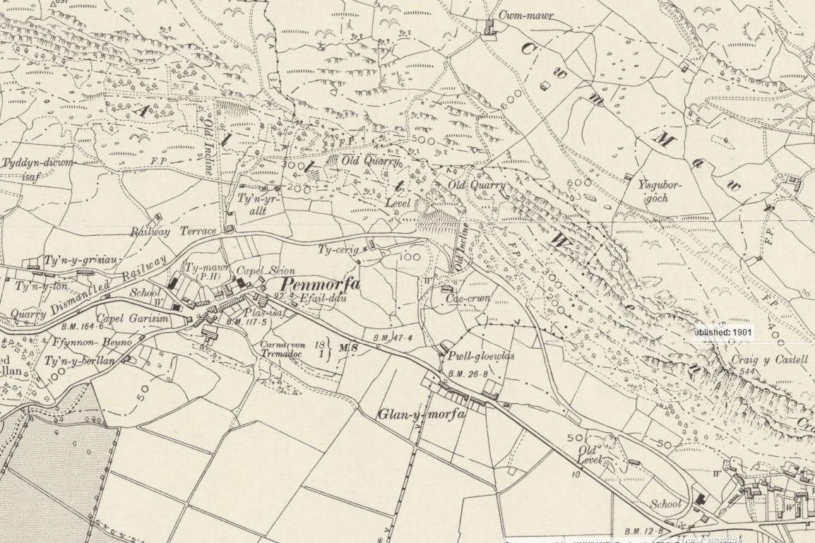 Reproduced with the permission of the National Library of Scotland In the map above, the modern hospital is at the bottom right. The Ironstone mine is marked "Old Level". 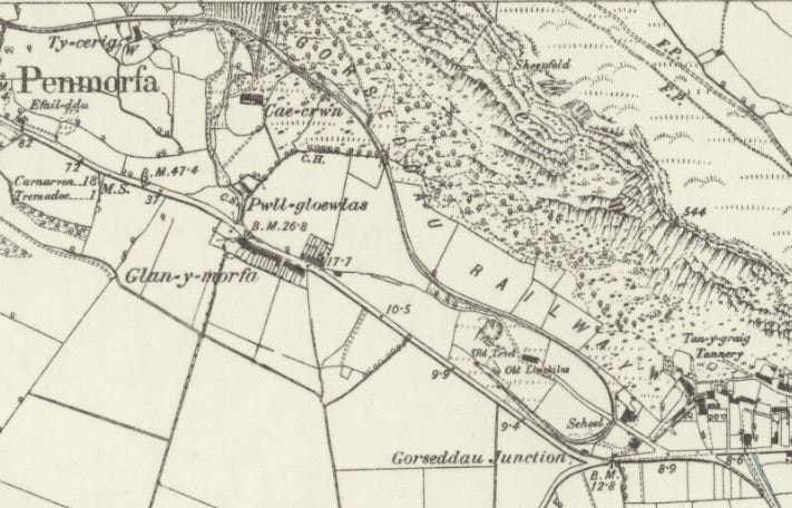 Reproduced with the permission of the National Library of Scotland On this 1887 map, the tramway is clearly marked. It makes a switchback to gain height underneath where the hospital is sited today. It's marked "Gorseddau Junction" because by now, after the ironstone mine closed, the owners of a quarry below the crags (Penmorfa, perhaps, or Ty Cerrig) extended the Tremadoc tramway to serve these concerns. This would be in 1856. The quarry owners were the Bangor and Portmadoc slate and slab company, who were later to open the rather more infamous Gorseddau Quarry. It was engineered by Sir James Brunlees and as can be seen on the ground, was a well-built and safely engineered route. The area around the smelter and mine was retained as a kind of depot for the dropping off of slate and slab destined for more local users. Inclines Certainly, looking at the early maps, the inclines from the Penmorfa quarry and Ty Cerrig bisect the route of the tramway. Yet at the same time, there are obvious loading banks at the side of the tramway and a possible formation beside the much degraded remains of the incline. It is unclear whether the switchback arrangement on the present site of the hospital was constructed at this time, but it seems logical to draw that conclusion. The tramway had gone through several iterations and changes of layout around the iron mine during it's life, but when linked to the slate quarries it would have needed to gain height quickly and economically. There was also an incline within the area of the ironstone mine, from the opencast. 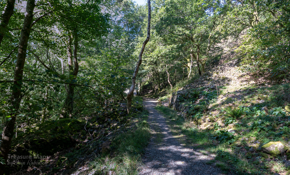 The Penmorfa incline goes from bottom left to top right...I told you the signs were feint! 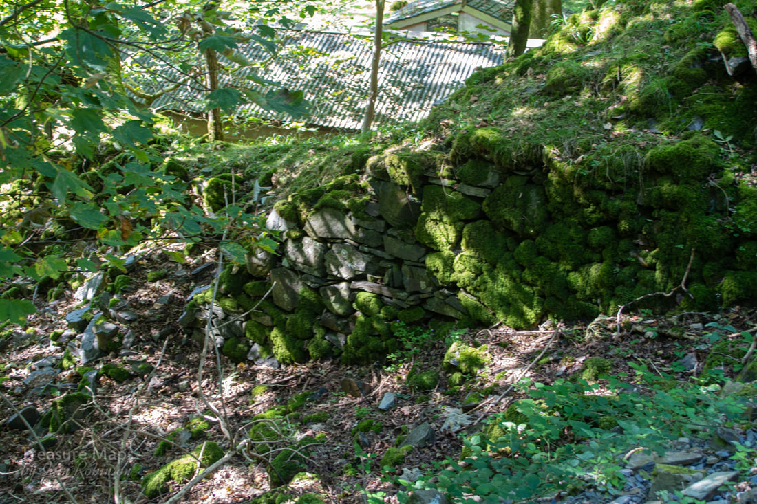 The lower end of the Penmorfa incline, showing the stonework. So that's the historical context, but what of the scene today? The tramway ambles along through woodland, making a delightful walk. For those with a weakness for mines, the signs are there, albeit subtly. There are vestiges of loading banks, inclines and tips shining through the trees. The last time we walked along the trackbed, the temptation became too much for Petra and she was off up the slate tip...it took me a while to catch up, by which time she had found an opencut at the end of a tip run. It didn't look too much like a slate mine, the spoil was more like chunks of igneous material mixed up with shaley blocks. The opencut was blocked by a big fall of soil, but clambering up it, we found an opening. I hadn't expected that! 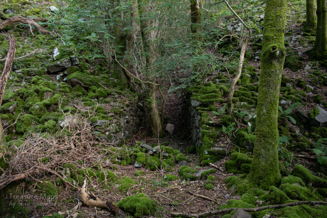 The opencut, discouraging at first. That's quite a big fall of soil blocking the entrance! 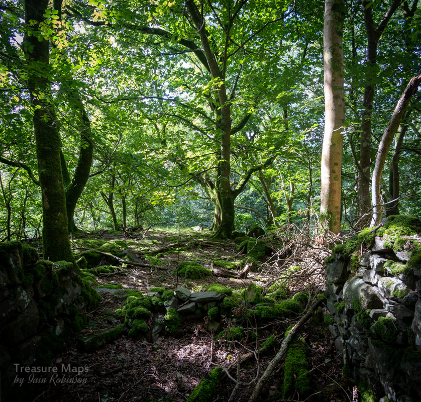 As I looked back before climbing the hill of spoil, the sun came out. 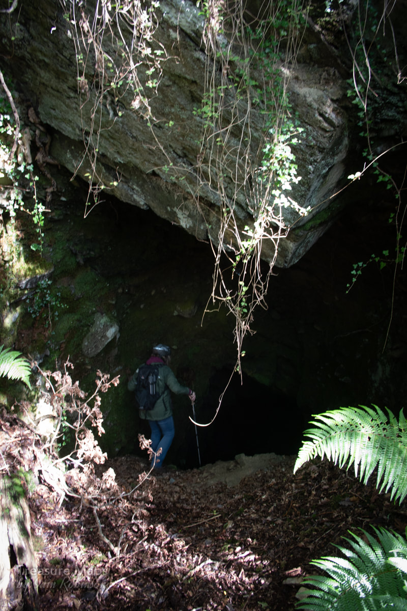 Petra makes her way down the steep slope into the mine. 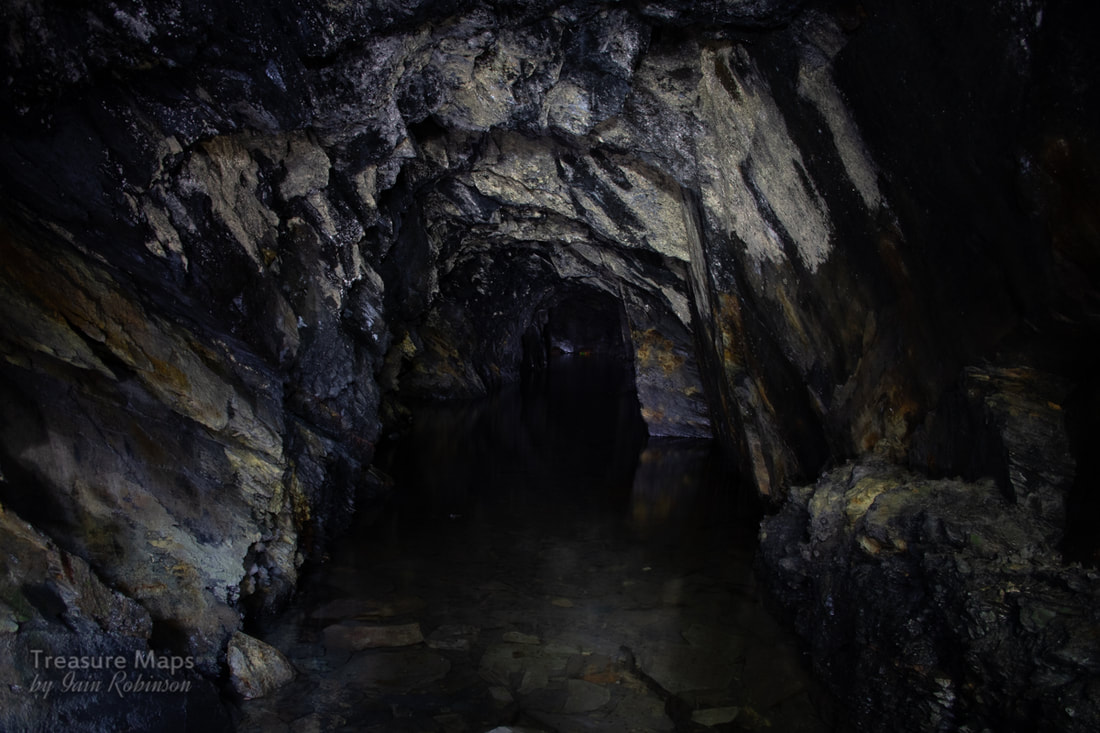 Inside the adit, clearly a trial but nice, very nice. The rock becomes very shaley at the footwall and I suppose they decided there was nothing to be gained by digging further. 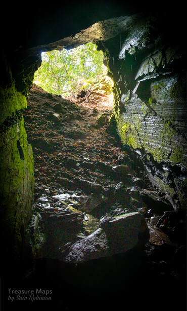 The way back out, up a small mountain of earth. Of course, the adit was wet inside and not very long, but a lovely find. Judging by the spoil, it was a trial...inside, the join between slate and gangue is all too obvious; the rock is not encouraging. It was a magical place, though. There were tips above and what looked like further workings, so we clambered up the very steep slopes to see. I was hoping to find signs of the drumhouse for the incline that crosses the road down below. We found excavations and a deep quarry, a working face had been hacked away to a depth of almost 80 feet in places. There were remains of a tramway, as the old OS maps suggest. An early adit had been topped out into an opencut and a shelter built within it. The place was overgrown and felt a little like a lost world...we explored on a beautiful day in late August, with the leaves giving a green shade to the rocks. It would feel different in winter, but the remains would be more visible. We carried on along the level and eventually came to the top of the incline, which needed the eye of faith to see. It really had been degraded by mother nature and there was certainly no sign of a drumhouse, which was strange. Petra made the suggestion that perhaps a horizontal sheave was used, Denbigh style, although there were few signs. 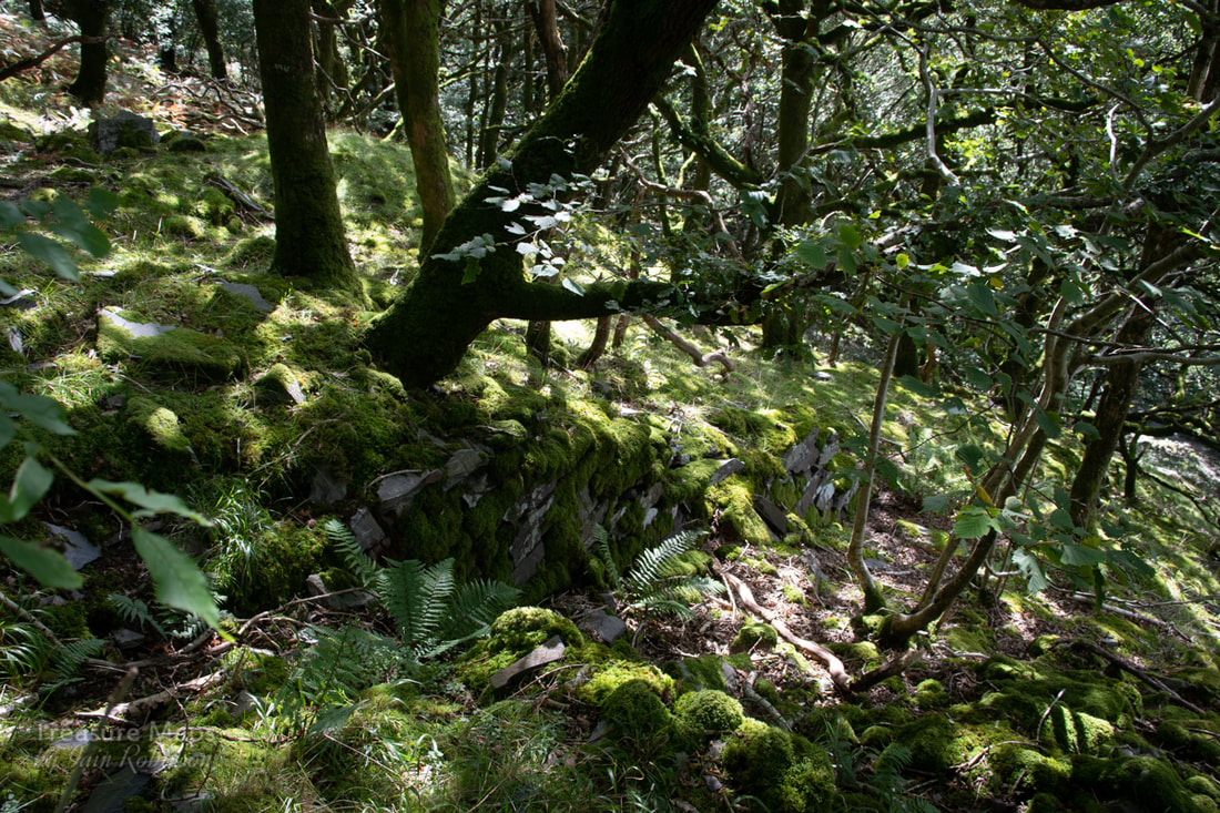 The top of the incline- no drumhouse, sadly. All that remains are a few coursed stones and the vestiges of the incline bed. We walked a little further and came to another, even more degraded pit , where the suggestion of a tramway ended. We didn't fancy walking back down the way we came, but luckily a footpath wound down a little to the north east. I realised that this was the path to the top of the ridge, something we'd done about ten years ago in summer and had nearly disappeared in bracken. It's worth doing, as the view from the top is wonderful and there are some mysterious stone pillars to wonder at while you get your breath back. We must do that again this winter perhaps. 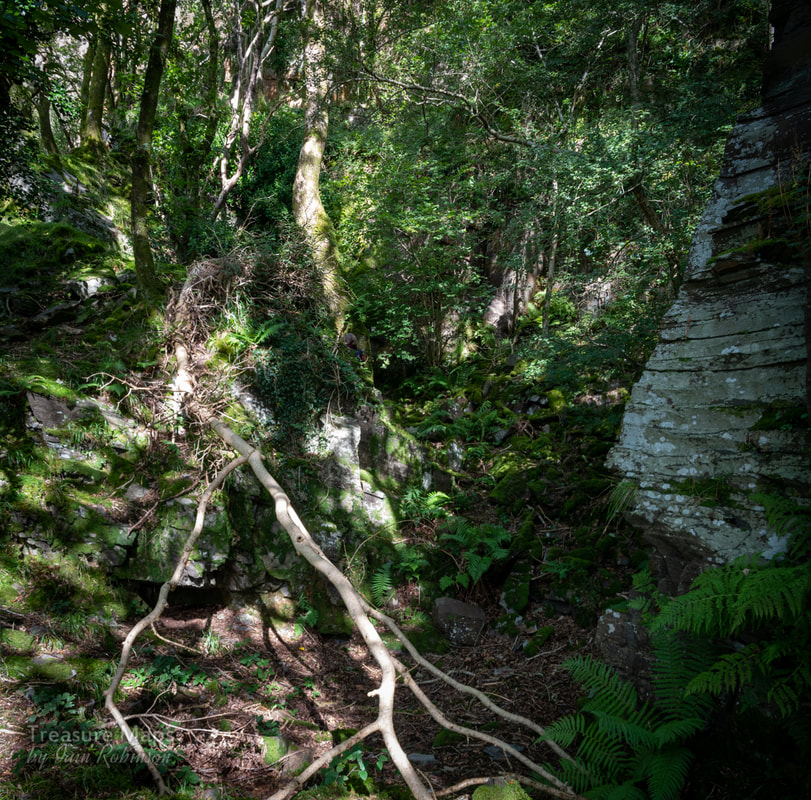 The entrance to a large pit at the top of the incline. Nature has all but obscured the evidence that could have shown there was a quarry here. It's magical, though. Once back down on the tramway, we continued north west towards Penmorfa. There's a lovely open stretch with views across the traeth towards the Arenigs. I took two photos and merged them, but otherwise this was straight out of the camera... 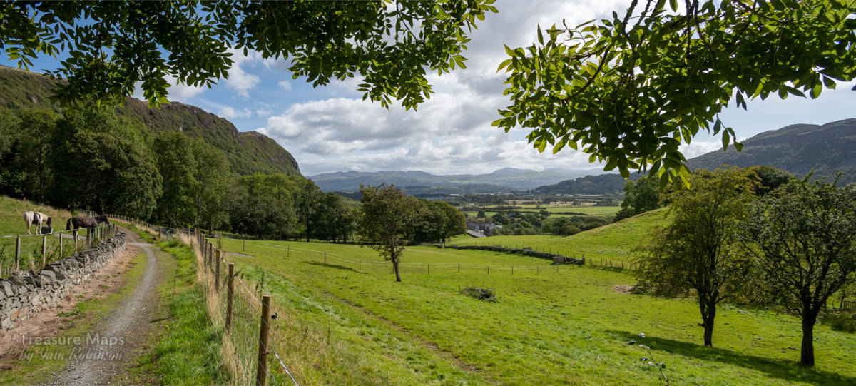 Looking back towards Port with the tramway on the left. 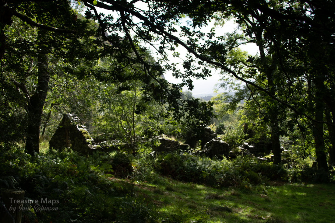 We passed this lovely ruin beside the incline- it might have had something to do with the quarry and later passed into agricultural use? We walked on, enjoying the sunshine until we came to a couple of houses in a terrace. Until recently, there was a sign here that said "Railway Terrace" and indeed, it is so marked on the 1887 map. But I guess that name isn't beguiling enough when you are trying to market a holiday let...although it would sell it to me! There are still some railway themed pottery ornaments on the wall, a crude but amusing depiction of a 14xx tank, some genuine rail and a tram waggon wheel. 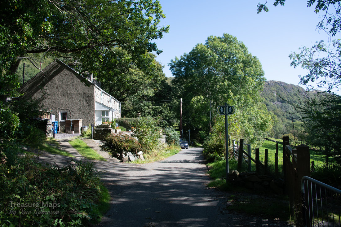 Railway Terrace. The incline from the Penmorfa slate quarry came down here from the left where the footpath sign is. You can walk up quite a way although there are few signs that you are on an incline- father time has foxed the edges of history again. It's a steep but fabulous walk to the top from here as well. The tramway then winds its way above Penmorfa, coming onto the road for a short while before crossing it. This is as far as you can walk here, as the rest is on private land, but there are things to see... 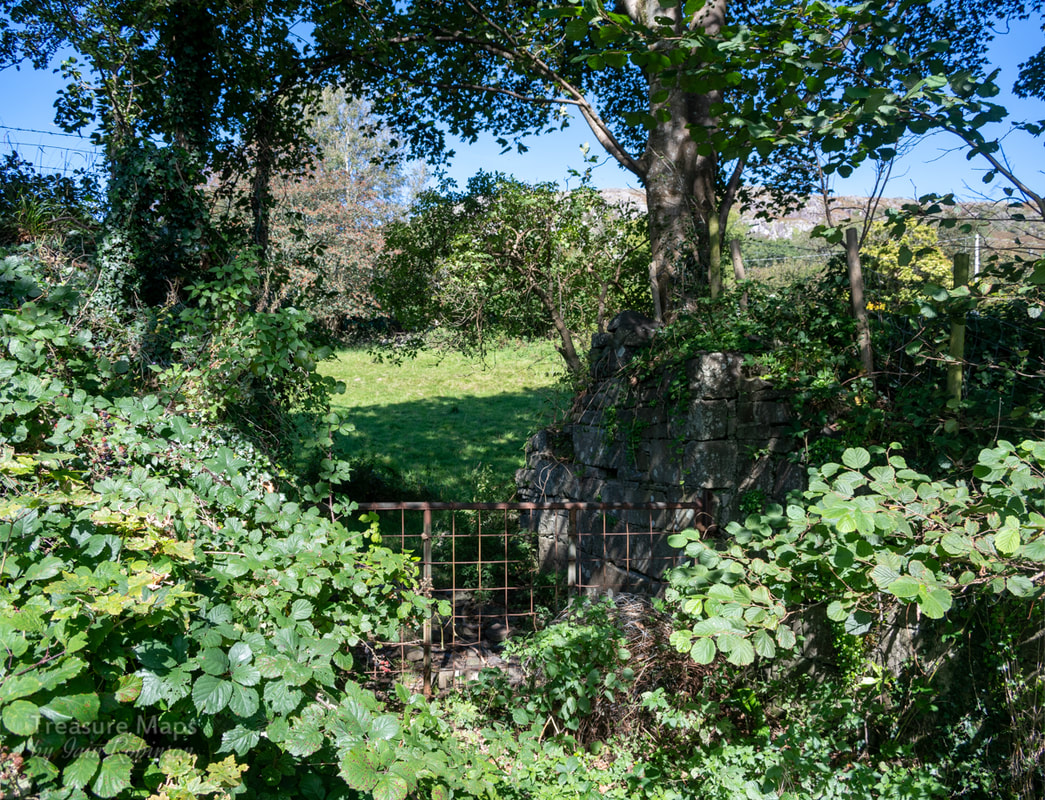 An old tramway bridge as it runs closely beside the A487 before disappearing under modern road improvements for a while. Well, that's the end of our first instalment of the Gorseddau tramway, but there's more to come soon. If you want to walk this short stretch, it is possible to park in the hospital car park (just don't tell them I said so) or in the layby at the other end near Penmorfa- SH 54582 40632 To whet your appetite, before my next posts- here's a map someone has done on Bing maps of the whole route. The Allt Wen area isn't just all about the tramway- bricks and human remains were discovered nearby in 1810 and thought to be of roman origin; later, workmen building a drain in 1876 found further remains. By 1908, excavations revealed a bath-house; pottery indicated occupation from the second century AD to the fourth (Breeze and Anwyl l909) The Gorseddau Junction Railway's only locomotive, "Pert" languished for a while in a shed on the iron mine site, the building is shown on the 1887 Ordnance map. Not much is known about the locomotive except that it was little-used and was a product of DeWinton's of Caernarfon. It worked during the last phase of the tramway, when its fate was connected to the spectacularly futile copper mine developments at the head of Cwm Pennant. Comments are closed.
|
TracksReceive the occasional Treasure Maps Newsletter- and alerts when a new post is available!
If you enjoy my content, please buy me a coffee!
Check out my other online activity...
Index
All
|
 RSS Feed