|
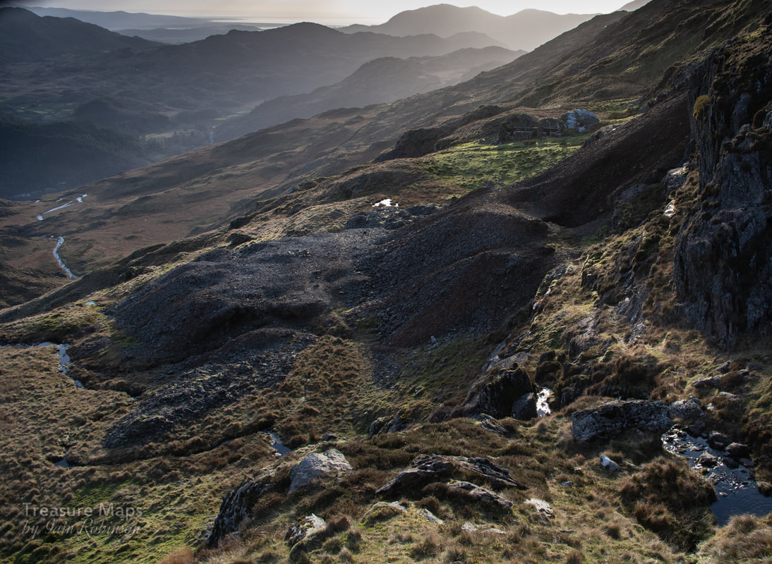
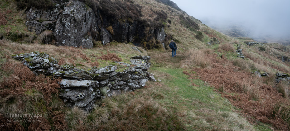
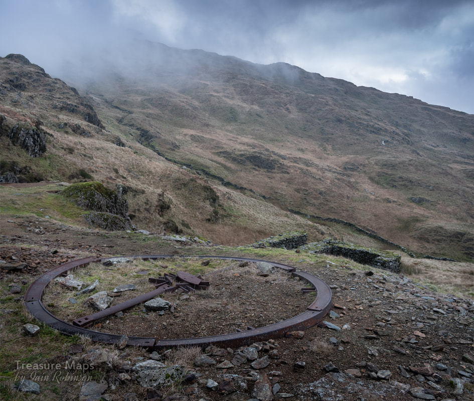
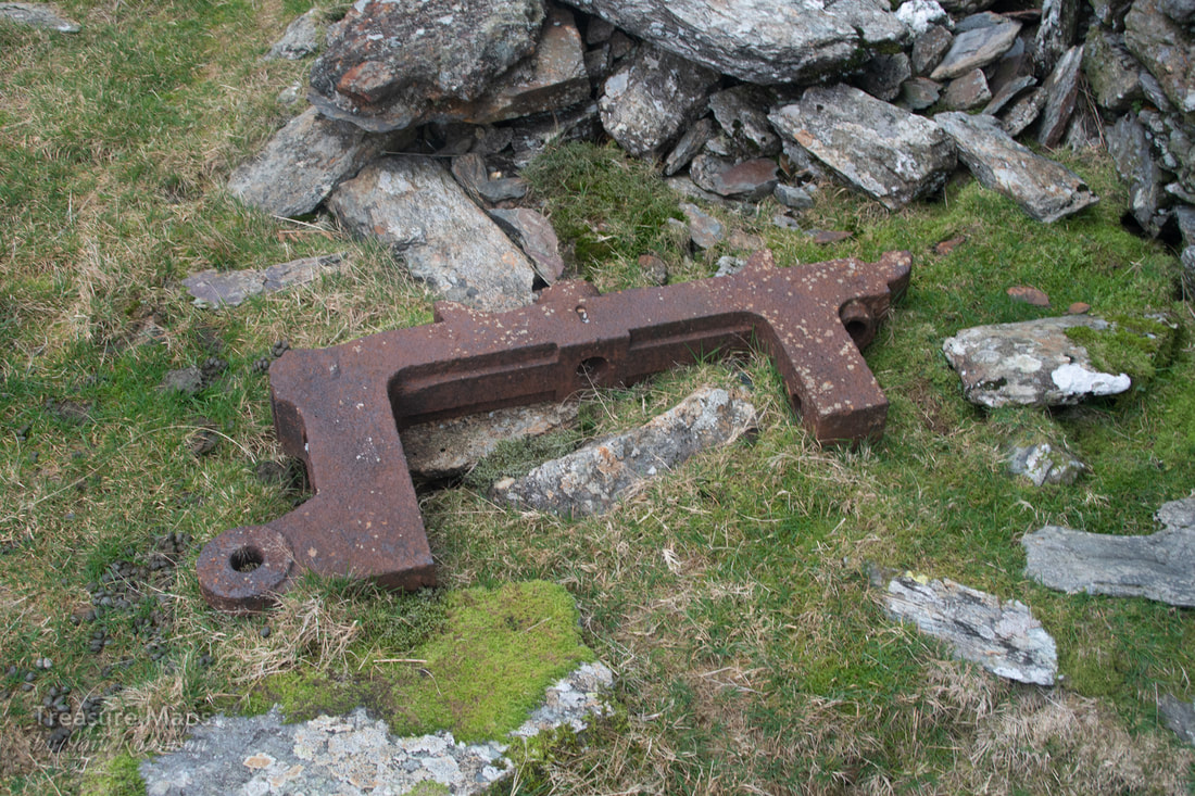
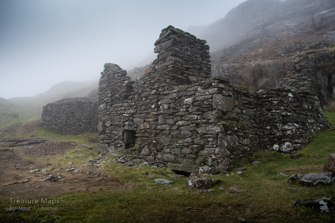
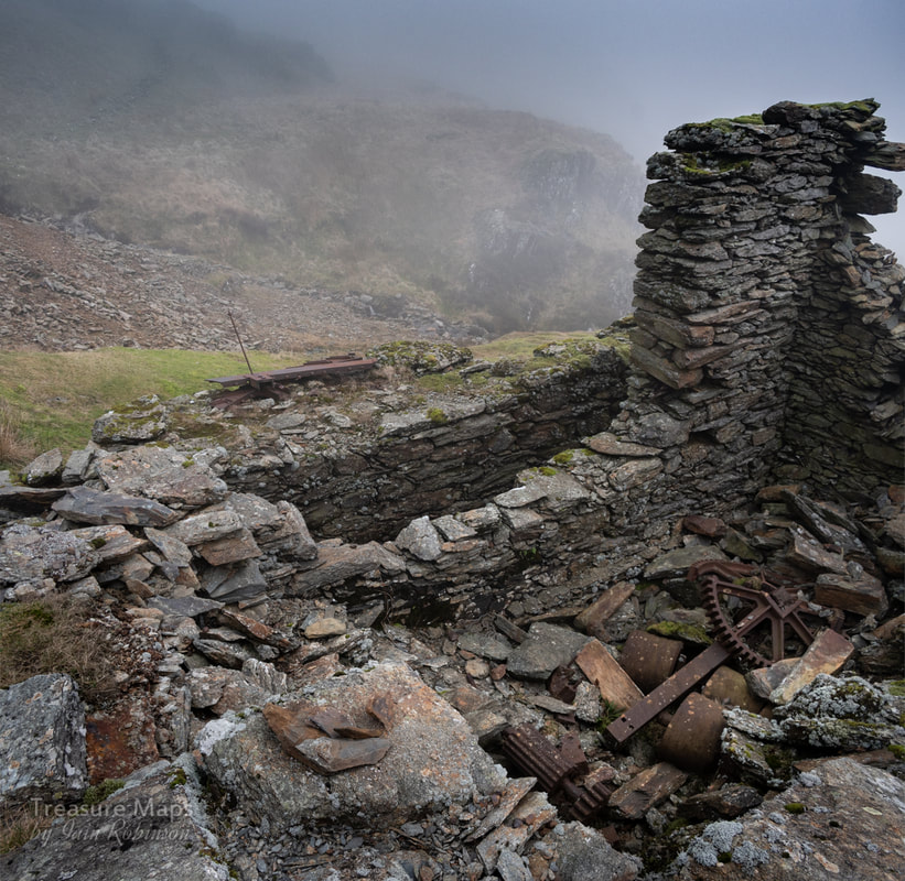
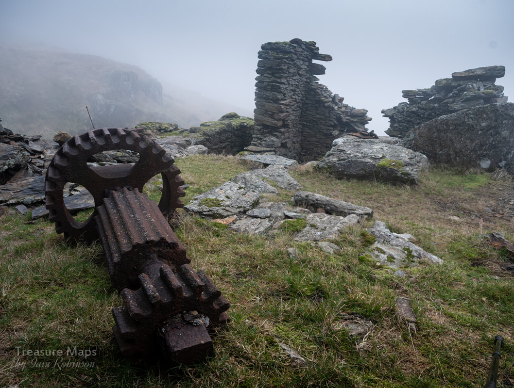
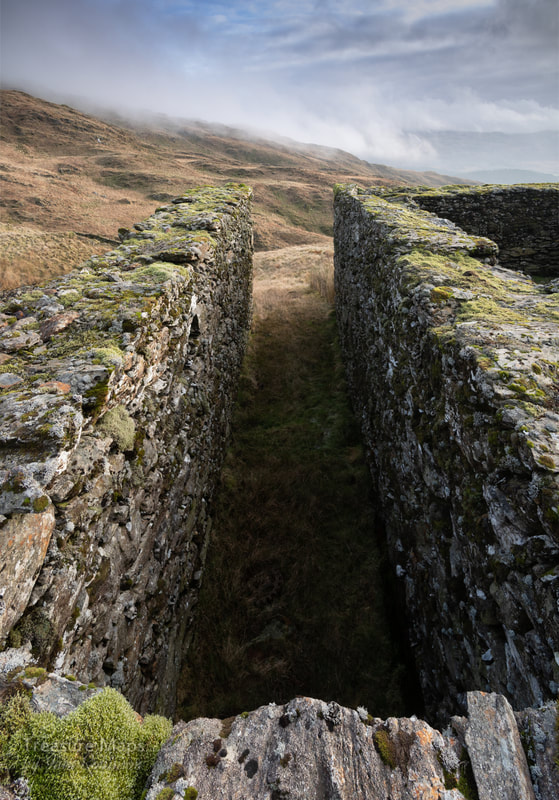
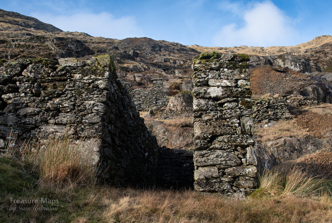
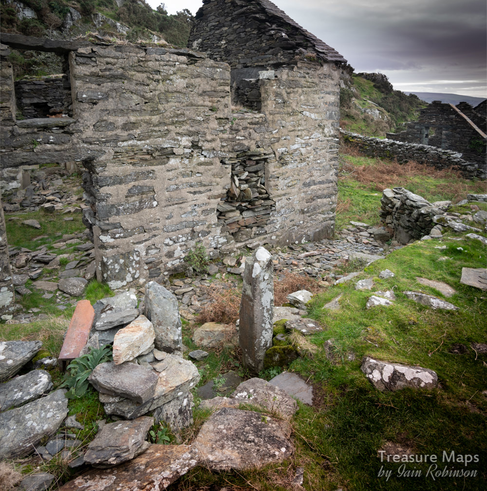
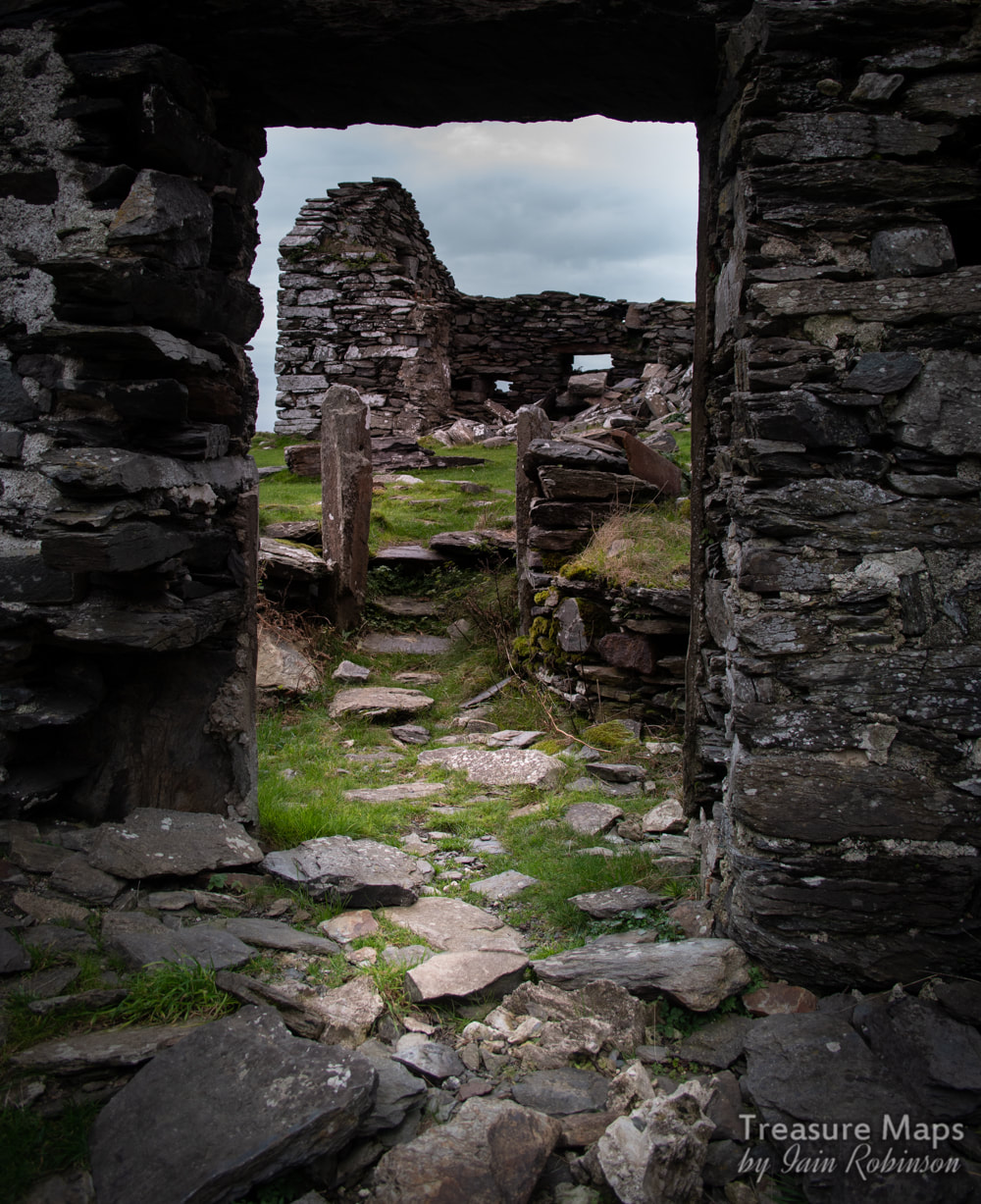
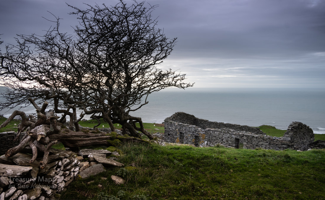
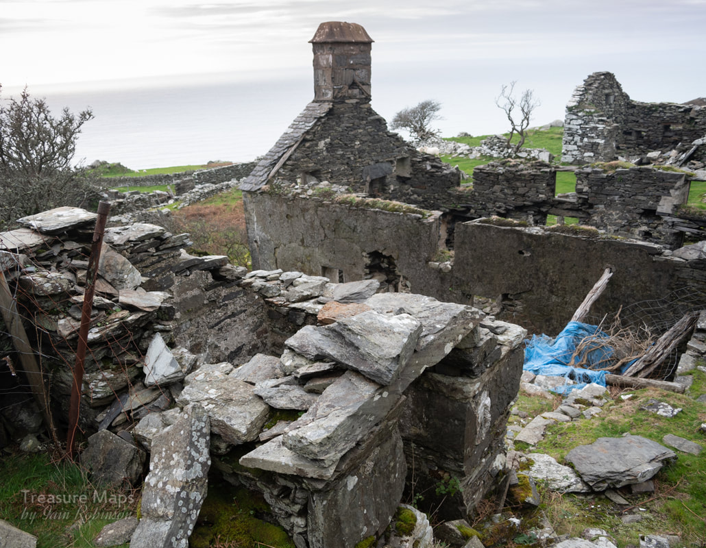
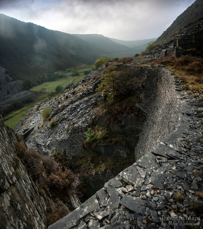
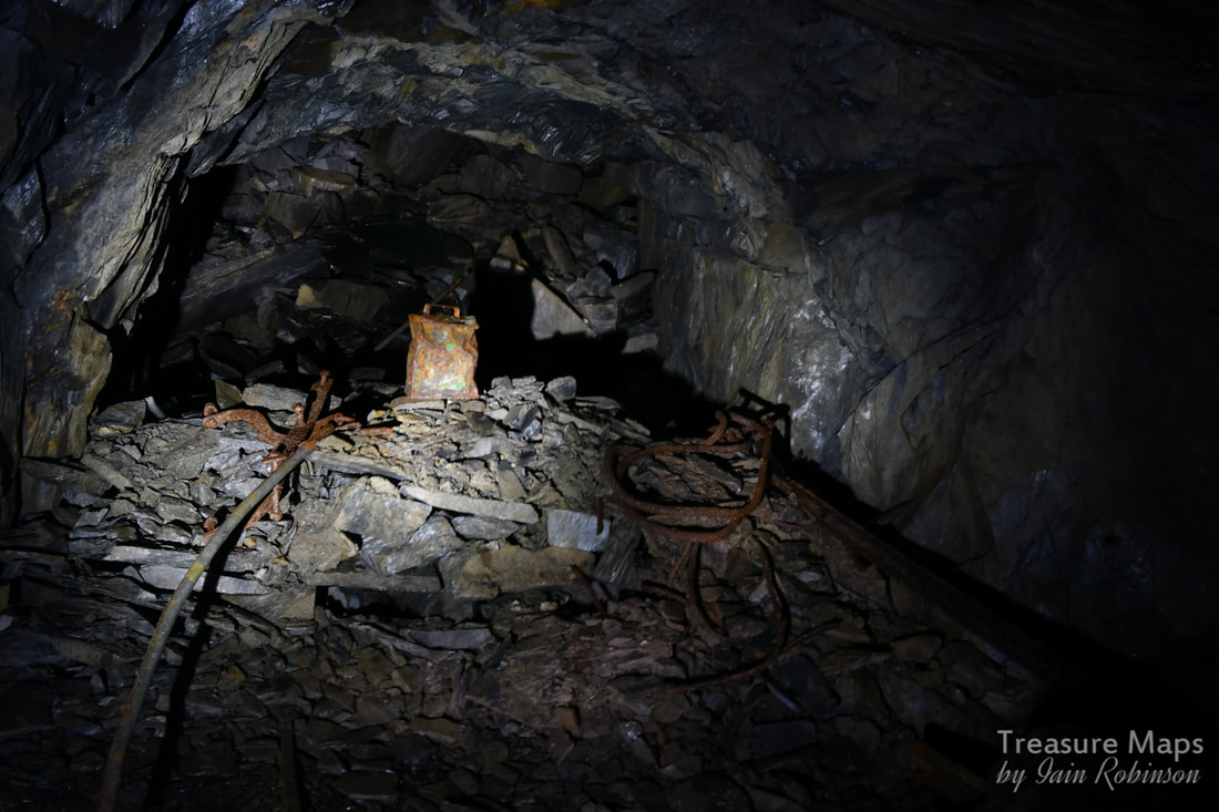
We return to the copper mine and finish off what we started. 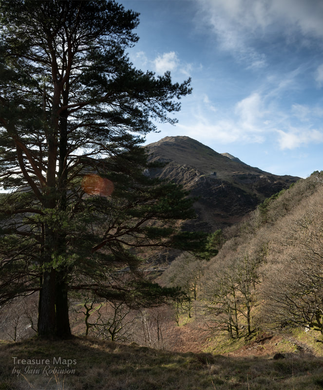 A view of the South Snowdon tramway's incline, from the old mule track up to the Lliwedd copper mine. Last time here, we ran out of time and light. So we hiked again up the thigh-sapping mule road into Cwm Merch for another look at this fascinating mine. This time, the weather was perfect and we didn't see a soul all day- peace reigned, except for the occasional buzzard, mewling high overhead. It was a case of rinse, repeat until we arrived at the Cei Mulod, (mule loading platform) where Petra had a hunch that a trackway up to the higher levels might be found. She was right; it was more a feint path, but it made a great way to access the upper working areas. We were unavoidably late setting out, so the sun was already low in the sky- but it made for some wonderful photo opportunities. The first thing we saw as we climbed up was this: 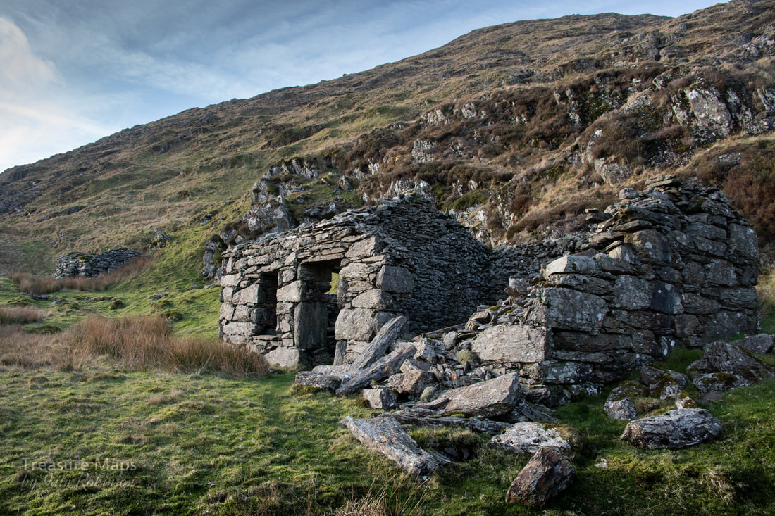 I'm assuming that this was the "office" building that Bick describes in his book. The smithy can be seen behind. It seemed a very inhospitable spot for an office, but then, the Moel Hebog mine's buildings were in a similarly uncompromising location, too. Definitely a case of "shut the door behind you"- I imagine that those mules must have brought as much coal up as copper down in winter. The smithy was a fine structure, unfortunately the hearth had collapsed in, and there must have been issues with one of the walls as a buttress had been built against the south wall. 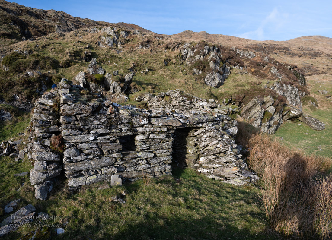 Note the double wall at the western end of the building. This was where the hearth was positioned. That's not Sasquatch on the right- just my shadow... Petra made an interesting discovery in the wall of the smithy, which we pondered about for a while. A number of holes drilled into a block, most at least six inches deep. I offered the theory that these might have been used as a sort of "Swage block" to bend hot metal. I know that it is the custom at mines to drill a hole above the hearth to commemorate comrades killed at work, but this didn't seem an auspicious location for that sort of thing- although it was at working height. 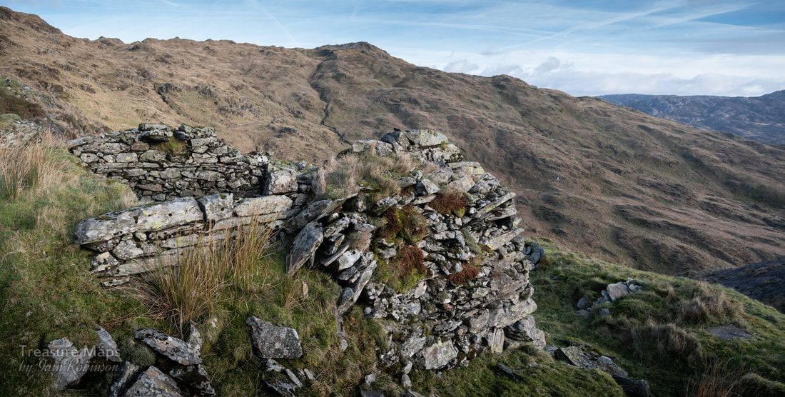 The thick west wall of the smithy, with Gallt y Wenallt in the background. We returned back to the office, where a well defined trackway went up again to another level. Here was a surprise- a reasonably well-preserved range of buildings which could only be the barracks. 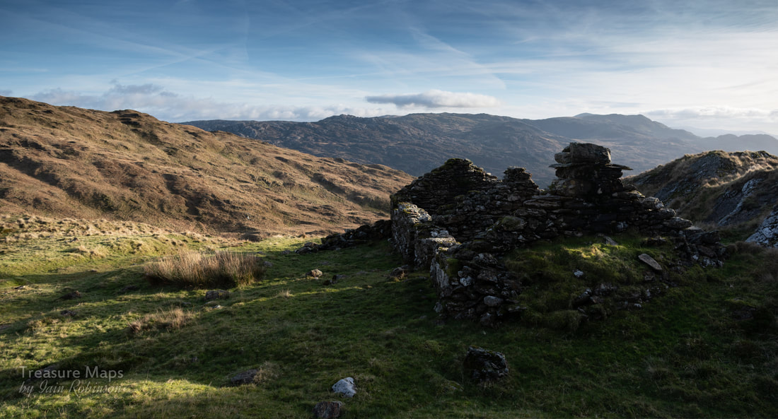 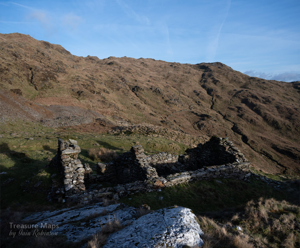 Behind the barracks can be seen the vast piles of cobbed spoil that litter the mountainside here. The barracks were nestled against a big quartz outcrop. Dividing walls inside had fallen down, but considering the location, this was in really good condition. The site here had originally been what looked like an intensive cobbing area, as spoil stretched over a wide, flat level- it had obviously been built up over decades of ore sorting. Not far to go to your work-place, anyway. There was a small stream issuing from the mountain nearby, showing where the miners got their water supply. Behind, up the mountain, gaping holes showed where ore had been stoped out.  Behind the barracks, the mountain is pocked with holes. Not a good route off the ridge in mist. We made our way across the working area and soon came to one of the biggest stopes on the site. 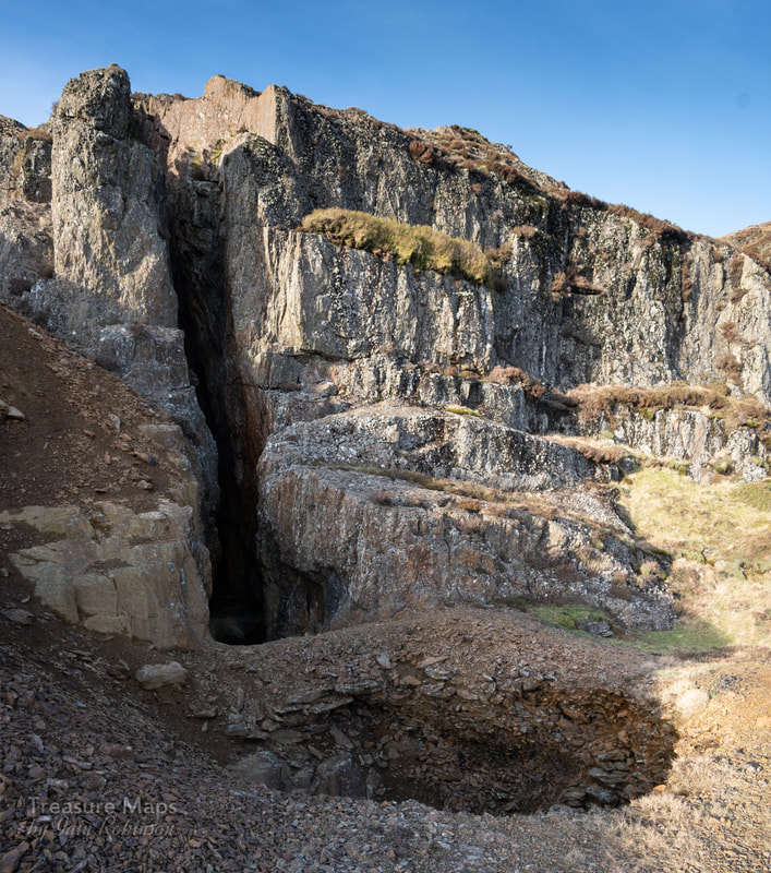 Imagine the ore that has been taken out here, then realise that it extends two hundred feet into the mountain. I suspect the rock has also been quarried here for ore. The depression in the front is actually another unfathomably deep hole. 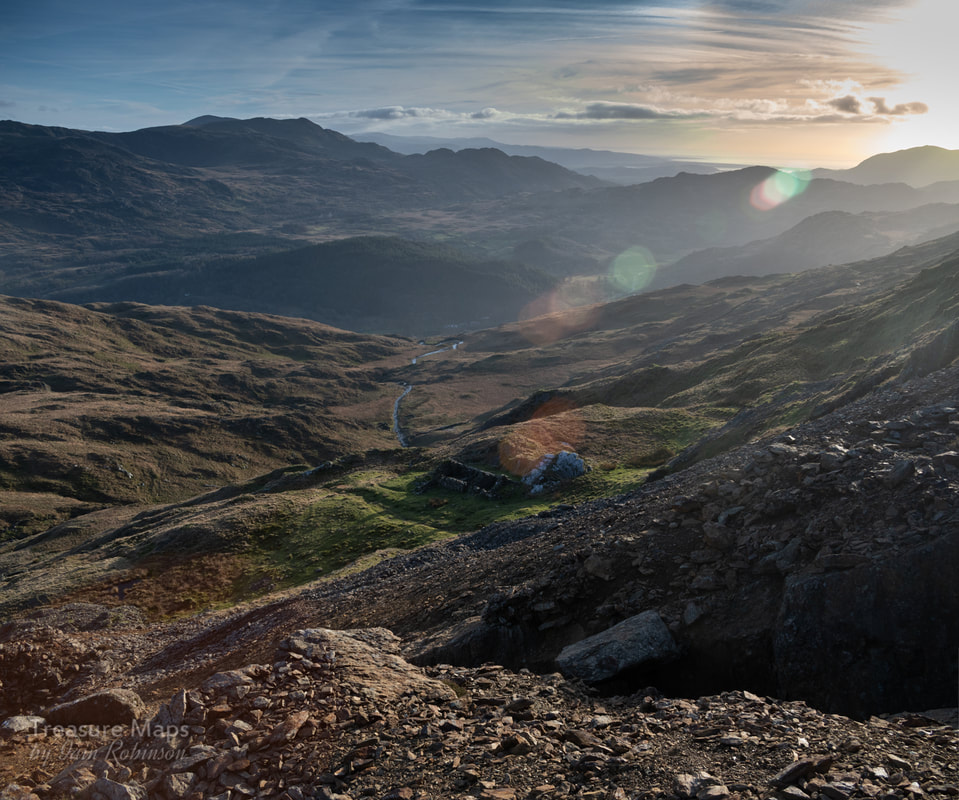 At the top of the stope, with the barracks in the middle distance. Cwm Merch runs in the centre of the picture while on the horizon the broad back of Cnicht obscures a view of the coast past Harlech. It was very tempting to stay and fossick around looking for minerals on the tips- I found a chunk of what Bick describes as "Peacock ore", an almost iridescent mineral, and many fine chunks of chalcopyrite and quartz. We carried on uphill again and found more buildings on a level that had perhaps been an early working. The structures were badly degraded, almost like walliau, surrounded by heaps of cobbed waste. The exposure here was a little bit frightening, with the proximity of those deep stopes. But the sun was getting low and I wanted us to make it back while some light prevailed, so we reluctantly retraced our steps downhill. We'd done what we'd set out to do and finished the job. 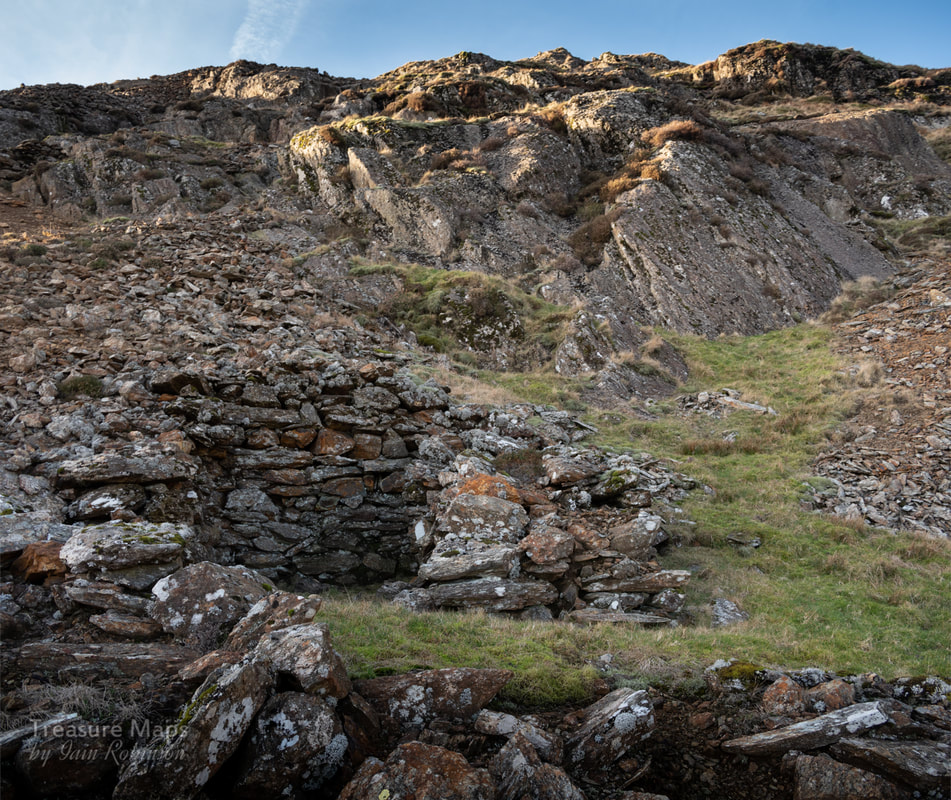 One of the ruinous structures on the top levels. The air is certainly clean here, as evinced by the lichen growth- Trentepohlia grew red on the walls along with the white Aspicilia Calcarea. 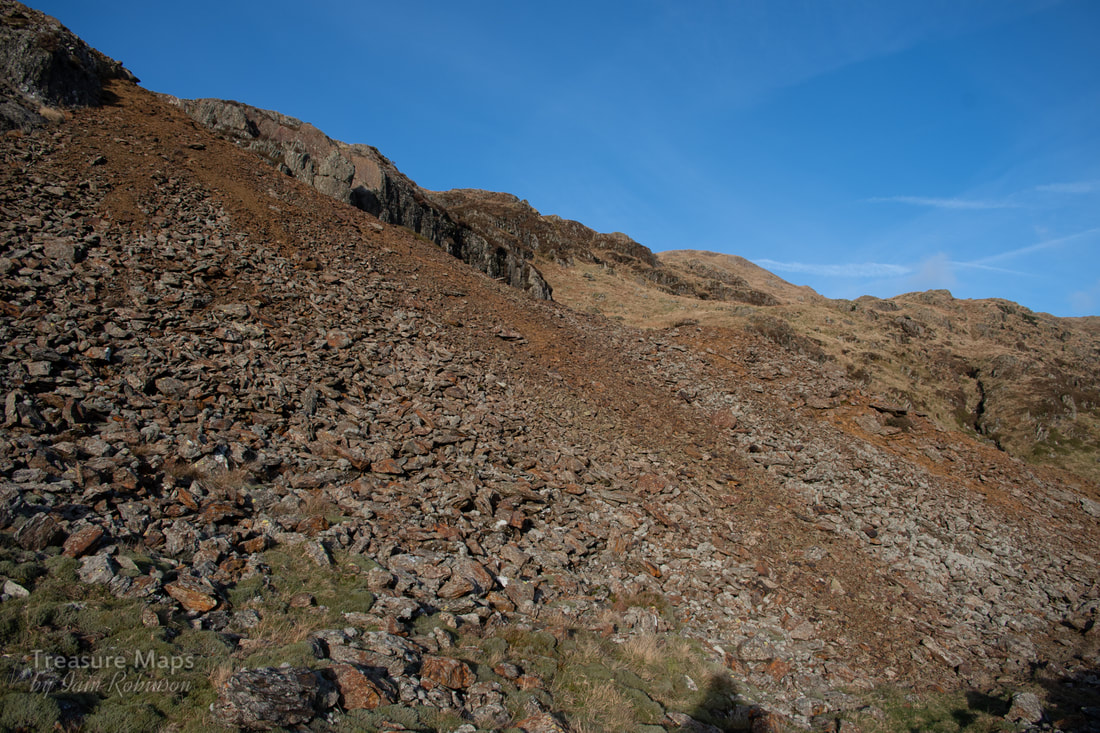 The vast quantities of waste. For a description of the lower areas of the mine, take a look at the first post in this series, here. 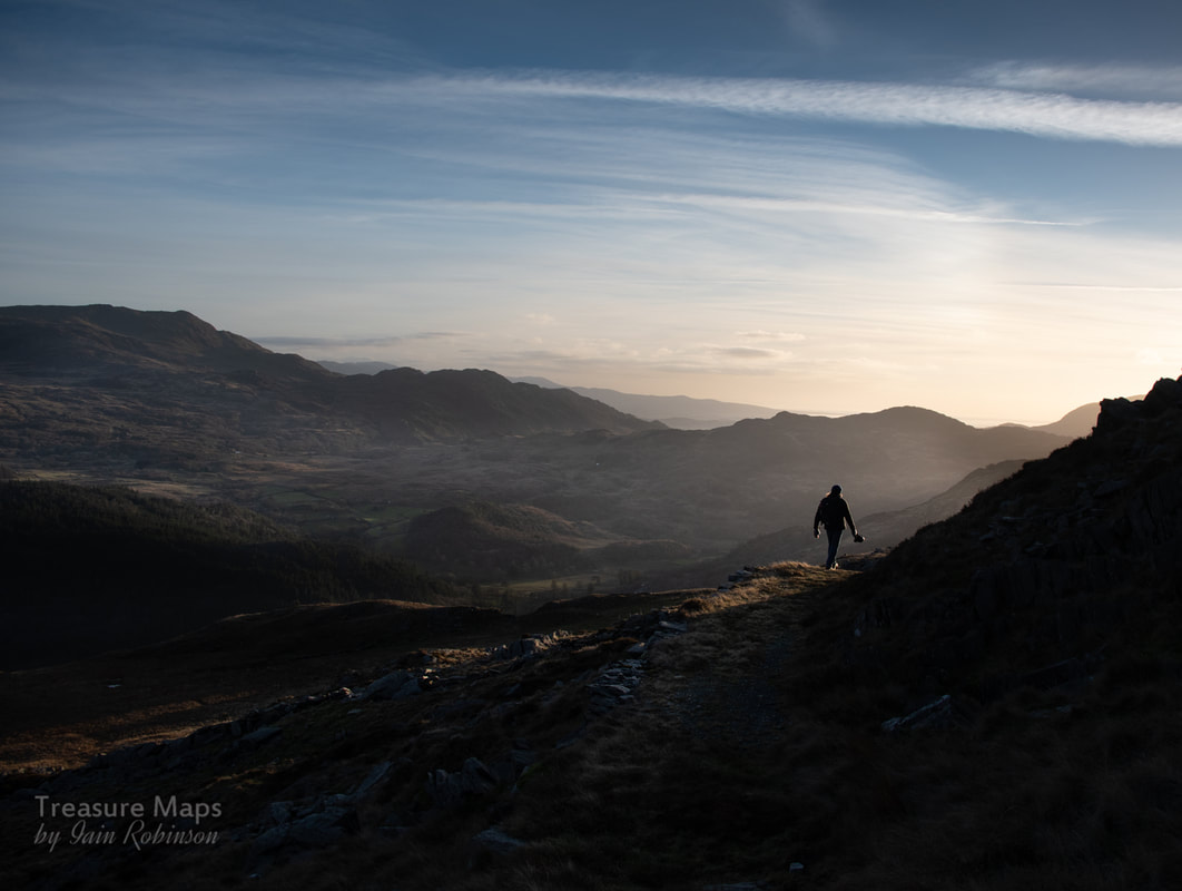 Until next time...
2 Comments
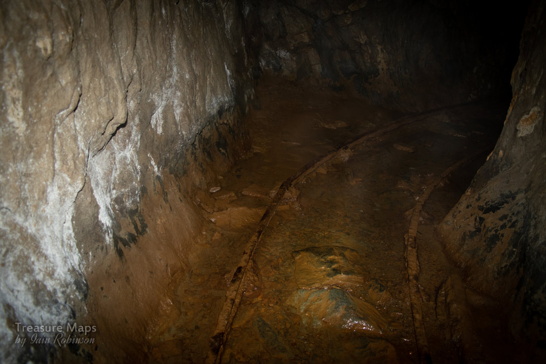
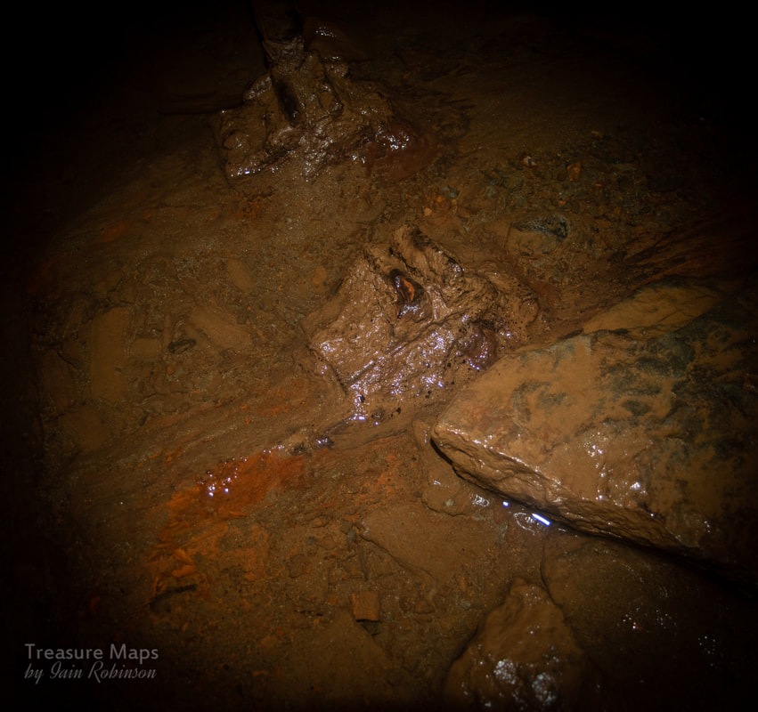
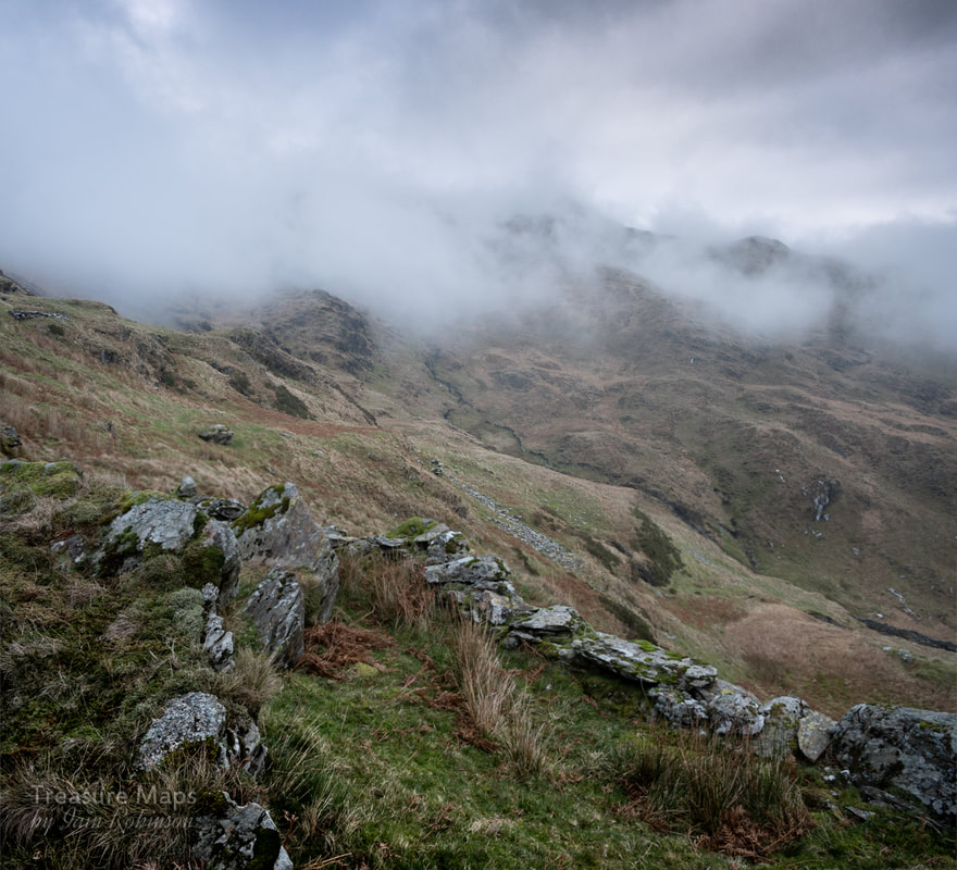
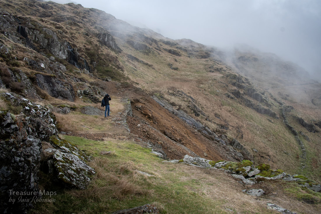
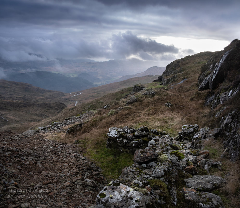
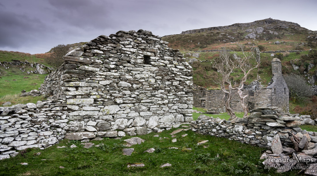
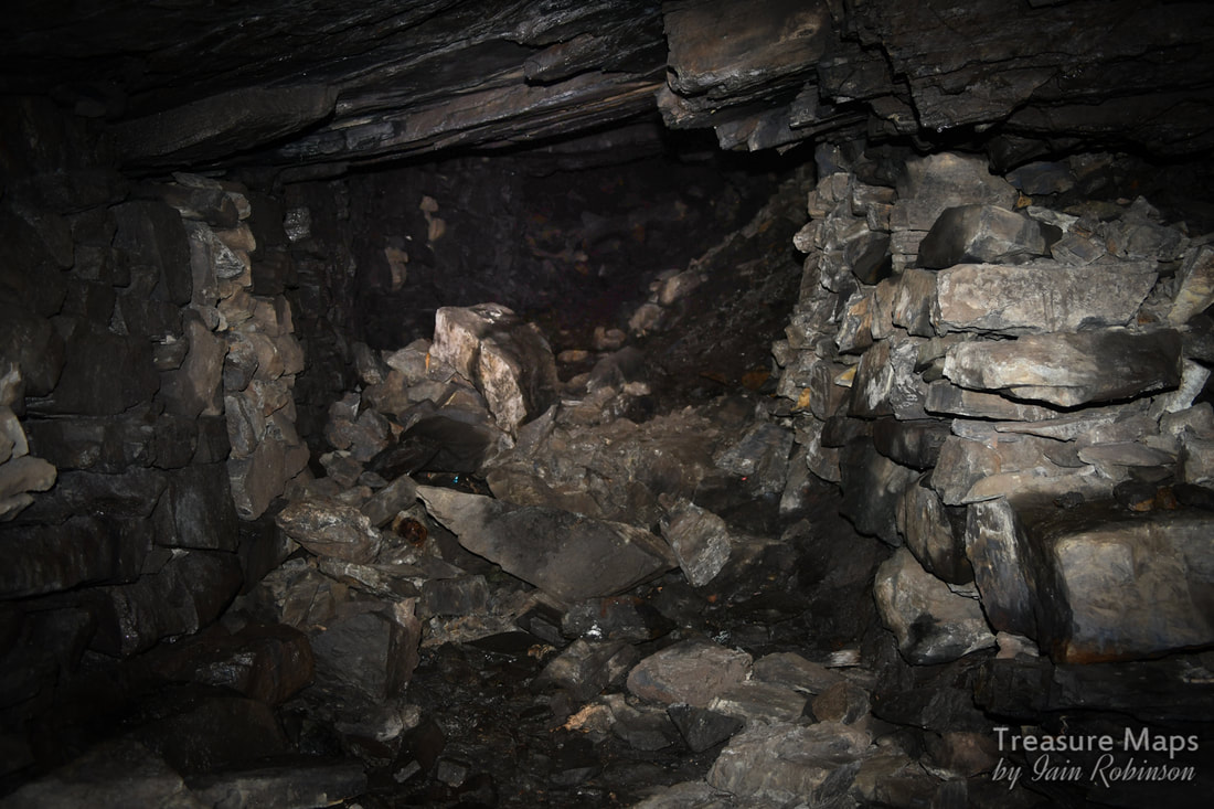
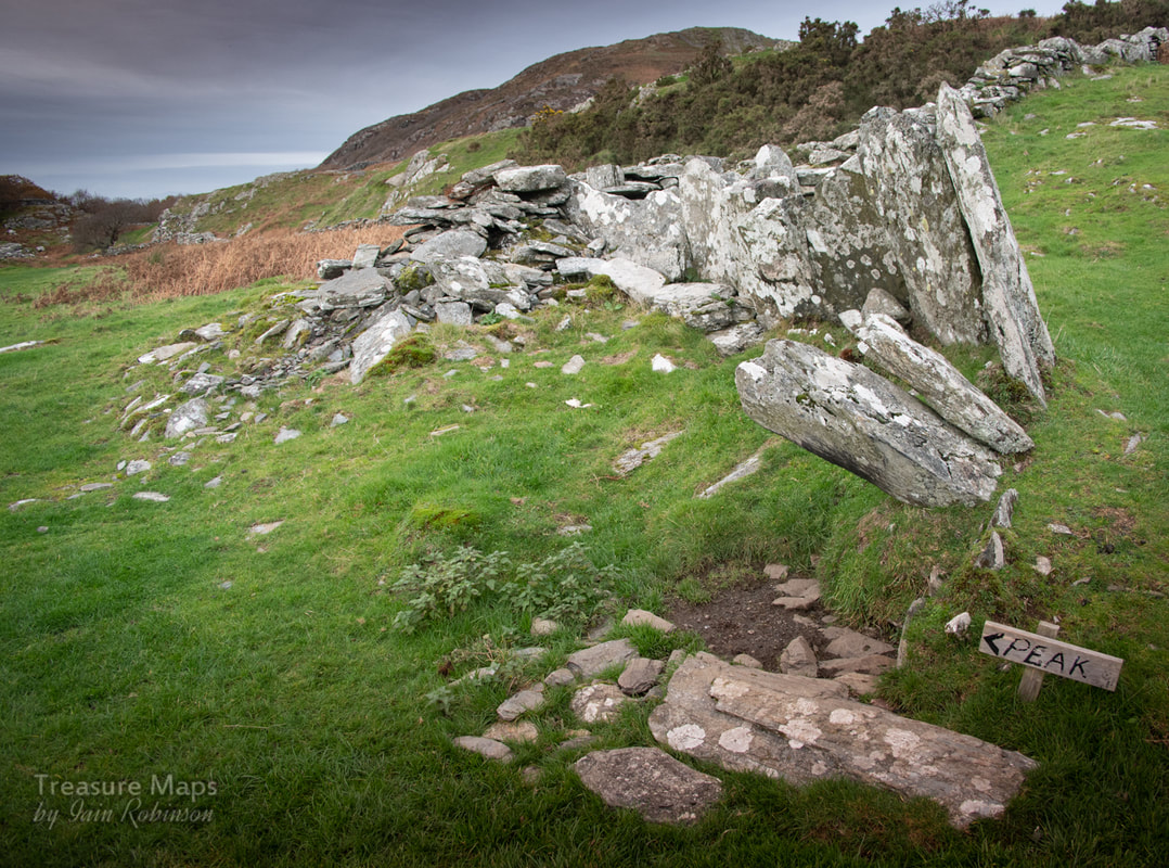
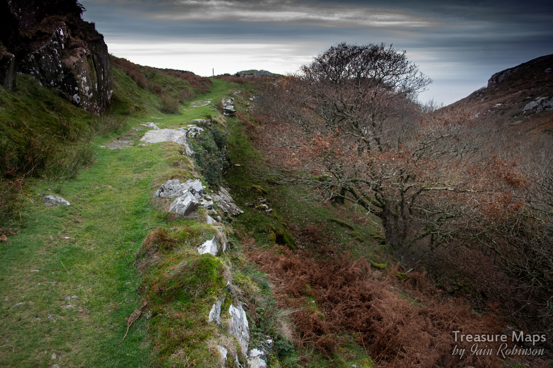
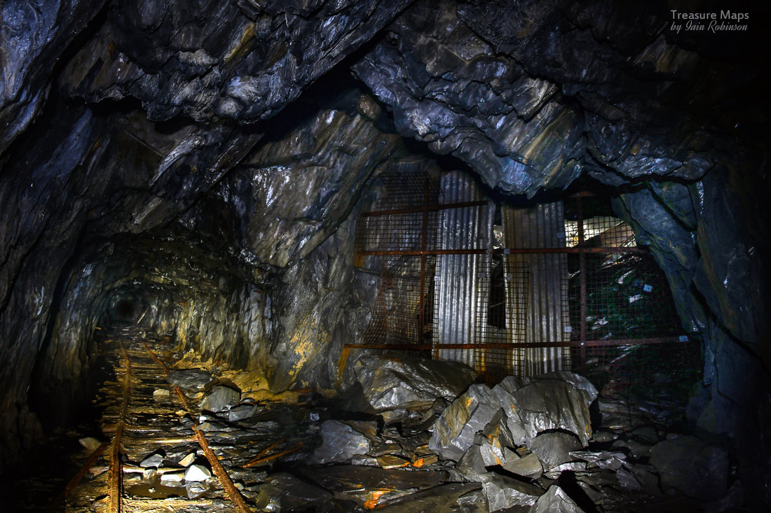
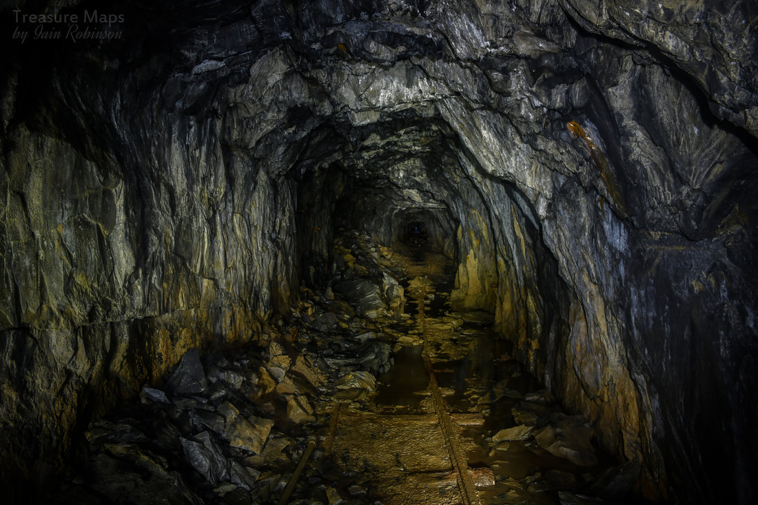
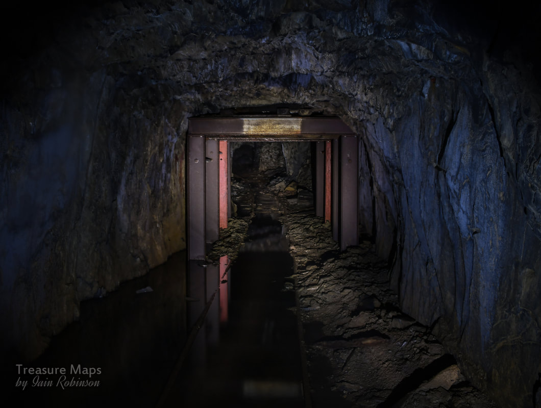
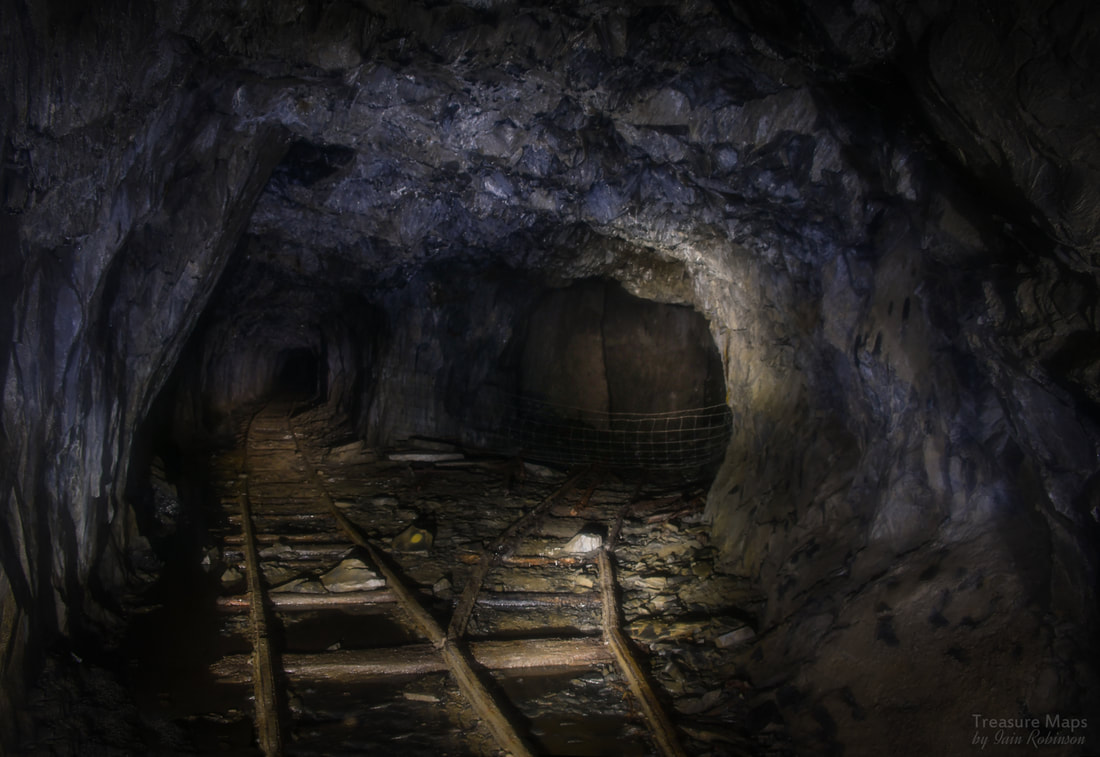
The first mine explore of 2019 finds us in the shadow of the mighty tops of Lliwedd. 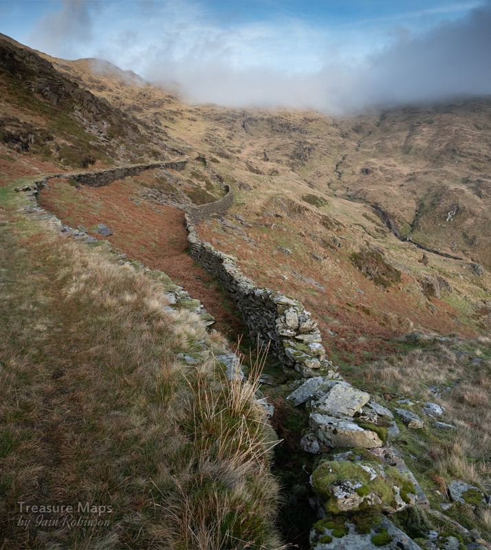 It was to be a day of contradictions. The weather forecast was for 10/10 cloud and general gloom, yet as we headed for Port, Snowdon was exultant, sunlight washing over her slopes like a golden mailed coat. The damp walls of the cob sparkled cut glass highlights, lifting our spirits as we headed for Beddgelert. However, once on the Beddgelert road, we fell in behind a gentleman who only wanted to travel at thirty mph...well, that was his top speed. If you know that road, you will understand it is impossible to overtake safely, especially as things became busy with oncoming vehicles. We resigned ourselves to travelling slowly, rather than at the 50 mph that would have felt like we were getting somewhere. At least we reasoned, we were safe behind Mr Magoo, but the winter days are so short, I felt we were squandering minutes of good light. The car behind felt that too, judging by his constant jockeying into the centre of the road and back again. At last, the parking space for the Watkin path came up and we pulled in. Inexplicably, our sloth guide came to a halt, confused, incurring the wrath of the other drivers. Eventually he pulled away- we will never know what made him pause. Perhaps he was reliving memories of his youth, of triumphant climbs, sun-kissed ascents of the mighty ridges around Yr Wyddfa. Then we discovered that we had no change for the car park. We would need £5.00. Petra turned the car and found a space on the opposite side, normally infested with cars, but today beautifully clear: free parking! I don't mind paying if the proceeds go to the Snowdonia national park; we just didn't have any change with us. We are a little disorganised sometimes. 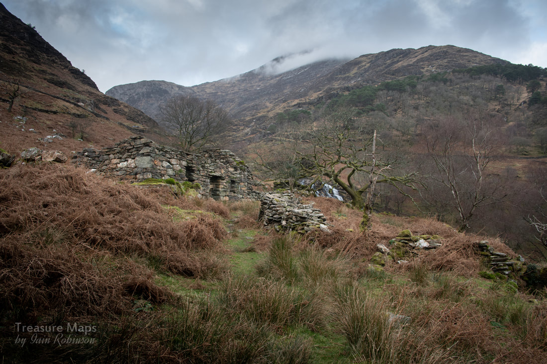 The Hafod beneath the Afon Cwm Llan falls. Lliwedd looms behind under cloud. We started up the climb to just below the Hafod y Llan mill, where we would turn up and join the steep mule track to the Lliwedd copper mine. We'd wanted to do this for a while but had been beaten back by my dodgy route finding and bad weather. This time, we told ourselves... The weather was still beautiful. We left the Watkin path at SH6247251402 for a rough track that leads to a ruined hafod. We carried on past that and eventually reached the falls at SH6229251668, where a party of six folk in their twenties were enjoying life, shouting, taking selfies. Oh, to be young again. We negotiated the narrow slab bridge over the Afon Cwm Llan and started the hard slog up the mule track. We stopped by a beautiful stand of pines, bathed in sunshine, with glorious views. Coffee was brought out. Despite the fine brew, my spirits sank a little as I realised from the screams and whoops filling the air, that the youngsters we'd heard at the falls were coming up here too. I was a little annoyed, we come out to the wild places for peace and quiet...you expect folk to make some noise, but this was a little over the top. Never mind, live and let live. They stopped by us and asked if this was the way "to the top". Petra told them that we were headed for the mine, so we didn't know. But that it wasn't the way up Snowdon. No matter, the boys told us, they just wanted to "be in the clouds". Their female companions didn't look quite so enthusiastic. But they all went off uphill, singing and shouting and goofing about. It was lunchtime, so we broke out some sandwiches and hoped that they had gone well ahead, although we could still hear them shouting and singing. 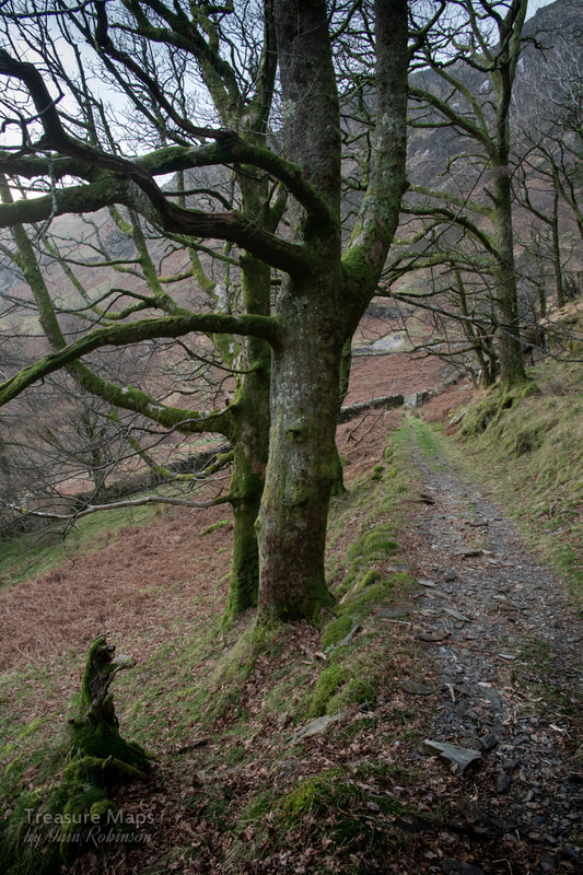 Looking back down the track from our lunch spot. I tried not to be like Victor Meldrew as I noted that all the gates had been left open along the way. We came to a place at SH6286252167 where to my dismay, the troupe were all gathered. It was about now that I noticed they were ill-equipped for the mountain, with expensive fashion trainers and flimsy lightweight coats over T shirts. I felt a little over-dressed with my three layers on and big boots, not to mention a rucksac full of nosh. They were a likeable bunch, though, and full of enthusiasm and malarkey. They asked about the way up again -I said, again, that we didn't know, but that it was bound to be gnarly and rather cold. I think they thought we were trying to put them off, as they immediately set off up to Y Lliwedd East Peak. One of the boys and his girl friend lingered, looking worried, and asked for a sip of water. I gave them one of our bottles. 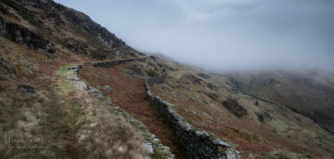 The mist comes in along the mule track. We set off along the mule track, relieved that now, we had the place to ourselves, although we could still hear yells from above us, "in the clouds" now. The mule track here is really well engineered and made a beautiful alpine walk. It became very cold up here on the slopes of the mountain- goodness knows what it was like on the ridge. We put on extra clothing and carried on. Mist was moving in, then being burnt off by the sun- it was delightful. We passed a very compact trial adit to our left- afterwards I found that there was an adit below the track, but neither of us noticed it in our excitement. We were finally going to reach the mine! 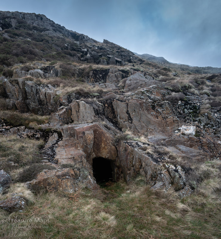 The compact and bijou trial adit. The track wound on, climbing slowly now from the 400m contour. After a while, we had our first view of the mine. It was even more impressive than the photographs I had seen. Unfortunately, our enjoyment was spoilt a little by feint shouts from high above, up on the ridge which sounded if they might have been screams for help. We looked up- the terrain here was impossible for a couple of old farts like us, without ropes and climbing gear -and it was uncertain what assistance we could offer anyway. We don't have a mobile phone either. We stood for a while, worrying about the kids, wondering what to do. . Then I distinguished a few shouts which seemed more like whoops, and decided that it was just their irrepressable high spirits again. 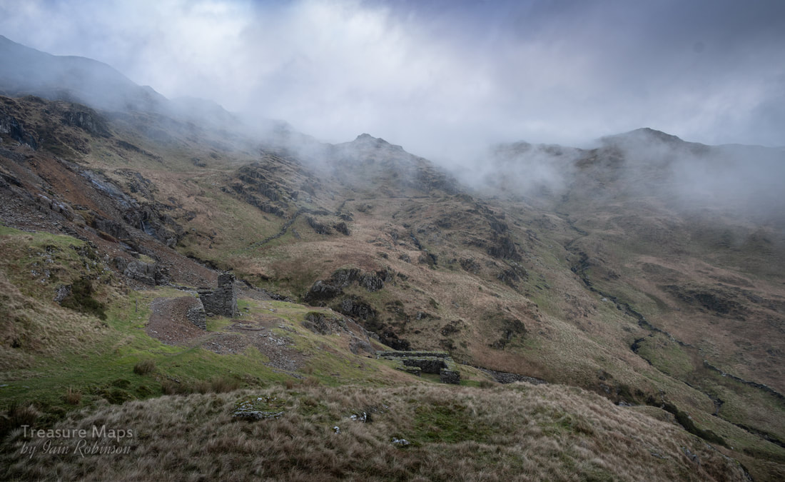 Our first glimpse of the mine. The mist was to burn off later. We resumed our explorations, happily photographing the mine and the remains- no wonder the scrap man didn't want to retrieve all the metal here, it had been quite a trek- I could only imagine what this place would have been like to work, in the kind of weather that Snowdon throws at you. In front of the crusher building, with it's wheelpit, there was a "cobbing floor" where Bick* says that women and children worked, hammering the ore and reducing it. 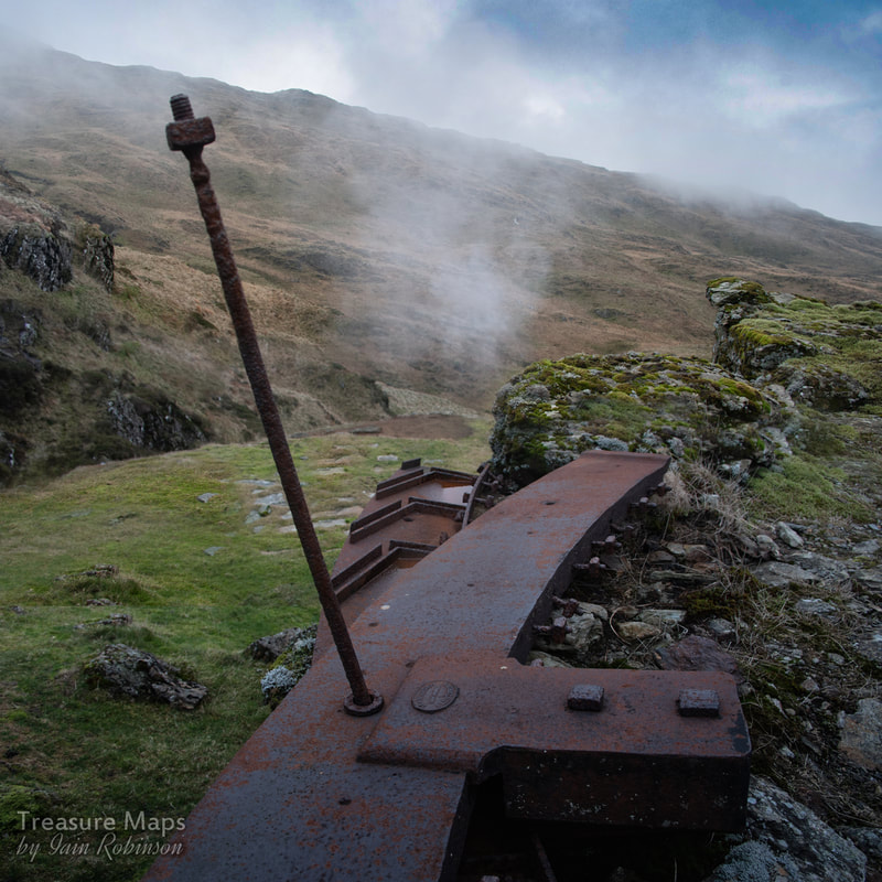 Remains of a waterwheel beside the crushing house. The wheel bears the stamp of the Hawarden Iron Works**. 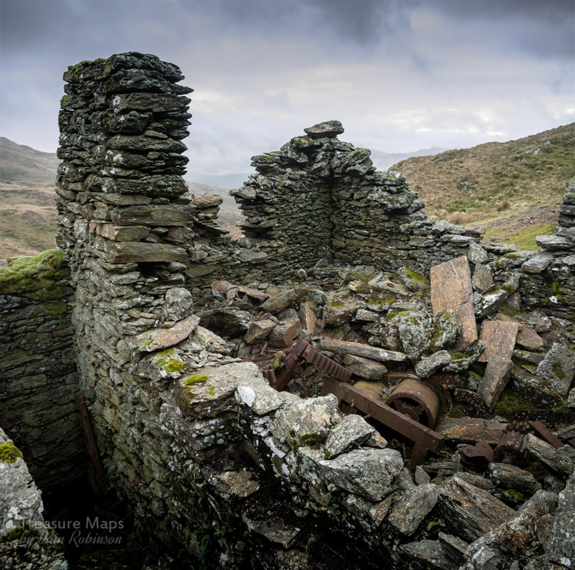 The crusher house was originally on two floors, and experts consider that there may have been two or more crusher rolls inside. It's an intriguing relic. Below was another waterwheel which appeared to be unfinished- perhaps the ore ran out as it was being built? There was a fine number of artefacts, from parts of the waterwheel, big castings and cog-wheels, down to rusty fragments of mine carts. There was also what I thought might be an incline, built with stone sides and a floor. Then, I realised that this was an ore chute from an adit above. 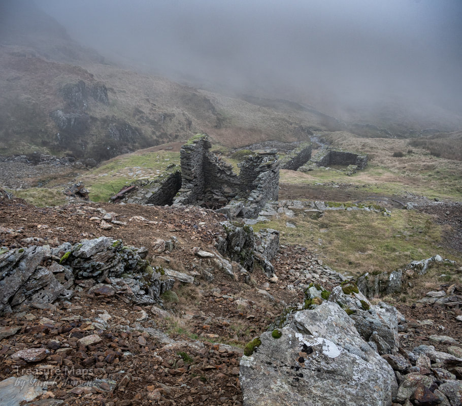 The ore chute and beyond, the waterwheel pit. 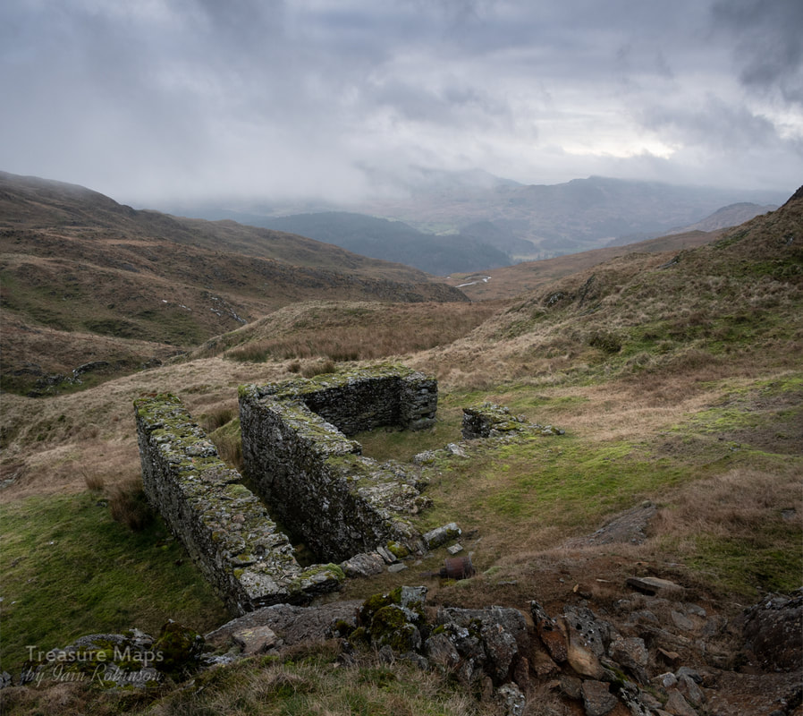 The lower waterwheel pit, with some very fine tailings and cobbed rubbish. More crusher gears and metalwork lay submerged in the grass. Petra had spotted a track, back along the path which appeared to go to another level, so we headed back and climbed up, to find a beautifully buttressed level area. One end was almost like a turning circle- I wondered if a horse-whim had been here. The level led to an area of tips, rich red in colour, with ruined shelters around. Then, in a hollow between the tips, we spotted the adit! It was a beauty, well-cut into the rock, although painfully low for someone of 6'2". We hadn't brought tripods, but the flash photos give an idea of how fine the place was. There were rails still on the floor, underneath six inches or so of water-and sleepers. The rail was "Top Hat" or "Bridge" rail, resting in proper chairs. It must have lain here for 120 years at least. It seemed to be of a peculiar gauge, 18" -and when Bick* visited in the 1950s, he reported a couple of carts in the adit. We walked in slowly from rock to rock, as we somehow hadn't expected an adit and we didn't have our waterproof booties with us. The adit carried on for quite a way and we were hopeful that it might connect with the stopes high above, but we were somewhat disappointed when it ended in a blind forehead. 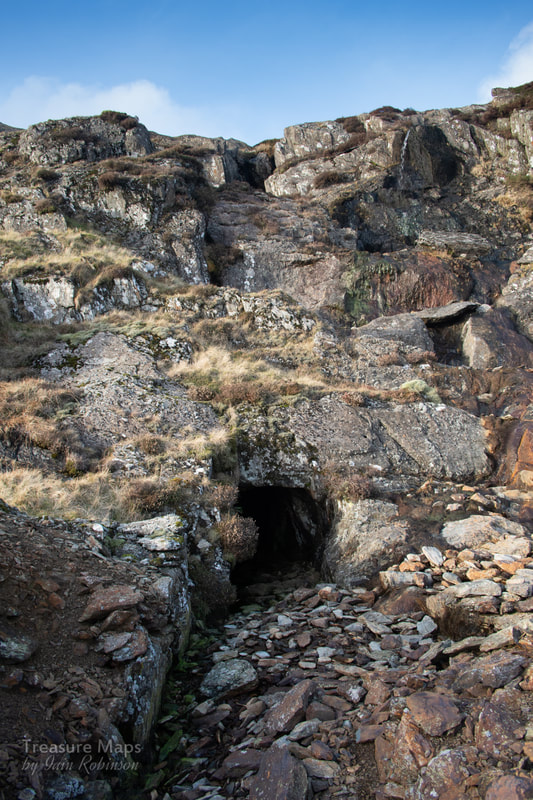 The main adit entrance...quite low! Inside the main adit As I was coming out of the adit I spotted the couple to whom we had given a bottle of water earlier. The girl in particular looked freaked; they told me they had just descended from the ridge down to the mine- in the mist. I didn't mention the cavernous, deep stopes that they could have stumbled into. I looked up and couldn't imagine coming down there in a pair of smooth soled shoes. They asked if there was a way down from the mine and Petra showed them how to get back on the track. The boy mentioned that the others were OK, but he and his girl had lost their nerve. The boy was very solicitous towards his girlfriend, who looked like she never wanted to go outside again. They were pitifully grateful for our meagre assistance and after a while, walked off down the track. 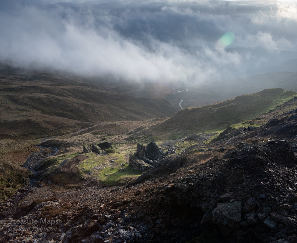 I must say that despite our enthusiasm and delight at the mine, the day was shaded by the kids- irritation had turned to worry about them and I wondered if we should have done more, or if we could have persuaded them of their folly. Selfishly, we had just wanted the place to ourselves, to be rid of their noise. Perhaps we should have been more hard core about their lack of equipment and experience- they were the sort of folks that give the mountain rescue people the wilts and vapours. 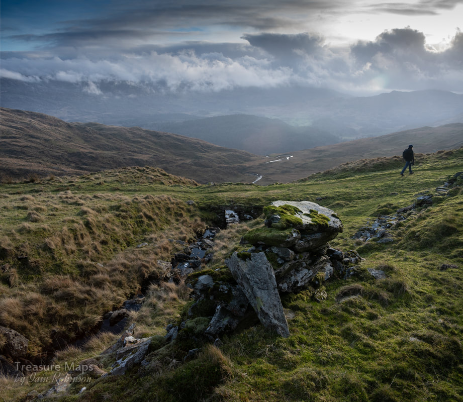 A bridge over a small stream along the mule track. We walked back along the track- there were no shouts now. Only the wind moaning through the grass and the occasional bird punctuated the blessed peace of our descent, although I noticed that the gates were all open again- the noisy party had obviously returned this way! 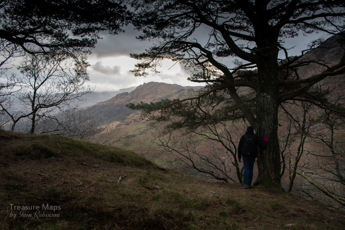 Soaking up the peace and quiet at the end of the day. The Factoids David Bick, in his wonderful "The Old Copper Mines of Snowdonia" describes the site well. The mine was begun in the latter part of the C17, but production didn't amount to much until after 1838, when 1090 tons of ore were sold at Swansea. The mine produced steadily- the stopes are a testament to that- until production slowly tailed off towards the end of the 1860s. There was a small-scale attempt to re-open the mine in 1910; Bick describes talking with a man who had once worked the mine. There was no mechanisation then, the ore was picked and sorted, then taken on mules down to Porthmadog and on to Swansea by sea. That there was such a lot of machinery out here, literally miles away from anywhere, is worthy of note. I shudder at the thought of the poor animals who had to drag the heavy cogs and rollers up those terrible, steep paths. Rather poignantly, Bick notes that perhaps a partial restoration of the machinery might be accomplished, an idealistic thought in these days. He says "...I do not think any other mine in Wales epitomises to a greater extent the determination and spirit of the "old men" and it would be a fitting memorial if something could be done to save the site, remote though it is." Sadly, I don't think that was ever a practical proposition, but now the mine lies slowly sinking back to nature, beautiful in it's decline. It is yet a "fitting memorial" to those hardy souls who opened and worked it. *Bick, David, "The Old Copper Mines of Snowdonia" published by the Pound House, ISBN 0 906885 03 5. Out of print, but copies can still be found in good secondhand book shops. **Hawarden Bridge Iron Works was established in 1895-6 by John Summers & Sons of Stalybridge, on a 6ha site on the north bank of the river Dee, adjacent to the Great Central’s railway line north of Shotton and Connah’s Qay. The works expanded, producing its own steel by the open hearth process from 1902, when it became known as Hawarden Bridge Steel Works. The steelworks continued to develop, becoming Shotton Steelworks and covering an area of around 470 ha. 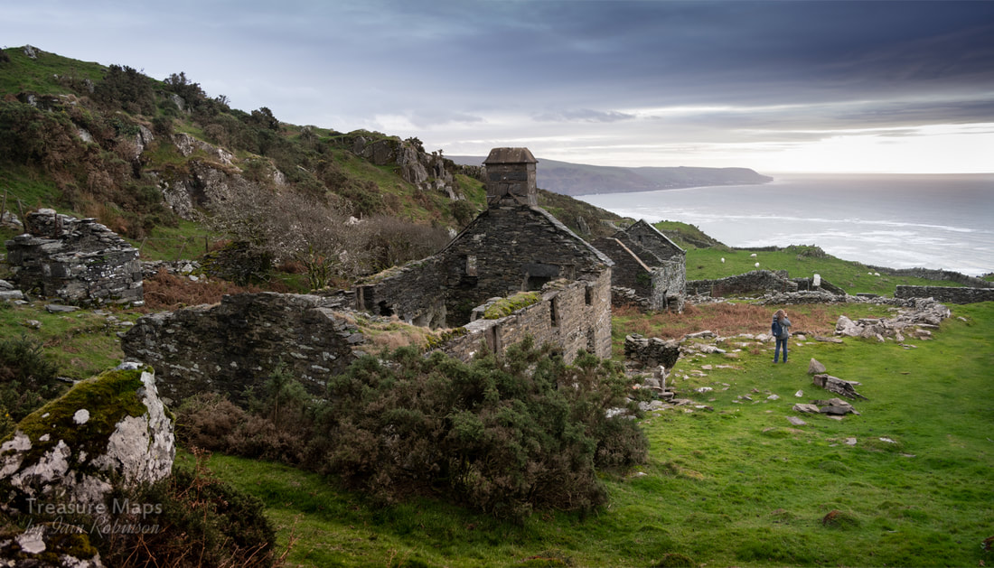 Google Earth is a good substitute for an adventure when it's raining- as it has tended to do rather a lot this winter. But in fact, most of our explores result from wandering happily about over the satellite view until we spot something interesting. Following the big manganese lode south from Cwm Nantcol, Gellfechan looked intriguing- there were the signs of mining activity and some interesting ruins. It was October before we could visit, but by then, the tourist hordes had relinquished Barmouth. It was a charming little coastal town again. I'd done some homework, combing "Merioneth Manganese" for info about mines, while Petra had found a lovely little book by a lady called Carol Skelton, which provided some interesting history of the farm and it's inhabitants. Carol has given me permission to reproduce some of the pictures and story. 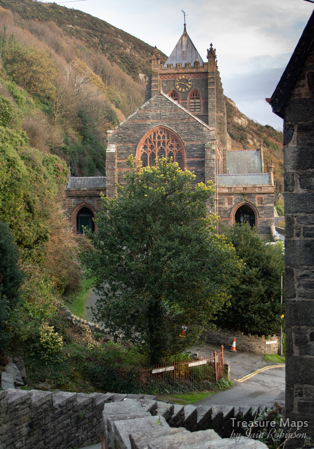 The starting point- St John's church, on Gellfechan road. I'm running ahead. Not that you would be doing much of that, going up to Gellfechan. The walk starts from St John's church, going steeply uphill along Gellfechan Road. After 100 yards, a signed footpath goes up off the road to the right at SH 61215 16047 and climbs past many old adits, reminders of the mineral wealth in this area. I'll come to those later. After a while, you take a sharp left at a hairpin junction in the path- there are a multitude of waymarkers here. Carry on going almost due north, then the track curves to the south west and comes to a hairpin again. The path that goes straight on leads to Dinas Oleu, a popular viewpoint and a National Trust property. We went left, up the steep track to the farm. The sounds of the town gradually faded, only the snarls of motor bikes and lorries wafted up now, almost lost amid the cries of birds and the wind's conversation with the hawthorns. 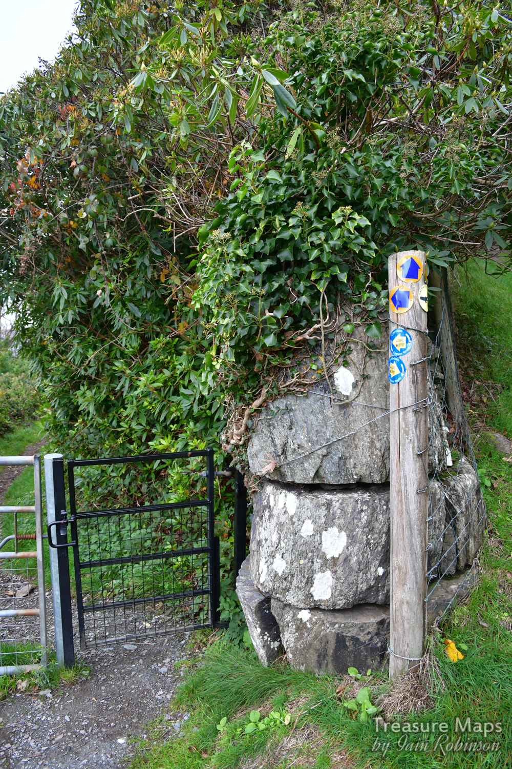 Waymarker overload! Carol's book tells of her late father, and her aunt and uncle in their turn, delivering milk to the town from Gellfechan, high on the top of the hill. Her aunt would do the delivery round before school, then slap the pony's backside to send it back up the hill. She would then go off to her lessons. I like to think that the pony enjoyed it's saunter back up to Gellfechan, browsing on succulent grass all the way up. Carol wrote to me about how her father, as a schoolboy, was in the habit of running up to the farmhouse at lunch hours with his siblings- in ten minutes! The return to school, full from their mother's excellent meal, was a little more leisurely. On another occasion, her father had to deliver a churn of milk to the town, which he somehow carried all the way down to Barmouth- then went to the pictures! To be sure, those were different times, tougher folk than today. 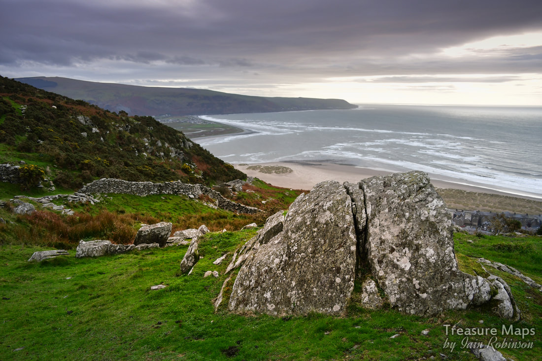 A rock outcrop beside the trackway up to the farm. Meanwhile, up on the hill, we were finding little excavations and piles of rock everywhere as we climbed up. My mine senses were working overtime. The views now were spectacular, although the weather wasn't too clear on the day we visited. Even so, it was possible to see out towards Tywyn and further. After climbing up the track for a while, we came through a gate beside a wall to the right. The farm could be seen above, nestling below a rocky crag. Apart from the wind's playful zephyrs, it was almost completely quiet now. 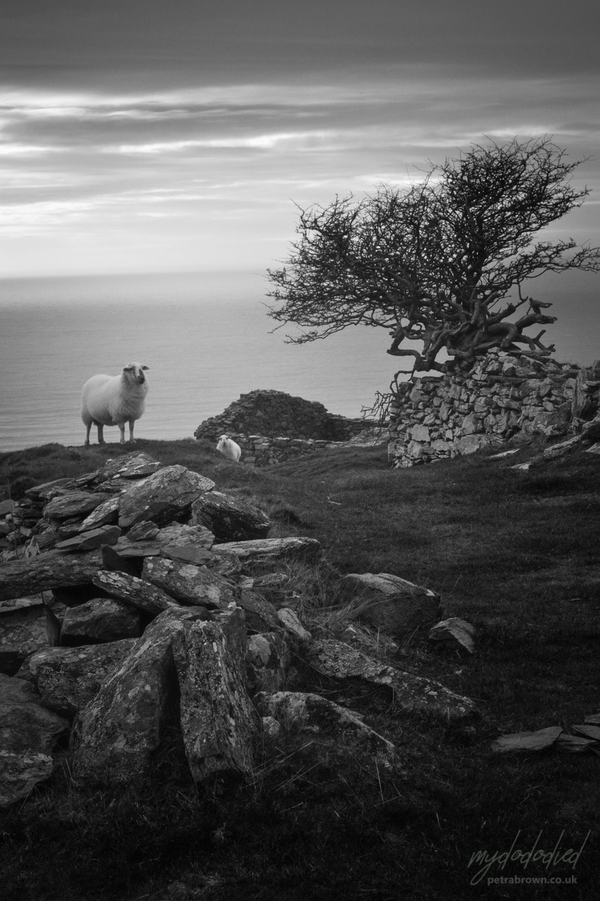 A sheep gives us "the stare" beside the gnarled old Hawthorn. Photo by Petra. The farm is approached by a well-made road which passes a long barn, then turns uphill again towards an older structure guarded by a wind-harried tree, looking like an old witch in the process of casting a spell. This old ruin, now very much the worse for wear, was the original "Gellfechan". The inglenook fireplace with it's oak beam is still there, under the rubble. Even in these reduced circumstances, the place reminded me of a scene from an Enid Blyton "Famous Five" story, where the farmer's wife would emerge and supply bread and fresh provisions in exchange for a few coins, while adventure beckoned in the hills all around. I suppose that dates me... 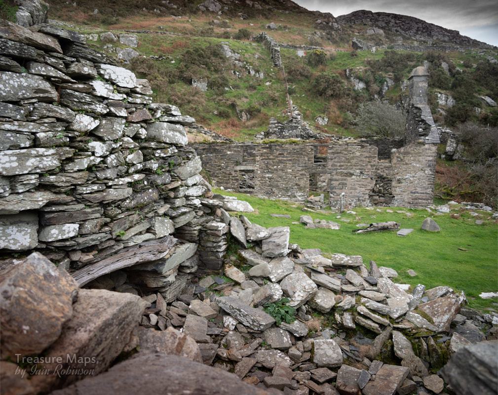 The original dwelling with inglenook. The newer house is in the background. 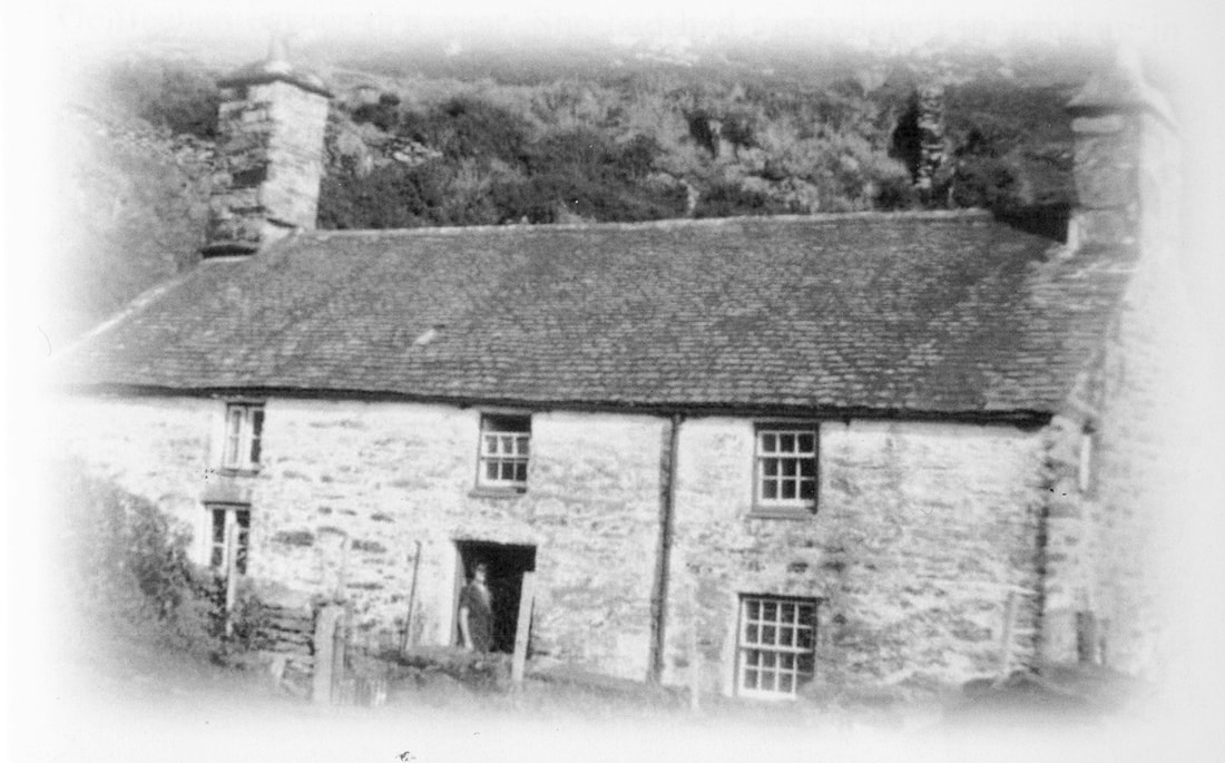 Gellfechan, possibly in the fifties. Look at the beautiful roof- and the tall chimney to the kitchen, which sadly fell in 1999. It looks a strong and cosy place, despite having no running water or mains electricity. (photograph by kind permission of Carol Skelton) The "new" house appears on the 1887 Ordnance survey map, and was probably built in the middle of the C19th. Now, it is roofless and in a bad way. It was abandoned in 1959, so quite a tribute to the original builders that it has lasted this long. It was sad seeing the remains of the front door and gate, the place of many greetings and farewells. Carol's book hints at the lively life of the farm, with cousins and aunts visiting and many adventures. At one time, teas and cakes were sold from the farm to walkers passing by as they journeyed to the various view points such as Dinas Oleu, or Craig y Gigfran nearby. For a time, full bed and board was offered- the house was a large one but even so, some of the family had to sleep over the stables when paying visitors arrived. 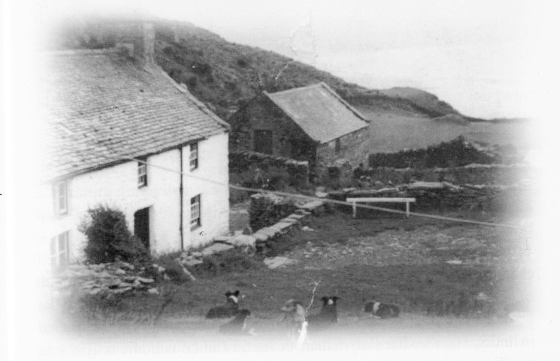 I wonder what the dog's names were? (photograph by kind permission of Carol Skelton) We spent quite a while, enjoying the special vibe of the place. Imagining people going about their daily chores, children playing. I could have wished for better light, taking photographs was a challenge, but I hope some of the atmosphere comes through. It was really nice that for once, I had an idea about some of the farm's life and times- so often, these places are frustrating ciphers, full of locked memories. Here, at least, I know that there was laughter and happiness as well as the hardship of living on an upland farm. 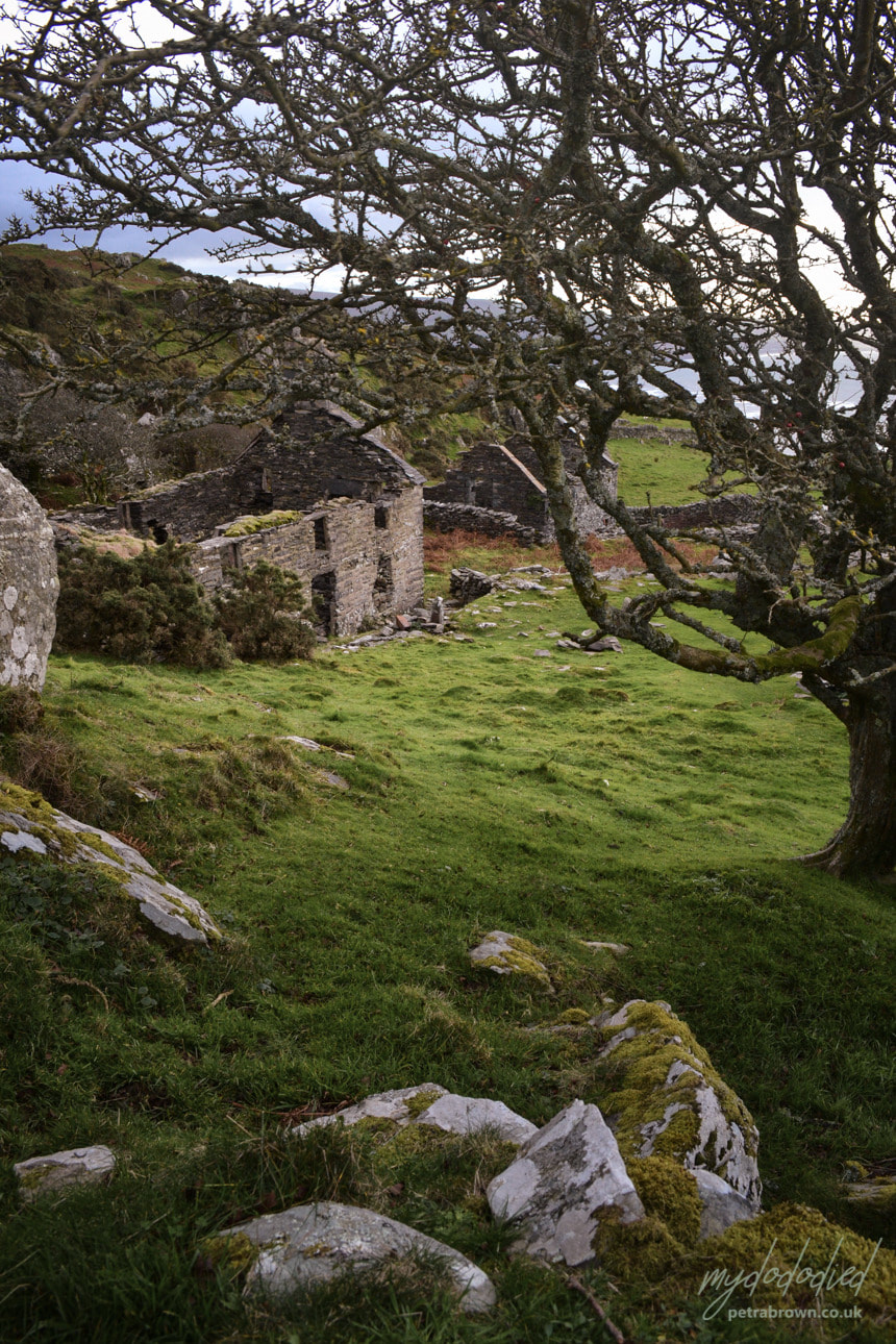 Photograph by Petra The mines They are not all Manganese mines, despite being on the south end of a long rake of excavations almost all the way to Cwm Nantcol. The manganese adits are mostly beside the track going up, and can be found with close reference to "Merioneth Manganese", referenced as "MM" where I have sourced information. Early on along the track, we found a couple of diggings, where the rock had been quarried back and an opening made. This looked like a manganese mine alright. There was a fine portal cut from the rock and although the floor level had been built up over the years, with a little stooping it was possible to gain access. The typical style of manganese workings, small chambers stacked with "deads" was apparent inside. 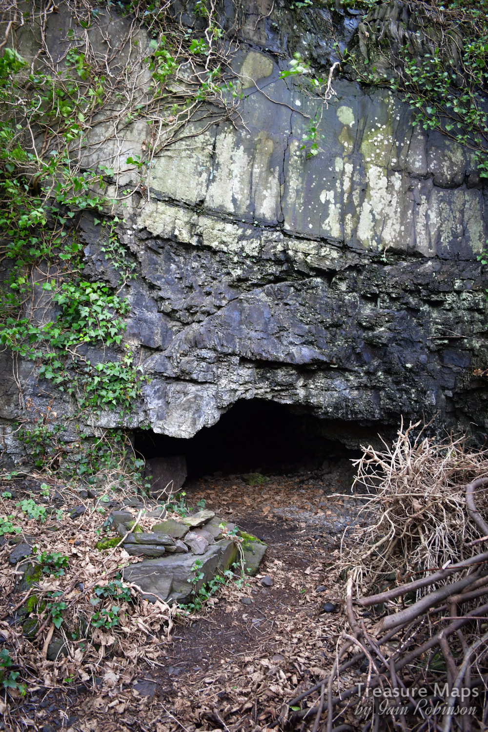 The first indication of manganese workings. After the "dog's leg" in the track is a mine that seems to be associated with the "Belle Vue" gold mine, which Jeremy Wilkinson puts at SH613161. It must take it's name from some villas named "Belle Vue residences" and what seems to be an area marked as such on the 1887 maps. Also marked on the 1887 map is a "Dripping well" which is further down the track towards the church. It must have been an early copper trial on a thick vein of quartz, as there is another adit concealed beside the church below. There's a little wall in front of the adit, which does indeed drip- but then most adits do! 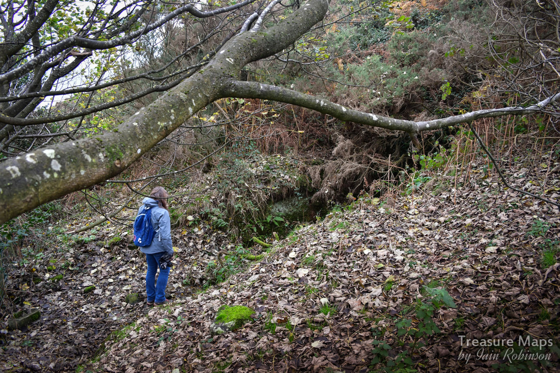 Petra considers the "Belle Vue" mine. We did bring our usual safety gear, helmets, torches, boots etc...at this point P is "evaluating" the situation. Higher up the hill, we encountered an adit next to the track. It didn't seem like a manganese mine, the tip was slightly chalcopyritic. (A brass-yellow mineral with a chemical composition of CuFeS2. It occurs in most sulfide mineral deposits throughout the world and has been the most important ore of copper for thousands of years. It loses it's brightness on exposure to atmosphere) There was a ruined structure nearby which I think was probably a sheepfold. However, it wasn't until we returned home that I saw on Google Earth that we had missed another adit below. 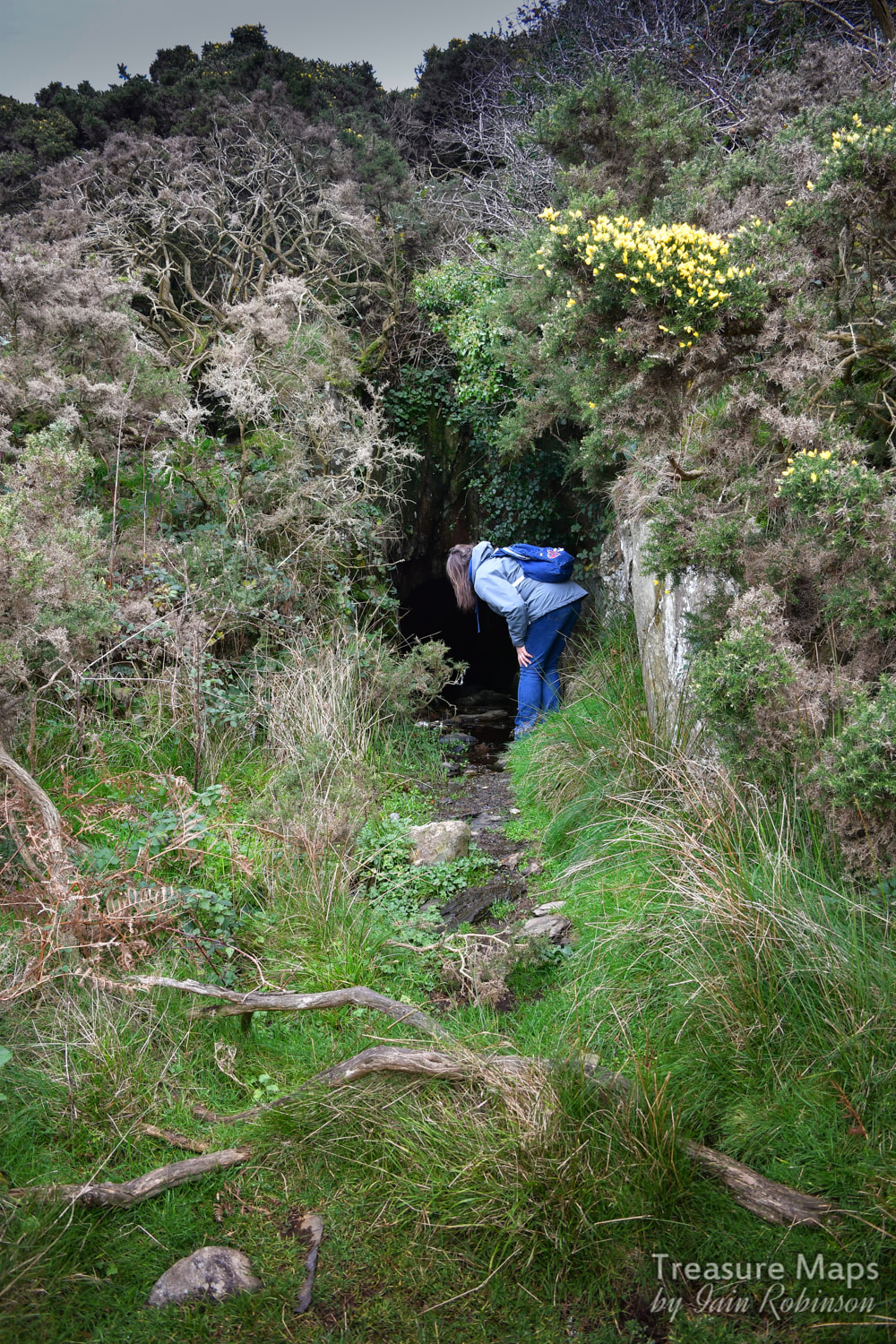 Further "evaluation"... 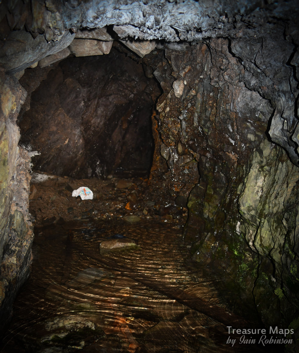 Inside the adit. Don't think they had carrier bags in the 1890s... The workings described on the maps as the Gellfechan manganese mine are to the east of the farm- the miner's "eye of faith" can easily spot the tell-tale depressions and piles of spoil. These continue in a north easterly direction until a ravine is encountered. There are two small adits with a little chambering at SH615167. There seems to be a mule track, well-revetted along the side of the ravine which goes east and then doubles back to the Cell Fawr mine on the north side of the ravine. We didn't explore further as light was failing, but intend to return. 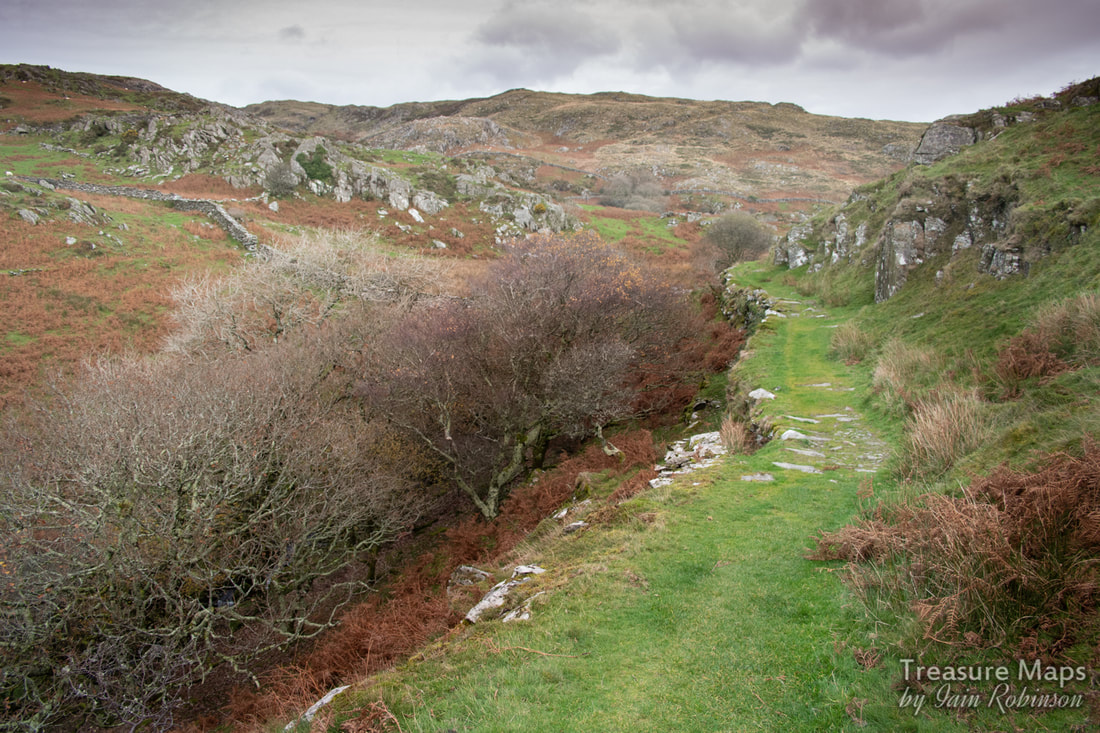 The mule track. Despite how it looks, the photo was taken at 1000ASA- it was becoming very gloomy. The wonders of modern cameras! An interesting clue lies in the 1899 sale advertisement for the estate, then owned by John Abraham Esq. It reads that "A valuable vein of manganese (occurs) on the estate, which has been proved... " "...and gold veins have also been opened" (MM) References in local papers indicate that a mine of some sort was working manganese here in 1917 (MM) Many thanks indeed to Carol Skelton for permission to use photographs of the farm in it's heyday, and for writing the lovely book. Copies are available at the "Y Tepot Arian" (the Silver Teapot) community cafe in Dyffryn Ardudwy- proceeds to the Wales Air Ambulance. There is also a web-site here where the book can be downloaded as a PDF for £1.00- very good value I reckon. Ty Dolwar Information on manganese mining and all the sites mentioned can be found at the excellent Merioneth Manganese site. The late Jeremy Wilkinson's Gazetteer of mines and quarries in North Wales is here. Part two of our continuing adventures around Aberllefenni... 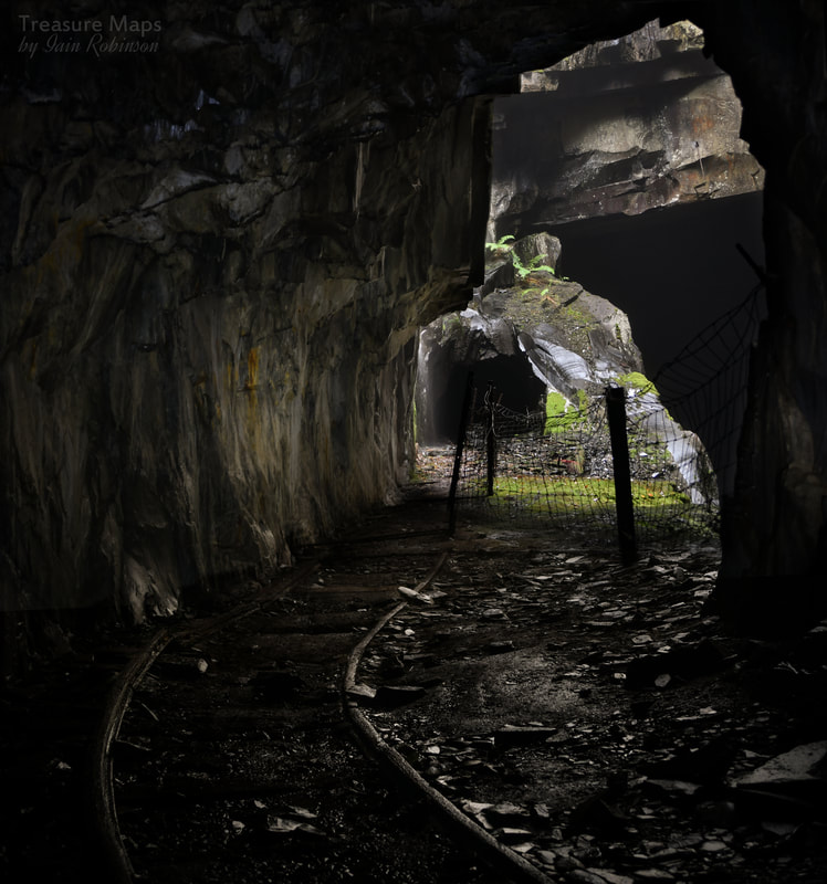 Last time, we had come down from the East side of Foel Grochan in failing light, and had gazed (from a respectful distance) at the famous "Alma Cavern", a deep abyss quarried vertically into the mountain. We left, vowing to return and explore further... Of course, exploring here is discouraged. A mine historian friend had warned me to be careful, as he had been caught by the landowner while underground, and it wasn't a pleasant or decorous meeting. So we were on our mettle when we returned on a very misty, damp day, the sort of weather that is a speciality in these parts. 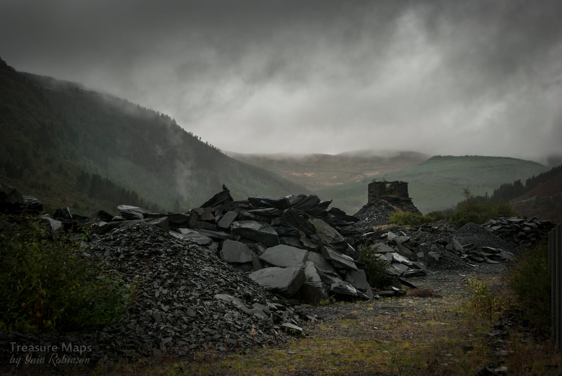 The remains of an old water balance incline in the bottom of the valley. We'd scoped out an entrance halfway up the mountain that would get us in to the mine, so made our approach under cover of the dense spruce woods that cloak the south side of Foel Grochan. There's a rough but official footpath that goes through there, if you don't mind climbing over countless wind-felled trees. Hard hats on, lamps and back-up lamps checked, we walked carefully in. The usual thrill of being underground hit us; the cold atmosphere, the sounds of water dripping and an all-pervading smell of damp rock. 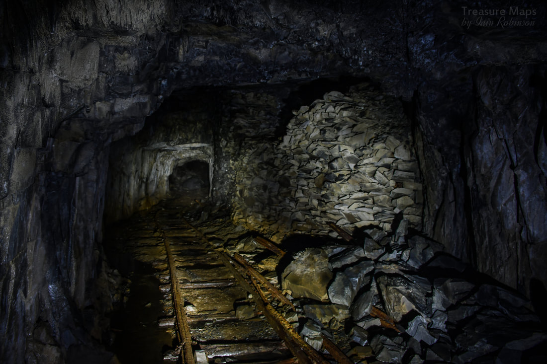 On our way in, past some stacked deads, concealing an entrance to a chamber. We walked on through a well-engineered tunnel, past stacked waste, until we came to a section that had obviously become unstable. Massive RSJ's were formed into a supporting arch. For a while, we had begun to sense light ahead. Now we could see that it was a chamber...the big one. We emerged into a scene reminiscent of the "Lord of the Rings" as a mighty hall rose up hundreds of feet to the surface and uncertain light. Below, rubble and huge blocks of slate punctuated the descent- a similar number of feet into total blackness. Eerie skeins of mist swirled through the chamber like ghost dragons. A ladder dangled crazily down, inviting the explorer to certain death. Because of the light coming from above, moss cloaked the wet surfaces everywhere- it was a wonderful ecosystem for them. 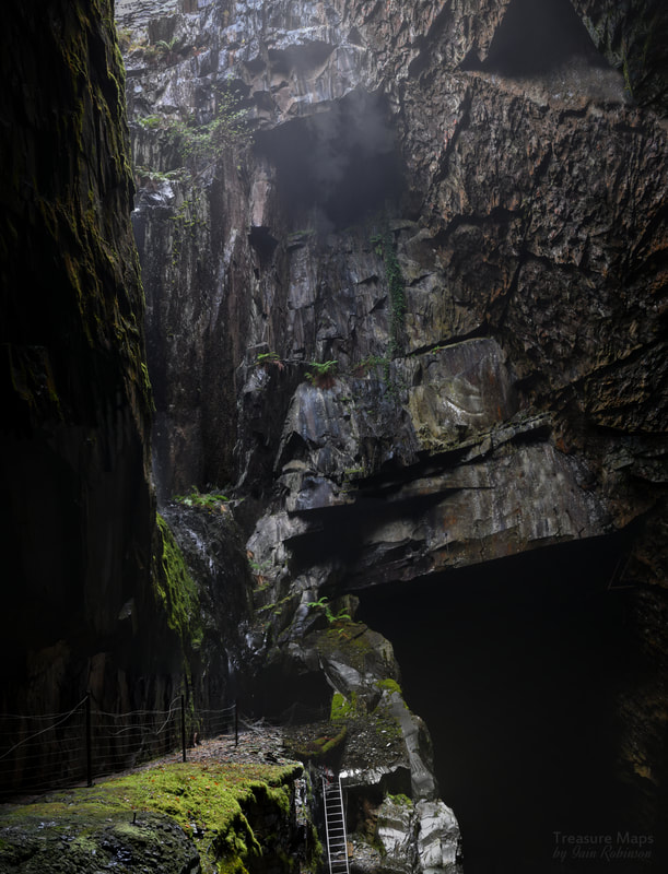 What is basically the central section of the "Alma Cavern", a small portion of the 800 or so feet of space in the mountain. The photograph was taken from a narrow ledge at the side of the chamber. We carried on into the mountain, walking probably more than a third of a mile in the blackness, punctuated occasionally by more chambers opening out. Some were flooded, blocked off with wire and corrugated iron, some just with a ledge and an old wooden crane hanging above an impenetrable black abyss. I wondered what the old miners thought, as they worked in these places. Was there a sense of the incredible spaces they were creating, or was it just a job, another day to be got through? I'd hate to think that they were oblivious to the incredible monuments that they had made to themselves here, in the middle of the mountain. 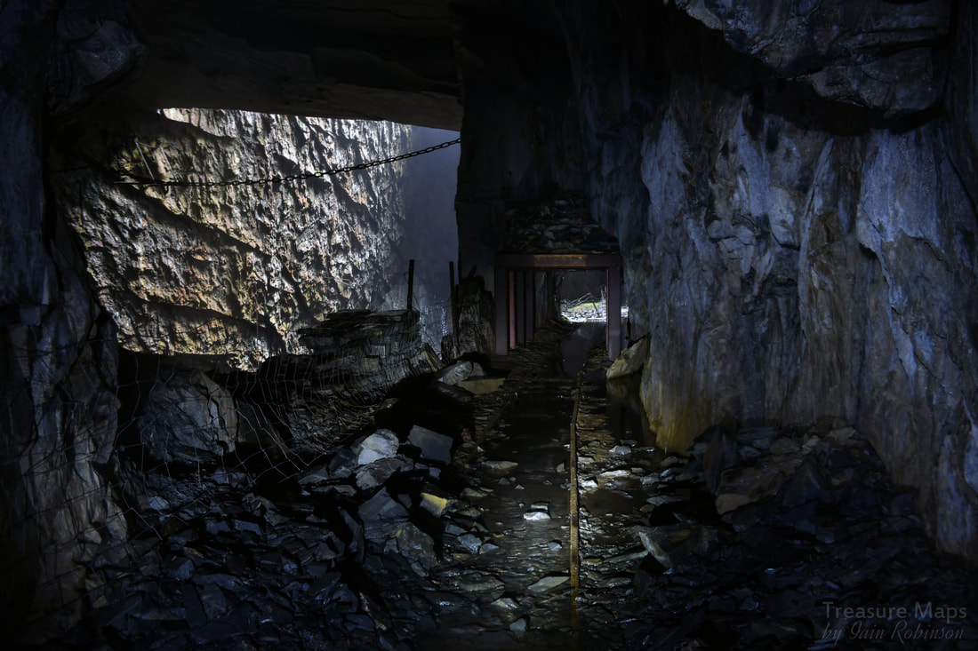 Looking out towards the place where the previous photo was taken. It's obvious that much quarrying of the adit has taken place as the workings continued downwards. Eventually, we found ourselves at the top of a ladder that descended into a deep chamber. It was claustrophobic and unpleasant, difficult to get a sense of the height as you looked down. I knew what was at the bottom anyway; a crane, sitting over another, deeper chamber. Despite Petra and I having been in a great many mines, this one had started to freak me. I began to have a sense of impending doom- we had been underground for a few hours; perhaps the dark was getting to me. There are plenty of shots of the crane at the bottom of the ladder on the 'net and I decided that we didn't need to add to them. The strain of keeping vigilant against the many perils underground had begun to tell on us. It was time to come out. 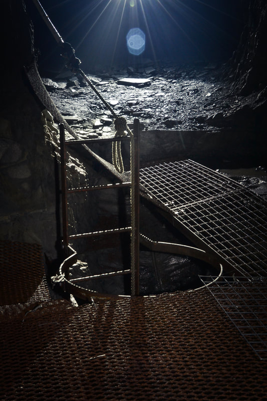 That ladder...Petra's photo. So, we turned back, feeling weary, but very happy to have explored such an uncanny and awe-inspiring place. It doesn't seem enough to say that I was impressed by the spaces created in the mountain by the miners. Working men, highly skilled, using primitive tools until the last few years. Later, Korfmann chain saws and wire saws took over, making the job more accurate and producing less waste; although requiring a whole new set of skills to be learnt. There are rumours that this place is to be developed as a tourist attraction- stories abound locally. It would certainly be a shot in the arm to the local economy, and it seems a shame that people can't see these wonderful caverns and marvel at the skills of the men who made them. It will be a different experience, a changed place, but nothing could take away from the majesty of the "Alma Cavern". 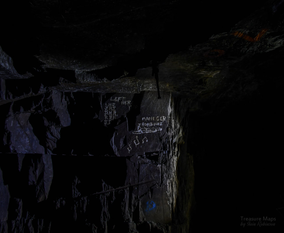 A poignant reminder of the men that worked a chamber, inscriptions and graffiti done at the abandonment of part of the workings. Some factoids. It's incredible to think that slate was being quarried here from the C14th! - so quarrying/mining was carried on continuously until 2003, a world record. Extraction was achieved by boring eight adits separated by approximately 60 feet (18.3 m) vertically. These were mined into the valley side just to the north of the near-vertical narrow vein. Each tunnel bored into the hards at the side of the vein, opening up chambers which formed as the rock was extracted. These chambers ranged from 100 to 187 feet (30.5 to 57.0 m) in length with 24 to 30 feet (7.3 to 9.1 m) of rock left between the bottom of one chamber and the top of the next lower chamber. As more slate was extracted, several of the upper chambers were joined vertically to form an extremely large cavern known as "Twll Golau" (light hole) or alternatively, the "Alma Cavern" which is open at the top. This cavern goes down into the mountain to about 800 feet depth. As with most mines on the Corris narrow vein, the oldest workings are near the top, as mining continued down the vein. A look at the sectioned drawings of the mine show many vertical chambers, almost hollowing out the mountain at some points. 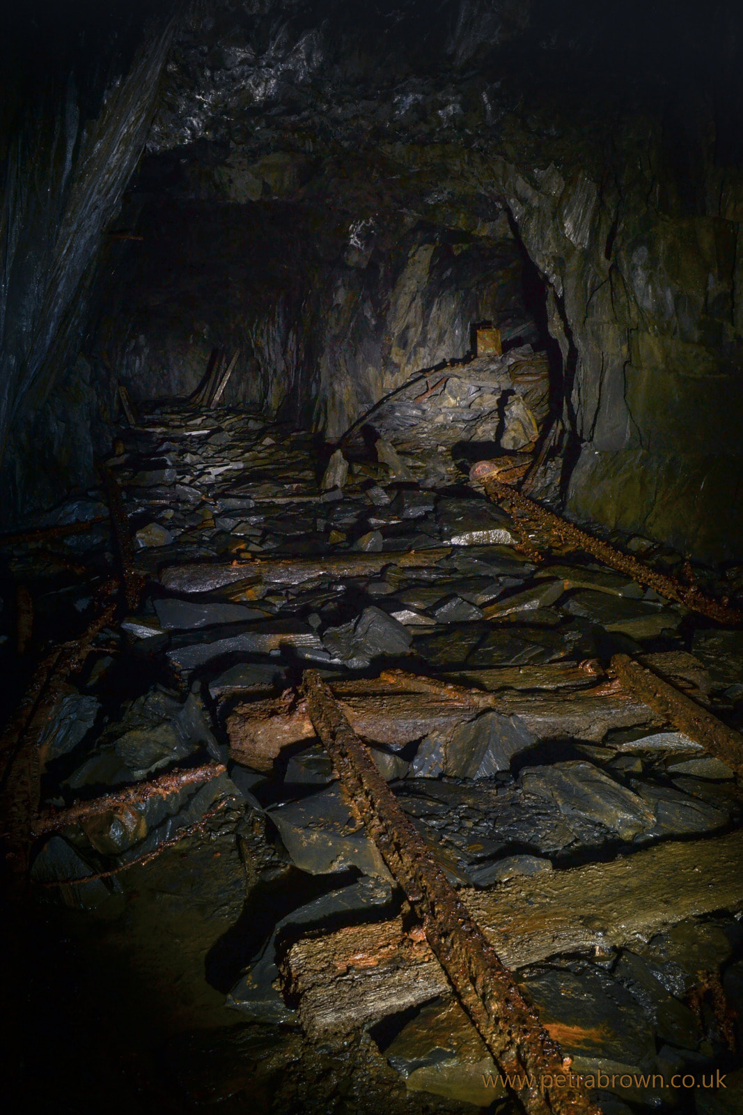 Junction underground- into a chamber, filled with waste. Petra's photo. The mine certainly had it's vicissitudes over the years, but was a major player in the Corris area. In approximately 1860, the owner of the mine commissioned a steamship, the 83 foot long "Aberllefenni Quarry Maid" with a steam engine built by DeWinton of Caernarfon- possibly the first marine engine built by them. The quarry outputs were high for the area, with 4,814 tons in 1883, with 177 men employed. In 1893, tonnages were up to 4,044 with 193 men per year, then 5,185 tons in 1895- with only 140 men, the tonnage per man/year being extremely high by local standards. After the Great War, with export markets non-existant, the market for slate withered, slowly picked up, then was knocked on the head again by the second great conflict. It was never to recover to pre war standards, although there was a steady demand. But worker's conditions and wages then became a sore point, culminating in a strike in 1947. The men found work elsewhere, constructing forestry roads. By the time the dispute was settled, the quarry were lucky to get the men back, as seen elsewhere, workers had become used to higher wages for easier, less dangerous work- and most quarries struggled to get a workforce. 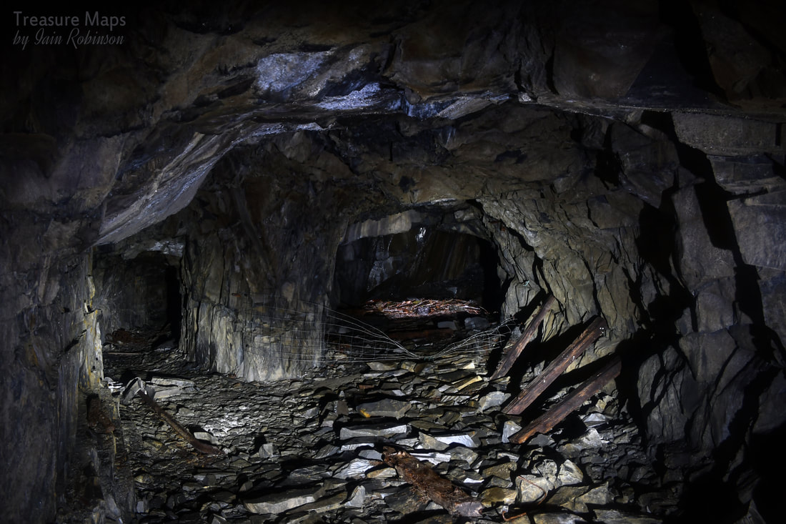 The entrance to another chamber, with a window of light coming from high above. Finally, the last years saw technological improvements, as have already been noted. The new wire saws improved productivity so that the waste rock to product ratio was up to 1-3, as opposed to 1-67 in force during most of the quarries' life! Getting slab was ever more difficult owing to the depth of the chambers, the way that they became wider as they went down- and the fact that short-sighted operations in earlier years had "sterilised" chambers by tipping waste into them. Chambers that could have been worked with modern equipment. But it was always thus. So, the story closes on this fantastic mine- but the mill, at least, is still producing slate from other quarries at the time of writing, December 2018. Further information: Richards, Alun John (1994). "Slate Quarrying at Corris". Gwasg Carreg Gwalch. ISBN 0-86381-279-1. Ray Gunn's lovely photographs and monologue: "Aberllefenni Quarry" here 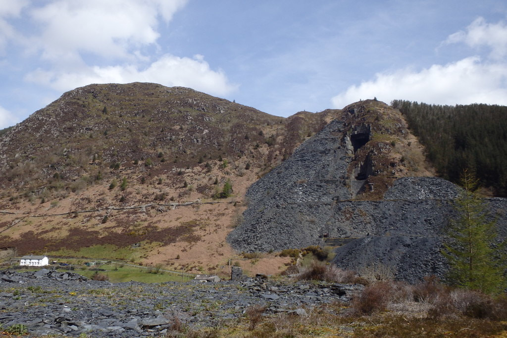 Here's a shot, sadly not mine, of the Alma Cavern from across the valley, showing the sheer size and depth of the operation. Bear in mind that the big cavern descends down from the top hole to a couple of hundred feet below the bottom of the valley surface level! Under Foel Crochan cc-by-sa/2.0 - © Michael Graham - geograph.org.uk/p/4939486 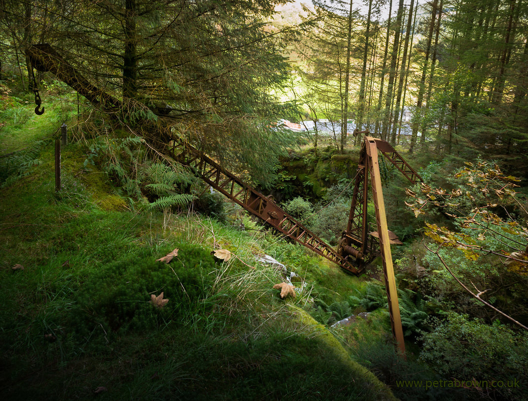 Photo by Petra Brown One of the things that I love about Wales is that, despite the tens of thousands of people who visit every summer, it is still possible to stumble upon something magical in the landscape. Something forgotten, perhaps even mysterious and obscure. The lovely cwm heading up to Ratgoed, with it's lost village, is well known among folk who like to explore Wales' little-known nooks and crannies. Hidden in the woods at the start of the cwm is an old red crane. It perches over a dark pit like a dead rust spider, it's jib gesturing to the woods above. 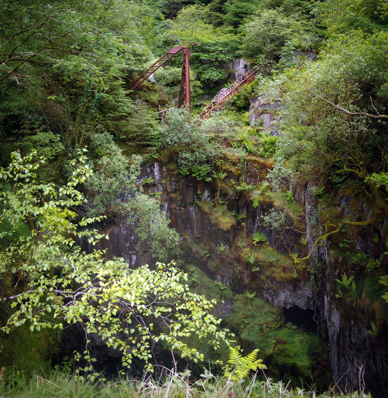 The pits here are all deep, because unlike at Blaenau Ffestiniog, the slate vein lies almost vertically. On the days we visited, there was a mist rising from the depths, gentle zephyrs combing it like lazy smoke through the mature spruces. Looking over the pit's edge, the cold air hit my face as I tried to see the bottom of the defile. I couldn't- it grew dark and ominous and the damp mist settled on my glasses. I could make out openings in the side of the hole, marooned adits and access points that had been superceded as the work drove ever deeper. It looked so intriguing, and so dangerous. But the crane wasn't really the magical discovery here. Of course, we had a good look around the thing, as you would imagine. It's purpose seems to have been to pull slate slabs up from below, at least 100 feet down, then transfer them to wagons. These ran on a track which followed a tunnel through the mountain to the other side, reaching the main Aberllefenni workings. We explored the tunnel as far as we could, past many open chambers, some of them very deep indeed. I have no idea why, probably it was my imagination, but the darkness inside the mine seemed all encompassing. Our lights, all 900 lumens units, didn't really make a dent in the gloom. The chambers betrayed themselves by their sound, and the way the air seemed to move about within them. Any light coming in from the tops of the chambers above was quickly overcome by the stygian gloom.. Sadly, we eventually reached a fall, blocking the way ahead. Coming back along the adit, I wondered where some of the chambers could have opened up on the hill above, the source of the occasional, very feint light from above. 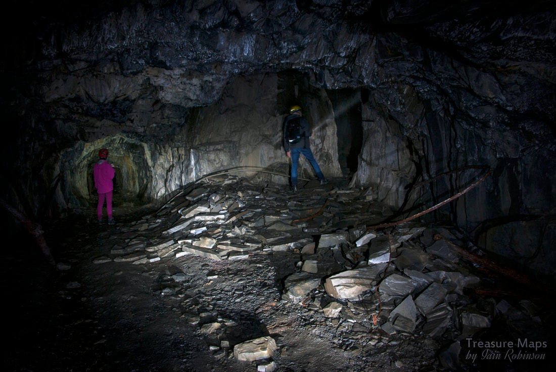 My daughter Sam and I caught posing at the entrance to a chamber. A look on Google earth showed a couple of openings, buried deep in the forestry. I thought it might be worth a look, although it would also be a tough climb- but a week later, yes, we were back. We took a left hand line past the pit with the old crane, up the steep, steep slopes of Foel Grochan. The spruce trees were very useful to hang on to and pull uphill with, as the slope was certainly brutal. After climbing for fifteen minutes (it seemed more like an hour) a tip came into view between the closely packed trees. This was exciting- what every mine explorer dreams about, finding a little known mine, or excavation. After we'd got our breath back, we walked up to an opencut. To my surprise, it was actually an adit, going in to the side of the hill. Petra walked carefully in, examining the roof and floor while I took a photo looking out. I wasn't expecting much of the adit, perhaps a big drop into more darkness. But after about fifteen seconds, I heard her call out in surprise. 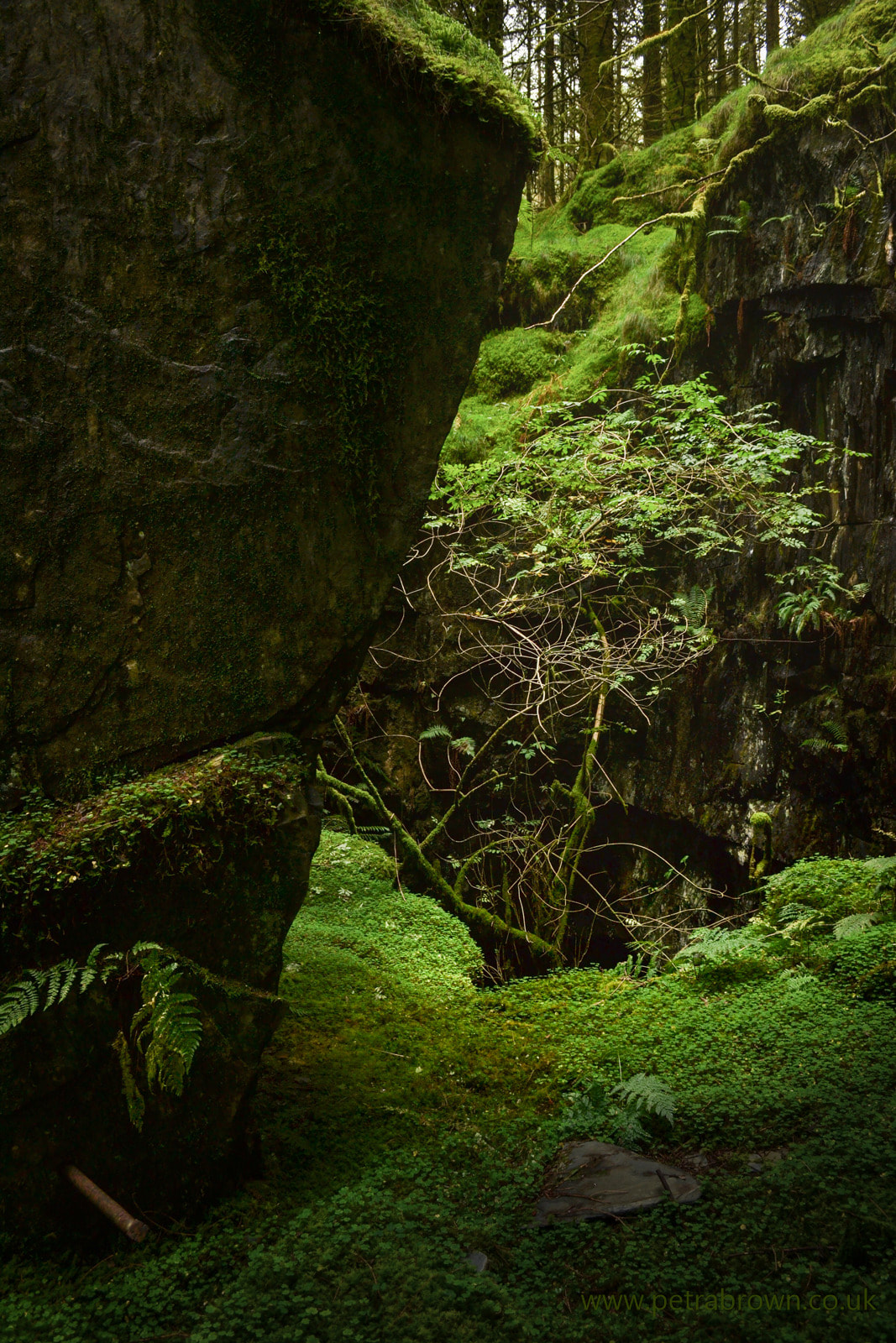 In the opencut (photo by Petra Brown) What she'd discovered was magical, at least to rust and equipment freaks like us. An old Victorian air winch, poised over the lip of one of the chambers, with various antediluvian cogged wheels like huge, discarded watch mechanisms lying beside it. To find this, untouched and undocumented, was wonderful. We spent quite a while in there, as you can imagine. At the back of the chamber was a passage which led on into the mountain, to a couple more small chambers, but nothing as exciting as our first discovery. As always with this place, the drop from the winch looked awful, like a high tide of darkness. I imagined falling down into the silence, never stopping until...well, perhaps not. My imagination is rarely helpful underground. 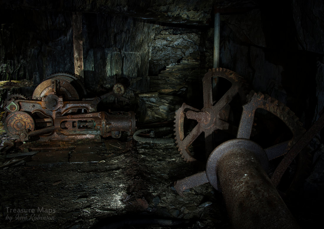 The scene that greeted us at the end of the adit. The roof, in fact the whole chamber, was very fragile...those vertical poles and wooden posts were all that was keeping the roof from coming down. 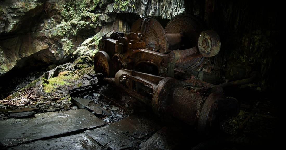 The winch, looking down into the pit, which isn't properly shown in this shot. Topsides, my photos here were uniformly terrible, so Petra has stepped ably up to the plate with a selection from her camera. I guess I was too excited, running about like a Jack Russell terrier. Outside the adit was a weigh house and a powder store, both roofless, of course, but looking fascinating and surrounded by bits of machinery being slowly assimilated into the hill by vegetation. We stopped and had a bite to eat before going back in to the adit for one last look, savouring the sight. And then it seemed only right that we should carry on uphill to see if there were any more holes on this side of the mountain; we knew there were some big ones on the other side, of course. So we struggled up to the next level. More tips, older, almost completely overgrown. And then this. 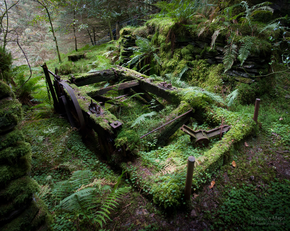 It's an ancient, manually operated winder, a machine for bringing slabs up from the pit, although I couldn't fathom how it could have worked- no doubt someone will tell me...please! I'd seen other examples of these machines on the web and noted that they are early, and I know that this part of the mine was the earliest, so we are probably talking about a date of mid-1800s. I have also examined the plans of the mine in Gordon and Anne Hatherill's wonderful book* and I can say with certainty that this hole goes down 500 feet to almost the bottom of the mine. It must be as black as the inside of the devil's waistcoat down there. Of course, work continued down all the time, so each lower level exploited a floor of the mine in it's Jules Verne-like journey almost to the centre of the earth.  A pulley wheel that would have ensured that the wire would be in the centre of the chamber to ensure a straight pull. Getting the slab landed would have been another problem! We stopped again here and had something to drink. We were a long ways up the mountain now. Going down the way we had come didn't seem very attractive, so we elected to carry on the hundred feet or so to the top and take our chances down the other side. On the way to the top, we saw some very early diggings, grass grown but obviously the work of the "old man". And then we reached the top, and savoured the view across to Aberllefenni and down into the frightening jaws of the awe inspiring Alma Cavern. 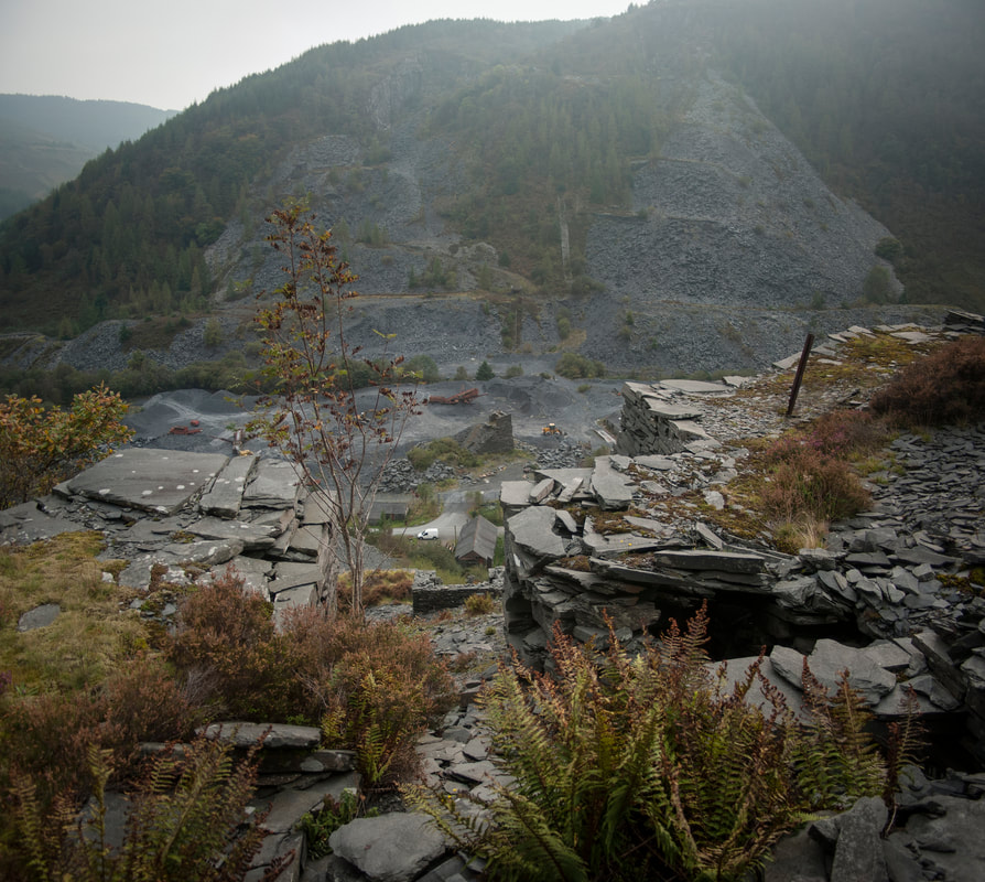 Coming down the other side, looking towards "Yr Hen Chwarel" and Ceunant Ddu from level 5. The bastion-like structure in the centre distance is one of several water balance inclines which were built for moving rubbish away from the mill and slate down to the mill. 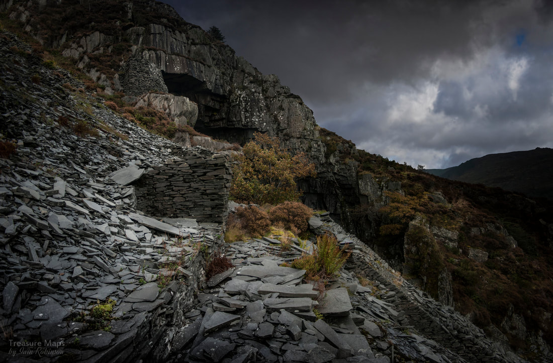 Descending carefully down the side of the Alma Cavern. It was getting dark now... We picked our way carefully down the slate and heather to the side of the great cavern. It was getting dark, and the weather was closing in. This was not the time to go looking around here. We agreed to high-tail it out of the place and come back with more time on the clock, more light on the dash. I promise that my next post will feature the cavern and the tricky story of our continuing explore. Meanwhile, we managed to find a footpath through the woods back round the base of Foel Grochan, back to the car. I wasn't sorry to rest my weary legs! The next instalment of the saga will appear soon :-) *"Slate Quarry Album" by Gordon and Ann Hatherill, RCL Publications, 2009. ISBN 978-0-9538763-8-9 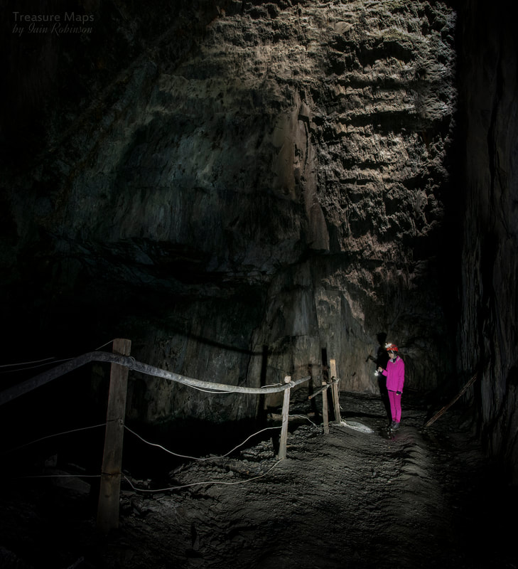 Sam looks down into one of the deep chambers. |
TracksReceive the occasional Treasure Maps Newsletter- and alerts when a new post is available!
If you enjoy my content, please buy me a coffee!
Check out my other online activity...
Index
All
|


 RSS Feed